
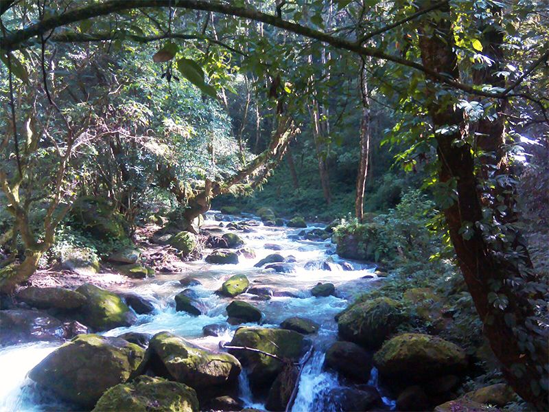
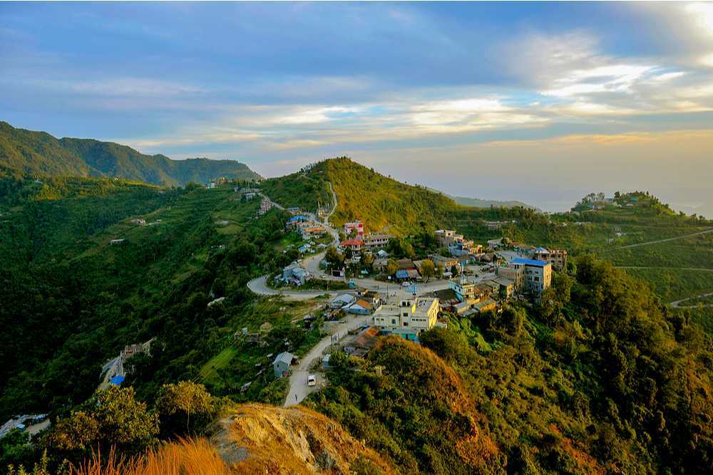
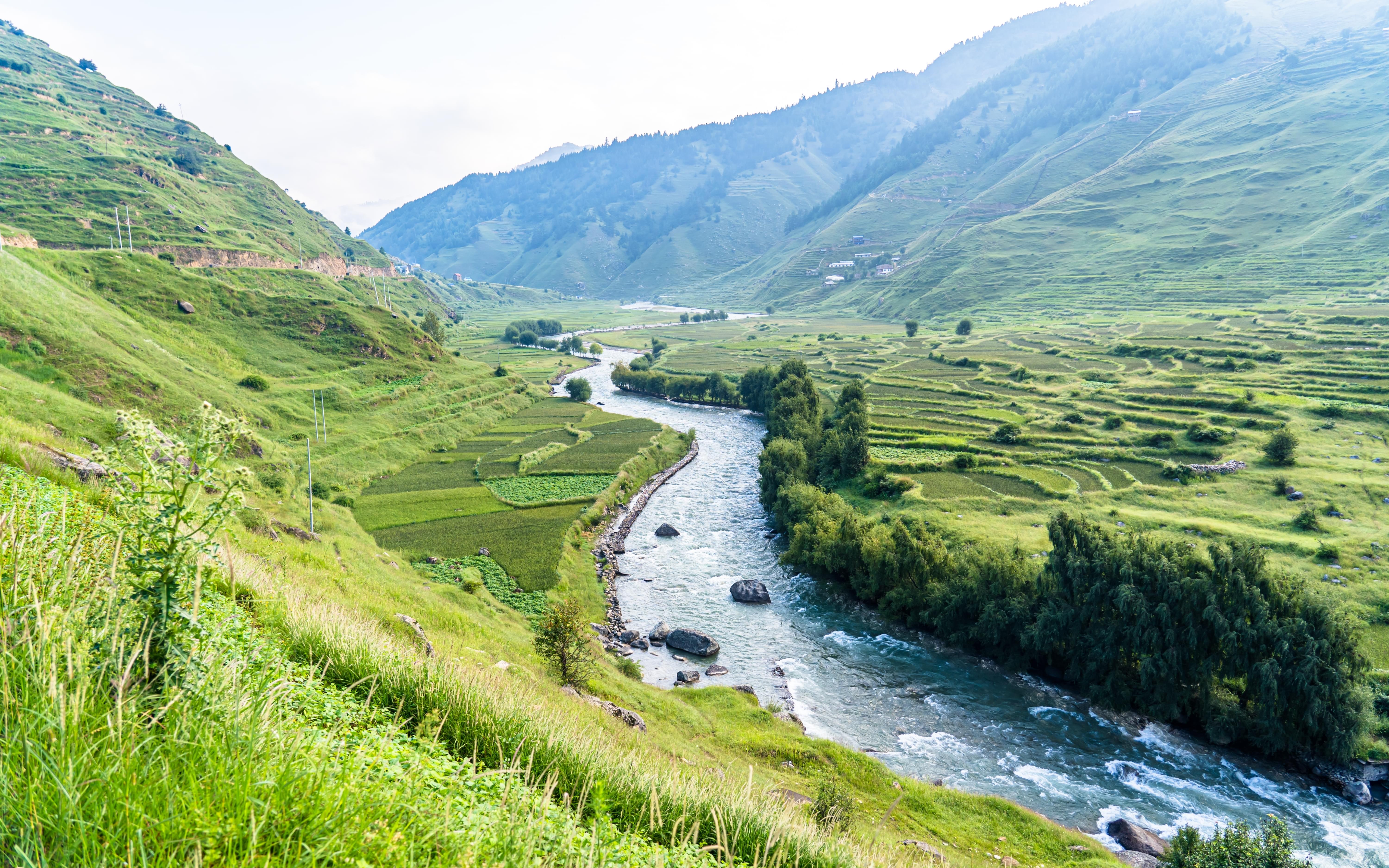
Shivpuri National Park
Established in 2002, Shivapuri Nagarjun National Park is Nepal’s ninth national park, located in Nepal and was established in 2002. It is located in the country’s mid-hills on the northern fringe of the Kathmandu Valley and named after Shivapuri Peak at 2,732 m. It covers an area of 159 sq km.
The area has always been an important water catchment area, supplying the Kathmandu Valley with several hundred thousand cubic litres of water daily. In 1976, the area was established as a protected watershed and wildlife reserve. In 2002, it was gazetted as Shivapuri National Park, initially covering 144 sq km and in 2009 was extended by the Nagarjun Forest Reserve covering 15 sq km. The park includes some historical and religious sites, and a popular hiking route. The park is located in a transition zone between subtropical and temperate climates.

Nestled within the national park is the Tibetan nunnery called Nagi Gumpha with stunning views of the valleys below. The trek through the national park will take one through dark green forests. Mostly a cool, shaded trek, the sunlight occasionally makes its way through the canopy of broad-leaved oak trees and creates limelight on the ground. For those who love mountain biking, there are routes for them as well. Bikes can be hired from the towns downhill, no matter which route one follows.
The national park is open daily from 7 am to 5 pm. Entry fees are NPR 50 for Nepali citizens, NPR 300 for SAARC citizens, and NPR 500 for others. Those travelling in a motorbike need to pay NPR 30, while a minibus, bus or truck will cost NPR 500, and a car, jeep, taxi, or van will set one back by NPR 300. For Nepalis, the cost of a mountain bike is NPR 100, while for foreigners, it is NPR 1000.

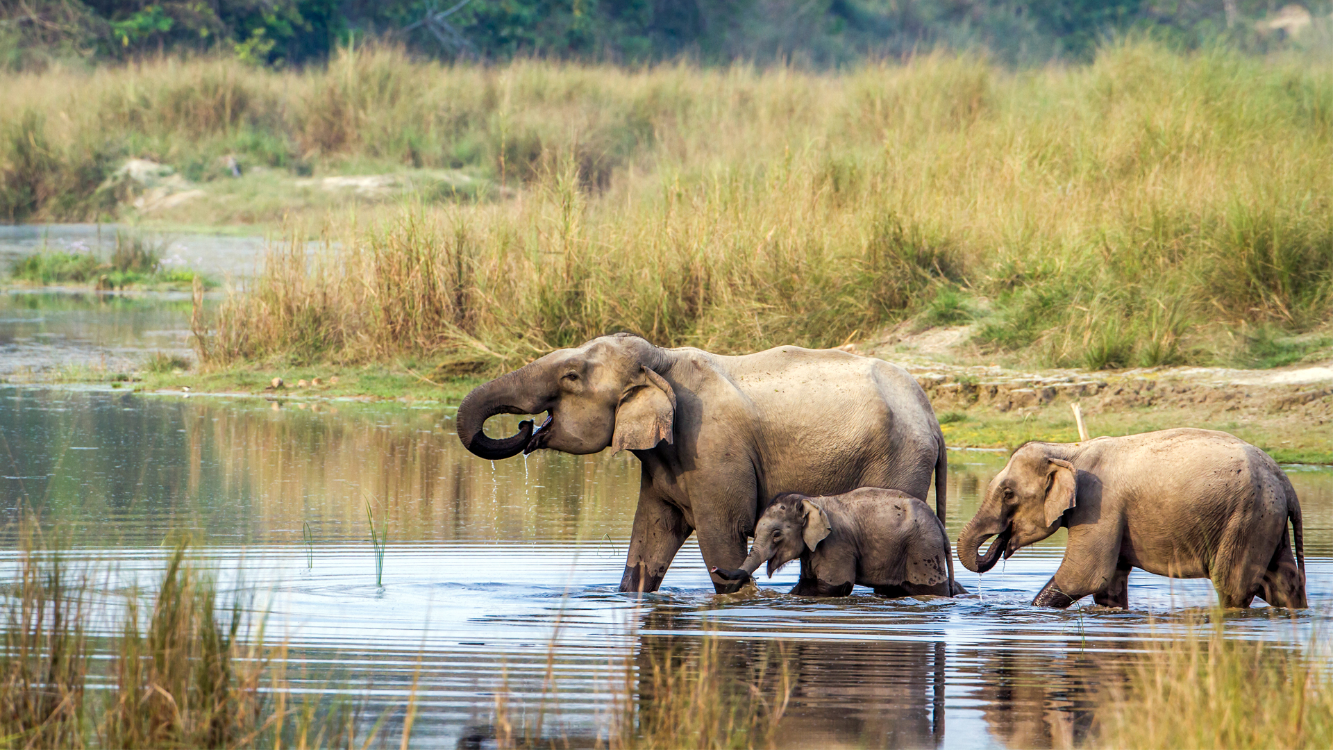
Chitwan National Park
Nepal’s first national park, Chitwan National Park was established in 1973 as the Royal Chitwan National Park and was granted the status of a World Heritage Site in 1984. It covers an area of 952.63 sq km in the subtropical Inner Terai lowlands of south-central Nepal in Nawalpur, Chitwan, Makwanpur and Parsa districts. It ranges in elevation from about 100 m in the river valleys to 815 m in the Sivalik Hills.
In the north and west of the protected area, the Narayani-Rapti river system forms a natural boundary to human settlements. Adjacent to the east of Chitwan National Park is Parsa National Park, contiguous in the south is the Indian Tiger Reserve Valmiki National Park. The coherent protected area of 2,075 sq km represents the Tiger Conservation Unit (TCU) Chitwan-Parsa-Valmiki, which covers a 3,549 sq km huge block of alluvial grasslands and subtropical moist deciduous forests.
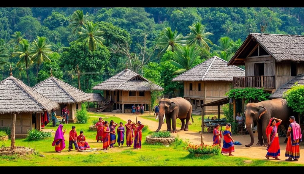
Apart from its biodiversity, Chitwan National Park provides a unique opportunity for cultural exploration. The indigenous Tharu community, residing harmoniously for centuries, shares their traditions and lifestyle through cultural performances, showcasing their music, dance, and art. The convergence of natural wonders and cultural richness makes Chitwan a captivating destination, offering an unparalleled glimpse into Nepal’s heritage and wildlife conservation efforts. Easily accessible via road from Kathmandu or Pokhara, Chitwan National Park remains a cherished destination, drawing global travellers with its captivating blend of nature, conservation, and cultural richness.
There are seven entrance gates to the park. Located near Sauraha, the Sauraha Gate offers entry to the eastern section of the park and is one of the primary entry points for visitors. Situated near the village of Meghauli, the Meghauli Gate provides access to the western part of the park and is ideal for visitors staying in nearby lodges or resorts. Serving as the headquarters of the park, Kasara Gate offers entry to the central region and houses park administrative offices and visitor facilities. Situated in the eastern section of the park, the Kalika Gate serves as another access point for visitors exploring this part of Chitwan. Positioned in the northern section of the park, Lothar Gate allows entry to the northern areas and offers access to distinct wildlife habitats. Located on the park’s northeastern side, Khoria Gate provides access to areas close to the convergence of the Narayani and Rapti rivers. Positioned northeast of the park, Kumroj Gate offers entry to parts near the Kumroj Community Forest.
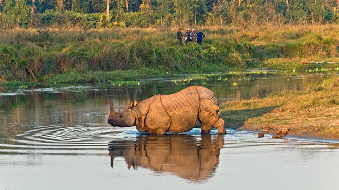
Since the end of the 19th century, Chitwan used to be a favourite hunting ground for Nepal’s ruling class during the cool winter seasons. Until the 1950s, the journey from Kathmandu to Nepal’s south was arduous as the area could only be reached by foot and took several weeks. Comfortable camps were set up for the feudal big game hunters and their entourage, where they stayed for a couple of months shooting hundreds of tigers, rhinoceroses, elephants, leopards and sloth bears. In 1950, Chitwan’s forest and grasslands extended over more than 2,600 sq km and were home to about 800 rhinos. When poor farmers from the mid-hills moved to the Chitwan Valley in search of arable land, the area was subsequently opened for settlement, and poaching of wildlife became rampant. In 1957, the country’s first conservation law ensured the protection of rhinos and their habitat. Research on Chitwan was conducted by Edward Pritchard Gee between 1959 and 1963.
By the end of the 1960s, 70% of Chitwan’s jungles had been cleared, malaria eradicated using DDT, thousands of people had settled there, and only 95 rhinos remained. The dramatic decline of the rhino population and the extent of poaching prompted the government to institute the Gaida Gasti – a rhino reconnaissance patrol of 130 armed men and a network of guard posts all over Chitwan. To prevent the extinction of rhinos, the Chitwan National Park was gazetted in December 1970, with borders delineated the following year and established in 1973, initially encompassing an area of 544 sq km. In 1977, the park was enlarged to its present area of 952.63 sq km. In 1997, a buffer zone of 766.1 sq km was added to the north and west of the Narayani-Rapti river system, and between the south-eastern boundary of the park and the international border to India.
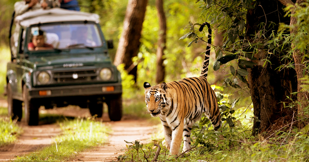
Jeep safaris in Chitwan National Park provide a thrilling opportunity to explore the wilderness and witness diverse wildlife. It is available twice a day, early morning and late afternoon. Early morning safari is the best time to spot Bengal Tigers and Rhinoceros. The most popular safari route is the Narayani River Route. Experienced guides lead the safari, offering insights into the park’s flora and fauna. Visitors have the chance to spot rhinoceros, deer, monkeys, and various bird species. The elephant-back ride offer a unique way to traverse the park’s terrain and observe wildlife from a different perspective. It generally last for about 1-2 hours, guided by trained mahouts or elephant handlers. Riding atop elephants, visitors can explore deeper into the jungle, increasing the chances of spotting larger animals like rhinos, sloth bears, and even tigers if lucky.
Canoe trips along the Rapti or Narayani River allow visitors to witness aquatic wildlife and birds. Canoe rides usually span 1-2 hours, led by experienced guides. Traveling silently along the river, visitors can spot crocodiles, waterfowl, and other river-dwelling creatures, offering a serene and picturesque experience. Nature walks in Chitwan National Park are guided tours led by experienced naturalists or park guides. Typically last from 1 to 3 hours, allowing visitors to explore specific trails within the park. Led by knowledgeable guides, nature walks offer close encounters with smaller wildlife, insects, and diverse plant species. Guides share insights into the park’s flora, fauna, medicinal plants, and their ecological significance. Visitors learn about animal tracks, bird calls, and the intricate balance of the park’s ecosystems.
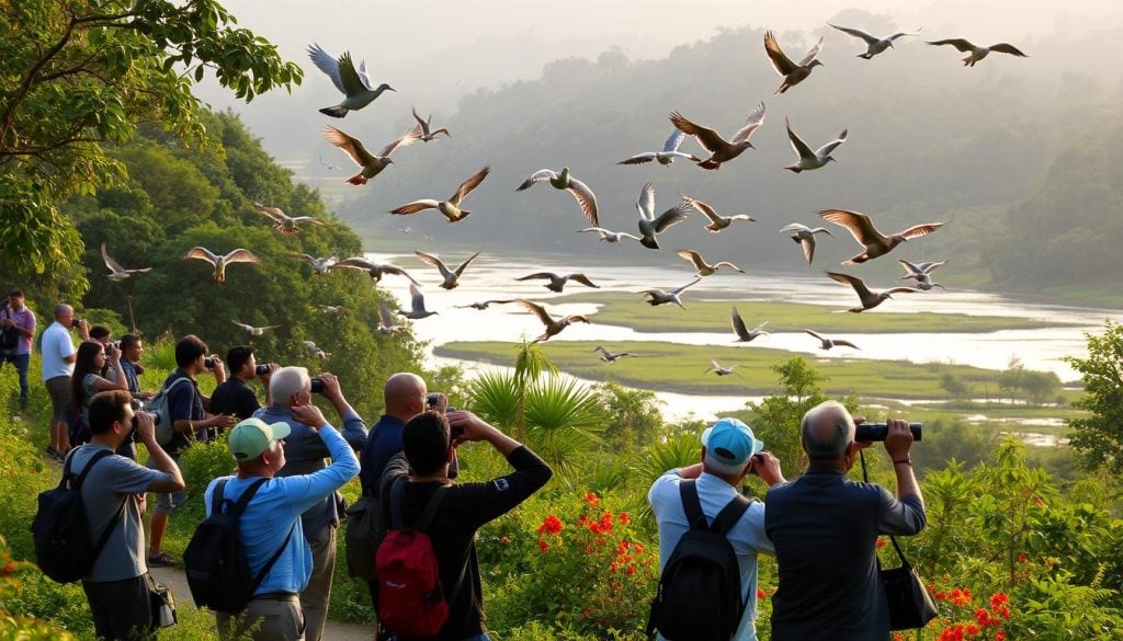
Chitwan is a paradise for birdwatchers, home to over 550 bird species, both resident and migratory. The duration varies based on visitors’ preferences, but birdwatching can span from early mornings to late afternoons. Visitors can spot a diverse range of birds, including kingfishers, hornbills, woodpeckers, peafowl, and endangered species like Bengal florican and great hornbill. Cultural visits involve engaging with the indigenous Tharu community, known for their distinct culture, traditions, and lifestyle. Guided tours to Tharu villages offer insights into their daily life, agriculture, craftsmanship, and unique architectural styles. Explore local houses, learn about their customs, and interact with villagers to understand their traditions and practices.
It would be really unfair to come to Chitwan National Park and not visit the village of Tharus, the original residents of this place. The village can be explored on foot or one can go the traditional way and take the famous ox-cart ride. One should take a guide along to explain the nuances of everyday Tharu lives, their past and present and their culture. The Tharu Cultural Museum serves the community and houses the evolution of the Tharu people from the olden days to the present, a tale told through old and new photographs, documents, weapons, potteries and other things they have used over the years. There are handicraft shops outside, from where one can buy small souvenirs to remember the lovely trip.
The shared jeep safari runs from 12:30 to 5:30 pm with rest timing changing with season and availability of vehicles. Private jeep safari timings are between 6 am and 6 pm. The elephant safari happens in the morning, mid-morning, and evening and is for 90 minutes. Canoeing can be done from 7:30 to 9:30 am while the elephant breeding centre is open from 6 am to 6 pm. The safari can be booked from any local tour operator, the park’s headquarters in Sauraha, or one’s hotel. The cost of the safari varies depending on the duration and number of participants. It is inaccessible in monsoon between June and September and during this time only the buffer zone is open to visit. Washroom facilities are available at the Gharial Breeding Conservation Centre
Entry fees to the park is 2000 NPR for foreigners, 150 NPR for locals, 1000 NPR for SAARC citizens and free for children below the age of 10. The Jeep Safari costs 2500 NPR per person for the shared jeep safari and NPR 4000 per person for a full-day safari. The elephant safari for two people costs NPR 2500 per elephant for foreigners, NPR 200 for locals and NPR 1000 for SAARC citizens. The Elephant Breeding Center entry fee is NPR 100 for foreigners, NPR 25 for locals, and NPR 50 for SAARC passport holders. If one is interested in bathing elephants, it will be NPR 200 per person. A half-day canoe ride will cost NPR 1400 while the full-day canoe ride will set one back by NPR 1800 per person.
Sagarmatha National Park
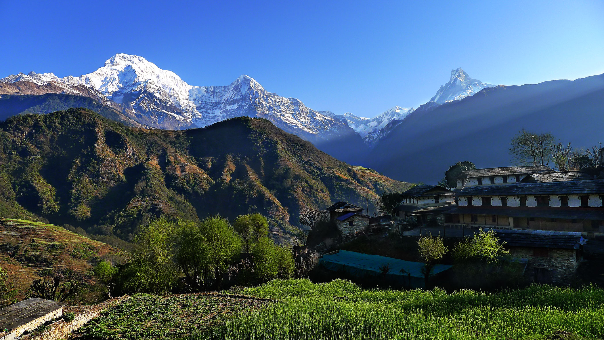
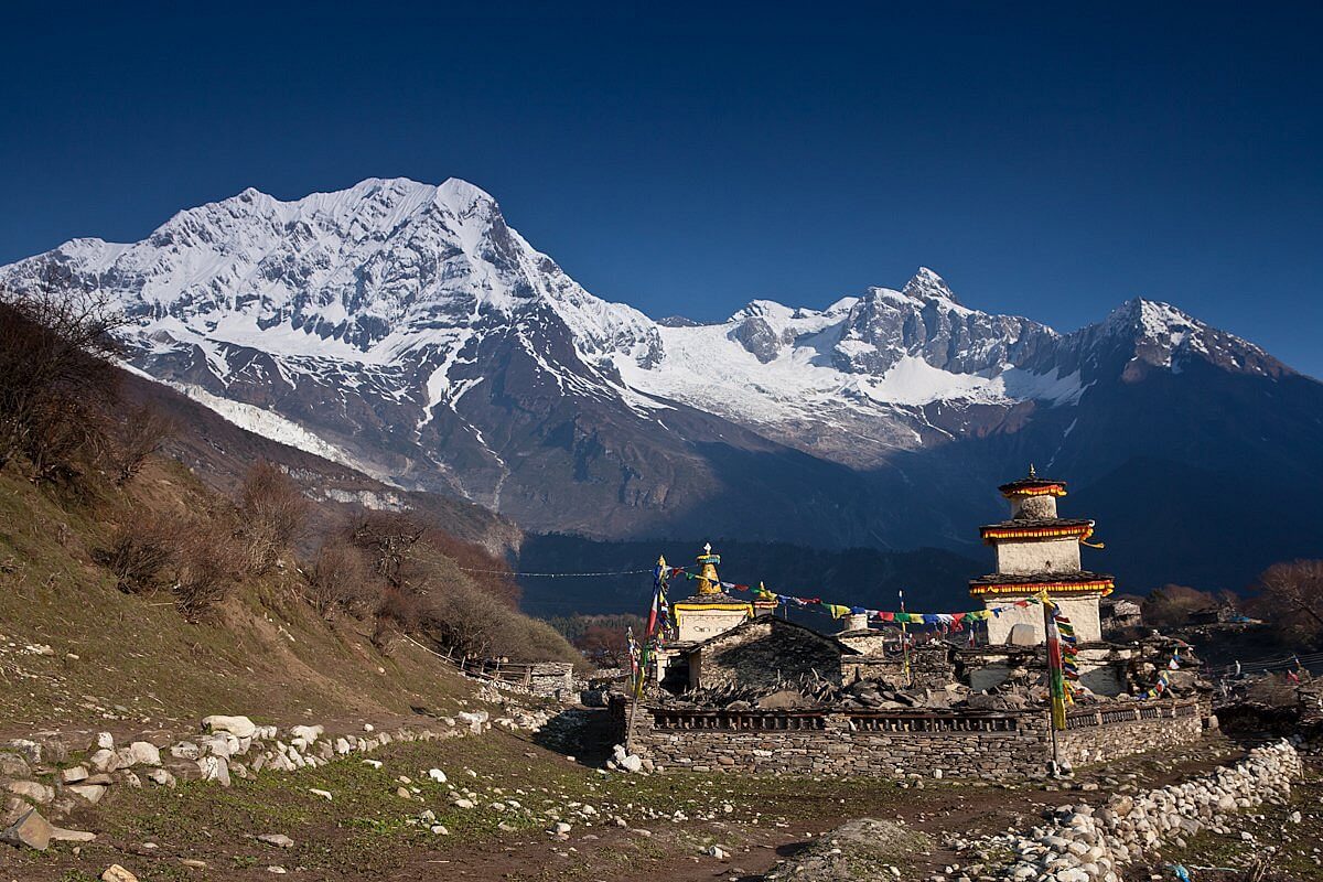
Established in 1976, Sagarmatha National Park is located in eastern Nepal and encompasses an area of 1,148 sq km. It ranges in elevation from 2,845 to 8,848 m and includes Mount Everest. In the north, it shares the international border with Qomolangma National Nature Preserve in Tibet Autonomous Region. In the east, it is adjacent to Makalu Barun National Park, and in the south it extends to the Dudh Kosi River and is part of the Sacred Himalayan Landscape.
The UNESCO World Heritage Site has other important peaks apart from Mount Everest like Lhotse, Cho Oyu, Pumori, Ama Dablam, Thamserku, Kwangde, Kangtaiga and Gyachyung Kang. It is also a preservation site for rare species of animals and birds, like the red panda and snow leopard. The wildlife sanctuary stretches over 1100 sq km and is recognised as an eminent bird sanctuary by Bird Life International, making it a highly important tourist attraction for people who enjoy mountaineering and bird watching. Sagarmatha National Park became the country’s first national park that was inscribed as a Natural World Heritage Site in 1979. In January 2002, a Buffer Zone comprising 275 sq km was added.

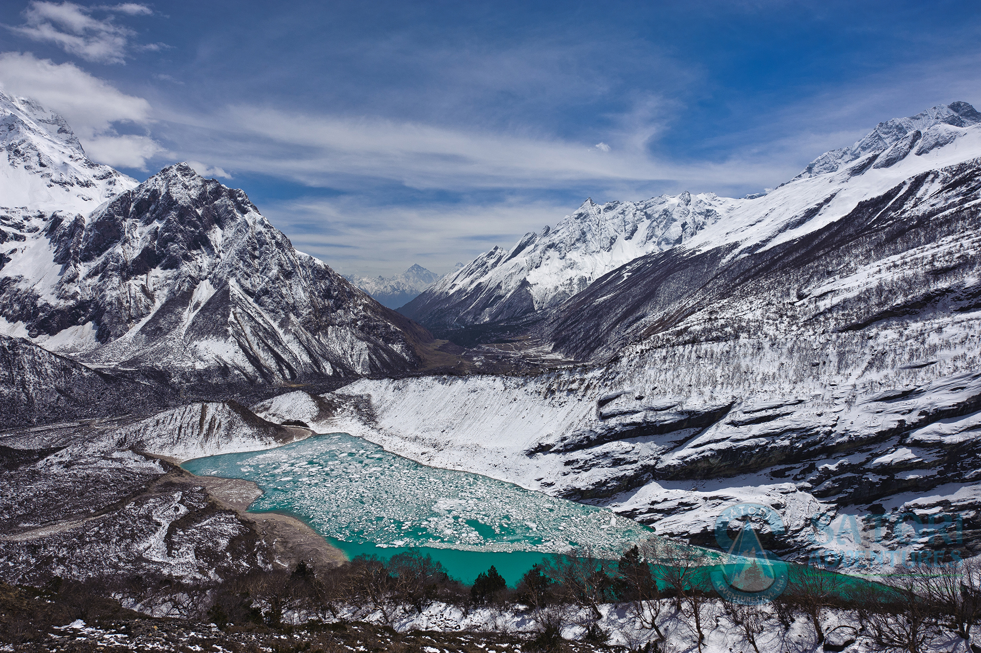
The park contains the upper catchment areas of the Dudh Kosi and Bhotekoshi rivers and the Gokyo Lakes. It ranges in elevation from 2,845 m at Monjo to the top of Mount Everest at 8,848 m. Barren land above 5,000 m comprises 69% of the park while 28% is grazing land and the remaining 3% is forested. Climatic zones span from temperate and subalpine above 3,000 m to alpine above 4,000 m, which is the upper limit of vegetation growth. The nival zone begins at 5,000 m.
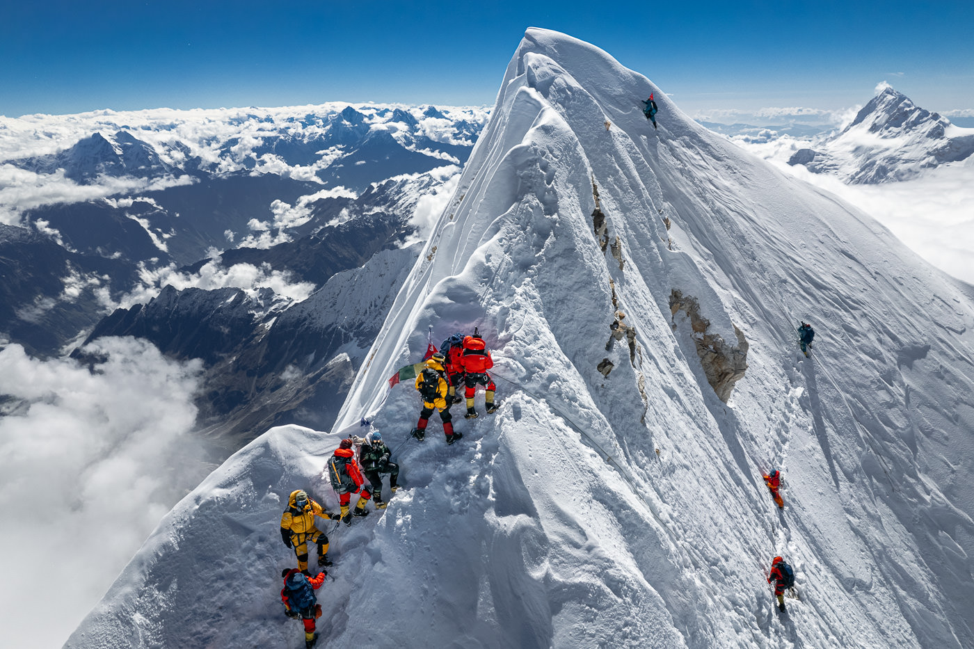
Visitors can indulge in various outdoor activities apart from sightseeing and enjoying the scenic beauty of the National Park. One of the most popular routes to trek along is the Everest Base Camp where tourists can visit the various landmarks within the Park while also enjoying the culturally rich Sherpa villages along the way. The trek lasts for 9-12 days and needs special permissions. Otherwise, there are plenty of other trails that are loved by most trek enthusiasts, which is usually guided by local Sherpas. Mount Taboche is a 6500 m high peak and is a scenic spot that tourists hike up to through Khumbu Valley amongst the Himalayas. The highest point on the Everest Base Camp trek is Kala Patthar, which isn’t classified as a mountain but the peak offers a spectacular view of the sunrise and a close look at the Mount Everest. Another peak on the same trail is Mount Ama Dablam, which translates to “mother’s necklace” in the local language, and has a particular structure which makes it stand out from the other peaks, and is usually hiked up by those who are trained as hikers and have technical equipment for the same. Khumjung Village is located at a height of 4000 m near Mount Khumbila and is known for the Scott Fischer memorial and the school that was built in 1961 by Sir Edmund Hillary’s Himalayan Trust.
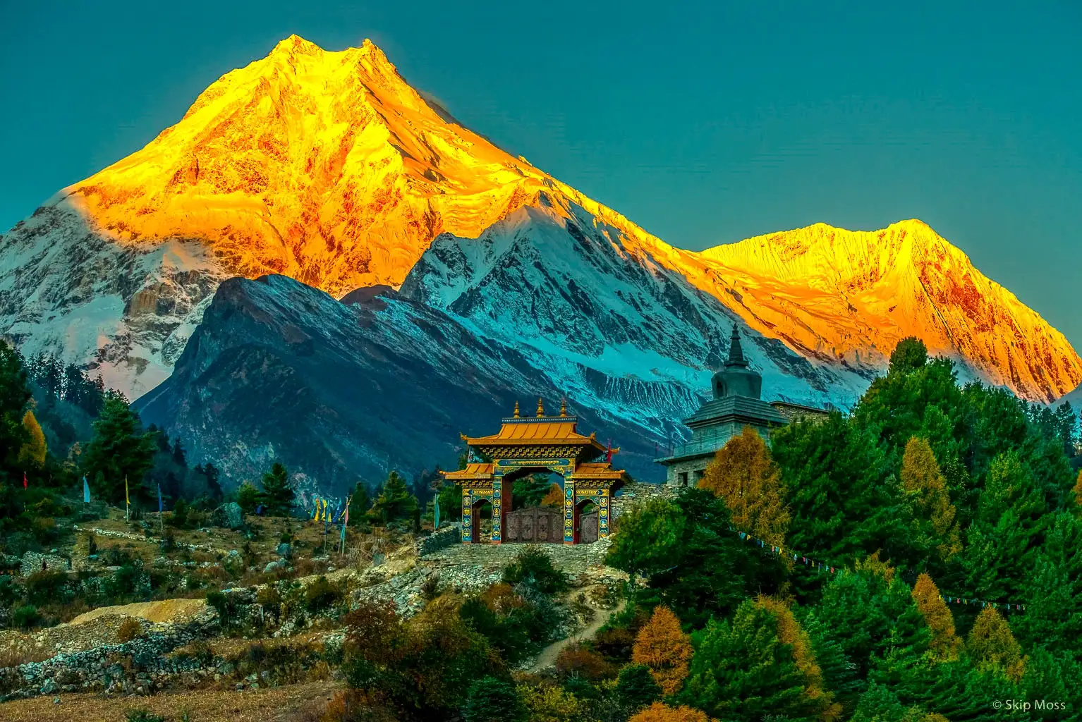
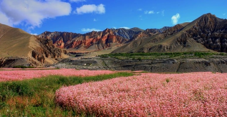
Mount Manaslu
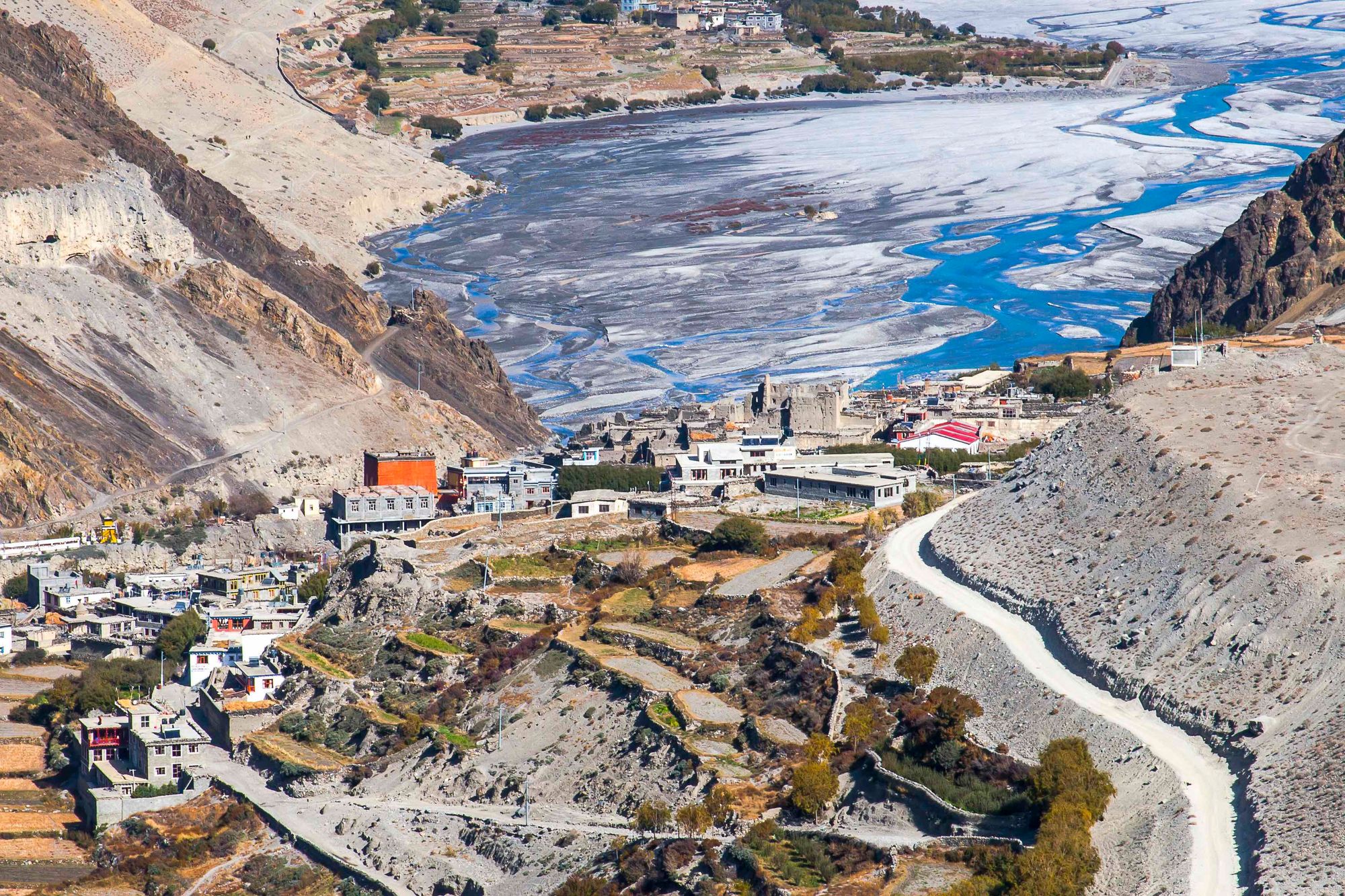
Also known as Kutang Kutan I in Tibetan, the meaning of which is a flat place, Mount Manaslu is the eighth-highest mountain in the world at 8,163 m above sea level. It is in the Mansiri Himal, part of the Nepalese Himalayas, in west-central Nepal. Manaslu means “mountain of the spirit” and the word is derived from the Sanskrit word manasa, meaning “intellect” or “soul”. Set in the northern Himalayan range, Manaslu is a serrated “wall of snow and ice hanging in the sky”. The three sides of the mountain fall in steps to terraces down below, which are sparsely inhabited with agricultural operations practised on the land. Apart from climbing Manaslu, trekking is popular in this mountain region, as part of the Manaslu Circuit, a notable path for trekkers in Nepal. A glacial saddle known as Larkya La, with an elevation of 5,106 m lies north of Manaslu and is bounded on the east by the Ganesh Himal and the Buri Gandaki River gorge, on the west by the deep fissures of the Marysyangdi Khola with its Annapurna range of hills, and to the south is the Gorkha town at the foot of the hill. There are six established trek routes to the peak, and the south face is reportedly the most difficult for climbing.
The Manaslu region offers a variety of trekking options. The popular Manaslu trekking route of 177 km skirts the Manaslu massif over the pass down to Annapurna. The Nepalese Government only permitted trekking on this circuit in 1991. The trekking trail follows an ancient salt-trading route along the Budhi Gandaki River. The trek requires a Manaslu Restricted Area Permit and a Manaslu Conservation Area Permit. The restricted area permit costs USD 100 per week in autumn and USD 70 per week in other seasons, whereas the conservation area permit costs USD 30 all year round. Trekkers are required to travel in a group of at least two persons with a registered guide. The trek lies on the newly developed Great Himalayan Trail. En route, 10 peaks over 6,500 m are visible, including a few over 7,000 m. The trekking route is through mountainous terrain prone to the consequences of monsoon rainfall, landslides, and landfalls. Hypothermia and altitude sickness, as well as encounters with passing yaks, are common. Trekking to Manaslu is thus a test of endurance. The highest point reached along the trek route is Larkya La at an elevation of 5,106 m. The Manaslu Conservation Area Project (MCAP) was established in 1997 with the primary objective of achieving conservation and sustainable management of the delimited area, which also includes Manaslu.
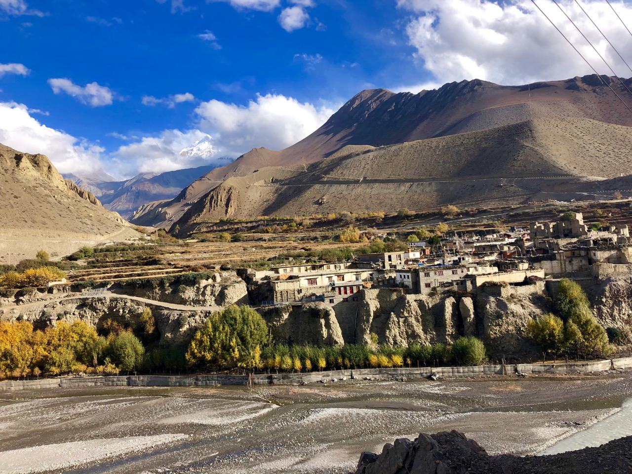
There are two ethnicities mainly inhabiting this region; Nubri and Tsum. The branching off of the river at Chhikur divides these two ethnic domains. While Nubri has been frequently visited since Nepal opened itself for tourism in 1950, Tsum still retains much of its traditional culture, art, and tradition. In the central hills of the region, Gurungs are the main ethnic group who have joined the Gurkha regiments in large numbers. Closer to Tibet, the Bhutias, also spelled Bhotias, akin to the Sherpa group, of Tibetan ethnicity dominate the scene with their flat-roofed houses, and are Buddhists. The region is dotted with austere monasteries, mani walls, chortens and other Buddhist religious landmarks.
The best season to hike the circuit is spring between March and May, just before the monsoon season begins. During this period, one can expect dry trails, stable weather, excellent visibility, and long trekking days. Similarly, autumn between September and November is another good season for the circuit, following the monsoon season.
Nepal has always been on my travel bucket list because of its proximity to India and the fact that it is mostly Hindu. I remember my grandparents visiting Kathmandu and the Pashupathinath temple in the late seventies, and after hearing stories about the country, I have always wanted to visit it. Now, after finishing this series, I want to visit the mystical country in the lap of the Himalayas more than ever.


.jpg)

