Niah National Park
An archaeological site that encompasses limestone caves and attracts the interest of both history and nature lovers, Niah National Park is lush green with exotic vegetation and wildlife.
Alfred Russel Wallace lived for eight months in Simunjan with a mining engineer, Robert Coulson, who had explored what is now northern Sarawak for mineral ores. Alfred Hart Everett surveyed 32 caves in three areas, including Niah/Subis near Miri and Upper Sarawak Proper to the south of Kuching, near Bau and Lundu. In the 1950s, Tom Harrisson, the curator of Sarawak State Museum was searching for evidence of ancient human activity in Sarawak. He came across Niah Cave, which showed no evidence of ancient human activity in the area. However, he inferred that since the cave was cool and dry and there were millions of bats and swiftlets which could be used as food, ancient humans could have lived in the cave. In October 1954, Harrisson with his two friends, Michael Tweedie and Hugh Gibb spent two weeks examining the Niah. They found evidence of long-term human occupation, habitation, and burial. In 1957, the Sarawak Museum organised a larger expedition with transport and equipment from Brunei Shell Petroleum and Sarawak Oilfields Ltd (Shell). Earthenware, shell scrapers, shell ornaments, stone pounders, bone tools, and food remains were found and radiocarbon dating of the charcoal layers put the site at 40,000 years old, dating back to the Paleolithic era. The expedition team led by Barbara Harrison discovered the Deep Skull in the Hell Trench, named for its unusually hot condition at 101 to 110 inches below the surface in February 1958. It is a partial skull with a maxilla, two molar teeth and a portion of the base of the skull. The skull is highly fragile and is not fossilised. The morphology of the skull suggests it belonged to a female in her late teens to mid-twenties. Near the skull, a complete left femur and right proximal tibia were found which belonged to the same individual. Harrisson also discovered Neolithic burial sites from 2,500 to 5,000 years ago. The discoveries led to more expeditions in 1959, 1965, and 1972.
In 1960, Don Brothwell concluded that the Deep Skull belonged to an adolescent male who may be closely related to an indigenous Australian from Tasmania. Another dating of the charcoal and the Deep Skull itself was done in 2000 which showed the age of the skeleton to be 37,000 years old. In 2006, studies from the Niah Cave Project found out that the ancient humans living in the Niah Caves probably used mammal and fish trapping technologies, projectile technology, tuber digging, plant detoxification, and forest burning. In 2010 and 2021, the Sarawak state government nominated the park for UNESCO’s World Heritage Site title. In 2020, all 122 pieces of Niah human remains were returned to Sarawak.
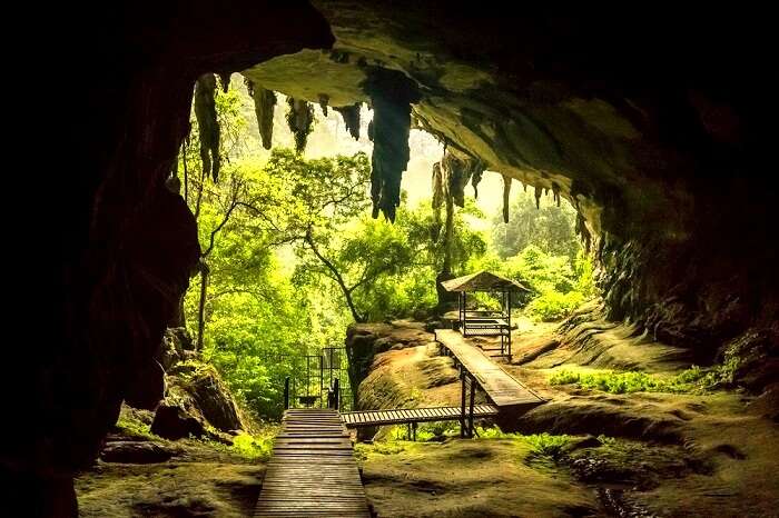
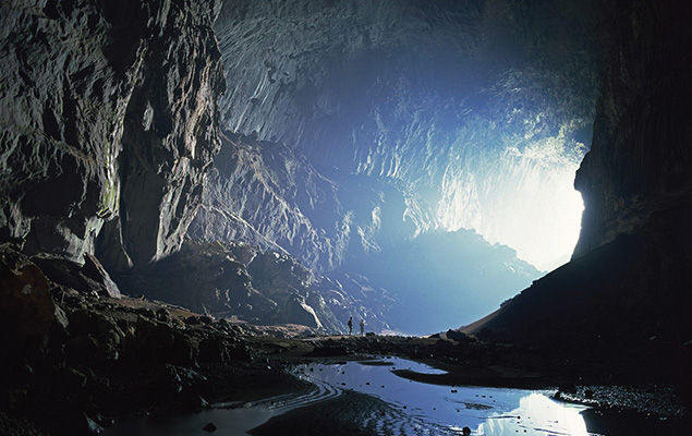
The Niah Caves are located on the northern edge of a limestone mountain named Gunung Subis or Mount Subis. The entrance is located at the west mouth of the cave, 15 km from the South China Sea and 50 m above sea level. The west mouth of the Niah Caves is 150 m wide and 75 m high.
There are two trails at Niah National Park which are worth seeing. The Bukit Kasut Trail makes one witness amazing cliff vegetation clinging to limestone slopes. This trail is a bit steep as one walks up the slope. However, the view of the rainforest canopy from this vantage point is to die for. The Madu Trail near the banks of Sungai Subis which is a tributary of Sungai Niah is another beautiful trail. Here one will find plenty of wild orchids, bizarre mushrooms and giant pandanus plants. A small pathway through the forest will lead one to the Painted Cave where one can find the famous Niah paintings which portray spread-eagled human figures symbolic of warriors and hunters, animals inhabiting the forest and most importantly longboats carrying the souls of the deceased on the dangerous journey to the land of the dead. The cave is tranquil and was used in ancient times to rest.
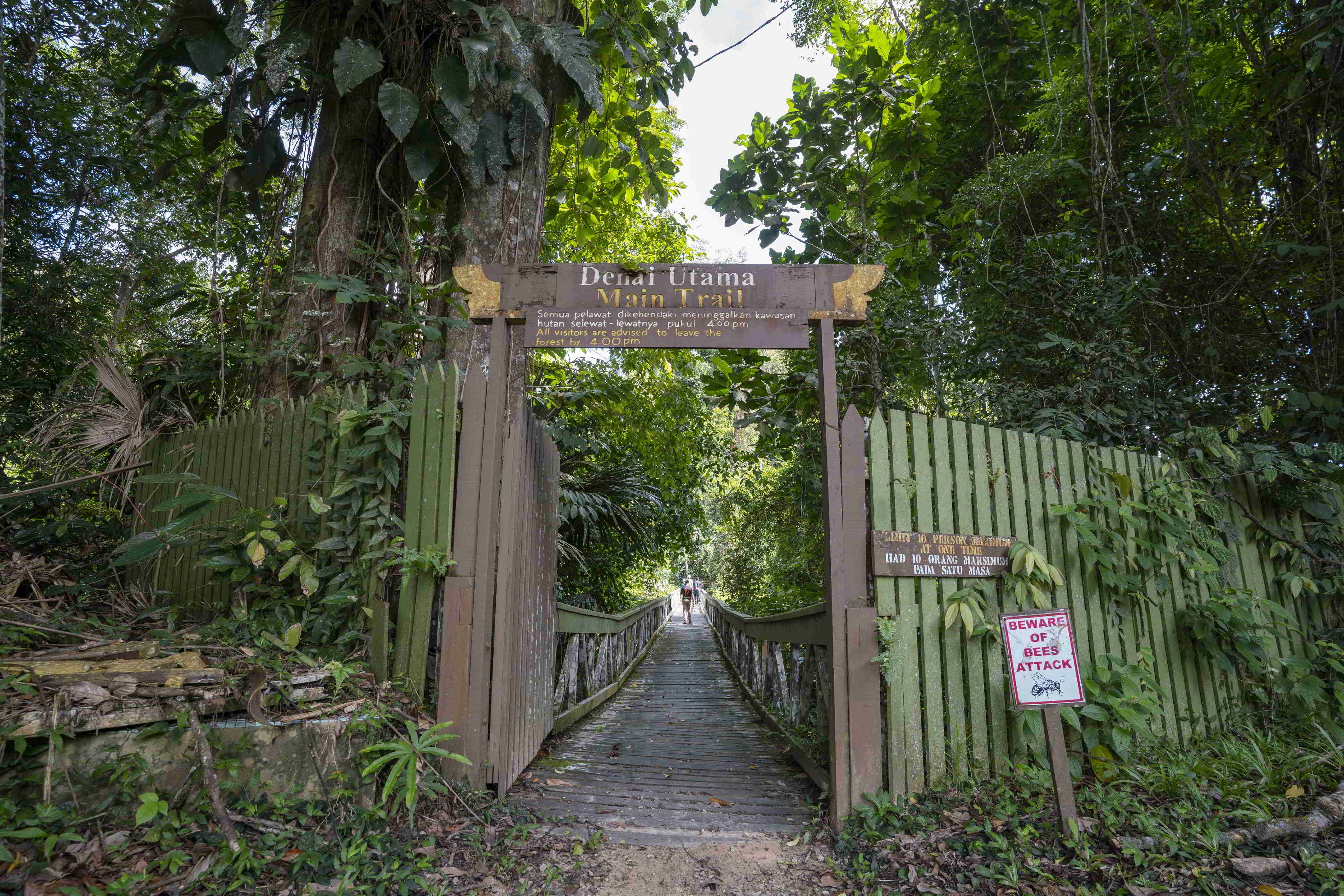
The Great Cave is sandwiched by a primary dense rainforest on both sides. A stroll along the plankwalk will take one close to giant tapang trees, huge pandanus plants, splendid orchids and tree fungi. Colourful birds, squirrels, lizards, butterflies and all manner of unusual insects and invertebrates are a common sight. Occasionally monkeys, flying lizards and hornbills can be seen.
The caves are also well known for the bird’s nest industry. Every section of the ceiling in the caves where swiftlets are roosting is privately owned and only the owner has the right to collect the nests. Collection is done twice a year, usually in January and in June. The collector climbs up hundreds of feet on a single pole to the cave ceiling and scrapes off the nest in flickering candlelight. The best time to visit the national park is between November to February. The park maintains a temperate and dry climate during these months. Monsoons should be avoided as the place gets marshy making the trek along the trails difficult thereby cutting down on the thrill and enjoyment.
The park is open from 8 am to 5 pm daily, including weekends and public holidays. Entry fees are RM 10 per person.
Gunung Mulu National Park
A UNESCO World Heritage Site, Gunung Mulu National Park encompasses caves and karst formations in a mountainous equatorial rainforest setting. The park is famous for its caves and the expeditions that have been mounted to explore them and their surrounding rainforest, most notably the Royal Geographical Society Expedition of 1977–1978, which saw over 100 scientists in the field for 15 months. This initiated a series of over 20 expeditions now named the Mulu Caves Project. The national park is named after Mount Mulu, the second-highest mountain in Sarawak.
The earliest reference to the Mulu caves was in 1858 when Spenser St. John, the British Consul in Brunei mentioned the detached masses of limestone, much water-worn, with caverns and natural tunnels in his book Life in the Forests of the Far East. Spenser tried to ascend Mount Mulu later but failed due to limestone cliffs, dense forests, and sharp pinnacles. In the 19th century, Charles Hose, an administrator in the Raj of Sarawak attempted to climb Mount Mulu but failed. It was only in the 1920s when a Berawan rhino hunter named Tama Nilong discovered the southwest ridge near the mountain which eventually led to the summit. In 1932, Tama Nilong led Edward Shackleton during an Oxford University Expedition to the summit of Mount Mulu. This was the first successful ascent to the summit of Mount Mulu. In 1961, G.E. Wilford, of the British Borneo Geological Survey, visited Mulu caves. He surveyed the Deer Cave and Cave of the Winds. He also predicted that more caves would be discovered in the future.
In 1974, Mount Mulu and its surrounding areas were gazetted as a national park by the Sarawak government. In 1978, the Royal Geographical Society organised a scientific expedition to the Mulu National Park, the largest such expedition ever to be dispatched from the United Kingdom. The expedition lasted for 15 months, in the course of which a small subgroup explored and surveyed 50 km of caves, including Clearwater Cave, Green Cave, Wonder Cave, and Prediction Cave. A base camp was established at Long Pala which was a three-day journey from the Miri upriver. In December 1980, another British expedition team was dispatched to Mulu Caves for 4 months. In this expedition, the Sarawak chamber, which lies in the Gua Nasib Bagus was discovered. In 1984, Gunung Mulu was designated as an ASEAN Heritage Park. In 1985, the park was officially opened to the public. In a British expedition in 1988, a link was established between Clearwater Cave and Cave of the Winds, extending the Clearwater Cave to 58 km, claimed to be the longest cave passage in Southeast Asia. Blackrock Cave was also discovered during this expedition. In 1991, a connecting passage was discovered between Blackrock Cave and Clearwater Cave, extending the Clearwater Cave passage to 102 km and making it the 7th longest cave passage in the world. Between 1993 and 2000, British expedition teams explored the eastern flank of Mount Api with several discoveries made in the Hidden Valley. Between 1995 and 2000, an American expedition team from the National Speleological Society surveyed Gunung Buda or Mount Buda. During these expeditions, Deliverance Cave was discovered.
Gunung Mulu National Park is the most studied tropical karst area in the world. It has 295 km of explored caves which houses millions of bats and swiftlets. The national park lies between the headwaters of the Tutoh and the Mendalam Rivers where the latter is a tributary of the Limbang River. The western side of the park are lowland areas and the eastern side is the mountain ranges consisting of limestone and sandstone. The park is dominated by three mountains: Mount Mulu, Mount Api and Mount Benarat.
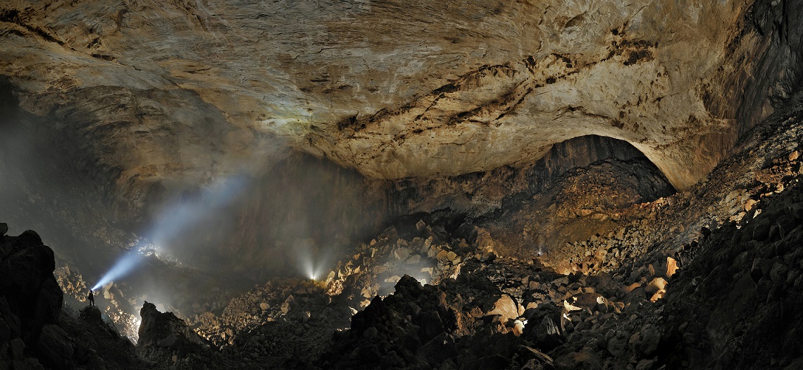
The national park has three notable caves: Sarawak Chamber, one of the world’s largest underground chambers, Deer Cave, the largest cave passage in the world, and Clearwater Cave, the longest cave system in Southeast Asia. Other caves in this area are Gua Nasib Bagus, Benarat Cavern, and Cave of the Winds.
There are 20,000 species of invertebrates, 81 species of mammals, 270 species of birds, 55 species of reptiles, 76 species of amphibians and 48 species of fish identified in the park area. Several amphibians are only known from the Gunung Mulu National Park. Gunung Mulu National Park contains a large number of plant species.
Tourists must purchase a five-day pass to visit the national park, which offers unlimited entry for the period. Malaysian adults pay RM 15 while foreigners pay RM 30.
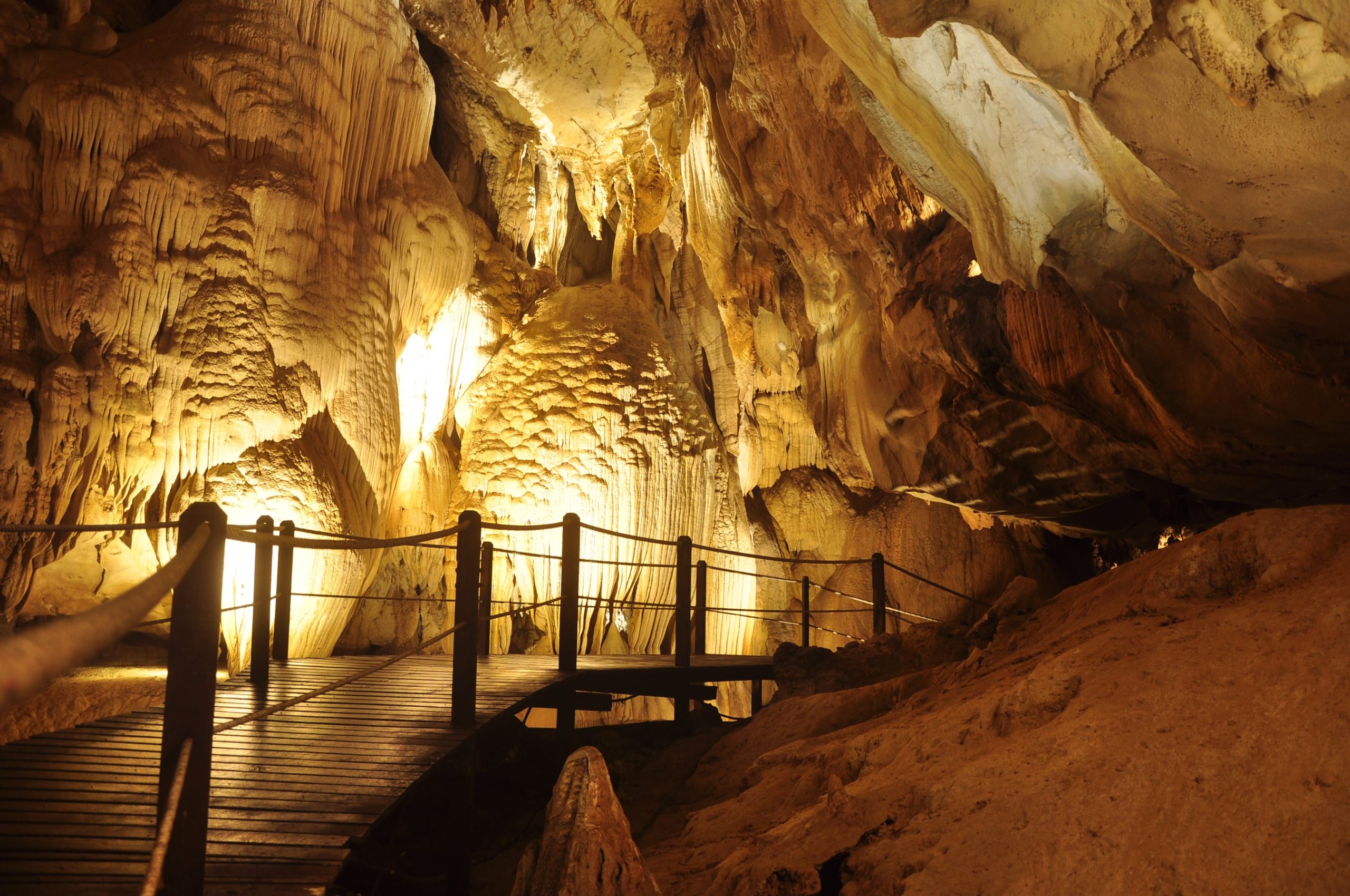
Exploring the Deer and Lang Caves will cost RM 35 per person, including the guide fee. It takes three hours and begins at 2 pm at the park HQ. Covering a distance of 9 km, the tour includes the Bat Observatory, the Deer Cave, whose high ceilings are home to over 3 million Wrinkle Lipped Bats, the Garden of Eden, and then Lang Cave, which features some wonderful limestone shawls, stalagmites, and stalactites.
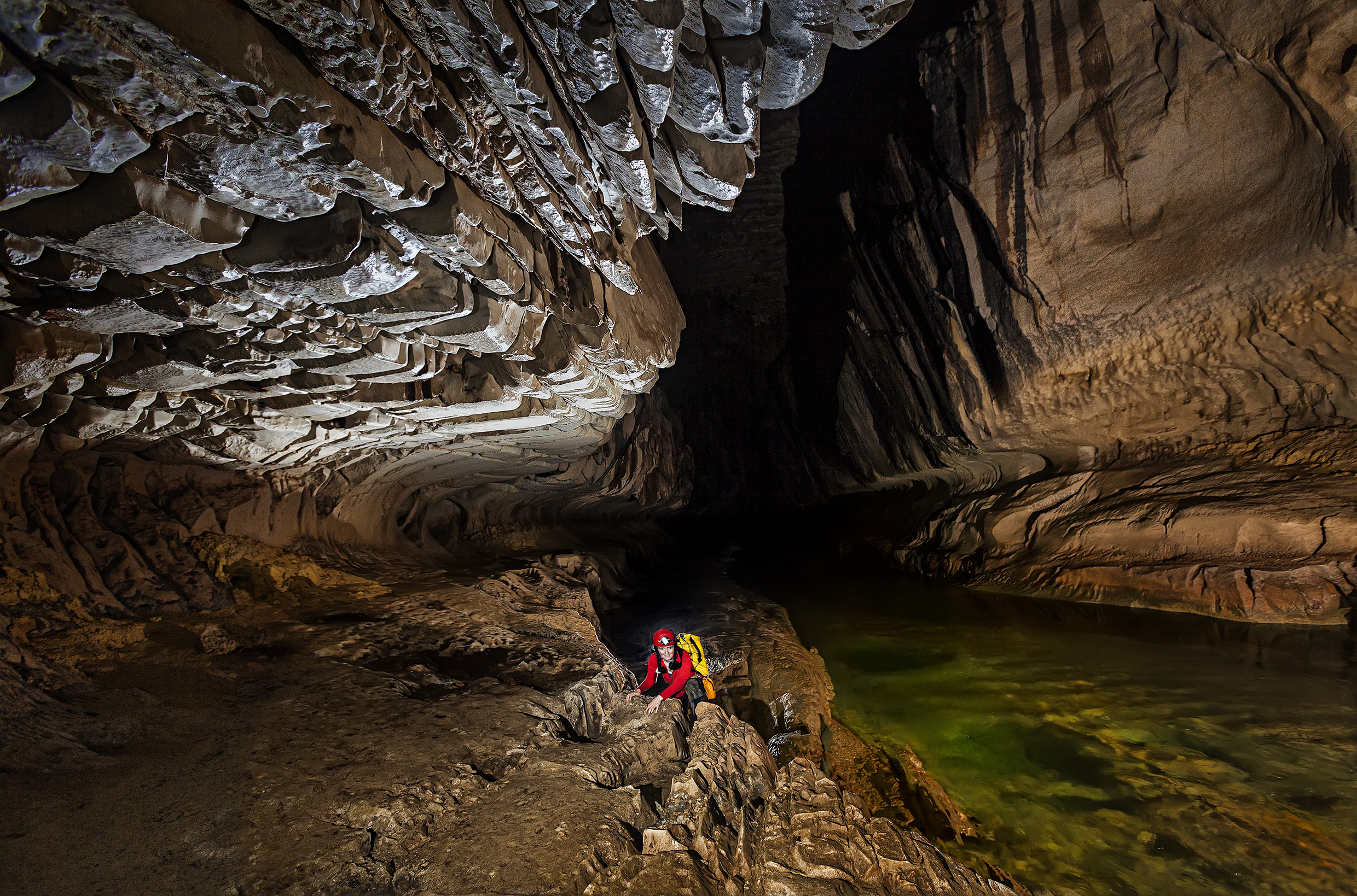
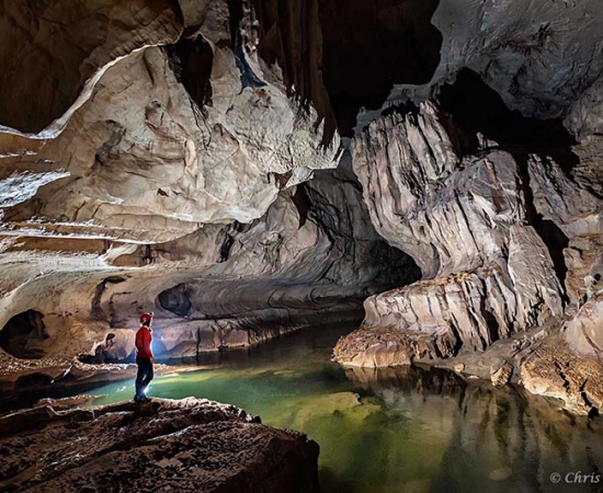
The tour to Clearwater Cave and Cave of the Winds costs RM 67 per person, including the guide fee and longboat fee and takes four hours starting at 8:45 am. On this cruise, one can enjoy a cruise up the Melinau River in a longboat, and then visit the Penan longhouse, the Cave of the Winds and the Clearwater Cave. The Clearwater Cave is one of the biggest caves in the entire world and is over 220 km in length. Even though swimming inside the cave is not permitted, one can enjoy floating with the fish in the waters at the picnic deck.
The Fastlane tour costs RM 65 per person, including the guide and boat fee. Taking 2.5 hours, it begins at 2 pm and involves a boat ride up the Melinau River, and then a walk through the rainforest to finally reach the caves. The cave is home to huge amounts of prehistoric sediments, including a volcanic ash layer, and is held in great awe by the scientists. One will also be able to spot various cave fauna and some of the best formations of Mulu once inside.
The Night Walk costs RM 22 per person, including the guide fee and begins at 7 pm. One must make sure that they move very quietly to catch sight of the nocturnal animals, and remain patient throughout.
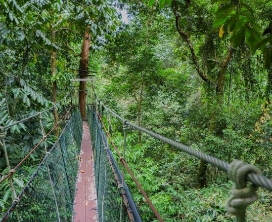
The Canopy walk that is suspended 25 m above the forest floor costs RM 45 per person, including the guide fee and begins at 7 am, 8:30 am, 10 am, 10:30 am, 1 pm and 2 pm. The longest tree-based canopy walks in the world, the Mulu Canopy Walk is an experience in itself.
Adventure Caving at Lagang Cave costs RM 160 per person. Booking is required, and a minimum of 3 people are needed for the tour with a minimum age of 12. The Lagang Cave is a scenic one with numerous stalactites, stalagmites, and cave sediments. One will have to scramble over ancient riverbeds to explore the wonders of the underground world. The best part is that there is no climbing involved, which makes the tour ideal for the entire family.
To get to the Paku Waterfall, one needs to walk about 1.5 km from Deer Cave till they reach a marked trail that will take them to the Paku River. One must wear good walking shoes and can enjoy the birds, insects, and ferns on the way. The Kenyalang Loop is a 2.5 km trail that gives one the option to explore the area without a guide. The Paku Valley Loop is an 8-km long trail, which normally takes around 5-6 hours.
The 30-meter high treetop tower is just a 10-minute walk from the headquarters and is a haven for bird watchers. One can pre-book a time slot that they prefer, though the tower remains locked for safety reasons. Additionally, one will have to pay RM 50 to take this tour, which is completely refundable once the tour ends.
A one-way walk to the observatory is 3.8 km and usually takes around 45 minutes. As the sun starts to set, bats gather at the entrance of the cave in millions and then circle higher and higher before moving out to the rainforest in spiralling ribbons.
One can only reach the national park via a plane ride because it is so isolated. Maswings, a subsidiary of Malaysian Airlines operates daily flights from Miri, Kuching and Kota Kinabalu to Mulu. Even though the Mulu area can be visited all year round, the months between June and September are the peak months.
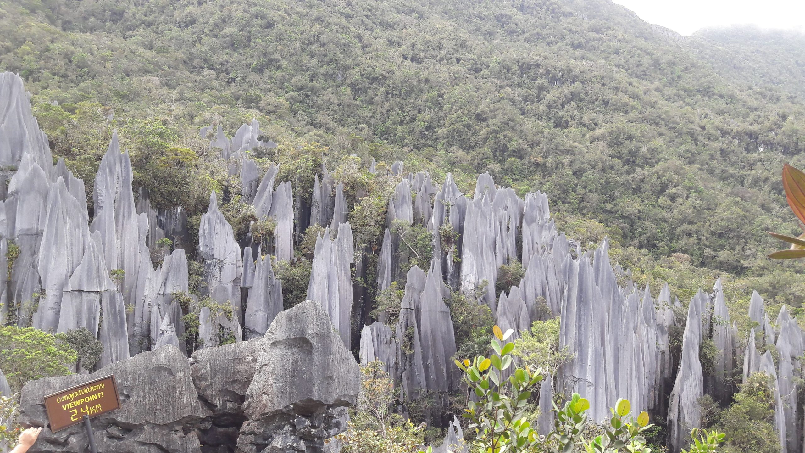
The national park has three climbing treks: The Pinnacles Summit Trek, The Headhunter’s Trail, and Gunung Mulu Summit Trek. The Pinnacles Summit Trek is a 3-day/2 night trek leading to the view of the Gunung Mulu Pinnacles. The trek usually starts with a one or two-hour boat ride from the Melinau River to Kuala Berar in the Berar Delta. The Base Camp 5 is a 7.8 km walk from Kuala Berar. Camp 5 is located near the Melinau Gorge which separates Mount Benarat from Mount Api. After Camp 5, there is a 1.2 km trek rising 1,200 m; passing from dipterocarp forest to moss forest. The last section requires ropes and ladders to help with the climb.
The Headhunter’s Trail is a route taken to enter or leave the Gunung Mulu National Park. The trail follows the route taken by the Kayan from the Melinau River to Melinau Gorge. The trail starts with a boat ride to Kuala Berar, then a trek for two to three hours to reach Camp 5. From Camp 5, there is an 11.2 km trail leading to Kuala Terikan which could last for four to five hours. The climbers can either choose to stay at a ranger station Nanga Metawai which is 15 minutes from Kuala Terikan or a longhouse named Rumah Bala Lesong which is three to four hours by longboat. After that, a boat ride further downriver would reach Nanga Medamit where there is a road leading to Limbang.
The Gunung Mulu Summit trek is the only trek to reach the summit of Mount Mulu. The summit is located 24 km away from the park headquarters. The trek starts from the national park headquarters to reach Camp 3. It is a 12 km hike through the primary forests with an elevation of 1,200 metres. The mossy forest starts from Camp 3. It will take a few hours to climb to reach Camp 4. After Camp 4, there are a few vertical climbs which require knotted ropes which eventually lead to the summit. Camp 1 is located along the descending trek from the summit of Mount Mulu. There is another 3-hour hike to reach the park headquarters from Camp 1.
90% of the park is closed to the public and a protected area while the remaining 10% is open to visitors. There are only four show caves open to the public: Clearwater Cave, Wind Cave, Deer Cave, and Lang’s Cave. All visitors require a permit and a park guide. Visitors are required to organise into groups of ten with visiting intervals of 20 minutes at the four show caves. On the other hand, there are seven caves available for adventurous caving in groups of six if properly equipped. There is also a 480-metre skywalk through the canopy. Other activities that can be done here are rock climbing, kayaking and mountain biking.
The park headquarters is located at the Melinau River, southwest of the park. It has a visitor registration building, interpretation centre, audio-visual room and washroom facilities. The 188-room Royal Mulu Resort has an air-conditioned longhouse, a guest house, four cabins and a hostel. All these facilities are located near the park entrance. The park can be accessed by air from Miri, Limbang, and Bandar Seri Begawan through the Mulu Airport; or by boat from Marudi through the Tutoh and Baram Rivers. There is no road access.
Pulong Tau National Park
Pulong Tau National Park‘s name in the In Lun Bawang and Kelabit dialect, Pulong Tau means our forests, which signifies the pride of the indigenous people in their forest heritage.
The national park was started as a community initiative in the 1970s. In 1984, Sarawak’s National Parks & Wildlife Office submitted a formal proposal with a petition letter from the local community to the
Sarawak state government. The proposal called for a 164,500-hectare park that included Mount Murud, Sarawak’s highest peak, the twin peaks of Bukit Batu Lawi, the Tama Abu mountain range, including the water catchment area of the entire northern Sarawak. Between 1984 and 1987, the Sarawak cabinet approved the proposal but the boundaries need to be redrawn to avoid conflicts with areas designated for land development. In 1986, a population of eastern Sumatran rhinoceros was discovered. It was previously thought that such a rhinoceros population would have extinct in Sarawak. During this survey, the importance of Laurel Forest in maintaining the Bornean bearded pig population was recognised. Rafflesia flowers were also found at the base of Mount Murud. Orangutan was found to enter the park occasionally. Therefore, a second proposal in 1987 argued that these areas should be included within the boundaries of the park. By 1998, when the proclamation to create the park was passed, the proposed area had been reduced to 63,700 hectares and did not include either Batu Lawi or the area where the rhinoceros was found.
When the national park was gazetted in 2005, the total protected areas were reduced to 59,917 hectares which extends from the western side of Kelabit Highlands to the Tama Abu range of mountains in the south and Mount Murud in the north.
The Kelabit Highlands were thought to have developed from the rifted continental crust where water sediments were deposited before Borneo was separated from the mainland Eurasian plate. This is evidenced by the presence of evaporite and limestone found in the area. Evidence of folding and faulting along the NE-SW axis is also found in this area. The types of stones change from oxidised iron and coal-bearing sandstones in the east of Kelabit Highlands, to mudstone and limestone of the Kelabit highlands, and grey sandstones westwards in the Mount Murud region. Pulong Tau National Park covers the water catchment area of the Baram, Belait, Limbang, Tutong, Trusan, and Padas rivers.
There are many species of orchids and Nepenthes pitcher plants. During an expedition in 1998, a total of 67 species of birds from 29 families, of which 13 species (19.4%) are endemic to Borneo was recorded. Besides, 28 species of mammals, 12 of which are endemic to Borneo were also recorded.
Lambir Hills National Park
The Lambir Hills National Park is a small national park 32 km west of Miri that is 6,952 hectares and is composed largely of mixed dipterocarp forest, with some small areas of kerangas or heath forest. Known as the world’s most ecologically diverse area, biologists have recorded 237 species of birds, 64 species of mammals, 46 species of reptiles and 20 species of frogs in the national park. Large mammals such as gibbons and sun bears are absent or very rare due to the small size of the forest and illegal hunting. More recent surveys done between 2003 and 2007 failed to find 20% of the park’s resident bird species and 22% of the mammal species, losses that include half of the park’s primate species and six out of seven hornbill species. The collapse in the population of large mammals and birds is an ecological disaster in Lambir. The park’s invertebrates include the Rajah Brooke’s Birdwing butterfly and more than 300 species of ants. Leeches are rare.
In 1991, the Sarawak Forest Department, Center for Tropical Forest Science/Harvard University, and the Plant Ecology Laboratory of Osaka City University, Japan created the Lambir Hills Forest Dynamics Plot. This is a 52-hectare area of the forest in which all trees thicker than 1.5 cm at breast height have been measured, mapped and identified. Every few years, researchers do a census of these trees so they can track their growth and changes in the population structure of each species. A census of all trees in the plot found 1175 different species. This gives Lambir Hills National Park possibly the highest diversity of trees of any forest in the Old World. The dominant family of trees in the park is the Dipterocarpaceae, whose members include Shorea and Dryobalanops species. As Lambir Hills National Park is the last intact patch of lowland dipterocarp forest left in Sarawak it is an important refuge for species that have been heavily logged elsewhere.
Among the tallest trees in the national park is the tapang, which can grow more than 80 metres tall, and which honey bees like to build their hives on. Other interesting plants in the park include several species of Macaranga that have formed a symbiotic relationship with ants. The ants live inside the plants’ hollow stems and protect them from herbivorous insects. The pitcher plant is found only in the park and its surrounding area. The park has a very high diversity of figs with nearly 80 species. Several research institutes have collaborated on long-term studies of the Lambir’s natural history and many individual MSc or PhD students have completed their fieldwork there.
In addition to the Lambir Hills Forest Dynamics Plot mentioned above, Lambir has a series of tree towers, a canopy walkway and a canopy crane that researchers use to gain access to different parts of the forest’s vertical structure.
The star attraction at Lambir Hills National Park is hiking. If one wants to go in for a full hiking experience, it will take them a minimum of four hours or maybe more depending upon their physical fitness. The best time to start the hike is around 8 am and they should remember to follow the signs and marks on the trails. If ambiguity persists, refer to the guide available at the counter.
Trail guides can be hired to take hikers to the best spots through convenient routes. It is strongly recommended to go in a group for hiking instead of opting for solo hiking. Hikers should visit the Latak Waterfall as the climb to this one is relatively easy which makes it more popular amongst hikers. Another waterfall that is a hikers’ favourite and is worth visiting is the Nibong Waterfall followed by Pantu Waterfall. If one is an experienced hiker, one can consider climbing up to the summit of Bukit Lambir. However, they need to be very careful of stingy ants that accompany them through the trails.
Visitors enjoy having a picnic with family and friends. At the very entrance of the Park Headquarters, there is a picnic table and bench where people can sit and enjoy the view.
The 22-m high tree tower near the Park Headquarters is a must-see. Another unique feature of the hike is the tree ladders that one can find almost everywhere in the Lambir Hills National Park. These ladders take one up to the forest canopy which enables the visitors to soak in the magnificent view from the treetop. However, this is not meant for the faint-hearted as one is expected to climb a sky-embracing tree without any safety measures. People scared of heights too should omit climbing the tree ladders.
The park is open daily from 8 am to 5 pm. Tickets can be bought at the entrance to the Park. Entry fees are RM 10 per person for Malaysian adults and RM 5 for Malaysian children between the ages of 6 & 18 and non-Malaysians, it is RM 20 for adults and RM 10 per child.
Gunung Buda National Park
Located in Limbang, the Gunung Buda National Park is located to the north of Gunung Mulu National Park and was gazetted in 2001. Roads were also planned to connect Gunung Buda with Gunung Mulu National Park. Gunung Buda means White Hill in the Lun Bawang language.
An expedition by British cavers in 1978 found the entrances and initial passages to several large caves such as Deer Cave and Clearwater Cave at Gunung Mulu National Park. These discoveries led to further explorations of Mulu caves in the subsequent years. Americans first visited Gunung Buda when John Lane and George Prest visited the mountain to assess its potential for an American expedition in 1993. In late 1994 and early 1995, the first American expedition took place. Others followed in 1996, 1997, and 2000. Collectively the expeditions have surveyed more than 60 kilometres of cave passages beneath Gunung Buda. The 1997 expeditions were made by the members of the National Speleological Society. The highest mountain in the national park is Mount Buda, which stands at 963 m high. It is separated from Mount Benarat by the Medalem Gorge.
The rain forests of Buda and nearby Mulu host a tremendous diversity of life, including at least 300 bird species, numerous primates, more than 2,500 tree species, more than 60 snakes and many other beautiful, varied forms of life.
That is all from me about this amazing, yet unexplored state. There are two more to go before we finish up Malaysia, so keep your eyes open.


