Hisar
About 66 km northwest of Meham lies Hisar, known for its steel industry. Hisar was ruled by several major powers, including the Mauryas in the third century BC, the Tughlaqs in the 14th century, the Mughals in the 16th century, and the British in the 19th century. After India’s independence, it became part of the Punjab state and when Punjab was divided in 1966, Hisar became part of Haryana.
Hisar comes from Hisar-e-Firoza, which was given to the town in 1354 by Firoz Shah Tughlaq, the Sultan of Delhi from 1351 to 1388. The word Hisar means fort or castle in Persian with Hisar-e-Frioza meaning the fort of Firoze. Timur invaded the city in 1398 AD and his soldiers set fire to the fort.
The Ghaggar and Drishadvati Rivers once flowed through the city, but they have now changed their course. Archaeological excavations at the nearby locations of Rakhigarhi (7000 BC), Siswal (4000 BC), and Lohari Ragho suggest the presence of human habitation from the pre-Harappan period. Later, the Aryan people settled around the Drsadvati River. The Jain literature Uttaradhayana Sutra from about 468 BC mentions a town Isukara, believed to be the earlier name of Hisar. The kingdom of Hisar, with its capital at Agroha, possibly assisted Chandragupta Maurya in his war against the Greeks. The kingdom was then included in the Mauryan Empire, as evidenced by the discovery of Ashokan pillars in the vicinity of the city and later came under the Kushan and Gupta Empires. The city later came under the rule of Sayyid dynasty and Lodi dynasties before Babur defeated Ibrahim Lodi in the first battle of Panipat and remained under the rule of the Mughals until 1760.
The region came under the rule of the British East India Company in 1803 and remained so until the Indian Rebellion of 1857 when Muhammad Azim and Rao Tula Ram conquered it away for a short period. Between 1803 and 1879, the British constructed a 4,000-km-long Great Hedge of India, for the levy of customs duty on salt and sugar, that ran through Hisar and Hansi. The city remained as a major centre of the Indian independence movement from the rebellion of 1857 until independence.

Signs of pre-Harappan settlements have been found at Siswal, Lohari Ragho and Mingni Khera near Hisar. The Rakhigarhi settlement covers 2180 hectares, making it the largest Harappan site in India and the second-biggest overall after Mohenjodaro. Agroha, located about 24 km from the city was once the capital of king Agrasena, believed to have lived during the last stages of the Dvapara Yuga during the time of the Mahabharata era. Remains of his capital have been excavated, known as Agroha Mound or locally as Ther, and belong to around 3000 BC. The city was also a major centre during the Mauryan period as Buddhist and Jain temples have also been revealed in the excavations.
The now lost ancient Drishadvati river, a tributary of ancient Sarasvati River used to flow through Hisar. Today it flows as a remnant via the Ghaggar-Hakra River. The historic Agroha Mound and Agroha Dham is located on the outskirts of the city about 22 km away. A local deity Banbhori is worshipped by the locals who believe in her power.
The oldest park located in the city is the Krantiman Park, located across the historic St. Thomas Church. The park was built in the 19th century and was then known as Company Bagh. Other parks include Madhuban Park, Town Park, and O. P. Jindal Knowledge Center, which includes a museum, library, park and houses a 25-storied steel tower, one of the tallest structures in the town and modelled on the Space Needle Centre in Seattle. The Haryana Rural Antique Museum exhibits the evolution of agriculture and vanishing antiques. The Jahaj Kothi Museum, named after George Thomas, is located inside the Firoz Shah Palace Complex while the Rakhigarhi Indus Valley Civilisation Museum is located at Rakhigarhi, an Indus Valley Civilisation site 60 km away.
Blue Bird Lake is an artificial lake and tourist complex maintained by the Haryana Tourism Department and offers boating and watersport facilities, bird watching and options to picnic. The deer park and Shatavar Vatika Herbal Park are located on the outskirts of the city and was established in 1971. Endangered species such as blackbucks, chitals, sambars, and nilgais can be found here.
Hisar Fort was built with four gates, the Delhi Gate and Mori Gate to the east, the Nagori Gate to the south, and the Talaqi Gate to the west and was completed in 256. In the middle of the fort stood the Firoz Shah Palace, built of red sandstone consisted of a mosque, a Diwan-e-Aam, a palace for the shah’s wife, underground apartments and a granary. The artwork in the fort synthesizes Islamic and Indian architecture while the mosque is an example of Seljuk architecture. The Shahi Darwaza entrance to the palace faces east and is still standing. Shahi Darwaza which in Persian means royal gate was reserved for the royal family. The Talagi gate faces west, with access to the ancient Agroha Mound and Sirsa, and still stands across from the main bus station of Hisar. The Nagauri gate, now demolished, led south to Nagaur and on to Jodhpur in Rajasthan. The Mori gate faced east with a water channel, entering the fort complex through a hole to supply water. Both the gate and the water hole no longer exist. The Delhi gate also no longer exists today. The royal palace is a rectangular three-storied building of stone masonry with two floors above ground and one underground. On the far north and west sides of the royal palace complex, a watchtower with three stories above ground and one underground doubled as a staircase, connecting all floors of the palace and serving as a corner passage between the north and west sides of the building and was the tallest structure in the complex. The central courtyard which served as an open-air private audience hall was known as the Diwan-e-Khas. Immediately to the right of the royal gate is the Diwan-e-Aam, or audience chamber. The Lat ki Masjid to the east is within its courtyard, and the Ashoka pillar or lat is in the middle of the courtyard. An L-shaped ablution pool lies in the south corner of the courtyard. In the northwest corner is a raised Takht-i-shahi or Muluk-khana platform on four smaller red stone pillars, where the throne of the king used to be. The throne can be reached by five red sandstone steps. Under the platform is a dried-up well. The most visible part of what now remains of the palace is the Baradari on the upper level, so named for the twelve doorways, three on each side. It was used for social gatherings. Four pillars inside the chamber support the roof.
Jahaj Kothi Museum, a later era building that was originally a Jain temple which was later used as a residence by George Thomas, is located inside Firoz Shah Palace Complex and maintained by the Archaeological Survey of India. The Haryana Rural Antique Museum in Hisar aims to preserve the vanishing antiques of rural Haryana and was extended in 2010. The museum houses the collection of antiquities showcasing the development of agriculture and rural society in the state with the collection including clothes, agricultural and farm tools and implements, rural tools and equipment, rural music instruments, Haryanvi folk dresses for men and women and farm vehicles.
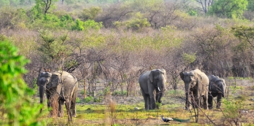
The Bir Bara Ban Wildlife Sanctuary is located about 69 km east of Hisar and is spread over an area of 4.2 sq km. The sanctuary has several species of birds, animals and mammals and was notified as a sanctuary on 11 October 2007.
Panipat
A historic city, Panipat lies about 95 km north of Delhi and 169 km south of Chandigarh. The city is well known by every Indian child for the three major battles fought in 1526, 1556 and 1761 that took place near the city. The city is famous in India as the City of Weavers and Textile City and is also known as the cast-off capital due to being the global centre for recycling textiles. Panipat was one of the five cities or prasthas founded by the Pandava brothers.
Panipat was the scene of three pivotal battles in Indian history. The First Battle of Panipat was fought on 21 April 1526 between Ibrahim Lodhi, the Afghan Sultan of Delhi, and the Turko-Mongol warlord Babur, who later established Mughal rule over the Northern Indian subcontinent. Babur’s force defeated Ibrahim’s much larger force and marked the beginning of Mughal rule in India. The Second Battle of Panipat was fought on 5 November 1556 between the forces of Akbar and Hem Chandra Vikramaditya, the last Hindu emperor of Delhi. The place of martyrdom of Raja Hemu is now a famous shrine in Panipat. The Third Battle of Panipat was fought on 14 January 1761 between the Maratha Empire and the Afghan and Baloch invaders. The Maratha Empire forces were led by Sadashivrao Bhau and the Afghans were led by Ahmad Shah Abdali. On 14 January, over 100,000 soldiers died resulting in the victory for the Afghans. However, after the victory, the Afghans facing a hostile North India, retreated to Afghanistan to avoid casualties. This battle served as a precursor for the East India Company to establish Company rule in India as most of North and Northwest Indian princely states were weakened.
The term Panipat Syndrome, coined by Air Commodore Jasjit Singh has entered the lexicon as the lack of strategic thinking, preparedness and decisive action by Indian leaders thus allowing an invading army to enter well inside their territory. This is based on the fact that in the three battles fought here, the defending armies were decisively defeated each time.
King Hemu’s Samadhi Sthal or the place where he was beheaded by Emperor Akbar’s general Bairam Khan at Shodapur on Jind Road. Hemu’s head was sent to Kabul where it was hung outside the Delhi Darwaza while his body was placed in a gibbet outside Purana Quila in Delhi to terrorise his supporters, who were mainly his subjects, both the Muslims and Hindus.
It was one of Sher Shah Suri’s dying regrets that he could never fulfil his intention of erecting a tomb to the fallen monarch Ibrahim Lodhi. The tomb is a simple rectangular structure on a high platform approached by a flight of steps. Much later, in 1866, the British relocated the tomb which was just a simple grave during construction of the Grand Trunk Road and added a platform to it with an inscription highlighting Ibrahim Lodhi’s death in the Battle of Panipat.
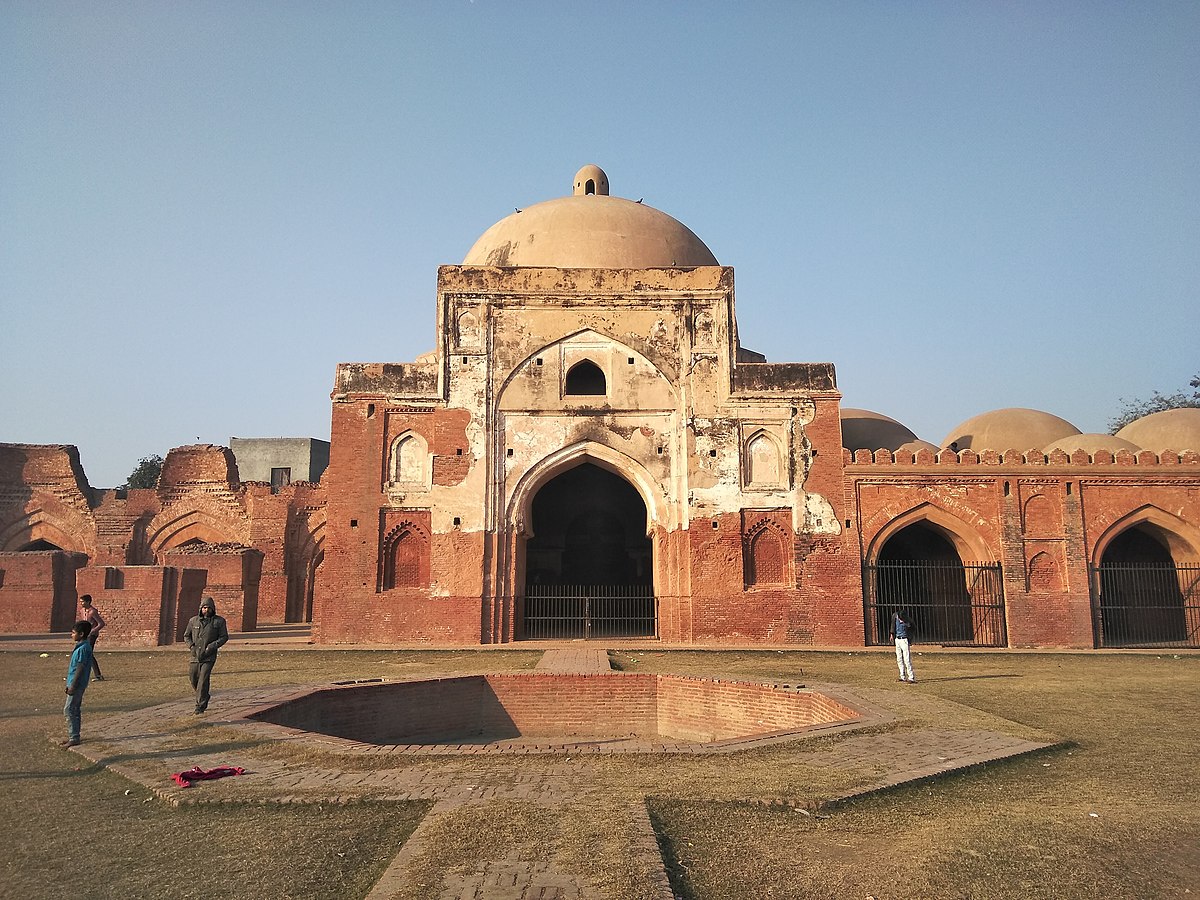
The garden of Kabuli Bagh along with the Kabuli Bagh Mosque and a tank were built by the Mughal emperor Babur after the First Battle of Panipat to commemorate his victory over Ibrahim Lodhi. Some years later when Humayun defeated Sher Shah Suri near Panipat, he added a masonry platform to it and called it Chabutra Fateh Mubarak, bearing the inscription 934 Hijri which corresponds to 1557. These buildings and the garden still exist under the name of Kabuli Bagh called so after Babur’s wife, Mussammat Kabuli begum.
According to tradition, the Kala Amb Memorial lies about 8 km from Panipat and is where Sadashiv Rao Bhau commanded his Maratha forces during the Third Battle of Panipat and was marked by a black Mango Tree or Kala Amb which has since disappeared. The dark colour of its foliage was probably the origin of the name. If legends are to be believed, the war ground, as well as the other plantations in the vicinity, turned black due to the uncontrolled bloodshed that took place and the mango tree situated in the centre of the ground started to bear back fruits, and thus the name Kala Amb.
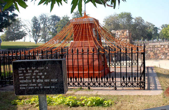
The site has a brick Pillar with a red obelisk which marks the spot where the Maratha commander Sadashiv Rao Bhau passed away and is surrounded by an iron fence. The site is being developed and beautified by a society presided over by the Governor of Haryana. The Kala Amb Smarak is a popular spot of interest at the Kala Amb. Built in the shape of a pillar that looks like a small tower, with one rod on the top jammed vertically into the pillar, it is made up of red coloured bricks, and its circumference decreases as the height increases, which means that from the bottom, it is much wider than at the top.
On the banks of a large tank lies the Devi Temple, dedicated to a local deity. Besides this, there is a Shiva temple which is believed to have been built by a Maratha named Mangal Raghunath who had remained in Panipat after the third battle and defeat of the Maratha forces. Dedicated to Lord Rama, the Shri Ram Sharanam is a prayer hall inaugurated by Swami Satya Nandji in 1960. Currently, it is headed by his disciples of Maa Shakuntala Devi and Maa Darshi Devi.
Standing for over seven hundred years, the tomb of Bu-Ali Shah Kalandar, a Sufi saint born in 1190, is also known as the Dargah of Shah Kalandar Khizar Khan, the son of Allau-din Khilji. Enclosed at Qalandar chowk, this tomb’s architecture matches the likes of the Ajmer Dargah in Ajmer and the Hazrat Nizamuddin Dargah in Delhi. The mausoleum was during the Mughal era by Emperor Jahangir’s general, Mahabat Khan in the memory of Hazrat Shareefuddin Bu Ali Shah Qalandar.
Set up by the Battle of Panipat Memorial Society, the Panipat Museum has been specially established for disseminating information about archaeology, history, art and crafts of Haryana with special emphasis on the Battles of Panipat which marked the turning point in Indian history. The museum displays antiquities, inscriptions, sculptures, arms and armours, Pottery, old and valuable documents, jewellery and art and craft objects aided by modern maps, write-ups photographs and slides. Enlarged photographs of a large number of important miniatures, mostly from Babur-Nama and Akbar-Nama, relating to these battles and personalities have been obtained from the National Museum of New Delhi, the British Library and the Victoria and Albert Museum of London. A Large number of contemporary weapons, armoury, guns, etc. have been acquired through a loan from the Archaeological Survey of India.
Karnal
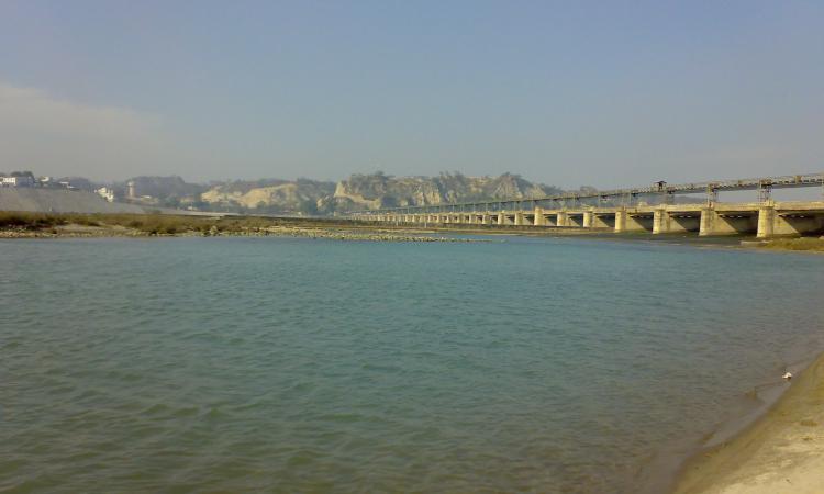
36 km north of Panipat, and nestled on the banks of the Yamuna River, Karnal is popularly called the Rice Bowl of India for its vast rice fields. The Battle of Karnal between Nader Shah of Persia and the Mughal Empire took place in this city in 1739 and the town was used by the East India Company army as a refuge during the Indian Rebellion of 1857.
The city associates itself with the warrior from the Mahabharat, Karna and has recently set up a large statue of the great donor and a powerful warrior. A tank in the city also bears the name Karna Tal and a town gate is called Karna gate. At the end of the 6th century, the area was under the rule of the Vardhanas of Thanesar while the 7th century was a period of eclecticism in religion with the decline of Buddhism and the resurgence of Hinduism in the Indo-Gangetic plains. The region was under Kanauj rule under the Pala Emperor of Bengal with the authority of Mihira Bhoja, the Pratihara ruler of Kanauj penetrating as far as Pehowa, including Karnal.
The Sikhs appeared on the scene in the 18th century when the importance of Karnal grew during the rule of Raja Gajpat Singh of Jind State who after its capture in 1763 built the boundary wall and a fort and under whose rule the town increased considerably in size. On 14 January 1764, Sikh Chiefs defeated and killed Zain Khan Sirhindi, the Durrani Governor, and took possession of the whole of Sirhind province as far south as Panipat including Karnal.
A popular tourist attraction, Karna Lake is also called the Karna Tal. Known for its spectacular sunsets, Karna Lake is named after the warrior Karna from the Mahabharata and is man-made with the beautifully landscaped Karna Lake Tourist Complex adjacent to it. Boating is a local favourite and the complex has swings and other rides for children. It is said that it was here that Karna decided to give away his protective armour to Lord Indra. The period from October to March is the best time to visit the lake when weather conditions are extremely pleasant and offer an ideal atmosphere for a picnic by the lake.
Atal Park is spread over an area of 55 acres, including a lake spread over 4 acres. It has an open-air gym, a lily pond, a few fountains which are illuminated with lights in the evening and a children’s playground. There is a modest Sarawati Temple inside the park and other nearby attractions include the Cantonment Church Tower, Karna Lake, Karneshwar Mahadev Temple and the Durga Bhawani Mandir. The park is open from 4 am to 10 pm and there is no entry fee.
The Durga Bhavani temple houses the powerful embodiment of female cosmic power or Shakti. The Navratri festival in the temple is especially popular and Dusshera is marked by large processions of the deity on the road and tall statues of the goddess. Don’t forget to shop for handicrafts and local delicacies in the nearby markets with metal jewellery and other trinkets especially favourite buys. The Sita Mai temple is the only temple dedicated to Goddess Sita in India and is built in an intricate Nepali architectural style with elaborate carvings on the bricks. Local lore has it that the temple marks the exact spot where Mother Earth is said to have taken Lady Sita into herself when she was asked to prove her chastity to Lord Ram.
Built-in 1528 by the Mughal emperor Babur to commemorate his victory over Ibrahim Lodhi, Babur’s Masjid is a must-visit. The walled mosque was home to a stunning garden too and at its peak, the mosque boasted of three octagonal towers and domes in addition to the central dome, but only one remains now. The resident well is still replenished by cold water, although the outer structure is in ruins. The magnificent Kalander Shah’s Tomb houses fountains, gardens and a serene tomb. Built by Ghiyas-ud-din, the Emperor of Delhi, the Dargah holds the memory of the Sufi sage Bo-Ali-Qalandar Shah who is famous for conjuring up a cow that ate a tiger. Emperor Alamgir also added to the construction and the Persian and Mughal influences are obvious in the architecture, adding to the charm. A mosque is also built in the vicinity that one can visit.
Miran Sahib’s tomb celebrates the mystic saint Miran. Syed Mohammed or Miran Sahib was a mystic saint who was hailed for his unique compositions and philanthropy and who rejected all the norms of caste and religious discrimination and took up the cause of the poor and downtrodden. When a King took a local Brahmin girl hostage, Miran Sahib is said to have paid an enormous sum of money to retrieve her. Interestingly, only his head is believed to have been buried at Karnal. After he was killed in battle, his body was buried at Muzaffarnagar in neighbouring Uttar Pradesh, while his head was brought to Karnal. The stunning mosque within the tomb complex is worth a visit too.
The Gurudwara Manji Sahib is associated with the first Sikh guru, Guru Nanak Dev Ji. It is famous for its celebrations during all Sikh festivals. The first Guru, Guru Nanak Dev Ji is believed to have visited Karnal during his travels in 1515 and stayed in a garden, where he sat and recited several hymns in praise of the Lord. Guru Harkrishan Sahib Ji, the Sixth Guru, is also said to have visited Karnal.
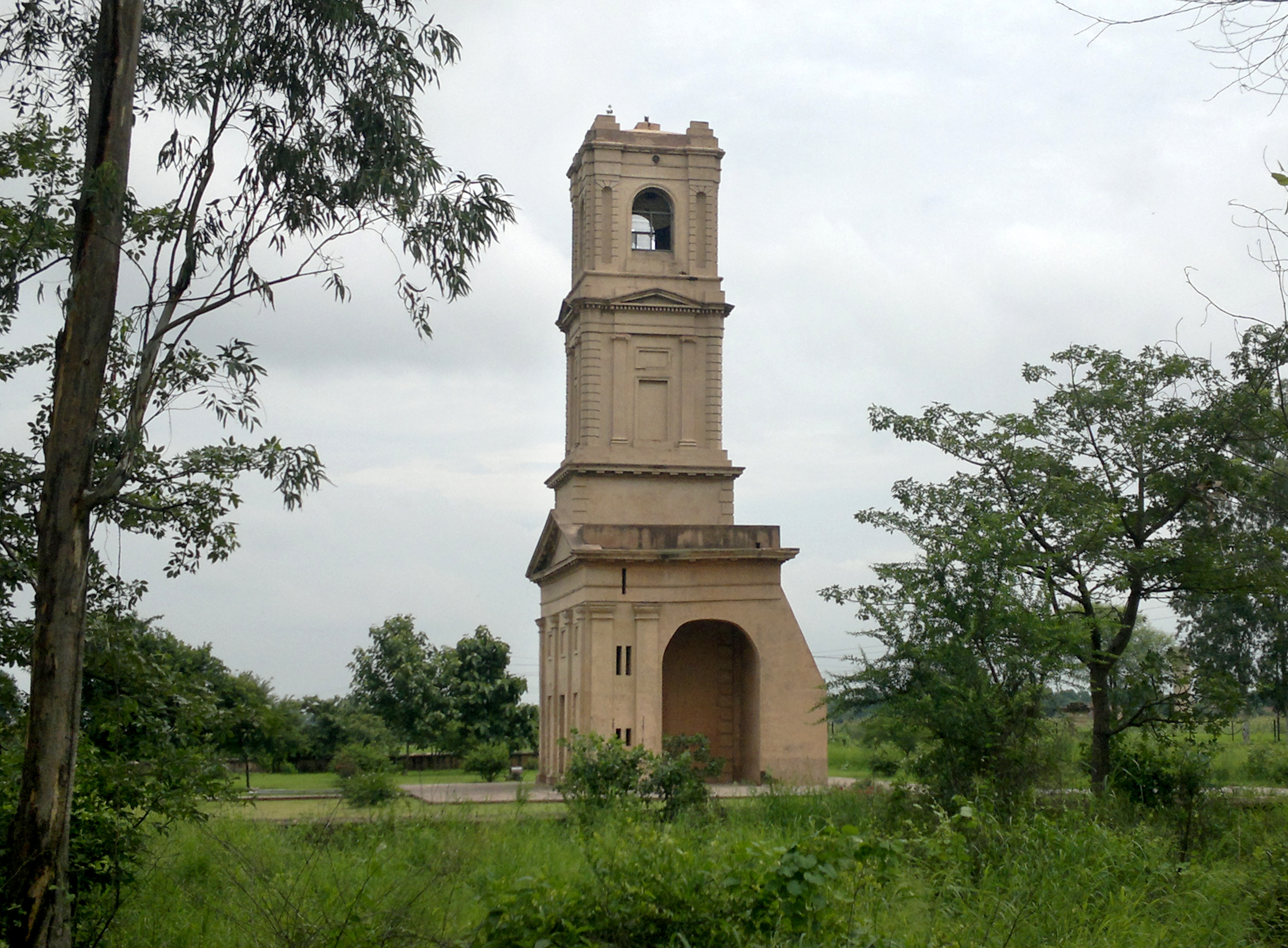
The Karnal Cantonment Church Tower is built in a Roman style. Formerly a part of St James Church, the major part of the area was dismantled as the cantonment was shifted before independence. The four-storeyed tower can be seen from km away and holds a spectacular ornamental cross on the top. Towering at the height of thirty-five metres, the Karnal Cantonment Church Tower is one of the most prominent landmarks of the region.


