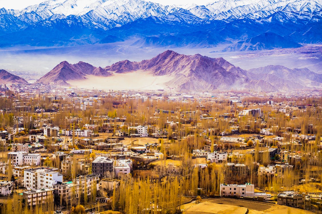
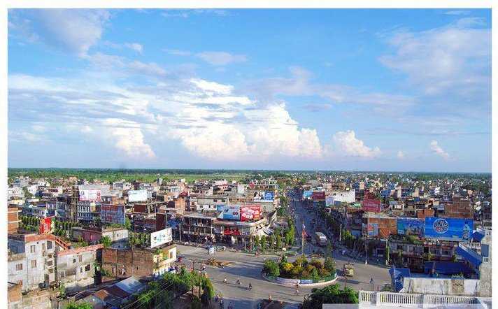
Travel Bucket List: Nepal – Part 13

Janakpur
Janakpurdham or Janakpur is the capital city of the Madhesh Province and is the central hub for Maithili language, religion and cultural tourism in Nepal. One of the fastest developing cities of Nepal, Janakpur is the largest sub-metropolitan city in the country and is currently the fourth most densely populated city. Janakpur is located about 23 km away from the Bhitthamore border with India and Nepal Railways operates a train service between Janakpur and Jaynagar in Bihar, India.

The city was founded in the early 18th century but was retrospectively assigned as the location of the capital of the Videha kingdom although there is no archaeological evidence to support this. Janakpurdham, popularly known as Janakpur is named after the late King of Videha in Mithila region – Janaka. The rulers of the Videha kingdom were accorded the title Janaka, meaning father in Sanskrit, and this character is the best-known bearer of the same.

Accounts from ascetics, pandits, and bards indicate that Janakpur was founded in the early 18th century. The earliest description of Janakpur as a pilgrimage site dates to 1805. Earlier archaeological evidence of the presence of an ancient city has not been found and there is a lack of evidence to assign the modern-day city of Janakpur to the ancient capital of the Videha kingdom. Until the 1950s, Janakpur was a cluster of rural hamlets inhabited by farmers, artisans, priests, and clerks who worked for the monasteries that controlled the land. After the Independence Act in India, Janakpur expanded into a commercial centre and became the capital of the Dhanusa District in the 1960s.

Gautama Buddha and Vardhamana Mahavira, the 24th and final Tirthankara of the Jain religion are said to have lived in Janakpur. The region was an important centre for the history of Mithila during the first millennium. Following the Sugauli Treaty in 1816 between the Nepali rulers and the British East India Company, the northern part of ancient Mithila state, including Janakpur, became part of Nepal, while the southern part went into India.

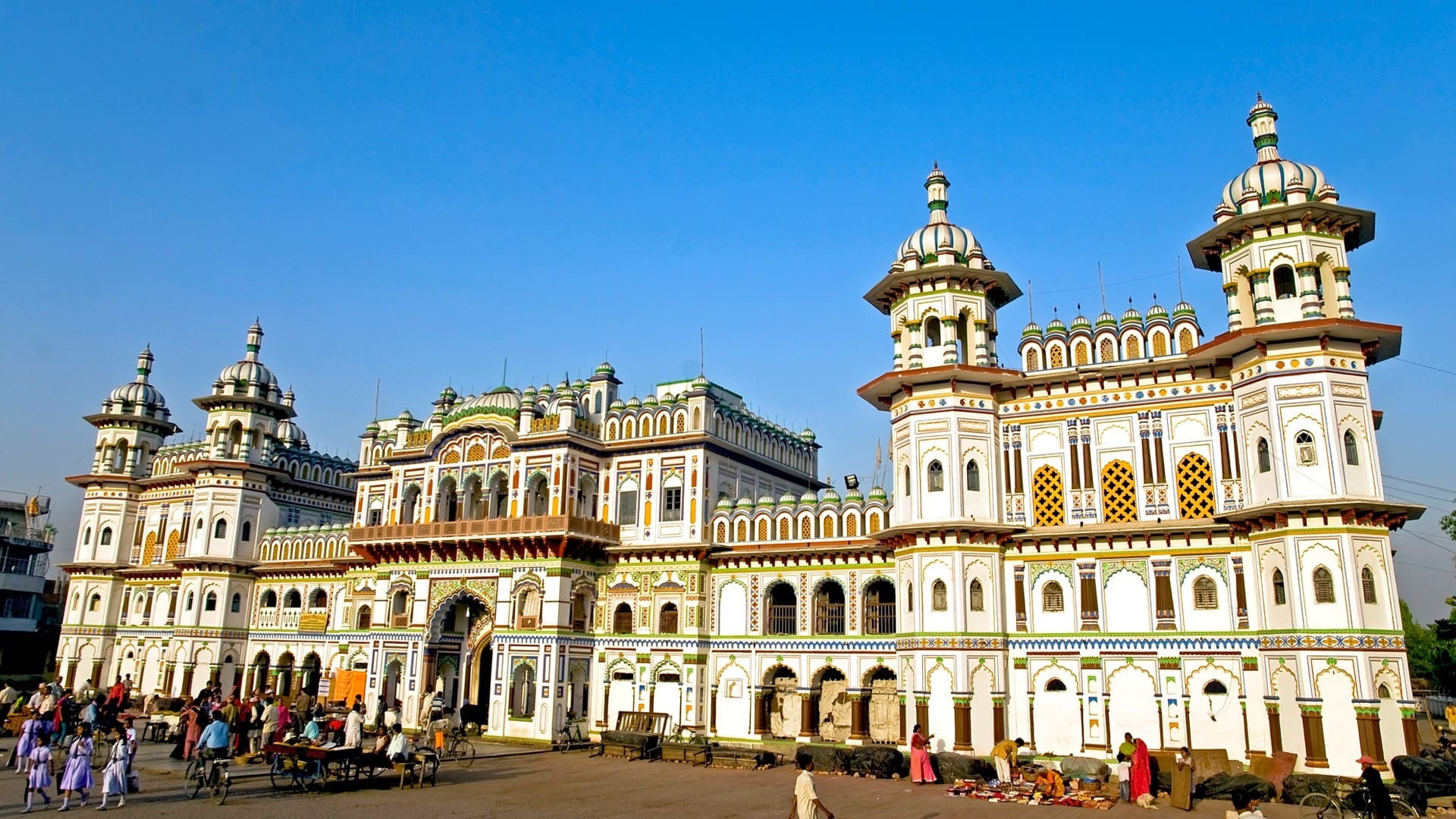
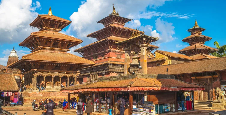
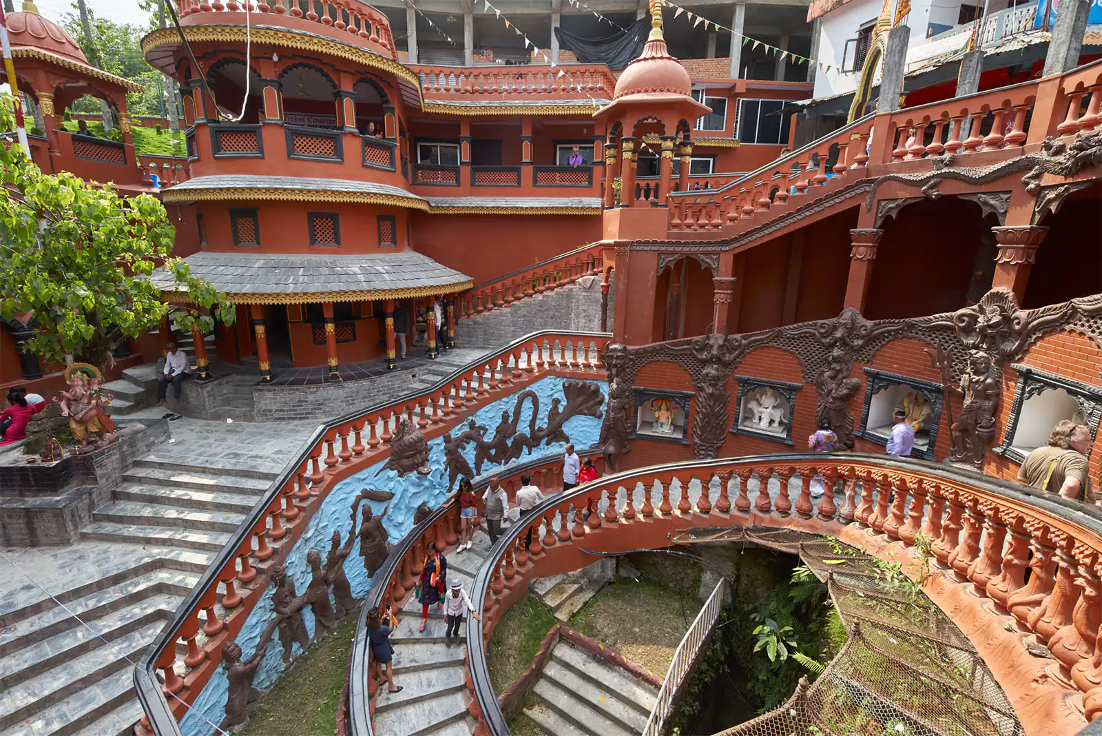
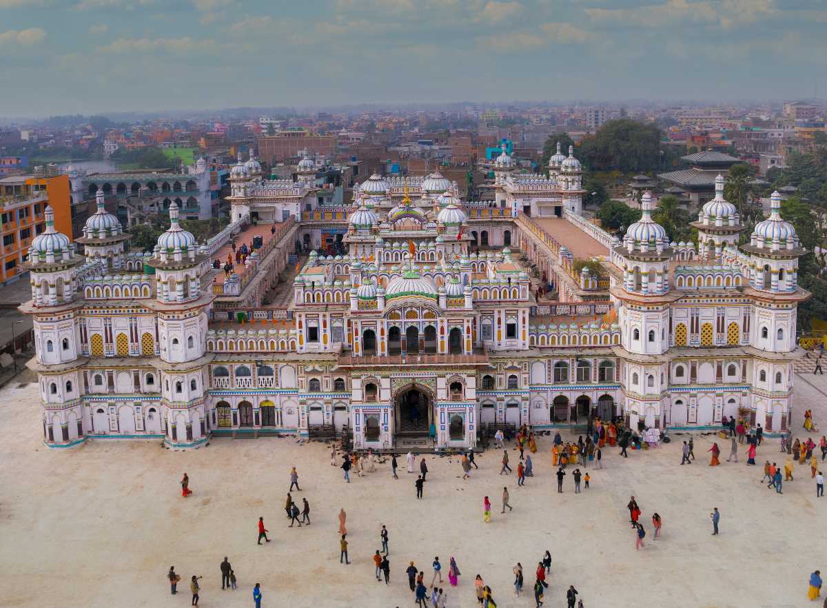
Dedicated to Goddess Sita, Janaki Mandir is the biggest temple in Nepal. It is constructed where Goddess Sita is said to have been born. The attraction is now considered a religiously important monument and a heritage site but is still an active temple for devotees. The Janaki Mandir is an example of the Hindu-Koiri Nepali style of architecture having a stunning white facade. The 3 storied temple is built entirely of stones and marble, while the 60 rooms inside are adorned with Nepali flag, engravings, paintings, beautiful lattice windows and turrets. Devotees predominantly throng the Janaki temple during auspicious occasions and festivals like the Ram Navami, Vivah Panchami, Dashain, Deepavali, and Holi from all around Nepal, Sri Lanka and India to worship the Goddess who is deemed an epitome of courage, purity, selflessness, dedication, loyalty and feminine virtues.

The temple was built by the Queen of Tikamgarh, Queen Vrisha Bhanu in 1910 and called the Nau Lakha Mandir. ‘Nau lakha’ translates into nine lakhs and has been derived from the fact that it took 900,000 Rupees to construct the temple at the time. The shrine is often associated with a well-known poet and saint, Sanyasi Shurkishordas, the founder of Janakpur. Shurkishordas is said to have preached the philosophy from Sita Upashinad most of his life. It is also believed that he found a golden statue of Goddess Sita at the site in 1657 which led to the faith that Sita lived here most of her life until she was married.

As one approaches the temple, one will get a clear view of the building which is in white with domes, pillars and verandas that resemble a palace. The temple is striking, a one-of-a-kind fusion of Hindu, Mughal and Koiri types of architecture made of white marble and occupying an area of over 4800 sq ft. To enter, one has to walk through the central 30-metre-high arched gate on the ground floor. As one proceeds, one will reach a courtyard with the sanctum sanctorum in the centre that houses a grand idol of Goddess Sita. There are a total of 60 chambers or rooms inside the temple complex that are adorned with intricate lattice windows, coloured glass, beautiful paintings and captivating carvings. There are also smaller shrines in the temple complex. These are called sannadhis and have idols of King Janak, Queen Sunaina, Lord Rama, another statue of Sita, Lakshmana, and Urmila.

After exploring the sanctum sanctorum, the sannadhis and the rooms, as one surveys the rest of the complex, one will find a collection of black stones behind the main shrine. These stones are called Saligrams, the sacred black stones that King Janaka used to worship. They are considered to be highly powerful and are mostly found in the houses of devotees who perform all the important rituals without fail. The temple priests allow visitors to offer prayers to these sacred stones and also share their knowledge about the saligrams, the shrine and the legend of Ramayana. The temple is open daily between 5:30 and 11 am and then again between 4 to 8:30 pm.

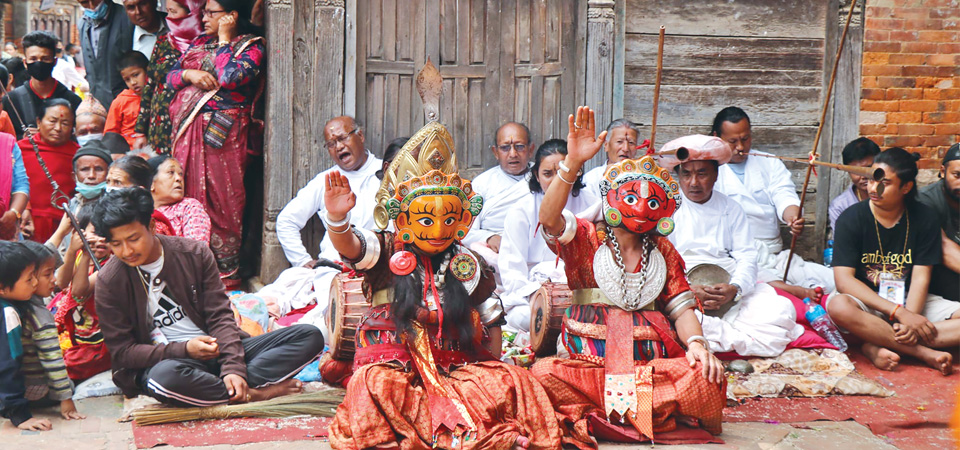
The Dolakha Bhimsen Mandir or Bhimeshwar Mandir is dedicated to Prince Bhim or Bhimsen. He was the second oldest Pandav brother from the epic, Mahabharata. The roofless temple houses a triangular idol made of rough stone. According to a legend, the idols resemble three different deities at different times of the day – Lord Bhim, Goddess Bhagawati and Lord Shiva.

The Ratna Sagar Temple is dedicated to Lord Ram and is his consort Goddess Sita. The tall temple is surrounded by a magnificent garden and a sacred pond called Ratna Sagar. The temple is closed on Sundays and Mondays and is open from 10:30 am to 4 pm on Tuesday to Saturday. Nepalis can enter for free while foreigners need to pay NPR 1000.

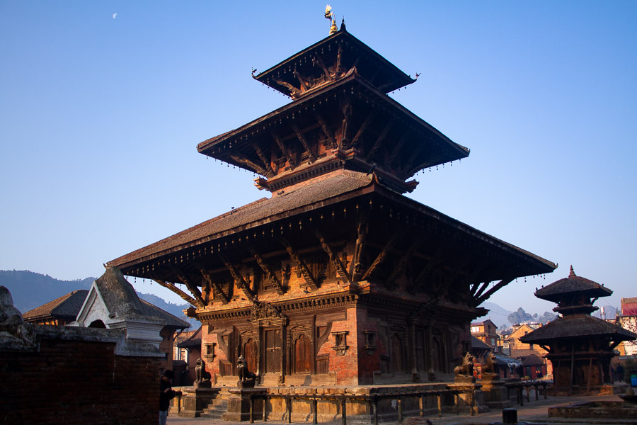
Ram Mandir is one of the oldest temples in Janakpur built in the late 1700s by Amar Singh Thapa, a Gorkhali general. The architecture of the temple is the traditional pagoda-style like the other shrines in the region. The modestly quaint temple is flocked by pilgrims during the occasion of Ram Navami and Dashain. The temple is open daily from 6 am to 7 pm.

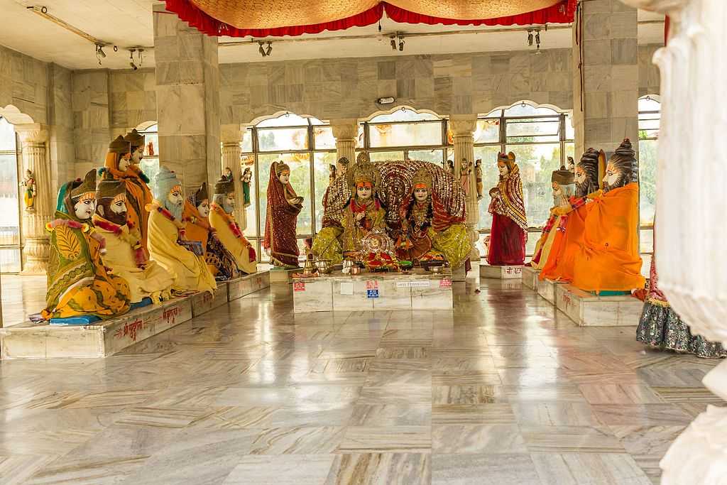
The Ram Sita Vivah Mandap is where Ram and Sita got married. The place is thronged by thousands of pilgrims on Vivah Panchami, usually celebrated on the fifth day of the Shukla Paksha or waxing phase of moon in November/December. The mandap is a gorgeous structure made of marble located in the southwest region of the Janaki Mandir. It resembles a part of a palace with sturdy pillars, elegant arches and stunning domes.

At the centre of the mandap, the legendary wedding ceremony is depicted. One can see idols of the couple, Goddess Sita and Lord Rama, sitting on a raised pedestal in the centre while some sages and their parents are seen seated on parallel pedestals facing each other. The idols are draped in colourful attire. Devotees can offer their prayers and sit in complete silence to soak in the tranquil vibe of the temple. The Mandap is open from 6 am to 7 pm daily.

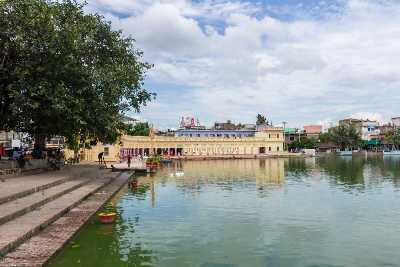
Located close to Janak Mahal, Ganga Sagar is a huge lake that is considered to be sacred. It is considered to be one of the more important pools in Janakpur along with Dhanush Sagar. Close to the lake is the 70-year-old Ganga Sagar library which is frequented by locals who come here to read the newspapers after a morning spent at the lake.

Dhanush Sagar is a sacred tank located near the famous Ram Mandir. It is also the largest ceremonial tank in the city. Visitors can see several small shrines all around the perimeter and vendors selling flowers and other ritual objects. Taking a bath at the ghat is considered sacred by the devotees.

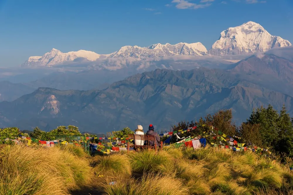
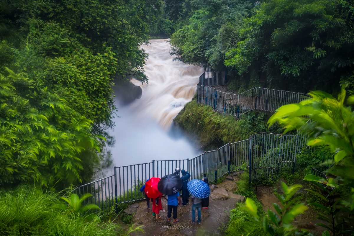
Rolwaling Valley, between the Everest and Langtang Himalaya ranges, is the toughest and most thrilling trekking trail in Nepal. The valley has an abundance of alpine lakes, hanging glaciers, moraines, high pastures, waterfalls and an imminent view of snowy peaks. Rich in varying flora and fauna, it is home to many endangered and globally threatened animals.

Jaleswar is a small municipality in Nepal named after the holy temple of Jaleshwarnath Mahadev, dedicated to Lord Shiva. The small town borders India with Bihar. During the months of Shravan in July and August, devotees from all over the world flock here to pay their respects to the Lord and his consort, Parvati. Since Jaleshwar revolves only around the Jaleshwarnath Temple, the transport facilities within the temple are quite functional and comprehensive.

Biratnagar
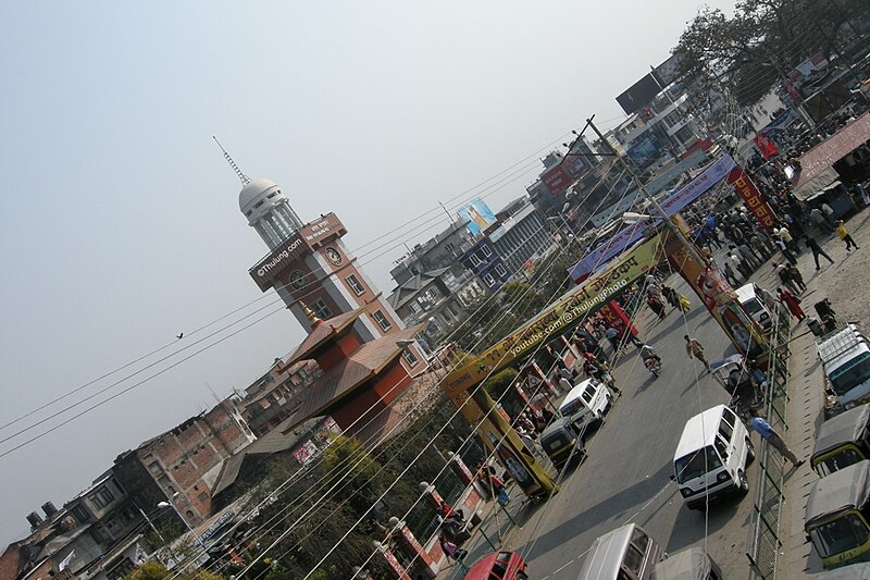
The economic centre of eastern Nepal, Biratnagar serves as the capital of the Koshi Province. With a Metropolitan Urban Agglomeration population of 244,750 as per the 2021 census, it is the largest city and fastest-growing city in the province and also the headquarters of the Morang district. It is located 399 km east of Kathmandu, and 6 km north of the bordering town of Jogbani in the Indian state of Bihar which is very well connected through Rani Path or the old highway and Koshi Path or the new highway. It is one of the major entry points into Nepal for businessmen and tourists visiting Nepal. The city is home to various large and medium-scale industries. Modern-day Biratnagar serves as an entry point to eastern Nepal as well as north-eastern India. It is the second Nepali city, after Janakpur, to have a connection with the Indian Railways and the only city other than Birgunj to operate an integrated check post (ICP) on the Indian border.

In 1914, Colonel Jit Bahadur Khatri, the then-district governor, laid the foundations of modern Biratnagar. The recorded history of Biratnagar dates back to the beginning of the 7th century when King Mung Mawrong Hang came to prominence in the terai lands of Limbuwan (present-day Sunsari, Morang, and Jhapa areas). He cleared much of the forest area in present-day Rangeli, east of Biratnagar, and built a town there. He named his Kingdom Morang after his name and rose to power. The old name of Biratnagar was Gograha Bazaar. The ruins of temples, palaces, and ponds are scattered in a vast area to the south of the current city, in Vedhyari, and Buddhanagar.

The town was named Biratnagar in 1919 by Keshar Shamsher Rana after the ruins of a palace, thought to be of King Virat. The kingdom of Virata mentioned in Mahabharata is however believed to be Viratnagar, located in present-day Rajasthan. King Virata was the king of the Matsya Kingdom, in whose court the Pandavas spent a year in concealment during their exile.

In Nepali, Birat refers to King Virata of the Matsya Kingdom and Nagar means a city. On 4 March 1947, the first anti-Rana movement in Nepal started in Biratnagar at the Biratnagar jute mills under the leadership of Girija Prasad Koirala and B. P. Koirala. This sparked a countrywide anti-Rana demonstration that eventually led to the abolishment of Rana rule in Nepal.

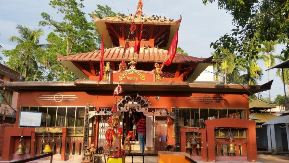
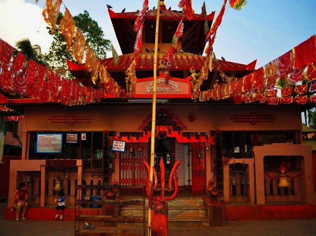
Baraha Chhetra is one of the most famous pilgrimage sites in Nepal. According to history, an evil demon known as Hiranyakashyapu was killed by Lord Vishnu here and that’s why this place is dedicated to Lord Vishnu. It is believed that the statues in this temple have been existing since the 5th century. There is also a stone in front of the temple that is said to predict whether you are sinful or not and people strongly believe in the sayings of the stone.

Dhankuta is known as the cleanest place in Nepal. If one is thinking about shopping in Nepal for reasonable prices, then Dhankuta is where they have to go. The forests of Tinjure, Milke and Jaljale are said to be one of the calmest and beautiful places on earth. The peaks of these forests offer stunning views of Mount Kanchenjunga, Mount Makalu and Mount Everest. The trails are completely covered with colourful flowers and more than 30 spices of Rhododendron are grown here. Lucky visitors can spot some rare birds such as the Daafe and the Serpent Eagle.

Started in 1936, the Jute Mills in Biratnagar is said to be the oldest in the country. It was noted to be the first registered company in Nepal. Biratnagar Jute Mills are considered to be one of the most important industries in the country as it was established after the orders of Juddha Shamsher, who was the Prime Minister of Nepal at that time.

Ilam is a beautiful hill station offering stunning views of the hills, complete with fog and mists. It is completely covered with tea plantations which make the tea in Ilam popular and delicious. Located 3636 m above sea level, Ilam is sometimes called Charkhol which means the area of four rivers: Jogmai, Puwamai, Mai, and Deaumai.

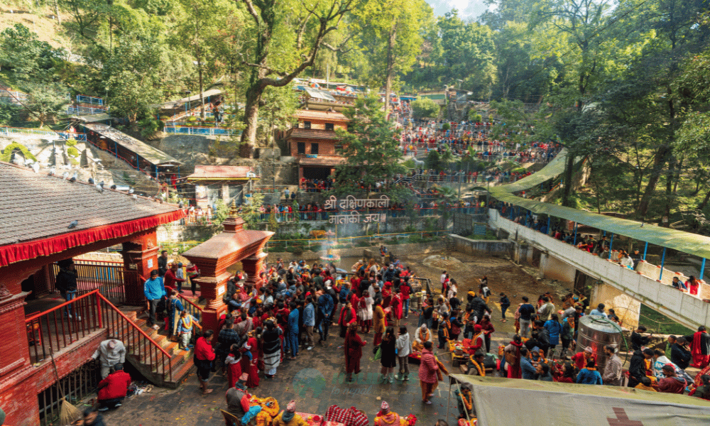
The Dakshin Kali Temple is dedicated to Goddess Kali, another incarnation of Goddess Parvati but always thirsty for blood. At the temple, known as the blood-soaked temple, devotees worship the goddess through animal sacrifices.

Located on the Northern slopes of the Himalayas and Southern slopes of Nepal, the Koshi River is considered to be holy and is worshipped. People believe that bathing in the Koshi River will clear their sins and allow them to go to heaven. The Koshi River is also a source of food for people living nearby as many species of fish and water animals can be found in this river.

Itahari
A sub-metropolitan city with seven municipalities, Itahari has recently evolved into a bustling transportation junction in eastern Nepal. The two main branches of the Nepal highway: the Mahendra Highway that runs from east to west and the Koshi Highway from north to south cross each other at Itahari, making the city a traffic nerve centre of Nepalese transportation. Established in 1997, Itahari was declared a metro city in 2014. Situated 25 km north of Biratnagar, Itahari is a junction point of the east-west Mahendra Highway and the north–south Koshi Highway.

Only a quarter of an hour’s drive away is one of Itahari’s major attraction sites – Taal Talaiya, meaning wetland in the local dialect. It is a charming ecological park, with lush greenery and crisscrossing roadways in between. The new art installations from an international sculpture art workshop in 2016 have left behind some masterpieces. There are around 55 such contemporary sculptures with one particularly haunting sculpture called the ‘Stone of Heart’ by an Israeli artist.

Ocean Park is a lovely and cheerful attraction for those who love the water, real or artificial. The place has an international-sized swimming pool for experts and veterans. Several other smaller pools, aided with fun and exciting features like a waterfall, fountains, water slides add to the allure of the attraction. Ocean Park plays Hindi, and English and occasionally Nepali music and it is a great place to let off some steam with your band of friends and enjoy a day out.

Budhikhola Ghat is a calm and quiet place, only a few minutes walk from the city centre. The Ghat or the water bank is where the Budhikhola Bridge connects Sunsari and Morang on two sides of the narrow muddy stream. There is not much water in the stream unless one goes during monsoons. The ghat is cemented with staircases and benches. There is a giant statue of Lord Shiva, along with some other idols.

Birgunj
Located close to Nepal’s border with India, Birgunj is a major point of entry for the Indian goods trade as well as goods coming in from Kolkata. Located in the Terai region, Birgunj is the second-largest city after Biratnagar and the sixth-most populated metropolis in Nepal. It lies about 135 km south of Kathmandu and a popular stopover for people undertaking treks in Nepal such as the Annapurna Base Camp and the surrounding mountains. Birgunj was established as a conglomerate of several villages in and around Gahawa Mai Temple which remains the epicentre of the town. The settlement was named after Nepal’s Prime Minister Rana Bir Shamsher, thus acquiring the name Birgunj. The ancient name of Birgunj was Gahawa but the 11th Rana Prime Minister of Nepal Bir Shamsher Jang Bahadur Rana changed it to Birgunj in 1897.

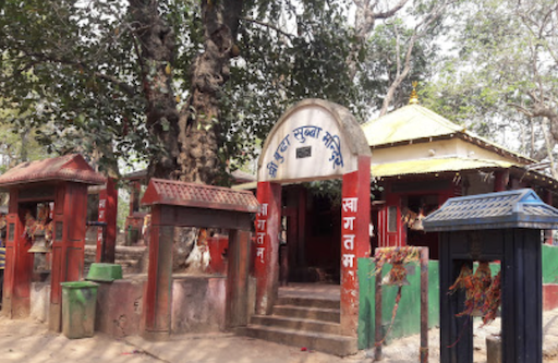
The Shri Gawaha Mai Temple shares a bit of history with Birgunj. Earlier, Birgunj was known as Gawaha in honour of the Shri Gawaha Mai Temple. Locals often visit this temple for good luck before opening their business. During the Chhath festival, Ghadiarwa Pokhari, a pretty pond surrounded by a garden, is visited by numerous people from different parts of the country. The Vishwa Buddha Vihar, located on the outskirts of the city is a local favourite. The vihar is shaped like a stupa and has engravings of the Buddha facing the cardinal directions. Vishwa is derived from the word vicchu-wa, which translates as a resting place for Bikshus or Buddhist monks and means a resting place. In ancient times, pilgrims stopped at Birgunj during their journey between Lumbini and Bodh Gaya in India. The Parsa National Park, located about 33 km from the city is known for its Royal Bengal tigers, Asian elephants, One-horned rhinoceros, common leopards, and various species of mammals, birds and reptiles. The city is popular for the Bindaswini Temple and its proximity to Arsa Wildlife Reserve & Chitwan National Park.

Travel Bucket List: Nepal Part 12

Pokhara continues to amaze visitors….

The International Mountain Museum in Pokhara has a stunning collection of artifacts, original gear, stories, and photographs of the mountains, their inhabitants, and the explorers who climbed some of the highest peaks in the world. The museum describes the people living in the Himalayas, the 14 highest peaks, and their most famous expeditions. The museum was established in 1995 by the Nepal Mountaineering Association to maintain a record and document the history, evolution, development, and legendary achievements in mountaineering. Every section of the museum is designed to highlight the commendable accomplishments of famous mountaineers in the majestic Himalayas and around the world. It also includes some exhibits from other mountain areas, such as Slovenia and Japan.

There are three halls that exhibit artefacts arranged in an interesting way to give insights into the traditions of the inhabitants, the biodiversity and geology of the region and information about the mountain peaks and mountaineers who climbed them. The Mountain People Gallery has an impressive display of artefacts arranged systematically. This is the first gallery where one will get to explore the lifestyle, culture and traditions of the inhabitants of the region. Before entering this part of the museum, one is shown a short documentary in the video hall that serves as a prelude to the exhibits in the gallery. The Mountain Gallery is where one can find the geological history and other detailed information on the mountains. Plant and animal replicas, rock samples and photographs from the tallest peaks climbed so far have been exhibited here. The Mountain Activities Gallery is dedicated entirely to the activities on the mountains and has exhibits of apparel, gear, equipment and photographs of the numerous mountain expeditions that took place in the region. Artefacts from the French expedition up the Annapurna led by Maurice Herzog in 1950, the one completed by Junko Tabei, the first woman from Japan to climb Mt. Everest, by Timanishi who was one of the first summiteers to climb Manaslu and the British expeditions to Mount Everest that were carried out between 1921 and 1953 are properly displayed in separate sections in the gallery. A stunning collection of photographs of all the peaks that were conquered by the courageous mountaineers is a must-see here. This section also gives insights into the mythical mammal, Yeti, a humungous brown bear. Stories and photographs of the signs and footprints that the mammal is believed to have left behind are also exhibited.

In the Associates Gallery, there are displays of the socio-economic life of the region. The collection spans across different periods in the past and highlights some important phases. Insights into the plans for the future that will help conserve the biodiversity and evolution of the people in the region can also be found here. This draws quite a few researchers and enthusiasts who seek information to bring about a positive change through their studies and innovations. The museum has a library with an impressive collection of books about the Himalayas and other mountains, achievements of famous mountaineers, books on popular expeditions, regional biodiversity, geology, culture, and traditions. The museum complex also has a Gorkha Village Restaurant that caters to the visitors and serves delicious regional cuisine and a souvenir shop where mementoes and gifts can be purchased. There is a well-maintained garden and lush green lawn with a wall designed to give a first-hand feel to amateur climbers. It has a 9.5 metre tall climbable model of Mount Manaslu and another 21-metre wall that can be climbed. The museum is open daily from 9 am to 5 pm. Entry fee for foreigners is NPR 500, for SAARC nationals, ot is NPR 250, for Nepal citizens, it is NPR 100, students need to pay NPR 50 and those with a resident visa need to pay NPR 250. To access the garden, one needs to pay NPR 30.

Located near Mahendra Pul, the Gorkha Museum is dedicated to commemorating the services of the Gurkha soldiers who joined the British Army in 1815. The museum is open from 8 am to 4:30 pm. Entry fee for foreigners is NPR 200, for SAARC nationals, it is NPR 100, and if one needs to use a camera inside the museum, they need to pay NPR 20.

Established in 1965, the Annapurna Butterfly Museum houses almost all of Nepal’s 660 common, rare and endemic species of butterflies. The collection illustrates their mimicry and camouflage with several charts comparing these species with others found in parts of the Palearctic region. The museum is open from 8 am to 8 pm daily.

The Pokhara Regional Museum is where one can find insights into the ancient culture and history of the Pokhara Valley. With a simple setup and artefacts depicting the tribes, their lifestyle and traditions, the stately museum houses collections that depict the tribal population of the town as well. The modest museum displays models and several valuable antiques from the region. The costumes and accessories exhibited are authentic and give insights into how the earliest tribal population of the region used to dress up. Kitchen and household items include pots, utensils and home decor items that were made with the material sourced from the valleys. Along with the equipment used for agriculture and traps used for fishing, there are religious artefacts and models of houses and some significant events depicted with mannequins for the visitors to get an idea of their traditions and celebrations. Photographs and descriptions have been put up to provide more information. The museum is open from 10 am to 4 pm daily. Entry fees for SAARC nationals is NPR 10, while other foreigners need to pay NPR 30. Camera fees for citizens of SAARC Countries is NPR 70, while for other foreigners, it is NPR 100.

Bat Cave or Chamero Gufa is where one can find thousands of bats. If one’s up for it, they can even explore the complete cave which takes about 10 minutes and wiggle their way through a narrow shaft to reach the surface. The bats here are mostly Horseshoe Bats, which cling upside down on the cool ceilings and dingy caves. This cave could get extremely confined, so those with claustrophobia might want to rethink their visit. The entry fee is around NPR 150, and one will be given a torch along with the entry fee. Guide services are available for NPR 300. There is one exit point of the cave, which is narrow, and the cave can get really slippery, so one should be careful.

Located in Batulechaur, Mahendra cave is a magnificent cave that tourists can explore. The cave is named after King Mahendra Bir Bikram Shah Dev and is a vast natural formation in limestone. Hindus consider the cave sacred and have installed a statue of Lord Shiva, but geographically, this is a cave with calcium salt deposits forming stalactites and stalagmites. The cave was discovered in the mid-1900s by shepherds and has been carefully studied by researchers from the United Kingdom in 1976. The geology & biodiversity of the cave and its surroundings have been documented as a part of the research. The information from the region is deemed necessary for future expeditions and is, to date, used as reference material by scholars. The cave is closed on Tuesdays and on other days is open between 10 am and 4 pm. Entry fee is NPR 100 for foreigners and NPR 50 for a camera.

The Old Pokhara Bazaar is a vibrant and historic marketplace showcasing the region’s cultural heritage. One can wander through narrow alleys lined with shops selling authentic Nepalese handicrafts, including handmade pottery, Tibetan rugs, traditional clothing, and intricately crafted jewelry and enjoy traditional Newari and Nepali cuisine at local eateries and street food stalls. The bazaar is known for its ancient Newari architecture with buildings featuring intricately carved wooden windows, brick facades, and pagoda-style rooftops, reflecting the traditional craftsmanship of the Newari community. The bazaar retains its historical charm, providing visitors a glimpse into the region’s past while coexisting with modern developments.

The preferable point to start exploring the bazaar is the Nepal Telecom Building. From here, head to the north-west, crossing some religious shops till they reach an intersection called Nala Mukh. This area is famous for the Newari Houses that are adorned with brickwork and bear beautifully carved wooden windows and doors. On proceeding further, one would reach Bhairab Tole which is one of Pokhara’s significant commercial centres. There is a 200-year-old temple dedicated to Lord Bhimsen here who is considered an important deity of the Newars. He is said to be the one who brings success in trade and commerce and is, therefore, worshipped with great devotion by the traders. A pit stop at this temple to admire its ancient architectural beauty is much advisable.

The region around the Bhimsen temple has some shops selling ceramics and baskets where tourists can spend some time shopping or just observing the authentic products on sale. A little ahead is a small hillock which is famous for another ancient temple, Bindhya Basini Temple. It is dedicated to Goddess Durga who is represented by a Shaligram instead of the usual imposing idol. The traditional two or three-storey buildings with brick and woodwork bearing intricate carvings that still stand tall in this part of the city sort of make the point that the charm of Old Pokhara is still alive and breathing.

The four official Tibetan settlement camps in the city is a small world in itself. These refugee camps were built for the thousands of Tibetan refugees that came to settle in Nepal after the Chinese takeover. They sell beautiful handmade jewellery, trinkets, carving and carpets for the visitors to showcase the beauties of Tibet. This is a popular place where tourists come to buy souvenirs.

Located next to Phewa Lake, Basundhara Park attracts tourists all year round. The park offers boat rides and fishing opportunities on the lake, and visitors can also rent boats and row across the lake on their own. Early morning joggers in the park can also spot birds in the Serene environment of the lake.

Seti River is famous for its deceptive river course and its milky white water. The water cuts a deep gorge right across the mighty Mahabharata range and then runs a deep chasm in the middle of the town. The gorge can be seen from a park in old pokhara close to the Gorkha Museum.

The Upper Seti River is one of Nepal’s best rafting destinations for families and water sports lovers. This river is a hidden gem with energising whitewater rapids of class 3 and 4, lush jungles, waterfalls, and native wildlife. Most rafting trips on the Seti are 90 minutes, priced about NPR 5,700. For whitewater rafting amidst Pokhara’s snow-capped mountains, head to Kali Gandaki River spanning Dhaulagiri and Annapurna Range.

Located on the scenic Sarangkot Mountain, Sarangkot is a village famous for its sunrise and sunset views of Annapurna and the takeoff site for paragliding. The village lies at an elevation of 1600 metres above sea level and is a perfect place to capture a mesmerizing view of the Annapurna, Dhaulagiri, the Manaslu Mountain Ranges and the valley of Pokhara. Located 5 km from Lakeside Pokhara, Sarangkot is also accessible by a trek of 1-1.5 hours. It is also famous for one of the world’s fastest ziplines and the site of an ancient fort connected by a few steps from the main village is a popular viewpoint. A trek along the ridge road that leads to the west of Sarangkot is much advisable to get more stunning views. The dense forestation is home to a variety of flora and fauna. The route, thus, is also famous for bird watching and rejuvenating nature walks.

Although Sarangkot is famous for its panoramic view of the majestic Himalayas, nature walks, treks and hikes through the village, it is also famous for paragliding. The town is located below the ridge, and one needs to climb the steps that lead to the top to witness the scenic mountains and head to the spot where all the paragliding activities takes place. Locals say there once was a fort at the location, hence the name Sarangkot.

Lukla
A small town in the Khumbu Pasang Lhamu rural municipality, Lukla lies in northeastern Nepal. Situated at 2,860 m above sea level, it is a popular place as a gateway for visitors to the Himalayas and Mount Everest, Although Lukla means the place with many goats and sheep, few are found in the area nowadays. Lukla village holds a small airport serving the region. From Lukla, travelers need two days to reach the village of Namche Bazaar, an altitude-acclimatisation stop for those continuing on. What was once a tiny farming community has now become a huge trekkers’ town, since the airport that Lukla houses is the region’s sole airport, and thus all trekkers who visit the region enter and exit from this town only.

The airport has a 527 m single asphalt runway, making it the shortest commercial runway in the world. A flight from Kathmandu to Lukla is just a 40-minute affair. How difficult can that possibly be? Well, those who have been on the flight have described it to be 40 minutes of mountain dodging, and the sensations being the same as that when experienced on a roller coaster. Tthe runway of the Lukla Airport is incredibly tiny, only 1729 feet long. Secondly, Lukla’s elevation with little descent further complicates matters. On one end of the runway is a cliff with the 2,000 feet drop, while the other end has a solid stone wall. This means that the plane will either land or drop off the cliff. In spite of all of this, Lukla is one of the busiest domestic airports in Nepal. Accidents happen rarely, and the airport is considered to be one of the most breathtaking airports in the entire world, with the mighty Himalayas surrounding it and the little flowers bordering the runway making for a picturesque scene.

The small town of Lukla is home to less than five hundred people, but it still houses a large number of trekkers each day. This is because the town is the most popular starting point to further go onto the Everest trekking route, be it for a two-week trek or for a forty day trek to the peak of the Everest.

Dharan
Located in southeastern Nepal, close to the border with India, Dharan is the third most populous city in this region. It is the gateway to the Mahabharat Hills and is one of the biggest pilgrimage locations in Nepal. This low-lying hilly region is extremely clean, colourful and culturally diverse, as well as a centre for football in Nepal, hence it being called a mini-Brazil.

Dharan was the capital town of the lowland Limbuwan kingdom of Morang, ruled by Limbu King Buddhi Karna Raya Khebang. King Buddhikarna Khebang was the descendant of the ruler King Muray Hang Khebang of Phedap Kingdom. Between 1584 and 1774, Dharan-Bijaypur was the capital city of Morang Kingdom of Limbuwan. It was also effective capital of the entire Limbuwan region or the Ten Limbu Kingdoms which was also known as Pallo Kirat . In August 1774, the Gorkha King Prithivi Narayan Shah’s representatives Abhiman Singh Basnet, Parath Bhandari, Kirti Singh Khawas and Bali Baniya met the ministers of Morang state and agreed to come to good terms with the Gorkha Kingdom and accept the Gorkhali king as Maharaja and that in return the kingdom of Gorkha would retain the right of self-government of Limbu rulers in their kingdoms.

The Budha Subba Temple is a famous religious shrine, mostly for the Eastern Nepalese. The establishment has many folk tales surrounding it, along with many superstitious beliefs. It is best known for being a peaceful location where people can wish for happiness and luck. Young couples in the region believe that tying a colourful string around their trunks and engraving their names on the trees would bring them happiness and long life together. The temple complex also has a couple of souvenir shops. The Buddha Subba Temple has a small car parking facility at the main entrance of the temple complex. The Budha Subba Temple is the tomb of Buddhi Karna Raya Rai, the last Limbu King of Morang; a Nepali district. Buddhi Karna Raya Rai was assassinated by the people working under King Prithvi Narayan Shah, who was at the time the king of Nepal. Shah tricked Buddhi Karna Raya Rai into coming to Bijaypur-Dharan, which was the capital of Morang and the politico-economic centre of East Nepal, under the guise of a negotiation. The folklore surrounding the location says that his spirit still wanders around the tomb and is said to be a friendly and helpful spirit. The Limbu folk even worshipped his soul as it was believed to bring good luck.

The Pindeshwor Temple is dedicated to Lord Shiva and is located in the central region of Dharan, at the base of the Vijayapur Hill. During the auspicious month of Shravan, around the end of July, and on the occasion of Maha Shivratri, the temple particularly witnesses an increase in the number of devotees. The lamp at this temple is always kept burning.

The Dantakali Temple was built in the honour of Goddess Parvati. It is located in Bijayapur village about 3 km from the centre of Dharan. The attraction is also considered to be a significant Shakti Peeth. This temple mainly attracts devotees on the occasion of Dashain, which is an auspicious Hindu festival that celebrates the victory of good over evil. According to a legend, after the passing of Goddess Parvati, Lord Shiva carried her dead body on his shoulder and roamed for days. Decayed parts of the goddess’ carcass fell at several locations. This location, where the Dantakali Temple is built, is believed to house the sacred teeth of Goddess Parvati. Hence the name, Dantakali wherein ‘danta’ means teeth and ‘kali’ signifies the Goddess.

The Pathivara Temple, also known as Mukkumlung, is said to be one of the most significant Hindu temples in Nepal. Situated on the Taplejung hills, the temple offers scenic views of the Mount Kanchenjunga. The members of the Nepal royal family are said to be ardent devotees of the Goddess and come here often to pay their respects. Dedicated to Pathivara Devi, also known as AdiKali, Maha Maya, Maha Rudri among many other divine forms, the Pathivara temple is considered to be one of the holiest temples. Believed to possess supernatural powers, Pathivara Devi is said to fulfil dreams and wishes of devotees. Pathivara, the hill goddess, is believed to be a fierce goddess easily pleased with selfless and straightforward acts of prayer and sacrificial offerings which is the sacrifice of one’s ego and greed. According to local legend, a few local shepherds were moving their sheep when they lost hundreds while grazing where the temple stands today. One day, the shepherds dreamt Pathivara Devi ordering them to carry out the ritualistic sacrifice of a sheep. When the sacrifice was offered, all of a sudden, the lost sheep returned to the temple. Since then, the ritual of offering sacrifices have been significant in this temple.

Dharan Clock Tower is a popular tourist attraction built in 1991. Its design closely resembles the Clock Tower of Hong Kong. Locally known as Ghantagha, the clock tower is located in Bhanuchowk and measures approximately 76 feet in height. It stands over a 55 feet tall pedestal which makes it seem even more taller. People visit this Clock Tower for its stunning appearance, architecture and the fabulous view of the city from the top.

Namaste Falls is a popular attraction located in Bhedetar village about 23 km from the city. The Waterfall is mainly known for the namaste it forms as it cascades down the slopes of a rocky hill at the height of 80 metres. The area is quite remote and thus, uninhabited, but offers jaw dropping views of the surroundings. The falls are recognised as a plunge waterfall and is known for the most number of rainbow sightings. Reaching Namaste Falls requires trekking a distance 2 kilometres or so from Bhedetar.

Namje Bazar or Namche Bazar is famous for its weekly market and lodging amidst scenic surroundings and lies at an altitude of over 3500 m. Several major trekking trails pass through the Bazar and is considered as an excellent acclimatisation point. Those heading to the Everest Base Camp often make a pitstop here. The weekly market that makes it a great attraction for tourists is the Tibetan Market, which is operational only on Saturdays.

Keep watching this space for more Nepal towns to explore…

Travel Bucket List: Nepal Part 11

Continuing on learning more about Pokhara…

Situated at an altitude of 3210 m, Poon Hill is a popular short trekking destination, offering an wonderful views of sunrises and sunsets. Most trekkers hike here from the village of Ghorepani to enjoy the spectacular view of Annapurna and Dhaulagiri ranges. The terrain is comparatively easier and leads to the Annapurna Mountain Ranges. The trekking trail covered with rhododendron forest, an amazing landscape, is perfect for modest trekkers. From the top of the hill, one can get a fabulous view of the Gangapurna, Annapurna I, Annapurna South, the Dhaulagiri, and the Hiunchuli Mountains.

The most preferred and famous trek in the region is the Ghorepani-Poon Hill-Ghandruk trek. It begins at Nayapul which is about 44 kilometres away from Pokhara and goes through Ulleri, Ghorepani and Ghandruk via the uneven terrain. The mountainous trails are traversed by foot through the rhododendron forests and regions inhabited by the Gurangs and the Magars. As the trek progresses, one would come across the terraces used for cultivating rice and the enchanting waterfalls in the regions. The hilltop, at 3210 metres above sea level, is the best place to get a stunning view of the Himalayan Peaks. If only Poon hill is to be explored, one can be assured that this is an easy level of trekking in the region. The best time to go on a trek on the Poon Hill is between March and May and between September and November.

At an elevation of 3210 metres above sea level, Ghorepani Hill is the most preferred trekking trail in Nepal. Also known as Nepal’s classic Himalaya Trek, it has been an important attraction with slightly elaborate treks that last for little over a week and begin at Pokhara and pass through Ghorepani, and some even continue to the Poon Hill. The trail consists of the ancient Trans-Himalayan salt trade route and runs through regions of paddy fields, forests, gorges and waterfalls. On a clear sunny day, the bright blue skies and the white cotton-like clouds are a treat to watch above the snow-laden mountain peaks. Local shepherds get their sheep to graze on the hill slopes every day, and there is a high chance that trekkers meet herds of sheep while passing by.

The rhododendron forests, the stone passages and stairs add to the level of difficulty but also make the activity more exciting. As one climbs through the region, they would notice they are actually trekking through the villages located on the hill slopes. If a break is required, feel free to stop by at one of these villages and interact with the lovely people before enjoying the mind-stirring view from the top of the Ghorepani Hill.

The city of Pokhara can be divided in two: the charming Lakeside Pokhara, and the Old City. The Lakeside part offers many tourist attractions and beautiful views, while the Old City is the city’s commercial hub. The Lakeside is further divided into the North and the Southside and is is named as it surrounds the Phewa Lake or Phewa Tal, a gorgeous freshwater lake which is eerily similar to a mirror! The lake gained popularity for its breathtaking reflection of the blue skies and the towering Mt. Machhapuchhre of the Annapurna range.

Built after World War II by Buddhist monks from the Nipponzan Myohoji organisation of Japan, the towering World Peace Pagoda stands on a ledge overlooking Phewa Lake. This destination can be reached by rowing on the Phewa Tal, and trekking for about an hour on the other side. The views are breathtakingly beautiful, and the serenity is bound to make one contemplate and meditate. Revered as the holiest Hindu shrine in Pokhara, the beautiful Varahi Mandir temple is located right in the middle of Phewa Lake, on a small island. One can access the temple by rowboat from Varahi Ghat and pay their respects to the fierce Varahi, who is known to grant all wishes. The Devi’s Falls is a special waterfall because half of it is underground. On the surface, it is a small stream which swells during the monsoon, but the water leads into an underground tunnel, surfacing at the Gupteshwor Mahadev Cave near the World Peace Pagoda. Patale Chhango is the actual name of this waterfall, but it is locally known as Devi’s Falls. Head over there and discover the local lore of how the waterfall got its name!

The Gurkha Museum, located near Mahendra Pul, chronicles the valiant achievements of the Gurkha regiment and has an interactive display as well. The AV show details the nuances of the regiment, and the exhibits contain many medals, artefacts and weapons used. There is also a wall of fame, naming prominent Gurkha soldiers. The museum is open daily from 8:30 am to 4:30 pm and foreigners need to pay NPR 200, while SAARC citizens pay NPR 100 and a camera can cost you NPR 20 to take inside. The International Mountain Museum is devoted to the Himalayas and her explorers. Containing the mountain scaling equipment of yore, champion trekkers and other exciting details, the museum also holds exhibits of the unique flora and fauna of the Himalayas. Outside, visitoes can try their luck at mountain climbing, by trying to scale a replica of Mt Manaslu. The museum is open from 9 am to 5 pm and foreigners need to pay NPR 400, while SAARC citizens pay NPR 200 and Nepalis need to pay NPR 80. A garden tour will set one back by NPR 20.

Pokhara is one of the most popular paragliding destinations in the world. One can take off at Sarangkot, near Lakeside where one can find most paragliding companies with very competitive prices. Solo and tandem flights can be taken all year round in conducive weather. Cost for a solo flight is USD 65 while a tandem flight will cost between USD 85 to USD 150 and lessons can be taken at USD 390.

As Lakeside Pokhara is the starting point for trekkers attempting to scale the Annapurna range, this is a welcome opportunity to meet like-minded people and trek with them. October to December is the best time to trek the Annapurna Circuit, which is a famous route. A minimum of three days is required to cover at least a part of this route – ideally, it takes 21 days to complete. One will need to have a permit card from the Annapurna Conservation Area Project, which costs NPR 2000, before one can attempt this route. Guided tours start from USD 25.

There are two rivers one can raft on near Lakeside, which are the Seti and Narayani. Many agencies near the rivers offer kayaking options, starting at USD 40 for a single trip. One can take a kayak from the Narayani River all the way to Chitwan National Park and most agencies rent all kayaking equipment for a price. One can also hire a Doonga, a brightly painted boat, to take them around the picturesque Phewa Lake.

Pokhara Valley’s second largest lake, Begnas Lake is a popular freshwater lake with beautiful natural surroundings. On a clear day, at the foothills of the Himalayas, the lake waters reflect the surrounding mountain ranges. One may choose to take a leisurely stroll on the banks or rest. The lake is also the third-largest lake in Nepal. Begnas, the twin of Rupa Tal, is the largest of the two situated to the south-east of the valley. A dam, Khudi Khola, built on the western stream regulates the level of the lake water providing enough for irrigation purposes in all the seasons other than the monsoons. The swamps around the lake have been converted into lush green paddy fields, and some sections of the water body are used for fish farming. The waters from the lake help the locals earn a major chunk of their livelihood. One may go for a long boat ride or go paddling solo in the calm waters. The lake has several resorts and guesthouses where tourists can stay for as long as they want and breathe in the freshness in the air and enjoy the stunning view of the valley and the Begnas Tal.

Rupa Tal is the only freshwater lake of Nepal and is located at an altitude of 600 m. The beautiful lake is famous for the variety of flora and fauna that it supports and has boating facilities available. One can even engage in fishing activities.

The second largest lake in Nepal, Phewa Lake is a semi-natural freshwater lake enveloped by Rani Ban or the Queen’s Forest and stunning reflections of the Annapurna and Dhaulagiri mountain ranges in the clear lake waters. It is also a perfect place to experience the ever so glorious Himalayan sunrises. One can hire a colourful boat called doonga and sail through the lake for a relaxing ride. It has some religious significance too as it is known for the sacred Tal Barahi Temple located on an island in the lake. Baidam or lakeside of Pokhara on the eastern part has some amazing lodges, restaurants, cafes and bookshops. The densely forested region around the lake has thrilling trails that lead up to higher grounds.

Phewa Lake is flocked by tourists, nature lovers and photographers. One may choose to rent a canoe or a paddleboat for NPR 500 approximately to explore and capture the scenic beauty to their heart’s content as they sail through the serene waters. When tired, a stop at the Tal Barahi Temple just to absorb the divine vibe or to offer prayers to the Goddess before setting sail ahead is quite recommended. There are also exciting trails in the thick forests surrounding the Lake that make it a perfect destination for nature walks, bird watching and treks. The forests house a variety of flora and fauna that one can explore while they rest on the shore in between their boat rides. One of these trails leads up to the World Peace Pagoda from where one can enjoy a splendid view of the lake and the mountain ranges. If the natural light is right, one may even see the reflection of the mountain peaks in the water.

The Tal Barahi Temple is located in the middle of Phewa Lake surrounded by nature and tranquillity. It is a sacred shrine dedicated to Goddess Durga who is considered to be the protector of all Gods and a symbol of Shakti/Strength. Barahi means Boar, an avatar which Goddess Durga manifested, also called Ajima, to kill the demons with her tusks. According to a legend, the deity came to visit the place and was so captivated by its natural beauty and the people that she decided to reside here. The temple was built in 1864 by the first Shah King of Kaski, King Kulmandhan Shah, who was an ardent devotee of Goddess Durga. The beautiful shrine has two-storey traditional pagoda-style architecture made of stone and wood and stands strong on an island in the lake which was formed after the dam was built. The temple is open daily between 9 am and 5 pm and the best time to visit the temple is between September and May.

Davis’ Fall is an extraordinary waterfall which creates a 500 feet long underground tunnel as it reaches its bottom. This tunnel has brought the fall its name, Patale Chango in the Nepalese language, which means underground waterfall. Fed by the Phewa Lake Dam, the waterfall is surrounded by abundant flora. A landmark of Pokhara, Devi’s waterfall is a must-visit when in Nepal. The fall marks the point where the Pardi Khola stream disappears underground and leaves no clue of its existence. When the monsoons are at full power, the splashes of water against the boulders create a terrific sight.

On July 31, 1961, a Swiss couple named Davis made their visit here. While swimming in its waters, the overflow pushed the woman in a sinkhole where she drowned. Her body was recovered after three days. It was at her father’s request that the fall was named Davi’s Fall. Some people even say that it was not only the woman who drowned but also her husband. The fall got a local reference by the name of Devi’s Falls, hence the name by which it is mostly known.

As the name suggests, Gupteshwor Mahadev is a the name suggests is a a cave beneath the ground that acts as the source via which the fall’s water passes after exiting the tunnel. The ancient cave beside the fall is known for its unique designs. People tend to forget the way through which they enter; hence, one should be careful and use one’s presence of mind while in the cave. Visitors usually try impressing their fortune by throwing or placing a coin at the deity’s statue in the luck pond. Devil’s Fall is open daily from 5 am to 7 pm.

Shanti Stupa, also known as the Peace Pagoda, is a stunning monument located on the Anadu Hill overlooking the Phewa Lake with the charming Annapurna Mountain range in the backdrop. One can either cycle through one of the tracks that lead to the top of the hill, take the road to the Stupa, or enjoy a drive through the scenic location. The surroundings have several trekking trails to cross to Phewa Lake and explore the Himalayas. It is a popular tourist attraction, striking landmark, or pleasant pit stop for intrepid climbers. The picturesque beauty is quite captivating, and the tranquil vibe of the monument is worth a visit for those seeking it.

The pristine white coloured monument is a classic example of the traditional pagoda style of architecture. The striking colour helps in spotting the pagoda from metres away. This is the first peace pagoda in Nepal and was built by a Nipponzan Myohoji monk named Morioko Sonin. The spectacular symbol of peace is the 71st peace pagoda in the world standing 115 feet tall and having a diameter of 344 feet. Visitors need to climb a flight of stairs to reach the top of the monument. There are two tiers to the structure with separate passages to circumambulate. It houses relics and four striking statues of Lord Buddha that represent significant events in his life. These statues were received as souvenirs from different countries.

The four striking statues of Gautama Buddha representing important milestones in Lord Buddha’s life are installed on the second tier of Shanti Stupa. These four figures gifted by four countries include the Dharmachakra Mudra which was gifted by Japan, Kushinagar from Thailand, Bodh Gaya from Sri Lanka and Lumbini from Nepal. On the very top of this arrangement is the pinnacle, also called gajur, that holds the crystal stone from Sri Lanka. This stone symbolises grace and intellect. Below the gajur is the Dharmachakra signifying the wheel of life, the teachings of Lord Buddha and Dharma. A prayer hall called the Dhamma Hall is located near the Shanti Stupa that houses the statues of Lord Buddha and where rituals and poojas are performed on auspicious days by the devotees. One may choose to explore this section of the Pagoda to get a glimpse into the regional culture. The stupa can be visited daily between 8 am and 8 pm.

The ancient Bindhyabasini Temple stands on top of a small hill. This temple is dedicated to Goddess Durga, an incarnation of Devi Parvati. The Goddess worshipped is in the form of a Shaligram. According to a local legend, King Siddhi Narayan Shah bought the idol from Bindhyachal in India. The Gopteshwar Mahadev Mandir is a cave temple dedicated to Lord Shiva near the place where Seti River emerges from underground. A self-emerging Shiva Lingam was found in the 3 km long cave during the 16th century. Apart from the temple, the long, deep and dark cave offer an excellent opportunity to explore the natural wonders in its truest form. The 200-year-old Bhimsen Temple is dedicated to the Newari God of trade and commerce. It is said to be the oldest temple in the city and it replicates the pagoda style of architecture. The exterior of the temple is covered with intricate erotic carvings and exquisite woodcarvings on doors, windows, pillars and struts.

The Tal Barahi Temple, also known as Lake Temple or Varahi Temple, is a two-story pagoda temple on a small island on Phewa Lake. Dedicated to Goddess Varahi, who is an incarnation of Goddess Durga, both Hindu and Buddhist followers visit here for worship. It is believed that the temple was built by King Kulmandhan Shah because of a dream that he saw. Goddess Varahi is an avatar of Goddess Durga who is believed to be the symbol of strength or Shakti. Varahi or Barahi means a boar in Nepali and it is the form which was taken by Goddess Durga to kill the destructive demons. She is believed to have fought the mighty demons with her tusks and killed them all. After the fight, she is believed to have visited the Pokhara Valley and found it so enticing that she wanted to stay there. Ever since, this powerful form of Goddess Durga has been an important deity for the Hindu community in Nepal. Locals also state that the temple was in fact, built by an ardent worshipper of Goddess Varahi, King Kulmandhan Shah of the Shah Dynasty. It was made during his resign in 1864, and he chose the spot on an island in the middle of Phewa Lake for the temple to be built. The island was actually formed after the inflow of water to Phewa Lake was controlled by a dam built nearby. The main shrine set has traditional pagoda-type architecture, mostly made of wood, bricks, and stone, and has a premise large enough to accommodate a number of devotees. The premise also has decent seats where one can sit for a moment before returning to the city. When visiting Phewa Lake, sailing to the island and exploring the temple are highly recommended. Shree Gaden Dhargay Ling Monastery is a Tibetan Buddhist Monastery established to spread Buddhist teachings and Tibetan influence in the country.

Next week, we continue exploring Nepal’s tourism city

Travel Bucket List: Nepal Part 10

Source

Panauti
Listed as a UNESCO tentative site since 1996, Panauti lies 33 km southeast of Kathmandu and is a leftover reminiscence of a time long bygone. The word ‘Panauti in Hindi means unlucky, and for some unknown reason, it sits perfectly well with the historical background of this medieval city. At one glance, the town of Panauti is a melancholic chock-a-block of wooden houses, public halls, temples and shops, all nestled together resembling the shape of a fish in the laps of Himalayan greenery. Though still dotted with enough places worth mentioning, there is a feeling of decay spread all across the once prosperous town.

On the north-east of the town lies the peak of Goraknath Hill at 2000 ft, from where a breathtaking panoramic view of the town can be seen. There are occasional courtyards or public squares as well, but one will not see a throng of tourists loitering around in this town.

Panauti was originally a small state given by King Bhupatindra Malla as dowry to his sister. The town has a population of under 15,000 people and a few prominent sites, such as the Indreswor temple and Panauti or Layaku Durbar square found in the town centre. At the end of the 13th century, Panauti was integrated into the unified kingdom of Nepal, along with Kathmandu, Patan, and Bhaktapur, all former capital cities of the Kathmandu valley. Panauti was a trading hub along the ancient Salt Trade route between Tibet and India. The recorded history of Panauti goes back to the first century AD. However, with the end of the Salt trade in the 1950s and the construction of the Arniko Highway in the 1960s bypassing the town, Panauti went into an economic rut. Panauti, consists of a variety of Buddhist and Hindu religious monuments, and is considered to be one of the area’s most important medieval sites. Panauti is also steeped in culture and tradition. Visitors will often find colorful stones, petals and other items that are laid out on the pavement to welcome everyone with great hospitality.

Panauti, situated at the confluence of the two rivers Rosi and Punyamati, has been regarded as an important religious site since very early times. In Nepali society, such rivers are considered to be sacred. A visit or just an ablution to such places enables the visitor to be freed from many sins and anxieties, as it is believed to be sacred. It is also believed that at Panauti, in addition to the two rivers, a third river Lilawati also converges making it again a tri-junction called Triveni. However, the last one is said to be visible only to the seers and intellectuals. On account of this, during every festival, a great number of devotees from all across the country pour here for a holy ablution and to pay homage to the nearby Indreshwor Mahadev Temple and other holy sites located here. The site is also regarded as Prayagtirtha of Nepal. It has been debated that Panauti was founded by Ananda Malla (1274-1310AD), others believe that there is a golden scripture dated 1385, which is located within the Indreshwar temple stating that King Harisingh Dev founded the town. Although Panauti was founded independently, as time went under the influence of Bhaktapur, increased and later it became part of Bhaktapur up until the 18th century. In 1763, King Prithvi Narayan Shah annexed Panauti to the larger and greater Nepal.

The main ethnic culture of Panauti is of the Newaris, which is spread over the bigger cities of Bhaktapur, Patan and Kathmandu. Their traditions and centuries old, and one of the most popular ones is the masked dance in devotion to multiple gods and goddesses. The earliest one is the Harisiddhi dance, done for the goddess Shakti. Another one is Nava Durga dance, whose preparations begin as early as June, by burning the old masks and throwing them into the holy river. These dances are part of the age-old culture of Panauti and are performed religiously, amidst a crowd of interested onlookers, in the Durbar Square of the town and other parts of the Kathmandu Valley area as well.

The Harisiddhi dance is considered to be the oldest traditional dance in Nepal. This dance was initiated about 2,400 years ago by King Vikramaditya. It is said to use the language of gods and speech of the spirits. As a result of discontinuity, it disappeared, and King Amar Malla was the first to re-initiate the dance. However, the tradition again vanished and was finally revived by King Pratap Malla. It was said that Raja Vikramaditya went to Ujjain, and brought the image of three Shaktis, or attributes, named Harisiddhi, placed her near Nil Tara from this, and this is how the village of Harisiddhi originated. The Raja then under the direction of the Goddess brought all the gods Nepal to that place with great ceremonies and dramatic and vocal instrumental music. It is well known that there is no dramatic performances to that of Harisiddhi.

Panauti Jatra is known as the chariot festival, which takes place every year in Panauti, at the end of the monsoon. The Jatra festival usually begins on the tenth day of the bright fortnight during the month of Jestha, in May or June. The Jatra is usually celebrated for three days, as everyone becomes busy for the preparation of celebrating the festival, known as Duin-chha-nya-ye-ke-guis, which is usually held in the evening. This event is one of the major cultural attractions of the Panauti Jatra. During this festival, images of the gods from the town’s temples are placed in a chariot and displayed around the city. The pulling of the chariot begins from the town’s old Durbar Square. A team consisting of a priest, a woman, and a porter crosses the bridge over the Punyamati River to worship the gods. This crossing over the Punyamati River is a yearly event and signifies the tradition from many years before. The following day of festival is called Mu-jatra, which means the main festival. On this day, many of the residents of Panauti will sacrifice male goats or ducks to the Gods, and many other will simply make an offering of food. The sixth day is the full moon day, which is also known as Panauti Punhi. This day is the most favorable day for visiting the river and cleaning your body.

Panauti is situated at the confluence of two main rivers, Rosi and Punyamati which has been regarded as an important religious site. In Nepali society, it is also believed that rivers are sacred places and such a visit allows man to cleanse his body and be freed from sins and anxieties. It is believed that there is also a third invisible river, the Lilawati creating a tri-junction and is historically known to have remarkably enhanced Nepal’s religious sanctity and popularity especially in Panuati. Due to the convergence of these three rivers, on festive occasions, large numbers of people from around the world come to this holy place to pay their respects, as well as visiting the Indreswor temple and other holy sites located in Panuati. The confluence of these three rivers is an important pilgrimage site where every 12 years, a month-long fair is held known as the Makar Mela. During this celebration, hundred and thousands of devotees visit Panauti to cleanse themselves in this sacred water.

The Namobuddha festival is a revered Buddhist festival, also celebrated with equal fervour by the Hindus, commemorates the great Prince Mahasatwo, who was born in Panauti and sacrificed his mortal body to feed a starving tiger and her little cubs. The festival is held city-wide, but mainly at the Namobuddha Monastery in the fringes of Panauti.

The Indreshwar Mahadev Temple is one of the largest and tallest pagoda style temples in Nepal. It was originally built over a lingam in 1294, making it the oldest surviving temple of Nepal. The roof struts embellishing the two lower stories of the temple are distinct Nepalese woodcarving and architecture. The upper section of the temple is hung with pots and pans, offerings from young married couples hoping for a happy and prosperous family life. The temple is in good condition and survived the 2015 earthquake. It is from this temple that the mystical third river of Panauti starts from leading to the Brahmayani temple across from the Tri Beni Ghats. The Indreshwar temple is kept in a very well maintained, walled in, compound which is managed by the Panauti Museum.

The non-existent, invisible part of this trident, the Lilawati River, is said to have originated from the Indreshwar Temple, located in Durbar Square. While the bottom two floors are adorned with intricate wood carvings, native to any Nepalese shrine, the top floor has endless bunches of hanging pots and pans – offerings from newly-wed couples hoping for a happy and everlasting marriage. Dedicated to Lord Shiva, the temple reflects the true essence of Newari culture and architecture in its three wooden storeys. Newars are the original descendants of the mountainous country, and their ancestors are said to have been there since civilisation started in the Kathmandu Valley.

Holding a close resemblance to the Buddhist Pagoda, but worshipping a Hindu god in its shrine, the age-old temple is a perfect embodiment of what the culture of Nepal looks like. Though scholars have dated the Indreshwar Temple back to the very late 13th century, it still stands tall and magnificent and is perhaps the most popular site in Panauti.

Other than the shrine itself, there is also a museum, a king’s palace and some other excavated brick and mortar structures scattered all across the Durbar Square, and there are some more still hidden under the earth somewhere, waiting to be dug out and explored. There is an entry fee of INR 300 for the entire place.

Other than this temple, there is also the king’s palace in Panauti’s Durbar Square, which has yet to be excavated to a larger extent in order to reveal more about Panauti. Nevertheless, there are many artifacts and remnants such as stone taps, bricks, water wells and coins found among some of the excavated sections of the palace.

The trekking route from Panauti to the colourful fluttering flags of Namo Buddha can be a charming addition to a Panauti trip. Located at 1750 metres above mean sea level, the uphill walk to the monastery takes not more than 45 minutes to one hour, depending on the speed and how many times one stops. Hikers get to see vast expanses of lush green paddy if they are travelling just before the harvest season otherwise, the sights one sees is that of farmers toiling in the fields.

Daman
One of Nepal’s most beautiful tourist destinations, Daman lies on the Tribhuvan Highway, about 77 km southwest of Kathmandu, about halfway to Hetauda, at an elevation of 2,322 m. The town has some of the greatest views of the Himalayas, extending on a good day from Dhaulagiri in the west to Mount Everest in the east. Daman also has the Everest Panorama Resort, which includes a helipad. During winter, snowfall occurs in the hills, augmenting the beauty of the place. The Risheshor Mahadev Temple is where it is said was where Lord Shiva rested when he was mourning and lamenting, carrying dead body of his beloved wife Satidevi. Being so thirsty he just hit the big rock with his weapon, the trisula, and water came out. Even today, one can see the water flowing in between the big rocks. The main festival occurs in Fagu Purnima and Thulo Ekadashi. There is a beautiful botanical garden in Daman which is one of the biggest and oldest botanical garden in Nepal. Different varieties of Rhododendron are available here.

With many picnic spots for outings, Daman can be visited just as a one-day trip or one can stay a few days. More than 90% of the people living in Daman are dependent on agriculture and rest of them on hotel business and other. Every season has its own appeal in Daman. The springs have red rhododendrons spread all-over the mountains and in the botanical gardens as well. Autumns bring in the clearest sky of the year and perfect view of the mountains. Summers are pleasantly warm and ideal for all the hiking and biking trails. Winters in Daman are quite magical, with bone-chilling cold and snowfall – a perfect setting for Christmas. Daman is often seen as a weekend getaway with the town especially during major festivities like Diwali and Christmas. The best thing to do in Daman is to explore the town. There are multiple hiking routes, and one can find newer routes.

For the lovers of everything green, the Mountain Botanical Gardens is a must-visit place in Daman. The lawn of the garden is very well-curated and beautifully maintained. The forested area has a great collection of flora – one that you do not possibly expect in a place so secluded. During springtime, the botanical gardens get decked up in ravishing red blooms of the rhododendron – Himalaya’s most exotic blossom.

The Shree Rikheshwar Mahadev Temple is a shrine situated atop Daman, dedicated to the Hindu God of Destruction, Lord Shiva. The local people consider this temple to be very sacred and awakened, which means their wishes get granted once it is spoken to the lingam here. A common practice in Shivalinga temples is to whisper the prayers and wishes into the ear of the Nandi bull that sits guarding the sanctum. The road leading up to the Rikheshwar Mahadev Temple is even more interesting. Visitors need to hike for a short distance of 1 km on a trail covered with dense green woods.

Pokahra
Located in central Nepal, Pokhara serves as the capital of the Gandaki province and is known as Nepal’s tourism capital. It is the second most populous city after Kathmandu and the country’s largest metropolitan city in terms of area. The city also serves as the headquarters of the Kaski district. Pokhara is located 200 km west of Kathmandu on the shore of Lake Phewa, and sits at an average elevation of approximately 822 m above sea level. The Annapurna Range, with three out of the ten highest peaks in the world: Dhaulagiri, Annapurna I, and Manaslu, is within 24–56 km aerial range from the valley. In 2024, Pokhara was declared as the tourism capital of Nepal, being a base for trekkers undertaking the Annapurna Circuit through the Annapurna Conservation Area region of the Annapurna ranges in the Himalayas. The city is also home to many of the elite Gurkha soldiers. The Nepali word Pokhari means a pond, and Pokhara is a variant of Pokhari as the city has numerous ponds.

Pokhara lies on an important old trading route between China and India. In the 17th century, it was part of the Kingdom of Kaski which was one of the Chaubisi Rajya or 24 kingdoms of Nepal, ruled by a branch of the Shah dynasty. In 1786, Prithvi Narayan Shah, the last ruler of the Gorkha Kingdom and first monarch of the Kingdom of Nepal, added Pokhara to his kingdom.

The first settlement of the valley is theorised to have taken place when the first King of Kaski, Kulamandan Shah Khad, also called Bichitra Khan and Jagati Khan, made Batulechaur in the northern side of the valley his winter capital during the mid 14th century. The people settled here included Parajuli Brahmins, who were asked to look after the Bindhyabasini temple and were given some land in that locality as Birta. Dhobi Gauda was the first market center developed in Pokhara valley before the last King of Kaski brought sixteen families of Newars from Kathmandu to develop the present-day market in the 1770s. Prior to that people were settled in the peripheral hills. Pokhara was envisioned as a commercial centre by the King of Kaski in the mid 18th century when Newars of Bhaktapur migrated to Pokhara, upon being invited by the king, and settled near main business locations such as Bindhyabasini temple, Nalakomukh and Bhairab Tole. Most of Pokhara, at the time, was largely inhabited by Khas, Gurungs, Magars and Thakuris. Today the Khas, Gurung or Tamu and Magar form the dominant community of Pokhara. There is also a sizeable Newari population in the city. Batulechaur in the far north of Pokhara is home to the Gandharvas or Gaaineys who are the tribe of musicians.

From 1959 to 1962, approximately 300,000 exiles entered Nepal from neighboring Tibet following its annexation by China. Most of the Tibetan exiles then sought asylum in Dharamshala and other Tibetan exile communities in India. According to UNHCR, since 1989, approximately 2500 Tibetans cross the border into Nepal each year, many of whom arrive in Pokhara typically as a transit to Tibetan exile communities in India. About 50,000–60,000 Tibetan exiles reside in Nepal, and approximately 20,000 of the exiled Tibetans live in one of the 12 consolidated camps, eight in Kathmandu and four in and around Pokhara.

Until the end of the 1960s, the town was only accessible by foot and it was considered even more a mystical place than Kathmandu. The first road was completed in 1968 after which tourism set in and the city grew rapidly. The area along the Phewa lake, called Lakeside, has developed into one of the major tourism hubs of Nepal.

Due to the high population density and the frequency of natural disasters, western Nepal is considered one of the most disaster-prone regions in the world. Pokhara is considered particularly vulnerable to earthquakes and floods because the Seti Gandaki River flows through the city.

Pokhara lies in the northwestern corner of the Pokhara Valley, which is a widening of the Seti Gandaki valley. In this region, the mountains rise very quickly, and within 30 km, the elevation rises from 1,000 to 7,500 m. As a result of this sharp rise in altitude the area of Pokhara has one of the highest precipitation rates in the country. The Seti Gandaki is the main river flowing through the city with the river and its tributaries creating several gorges and canyons in and around Pokhara that give intriguingly long sections of terrace features to the city and surrounding areas. These long sections of terraces are interrupted by gorges that are hundreds of metres deep. The Seti gorge runs through Pokhara from north to south and then west to east; at places, these gorges are only a few metres wide. In the north and south, the canyons are wider.

In the south, the city borders Phewa Tal or Phewa Lake at an elevation of about 800 m above sea level, while north of Pokhara, the village of Lumle at 1,740 m touches the base of the Annapurna mountain range. Pokhara, the city of lakes, is the second-largest city of Nepal after Kathmandu. Three 8,000-m peaks: Dhaulagiri, Annapurna, and Manaslu, can be seen from the city while the Machhapuchchhre or fishtail with an elevation of 6,993 m is the closest to the city.

Since the 1990s, Pokhara has experienced rapid urbanisation with a result that service-sector industries have increasingly contributed to the local economy overtaking the traditional agriculture. Tourism, service sector and manufacturing contributes approximately 58% to the economy, remittances about 20% and agriculture nearly 16%.

We will be continuing learning more about this amazing city in the next part…

Travel Bucket List: Nepal Part 9

Continuing on the tour of Bhaktapur…

The Bhairavnath temple is one of the temples in Bhaktapur Durbar Square and is built in the pagoda style. The entry ticket to the Darbar Square also guarantees a visit to this temple. The temple is dedicated to Lord Bhairav, which is supposed to be the most ferocious form of Lord Shiva. Originally, the temple had just one storey which was built by King Jagat Jyoti Malla. However, in 1717, two more storeys were added to this temple by King Bhupatindra Malla. The statue of Lord Bhairav is about 12 feet long and is one of the largest statues in Kathmandu Valley. Thousands of people visit Bhairavnath temple during Bhairav Ashtami or Bhairav Jayanthi as it is celebrated religiously. Even though the temple was slightly damaged during the earthquake in November 2015, it still has retained most of its structure.

The inner part of the temple consists of the head of Lord Bhairav. There are many stories as to why and how Lord Bhairav’s head was cut off and worshipped here. According to one legend, when Sati wanted to marry Shiva, Daksha, Sati’s father, was against it and did not agree on Shiva becoming his son-in-law. One day, Daksha organised a yagna and invited everyone except Shiva. But when Daksha saw Shiva enter the yagna uninvited, Daksha got angry and killed Shiva. Hearing this, Sati jumped into the yagna fire. Shiva became very furious at Daksha and beheaded him. Then he carried Sati’s body out of the fire an danced around the world for days. On seeing this, Vishnu was afraid this would be the cause of the end of the world and transformed Sati’s body into pieces with the help of his Sudarshana Chakra. Shakti peeth emerged wherever her body pieces fell.

Another legend of this temple says that Lord Bhairav was very fond of the Lingo festival that was celebrated in Bhaktapur. It was believed that he used to come to watch the festival in a human form. When the King got to know, he wanted to capture Bhairav and keep him in the city. So, he commanded his ministers and Aachaju to look out for Bhairav. During the Lingo festival, Bhairav was caught and beheaded by Aachaju. Later, Aachaju was found feeling guilty for killing Lord Bhairav and therefore, started to worship Lord Bhairav’s head.

The Lion Gate is a 17th-century structure, created with the belief that it will protect the ancient city. The gate has two large and majestic lion statues placed on either side. The Lion Gate is located inside the Bhaktapur Durbar Square along with several other ancient buildings and artefacts, which is accessible through many well-maintained pathways. Popular belief holds the King to have chopped off the hands of the artisans who built the Lion Gate, an attempt to ensure that to Lion Gate would never be replicated. Sculptures of Lord Bhairava and his consort Goddess Ugrachandi are also installed beside the lion statues, one on each side. The legend emphasises on how significant the structure is for the locals. It thus has immense cultural significance too. A visit to check out its stunning ancient craftsmanship is highly recommended.

The magnificent Taleju temple, located in Durbar Square is dedicated to the clan Goddess of Malla kings, Devi Taleju Bhawani. Traditionally, entry into the temple was restricted to kings but has now been extended to the Hindus. It is believed that the temple was constructed in the shape of a Yantra, a form of Mandala, as was directed by the Devi herself. In the middle of Durbar Square, the temple, set atop a pedestal, is a stunning sight. The Degu Taleju Temple is not open to all. However, on the ninth day of Dasain, Hindu devotees can enter to offer prayers to the Goddess. Everyone else can explore the shrine from the outside.

Before Nepal was founded, Kathmandu was majorly ruled by the Newars who were ardent worshippers of Goddess Taleju who was believed to be an incarnation of Goddess Durga and the guardian of the kings. She is, therefore, considered to be a powerful deity and is worshipped in the region since the 14th century. The place of worship, Taleju Temple, is proof of this history and has been considered as an essential tourist attraction.

The temple is a 35-metre high monument that stands prominently on a pedestal with twelve levels or steps made of stone. On the eighth level, a wall has been built all around the shrine that acts as a compound for the temple. There are 12 smaller shrines in front of this wall. On the other side, there are four more shrines other than the main one. This ancient place of worship has traditional pagoda-style architecture with a three-tiered roof, wooden doors and window frames decorated with intricate carvings.

Located right next to the famous Durbar Square, Taumadhi square is often left unnoticed while travelling to Bhaktapur but one has to explore it in order to know about ancient legends and adore ancient architecture. The square is very popular among tourists because of the beautifully structured stones and carvings on the wood. The stone sculptures are a major attraction in this square. It represents the ancient life in Bhaktapur. Also known as Taumadi Tole, it owes much of its reputation to be the site for Nyatapola Temple, the tallest temple in Nepal towering to a height of 30 metres.

The traditional New Year celebrations are held in Taumadi Square. The idols are placed inside the chariots and the chariots are pulled by the youths. This event is followed by a tug of war between Thane and Kone, which determines who will be blessed with a good fortune. Nyatapola temple is the tallest and one of the most popular temples in Nepal. Made out of wood and bricks, this five-storey temple is dedicated to Goddess Siddhi Lakshmi. The structure and architecture of this temple are so strong that it withstood two earthquakes without causing any damage. The Til Madhav Narayan Temple is one of the hidden temples in Taumadi Square. It is often left unnoticed as it is located behind a dance platform. Inside this temple, there is the main double roof of a Narayan Temple. This is one of the oldest in the valley. An inscription in this Narayan temple denotes that it dates back to atleast 1080 AD.

Thimi
Thimi is the fourth largest town in Kathmandu Valley and is situated in between Kathmandu, Lalitpur and Bhaktapur. The Kings of Bhaktapur often called this city as Chhemi which means capable people, thus praising the people of Thimi for their constant and loyal support towards Bhaktapur. The town is a large producer of pottery and masks. Che city is filled with Newari culture and traditions. Thimi is elevated and one must climb up the valley in order to reach the city. The city was originally known as Madhyapur which translates it to ‘middle place’ which is now more often used than Thimi.

Thimi is famous for its pottery art. Chapacho, Nasanani, Tulanani, Pacho and Digutole are some of the famous pottery squares in Thimi. Bisket Jatra is celebrated every year in the mid-April to signify an end of the year and the beginning of a new year according to the calendars of Bikram Samvet. This festival is celebrated in many parts of Bhaktapur in different ways with different rituals. In this event, hundreds of people pull a chariot which consists of Lord Bhairav’s statue or there will be a number of chariots which carries Devthas (God) in them and the chariots are circulated among the youngsters. Nearly 32 chariots are circulated every year. In Bhaktapur Tamadhi, a tug of war is conducted between the upper and lower part of the city, that is, Thane and Kone.

Sindhur Jatra is a festival, when people from different parts of Thimi gather and throw coloured powders at each other while listening to Dhimay music. Neelbarahi Naach is a famous dance festival held every year in Bode. People wear various masks and dance to spiritual music. Masked people are not allowed to talk, eat or even drink water. The Layaku Bhaila Naach is a festival is performed in the month of August. The number of people taking part in this dance festival will be 5, which includes 4 youths and one child. Two out of the four youths wear masks of Lord Bhairab and the other two youths wear the masks of Daagi. The child will be a Jyapuga. The five people dance to a piece of spiritual music. Once they are done dancing, the youths start shivering and lose their sense. According to the dancers, it feels like the god himself is asking them to dance more and more. They will not be aware of what will be happening. The four youth dancers who are dancing, get hypnotised when they hear the sound of Daaga Baja, Bhusya Baja and Ponga Baja.

Thimi holds a tongue piercing ceremony where a person’s tongue is pierced by a 13-inch iron spike and he is told to walk around the city for the whole day. Many people walk around the city with the person with the pierced tongue. In the end, the person (whose tongue is pierced) must give a feast party to the ones who walked around the city with him. The legend behind this festival is that back in the days, there were man-eating demons in Thimi. The people were so haunted by these demons that they could not even walk around in the streets in the daylight. The people in the town one day requested the king to help them. The King immediately ordered the guards to catch the demons and punish them in front of Lord Bhairab. Once the demons were caught, their tounges were bored and they were made to carry 108 Dhani on their shoulders and walk around the city. Hence, this festival is celebrated even now to remind that people will be punished if they cause any trouble to other people or the country.

Dhulikhel
Located in the eastern rim of the Kathmandu Valley, Dhulikhel lies about 31 km east of the capital city at 1550 masl. Dhulikhel is a genuine Newari town and is thus the perfect place to visit if one wants to explore authentic Newari culture and heritage. The mountain bike trip from Dhulikhel to Namobuddha, a favourite tourist activity also why Dhilikhel is popular in the tourism circuit. The three-hour trek passes through the Kali Temple, then through the villages of Kavre and Faskot, and finally through a Tibetan monastery on the hilltop, below which one will find Namobuddha.

Dhulikhel boasts as a major touristic destination with attractions that range from natural scenario to cultural and historical elements. One can view the Himalayan range at an 180 degree panoramic view of mountains including Annapurna, Ganesh Himal, Langtang, Phuribichyachu, Gaurishankar, Lhotse among others. Other natural attractions include locations like Tundikhel plus cultural and religious sites like Bhagawati, Kalidevi, Gita Mandir, Gaukhureshwor.

The name Dhulikhel comes from the Nepal Bhasha word Dhali_Khela, which is the earlier form of the present Nepal Bhasha name Dhau_khyo. Dhali or Dhau means yogurt and Khela or Khyo means field in Nepala Bhasha. It is said to have come from the Lichchhi name Dhawalasrotapura. Dhulikhel was the eastern border of ancient Nepal Mandala, and it was one of the territories of Bhaktapur kingdom. Dhulikhel was among the last places to be annexed to the country by the Gorkha Kingdom that was being expanded by Prithvi Narayan Shah.

Dhulikhel is a major part of the Kathmandu Valley Cultural Trekking Trail. This five-day trail provides a short trek with Himalayas in the background and showcases a number of cultural highlights and rich biodiversity. Visits to hill stations like Chisapani, Nagarkot along with Dhulikhel will be less challenging than going to the Himalayan routes but with equal thrill and rewards. Dhulikhel is one of the starting or the middle points for hiking routes. These include walks to Panauti, Kavre village, Opi village as well as to Hazaar Sindhi all of which take as long as a half day. A longer walking route includes trail to Nagarkot and Namobuddha. The town also forms one of the points for Mountain Biking with challenging terrains as well as the site of people with rich ethnic culture and the scenery of mountain ranges along the way. Routes include Dhulikhel-Panauti, Dhulikhel-Khopasi, Dhulikhel-Palanchowk-Dhulikhel, Dhulikhel-Namobuddha-Dhulikhel.

At Dhulikhel, one can also do activities like bird and butterfly watching from various points. Hazaar Sindhi, Thulochaur Kavre, and Gosaikunda forests has as many as 72 species of birds that can be sighted. Dhulikhel is also the perfect place to stop to spend the night on the way and back from Tibet. The oldest area in the town is located in the southern end comprises of old Newari houses adorned with stunning windows and beautifully carved doors.

There are also located numerous temples in the town, including Hindu temples and a few Buddhist stupas. The Narayan Temple located in the centre of the old town with its yellow metal roofs is dedicated to Lord Krishna while the Harisidhhi Temple, also located nearby, boast of intricate wood carvings. Both the temples are fronted by two Garudas.The Bhagwati Temple, the Gaukhureshwor Mahadev Temple and the Bhagwati Kali Temple are other temples that must be visited.

Dhulikhel has been for centuries an important trading centre on the commercial route linking Nepal to Tibet. The Nepali people travel to Tibet to bring salt and gold and Tibetans, with their flocks of sheep enter Nepal during Dashain to purchase chilies and other daily necessities. Previously, walking between Kathmandu and Dhulikhel used to be a day’s walk which was easily done by the Tibetans, with an overnight stay at Dhulikhel, but after a motorable road was constructed in 1965, Dhulikhel got a face lift and developed as a tourist destination. The snowfed mountains seen from Dhuklikhel are a fine panoramic view. When a blue haze covers the lower portion of the mountains, they seem to be floating in the air. Geographically, the plains rise gradually up to the green mountains and further into the snow-capped Himalayas. The panorama offers a view of the Himalayan ranges stretching from Mount Annapurna in the far west to Mount Karolung in the far east. More than twenty Himalayan peaks including Mt. Annapurna, Mt. Ganesh Himal, Mt. Langtang, Mt. Phuribichyachu, Mt. Gaurishanker, Mt. Lhotse, and many others can be seen from Dhulikhel.

Panauti, another historical and culturally rich town located to the south east of Dhulikhel. One can reach Panauti by bus via Banepa or walk there along the trails of Namobuddha or walk along the DBP corridor. The town hosts one of the biggest festivals of Nepal, Makar Mela held every 12 years. Namobuddha is where a prince sacrificed himself for a hungry and sick tigress. This story is etched in a stone in the town. Palanchowk Bhagwati lies about a half-hour ride from Dhulikhel. The shrine is dedicated to a goddess of the same name, who is 18-armed and is the goddess of protection from danger and misfortune. The temple dates back to 503 AD. The Chandeshwori Temple is located around 1 km northeast of Banepa, and commemorates the mother goddess Chandeshwori who defeated the demon Chanda. Nala is one of the seven villages established by Ari Malla about 700 years ago, Nala boasts of temples of Karunamai Lokeshwor and Bhagawati. Located 4 km north west of Banepa, the valley is fertile and produces a number of vegetables. It can be reached from Dhulikhel through Gosaikunda Hill, Opi village and Sumara. Deriving from local language meaning village of cows, Sanga is gateway to Kavrepalanchowk district. It now has a massive statue of Lord Shiva which is 143 ft tall.

Nuwakot
Located on the banks of the Trishuli and Tandi Rivers, Nuwakot lies around 60 km west of Kathmandu, and is known as a historic town which was the capital of the Valley in the days before the unification of Nepal by Prithvi Narayan Shah. For more than 1,000 years the hilltop had served as a lookout and fort or kot guarding the western entrance to Kathmandu Valley. Nuwakot served as an important trading hub for the Malla kings of the Valley, and was along a major transit route used for trade between India and Tibet, via Kerung. The name comes from the belief that there are nine or nawa hills in the region, each of which stands for a sacred site or kort, dedicated to a particular deity. Together they look after the valley, giving Nuwakot district the name city of nine hills. This makes the Nuwakot hill the main fort including other eight forts: Malakot, Simalkot, Bhairabkot, Belkot, Kalikot, Salyankot, Dhuwankot and Pyaskot in its surrounding area, collectively named as Nawakotta or nine forts.

Because of its significance, the fort was a target for conquest by neighboring kingdoms, including the Kingdom of Gorkha. The founder of modern Nepal, Prithvi Narayan Shah attacked and finally captured the hill fort in a surprise attack on September 26, 1744. The Malla king Jaya Prakash Malla made one final attempt to get victory over Nuwakot the following year after Malla forces under Kasi Ram Thapa Magar, the chief commander of Kantipur and Nuwakot, had defeated the Gorkha army at Naldum. However, the Gorkha army was able to repel the attack and secured Nuwakot as a permanent fort under Gorkha control. Nuwakot would afterwards serve as one of the key staging grounds for the eventual conquest of all three Malla kingdoms in the Kathmandu Valley, viz. Kathmandu, Patan, and Bhadgaon, which fell between 1768 and 1769 to Prithvi Narayan Shah.

Nuwakot has featured in several prominent moments of Nepali history. Chinese forces under General Fu-k’ang-an nearly captured Nuwakot during the Nepal-China conflict in 1792. It was also the location of the first meeting between the British envoy Captain William J. Kirkpatrick and the acting Regent Bahadur Shah in 1793, shortly after the war with China ended.

The current seven-story Nuwakot Durbar and surrounding complex was expanded in the 18th century by Prithvi Narayan Shah to support the growing trade routes linking Kathmandu with India and Tibet. Built in the Malla style, the architecture of the complex is divided into the main palace, the Bhairab Temple, as well as other temples and shrines. In 2008 the site was submitted for consideration as a UNESCO World Heritage Site. Some of the temple complexes and buildings were damaged in the 2015 Nepal earthquake.

From afar, the block fortress of Nuwakot perched atop a hill looks like a painting on canvas. The road winding up to the fortress is dusty and offers a spectacular view of the valley. There is a barrack of Nepal army in front of the palace, maintaining the tradition of it being a strong holdfast. The Nuwakot fortress on the other side still stands with all its seven storeys of Newari architectural glory but with only a fraction of its strength. In front of the citadel, a beautifully curated garden marks the path to the old barracks and prison cells called Garad Ghar and the dance hall namely Ranga Mahal. They too are in a state of ruin, but the once-prominent magnificence can be observed from whatever is left. There are a couple of Vishnu shrines right in front of them.

Nearby stands the Bhairav Temple, dedicated to Lord Shiva, in his incarnation as the god of annihilation, the destructive manifestation of Shiva. The temple has similar red brick construction and a traditional Newari origin and is looked after by the local community. The smear marks of sindoor or vermillion on the ancient carved door is a mark of how revered they consider the shrine to be. A bell hangs in front of it for the devotees to pay their respects. Beyond the temple, the edge of the land offers a breathtakingly beautiful view of the western part of the valley, covered in small toyland-ish villages and rice terraces.

There is another small shrine in the region, but it is not in use anymore. Right before the Nuwakot fortress there lies the Taleju Temple on a small hillock. Built in around 1564, this is the temple for goddess Taleju, whom the Malla dynasty followed. The local tradition of worshipping a young girl as goddess Kumari Devi comes from this deity – Kumari is considered as a reincarnation of Taleju.

The Durbar Square turns into a festive arena full of colours and celebrations during the Sindure Jatra festival. It is one of the main festivals of Nuwakot, celebrated during mid-April. It marks the Nepali New Year and corresponds with the local New Year celebrations of many Indian ethnicities like Bengali, Punjabis and Tamils. It is also a harbinger of spring. The festival is celebrated by worshipping the deity of Goddess Bhairabi on a wooden chariot, singing and dancing to traditional music.

Being close to Langtang Himal, opportunities for hiking, trekking and mountain biking are within proximity of the town. In fact, the one hour climb from the bustling Trisuli Bazaar down the hill up to Nuwakot is a route that many tourists opt for.

For those looking for an even quieter mountain retreat at an even higher altitude and perfect sunrise view, Kakani is the perfect location. It is famous for strawberry farming and the memorial park for the victims of the 1992 Bangkok-Kathmandu plane crash.