

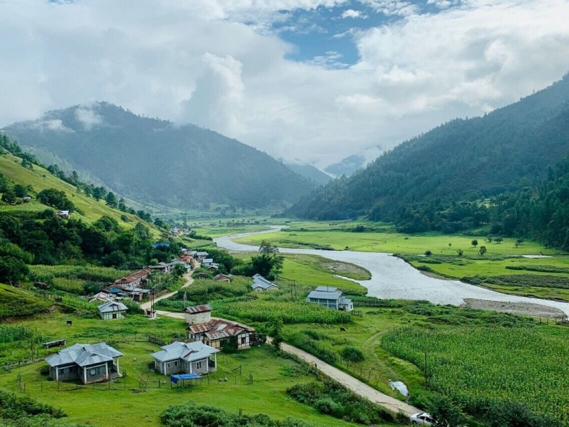
Bomdila
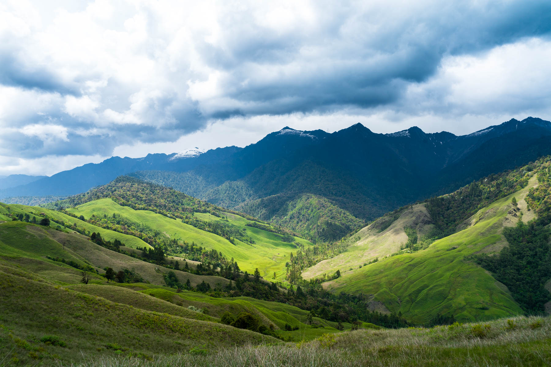
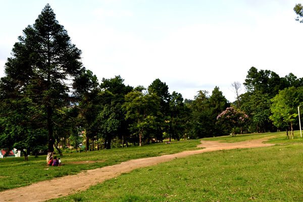
270 km west of Itanagar, Bomdila is a lesser-known destination set in the eastern Himalayas with beautiful views amidst nature. It is also well known for its apple orchards and many Buddhist monasteries. Bomdila was ruled by tribal rulers until the arrival of the British who made it part of Arunachal Pradesh in 1873. The Bomdila Monastery also known as Gontse Gaden Rabgyel Lling monastery and the Eaglenest Wildlife Sanctuaries are the major attractions. Tourism is on the rise here and Bomdila has become a halt station for tourists travelling to Tawang. The Bomdila pass offers views of Kangto and Gorichen Peaks, the highest in the state.

Also known as Gentse Gaden Rabgyel Lling monastery, the Bombdila monastery was built in 1965 by the twelfth incarnation of the TsonaGontse Rinpoche. And was rebuilt by the thirteenth reincarnation, TsonaGontseRinponche who renovated the monastery by building a larger prayer hall. Inside the Gompa, there’s a huge prayer, which is used by the lamas for praying; the temple of Buddha, and a tiny quarter of monks. Apart from its religious significance, the monastery is also known for its natural beauty with stunning vistas that are fabulous and breathtaking. The Upper Gompa is located atop a steep hill. There is a monk school, a prayer hall as well as a temple dedicated to Lord Buddha on the premises. The Lower Gompa is located at the end of Bazaar Street and the main attraction is the marvellous Tibetan architecture and massive prayer hall inside. There is also a craft centre located opposite it which should be visited. R.R Hill is the highest point of Bomdila and from this height, visitors can see the roads leading to the Bhutan border as well as the one up Tawang.

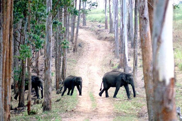
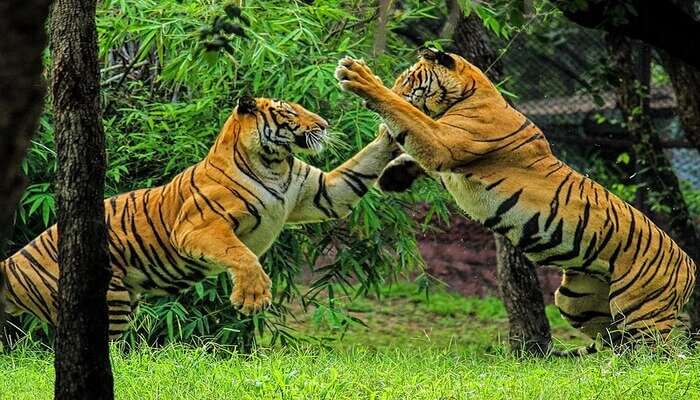
The Eagle’s Nest Wildlife Sanctuary lies between the Sessa Orchid Sanctuary and the Pakhui Tiger Reserve. It’s a great place for bird watching with over 450 species spotted here. The sanctuary conjoins the Sessa Orchid Sanctuary to the northeast and the Pakhui Tiger Reserve across the Kameng river to the east. Altitude ranges here are extreme, from 500 m to 3,250 m and are part of the Kameng Elephant Reserve. The sanctuary derives its name from the Red Eagle Division of the Indian army which was posted in the area in the 1950s. Eaglenest is bounded to the north by the Eaglenest Ridge and the reserved forests of the Bugun community and adjoins the Tawang district to the north. There are no distinct geographical features delineating its western boundary along the Bhutan border and the southern boundary. Eaglenest has an unpaved road running from its base to Eaglenest pass at 2,800 m allowing good access to the entire altitudinal range, making it accessible to the military, scientists and ecotourists.

Eaglenest Wildlife Sanctuary is well known as a major birding area and is home to at least 454 species of birds. The sanctuary has the distinction of having three tragopan species, perhaps unique in India and is where the Bugun liocichla was first discovered in 1995 and again observed and described in 2006. The sanctuary is also home to a wide variety of herpetofauna including at least 34 species of amphibians, 24 species of snakes and 7 species of lizards as well as at least 165 species of butterflies. This area is extremely important for the continued well-being of the Asian elephant. Elephants regularly move up from the Assam plains to the Eaglenest ridge at 3250 m in summer, perhaps the highest altitude that elephants reach in India.
Tawang
The town of Tawang or Dawang is located about 450 km northwest of Itanagar at an elevation of approximately 3,048 m to the north of the Tawang Chu river valley, roughly 16 km south of the Line of Actual Control with China. In 1989, the present-day Tawang district to the north of the Sela Pass was split off as a separate district. Tawang is inhabited by the Monpa people.
Historically, Tawang was under the control of Tibet. During the 1914 Simla Conference, Tibet and British India signed an agreement delineating their common boundary in the Assam Himalaya region, which came to be known as the McMahon Line. By this agreement, Tibet relinquished several hundred square miles of its territory, including Tawang, to the British. This agreement was not recognised by China and records show that the Tibetans regarded the border agreed upon in 1914 as being conditional upon China accepting the Simla Convention. Since the British were unable to get China’s acceptance, the Tibetans regarded the MacMahon line as invalid. The British did not implement the McMahon Line for over two decades, during which Tawang continued to be administered by Tibet. In November 1935, the British government demanded that Tibet implement the border agreement which was met with resistance from the Tibetan government implying that China’s acceptance of the Simla Convention was a prerequisite to all such concerns. Tibet refused to surrender Tawang, partly because of the importance attached to the Tawang Monastery. In 1938 the British tried to assert sovereignty over Tawang by sending a small military column which was met with strong resistance from the Tibetan government and a serious protest was lodged against the British Indian government.

After the Sino-Japanese war in 1941, the Assam government tightened its hold on the area of the Nort-East Frontier Agency, NEFA which later became Arunachal Pradesh. In 1944 administrative control was extended over the area of the Tawang tract lying South of the Sela Pass Though the Tibetan tax-collectors packing and protests were brushed aside, no steps were taken to evict Tibet from the area north of the pass which contained Tawang town. This situation continued after India’s independence but underwent a decisive change in 1950 when Tibet lost its autonomy and was incorporated into the newly established People’s Republic of China. In February 1951, India sent an official with a small escort and several hundred porters to Tawang and took control of the remainder of the Tawang tract from the Tibetans, removing the Tibetan administration. During the Sino-Indian war of 1962, Tawang fell briefly under Chinese control, but China voluntarily withdrew its troops at the end of the war and Tawang returned to Indian administration. But China has not relinquished its claims on most of Arunachal Pradesh including Tawang.
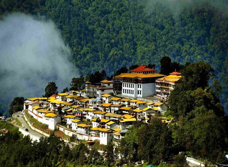
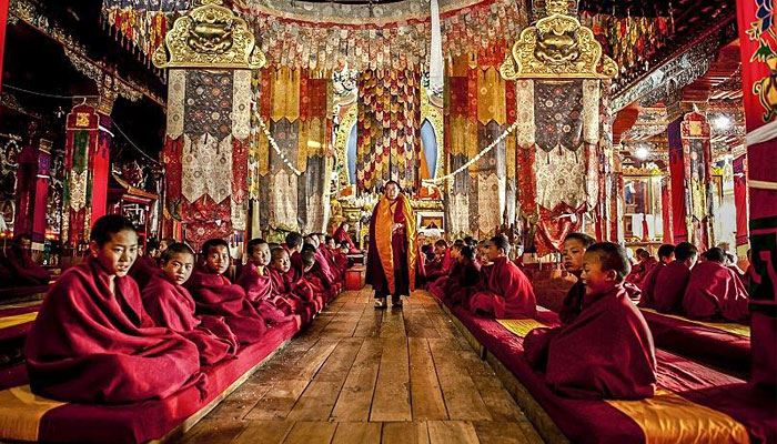
The Tawang Monastery was founded by the Merak Lama Lodre Gyatso in 1681 following the wishes of the 5th Dalai Lama, Ngawang Lobsang Gyatso. To fix the perimeter of the Dzong, the Dalai Lama had also given a ball of yarn, the length of which was to form the limit of the monastery. Perched at the height of 3,000 metres above sea level, the monastery belongs to the Gelugpa sect and is the largest Buddhist monastery in India and the biggest Buddhist monastery in the world outside of Lhasa, Tibet. It is a major holy site for Tibetan Buddhists as it was the birthplace of the sixth Dalai Lama, Tsangyang Gyatso. The monastery is believed to be 400 years old and has control over 17 gompas in the region.
Offering breathtaking views of the Tawang-Chu Valley, the monastery is built as a large three-storeyed mansion enclosed by a 925 feet long compound wall and is home to over 300 monks. The most prominent attraction in the monastery is the massive statue of Lord Buddha which is 8 m in height. The main temple, Dukhang, boasts magnificent interiors with beautiful artwork while the inner walls contain sketches and paintings of Bodhisattvas. The library is stocked with valuable old scriptures like Kangyur and Tengyur and all primary structures are built in the traditional style of Buddhist architecture. The Tawang Manuscript Conservation Centre was established in the monastery in August 2006, which has curated 200 manuscripts, and 31 manuscripts have been treated for preservation.

The full name of the monastery is Tawang Galdan Namgye Lhatse where Ta means horse and wang means chosen, which together form the word Tawang, meaning the location selected by a horse. Gadan means paradise, Namgyal means a complete victory and Lhatse means divine. Thus, the full meaning of the Tawang Galdan Namgye Lhatse is the site chosen by the horse is the divine paradise of complete victory.
There are three legends which speak of the establishment of the monastery. In the first legend, it is said that the location of the present Monastery was selected by a horse which belonged to Merag Lama Lodre Gyatso who was on a mission assigned by the 5th Dalai Lama to establish a monastery. After an intense search, when he failed to locate a suitable place, he retired to a cave to offer prayers seeking divine intervention to choose the site. When he came out of the cave, he found his horse missing. He then went in search of the horse and finally found it grazing at the top of a mountain called Tana Mandekhang, which in the past was the palace of King Kala Wangpo. He took this as a divine and auspicious guidance and decided to establish the monastery at that location. Seeking the help of the local people, Mera Lama established the monastery at that location in the latter part of 1681. The second legend of the derivation of the name Tawang is linked to Terton Pemalingpa, the diviner of treasures. Here, he is stated to have given initiations of Tamdin and Kagyad, which resulted in the name Tawang where Ta is an abbreviated form for Tamdin and Wang means initiation. According to the third legend, a white horse of the Prince of Lhasa had wandered into Monpa region. People, who went in search of the horse, found the horse grazing at the present location of the monastery. The people of the area then worshipped the horse and the location where it was found and venerated it every year. Eventually, to honour the sacred site, the Tawang Monastery was built at the site. There is one more legend narrated about the Goddess painted on a thangka in the monastery which is that of Palden Lhamo. This female deity is compared to the Hindu Goddess Kali. Like Goddess Kali, Palden Lhamo’s thangka is drawn in black colour, with flaming eyes, dressed in a skirt made of tiger skin, and a garland of skulls around her neck. A moon disc adorns her hair, similar to the one seen on Shiva. She is also associated with Goddess Saraswati and Ma Tara. Legend also states that in the past she had lived in Sri Lanka as the consort of a demon king who practised human sacrifice. As she was not supportive of this practice she fled from the kingdom. As she was running away, the king shot her with an arrow, which struck the backside of the mule that she was riding. When she drew out the arrow, it left a gaping hole in the mule’s back, and through this gap, Palden Lhamo could watch the teachings of Lord Buddha.
At the entrance to the monastery, there is a colourful gate structure, known as the Kakaling, built in the shape of a hut-like structure, with the roof featuring mandalas. A distinctive mural is of Ningmecahn, the protector deity of the Bon religion, who is considered the guardian deity of the Tawang region. A notable feature on the wall of the front porch on the ground floor is a footprint on a stone slab said to have belonged to a resident, a water carrier, known as Chitenpa who served in the monastery for a long time and on one day announced that he had completed his service to the monastery and then stamped his left foot on the stone slab which created a dented formation of his step. This step is venerated as a miracle.
Torgya, also known as Tawang-Torgya, is an annual festival held in the monastery whose objective is to seek protection from evil spirits and pray for the prosperity and happiness of the people in the coming year. The famous dance, Losjer Chungiye is performed by the monks at the festival. The monastery is open daily between 7 am and 7 pm.

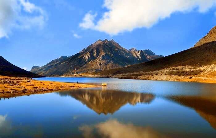
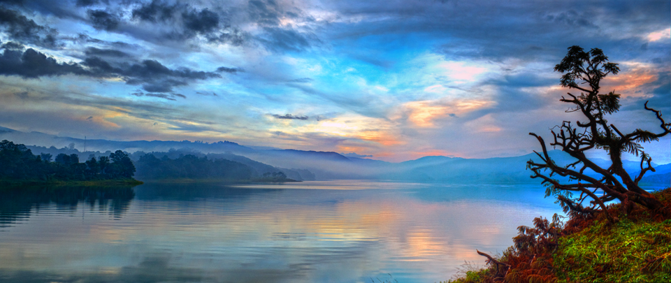
Arunachal Pradesh’s lifeline, Sela Pass connects Tawang to the rest of the country. Not just important geographically, Sela Pass is breathtakingly beautiful always covered in snow providing gorgeous views of the eastern Himalayan range. The rocky pass is also home to one of the state’s most beautiful lakes, the Sela Lake. One needs an inner line permit to visit Sela Pass. Located at an altitude of 4170 m, Sela Pass and Sela Lake lie on on your way to Tawang which is about 80 km from the pass. Also known as Se La where La means a pass, the pass is usually covered in snow and supports scarce amounts of vegetation. Sela Lake, near the summit of the pass, is one of approximately 101 lakes in the area that are sacred in Tibetan Buddhism. Sela Lake is a large lake located on the north side of the pass at an elevation of 4,160 m and often freezes during winter and is drained in the Nuranang River, a tributary of the Tawang River. Limited vegetation grows around the lake which is used as a grazing site for yaks during the summer. Construction of the Sela Tunnel which is underway will bring Tawang on the railway map through the Bhalukpong–Tawang railway line.
According to legend, a sepoy of the Indian Army named Jaswant Singh Rawat fought alone against the Chinese soldiers near the pass during the 1962 Sino-Indian War. A tribal woman named Sela who had brought food and water to him is said to have killed herself upon seeing the dead body of Jaswant Singh Rawat. Singh was posthumously awarded the Maha Vir Chakra for his courage and devotion to duty. Even though the pass is open throughout the year, the best months to visit are October, November, March, April and May as there are fewer chances of the route being snowed in.
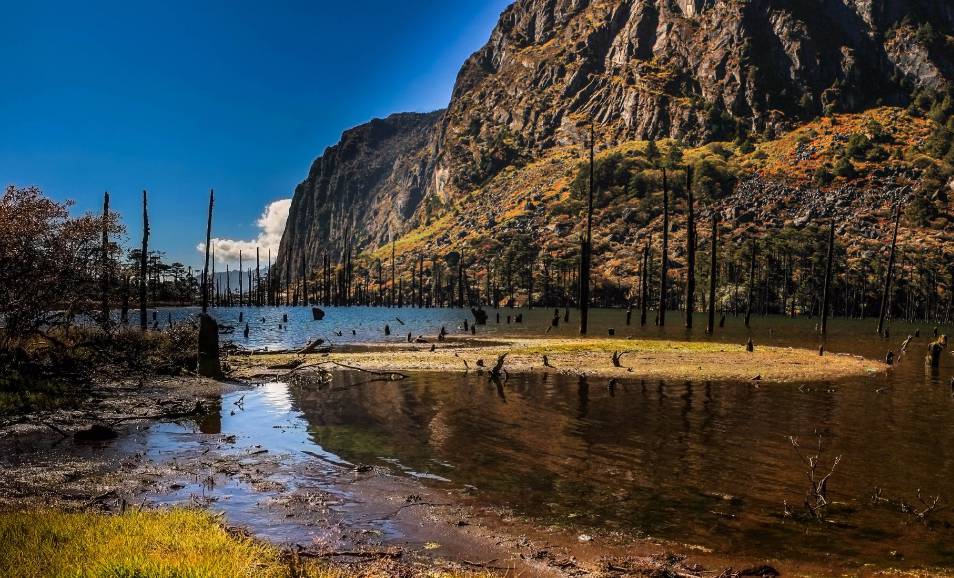
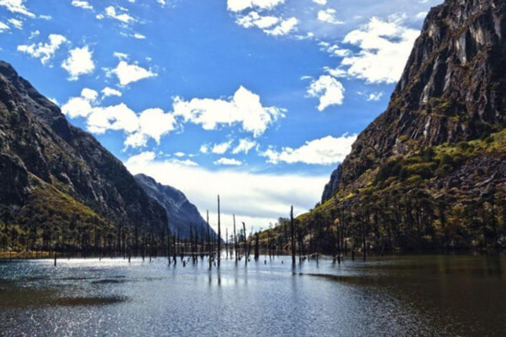
One of India’s remotest lakes, Madhuri Lake or Sangetsar Lake is a gorgeous lake against the Himalayas. The lake was made popular due to its appearance in a Bollywood movie and is known after its lead actress Madhuri Dixit who danced on its shores. The lake was previously known as Shonga-tser Lake and is located on the way from Tawang to Bum La Pass at an altitude of 12,000 ft above sea level just 30 km northeast of Tawang. The lake was created by falling rocks, boulders and trees in an earthquake and is tucked between huge mountains with many upright tree trunks standing in its belly as if guarding the lake and is special to Buddhists of India and Tibet who come here every year to pray. The best months to visit the lake are during October, November, March, April and May as the cold at this time subsides a little to allow normal tourist activities. Visits by civilians are only possible with permission from the Indian Army. The track is very treacherous, only SUVs advisable, and that too only on clear days with no snowfall or rainfall. Located almost 25 km from Tawang, the immensely picturesque P.T. Tso Lake is a perfect picnic spot, depending on the weather.

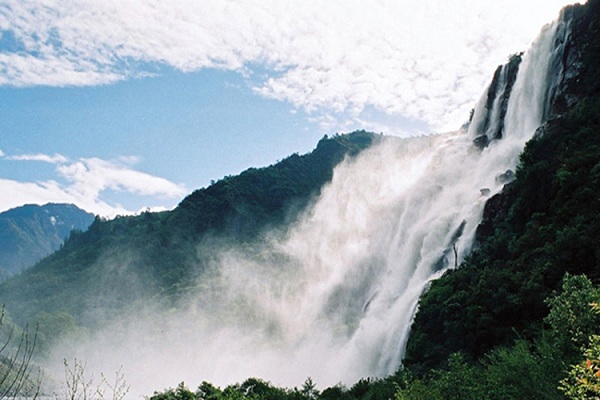
Largely known, the Nuranang Falls lie deep in the forest of Tawang and is one of the most spectacular waterfalls in the country. A beautiful white sheet of water that descends from the height of about 100 meters, it is a part of the Nuranang River which originates at the Sela Pass and just after the falls, merges with the Tawang River. Popularly known as the BTK waterfall, the Bap Ten Kang has crystal clear waters inside a lush green forest. The scenery around the falls is dotted by high hills all around, covered in thick greenery and mist hanging about. At the falls, one can visit the Hydel plant.

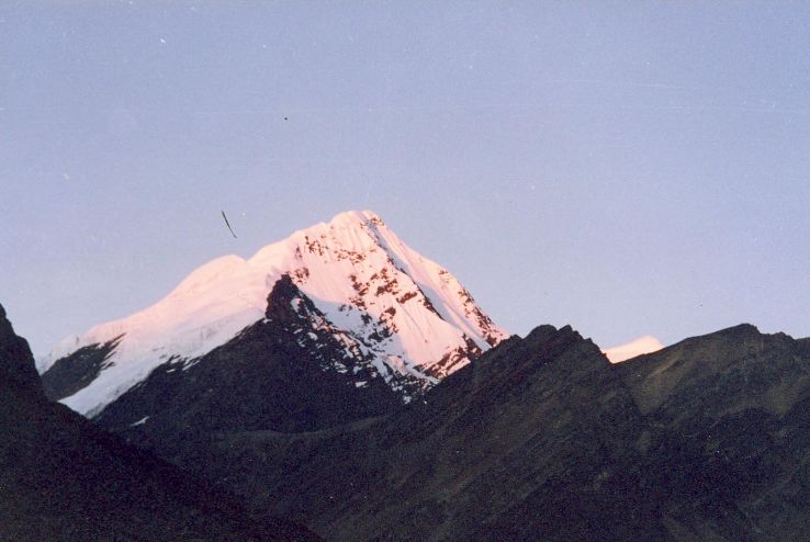
Gorichen Peak is Arunachal Pradesh highest peak and is located between Tawang and West Kameng at an altitude of 22,500 f above sea level, roughly about 164 km from Tawang. The peak is locally known as Sa-Nga Phu, which means the Kingdom of the Deity and is considered to be one of the sacred peaks protecting the people from the evils according to the local Monpa tribe.
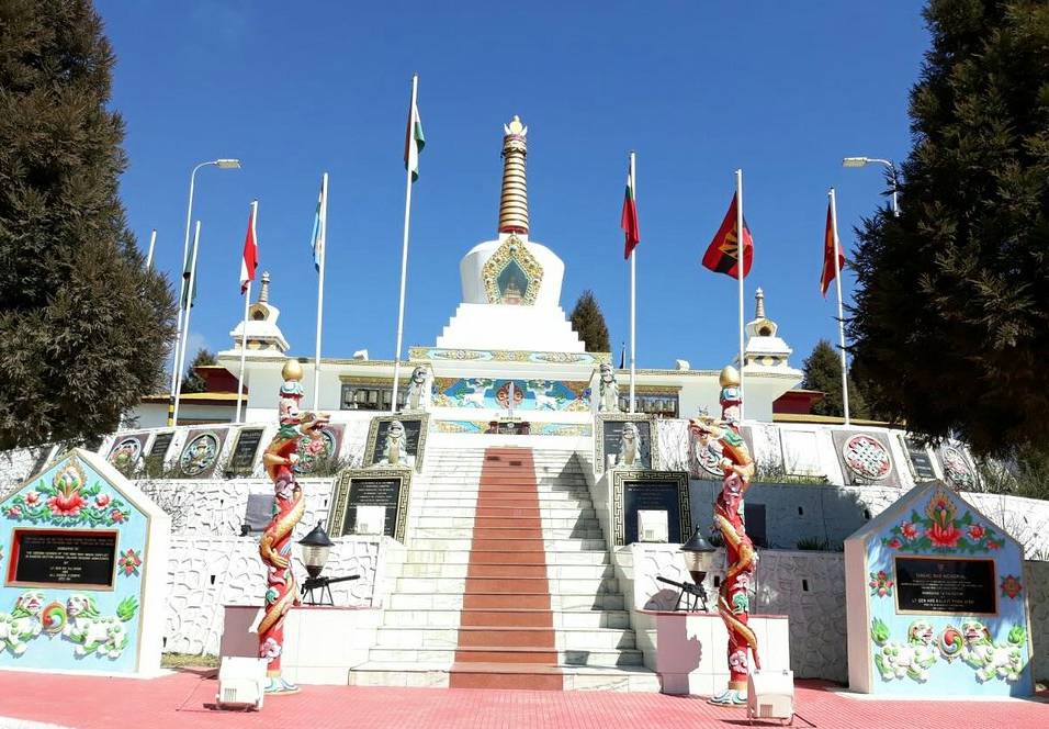
The Tawang War Memorial is a 40 feet colourful structure dedicated to the martyrs of the Sino-India War of 1962 overlooking the scenic Tawang-Chu valley.


