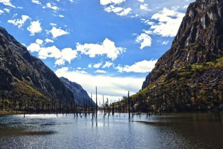
Travel Bucket List: India – Assam Part 3

Darrang
Moving on, our next destination is Darrang, a town which lies about 75 km east of Sualkuchi and about 75 km northeast of Guwahati. Created in 1983, there are no definite records about Darrang in the medieval era, but it was thought to perhaps have been formed as part of the ancient kingdom of Kamarupa and with its decline, Darrang at different times might have been under the rule of the Chutia Kingdom, Bodo people and Baro-Bhuyans. In the 16th century, Darrang was under the Kamata king Nara Narayan, and on the division of his dominion among his heirs, Darrang became a part of Koch Hajo. Early in the 17th century, Raja Bali Narayan invoked the aid of the Ahoms of Upper Assam against the Mughal invaders and after his defeat and death in 1637 the Ahoms dominated the whole district. In about 1785 the Darrang Kings took advantage of the decay of the Ahom kingdom to try and re-establish their independence but were defeated by a British expedition in 1792, and in 1826 Darrang, with the rest of Assam, passed under British control. The name Darrang was derived from the Bodo word Dourang, which means a Playground of Gods. According to other scholars, the word Darrang came from Dawrang which means a Gateway, as there was a direct entry to Bhutan and from there to Nepal, China and other countries.

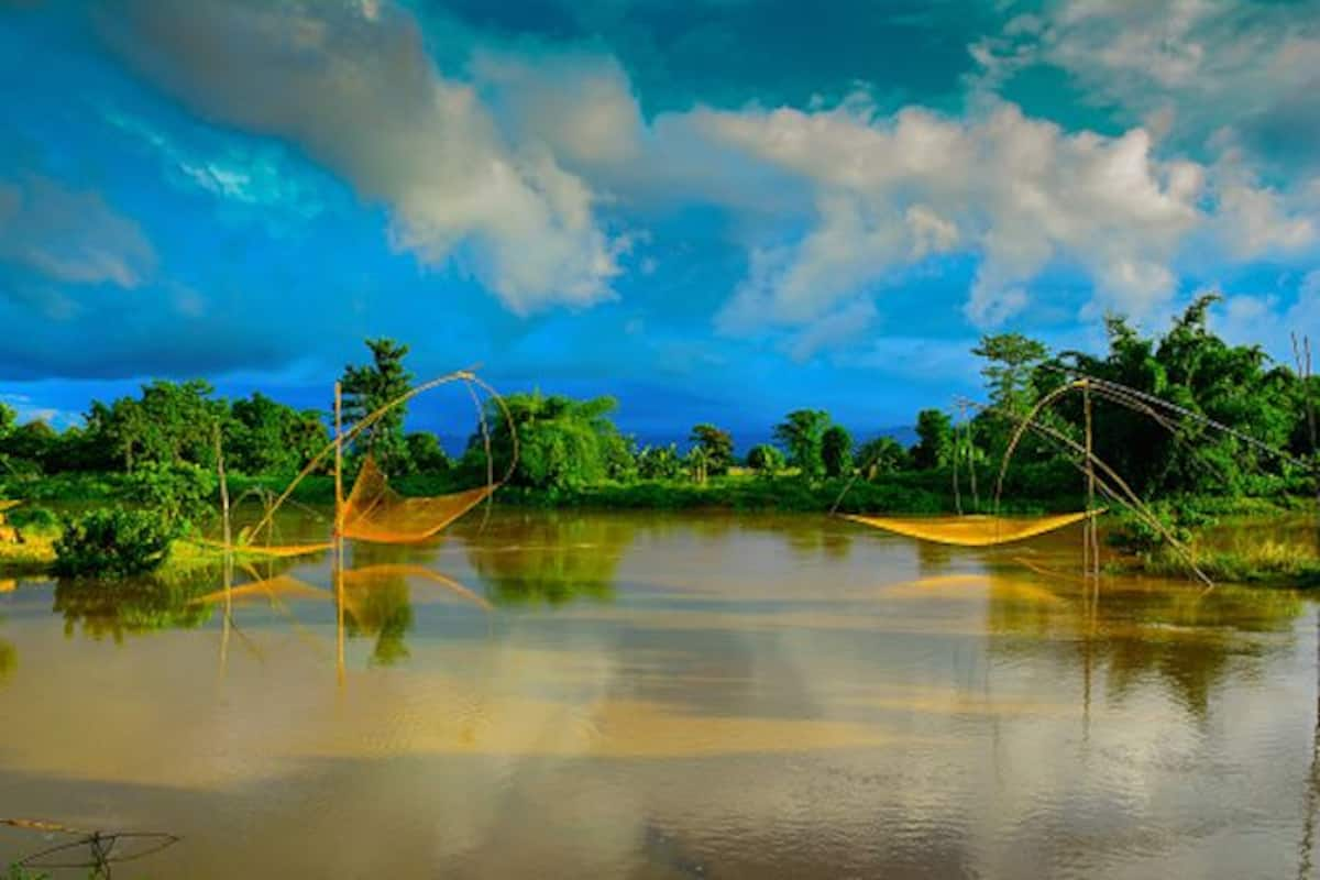
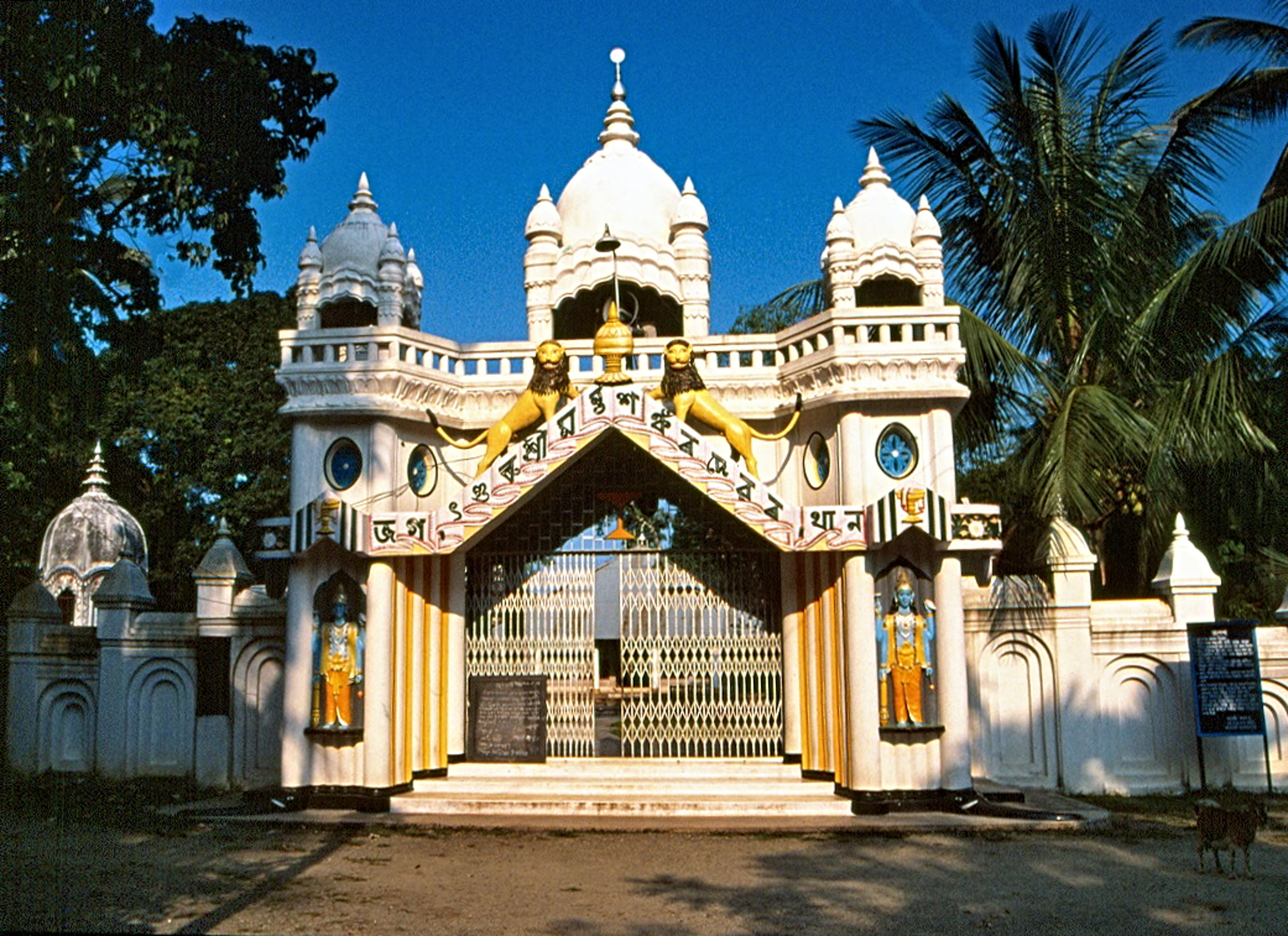
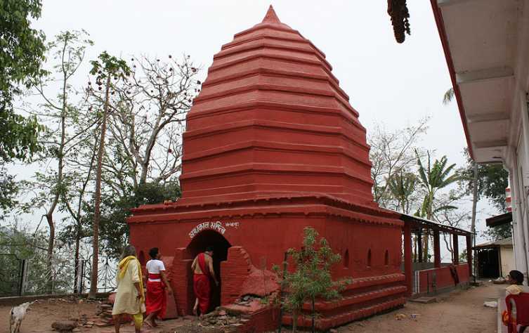
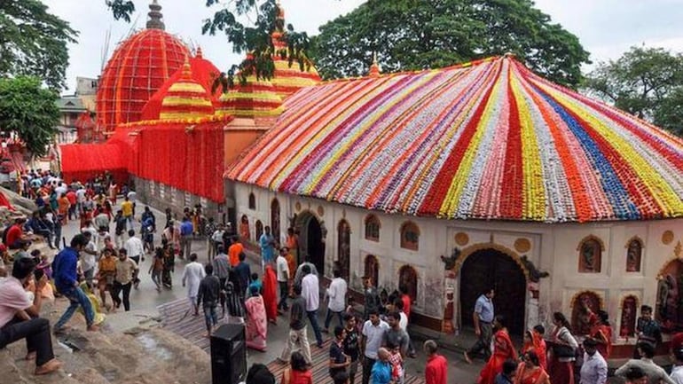
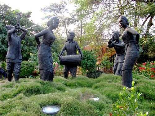
The Satras, which are similar to monasteries, were established by Sankardeva and later by his followers. Apart from practising Bhagawatee Baishnav here, Satriyaa Art, an art form also flourishes here. There are two Satras in Darang, the Khatara Satra, one of the oldest while the other is Dihing Satra. Visit the Satras in Darrang to witness the unique and rich culture that can only be found in Assam. Located near the Lakhimpur Village, the Kamakshya Devalaya temple is renowned for its stonework which includes an 8-petaled lotus inside the complex. Dating back to the 12th century, this temple was the preferred one by both the Ahom and Koch kings. The temple is also famous for its annual Doul Festival celebrated in springs. Bar Masjid is one of the oldest mosques in Darang while Engil Baba’s Mazaar is an architectural marvel and is located in a graveyard where Hindus and Muslims come together every Thursday to offer prayers. The Urus Mubaraka Festival is celebrated annually on 5th February. The Patharughat Swaheed Minar was established to commemorate the victims of the Jallianwala Bagh massacre of Assamese origin. The Gandhi Smriti Park is a beautiful lush green park and well maintained. Jaypal Pukhuri is a huge pond with pristine blue water which is always above ground level. The pond was established under the rule of King Jaypal and is an ideal spot for picnics. Pukhuria Beel is known for the hundreds of migratory birds and is a favourite haunt for bird lovers.

Mayong and Morigaon
Mayong or Mayang is a village that lies on the bank of the river Brahmaputra, approximately 40 km from Guwahati and on the opposite bank from Darrang. Once considered the cradle of black magic in India, today, Mayong is a tourist attraction because of its history. The origins of the name may be based on several sources including the Sanskrit word Maya or illusion, the Chutia/Tiwa/Deori word Ma-Yong which means mother, the Kachari word for an elephant, Miyong, or from maa for Mother Shakti and ongo meaning part. Some believe that Manipuris from the Moirang clan used to inhabit this area, therefore; the name Moirang became Mayhong with time.

History has it that Aurangzeb instructed his Mughal General Raja Ram Singh to defeat the Ahoms in Assam in 1667. Though he did not die here, he was defeated. In 1256-57, Ikhtiyaruddin Yuzbuk Tughril, the Sultan of Bengal attacked Assam and never came back and he, along with his army of 10,000 soldiers died there. There are numerous texts of magic even today which are preserved by the families in Mayong. Mayong has been mentioned in the Mahabharata and many ancient works. Legend has it that the Chief of the Kachari Kingdom, Ghatotkacha participated in the battle of Mahabharata after he got magical powers from Mayong. It is also believed that the forest is still home to the saints who wish to practice black magic. It seems the village is surrounded by mystery with stories of men disappearing into the air and humans beings turned into animals.

Because the Pobitara Wildlife Sanctuary is situated beside the village, Mayong village is surrounded by wildlife and has adventure sports including trekking and river sports organised in the village due to which is why it sees many adventure enthusiasts. There are also some ancient ruins of Ayurveda and black magic which have been conserved in the Mayong Central Museum which was opened in 2000. The museum has archaeological and ancient objects and artefacts kept in the museum as well as books on black magic and Ayurveda.

There are numerous shrines and temples in the village. Mayong is also known as the land of the Pancha Devta namely Lord Ganesha, Lord Vishnu, Lord Dinesh, Goddess Parvati and Lord Shiva. The shrine of Lord Shiva of Kachashila, the Lord Narasinha Ashram of Hiloikhunda, the Ganesh Temple of Hatimuria and the Kechaikhaiti Shrine of Burha Mayong are some of the significant temples. Sitajakhala is an ancient temple on the bank of the river Killing was discovered during the 1940s and is adorned with many idols of Goddess Sita and Lord Hanuman. As per popular myth, the sage Valmiki built the stone steps for Goddess Sita, going up to the River Killing for her convenience and hence the steps were named Sita Jakhala.

Located at Deosal Village near Pabitora Wildlife Sanctuary, the Deosal Siva Temple is dedicated to Lord Shiva and is famous for the festival of Shivaratri. It is believed that this village of Deosal was where the ashram of Maharishi Valmiki was located and where Goddess Sita took refuge after Lord Rama abandoned her. Another ancient temple at the top of Kachsila Hill is located a few km from Pobitora. Dating back to the 9th century, the temple houses many idols of Lord Shiva and Goddess Parvati as well as many idols of Lord Ganesh in the complex. The rare statues and stones often attract researchers. Sivakunda is a waterfall that is a popular picnic spot located in the Amsoi Hills and is best visited between October and March.

Source

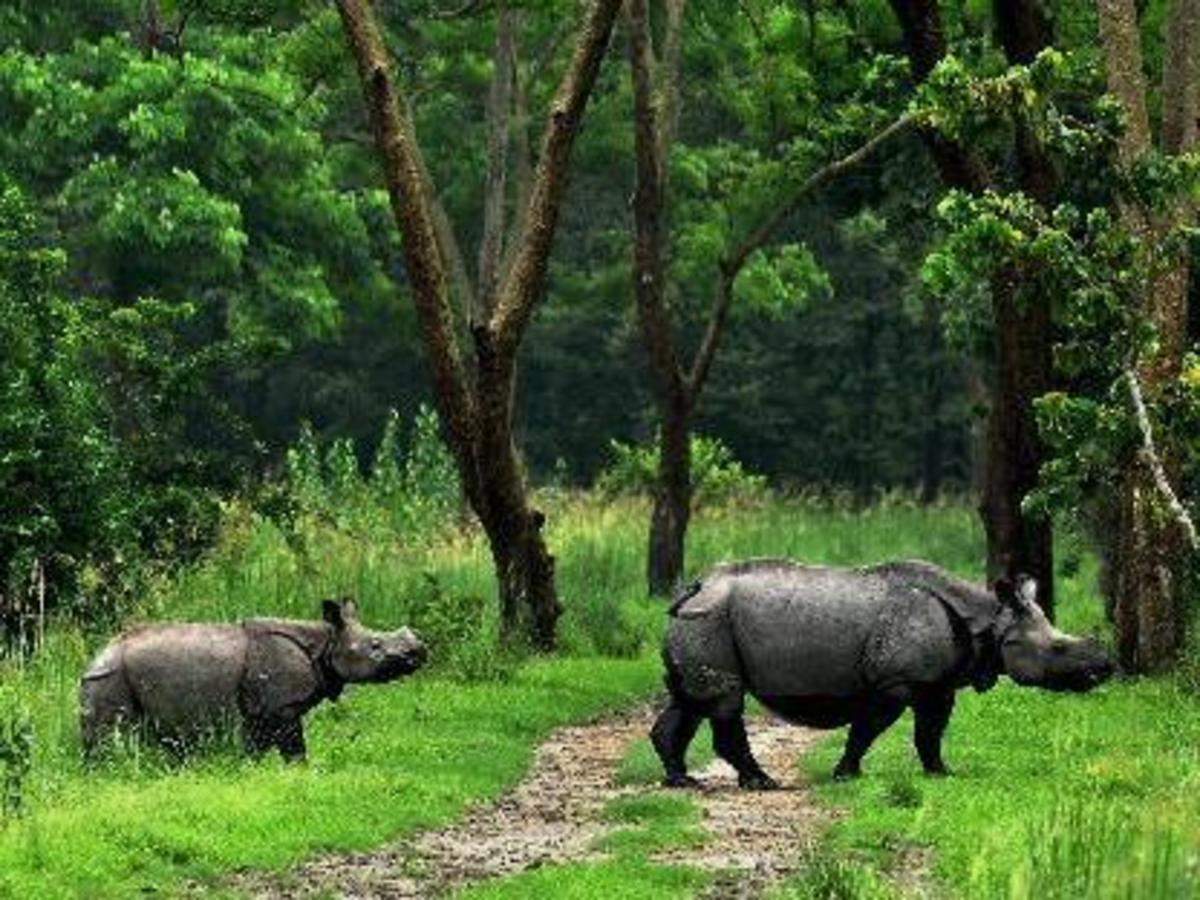
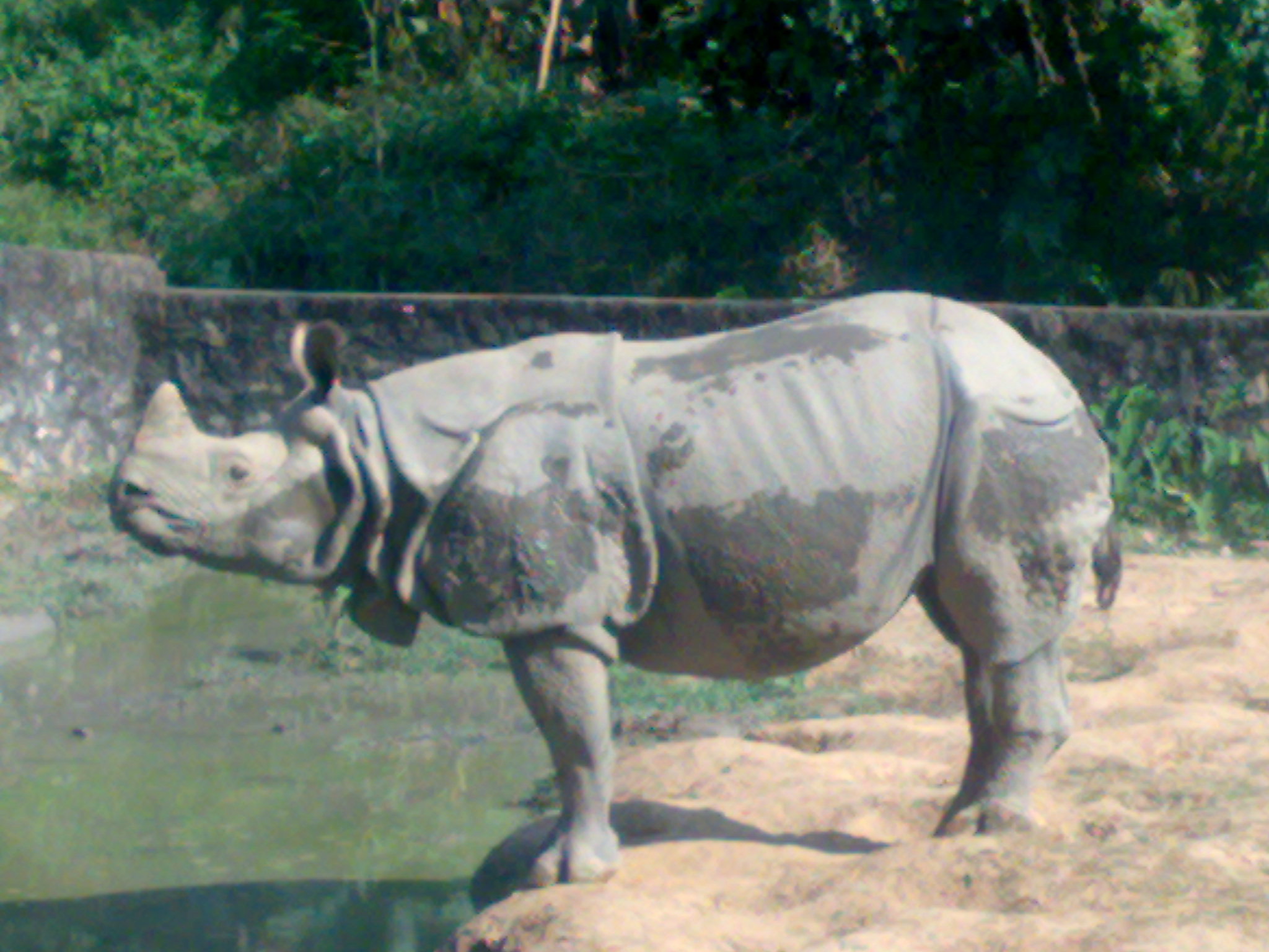
A wildlife sanctuary on the southern bank of the Brahmaputra, the Pobitora Wildlife Sanctuary was declared as such in 1987 and covers an area of 38.85 sq km. With one of the largest Indian rhinoceros populations in Assam, the sanctuary provides a grassland and wetland habitat for the animal consisting of at least 15 different species of grass. Other mammals in the sanctuary include the golden jackal, the wild boar and the feral water buffalo with the barking deer, the Indian leopard and the rhesus macaque living in the sanctuary’s hilly areas. Pobitora is home to more than 2000 migratory birds and various reptiles and is also called the Bharatpur of the East.

After Pobitora Wildlife Sanctuary saw a 10% increase in its rhino population, it exceeded its rhino-bearing capacity and became overpopulated and so the animals began moving outside the sanctuary in search of food, and chances of serious man-animal conflict became quite rife and the straying animals carried the risk of contracting diseases that afflicted domestic animals. Under the Indian Rhino Vision 2020, eight rhinos were translocated from Pobitora and re-introduced into the Manas National Park. The park is usually crowded during weekends and the holiday season, so visiting during that time, one needs to reach early to book elephant rides as they tend to be in short supply during the peak season.

Source

The elephant safari is run between 6:30 am and 7:30 am while the rest of the day is for jeep rides through the forest. The first jeep safari departs at 7 am and the last one at 3 pm with an hour’s break from 12 noon to 1 pm. The rate for the jeep safari is INR 1,300 for a group of six people, which includes the cost of toll, guide and security. Solo travellers can join a group of travellers so they don’t have to pay for the whole jeep and this is the rate for the specific route tour. One can also choose to spend the whole day inside the park, and the cost for the same is INR 200 for Indians and INR 2,000 for foreigners. Elephant safaris cost INR 500 per person for Indians and INR 1,000 per person for foreigners. Photography is likely to incur an additional cost of INR 50. Permits to enter Pobitora National Park is available at the entrance in exchange for INR 50 per person for Indians and INR 500 per person for foreigners. The best time to visit the sanctuary is between November and February as the climate then is pleasant during the day and chilly at night. The monsoon season should be strictly avoided as the region is prone to flash floods and the conditions of the roads make travelling almost impossible.

Nagaon
About 75 km east of Mayong and 122 km east of Guwahati lies Nagaon which used to be the Assam’s most populous district until 2011 when it lost its title to Dhubri after the split of the Hojai district. It is also famously known as the Rice bowl of Assam and is rich in paddy. Located in Assam’s heartland, Nagaon lies at the centre of northeast India and dates back to 1833. Its British administrators jocularly described Nagaon as a district of 3 C’s; namely: Chickens, Children and Cases. The Kaziranga National Park is close by which makes Nagaon a tourist magnet.

The eastern, western and southern segments of Nagaon were initially ruled by different feudal kings or their agents with the geography of these segments deciding who their ruler would be. Nagaon was spelt as Nowgong, and it was only in 1832 after it became a separate district administrative unit that the name became Nagaon where Na means new and gaon means village.

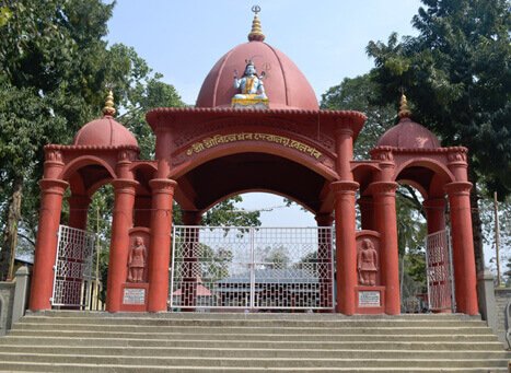
Nagaon is the birthplace of Mahapurush Srimanta Sankardeva, the great founder of Vaishnavism, an artist, dramatist and author. Nagaon is also home to the Laokhowa Wildlife Sanctuary. Located at Laokhowa and covering an area of 70 sq km, the sanctuary is located at a distance of 25 km from the Nagaon. The main attraction here is the Great Indian one-horned Rhinoceros and other animals include tigers, civet cats, leopards, Asiatic buffalos, wild boars and hog deers. The Champawati Kunda falls in Chapanala is a sight to behold while Kaliabor, famous as a historical place was the scene of several battles against the Muslim invaders. Silghat is a vital and picturesque river port lying on the south bank of the Brahmaputra and has several temples. Nagaon is also especially famous for its two satras, the Narowa Satra and the Salaguri Satra, which are believed to have been founded by Srimanta Sankardeva in 1494 after he returned from his first pilgrimage.

An integral institution of worship in the Vaishnavite culture, almost every Assamese locality houses a Namghar which means a House of Prayer and is a congregation hall where people recite the name of Lord Krishna. The architecture and structure of these Namghars are worth mentioning, and the unique element here is the ghaaikhuta or laikhuta, which is an oversized column in the mandap or the assembly place. No one is allowed to sit near this column since it is believed to be the seat of the Lord. The most prominent Namghars in Nagaon are the Bharali Namghar, situated in Hatbar and the Bordowa Namghar located in Nagaon Satra where Mahapurush Sankardev was born.
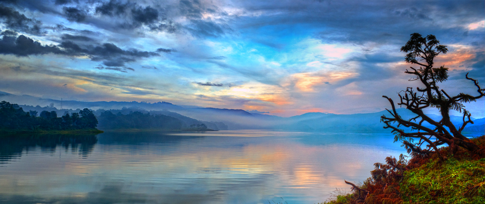
Tezpur
Located on the northern bank of the River Brahmaputra, Tezpur lies 175 km northeast of Guwahati, 57 km north of Nagaon and is the largest of the north bank cities. Known as Assam’s cultural capital, Tezpur has a rich cultural heritage with beautiful hillocks, parks and gardens.

Source

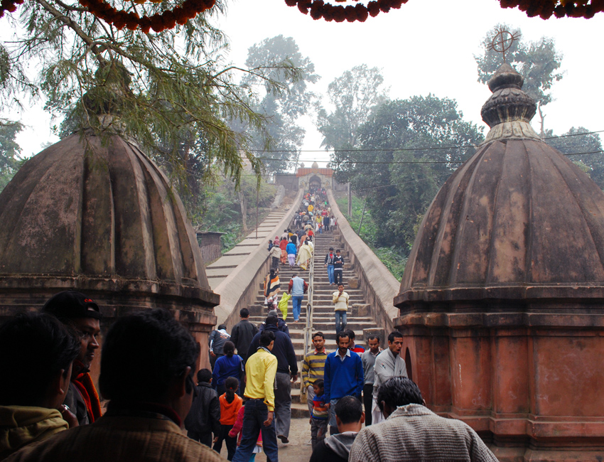
Agnigarh which means a fire fort or a residence set amidst fire is a big fortress on a hilltop on the banks of the Brahmaputra. It was the site of the legendary romance between Princess Usha, the only daughter of King Banasura and Aniruddha, the grandson of Lord Krishna. According to legend, Usha was imprisoned on this hillock which was surrounded by fire and hence the name Agnigarh. To reach the fortress, one needs to climb the circular staircase and from the top, there are splendid views of Tezpur and the Brahmaputra.

Source

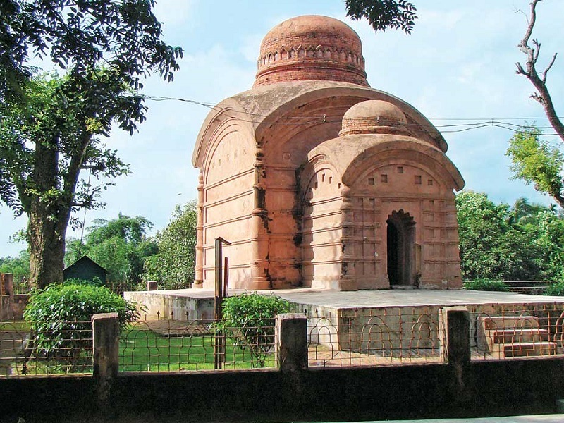
The ruins of the Bamuni Hills dating to the 9th and 10th centuries are famous for their artistic finesse. The influence of the Gupta style of architecture is seen here with the stone carvings depicted on the walls a fine specimen of the architectural brilliance of that age. Here, one can find Lord Vishnu’s 10 incarnations depicted in the bracket lintel that is cross-shaped.

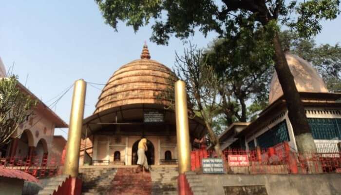
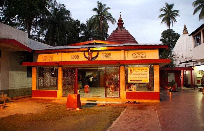
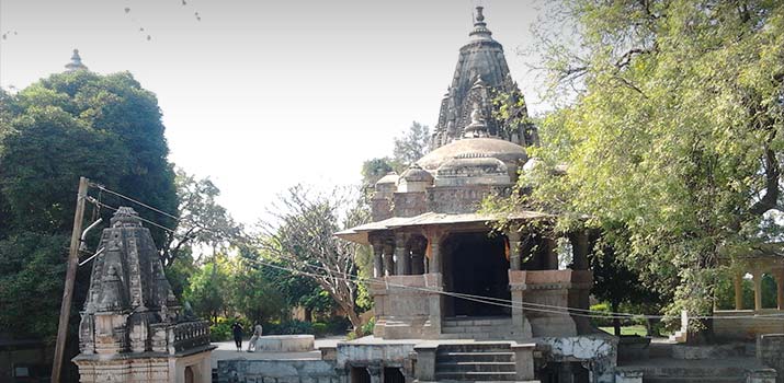
Ouguri Hill located on Brahmaputra’s bank poses tough challenges to climbers with its giant monoliths. The view from the hilltop is breathtaking with Tezpur lying on one side and the River Brahmaputra on the other side. On the top of the hill, there is a statue of Kanaklata, a martyr during the Quit India Movement. The ancient temple of Mahabhairab stands to the north of Tezpur and is believed to have been established by King Bana with a Shiva Lingam. Formerly, this temple was built of stone but the present one is built of concrete. During the later years, the Ahom kings donated a lot of land for the temple. The Rudrapada Temple lies to the east of Tezpur, on the banks of the Brahmaputra. It is believed that Lord Shiva in the Rudra form left the print of his left foot or pada on a stone found in the temple. It is believed that the Lord showed his real self to King Bana here. The temple was built by King Siva Singha in 1730 and the main temple was destroyed, due to erosion of the river Brahmaputra. The doorframe of the Da-Parbatia temple is said to be belonging to 600 and is the most ancient specimen of that time depicting the Gupta style of sculpture. The site is now protected by the Archaeological Survey of India. The Nag-Sankar Temple belongs to the 4th century and is believed to be constructed by King Nagsankar of the Lohitya dynasty. The temple was renovated in 1480 by the Ahom King Su-sen-pha. Another theory is that the temple was constructed by King Nagmatta. The large pond in the temple is home to a variety of fish and turtles with some turtles said to be over 100 years old and the park houses deer, peacocks and pythons. The Ketakeshwar Dewal is a famous temple devoted to Lord Shiva and is unique as the Shivalingam in the temple is one of the biggest in the world with the temple comprising of two parts. Legend has it that this Shivalingam was uprooted during a severe earthquake and got fixed in the current position after that.

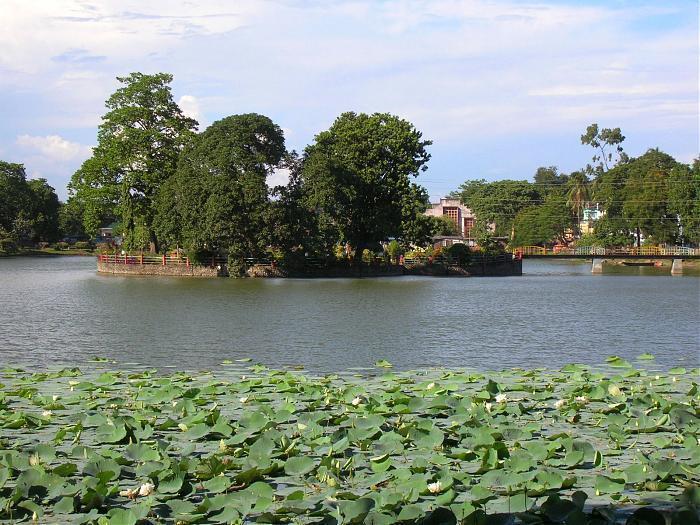
Padum Pukhuri is a beautiful lotus lake with an island that has been developed into a beautiful park with a musical fountain. There is an iron bridge to take one to the island and one can boat on the lake. One of the attractions of the park is the toy train. Hazara Pukhuri is a large tank named after Harjar Varman which was built in the early part of the 9th century.

Chitralekha Udyan or Cole Park is a beautiful garden established by the then British Deputy Commissioner, Mr Cole in 1906. The park which is set in a stunning landscape with many hillocks and lakes has two massive ornamented stone pillars and other sculptural remnants. It was renovated and revitalized in 1996 and now has a water sports facility, walkways, restaurants and an open-air stage. Trimurty Udyan is a park named after the three jewels of Assamese culture – Rupkowar Jyoti Prasad Agarwalla, Kalaguru Bishnu Prasad Rabha and Natasurjya Phani Sarmah.

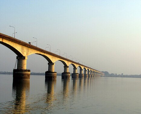
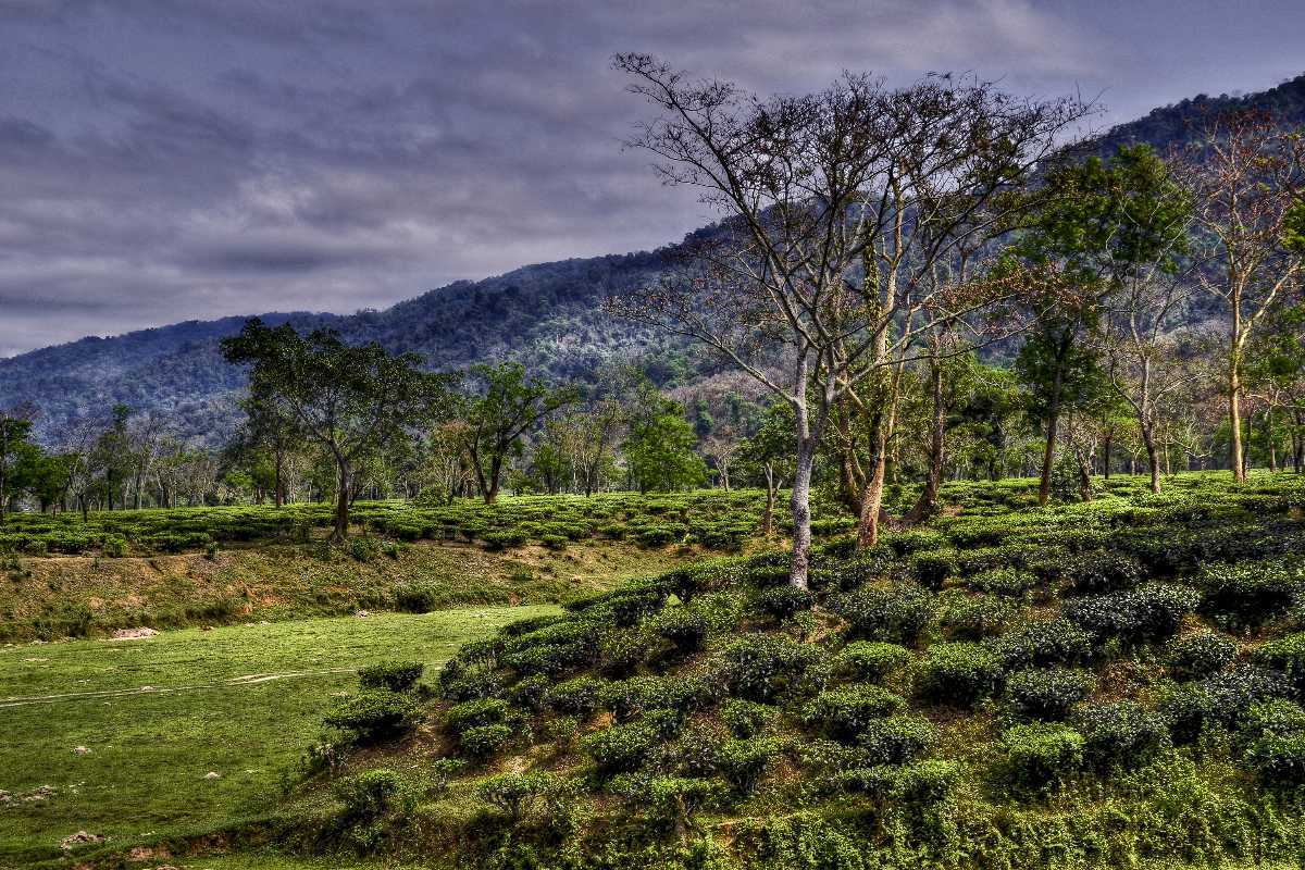
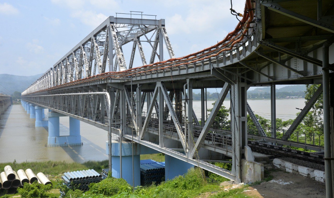
Bhomoraguri is a mammoth stone inscription made by the Ahom General Kalia Bhomora Borphukan, who planned to construct a bridge over the Brahmaputra. Almost two centuries later, a bridge at the same site now stands completed. The 3.015 km bridge, which took six months to complete is named after the great Ahom general, connects Silghat of Nagaon district with Tezpur. The Bura-Chapori Wildlife Sanctuary, situated 30 km from Tezpur on the banks of the Brahmaputra covers an area of 44.06 sq km and has a wide range of flora and fauna including tigers, wild buffaloes, wild pigs, one-horned rhinos and elephants. The District Museum of Tezpur was established in 1986 and provides an insight into the culture of the region. Some of the collections on display here include traditional textiles of Assamese, silver coins, copper coins, inscriptions, manuscripts and stone sculptures.

Jorhat
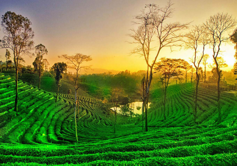
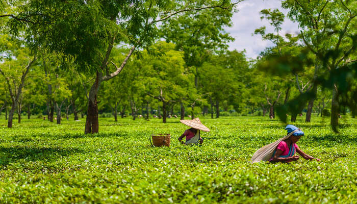
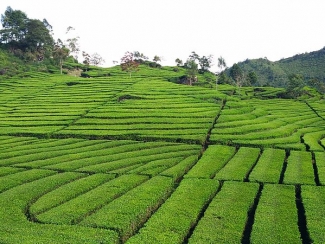
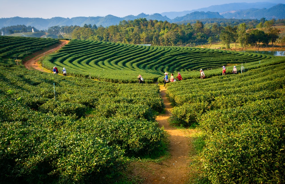
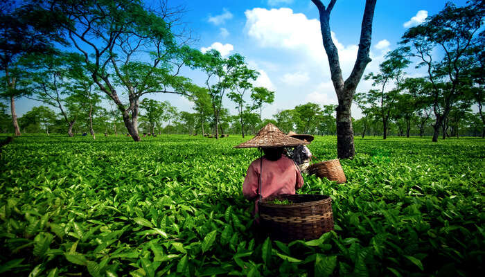
From Tezpur, our next destination is Jorhat which lies about 162 km east of Jorhat and about 305 km east of Guwahati. Jorhat or Jorehaut means twin hats or markets which refer to Macharhat and Chowkihat which were on the two banks of the river Bhogdoi during the 18th century. The northernmost area of the present district was a part of the Chutiya Kingdom before the Ahom-Chutiya war in the 16th century. In 1794 the Ahom king Gaurinath Singha shifted the capital from Sibsagar to Jorhat which was a flourishing and commercial metropolis but was destroyed after a series of invasions from the Burmese from 1817 till the arrival of the British forces in 1824. On the north of the district, the river Brahmaputra forms the largest riverine island of the world, Majuli, spread over 924.6 sq km which is today being threatened by erosion. Jorhat is well known for its extensive tea gardens and is the nerve centre of the tea industry, including the Tocklai Experimental Centre where research is carried out to find new varieties of tea as well as the curative effects of green tea.

Established by the saint and reformer Madhabdev in 1461, the famous Dhekiakhowa Bor Namghar is just 4 km from the city. The centre was opened to preach Vaishnavism and is a large complex where various cultural and social programmes are held. The Burigosain Devalay is located in the heart of Jorhat with Burigosain the presiding deity with the other deity that of a priest with the deities brought in from Jayantiya and established first at Rangpur and later shifted to its present location. The Hatibaruah Namghar is very important to those of the Ekasarana sect. A Namghar is not just a place of worship but also functions as a meeting house for the congregation. The structure has assembly halls which are usually rectangular buildings with a hip roof raised on pillars. The west end of the hall is called a Manikut which refers to the jewel hut and houses idols called Guru Asana. Devotees sit facing each other in North-South direction emphasising on the Bhakat or worshiper with prayers led by a Naam Loguwa who faces the idol. This temple also serves as a place of cultural and sectional activities like Bhaona or dance. The Namghar is open daily between 6 am and 8 pm.

A Namghar, the Dhekiakhowa Bornamghar is said to have been built by Madhavdeva, a saint-reformer who ignited the earthen lamp which has been burning nonstop since 1528. The Namghar is spread across 8 acres and is the site for many social, cultural and religious activities. According to legend, Madhavdevi came to the village of Dhekiakhowa after spreading Ekasarana Nam Dharma and reforming people and decided to take shelter at the hut of an old woman who served him Dhekia Saak which is a very common vegetable along with rice. She was embarrassed at serving this to Madhavdevi but he was very impressed with her hospitality. As a result, he started the Dhekiakhowa Bornamghar here and gave the old woman the responsibility of igniting the earthen lamp every day. This Namgar is known for making wishes come true and is worth a visit.

Ladai Garh is a fortified structure nearly 15 km from Jorhat and was constructed by King Pratap Sinha to protect his kingdom from the neighbouring kingdoms. The fort comprises three parts out of which one, Mera Garh is at Majuli. Magolu Khat is a historical site constructed by King Rajeshwar Sinha after he married the Manipuri princess, Kuranganayani. Even though it is in ruins today, it is worth a visit. Magolu Khat is on all days from 8 am to 7 pm and there is no entry fee. Sukapha Samannay Kshetra was constructed in the memory of Sukapha, the first Ahom king of Assam. An excavation is undergoing here hoping to find remains of the Ahom Kingdom. Created to keep elephants, Gazpur is in ruins today. The local king is said to have asked his soldiers to bring around 1000 elephants that he had captured here to celebrate the inauguration of a new city under his rule. When the city was first established, the king called it Hatigarh but soon the king realised that his desire of capturing 1000 elephants and keeping them here was not conceivable and as a result changed the name to Gazpur, which comes from the Assamese word, Gaz which means elephants. Gazpur is open on all days and entry is free.

Bangalpukhari is a water tank created in 1739. The water tank is untouched due to the myth that it will bring a bad omen. The story of Bangalpukhari dates back to when it was built after the slaughter of the Ahom governor, Badan Barphukan who was infamous for torturing innocent Assamese and Burmese soldiers. Rupali Singh Bhangal, the man who killed Barphukan was awarded money for this act of bravery, which he used to build this tank. Hence, the people of Jorhat do not use this tank since it was built in the blood of a man. Open at all hours of the day, there is no entry fee to visit Bangalpukhari.

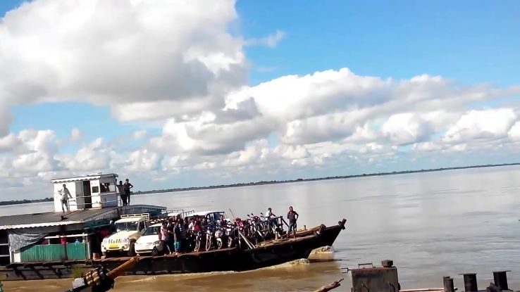
Nimati Ghat, or Nimati, is an essential port in Assam and the only entry point to Majuli and it serves as a link for ferries that go to Auniata and Kamalabari. Located near the Brahmaputra, the ghat is significant not only for local villages but also for upper Assam. The ferries that run from Nimati Ghat to Majuli are government-run and hence are simple wooden boats with long benches on the side, facing each other. The ferry runs on all days of the week and the charges are INR 15 per person, with someone wanting to take their vehicles on board needing INR 800 per vehicle. The first ferry leaves Nimati at 8:30 and the last one leaves at 4 pm while the first ferry from Majuli leaves at 7:30 am and the last one at 3:15 pm.

Source

The Cinnamora Tea Estate was established by Maniram Dewan in 1850 and is the first tea estate in Assam. The Tocklai Tea Centre, also known as Tocklai Tea Research Center or Tocklai Experimental Station for Tea Research is a laboratory and research institute located near river Tocklai. Established in 1911, this tea station is one of the largest and oldest tea stations in the world. The idea of the centre is to improve tea development by discovering a range of methods for expanding the dietary estimation of the drink. The centre has eight main research departments including botany, soil, agronomy, engineering, biochemistry, tea tasting, plant protection, statistics, manufacturing technology and agricultural economics. The centre is open between 8:30 am to 5 pm daily.

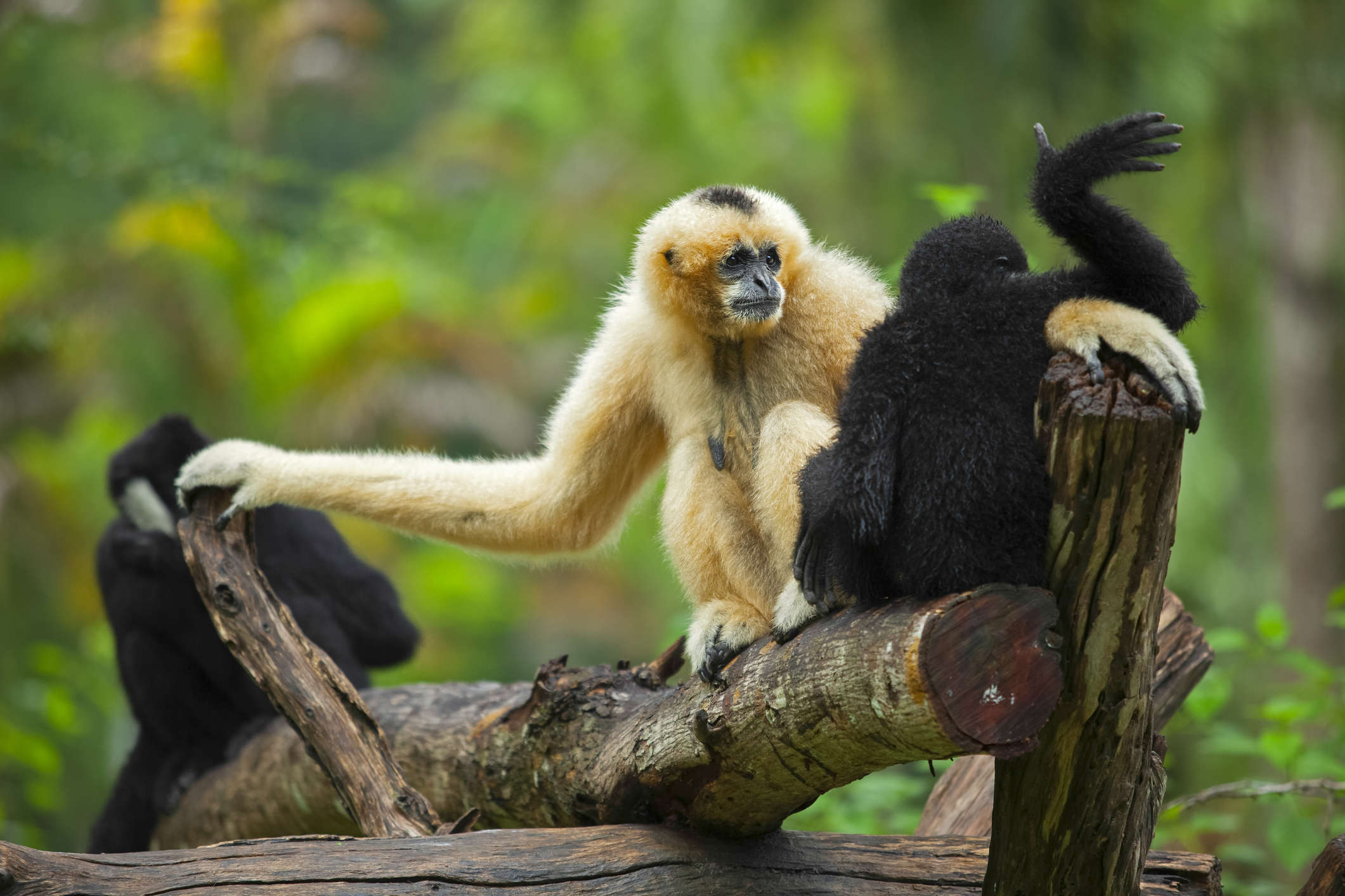
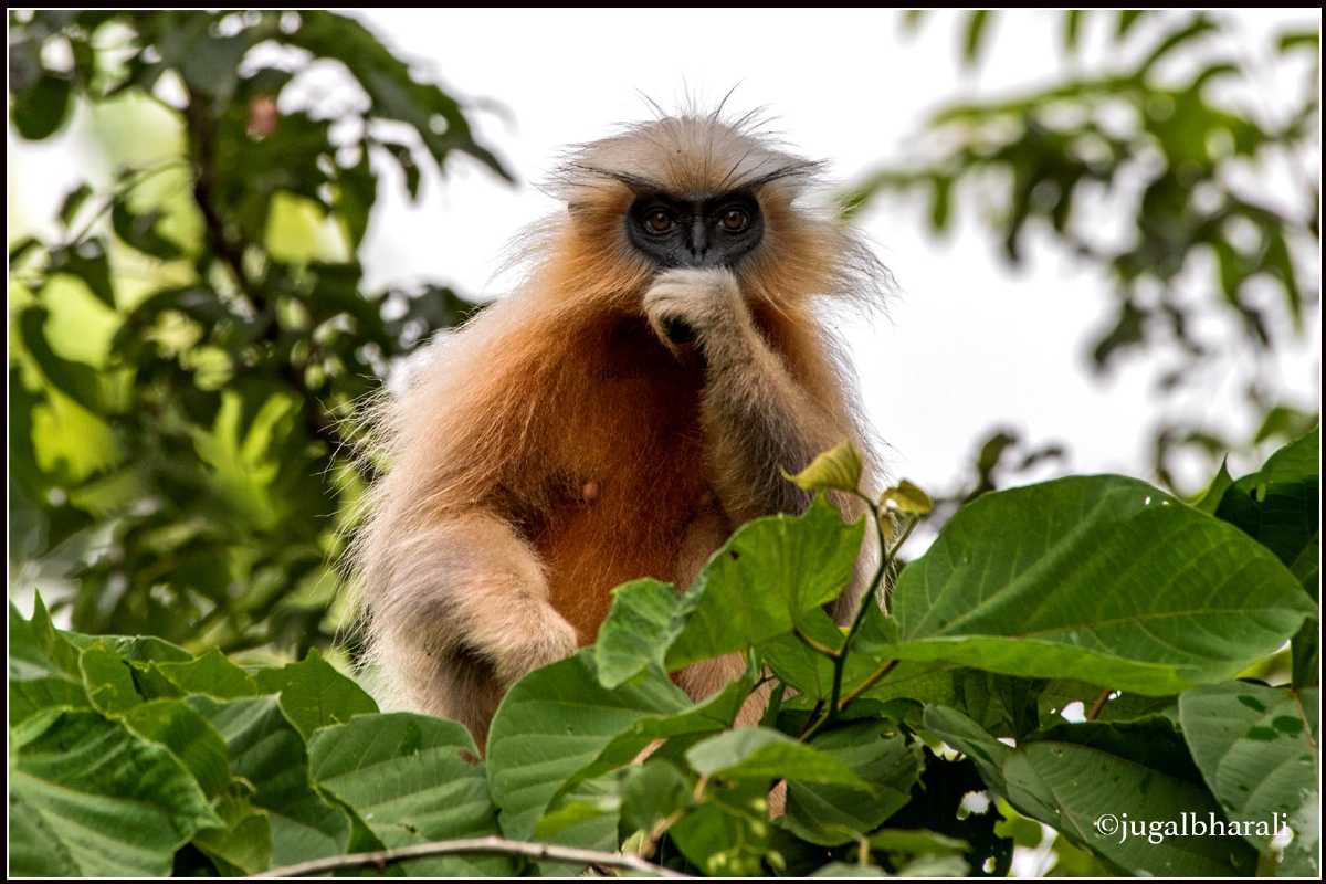
Located around 20 km from Jorhat, the isolated Hoollongapar Gibbon Wildlife Sanctuary is famous for its Hoolock Gibbon population. Surrounded by the Brahmaputra river on one side and with tea gardens everywhere else, this is a good enclosure for the 40 or so species of Hoolock Gibbons residing here. Apart from the Gibbon, one can see capped langurs, stump-tailed macaques, pigtail macaques, Assamese macaques, rhesus macaques, slow loris, elephants and many other species.

Source

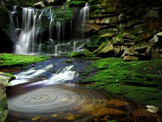
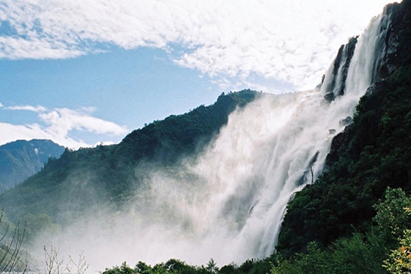
Located at an altitude of 116 meters, the Kakochang Waterfalls are also called Kakojan and are situated in the unknown forests of Bokakhat. The remains of the historical Numaligarh fort can be found here and the waterfalls offer a great view of the tea gardens of Difanu, Hathkhuli, Behora Borchapori and Methoni and serve as a great picnic spot. The falls have clear water falling from the top of the hill which gathers in a natural pond below. Open all day and at all hours, it is however recommended to visit the waterfall only during the day to ensure safety.

Travel Bucket List: India – Assam Part 2

Source

Kokrajhar
About 226 km west of Guwahati is the town of Kokrajhar, our next destination. Located on the north bank of the Brahmaputra, with the Gourang river flowing through it, the district shares a border with the Kingdom of Bhutan. Abode of the elusive Golden Langurs, the Chakrashila Wildlife Park is located here. The area is rich in natural beauty and sits at the foot of the lower Himalayas and the region is dotted with lush green forests. Kokrajhar is also the headquarters of the Bodoland Autonomous Council. Although the residents mainly speak Bodo now, early settlers were the Mon-Khmer speakers who were later pushed over by the Tibeto-Burman speakers that migrated from Tibet and China. The settlement of the Bodo people started with the earliest ruler of Assam, Kalika Purana, who belonged to the Bodo tribe. According to experts, the last rulers of the Naraka dynasty that ruled Assam fought for the Kauravas in the Mahabharat and were slain by mighty Krishna himself.

The three major tourist attractions here are the Chakrashila Wildlife Sanctuary, the Hanuman Temple and the Kali Temple. The Chakrashila Wildlife Sanctuary covers about 46 sq km and is popular for its exotic Golden Langur, making it the second protected habitat of the Golden Langur in India. Home to leopards, leopard cats, rhesus macaques, porcupines, Asiatic jackals; the sanctuary is also the abode of 250 endangered bird species including the night heron, the open billed stork, the lesser whistling teal and the hornbill. The sanctuary also has 23 different species of amphibians, over 40 species of butterflies and 60 types of insects. The lakes of Dheer and Deeplai which lie adjacent to each other adds to the beauty of the sanctuary. The sanctuary has provisions for trekking. Open all year, it is better to avoid the sanctuary in the monsoon season because the region is prone to heavy rainfall. The ancient Hanuman Temple is very popular while the Brahma Mandir which is dedicated to Lord Brahma said to be the creator of the universe is open daily between 5 am to 8 pm. The Daimalu Park and the Thandwai Brahma Memorial Park are ideal for relaxing while the Mahamaya Dham of Parbatjhora is a site of religious importance visited by devotees. The marvellous architecture of Mahamaya Snanghat Mandir is sui-generis. The lofty Maa Kali statue of Pachis Haat Kali Mandir catches the attention of the passers-by.

Bongaigaon
Our next destination is Bongaigaon which lies about 43 km east of Kokrajhar and 184 km west of Guwahati. The industrial and commercial hub of West Assam, Bongaigaon was the last capital of the Kamatapur Kingdom and home to many historical monuments of Assamese culture.

The Bagheswari Temple is one of the oldest temples in Assam and is dedicated to Goddess Parvati. It is among the oldest of the 52 Shakti Peethas or shrines devoted to Shaktism and the temple is so named due to the nearby Bagheswari Hill where tigers or bagh would be found in large numbers. Devotees flock to the temple in large numbers during the festival of Durga Pujo, specifically at the time of Durga Mahaashtami when buffalos are sacrificed. Legend has it that when Goddess Parvati was scattered across the earth by Lord Vishnu, a part of her Trishul or trident was found where the shrine within the temple lies, constructed by King Abhayapuri. The Lalmati – Duramari Ganesh Temple lies on Khagrapar Hill and is an ancient temple with stone carvings in the temple suggesting that the temple could belong to a period between the 8th and 10th centuries. Believed to be destroyed by an earthquake, the temple exists in a ruined state today. The Rock Cut Caves are evidence of the far-reaching rock-cut architectural movement during the Salasthamba period. These five caves at Jogighopa, at the bank of the Brahmaputra river, are some of the best-known examples of rock-cut structures in the state and are now preserved by the Archaeological Survey of India. The Bagheswari Hill is the highest point in Bongaigaon which houses a shrine dedicated to Lord Shiva. This hill overlooks the Bagheswari Temple, lending its name to it. From the top of the hill, one can enjoy panoramic views of the city.

Known locally as Tamranga Bil or Tamranga Beel, the Tamranga Lake is one-half of the largest freshwater lakes in Assam. Located at around a half-hour drive from Bongaigaon, the lake is flanked by hills on one side and paddy fields and rubber plantations on the other and serves as a great picnic sport during the winter season. Tourists or non-locals who visit can pay local fishermen or boatmen a small fee to enjoy a leisurely boat ride on the lake. The Birjhora Tea Estate is one of the biggest tea gardens and is beautiful because of how it slopes towards Birjhora Hill. Situated on the banks of River Brahmaputra, Jogighopa and Pancharatna are two famous historic sites with Pancharatna lying on the southern side while Jogighopa lies on the northern side of the banks of the river. Both places have several cubicles cut down from rocks. These small rooms are considered to belonging to the medieval period and used by monks to meditate. There are various ancient temples and monuments made of huge rocks. The Narnarayan Setu is a double-deck bridge with a railway track on the lower deck and a road on the upper deck that connects Jogighopa with Pancharatna.

The Koya-Kujia Bill is an ecological park, famous as a picnic spot. A project undertaken by the Assam Tourism Development Corporation, Koya-Kujia Bill aims to keep safe the number of birds that fly here every winter and to keep intact its natural vegetation. It is a natural water body that is surrounded by well-manicured gardens laden with the rich vegetation of different species of plants, shrubs, and herbs. The park also has recreational activities including swings and slides and boating in the waters of the Koya Kujia Lake. Each year, numerous birds arrive at the park in January and December. Located in the small town of Abhayapuri, about 22 km south of Bongaigaon, one will need to hire a private vehicle to reach the park. The Kachugaon Game Reserve, located in Kachugaon is a protected area under the Assam Forest Department which has many rare and endangered species such as the gaur, the golden langur, the spotted deer and the elephant.

Source

Located on the banks of the river Aie, about 15 km from Bongaigaon, the Kakaijana Wildlife Sanctuary or the Kakoijana Reserved Forest’s famous inhabitants are the golden langurs which are native to western Assam and along the Indo-Bhutan border region. Golden langurs are listed in the category of rare species in the Red Data Book of the International Union for Conservation of Nature. Set in an area of 17.24 sq km, the sanctuary was initially, a reserved forest, it later got promoted to the status of a sanctuary. Apart from the golden langur, several species like stork, python, leopard, hornbill, porcupine and much more are found here.

This sanctuary houses various species of animals like hornbill, leopard, python, stork, golden langur, monitor lizards and pangolin. In addition to these, jungle fowl, barking deer, porcupine, mongoose and binturong can also be spotted at this sanctuary. Apart from the animals, tourists can also find various kinds of bird species like red vented bulbul, pied harrier, jungle leubbler and many others. Kalikapat, a spring on the hill, which flows from the dense forests and reaches paddy fields is yet another leading attraction.

Goalpura
Located about 57 km south of Bongaigaon and roughly 150 km east of Guwahati, on the south bank of the Brahmaputra, Goalpura was a princely state ruled by the Koch kings and came under British colonial rule in 1765. In 1826 the British accessed Assam and Goalpara was annexed to the North-East Frontier in 1874. The name Goalpara is said to have originally derived from Gwaltippika meaning Guwali Village or the village of the milkmen. Goalpara is known for its rich wildlife and dense forests. It is home to numerous rare and endemic plant and animal species. But lately, due to tremendous tourism pressure and human traffic, there has been a considerable loss of biodiversity and disbalance in the ecosystem. The forests were originally covered with Sal or Shorea Robusta trees, however, there has been a large-scale decline in the vegetation due to exploitation and encroachment. The rapid depletion of the forest cover has not only brought about environmental changes but has also led to the extinction of various floral and faunal species.

Surya Pahar is a relatively unknown site 12 km southeast of Goalpara with high archaeological value. Translating to the Hill of the Sun, Surya Pahar’s name implies that the site was associated with the cult of sun worship. The archaeological findings discovered from the area are kept in the local museum. Dotted with shivlingas, Suraya Pahar holds the unique distinction of being marked and holding major significance in the history of 3 major religions which is proven by the presence of an amalgam of Hinduism, Buddhism and Jainism relics, archaeological and religious articles. It is believed that the great sage Vyasa laid the foundations for Surya Prahar modelling it on Kashi with 99,999 Shiv Lingams dotted across the mountain face and it was a thriving civilization and a major trading city long ago with maritime trade routes through the mighty Brahmaputra. Being an amalgamation of Hinduism, Buddhism, and Jainism, it enjoyed great status. Some historians even believe that Sri Suraya Pahar was the ancient seat of the Pragjyotish Kingdom and not Guwahati. Many Hindu rock carvings have been discovered in this place along with some rock-cut antiques, 25 stupas and the deities belonging to Hinduism, Buddhism, and Jainism. These are kept at a museum in Surya Prahar. Jainism which didn’t have a strong foothold anywhere in the Northeast except for its presence in Suraya Pahar, hence, is of great significance. 25 stupas in the eastern periphery are proof of the presence of Buddhism.

Around 15 km from Goalpara lies Tukeswari. According to legends, a portion of Goddess Sati fell at this site and the Tukeswari temple which is located atop the Tukeswari Hill also has a temple dedicated to Lord Shiva. An ancient shrine, the Nandeswar Devalaya stands atop the Nandeswar hill alongside the river Dudhnoi. Dedicated to Lord Shiva, the temple comes to life during the festivals of Shivratri, Dol Jatra and Durga Pooja. One of the 51 Shakti Sthals, the Sri Joybhum Kamakhya Temple is a major temple nestled on the banks of River Brahmaputra, about 50 km from Goalpara. There is also a temple of Lord Shiva built near the Joybhum Kamakhya Temple and thousands of devotees come to the temple during the celebration of the annual festival in October. A hub of Vaishnavite culture and religion, the Shyamrai Satra was established in Goalpara with the ashes of Sri Manta Sankardeva preserved by the Satra authority and which is displayed during the celebration of Sankar Jayanti which takes place in April/May. An important religious site on the banks of Brahmaputra, Buraburi Than showcases secularism with people from different religions taking part in the various religious functions. At Dadan Hills, there is a temple dedicated to Lord Shiva which was built by Dadan, a general of King Bana of Sonitpur. One of the many legends that surround this temple suggest that a wild elephant was killed by the general at the foothill of the hill, who can be seen in the form of a stone sculpture on the banks of the river Dariduri.

Barpeta
70 km northeast of Goalpura and 95 km northwest of Guwahati lies the town of Barpeta, the next town we will be exploring. Known as the Land of Satras, the town is referred to in the local language as Satra Nagari or the town of temples due to it being home to many Vaishnavite Satras. The name Barpeta is derived from Bar meaning big and Peta meaning pond. Hence, the name Barpeta translates to a land of big ponds. Barpeta was earlier known as Tatikuchi, where Tati stands for weaver and Kuchi means a cluster of villages in the native Barpetia dialect, the land of weavers. In ancient times, it was a central part of erstwhile ancient Kamrup, included in Kamapitha of Kamarupa Pithas, the ancient divisions of the old Kamrup region. Before urbanisation, the town had many ponds. Barpeta is also the gateway to the rich natural reserve of Manas National Park.

One of the most popular Satras in Assam, the Barpeta Satra was originally known as Barpeta Than. It was established by Sri Madhabdeva around 500 years back around 1583. Sri Mathura Das Burha Ata, a disciple of Sri Madhabdeva, became the first Satria of the Barpeta Satra and today, the Barpeta Satra functions as a Kirtanghar and stands as an important site for Vaishnavite devotees An important festival celebrated here is Holi, where devotees flock from across the state to observe Doul Mahotsav. The Sundariya Satra was constructed by Shri Madhavdeva after he left the Ganakkuchi Satra. Apart from serving as an abode to Shri Madhavdeva, the premises of the shrine played a vital role in spreading Vaishnavism and reformation. The Dargah of Syed Shahnur Dewan is located at Bhella, nearly 8 km away from Barpeta. An important shrine for those following the Islamic faith, it is said that during the medieval period, Syed Shahnur Dewan, a disciple of the Muslim Sufi saint Ajan Fakir, arrived here to spread the religion of Islam and Sufi philosophies. The Beki river which originates in Bhutan is one of the right bank tributaries of the river Brahmaputra and a significant portion of this river flows through Assam. A great view over the river can be had from the bridge along NH-31 which runs across the river.

Nalbari
Located at the base of the eastern Himalayas, about 52 km east of Barpeta and 72 km north of Guwahati, Nalbari’s history dates back many centuries. The Suvarnakundya village close to Nalbari produced the finest silk of Kautilya’s time. The area also produced a special perfume with the Chandan and Aguru products highly sought and exported far and wide, including north India. Western Assam was known as Kamarupa from the ancient to the pre-modern period and existed in harmony with the Davaka region of central Assam. Kamarupa was divided into Kamarupa Pithas or geographical divisions and the Nalbari district was carved out in 1985. Bhutan shares an international border with the district with the Bramhaputra river lies to the south. The word Nalbari is derived from Nal and Bari with Nal a variety of reed while Bari is enclosed ground with plantation.

Hari Mandir, located in the heart of the town is a major attraction. Established in 1965, the temple is built on the land donated by Rambahadur Pratap Narayan Choudhury and witnesses a huge crowd of pilgrims during a celebration of the festival of Raas Mahotsav. The festival is held annually during November and goes up to 15 days drawing pilgrims from all over the country.

The annual Raas Music Festival is a significant cultural and spiritual festival is celebrated at the end of the year, generally in November and go on for 11 days in the premises of the Hari Mandir. Raas essentially translates to dancing in delight and is often associated with Lord Krishna. The festival transforms the town of Nalbari into a festive extravaganza attracting thousands of visitors every year. The festival was first believed to have been celebrated in 1933 in the Nalbari Purana Natkhola, but the venue was later shifted to the present Hari Mandir to accommodate the growing number of visitors. The main puja mandap or hall at Hari Mandir has a beautiful idol of Radha-Krishna where the main Raas pooja takes place. In addition, there are several other temporary stalls with idols depicting a varied range of events, from events in the life of Lord Krishna to mechanised versions of current events.

The Billeshwar Temple is an ancient temple over 500 years old with an interesting past. Located at Belsor village near Nalbari, the temple is dedicated to Lord Krishna, although it is believed that a Shiva Linga was found on the same spot. As per the legend, once a cow owned by the priest refused to be milked. The following day, the priest found out that the cow gave her milk to a bush of Virina. When the case came to the notice of the king, he dug up the place and found a Shiva Linga. The Birreswar was soon established which later came to be known as the Billeswar Temple and today is known as the Belsor Temple. An ancient temple dedicated to Goddess Parvati, the Shripur Dewalay Mandir is said to have been created by an Ahom king, Sib Singha. As per the legend, the part of the body of Goddess Parvati or Sati fell here. Every year, the festivals of Durga Puja and Kali Puja are celebrated here. Located in Daulashal, the Daulashal Temple is dedicated to Lord Krishna and his brother Lord Balram. Once known as Daulakhal owing to the presence of a great temple or doul and a canal or khal, today it is a centre of religious significance. According to legend, the Jaypal Than Temple was revealed to the Ahom king Sib Singh by a cow named Kapali. Today, only some parts of the temple are visible, the larger part being buried underground due to an earthquake. The Basudeb Devalay was built between 1718 and 1744 under the rule of Ahom King Sib Singha. As per legend, once the fishing net of some fisherman fishing in the pond got stuck for seven days. On the seventh day, a local had dreamed of Lord Basudeb wishing to be relieved from the fishing net. When the news of the dream reached King Sib Singha, he immediately tried to remove the two stones on the spot. However, when he failed, the king decided to build a temple there. The Bagheshwari Dewbahar Guri Dewalay is an ancient temple situated near Nalbari and was patronised by Kamleswar Singha, the Ahom king. Thetha Gohain was established by the end of the 19th century on a piece of land donated by Janmi Majumdar, who lived in Kamarkuchi. Also known as Sangdo Palgi Gumba, the Buddhist Temple is located in Bangnabari village, about 30 km from Nalbari and was built 60 years ago by Nepalese immigrants and is one of the biggest Gumbas in the district.

Built by King Fenugwa in the 14th century, the Fenguwa Fort is massive at 3.2 km in length and was built to safeguard the kingdom. Located about 7 km south of Nalbari, the Ganga Pukhari is a pond that was created by a Brahmin named Gangadhar and is renowned for a fair that is organised annually on the occasion of Ashok Ashtami. Another lake, Mahmara Pukhari was dug up under the rule of the Ahom kings and it is believed that a buffalo was sacrificed during the excavation to get rid of water scarcity. The Angradhowa Pukhari was constructed by King Fenguwa and according to legend, was used to wash the queen’s jewellery with charcoal and thus got its name. Sonkuhira is a local favourite picnic spot and is home to many migratory birds and thus serves as a paradise for bird watchers.

Hajo
25 km south of Nalbari and about 24 km northwest of Guwahati lies Hajo, a multi-faith pilgrimage centre. Hajo is an ancient pilgrimage centre for Hinduism, Buddhism, and Islam and lies on the northern bank of the Brahmaputra River. The area is dotted with several ancient temples and other sacred artefacts. The word Hajo is derived from the Boro word Hajw which means Hill.

The Hayagriva Madhava Temple has an idol of Lord Vishnu that is similar to the idol of Lord Jagannath in Puri. It is also believed that Lord Buddha is to have attained Nirvana here and hence is visited by Buddhists, Bhutiyas and Hindus. Visitors will have to climb a fleet of stairs to reach the temple and the festival of Holi in March is celebrated with grandeur. The Kedareswar Temple, located atop Madanachala Hill is a temple dedicated to Lord Shiva and is regarded as one of the oldest temples in the Indian subcontinent. This temple enshrines a huge Shivalinga, made of stone, which is popularly known as the Svayambhu Linga. It is also referred to as the Ardhanariswara form of Lord Shiva and the Shivalinga is always covered by a huge metal bowl. The Kamesware Temple is an ancient temple, built in the 18th century by the Ahom king Pramatta Singha. Much later, it was turned into a temple dedicated to Lord Shiva with the shiv linga here resembling that in Kedarnath. One of the popular temples, the Deva Bhavana was, according to a legend, the meeting point of deities. The Hajo Powa Mecca is located near the Madhava temple and was constructed by Mir Lutufullah-i-Shiraji in 1657, during the rule of the Mughal Emperor Shahjahan. The word Powa means ¼ and, Powa Mecca figuratively refers to having a quarter of the sanctity of Mecca. It is also believed that the foundation of the mosque was laid with the soil that was brought from Mecca. The tomb of Pir Giasuddin Auliya, a pioneer of Islam is located here.

Sualkuchi
Sualkuchi is a small sleepy village about 11 km south of Hajo and just on the other bank of the Brahmaputra and across the river from Guwahati is best known for its skill and craftsmanship for producing one of the best kinds of silk in the state. It has a large number of cottage industries engaged in handloom and is the textile centre of Assam. Muga silk and Pat silk along with Eri silk and Endi cloth from this region is famous for their quality. Mekhela chadors and Gamosas made from these indigenous materials are in demand throughout Assam as well as other parts of India. Also rich in flora and fauna, Sualkuchi is an ecologically diverse area inhabiting not only the local exotic animals and birds but also varied species of migratory birds. The Hatisatra Monastry is not only beautiful but one of the biggest monasteries dedicated to Lord Krishna. Established by Kanu Bura Thakur, a saint from Nalanga, the monastery attracts pilgrims in large numbers. The Sidheswar Devalaya is one of the major temples dedicated to Lord Shiva and was renovated by the Ahom King Shiba Singha. Situated in the southwest part of the town, on the Sidheswari Hill, long queues can be seen in this ancient temple, especially during the month of Bhole Bom. The Ganesh Bigrah Temple is an ancient temple believed to be established in the 11th century by King Ratnapal. Situated near Ghatia Hills, this temple houses a very majestic stone sculptured idol of Lord Ganesha along with the stone idol of Har-Gouri and a Shivalinga. One can also witness a copper idol of Lord Krishna of a height of about 10 inches.

Travel Bucket List: India – Assam Part 1

Source

My post on northeast India written more than two years back was the genesis for this series and so lately I have been thinking that I have been unfair about lumping all the eight states as one being, especially when I have researched in detail the other states. So, to overcome this, I will be doing each state in detail and will be starting with the state of Assam, one of the larger states.

Located south of the eastern Himalayas along the Brahmaputra and Barak River valleys in north-eastern India, Assam is bordered by Bhutan and Arunachal Pradesh to the north; Nagaland and Manipur to the east; Meghalaya, Tripura, Mizoram and Bangladesh to the south; and West Bengal to the west via the Siliguri Corridor, a 22 km wide strip of land that connects the state to the rest of India. The state language is Assamese, followed by Bengali, which is official in the Barak Valley and Bodo which is official in Bodoland Territorial Region.

Known for its tea and silk, the state was the first site for oil drilling in Asia. Assam is home to the one-horned Indian rhinoceros, along with the wild water buffalo, pygmy hog, tiger and various species of Asiatic birds, and provides one of the last wild habitats for the Asian elephant. The Assamese economy is aided by wildlife tourism to the Kaziranga National Park and the Manas National Park, which are UNESCO World Heritage Sites. Assam receives more rainfall than most parts of India; this rain feeds the Brahmaputra River, whose tributaries and oxbow lakes provide the region with a hydro-geomorphic environment.

Assam and adjoining regions have evidence of human settlement from the beginning of the Stone Age. The first dated mention of the region comes from Periplus of the Erythraean Sea in the 1st century and Ptolemy’s Geographia in the 2nd century which calls the region Kirrhadia after the Kirata population. In the classical period and up to the 12th century the region east of the Karatoya river, largely congruent to present-day Assam, was called Kamarupa, and alternatively, Pragjyotisha. Though a western portion of Assam as a region continued to be called Kamrup, the Ahom kingdom that emerged in the east, and which came to dominate the entire Brahmaputra valley, was called Assam; and the British province too was called Assam. Though the precise etymology of Assam is not clear, the name Assam is associated with the Ahom people, originally called Shyam or Shan.

According to a late text, the Kalika Purana from around the 9th to the 10th century, the earliest ruler of Assam was Mahiranga Danav of the Danava dynasty, who was removed by Naraka of Mithila and established the Bhauma dynasty. The last of these rulers, also Naraka, was slain by Lord Krishna. Naraka’s son Bhagadatta became the king, who, it is mentioned in the Mahabharata fought for the Kauravas in the battle of Kurukshetra with an army of kiratas, chinas and dwellers of the eastern coast. At the same time towards the east in central Assam, the Asura Kingdom was ruled by another line of kings. Evidence indicates the presence of civilization in Assam around the 2nd century with a rock-cut stupa at Sri Surya Pahar that has been dated to 200 BC contemporary with the rock-cut Karle and Bhaja caves of Maharashtra. Samudragupta’s 4th century Allahabad pillar inscription mentions Kamarupa and Davaka in central Assam as frontier kingdoms of the Gupta Empire. Davaka was later absorbed by Kamarupa, which grew into a large kingdom that spanned from Karatoya river to near present Sadiya and covered the entire Brahmaputra valley, North Bengal, parts of Bangladesh and, at times Purnea and parts of West Bengal. The kingdom was ruled by three dynasties who traced their lineage from a mleccha or Kirata Naraka; the Varmanas, the Mlechchha dynasty and the Kamarupa-Palas, from their capitals in present-day Guwahati or Pragjyotishpura, Tezpur or Haruppeswara and North Gauhati or Durjaya respectively. All three dynasties claimed descent from Narakasura.

The Ahoms, a Tai group, ruled Upper Assam. The Shans built their kingdom and consolidated their power in Eastern Assam with the modern town of Sibsagar as their capital. Until the early 1500s, the Ahoms ruled a small kingdom in Sibsagar district and suddenly expanded during King Suhungmung’s rule taking advantage of the weakening rule of Chutia and Dimasa kingdoms. By 1681, the whole track down to the border of the modern district of Goalpara came permanently under their sway. Ahoms ruled for nearly 600 years between 1228 and 1826 with major expansions in the early 16th century. The Koch, another Bodo-Kachari dynasty, established sovereignty in 1510. The Koch kingdom in Western Assam and present-day North Bengal was at its zenith in the early reign of Nara Narayan between 1540 and 1587 and later split into two, the western part as a Mughal vassal and the eastern as an Ahom satellite state and later in 1682, Koch Hajo was entirely annexed by the Ahoms.

Despite numerous invasions, mostly by the Muslim rulers, no western power ruled Assam until the arrival of the British with the Mughals making seventeen unsuccessful attempts to invade. The discovery of Camellia sinensis in 1834 in Assam was followed by testing in 1836–37 in London. The British allowed companies to rent land from 1839 onwards and then tea plantations proliferated in Eastern Assam, where the soil and the climate were most suitable. Problems with the imported Han Chinese labourers from China and hostility from native Assamese resulted in the migration of forced labourers from central and eastern parts of India. After initial trial and error with planting the Chinese and the Assamese-Chinese hybrid varieties, the planters later accepted the local Camellia assamica as the most suitable variety for Assam. By the 1850s, the industry started seeing some profits. The industry saw initial growth when in 1861, investors were allowed to own land in Assam and it saw substantial progress with the invention of new technologies and machinery for preparing processed tea during the 1870s. In the later part of the 18th century, Ahom occupied Assam was captured by the Burmese who then leashed a reign of terror on the Assamese people who fled to neighbouring kingdoms and British-ruled Bengal after which the First Anglo-Burmese War took place in 1824 and ended under the Treaty of Yandabo in 1826, with the Company taking control of Western Assam and installing Purandar Singha as king of Upper Assam in 1833 under an arrangement that lasted till 1838 after which the British gradually annexed the entire region.

Initially, Assam was made a part of the Bengal Presidency, then in 1906 it was made a part of Eastern Bengal and Assam province, and in 1912 it was reconstituted into a chief commissioners’ province. The Assam territory was first separated from Bengal in 1874 as the North-East Frontier non-regulation province, also known as the Assam Chief-Commissionership. It was incorporated into the new province of Eastern Bengal and Assam in 1905 after the partition of Bengal between 1905 and 1911 and re-established in 1912 as Assam Province. After India’s independence, the Indian government divided Assam into several states beginning in 1970 within the borders of what was then Assam. In 1963, the Naga Hills district became the 16th state of India under the name of Nagaland and a part of Tuensang was added to the new state. In 1970, the districts containing the Khasi Hills, Jaintia Hills, and Garo Hills were formed into an autonomous state within Assam which then became the state of Meghalaya in 1972 and the same year, Arunachal Pradesh or the North-East Frontier Agency and Mizoram, from the Mizo Hills in the south were separated from Assam as union territories, with both becoming full states in 1986.

A significant geographical aspect of Assam is that it contains three of six physiographic divisions of India: the Northern Himalayas or the Eastern Hills, The Northern Plains or the Brahmaputra plains and Deccan Plateau or the Karbi Anglong. The climate is cold and there is rainfall most of the year. Geomorphic studies conclude that the Brahmaputra, the lifeline of Assam, is an antecedent river older than the Himalayas. Assam is one of the richest biodiversity zones in the world and consists of tropical rainforests, deciduous forests, riverine grasslands, bamboo orchards and numerous wetland ecosystems with many now protected as national parks and reserved forests. Assam has conserved the one-horned Indian rhinoceros from near extinction, along with the pygmy hog, tiger and numerous species of birds, and it provides one of the last wild habitats for the Asian elephant. The state has the largest population of wild water buffalo in the world as well as the highest diversity of birds in India with around 820 species which go up to 946 when subspecies are included.

Assam’s economy is based on agriculture and oil with Assam producing more than half of India’s tea. The Assam-Arakan basin holds about a quarter of the country’s oil reserves and produces about 12% of its total petroleum. The Assamese culture is traditionally a hybrid one developed due to assimilation of ethnocultural groups of Austric, Dravidian, Tibeto-Burman and Tai origin in the past. Therefore, both local elements or the local elements in Sanskritised forms are distinctly found.

We shall start our exploration of the state with its largest city Guwahati as well as its capital Dispur, which is a circuit city region located within Guwahati.

Guwahati

The largest city in Assam and also the largest metropolis in northeastern India, Guwahati is a major riverine port city along with hills and is called the Gateway to Northeast India. Dispur, the capital of Assam, is in the circuit city region located within Guwahati and is the seat of the Assam government. The city is also called the City of Temples because of the many ancient Hindu temples in the city. The city of Guwahati lies between the banks of the Brahmaputra River and the foothills of the Shillong plateau with the northern bank of the Brahmaputra, being gradually incorporated into the city limits. Guwahati is the largest city in Northeast India and the region hosts diverse wildlife including rare animals, primate species and endangered birds.

Once known as Pragjyotishpura or the light of the east, Guwahati was the capital of the ancient kingdom of Kamarupa and derives its name from the Assamese word Guva which is derived from the Sanskrit word Guvaka, meaning areca nut and its plant and Hati meaning rows with the city’s name translating to the rows of the areca nut tree. Guwahati’s myths and history go back several thousands of years, though the exact date of the city’s beginning is unknown, references in the epics, Puranas, and other traditional histories of India, lead many to assume that it is one of the ancient cities of Asia with the Kalika Purana mentioning that Kamarupa was inhabited by Kiratas. The city was the seat of the Borphukan, the civil-military authority of the Lower Assam region appointed by the Ahom kings. The Mughals invaded Assam seventeen times but were defeated by the Ahoms in the Battle of Itakhuli and the Battle of Saraighat on the outskirts of Guwahati. In 1972, the capital of Assam was moved to Dispur, a neighbourhood in Guwahati.

The Brahmaputra river flows to the north of the city which is bordered on the south by the foothills of the Shillong plateau and to the east by the Amchang Wildlife Sanctuary. The Bharalu River, a tributary of the Brahmaputra, flows right through the heart of the city and to the south-west of the city lies Dipor Bil, a permanent freshwater lake with no prominent inflows apart from monsoon run-off from the hills that lie to the south of the lake and drains into the Brahmaputra, acting as a natural stormwater reservoir for the city. There are also multiple hills within the city limits.

The Umananda Temple is located on Peacock Island that lies on the Brahmaputra River and is named after and dedicated to Lord Shiva. The name Umananda comes from the words, Uma, another name for Goddess Parvati and Ananda meaning happiness. Peacock Island is one of the smallest inhabited islands with the temple and its surroundings a haven for nature lovers. . The Island is home to a very rare and endangered species called the Golden Langur who are considered highly sacred. The temple is situated on top of a hill called Bhasmakala or Bhasmakuta. The island was originally built in 1694 by King Gadadhar Singha but was destroyed by an earthquake in 1897 and later rebuilt by a wealthy local merchant. The Umananda temple was crafted beautifully by the skilled Assamese workmen and aside from Lord Shiva, there are 10 other Hindu Gods whose idols reside in the shrines. The sanctum sanctorum encloses the rock on which Lord Shiva is said to have sat to meditate. According to a legend, Lord Shiva resided on this island as Bhayananda and it is said that at the beginning of creation, Lord Shiva sprinkled ashes here and imparted the supreme knowledge to his wife, Goddess Parvati. It is said that the Goddess Urvasi resides on this island and brings Amrit or nectar to Goddess Kamakhya which is why the island is also called Urvasi island. Even the Bhasmakuta hill on which the temple is located has a story. Legend says that when Kamadeva disturbed Lord Shiva during his meditation, he turned him into ash on this hillock, hence earning it the name of Bhasmakuta. The temple can be reached by a winding flight of stairs and is an ode to the mastery of the Assamese craftsmen and architects. Avoid visiting the island during monsoons as access to the island can be denied due to the rising water levels of the River Brahmaputra as well as due to flash floods. The temple is open from 5:30 am to 6 pm every day.

Located on the Nilanchal Hill in the western part of Guwahati,  the Kamakhya Temple is one of the most revered shrines of Goddess Shakti in India. According to the Hindu scriptures, there are four important Shakti Peethas or temples with the highest powers of divinity in the country and the Kamakhya Temple is one of them. The temple celebrates the power of the woman to give birth and is regarded as extremely auspicious among the followers of the Tantrik sect of Hinduism and was built and reconstructed multiple times between the 8th and 17th centuries. The main entrance of the temple is designed with carvings decorated with flowers and the temple has a massive dome and is decked up during the Ambubachi Festival and Fair held in June. One of the oldest temples in the country, the Kamakhya Temple has a long history. It is believed that this temple was built during the Mleccha dynasty in the 8th or 9th centuries. The Kamarupa Kings from Indra Pala to Dharma Pala were ardent followers of the Tantrik cult and at that time this temple became an important destination for Tantrikism. The Kalika Purana was composed in the 10th century and enhanced the importance of the temple as a seat for Tantrik sacrifices and sorcery. Mystic Buddhism or Vajrayana emerged here around that time and several Buddhist professors in Tibet were known to belong to Kamakhya.

The Kamakhya temple was destroyed during Hussein Sha’s invasion of the Kamata kingdom, the ruins remaining undiscovered until the 1500s when King Vishwasingha revived the temple as a site of worship. The Kamakhya temple was reconstructed in 1565 during the reign of his son and ever since then, the shrine has been an important religious centre for Hindus. The current structure of the temple is said to be of the Nilachal type, another word for architecture with a hemispherical dome and a cruciform shaped base. The temple has four chambers aligned from east to west and is described as the Garbhagriha or the main sanctum sanctorum rests on a base that has several sunken panels embellished with the sculptures of Ganesha and other Hindu deities. The lower parts of the Garbhagriha are made of stone while the zenith is in the shape of an octagon and is made out of bricks. The Garbhariha is situated below ground level and can be reached by a series of rock-cut steps. A rock fissure in the shape of a vulva-shaped depression is present here and worshipped as the goddess Kamakhya. The depression is filled with water from an underground spring and this is the general pattern of all the Garbhagrihas in this temple. Towards the west of the Kamakhya temple lies the Calantha, which is a square-shaped chamber of the atchala type. Small moveable idols of Gods and Goddesses are found here, while the walls of this chamber have many images and inscriptions carved onto its surface. To the west of the Calantha is the Panchratna which is a large rectangular construction having a flat roof and five small spires protruding from its roof. Towards the west of the Pancharatna is the last structure of Natamandir which has an apsidal end and ridged roof of the Ranghar type Ahom style. The walls of the Natamandir has inscriptions from Rajewas Singha and Gaurinath Singha inscribed upon them.

Legend has it that during the month of Ashadh or June according to the Gregorian Calendar, the Bramhaputra River that flows beside the temple turns red. It is believed that this is a divine phenomenon and that it happens because the Goddess menstruates during this time. While some people claim it is due to the high iron and Cinnabar deposits in the water, others continue to believe in the miracle and so every year during the Ambubachi Mela, the river and the temple attracts thousands of devotees. The Ambubachi Festival is a celebration of the Goddess’ fertility and the celebration hinges on the belief that the Mother Goddess, Kamakhya, Shiva’s young bride, is menstruating at this time. The Temple remains closed and the Goddess is bathed after those three days after which the normal activities of the temple are resumed. It is believed that at the time of monsoon when this festival is observed, Mother Earth is at her fertile best due to the rain nurturing her womb aka the soil.

On regular days, the temple remains open from 8 am to 1 pm and then again between 2:30 to 5:30 p. Entry fees for the general public are free while for the special entry it is INR 101 and direct entry is INR 501.

The ISKCON temple in Guwahati is known as the Shri Shri Rukmini Krishna, after Rukmani, the wife of Lord Krishna. It is located on a hilltop of the Ulubari Chariali area and is constructed of white marble. The interiors of the temple include the deities of Lord Krishna and Rukmani and there are various halls inside the temple for preaching the teaching of the society which is based on Vaishnavism. The temple is surrounded by lush green gardens which inspires quiet contemplation of the divine.

Dedicated to Goddess Bhuvaneshwari, the white shrine is perched atop a hill adjacent to the. The Bhubaneswari Temple provides visitors with a magnificent panoramic view of the city with the sunset views on the Brahmaputra River as viewed from the hill a must-see when in Guwahati. Though the temple is high upon a hill, it requires a 20-minute walk from the bus stop.

Perched on top of the Chitrachal or Navagraha Hill, the Navagraha Temple is dedicated to the nine celestial bodies. Believed to be the dwelling of the Sun, the temple enshrines nine Shiva Lingas in different coloured clothes representing planetary gods including Chandra or the Moon, Mangala or Mars, Budha or Mercury, Brihaspati or Jupiter, Shukra or Venus, Shani or Saturn, Rahu or the North Lunar Node and Ketu or the South Lunar Node surrounding the Sun or Surya in the middle. Built in 1752 by the Asom King, Raja Rajesvar Singha, the Navagraha Temple is built in the old Shikara style and is known to have survived major earthquakes. Instead of a roof, there is a huge dome with a beehive pattern. The temple premises are also used as a research centre for both astronomy and astrology and offer spectacular views of the Brahmaputra river and the valley below. The temple is open from sunrise to sunset daily.

Perched on the Sukreshwar or Itakhuli Hill on the southern bank of the Brahmaputra river, the Sukreshwar Temple is dedicated to Lord Shiva. Built in 1744, by the Ahom King Pramatta Singha, the temple was improvised and financial changes were made in 1759 by Rajeswar Singha. The temple offers an enchanting view of the valley below with a few steps leading down to the river and is popular for the spectacular sunrise and sunset. The temple is popular for conducting post-death rituals and there is a common belief that rituals here can help the dead attain peace or moksha. The temple complex also houses a Vishnu temple and a few chambers to conduct religious ceremonies. It is also said to house the largest Shivalinga in India. As per Kalika Purana, this hill was originally shaped like a hump of an elephant and hence known as Hastagiri. Open all through the year from 6 am to 7 pm, the best time to visit is during Mahashivaratri.

The Ugra Tara Temple enshrines the deity of Tara Devi. Built in 1725 by the Ahom ruler Siva Singh, the Shakti temple is unique in the sense that it does not have an idol like other temples do, instead, the inner sanctum sanctorum houses a small pit of water which is worshipped as Goddess Tara who is believed to be an incarnation of Goddess Parvati. There is also a water tank called Jorepukhuri, situated to the east of the temple which survived a devastating earthquake that destroyed the upper part of the temple. Goddess Ugra Tara is revered as Goddess Kamakhya and is showered with offerings and sacrifices and it is believed that the Goddess likes consuming meat, coconut and liquor; hence, get offered the same. According to legend, the navel of Goddess Sati is said to have fallen here while another legend suggests that when Lord Yama, the God of Hell complained to Lord Brahma that nobody was being sent to hell from the Kamarupa region because of its sacredness, Lord Brahma, in turn, went to Lord Shiva, and he, in turn, sent Goddess Ugra to drive away from her people and she sent in her army to bring them back. The army met Sage Vashishtha on its way back and disturbed his meditation. In anguish and rage, the sage cursed Goddess Ugra and Lord Shiva and from then on, all the Vedic sadhanas were given up in the Kamarupa region and people started worshipping the Goddess who became a Goddess of the Vamachara sadhana and the army became the Mlecchas. Goddess Ugratara is also worshipped in Buddhism. The temple is open between 5:30 am and 8 pm daily.

Perched on the hillock of Shukleshwar on the Shukleshwar ghats of the Brahmaputra river, the Janardana Temple is dedicated to Lord Vishnu. While the origin of the temple cannot be traced, it is believed to have been renovated sometime in the 17th century. The temple is an amalgamation of Buddhist and Hindu architectural styles, incorporating design elements from both with milky white interior walls with elaborate carvings of deities. The sanctum sanctorum of the temple enshrines a Buddhist statue and is revered as a place of meditation and worship by both Hindu and Buddhists. According to the myth associated with the temple, Lord Buddha is believed to be an incarnation of Lord Vishnu and he is known as Lord Janardana. Lord Janandana once fought and defeated the mighty demon Raja Bali in the disguise of a Vamana or a dwarf to protect the people from the wrath of the asuras or the demons. The battle spot came to be known as Janardana Tirtha and later, a temple was constructed around it known as the Janardana Temple. The temple is open from sunrise to sunset every day.

Located 40 km north of Guwahati, the Madan Kamdev Temple is an archaeological find in Baihata Chariali and is spread over an area of 500 metres, perched on top of a hillock. Here, the idols and sculptures of Madan Kamdev are scattered all over and the idols have detailed architecture and carvings on them.

Assam’s capital since 1973, Dispur is a suburb of Guwahati and houses some of the important buildings of the state like Assam Secretariat, State Emergency Operations Center and State Assembly House. Dispur is also famous as a tea auction market and is has beautiful weather throughout the year.

Pandu is another Guwahati suburb and is named after King Pandu, the father of the Pandavas. The Tila Hills here has a temple dedicated to Pandu known as the Pandunath temple. Five Ganesha idols representing the five Pandavas are found here and it is believed that during their exile, the Pandavas hid here under the disguise of Ganesha. The place also presents various other idols.

Built over the Brahmaputra River, the Saraighat Bridge is the first railway-cum-road bridge. The construction of the bridge was started in 1958 and it was first inaugurated for goods trucks in 1962, by then Prime Minister, Pandit Jawaharlal Nehru. A year later, on 7th June 1963, it was open to public traffic. The double-decker bridge has a road highway on top with a rail line below. Originally built for the North Frontier Railway, the bridge is a vital link between the North East region and the rest of the country; it has Lachit Borphukan Park situated on the south end and Chilarai Park situated on the north end. The 1.4 km long bridge connects both banks of the Brahmaputra river in Saraighat, a small town famous for the huge war between Ahoms and Mughals. An adjacent three-lane concrete bridge was also created and inaugurated in 2017.

The Assam State Zoo cum Botanical Garden or the Guwahati Zoo as it is popularly known spreads over an area of 430 acres of a densely vegetated forest area known as the Hengrabari Forest Area in the centre of Guwahati. Often referred to as the green lung of the city, the zoo is the largest of its kind in the North-East region and has landscape gardens, wildlife and a serene environment. Established in 1958, it is home to 113 different species of animal, with more than 900 animals, birds and reptiles. Over the years, the zoo has created a charming botanical garden in its vicinity. The main attractions of the zoo are the fauna exhibits, the botanical garden, a museum, a reptile house and a herbarium collection. The zoo has started several captive breeding programs to increase the population of endangered species like the one-horned rhinoceros, gharials and white tigers.

Located 18 km southwest of Guwahati, Dipor Bil or Deepor Beel is a freshwater lake in the former channel of the Brahmaputra river. Sprawling over an area of 40 sq km, the lake was declared as a Bird Sanctuary in 1989 owing to its rich biodiversity and heritage and is home to a vast variety of bird species. Dipor Bil offers a spectacular view of the fascinating wetland and rich forest ecosystem with as many as 19,000 different species of rare and endangered birds. In 2002, the Ramsar Convention listed it as a Ramsar site and Birdlife International has also declared it as Important Bird Area (IBA). Winters are the best time to visit as the weather conditions attract hibernating birds from far west and south countries. As per research 18 varieties of phytoplanktons have been found at the site including rare plants like Euryale Ferox, Potamogeton crispus etc. Dipor Bil has been derived from the Sanskrit word Dipor meaning elephants and bil meaning wetland or lake. It is believed that the lakeside was once an important dockyard for the Tai- Ahom and the Mughals and at one point in time, the Kampitha and Rambrai Syiemship which was the political authority of Meghalaya had control over this site. Known to be the largest lake or beel in the Brahmaputra valley of Western Assam, Dipor Bil has also been classified as representative of wetland type under the Burma Monsoon Forest biogeographic region.

Chandubi Lake is a natural lake born when an earthquake hit the region in 1897 and the forest that was there vanished and became the lake. It is located at the foot of the Garo Hills and is surrounded by tea gardens, deep forests and tiny villages and is free from pollution because it is slightly inaccessible. Spread over 2000 hectares, it is a lovely picnic spot that attracts a large number of migratory birds during the winter months. The lake forms the breeding ground of the birds, both residential and migratory. Chandubi which means the setting sun is thought to have gotten the name because an unknown British officer was mesmerised by the sunset here. Another version claims that the legendary merchant Chanda Sadagar used this beautiful lake as a transit point for his business and as the lake grew popular because of the merchant, it eventually came to be associated with his name.  The prominent feature of the lake is the natural lagoon that was formed. The Chandubi Festival usually takes place in the first week of January when local villagers come together to perform traditional dance forms and celebrate their unique culture.

Located in the heart of the city, Nehru Park is a charming garden built in 2000 and named after India’s first Prime Minister, Pandit Jawaharlal Nehru. The park was originally a church with several cemeteries, which was later converted into a park. Nehru Park boasts of 45 sculptures carved out of concrete depicting various dance forms of the state as well as an open-air theatre, a rock garden, a charming lawn and a few artificial ponds. There is also a jogging track and a children’s garden with rides. The musical fountain which starts once night has fallen is a local favourite. The park is closed on Thursdays and other days is open between 10 am and 8 pm. The entry fee for adults is INR 10 per person and a child pays INR 5.

Source

The Assam State Museum or the Assam Rajyik State Museum is one of the most famous museums of Northeast India that gives insights into the ancient and modern history of the region. The museum was established during the British colonial rule in 1940 and set up by the Kamarupa Anusandhan Samiti, Assam research society to showcase the history, sculptures, and handicrafts of Northeast India. The Museum offers an extensive collection of artefacts and sculptures dating back to the 5th to the 12th centuries to World War II and is divided into various sections each one showcasing a different era in history. The manuscript section displays the ancient manuscripts in Assamese, Tai and Myanmarese with a collection of these documents written on the bark of old trees and well-preserved. The arms and ammunition section has a vast collection of swords and armours from the Medieval to the Mughal period including the Ahom dynasty from the 1200s as well as a collection of ammunition from World War II. The prehistoric terracotta section has on display statues from the Indus Valley Civilization and various terracotta objects extracted from the different parts of Northeast India. The numismatics and metallic sculptures section have a collection of metal relics of Lord Vishnu, Goddess Durga and the Buddha along with a collection of coins from the Mughal and Ahom dynasties. The epigraphy section has a collection of stone and copper inscriptions belonging from the 5th to the 18th centuries while the natural history gallery has the collection of the natural biodiversity of the state including the life of a one-horned rhino. The museum also has on display the various handicrafts and handmade objects of Northeast India along with reconstructed tribal huts. Opened in June 1984, the conservation lab helps to conserve the present collection. During the summer months, the museum is open between 10 am and 5 pm while it is open from 10 am to 4:30 pm during the winter months. The entry fee is INR 5 while a camera fee of INR 10 is levied in case visitors want to photograph the exhibits.

The Guwahati War Memorial opened to the public in December 2016 and is a local favourite. The memorial houses a replica of the Amar Jawan or the eternal soldier and depictions of the Battle of Saraighat between the Mughals and the Ahoms. The entrance is decorated with an army tank used in the war donated by the Indian Army and the Indian Air Force.  There are also a few sculptures on a boat showcasing war scenes on the water. The memorial also displays scenes from the Kargil war, the attack on Karachi by the Indian Navy in 1971 and the Sino-Indian war.

The Regional Science Centre is one of the 27 such centres maintained and administered by the Government of India’s National Council of Science Museums. Locally known as the Science Museum, this is a wonderful initiative to educate, enlighten and entertain the visitors through the medium of science and technology. Established in 1994, the museum houses rare instruments, machinery, rare science equipment and demo experiment setups. The science centre also boasts of interactive displays to learn from, both for kids and adults, ranging from everyday activities to prehistoric exhibits and non-formal science education. In addition to the permanent galleries showcasing various exhibits, the museum also has a dynamic science park, a mock prehistoric park, a superb 3D animation theatre, a spacious auditorium and an inbuilt aquarium. The Science Centre was the first in the entire northeast to have a stereoscopic digital 3D cinema projection facility and another highlight is the Digital Planetarium which provides one with a unique experience of artificial sky gazing. The Magic and Miracle Show enlighten visitors against the misuse and superstitions of magic and in the process educates them to the wonders of science through which magic is possible. The Super Cold Show demonstrates experiments on different elements to exhibit different behaviours on being exposed to super cold conditions while the Sky Observation Programmes enable visitors to witness celestial bodies with the help of a 6-inch refractive telescope. There is also a tiny butterfly park that demonstrates the lifecycle of a butterfly. The science centre is open between 10 am and 5:30 pm but the ticket counter closes at 5 pm. Charges are INR 25 per person for Indians and INR 50 for foreigners. The planetarium show takes place between 12 noon and 3 pm and has a fee of INR 20 while the Super Cold Show which takes place between 11 am and 4 pm has a ticket fee of INR 10. The 3D Film Show and the mock coal mine have multiple timings and have a ticket fee of INR 25 and INR 10 respectively.

At the Guwahati Planetarium, apart from the regular Sky watching sessions, special shows are projected on a dome-shaped overhead screen. These shows are available in Hindi, English as well as Assamese.

Named after the poet-playwright and reformer, the Srimanta Sankardev Kalakshetra is a cultural institution whose aim is to promote the culture, art and tradition of Assam. Built in 1990, the Kalakshetra showcases the artistic excellence of the Northeast and is sprawled over a vast area, boasting a museum, a library, an art gallery and a children’s park among others. The complex has been constructed in the conventional Assamese design and showcases the lives of the local people, groups and sub-groups of the state. The Kalakshetra is open between 10 am and 7:30 pm and has an entry fee of INR 30 for Indian adults, INR 10 for children below the age of 14 while foreigners need to pay INR 100. There are camera charges of INR 10 for a still camera and INR 100 for a video camera.

The Maati Centre is an initiative by a former World Bank employee Pabitra Lama Sarmah and her husband, Rishi Raj Sarmah. Established to promote the talents and hand crafted works of local artisans from nonprofit organizations like Tihar Jail and Dastakar Ranthambore, the centre has emerged as a wonderful blend of local culture and regional arts. With the idea to promote handicrafts and heritage, Maati Centre provides a platform to showcase young and independent artists and gives them a broader exposure. The centre protects, documents and maps the oral and folk and tribal arts to restore the long lost culture.

Travel Bucket List – North East India Part 1

India, my birth country is a fascinating country with a varied and diverse geography which spans from the cold mountains of Kashmir to the tropical south India, from the hilly and beautiful terrains of the northeast to the arid desert of the west. This country has something for everyone, irrespective of what your travel plans are. I have barely scratched the surface visiting places, and so this series will allow me to plan a trip across my country, with the intention to show GG & BB where their roots lie.

I’ve always been fascinated by the north eastern part of India and have badgered my parents to take me on a holiday there since I was a school girl. But political instability and insurgency in the region, it has remained a dream all these years. I am hoping that I will be able to visit this part of the country very soon.

The easternmost region of India comprises eight states – Arunachal Pradesh, Assam, Manipur, Meghalaya, Mizoram, Nagaland, Sikkim, and Tripura. The Siliguri Corridor in West Bengal, connects this region with the eastern part of the country. The eight states share about 99% of their borders with other countries including China, Myanmar, Bangladesh, Nepal and Bhutan.

Residents in this region look slightly different compared to the average Indian, as the earliest settlers may have been speakers from the Austroasiatic and Tibeto-Burman languages of Southeast Asia.

Beautiful and serene, the best time to visit this region is between November and May due to the very pleasant weather during these months.

So where would I go and see during my trip to northeast India? Read on…

I will break this post into two parts, because due to the sheer beauty of the region, one long post will not make it. In part one, we will explore the contentious state of Arunachal Pradesh, the largest of the northeastern state of Assam and the state of Meghalaya. In Part 2, we will look at the other states, viz Sikkim, Tripura, Nagaland, Manipur and Mizoram.

Kaziranga National Park, Assam

Source

Declared a UNESCO Heritage Site, the National Park is home to the one horned rhinos which attract tourists from all over the world. Spotting a one-horned rhinoceros in its stomping yard is an experience that you can live to tell your grandchildren. It will be unlike any lore ever told. This undisturbed acres long stretch of forests and marshlands is located in the heart of Assam and is visited by hordes of tourists every year. The notable one-horned Rhino is a major attraction in Kaziranga which is an endangered species in the world. Other than that Elephants, wild water buffaloes and Swamp Deers can also be seen on a safari. You can either book an Elephant Safari or Jeep safari to explore the park. The best time to visit the park is between November to April. Note that the park is closed during the monsoon months.

Talatal Ghar, Assam

Source

Literally translated to the “royal palace,” the Talatal Ghar was built by Swargadeo Singha in the 18th century. The 7 storied palace is not your usual palace, which serves up a heavy dose of grandeur. Its modesty and unusual architecture are a delight to witness as it offers a truly enriching experience. So, if you’re a history buff, make sure you visit this place on your next trip.

Majuli Islands, Assam

Source

The river island is situated in the mighty Brahmaputra, and is one amazing place to see in the North East. It is a cultural hub of the region, with a number of tribes calling it their home. The size of the island was originally 1200 sq. km, but it has now come down to just 420 sq. km. due to the erosion from the Brahmaputra. It is now a strong contender as a UNESCO World Heritage site. Majuli calls the cultural capital of Assam and is inhibited by tribal people whose occupation is mostly fishing. Majuli heavily relies on waterways so do not forget to take motorboat or ferry ride. Nevertheless, it’s an astonishing place to witness on your trip. The islands of Majuli are being eroded by the Brahmaputra every year. They might last only a couple of years more so do visit them while they are still on the map!

Kamakhya Temple, Assam

Source

Set atop Nilachal hills, this unique and ancient temple has recognized and celebrated the biological process of menstruation in women since forever. The temple is dedicated to Kamakhya Devi who is also called as the “bleeding goddess.” The story of its origin revolves around a story that involves Lord Shiva and Goddess Sati.

Dibrugarh, Assam

Source

Dibrugarh is the largest tea producing district located on the upper Assam area, right on the banks of river Brahmaputra. The lush green tea gardens and the vastness of Brahmaputra attract hordes of tourists to Dibrugarh every year. It is considered to be one of the perfect lands for tea plantation in the entire Northeastern region.

Tawang Monastery, Arunachal Pradesh

Source

Situated at a height of 10,000 feet in the picturesque and scenic mountain town of Tawang, the 400 year old Tawang Monastery, which is recognised as the second largest in the world, after Lhasa gives a breathtaking view of the valley. Home to 450 monks, this is the perfect place to visit for a surreal experience. This place is popular as the birth place of the Dalai Lama and is the largest Buddhist monastery in the entire country. You can also sit and just admire the captivating view of the Tawand River in the evening.

Nagula Lake, Arunachal Pradesh

Source

One of the prettiest sights of Tawang, this lake is a must visit in Arunachal Pradesh. The high-altitude lake, which is situated at nearly 4300 feet, is a picturesque natural body with a fascinating ambience. Natural life flourishes all around the shores of the lake, making it a very good place to enjoy the serenity and calm reflection. The lake is frozen through most part of the year except in the summer months from April to May. You can easily trek up to the lake and have a fun-filled picnic by its shores.

Ziro Valley, Arunachal Pradesh

Source

The Ziro Valley is one of the best places to see in North East as it presents you with some memorable views that are going to be etched in your memory forever. The valley is most famous for its three day and night rock concert, which is held annually towards the end of September. A flat land amidst the sky jutted mountains with around five villages, the verdant rice field, in-line tribal huts, vibrant and colourful attires and accessories of the Apatani people make the Ziro valley the perfect holiday destination.

Nuranang Falls, Arunachal Pradesh

Source

Also known as the Bong Bong falls, the serenity of these 100 meter tall falls are to be seen to be believed. Plummeting from an elevation of about 100 meters, Nuranang falls is a pristine waterfall hidden in the thick forest stretches on your journey from Tawang to Bomdila. This virgin waterfall is famous as BTK, Bap Teng Kang waterfalls and can be located on the way through Tawang towards Zemithang. It is one of the places in Northeast India that defines the hidden beauty of the region with its crystal clear pools and green surroundings.

Madhuri Lake, Arunachal Pradesh

Source

Named after the famous Indian actress, Madhuri Dixit, the lake is one of the best places to see in the North East. Previously it was known as Shungaster Lake. A little army cafeteria near the lake serves up some delicious momos, which you can enjoy while soaking the peace around.

Gorichen Peak, Arunachal Pradesh

Source

On the way from Bomdila to Tawang, enjoy the magnificent vistas of the Gorichen Peak. It is one of the toughest treks in the northeastern part of India as the peak is located at a height of 22,500 feet between Tawang and West Kameng districts. Gorichen peak is roughly 164 kilometre from Tawang Town, and it shares its border with China in the North. Another name for Gorichen Peak is Sa-Nga Phu, which according to the native tribe Monpa is a sacred peak that protects them from all the evils.

Namdapha National Park, Arunachal Pradesh

Source

The third largest national park in the country area wise, the Namdapha National Park serves as an abode to the rarest of floras and faunas and the many endangered species. You can trek, hike or set out on a jungle safari to spot Indian Elephants, Tigers, Leopards, Black Bear, and Bison etc.

Cherrapunji and Mawsynram, Meghalaya

Source

The wettest places in the world finds its home in Meghalaya. While Cherrapunji is famous for its living root bridges, formed due to incessant rain, it is also popular for being one of the wettest places in the world. Mawsynram is the wettest between the two, with a recorded annual rainfall of 11,872 millimetres, making Cherrapunji the second wettest place in India that receives an average annual rainfall of 11,777 millimetres. Both places are located on the Southern side of East Khasi hills and is beautiful during and post-monsoon with innumerable waterfalls and mist-laden valleys.

Jaintia Hills, Meghalaya

Source

Located in the heart of Meghalaya, the Jaintia hills are stuffed with limestone deposits and the hills have a number of caves for the explorer in you to enjoy and soothe your mind. Spelunking in these caves can lead you to a number of shallow and some long caves, making it an adventurous attraction in the region.

Dawki Lake, Meghalaya

Source

A town nestled in the West Jaintia hills, the town of Dawki is known for its beautiful lake. The crystal clear Umngot River in Dawki is one of the cleanest rivers in the world that you can clearly see the bottom. Every year, people visit Dawaki to see the crystal clear waters and take boat rides in an almost transperant water. The place is nestled in the West Jantai hill that has an active tourism and every year people visit Dawki to boat around this iconic river where the river bed is unbelievably clear. The suspension bridge and the diveable river hotbeds can lure you into entering the water to take a dip.

Nohkalikai Falls, Meghalaya

Source

If you haven’t been to the fourth highest waterfall in the world which plunges from a height of 1100 feet, then now is the time to do so! With a mere 5 km drive from the stunning land of Cherrapunji, a short trek would lead you up to this gorgeous ultramarine pool where you can see the pristine waterfall flowing from up above. Since it can only be viewed when there is no mist, avoid going here in monsoon and savour the beautiful views from the viewing gallery.

Umiam Lake, Meghalaya

Source

Just 17 km distance from Shillong, this mesmerizing lake will sweep you off your feet. Surrounded by dense coniferous forests, this man-made reservoir is spread over 222 square km a and is one of the main sites for watersports! The beauty of the lake is enhanced by the encircling Khasi hills which bestow the travellers with unparalleled landscapes

Mawlynnong Village, Meghalaya

Source

Acclaimed to be Asia’s cleanest village in 2003, this village is an excellent example of sustainable and eco-friendly living. Even the dustbins are made of Bamboo just like the sky tower which is around 85 ft. The trek to the Living Root Bridge starts from Mawlynnong Village and it is one of those tourist places which is in everyone’s itinerary. This pretty village is spotless clean outlined with thatched Khasi huts. The village is very close to Bangladesh and around 100 KM from Shillong and is really the cleanest village in India.

Laitlum Canyon, Meghalaya

Source

The name Laitlum literally stands for “The end of hills,” or “the end of the world.” The Laitlum Canyon is situated in the East Khasi hills enabling a vast and panoramic view of the entire valley of canyons. These picturesque rocky formations are a delight to trekkers, nature lovers, photographer, and adventurers. The place is quite secluded and is not accessed easily, but if you do manage to get there, the beauty of the place is unique, unparalleled and incomparable. The best time to visit is either in the early morning hours or during sunset.

Mawsmai Cave, Meghalaya

Source

This cave is one of the many caves in Northeast India which has enough light passing for the travellers to see the limestone structures and uneven walls. This natural marvel has undergone years of abrasion and underground water exposures that the stalactites and stalagmites are carved out in a various structure that leaves you spellbound. Being the only lit cave in Meghalaya, Mawsmai cave is a crowd puller.