Travel Bucket List: India – Himachal Pradesh Part 4

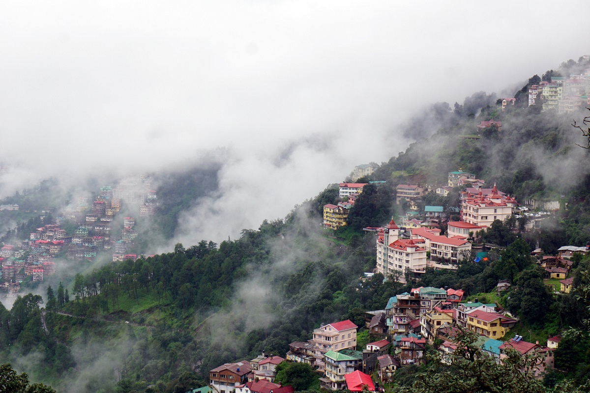
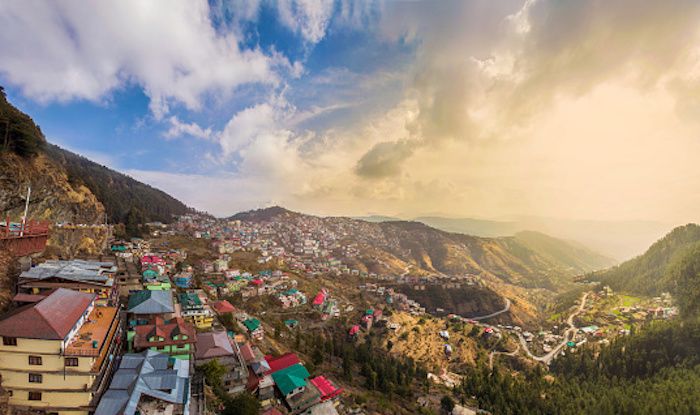
In this part, some of the smaller towns and valleys in the state will be explored.
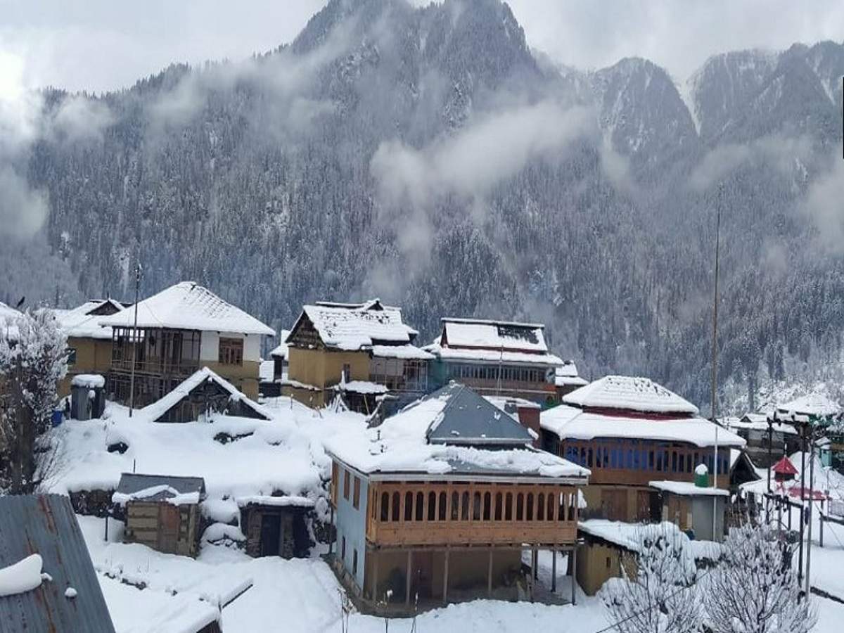
Trithan Valley
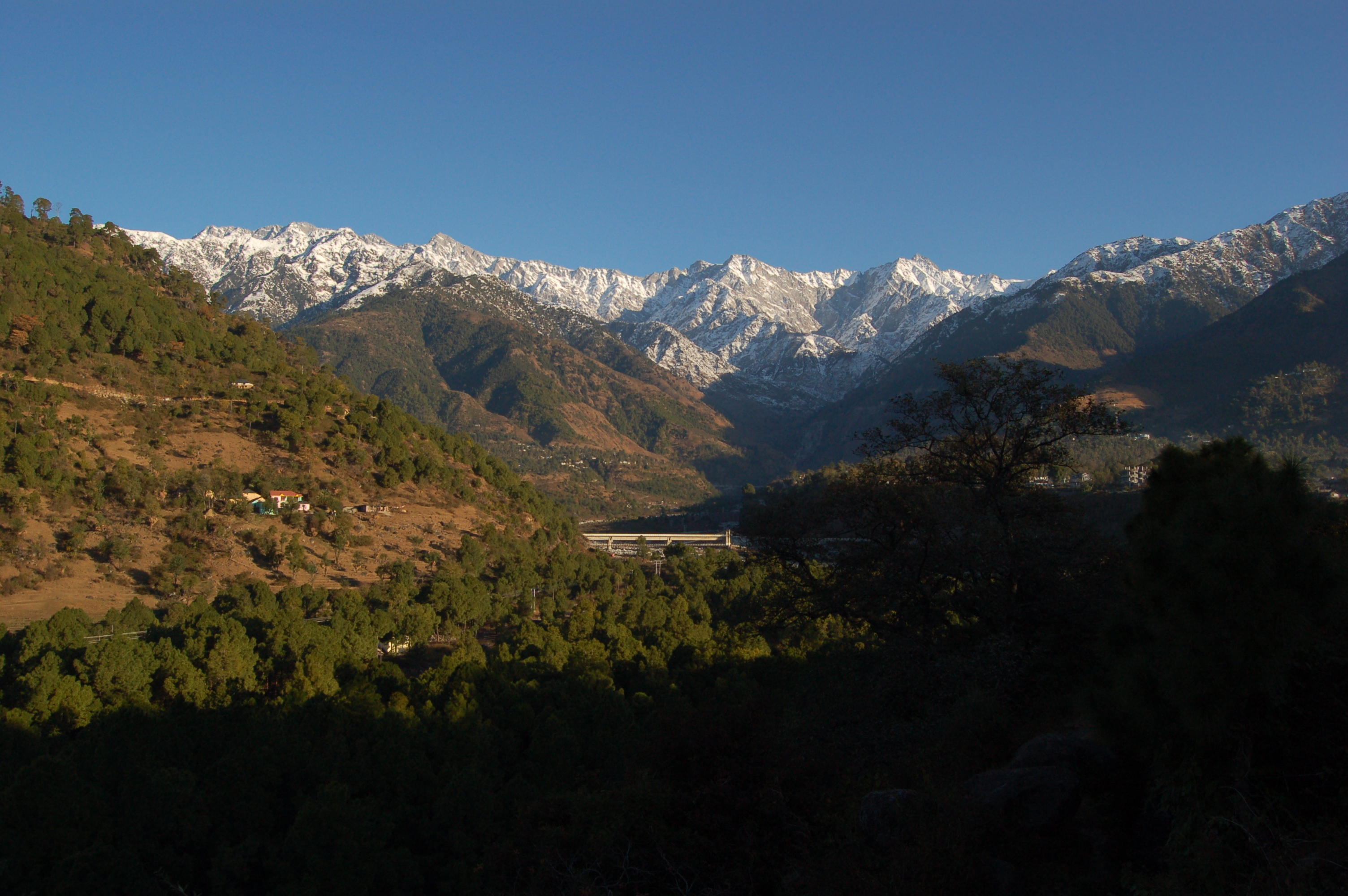
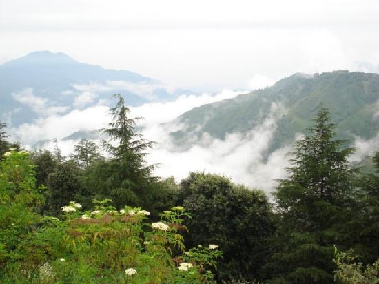
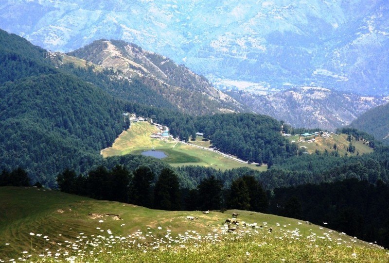
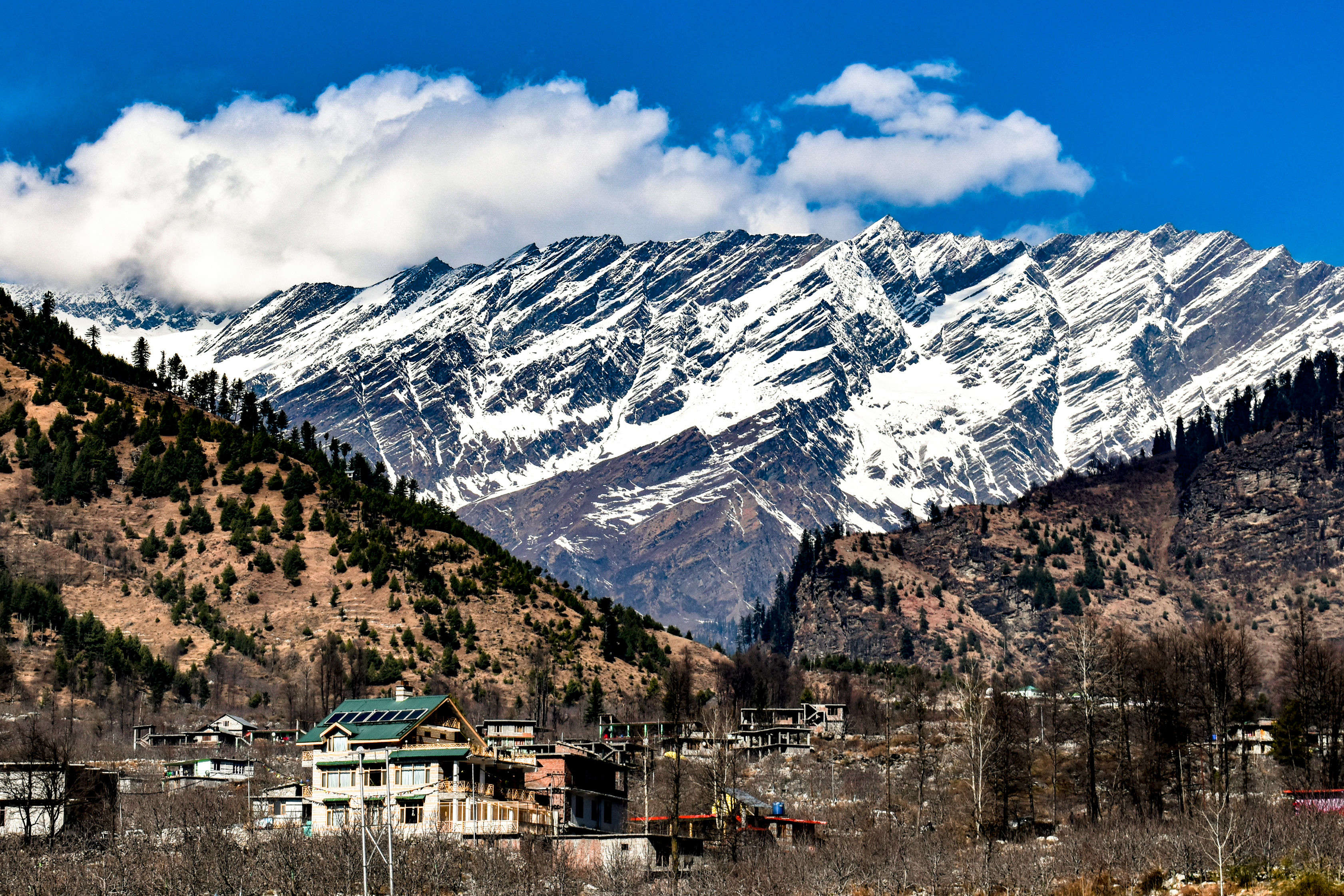
Tirthan Valley is perched at an altitude of 1600 metres above sea level and derives its name from the Tirthan river flowing through. It lies around 3 km from the entrance to the Great Himalayan National Park and is a paradise for nature lovers besides having an abundance of adventure activities. The valley is best known for its trout fishing, trekking, and adventure activities and beautiful guesthouses set in nature. A major attraction of the valley, the Serloskar Lake is located about 5 km from Jalori Pass with the walk to the lake is enchanting with a thick cover of oak trees at an altitude of 3,100 metres and is believed to have medicinal properties. The place is better known for its temple devoted to Goddess Budhi Nagin and it is believed that the Goddess has a hundred sons and acts as a guardian of the place and the trek to the lake is a moderate one.

The Great Himalayan National Park is a national park which is surrounded on three sides by the Himalayas and is home to diverse wildlife species. Instituted a national park in 1999, today it is home to more than 375 species of fauna, 31 species of mammals and 181 species of birds. The culture inside the park is unique with each village having a deity of its own with some fairs organised during April, May, August, and September. A permit is needed to visit the park and the park provides trekking facility to visitors for which the Kullu Valley is the starting point. There are different levels provided for trekking ranging from easy to moderate hikes, moderate to tough and strenuous treks. Moderate day-long treks to difficult multi-day treks are organized on all the four valleys of the park including Tirthan, Jwar Nala, Parvati and Sainj. It is compulsory for the tourists to seek prior permission from the park officials for the treks held at different days. The parj is open between 10 am and 5:30 pm and needs about three to four hours to cover. Entry fees for Indians is INR 50, for Indian students it is INR 30 and foreigners pay INR 200 while foreign students pay INR 100. Camping charges for a two person tent per day is INR 100, while it is INR 150 for a three person tent per day and INR 200 for a four person tent per day. For more than four persons, it is INR 500 per day while the toilet tent will set one back by INR 100 per tent per day. Trout fishing in the crystal clear Tirthan river, a tributary of Beas is a favourite angling spot for visitors. The river is filled with brown and rainbow trout and has many anglers who come here especially to fish.

Bhuntar
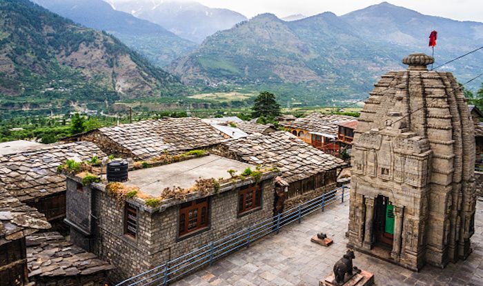
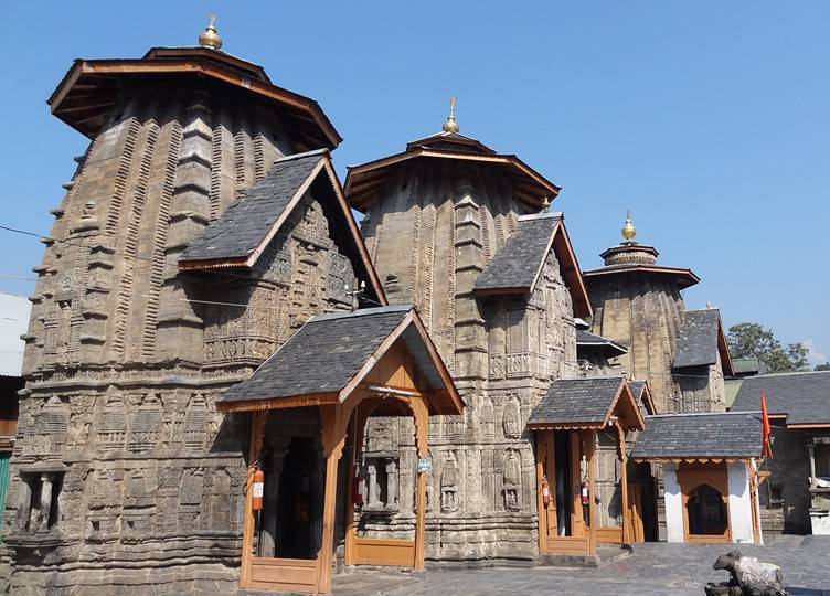
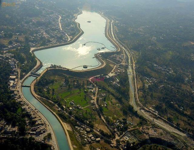
A town used a gateaway to Kullu, Manali, Kasol and Manikaran, Bhuntar is where Kullu’s airport is located. It is at the confluence of the Parvati with Beas rivers where the Parvati Valley runs eastwards, through a steep-sided valley towards Kasol and Manikaran. A quaint little town, it is perfect for those who prefer to visit less touristy places. Bhuntar has a quaint serenity to it and is surrounded by lush greenery and temples with splendid architecture. The Basheshwar temple is said to have been built by the Pandavas and is a beautiful temple with stone carvings everywhere which are very detailed and awe-inspiring. Easily distinguished by the flat shaped shikaras, it is the biggest of the temples in the Kullu Valley. Located just 3 km away from Bhuntar, amidst lush green mountains, the Jagannath Temple, at a height of around 5,000 ft. above the sea level is dedicated to Lord Jagannath. The Bijli Mahadev temple is located at an altitude of 2460 m on a hilltop across the Beas river. As its name suggests, it is dedicated to Lord Shiva and it is said that the temple houses a Shiva linga which was broken into pieces by lightning, that was brought back together and bound by a temple priest using butter. It is said this happens each year and locals the priest use cereal and pulse flour with unsalted butter on the broken pieces to restore the linga back to its original form. There are various sources as to the lightning strikes and locals believe the lightning strike is divine grace and the deity wants to protect the inhabitants from evil and some believe the lightning is a form of the deity with supernatural powers. The temple has to be reached by a 3 km trek through long path covered with pine trees and has stunning mesmerizing views of the surrounding valleys.

Sainj Valley
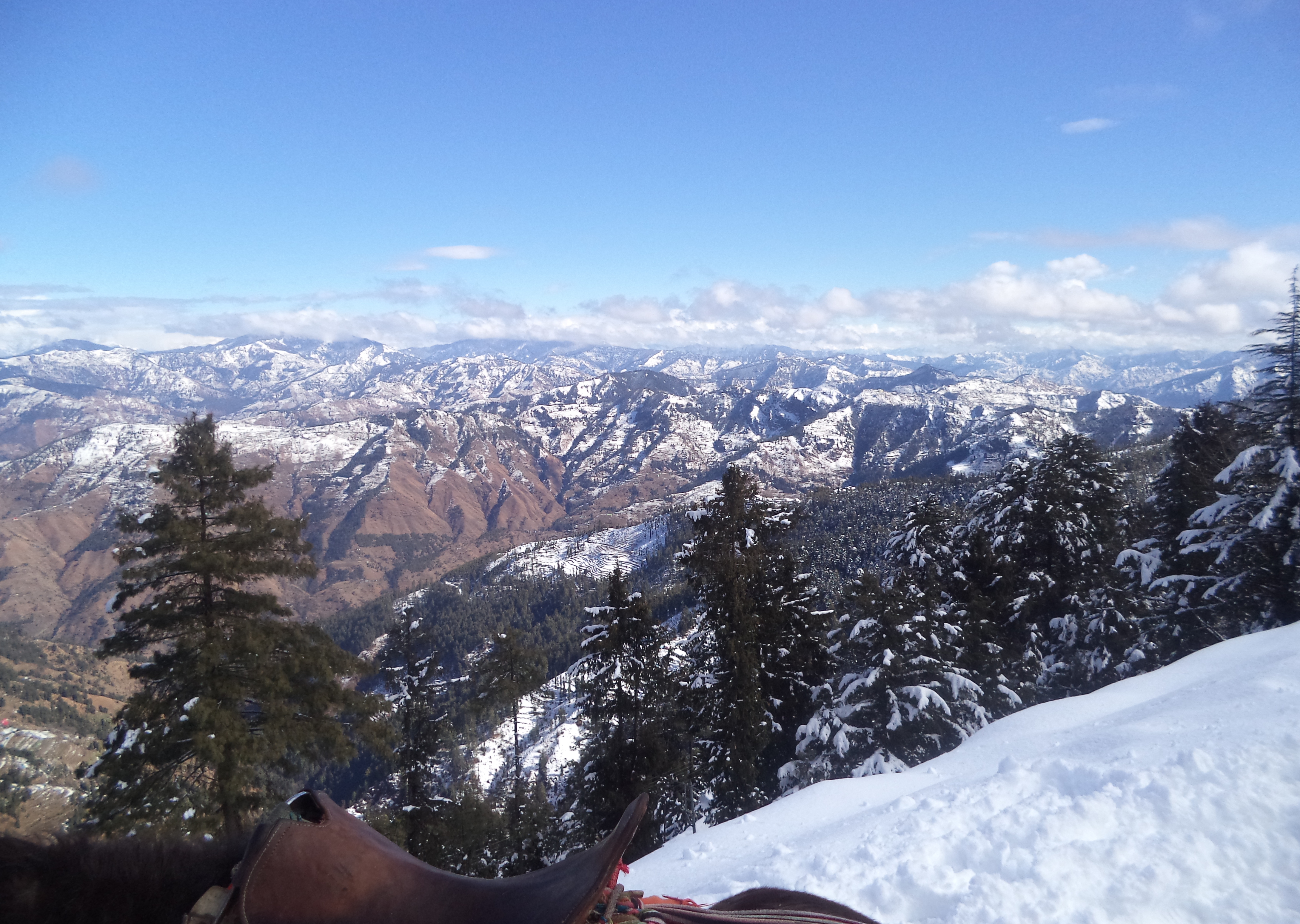
Not widely popular and located at the lower areas of the Great Himalayan National Park, Sainj Valley, along with the Tirthan Valley, forms the Great Himalayan National Park, a UNESCO World Heritage Site today. The Shangchul Mahadev temple, located in Shangarh, sits majestically on an expansive meadow. The main temple, a multi-storeyed building with intricate wooden carvings was gutted in a fire in 1998 but was soon restored. Smaller temples are scattered all around the place, with many stories woven around them. The Shangarh meadow is more beautiful than the more frequented Khajjiar and a visit here while in Sainj is a must. The Pundrik Rishi lake remains dry today, but is filled with countless beliefs and stories and one is not supposed to touch the waters of the lake. Shanshar is a village which has the Manu temple, believed to be hundreds of years old, built in the Pagoda style as well as another dedicated to Manu at Talyara village, which opens up to a view of the far-reaching valley and mountains of the national park. Other temples include the Ashapuri and the Budha Narayan temples which are built of stone and wood and have a gabled roof, reflecting the art and architecture of the region. Beginning at Neuli, the Raktisar Trek is a riverside trek that goes up to Raktisar, where the river Sainj originates. A seven day trek to cover 92 km, the best time to do the trek is between April and June or October and November. Another favoutitr trek is the one from the Sainj valley, the Tirthan valley through dense forests and streams with loads of walnut trees and medicinal plants. This trek, which take around either to nine days to cover is for experienced trekkers and offers a transition from one valley to another. The Jiwa Nala trek takes one amidst dense forests and lakes, with overarching views of the Himalayas. During this trek, one will come across two passes, the Kandi Galu at 3,700 metres and the Phangchi Galu at 4,700 metres and will take nine days. A permit is required to undertake this trek and permits can be got from the Great Himlayan National Park office at the Sainj village. The Lapah to Shumga trek is by far the most difficult one as it takes one to the highest altitude here at 12,500 ft with sceneries ranging from meadows to jungles to open landscapes with mountains bordering the way. Beginning at Shangarh, there is a defined trail up to Lapah, where one can set up camps and then the path leads one into thickets before arriving at Shumga. For a novice trekker, there are shorter trails available.

Barot
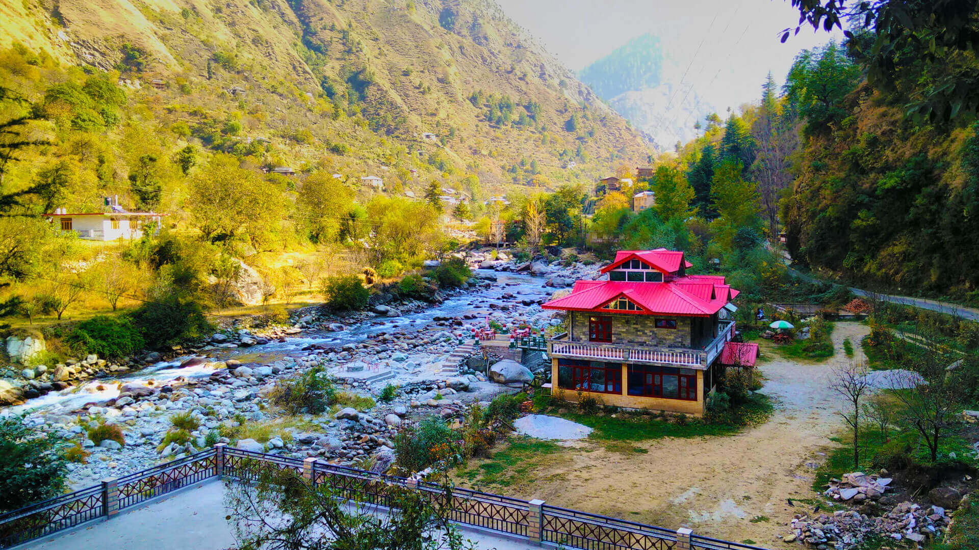
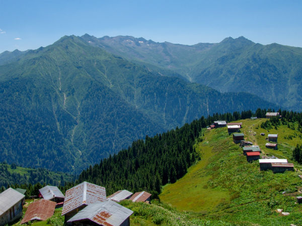
Barot is a beautiful village located in the serene valleys of Mandi about 67 km from Mandi. The scenic landscapes are captivating, and the unpolluted air is famous for its numerous trekking trails.An unexplored and unexploited landscape, it came into limelight when the Shanan Hydroelectric Project was proposed around 1920. The project was to utilize the hydroelectric potential of the river Uhl. The forests around the village are mostly Deodar and Oak that grow in abundance and is home to a variety of flora and fauna. Fishing in the river Uhl is popular because of a trout breeding centre which makes it a perfect place for angling with over 30 km of the river used for this purpose. Across the River Uhl is the Nargu Wildlife Sanctuary which is a great picnic spot and home to a variety of flora and fauna. There are numerous trails around the Barot valley with the Barot Himri Trek along the mule trail quite famous and during winters, many visit Barot for snow trekking. Astronomy enthusiasts visit Barot to get stunning views of the night sky since the village is far away from city lights and located in the midst of a valley.

Bir Billing
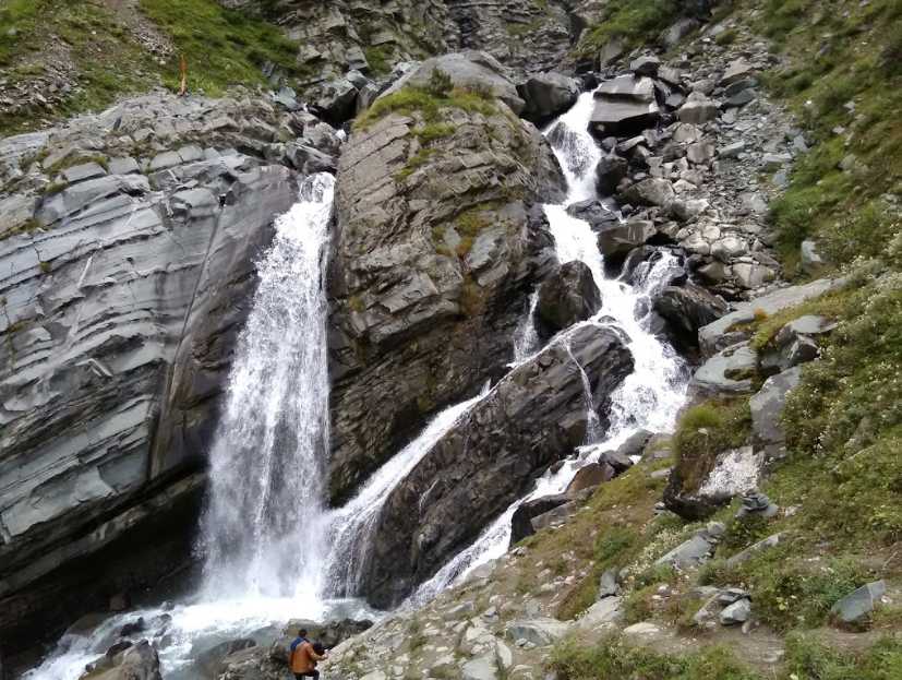
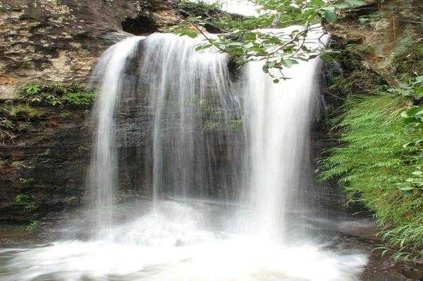
A small town, Bir is named after Birsen the ancestor of the Sen dynasty and ruled by the Pal dynasty of the Chandarvanshi lineage. The town is known for the adventures sports like paragliding, treks and also as the town for meditation because of the influence of the Tibetan culture. One of the best spots in the world for paragliding, the take-off site in Bir is called Billing and the landing site is Bir and the overall altitude change is around 800m. Visitors can also go for short hikes, visit the monasteries, take a ride in the nearby Jogindernagar-Pathankot Narrow Gauge train or just spend a day at the tea gardens. In 1966 the third Neten Chokling, an incarnate lama of the Nyingma lineage of Tibetan Buddhism, brought his family and a small entourage to Bir and with the help of foreign aid, purchased over 200 acres of land and established a Tibetan settlement where 300 Tibetan families were given land to build houses. Chokling Rinpoche also started building a new Neten monastery and disciples who had followed him into India formed its first sangha. The Chokling Monastery or Pema Ewan Chogar Gyurme Ling Monastery is one of the main attractions of Bir and t houses a grand and colossal stupa as well as an enthralling statue of Padmasambhava. The monastery is divided into a passageway, a temple and a prayer hall. The Palpung Sherabling monastery located at Keori near Bir, is a religious centre of eastern Tibet that offers Buddhist studies and other forms of living art and culture along with Periodic courses in Buddhist meditation and philosophy. The monastery is divided into an old and new structure which creates a confusion amongst visitors as the two lie at quite a distance from each other and is one of the branches of Palpung Monastery of Eastern Tibet, Palpung which means glorious union of study and practice. The monastery complex has a school, college and university. The monastery houses an enormous stupa of Maitri Budh, the one who is yet to come. The Lamas perform the Mahakal Lama dance on certain days. The monastery complex is massive and sits in the middle of the forest, at the foot of the Himalayas, surrounded by pine trees. The Gunehar waterfalls in Gunehar village, is tucked away on a hillock around 1.5 km away from Bir. At a height of 100 ft., the gorgeous waterfall can be reached through a short trek from the village with the crystal clear water cascading down the hillock a sheer visual delight. The Bir Cooperative Tea Factory is located near the Bir Bazaar Road and manufacturers the local tea of this region and offers tours of the factory.

Palampur
Nestled between the majestic Dhauladhar ranges amidst pine and deodar forests as well as tea gardens encircling the town and numerous streams pouring in, Palampur was first noticed by the British that was soon turned into a bustling town. The town derives its name from the local word palum, meaning much water. Once part of Jalandhar kingdom, the town came into being when Dr. Jameson, Superintendent of Botanical Gardens, introduced the tea bush from Almora in 1849 and since then, the Kangra tea of Palampur has been known internationally. The Tashi Jong Monastery complex has a college for freshers and a Tibetan restaurant beside the main shrine. Inhabited by the Tibetans for many years, the place has a quaint serenity about it with Tibetan artefacts sold in the crafts emporium. The hilltop temple of Chamunda Devi is one among the 51 Shakti Peethas approximately 10 km west of Palampur, on the banks of the river Baner. Chamundeshwari Devi is said to be one of the most powerful avatars of Goddess Durga and Navratri a prominent festival. The temple has engravings from the Mahabharat and Ramayana and is designed in the traditional Himachali architecture style. It is believed that the Chamunda Devi temple came into being during the 1500s when goddess Chamunda appeared in a local priest’s dream and urged the idol to be shifted to a specific spot which hosts the present-day temple. Also referred to as Raktha Kali, Charchika and Chamundeshwari, Chamunda Devi is a terrifying version of Goddess Durga or Durga Maa as locals refer her. It is said that a corner within the temple has the footsteps of the goddess on a rock and the temple has a staircase in marble that leads downwards to a Shiva cave, where the Lingam is worshipped. The Shiva temple here, known as Nandikashwar Mahadev. Palampur is known as the tea Capital of northern India and is famous for its vast spreads of lush tea gardens. Tea was introduced in the 19th century and since then Palampur has become quite famous for its speciality teas, especially Kangra Tea. The first tea plantation was started in Palampur by Dr Jameson, the Superintendent of the Botanical Gardens, North-West Frontier Province. Today, the tea gardens cover an area of 1,000 hectares and produces 8,50,000 kgs of tea every year. The tea plantations are open from 10:30 am to 12:30 pm and then again between 1:30 to 4:30 pm. The Saurabh Van Vihar is a nature park dedicated to a soldier Saurabh Kalia, a martyr in the Kargil War located on the banks of the snow-fed Neugel Khad in the village of Kwat and is spread over a total area of 13 km. Saurabh Van Vihar is located 4 km from Palampur and offers a panoramic view of the Dhauladhar range and is home to a wide variety of plants, trees and birds. The park is open between 9 am to 7 pm and has an entry fee of INR 10. A picnic spot located 2 km away from town, Neugal Khad is a beautiful place to enjoy nature’s beauty. People watch at the Neugal cafe which is maintained by the government. The most popular attraction in Palampur is experiencing a toy train ride which is also a UNESCO World Heritage Site. The train commutes between Palampur and Pathankot and takes one on a hilly ride amidst lush green forests, shimmering waterfalls and across meandering rivers. While one will definitely enjoy the picturesque vistas enroute, they will also cross rural villages and witness the rural way of living in the hills.

Kasol
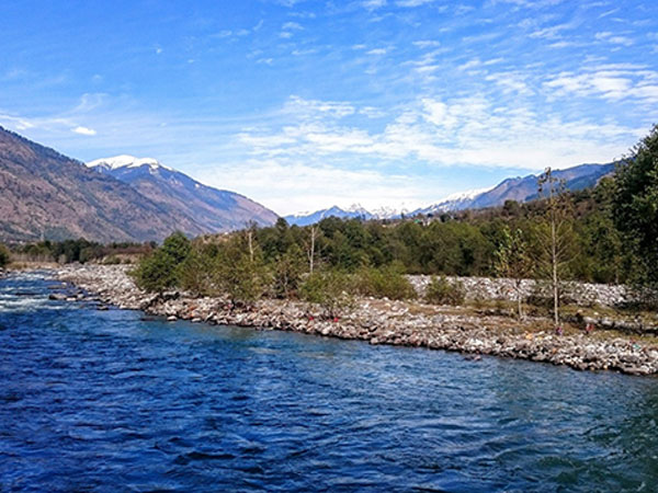
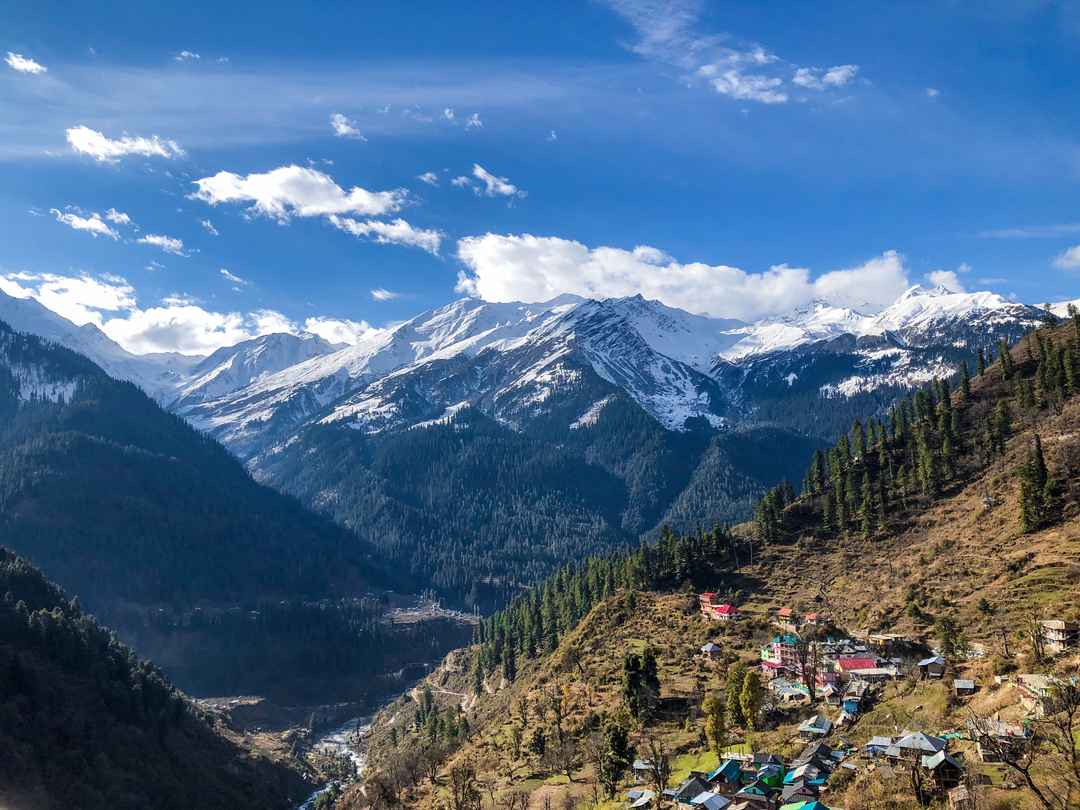
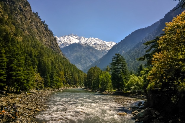
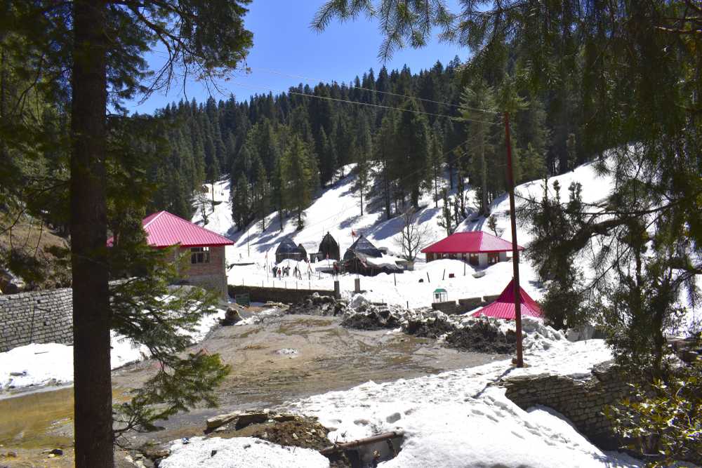
A quaint little village on the banks of the Parvati river, Kasol is popularly known as the Amsterdam of India. Kasol is 23 kms from Bhuntar and next to Manikaran and is famous for its trekking trails. Also known as Little Israel because of a large number of people from Israel, Kasol has few streetside cafes and sitting there and enjoying a meal amidst the dark green forests and the awe-inspiring mountains make the meal even more enjoyable. The Parvati river flows through the Parvati Valley with the thundering river originating from the Man Talai glacier, flowing north of Parvati Valley and eventually flowing into the Beas River near Kulu. Kheerganga is a tiny village with the Kheerganga Waterfalls a small stream of cascading water from the rocky hills on the side, en route to Kheerganga amidst the backdrop of beautiful green hills and lush greenery and is a popular stopping point in the Kheerganga trek. A little further from Kasol is the village of Chalal which is situated at an altitude of over 5300 feet and a 30-minute trek from Kasol and is favoured by backpacker and trekkers. Rasol is located at 10,000 feet above sea level with breathtaking views of the snow-capped Himalayas. Rasol is a three to four hour trek from Kasol with Chalal the starting point of the trek. The village temple is devoted to Jamdagini Rishi, an incarnation of Lord Vishnu. The villagers offer prayers to their deity, but if outsiders enter the temple premises, they are fined INR 2000. Located 3 km from Barsheini, Pulga is located amidst denser deodar trees, waterfalls and apple orchards and is known for its scenic beauty and wooden homestays and is only accessible on foot. Kheer Ganga at 3050 meters lies at the extreme end of the Parvati valley and the last inhibited village while trekking to Pin Valley via the Pin-Parvati pass. Kheerganga has a hot water spring, a small temple of Lord Shiva and a bathing tank. The Pin Parvati Pass is the perfect destination for the trekkers seeking a challenging adventure and is an amazing Trans Himalayan trek of approximately 110 km. The trek is not really well defined but get worse during the monsoon season. Blessed with diverse terrain and rich in nature’s beauty, the Sar Pass Trek is the perfect trek destination for beginners which passes through thick forests, lush green meadows, rustic villages, and snow clad mountains in the backdrop.
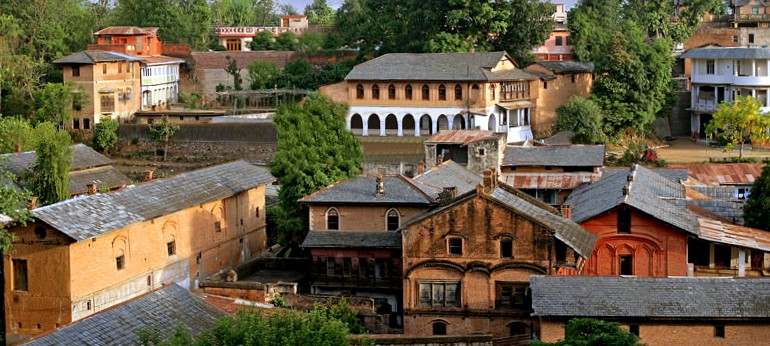
Naggar
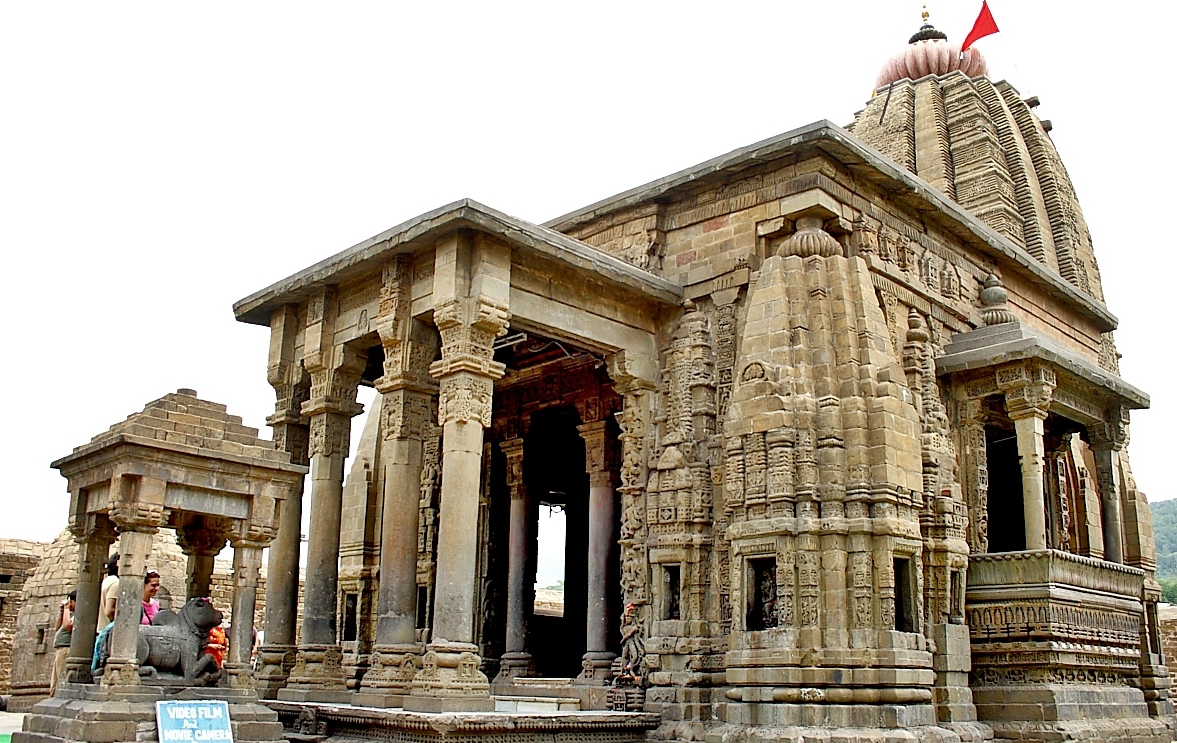
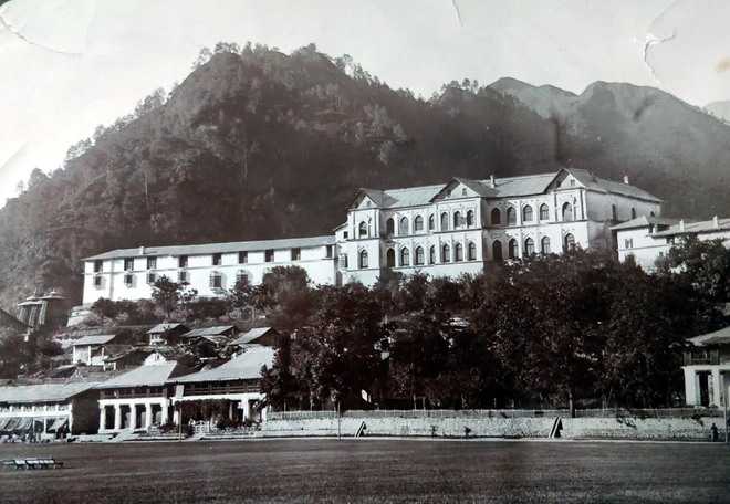
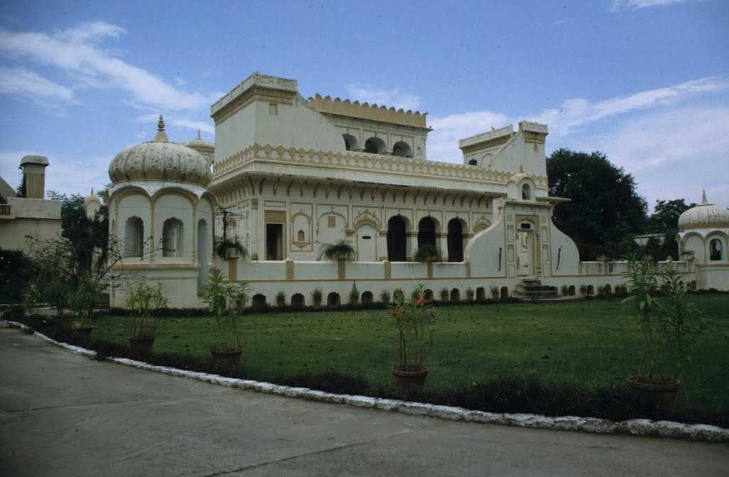
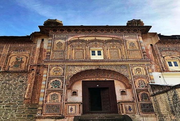
Set against the backdrop of majestic hills and the clear and pristine Beas River, Naggar is home to the Naggar castle, once the residence of Raja Sidh Singh of Kullu. Situated on the left bank of the river Beas at an altitude of 1,800 meters, Naggar is an ancient town and was once capital of the Kullu kingdom and was founded by Visudh Pal and remained as the capital until that was moved to Sultanpur by Raja Jagat Singh. Naggar Castle, the official seat of kings for centuries. was built by Raja Sidh Singh more than 500 years ago. According to a legend, he used stones from the abandoned palace or Gardhak of Rana Bhonsal to build the castle. Labourers were ordered to form a human chain over the Beas river to transfer the stones manually. The castle is a unique blend of the western and Himalayan styles of architecture. The castle, which is open from 7 am to 10 pm daily survived the earthquake of 1905 even though most houses in the valley and the nearby city of Jawa were completely ruined. The castle also houses a temple in the courtyard known as the Jagtipatt temple which has alternate slabs of deodar timber, making it an earthquake resistant structure. Naggar castle was taken over by the Himachal Pradesh Tourism Development Corporation (HPTDC) in 1978 to be run as a heritage hotel and has an entry fee of INR 15 per person and a camera fee of INR 25. The Russian painter and explorer Nicholas Roerich who settled in Naggar in the early 20th century has a two storied house, the Roerich Estate which today is a museum and features a collection of his popular paintings. The Gauri Shankar temple located just below castle is dedicated to Lord Shiva was built in the 11th century and is said to be the last structure of the Gurjara-Pratihara traditions. The temple has stone carvings with the stunning medieval architecture. A unique temple, the Tripura Sundari temple, built completely of deodar wood, is host to a rather unique practice, where every Baisakh, it receives the shrouds of dead bodies as clothes for the goddesses. The Chamunda Bhagati temple in Nishala village is surrounded by some of the most beautiful sceneries in the region. The Dagpo Shedrupling monastery is a recent addition built in 2005 with breathtaking views dedicated to His Holiness the Dalai Lama. Originally established as a research institute in 1928 by the Russian Professor Nicolas Roerich with the aim of creating an intellectual environment where research on Tibetan and Indian medicine could be carried out, the Uruswati Himalayan Folk Art museum is located 100m uphill from the Nicolas K. Roerich Art Gallery. The name Urusvati which means the light of the morning star was named in 1993 and the museum is based on Russian folk art and houses various musical instruments and stone carvings made by Roerich himself. The Roerich Art Gallery and Estate houses a good collection of Roerich’s art, his car and the house where he stayed. Located at slightly secluded location and not far from the Naggar Castle, the estate a nice forest area or garden with a large number of deodar trees and a great view of the peaks around.
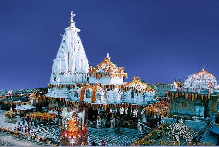
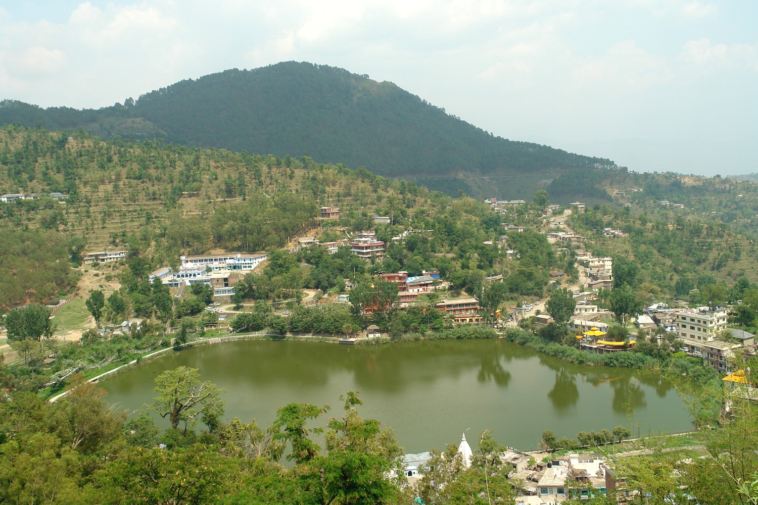
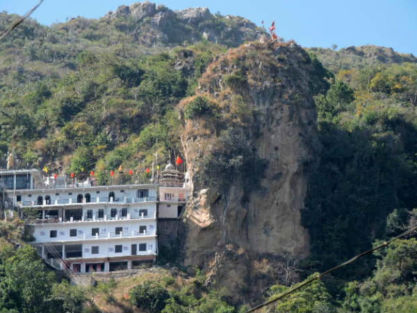
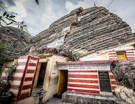
Source

Manikaran Sahib
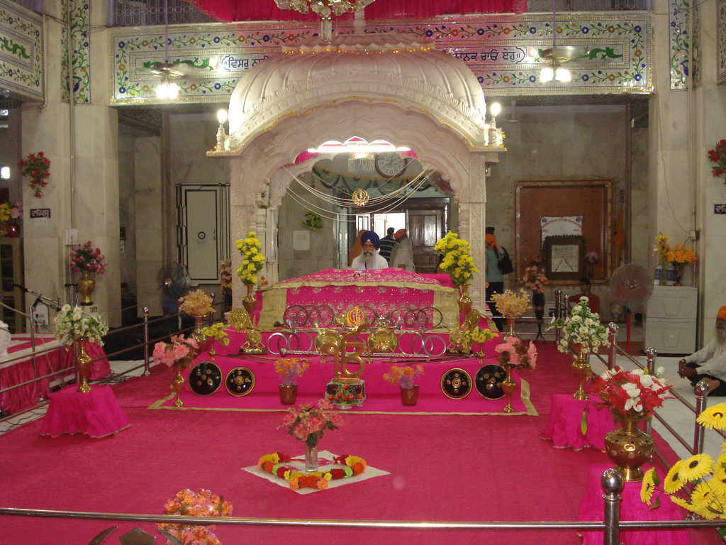
Located at a distance of 4 km from Kasol at an altitude of 1760 m along the banks of river Parvati, Manikaran is known as a famous pilgrimage destination for both Sikhs and Hindus. There are three hot springs where one can take a bath, one being inside the Gurudwara itself and the other two privatised by guesthouses. The water in these springs contain sulphur capable of curing diseases. The water is hot enough to prepare food by directly placing the vessels and is served as langar.

Hindus believe that Sage Manu recreated human life in Manikaran after the flood. Another legend says that when the Lord Shiva and his consort Parvati were walking in the valley where they live for eleven hundred years, Parvati dropped one of her earrings. The jewel was seized by Shesha, the serpent deity, who then disappeared into the earth with it. Shesha only surrendered the jewel when Shiva performed the cosmic dance, the Tandava and shot the jewel up through the water. Apparently, jewels continued to be thrown up in the waters at Manikaran until the 1905 Kangra earthquake. The name Manikaran is derived from this legend as mani is jewel in most Indian languages. According to the Sikhs, during third Udasi, the founder of Sikhism Guru Nanak came to this place in 1574 with his disciple Bhai Mardana who felt hungry but they had no food. The Guru sent Mardana to collect food for the langar or the community kitchen with people donating flour to make rotis or flatbread. The problem was that there was no fire to cook the food, so Guru Nanak asked Mardana to lift a stone and a hot spring appeared. As directed by Guru Nanak, Mardana put the rolled chapatis in the spring which then sank and was told to pray to God by promising to donate one roti in his name if they float back. When Mardana prayed, all the chapatis started floating back, duly baked and the Guru said that anyone who donates in the name of God, will have his drowned items float back.

The Sri Guru Nanak Devji Gurudwara is mentioned in the Twelfth Guru Khalsa by Giani Gian Sikh. A highly revered center for worship amongst Sikhs, this Gurudwara is believed to have been visited by the Guru Nanak with his five disciples. The langar here is very big and it serves free food to disciples and the needy. A highly revered temple dedicated to Lord Shiva, the Shiva temple was slightly damaged and tilted due to an earthquake in 1905. It is said that Gods of Kullu pay regular visits to this temple. The Kulant Pith is said to be the most sacred and superior of all the piths in India. It is believed that Lord Shiva stayed here for some time. The Vishnu Kund is believed to be the purest of all the kunds and a dip into this is believed to wash away all sins. Also, locals believe that this place takes away all the anger and evil of the individuals dipping into it. Another belief is that having food boiled in the water here can take one to Vishnu’s abode in heaven. Built in the 17th century by Raja Jagat Singh, the Lord Ramachandra temple’s legend says that Lord Rama brought it from Ayodhya. The temple is famous for its idols of Lord Rama and Goddess Sita and is located in the center of the city with three halls and 40 rooms for devotees who visit. The hot springs in Manikaran Sahib contain uranium and other radioactive elements and is believed to cure diseases. The water in these springs are extremely hot, so much so, that one can even boil rice in these. The town of Manikaran is surrounded by the snow-capped mountains of the Harinder mountains to the north with breathtaking views from the town.
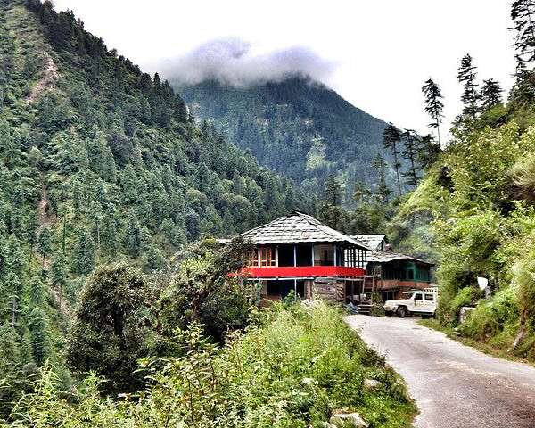
Tosh
Popular for its cannabis plantations and located at the far end of the Parvati Valley at 2,400 m in elevation, Tosh is untouched by modernisation and the fast-paced life. With its gradual terrain and the waters of river Parvati flowing through the village, the Tosh Kasol trek is the go-to trek for adrenaline junkies. The best time to visit Tosh is between April to October, though it has a pleasant weather throughout the year. The period from November to February sees the whole village covered in snow and can be a good time to visit to experience the freezing cold and snow. Tosh is the place one comes to just chill and enjoy the peaceful surroundings for a laid back holiday. In the centre of the village, there is a temple of Jamdagni Rishi which is opened only once a year during January or February. The temple has a long verandah which provides a breathtaking view of the surrounding snow-capped Himalayan ranges.

Parvati Valley
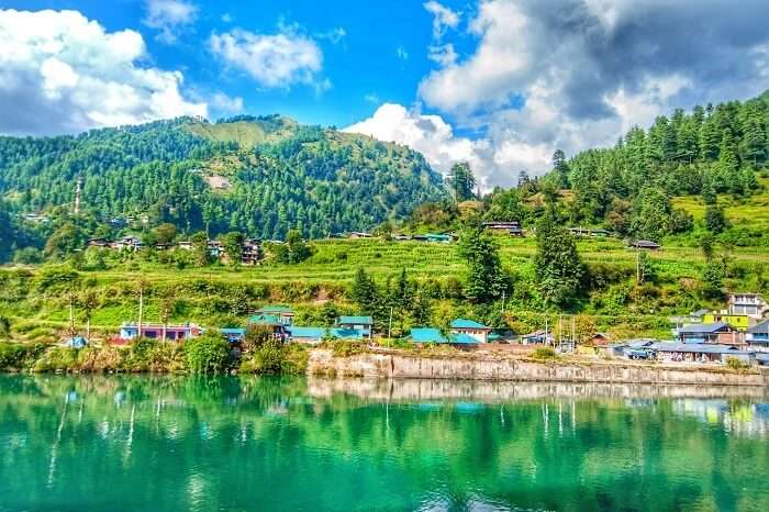
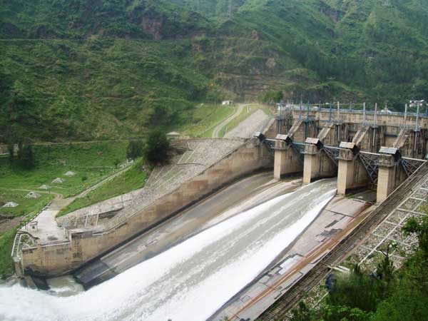
Running along the various destinations in the state, the precipitous and stunning Parvati Valley is famous for backpacker hangouts and adventure activities. From the confluence of the Parvati River with the Beas river, the Parvati Valley runs eastwards, through a steep-sided valley from the town of Bhuntar. The Parvati River is joined by many smaller tributaries along the way that result in many beautiful cascading waterfalls. A clear-view of the Himalayas greet visitors as they indulge in trekking, camping and river rafting. The precipitous valley road climbs past a side valley leading to the village of Malana near Kasol. From here, the road passes through the pilgrimage town of Manikaran and terminates at Pulga, where the construction of the Parvati Hydel Project, a hydroelectric dam, dominates the landscape. From Pulga, the footpath climbs to a temple and small dhaba at the Rudra-Nag waterfall, apparently after its resemblance of a water snake. Beyond the Rudra-Nag waterfall, the trail ascends further through thick pine forests to Kheerganga where Lord Shiva is said to have meditated for 3000 years. From Kheerganga to Tunda Bhuj village at 3285 m, the Parvati Valley cuts a steep-sided gorge through the mountains and as the altitude increases, the thick, coniferous forest gradually makes way for patches of meadowlands scattered with boulders. Several tributaries join the main Parvati river and numerous waterfalls cascade down the steep valley sides. Beyond Tunda Bhuj, the conifers continue only as far as the Basuki Nal tributary but groves of silver birch continue to line the valley, quickly becoming sparse as the altitude increases. At Thakur Kuan village which is at an altitude of 3560 m, the Parvati Valley meets the valley of the Dibibokri Nal river which is a tributary of the Parvati River, which then climbs towards the northeast to the Dibibokri Glacier and the Dibibokri Pyramid mountain peak at 6400 m. The area is characterised by abundant alpine flowers and rocky outcrops glittering with mica. Beyond the Thakur Kuan village, the Parvati Valley ascends gradually to the Pandupul village where two natural, rock bridges cross the Parvati River and a southern tributary. According to legend, these bridges were created by the massive strength of the Pandava brothers. From Pandupul, the wide valley of the upper Parvati valley climbs gradually through the wide, high-altitude meadowland of Odi Thatch to the sacred site of Mantalai Lake at 4100 m, the source of the Parvati River. Continuing east from the Mantalai lake, it is possible to cross the Pin Parvati Pass at 5319 m into the Pin Valley National Park and on to the Mudh village in the Lahul and Spiti district.

More absolutely stunning locations from Himachal coming your way in the next part…

Travel Bucket List: India – Himachal Pradesh Part 3

In this part, we visit some more of the beauties of the state.

Kangra
Historically known as Nagarkot, Kiraj and Trigarta, Kangra was founded by the Katoch Kshatriya Rajputs of the Chandervanshi lineage. Another ancient name of the city is Bhimagar and it was supposedly founded by Raja Bhim, the younger brother of the Kuru Emperor Yudhishthira from the Mahabharata. Kangra is also known for the backdrop of Dhauladar range, ancient temples and endless tea plantations. Repeated mentions of the valley in holy Hindu texts, showcase Kangra as Devbhumi or Land of the Gods. Kangra is a composite word made out of Kaann, meaning ear and gaddha which means creating or molding. The British archaeologist and historian Alexander Cunningham documented and brought to light the tradition and science of Kangra plastic operations. Although, modern plastic surgery uses the same techniques as the ancient techniques developed in South India, for north Indians Kangra’s own unique methods were more popular and accessible.

A beautiful and picturesque lake, the Kareri Lake is known as Kumarwah Lake and is a shallow, freshwater lake that is situated to the south of the Dhauladhar range. Located at an altitude of 2,934 metres above the sea level, Kareri Lake is a popular trekking destination and is frequented mostly by the Gujjars and Gaddis who reside in the nearby villages because of the extensive pasturelands that the lake houses. The lake also boasts of beautiful clusters of dense conifers and different kinds of colourful perennial flowers. The snow melting from the Dhauladhar range serves as the water source for this lake, and the pristine water from the lake then outflows in the form of a stream known as Nyund. One of the major attractions near the Kareri Lake is an ancient temple that is dedicated to Lord Shiva and Shakti located on a hilltop overlooking the breathtakingly beautiful lake.

Situated on the outskirts of the town, the Kangra Fort traces its origins to the ancient Trigarta Kingdom, mentioned in the Mahabharata. It is the largest fort in the Himalayas and probably the oldest dated fort in India. Though the tales of treasures are nothing but stories at this ruined fort, there was a time when the sanctum sanctorum of the Kangra Fort held unimaginable riches which were offered to the large idol in the Brijeshwari temple inside the fort. And perhaps because of these treasures, this fort has been attacked many times with almost every ruler, be it an invader or a native ruler have tried to lay control over the Kangra fort. After Emperor Jahangir captured the fort in 1622, it was Raja Sansar Chand II who finally succeeded in recovering the ancient fort of his ancestors from the Mughals in 1789. It was then handed over to the British occupied by them until it was heavily damaged by the earthquake of April 4, 1905. The fort is open from 9 am to 5 pm every day and Indian visitors pay INR 150 and foreign visitors INR 300 as entry fees.

Spread over a 15-acre forested land surrounded by tea gardens, the Taragarh Palace is situated at the height of 1000 meters at the foot of the Dhauladhar Mountains with splendid views of the peaks covered in snow. This picturesque residential property belongs to the royal family of Jammu and Kashmir and was earlier known as Alhilal meaning the land of the crescent moon. It is a hotel currently and the personal summer residence of the Nawab of Bahawalpur and was constructed in the European-style of architecture with greenery all over in the form of gardens along with a glass pavilion and a mosque. Its name was later changed to Taragarh after the wife of Hari Singh of Kashmir Maharani Tara Devi took over the property in 1950 and converted into a hotel in 1971. The hotel showcases a lot of portraits of the Dogra Royal Family, with Italian marble, chandeliers and tiger skins. After the Nawab of Bahwalpur decided to move to Pakistan, the vast property went to the government of Punjab, who sold it to Tara Devi of Kashmir. The glass exhibition area was converted into a temple and renamed Taragarh. The palace has an entry fee of between INR 4000 to 5000.

Built on the Beas River the Pong Dam is an earthfill reservoir constructed for generating hydroelectricity and irrigation. Constructed in 1975, the dam is based on the foothills of the Shivaliks and is known as the Beas Dam. The area surrounding the dam boasts of rich wildlife and is a breeding ground of commercially viable fish. The reservoir behind the dam, also known as Maharana Pratap Sagar is home to a large number of birds and has been converted into a Bird Sanctuary. The surrounding dense forest cover is a natural habitat for several flora and fauna species which adds to the natural beauty of the place. The region has been declared as one of the 27 international wetland sites by the Ramsar Conventions owing to its rich wildlife and vegetation cover. The sanctuary is home to several species of avifauna some of which include Barheaded Geese, Red-neck Grebe, northern lapwing, common teal, spot-billed duck, Eurasian coot, black stork, egrests, among others. Sprawling over an area of over 240 kms, the lake is also an important fish reservoir which acts as a fish breeding ground for commercial purposes.

The Baijnath Temple is dedicated to Lord Shiva who is worshipped as the God of Healing. Baijnath or Vaidyanath is an avatar of Lord Shiva, and in this avatar, the lord rids his devotees of all miseries and pain. The water of this temple is believed to have medicinal value and the potential to cure several illnesses and diseases, drawing thousands of devotees from all around the world every year. Built in 1204 by two local merchants, Ahuka and Manyuka at a distance of 16 kms from Palampur, it is one of the few temples in India where both, Lord Shiva and the demon King Ravana are worshipped. According to ancient scriptures, Lord Shiva established 12 jyotirlingas, pillars that emanated pure light and unencumbered power, across the country as a challenge to Lord Vishnu and Lord Brahma and one of these 12 jyotirlingas rests inside the Baijnath Temple. Set against the backdrop of the Dhauladhar Range, the temple have amazing views. The temple’s architecture hints of an early medieval North Indian style which is popularly called as the Nagara style. There are two entrances, north and south and a vast vestibule in the middle with balconies on either side known as the Mandap before which is a small porch that is based on four columns where the mount of Lord Shiva, Nandi rests. The inner sanctum, where the Shivaling lies, is surrounded by walls that are speckled with artistic drawings and paintings. The history of the temple is inscribed on the stone walls of the complex with inscriptions indicating that before the present temple, a shrine of Lord Shiva rested on the same spot. The temple is open between 6 am and 9 am daily.

The Brajeshwari temple reverberates with mysticism, mainly because of its architecture. It is highly advisable to make it for the Aarti as this temple is one of the 51 Shakti Peeths of India. This temple was one of the oldest and wealthiest in northern India but was destroyed, together with the fort and the town, by the 1905 Kangra earthquake on 4 April 1905. The Jwala Devi temple is dedicated to Jwala Ji, a Hindu Goddess depicted by a set of eternal flames. One of the Shakti Peethas, it is believed that the tongue of Goddess Sati fell where the Jwala Devi Temple is located. A temple with no idol, the five aartis conducted at Jwala Devi Temple are the main attraction. It is believed that the Goddess resides in the holy flames of the temple, which miraculously burn day and night without any fuel. The flames represent the nine forms of Goddess Durga, namely Mahakali, Annapurna, Chandi, Hinglaj, Vindhya Vasini, Mahalakshmi, Saraswati, Ambika and Anji Devi. The Goddess is offered the sweet Rabri. Located 1 km from the temple is Jwalamukhi Cave which previously had three openings but today only has one and is filled with the water of a spring. The temple is open from 5 am to 10 pm during summer and from 6 am to 9 pm in the winter months.

The hilltop temple of Chamunda Devi Temple is one of the Shakti Peeths, on the banks of river Baner. Chamundeshwari Devi is said to be one of the most powerful avatars of Goddess Durga with the Navratri festival a prominent festivity of the temple. The temple has engravings from the Mahabharata and Ramayana and is designed in traditional Himachali architecture. It is believed that the temple came into being during the 1500s when goddess Chamunda appeared in a local priest’s dream and urged the idol to be shifted to a specific spot which is the present-day temple. Also referred to as Raktha Kali, Charchika and Chamundeshwari, Chamunda Devi is a terrifying version of Mother Durga and it is believed that Goddess Durga created another goddess with immense power and strength to destroy the demons, Chanda and Munda. Upon destruction, the goddess was then named Chamunda Devi, or the one who triumphs over evil. During the summer months, the temple is open from 5 am to 12 noon and then again from 1 to 10 pm. During the winters, it is open from 6 am to 12 noon and then between 1 and 9 pm. The ancient temple of Kaleshwar Mahadev is also dedicated to Lord Shiva with the main attraction being the Lingam which is placed at ground level and the temple is adorned with beautiful sculptures.

Tashijong is located about 5 km west of Baijnath and is famous as it is home to a small community of Drukpa Kagyud monks and refugees. The Tashijong Gompa is quite impressive and attracts a lot of people. Apart from the Gompa, most of the life revolves around carpet making, thangka painting and woodcarving.

The trek to Indrahar Pass is a fairly easy one, being the most picturesque trail starting from Mcleodganj, covering Lahesh and Triund Caves, and lasts about 14 km one way. One can easily spot the Pit Panjal range and other smaller ranges on either side. The scenic beauty of this trek is spellbinding with the peak trekking time between April to October. The Dhauladhar Range trek is one of the most visually rewarding treks. This peak is visible almost all throughout the higher altitude treks in Kangra, but this particular trek is to the north of Kangra and covers the southern outer range of Himalayas.

The Kangra Museum is dedicated to the brilliant marvels of Tibetan and Buddhist artwork and their rich history. Among the large variety of its precious collectibles are jewelry, rare coin memorabilia, paintings, sculptures and pottery. The essence of tribal culture is beautifully reflected in the exquisite pieces of art on their culture.

Known for its Sikharas which resemble the Angkor Wat of Cambodia, Masrur is located around 30 km from Kangra. These 10th century temples, however were badly damaged in the 1905 earthquake.

Pragpur is a heritage village situated near Kangra and houses the Judge’s, Court Manor. The largely unaltered village, complete with an old world charm of small red brick shops and traditional rural houses is perfect for an undisturbed village tourism option. Reputed as India’s first heritage village, visitors get pulled by its cobbled streets, the ornamental village tank and slate-roofed and mud-plastered houses. Pragpur is also the base for the famous Kangra School of Painting. The Indian National Trust for Art and Cultural Heritage are working on preserving and running the village in the same ethnic rural backdrop.

Haripur and Guler are twin townships carrying the heritage of Guler kingdom and are separated by a river which creates a wetland and home to a large number of migratory birds in winters due to the marshes and irrigated private land. Guler is situated on the other side of the town having a narrow gauge railway station connected from Pathankot to Jogindernagar while Haripur was founded in 1464 and it is the place where the Pahari Paintings known as the Kangra miniature paintings originated. The town also known as the cradle of Kangra School of Paintings came to a downfall at the end of the 19th century. Haripur comprises of old fort and water springs which are worth visiting. According to legends, Raja Hari Chand of Kangra went hunting but got separated from his hunting party and fell in a well. Everybody searched for him, but when they could not find him, the king was declared dead. After they returned to Kangra, his wives burned themselves, became sati and Karan Chand, who was his younger brother, was given the throne. Hari Chand was trapped in the well for 22 days after which he was rescued by a passerby. Hari Chand did not regain control over his kingdom but instead set up a new kingdom known as Haripur named after himself. Guler state which was founded in 1405 was a princely state which was taken over by Punjab in 1813. On the hills of Haripur, there is a ruined fort which was built by Raja Hari Chand, which is the second fort built by him after the Kangra or Nagarkot Fort as well as caves and some temples built by the king.

Khajjiar
Often referred to as the mini-Switzerland of India, Khajjiar is a small town near Dalhousie which provides visitors with a unique combination of forests, lakes and pastures. Located at an altitude of 6,500 feet, Khajjiar is known for its nine-hole golf-course which is nestled in the midst of lush greenery and a breathtaking landscape. Khajjiar is a small saucer-shaped plateau which also has a small lake and is surrounded by green meadows, dense forests and beautiful temples.

Thick deodar foliage, a plethora of wildlife, snowcapped mountains, carpets of verdant grasslands and easy on the eye streams of fresh water make up the Kalatop Khajjiar Sanctuary which is also known as the Kalatop Wildlife Sanctuary. The name Kalatop means black cap, which refers to the thick, black forest cover on the highest hilltop in the sanctuary. Situated a few km from the Chamba dam and Chamera reservoir on the river Ravi, it is known to be rich in flora and fauna. Hundreds of small freshwater streams flow into the Ravi river north of the sanctuary. The well laid out trekking and hiking trails in the sanctuary offer an experience not found elsewhere. Treks are the best way to explore the beautiful untouched forests of the park area with views of the towering Pir Panjal range from sanctuary resthouse a breathtaking sight. The sanctuary holds a great diversity of flora and fauna. There is a small adventure park inside the sanctuary, ideal for kids to have some fun time. The Kalatop Khajjiar Sanctuary has a small guesthouse located inside the premises for which one will need to make prior reservations. The summer months from March to May are the best times to visit with the post-monsoon season from September onwards pleasant. During the rule of the princely states under the British, the place was famous as the hunting and sporting grounds for the Chamba rulers. The area under the Kalatop Khajjiar Sanctuary was notified as a natural reserve during the early 1960’s but efforts to protect and preserve the pristine area was undertaken only during the 1970’s when it was declared a sanctuary. The lush oasis has always been an open forest sanctuary, meaning that there are no enclosures of any kind and animals are free to move in and out of the area.

Bharmour
Known to be Himachal’s well kept secret, Bharmour is a quaint little hilltown boasting of lush green scenery and snow clad peaks. Formerly called Brahmpura, the hill hamlet is situated at a distance of 64 km from Chamba and is known for its several ancient temples, some of which are believed to date back to the 10th century. Flanked by the Ravi and Chenab valleys and tucked in between the Dhauladhar and Pir Panjal ranges, Bharmour is sometimes called the Land of Lord Shiva as it is believed that Lord Shiva resided at the Kailash Parvat nearby. Situated in the heart of Bharmour, the Chaurasi temple complex is the highlight of the place. The huge complex houses as many as 84 small shrines in the premises dedicated to different gods and goddesses, hence the name Chaurasi. Believed to have been built 1400 years ago, the Manimahesh occupies the centre which is built in the Shikhara style. The Lakshana Devi Temple is the oldest temple in the complex and it still retains features like the wooden architectural designs and intricately carved entrance. The temple is presided by Goddess Durga in the form of four-armed Mahishasuramardini and their are carvings from Shaivism and Vaishnavism. The Manimahesh temple is situated in the centre of the complex and is considered to be the most important temple. Enshrined by a large Shivalinga, the temple is dedicated to Lord Shiva. The Narsingh or Narasimha temple also dates back to the 7th century and is enshrined by Narasimha, the half man half lion incarnation of Lord Vishnu. The Lord Nandi Bull Temple is situated right across the Manimahesh Temple and is presided by a life size metal sculpture of the bull Nandi. The Dharmeshvar Maharaj or Dharamraj temple which is presided by Dharamraj or the lord of death. It is common belief among locals that dead souls stand here to seek permission from Lord Dharamraj before departing on their final journey. The Ganpati temple is dedicated to Lord Ganesh and is built near the entrance of complex and is enshrined by a bronze statue of Lord Ganesh.

Bharmour is home to two prominent wildlife sanctuaries in the region, the Kugti Wildlife Sanctuary and the Tundah Wildlife Sanctuary. Kugti is one of the largest wildlife sanctuaries in the region situated at a varying heights of 2195 to 5040 m. The Tundah wildlife sanctuary is also situated near the Kugti Wildlife Sanctuary and is linked to it through a forest corridor. Both of these have a flourishing wildlife.

Chamba
Not to be confused with a town of the same name in Uttarakhand, Chamba in Himachal Pradesh is located at an altitude of 1,006 metres above sea level, on the banks of the ravi River, a major tributary of the Indus river, at its confluence with the Sal river. Known for the ancient temples and caves, Chamba is famous for mesmerising views of the Pir Panjal, Zanskar and Dhauladhar ranges which forms the backdrop to the town. Chamba is popular for its traditional handicrafts and art along with the miniature Pahari paintings, a form of Indian painting that originated from the Himalayan hill kingdoms of North India during the 17th to 19th centuries. It is also the base camp for several treks in the great Himalayan ranges.

Though historical records date the history of the Chamba region to the Kolian tribes in the 2nd century BC, the area was formally ruled by the Maru dynasty, starting with the Raju Maru from around 500 AD, ruling from the ancient capital of Bharmour. In 920, Raja Sahil Varman shifted the capital of the kingdom to Chamba, following the specific request of his daughter Champavati for whom Chamba was namedThis dynasty ruled Chamba until its merger with India in April 1948. Chamba celebrates two renowned festivals, the Suhi Mata Mela, held during March/April for four days and the Minjar Mela, celebrated on the 2nd Sunday of the Shravana month, in August.

The Manimahesh Lake, also known as the Dal Lake is situated in the Pir Panjal range nestled at an elevation of 4,080 meters and is considered only second in significance to the Lake Mansarovar in Tibet. Manimahesh means Lord Shiva’s jewels and according to local legend, on a full moon night, one can see the reflection of this jewel in the magnificent lake. It remains closed most of the year due to snow, and one has to trek a distance of 13 km to mountains to get there. Shaped like a saucer, the lake is divided into two parts, the larger part is the Shiv Katori or the bathing place of Lord Shiva, and the lower part is called Gauri Kund or the bathing place for Goddess Parvati. The lake is close to the peak of the Manimahesh Kailash Parbat, which is considered to be the holy abode of Lord Shiva and it is said that he created both the landforms as his marital home with Goddess Parvati, and is believed to be still residing here. There is a marble image dedicated to the Lord in the periphery called Chaumukha. There are many legends associated with the origins of Manimahesh Lake with one of the most popular that says that Lord Shiva created the lake after he married Goddess Parvati. It is also believed that the avalanches and blizzards that occur in the region are caused due to Lord Shiva’s displeasure and legends also mention the lake as the sight of Shiva’s penance. There is no better way to see the gorgeous landscape of the Manimahesh lake than through a helicopter ride. One can make reservations for the ride from either Bharmour or Chamba. The helicopter reaches takes passengers to Gauri Kund, and from there one has to make a 1 km hike, offer prayers to the Lord, before the return flight to Bharmour or Chamba. A return trip will set one back by around INR 8,000 per passenger from Bharmour and INR 14,500 per passenger from Chamba.

Thala Waterfall is a gorgeous perennial waterfall that is popular among locals and visitors. The cascading water forms a pool at the base which is a pure delight, however, it is advisable not to take a dip at the pond as the water pressure is really high and there are chances that one might get sucked into the bottom. Surrounded by immense natural beauty, the fall is also an ideal place to have a quiet picnic as it is situated at a distance of 100 m from the Thala Bridge and is easily walked from there.

Source

Hadsar is a small town that is known as the base camp of the Manimahesh Yatra and is home to the gorgeous Hadsar Waterfalls. Boasting of enchanting natural beauty and sprawling pastures of alpine woods, the waterfall is a popular picnic spot and can be reached through a short trek.

The Lakshmi Narayan Temple is the oldest and largest temple in Chamba, and is built in the shape of a Shikhara. It houses six stunning idols of Lord Vishnu and Lord Shiva with the central Vishnu idol carved out of marble.

The extravagance of the Vishnu idol takes the centre stage at the Hariraya temple. The idol is is a bronze idol covered in saffron, adorned with jewelry, including rings, armlets, kundals or earrings, a crown and necklaces. Lord Vishnu is seen riding a chariot pulled by six horses and the 11th century constructed stone carved shikhara type temple makes for an enchanting experience.

Built by Raja Sahil Varman in the memory of his daughter, Champavati, the Champavati temple is a thronged by pilgrims and is located in the heart of the cit built in the distinctive Shikara style with features inspired by the Nepal architectural designs. It boasts of several rock carvings and has a magnified wheel on the rooftop which makes it unique. Large sculptures grace the interiors and the walls have beautiful carvings on stone. The Champavati temple enshrines the idol of Goddess Mahisasuramardini, an incarnation of Goddess Durga. In addition, the premises also house shrines of Vasuki Naga and Wazir. The temple is managed and maintained by the Archaeological Survey of India and is open between sunrise to sunset daily.

The Vajreshwari temple is dedicated to the Goddess of lightning popularly known as Goddess Vajreshwari, and is atleast a thousand years old. Goddess Vajreshwari is believed to be a manifestation of Goddess Parvati and she is worshipped here in her pinid form. Built in the traditional Shikhara style of architecture, the shrine is a amalgamation of spectacular carvings, intricate woodwork and delicate stonework. The interior walls have elaborate carvings of different Hindu deities and idols. Also known as the Bajreshwari Temple, the temple has eighteen tiny inscriptions on the outer walls, and some on the gigantic pillar guarding the entrance. The entrance has a Nagarkhana or a drum house with two huge stone lions, which are a symbol for protecting the temple’s wealth. The shrine houses a magnificent idol of Goddess Durga seated on a lion along with Lord Vishnu on the side with three faces, human, boar and lion.The best time to visit the temple is in the month of March during Amavasya or the new moon, when a huge fair is held in the honour of Goddess Vajreshwari as well as during Navratri celebrated in March. The Vajreshwari temple has several myths attached to it with the most prominent one that goes to suggest that after Goddess Sati sacrificed herself during her father’s yagna, Lord Shiva started the tandav or the dance of destruction and took off with her body. In order to save the world from Lord Shiva’s wrath, Lord Vishnu destroyed her body and divided it into 52 parts with his Chakra. Goddess Sati’s parts fell in different parts of the world, the temple spot being one of it thus making it the shakti peeth. Later Goddess Parvati appeared in the dreams of Pandavas and ordered them to build a temple on the site to save themselves from destruction. This is how a temple came to be built in the memory of Goddess Sati and was named Vajreshwari Temple. The temple is known to possess immense wealth with the idols believed to be clad in heavy ornaments and expensive jewellery. The shrine was plundered repeatedly over time with Mahmud Ghazni pillaging in 1009 who destroyed the temple and built a mosque here. After thirty five years, the king of the region regained the site and the shrine was replicated and restored. The new temple was generously decorated with jewels in gold, silver and diamonds. Not long, it was plundered and looted by Firoz Shah Tughlaq in 1360, but later the Mughal emperor Akbar decided to restore the temple’s grandeur. In 1905 a severe earthquake annihilated the temple, but not to a great loss.

Perched on top of the Shah Madar range and overlooking a spectacular view of Chamba, the Chamunda Devi temple was built by Raja Umed Singh in 1762. Nestled amidst the woods of Pathiar and Lahla, the temple is entirely made of wood and has gable roofs and is situated on the banks of the river Baner. Dedicated to Goddess Kali, also known as the Goddess of war, the temple could only be reached through a flight of around 400 steps cut out of a stone pathway previously, but now it is easily accessible through a 3 kms long concrete road from Chamba. The seven-hundred-year old temple has a cave-like structure at the back which is believed to be the symbol of Lord Shiva and a stone phallus is kept to mark the territory. Also known as Chamunda Nandikeshwar Dham, the temple is home to Lord Shiva and Goddess Shakti. Lord Hanuman and Lord Bhairav guard the front gate of the temple and are considered to be the protectors of the Goddess. The shrine boasts of enchanting decor and striking architecture, and has carvings on silver sheet in the inner sanctum. Adorned with beautiful floral patterns and extravagant idols, the temple also present a wonderful picture of the beguiling Himalayan range in the backdrop. In addition, the temple complex also houses a handicrafts shop which sells pretty souvenirs.

The Sui Mata temple was built by King Varman in memory of his wife Queen Sui who sacrificed her life for her people. Situated on top of the Shah Darbar hill, the shrine provides a spectacular bird’s eye view of the township below. The temple complex has been divided into three parts which includes the main temple, a channel and a memorial dedicated to Rani Sui Mata. The temple can be reached by alighting a flight of stairs paved along a pathway from the bottom of the base. The interiors have been tastefully done in beautiful paintings depicting the life and times of Sui Mata. The temple is most crowded during the annual fair which is held in the months of April and May with little girls and women dressing up extravagantly to pay their homage to the sacrifice of Queen Sui. The legend behind the temple states that once there was drought in the kingdom of Raja Varman who prayed to the Gods, gave away offering and tried every way to please the deities but to no avail. Disappointed and anguished, he took advice from the brahmins and religious priests who told him about the extreme demands of the gods. In order to bring water to the town, the King would have to either sacrifice his son or his queen. Taking a very tough call, the king decided to sacrifice his son but the queen could not see this happen and so she died instead. Soon after there were heavy rains and the town was flooded with water. Later, a memorial was built for Queen Sui Mata for her sacrifice.

Source

Situated next to the Chaughan gate, the Sri Hari Rai temple is built entirely of woodwork and boasts of the shikhara style of architecture with wooden chattris and an elevated platform base. The temple is enshrined by Lord Vishnu, in his three faced avatar of human, lion and boar riding on six horses. Built in the 11th century, the main idol is heavily adorned with rings, amulets, necklaces and earrings. The temple also houses several other deities including Lord Shiva seated on a bull with Uma on his side and their mounts, the lion and nandi in the front and Lord Surya seated on a chariot among others.

The Church of Scotland, built in 1903, a quiet sanctuary, is a Protestant Church which speaks of its strong Scottish artistic sensibilities in its arched windows and deep cravings. With absolutely no alterations since its erection, except a boundary wall, the church, also known as St. Andrews Church is extraordinarily well preserved and should not be missed.

The Bhuri Singh Museum is a delight for those interested in Indian epics and texts. Originally written pages from the Mahabharata and the Upanishads are on display here, apart from the rare brass and copper engraved coins and such artefacts. Also on display, are the popular Basholi and Kangra style paintings.

Built in the mid 18th century, the Chamba Palace or Akhand Chandi Palace is the stately white building which lording over town. The royal palace was originally constructed during the reign of Raja Umedh Singh as a residential palace, but over the years, the palace was reconstructed, renovated and modified many times both by the British and the Mughal emperors. They added the Darbar Hall, also called Marshall Hall, the Zenana Mahal and several specimens of Mughal architecture which makes the palace a wonderful amalgamation of the both their designs and creativity. The Akhand Chandi Palace also has a distinguishable green roof which showcases the regal building from other places of importance in Chamba. The entire premises are divided in three segments, with sloping roofs for the easy shedding of snow. The architecture boasts of well-decorated arc styled windows and intricate wood and glass work in the interior walls. Surrounded by plush gardens and fancy fountains, the palace was handed over to the Himachal government in 1958 and has now been converted into a government college and a district library.

Tattapani
A popular destination, Tattapani is a quaint village located 60 kms north of Shimla on the right bank of river Sutlej at an altitude of 2,230 feet above sea level. In the local language, Tattapani means hot water and this place famous for its hot water springs that is spread over an area of one sq km and this spring is is said to have curative properties for ailments like stress, joint pain, fatigue and other skin diseases. An ancient religious place, the Shiva Cave is about 3.5 km from Tattapani and is dedicated to Lord Shiva. Apart from its religious aspects, in this cave one can witness stalactites and stalagmites which is also an ideal spot for fishing and swimming. The Shivaratri festivities in this cave are feverently celebrated which can be approached either by a 10 min drive or by climbing a well maintained 450 stairs. An ancient temple 35 km from Tattapani and dedicated to Mahun Nag, the Mahunag temple is famously referred to as the great snake of Maharaja Karana. An ancient temple dedicated to Lord Hanuman also known as the Jai Shree Dev Badeyogi Ji Maharaj, is a famous temple located in Mandi. The hot water springs in Tattapani are very sought after and it is believed that a dip in the hot water can cure skin diseases, joint pains and fatigue. The spring is however not a natural spring since it disappears in the month of June and July as the level of the river rises and reappears in November and December. Adventure tourists can also do white water rafting on the Sutlej river.with the time for this during May and June. Chindi is a small village packed with apple orchards, enormous pine and deodar forests and several small temples near the village.

Jalori Pass
Nestled in the peaks of the northern Himalayas the Jalori mountain pass is located between Kullu and Shimla. This pass opens in the second week of March and shuts down in December due to snowfall. Situated at a height of 10,800 feet above sea level, Jalori Pass is located 5 km from Shoja and the road leading to the pass is narrow and extremely steep, not to mention uneven and full of potholes, making it a bumpy ride and sometimes becoming difficult to drive even in first gear. Vehicles are prone to slipping due to frost during the winter, even after machines have swept away the snow. The Jalori Pass Trek is a moderate level trek which follows a trail amidst vast coniferous forests, and can be best covered between mid-June to mid-October when traversing through the snow is an easy feat. The path leads to the nearby Serolsar Lake and the Budhi Naagin temple. Legend has it that the Goddess Budhi Naagin, the Mother of snakes, resides in the Serolsar Lake and is said to have two birds as companions, who jointly protect the lake, keeping it clean and pure. It is also believed that the Pandavas visited this place during their exile. Numerous little hamlets can be found in the surrounding area, each with their own distinct cultures. The Jalori Mata temple is located approximately 3 km from the pass. The village of Shoja is part of the Great Himalayan National Park, which consists of large conifer and oak forests, rivers and glaciers. The pass is a treasury of flowers, trees, and migratory birds and is home to the Indian blue robin, nutcracker, white-throated tit, and yellow-billed blue magpie. Shrubs of Iris flowers, ferns and wild roses commonly festoon the grounds in the locale. The remaining fertile area is filled with fields of cauliflower, wheat, potatoes and other vegetables. The road through Jalori pass holds a historical and strategic importance and was constructed by the British to gain access to the Kullu Valley.

Jibhi
Often referred to as a mesmerising hamlet situated amidst the lush green forests and surrounded by variegated mountain, Jibhi is untouched by industrialisation and surrounded by nature. The dense pine forests, tranquil freshwater lakes and pristine temples make this place worth visiting. The dense forests of Jibhi are replete with flora and fauna with the rich biodiversity of this place leaving one enchanted. Many wild and rare flowers can be spotted in the rich forests. The Jibhi waterfall is hidden inside the forest that cannot be seen until one is well inside the dense forest. The gushing of water flows like music and small wooden bridges are built near the waterfall providing a picturesque view of the place. Built in the Pahadi style architecture, the 1500-year old Chaini Fort is a timber tower of 40 meters which makes it the best place from where one can see the panoramic beauty of the place. The fort has a secret tunnel underground and one can take a walk through the tunnel to unveil its mysteries. Made using fine timber interlocked with each other, the fort stands tall and today has been converted into a temple of dedicated to Lord Krishna. Located at a distance of 500 meters, the Shringa Rishi temple is surrounded by lush green trees and blooming flowers with the view from here is absolutely mesmerizing giving a bird’s eyes view of Jibhi. A short trek of 250 to 300 meters will take one to what is locally known as Mini Thailand A walk of 250-300 metres towards the Jalori pass and one will see a yellow board of the forest guest house on the left side. A trek down for around 200 metres will make you reach the pond where one can take a dip.

Mandi
Formerly known as Mandav Nagar, Mandi is located at the junction of Kullu and Dharamshala and is often referred to as the Varanasi of the hills or Choti Kashi because of the 81 temples spread across the town. Lying on the banks of river Beas, Mandi serves as the gateway to the valleys of Kullu, Manali, Spiti and Lahul and lies at an average altitude of 800 metres, which means summers are pleasant and winters are cold. The city was established in 1527 by Ajbar Sen, as the seat of the Mandi State, a princely state till independence and today, it is widely known for its International Mandi Shivaratri Fair. The first heritage city of the state, it has one of the oldest buildings in the state. The name Mandi and its former name of Mandav Nagar comes from the sage Rishi Mandav, who prayed in this area and it is said the rocks here turned black due to the severity of his penance. Alternatively, the name may also have been derived from the common word mandi which means a market and may be connected to the Sanskrit root word mandaptika, meaning an open hall or shed.

Dating back to the 1520s, the Bhutnath temple is as old as the town itself. Located almost at the center of the town, the temple is dedicated to Lord Shiva with the Shivaratri festival celebrated in the month of March a major event of this temple and town. The Bhima Kali temple is dedicated to the Goddess Bhima Kali. Situated on the banks of the river Beas, this temple also showcases statues and idols of various Gods and Goddesses in a museum. It is also believed that this is where lord Krishna fought with the demon named Banasura. The Shikhari Devi temple is located 15 km from Mandi with the trek to this temple located at a height of 3332 m above the sea level quite exciting. Sunrises and sunsets from the temple leaves one breathless and enchanted.

Located almost 80 km from Mandi, the Kamlah Fort stands on the Sikandar Dhar ranges. Built by Raja Suraj Sen in 1625, it stands at a height of 4772 meters. With its entrance present in the form of a maze, the landscape around is lush, green and picture perfect.

The Pandoh Dam is an embankment dam that is constructed on the Beas river whose primary purpose is hydroelectric power generation. Commissioned in 1977, the man-made lake created by the dam picturesque and full of lush greenery. Entry fees to the dam start from INR 500 onwards.

The Rewalsar Lake, also known as the Tso Pema Lotus Lake is a mid-altitude lake located on a mountain spur about 23 km to the south of Mandi. This mountain spur is protected by a variety of dense vegetation and plants, and the lake is particularly well known for its floating islands of reed. It is believed that these islands can be moved by prayers or by the breeze. The square-shaped lake has a shoreline of 735 kilometres and is at an elevation of 1,360 metres above sea level. The major attraction at the lake is the statue of Guru Rinpoche, and it is the second largest statue in the country. Standing 123 feet tall, at the height of about 4,000 feet above the sea level, the lake houses a beautiful Gurudwara built by Raja Joginder Sen of Mandi in 1930 to honour Guru Gobind Singh Ji’s visit to Rewalsar in 1738. There are also three temples dedicated to Lord Krishna, Lord Shiva and the sage Lomas near the lake. The place also has a Drikung Kagyu Gompa, which is an academy for Buddhist studies. The lake Kunt Bhyog, which is located at an altitude of 1,750 metres above the sea level, is located above the Rewalsar Lake and is known by the Tibetans Tso-Pema which means the Lotus Lake. There is a 12-metre high statue of Padmasambhava at the lake, which is the main attraction of the location.

A famous trekking path all around and situated at the height of 3334 m, Kamru Nag Lake lies on the Mandi-Karsog road and serves as arresting place for trekkers. Bound by the snow covered Dhauladhar and the Bahl Valleys, there is a Kamru Nag Temple in the proximity which is flanked by thick cover of lush green forest. An offbeat places in Himachal Pradesh, Prashar Lake is a crystal clear water body situated about 50 km north of Mandi, with a three-storied pagoda-like temple dedicated to the sage Prashar. The lake is located at the height of 2730 m above sea level with deep blue waters and is bound by the mighty Dhauladhar ranges in Kullu Valley and is surrounded by snow-topped peaks that looks down on the fast flowing river Beas. The temple was built in the thirteenth century, and has a floating island in it, whose actual depth is unclear.

A former princely state, Sunder Nagar was known as Suket and is famous for the man-made lake produced by the waters of Beas-Sutlej Project, India’s biggest hydel project and is known for its shady and high towering trees. Sunder Nagar was once the jail of Mandi and the most visited temple here is the Mahamaya temple which is located on the hill and offers a panoramic view of the city. The Murari Devi temple is said to have been built by Pandavas during their exile and has rocks which are believed to be the footprints of the Pandavas. An ancient cave dating to the Puranas, the Shukdev Vatika is said to be the place where the saint Sukhdev meditated. The ancient cave leads to Haridwar, and it is believed that Rishi Sukhdev took a bath in the holy water of Ganges through the cave.

I can’t wait to share more of Himachal Pradesh in the next part…

Travel Bucket List: India – Himachal Pradesh Part 2

In this part, we look at some of the smaller and possibly lesser known towns in Himachal.

Source

Chail
Located 45 km south of the state capital of Shimla, Chail is known for its salubrious beauty and virgin forests. In 1891, when the Maharaja Rajendra of Patiala incurred the rage of Lord Kitchener, he was denied entry into the Indian summer capital of Shimla. This incensed the Maharaja and he vowed to build a new summer retreat for himself and so he built Chail from stratch in defience. The Chail Palace, built as a summer retreat for the Maharaja of Patiala is well known for its architecture. The cricket ground and polo ground built at an altitude of 2,444 m and owned by erstwhile royal family of Patiala is the world’s highest cricket ground. Chail is also frequented by hikers as it offers wonderful views of the lower Himalayas. After accession to the Indian Union, Maharaja of Patiala donated most of his buildings to Chail Military School and the Government of India.A dainty little village based on the hill river of Ashwin, between Chail and Solan, Sadhupul has a small bridge atop the river which is the highlight of the hamlet and a popular picnic spot. Nestled in the heart of the beautiful city, the Palace Hotel is situated in the middle of 75 acres of exquisite lawns and gardens. The palace is covered with royal furniture, captivating log huts, charming cottages, thick forests, a private orchard where one can go for a quiet walk around the hotel admiring the beautiful nature or visit what is known as the lover’s hill nearby. The hotel is open from 9 am to 10 pm and has an entry fee of INR 100 per person. Previously a hunters’ reserve for the royal family, the Chail Wildlife Sanctuary was declared a wildlife sanctuary by the government in 1976. The sanctuary has a myriad species of birds and animals including the Indian Munjtac, Leopard, Wild Boar, Garal among many others as well as Sambhar, Red Jungle Fowl, Kakkar. The best time to visit for the sanctuary is from March, and all the way to October. The Kali temple is a popular religious spot in Chail and is also known for some breath-taking views. The Sidh Baba ka Mandir was was built by Maharaja Bhupender Singh when a saint visited him in his dream and told him about the place being his place of meditation and then a temple constructed here. The perfect time to visit Chail is during the summer season from April to June when the climate is very pleasant with the average temperature of 20 degrees Celsius. The winter season from October to March remains chilly and is a heaven for the snow lovers.

Solan
Located on the Punjab-Himachal Border, and the largest municipal council of the state, Solan lies on the lower ranges of the Himalayas on the Shivalik range and is more of an industrial town. Also known as the mushroom city of India due the vast mushroom farming as well as the location of the Directorate of Mushroom Research (DMR) situated at Chambaghat and the city of Red Gold, due to the bulk production of tomatoes in the area. Solan is named after the Hindu goddess Shoolini Devi in whose name every year in June, a fair venerating the goddess is held and was the capital of the erstwhile princely state of Baghat. The history of Solan goes back to the era of Pandavas. According to local folklore, the Pandavas lived here during their exile. In 1815 British won Baghat state, now Solan from the Gurkhas, with the Gurkha or Arki Fort still standing tall on a mountain near Solan. A beautiful city, Solan has ancient temples and monasteries that attract hundreds of visitors.

The Majathal Sanctuary is spread across an area of 55,670 sq km and this this wildlife sanctuary is a forested area with a wide variety of flora and fauna. A lot of endangered species can be found here, including the Cheer Pheasant. Other species of animals in this sanctuary are Gorals, Goats and many unique varieties of birds. Accommodation in the form of jungle houses are also available inside the sanctuary itself.

The Nalagarh Fort is a famous heritage hotel built in 1421 at the foothills of the Himalayas. Situated in the middle of lush greenery over a vast 20-acre property, combined with modern amenities, it serves as an ideal getaway for a weekend getaway with a fantastic view of the Shivalik Hills. Built in the mughal style of architecture in five levels, the majestic fort has now been converted into a hotel. The conference hall of the fort known as Diwan-E-Khas was built by Raja Sansar Chand in 1618 AD.

The Kuthar Fort which is said to be around 800 years old, is the oldest historical monument in the region and is spread over a large area with a number fresh-water springs. A walk around this ancient structure showcases a few more monuments such as the Gurkha fort and more.

Dagshai or Daag-e-shahi is the oldest cantonment town in Solan district perched on top of a hill 5,689 feet above sea level. The township’s foundation was laid down by the East India Company in 1847 and also includes a prison which is today converted into a jail museum. From some of these places, one can view the entire Panchkula and Chandigarh lights at night. According to legend, the name Dagshai has been derived from the word Daag-e-Shahi, because during the reign of the mughals, a permanent royal mark known as Daag-e-Shahi was put with a hot iron on the forehead of criminals and they were then sent to the Dagshai village.

One of the oldest breweries in the country, the Solan brewery started in 1855 and has been converted into a distillery today. Started by an Englishman Edward Dyer as Dyer Breweries, it is now run by Mohan Meaking Ltd and is located very close to the Solan railway station.

The Shoolini Temple dedicated to Goddess Shoolini is one of the oldest temples in the region which hosts an annual fair in the month of June which is celebrated with much grandeur and vibrance. The Menri Monastery is one of the oldest monasteries in India, which houses a large statue of Lord Shenrab Mibo. The monastery showcases performances of the Cham and Bon dances during the new year which is the best time to visit the monastery.

The Darlaghat is a wildlife sanctuary housing a number of wildlife species like the leopards, black bears, sambars and barking deers. It is located on the Shimla-Bilaspur road with a number of eco treks are also conducted by the state tourism.

Barog
An destination which is a combination of scenic beauty and pre-colonial history and ancient myth, Barog is like Shimla, but without the capital’s hustle and crowds. Situated at a height of about 1560 m, Barog offers countless pockets of nature where one can trek, relax, click pictures, and enjoy the scenic view with family and friends. The Choor Chandini peak, at an altitude of about 3650 m above sea level is a favourite among trekkers. The name of the peak derives from how the mountain appears to have silver bangles all over it on moonlit nights. About a distance of 16 kms from Barog lies the ridge of Karol with a famous temple on the top, but the landmark especially popular among tourists is a cave called the Pandava cave. Legend has it that the Pandava brothers resided in these caves for a few days, which is said to be longest of its kind in the state. Established in 1969 by Abbott Luntog Tengpai Nyima, the Dolanji Bon Monastery is a haven for Tibetan culture in Barog. Set up as a small cultural heritage site at its inception, this monastery has now developed to house 120 monks and is famous for performances of the Bon dances during the New Year.

Nahan
A perfect romantic getaway lying among the Shivalik range overlooking lush green fields, Nahan has a chequered past. Founded by Raja Karan Prakash in 1621 as a capital of the erstwhile princely state of Sirmour, it is believed that the town derives its name from a sage named Nahar who lived where the town stands today. According to another version, the town gets its name from when the king who was trying to kill a lion was stopped by a saint named Baba Banwari Das who told the king, Nahar which means don’t kill. The quaint town today, is dotted with gardens, temples and a manmade lake. Located at an altitude of 932 m, Nahan is a used as a base for visits to the surrounding areas.

The Suketi Fossil Park, also known as the Shivalik Fossil Park, is the first in Asia to be situated on the same site where the fossils were unearthed, and has a collection of vertebrate fossils and skeletons that date back to the prehistoric times, and have been recovered from the upper and middle Siwaliks geological formations of sandstones and clay at Suketi. Established on 23 March in 1974 by the Geological Survey of India, in association with the Himachal Pradesh government, the fossil park is named after the Suketi village, where the park is located. The primary objective behind the establishment of this park was to preserve the site and the fossils that were found here and to protect the fossils from being extracted and vandalised. The park is open from 9:30 am to 5 pm and is closed on Tuesdays.

Source

The Jaitak fort built by the Gurkha leader Ranjor Singh Thapa in 1810, is situated on the top of the Jaitak hills and is constructed using the materials recovered from Nahan fort after it was ransacked and destroyed. The Jaggannath Temple is a major attraction of the town and was built by Raja Budh Prakash in 1681. Dedicated to Lord Neel Madhav, this temple is constructed on the same line of architecture of original temple in Puri, Odisha. The Trilokpur temple, almost 23 km away from Nahan was built by Raja Dip Prakash in 1573 and is devoted to goddess Mahamaya Bala Sundri. Millions of pilgrims from northern India visit this temple during the Navratri festival in October and April when a fair is held. The Dhaula Kuan is packed with numerous orchards housing plants of citrus fruits and mango trees and there is a fruit canning factory nearby. Apart from sprawling orchards, one will also find a Kastasan Devi temple close by which was built by Raja Jagat Singh who defeated the army of Rustam Qadir Rohilla and represents the victory in the battle. Rani Tal is a nature’s treat that is also known for its royal past. This place with its calm and serene surroundings is ideal for picnic while enjoying a boat ride in lake. Once a retreat for the royal family, today this lake bound by lush green lawns with a temple located near the lake devoted to Lord Shiva. The Jamu Peak offers splendid views of Renuka Lake from the top and is located almost 8 km from the lake and houses a small temple where it is believed that sage Jamadagni meditated. The Simbalwada Wildlife Sanctuary is home to various migratory birds and wild animals and consists of sal forests and lush green grassland with meandering streams in this natural part of Shivaliks. Sambhar, Chittal, Goral red jungle fowl, Partridges barking deer and wild boar are some of the birds and animals found here.

Sirmour
Also known as the Peach bowl of India, Sirmour is untouched by industrialisation and offers visitors picturesque landscapes, rocky hills to trek, serene lakes and beautifully built temples. Situated at an elevation of 3,646 meters, Churdhar is a beautiful place where according to myth, in the Ramayana, this is where Lord Hanuman came to find herbs for the severely injured Lakshmana and later carried the whole hill. The Renuka lake in Nahan is a located at an elevation of 672 m and is the largest lake in the state surrounded by green trees and hills. Sunrises and sunsets here are stunning here. Located near the pristine and clear Renuka Lake, Renukaji is a popular pilgrim spot also housing a gaming sanctuary and a wildlife reserve and is famous for the festival that is celebrated during Kartika Ekadashi. The Habban valley houses many temples built by the Rajput rulers including the Shirgul Devta temple, the Palu Devta temple and the Tokro Tibba Kali temple. Haripur Dhar
is a popular mountain for trekking at an altitude of 2687 m with a temple dedicated to Maa Bhangayani called Maa Bhangayani temple at the top as well as a fort. Bhureshwar Mahadev is where according to myth is where Lord Shiva and Goddess Parvati saw the famous war of Kurukshetra in the epic of Mahabharata from here. This place is visited by a lot of Pilgrims and tourists because of this famous myth. This place is full of lush green trees and hills. Located around the Renuka lake is the Renuka Wildlife Park where a variety of animals and birds such as the Asiatic lions, lion tailed macaques, Indian antelopes, red-jungle fowls, chitals, sambars, peacocks and black-pheasants can be found. There is a mini zoo also in the sanctuary which has provision for trekking, lion safaris and boating as well as tourist accommodations and cafeterias.

Paonta Sahib
A vibrant, industrial town Paonta Sahib, on the banks of the Yamuna river which forms the boundary between the states of Himachal Pradesh and Uttarakhand, was founded by the Sikh Guru, Guru Gobind Singh Ji. The Gurudwara Paonta Sahib has linkages to the tenth Sikh Guru, Guru Gobind Singh and the Sikh leader Banda Singh Bahadur. Its original name was Paontika and in the Hindi language, Paon means feet and tika means became a stable. It is believed that Guru Gobind Singh and his horse stopped at this place, and he decided to stay here, living here for four and a half years, having never stayed so long at any other place in his entire life. He wrote many Sikh religious books during the stay and then moved to Anandpur Sahib to establish the Khalsa Panth. The Gurudwara houses a museum containing antiques and weapons used by Guru Gobind Singh. Paonta Sahib is the birthplace of Ajit Singh, the eldest son Of Guru Gobind Singh. In his memoirs, Guru Gobind Singh Ji has described his time in the city as the happiest years of his life where he witnessed amusements of various kinds. The place where the Gurdwara now stands is where Guru Ji stayed with his family. The gurdwara also has a museum with Guru Ji’s war antiques and other weapons. The Palki on which the religious Sikh text, Guru Granth Sahib Ji is kept, is made of pure gold.

The Gurudwara Paonta Sahib is a sacred shrine for the adherents of the Sikh faith. There are cultural events and reading held on its premises during the evenings and houses a museum which displays the several antiques and weaponry that Shri Guru Gobind Singh used during his stay over here. The Assan Lake is a picturesque lake offering a wide array of recreational activities like rowing, boating and paddling with adventure sports like water skiing and hovercraft rides also available and restaurants on the lakeside premises that offer a broad spectrum of cuisines.

Shoghi
A hidden gem just 13 km southwest of Shimla, Shogi is the perfect counterpoint to the crowds in Shimla. This small town offers visitors everything, from attractive old temples to adrenaline-teasing activities and its famous fruit made products. And amazing weather throughout the year, perfect accommodation facilities and just right surrounding to rejuvenate the mind and soul, all contributes to make the perfect holiday. A quiet and peaceful spot, Kandaghat is a lovely weekend getaway nestled amidst the Himalayas, offering great views of green valleys and high mountains, all this without the crowds. It is said that the sun here paints a brilliant picture twice every day during sunrise and sunset, with an otherwise a brilliant blue sky, free from smoke and pollution. Kandaghat lies on the way to Chail and is equidistant from Chail and Shimla. Shoghi is known as a city of temples and the Tara Devi temple, considered to be 250 years old is situated on the top of the Tara Parvat or hill. Devoted to the Tibetan Buddhists Goddess Tara, she is believed to be one of the nine sisters of Goddess Durga with the idol of the deity in wood as it is believed to be brought by the Sen dynasty from West Bengal. The Hanuman temple is dedicated to Lord Hanuman is also fondly referred to as the Shri Sankat Mochan Temple with the temple walls adorned with paintings that narrate significant stories from Hindu mythology. At almost 150 years old, the Kali temple is situated 8500 ft above the sea level on the top of Jakhoo Hills. Dedicated to Goddess Kali, one can also find the idols of Goddess Chandi and Shyamala in the temple complex. The Viceregal Lodge is a perfect place for history lovers. Built in 1888, this six story building constructed in the Scottish Baronial style once served as the residence of Lord Dufferin, the British Viceroy of India. Today, this lodge houses several articles and pictures reminding visitors of India’s colonial past and is popularly known as the Rashtrapati Niwas. The Pabbar Valley, an enchanting valley of the Pabbar river is located in the belt that cuts through the Chanshal Mountain Range with apple orchards, majestic mountains, lush green meadows, dense oak & deodar forests. The valley terrain also is quite an attraction for adventure seekers with the densely covered slopes of the mountains providing for exciting trails waiting to be explored. The river Pabbar that forms the valley has crystal clear waters that come from the glacial ice of the Chandan Nahan Glacier located high in the snow-capped mountains surrounding the picturesque valley. Its vast stretch begins in the southern region of Kinnaur and extends to the boundaries of Uttarakhand before it connects to the river Tons and then drains into the river Yamuna. Pabbar, is also called a tributary of River Tons and the river is also considered a famous spot for fishing and angling, home to several species of fish like trout, goonch and the golden mahseer.

Kasauli
A hilly cantonment town, Kasauli is located on the southwestern part of the state between Chandigarh and Shimla and is on the relatively lower edges of Himalayas. Established by the British in 1842 as a colonial hill station, Kasauli is nestled amidst beautiful woody forests of pines, herbs and cedar trees with lavish Victorian buildings which speak volumes of its glorious past. Mainly known for its accessibility from Chandigarh and Delhi, Kasauli is all about the serene environment and a major attraction for trekkers and campers.

Source

Kasauli’s Monkey point is the highest point of the town and has a small temple dedicated to Lord Hanuman with some scenic views. From here, one can have a bird’s eye view of the nearby cities of Chandigarh, Kalka, and Panchkula from this point as well as the mighty Sutlej river which can be seen coursing its way through the mountains. Local legend dictates that while fetching the Sanjeevani herb for Laxman, Lord Hanuman’s foot touched this spot. The top of the hill is shaped like a foot and Tapp’s Nose was the name given to this unusual shape. The fresh mountain breeze coupled with the reverberating sounds of temple bells is something that should not be missed. Monkey Point is open from 9 am to 5 pm and has no entry fee.

Sunset Point is a popular yet very quiet spot to enjoy sunset with pine-laid landscapes, valleys and sceneries. Nearby is a trail or a path known as the Lover’s Lane which is a quiet walk through the valleys and some of Kasauli’s most calm and breath-taking sceneries. It is preferable to leave the area before its gets dark or late in the evening, as it tends to be a rather off-beat place with not to many facilities.

Gilbert Trail is an easy hike of 1.5 km which starts from Kasauli Club and ends at the Air Force Station, close to Sunset Point. The path is wide in the strat and gets narrow after a while and the trail is known for its views and different species of birds.

Timber Trail is an emerald beauty with its many pine and coniferous trees. One of the most sought-after destinations around the Parwanoo area, this trail is a favourite among the backpacker and student community. Well within the city and yet away from it still, the trail is the perfect place to seek serenity within the hustle bustle of the town. The view from the Timber Trail is breathtaking and is popular for its ropeway rides, a thrilling experience. The deep gorges right below the ropeway gives one an incredible adrenaline rush even without moving the feet! The ropeway covers a distance of about 1.8 km and costs INR 770 per person for a two-way ride. The ropeway provides a spectacular bird’s eye view of the entire town of Kasauli and should not be missed at all!

Source

The Gorkha Fort is for people who are fascinated by the past and with history. The Gorkha Fort which is situated on a small hill known as Subathu is 16 km from Parwanoo and is believed to be founded by the Gurkha Army Chief Amar Singh Thapa to fight the British, but is in ruins today.

Source

The Sri Baba Balak Nath temple is dedicated to Baba Balak Nath, an ardent follower of Lord Shiva. The belief surrounding this temple is that if childless couples come and pray here they will be blessed with children. The Kali Mata temple is an ancient temple situated 2 km from Parwanoo which is dedicated to Goddess Kali and is beleievd to have been visited by the Pandavas during their exile. The Shri Balaji temple is another ancient Hindu temple located in Parwanoo in a small village Bhairo ka Ser. This temple was buried in the earth until it was excavated in 1988 and since then the temple attracts tourists in large numbers.

The Gurudwara Shri Guru Nanakji is an important religious center and other than daily prayers and programmes, a special programme is held on the Sundays. The Gurudwara also offers accommodation facilities. Built in the year 1923 by the British, architecture of the Baptist Church is influenced by a blend of Indian and Victorian styles. The church was damaged by a fire in 2008 and all internal furnishings destroyed. Located in the centre of the city with the vibrant Mall road built around it, the Anglican Christ Church is a popular tourist spot constructed in 1853 and was built in the Gothic style of architecture. The church has beautiful Italian and Spanish stained glass windows depicting Christ, Mary, Saint Barnabas and Saint Francis and is a beautiful interlude.

Arki
A small town locally known for its 18th century fort, Arki is an off-beat destination that offers a unique blend of art, culture and heritage. Situated amidst the Shivalik hills, Arki is one of the smallest towns in the region and means a sunny place. Arki is famous the Arki Fort, the Luturu Mahadev temple and the Jakholy Devi temple. The majority of the architecture in Arki shows a blend of the Mughal and Rajasthani architectural styles.

The Arki Fort was built by Rana Prithvi Singh and today turned into a heritage hotel. With a history of bloodshed, the fort has witnessed battles where the Gurkhas displayed great valour and bravery. This fort was built with a blend of Rajput and Mughal styles of architecture and is also influenced by Rajasthani aesthetics. Adorned with beautiful paintings which speak volumes of the Pahari style of art, the Arki Fort is a must visit place while in Arki. The Diwan-i-Khaas or the Audience Hall was bBuilt by Ram Shara Singh, and is a glorious building which houses paintings and frescos of myriad styles like the Rajasthani, Kullu, Kangra and Arki forms of art. The Arki Palace located on the western part of the Himalayas, houses countless paintings, frescos, sculptures, arms and artifacts and is known for the wall painting of Kalidasa’s Kumarasambhava as well as many imprints of the Baghal dynasty. Visitors should browse through the frescos done in the Arki Kalam style as well as paintings based on folklores and inscriptions from Puranas. From the palace, one can get a view of the entire city.

Situated atop a hillock in the most rugged and inhospitable of terrains, the Luturu Mahadev Temple is dedicated to Lord Shiva and was built by the Raja of Bhagal in the year 1621. It is said that the King had a dream that Lord Shiva himself asked him to build the temple. The architecture of this temple is influenced by the Shikhara Style. Also constructed in the Shikhara style, the Bhadrakali Temple is dedicated to Goddess Kali and is considered to be one of the Shaktipeeths in the state. A 1000-year old temple, the Laxminarayan Temple is one of the very few temples which were not destroyed by the invading Muslims during the medieval period. Dedicated to Lord Vishnu, Goddess Lakshmi and Narasimhan, this temple adorns beautiful sculptures and figurines which boast of artistic finesse. A cave temple, the Shakhni Mahadev temple is dedicated to Lord Shiva and built in accordance to the Shikhara style of architecture with views of the upper ranges of Himalayas. Dedicated to the Goddess Durga in the Shikara style, the Durga Temple is a hub of much color and festivity during the Navratri festival when an annual fair is organised by the temple.

Nalagarh
Also known as the Gateway to Himachal Pradesh, Nalagarh is known for its abundant greenery, serenity and beautiful views of the Shivalik hills. An emerging industrial town, the place is dotted with ruins of many forts which include fortifications of Chamba, Surajupur, Ramharh and Malaon. The Fort of Nalagarh was built in 1421 during the reign of Raja Bikram Chand on a hillock at the foothills of the mighty Himalayas and affords a panoramic view of the Shivalik hills beyond the Sirsa river which gave the erstwhile state its name. Today it is a heritage hotel which serves as an ideal getaway for the weekend clubbed with a fantastic view of the Shivalik Hills. It is situated in a vast 20-acre property adorned with forests, orchards and beautifully landscaped lawns. As one walks through the tallest door in the country, ambling past ancient sundials, bending to look inside a massive well or an unused tunnel, it would bring them back in time at the Ramgarh Fort. Built by Raja Ram Chander, the fort is located at the hilltop having the Shivalik range as a back drop. It is also a heritage hotel around an hour’s drive from Nalagarh.

Dadasiba
Dadasiba is an idyllic village in the Kangra district in Himachal Pradesh. Tourists often plan a visit to the Dadasiba temple during April, May and June to see the architectural jewel that was built throughout 18 years by Raja Ram Singh. To avoid visiting annual pilgrimage all the way to Mathura as an ardent follower of Krishna, Raja Ram Singh constructed a Radha Krishna temple in his kingdom of Dadasiba. The mural on the inside of the temple showcase the king’s rich taste in beauty and grandeur.

Bilaspur
India’s first planned hill station, Bilaspur is famous for its forts and Gobind Sagar lake, a man-made reservoir considered the lifeline of the district which provides water to the Bhakra Nangal Dam. The Bhakra Nangal Dam across the Satluj River stores up to 9.34 billion cubic meters of water. Called the New Temple of Resurgent India, by India’s first Prime Minister, Jawaharlal Nehru, the dam attracts a significant number of tourists from all over the country. Together with the Nangal Dam, the dams are called the Bhakra Nangal Dam which are multi purpose dams and one of the highest gravity dams in the world. The Gobindsagar reservoir created by the dam is the third largest reservoir in India and holds water in right ways and prevents the fields from being damaged during monsoons. For security reasons visitors to Bhakra Nangal were banned in 2009. The dam is open from 8 am to 3:20 pm. The Koldam Dam, built on Satluj river is located about 18 km from Bilaspur and draws engineering buffs because of the massive engineering marvel it is. The dam is surrounded by natural landscapes and is often preferred by picnickers for a quick escape. A top view of the massive dam is a breathtaking sight and the abundance of natural beauty of the location and the massive engineering marvel must be explored. The Gobind Sagar Lake with its scenic views of rolling hills and plains overlooking the azure blue tint of the man-made reservoir is an alluring sight. The gigantic reservoir is formed on the Sutlej river by the Bhakra Dam and is the third largest reservoir in the country. The dam gates are closed before sunset for safety concerns, although the lake can be visited anytime through different routes. There are temples that lie below the water and only rise when the water level receeds. 28 temples were submerged as a result of Bhakara Dam Reservoir out of which 12 are of great importance belonging to the 8th and 19th centuries. The Kandraur Bridge on the Sutlej river was once the highest bridge in Asia and at a height of 80 meters, is still one of the highest in the world. The bridge is surrounded by limestone rocks and the river below is in maximum verve during the summers, due to the water from the melting of Himalayan glaciers.

Source

A cave on the banks of the Sutlej rivee where the author of the epic, the Mahabharata, Rishi Ved Vyas spent time in penance. The Vyas Cave is situated at a height of 610 m and lies on the left bank of Sutlej and grant the town it’s name which was earlier known as Vyaspur. The Laxmi Narayan Mandir dedicated to Goddess Lakshmi and her consort Lord Vishnu is constructed according to the Shikhara Shaily type of architecture and is a pristine white temple. The stately temple has beautiful idols of Lord Vishnu and Goddess Lakshmi as well as idols of Lord Shiva, Goddess Durga, Lord Ranganath and Baba Bangali. The entire structure is made of white marble, and door frames are coloured brick red. For ventilation, it has rectangular jali-work that is consistently found all around the walls of the temple. The temple is open between 6 am to 7 pm daily. The Markandeya Rishi temple is dedicated to Markandeya Rishi and is located 20 km from Bilaspur. The deity is considered to be extremely powerful and has a spring nearby which is considered to be holy as it is said to have medicinal properties. The idol of the deity is a unique feature of the temple as devotees believe Rishi Markandeya can cure them of many physical and medical ailments with many childless couples visiting the temple to offer their prayers in the hopes of having a child. A dip in the holy spring is also said to cure infertility along with many other diseases. The temple is open from 6 am to 7 pm daily. The Sri Naina Devi Ji temple is situated on a hilltop at a height of 1219 m above sea level and built by Raja Bir Chand in the 8th century. The temple was constructed on a triangular hillock and is considered one of the 52 Shakti Peeths. The most widespread story associated with the temple is that Goddess Sati burnt herself alive in a Yagna, which distressed Lord Shiva who then picked the corpse of Sati on his shoulder and started his Taandav dance. This horrified all deities in the heaven as this could lead to a holocaust who then urged Lord Vishnu to unleash his Chakra that cut the Sati’s body into 51 pieces. The Shri Naina Devi Temple is the place where eyes of Sati fell, hence the name, Sri Naina Devi Ji. The Nahar Singh Dhaulra is a temple dedicated to Baba Nahar Singh and holds his wooden slippers. The temple holds town fairs on Tuesdays from mid May to mid June.

Bachhretu Fort is an ancient fort that was built in the 14th century during the reign of the king of Bilaspur, Raja Ratan Chand. Once a magnificent structure, it is now in ruins. Some of the walls stand at about the same height they were built in and are a characteristic feature of the fort. This property now comes under the Archaeological Survey of India and has been open to the public. The ruins of Bachhretu Fort lie at an elevation of 3000 feet above sea level. The views of the surrounding hills and the serene Gobind Sagar Lake is best viewed from the fort. The premise also has a temple dedicated to Asht Bhuja, the Goddess with eight arms. Idols of some more deities can also be seen inside the temple. The Kahlur Fort or Kot-Kahlur built about 3600 feet above sea level was initially was known as Kahlur, a princely state during the British era. The fort served as a palace for the King of Bilaspur, Raja Bir Chand who ruled between 697 and 730. Made entirely made of stone, the fort is open from 8 am to 5 pm with views from the top of the fort just mind-stirring. The Tiun and Sriun Forts are located on two different mountain peaks facing each other. Tiun Fort is located on the Tiun range of hills while the Sriun Fort is located on the eastern side of the Tiun range. What remains today are just the ruins, but the fortifications are still considered to be having immense historical importance. The Tiun Fort spreads over an area of 14 hectares on the hilltop, and the structure is said to be 10 metres tall. The Sriun Fort is a structure entirely made of stones. Locals believe that the stones from the fort cannot be used to build any other house as it brings bad luck. The location of the forts makes them one of the best sites to view the sunrises and sunsets. It is advised to visit the forts between sunrise and sunset. The Bahadurpur Fort was once a majestic fort but is in remains today.

Dalhousie
Also called the Little Switzerland of India, the tiny town of Dalhousie is called a paradise boasting of an old-world charm, mesmerising natural landscapes, pine-clad valleys, flower-bedecked meadows, fast-flowing rivers and magnificent misty mountains. A favourite summer destination of the British, the Scottish and Victorian architecture in the town transports one to a pollution-free environment in the lap of nature situated on five hills at an elevation of 1,970 m above sea level. Dalhousie was named after The Earl of Dalhousie, the then British Governor-General of India who established this as a summer retreat.

Source

Surrounded by a cover of fresh, green pine and deodar trees, Panchpula is a waterfall and a popular picnic spot best known for trekking and its marvellous, cascading beauty. Five streams come together to form this waterfall, and Panchpula’s main stream supplies water to many areas of Dalhousie. The main stream originates from the northern side of Dain Kund and is a sight for sore eyes. A samadhi or monument is built near Panchpula in the memory of Sardar Ajit Singh, the uncle of Saheed Bhagat Singh, who breathed his last here. This fall is best enjoyed during the monsoons, when the water gushes down the falls and the surroundings leave you stupefied. A great place for photography, Panchpula is the base for many treks in the area with the most popular one being the one from Panchpula to Dainkund Peak. The falls are open between 9 am to 6 pm.

The stunning Satdhara Falls is surrounded by fantastic views of the Chamba valley, with snow-covered ranges and fresh, green pine and deodar trees. Satdhara means seven springs and this waterfall brings together the waters of seven springs with their meeting point at 2036 m above sea level. The water here is said to contain mica, which has medicinal properties and can cure skin diseases. One can also opt to trek to the Satdhara Falls through the wilderness with soft breezes rustling trees and leaves. Sunsets from the falls are splendid.

Also known as the Singing Hill, the Dainkund Peak is perched at an elevation of 2755 m above sea level and is the highest point in Dalhousie. Because of this, the peak offers a bird’s eye view of the verdant valleys and mountains with tall Deodar trees and colourful flower valleys. As one makes their way upwards, they can hear the gentle breeze passing through the trees making a musical sound. The scenic charm of the Khajjar lake and the picturesque view of the mud houses amidst lush greenery is a treat to the eyes. The Pholani Devi temple is a restful interlude at the peak. The 4.5 km trail to the peak is an easy to moderate level trek as one passes through lush green fir and deodar forests of Dalhousie. The ascent to the peak begins after crossing Lakkar Mandi. The Dainkund Peak trek takes one along a beautiful ridge which offers panoramic views of spectacular valleys and snow-clad mountains. It is believed to have been the favourite hangout spot for some witches and hence the name Dain Kund which translates to Witch’s Pond.

Ganji Pahari is a scenic hill located at a distance of 5 kilometres from Dalhousie. The name Ganji Pahari was derived because of the complete absence of flora on the hill with Ganji meaning bald and Pahari meaning Hill in the local language. The natural landscape makes it an exciting trekking trail and its accessibility also makes Ganji Pahari a favourite picnic spot. During winters, the same terrain is covered in a thick coat of snow, and the panoramic view it offers is just breathtaking. A trip to Ganji Pahari can also be accompanied by a guide who can be hired from Dalhousie and is one of the best ways to explore the place instead of wandering around clueless. The brilliant colours reflecting from the landscape surrounding the hill is mesmerising at any time of the day, but the misty sunsets and sunrises are the best features to see from Ganji Pahari. The trek to Ganji Pahari begins from Dalhousie and trekkers walk through the town before taking the route to Panchpula. At a point in Panchpula, the trekking trail goes through a rugged and uneven route till the top of the hill. This climb is about 6 km and offers beautiful views of the landscape.

Sach Pass is a mountain pass that runs over the Pir Panjal Mountain range, at the height of 4500 m and connects Dalhousie with the Chamba and Pangi Valleys. At a distance of 150 km from Dalhousie, it is one of the most difficult passes to cross in North India. The pass plays an important role in the region as it is the shortest route to Killar and has helped reduce the travel distance between Pathankot and Leh and so is the preferred route for locals to reach the Chamba or Pangi valleys, and is a famous point for trekking from Dalhousie.

Bakrota Hills, also known as Upper Bakrota, is the highest area in Dalhousie and is circled by a road called Bakrota walk which leads to Khajjiar. With a handful of estates here, the area does not have too much to attract tourists but is ideal for strolls and to look around and enjoy scenic views. The area is surrounded by deodar trees and hills all around.

Located near Dalhousie, the Chamera Lake is the man-made reservoir for the Chamba Dam. The lake and the dam are complementary to each other and add to the view. During monsoons, the flooding of river Ravi causes the Chamera to look like a miniature but majestic version of the Arabian Sea and is a popular picnic spot and boating location. At 763 m above sea level, one can explore the lake on a speed boat or a rowboat.

Named after the freedom fighter Subhash Chandra Bose, Subhash Baoli is a perennial spring which has medicinal properties and is believed to have cured the freedom fighter of his ill health. Located 1 km from Gandhi Chowk in Dalhousie, this serene spot is visited by locals and visitors alike who come to enjoy the natural beauty, with the expanded views of the snow-dusted mountains in the distance. Situated near these springs is a beautiful waterfall which flows into a glacial stream. The Rock Garden is a beautiful garden and a popular picnic spot which also has several adventure sports available in the area including zip lining etc.

Garam Sadak is a road in Dalhousie connecting Gandhi Chowk and Subhash Chowk offering scenic vistas of the valley below. Lined with tall trees and green vegetation, taking a walk on this scenic road is one of the most touristy things to do in Dalhousie. One can also be able to see beautiful Tibetan Rock Paintings adorning the walls of the road on the side.

Built in 1863, the St John’s Church is the oldest church in Dalhousie and a favourite amongst photographers because of the steady mix of beauty and history. A library neighbours the church, where one can find a lot of book about the town’s history. The Sunday Service performed here is attended by the locals and tourists alike. The interior of the church is adorned with stunning glass paintings of St John the Baptist along with St Peter. The church is open between 7 am and 7 pm daily.

The Chamunda Devi Temple dedicated to Goddess Kali is said to have been where Goddess Ambika killed the demons Munda and Chanda. The deity is kept wrapped in a red cloth, sacred and untouched by the visitors and offers beautiful views.

Travel Bucket List: India – Himachal Pradesh Part 1

Source

Called the snow-laden province, Himachal Pradesh is a state in the northern part of India, situated in the Western Himalayas. The state is characterised by an extreme landscape featuring several peaks and extensive river systems and shares borders with the Union territories of Jammu and Kashmir and Ladakh to the north, and the states of Punjab to the west, Haryana to the southwest, and Uttarakhand and Uttar Pradesh to the south. The state shares an international border to the east with the Tibet Autonomous Region in China.

The predominantly mountainous region comprising the present-day Himachal Pradesh has been inhabited since pre-historic times having witnessed multiple waves of human migrations from other areas. Throughout its history, the region was mostly ruled by local kingdoms some of which accepted the suzerainty of larger empires. Before India’s independence from the British, Himachal comprised the hilly regions of Punjab Province of British India and after independence, many of the hilly territories were organised as the Chief Commissioner’s province of Himachal Pradesh which later became a union territory. In 1966, hilly areas of the neighbouring Punjab state were merged into Himachal and it was ultimately granted full statehood in 1971.

Himachal Pradesh is spread across valleys with many perennial rivers flowing through them. Around 90% of the state’s population lives in rural areas with agriculture, horticulture, hydropower and tourism important constituents of the state’s economy. Tribes such as the Koli, Hali, Dagi, Dhaugri, Dasa, Khasa, Kanaura, and Kirat have inhabited the region from the prehistoric era with the foothills of the state inhabited by people from the Indus valley civilisation which flourished between 2250 and 1750 BC. The Kols and Mundas are believed to be the original inhabitants of the hills followed by the Bhotas and Kiratas.

During the Vedic period, several small republics known as Janapada existed which were later conquered by the Gupta Empire. After a brief period of supremacy by King Harshavardhana, the region was divided into several local powers headed by chieftains, including some Rajput principalities. These kingdoms enjoyed a large degree of independence and were invaded by Delhi Sultanate a number of times. Mahmud Ghaznavi conquered Kangra at the beginning of the 11th century and Timur and Sikander Lodi also marched through the lower hills of the state and captured a number of forts and fought many battles. Several hill states acknowledged Mughal suzerainty and paid regular tribute to the Mughals. The Kingdom of Gorkha conquered many kingdoms and came to power in Nepal in 1768 and after consolidating their power, began to expand their territory and gradually annexed Sirmour and Shimla. Under the leadership of Amar Singh Thapa, the Nepali army laid siege to Kangra and managed to defeat Sansar Chand Katoch, the ruler in 1806 with the help of many provincial chiefs. However, they could not capture Kangra fort which came under Maharaja Ranjeet Singh in 1809. After the defeat, they expanded towards the south of the state, however Raja Ram Singh, the Raja of the Siba State, captured the fort of Siba from the remnants of Lahore Darbar during the First Anglo-Sikh War. The provincial kings came into direct conflict with the British along the Terai belt after which the British expelled them from the provinces of the Satluj. The British gradually emerged as the paramount power in the region and in the revolt of 1857, or the first Indian war of independence, the people of the hill states were not as politically active as were those in other parts of the country. The British territories came under the British Crown after Queen Victoria’s proclamation of 1858 with virtually all rulers of the hill states remaining loyal and contributing to the British war effort during World War I.

After independence, the Chief Commissioner’s Province of Himachal Pradesh was organised on 15 April 1948 as a result of the integration of 28 princely states, including feudal princes and zaildars in the promontories of the western Himalayas known as the Shimla Hills States and four Punjab southern hill states. The State of Bilaspur was merged into Himachal Pradesh on 1 July 1954. Himachal Pradesh became a union territory on 1 November 1956 with some areas of Punjab State, some specified areas of Una Tehsil of Hoshiarpur District, as well as some parts of the Dhar Kalan Kanungo circle of the Pathankot tehsil of Gurdaspur District were merged with Himachal Pradesh on 1 November 1966 due to the Punjab Reorganisation Act of 1966. The new state of Himachal Pradesh came into being on 25 January 1971 and became the 18th state of India.

Tourism is a major contributor to the state’s economy with the Himalayas attracting tourists from all over the world. The state is also referred to as Dev Bhoomi, literally meaning the Abode of Gods due to its mention in ancient Hindu texts and the occurrence of a large number of historical temples in the state. Hill stations like Shimla, Manali, Dharamshala, Dalhousie, Chamba, Khajjiar, Kullu and Kasauli are popular destinations for both domestic and foreign tourists. The British developed hill stations during their reign one of them being Shimla which they called The Summer Capital of India. The state also has many important Hindu pilgrimage sites with prominent temples like Naina Devi Temple, Bajreshwari Mata Temple, Jwala Ji Temple, Chintpurni, Chamunda Devi Temple, Baijnath Temple, Bhimakali Temple, Bijli Mahadev and Jakhoo Temple. The Manimahesh Lake situated in the Bharmour region of Chamba is the venue of an annual Hindu pilgrimage trek held in the month of August which attracts hundreds of thousands of devotees. The state is also known for its adventure tourism activities like ice skating in Shimla, paragliding in Bir Billing and the Solang valley, rafting in Kullu, skiing in Manali, boating in Bilaspur and trekking, horse riding and fishing in different parts in the state. Shimla, the state’s capital, is home to Asia’s only natural ice-skating rink. Spiti Valley in Lahaul and Spiti District situated at an altitude of over 3000 metres with its picturesque landscapes is an important destination for adventure seekers. The region also has some of the oldest Buddhist monasteries in the world.

We’ll start our exploration of Himachal Pradesh from it’s state capital of Shimla and then go in a circle, starting from the east all the way around to the north east exploring some interesting destinations on the way. So buckle up and let’s go.

Shimla
The capital and largest city in the state, Shimla is a very popular hill station. Declared the summer capital of British India in 1864, Shimla was the capital city in exile of British Burma which is present-day Myanmar from 1942 to 1945. The city is the principal commercial, cultural and educational centre of the state.

Shimla gets its name from Shyamala Mata, a fearless incarnation of the goddess Kali. The temple of the goddess is situated on Bantony Hill, near The Ridge, named Kali Bari temple. Most of the area occupied by present-day Shimla city was dense forest during the 18th century with only the Jakhoo temple and a few scattered houses in the name of civilisation. Today’s Shimla was invaded and captured by Bhimsen Thapa of Nepal in 1806 and then the British East India Company took control of the territory as per the Sugauli Treaty after the Anglo-Nepalese War which took place between 1814 and 1816. In 1819, Lieutenant Ross, the Assistant Political Agent in the Hill States, set up a wood cottage in Shimla and three years later, his successor Charles Pratt Kennedy built the first pucca or permanent house in the area named Kennedy Cottage in 1822, what is now the home for the CPWD office. Because of the Britain-like climate, the city started attracting several British officers during the hot Indian summers and by 1826, some officers had started spending their entire vacation in Shimla. In 1830, the British acquired the surrounding land from the chiefs of Keonthal and Patiala in exchange for the Rawin pargana and a portion of the Bharauli pargana and the settlement grew rapidly, from 30 houses in 1830 to 1,141 houses in 1881. Shimla soon became a hill station famous for balls, parties, and other festivities and subsequently, residential schools for pupils from upper-class families were established nearby. On 9 September 1844, the foundation of the Christ Church was laid and several roads were widened and the construction of the Hindustan-Tibet road with a 560-feet tunnel was taken up in 1851–52. In 1863, it was decided to shift the summer capital of the British Raj to Shimla.

The Kalka–Shimla railway line, opened in 1903, added to Shimla’s accessibility and popularity. The railway route from Kalka to Shimla, with more than 806 bridges and 103 tunnels, was touted as an engineering feat and came to be known as the British Jewel of the Orient and in 2008, it became a UNESCO World Heritage Site. Shimla was the capital of the undivided state of Punjab in 1871, and remained so until the construction of the new city of Chandigarh, the present-day capital of the Indian states of Punjab and Haryana and upon the formation of the state of Himachal Pradesh in 1971, Shimla was named its capital.

The Kalka to Shimla route is best travelled by way of the toy train that runs on a narrow-gauge track and is known for its dramatic views of the hills and surrounding villages. The historic Kalka Shimla Toy train is part of the UNESCO World Heritage List. The journey was carved through the abundance of nature in the state during the British rule through one of the most scenic railway journeys in India. The 5 and a half-hour toy train journey provides special services and is must-do when visiting the mountainside of the North. The route from Kalka to Shimla is a 96-kilometre long uphill course all the way from the foothills to an altitude of 2076 metres above sea level with 102 tunnels, the longest of which is Barog tunnel that takes 3 minutes to pass. Passengers can also enjoy the stunning views and ornate bridges which are a staggering 869 in all, that they will pass through.

Located in the heart of Shimla, The Ridge is a wide open street located on the side of Shimla Mall Road. The Ridge has everything, from shops selling some exclusive artefacts to the spectacular view of the snow-capped mountain ranges set against an orangish hued sky and is famous for shopping. The Ridge is the most recognised face of Shimla and is often the most photographed part of the hill station covered with pine, firs, Himalayan Oak and Rhododendron trees. Not just a market place, The Ridge is also the social hub of the city. This wide open space is thronged by locals and nature enthusiasts as well as travellers with the road lined with cafes, bars, boutiques, shops and restaurants. It runs from east to west on the side of the Mall Road and connects it to the famous Scandal Point on the west end while on the east end, it is connected to the Lakkar Bazaar, the most famous wooden crafts market in Shimla. Apart from being the cultural centre, it houses the city’s lifeline – the water reservoir built in the 1800s with only lime motar, with the capacity of storing one million gallons of water, which supply water to the entire town. Various government functions and fairs are also held at the Ridge and it is the venue for all the major occasions held in Shimla. The most famous festival held here is the Summer Festival, a five-day extravaganza during April or May. The only place in Asia to have a natural ice skating rink, a Winter Sports festival is also organised here as well as a Tudorbethan style library established in 1910. The Ridge is open between 8 am and 6 pm every day and visitors will need about two to three hours to explore the place.

The Mall Road located in the heart of the town, is the main street that is lined up with a myriad of restaurants, clubs, banks, shops, post offices and tourist offices and also boasts of other attractions such as the Scandal Point and Kali Bari Temple. One of the busiest and more commercial areas of Shimla, this stretch truly celebrates the spirit of the hilltown. The stores located here are famous for their woollen clothes and handcrafted works. Vehicles, except emergency ones, are not allowed on this street, which makes the Mall Road an ideal place to stroll around in the evenings, without being concerned about traffic. The Mall Road is also famous for its variety of cafes so an evening spent people watching is wonderful here. The road is open between 9 am and 9 pm.

The Shimla Heritage walk is a guided tour of the Heritage Zone which begins at one end of the city and participants walk to every heritage monument , more like a leisurely stroll at one’s own pace with or without a guide and is the best way to explore the heritage monuments when travelling on a tight schedule. Different organisers take different routes for the heritage walk with some begining at the Ridge while others start at the Mall Road with pit stops for lunch and refreshments. The route covers the Vice Regal Lodge, Clark’s Hotel, The Ridge, Gaiety Heritage Cultural Complex, Bandstand, Scandal Point, Town Hall, Telegraph Office, Connie Cottage/ General Post Office, Gorton Castle, Council Chambers of the State Legislative Building, Cecil Hotel and Kennedy Cottage with some guides continuing the walk into the Bazaar where visitors can purchase local spices, vegetables and other items. The best time for a heritage walk is in winter, between October and February. The region receives snowfall, and the natural landscape is covered by snow, making the trail a beautiful experience.

A heritage monument, over a century old, Gorton Castle was built during the colonial era and is used as the office of the Accountant General of Himachal Pradesh today. A perfect blend of the rich history and heritage of India during the colonial era, the castle is built according to the Neo-Gothic type of architecture and exudes the vibe of a fairy tale with its characteristic features. Located on a hilltop, Gorton Castle is surrounded by tall lush green deodar trees and the scenic beauty of the location makes it look incredibly majestic. Built in 1904 and designed by Sir Winton Jacob, Gorton Castel has a magical vibe with its stone structure and glass windows that take visitors back to the bygone colonial era. Located in the Shimla Heritage Zone, Gorton Castle is included in the Heritage walks held by several organisers in the city. A three storey building, set over an area of 40 thousand sq feet, the castle has 125 rooms and is built of grey coloured stones sourced from Sanjauli in the state with tall towers, beautiful windows, large doors and a roof that was initially made of tiles but is now replaced with galvanised iron sheets. The building has balconies which are adorned with traditional Rajasthani Jali and Jari work, and the entire building is surrounded by shrubs and trees that make the heritage monument a sight to remember. The castle is open from 9 am to 5 pm and has no entry fee to access it.

The Bantony Estate is a heritage site built during the British times and is located on Bantony Hill. The estate consists of Bantony Castle and Bantony Cottage and today comes under the Heritage Zone of Shimla and is included in the Shimla Heritage walk. The beautiful wooden architecture of the building amidst the sprawling lawns is a site worth exploring. Although the castle is in the process of refurbishment and renovation, some parts are still in ruins, but the potential of this heritage monument as a tourist attraction cannot be denied, which is why the government purchased the property from the owners to rebuild it.

Located on Jakhoo hill, Rothney Castle is a heritage monument located on a steep slope amidst lush green natural vegetation. As one climbs up the steep slopes of Jakhoo Hill, they are bound to be greeted by the enchanting chirping sounds of the birds, the colourful wildflowers and wild berries growing around enhance the experience. Once home to A.O. Hume in the late 1850s, who is also known as the father of Indian ornithology and the founder of the Indian National Congress, the castle comes under the heritage zone and is included in the heritage walks. The castle is surrounded by lush greenery that resembles an overgrown or a rarely maintained garden. It was here that Hume began his study and documentation of the birds found in the Indian Subcontinent and later started a museum in the castle to exhibit the variety of bird species he had acquired over the years.

A place with a titillating name, Scandal Point’s scenic beauty is picturesque with unobstructed views of the gigantic mountains covered in a blanket of dense fir and spruce. The point rests on the intersection of the city’s important roads, Ridge Road and Mall Road. Scandal Point is a year-round magnet where people come to relax and rejuvenate amidst the view of the soaring mountains. The story of why this point was named Scandal Point is an intriguing one. This captivating tale involves the Maharaja of Patiala, Maharaj Bhupinder Singh and the British Viceroy, Lord Kitchner’s daughter. Lord Kitchener had his entire family move to India while viceroy and his family was very uncomfortable with the move, especially his daughter. Bhupinder Singh used to visit the viceroy often and met his daughter, with whom he fell in love and she reciprocated. They met often and started spending time together and when Kitchener found out, he was furious. The couple wanted to get married, but this was not acceptable by Kitchner and ordered his daughter to stop seeing the king and tried to break off the relationship. The lovers could not be apart and decided to elope and met at what is today Scandal Point, and ran away in 1892. This incident remained the talk of the town for years and went down in history as one of the first alliances between the British and the Indians. Enraged by their misconduct, Lord Kitchener swore that he would ruin the king’s life and expelled the Maharaja from Shimla. However, Maharaja Bhupinder Singh was confident in his love, and constructed the summer capital of his kingdom from scratch in Chail, only 50 miles away from Shimla. Scandal Point is open between 6 am and 8 pm daily.

Annandale is a destination for everyone with a golf course, a playground, a cactus museum and an Indian Army museum here as well as as a favourite local picnic spot. At the Indian Army Museum, visitors will come across artefacts and stories of sacrifices and victories of the Indian armed forces. The museum has a collection of flags, uniforms, weapons, ammunition and information about all the regiments of the Indian cavalry. The Cactus Museum is maintained near the Indian Army Museum and has a variety of cactii brought in from significant cactus growing regions in the world. There is also a cafe that serves a variety of locals snacks.

Built in the Victorian or Gothic style of architecture over a century ago, the Gaiety Heritage Cultural Complex is of immense historical and cultural significance. The five-storey complex houses an exhibition hall, a multipurpose hall, an art gallery and an amphitheatre and is considered an essential centre of performing arts for artists and art enthusiasts. Built in 1887, the complex was designed by the British-Indian architect, Henry Irwin. The main attraction of the cultural complex is the theatre. The Art Gallery the complex works in association with the Lalit Kala Academy in New Delhi and has hosted several national and international art exhibitions. A theatre and amphitheatre are also located in the complex which have a decent sound system. The structure has large Victorian style doors and glass windows. The space is cleverly utilised to display paintings and sculptures. The complex is open from 11 am to 1:15 pm and then again from 1:45 to 7 pm. Indian citizens pay INR 10 per person and INR 25 for a camera while foreigners pay INR 25 per person and INR 50 for a camera.

Set amidst the lush green background of the Shivalik hill ranges on Jakhoo Hill, the highest point in Shimla, the Jakhu Temple is an ancient site shrouded in legends and offers a mystical vibe to visitors. The Jakhoo Temple is dedicated to the Hindu monkey god, Lord Hanuman and has the world’s largest Hanuman statue, visible from most parts of Shimla. According to the legend that surrounds Jakhu Temple, Lord Hanuman stopped at this spot to take rest before resuming his search for the Sanjeevani herb to revive Lord Lakshman during the war in the Ramayana. It is also believed that the place has earned its name from sage Yakoo whom Hanuman had seen sitting here while he was on his way to the Himalayas and landed here to get more details about the Sanjeevani plant and because of this, Jakhoo hill which was much higher, sunk halfway into the earth. Hanuman then proceeded to Mount Dronagiri in the Himalayas and promised to visit sage Yaaku on his return, but due to a shortage of time, and his confrontation with the cunning demon, Kaalnemi, he could not make it back to the hill. Sage Yaaku supposedly built this temple in the honour of Lord Hanuman. Legend says that the temple has been built around Hanuman’s footprints and the monkeys that flock and reside around the shrine are said to be the descendants of Lord Hanuman. The original date of construction of the temple is not clearly known but is believed to be existing since the times of Ramayana. The vintage British-era architecture coupled with the scenic views of the Himalayan landscape is thoroughly enjoyed by the ropeway cable car from the bottom of the hill to the top. The Jakhoo ropeway is one of the four major ropeway attractions in the state and each cabin can carry six people. The ropeway operates from 9:30 am to 6 pm daily. Free for children below three, it costs INR 200 for children between 3-12 years and INR 250 for adults for a one way ride. The temple is open from 5 am to 12 noon and then again between 4 to 9 pm daily.

The Kali Bari temple is an ancient place of worship dedicated to Goddess Kali built in 1845. The shrine houses a captivating idol of Goddess Kali beautifully adorned with jewellery and colourful flowers. Located in Shimla, very close to the Shimla City Mall, it is often visited by devotees in large number. The temple premise is kept clean and is well-maintained, and devotees can sit for hours here absorbing the heavenly vibe. Many prefer chanting or meditating here to contemplate issues they are facing as they seek power and energy from Goddess Kali to face and fight them. Locals believe that Goddess Kali lived on Jakhoo Hill, the location of an ancient temple that was later relocated to Kali Bari by the British and also call Goddess Kali as Goddess Shyamala from which Shimla derived its name. A large number of devotees visit the Kali Bari Temple seeking Goddess Kali’s blessings and to offer her prayers during Navratri. The temple is open from 6 am to 7 pm but the best time to visit the temple is in the evening during the evening arti at 7 pm.

The second oldest church in Northern India, Christ Church is a site of architectural beauty. The church, which took 11 years to complete, reminds visitors of India’s colonial past. At night, the church glows when it is lit up, while during winters, it dons the look of a magnificent castle. The yellow building and its silhouette is visible from across the town and it is inspired by the neo-gothic style of architecture, complete with a front porch, church bells and five stained glass windows that represent different virtues in Christianity. These windows are a unique feature and represent the various virtues of Christianity, namely Charity, Humility, Fortitude, Faith, Patience and Hope. The towers of this holy church are about 90 feet high, and the building is complete with a brass church bell, a clock and a set of five tubular bells. The Pipe organ of the church is the biggest that the Indian subcontinent has seen. Even with the hullaballoo outside at the Ridge, Christ Church is peaceful which makes a nice interlude to a person’s day. A grand library, built in 1910 by James Ransome and designed in the typical Elizabethan style, is located right next to Christ Church and boasts of an enviable collection of books and other ancient scriptures. The church is open between 8 am and 6 pm daily.

A small hill station, about 22 km from Shimla, Naldehra is famous for its greenery, golf course and views of the mountains filled with thousands of pine trees. Naldehra came into prominence when Lord Curzon, the then British Viceroy of India, discovered the place. Visitors can enjoy a wonderful afternoon in the lush green valley with interposed with clouds or can take a horse ride to the golf course. There is a small temple dedicated to Kogi Mata known as Kogi Mata Temple situated in Kogi village near Naldehra and in the midst of the golf course is the Mahunag Temple dedicated to the snake god and is believed to be the reason Naldehra is named which translates to abode of the king of the snakes. Visitors also enjoy the Karsog Valley view along with the northern Himalaya from the temple. The golf course built by Lord Curzon is considered the oldest nine-hole course in India and is opem from 8 am to 6 pm. The best way to cover the course is via horseback which costs about INR 1000 per person and takes about two hours to do. Green Valley is a beautiful and breathtaking mountain range that falls on the way to Kufri from Shimla surrounded by verdant hills on all sides that are covered with thick forests of pine and deodar and visitors can see Yaks wandering and grazing around in the valley. Not developed for tourism, it is still a crowd puller and is imbued with natural beauty, as is evident in the dense deodar and pine trees that line the majestic hills.

The quaint village of Kharapathar near Shimla is located at the height of 8770 feet above sea level, making it the highest point on the Shimla route. Aside from its surroundings, Kharapathar is best known as a base for several trekking and hiking routes amongst which the most famous one is the Giri Ganga River Trek. The village and the area surrounding it are also often referred to as the ‘apple belt of Himachal Pradesh’ due to sprawling apple plantations dotting the hills with the reds and greens. Camping and fishing are activities that are also often taken up by individuals visiting the area.

Located in the Glen forest, Chadwick Falls’ stream of water trickles from a height of about 100 metres. The name Chadwick is derived from Chidku Jhaar where Chidku means sparrow and Jhaar means waterfall in the local language. It was named so because the locals thought only sparrows could reach the top of the waterfall and not humans. The Britishers found it difficult to pronounce this name and hence started calling the waterfall Chadwick. The best time to visit Chadwick Falls is during the monsoon time, from June to September as the region receives a good amount of rainfall and the level of water rises considerably.

A little aviary, the Himalayan Bird Park is home to rare and exotic birdlife as well as the iridescent monal pheasant which is Himachal’s former state bird. This nature park is located in the heart of the city opposite the Vice Regal Lodge and visitors can take a walk around the park and explore the rich collection of plants and trees. The collection of pheasants, peacocks and peafowl are bliss to bird watchers as well as wildlife photographers and is a must-visit for the nature lovers owing to the lush green pastures that the park boasts of. Summers are the best time to visit Himalayan Bird Park, because, during winters, the place gets covered in snow. The bird park is open from 10 am to 5 pm with entry fees being INR 10 per person.

Popularly for its rare variety of flora and fauna, the Shimla Reserve Forest Sanctuary is a must-visit for all wildlife enthusiasts. Animals such as jackals, barking deer, monkeys and leopards are commonly sighted here. The Pir Panjal ranges of Jammu and Kashmir can also be seen from here, making this an ideal spot for trekking and picnics.

The Indian Institute of Advanced Studies located on the Observatory Hill is a majestic structure made with Victorian-style architecture which has now been converted into an educational institution offering post-doctoral courses. This building was formerly used by the British Government to hold important political meetings.

The Himachal State Museum is located on the Mall Road and has some unique collectables like ancient coins, paintings and other handicraft items collected from all over the state and the rest of the country, the aesthetics of which are influenced by the Pahari form of art. One of the major highlights is the library housing around ten thousand books, magazines and journals. The museum also has a doll gallery which has several bride and groom dolls among many others as well as some archeological artefacts which includes stone images from the 8th century. In colonial times, the grand building housed Lord William Beresford, the Military Secretary to the then Viceroy in India. Being occupied by several tenants later, after independence, it housed the government state officials and was finally converted into a museum on January 26, 1974. The museum is closed on the weekends and Mondays and is open from 10 am to 1:30 pm and then again from 2 to 5 pm on Tuesdays to Fridays. Entry fees for Indians is INR 20 while for foreigners, it is INR 50.

Kufri
A resort hill station about 15 km east of Shimla, Kufri’s name is derived from the word kufr meaning lake in the local language. The region around Shimla including Kufri was once a part of the Kingdom of Nepal until the area was ceded to the British Raj as part of the Sugauli Treaty. This region remained obscure from the rest of the world until the British discovered it in 1819. While there’s not much to see in Kufri as such, but the panoramic views and temples after a bit of trekking are worth the time. Kufri can be done as a day trip from Shimla and is quite crowded and a popular as everyone who comes to Shimla visits Kufri. The highest point in the surrounding region, Kufri has a Himalayan wildlife zoo which hosts rare antelopes, felines and birds including the Himalayan monal, the state bird of Himachal Pradesh until 2007. During winter a meandering path through the potato plantations turns into a popular ski track. Mahasu Peak is the highest point in Kufri and the journey to the peak can only be covered on horse or mule back, because the path is very muddy and almost impossible to tread on foot. Horses or mules can be hired for INR 650 to the Mahasu and INR 380 to the Deshu peaks. The Nag Temple on top of the Mahasu Peak is a sight to behold, as is the panoramic view from the top and worth the long trek. Situated at over 2,600 metres altitude, the Himalayan Nature Park forms natural habitat for many wild animals of the Western Himalayas. At the nature park, on a clear day, visitors can enjoy the breathtaking view of the entire range of Himalaya’s snow clad peaks. The natural habitat of the Nature Park has been used to house selected Himalayan animal species primarily for the purpose of education of visitors. Close to the Himalayan Nature Park is the Indira Tourist Park which offers a calm ambience, good atmosphere, good food and coffee. One of the most unique things to do in Kufri is experiencing a Yak ride. The slow, prodding, fluffy animals will make you go back in time when people travelled on yaks.

Fagu
Situated at an elevation of 2500 meters, Fagu is a serene snow clad hamlet about 18 km east of Shimla and is nestled in the majestic Himalayan range. This place looks magical as it is always enveloped in snow and fog with the clouds so close that at times it feels as if one is walking on them. The verdant trees, snow clad mountains and lush green fields make Fagu a must visit place to relax and unwind. It is believed that Fagu derived its name from the word fog. The picturesque hamlet is home to a myriad flora and fauna and enveloped by lush green pine and cedar trees. A number of apple trees are also located here as well as lush fields of potato which beg for lazy strolls to be taken amongst them. Visitors may also spot animals such as snow leopards, yaks and ponies. The stunning Fagu valley is a magnificent place that is unaffected by industrialisation making it abundant with the beauties of nature. The Bhantia Devta temple is an architectural marvel with intricate wooden carvings which enhance its beauty. The verdant trees and mountains surrounding Fagu will make you feel close to nature refeshing the mind, body and soul. During the winter season when the place is covered by thick white snow, visitors can enjoy skiing. Skiing in Fagu will be a delightful experience and the mesmerizing beauty surrounding the place will make the skiing experience even more magical. The best time to visit Fagu is during the winter season between the months of October and February. The weather during this time period is freezing and the place looks serene in white snow. Visitors can also experience skiing in winters. Summers in Fagu are also a great way to beat the heat.

Theog
A quiet escape and a lesser crowded attraction in the state, Theog located in the Himalayas, has everything a popular hill station can give you minus the tourist rush. Located 32 km east of Shimla, Theog is a town of five ghats or ridges and makes for a beautiful weekend getaway as well as a popular camping site. Theog experiences pleasant weather all year around and October and November are considered the better months to visit as the climate and the hamlet are in its best form then. It gets extremely cold here after November with the mercury falling sharply accompanied by mild to heavy snowfall. The Rajput rulers of Theog share a common line of descent with the founders of Ghund and Madhan, who were sons of a Chandel Rajput from Jaipur and Theog was made subordinate to Keonthal in September 1815. While in Theog, visitors must take plenty of walks because the hamlet is all about nature in its raw original and unadulterated beauty.

Hatkoti Valley
105 km east of Shimla lies the quaint village of Parhaat and near this village and on the banks of the river Pabar is the stunning valley of Hatkoti. This valley of stone temples is as preternatural and peculiar as it is ancient. The valley lies in the Jubbal tehsil and provides some of the best views as it is set against the colossal Himalayan ranges. The valley is visited by locals as a day trip from Shimla and is a popular pilgrimage spot. Near Hatkoti, the river Pabar is joined by two tributaries called Bishkuti and Raanvti. This joining of the three rivers and formation of a junction along with the presence of the stone temples makes this place a pilgrimage spot. The locals believe the river Bishkuti is poisoned due to its pale grey colour. The main temple in the valley is the Hateshwari Hatkoti temple with a stunning view of the nearby area as well as the other temples that dot the serene valley. The Hateshwari temple is dedicated to the Goddess Durga while the smaller temple next to it worships Lord Shiva. For architecture buffs, the temple’s unique architecture that strongly resembles the Gupta period between the 6th and the 9th centuries is a draw. The main idol of Goddess Durga depicts Mahishasuramardini, also called Mata Hateshwari with the idol standing at 1.2 m and is made of a fusion of eight metals. On either side of this idol lie paintings and pictures of the Brahmi script, which has not been deciphered by anyone till date. Another peculiar aspect of the main temple is the fact that the Shivalinga placed inside the temple seems to be miraculously wider than the doorway itself. Besides the temple, there are several attractions one can visit in this valley. The hills of Sunpuri are considered sacred by many individuals due to the presence of another temple of Durga as well as other temples believed to be built by the Pandavas. According to legend, these stone temples were said to be made by the Pandavas as toy houses and are said to have played a pivotal part in the Mahabharata. Other legends say that many of these temples erupted as a result of the fight against gods and demons which took place at Hatkoti. Visiting the valley during winter is also very delightful.

Chanshal Valley
Also known as Chanshal Pass, Chanshal Valley is a beautiful destination located 160 km east of Shimla. This gorgeous mountain valley is the perfect spot for a weekend getaway and relaxing while watching a peaceful sunrise atop the mountain peaks here will bring a deep sense of peacefulness to the soul. At an altitude of 3,755 m, the valley is located on top of the highest peak in the Shimla district , the Chanshal Peak. The valley is an 180 km road which forms a connection between the townd of Rohru or Chirgaon and the Dodra Kwar Valley and today this valley has become extremely famous for its scenic, breathtaking views. The pass remains open from May to October and is covered with snow for the rest of the year. The best time to visit the Chanshal Valley is during late June, September and October. It’s inadvisable to visit during the winters because the valley experiences countless blizzards and snowstorms in addition to the extreme cold. The early summer months should also be avoided because the fresh summer heat melts the ice, making the path extremely slippery. Any trip to the Himalayas makes for beautiful photographs. The view from the top of the peak, as the sun is cloistered amongst snow-capped peaks far away, is enchanting. The trek to Chanshal Pass is taxingly steep, and the going gets difficult but if someone can do it, then it’s an opportunity to not be missed.

In the next

Travel Bucket List: India – Bihar Part 6

This last part, after exploring Bodh Gaya and Vaishali, we shall peek at the offerings in Muzzafarpur, Sitamarhi, Madhubani, Lauriya Nandangarh, Bhagalpur and Bihar’s sole wildlife reserve, the Valmiki National Park Tiger Reserve and Wildlife Sanctuary.

Muzzafarpur
Famous for its Shahi lychees and known as the Lychee Kingdom, Muzaffarpur is the fourth most populous city in Bihar about 72 km north of the capital, Patna. It is located on the banks of the perennial Burhi Gandak River, which flows from the Someshwar Hills in the Himalayas.

The current city was established in 1875 during the British Raj for administrative convenience, by dividing the Tirhut district and was named after an aumil, Muzaffar Khan; and the city came to be known as Muzaffarpur. Muzaffarpur’s significance is due to its position between cultural and spiritual influences and the city is a melting pot of Hindu and Islamic culture.

One of the city’s main attractions is the Baba Garibnath Temple which is home to the shivalinga of Lord Shiva known as Baba Gareebnath. Legend has it that the shivalinga was acquired from the peepal or sacred fig tree where the temple stands today and it is said the man who cut down the tree witnessed blood oozing out of the tree, revealing the shivalinga which compelled him to build the shrine that now attracts a large number of devotees. The Baba Gareebnath temple is especially crowded during the holy month of Shravan, which is in July-August according to the Gregorian calendar.

The Devi Mandir is considered a very holy temple, dedicated to the Goddess Durga. The temple is one of the 51 Shaktipeeth, which are small shrines and big temples dedicated to the Goddess Shakti in all her forms. The temple is actually called Maa Raj Rajeshwari Mandir, which is the form of Durga with 18 hands. The temple sees its largest footfall during the Navratri and Durga Puja time, usually falling sometime in October or November. It is often believed that one’s desires and wishes will come true if one visits and worships the Goddess here. The temple is open from 4 am to 11 pm daily.

Muzaffarpur is known for its lychees and lychee gardens and visiting this place especially in May and June when the lychees are ripe and in perfect taste is highly recommended. The most famous lychee gardens are the Mushahari, Jhapaha and the Bochaha gardens.

The Khudiram Bose Memorial was raised as a tribute to the 18-year-old freedom fighter Khudiram Bose who was executed along with Prafool Chaki in 1908 for throwing a bomb at Kingsford who was the then British session judge of Muzaffarpur.

The Ramchandra Shahi Museum, constructed in 1979 holds exhibits of ancient utensils, artefacts and intricate statues like the Manasa Nag and Ashtadikpal which are unique attractions.

Sitamarhi
An ancient town, Sitamarhi is the birthplace of the wife of Lord Ram, Sita. Bordered by Nepal in the North, Sitamarhi is a town of great historical importance and has a large number of tourist attractions. According to mythology, the Goddess Sita was born in an earthen pot under the land of Sitamarhi which is named after her. Sitamarhi has a rich culture of folk arts, dance and music and is well known for its lac bangles and the world-renowned Madhubani paintings.

A temple dedicated to Sita, known as the Janaki temple is located at Punaura Dham Sitamarhi. This is the spot where Goddess Sita appeared in an earthen pot. There were also some submerged building found here at this spot during the earthquake of 1934. Pupri is a village famous for the Baba Nageshwarnath temple of Lord Shiva. The Sita Temple, dedicated to Goddess Sita, has beautiful stone statues of Lord Ram, Goddess Sita and Lord Lakshman preserved in the temple. Haleshwar Sthan is dedicated to Lord Shiva. The Haleshwar Sthan is a pilgrimage site in Sitamarhi dedicated to Lord Shiva, which has an ancient Hindu temple and is located 3 km north-west of the town. According to local myth, King Videha founded a temple of Lord Shiva on the occasion of Putra Yeshti Yajna which was the Haleshwarnath temple. A rock-cut sanctuary from the great Mauryan period is found near Sitamarhi. Other places worth visiting are the Janaki temple at Punaura, the Baghi Math, Goraul Sharif, the Shukeshwar Sthan, Bodhayan-Sar and Sabhagachhi Sasaula. Most of the temples close by 10 in the night and open early in the morning.

Madhubani
An ancient city, Madhubani for the richness in art and culture that the place strives for. Mentioned in the Ramayana, the city is known for the world popular Madhubani paintings which originated here. The word Madhuban means a forest of honey from which Madhubani is derived, but sometimes it is also said to have been derived from Madhu meaning sweet and Vaani meaning voice or language. The district of Madhubani emerged from the Darbhanga district of Bihar in 1972 during the reshuffling of territorial boundaries. The town has multiple temples which are the main attraction points of the town.

On the road from Madhubani to Jaynagar, Saurath is a small roadside village, known for the popular Somnath Mahadev temple. Each year, all the Maithili Brahmins from the nearby villages meet here during the annual sabha to discuss and negotiate proposals which eventually terminate into weddings which is one of the reasons the temple is very famous. The Bhawanipur village is popular for its Ugaranath temple and its association with the poet Vidyapeeth. According to Indian mythology, Vidyapet was considered an ardent devotee of Lord Shiva, due to which Shiva began serving him as a servant named Ugana. The Ugana Mahadev Mandir is where Lord Shiva revealed his true identity to Vidyapeeth. On the western bank of Thumne river, stands the tall Bhagwati temple. According to historic stories, the goddess Bhagwati blessed the famous writer and poet Kalidas at this spot and it is said that the goddess was supremely impressed by the talent, skills and dedication of Kalidas. To the south-east of the temple is Kalidas’s pathshala. The temple is an ancient site and is built with an Indo Aryan of architecture. It is said that when years ago, the Maharajadhiraaj Shri Rameshwar Singh had insisted on reinstalling the head of the image of the deity, just a night before installation of the newly designed head, the goddess appeared in the king’s dream and asked him it was right for him to create the creator. The head was hence not installed and is still kept right next to the statue of the deity. 9 km from Madhubani is a small village called Kapileshwar which is known for having the Kapileshwar temple dedicated to Lord Shiva. The temple is exceptionally crowded on Mondays especially during the month of Shravan. On the occasion of Mahashivratri, the temple hosts a huge fair in which the entire village plays the host celebrating the occasion with a lot of pomp and show.

Built by Maharaja Shri Rameshwar Singh, the Nagar fort is popularly known as the Naulakha Palace. Situated in Rajnagar on the eastern bank of River Kamla, the palace is an ancient royal palace which is a popular heritage building. The palace boasted of well-paved gardens, tinkering ponds, temple complexes and the like. However, it suffered a major loss and extensive damage in 1934 when an earthquake hit it. It has never been repaired and currently lies in ruins. The Navlakha Palace has a central tower which is seven storeys. Originally, it had a Durga Bhawan towards the north end of the complex. The Bhawan has a glittering pond in the front and a pearly white marble temple dedicated to Goddess Kali to its north. The Durga Bhawan is still in function while the other structures have been dismantled. It is made of ivory marble and resembles the Taj Mahal. The portico has four arches resting on cement elephants. There is a functioning family room in the building called the Gausani Ghar which houses the family deity. It is here that you can also find the oldest existing Mithila painting. Even in ruins, it boasts of an old world charm and brilliant architecture.

Jainagar, also spelt as Jaynagar is a town located situated on the holy Kamala River and is the nearest town to India’s border with Nepal. Jainagar is situated in the centre of Mithilanchal so visitors to this place can immerse themselves in the Mithilanchal culture.

Lauriya Nandangarh
Also known as Lauria Nandangarh, Lauriya Navandgarh, is a town in West Champaran situated near the banks of the Burhi Gandak River. The village draws its name from a pillar or laur of Ashoka standing there and the stupa mound Nandangarh about 2 km south-west of the pillar. Remains of the Mauryan period have been found here. Lauriya Nandangarh is also a site for about 20 archaeological banks organized in three rows. Forty pillars were built here by Emperor Ashoka originally but today only one pillar exists in complete form, at its initial position in Lauriya Nandangarh. The Ashokan pillar consists of the six Ashokan proclamations. The height of the pillar is more than twelve meters and the pillar has been inscribed with six Ashokan edicts, issued by the Emperor in the year 244 BC and the top of the pillar is adorned with a lion, in a crouching position. One of the main tourist attractions here is a large stupa, which is believed to be one of the biggest stupas in India which is 24m in height and has a circumference of almost 457 m. The Stupa with a polygonal or cruciform base;[1][5][6] with its missing dome which must have been proportionately tall, the Stupa must have been one of the highest in India. The walls of the four cardinal directions at the base are each 32 m long and the wall between each has a zigzag course with 14 re-entrant and 13 outer angles. An extensive later restoration hid the four upper walls and provided new circular ones; the polygonal plan of the walls of the base and the first terrace were left unaltered. The top of each terrace served as a pradakshina-path or a south facing pathway, though no staircase to reach the top was found in the excavated portion. Lauriya has 15 Stupa mounds in three rows, each row upwards of 600 m; the first row begins near the pillar and goes E to W, while the other two are at right angles to it and parallel to each other. Less than half a km from the village and 2 km from the mound, stands the famous pillar of Ashoka which is a single block of polished sandstone over 32 feet high. The top is bell shaped with a circular abacus ornamented with Brahmi geese supporting the statue of a lion. The pillar is inscribed with the edicts of Ashoka in clear and beautifully cut characters. The lion has been chipped in the mouth and the column bears the mark of time just below the top which has itself been slightly dislodged. Signs of vandalism over the years are clearly visible.

Bhagalpur
Also known as the Silk City of Bihar, the historically significant city of Bhagalpur lies on the southern banks of the river Ganges and is the 3rd largest city in the state located about 250 km east of the state capital of Patna. The river Ganges at Bhagalpur is home to the Gangetic dolphin, the national aquatic animal of India with the Vikramshila Gangetic Dolphin Sanctuary established near the town.

Known to be one of the most prominent Buddhist learning centres during the Pala Empire, Vikramshila was established when the quality of education at Nalanda started declining. Founded by the Pala King Dharmapala sometime between the 8th and 9th centuries, Vikramshila was part of the network of the five important learning centres of that time, and it was home to more than 100 teachers and 1000 students. Information on the Vikramshila is mostly found in Tibetan writings of Taranatha, a Tibetan Monk of the 16th and 17th centuries and the subjects taught here included philosophy, metaphysics, grammar, Indian logic, tantra, etc. One of the most famous scholars of Vikramshila was the abbot Atisha Dipankara who also found the Sarma tradition in Tibetan Buddhism. Vikramshila taught its students for more than four centuries before it came to an end when Bakhtiyar Khilji destroyed it in the year 1193 along with the other Buddhist centres.

Source

The Ajgaivinath Temple, located in Sultanganj, is a famous Hindu temple dedicated to Lord Shiva with the idol in the main temple believed to be swayambhu or self-manifested. The temple has been associated with Muni Jahnu, as a belief says that the idol in the temple protruded in Jahnu Muni’s ashram. There is a story which says that when Muni Jahnu was meditating in his ashram, the Ganges on her way to the ocean disturbed Jahnu with the ripples of her waves. Muni Jahnu is believed to have swallowed the whole river, and Muni Bhagirath saved the Ganges by making an incision on Jahnu’s thighs to make way for the Ganges. Thus river Ganges is also known as Jahnavi. The temple is open from 9 am to 12:30 pm and then again between 5 and 8 pm.

The Budhanath temple is one of the main attractions of Bhagalpur and is located on the banks of the Uttaravahini Ganga or the northward-flowing Ganges, spread over three acres. The temple is one of the oldest temples of the region and Baba Budhanath is referred to in the Shiva Puranas as Bal Vridheshwarnath in the first of the eight segments. The Shiva Linga that resides in the temple is believed to have been self-manifested as it is not known about the birth of the Shivalinga.

The Champapur Digambar Jain Mandir dedicated to Vasupujya, the 12th Tirthankara is located in Nathnagar and is an ancient and historical Teerthkshetra. It is believed that all the five Kalyanakas of Vasupujya Tirthankara took place in Champapur which is said to have been the capital of the Anga Kingdom ruled by Karna. The Anga Janpada was one of the 52 Janapada established by Adi Teerthankar Bhagwan Rishabh Deo. Champapur also existed as Mahajanapada among the six Mahajanapadas during the time of Bhagwan Mahavira Swami. The main temple of Champapur is believed to be about 2500 years, adorned with five altars symbolising the Five Kalyanakas. There are two spectacular columns of fame or Keerti Stambhas that have survived among the four that existed on each corner of the compound. The most recent addition to the sculptures is the 31 feet tall statue of Vasupujya that was built under the guidance of a charitable trust based in Nagaland.

Situated beside Bhagalpur Railway Station and founded in 1577 AD, the Khanqah e Shahbazia is one of the most revered shrines of Bhagalpur, visited by people of all faiths every year. A mosque and a shrine of the Sufi Maulana Shahbaz Rahmattullah who is considered to be one of the 40 sacred Sufis sent to spread the message of Allah, the shrine is still being run by his 13th generation descendants. The Mosque was built by Aurangzeb and was frequently visited by him. Every Thursday, visitors assemble at the place to be blessed with most of the visitors from the eastern parts of India and Bangladesh. There is a belief that the water in a pond here has medicinal qualities that can cure illness and snake bites. The Archeological Survey of India has discovered some ancient manuscripts from the Basement of Khanqah-e-Shahbazia. The Khanqah is also famous for its library, which has a vast collection of Arabic and Persian theological texts, including a copy of the Qur’an transcribed by Murshid Quli Khan, the Nawab of Murshidabad in Bengal.

Mandara Parvat is a 750 feet high granite hill located about 48 km to the south of Bhagalpur. According to mythology, Bhagalpur was the place where Samudra Manthan took place, and the Devatas and the Asuras churned the ocean of milk using Mount Mandara to obtain the elixir. The Serpent King Vasuki is said to have offered himself to be used as a rope to churn the ocean of milk, and the faint impressions of a coil on the Mandara hill stand as a proof of this story. One of the Puranas says that Lord Vishnu defeated the demon Madhu and placed the hill, now known as Mandara, over him. The conch shell, Panchajanya, which marked the start of the war of Mahabharata is believed to have been obtained from the Shankha Kunda here. Kalidasa refers to Vishnu’s footmarks on Mount Mandara in his epic Kumarasambhava. The Hill happens to have numerous sculptures of Hindu Gods cut into its Rocks. A belief among the Jains depicts that the 12th Tirthankara, Vasupujya attained Nirvana at the peak of the same hill.

The Vikramshila Setu is 5th longest bridge over water in India. The 4.7 km long two-lane bridge serves as a link between NH 33 and NH 31 running on the opposite sides of the Ganges. This bridge has reduced considerably the road travel between Bhagalpur and places across the Ganges, like Darjeeling, Siliguri, Assam etc. Before the opening of this bridge, steamers were being used for transportation across the Ganga river.

Located 30 km west of the city, the Vikramshila Gangetic Dolphin Sanctuary is stretched for 50 km of the river Ganges, starting from Sultangunj to Kahalgaon. The sanctuary was established in the year 1991 to protect the endangered species of the Gangetic dolphins which were once abundant, but today is in danger of extinction. The Gangetic Dolphins were declared as the National Aquatic Animal of India on 5 October 2009 and classified under the IUCN Red List of 2006 as threatened and endangered species. The Sanctuary is also home for various other aquatic and wild animals that come under the threatened category such as the Indian otter, gharial, freshwater turtles etc and the best time to visit the Sanctuary is between October and June.

The Kuppaghat Ashram is located by the banks of the Ganges. Kuppaghat translates to cave by the banks of a river and has a cave which is believed to have been used by Maharshi Mehi Paramhans as a place for meditation. Kuppaghat has been transformed as Maharshi Mehi Ashram and has grown to be a pilgrimage for the Followers of Santmat. Every year on the occasion of the birth anniversary of Maharshi Mehi, Maharshi Santsevi who was Mehi’s successor and on Guru Purnima, the ashram is visited by many devotees which made the Ashram as the national headquarters of the Akhila Bharatiya Santmat – Satsang. The Kuppaghat Ashram has a well-maintained garden and an orchard with sculptures and paintings of scenes depicting Lord Rama’s visit to Shabari and also of Jatayu’s death in the hands of Ravana along with spiritual quotes.

Valmiki National Park, Tiger Reserve and Wildlife Sanctuary
The Valmiki National Park, Tiger Reserve and Wildlife Sanctuary is located at the India-Nepal border in the West Champaran district on the banks of the river Gandak and is the only national park in Bihar. The National Park gets its name from Valmiki Nagar, the adjoining town to the forests which is also the only possible entrance to the wildlife reserve. The extensive forest area of Valmiki Nagar, formerly known as Bhainsa Lotan was previously owned by the Bettiah Raj and the Ramanagar Raj until the early 1950s. One of the natural virgin recesses in east India, the Valmiki Tiger Reserve has pristine forest and wilderness which is an excellent example of the Himalayan Terai landscape and covers 899.38 sq km, which is 17.4% of the total geographical area of West Champaran and as of 2018, there were 40 tigers in the reserve. The park is divided into two sections: the wildlife sanctuary declared in the year 1978 covers an area of 545 sq km and the national park which was established in 1990 covers an area of around 335 sq km.

The Valmiki landscape harbours a vivid socio-cultural diversity. Tharu, a scheduled tribe, is the dominant community in the landscape with several theories on the colonisation of this community and maintain socio-cultural relationships with the Tharus of Nepal. Other tribes in the Valmiki landscape are collectively called Dhangar comprising of four tribes, the Oraon, Munda, Lohra and Bhuiya. Communities other than the tribes are called Baaji who are outsiders and involved in agriculture as well as small businesses in the villages.

Flaunting flourishing wildlife with extensive varieties of flora, fauna and avifauna, the highlight of the region is the Bengal tigers. The government further plans to convert 800 hectares of the forest area into grasslands to make it the largest grassland in the country.

The Valmiki Tiger Reserve stays open from 1st October to 31st May with the best season to visit the sanctuary between November to March. The place is dotted with temples, shrines and historical monuments. Some of the prominent and must-visit attractions of the national park include the Bheriyari Watch Tower which is located in the Bheriyari Grassland region and is ideal for bird watching several exotic bird species at play and viewing the herbivores in their natural habitat. Located exactly on the Indo- Nepal Border, the Bhikhna Thori at the northeastern end of the sanctuary is a popular route to Tibet across Nepal. According to local history, this was a resting place called thaur in the local language, for Buddhist monks and hence is called Bhiktchuk Thaur or Bhikhna Thori and is a popular picnic and leisure spot. Rohua Nala is a tributary of the river Gandak and is situated in the Mandalpur range which is a combination of wetlands, forests, swamps and canebrakes and the region has been declared as an Important Bird Area (IBA) by the Indian Bird Conservation Network. Kapan is a major perennial river originating from the Raghia Range. Walking northwards along the river, one can witness one of the most beautiful trails of the park with the forest on the side and the trailing river in the centre. Lalbhitiya is a beautiful vantage point providing a bird’s eye view of pure sal forests with mesmerising sunrise and sunset views. On clear days, one can also see the snow-white pearly peaks of the Himalayas. The Manor Trek is a comparatively easy trek of 1.5 km which can be done solo with the trail passing along the forest to the Manor watchtower which provides majestic views of the adjoining snow-clad Himalayas and beautiful panoramas of the river manor below. Parewa Dah is the most beautiful spot of the forest and a trip to the park is considered incomplete without a visit to this place. Parewa means pigeons and dah means water bodies and Parewa Dah means a place where both these factors co-exist. The water here is so clear that you can even see the fish swimming at shallow levels. Perched at an elevation of 2884 metres, Someshwar Peak is the highest peak in the region which can be reached through a trek of 14 km from the base camp. On the border the Someshwar temple dedicated to Shiva and Kali is located with the ruins of the hermitage of Baba Bhatrihari at the base of the temple, Valmikinagar is the adjoining tiny town with the Gandak Barrage offering magnificent views of the Triveni and iother places from here.

A Gypsy or Jeep Safari for 4 people for 2.5 hours will cost INR 600 per group while 8-person rafting for 3 hours will set your group back by INR 2000 and a 4 person boating will cost you INR 500 per group. A nature walk for a group of 4 to 6 persons for 3 to 4 hours is INR 100 per person and the Border Trek for a group of 10 to 15 persons for 10 to 12 hours is INR 500 per person. The Jungle Camp for 4 to 6 persons for a night will cost INR 200 per person and the Tiger Trail for 4 to 6 persons for 3 to 4 hours will set one back by INR 200 per person. If you like cycling, it will cost INR 20 per hour per cycle.

And with this we come to the end of our journey through the state of Bihar. I really enjoyed reading about this amazing state which has so much to offer, especially to students of history, religion and archaeology. We will soon explore more of what India has to offer and in times like this, armchair tourism is all that we can do!