

Bhilai and Durg
Known as twin cities, Bhilai and Durg are approximately about 32 km and 50 km west of Raipur. With a population exceeding 1 million, Bhilai is the second-largest urban area in Chhattisgarh after Raipur as well as a major industrial city and an education hub of central India. Durg lies east of the Shivnath River and is part of the Durg-Bhilai urban agglomeration and is the headquarters of the Durg District. Bhilai is home to several industries as well as the Indian Institute of Technology Bhilai. The Jama Masjid in Bhilai is one of the largest mosques in India and the state’s oldest zoo, Maitri Bagh lies in Bhilai.
It is believed that Bhilai is derived from the Bhil tribe which originally inhabited this region and continues to dwell in the nearby forests even today. The Bhilai word means the Bhils arrived. Bhilai was a small village and a part of the Haihaiyavansi Kingdom until 1740 when it was conquered by the Marathas. The foundation of the modern city of Bhilai was laid in 1955 when the Indian government signed a historic agreement with the Soviet Union in Magnitogorsk to establish a steel plant near the village. The first blast furnace of the plant was commissioned in 1959 by the first President of India, Dr Rajendra Prasad. The number of steel rails produced by the facility till 2007 can go around the circumference of the earth 7.5 times and this is depicted on the monument at Globe Square in the heart of the city. The facility underwent modernization and expansion and is amongst the leading manufacturers of iron and steel in Asia.
An ancient fort and a temple, Dhamdha is located nearly 35 km from Bhilai on the way to Bemetara. There are several restaurants and hotels for overnight stays, should one want to do that. Lying 60 km from Bhilai, Tandula is known for a man-made dam built over the Tandula River. Serving as a perfect picnic spot, this place is flocked by tourists, especially during winters. The Irrigation department has guest houses for visitors to stay overnight. About 100 km from Bhilai, amid a dense forest, tunnels and hills, Hajra Falls offers a spectacular view falling from a height of 150 m. Famous as a picnic spot among locals as well as tourists, one can also find accommodation in form of a Forest Bungalow.
Maitri Bagh, which translates to a Garden of Friendship, is a zoo cum park that caters to both adults and children. It is the biggest zoo in the region and offers a wide array of options for entertainment. Maitri Bagh was established as a symbol of friendship between the USSR and India, in 1972 and was developed by the Bhilai Steel Plant and the Steel Authority of India Ltd. The entrance to the zoo has a pair of giraffes that welcome visitors. The zoo is spread over an area of about 167 acres and is home to about 39 species of animals, birds and reptiles, including some endangered species with the white tiger the main attraction of the zoo. There is a musical fountain situated on the island in the artificial lake of Maitri Bagh and is lit in colour during the show that takes place each night. There is a toy train called Maitrey Express that covers the entire zoo and is a hit among children. There is also a flower show held annually. The entry fee to the Maitri Bagh Zoo is INR 20 for Indian nationals and INR 10 for Indian children while adult foreigners need to pay INR 20 and their children can enter free. Maitri Bagh remains closed on all Mondays while on other days, the zoo is open between 10 am to 5 pm while the park is open between 10 am to 7:30 pm and the musical fountain takes place from 7 pm onwards only on Saturdays and Sundays. The operating hours of the toy train ride are from 3 pm to 6 pm on the days Maitri Bagh is open. Guides are available on request.
Lying amid a picturesque location, Siyadevi is known for its Sita Maiya Temple. And for those visiting between July and February, one can enjoy the beautiful views of the natural waterfall. Named after the devout wife of Lord Ram, Goddess Sita, Siyadevi is believed to be one of the places where Lord Ram, Lord Laxman and Goddess Sita lived during their vanvaas or exile. Housing an ancient Shiva Temple, Deobalod is situated about 3 km from Bhilai. Located about 60 km from Bhilai, the Ganga Maiya Temple at Jhalmala has a very interesting legend attached to it. According to the legend, a local fisherman found the deity of the temple in his net but ignored it instead of recovering it. Later, a villager from the same village had a dream in which the idol ordered the person to retrieve and keep it in a hut near the village. Sometime later, a temple was established there by Bhikam Chanda Tiwari.
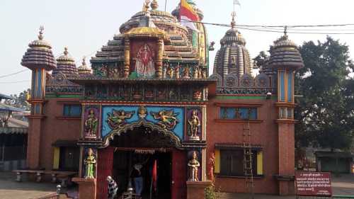
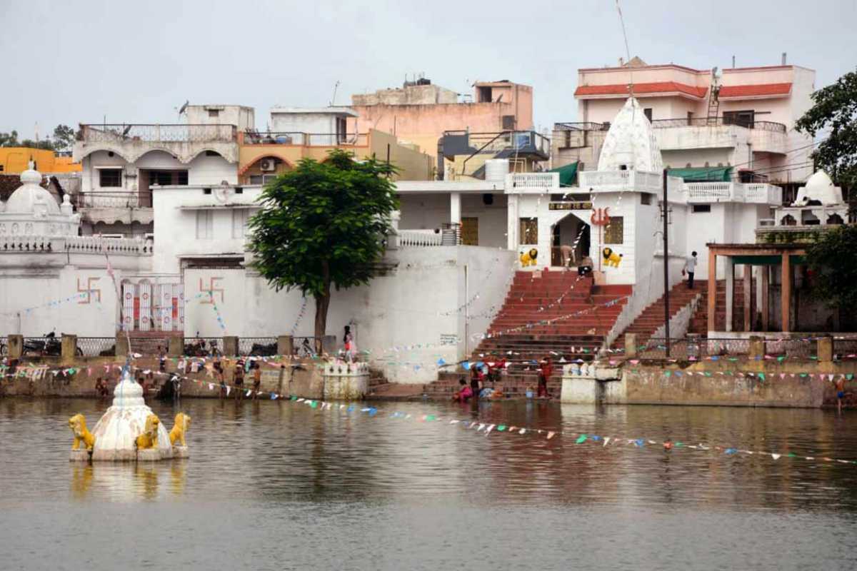
Situated on the bank of river Sheonath, amidst entrancing natural scenery, the Uwasaggharam Parshwa Teerth is the shrine of the 23rd Teerthankar Lord Shri Parshwanath and commemorates his visit to this region about 3000 years ago as a Shraman or a wandering mendicant dedicated to self-realization through self-sacrifice. Founded in 1995, the temple is also home to a garden, temples, a Yoga centre and a guest house all built on the banks of the River Sheonath. The entrance to the resplendent marble temple of Shri Parshwanath is through a 30 feet gate that has the idol of Parshwanath, supported by four pillars representing the four essentials of spiritual atonement, wisdom, introspection, good conduct and penance, being worshipped by two elephants. Sacred water or amiya, oozes from the idol here and hundreds of pilgrims visit this shrine on the day of the full moon.
Rajnandgaon
Located about 72 km west of Raipur, the district of Rajnandgaon came into existence on 26 January 1973, as a result of the division of the Durg district. Originally known as Nandgram, Rajnandgaon State was ruled by the Somvanshis, the Kalachuris of Tripuri and the Marathas. The palaces in the town showcase tales of the rulers, their society and culture, and their traditions.
The city was ruled by a dynasty of Hindu caretakers or Bairagis, who bore the title Vaishnav and Gond rajas or chiefs. Succession was by adoption and the foundation of the dynasty is traced to a religious celibate who came from Punjab towards the end of the 18th century. From the founder, it passed through a succession of chosen disciples until 1879 when the British government recognised the ruler as a hereditary chief and it came to be known as the princely state of Raj Nandgaon and the heir was conferred the title of Raja Bahadur. The first ruler Mahant Ghasi Das was recognised as a feudal chief by the British government in 1865 and was granted a letter of adoption. Later the British conferred the title of Raja on the ruling mahant.

In ancient times Rajnandgaon, like the rest of the Chhattisgarh plain, was part of Dakshina Kosala and part of the Mauryan empire during Emperor Ashoka’s time. Coins of the Indo-Sassanians have been found near Rajnandgaon dating from the 3rd century, implying the region had indirect contact with the rest of the world. In the 4th century, Dakshina Kosala was one of the regions which were subdued by Samudra Gupta on his southern expedition. However it was unlikely the Guptas ever directly controlled this territory south of the Mahanadi, rather the local rulers acknowledged Gupta overlordship. Gupta coins have been found in Dakshina Kosala. Parts of the region were controlled by the Nalas of Bastar at times, while other areas were controlled by the Vakatakas for periods in the 5th century. In the 6th century, the area was under the control of the Somavamshis while it fell back into Nala hands in the 7th century. In the 10th century, the Somavamshis returned to power, but were soon overthrown by the Kalachuris, who claimed Haihaiya origin. In the 12th and 13th centuries, the southern part of the district fell into the control of chieftains from Kanker. The Kalachuris or Haihaiyavansis continued ruling the district until the 18th century. Khairagarh and the northern part of the district were ruled by the Raj Gonds of Garha-Mandla. After the struggle of Rani Durgavati, these rulers, as well as the Kalachuris of Raipur who ruled the southern part of the district, became vassals of the Mughals. In 1742, the Marathas under the Bhonsles of Nagpur invaded Chhattisgarh and quickly overthrew the last king of the Haihaiyavansis and took over what is now Rajnandagaon district. In 1753, the Bhonsles of Nagpur confiscated all the territory that is now Chhattisgarh, and Raghoji gave the area to his son, Bimbaji, who ruled it virtually independently. The territory continued to be controlled by the Marathas until the Third Anglo-Maratha War when it fell into British hands who then returned the territory to Maratha hands. Until 1836 it was administered by a series of subadars obedient to the Nagpur state. In 1853, Nagpur was annexed by the British under the Doctrine of Lapse and Rajnandgaon fell under direct British administration under the Central Provinces and Berar. Rajnandgaon remained a Princely State in independent India and in 1948, was merged into the Durg District of Madhya Bharat, later Madhya Pradesh. Rajnandgaon district was carved out from the erstwhile Durg district on 26 January 1973. Later, Kabirdham district was carved out from this district on 1 July 1998. Rajnandgaon is a part of the Red Corridor.
Situated on a hilltop at a height of about 490 m about 26 km from Rajnandgaon, is a significant religious site. Also referred to as Badi Bambleshwari, the temple is located in Dongargarh and is half a km from the main temple complex at the foot of the hill known as Chotti Bambleshwari. Thousands of devotees from in and around Chhattisgarh flock to the shrine during the ten days of Navratri in September and October as well as during Ramnavmi in April. During this time, fairs which are run 24 hours are organised in the temple premises. It is said that about 2,220 years ago, a local king, Raja Veersen performed several Pujas and worshipped the gods to be blessed by an offspring. When after a year, the queen gave birth to a son, the king who believed it to be a blessing from Lord Shiva and Parvati, constructed the temple here.
Another site of interest is the ancient place of Mata Sheetala Devi Shakti Peetha. This temple, which is more than 2200 years old, lies 1.5 km from the railway station. Pragyagiri, a famous Buddhist Vihara is another attraction as is Barfani Dham where pilgrims throng. Other places of interest are Ambagarh Chowki, Ambagarh Devi Mandir, Mongara Dem and Sankar Dahara Tipagarh Pahadi.

Chirmiri
Chirmiri is a hill station about 298 km north of Raipur and not far from its border with Madhya Pradesh. It was a part of the Koriya district until 15 August 2021 when the separate Manendragarh-Chirmiri-Bharatpur district was created. Chirmiri is known for its coal extraction as the area is rich in coal. Chirimiri is referred to as the Heaven of Chhattisgarh due to its lush greenery, mountains, and rivers that make it a perfect getaway destination. There are several temples and other places famous among tourists. Located at an altitude of 579 m above sea level, Chirimiri lies along the banks of the Hasdeo River, one of the most prominent tributaries of the Mahanadi River. Chirmiri’s weather is pleasant all year round, and there are dense forests in the region housing exotic flora and fauna. The best time to visit Chirmiri is March just in time to celebrate Shivratri with the locals. It is one of the most popular festivals in the region. Otherwise, the monsoon season between October to April is when the city is clean and green with the dirt and grime washed away.
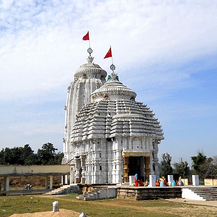
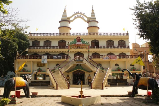
One of the chief tourist attractions of the region is the Lord Jagannath Temple which is a replica of the Jagannath temple in Puri, Odisha. The Kalibadi Temple is located in Haldibadi on a hill and is very close to the main train station. Baigapara is a temple located in Bartunga where there is also an ancient Sati temple dedicated to the Goddess Sati. The Gufa Mandir is located in Godaripara while the Maha Maya Temple in Ratanpur is one of the 52 Shakthi Peeths, and is dedicated to Goddess Lakshmi and Goddess Saraswati. The temple was built by the Kalachuri King Ratnadeva in the 12th or 13th century. The architecture is of the Nagara art, facing north with a big water tank. There are also temples dedicated to Lord Shiva and Lord Hanuman respectively on the premises. The oldest temple here, built in 1039 is a temple dedicated to Kantideval and is said to be constructed by an ascetic known as Santhosh Giri. The temple is guarded by Kalabhairava residing in another temple on the approach road. There are also ruins of an 11th-century Kadaeideol Shiva temple on a hilltop near a fort.

17 km from Chirmiri lie Amrit Dhara Falls which are located in Barbaspur. There is a famous temple dedicated to Lord Shiva near the waterfalls. The falls are also a favourite picnic spot for locals. Apart from being a famous waterfall, the place is used for picnics by the locals. The local authority has developed the banks of the Hasdeo River and now this is a preferred picnic spot.

Madku Dweep
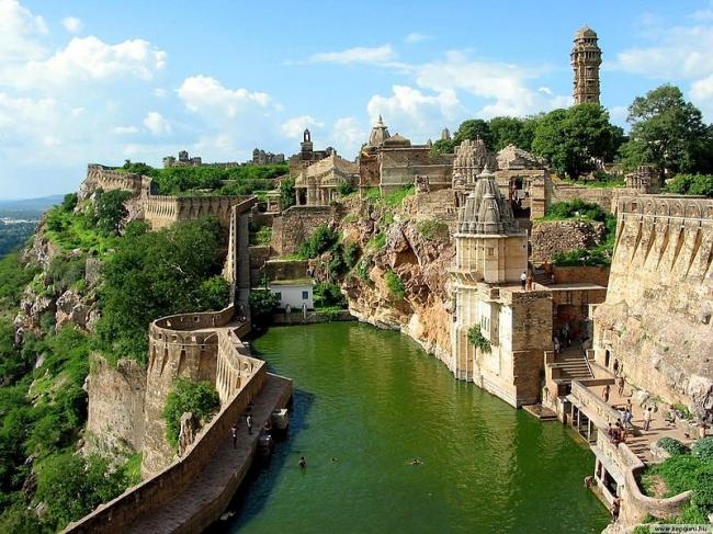
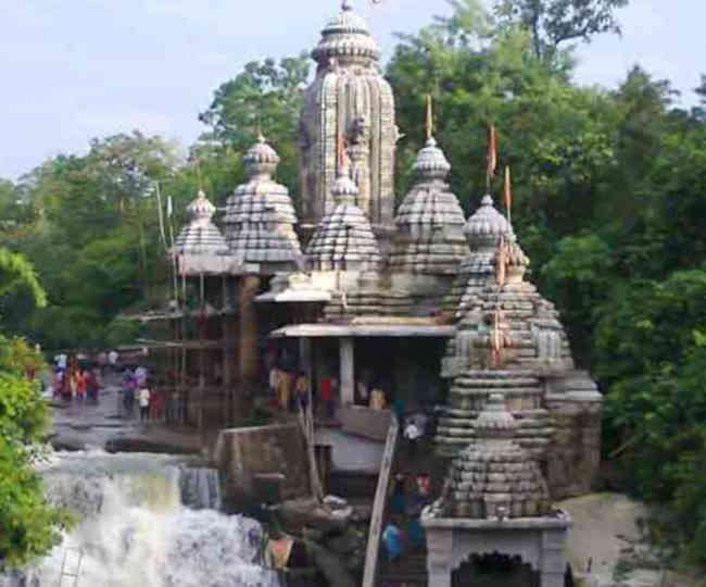
A beautiful island, Madku Dweep lies on the River Shivnath about 87 km north of Raipur and about 40 km south of Bilaspur. The name Madku came about because the island has the shape of a frog. The picturesque Madku Dweep has an area of around 24 hectares and is full of greenery and is famous for its ancient temples and their historical and archaeological importance.
Archaeologists have discovered prehistoric stone tools, epigraphs, and coins on this island. Stone inscriptions have also been found, which are believed to date back to the 3rd century. One stone inscription was in Brahmi script and another in the Shankha script. Madku Dweep is also home to several ancient and unique idols of Lord Shiva, Ganesha, Shiv-Parvati, Nandi, and various other Gods have been found. There are temples, both old and new, that are frequented equally by devotees from across the globe. Madku Dweep is popularly known as Kedar Tirth and Harihar Kshetra Kedar Dweep. Archaeologists have successfully excavated 19 temples on the island of which 18 face east, whereas the middle temple is the only one that faces west. The architectural style of these temples along with the sculptures and idols is believed to be similar to that of the Great Kalchuris. The festivals of Mahashivratri and Hanuman Jayanti are celebrated enthusiatically and there is a seven day fair held with utmost devotion on this island. There is also a 7-day mela or fair that is held in January during Paosh Purnima.

Mudku Island is divided into two parts of the river Shivnath river. Two very ancient Shiva temples from the 10th and the 11th centuries are situated on the smaller island. One of them is situated at Dhanmanteshwar and to its right side is an ancient valley located in the north, which drains the water. Two ancient inscriptions have been found at this place. The first inscription is the Brahma inscription of about 3rd century while the Akshaya found and the second inscription has letters of the Shankhalipi script. A statue of a man without a head appears to be from the 10th or the 11th centuries. Archaeological excavations have found ancient idols of Gupta and Calcutta carvings. The statue of the Culturary Chattrabhuji dance is found in the statue of Ganesh under the tree of Bakul which dates to the 11th century.
Bhoramdeo Temple
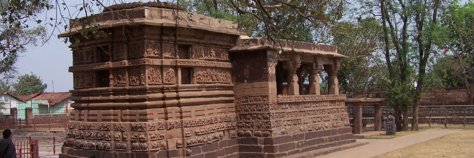
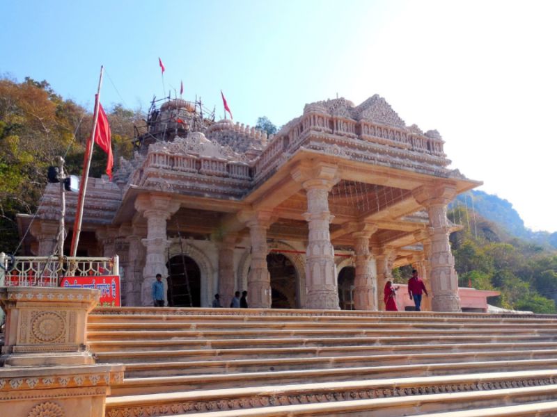
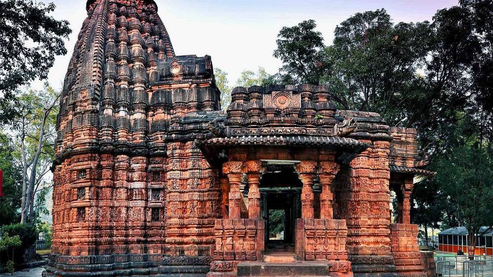
Bearing a striking resemblance to the Konark Sun Temple, the Bhoramdeo Temple is located about 135 km north of Raipur and is believed to have been constructed between the 7th to the 12th centuries and is popularly known as the Khajuraho of Chhattisgarh as it also resembles the Khajuraho Temple in Madhya Pradesh. The Bhoramdeo Temple is a complex of temples dedicated to Lord Shiva in Bhoramdeo and comprises a group of four temples of which the earliest is a brick temple. The Bhoramdeao temple complex is built at the foot of the thickly forested scenic backdrop of the Maikal range of hills, in the Daksina Kosala region.
The temple complex, rich in history and archaeological details, is dated to the Kalachuri period between the 10th and 12th centuries, which ruled over areas in Central India in west Madhya Pradesh, Rajasthan and were called Chedi, Haihaya or Heyheya or the northern branch with a close identity with the sculptures found in nearby archaeological sites such as Janjgir, Kalachuri, Narayanpur and Ratanpur sites. The brick temples were built during the rule of Pandus and are similar to those built in Kharod, Palari, Rajim and Sirpur in the state.

The temple was built by Laxman Dev Rai & Gopal Dev of the Faninagvansh Dynasty. The temple complex, highlighted as scintillating poetry in stone, is credited to the Nagwanshi Kings who practised tantrism and who ruled in the then Southern Koshal region, which is now the state of Chhattisgarh. Its construction is dated between the 7th and 12th centuries and the temple is named Bhoramdeo because the Gond Tribals of the area worshipped Lord Shiva whom they called Bhoramdeo.
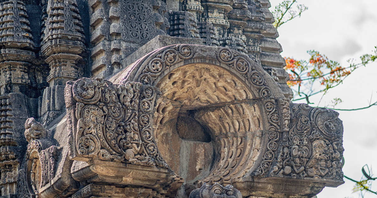
The main temple is the Bhoramdeo temple built in stone and is older than the Khajurao complex and has an abundance of carved images on its walls, especially the exterior ones. The structural uniqueness of the temple stems from having receding rows placed consecutively upwards in the upper part of the temple tower. It has the standard Hindu temple composition of a mandapa, followed by a passage leading to the sanctum sanctorum or Garbhagriha. The sanctum sanctorum is the primary enclosure of the temple where the presiding deity Shiva, in the form of a Shiva linga, is worshipped. Four main central pillars support the mandapa, along with several peripheral pillars. All the enclosures are linked through passageways. The temple is built facing the East, with an entry door that faces the same direction. In addition to this, two more doors open in the South and North directions. However, there is no door facing the Western direction. The main entrance door of the temple flaunts sculpted images of Ganga and Yamuna. The entrance to the sanctum sanctorum or Garbhagriha has finely sculpted images of all the ten avatars of Lord Vishnu. Intricately sculpted images of Lord Shiva and Lord Ganesha can also be found.
Another temple about 1 km from Bhoramdeo, which is mentioned along with the Bhoramdeo complex is the Madwa Mahal, which means marriage hall in the local dialect, also known as Dullhadeo. It was built in 1349 during the reign of Ramchandra Deo of the Nagavanshi dynasty and has a unique Shiva Linga erected over 16 pillars. It was built to commemorate the wedding of the Nagwanshi king, Ramachandra Dev, and the Haihawanshi Queen, Raj Kumari Ambika Devi. Interestingly, this temple is west-facing. Since this temple’s structure is similar to a marriage hall or pandal, it gets its name Madwa. The entrance of this temple flaunts traditional architectural embellishments.

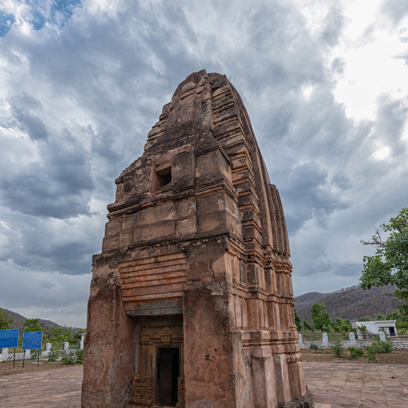
The Istaliq temple or the temple built with dried or burnt clay bricks adjoins the main Bharamdeo temple. It was the first temple built between the 2nd and 3rd centuries. This temple is in a dilapidated condition and only has sanctum sanctorum without an entrance hall or mandap. The tower above the sanctum sanctorum is extant only to half its height and there is a wall projecting out of this temple which is known as the Allinda. Other existing structural features seen in the sanctum sanctorum are a few sculpted pillars as well as a sculpted Shiva Linga that is deified here along with images of Uma Maheswar and that of the king and queen standing in a worshipful pose.
Cherki Mahal, the last temple in the complex, is not easily locatable as it is situated in a thinly forested area. A Shiva Linga form, not carved is deified in this temple. The roof of the sanctum of the temple has lotus decoration. The entrance porch has many aesthetic repeated patterns. A temple washed in red colour was recently built for the deity Hanuman, located on one side of the temple courtyard.
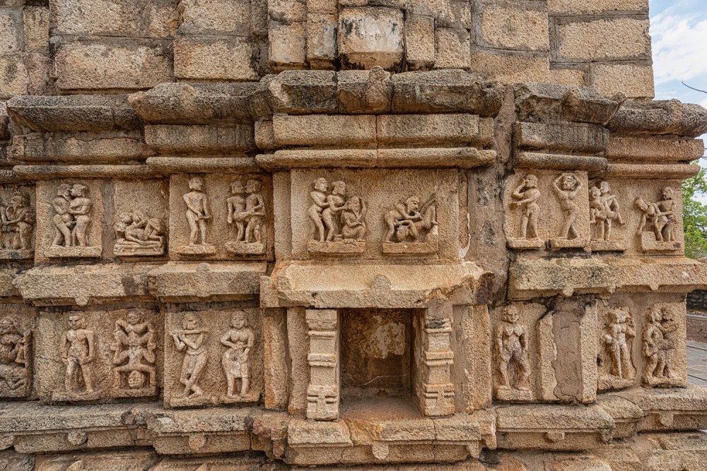
An open-air museum is located within the temple complex that is home to a massive collection of archaeological artefacts that were unearthed in this area, some even dating back to the 2nd or 3rd centuries. The Sati Pillars are also on display here that have a unique architectural motif, showing couples in squatting amorous postures. The museum complex also boasts collections such as dilapidated images and friezes of Linga and Nandi.

Guru Ghasidas National Park
A beautifully protected reserve located about 320 km north of Raipur, the Guru Ghasidas National Park is also known as the Sanjay National Park as it used to be part of Madhya Pradesh’s Sanjay National Park. After Chhatisgarh’s formation, 60% of the park came under the new state and was renamed Guru Ghasidas National Park.
Stretching over an area of 1441 sq km, the park is a must-visit while in Chattisgarh and is part of the Sanjay-Dubri Tiger Reserve, located in the Narmada Valley dry deciduous forests ecoregion. The park has a network of small streams cutting through forests which contain distinct flora and fauna. The park also offers safaris which highlight the park’s excellent features and allows picnics to be held inside the premises, with a choice of backdrop for the meal.
The history of Guru Ghasidas National Park dates back to 1981 when it was established. During this time, Guru Ghasidas was called Sanjay National Park and was a more significant area in Madhya Pradesh. The area of the park was then divided into two parts during the formation of the state of Chhattisgarh in 2000. During this time 60 per cent of Sanjay National Park fell under the district of Koriya in Chhattisgarh and this part of the park was then renamed Guru Ghasidas National Park after the famous Satnami reformist hero. The national park is now an individualistic thriving community of different plant and animal species under one roof.
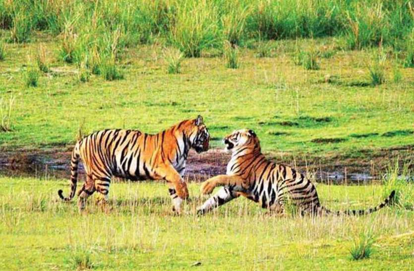
The park is mostly composed of tropical forests of Sakhua or Sal trees. Many species are to be found here including the Bengal tiger and the Indian leopard as well as 309 species of birds, including the Golden Hooded Oriole and the Racket-tailed Drongo, among others and the park and its environs is the last known territory of the Asiatic cheetah in India.
The national park is smack in the middle of two very prominent tiger reserves, the Bandhavgarh Tiger Reserve in Madhya Pradesh and the Palaman Tiger Reserve in Jharkhand. The geographical topography of the national parks includes several small hills that are separated by grassy, open plain areas as well as sandy soils. The forest area is mostly a mixed deciduous type along with patches of mixed subtropical vegetation. Aside from the array of streams that criss-cross through the terrain, the primary source of water for the animals is from two important rivers on the premises. These rivers include the Banas River in the west of the Guru Ghasidas National Park which is renowned for its diverse flora and fauna that spreads through the area.
The Guru Ghasidas National Park is open between 8 am and 6 pm daily and has an entry fee of INR 100 per adult and INR 50 per child. Guides who have extensive knowledge of the national park and its inhabitants are also available during the safari.


