A flowing six-yard drape of beauty and grace, the saree can be called India’s national dress for women. Every state and community has their fabrics and materials that are unique to the region and drapes that instantly brings a specific community to mind. The saree consists of an un-stitched stretch of woven fabric arranged over the body as a robe, with one end tied to the waist, while the other end rests over one shoulder as a stole or shawl, with a part of the midriff showing. It may vary from 4.1 to 8.2 metres or 4.5 to 9 yards in length, and 60 to 120 cm in breadth. The saree is part of the traditional wear of women of the Indian subcontinent in India, Pakistan, Bangladesh, Sri Lanka & Nepal. There are various names and styles of sari manufacture and draping, the most common being the Nivi style. The sari is worn with a fitted bodice commonly called a blouse and a petticoat.
This post started as my ode to the different fabrics and sarees available in the country and I soon realised this is much larger than just naming the various fabrics in the country. So this is now a three-part short series because I wanted to showcase as much as I can of the amazing fabrics available. And on a personal note, this is also a repository for me to refer to because one of my dreams is to have a saree from every Indian state.
Sadee is a Hindustani word that means a strip of cloth that evolved to sāṛī in modern Indian languages. The word śāṭika is mentioned as describing women’s dharmic attire in Sanskrit literature and Buddhist literature called Jatakas which could be equivalent to the modern-day saree. The term for female bodice, the choli evolved from ancient stanapaṭṭa. Rajatarangini, a tenth-century literary work by Kalhana, states that the choli from the Deccan was introduced under the royal order in Kashmir. The petticoat is called sāyā in Hindi and Urdu, parkar in Marathi, ulpavadai in Tamil, sāẏā in Bengali and eastern India, and sāya in Sinhalese. Apart from the standard petticoat, it may also be called an inner skirt or an inskirt.
The history of a sari-like drapery is traced back to the Indus Valley Civilisation, which flourished during 2800–1800 BC around the northwestern part of the Indian subcontinent. Cotton was first cultivated and woven in the Indian subcontinent around the 5th millennium BC and dyes used during this period are still in use, particularly indigo, lac, red madder, and turmeric. Silk was woven around 2450 BCE and 2000 BCE.
The word sari evolved from śāṭikā a Sanskrit word mentioned in earliest Hindu literature as women’s attire. The sari or śāṭikā evolved from a three-piece ensemble comprising the antarīya or the lower garment; the uttarīya which was a a veil worn over the shoulder or the head; and the stanapatta, a chestband. This ensemble is mentioned in Sanskrit literature and Buddhist Pali literature during the 6th century BCE. This complete three-piece dress was known as poshak, a generic term for a costume. The ancient antariya closely resembled the dhoti wrap in the fishtail” version which was passed through legs, covered the legs loosely and then flowed into a long, decorative pleats at front of the legs. It further evolved into the Bhairnivasani skirt, today known as ghagri and lehenga. The Uttariya was a shawl-like veil worn over the shoulder or head, and evolved into what is known today known as dupatta and ghoonghat. Likewise, the stanapaṭṭa evolved into the choli by the 1st century CE.
It is generally accepted that wrapped sari-like garments for the lower body and sometimes shawls or scarf like garments called uttariya for the upper body, have been worn by Indian women for a long time, and that they have been worn in their current form for hundreds of years. Based on sculptures and paintings, tight bodices or cholis are believed to have evolved between the 2nd century BCE and the 6th century CE in various regional styles.
After this short history about the saree, let’s take a trip around the country to see the various fabrics and sarees available in the different states of India. This is by no means an exhaustive list and I have probably missed many regional varieties, so apologies in advance if I have missed something I should not have.
Chirala: A coastal town also known as Kshiraputi, Chirala, which means saree in Telugu is renowned for its handlooms that are soft and durable. With more than 60% of the town’s population belonging to the weaving community, the looms used in the town are mostly pit or fly shuttle looms and the motifs in the fabrics and sarees are usually geometrical designs. The weavers of Chirala produce, cotton sarees, seico sarees that are a fine blend of cotton and silk fibres and kuppadam or the Gadwal type. The hand butta is another fascinating design feature of Chirala sarees, where colours are manually added in-between the zari design. Kalamkari printing is also a speciality of the Chirala saree.
Dharmavaram: Handloom silk sarees, Dharmavaram fabrics are textiles woven by hand with mulberry silk and zari which is fine thread traditionally made from gold or silver. The Dharmavaram fabric has a GI or Geographical Indications tag. Kriya Shakthi Vodavaru Swamy named Dharmavaram after the name of his mother, Dharmambai around 1153–54 and by the 19th century, the silk handloom industry emerged as the main occupation. Paintings on the roof wall of Lepakshi temple and the Latha Mandapam depict the designs of Dharmavaram sarees. These saris are worn in the winter months or when it is cold and on special occasions and are mostly used by dancers of Bharatnatyam and Kuchipudi.
Kalamkari: A type of hand-painted or block-printed cotton textile, Kalamkari is produced in Isfahan in Iran and Andhra Pradesh. Only natural dyes are used in Kalamkari, which involves twenty-three steps. There are two distinctive styles of Kalamkari art in India, the Srikalahasti style and the Machilipatnam style. The Srikalahasti style of Kalamkari is where the kalam or pen is used for freehand drawing of the subject and filling in the colours and is entirely hand-worked. This style flourished in temples centred on creating unique religious identities, appearing on scrolls, temple hangings, chariot banners as well as depictions of deities and scenes taken from the Hindu epics like the Ramayana, the Mahabharata and the Puranas. The Machilipatnam style of Kalamkari involves vegetable-dyed block painting, where the dye is applied to the fabric with the help of wooden blocks. The natural dyes for the cloth are obtained by extracting colours from various roots, leaves, and mineral salts of iron, tin, copper, and alum and mixing them with cow dung, seeds, flowers, and milk. Historically, Kalamkari used to be termed Pattachitra, an art form still found in neighbouring Odisha and other parts of India and Nepal. The term Pattachitra translates to patta, meaning a cloth, with picture or chitra. Paintings made on fabric and fabric scrolls are mentioned in ancient Hindu, Buddhist and Jain literature. Under medieval Islamic rule, the term Kalamkari is derived from the words kalam, which means pen in Telugu, and kari, which means craftmanship and this style became popular under the patronage of the Golconda sultanate.
Mangalagiri: Mangalagiri Sarees and fabrics are produced by handloom weaving in Mangalagiri, a town in Andhra Pradesh. Mangalagiri cotton silk sarees are a unique variety, woven from cotton, and feature characteristic features such as zari on the border and no woven pattern on the body. Borders in thick gold thread or zari, traditional patterns in Nizam, and simple mono or multicoloured striped pallus adorn the fabric. The sarees have various designs like leaves, mango, parrot, and gold coins. The soft and comfortable all-weather fabric generally has no pattern on the body and is known to have no gaps in its weaving with missing saree threads rarely found. As the town is also the abode of Lord Narasimha Temple, the saris are also used by the devotees for devotional purposes.
Uppada: The Uppada Jamdani Sari is a silk sari style woven in the town of Uppada in Andhra Pradesh and is known for its light weight. The saree was also accorded the Geographical Indication tag from Andhra Pradesh. The name Jamdani is a Persian terminology, in which Jam means flower and Dani means a vase. The Jamdani style of weaving originated in Bangladesh and was brought to the south and Uppada village in the 18th century and recreated with a local flavour. old The Jamdani style of weaving is about 300 years old and in 1972, Uppada weavers were recognised by the Indian government with the President’s award. The Uppada Jamdani saree is a beautiful textile with a silk-like texture and is lightweight. The weaving of the saree takes between 10 to 60 days for which least 2-3 weavers spend 10 hours a day. There are around 3000 looms producing Jamdani sarees in and around the Uppada and Kothapalli area. Around 40% of the local weavers are women. The saree consists of a cotton body with a silk pallu and is completely handwoven. The saree is woven in such a way that it can be folded and fit inside a matchbox. The speciality of the Jamdani saree is that the design is shown on both sides of the fabric.
Venkatagiri: Woven in Venkatagiri near Tirupati in Andhra Pradesh, this fabric has also been accorded the GI tag and is known for its fine weaving. The history of the saree dates back to the early 1700s in the Venkatagiri village and were encouraged by the Velugoti dynasty of Nellore and also by the Bobbili and Pithapuram dynasties. In those days, they were mostly woven fabrics for royalty and landowners.
Assam Silk: Assam silk refers to the three major types of indigenous wild silks produced in Assam —golden muga, white pat and warm eri silk. Assam was well known for the production of high-quality silk since ancient times. The knowledge of sericulture probably arrived with the Tibeto-Burman groups which arrived from China around 3000-2000 BC. Genetic research on silkworms shows that Assam silk originated in two specific regions of Assam, the Garo Hills in the ancient Kamrupa Kingdom and Dhakuakhana in the ancient Chutia kingdom.
Muga silk is the product of the silkworm Antheraea assamensis endemic to Assam. The silk produced is known for its glossy, fine texture and durability and has a natural yellowish-golden tint. It was previously reserved for the use of royalty. This silk can be hand washed with its lustre increasing after every wash. Very often the silk outlives its owner. The silk has been given the Geographical Indication (GI) status since 2007.
Pat silk is produced by the Bombyx textor silkworms which feed on mulberry leaves. It is usually brilliant white or off-white and must be dried in the shadows and not in direct sunlight. Eri silk is made by the Samia cynthia ricini which feed on leaves of castor oil plant. It is also known as endi or errandi silk. Because the manufacturing process of eri allows the pupae to develop into adults and only the open-ended cocoons are used for turning into silk, it is also popularly known as non-violent silk which is soft and warm and is popular used as shawls and quilts.
The Bhagalpuri or Kosa or Tussar Saree is Tussar silk that is valued for its rich texture and natural deep gold colour. The tussar silk weaving industry in Bhagalpur is more than a century old and has about 30,000 handloom weavers working in producing the sarees. Bhagalpuri silk is made from cocoons of Antheraea paphia silkworms which are only found in India and is processed at Nathnagar at Bhagalpur. The unique dyeing technique of these Bhagalpuri silk sarees sets them apart from the art silk sarees. The saree was supposed to have been produced in ancient times and even Mughal rulers patronised the weavers. But the technique soon got extinct and was revived about 200 years back by the weavers. The silk fabric is extremely soft and lightweight and is known as the queen of fabrics.
The Chattisgarh Kosa saree is Tussar silk similar to the Bhagalpuri Kosa. Kosa silk is mainly derived from Antheraea mylitta, an Indian silkworm and is special type of tussar silk that is drawn out of the cocoons grown on trees like Saja, Sal, and Arjun mostly grown in Chattisgarh. The silk is widely popular owing to its sturdiness, purity and soft texture. The dull golden brownish texture of the silk is its signature trait, but can also be found in natural shades of dark honey, fawn, orange, pale golden and cream. The actual colour of kosa is a dull gold, but the finished fabric is dyed with natural dyes extracted from natural dyes. The towns of Champa and Korba are known for their production of Kosa Silk, and the silk produced in Champa is considered to be the best silk.
Bandhini: A type of tie-dye textile decorated by plucking the cloth with the fingernails into many tiny bindings that form a figurative design, Bandini or Bandhani dates back to the Indus Valley Civilization where dyeing was done as early as 4000 BC. The earliest example of the most pervasive type of Bandhani dots can be seen in the 6th-century paintings depicting the life of Buddha found on the wall of Cave 1 at Ajanta. The main colours used in Bandhana are natural. As Bandhani is a tie and dye process, dying is done by hand and hence best colours and combinations are possible in Bandhanis. The fabric used for making Bandhani sarees and dupattas are loosely woven silk called Georgette, or cotton known as Malmal. The knots are tightly tied, and the rest of the fabric is dyed in multiple stages. This leaves the knots undyed and hence a beautiful flower-like pattern appears all over the cloth as a design.
The term bandhani is derived from the Sanskrit verbal root bandh which means to bind or to tie. Today, most Bandhani can be found in Gujarat, Rajasthan, Sindh, Punjab and Tamil Nadu where it is known as Sungudi and is known as chunri in Pakistan. The art of Bandhani is a highly skilled process with the technique involving dyeing a fabric which is tied tightly with a thread at several points, thus producing a variety of patterns, depending on how the cloth is tied. The main colours used in Bandhana are yellow, red, blue, green and black.
The Bandhani work has been exclusively carried out by the Khatri community of Kutchh and Saurashtra. Bandhani work is also done in Rajasthan, where different colours and designs are used than in the Kutch and Saurashtra regions of Gujarat. Establishments of varying sizes in the entire Kutch belt in Gujarat produce many varieties of Bandhani. This Bandhani style is called Kutchi Bandhani. Bandhani tying is often a family trade, and the women of these families work at home to tie patterns.
Patola: A double ikat woven sari, usually made from silk, the Patola saree comes from the town of Patan. Similar to Bandhani, Patola sarees are also a type of tie and dye process and are well known for not losing their colour at all. They are very expensive, once worn only by those belonging to royal and aristocratic families. Patola sarees are found in two different types – the Rajkot Patola and the Patan Patola. These two are differentiated with the Rajkot Patola having a single ikat weave that is dyed vertically, while the Patan Patola has a double ikat weave and is dyed horizontally. The word patola is the plural form; the singular is patolu.
To create a patola sari, both the warp and weft threads are wrapped to resist the dye according to the desired pattern of the final woven fabric. This tying is repeated for each colour that is to be included in the finished cloth. The technique of dyeing the warp and weft before weaving is called double ikat. The bundles of thread are strategically knotted before dyeing. Patola saris from Surat, Ahmedabad and Patan are renowned for their colourful diversity and geometrical style.
Silk weavers of the Salvi community from Maharashtra chose Gujarat as the home for their renowned patola fabric. It is believed that the Salvis went to Gujarat in the 12th century to acquire the patronage of the Chaulukyas Rajputs, who ruled Gujarat and parts of Malva and south Rajasthan, with Anahiwad Patan as their capital. Legend says that over 700 patola weavers came to the palace of Raja Kumarpal, at the personal request of the king. The Solanki or Chalukya rulers used to dress in patola silk on special occasions. The art of Patola weaving is an ancient one. According to some historians, the art of Patola weaving was known also in the 4th century as seen by the carvings at the Ajanta caves. After the decline of the Solanki empire, the Salvis founded a rich trade in Gujarat. Patola saris quickly became a sign of social status among Gujarati women and girls, especially as part of streedhan or the items that a woman can claim as her wealth.
There are four distinct patterns which are woven primarily in Gujarat by the Salvi community. In Jain and Hindu communities, double ikat saris with entire designs of parrots, flowers, elephants and dancing figures are generally used. In Muslim communities, saris with geometric designs and floral patterns are typical, being worn mostly for weddings and other special occasions. Maharashtrian Brahmins wear saris woven with plain, dark-coloured borders and body and a bird design called Nari Kunj.
Tanchoi: Tanchoi sarees are one of a kind, having spots all over the surface and woven with a dual colour warp. The stand-alone feature of the Tanchoi saree is that the fabric texture background has a satin finish. Extra threads are added to give these sarees the appearance of being embroidered. Famed for the intricate and small weaving patterns over the fabric, the commonly used motifs are those of flowers, small birds in flight, peacocks and parrots. Tanchoi silk is said to have been brought to India by Chinese traders in the 19th century and later adapted to suit the preferences of the Indian market. Three Parsi brothers are said to have travelled from India to China in the 19th century and were enamoured by the technique. After learning the skill, they came back to Surat, Gujarat and trained the weavers in the technique and then evolved the Tanchoi weaving technique into Indian versions.
Tangaliya: A handwoven, GI-protected textile, made by the Dangasia community, the 700-year-old indigenous Tangaliya is native to the Surendranagar district in the Saurashtra region. The textile was usually used as a shawl or wraparound skirt by women of the Bharwad shepherd community. Woven on pit looms at homes, the technique involves weaving knots in colours contrasting to the warp colour to create the effect of raised dots. The weaving is based on precise mathematical calculations. The weaver has to count the warp yarns each time, before hand-knotting the dot in acrylic yarn, to produce geometric patterns. A single mistake can lead to the final design looking faulty. The effect of the pattern also has a tactile feel, similar to braille, because of the raised surface of the dots. This has become the signature style of the textile. Another important aspect is the visual effect of dots, which is most striking and appealing on dark colour bases, especially black. The graphic quality of white dots mixed with other bright coloured dots gives the craft its special appeal. Moreover, due to the ease of knotting the white colour yarn compared to coloured yarns, white dots were common. Traditionally, most woollen shawls featured graphic patterns of white and maroon coloured dots on a black base. With every wash, the cotton textile tends to become denser and integrates the dots even more finely between the warp and weft. Today, there are only fifteen families in Surendranagar pursuing this craft.
Jamawar: Jamawar is believed to have been derived from the word jam which means a shawl or robe and war, which implies the chest, in either Persian or Kashmiri. The fabric is believed to have found its way to Kashmir from Persia and reached its peak during the heyday of the Mughal dynasty in India. Owing to the elaborateness that goes into the making of the weave, it takes months on end to craft a finished Jamawar piece, and sometimes, even years, depending on the level of intricacy involved. Jamawar is traditionally woven with a rich blend of Pashmina wool, cotton and silk. Given the generous use of colours and motifs, the finished weave is highly iridescent. One of the many distinguishing factors of the Jamawar is that it is so intricately woven that its front and back, both look identical, with no stray thread sticking out of its surface. A dominating design element of the weave is the paisley, which derives inspiration from Persia; other motifs of flora and fauna, too, are seen. Jamawars also feature a wide use of hand embroidery and traditionally, a single jamawar piece was woven with up to 50 varying hues.
Kani: The Kani weave is said to have originated in Kanihama village of Jammu and Kashmir, and its exquisiteness earned it the Geographical Indication (GI) tag in 2008. The word Kani translates to bobbins in Kashmiri because the weave involves extensive use of wooden bobbins on which varicoloured threads are wound. Legend has it that the art of weaving Kani shawls was first brought to Kashmir in the 15th century by Persian and Turkish weavers, who introduced this art to Ghiyas-ud-Din Zain-ul-Abidin, the eighth sultan of Kashmir. One of the most defining characteristics of the Kani weave, colloquially known as Kaniwar, is its impeccably patterned motifs. These motifs, which include flowers, gardens, creepers and paisleys are brought to life through a technique called twill tapestry featuring double interlocking, wherein both the warp and weft yarns are mounted diagonally onto each other on the loom.
Traditionally, Kanis are crafted from the pashmina wool of the local Changthangi goat. At the time of weaving, the loom is packed with bobbins or kanis, through which the craftsmen carry out the fashioning of the weave; a total of nearly a thousand bobbins or more can be used for a single weave. Each colour is woven in individually, with the help of bobbins wound with threads of that particular colour. The designs are first drafted in the form of sketches, in a grid-like format called naksh, after which each step from the draft is dictated to the weaver. An elaborately woven Kani shawl can take anywhere from 9 months to a year to be made, with two artisans working on it.
Pashmina Silk: A fine variant of spun cashmere, the animal hair fibre forming the downy undercoat of the Changthangi goat, Pashmina today may refer either to the material or to the variant of the Kashmir shawl that is made from it. The word pashm means wool in Persian, but in Kashmir, pashm referred to the raw unspun wool of the domesticated Changthangi goats. Both generic cashmere and pashmina come from the same goat, but generic cashmere ranges from 12 to 21 microns in diameter, whereas pashmina refers only to those fibres that range from 12 to 16 microns.
Samples of wool fibres discovered from corroded copper artefacts from Harappa dating back to the Indus valley civilization are extremely fine and resemble Pashmina and Shatoosh. In Mughal times, this was used as an indicator of rank and nobility. Pashmina blankets were also vital additions to a wealthy woman’s dowry in India, Pakistan and Nepal. The wool for pashmina is collected by combing the undercoat of the goat, and not by shearing, as in other fine wools. The entire process is carried out by hand by specialised craftsmen. The approximate time put into producing a single traditional pashmina stole is about 180 hours. Kashmiri embroidery or Kashida as it is known, employs bright and colourful designs, with motifs of floral borders, paisley and chinar leaves and other inspirational settings of nature. The patterns and the colours of Pashmina silk saree harmonises with nature. A heavily adorned pashmina silk sari with zardozi aari embroidery is a must in any bride’s trousseau. China accounts for 70% of the world’s cashmere production.
In the next part, we’ll see more fabrics and sarees from other states.
Today’s post is all about the fascinating part of Gujarat that is Kutch.
Literally meaning “something that intermittently becomes wet and then dry”, Kutch is the largest district in India. Home to the Kutchi people who speak the Kutchi language, a large part of this district is known as Rann of Kutch which is shallow wetland which submerges in water during the rainy season and becomes dry during other seasons. The same word is also used in Sanskrit origin for a tortoise. The Rann is known for its marshy salt flats which become snow white after the shallow water dries up each season before the monsoon rains. This area is also known for the ecologically important Banni grasslands with their seasonal marshy wetlands which form the outer belt of the Rann of Kutch.
Kutch is virtually an island, as it is surrounded by the Gulf of Kutch and the Arabian Sea in south and west, while the northern and eastern parts are surrounded by the Great and Little Rann or the seasonal wetlands of Kutch. The Rann of Kutch remained wetlands for a large part of the year and even today with many dams in the region, it remains wet for a significant part of year. The border with Pakistan lies along the northern edge of the Rann of Kutch, on the Sir Creek.
The history of Kutch can be traced back to prehistoric times. There are several sites related to the Indus valley civilization in the region, and this area is mentioned in Hindu mythology. In historic times, Kutch was ruled by Menander I of Greco-Bactrian Kingdom which was overthrown by Indo-Scythians followed by Maurya Empire and Sakas. In the first century, it was the under Western Satraps followed by the Gupta Empire. By the fifth century, Maitraka of Valabhi took over and from this point onwards, it became associated with the Gujarati ruling clans. The Chavdas ruled the eastern and central parts by the 7th century but then came under Chaulukyas by the 10th century. After the fall of the Chaulukyas, the Vaghelas ruled the state and following the conquest of Sindh by the Muslim rulers, the Rajput Samma started moving southwards to Kutch and ruled the western regions. By the 10th century, the Rajput Sammas controlled a significant area of Kutch, and by the 13th century they controlled the whole of Kutch and adopted a new dynastic identity, Jadeja.
For three centuries, Kutch was divided and ruled by three different branches of the Jadeja brothers. In the 16th century, Kutch was unified under one rule by Rao Khengarji I of one of these branches and his direct descendants ruled for two centuries and had a good relationship with the Gujarat Sultanate and the Mughals. One of his descendants, Rayadhan II, left three sons, of whom two died, and a third son, Pragmal Ji took over the state and founded the current lineage of rulers at the start of the 17th century. The descendants of the other brothers founded states in Kathiawar. After turbulent periods and battles with the armies of Sindh, the state was stabilized in the middle of the 18th century by a council known as Bar Bhayat ni Jamat who placed Rao as a titular head and ruled independently. The state accepted the sovereignty of the British East India Company in 1819, when Kutch was defeated in battle and in the same year, the state was devastated by an earthquake.
Upon Indian independence, Kutch acceded unto the dominion of India and was constituted an independent commissionaire. It was created a state within the union of India in 1950 and in 1956, was merged with Bombay state, which in 1960 was divided into the new linguistic states of Gujarat and Maharashtra, with Kutch becoming part of Gujarat state as Kutch district.
Bhuj is the headquarters of the district and the largest city of the region. According to legend, Kutch was ruled by the Naga chieftains in the past. Sagai, a queen of Sheshapattana, who was married to King Bheria Kumar, rose up against Bhujanga, the last Naga chieftain of Naga. After the battle, Bheria was defeated and Queen Sagai committed sati. The hill where they lived later came to be known as Bhujia Hill and the town at the foothill as Bhuj. Bhujang was later worshiped by the people as snake god, Bhujanga, and a temple was constructed to revere him. Bhuj was founded by Rao Hamir in 1510 and was made the capital of Kutch by Rao Khengarji I in 1549. When forced to acknowledge Muslim supremacy in 1590 Bhuj came to be known as Suleiman Nagar.
Gandhidham which was built in the early 1950s to resettle refugees from Sindh in today’s Pakistan was named after Mahatma Gandhi and is today the economic capital of Kutch and a fast developing city in the state. This town is now the 8th most populous city in Gujarat.
The town of Anjar has has a history of over 1,400 years and was founded in 650 AD and is the oldest town of Kutch. It is located around 40 km away from one of the biggest ports in India, Kandla Port.
The town of Mandvi was once a major port of the region and summer retreat for the Maharao or king of the Kutch State. The city has a four-hundred-year-old ship building industry, which is still functional and ships of made of wood called Dhows are still made here. The old city was enclosed in the fort wall and remains of the fort wall can be still seen today.
Most people put Kutch on their travel bucket list because of the Great and Little Rann of Kutch. The Great Rann of Kutch is a salt marsh and desert in the Thar Desert and is about 7,500 sq km in area and is said to be one of the largest salt deserts in the world. The Great Rann of Kutch, along with the Little Rann of Kutch and the Banni grasslands on its southern edge, in total comprises some 30,000 sq kms between the Gulf of Kutch and the mouth of the Indus River in southern Pakistan. The Great Rann of Kutch together with the Little Rann of Kutch is called Rann of Kutch. Rann which means desert in Hindi and Gujarati comes from the Sanskrit word Irina meaning desert and the Rann has references in the the Vedas as well as in the epic Mahabharata.
In India’s summer monsoon, the flat desert of salty clay and mudflats, which average 15 meters above sea level, fills with standing water. In very wet years, the wetland extends from the Gulf of Kutch on the west through to the Gulf of Cambay on the east. The area was a vast shallow of the Arabian Sea until continuing geological uplift closed off the connection with the sea, creating a vast lake that was still navigable during the time of Alexander the Great. The Ghaggar River, which presently empties into the desert of northern Rajasthan, formerly emptied into the Rann of Kutch, but the lower reaches of the river dried up as its upstream tributaries were captured by the Indus and Ganges thousands of years ago. Traces of the delta and its distributary channels on the northern boundary of the Rann of Kutch were documented by the Geological Survey of India in 2000. There are sandy islets of thorny scrub, forming a wildlife sanctuary and a breeding ground for some of the largest flocks of greater and lesser flamingos. Wildlife, including the Indian wild ass, shelter on islands of higher ground, called bets, during the flooding.
In India the northern boundary of the Greater Rann of Kutch forms the International Border between India and Pakistan and is is heavily patrolled on both sides. At night, an unexplained strange dancing light phenomenon known locally as Chir Batti or ghost lights occur in the Rann, the adjoining Banni grasslands, and the seasonal wetlands.
The annual 3-month long “Rann Utsav” festival is organised by the Gujarat government from December to February every year near Dhordo village. In this 500 sqkm of pristine white salt desert landscapes, tourists can see the various sights of the Rann during the winter. The Rann Utsav can be visited by anyone but the Tent City with 400 tents allows entry only to those who are staying there. There are cultural programmes, adventure activities, as well as an arts, crafts and handicrafts fair during the festival as well as 3 to 4-day events held at many other exotic locations around the larger Kutch area to expose tourists to the native culture.
Bhuj is the nearest city to the Rann and is around 102 km southeast. You can hire a vehicle to take you to the Rann or take the many buses that ply this route. Climates are quite harsh in the Rann with the summer temperatures going as high as 50 degree celcius and winters going as low as 0 degree celcius. To visit Rann of Kutch, all travellers must have valid ID proof which are checked by the army at the entry point. The best time to visit the Rann is during the Rann Utsav, but if you are not interested in the crowds, go just before or after the festival either in November or March. A few other ‘not-to-miss’ spectacles at Rann are the sunset and the moon rise or a new moon night which adds to the beauty of the white desert by adding different shades of colours to the white sand.
Kalo Dungar or Black Hill is the highest point in Kutch at 462 m and is located about 97 km north of Bhuj. This is probably the only place in Kutch from where you can get a panoramic view of the Great Rann of Kutch. Since it is located very near to the Pakistan border, there is an Army post at the top and beyond this point, only military personnel are allowed. The Kalo Dungar is also famous for a 400-year-old Dattatreya temple and there is an anti-gravity slope which has magnetic properties where a popular optical illusion of vehicle which seem to defy the gravity and roll up the slope can be seen.
The largest wildlife sanctuary in India, the Kutch Desert Wildlife Sanctuary was declared a sanctuary in February 1986. The sanctuary is one of the largest seasonal saline wetlands having an average water depth between 0.5 and 1.5 metres. By October–November each year, rain water dries up and the entire area turns into saline desert. The sanctuary supports wide variety of water birds and mammalian wildlife. The sanctuary encompasses a true saline desert where thousands of greater flamingo nest in the world-famous ‘Flamingo City’ which is located in the mud flats of the Rann and is the only area where flamingoes congregate to breed regularly. The northern boundary of this sanctuary forms the international border between India and Pakistan and is heavily patrolled with much of this sanctuary being closed to civilians after the India Bridge at Kala Dungar. Tourists and researchers can only enter here with special permission from the BSF. After the “India Bridge” area, the Rann is several hundred square kilometers of pure white like snow with heavy deposit of salt crystals. The marshy Rann here becomes pure white and flat till the eye can see, till the horizon after the rain water has dried up, in the winters every year. Buried nearby to where the flamingoes breed is the ancient excavated city of Dholavira from the Harappan civilization and embedded in the Jurassic and Cretaceous rocks on Khadir, Kuvar and Pachchham bet islands in the Greater Rann, are many fossils of vertebrates, invertebrates and plants. Fossils of dinosaurs, crocodiles of the ‘Dinosaurian period’ and whales dating from the tertiary period have been recorded to have been recovered from here. You can also find fossilised trees and forests in the rocks belonging to the Jurassic and Cretaceous periods as well as the fossils of invertebrates, including those of sea urchins, ammonites and such others. The sanctuary is open between 6 am to 6 pm every day. Entry fees differ on weekdays and weekends with Indians paying INR 250 on weekdays and INR 280 on the weekends. Foreigners pay INR 1200 during the week and INR 1500 over the weekend. If you want to take in a camera inside the sanctuary, Indians will need to pay INR 50 and foreigners INR 350 for the privilage.
The Kutch Bustard Sanctuary also known as the Lala–Parjan Sanctuary, is located near the Jakhau village and is one of the two great Indian bustard sanctuaries in Gujarat; the other in Jamnagar. It was declared as a sanctuary in July 1992, specifically for the conservation of the great Indian bustard, the heaviest flying bird. However, the sanctuary presently legally covers a protected area of about 2 sq km of fenced land only and is the smallest sanctuary in the country. The main bird species of the sanctuary, the great Indian bustard, locally called “Ghorad,” is included in the Red Data list of the International Union for Conservation of Nature (IUCN). According to the studies conducted, the estimated total population of the great Indian bustard in all 12 sanctuaries in the country is said to be only about 1,000, out of which only about 30 birds had last been counted within the sanctuary, second only to the Desert National Park in Rajasthan which reportedly had about 70–75 birds. Of the twenty three species of the bustards found in the world, the magnificent, tall, long-necked great Indian bustard or Ardeotis Nigriceps is the only one to have been recorded as endangered according to the 2009 IUCN Red List Category. This sanctuary is open from sunrise to sunset and there is no entry fee.
Also known as the Will Ass Wildlife Sanctuary, the Indian Wild Ass Sanctuary is spread over an area of nearly 5,000 sq km. Established in 1972, the sanctuary is one of the last places on earth where the endangered Indian Wild Ass also called “guskhar” locally can be spotted. A fascinating creature, the Indian Wild Ass stands more than one meter tall and is almost two meters in length. Being very agile creatures, they can run at a speed of almost 50 km/h. The Wild Ass Sanctuary is home to almost 3000 wild asses and these animals are often seen in herds. Apart from the wild ass, the sanctuary is home to almost 32 other species of mammals including the chinkara or the Indian gazelle, two types of desert foxes, the Indian and the white-footed, the nilgais which is the largest antelope of Asia, blackbucks, Indian wolves and striped hyenas, among others. Due to its proximity to the Gulf of Kutch, the sanctuary is an important site for birds to feed and breed in. Some of the birds one can spot include the ceraneous vulture from Egypt, the houbara bustard of Iran and the demoiselle cranes from Siberia, among others. The sanctuary is open on all days except Wednesdays from 7 am to 1 pm and then again between 2:30 to 6:30 pm. Entry fees differ for weekdays and weekends and for Indians and foreigners. For you are an Indian visitor, you pay INR 250 per person on a weekday and INR 280 per person on weeknds and INR 1000 for your vehicle entry permit. For foreigners, you pay INR 1,200 per person on a weekday and INR 1,500 per person on weeknds and INR 1,500 for your vehicle entry permit. If you plan on taking a camera inside, you need to pay INR 100 per still and INR 150 per video camera. The sanctuary also offers safaris and the morning safari starts at 7 am and the evening safari starts at 2:30 pm and costs INR 600 for Indians and INR 1,000 for foreigners.
The desert forest at the Narayan Sarovar Sanctuary is also Narayan Sarovar Chinkara Sanctuary is said to be the only one of its kind in India. Located in the arid zone, a part of it is a seasonal wetland and has 15 threatened wildlife species and has desert vegetation comprising thorn and scrub forests. Its biodiversity has some rare animals and birds with rare flowering plants. The Wildlife Institute of India has identified it as one of the last remaining habitats of the cheetah in India and a possible reintroduction site for the species. The most sighted animal here is the chinkara whose population is estimated in the range of 1200–1500 and this is the flagship species of the sanctuary.
The Banni Grasslands Reserve forms a belt of arid grassland ecosystem on the outer southern edge of the desert of the marshy salt flats of Rann of Kutch. The grasslands are known for their rich wildlife and biodiversity and are spread across an area of 3,847 sq km. The word ‘Banni’ comes from Hindi word ‘banai’, meaning made. The land here was formed from the sediments that were deposited by the Indus and other rivers over thousands of years. It is said that before the 1819 devastating Kutch earthquake, the Indus river flowed right through banni and the local farmers reaped a rich harvest of crops. But now the Indus has changed its course and now flows through Sindh in Pakistan effectively turning this entire region arid. The Banni Grassland is peculiar to the Rann of Kutch and has some forty Sindhi speaking Maldhari or cattle breeding hamlets and is home to the Halaypotra, Hingora, Hingorja, Jat and Mutwa tribes. In the grassland, a phenomena called Chir Batti a ghost light is reported with Chir meaning ghost and Batti meaning light. The phenomena is described as an unexplained light occurring on dark nights as bright as a mercury lamp that changes its colour to blue, red and yellow and resembles a moving ballof fire, which may move as fast as an arrow but may also stop. As per local folklore, these lights have been a part of life in the Banni grasslands and the adjoining Rann of Kutch for centuries, but are little known beyond the immediate area. Witnesses claim the lights appear to be playing hide and seek or follow them and some reports claim the light can only be seen after 8 pm on dark nights, are always two to ten feet above the ground, and if followed during the night, one could be misled from the road and lose your way in the thorny jungles or desert of the salt flats of the Rann. Science says that these could be the oxidation of phosphine, diphosphane and methane. These compounds, produced by organic decay, can cause photon emissions.
The Chari-Dhand Wetland Conservation Reserve is located on the edge of the arid Banni grasslands and the marshy salt flats of the Rann of Kutch. Chari means salt affected and Dhand means shallow wetland with Dhand being a Sindhi word for a shallow saucer shaped depression. This is a seasonal desert wetland and only gets swampy during a good monsoon, receiving water from the north flowing rivers as well as from the huge catchment areas of many surrounding big hills. It is spread over an area of 80 sq km 80 km south west to Bhuj. It is home to nearly two lakh birds with migratory and endangered species of birds flocking into the area in thousands during monsoon and winters.
An archaeological site at Khadirbet, Dholavira takes its name from a modern day village 1 km south of the site. Also known locally as Kotada Timba, Dholavira contains the ruins of an ancient Indus Valley Civilization or Harappan city. Dholavira’s location is on the Tropic of Cancer and is one of the five largest Harappan sites and the most prominent archaeological site in India belonging to the Indus Valley Civilization. It is also considered as having been the grandest of cities of its time. Dholavira is located on the Khadir bet island in the Kutch Desert Wildlife Sanctuary. The 120 acre quadrangular city lay between two seasonal streams, the Mansar in the north and Manhar in the south and was thought to be occupied from 2650 BC, declining slowly after about 2100 BCE, and that it was briefly abandoned then reoccupied until 1450 BC. Recent research however, suggests the beginning of occupation around 3500 BC which makes it pre-Harappan and occupied until around 1800 BC which is the time of the early part of late Harappan period. Dholavira was discovered in 1967-68 and has been under excavation since 1990 by the ASI.
Located near the Nani Aral village, Dinodhar Hill is a tourist and pilgrimage spot. The hill is an inactive volcano and on the highest peak of Dhinodhar hill, there is a small, domed, somewhat cracked shrine of limestone and mud plastered with cement, built 1821. The shrine faces the east and has no doors and is dedicated to the holy Dhoramnath or Dharmanath. In the shrine is a red -smeared triangular conical stone in which Dhoramnath is said to have rested his head when performing penance. Outside of the shrine is the original ascetic’s fire or dhuni, which is lighted three days in August and September), when the head of the Than monastery at the foot of the hill comes to worship and receives homage from the people of the neighboring villages. At the foot of the hill, amongst the monastery buildings, is another temple to Dhoramnath on a raised platform facing the east, about seven feet square and with walls about seven feet high. Inside is a three feet high marble image of Dhoramnath, some small lingas, and other brass and stone images, and a lamp always kept burning. There are some great views of the Great Rann and the Chhari Dhandh Wetlands from the peak of the hill.
Located about 55 km from Bhuj, the Kutch Fossil Park is a one of a kind museum founded in 2002. Mohan Sinh Sodha, the man who single-handedly opened this park is continuously adding to the collection of the several fossils that are on display in the small 2 rooms’ exhibition area and has been doing this for almost 4 decades now since his first rendezvous with a fossil called Ammonite in the 70s. The most astounding fossil exhibited here is of the Dinosaur and its egg that has been collected over the time in bits and pieces and then restructured to give a good shape. This park is located amidst the desert area and there is no entry fee here and the establishment runs purely on donations. The park open from 10 am to 12 noon and then again between 3 to 6 pm.
Bhujia Hill or Bhujiyo Dungar as it is called locally is a hill located in the outskirts of Bhuj with the Bhujia Fort built on the hill which overlooks the town. According to the legend, Kutch was ruled by the Naga chieftains in past. Sagai, a queen of Sheshapattana, allied with Bheria Kumar and rose up against Bhujanga, the last chieftain of Naga. After the battle, Bheria was defeated and Sagai committed sati. The hill where he lived later came to known as Bhujia Hill in Kutch and the town at the foothill as Bhuj. Bhujang was later worshiped by the people as snake god, Bhujanga, and a temple was constructed in his name atop the hill. The Bhujia Fort was constructed for the defense of the town by the Jadeja Chiefs. Rao Godji I started the construction in 1715 which ended during the rule of Deshalji I in 1741. The fort is partially in ruins, but there are some scattered buildings with an irregular area. At one corner of the fort is a small square tower dedicated to ‘Bhujang Nag’ or the snake god, who in folklore is said to have been the brother of ‘Sheshnag’, the Lord of the nether world. It is said he came from Than in Kathiawar and freed Kutch from the oppression of demons. The Snake Temple was also built at the time of the fortification of the hill during Deshalji I’s reign. In a battle that was won with help of Naga Sadhus, who worship the Snake god, by Deshalji, the ruler of Kutch, also built a Chhatri over the temple in 1723. To commemorate this event, ever since, an annual fair is held on the fort-hill on the Nag Panchami day in Shraavana month in the Hindu calendar.
Sometimes referred to as the Kateshwar Budhhist Caves, the Siyot Caves are five rock-cut caves located near the Siyot village. The main cave has an east facing sanctum, ambulatory and space divisions which suggests a Shiva temple from the first or second century. The cave was used by Buddhists later which can be inferred based on the seals found here and the traces of Brahmi inscriptions. Other caves are simple single cells which were probably the part of eighty Buddhist caves located near the mouth of Indus river as reported by Xuanzang in the 7th century. Excavation in 1988–89 recovered some clay seals engraved with the images of Lord Buddha in various mudras and seals engraved with late Brahmi and Devnagari inscriptions. Other findings included copper rings, Gadhaiya coins, terracotta Nandi with bell and chain and different types of earthenware. Based on evidence, it is established that the site was occupied by the Buddhists before it was again occupied by Shaivaites around 12th or 13th centuries. There is a primitive stepwell located nearby. Hamirsar Lake is a 450-year old man made lake named after the Jadeja ruler Rao Hamir, the founder of Bhuj and built during the reign of his son Rao Khengarji I and is located in the centre of the town. There is a tradition from the days when Kutch was a princely state that a puja or an act of worship will be performed by royalty whenever lake overflowed due to rains and a prasad or offering of ladoos called megh laddoos distributed to citizens.
The Swaminarayan Mandir at Bhuj is a new temple, built after the older temple was completely destroyed by the 2001 earthquake which razed much of the town of Bhuj. However, the idols of the presiding dieties were left untouched. The new temple faces the east and is constructed mainly with pure marble. Located in an area of more than 3,000 sq meters, the temple has seven pinnacles, a central dome, 25 minor domes and 258 pillars.
The Tapkeshwari Temple is a Hindu temple dedicated to the Goddess Tapkeshwari situated in a valley surrounded by the hills 12 km south of Bhuj. The name of the temple comes from the Gujarati word ‘tapakvu,’ which means ‘to drop.’ According to history, this used to be the site of a year-round spring, causing water to ‘drop’ down the cliff walls. No spring is present today. There are many caves on the hill. The rock cut by dripping water has formed a unique formation that will make you marvel at nature. Visitors need to climb a flight of steep steps to reach the caves from the temple. One can get a panoramic view of Bhuj city and its surroundings from the top of the hill. The temple is open from 8 am to 5 pm.
The Bhadreshwar Jain Temple, also known as Vasai Jain Temple, located in the Bhadreshwar village and is believed to be one of the oldest Jain temples in India. The temple was built around 45 years after Lord Mahavir’s death, and this temple retains the original Parshwanath idol from 500 BC. The temple is said to be first renovated by King Sidhsen of Bhadrawati in 449 BC and is said a Jain layman named Devchandra laid the foundation stone of this temple centuries ago. In the year 1125, the temple was renovated extensively by Jagdusha. In its previous incarnation, the lower part of the temple was considered the oldest in age, perhaps built about 1170. The temple complex was again completely devastated in earthquake of 2001, and has now been completely rebuilt but many of the old shrines were destroyed to the extent that it could not be rehabilitated. The temple is built like the Dilwara Temples on Mount Abu and stands in a court about 48 feet wide by 85 feet long, surrounded by a row of forty-four shrines with a corridor in front. The temple stands in a courtyard, which, from the line of the temple front, is covered by three pillared domes. The temple, facing the east, is entered by a flight of steps that rise from the outer door to the covered area in front of the sanctuary. Over the porch is another large dome covering an area separated by a low screen wall from the area of the entrance hall, mandap, between it and the front of the temple itself. At the south-west corner and behind the cells on the left side is a row of chambers with cellars entered by lifting up flagstones in the floor. In the shrine are three white marble images. The central image is that of Ajitnath, the second of the Jain Tirthankars, with a date marked 622. On his right is Parshwanath with the snake hood with the date marked 1175, and on to Parshwanath’s left is Santinath, the 16th Tirthankar, also marked with the date 1175 On the extreme right is the image of the black or Shamla Parshwanath. The temple is open from 6 am to 9 pm.
Ashapura Mata is one of the principle deities of Kutch and as her name indicates, she is the Goddess who fulfills the wish & desires of all those who trust and believe her. Her temples are mainly found in Gujarat and some people in Rajasthan and Gujarat consider her to be an incarnation or avatar of the Goddess Annapoorna devi, the Hindu Goddess of food and nourishment. The unique thing about most of the idols of Ashapura Mata is that it has 7 pairs of eyes. The main and foremost temple of Ashapura Mata, is located at Mata no Madh, where she is worshiped as the Kuldevi or ancestral diety of the Jadeja rulers of Kutch and main guardian deity of region. The original temple is located 80 km from Bhuj, and is apparently thousands of years old. The original temple was renovated around 1300 and later adapted as the Kuldevi by the Jadeja rulers. Every year at the Navratri annual fair at Mata no Madh, hundreds of thousands of devotees turn up to pay their respects to the goddess from all over.
Located on the periphery of the Roha village, about 48 km from Mandvi and 51 km from Bhuj, Roha Fort, also known as Roha Sumari Fort, was the seat of the Roha Jagir. The fort covers an area of about 16 acres and is about 800 feet above sea level. The fort appears like a temple and was mainly built with the use of stones and baked bricks, but over the years, most of the parts of the fort have been destroyed due to earthquake and the lack of proper management. But one can see a temple at the bottom and another one at the top of a small hill. The famous poet of Gujarat, Kalapi, wrote many romantic poems at Roha hill because it was said the atmosphere of Roha was peaceful and conducive to writing. The fort is open from sunrise to sunset that is from 6 am to 6 pm.
The Kanthkot Fort is an old fort on the top of an isolated rocky hill about 5 km in circumference, has walls built of massive blocks repaired in many places by smaller stones. It is said to have been the capital of the Kathis in the 8th century and was to have been taken from them by the Chavdas. According to local legend, the present fort was begun about 843 AD and a part of the wall crossed the fireplace of the great ascetic Kanthadnath, who in anger destroyed it. Appeasing the ascetic, the builders of the fort named it afrer him and after this were allowed to finish building the fort. About the middle of the 10th century, under the name Kanthadurg, it appears as the place to which the Chaulukya king Mularaja fled, when pressed by Tailapa II of Kalyani. In the 11th century, it is believed to be the fort Khandaba, forty parasangas or leagues from Somnath, where Bhima I sought shelter from Mahmud Ghazni. In the 13th century, it was the capital of the Vaghelas from whom, about the close of the century, around 1270, it was taken by Mod and Manai Samma. In the beginning of the 15th century it was besieged by Muzaffar Shah and passed to the Deda branch of the Jadejas. In 1816, it surrendered to a British detachment under Colonel East. Today, you can come across remnants of three temples in this fort including one to the ascetic Kanthadnath, an old Jain temple dedicated to Lord Mahavir and a sun temple showing an image of the Sun God with folded hands. The temple is open 24 hours.
Located at the mouth of the Kori Creek and at the very edge of India’s border with Pakistan is the town of Lakhpat and the fort that straddles the town. Historically Lakhpat has been a very important trading post connecting Gujarat to Sindh. The waters of the Sindhu river used to flow into Lakhpat and further on to Desalpar Gunthli. After the earthquake of 1819 a natural dam known as the Allahbund was formed, and the Indus river changed its course of flow and started flowing into the Arabian sea further north, thus making Lakhpat losing its importance as a port. Today the town is a sparsely populated ghost town, a city of ruins of buildings and the magnificent fort surrounding them. The fort, rebuilt and expanded in 1801 by Fateh Muhammad, is an irregular polygon, defended by round towers and built of hard brown stone. The 7km-long walls are of considerable height but not thick. There is also a tomb of the Sufi saint and Syyed of Lakhpat, Pir Ghaus Muhammad. The water tank opposite the tomb is believed to have healing characteristics for skin diseases. The Lakhpat Gurudwara Sahib is an important place of worship for those of the Sikh faith. It is believed that Guru Nanak on his way to Mecca for Haj stayed over here and you can see his relics enshrined here like his footwear and palkhi.
Gujarat’s oldest museum, founded in 1877 by Maharao Khengarhi, the Kutch Museum at Bhuj has the largest existing collection of Kshatrapa inscriptions, dating to the 1st century AD, as well as examples of the extinct Kutchi script and an interesting collection of coins, including the kori, Kutch’s local currency. A section of the museum is devoted to tribal cultures, with many examples of ancient artifacts, folk arts and crafts and information about tribal peoples. The museum also has exhibits of embroidery, paintings, arms, musical instruments, sculpture and precious metalwork. The Museum has been under renovation lately, so remember to check the hours before visiting. The museum is usually open from 10 am to 1 pm and then again from 2:30 to 5:30 pm. It is open on all days except Wednesdays and Public Holidays. Entry fees are INR 5 per person.
The Aina Mahal palace, or “The Hall of Mirrors” in Bhuj was built during the flamboyant rule of Lakhpatji in the middle of the 18th century. Master craftsman Ramsinh Malam, who trained as an artisan for 17 years in Europe, felt unappreciated by lesser rulers in the area, so he went to the royal court at Bhuj and appealed to the king for work, who commissioned this palace. Malam designed it in a mixed Indo-European style and set about creating the materials for the palace locally. He established a glass factory at Mandvi, forged cannons in an iron foundry and manufactured china tiles in a factory in Bhuj. He personally crafted the fountains, mirrors and glasswork, as well as many other wonders of artisanship like a pendulum clock in sync with the Hindu calendar, doors inlaid with gold and ivory and much more. Located at the northeast corner of the Hamirsar lake, this palace is easily walkable from most of Bhuj. Once there, be sure to explore the rest of the compound outside the palace, with its beautiful carved doorways, elaborate window boxes and balconies. Most of the compound is in ruins, some brought down as recently as the 2001 earthquake. The palace is open from 9 am to 12 noon and then again between 3 to 6 pm on all days except Thursdays. Entry fees is INR 20 per person and you need to pay INR 30 if you plan on any photography within the palace.
Next door to the Aina Mahal, in the same walled compound, is the giant Prag Mahal, which at first may seem slightly out of place at the far western edge of India, looking more appropriate in France. This palace was commissioned by King Pragmalji in the 1860s, designed by Colonel Henry Saint Wilkins in the Italian Gothic style and built in the middle of Bhuj next to the Aina Mahal. Inside the palace, you can visit the main palace halls as well as climb stairs of the 45m bell tower for an exhilarating view of the city. After coming down, check out the cracks between the stones in the wall, visible from the courtyard, caused by various earthquakes over the years. This palace is open from 9 am to 12 noon and then again between 3 to 6 pm every days except on Public Holidays. Entry fees is INR 20 per person and you need to pay INR 30 if you plan on any photography within the palace and pay INR 100 for any videography.
Built in 1929 by Rao Vijayrajji, the Vijay Vilas Palace is very well-maintained, and often the scene of filming for Bollywood productions. It was built of red sandstone in the Rajput style, with a main central dome, Bengal domes at the sides, bastions at the corner, and colored glass windows. The balcony at the top affords a superb view of the surrounding area, and the king’s tomb can also be seen. The palace is about 7-8 km from the center of the town of Mandvi and is open every day from 9 am to 1 pm and then again between 3 to 6 pm. The entry fee is INR 20 per person and if you plan on doing photography in the palace, it will cost you INR 50. If you enter using a private vehicle, you need to pay an additional INR 10 per vehicle.
The first thing most people think of when they visit Mandvi is visiting the seashore. The Mandvi Beach is the closest to the town centre, across the bridge to the east side of the river, then down the road past a place called Salaya, accessed from just near the Kashi-Vishvanath Temple. The beach is sometimes called the Kashi-Vishvanath Beach. The Wind Farm Beach is 7 km west of the town, named for the windmills that line it to generate electricity for the area. The Maharao’s private beach, behind the Vijay Vilas Palace, is 8 km from the town, and requires a small fee, while the other beaches are free and open to the public. More secluded than the others, the Vijay Vilas Beach has nice white sand, lovely places to swim and accommodation available in air-conditioned tents along the shore.
The Kandla port forms a vital marine network for vessels entering India through its western waters from the Arabian Sea. Situated in the Gulf of Kutch, the port has been in existence since the mid-1900s, specifically constructed to fulfil the dearth of marine harbours in the country’s western water route. A sheltered natural cove, the port of Kandla was first considered in the mid-19th century. At the time, the construction importance of the Karachi port made that the primary marine harbour in the whole of western, undivided India. Post the partition, the Karachi went to Pakistan, the Kanda port started to grow in importance also due to the over utilisation of the Mumbai port.
The town of Anjar has historic importance and lies around 40 km from the Kandla Port. Founded around 650, Anjar is said to the Kutch’s oldest town. Historical anecdote says that a group of early settlers led by the warrior Ajay Pal or Ajepal, the brother of the King of Ajmer in Rajasthan arrived and settled there around 650 and slowly the settlement flourished and became a centre of trade and commerce. Due to Ajepal’s efforts in protecting the town and surrounding area from invaders, and his selfless sacrifice, he is worshiped as a saint and his tomb and temple is located on the outskirts of the town. He is fondly known as the ruler of the town till date. To east of Ajepal’s monastery, is a small tiled shed with tombs of Muslim patterns sacred to Jesar or Jesal, a Jadeja, and Turi or Toral, a Kathi. The temple is locally known as Jesal Toral ni Samadhi, which literally means ‘the tomb of Jesal and Toral’. The shrine at Anjar is under the charge of the Ajepal monastery.
A peninsular region of Gujarat covering about a third of the state, some parts of Saurashtra are also known as Sorath or Kathiawar. The Saurashtra peninsula is bound on the south and south-west by the Arabian sea, on the north-west by the Gulf of Kutch and on the east by the Gulf of Khambhat. From the apex of these two gulfs, the Little Rann of Kutch and Khambhat, waste tracts half salt morass half sandy desert, stretch inland towards each other and complete the isolation of Kathiawar, except one narrow neck which connects it on the north-east with the mainland of Gujarat. The name Kathiawar is after the Kathi Darbar, which once ruled most of the region. However, Saurashtra is not entirely synonymous with Kathiawar, since a small portion of the historical Saurashtra region extends beyond the Kathiawar peninsula. Sorath forms the southern portion of the peninsula.
Referred to as Saurashtra and as some other names as well over a period of time, since the Mahabharata and Vedic period, this region is mentioned again as Surastrene, or Saraostus in the 1st century. Saurashtra and its Prakrit name Sorath, literally means “Good Country”. The name finds mentions in the Junagadh Rock inscription dating to 150, attributed to Rudradaman I. From the 8th to the 11th centuries, Brahmin merchants from the Saurashtra region started migrating towards Southern India due to the frequent Muslim invasions. On the invitation of the Chola, Pandya, Vijayanagara, Nayak and Thanjavur Maratha Kings, they set up mercantile silk-weaving guilds throughout Southern India and were involved in the trade of silk clothes and diamonds to the royal families of ancient South India, as the silk became the attire of royal families after the period of Gupta dynasty. These Brahmins who trace their ancestry to the historical region of Saurashtra are now known as the Saurashtra people. For a long time, the name Sorath referred to the region around Gir. From the 9th to the 14th centuries, Chudasama Rajputs ruled Sorath from their capitals of Vanthali and Junagadh alternativelyuntil the area came under Muslim rule. Sorath, a Muslim name of Saurashtra, was initially one of ten prants or historical disricts, but by the colonial era, it was one of only four surviving ones, the others being absorbed. The princely state of Junagadh was founded during British rule. In 1947, during partition, Junagadh’s Muslim ruler desired to accede his territory to Pakistan, but the predominantly Hindu population rebelled. After India’s independence, 217 princely states of Kathiawar, including the former Junagadh State, were merged to form the state of Saurashtra on 15 February 1948 with Rajkot as its capital. On 1 November 1956, Saurashtra was merged into Bombay state and when the Bombay state split along linguistic lines in 1960, Saurashtra, including Junagadh and all of Sorath, became part of the state of Gujarat.
Important cities and places in Suarashtra include Rajkot, Jamnagar, Dwaraka, Porbandar, Junagadh, Gir Somnath, Morbi, Bhavnagar, Amreli, Botad and Surendranagar
Rajkot The fourth-largest city in Gujarat, Rajkot lies in the centre of the Saurashtra region and is located on the banks of the Aji and Nyari rivers. The city has been under different rulers since it was founded with a long history and has had significant influence on the Indian independence movement.
The Khambhalida Caves, also known as Rajkot Caves, are a set of three Buddhist caves cut out of limestone dating back to the 4th and 5th centuries. They are located near Gondal about 65 km south of Rajkot . Out of the three caves, the centre cave is named Chaitya and is a worn out stupa. Two sentinel statues, the left one being the stone of Bodhisattva and the right one being that of Vajrapani also stand guard atop a nearby cliff face which looks down on the caves. These caves are believed to be the oldest caves in Rajkot and are currently maintained by the Archaeology Department of Gujarat. Entry is free to the caves.
Around 35 km south of Rajkot lies the quaint city of Gondal once ruled by a royal family whose passion for cars was well known as well as its efficient road network dating from pre-independence times. That passion resulted in a wonderful collection of automobiles which are today exhibited in the museum located inside the palace premises. The city retains its grandeur and sense of royalty with the help of the Riverside Palace and the Darbargadh. The Riverside Palace which was built in 1875 by Batwat Singhji is now a heritage hotel whose enormous grounds double into a private forest reserve where individuals can occasionally spot deer and rare bird species. The Darbargadh also known as ‘Navlakha Palace’, on the other hand, is a 17th-century palace whose main feature are the excellent arches that are scattered across the grounds. Exploring its interiors provides a glimpse of the opulent living style of the Maharajas. You can enter the Darbargadh by paying a small fee. This place is also home to the Shri Bhuvaneshwari Pith, a very famous temple with the presiding diety of Goddess Bhuvaneshwari, considered as the creator of the universe.
Mahatma Gandhi spent his early years in Rajkot and the Kaba Gandhi no Delo is the house where he lived when studying here while his father was the Diwan of Rajkot. This place is now a museum of historical importance with preserved artefacts and a pictorial tour which depicts the life of Mahatma Gandhi. An NGO also holds classes in the grounds which are primarily based on sewing and embroidery work for anyone who wishes to learn. This museum is open from 9 am to 12 noon and then again from 3 pm to 6 pm from Mondays to Saturdays and from 10 am on Sundays.
The Gandhi Museum, commonly referred to as the Mahatma Gandhi Museum documents and exhibits the life and work of Mohandas Karamchand Gandhi. This museum has 39 galleries which provide the visitor an enriching and comprehensive information about Gandhi and his ideologies. The museum is located in what was formerly the Alfred High School, which was where Mahatma Gandhi attended school in 1887. The museum also features a Light & Sound show based on Gandhiji’s life which is around 20 minutes daily at 7 pm. Fee paying visitors have this show included in the cost of their tickets. The museum is open from 10 am to 7 pm on all days except Mondays when it is closed. You will need around 2 hours to see the entire museum and ticket prices are INR 10 for Indians between the ages of 3-12, INR 25 for Indians above the age of 12 and INR 400 for foreigners.
One of the largest and oldest museums in Gujarat, the Watson Museum contains many artefacts and belongings of the Jadeja Rajput dynasty, who were also the founder of the princely state of Rajkot. The Gujarat State Government manages this museum and has preserved this as a part of the state’s long and rich cultural heritage. Other than the collections, the museum also has an extensive library. The museum has various sections containing scriptures, inscriptions, manuscripts, painting, coins, embroidery and textile works, handicraft items, different wood carving, musical instruments, etcetera. Several royal families from different parts of India have donated many paintings, artefacts, and manuscripts to the museum which it now houses.It also has on display examples of the colonial style of textile and jewellery design. One of the fascinating sections in the museum is the one on the Indus Valley Civilisation, which contains several artefacts collected during the excavations located around Saurashtra. These artefacts include many statues, coins, carvings, and costumes of the inhabitants of Mohenjo Daro. The museum is open every day except Wednesdays, the second and fourth Saturdays of each month, and all government holidays, from 9 am to 12:45 pm and then again from 3 pm to 6 pm. Entry fees are very nominal with students paying INR 2, Indians paying INR 5 and foreigners paying INR 50.
A very interesting and unique museum in Rajkot is the Rotary Dolls Museum with its array of dolls from all around the world. Each doll in the museum unique as they tell tales of different traditions and cultures around the world. There are more than 1600 dolls in the museum wearing apparel representing over 102 countries, their cultures and traditions. The dolls have been donated to the museum by various rotary clubs throughout the world. The museum also maintains brief records of history about the dolls for knowledge as well as entertainment. The museum is open from 9:30 am to 1 pm and then again from 3:30 to 7:30 pm every day except Mondays. Adults pay INR 25 while children above the age of 5 pay INR 15 and if you want to use a camera inside, you need to pay INR 35 for that.
The Jagat Mandir is a universal temple which holds the idols of several deities and takes into account religions like Hindism, Christianity, Islam and Buddhism. However, the chief deity to which the temple is devoted to is Shri Ramakrishna Paramahamsa. The statue of Paramahamsa is made entirely out of white marble which contrasts the temple walls, and the idol is depicted sitting on a lotus flower. Aside from its religious uniqueness, the temple is also known for its architecture. The temple is entirely made of red stone which contrasts with its natural surroundings and stands out during the day as well as night. The temple is supported by 60 pillars which are made of granite and sandstone and are unique in their own right.
The Jubilee Garden is situated in the heart of the city and is an open garden with an expanse of lush green grass, ideal for a family picnic or a day out with friends. Within the garden area, there is a museum, an auditorium, a library which is known as Lang Library and a few fairground rides. The pathways in Jubilee Garden are adorned with small plants and bushes. The avenue of shady trees and the occasional sight of uncommon birds are the reasons why nature lovers love to spend their leisure time in the Garden.
The Lalpari Lake located at the outskirts of Rajkot has a captivating landscape that entices its audience. The glimmering lake along with the lush green surroundings makes an excellent picnic spot as well. Another exciting aspect of the lake which brings forth a lot of nature enthusiasts is the fact that it attracts several migratory birds which can be easily spotted from the lakes shore and which add to the mystic beauty of the place. Located at a distance of 5 km from Rajkot, Nyari Dam is a scenic picnic spot that is frequented by locals and tourists. This dam also draws a lot of birdwatchers as the area is visited by several migratory birds especially during the winter season. Recently, a children’s area has also been constructed here to let kids have a good time. In addition to that, there are a few eateries and food stalls at the spot to provide you with refreshments and beverages.
Dividing the city of Rajkot along its east-west line, the Aji river is one of the most important rivers of the region. It supplies considerable water for drinking as well as for agricultural purposes, and is also often referred to as the ‘lifeline of Rajkot’. There are four dams across the Aji river, which was completed in the year of 1954; the garden and the zoo were inaugurated later in June 2017, by the then Prime Minister. The Aji dam, on the downstream area of the river, is the most important one among them and is located in the outskirts of Rajkot, around 8 km from the central city. This dam, along with the Nyari Dam, makes for an essential source of water for Rajkot. The Aji dam also has a garden and a zoo next to it, which makes it an even more attractive tourist destination.
Located in a tranquil setting the Rampara Wildlife Sanctuary has sprawling acres of land boasting of a rich wildlife, both in terms of flora and fauna. Considered to be a haven for bird lovers, the sanctuary attracts a lot of migratory birds like the ring dove, large gray blabber, yellow-throated sparrow, purple sunbird, common peafowl and partridges etc., it is also not unusual to find several deer and antelopes flocking the place. Among other common animals that can be found here are blue bull, hyena, foxes, jackals, and wolves etc. Established in 1988, Rampara Wildlife Sanctuary is spread over 15 square km of land area and boasts of over 280 species of flora and 130 species of birds, and over 30 species of reptiles and mammals. The land area is divided into patches with shrubs, trees and there is a watchtower constructed in the centre, from where you can enjoy a bird’s eye view of the place. The sanctuary is open from 7 am to 7 pm on all days except Sundays.
Jamnagar Jamnagar is the largest city on the westernmost part of India and is the fifth largest city in Gujarat. H.H. Jam Ranjitsinhji was instrumental in building the modern infrastructure of the city during his reign in the 1920s. Thereafter, the city was substantially developed by Jam Saheb Shri Digvijaysinhji Ranjitsinhji in the 1940s, when it was part of the Princely state of Nawanagar. The city lies just to the south of the Gulf of Kutch.
Nawanagar was founded by Jam Rawal in 1540 as the capital of the eponymous princely state. Jamnagar, historically known as Nawanagar or the new town, was one of the most important and the largest Princely states of the Jadejas in the Saurashtra region. According to mythology, Lord Krishna established his kingdom at Dwarka town in Jamnagar district, after migrating from Mathura, and accordingly, it is to the Yadava race that the Jams of Nawanagar trace their ancestry. Once on a hunting trip in present-day Jamnagar, a hare was found to be brave enough to turn on the hunting dogs and put them to flight. Deeply impressed by this, Jam Sri Rawalji thought that if this land could breed such hares, the men born here would be superior to other men, and accordingly he made this place his capital. In August 1540 on the banks of the rivers Rangmati and Nagmati, he laid the foundation of his new capital and named it Nawanagar or new town, which after few centuries came to be known as Jamnagar, meaning the town of the Jam’s.
The Pratap Vilas Palace is a beautiful royal palace built by Jam Ranjit Singhji between 1907 and 1915. The palace is constructed in the Indo-Saracenic architecture style overlaid with European architecture inspirations, reminiscent of the Victoria Memorial Building in Kolkata. The three glass domes are the chief attraction here. The carvings of flowers, leaves, creepers, birds and animals on the pillars enhance the appeal of the palace. The walls of the magnificent halls of the building are adorned with hung portraits and paintings by artists of that period. There are swords and armor and other period pieces. Mainly built to serve as a guest house for royal guests, the palace sits in the middle of spacious grounds and a park that was converted in to a Natural Park in 1968 by Maharaja Kumar Ranjit Singhji. The Gujarat earthquake of 2001 has caused loss of a few parapets and furthermore the partition of some upper dividers at the rooftop level of the royal residence. Though not open to the public, permission can be obtained from the Darbargarh Palace to visit this palace, but note that even with permission, you may not have access to all areas inside the Palace. The Palace is open on all days from 11 am to 5 pm and you need to pay INR 100 per person to get inside.
Also known as Lakhota Lake, the Ranmal Lake is one of the largest water bodies in the city. The lake was constructed in the mid-19th century by Jam Ranmal II, the king of Nawanagar. The lake was intended to act as a water reservoir in times of need. The lake is home to one of the oldest man-made structures in Jamnagar, the famous Lakhota Palace. The Lakhota Palace is situated on an island in the middle of the Ranmal Lake in the shape of a large bastion. This palace was constructed as a famine relief work in 1839-45 AD by the then Maharaja of Nawanagar. An arched stone bridge connects the Lakhota Palace with the town. The entire palace was designed as a fort with the Ranmal Lake serving as a natural moat. The palace contains a circular tower, a pavilion and rooms for the royal guards. The tower and turrets surrounding the structure was also used by soldiers to store their arsenal. This palace now houses a museum which possesses sculptures dating from 9th to 18th century, arms and firearms, medieval age pottery from surrounding villages and so on. The walls of the museum are adorned with frescos depicting scenes of battle fought by Jadeja Rajputs. The lake is lit at night which makes the whole place more attractive and there is also a musical fountain show at night. The lake is open from 5 am to 10 pm while the palace and museum are open from 19:30 am to 2 pm and then again from 2:30 pm to 5:30 pm. The musical fountain show runs between 8:30 – 9 pm on all days except Wednesdays. The entry fee for the lake is INR 10 per person and INR 25 is charged for the musical fountain show.
Darbargadh is an old royal palace which served as the first royal residence of the Jam Sahib. The construction of the palace was initially started in 1540 AD along with the construction of Jamnagar city but it went on intermittently leading to an exquisite mix of Rajput and European architectural styles. It is in the form of a rectangular palace surrounded by walls, having gates in each direction to enter. The palace complex consists of a number of buildings with very fine architectural features and detailing with some fine examples of stone carvings, jali-screens, ornate pillars, decorated mirrors and sculptures. The rooms of the palace are full of paintings portraying armies bearing images of men and women in the setting of battlefields and palaces. In one of the hall, the ceiling is covered with the map of Jamnagar and is believed that the map was engraved in 1912. The outer walls of the palace are featured with carved jharokha balconies designed in the Indian tradition. A section of the palace called the Tilamedi is said to be the place where the crowning ceremony of kings used to take place. The wooden throne of Jam Rawal, his sword, dagger and spear are still preserved in Tilamedi. Jam Ranjitsingh built two important urban projects in front of Darbargadh Palace namely Willington Crescent and Chelmsford Market. There is a statue of Jam Ranjitsinghji in the middle of the crescent. The Chelmsford Market is located in front of the Willington Crescent which is a two storied semicircular arcade. At this semicircular arcade outside the palace, the former Maharajas of Nawanagar once used to gather and hold his public meetings. The earthquake of 2001 caused significant damage to the Darbargadh Palace. You can visit this palace between 9 am to 9 pm and entry is free.
The Bala Hanuman Temple also known as the Shri Bala Hanuman Sankirtan Mandir is a Hindu temple situated on the southeast corner of Ranmal Lake. The temple is dedicated to Lord Hanuman and was established in 1964 by Shri Prembhikshuji Maharaj. The temple houses the idols of Lord Ram, Lakshman, Goddess Sita and Hanuman and is very popular as it has been recorded in the Guinness Book of World Record for its continuous 24 – hours chanting of the mantra, ‘Sri Ram, Jai Ram, Jai Jai Ram’ since 1964. The temple has intricate architecture that consists of ethnically designed pillars and amazing carvings. The temple is open from 6 pm to 12 noon and then again from 4:30 to 10 pm though the chanting is constantly going on and visitors can join in this chanting.
The Jain Temple complex is a cluster of four Jain temples dedicated to various thirthankaras of the Jain sect. These temples form the centerpiece of the old city with its lovely buildings of wood and stone, adorned with pastel colored shutters and wooden balconies. Built between 1574 and 1622, the most intricate of the temples in the complex is the Raisi Shah Temple dedicated to the 16th tirthankar, Shantinath. Also known as Shantinath Temple, the temple has mirrored domes, coloured columns, and intricate carving. The walls of Shantinath Mandir are richly decorated with fine frescos as well as other wall paintings (murals), which depict the lives of various Tirthankaras. The floor is made of marble and is decorated with distinctive Jain patterns in yellow, black, white and red. Next is the Vardhman Shah temple, dedicated to Adinath, the 1st thirthankar of Jainism. Also known as Adinath Jain Temple, it is a simple structure compared to Shantinath Temple, but more vibrant in color. The foundation stone of this shrine was laid in 1612, during the reign of Jam Jasaji I, and it was completed in the year 1620. The temple is surrounded by 52 small temples or Deri, which were built in the year 1622. The third temple is Sheth’s Temple which was built by Bhansali Abji in the year 1594 AD. The last temple in the complex is Vasupujya Swami Temple and is believed to be built by Aaskaran Shah in the 17th century. The complex is open from 5:30 am to 1 pm and then again from 3:30 pm to 9 pm.
The Bhidbhanjan Temple is dedicated to Lord Shiva, and this beautiful temple was constructed during the rule of Jam Rawal, the founder of city. The temple is best known for its Hindu-Rajput style of architecture. The temple walls and pillars are adorned with exquisite carvings and the intricate silver work on the doors is a testament to the craftsmanship that is found in Jamnagar even today. The shikhara of the temple is inspired from the architecture of the shikhara of South Indian temples. There are also 10 small shrines dedicated to various Hindu gods including Goddess Parvati and Lord Ganapati. People believe that chanting of Mrutyunjay Mahadev mantra here is quite beneficial. The best time to visit the temple is during the aarti, which is usually performs at 7 pm while the temple is open from 8 am to 8 pm.
The Bohra Hajira, a beautiful mausoleum, also known as Mazar E Badri, it is one of the holiest of its kind in Gujarat. The resting place of Mota Bawa, a Muslim saint, the dargah of the Dawoodi Bohra community was built by Jam Rawal in 1540 on the banks of the Rangmati and Nagmati Rivers. Made out of white marble, the mausoleum that represents the Saracenic style of architecture has intricate carvings. When this mausoleum was being constructed, it used to be the boarding place for those who wanted to cross the Nagmati or Rangmati rivers by boat. Today, the rivers have almost dried up now and the dried river banks close to the Hajira play host to Hindu fairs during the holy month of Shravan. One can also visit Saifee Tower situated nearby. Please not that you need to take prior permission from the manager to visit the mausoleum which is open from 8 am to 8 pm daily.
Located 16 km from Jamnagar the Khijadiya Bird Sanctuary is situated off the coast of Kutch and covers an area of about 6 sq km. This bird sanctuary is unique in having fresh water lakes as well as salt and freshwater marshlands. Though it was officially declared as a sanctuary in 1982, it had already become a natural habitat for local and migratory birds before India’s independence when the then rulers constructed a small check dam on the Ruparel river for storing water. This dam created a unique ecosphere with the freshwater lakes on one side and the salty water of the sea forming marshes on the other to support not only a variety of fauna but also flora. The main sanctuary covers the area around the Ruparel and Kalindi rivers towards the north-east of Jamnagar. The sanctuary is home to more than 250 species of resident and migratory birds, including globally threatened species such as Dalmatian pelican, Asian open bill stork, Black-necked stork, Darter, Black-headed ibis, Eurasian spoonbill, and the Indian skimmer. It is more recognized as the breeding ground for the great crested grebe. One can also find jackals, cats, snakes, wolves, bluebells, mongoose and reptiles here. The site is also considered remarkable for ecological research and education. There are also facilities like nature trails, watchtowers, and reclamation bunds to watch these winged visitors. One can climb up any of the three watch towers, opt for paddle boats, or walk along any of the trails to check out the wild in all its grandeur. The best season to visit the sanctuary is between September to February and the best time is either early in the morning or in the evening. However, note that entry to the sanctuary has to be registered with the Forest Office in Jamnagar which closes at 2 pm. The sanctuary is open from 6:30 am to 6 pm. The entry fee for Indians is INR 40 and for foreigners it is USD 10. You also need to pay for any camera or video equipment you take inside as well as for your vehicle.
The Narara Marine National Park is a marine wildlife sanctuary in the Gulf of Kutch located 56 km from Jamnagar and is the first Marine National Park in India. This place is among the few where one can look at corals without having to dive down into the water. An area of about 458 sq km between Okha and Jodiya was declared as a marine sanctuary in 1980 and later in 1982, about 163 sq km of the core area was declared as a Marine National Park. There are 42 tropical islands on the Jamnagar coast in the Marine National Park, most of them surrounded by reefs out of which 33 islands have coral reefs. Some of the best known islands are Pirotan, Karubhar, Narara, and Poshitra. There are islands with sandy beaches and mangrove swamps. The major ecosystem available are coral reefs, mangroves, mudflats, creeks, sea grass, & sea weeds, estuaries, sandy strands to saline grasslands, marshy areas and rocky shores. All of the ecosystems support the rich marine life & bird life in the marine park. The sanctuary lies in the intertidal zone, so during low tide, visitors can get to observe the rich diversity of marine life here. If you just walk in the water during low tide till about 1-2 feet of water, you can see this fascinating underwater world of corals. It is a 2 km walk and takes 1.5 – 2 hours to complete and during the walk, you can spot a variety of marine life. Since it is protected area, visitors cant pick up anything from the marine national park and ca’t touch, catch or disturn any marine creature. Here again, you need permission from the forest department to access the park and foreign tourists need additional permission from the police department.
The park can be accessible only during low tide and in a day there are four tides; two high and two low. The High tide occurs every 12 hours, and the Coral walk is done between the two high tides. Generally, it takes 3.5 hours for the tide to reach its highest point at Narara, so make sure you start your visit when low tide starts, as you cannot enter the park during high tide. If you are planning to visit this marine park, make sure you call the forest office at Jamnagar or check online for the details of tidal times before you visit. The park is open from 9 am onwards and entry fee is INR 100 for Indiams and INR 650 for foreigners. A guide will cost you INR 300 and you need to pay INR 200 for any camera you will take inside.
Pirotan Island which is spread across 3 sq km, is one of the 42 islands which comprise the Narara Marine National Park. It is one of the two islands in the marine national park, the other being Narara Island. Pirotan was originally known as ‘Pir jo Thaan’ which means the sacred place of a saint, in this case of Saint Khwaja Khizer Rahmatullahialaih. The holy shrine of the saint is located on the island which also houses a lighthouse. The island is uninhabited except for the workers at Pirotan Island’s lighthouse, the forest guard, and the Mujhavars or servers at the shrine. Because there is no regular ferry service to the island, one has to hire boats from the Bedi or Rozi Ports and it takes about 1.5 to 2 hours to reach the island. Since the beach is very shallow, the boats can only reach the island during high tide and leave the island during high tide. The tide timings need to be checked with the forest department or locals as they tend to change with the change in the position of moon. Bring your own food and water as there is nothing on the island and you will need to stay for approximately 12 hours on the island as the high tide cycle is a 12 hour one. As with Narara, you need the permission of the forest department and in this case permission from the customs and port authorties as well. Foreigners need additional permission from the police.
Dwarka Dwarka or Devbhoomi Dwarka as it’s also known, is an ancient city located on the western shore of the Okhamandal Peninsula on the right bank of the Gomti River. One of the Chardhams or the four sacred Hindu pilgrimage sites, Dwarka is one of the Sapta Puri or the seven most ancient religious cities in the country. The city is also often identified with the Dwarka Kingdom, the ancient kingdom of Krishna, and is believed to have been the first capital of Gujarat. The city’s name literally means gateway and has been referred to throughout its history as “Mokshapuri”, “Dwarkamati”, and “Dwarkavati”. It is mentioned in the ancient prehistoric epic period of the Mahabharata and according to legend, Krishna settled here after he defeated and killed his uncle Kansa at Mathura. This mythological account of Krishna’s migration to Dwarka from Mathura is closely associated with the culture of Gujarat. Krishna is also said to have reclaimed 12 yojanas or 96 square kilometres of land from the sea to create Dwarka. Dwarka was established as the capital in Saurashtra by the Vedic Indians during the Puranaic period. The Yadavas, who had migrated from Mathura, established their kingdom here when the city was known as “Kaushathali” and during this period, the city underwent rebuilding and was named Dwarka. The city’s Dwarkadhish Temple dedicated to Krishna was originally built around 2,500 years ago, but was destroyed by the Mahmud Begada rulers and subsequently rebuilt in the 16th century. The temple is also the location of Dwaraka matha, also called Sharada Matha or Sharada Peeth and the “western peeth”, one of the four peeths or religious centres established by Adi Shankaracharya.
Archaeological investigations at Dwarka, both on shore and offshore in the Arabian Sea, have been performed by the Archaeological Survey of India. The first investigations carried out on land in 1963 revealed many artifacts. Excavations done at two sites on the seaward side of Dwarka brought to light submerged settlements, a large stone-built jetty, and triangular stone anchors with three holes. The settlements are in the form of exterior and interior walls, and fort bastions. From the typological classification of the anchors it is inferred that Dwarka had flourished as a port during the period of the Middle kingdoms of India. Coastal erosion was probably the cause of the destruction of what was an ancient port. Dwarka is mentioned in the copper inscription dated 574 of Simhaditya, the Maitraka dynasty minister of Vallabhi. He was the son of Varahdas, the king of Dwarka. The nearby Bet Dwarka island is a religious pilgrimage site and an important archaeological site of the Late Harappan period, with one thermoluminescence date of 1570.
The Greek writer of the Periplus of the Erythraean Sea referred to a place called Baraca, which has been interpreted as present-day Dwarka. A reference made in Ptolemy’s Geography identified Barake as an island in the Gulf of Kanthils, which has also been inferred to mean Dwarka. In 1241, Mohammad Shah invaded Dwarka and damaged the temple. In 1473 the Gujarat Sultan Mahmud Begada sacked the city and destroyed the temple of Dwarka. The Jagat Mandir or the Dwarakadhisa temple was later rebuilt. Vallabha Acharya retrieved an idol of Dwarkadhish, which was revered by Rukmini. He hid it in a stepwell, known as Savitri vav, during the Muslim invasion, before moving it to Ladva village. In 1551, when Turk Aziz invaded Dwarka, the idol was shifted to the island of Bet Dwarka. Dwarka, along with the Okhamandal region, was under the rule of Gaekwad of Baroda state during the Indian rebellion of 1857. In 1861, the Dwarakadheesh Temple was renovated by Maharaja Khanderao and the British, who refurbished the shikara. Maharaja Gaikwad of Baroda added a golden pinnacle to the shikara in 1958 during a refurbishment by Shankaracharya of Dwarka. Since 1960, the temple has been maintained by the Government of India. Dwarka is one of 12 heritage cities across the country selected to develop civic infrastructure. The Sudama Setu, a bridge over the Gomti River connecting mainland Dwarka with Panchkui island was opened in 2016.
Dwarka is a temple city, given it’s ancient lineage and most visitors to the city are pilgrims, visiting the city for its most famous temple, the Dwarkadish Temple. Also known as the Jagat Mandir, the temple is styled in the Chalukya style of architecture and dedicated to Lord Krishna. The five storied main shrine is grand and marvelous in itself constructed of limestone and sand and supported by 72 pillars and an intricately carved spire that is 78.3 meters high. The spire has an exquisitely carved Shikhar or pinnacle that soars 42 m high with a flag made of 52 yards of cloth. The flag consists of the sun and moon symbols, personifying Lord Krishna’s reign over the temple as long as the sun and moon exists on this earth. There are two two gateways to the temple, the Swarg Dwar or Heaven’s Gate where pilgrims enter and the Moksha Dwar or the Liberation Door where pilgrims exit and comprises of a vestibule, sanctum and a rectangular hall with porches on its either sides. Outside the south doorway of the edifice, 56 steps lead to the banks of the Gomti river.
The 2,200-year-old architecture, is believed to be built by Vajranabha, Lord Krishna’s grandson over Hari-Griha, who constructed it over the land reclaimed from the sea by Lord Krishna. The temple’s name of Dwarakdish means Lord of Dwarka, referring to Lord Krishna. The temple showcases intricate sculptural detailing done by the ancestral dynasties that ruled the region and the black magnificent idol of Lord Krishna. There are other shrines within the temple which are devoted to Subhadra, Balarama and Revathy, Vasudeva, Rukmini and many others. Devotees are expected to take a dip in the Gomti river before proceeding into the temple through the Swarg Dwar. The eve of Janmashtmi is the most special occasion in any Krishna temple, the Dwarkadhish temple is adorned by thousands of devotees chanting prayers and rituals. The shrine is a hive of colours, voices and faith transforming itself into inner silence and sanctity. The best time to visit the temple between October to March when the weather is cooler. The Janmasthami festival which is the festival to celebrate Lord Krishna’s birth around August/September is also wonderful time to visit to take part in the festivities. The temple is open from 6 am to 1 pm and then again from 5 to 9 pm and should keep aside around 2 hours to walk around the temple and soak in the atmosphere. As with all religious places in India, there is no entry fee.
The Nageshwar Temple is one of the 12 Jyotirlingas in India and is situated on the route between Gomati Dwarka and the Bait Dwarka Island on the coast of Saurashtra in Gujarat. Also sometimes known as the Nagnath Temple, the main deity here is Lord Shiva, also known as Nageshwar Mahadev. According to the Shiva Purana, those who pray at the Nageshwar Jyotirlinga become free from all poisons, snake bites and worldly attractions. Unlike other Nageshwar Temples, the statue or the Linga here faces south. A major highlight of Nageshwar Temple is the massive 80 feet tall statue of Lord Shiva made up of stone, known as Dwarka Shila, having small chakras on it and in the shape of a three mukhi Rudraksha. The temple itself is characterised by typical Hindu architecture. The importance of Nageshwar Jyotirlinga stems from the fact that it is believed to be the first of the 12 Jyotirlingas in India. Designed on the principles of Vaastu Shastra, the temple is planned on the Sayanam or sleeping posture of the human body. On the festival of Maha Shivaratri, the Nageshwar Jyotirlinga Temple witnesses grand celebration, drawing flock of devotees from all across the globe. The temple is open from 6 pm to 12:30 pm and again between 5 to 9:30 pm every day. You can’t bring a camera inside the temple sanctum, though it is allowed inside the temple premises. If you plan on doing an offering or abhishegam which takes place when the temple is open in the mornings, please note that men have to wear dhotis which are also available in the temple free of cost while women have to wear sarees.
A small but important shrine dedicated to Krishna’s beloved consort, Rukmani Devi, the Rukmani Temple is not as majestic or gigantic as the Dwarakdeesh temple, but is an architectural masterpiece in itself. The temple is said to be 2,500 years old but in its present form it is inferred to belong to the 12th century. It is a richly carved temple decorated with sculptures of gods and goddesses on the exterior with the sanctum housing the main image of Rukmini. Carved naratharas (human figures) and carved gajatharas (elephants) are depicted in panels at the base of the tower. There is an interesting legend to justify separate dwelling temples, far away from each other, for Rukmini and her husband Krishna. It is said that at the request of sage Durvasa, who was renowned for his short temper and bestowing curses Krishna and Rukmini pulled a chariot taking sage Durvasa to their house for dinner. On the way, when Rukmini asked for water to quench her thirst, Krishna drew Ganges water, by prodding the ground with his toe, for her to drink. Rukmini quenched her thirst with the Ganges water. But Durvasa felt insulted as Rukmini did not have the courtesy to offer him water to drink. He, therefore, cursed her that she would live separately from her husband.
The Bhadkeshwar Mahadev Mandir, dedicated to Lord Shiva, is an ancient temple dating back some 5000 years old, which was built around a self-manifested Shivaling found in the Arabian Sea. The temple gets submerged in the sea every year during the monsoons, which devotees believe to be nature’s way of performing the religious process of Abhishekam. The presiding deity is known as Chandra-Moulishwar Shiva and the temple houses more than twelve hundred Shalgramshilas, thirteen hundred Shiva Lingas, and metal statuette forms of seventy-five Shankaracharyas. Shalgramshilas are priceless holy gemstones that are believed to be the earthly manifestations of Lord Vishnu and a single touch of a Shalgramshila is said to wipe away all mortal sins.
If the holy scriptures are to be believed, the Gomti River is none other than the Ganges, descended directly from the heavens. The Ghat is located at the mouth of River Gomati and you have go down a flight of 56 steps from the Dwarkadheesh temple’s Swarga Dwar in order to reach the ghat. According to myths the river Gomati is the daughter of Sage Vashishtha and her waters are powerful enough to purge one’s mortal sins. Thus pilgrims make it a point to bathe in River Gomti and they usually take their holy dip into the Gomati Kund, the point of confluence of River Gomti and the sea. Gomti Kund is located very close to the Gomati Sangam Ghat of Dwarka. Also, River Gomti is believed to be the ‘descending Ganges’, a river that descends straight down from heaven which is why it is a river that can wash away every sin as per Hindu mythology. You can also take a boat trip down the river which offers panoramic views of the holy city of Dwarka.
Named after the Lord Krishna’s childhood friend, Sudama, the Sudama Setu Bridge is a stunning suspension bridge built for pedestrians to cross the Gomti river. It connects the ancient Jagat Temple on mainland Dwarka to the sacred Panchad or Panchkui Tirth teerth on the island southeast to Dwarka and is associated with the legendary Pandava brothers. Other than mythology, the bridge is also famous for a breathtaking view of the river and the Arabian Sea. The bridge is open from 7 am to 1 pm and then again between 4 to 7:30 pm.
Situated around 30 km from the main town of Dwarka, Beyt Island, also called Bet Dwarka or Shankodhar, is a small island which was the main port in the region before the development of Okha. Located at the mouth of the Gulf of Kutch, the island is enclosed by a few temples, white sand beaches and coral reefs. Among the several activities available at the beach include dolphin spotting, marine excursions, beach camping and picnics. The name comes from ‘bet’ or ‘beyt’ which in Gujrati means a land surrounded by water on all sides. The island is also called Shankodhar because some people believed that the island is ‘shankh’ or conch shaped. And it is also a source of conch shells. The island also holds a significant mythological and religious significance as it is believed to be the home of Lord Krishna when he was the king of Dwarka. It was here where Lord Krishna exchanged the bags of rice with his friend Sudama – as the story goes. Therefore, this place is also visited by several devotees for a pilgrimage as well.
Popular among both tourists and locals, Dwarka beach and the lighthouse at the edge of the beach are the go-to places in the evenings. The beach is located quite close to the main temples in town and the lighthouse tower, which is 43m in height was panoramic views of the sunset.
Pordbandar Best known as the birthplace of Mahatma Gandhi, Porbandar was the former capital of the Porbandar princely state. Onshore explorations in and around Porbandar suggests the remains of a late Harappan settlement dating back to the 16th to 14th centuries BC. The discovery of ancient jetties along the Porbandar creek signifies the importance of Porbandar as an active center of maritime activities in the past. Indian theology also views Porbandar as the birthplace of Sudama, the friend Krishna. For this reason, it is also referred to as Sudaamapuri or Sudamapuri. Porbandar was the seat of the eponymous princely state in British India. In ancient times Porbandar was known to be Pao Bandar, due to its bread factories that used to export Pao ruti to Arab nations across Arabian sea. Colloquial changes in language results in name change to Pore Bandar. Later the state belonged to the Jethwa clan of Rajputs and had been established in the area since at least the mid-16th century. The state was subordinate to the Mughal governor of Gujarat until being overrun by the Marathas in the latter half of the 18th century. After, they came under the authority of the Gaekwad court at Baroda and eventually of the Peshwa. In common with the other states of Kathiawar, the state first came into the ambit of British influence in 1807, when the East India Company guaranteed security in the area in lieu of a fixed annual tribute to be paid to the Peshwa and the Gaekwad. In 1817, the Peshwa ceded his share to the EIC; in 1820, the Gaekwad agreed to have the IEC collect his due tributes in Kathiawar and remit the same to his treasury. Upon the Independence, the state acceded to the dominion of India and was merged with the ‘United State of Kathiawar’, and eventually came to form part of the present-day state of Gujarat. The last King of Porbandar was Natwarsinhji Bhavsinhji Maharaj.
The Kirti Mandir was built in the honour of Mahatma Gandhi and his wife Kasturba Gandhi. The ancestral house of Mahatma Gandhi is located right beside the temple and visitors can enter the ancestral home from the temple. The temple was built to mark the release of Mahatma Gandhi in 1944. The 73-year-old structure stands strong adorning the National Flag. The importance of this historic temple is such that even today political figures from all around the world often come to pay respect to the father of the nation, Mahatma Gandhi. The Maharaja of Porbandar, H.H. Maharana Shree Natavarsinhji, and Raj Ratna Shree Nanjibhai Kalidas Mehta and his wife, Sreemati Santokbehn Mehta undertook the project of building the temple. Before laying the foundation of the temple, the ancestral home was purchased from the Gandhi family and you can see the registration papers of the house, signed by Gandhi on display in the museum room of the Kirti Mandir complex. There is no entry fee for this complex which is open from 10 am to 12 noon and then again between 3 to 6 pm.
About 2km from the town, Bharat Mandir also Known as India Temple showcases many sculptures, pictures and other artifacts about the Indian tradition. Located opposite to Nehru Planetarium in a garden, the temple houses stone carvings and brass reliefs of heroes from Hindu mythology on the pillars. Entry fee to enter the temple is INR 3 and it is open from 9 am to 12 noon and then again between 3 to 6 pm.
The Krishna Sudama Mandir of Porbandar was built by Sri Ram Devji Jethwa of the Jethwa dynasty between 1902 and 1907, and is the only temple in India dedicated to Lord Krishna’s friend Sudama. The temple’s architecture is simple yet imposing. Open from all sides, the structure has been built in white marble and boasts intricately carved pillars. The arches are beautifully decorated with finely detailed carvings and the shikhara or temple spire has been designed with detailed carvings while the black and white chequered floors are in contrast with the marble structure of the temple. The temple complex is surrounded by a well-maintained garden and houses a small stepwell and a smaller temple dedicated to Lord Ganesha. A statue of Ram Devji Jethwa, the ruler of the Jethwa dynasty, under whose guidance the temple was constructed, is also present inside the temple. It is visited by thousands of devotees, especially newly married Rajasthani Kshatriya couples to receive blessings from the presiding deity. It is said that when the temple was being constructed, special plays were staged to collect funds for its construction and donations were taken from the rich traders of Porbandar.
Dating back to as early as 550, the Gop temple which lies on the road between Porbandar and Jamnagar is a peculiar culmination of numerous faiths as well as architectural styles. It is believed to have been constructed by the rulers of the Maitraka dynasty who ruled this area between the 6th and 8th centuries. The temple, much of which is in ruins now is dedicated to Lord Shiva and has a shikhara or tower spire topped with a armalaka or circular disk. The skeleton of the temple has hints of Dravidian, Nagar, Kashmiri as well as slight influence of the Harappan style. Inside there are motifs and inscriptions related to Hinduism and also many unidentified ones.
Once the prosperous capital of Saindhava and then the Jethwa dynasty of Sourashtra back in the 12th and 13th centuries, Ghumli is now an important and preserved archaeological site. The village features a number of temples, historical gates and other structures built by the dynasties. The Navlakha temple and the Ashapura temples are a must-visit for the visitors. The Navlakha Temple, built by Jethwa rulers in the 12th century, is considered to be oldest Sun temple of Gujarat which is now in ruins. The temple is built in the Solanki style of architecture with entwining tusk of three elephants as a trade mark of temple. Close by, little easterly to Navlakha temple there are step wells called “Vikai Vav” the largest in Kathiawar and “Jetha vav”. Vikai or Vikia Vaav built by Jethwa ruler Vikiaji after whom it is named, is the oldest and one of the biggest step wells of Gujarat measuring almost 60 by 40.5 sq m. The well has numerous flights of steps leading up to it and string-coursed carvings. The entrance pavilions can still be seen standing intact at three places.
The Huzoor Palace is a grand, neoclassical structure of the early 20th century, touched with Anglican influences both in architecture and the administration. Featured with ornamental pillars and porticos, and flanked with gardens with fountains, the palace is a view to behold right at the shore of the sea. Visitors crowd in front of the palace during the Navratri festival to pay respects to the previous rulers, but are not allowed inside the palace.
The Darbargadh is an imperial fort constructed by Rana Sartanji during his regime. The whole palatial structure features authentic Rajput style of architecture. The outer walls are fortified with four giant arch gateways, and inside there are three more. One of them, called the Darbar Bari, is an ornate one with a traditional Rajasthani jharokha, supported by four elephant statues.
Also known as Willingdon Marina Beach, the Porbandar Beach is located close to the Huzur Palace and is an ideal place to sit and enjoy watching the waves and the fishing boats in the horizon. This beach is nestled between Veraval and Dwarka and is a favourite spot for morning and evening joggers.
The sandy stretch of the Chowpatty Beach is a perfect place for visitors to enjoy a lazy afternoon stroll or to sit and enjoy the blue expanse of the Arabian Sea. Flamingos, seagulls and other sea birds throng the beach throughout the day.
Located at about 15 km from Porbandar, the Barda Hills Wildlife Sanctuary is spread across the. Porbandar and Jamnagar districts. The Sanctuary exhibits great variety of fauna including varieties of butterflies, lion, chinkara, sambar, crocodile and chameleon, ratel, leopard, wolf, spotted eagle and the crested hawk eagle. It is still called as Rana Barda and Jam Barda by local people as the sanctuary was a private property of princely states of Ranavav or Porbandar and Jamnagar. The best time to visit the sanctuary is from November to March. Entry fees are INR 500 per adult and the sanctuary is open ever day from sunrise to sunset.
Junagadh Literally translated into “Old Fort”, Junagadh is the 7th largest city in the state. A different etymology derives the name from “Yonagadh” or “City of the Yona or the Greeks”, referring to the ancient inhabitants of the city under the Indo-Greek Kingdom. It is also known as “Sorath”, the name of the princely state of Junagadh. After a brief struggle between India and Pakistan, Junagadh joined India on 9 November 1947. It was a part of Saurashtra state and later Bombay state. In 1960, in consequence of the Maha Gujarat movement, it became part of the newly formed Gujarat state.
An early structure, Uparkot Fort, is located on a plateau in the middle of town. It was originally built in 319 BC during the Mauryan dynasty by Chandragupta. The fort remained in use until the 6th century, when it was abandoned for about 300 years, then rediscovered by the Chudasama ruler Graharipu in 976. The fort was subsequently besieged 16 times over an 1000-year period. One unsuccessful siege lasted twelve years. Within 2 km of Uparkot Fort is an inscription with fourteen Edicts of Ashoka on a large boulder. The Maitraka dynasty ruled Gujarat from 475 to 767. The early history of the Chudasama dynasty, which ruled Saurashtra from Junagadh, is almost lost. The bardic legends differ very much in the names, order, and numbers of early rulers; so they are not considered reliable. According to tradition, the dynasty is said to have been founded in the late 9th century by Chudachandra. Subsequent rulers were in conflict with the Chaulukya rulers and Saurashtra was briefly governed by Chaulukya governors during this period. These events are recorded in contemporary and later Jain chronicles. After the end of the rule of the Chaulukyas and their successors, the Vaghela dynasty, in Gujarat, the Chudasamas ruled independently, or as vassals of successor states, the Delhi Sultanate and the Gujarat Sultanate. The last king of the dynasty, Mandalika III, was defeated, and forcibly converted to Islam, in 1472 by Gujarat Sultan Mahmud Begada, who annexed the state and changed the name of Junagadh to Mustafabad and built the fortifications around the town and the mosque in Uparkot Fort. After the accession of Sultan Muzafar, and indeed during the latter part of Sultan Mahmud’s reign, the seat of government was removed from Junagadh to Diu owing to the importance of that island as a naval station and to check the ravages of the Portuguese. When the Portuguese took over the ports of Diu and Daman in the 16th century, a fifteen-foot cannon, made in Egypt in 1531, was abandoned by a Turkish admiral opposing the Portuguese forces at Diu, which is now at Uparkot Fort. In his time, Akbar conquered Gujarat, although Sorath yet remained independent under the Ghori rule. Around 1521-22, Junagadh became the seat of the imperial faujdars or garrison commanders of Sorath in subordination to the imperial viceroy at Ahmedabad. The last of the faujdars was Sherkhan Babi, who became independent and assumed the title of Nawab Bahadur Khan in 1730 after the invasion by the Maratha Gaekwad dynasty and founded the Babi dynasty.
In 1807, Junagadh State became a British protectorate, but the Saurashtra area was never directly administered by the British, who instead divided the territory into more than one hundred princely states, which remained in existence until 1947. The present old-town, developed during the 19th and 20th centuries, constituted one of those princely states. During the period just before the independence and partition of India and Pakistan in 1947, the 562 princely states that had existed outside British India, but under British suzerainty, were given the choice of acceding to either India or Pakistan, or to remaining apart. The Nawab of Junagadh, which, although located at the south-western end of Gujarat, had no common border with Pakistan, but chose to accede to Pakistan, arguing that Junagadh could access Pakistan by sea. India asserted that Junagadh was not contiguous to Pakistan and, believing that if Junagadh was permitted to accede to Pakistan communal tension already simmering in Gujarat would worsen, refused to accept the nawab’s accession to Pakistan. The Indian government pointed out that the state was 96% Hindu, and called for a plebiscite to decide the question of accession. On 26 October, the nawab and his family fled to Pakistan following clashes between Junagadhi and Indian troops. On 7 November, Junagadh’s court, facing collapse, invited the government of India to take over the state’s administration. Based on a plebiscite conducted in February 1948, which went almost unanimously in favour of accession to India, Junagadh became a part of the Indian state of Saurashtra until 1 November 1956, when Saurashtra became part of Bombay state and then a part of the Gujarat state in 1960 when the state was formed on linguistic lines.
Over 2300 years old, with walls up to 20m high in some places and with a 300 ft. deep moat inside the walls which reportedly used to be inhabited by crocodiles for the fort’s protection, the Uperkot Fort and a town was established at the foothills of Girnar hill during reign of the Maurya Empire and continued to be used during Gupta period, but it lost its importance when the capital of Saurashtra region was moved from Junagadh to Vallabhi by the Maitrakas. The Chudasamas settled around Junagadh from 875 according to bards when they acquired Vamansthali or Vanthli from the Chavda ruler. According to legends, after several Chudasamas of Vamansthali had ruled, a woodcutter one day managed to cut his way through the forest and came to a place where stone walls and a gate existed. Nearby sat a holy man in contemplation, and on being asked by the woodcutter the name of the place and its history, he replied that its name was “Juna” or old. The woodcutter returned by the way he had come to Vamansthali, and reported his discovery to the Chudasama ruler, who ordered the forest to be cleared away. This being done, the fort came into sight. But there was none who knew its history, or who could tell more than the holy man had told the woodcutter. So the place became known as “Junagadh” for want of a better title. If this story is to be believed, either Graharipu rediscovered an ancient stronghold or else after he had built the fort, it was abandoned and afterwards found again by a later ruler Navaghana who transferred Chudasama capital from Vamansthali to Junagadh. Neelam and Manek, forged in Cairo and brought by the Turks are the two major tourist attractions in the fort. Also make sure to see the stepwells and caves in the fort complex.
Located in the Uperkot Fort, the Jama Masjid is a yellow sandstone mosque boasting of a spacious courtyard covered in white marble and a huge ablution tank in the premises. The inner walls have intricate carvings and the central dome is carved in the shape of a lotus flower.
Adi-kadi Vav and Navghan Kuwo and two step wells inside the Uperkot Fort. Usually wells are dug into the ground through layers of soli, stones, etc. and the construction is like that done above the ground. But these two stepwells are different. Unlike most wells, this well isn’t dug. It is carved out of the stone in the ground. Technically the entire structure is carved out of a single stone!
Also known as Mausoleum of Bahaduddnbhai Hasainbhai, the Mohabbat Maqbara is a mausoleum built in the late 19th century, housing the tombs of Mohabbat khanji in the Mohabbat Maqabra and tomb of Bahaduddin Hasainbhai in the Bahaduddinhassainbhai Maqabra. This monument is a unique example of Indo-Islamic and Gothic architecture with finely designed arches, elaborate stone carvings on the walls and windows, silver-decorated portals, the winding staircases encircling its four tall minarters, the old step-well in the grounds and its onion shaped dome. The Jama Masjid is also located nearby.
The Buddhist Caves aren’t exactly caves but rooms carved out of stones and were used as monk’s headquarters. The oldest, the Khapara Kodia caves belong to 3rd and 4th centuries and are plainest of all cave groups. They were carved into living rock during the reign of Emperor Ashoka and are considered the earliest monastic settlement in the area. Another set of caves, the Baba Pyara caves lie close to the Modhimath, which has four caves in its northern group.
Located 5 km east of Junagadh town, the Girnar hills are a collection of hills, whose origins can be traced back to the Vedas. It has been considered to be a religious place even during the Mohan-jo-Daro period. Flocked by Hindu and Jain pilgrims alike, this place is also nature’s paradise located in midst of the Gir Forest. Girnar offers its visitors some good trekking avenues, religious spots and pre-historic sites and mountains. Duing the 11th day of the Hindu calendar month of Kartik, Hindus in large numbers come to the mountain range for the Girnar Parikrama, a massive annual event which starts and ends at the Bhavanat Temple
The Girnar Parikrama is a massive annual event for Hindus. More than ten lakh pilgrims come to Girnar to carry out the procession. The procession of sadhus and pilgrims begins and ends, at the Bhavanat Temple. This festival takes place on the This procession is the backbone of the economy of Junagarh.
There is a group of Jain temples in Girnar near Junagadh, which are all unique yet similar in architecture and style. The Neminath Temple, built from 1128 to 1159, is one of the main attractions. The temple complex has quadrangle courtyards, corridors and other shrines as well, with pillars adorned with intricate carvings of Jain Tirthankars. The idol of Bhagwan Neminatha here is thought to be the oldest one in the world, approximately 84,785 years old. Innumerable monks come here to attain Moksha and for this reason Girnar is said to be an important religious place for the Jains.
Located on the top of the Girnar Mountain, the Dattatreya Temple is revered Hindu temple dedicated to the holy trinity of Brahma, Vishnu and Shiva collectively known as Dattatreya or Datta. However, the temple can only be reached by scaling the mountain height on foot which is a rather difficult trek.
Situated on the top of the Girnar Hill in Junagadh, Gujarat, Goddess Ambe Temple or Ambe Mata Temple is a revered Hindu temple and an important pilgrimage site for the Hindus. Dedicated to the Hindu Goddess Ambe Ma, the shrine is mostly visited by newly wed couples. The temple also provides a picturesque view of the town below.
The Jatashankar Mahadev Temple is a Hindu temple situated on the rear side of the Girnar mountain and is enshrined by Lord Shiva in the form of his shivalinga which is naturally bathed by a stream flowing along and water falling on the idol itself. The place is also the origin of river Sonrekh and is covered in ethereal beauty.
At the base of Ashwatthama Hill in the Girnar mountain range, is a sacred Hindu temple called Shri Damodar Haries Temple alongside a holy water pond called Damodar Kund. The temple is enshrined by Lord Krishna and is surrounded by natural beauty lush greenery. The premises also have a gaushala to tend to cows. The Damodar Kund Water Reserve is considered holy by the Hindus with regard to certain myths and legends. The ghat at the lake is used to cremate dead bodies and the water is believed to have properties to dissolve bones. The lake also has a temple and many poojas are performed at the site.
The Ashok Shilalekh is large rock inscription located around 3 kms from the Girnar Mountain. The massive boulder is 7 metres in circumference and 10 metres in height and makes a popular tourist site. The rock has 14 inscriptions carved in iron pen from the time of King Ashoka written in Brahmi script of Pali language.
Dataar Hills is a holy site located southwest of the Girnar range which is popular for housing the shrine of Jamiyal Shah Datar at the top of the mountain peak. The shrine is worshipped by Hindus and Muslims alike and also offers a spectacular panoramic view of the town below. The Urs festival is celebrated with great pomp and show here.
The Gir National Park, also known as Sasan Gir, is the only remaining home for the Asiatic lions other than Africa where the lions can be seen roaming free in the wild. This national park is situated approximately 65 kms south east of Junagadh. In 1965, the Indian government notified the large geographical extent of Sasan Gir as wildlife sanctuary to conserve the Asiatic Lion. It covers total area of 1412 sq km of which 258 km forms the core area of the National Park. Indiscriminate hunting by the people of Junagarh led to their decrease in population drastically, while they were completely wiped out from the other parts of Asia. From a population of approximately 20 lions in 1913, the lion population has risen to a comfortable 523 according to the 2015 census. Because the entire forest area is dry and decisous, providing the best habitat for the Asiatic Lion, as of 2015, there were 106 male, 201 female and 213 sub-adult lions in the wilderness of the national park. The park also is home to about 2375 differnet species of fauna here with 38 species of mammals, over 300 species of birds, 37 species of reptiles and over 2000 species of insects. There are also more than 300 leopards and the park is known for the Chowsingha – the world’s only four horned antelope. The sanctuary has been declared an important bird area by the Indian Bird Conservation Network and is a habitat of raptors like the critically endangered white-backed and long-billed vultures. Kamleshwar, a large reservoir in the sanctuary is the best spot where Marsh Crocodile can be seen in large numbers. The Devaliya Safari Park is an enclosed area of the sanctuary that offers a good opportunity for visitors to experience the rustic beauty and wilderness of the area. The safari tour is conducted in a mini bus that takes visitors to another cross section of the Gir. The park is closed from 16 June to 15 October every year with the months between December and March being the best months to visit. Although it is very hot in April and May, these are the best months for wildlife viewing and photography.
Located in the premises of Gir Forest National Park, Tulsi Shyam Springs is a group of three hot sulphur streams alongside a Lord Vishnu Temple. The first is warm, second is slightly hot and the third stream is boiling hot; it is believed to have curative powers. It is believed a dip in the springs can cure one of skin diseases.
The former residencial palace of the rulers of Junagadh was later converted into the magnificent Darbar Hall Museum exhibiting the splendid possessions of the 19th century Nawabs. The museum has several galleries exuding opulence and grandeur, decked with palatial rooms, goods, weapons, palanquins, pictures, photographs and artefacts. Open from 10 am to 1:15 pm and then again from 2:45 to 6 pm, the museum is closed on Wednesdays and the second and fourth Saturday of the month. Entry fee for Indians is INR 5 and for foreigners, it is INR 50.
Madhavpur beach is a stunning beach lined with gorgeous coconut trees and boasting of an ethereal landscape. The other side of the beach, across the road has verdant green grass and vegetation which makes the area look even more pleasant. The beach is not considered ideal for swimming due to high tides; and is home to thousands of turtles.
The Ahmedpur Mandvi Beach is a 6 kms long pristine coastline kissed by the sparkling waters of the Arabian Sea situated on the junction of Diu and Gujarat and dotted with windmills and boasting of soft white sand. The beach is ideal of swimming, water sports and dolphin spotting and is visited by a large number of tourists throughout the year. The beach provides some stunning views of the Arabian Sea with a number of beautiful temples and palaces that can be visited as well as a fishing village surrounding it.
The famous Somnath temple located about 90 km southwest of Junagadh is believed to be the first among the twelve jyotirlinga shrines of Lord Shiva, which according to tradition, Shiva is believed to have appeared as a fiery column of light. The jyotirlingas are taken as the supreme, undivided reality out of which Shiva partly appears. Each of the 12 jyotirlinga sites take the name of a different manifestation of Shiva and in all these holy places, the primary image is a lingam representing the beginning-less and endless stambha or pillar, symbolizing the infinite nature of Shiva. Somnath has been a pilgrimage site from ancient times on account of it being a triveni sangam or the confluence of three rivers: Kapila, Hiran and the mythical Sarasvati. Soma, the Moon god, is believed to have lost his lustre due to a curse, and he bathed in the Sarasvati River at this site to regain it. The name of the town Prabhas, meaning lustre, as well as the alternative names Someshvar or the “Lord of the Moon” and Somnath or the Moon God” arise from this tradition.
The fabulous wealth of the temple attracted various invaders who attacked and plundered it ruthlessly. However, every invasion was followed by its reconstruction which restored it to its former glory. The present temple was reconstructed in the Chaulukya style of Hindu temple architecture and completed in May 1951. According to popular tradition, the first Shiva temple at Somnath is believed to have been built at some unknown time in the past. In 1024, during the reign of Bhima I, the prominent Turkic Muslim ruler Mahmud of Ghazni raided Gujarat, plundering the Somnath temple and breaking its jyotirlinga and taking away a booty of 20 million dinars. During its 1299 invasion of Gujarat, Alauddin Khalji’s army, defeated the Vaghela king Karna, and sacked the Somnath temple. As late as the 14th century, Gujarati Muslim pilgrims were noted by Amir Khusrow to stop at the temple to pay their respects before departing for the Hajj pilgrimage. In 1395, the temple was destroyed for the third time by Zafar Khan, the founder of Gujarat Sultanate and in 1451, was desecrated by Mahmud Begada, the Sultan of Gujarat. By 1665, the temple, one of many, was ordered to be destroyed by Mughal emperor Aurangzeb and in 1702, he ordered that if Hindus revived worship there, it should be demolished completely.
The temple’s Shikhar, or main spire, is 15 metres in height, and it has an 8.2-metre tall flag pole at the top. The temple is situated at such a place that there is no land in a straight line between the Somnath seashore until Antarctica as per an inscription in Sanskrit is found on the Baṇastambha or arrow pillar erected on the sea-protection wall. The Baṇastambha mentions that it stands at a point on the Indian landmass that is the first point on land in the north to the South Pole at that particular longitude.
Bhavnagar The town of Bhavnagar was founded in 1724 by Bhavsinhji Gohil and was the capital of the Bhavnagar State, which was a Princely state before it was merged into the Indian Union in 1948. The world’s largest ship-breaking yard, Alang located 50 km south of Bhavnagar.
The Gohil Rajputs of the Suryavanshi clan moved to the Gujarat coast in 1260 after facing severe competition in Marwar and established three capitals – Sejakpur, now Ranpur which was founded in 1194, Umrala, and Sihor. After a war in 1722-1723 on Sihor, Maharajah Bhavsinhji Gohil realised the reason for repeated attack was the location of Sihor and so in 1723, he established a new capital near Vadva village, 20 km away from Sihor, and named it Bhavnagar after himself. In 1807, Bhavnagar State became a British protectorate. The old town of Bhavnagar, a fortified town remained a major port for almost two centuries, trading commodities with Mozambique, Zanzibar, Singapore and the Persian Gulf. Bhavnagar benefited from the revenue that was brought in from maritime trade, which was monopolized by Surat and Cambay. Whilst Bhavsinhji was in power, Bhavnagar grew from a small chieftainship to a considerably important state. During the late 19th century, the Bhavnagar State Railway was constructed making Bhavnagar the first state that was able to construct its railway system without any aid from the central government. The former princely state of Bhavnagar was also known as Gohilwad or the “Land of the Gohils” which was the clan of the ruling family. Until Indian independence, Bhavnagar was an independent state ruled by the Rajput Gohil family. The last ruling Maharajah of Bhavnagar, Krishnakumar Sinhji handed over the administration of his state to to India in 1948. It is said the Bhavnagar state was the first princely kingdom to give up their state to join the Indian Union.
The Nilambag Palace is an ancient mansion initiated by the king of Bhavnagar of the time, Maharaja Saheb Takhatsinhji. He channelled the German architect Simms towards its construction in 1879. This palace which has an Anglo-Indian architectural style, was revamped as a heritage hotel in 1984. It is a part of the local heritage of the land as it has colonial historical significance.
The Gandhi Smriti stands in the centre of the city and commemorates the life and service of Mohandas Karamchand Gandhi. Constructed in 1955 and attached to a tower clock, the you can find rare photographs of Gandhi and a vast collection of books and memorabilia that Gandhi used at the Gandhi Museum. On the ground floor, you can find the oldest oldest library in the city, the Barton Library which has a huge collection of books as well as a range of archaeological remains of the surrounding areas. The Gandhi Smriti and the the Barton Library are closed on Sundays and the second and fourth Saturdays of the month and are open on other days from 9 am to 1 pm and then again between 2 to 6 pm. Entry fees are INR 3 per person.
Situated along the Takteshwar Tarheti Road, the Takhteshwar Temple is a hilltop temple and one of the oldest recorded holy sites in Gujarat. Established in 1893, the temple is named after its founder, Maharaja Takhatsinghji, the king of the time. The pathway to the temple is more a trek laid along a marble staircase that overlooks a breathtaking view of the lush green view that saddles the temple. This Shaivite temple has an idol of Lord Shiva, besides a smaller Nandi statue housed on a massive courtyard held by eighteen elaborately designed pillars. The temple attracts numerous devotees especially during Navratri. The temple is open from 5:30 am to 7 pm every day.
Bracketing the Victoria Park in Bor Talav, the Gaurishankar Lake is also known as the Bhavnagar Nagar. Merging along with its sister-stream, Balvatika, the Gaurishankar Lake was first created as a public reservoir in 1872. Alongside the Pil Garden, a dedicated space for children, the lake also has a Shiva temple. The lake is also a good place to view the sunset. On the edges of the lake, is a 2-sq-km protected forest known as Victoria Park. Here, one can spot vibrant flora, various species of birds and butterflies and a large fox population. It is one of the oldest human-made forests in India, made in 1888 by Mr Proctor Sins for Maharaja Takhtasinhji of Bhavnagar. The lake and park are open from 6 to 9 am and then again from 4 to 7 pm and the entry fee to the park is INR 20.
The Blackbuck National Park at Velavadar is located about 42 km north of Bhavnagar and was established in 1976 in the Bhal region. Hugging the coast of the Gulf of Khambhat on the south, it is spread over an area of 34.08 sq km, which was primarily a “vidi” or grassland of the Maharaja of Bhavnagar for hunting the blackbucks with his famous hunting cheetahs. On the northern side, it is surrounded by wastelands and agriculture fields. The national park has been classified as 4B Gujarat-Rajwada biotic province of semi-arid bio-geographical zone. Flat land, dry grasses and herds of antelope have always attracted visitors to this park which has a grassland ecosystem. Successful conservation programs for the blackbuck, wolf and lesser florican, a type of bustard which is considered an edemic Indian species, currently endangered, are ongoing.
A small town located about 50 km southwest of Bhavnagar, Palitana is noted as a popular pilgrimage spot for people of the Jain faith. This town follows strict vegetarianism which makes it the first town in the world to abide by the vegetarian diet legally. So the selling of any animal product is or activity which involve the killing of animals is illegal here. The town of Palitana has over 900 temples of which Shatrunjaya Hill which translates to the “Victory Ground” receives Jain pilgrims in large numbers because this is considered to be the most pious for them. This hill alone has more than 3000 temples. The Jain temples in Palitana worship Jain Tirthankars, and the foremost temple is dedicated to the first Tirthankara, Rishabhanatha, also known as Rishabhadeva. The temples on the Shatrunjaya Hills have been constructed by generations for almost 900 years. The first temple is believed to have been built in the 11th century. If you begin at the foot of the hill and go to the peak, the way to the temples have been carved out of more than 3,800 stone steps.
The temples flaunt exquisite craftsmanship with the intricate marble carving and the creative motifs. All the temples have been clubbed under nine different temple complexes or tunks; each of these housing several smaller temples which have been built around the central temple. The Chaumukh Temple is among the most important of all the temples here, characterised with the holy deity of Adinath who has four-faces, carved on marble and placed in a temple which is open on all sides. The architecture of the Chaumukh temple, built at the beginning of the 17th century, is unique and inspired by the five sacred hills worshipped by the followers of Jainism. The Adishwar temple is an architectural marvel with its beautifully carved pillars and roofs. Make sure you check out the brilliant dragon-shaped carving inside. There is also a Muslim shrine nearby, Angar Pir, which is visited by couples who are facing difficulties in getting pregnant.
There is no entrance fee to visit the temples, however, for those who can’t climb the steps, you can use a carriage or slig chair, called Doli which is chargeable. It will normally cost INR 2500 for two people for a doli without chairs and INR 500 for a doli with chairs for four people. During the peak season, the rates might often go up, however, in the offseason, it might be slashed to half.
The next post, the last post about this state, will be about the fascinating region of Kutch.
In this post we will visit the northern part of Gujarat. This region comprises of the districts of Gandhinagar, Banaskantha, Sabarkantha, Aravalli, Mehsana, and Patan. The diary industry dominates this part of the state. An interesting trivia about this part of the state is that the dialects of the language Gujarati differ not only from each other in the region but from dialects in the other parts of the state with minor differences. Water scarcity is also a big issue in this part of the state which share a border with Rajasthan. The water table here drops by as much as six meters each year which is a huge cause of concern for the people.
Gandhinagar Gujarat’s planned capital Gandhinagar is located on the west bank of the Sabarmati river, about 23 km north of it’s biggest city of Ahmedabad and on the industrial corridor between India’s political and financial capitals of New Delhi and Mumbai. In a determination to make Gandhinagar a purely Indian enterprise, because this state was the birthplace of Mahatma Gandhi, the planning for the new capital was done by H.K. Mewada who apprenticed with Le Corbusier and his assistant Prakash M Apte. The capital was formed on March 16, 1960 after the partition of the Bombay Presidency into Maharashtra and Gujarat.
One of the biggest temples in India, the Akshardham Temple is an architectural masterpiece dedicated to Lord Swaminarayan and builts by the BAPS Swaminarayan Sanstha. The 10 storied temple with its 97 sculpted pillars is situated in the centre of a 23-acre complex and was built using 6,000 tonnes of pink sandstones from Rajasthan which took over 13 years to build with the temple being innagurated on 30 October 1992. The temple complex also houses an herbal garden, a lake and a waterfall.
The principal structure in the complex is the Akshardham Mandir, which is 108 feet high, 131 feet wide and 240 feet long. The temple is held in place by 97 intricately carved pillars and is embellished with 17 ornamental domes. In addition, there are eight balconies, 220 stone beams and 264 sculpted figures. Because the temple is built in accordance to Vedic architectural principals, no steel or iron has been used anywhere in its construction. The temple’s central chamber houses a seven-foot-tall sacred image of Swaminarayan, who is worshipped by followers and is visited by around two million devotees each year.
Spanning over more than 40,000 sq ft, the Trimandir temple which means three temples celebrates Jainism, Shaivism and Vaishnavism under one roof. The entire temple is surrounded by a lush green garden, classic wooden benches and a beautiful towering fountain. The premises of the temple also include an informative museum and a mini-theatre that plays shows about the history of these cultures. The temple is open from 5:30 am to 9:30 pm daily and has no entry fee.
Built over 2, 000 years ago, the Mahudi Jain temple houses the infamous idol of Ghantakarna Mahavir Dev, which is believed to possess miraculous powers. Thousands of devotees, Jain and otherwise, come here to pray to this idol and seek the blessings of the lord. Once visitors make a wish, they climb 30 feet to ring a bell to have their desires fulfilled. There is no entry fee to this temple which is open 24/7.
Boasting of a unique blend of Hindu and Mughal architecture, Rani Roopmati’s mosque is an architectural gem of Gujarat. Built in the early 1400s, the mosque is dedicated to Rani Roopmati, the Hindu wife of the Sultan of Ahmedabad. The ostentatious pillars, intricately carved walls and the ornate three-dimensional decorations are sure to leave you awestruck. The mosque is open from 9 am to 8 pm daily and has no entry fee.
Built to mitigate a water crisis in and around the Adalaj village, the Adalaj Stepwell is located at a distance of 3-4 kilometres to the south-west of Gandhinagar. The stepwell was built in 1498 and is one of the many step wells built in India to provide access to groundwater. Walk into the stepwell and be amazed at the sudden yet soothing drop in temperature. When the stepwell was built, the villagers would fill water every morning and offer prayers to the deities exquisitely carved into the walls. The place also served as a venue to socialise and celebrate local festivals.
The ceiling of the step well has an opening which allows the entry of light and air into the premises of the octagonal structure. However, the construction is such that direct sunlight does not touch the steps or landings except for a brief period at noon. This allows the temperature inside the well to be around six degrees cooler than the outside. Another remarkable feature of the Adalaj step well is that out of all the step wells in Gujarat, it is the only one with three entrance stairs. These stairs meet at the first storey which has an octagonal opening on top. The best time to visit the stepwell is between October to March as the well is not full of water and visitors can explore most the floors of the stepwell. There is no entry fee and the stepwell is open from 9 am to 5 pm every day.
Set behind the Sabarmati river and popular for its Bandhani Sarees, the Craftsman Village in Gandhinagar is visited by hundreds of tourists and shoppers every day. Sarees and dresses are hand printed and decorated with wooden printing blocks in vivacious colours. The cloths available here are carefully worked on by skilled craftsman and are quite economical too.
Puneet Van whose name literally translates to “Holy forest” in Gujarati, is a botanical garden that has been carefully named. The uniqueness of this garden is that it houses over 3,500 trees and plants, and they are all chosen and arranged in accordance with Hindu mythology and astrological significance. The garden is divided into 4 astrological divisions and the plants are named after planets, stars and the zodiacs. The garden is open from 8-11 am and then again from 5-7:30 pm daily and has no entry fee.
Resting on the banks of River Sabarmati is a 400-hectare unique gem, the Indroda Dinosaur and Fossil Park. Not only is this park the second largest dinosaur-egg hatchery in the world, but it also houses skeletons of gigantic mammals like the blue whale. The premises of the park include a vast botanical garden, an amphitheatre and an interpretation centre equipped with full camping facility. Open from 7 am to 7 pm daily, the entry fees for children between the ages of 5-12 is INR 10, for all others is INR 20. For students in school groups and differently abled persons, the fees is INR 5 and children below the age of 5 enter free.
Patan The capital of Gujarat in medieval times, Patan today is the administrative seat of district bearing its name and has many Hindu and Jain temples as well as few mosques, dargahs and rojas. This historical city is located on the banks of the Saraswati river, the remains of the ancient river of the same name which existed during the times of the vedas.
Patan was established by the Chavda ruler Vanaraja in 8th century as “Anahilapataka”. Between the 10th-13th century, the city served as the capital of the Chaulukyas, who supplanted the Chavdas. It is estimated that Anhilwara, the ancient city upon which today’s Patan is built on was the tenth-largest city in the world in the year 1000, with a population of approximately 100,000. The city was sacked between 1200 -1210 by Qutb-ud-din Aybak and destroyed by Allauddin Khilji in 1298. Between 1304 – 1411, Patan was the Suba headquarter of Delhi Sultanate and then the capital city of the Gujarat Sultanate after the collapse of the Delhi Sultanate at the end of the 14th century. A new fort was built, a large portion of which is still intact. In 1411, Sultan Ahmed Shah moved the capital to Ahmedabad. Patan was part of the Baroda state from the mid-18th century until India’s independence in 1947, when Baroda became part of Bombay state, which in 1960 was separated into Gujarat and Maharashtra. Today Patan is famous throughout the world for its exquisite Patola sarees which is included in every Gujarati bride’s trousseau.
Designated a UNESCO World Heritage Site in 2014, Rani ki Vav or Queen’s Stepwell is a stepwell constructed during the Chaulukya dynasty when the Solanki’s ruled Patan. It is a richly sculptured monument, designed in the shape of an inverted temple and divided into seven levels and was built by Queen Udaymati in memory of her husband, Bhima I in 1603. It was one of the largest and the most sumptuous structures of its type, however it became silted up and much of it is not visible, except for some rows of sculptured panels in the circular part of the well. Among its ruins one pillar still stands which is proof of the elegance of its design and an excellent example of this period. A part of the west well is extant from which it appears that the wall had been built of brick and faced with stone. From this wall project vertical bracket in pairs, this supported the galleries of the well shaft proper. This bracketing is arranged in tiers and is richly carved. There is a small gate below the last step of the step well which has a 30 km tunnel, which has now been blocked by stones and mud, which leads to the town of Sidhpur near Patan. It was used as an escape gateway for king who built the step well in the times of defeat. This stepwell is the oldest and the deepest among the 120 other stepwell in Gujarat. The Vav consists of more than 800 elaborate sculptures among seven galleries. The central theme of the stepwell is the Dasavataras, or the ten incarnations of Lord Vishnu, including Lord Buddha. At the water level you can see a carving of Sheshashayi-Vishnu, where Vishnu is depicted reclining on the thousand-hooded serpent Shesha. Today you can see its image in the new INR 100 note issued by the the Reserve Bank of India. Rani ki Vav is open from 8 am to 6 pm and visitors will need between one to two hours to explore the stepwell. The entry fee for Indians is INR 5 and for foreigners, it is around INR 100 per person.
A part of the erstwhile Solanki rule in Gujarat, the famous and beautiful Sun Temple is located in the village of Modhera, which lies around 35 km south of Patan. Dedicated to the solar diety of Surya or the Sun, the temple stands on the banks of the river Pushpavati. It was built after around 1026-27 during the reign of Bhima I of the Chaulukya dynasty. No worship is offered now and the monument is protected is maintained by the Archaeological Survey of India. The temple complex has three components: Gudhamandapa, the shrine hall; Sabhamandapa, the assembly hall and Kunda, the reservoir. The halls have intricately carved exterior and pillars. The reservoir has steps to reach the bottom and numerous small shrines. There is no entry fee and the temple is open to visitors from 6 am to 6 pm on all days.
Patan is also home to as many as more than 100 temples dedicated to various gods of the Hindu pantheon, including a number of Jain temples. The most famous of these temples is the Jain temple, Mahavir Swami Derasar and is known for its beautifully engraved wooden dome. Amongst the other temples, the famous ones are the Kalika Mata temple, the Sidhwai Mata temple and the Brahmakund temple. The Hemachandra Gyan mandir stores many ancient manuscripts in Sanskrit and Prakrit. Hemachandra was a great scholar and is said to be the key man in formulating grammar for the Guajarati language.
Situated in the north west of Patan, the Sahastralinga Talav is an artificial water storage tank constructed by the Chalukyan king Sidharaj Jai Singh in the late eleventh century. The tank gets water supply by a channel of the river Saraswati. When it was constructed, the tank would have been brimming with water, but today the tank is dry, the result of a supposed curse by a beautiful woman from the community which dug the tank. Because of this curse, the reining king died without a heir and the tank remains devoid of water ever since.
Mehsana Mehsana was established by Mehsaji Chavda, the Rajput heir of the Chavda dynasty. He constructed the Torana or arc gate of the city and a temple dedicated to Goddess Toran in 1358. Another legend says that Mehsaji established it 1319 and the town is named after him. Gaekwads conquered Baroda and established Baroda State in 1721. They expanded their rule in north Gujarat and established Patan as its administrative headquarters. Later the headquarters was moved to Kadi and subsequently to Mehsana in 1902. The Gaekwad dynasty connected the city by Gaekwar’s Baroda State Railway. In 1904, Sayajirao Gaekwad III built Rajmahal palace in which was intended for his son, Fatehsinhrao, who died shortly afterwards in 1908. After Fatehsinh’s death, the palace was handed over to municipal authorities and is currently being used as a district court. After India’s independence in 1947, the Baroda State was merged into the Indian Union and Mehsana was merged into Bombay State as Mehsana district in 1949. It became a part of Gujarat in 1960 after the division of Bombay state into Gujarat and Maharashtra.
The Thol WildLife Sanctuary is an artificial lake near the Thol village in Kalol. The lake has a storage capacity of about 84 mcm of water and is mostly a wetland with marshes at edges along with scrub forests on either side of the embankments. The place is quite peaceful and is a perfect destination for those who want to avoid the hustle & bustle of the city life. The wildlife sanctuary shelters various species of domestic as well as the migratory birds. During winters one can see a large number of birds like flamingos, black ibis, waterfowls, grey pelicans, spotted flycatcher, graylag geese, waders, mallards etc. The best time to visit the sanctuary is between November and February and the sanctuary is open for 12 hours every day from 6 am to 6 pm.
Built in 1781 by Manajirao Gaekwad, the Bahucharaji Temple is famous for the temple of Goddess Bahucharaji. There are three temples of the Goddess in the complex, of which two are termed ‘Adyasthan’ or the the original site, and the center temple as a ‘Madhyasthan’. The first of these encloses a Varkhadi tree from where the Goddess is supposed to have appeared. The little temple was built by Maratha Fadnis and is the principal place of worship while the outer temple was built by Manajirao Gaekwad. The presiding diety of the temple, Bahuchara Mata is shown as a lady who holds a sword in her right hand, sacred texts on her left and with the abhay hasta mudra symbolising protection, peace, and the dispelling of fear with a trident on her left side. She sits on a chicken symbolising honesty. The Adyasthan contains the Sphathik Bala Yantra which is covered in gold. On every full moon day, the temple of the Goddess is visited by a large number of devotees.
Palanpur The ancestral home to an industry of Indian diamond merchants, Palanpur in early times is said to have been called Prahladana Patan or Prahaladanapura after its founder Prahladana.Later, it was populated by Palansi Chauhan from whom it took its modern name. Others say that it was founded by Pal Parmar whose brother Jagadev founded nearby Jagana village. Jain texts mention that Prahladana, the brother of Paramara Dharavarsha of Abu, founded Prahladanapur in 1218 and built the Prahladana-vihara dedicated to Pallaviya Parshwanatha. The town was re-peopled and ruled by the Chauhans around the 13th century. At the start of the seventeenth century, the Palanpur State was taken over by the Jhalori dynasty and ruled from Jhalor in Rajasthan. The dynasty came into historical prominence during the period of instability that followed the demise of Mughal Emperor Aurangzeb in the early 18th century. It became a British protectorate in 1817 and after independence, the Palanpur State was dissolved and merged with the Indian Union as part of Bombay State and then became part of Gujarat following the split in 1960.
Saluting the glory of the Nawabs of Palanpur is the Kirti Stambh, a tall pillar constructed near the railway station in 1918 by Nawab Shri Taley Mohammed Khan to commemorate the gallantry of Shri Sher Mohammed Khan. Today the pillar is a symbol of the city’s glory, and provides a record of Palanpur’s evolution, with the list of the rulers of Jhalore and Palanpur being engraved on it.
Source
The Mithi Vav is a five-storied stepwell which is the oldest surviving monument of town. It is situated in the eastern part of the town and can be entered from the west. Based on its architectural style, it is believed to be constructed in the late medieval period but the sculptures embedded in the walls may belong to an earlier period. The sculptures include those of Lord Ganesha, Lord Shiva, Apsaras or celestial beauties, dancing figures, worshiping couples and floral or geometrical patterns. A worn out inscription found on one sculpture embedded in left wall can not read clearly but the year Samvat 1320 or 1263 AD can made out.
Source
Palanpur has several temples dedicated to Hinduism and Jainism. Amongst the Hindu temples are the Pataleshwar Temple dedicated to Lord Shiva, the Lakshman Tekri temple, the Mota Ramji Mandir and the Ambaji Mata Mandir. Amongst the Jain temples, mention must be made of the Motu Derasar which is also known as the Pallaviya Parshwanath Temple built by King Prahaladan which is dedicated to Parshwanath, the 23rd tirthankar and the Nanu Derasar.
The Jessore Sloth Bear Sanctuary located in the Jessore hills of Aravalli range covers an area of 180 sq. kms of dry deciduous forest. This fascinating sanctuary is located about 45 km north of Palanpur and mainly works towards the protection of the endangered sloth bears. Apart from the sloth bear, other fauna reported in the sanctuary are leopard, blue bull, wild boar, porcupine and a variety of birds. Other endangered species harboured by the sanctuary are jungle cat, civet, caracal, wolf and hyena. The sanctuary has also identified 406 species of plants. Winters are the best time to visit the sanctuary which is open daily from 7 am to 10 pm. There is no entry fee to the sanctuary.
The Lohani Nawabs who reigned over the region of Palanpur or Banaskantha was believed to have utilized the Balaram Palace as his favourite resting place. Historical records claim that the Balaram Place was constructed between the years 1922 and 1936, by the 29th king of Palanpur. The interiors of this grand palace have been inspired by the neo-classical and baroque style of architecture. The total area occupied by this palace measures about 542 square kilometres. Lush green forests and gardens surround this magnificent palace. However, currently, this palace, which was once enjoyed by Nawabs and kings as a hunting retreat has now been transformed into a resort. It is situated at the topmost point of the area in northern Gujarat.
In the next post, we will try to discover Saurashtra.
Central Gujarat is the Gujarati heartland. All the districts in this area share a common culture with no variations in dialect. Important cities in this area include Gujarat’s commercial capital of Ahmedabad, Vadodara, it’s milk capital of Anand, Chhota Udaipur, Dahod, Kheda, Mahisagar, Panchmahal, Nadiad and Mehsana. Let’s start with Ahmedabad, the biggest city in Gujarat.
Ahmedabad The largest city and former capital of the state, Ahmedabad was previously part of the Bombay Presidency. This city is the fifth most populous city in India and the encompassing urban agglomeration is the seventh-most populous in India. Ahmedabad is located on the banks of the Sabarmati River, 23 km from the state capital Gandhinagar, which is its twin city, but Gandhinagar does not fall under central Gujarat, instead it is counted as a north Gujarat city. Ahmedabad is the second-largest producer of cotton in India, and its stock exchange is the country’s second oldest.
The area around Ahmedabad has been inhabited since the 11th century, when it was known as Ashaval. Ahmedabad is named after the grandson of Muzzafar Shah I, Sultan Ahmed Shah who founded the Muzzaffarid dynasty in early 15th century. Ahmed Shah I laid the foundation of the city on 26 February 1411 and chose it as the new capital on 4 March 1411. During the period of Maratha Empire governance, the city became the centre of a conflict between the Peshwa of Poona and the Gaekwad of Baroda but the the British East India Company took over the city in 1818 during the Third Anglo-Maratha War. A military cantonment was established in 1824 and a municipal government in 1858 and this city which became one of the most important cities in the Gujarat region became a part of the Bombay Presidency. In 1864, a railway link between Ahmedabad and Bombay was established by the Bombay, Baroda, and Central India Railway or BB&CI, enabling traffic and trade between northern and southern India via the city. Over time, the city established itself as the home of a developing textile industry, which earned it the nickname “Manchester of the East”.
The Indian independence movement developed roots in the city when Mahatma Gandhi established two ashrams – the Kochrab Ashram near Paldi in 1915 and the Satyagraha Ashram which is now called the Sabarmati Ashram on the banks of the Sabarmati in 1917 – which would become centres of nationalist activities. In 1930, Gandhi initiated the Salt Satyagraha from Ahmedabad by embarking from his ashram on the Dandi Salt March. Following independence and the partition of India in 1947, the city was scarred by the intense communal violence that broke out between Hindus and Muslims. In 1947, Ahmedabad was the focus for settlement by Hindu migrants from Pakistan, who expanded the city’s population and transformed its demographics and economy.
Early in Ahmedabad’s history, under Ahmed Shah, builders fused Hindu craftsmanship with Persian architecture which gave rise to the Indo-Saracenic style seen in many of the heritage structures in the city.
Ahmedabad is synonymous with the Father of the Nation, Mahatma Gandhi and no visit to Ahmedabad can be complete without a visit to Sabarmati Ashram. Once the residence of Gandhiji and his wife Kasturba, this ashram is located on a tranquil and serene stretch of Sabarmati river. It is commonly believed that Mahatma Gandhi chose this site for it is located between a prison and a cemetery and a Satyagrahi is likely to end up in one of these. In gratitude of the substantial impact Dandi march had on the Indian independence movement, the Indian government has recognised the Sabarmati Ashram as a national monument. While visiting the Ashram, don’t forget to stop by the Upasana Mandir, Magan Niwas, Hriday Kunj, Udyog Mandir and Nandini. The Ashram Museum, Gandhi Smarak Sangrahalaya, includes an art gallery, a library, and the archives, tells you a lot about Gandhi, his family, his ways, revolutionary movements as well as some of Gandhi’s personal letters and photographs which are on display. The ashram is open daily from 8:30 am to 6:30 pm and entry is free.
Ahmedabad is also well known for its temples and mosques. The Swaminarayan temple is a shrine dedicated to Narayan Dev built in 1822 on the instructions of Swaminarayan, who was the founder of the Swaminarayan sect of Hinduism. Embellished with vivid colours and intricate carvings, the temple is a marvellous example of the architecture of the nineteenth century. Beautifully carved out of Burma teak wood, the intricate detailing in the carvings of this temple makes it an engineering masterpiece. The temple is open from 6 am to 7 pm, seven days of the week and entry is free.
Established in 1848, the Hutheesing Jain Temple is is dedicated to Dharmanath, the 15th Tirthankara of Jains, and is among the finest Jain temples in Gujarat. This two-storied elegant white marble structure is home to 11 deity sculptures. The courtyard, is bordered by a row of pergolas that has 52 shrines where each shrine exhibits remarkable designs and intricate carvings. The temple was christened after Sri Hathee Singh and it was made in the same architectural patterns of the Dilwara Jain Temples of Rajasthan.
Popularly known as Sidi Saiyyed Ni Jaali, the Sidi Saiyyed Mosque was built in the year 1573 and is among the last few mosques that were built under the Gujarat Sultanate and was completed in the last year of their reign before the Mughals invaded Gujarat and defeated them. The construction of this fantastic mosque is credited to Sidi Saiyyed in the retinue of Bilal Jhajar Khan, the general in the army of the last Sultan, Shams-Ud-Din Muzaffar Shah III, of the Gujarat Sultanate. The mosque is especially famous for its beautiful ten stone latticework windows, also known as Jalis, on the side and rear arches. The stone slabs are carved in the designs of intertwined trees and foliage with a palm motif. The mosque is now under the care of the Archaeological Survey of India (ASI). The mosque is open from 7 am to 6 pm and there is no entry fee.
The Jama Masjid in Ahmedabad is one of the largest mosques in India built in around 1424. A beautiful blend of Hindu and Muslim architecture styles, it was constructed with the purpose of serving as a private shrine to the Sultans and took about 13 years to finish. The mosque was built out of stones and rubble rescued from demolished Hindu and Jain temples. The Jama Masjid also houses the tombs of Ahmed Shah I, his son and his grandson followed by the graves of the queens of the king. The facade of Jama Masjid has a huge archway that welcomes you into the main complex. Made out of intricate stonework, the mosque opens into a splendid courtyard with an abulution pool right in the centre. The most striking feature of the construction is its unique meshwork in the main prayer hall, which allows enough illumination into the room without any direct sunlight. The mosque is open all days of the week between 6 am to 8 am and entry is free. Do note that during times of prayers, the doors are closed to visitors.
The Sarkhej Roza is a tomb and mosque complex is an attractive architectural complex which depicts the Islamic style during the Mughal period. This complex is also known as Ahmedabad’s Acropolis as the famous architect Le Corbusier’s compared this mosque’s design to the Acropolis of Athens. Don’t miss the Persian designs of the toms, Ganj Baksh’s Tomb and Sarkhej Lake when you are there. The tomb is open from 9 am to 6 pm with entry being free.
Also known as the Arak Fort, the 44 acre-Bhadra fort comprises of intricate carvings, latticework and frescos alongside arches and inscriptions at the entrance. Built in 1411 by Ahmed Shah I, the walls are said to have been established to protect the Gujarat Sultanate. The fort’s name is said to have come from the Bhadrakali temple installed by the Marathas. This red stone-fort located along the Sabarmati river was revamped by the Ahmedabad Municipal Corporation and the Archaeological Survey of India in 2014. The fort comprises of a majestic palace, a lush green courtyard, and the Bhadrakali temple. Popular belief says that Goddess Lakshmi once stepped into the Bhadra Fort and blessed the Sultan that his city was to always remain wealthy and affluent. Even today it is believed that there are statshes of hidden wealth buried deep within the fort. Don’t miss the Royal Square, the Azam Khan Sarai, Clock Tower, Nagina Baugh, Maidan-e-Shah and the gardens within the fort. The fort is open from 9 am to 5 pm, all days of the week and entry to the fort is free.
Located at the eastern end of the Bhadra Fort, the Teen Darwaza holds historical significance as it used to bracket the Maidan Shahi palace. The gateway essentially opened into the fort’s Royal Square which organised games, processions and events. Besides being the city’s longest and oldest gateway, the Teen Darwaza is also featured on the emblem of the Ahmedabad Municipal Corporation. An architectural marvel in every sense, the Teen Darwaza is made of stunning arched gates and was established in 141 A.D. by the founder of Ahmedabad city Sultan Ahmed Shah. The arch is open 24 hours of the day, seven days of the week and you don’t have to pay anything to view this magnificent structure.
Kankaria Lake is the second largest lake in Ahmedabad and was formerly known as Hauz-e-Qutub. Bulit in the 15th century, this pristine lakefront is popular among locals for an evening stroll because of the multi-coloured lights glowing all around its periphery. The lake also has a balloon safari, zoo, toy trains and an amusement park. The Kankaria carnival is usually celebrated as a week-long festival during the last week of December and is filled with many cultural, art and social activities. The lake is open from 9 am to 10 pm every day and you need to pay INR 10 for an adult and INR 5 for a child to enter the premises.
A lush green and well maintained garden, the Law Garden is frequented by locals and tourists alike. The garden is famous for its night market where one can find intricate traditional work and is a great place to buy traditional Gujarati apparel, accessories, ornaments and handicraft with traditional handiwork on them. This place is also well known for its street food and foodies will be spoilt for choice here.
The Sabarmati Riverfront is a waterfront developed on the banks of river Sabarmati. It was initiated with the objective for sustainable development and environmental improvement, but this riverfront has now become a major tourist attraction owing to its lush green promenades, beautiful parks and plazas and an all-around soothing ambience.
Also known as the Bai Harir Stepwell, the Dada Harir Vav is among the two famous stepwells in this region. The stepwell was built in 1485 by Dhai Harir, a household lady of Mahmud Begada according to the Persian inscription in the stepwell who was the superintendent of the royal harem. This octagonal stepwell designed in sandstone is a remanence of the Solanki style of architecture with intricate carvings and the stunning architecture of a bygone era. The stepwell has seven levels and is a great source of water conservation. Located right behind the grave of Dhai Harir, this unique construction showcases three stairways to the bottom of the well from the first storey. The whole structure of the Dada Harir Wav is a masterpiece of Gujarati design and intricate artistry in stone. The well bears two inscriptions, one in Sanskrit on the south, and one in Arabic on the north wall, of the first gallery. The Vav is open from 9 am to 5 pm and is free to visitors.
The Jhulta Minar or shaking minarets are among one of the most intriguing architectural wonders you can see. Originally part of the Sidi Bashir Mosque, only the central gateway and two minarets survive. The minarets are the tallest in Ahmedabad and though much damaged, especially near the foot, the stairs inside the minarets may still be used. The minarets are three stories tall with carved balconies. A gentle shaking of either minaret results in the other minaret vibrating after a few seconds, though the connecting passage between them remains free of vibration. The mechanism of this is not known, although the layered construction is thought to be a factor. The minarets are also able to withstand fast-moving trains passing close by. The minar is open from 5:30 am to 9 pm, with no entry fee, though entry was prohibited following an 1981 incident at the Qutub Minar in Delhi, when a stampede resulted in the deaths of many children. There is also damage to the upper sections.
Abbreviated as L.D Museum, the Lalbhai Dalpatbhai Museum, established in 1984 has Indian sculptures, bronzes, manuscripts, paintings, drawings, miniature paintings, woodwork, beadwork and ancient and contemporary coins. An outcome of the visions of Muni Punyavijayaji, an erudite monk scholar and Sheth Kasturbhai Lalbhai, the well-known industrialist of Ahmedabad, the museum is located on the premises of the L.D. Institute of Indology. All the major regional styles of the sub-continent find their place on the ground floor in Madhuri D. Desai Gallery. The museum has finest paintings in Gujarati Jaina Style, some of which are older than Mughal Period. The paintings find their place on the 1st floor of the Museum Building. In its eastern wing of the Muni Punyavijayaji Gallery, there is a section displaying the Leelavati Lalbhai Woodwork Collection. The museum houses 76,000 handwritten Jain Manuscripts, including 500 illustrated versions and 45,000 printed books, making it the largest collection of Jain scripts. The old books are written in languages such as Sanskrit, Pali, Old Gujarati, Apabhramsa, Hindi and Rajasthani. The museum is open on all days, except on Mondays and public holidays, from 10:30 am. to 5:30 pm. Entry is free in the museum.
The Calico Museum of Textile managed by the Sarabhai Foundation, is one of the oldest textile museums in the country and comprises exclusive collections of various textiles, fabrics and artefacts; rare collections of antique textiles; spectacular samples of Kashmir shawls; tie and dye fabrics; and relics from various parts of the country that makes it one of the best places for those interested in the history of fabrics and clothing. Don’t miss the exlusive collections of bronze, pichwai paintings, Jain art items, Indian miniature paintings, tribal art and handicrafts which are displayed in the museum. The museum is open from 10 am to 12:30 pm and then again from 2:45 pm to 4:30 pm every day of the week except Wednesdays with free entry into the museum.
Designed by the famous Le Corbusier, Sanskar Kendra is a city museum depicting history, art, culture and the architecture of Ahmedabad. A Patang or Kite Museum is also located next door, which includes a collection of kites, photographs, and other artifacts. Visiting this museum will give you a glimpse of the the living heritage of the city and its glorious past. Make sure you check out the photographs related to history of city, art, photography, Mahatma Gandhi, the Indian independence struggle and the various religious communities of Ahmedabad. The museum also houses the tallest incense stick of the world at 4.5 m long. Entry is free to this museum which is open on all days of the week from 10 am to 6 pm.
The Vechaar Utensils Museum is a unique and exclusive showcase depicting an centuries old antique collection of utensils and pots that have been picked from all over the country. Built in 1981, this one of a kind museum has a collection of over 4,500 exhibits and aims at preserving the evolution of Indian utensils over time. You need to pay INR 30 per adult and INR 10 for children aged 3 to 11 yearsto access the exhibits which remain open from 3 to 10:30 pm on all days except Mondays. Please note that foreigners pay more which is INR 100 per person and if you want to carry your camera or mobile phone inside, you need to pay an extra INR 100. If you plan on making videos inside the museum, it will cost you an extra INR 500 per video camera.
Lothal One of the southernmost cities of the ancient Indus Valley Civilization, Lothal was located in the Bhal region in present day Gujarat and first inhabited from 3700 BC. Discovered in 1954, Lothal was excavated by the Archaeological Survey of India (ASI), and was said to have had the world’s earliest known dock, which connected the city to an ancient course of the Sabarmati river on the trade route between Harappan cities in Sindh and the peninsula of Saurashtra when the surrounding Kutch desert of today was a part of the Arabian Sea. Lothal was a vital and thriving trade centre in ancient times, with its trade of beads, gems and valuable ornaments reaching the far corners of West Asia and Africa. The techniques and tools they pioneered for bead-making and in metallurgy have stood the test of time for over 4,000 years.
Lothal, which means “Mount of the Dead” is located near the village of Saragwala about 85 km southwest of of Ahmedabad on the banks of the ancient mythical river Saraswati which has now dried up or gone underground as it is commonly understood, the nearest cities to Lothal are Dholka and Bagodara. Adjacent to the excavated areas stands the Archaeological Museum, where some of the most prominent collections of Indus-era antiquities in India are displayed. This site has been nominated as a UNESCO World Heritage Site.
Vadodara Known as Baroda during the British times, Vadodara is known as a Sanskari Nagari or traditional city of India. The city used to be called Chandanavati after its ruler Raja Chandan of the Dodiya of Rajputs. The capital was also known as Virakshetra or Viravati or the Land of Warriors. Later, it was known as Vadpatraka or Vadodara, which according to tradition is a corrupt form of the Sanskrit word vatodar meaning in the belly of the Banyan tree. In 1974, the official name of the city was changed to Vadodara.
The Navratri festival celebrated in Vadodara in the months of October/November are famous throughout India. The festival is celebrated with a lot of exuberance in this city and one should not leave the city without shaking a leg in its traditional dance forms of Garba and Dandiya. If you plan on visiting this city during this time, make sure you are there during Navratri and can check out the amazing and huge dance floors in the city. The picture above is the largest garba stadium and the small images inside the photo are the hundreds of thousands of people all dancing together.
The Laxmi Vilas Palace is the one thing you must visit while in Vadodara, if not anything else. Built in the Indo-Saracenic school of architecture, the Laxmi Vilas Palace is almost four times the size of Buckingham Palace and was the private residence of Maharaja Sayajirao Gaekwad III. The royal family of the Gaekwads still reside today in private parts of the palace. Constructed in in 1890 and taking nearly twelve years to complete, the palace complex sprawls over an area of about 700 acres. It is built in the Indo-Saracenic style which is a hybrid of the Hindu, Gothic and Mughal architectural forms with the presence of domes, minarets and arches. The palace incorporates several important buildings within, including the Moti Baug Palace, the Maharaja Fateh Singh Museum building and the LVP Banquets & Conventions building.
The Maharaja Fateh Singh Museum building was mainly constructed as a school for the Maharaja’s children. Today, it houses an extraordinary collection of sculptures and paintings by Raja Ravi Verma and various other artefacts gathered from all around the world, including several portaits of the royal family. The oriental gallery present inside the museum comprises of Chinese as well as Japanese sculptures. An excellent audio tour with free drink and snack are included in the ticket price.
The Makarpura Palace was initially constructed as a summer palace for the royal family of the Gaekwads. Built in 1870 and given an Italian touch in terms of architecture, it was renovated years after it was built because the palace was left unused as the royal family preferred spending most of their summers in the relatively cooler Nilgiris in Tamil Nadu. It now serves as a training school called No.17 Tetra School used by the Indian Air Force.
Believed to be used to collect tolls from merchants and traders, the Mandvi Gate is located at the exact centre of the old walled city. A pavilion or Mandapa, standing at the crossing of of the two cardinal streets of the old city, the structure is actually part of a larger building scheme, the “Killa-e-Daulatabad”. The fort is supposed to have been designed and constructed by Rumin Khan and based on the design of a Chopat or Ludo game. The square was cut into four more squares by two major streets and aligned with the cardinal directions. The fort walls were pierced with four gates, one on each side where the streets intersected with the wall. At the intersection of these cardinal streets, at the centre of the square, Mandvi Gate was built. The entire structure is illuminated during festivals and is truly a sight to behold.
Maharaja Sayajirao Gaekwad III had an entire monument built to commemorate the cremation of his family members. This monument was called the Kirti Mandir. Widely known as the Temple of Fame, this structure was constructed also to celebrate the fifty years of his mighty administration. One of the carvings on the cenotaph makes one reminisce about the good old days, where India was not divided into so many states and territories, due credit to the undivided map of India displayed on the central arch. The 33 m high central arch is also ornamented with the sun, the moon and the earth and the rooms behold the sculptures and photographs of the members of the Gaekwad family.
Constructed by the Gaekwads in 1894, the Vadodara Museum and Picture Gallery is host to umpteen numbers of relics relating to a wide spectrum of fields right from archeology to geology. It also houses a few rare personal collection pieces of Maharaja Sayajirao III. Some of the most noteworthy relics include the 109 miniature paintings of the Mughal times, a Persian version of Mahabharata specially commissioned by Mughal Emperor Akbar and a 11th century Shiva in the Natraja pose, amongst others.
Sayaji Baug or Gardens, was dedicated to Maharaja Sayajirao Gaekwad III by Maharaja Sayajirao Gaekwad III himself. It is the most extensive garden in India’s western region and sprawls over 45 hectares of land. The garden was built in 1879 on the banks of the river Vishwamitri, and it comprises of a broad spectrum of flora, with more than 99 species of trees. The park also houses two museums, a planetarium, a zoo, a toy train for children and a flower clock. This park is a popular hangout for locals, especially during weekends.
Decked with green manicured lawns and towering palm trees, the crowd puller at the Ajwa Nimeta Garden is the 100-meter row of perfectly aligned musical fountains that mesmerise visitors with coordinated water shoots in the background of lively colours.
Located at a distance of about 90 km from Varoda in the heart of the Shoolpaneshwar Wildlife Sanctuary, the perennial and gorgeous Zarwani Waterfalls provide you an opportunity to trek, picnic, and indulge in wildlife photography.
Source
Deserted today, the city of Champaner provides a glimpse of the kind of prosperity which must have existed at one point of time. Located in the foothills of Pavagadh, the Champaner-Pavagadh Archaeological Park is a UNESCO World Heritage Site that rests on a rocky hilltop and is dotted with mosques, forts, temples and palaces. The architecture of many old mosques reflect a blend of Islamic and Jain tradition. You also come across various heritage monuments belonging to the 16th century including mosques, temples, fortresses and palaces, among others. Some of the famous attractions worth checking out are the Jama Masjid, the Lila Gumbaj ki Masjid, the Lakulisa Temple, Pavagadh Fort and the Helica step-well. The hill of Pavagadh is believed to be a chunk of the Himalayas that was originally carried by Hanuman to Lanka in the Hindu mythological epic, the Ramayana.
Anand Known as the Milk Capital of India, Anand came into the nation’s conscious when it became famous for Amul dairy and its milk revolution spearheaded by Dr. Verghese Kurien.
The Anand Milk Union Limited or Amul is a brand name that every Indian knows and has tasted. The Amul Chocolate Factory Dairy is a great place to revisit your childhood for adults and for children to believe they are in Willy Wonka’s world. You can see what goes behind making chocolate from all the stages of chocolate production, right from the earliest of stages to packaging. The factory also has a museum known as AMUL Co-operative Museum which has an exhibition, tracing down the storied past of one of the country’s greatest institutions and takes the visitor down the history of one of India’s best loved brands. It shows the advanced pasteurization methods of milk and the production of processed food. The museum is part of the history and heritage of Anand and has a photo gallery as well as an auditorium with a capacity to seat hundred people which showcases documentaries that take one back to its origins in the 1960s.
The Sun Temple at Borsad in Anand is dedicated to the Sun God. People believe that visiting and praying in this temple relives visitots from ailments which might cause unhappiness. The history behind this temple is a bit vague, but is believed that the temple was built at the insistence of the Sun God himself.


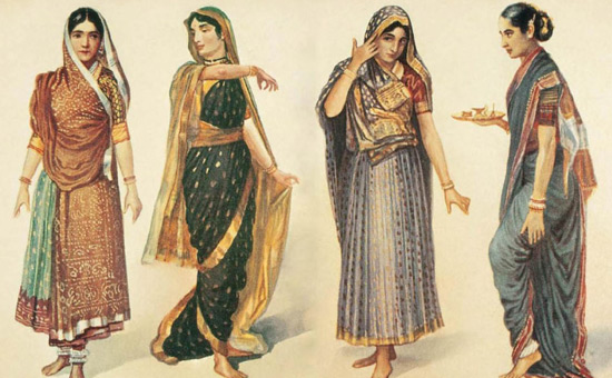


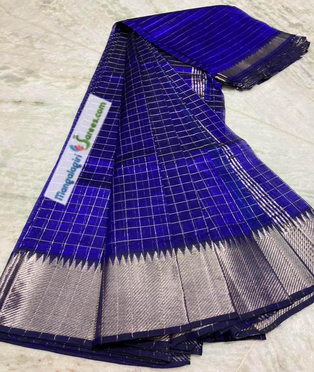


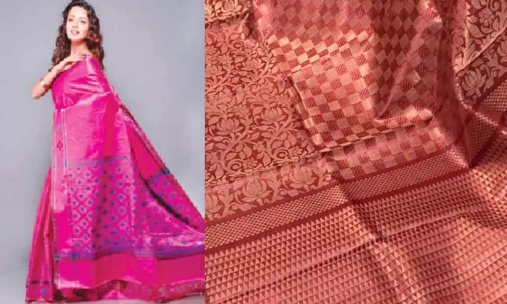


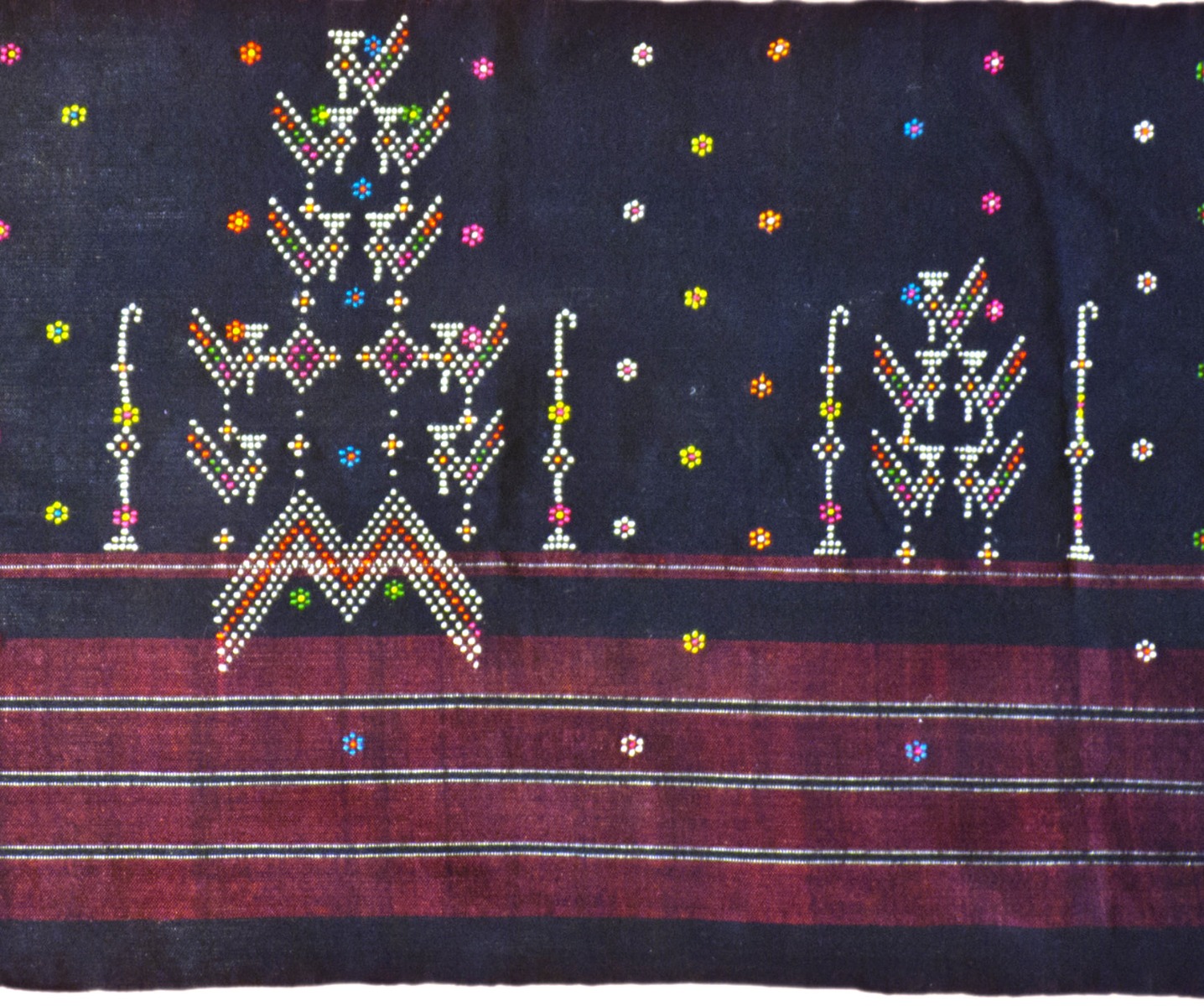
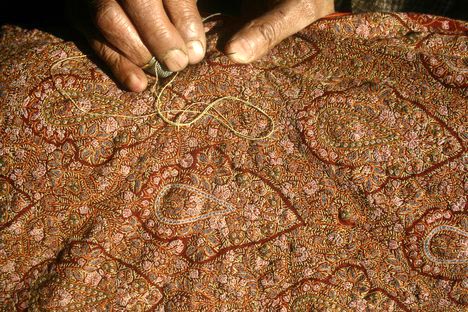

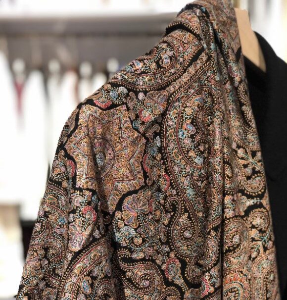
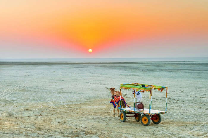

/GettyImages-537000923-541774dbe2d44759815fdf0719b04685.jpg)

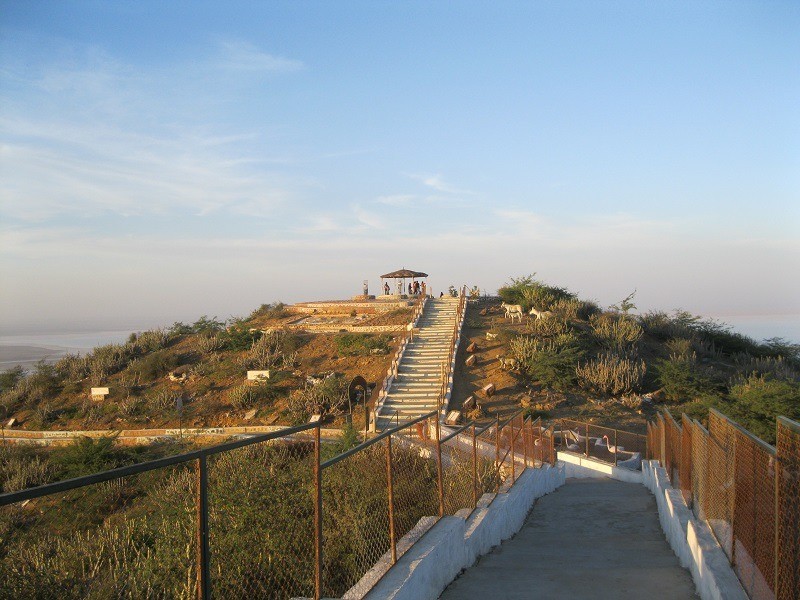
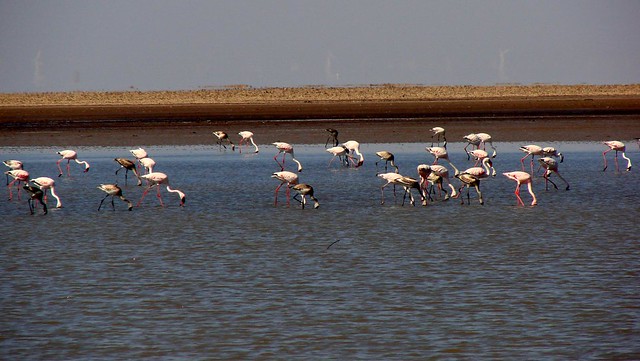
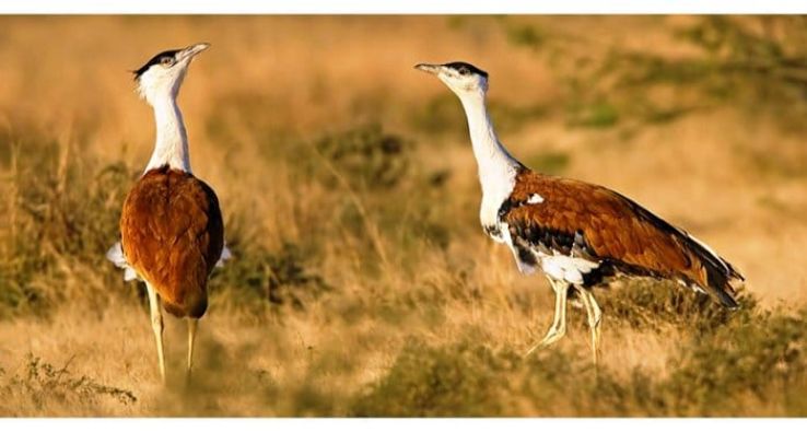


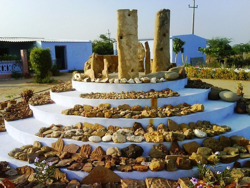


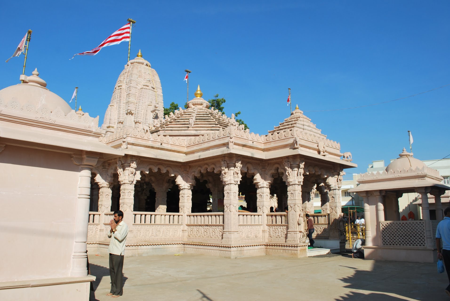
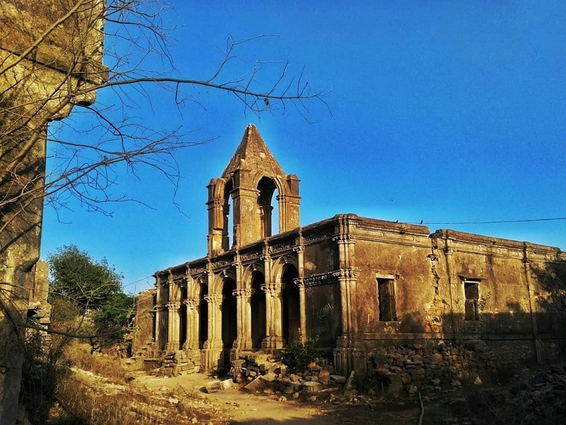
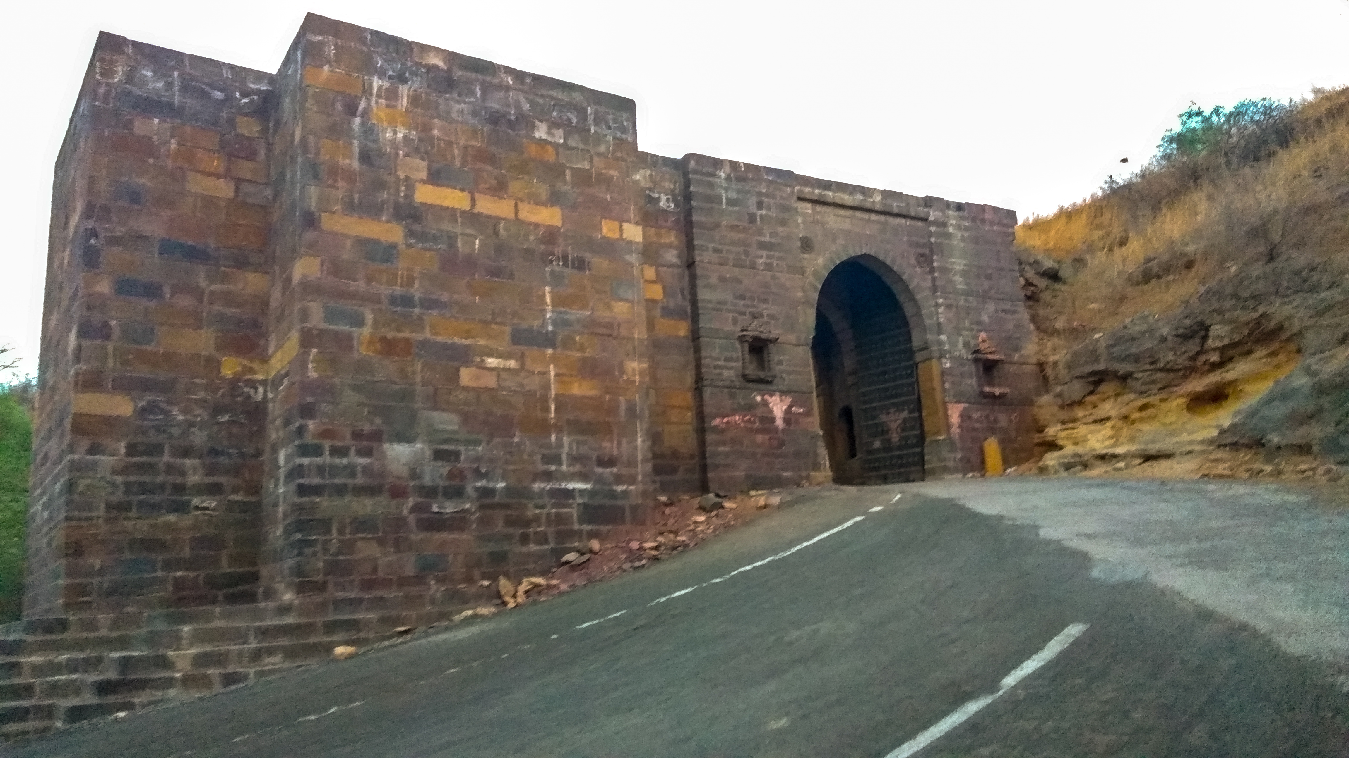


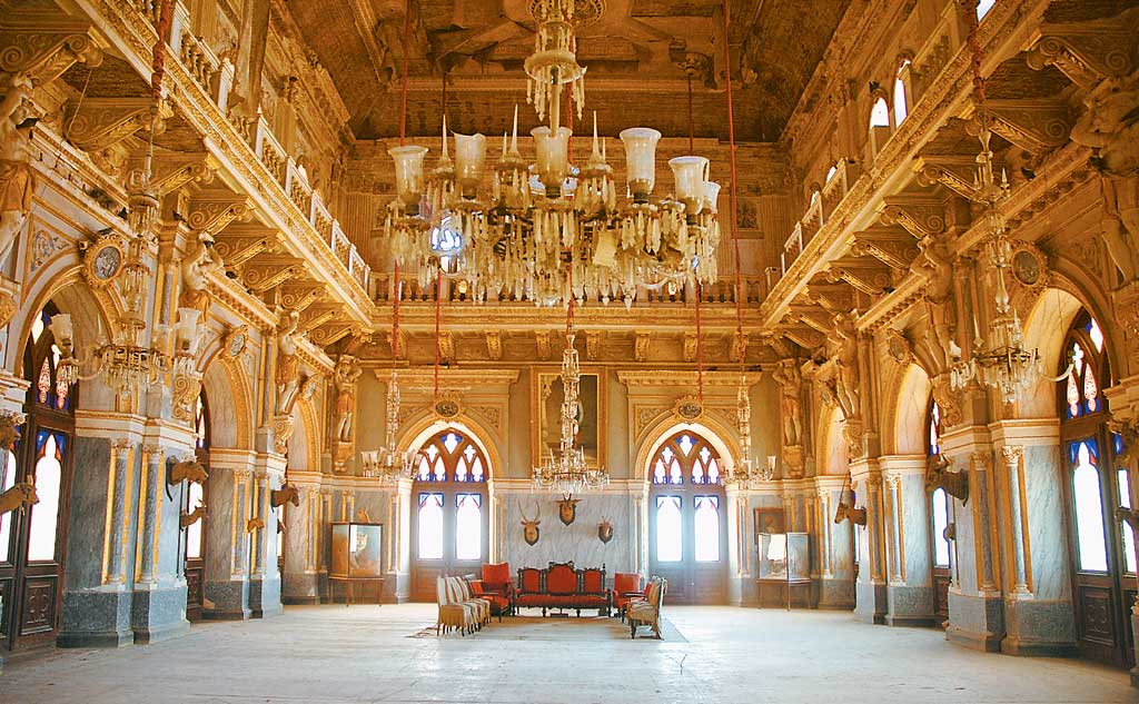
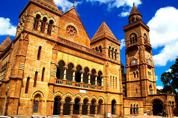

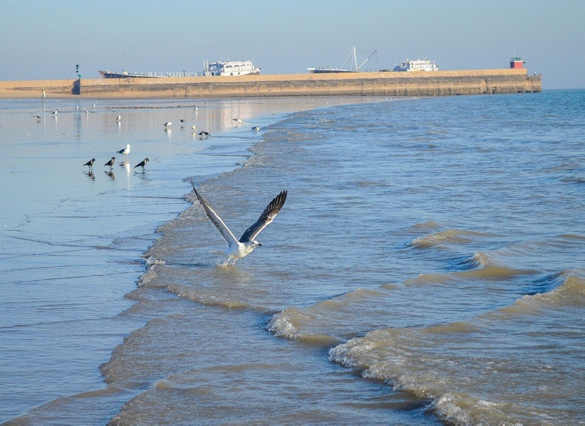

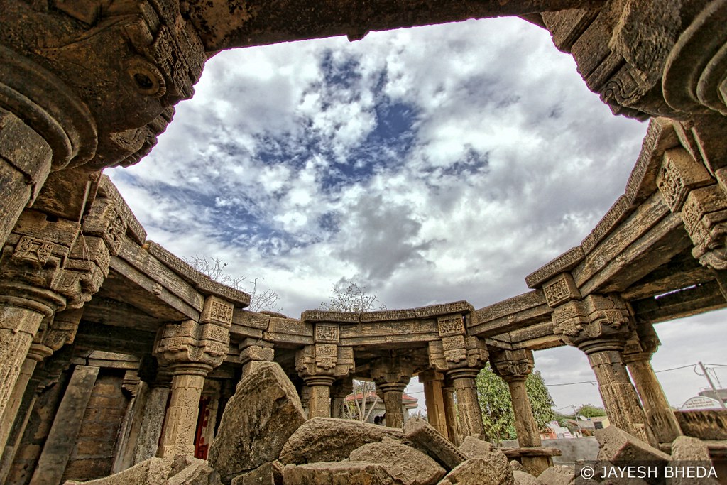

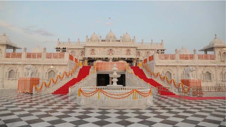
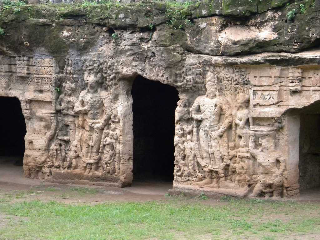
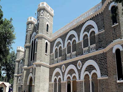
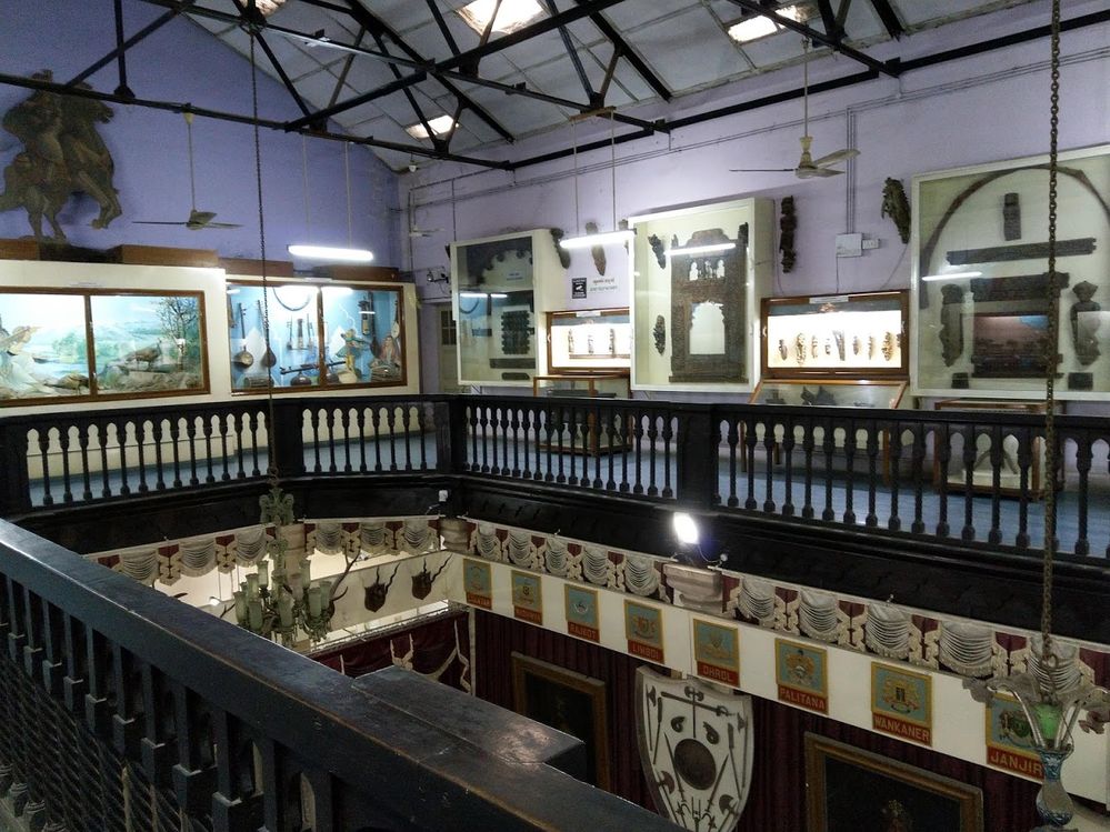

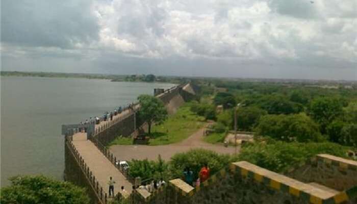
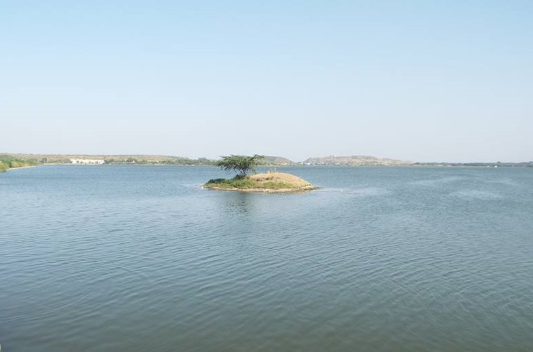


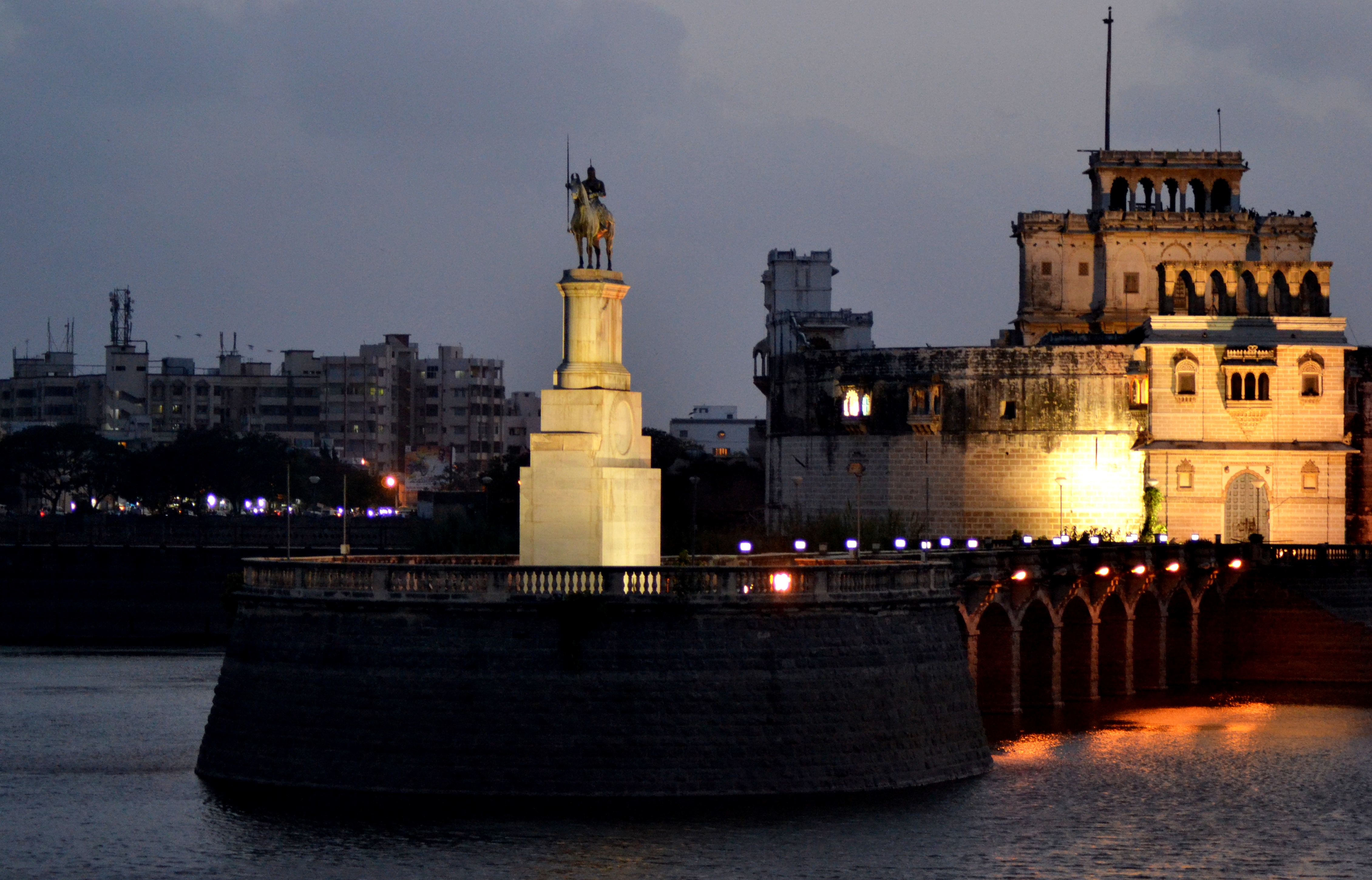
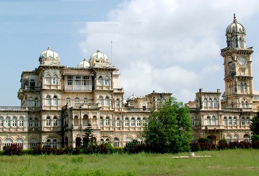


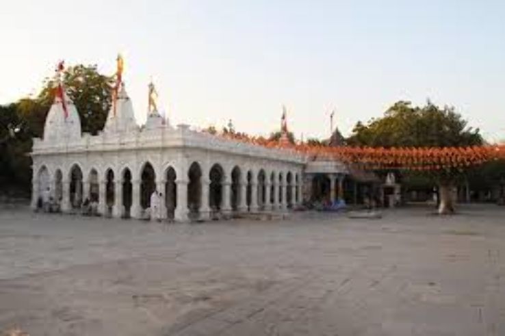

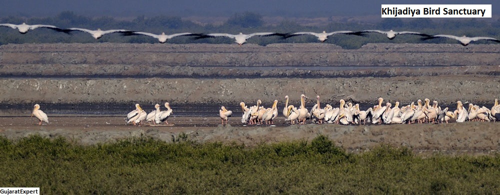

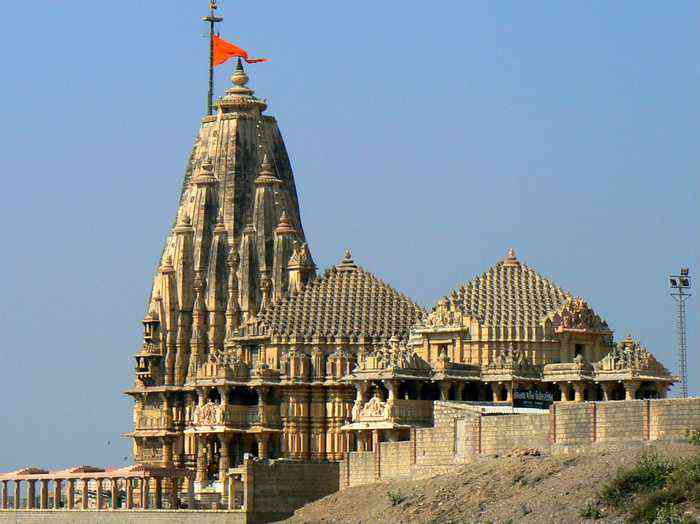

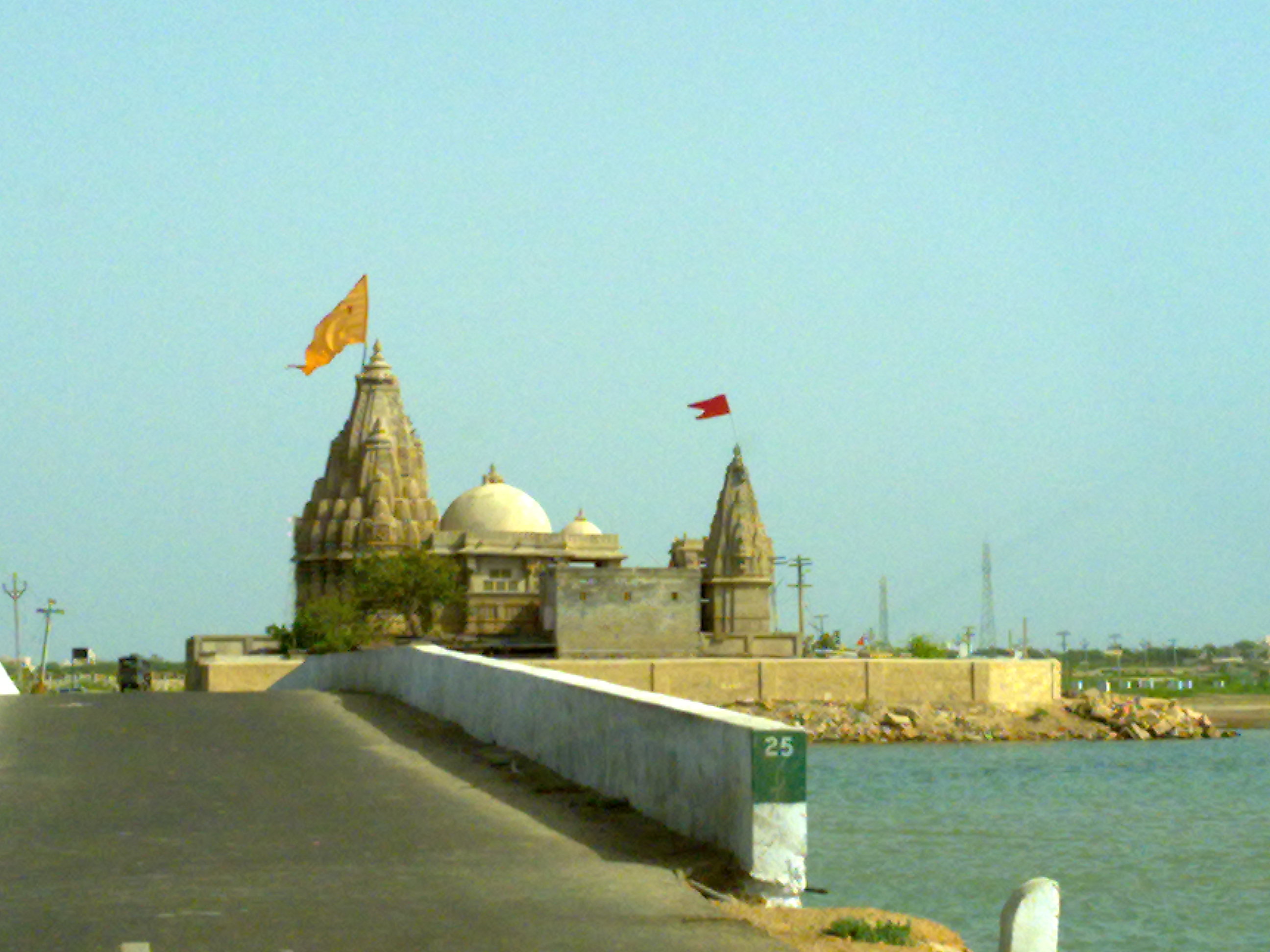

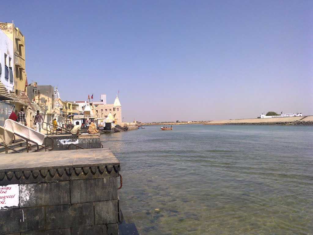
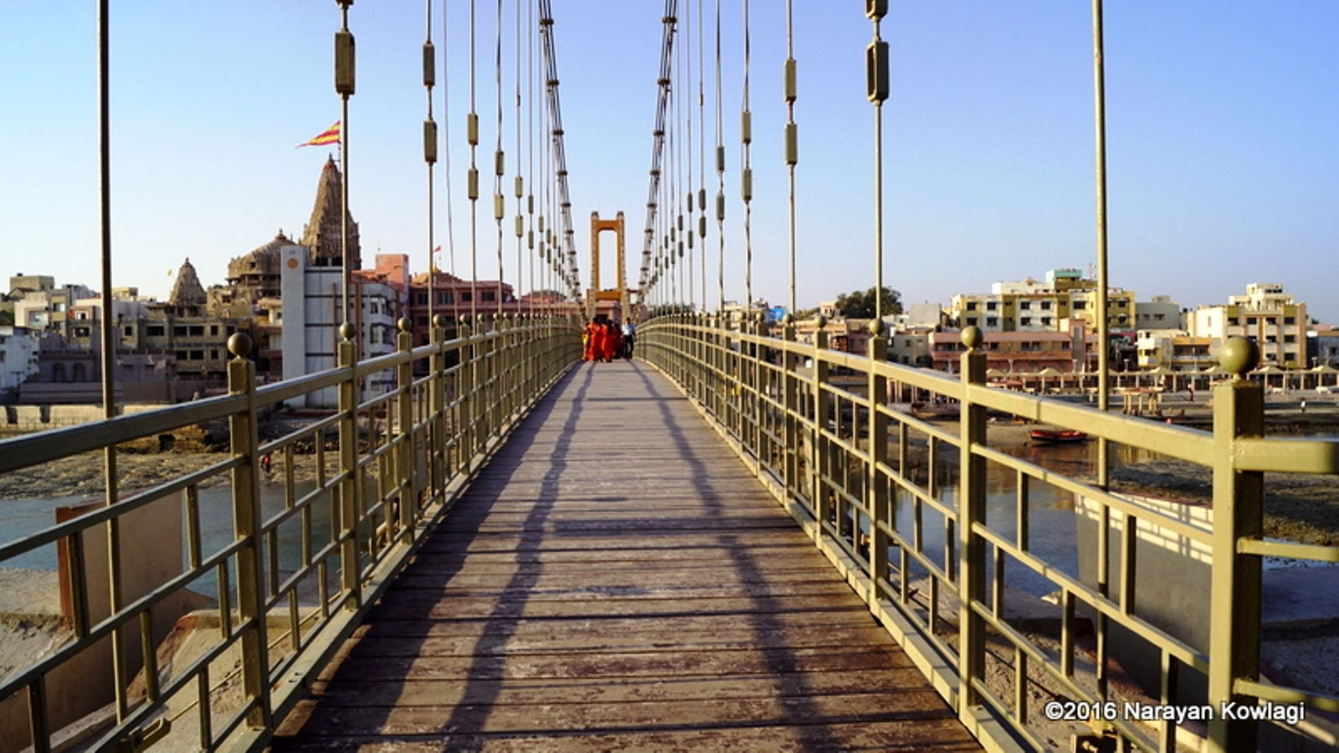


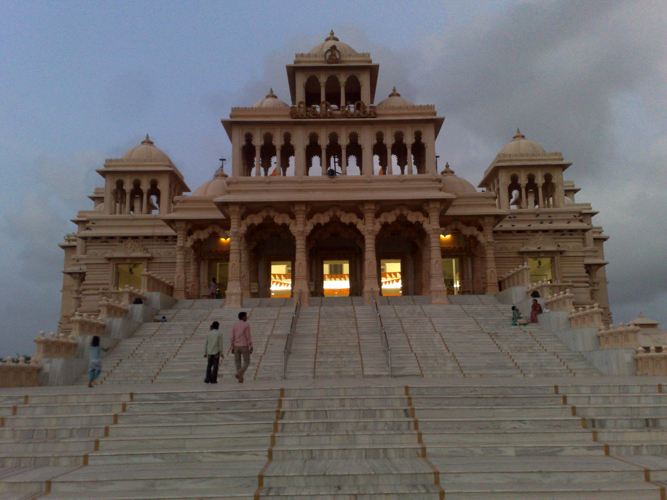

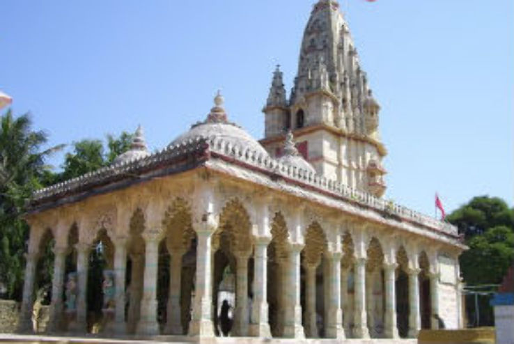

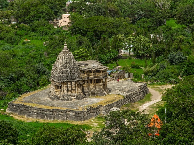


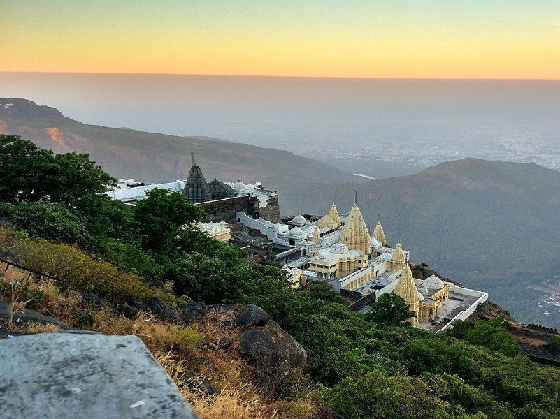


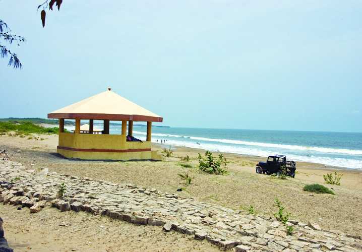

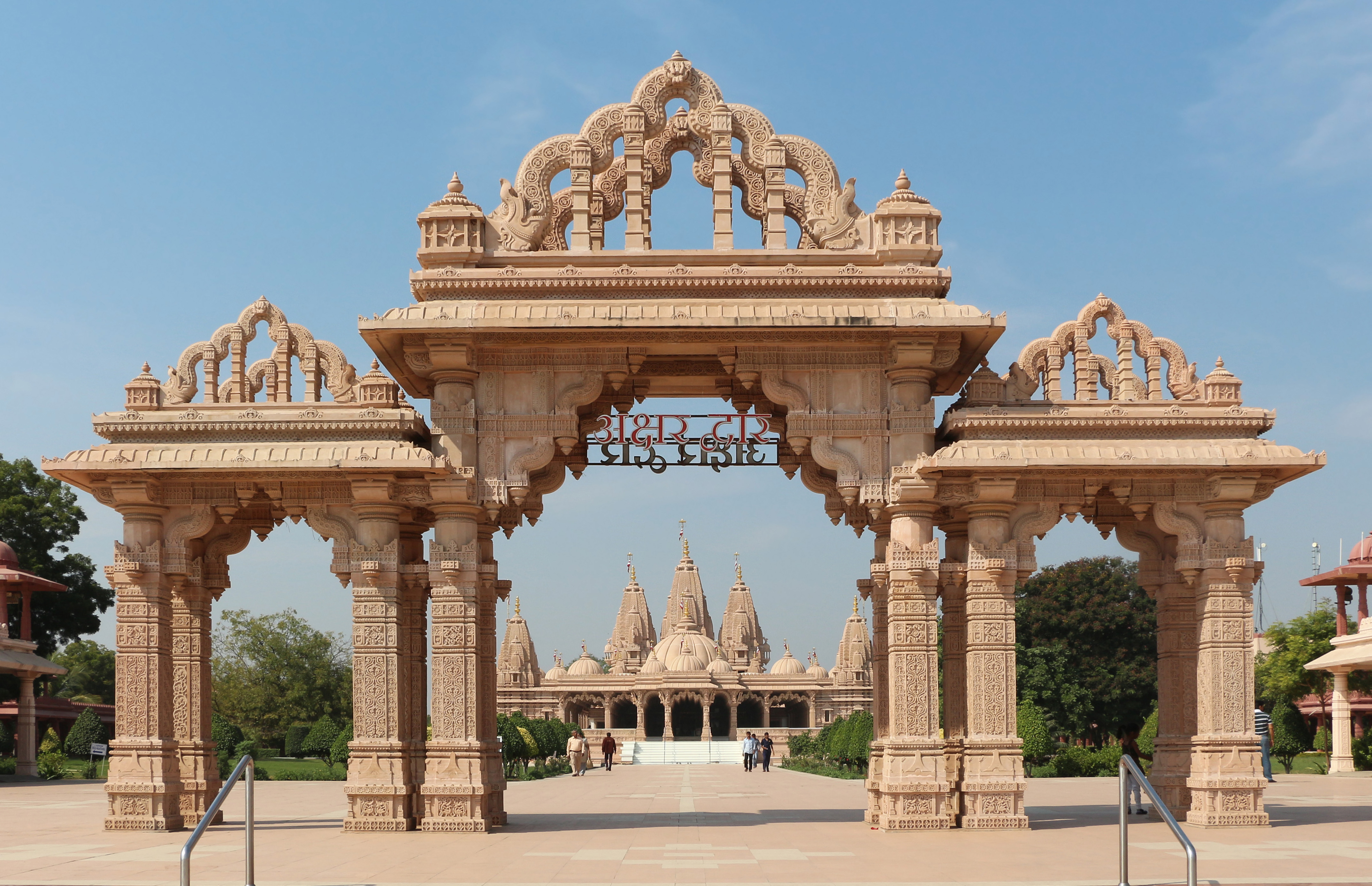
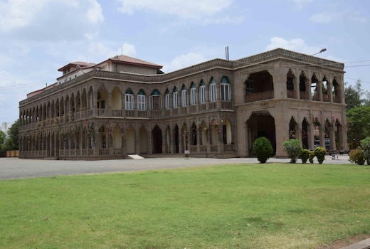
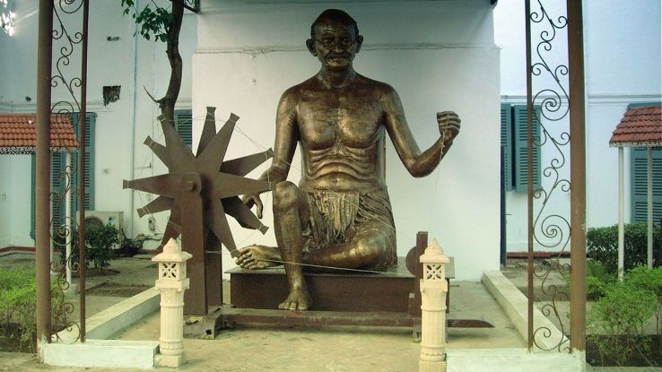
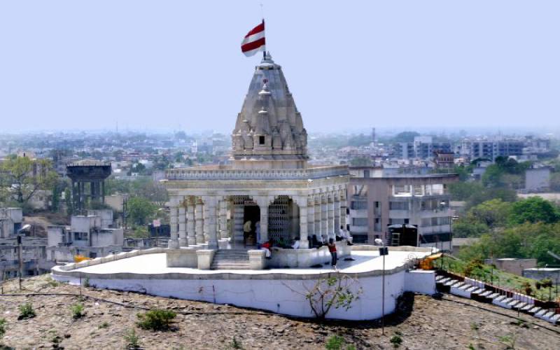
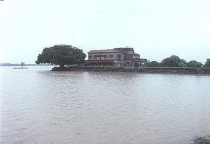


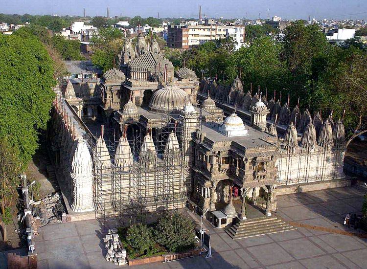
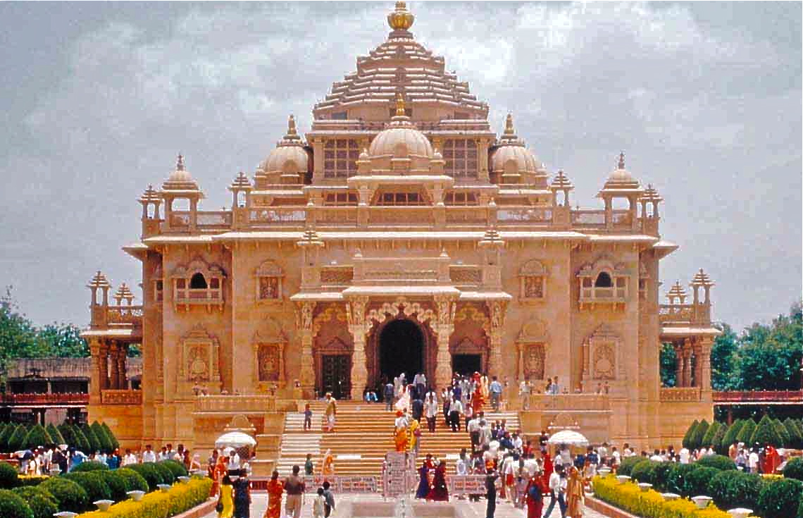
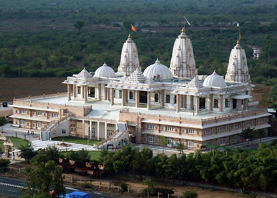

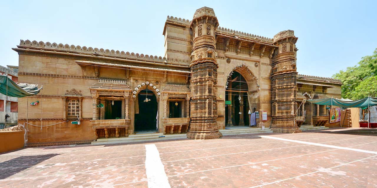

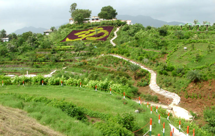

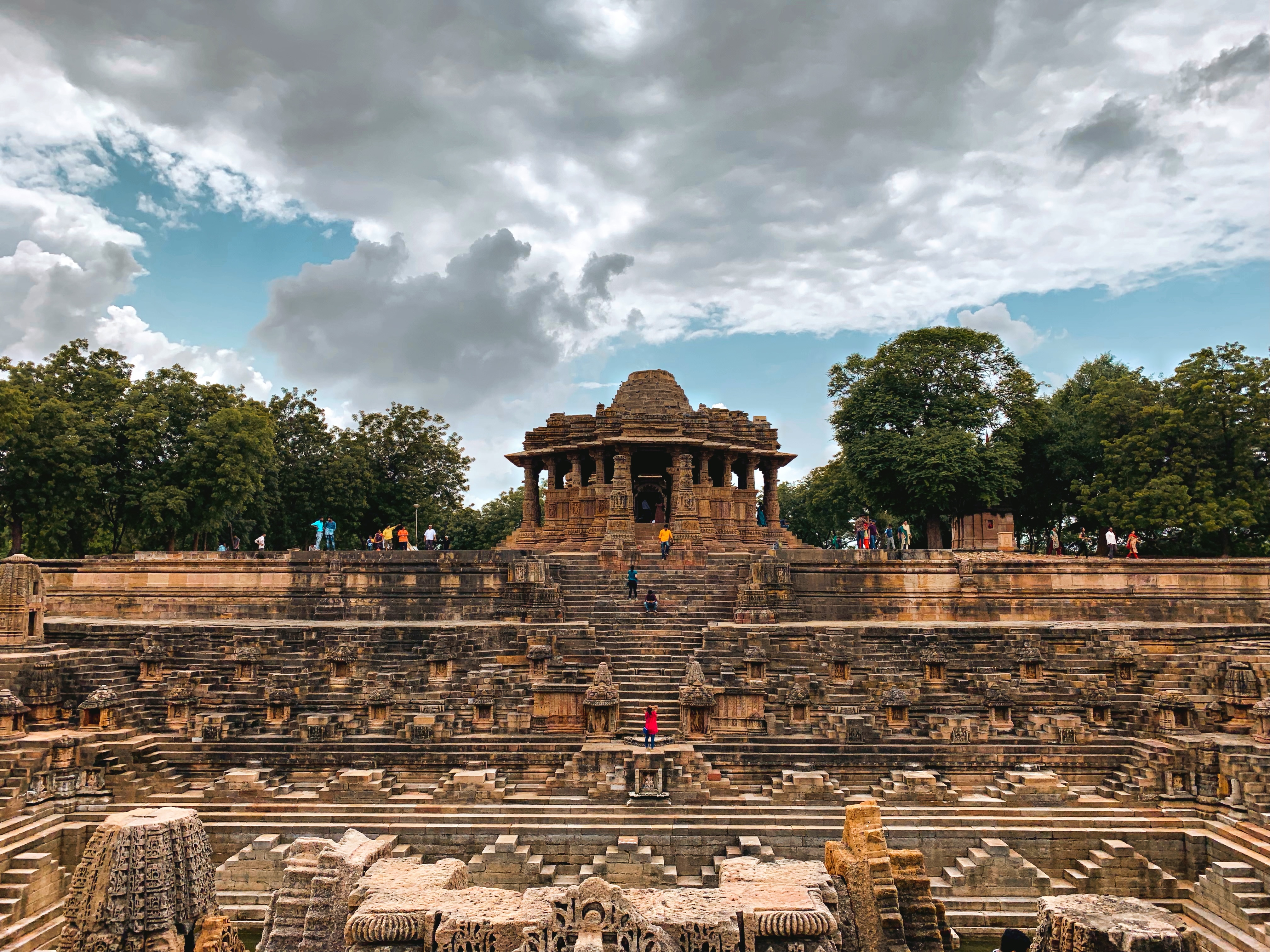
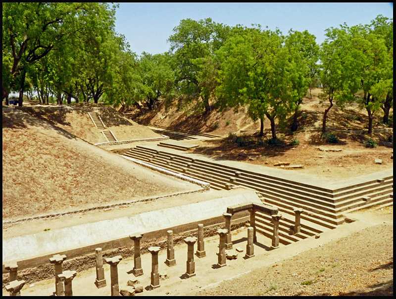

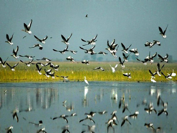

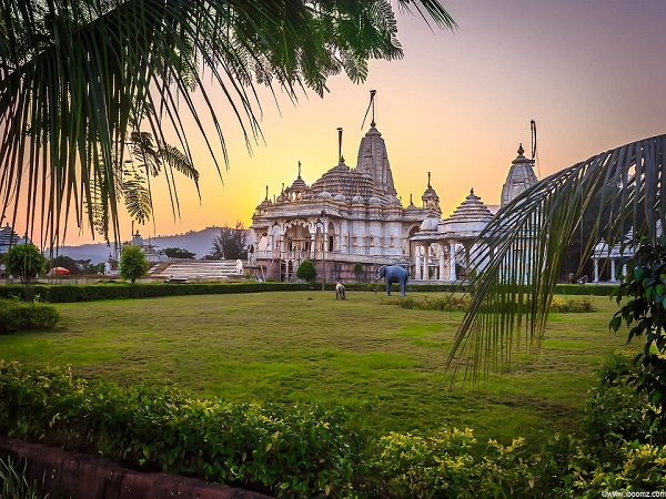


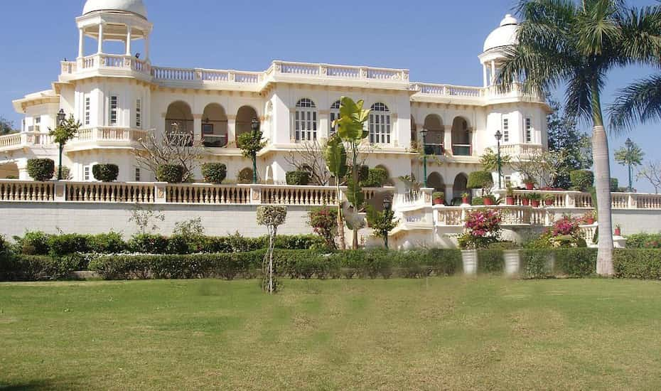
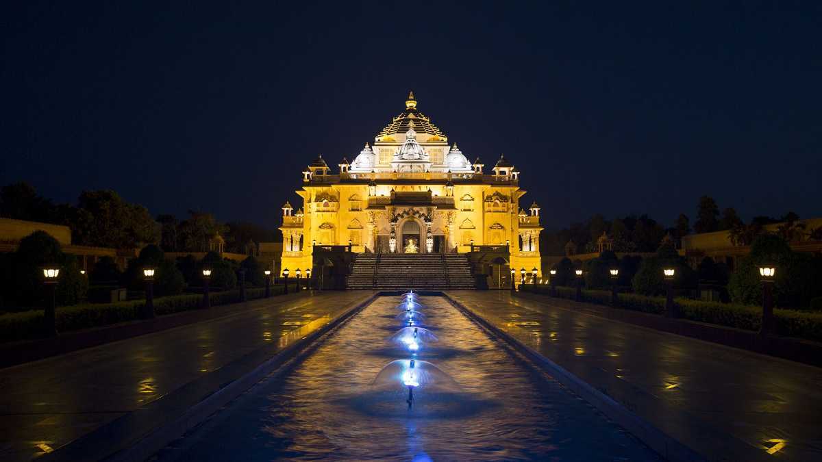


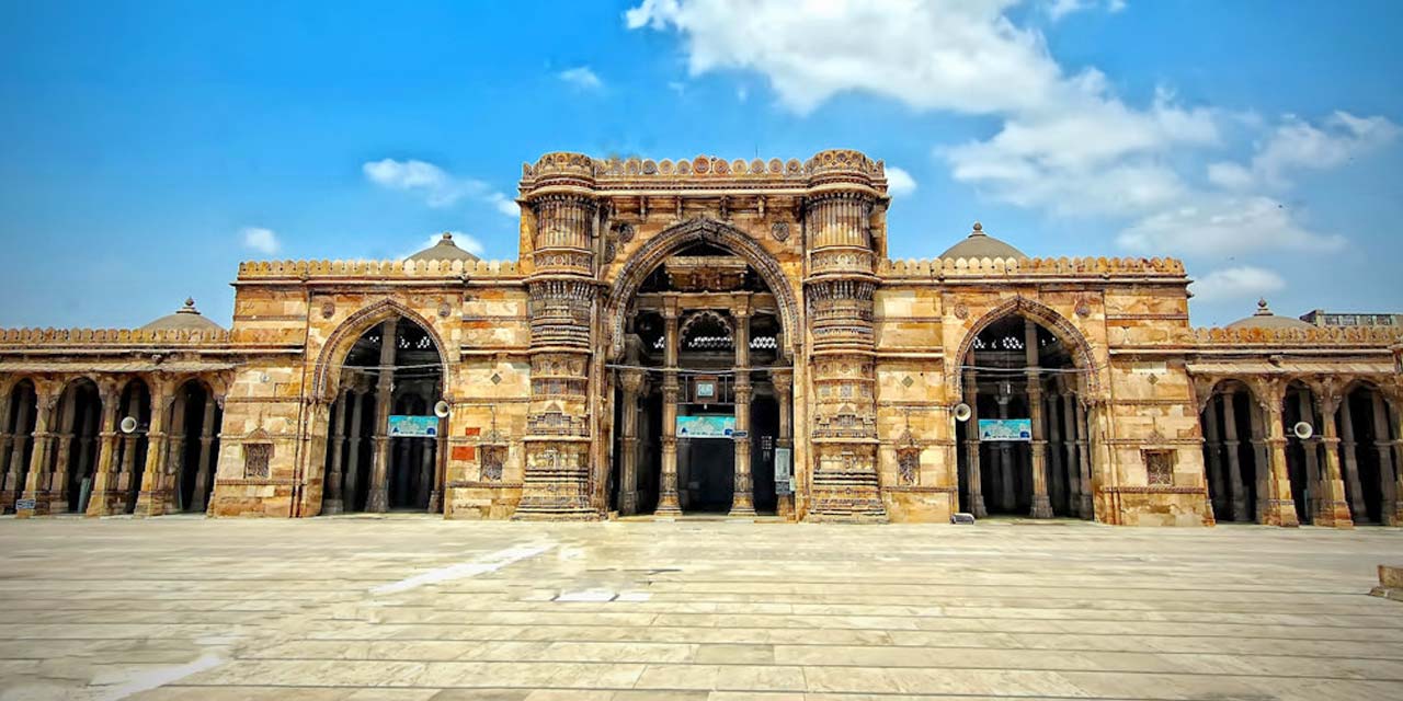

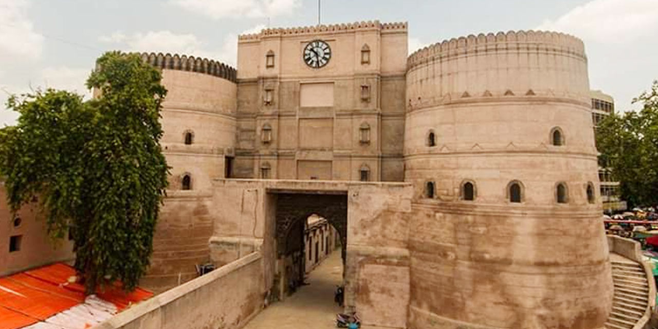
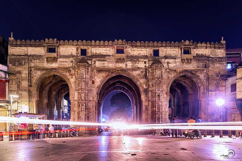
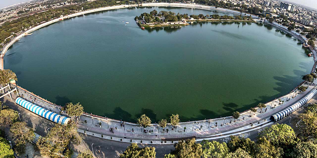
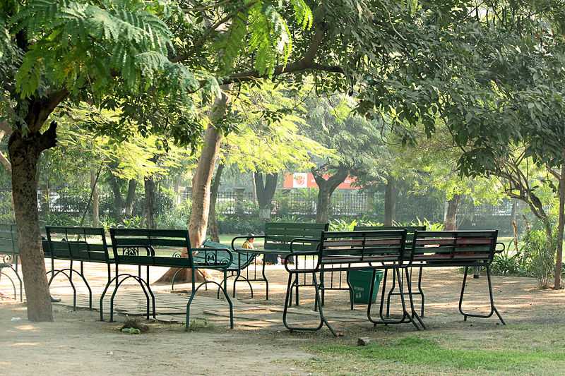
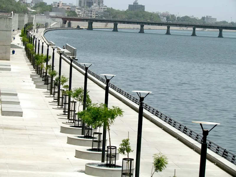

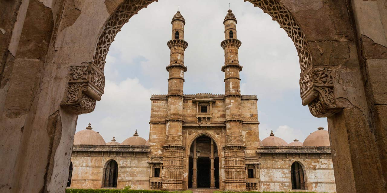


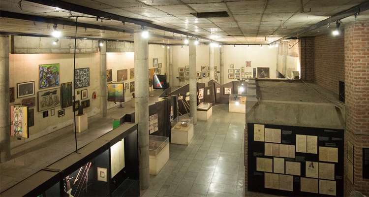

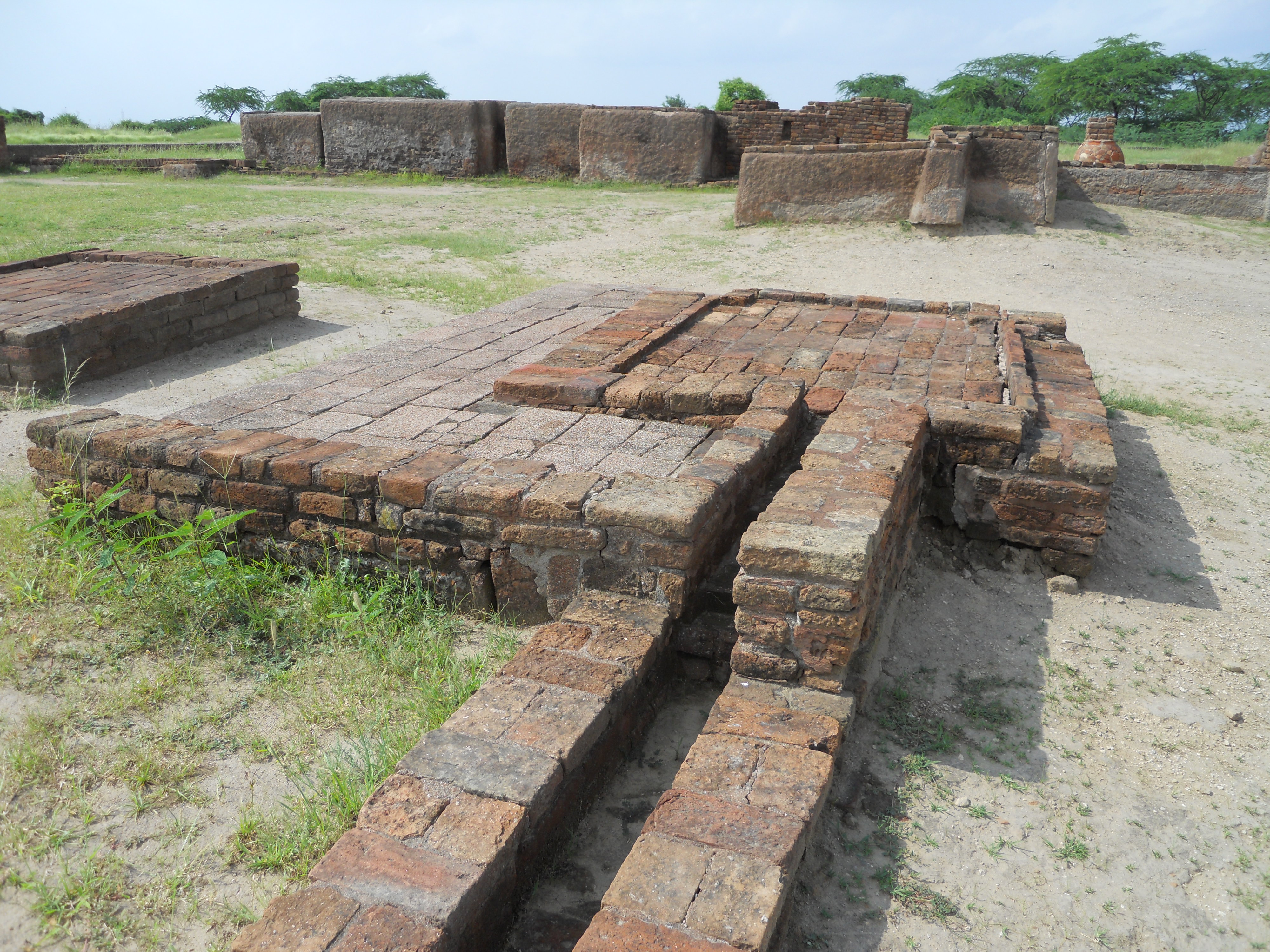
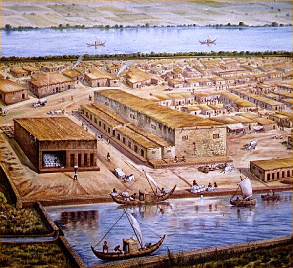


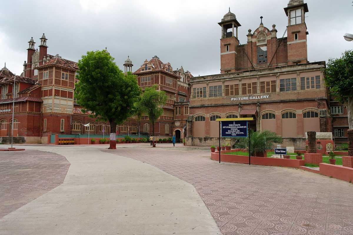
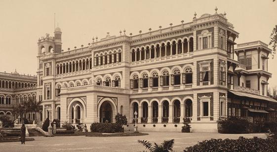
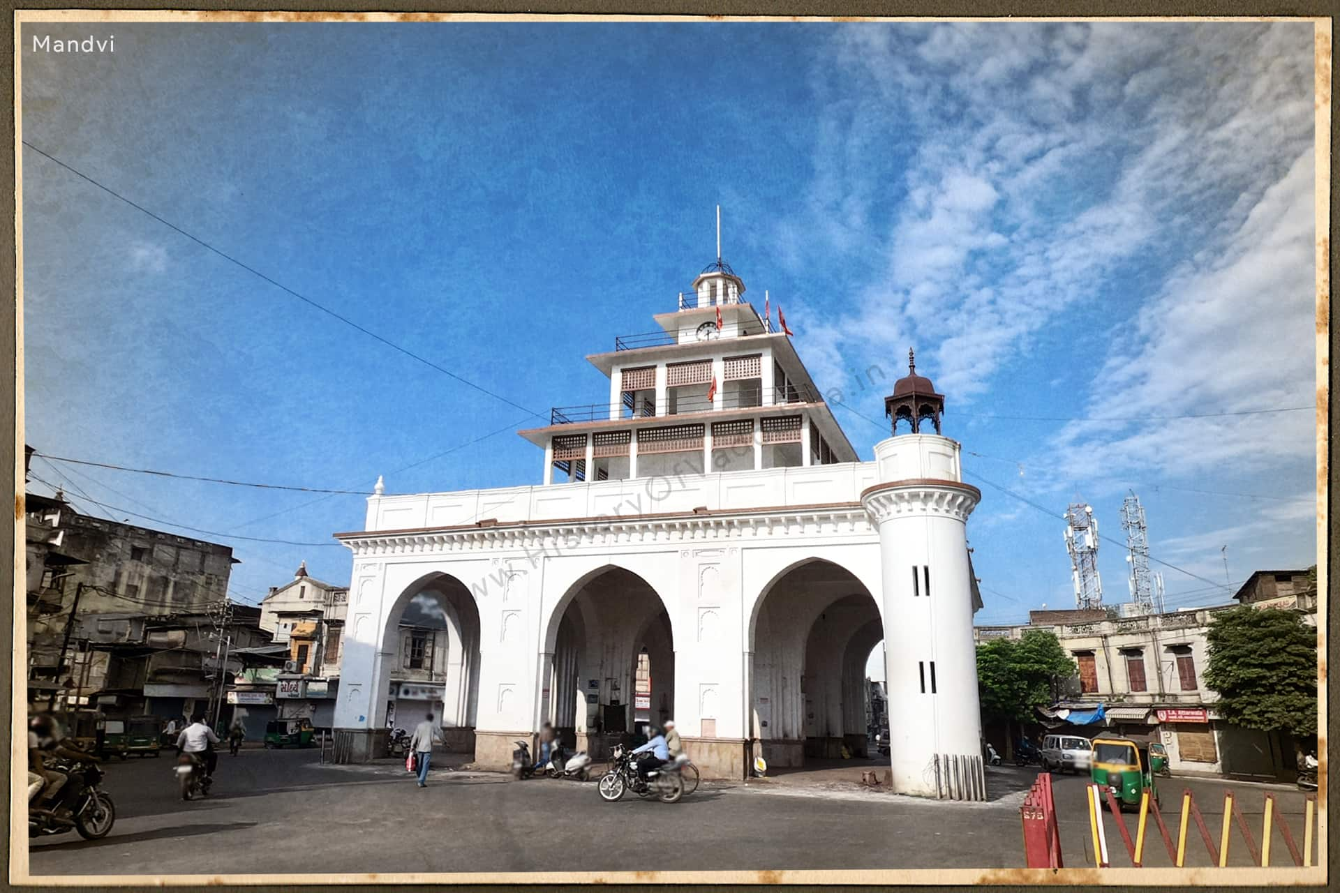


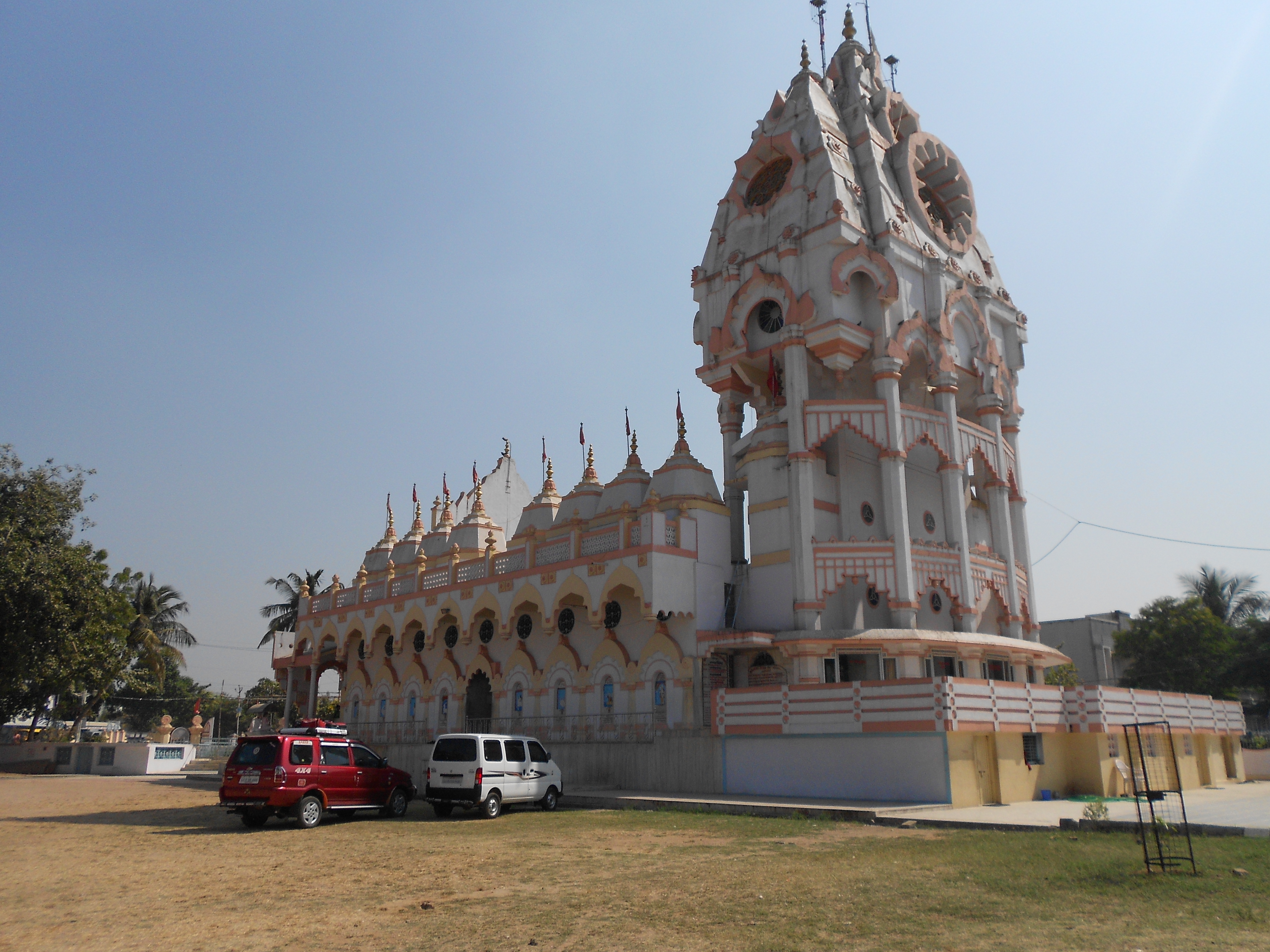

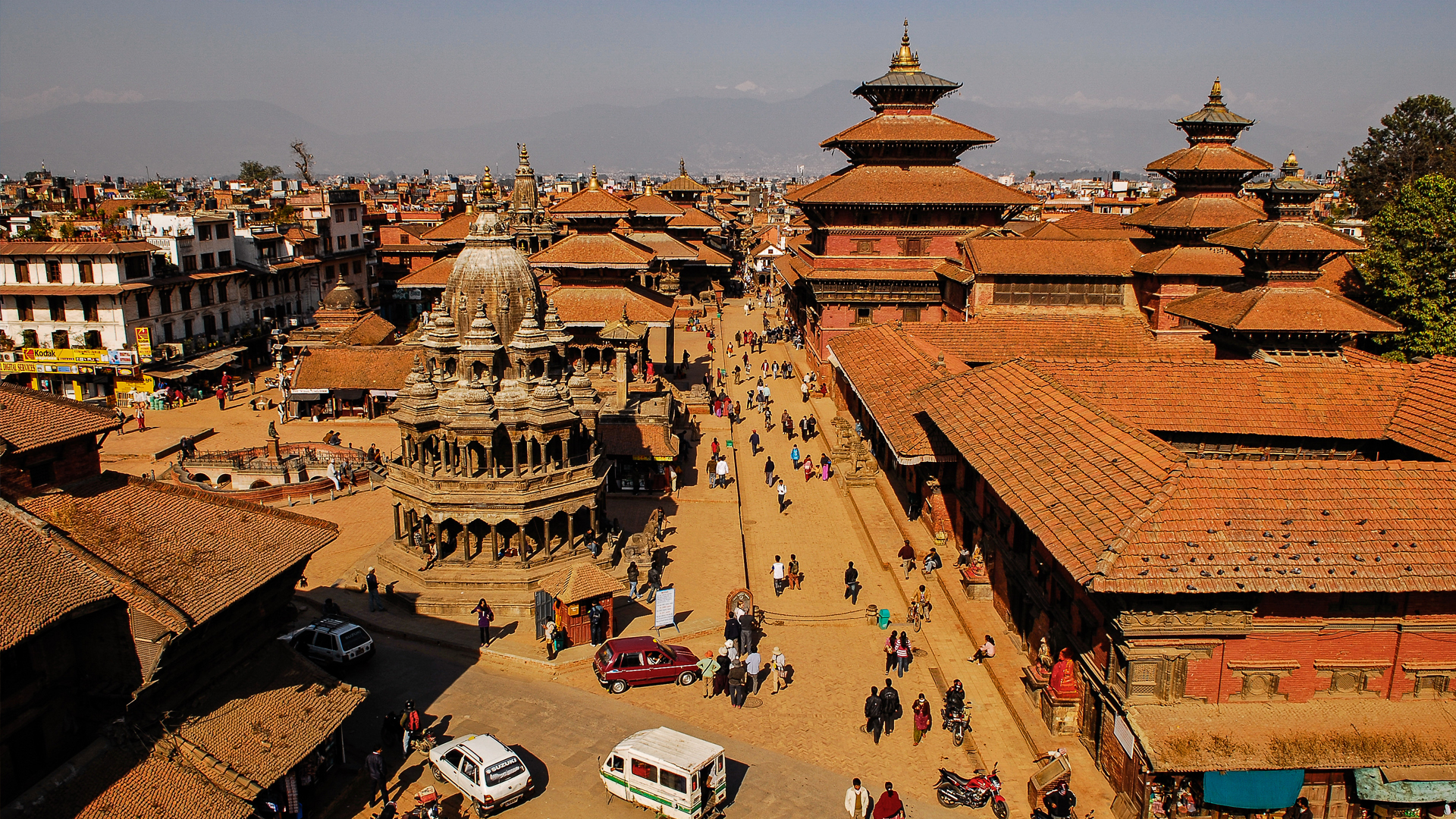