Travel Bucket List: Malaysia Part 41 – Kedah Part 5

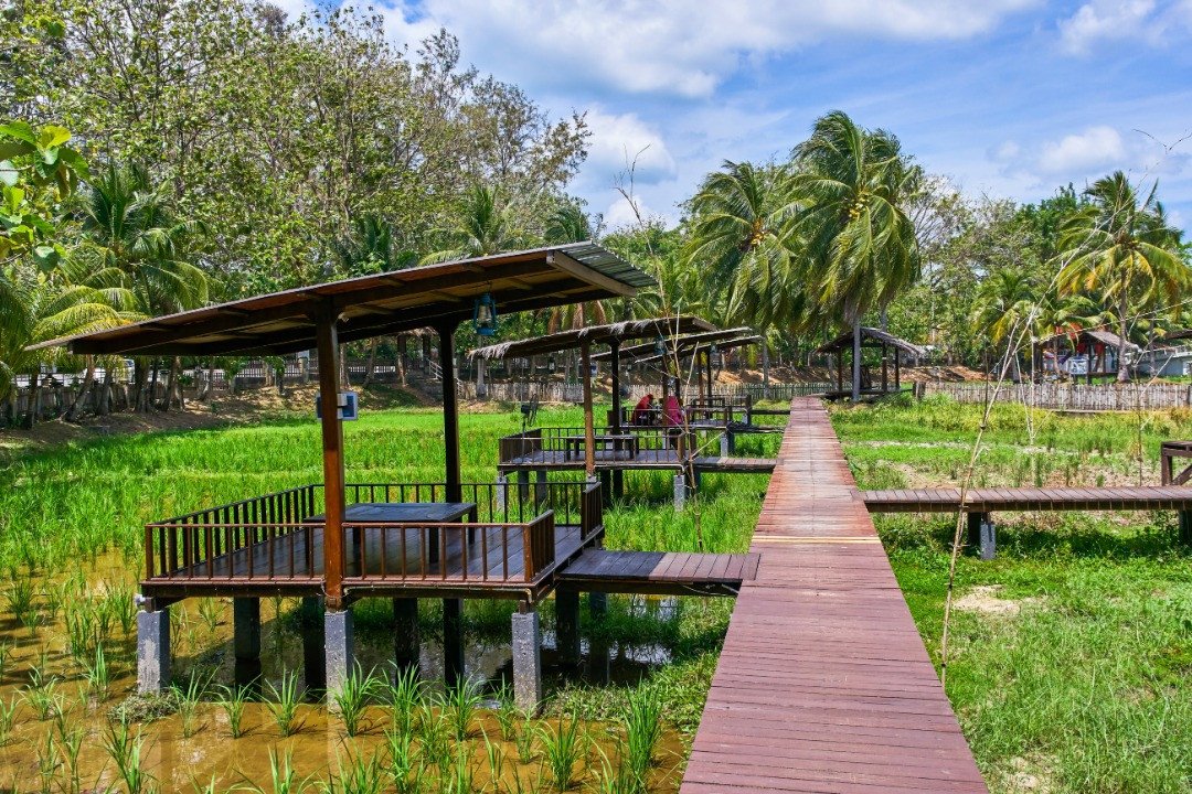
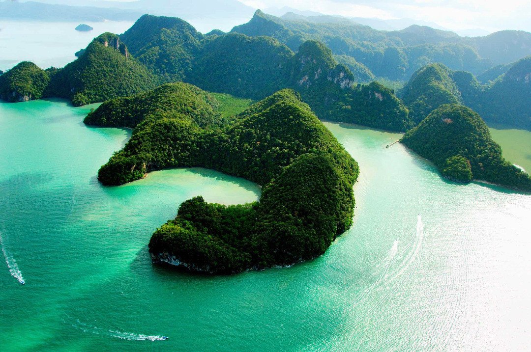
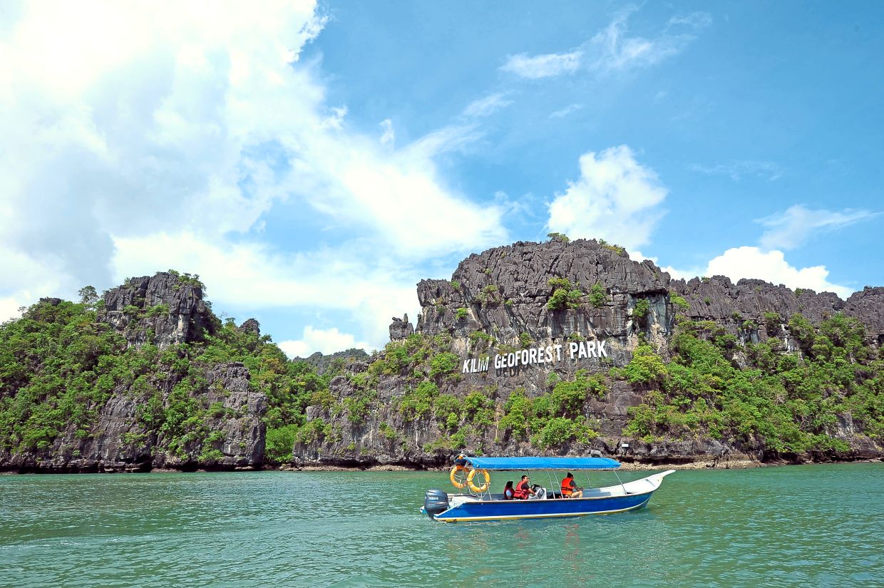
The Kilim Karst Geoforest Park is a mangrove forest park that consists of limestone caves and interconnected three river estuaries that stretch from Kisap village approximately 10 km to Tanjung Rhu. Bats, crocodiles, eagles, kingfishers, monitor lizards, macaques, otters, snakes, and tree crabs are some of the wildlife in the park. A stunning landscape around three interconnected estuaries, Kilim Geoforest Park is best explored by riverboat or mangrove tour. Kilim Karst is home to Gua Kelwar, a popular well-maintained bat cave. The mangrove tour starts off with pick-up from the hotel and heading off to the northern part of the mangroves island in a long-tailed covered boat. While in the boat, one can view a rich variety of wildlife like the monitor lizard, monkeys, and mud-crab as well as an amazing variety of birds. The first stop in the tour is the Floating Fish Farm where feeding the stingrays is altogether a different experience. Next is the Eagle Feeding Spot which is the highlight of the tour. Further is Fossil Island which is a tiny island housing 480 million years old fossils on the rocks. Next is the Gua Langsir cave. The cave is hidden under the mangrove roots, and hence, is also known as the Hidden Cave. Climbing a flight of stairs here and crossing a footbridge takes one to a beautiful lake called the hidden lake. Next, the high-speed boat takes one to the open sea to view the Shoe Island, named so because of its resemblance to the shape of a shoe. The next part of the tour is a visit to the soft white sands of the Tanjung Rhu Beach. Lunch at the Hole in the Wall floating restaurant also forms a part of the tour. After lunch, one is taken to the Crocodile Cave followed by the Bat Cave which is the final stop. Apart from the spectacular sight of bats and unique limestone formations, the Living Fossil, a centuries-old plant, is the highlight of the cave. Although Kilim Geoforest is open throughout the year, the best time to visit it is during the migratory season from September to March. The Geoforest is open fro 9 am to 5 pm every day and has fees between RM 200 to RM 500 which includes a boat and tour guide.

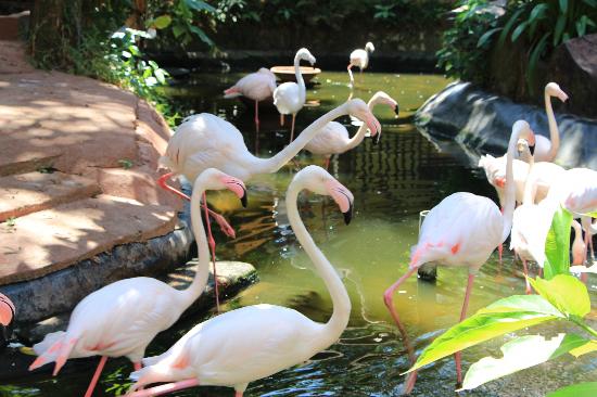
Langkawi Wildlife Park & Bird Paradise is an alluring wildlife and bird sanctuary situated in Jalan Ayer Hangat. Established in 2002, this beautiful garden and spacious arena is home to various exotic wildlife animals and 2500 bird species. Visitors can catch a glimpse of canaries, owls, eagles, toucans, hornbills, macaws, flamingos, peacocks, mandarin ducks, ostrich, and cranes, among many others. Apart from this, explore some fascinating animals like alligators, turtles, lizards, porcupines, monkeys, meerkat, mouse deer, Iguana, deer, etc. inside the wildlife section of the park. A one-way path is made around the sanctuary with caged boundaries for a comfortable sprawl. Feed the animals with the assistance of the guides or shop a souvenir or gift from a crystal shop having some fine crafted Chinese and Brazilian jewellery, duty-free outlets, and souvenirs outlet located inside. Langkawi Wildlife Park & Bird Paradise is also extremely famous for a 15 feet human-made waterfall that let the visitors capture some mesmerizing and picturesque sights. Tickets are sold till 6 pm and Malaysians pay RM 30 for adults and RM 22 for children and senior citizens while foreigners pay RM 45 for adults and RM 28 for children and senior citizens. The bird park is open daily from 8:30 am to 7:30 pm.

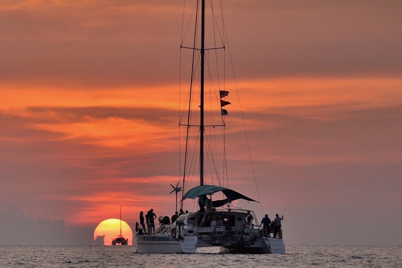
A sunset cruise is one of the best experiences for tourists visiting Langkawi. Cruises also offer a saltwater jacuzzi, where you can float on a seat protected by a net and enjoy being massaged by the yacht’s trail. In addition, the cruises provide seafood barbecues for dinner, as well as unlimited drinks, included with the ticket price.

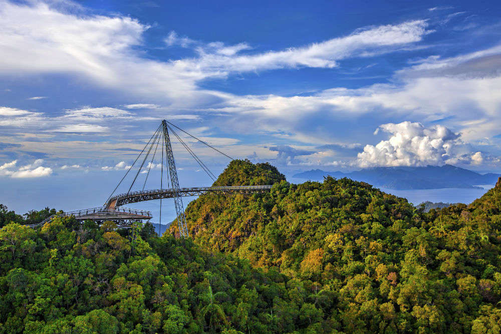
The Langkawi Cable Car takes visitors up to the peak of Gunung Mat Chinchang, where the Langkawi Sky Bridge is located. An inclined lift called SkyGlide that would take visitors from the top station to the Sky Bridge was completed in late 2015. The start of the cable car ride is located in the Oriental Village where there are several attractions, including a 3-Dimensional art museum known as Art in Paradise.

Located at The Oriental Village in the upper northwest of Langkawi Island, the Langkawi Cable Car takes the riders to the top of Mount Mat Cincang. Also referred to as Langkawi SkyCab, it is popular for the panoramic view of the surrounding islands and the Andaman Sea. Officially opened on November 1, 2002, Langkawi Cable Car is the world’s steepest SkyCab and has the longest free span for a monocable. The cable comprises three stations: the base station, the middle station, and the top station. The total length of the cable is 4400 metres from the base station to the top station, which is covered in approximately 15 minutes and a round trip takes about 28 minutes. The viewing points at the stations offer a fascinating view of the mountains, caves, cliffs, blue waters, beautiful skyline and the tiny islands scattered in the Andaman Sea. At the base station and the top station, there are a plethora of activities and facilities.

Base Station is located at the foothills of the Machincang Mountain in the Oriental Village and offers different facilities for shopping and eating. From here, the visitors are taken to MachincangRangee, Middle Station via the Langkawi Cable Car. The visitors can either alight at the station and walk up to the viewing platforms or continue travelling to the Top Station. The journey from the base station to the middle station covers 1700 metres and provides access to the eastern ridges. The Middle Station is at an elevation of 650 metres above sea level, where you can get a 360-degree view of the main island and the surrounding islands.

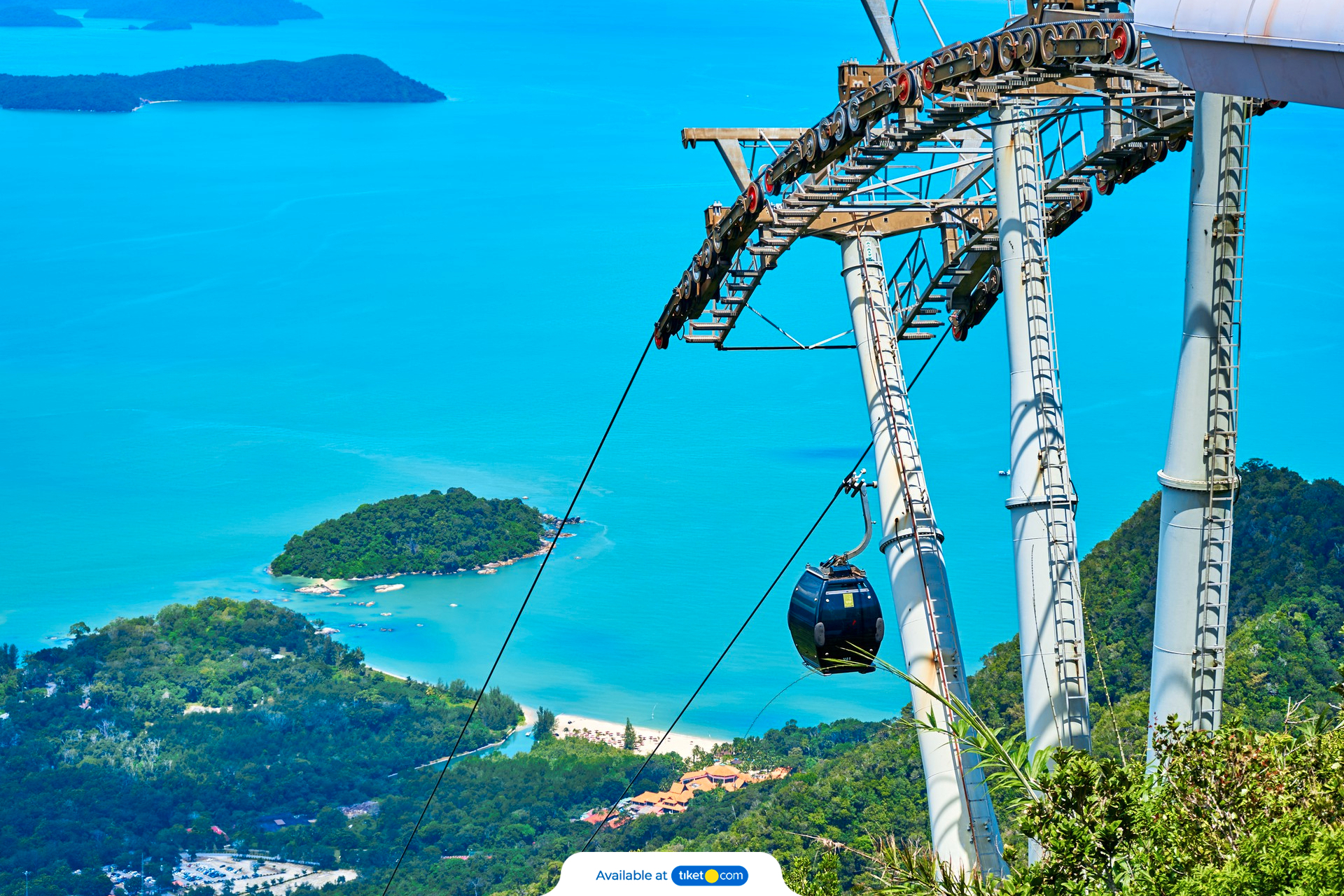
On the journey to the Top Station, visitors can spot the flora and fauna that surrounds the area at a close range. The Top Station is at an elevation of 708 metres from the sea and has at its disposal two circular viewing platforms at the top of Machincang Mountain which are both a short walk up the stairs. This sight beholds an awe-inspiring view of Southern Thailand, Langkawi, isolated pinnacles, and cliff walls. There is a 2.5-km walking trail referred to as the Sky Trail through the forest that goes down to the Middle Station and Seven Wells Waterfalls.

A normal gondola can accommodate six people and takes 15 minutes to reach the top station. It’s priced at RM 40 for an adult and RM 30 for a child who is Malaysian. For non Malaysians, adults pay RM 55 for an adult and RM 40 for a child. For express lane privileges, it can cost between RM 90 and RM 105 per person, reducing the waiting time to not more than 10 minutes. The Bottom Glass Gondola has a transparent glass bottom and provides dazzling views of the mountains and forests underneath. It costs RM 105 per person and takes 15 minutes to reach the top station. The price is inclusive of Express Lane privileges. A private gondola can accommodate up to 6 people and uses the Glass Bottom Gondola. The price is RM 550 per gondola, inclusive of express lane privileges. To experience a private ride, one should opt for a VIP Gondola, which can accommodate up to 3 people in a VIP Gondola for RM 550 per gondola, inclusive of the Express Lane privilege and a complimentary meal. The cable car is open from 9:30 am to 7 pm daily.

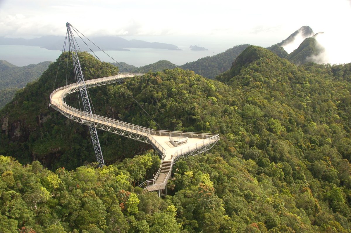
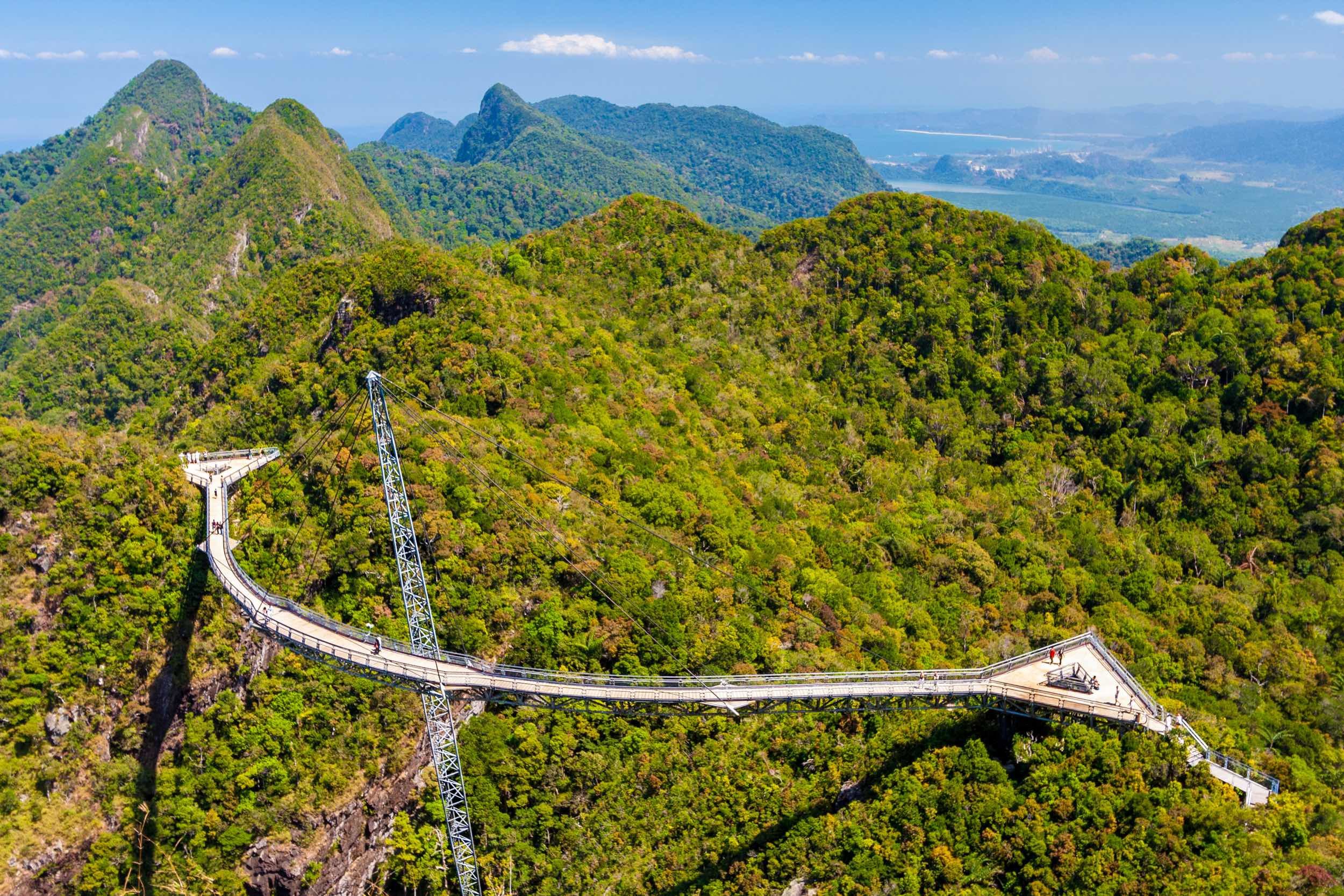
The Langkawi Sky Bridge is a 125-metre curved suspension bridge, located at the end of the Langkawi Cable Car ride. Touted to be one of the world’s longest curve suspension bridges, it overlooks Mount Mat Cinchang and offers mind-stirring panoramic views. Suspended at an altitude of 100 meters from sea level, the view from the Langkawi Sky Bridge includes the Telaga Tujuh Waterfalls and a rainforest, both of which make the walk worthwhile. The sky bridge is accessible from the Top Station of Langkawi Cable Car.

The Sky Bridge is supported by 8 cables from a single pylon of 82 meters, which is the only supporting structure of the Sky Bridge. The bridge is supported by double steel railings and has an enclosed steel wire mesh below, which makes it safe to travel. The bridge also has two triangular platforms where people can rest their feet while admiring the view. Since the stunning Langkawi Sky Bridge is a curved walkway, it allows visitors to maximize their viewing experience. The maximum capacity of the bridge is 250 visitors at a time and is spread over an area of 500 square meters. The bridge is considered an architectural marvel and rightly so, as it was constructed with precise details and planning. In fact, a helicopter lifted the entire bridge on top of the mountain and was then attached to the pylon.

The Sky Glide is a cabin type of transport that takes passengers to the Sky Bridge located below the Top Station of the Langkawi Cable Car. The sky glide is essentially like an elevator that can drop visitors to the foot of the sky bridge. With a track length of 94 meters, it reaches the sky bridge in two minutes. However, visitors must pay extra for the Sky Glide and tickets must be purchased at the counter in the top station. The price for the Sky Glide is RM 10 for an adult and RM 7 for a child. For a cheaper and more adventurous visit to the Sky Bridge, one can take a 10-minute-walk through a small jungle trail to arrive at the foot of the bridge.

The fare for the sky bridge is not inclusive of the cost of the cable ride. The cable ride has its own set of charges. It is recommended to visit the Sky Bridge after 2:00 PM, as it is crowded in the morning. It is also recommended to visit the bridge when the sky is clear, as cloud formations may prevent visitors from enjoying the view. Entry fees are RM 6 for an adult and RM 4 for a child. Tickets can be purchased at the Sky Bridge Ticketing Counter at Top Station

A helicopter ride is the best way to see all the sights of Langkawi from 10,000 feet above the ground. Tourists can experience panoramic views of the island and the surrounding Andaman Sea, as well as the charming harbours across Langkawi. The tour also takes passengers above Cenang Beach, Tengah Beach, and Dayang Bunting Lake.

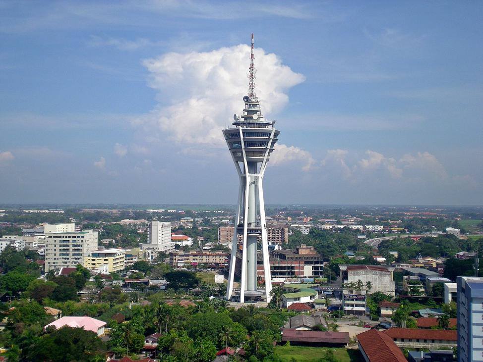
The MAHA Tower in Kuah, part of the Langkawi City project, is the latest addition to the attractions on the island. The tower is approximately 1.40 km from Dataran Lang. Formerly known as Langkawi City Tower, the MAHA Tower is a 2-story, 138-meter-tall tower, and Malaysia’s second-tallest tower. It serves as the landmark of the Langkawi City development, which is set to be completed in 2024/2025.

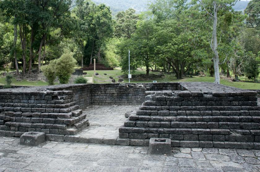
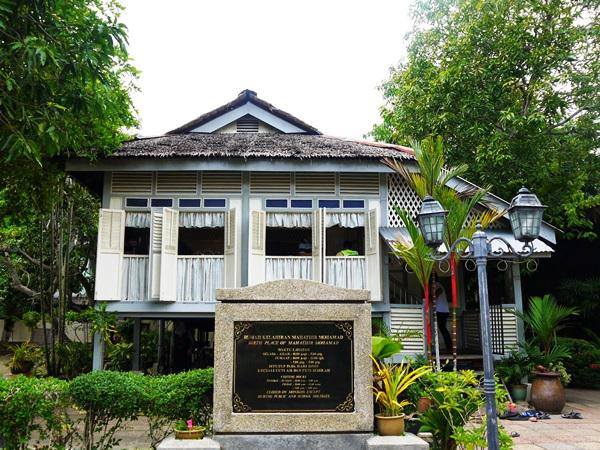
Mahsuri’s Tomb, located 12 km from Kuah, is the tomb of the legendary Princess Mahsuri. Also called Makam Mahsuri, it is known for its beautiful architecture and peaceful gardens. The legend of Mahsuri is from about 200 years ago, when a beautiful and charming village maiden named Mahsuri, who lived in Langkawi, was wrongfully executed to death on grounds of adultery. Mahsuri’s Tomb entails a crypt of Princess Mahsuri, along with an outmoded Malay house with a diorama museum, a theatre and a handicraft shop at the monument compound.

It is to be believed that Mahsuri, who was a delightful young woman craved by many suitors, married the chief minister of the village. When her husband went away to defend the village from attackers, she was accused of adultery by a jealous member of the royal family for her alleged affair with a trader from another town whom she allowed to stay at her house. Despite her vehement pleas of innocence, Mahsuri was convicted and stabbed to death by her own family’s keris, the traditional Malay sword. It is to be believed that Mahsuri bled white blood, symbolising her purity and innocence and with her dying breath, laid a curse on the inhabitants of Langkawi to have no peace or prosperity on the island for the next seven generations. Soon after her execution, Langkawi Island was attacked by Siamese.

To protest, the inhabitants of Langkawi burst the rice fields and poisoned the wells of the village to impede the attackers, but all these attempts fell in vain. Langkawi remained a barren piece of land for a long period of time, until the 20th century. It is believed that the curse ended in 2000, when the Kedah government located the descendants of Mahsuri on the island of Phuket and invited them to Langkawi to make it their new home.

The structure of the Mahsuri Tomb is established as a cultural and historical compound consisting of the crypt of Mahsuri. The entrance is marked by a small lobby that leads to a ticket counter, followed by an indoor passage leading to a musical room that consists of a theatre and a diorama museum. The museum keeps various pieces of jewellery from Mahsuri and the weapons used to execute her to death, along with a section of souvenirs and gifts to take home. The theatre is an audio-visual room that narrates the story of Mahsuri in the form of a video presentation, along with written narratives of the folklore of Mahsuri’s legend. The famous tomb of Mahsuri is secluded in a traditional Malay house, laid down in Muslim style on a flat, plain white marble slab, fenced by a lawn. It is surrounded by a tomb garden, with trees and benches scattered around the complex. The tomb is open from 8 am to 6 pm every day and costs for Malaysians are RM 5 for adults and RM 2.5 for children between 3 and 12. Non-Malaysians pay RM 10 for an adult and RM 5 for children.

The Relic of Mahsuri in Wings by Croske Resort Langkawi at Padang Matsirat, which recorded the ancient history and story of Langkawi, is part of the State Government of Kedah’s Safe Langkawi project. The hand-crafted stone wall is 200 meters from Langkawi International Airport.

The main highlight of Dataran Lang, Malay for Eagle Square, is a 12-meter-high sculpture in the shape of a sea-eagle perched on rocks in pre-flight pose. It is located on the waterfront of Kuah, near the jetty. The eagle is the emblem of Langkawi Island, as its name is thought by some to have been derived from the Malay word for eagle. The square is a landscaped area with ponds, terraces, and bridges. A favourite photo spot, the square is beautifully bordered with picturesque ponds, bridges and fountains. This giant eagle statue is positioned in such a way that it overlooks the Kuah Jetty. There are some stalls at Dataran Lang, selling local traditional pottery and handicrafts. The sunset point nearby offers a glorious, warm view of the sun sinking.

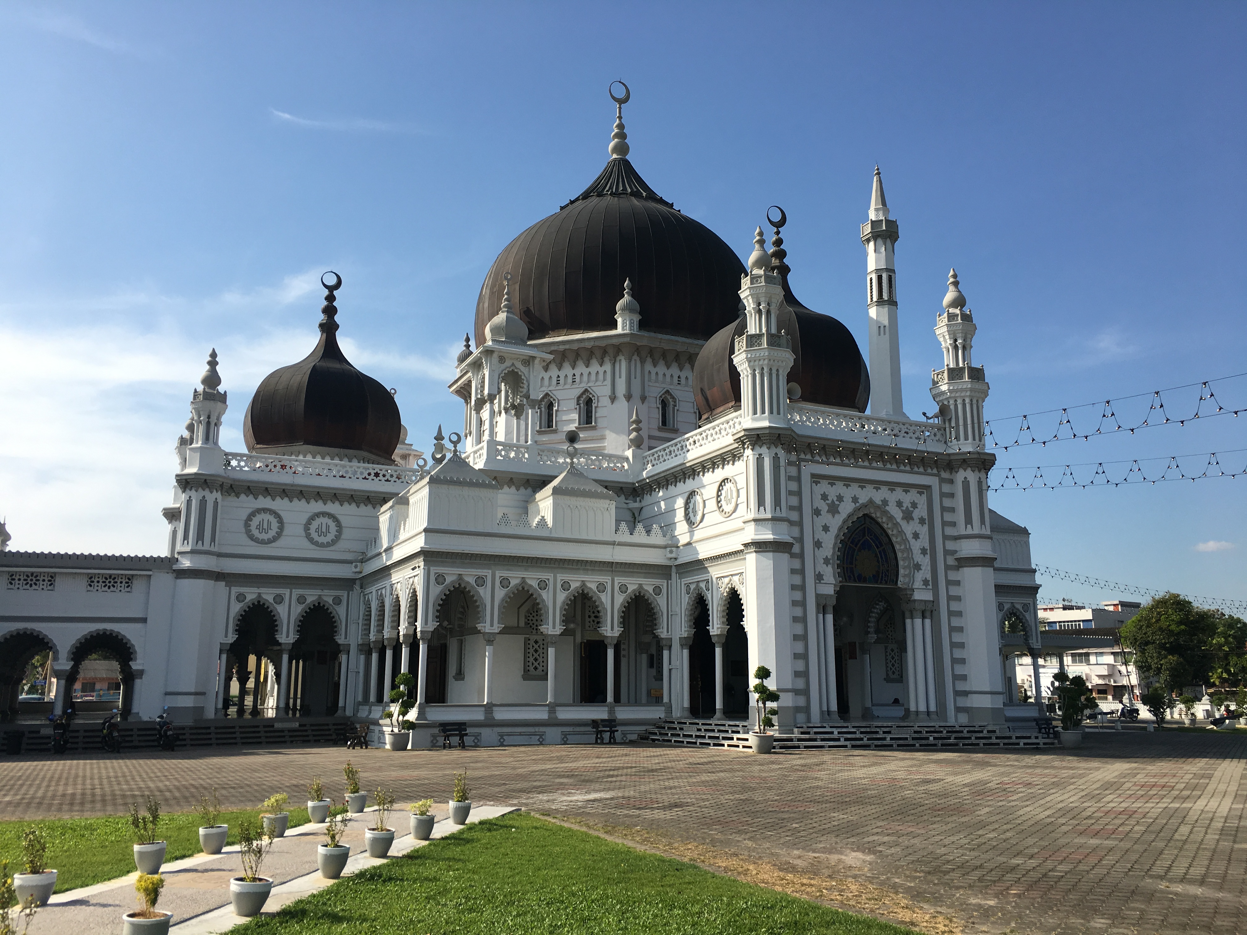
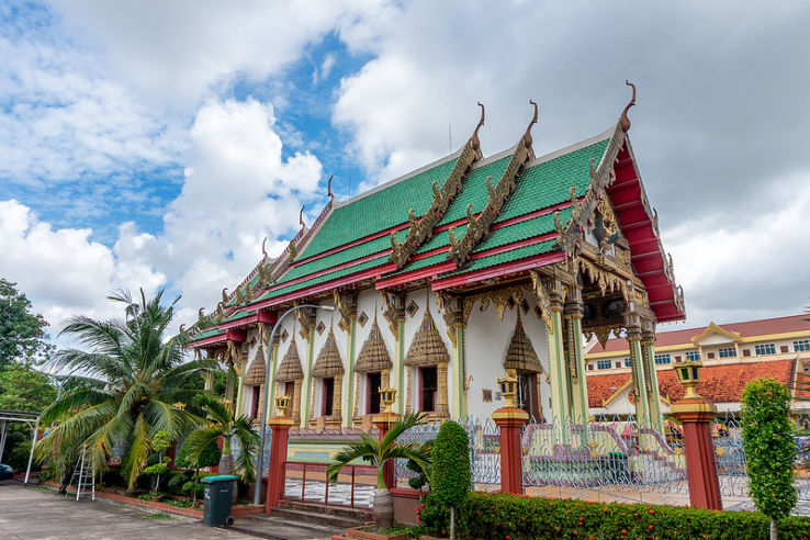
The Al-Hana Mosque is one of Langkawi’s oldest, largest, and most popular mosques. Located in Kuah, the whitewashed peach and gold mosque incorporates Moorish architecture and motifs and carvings from Uzbekistan, along with traditional Malay elements. The mosque was opened by the first Prime Minister of Malaysia, Tunku Abdul Rahman, in 1959. This whitewashed peach and gold structure exquisitely features Moorish architecture by amalgamating the Islamic motifs and carvings from Uzbekistan into the Malaysian style of architecture. Visitors are required to maintain silence and remove their shoes outside the mosque. Female congregants are expected to be dressed modestly.

The Sri Maha Mariamman Devasthanam is one of the biggest Hindu temples in Langkawi. The temple houses several statues and sculptures of various Hindu Gods and Goddesses. The temple is categorised into several sections where devotees can offer prayers and offerings to the deities. The temple is adorned with vibrant colours and accentuated with a grand and elaborate style of architecture. A long fence has also been built around the premises, and is an ideal place for meditation.

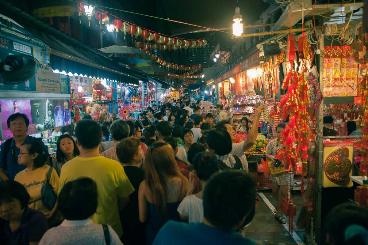
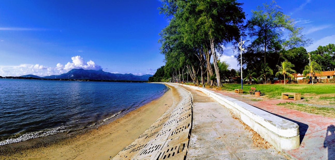
The Ayer Hangat market is a must-visit Friday night market which is set up close to the Tanjung Rhu Beach, on Jalan Tanjung Rhu. A local landmark, the market starts in the afternoon or early evening and is replete with Malaysian and Thai fast food. The market is open from 5 to 10 pm every Friday.

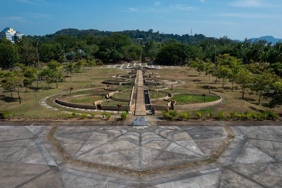
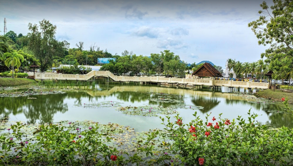
Langkawi Legend Park is a recreational area opened on 27 April 1996 dedicated to Langkawi’s heritage of myths and fables. The park covers an area of 50 hectares of reclaimed land and is more of an open-air garden museum featuring sculptures, scenic gardens, ponds and fountains, and fruit trees growing around pathways and along the ponds. Along with the flowering vegetation, the park has 17 sculptures that depict the many legends found in Langkawi, such as the duel between two giants that led to the formation of Mounts Mat Cincang and Raya, mythical birds, and fairy tales of princesses. In addition, there are 4 artificial lakes and a man-made beach to complement the picturesque scenery. The park is open from morning till late at night and is within walking distance from the jetty.

Adjoining Taman Lagenda is the CHOGM Park, built to commemorate the 1989 Commonwealth Heads of Government Meeting or CHOGM, in Langkawi. Until recently, the park carried the flags of all the Commonwealth nations that participated. The park has a man-made beach next to it and a children’s play area.

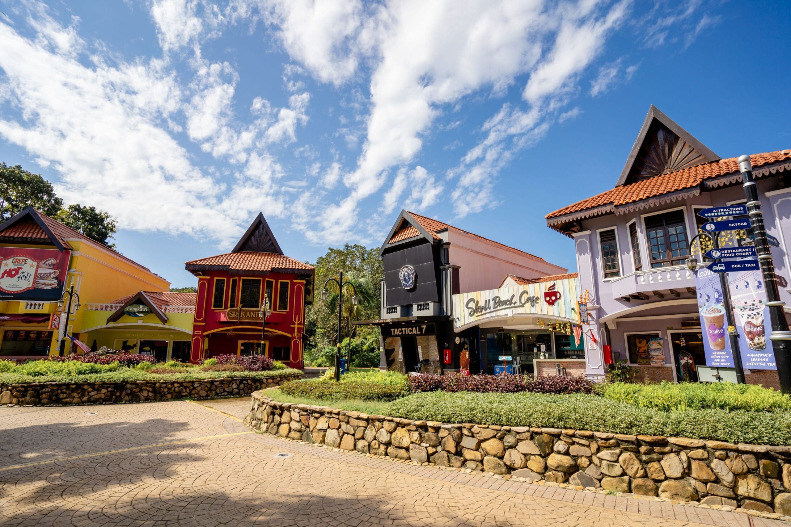
Oriental Village is an open-air lifestyle complex at the base of Mount Mat Cincang. The open-air attraction is famed for the marvellous Sky Cab and the Sky Bridge. The signature attraction of Oriental Village is the exhilarating cable-car ride to the top of Mount Chinchang. It is Malaysia’s longest cable car ride. During the 15-minute ride, one gets dramatic views of Seven Wells Waterfall, the slopes of the magnificent mountain and Langkawi Island. The ticket price is inclusive of return fare and passes to the SkyRex, SkyDome and 3D museums. Tickets can be purchased either from the ticket kiosk or online. The Sky Cab takes one to the 125-metre-long Sky-Bridge. Standing at a height of 700 metres, the curved suspended bridge is a great point to click some amazing pictures. Spread over an area of 21,000 square feet, the 3D Art Museum has over 100 interactive artworks, making it a favourite among kids. Set in the lap of nature, the Animal Farm houses small animals and costs RM1 to enter.

The biggest aquarium in Malaysia, Underwater World Langkawi, is home to more than 4000 marine life forms, spanning over 60,000 square feet. Located at the southern end of Pantai Cenang, the main attraction of the huge, white-washed structure is the Jurassic Arapaima, the biggest freshwater fish in the world. The Underwater World Complex is divided into three separate sections: Sub Antarctic, Tropical and Temperate. The major highlight of these three is the Sub Antarctic section, which is home to the popular penguinarium featuring rockhopper penguins. In the tropical sections, visitors will find themselves in a tropical rainforest with birds and animals endemic to this region. The highlight of this section is the Marmoset, the smallest monkey in the world. The temperate section features fur seals from South America and Africa, with a daily show at 2:30 pm where a trainer feeds them in front of an audience. The world’s biggest freshwater fish, Arapaima, sits at the entrance of the aquarium and is a prominent attraction in the building. The River Ecosystem features fish species from various parts of the world and houses unique marine life creatures. Visitors can walk through a 15-meter tunnel while being surrounded by fish and other marine creatures. The Coral Reef Section, which is the last section of the aquarium, shows the relationship between coral reefs and other marine life forms. Other highlights of Underwater World include a 3D theatre, an educational resource center, and a cafeteria. The 3D Theatre is where one can watch the story of a prehistoric fish and how it became a fossil. Underwater World is open from 10 am to 6 pm during the week and on weekends and public holidays, it is open from 9:30 am to 6:30 pm. Entry fees for Malaysians are RM 33 for adults and RM 23 for children, while for non-Malaysians, it is RM 43 for adults and RM 33 for children.

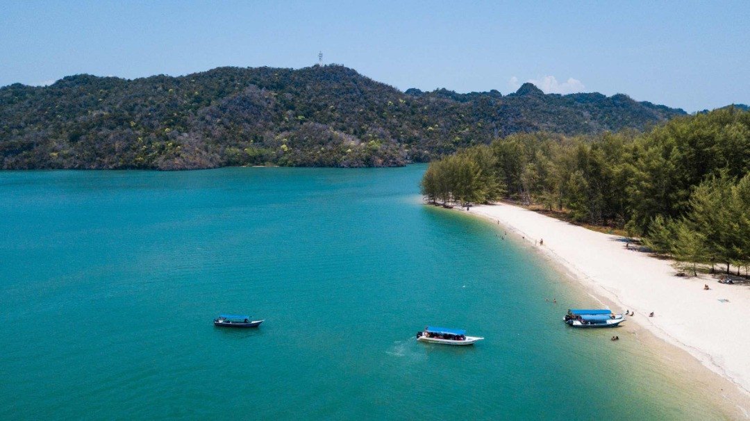
The Pulau Payar Marine Park, located about 30 km from the main island of Langkawi, is a popular scuba diving and snorkelling destination. Here, one can observe the natural habitat of various species of fish and baby sharks and feed them. This island comprises four smaller islands, all of which are uninhabited and are highly monitored to prevent any degradation of the virginal marine life. The stunning island also has jade green rainforests forming a natural border around it, which is not open to all tourists but can be accessed only with special permission from the authorities. The marine park can be accessed only as part of some tour packages affiliated with the Fisheries Department of Kedah to promote the conservation of marine life and raise awareness against coral bleaching and degradation. There are about 15 diving sites located at different points around the island, with separate provisions for beginners and more experienced drivers.

The Coral Garden is the most popular diving and snorkelling point on this island, as this region absolutely teems with coral reefs and newly formed corals. The special snorkelling points allow one to immerse themselves amongst the friendly aquatic creatures and easily spot a school of eels, pufferfish, snappers or even batfish and the Titan triggerfish. There is a special coral park that has a huge variety of rare, colourful corals that are highly monitored and protected from visitors. Special permission from the authorities has to be obtained to visit the coral park. Admission to Coral Park is RM 180 for an adult, RM 150 for a child between 3 and 11 and RM 100 for an infant. There are certain marked areas located in the offshore areas of the Coral Gardens where one can feed the school of fish. Also, there is a special point where one can feed baby sharks, either from the jetty itself or in the shallow water, once the shark caller calls them for their next meal. Entry fees for the feeding area is RM !50 for an adult and EM 130 for a child.

And with this, we end our visit to the state of Kedah. Our next state, the state of Perlis, is one of the smallest and the last of the states on Peninsular Malaysia. That will come to you next week, so watch this space!

Travel Bucket List: Malaysia Part 40 – Kedah Part 4

Located on the western part of Langkawi, the pristine Pulau Beras Basah Island is just 25 km southwest of Kuah, offering a crystal-clear sea and an amazing sea-diving experience. One of Langkawi’s most popular tourist spots, Pulau Beras Basah, is covered by lush greenery, giving a panoramic view of the island amidst the sparkling water. It can be reached by speedboats, boats, or cars. Washroom facilities and small food carts are available in the island.

It is believed that a ship sailing towards the Straits of Makassar carrying food and rice toppled in the sea, spilling off all the food carried. In the shallow water, the food, especially the rice, did not sink into the water but stayed afloat, forming a large rice mound. It is said that, with time, this white mound got transferred into the white sand of the island. In Malay, the word beras means rice and basah implies wet. Hence the name of the island.

Rebak Island is a beautiful and isolated island that houses a luxury resort. Sprawling across 390 acres, this island is one of the most secluded islands of Langkawi which makes it the perfect spot for a romantic getaway. One can relax and rejuvenate on the golden sandbanks.

Pantai Cenang is the most popular beach on the island, with operators offering visitors watersport opportunities like jet skiing, parasailing, kayaking, water skiing, and speed boat rides. Located on the western shoreline of Langkawi, Pantai Cenang offers a vibrant nightlife with its splendid beachfront bars and classy lounges. Pantai Cenang is a popular family tourist destination offering various children – friendly attractions such as Underwater World and Kiki Club. With duty-free outlets and souvenir shops offering a wide range of imported goods, one can also enjoy strolling along the Pantai Cenang road.

Located at the southern end of Pantai Cenang is Malaysia’s biggest aquarium and one of the island’s best-known attractions. The Underwater World houses more than 200 species of marine and freshwater fish and is built to create awareness about the need to conserve aquatic life forms. Visitors walk through a 15-meter-long tunnel that is full of different fish and look at the different marine creatures.

Laman Padi, which means a rice field, is a vast complex that explains the process and evolution of rice cultivation and harvesting and consists of rice fields, herb gardens and galleries. The museum showcases different tools used in rice farming. The other attractions include a floating rice garden and cottages built in the traditional themes.

The Temoyong Night Market is a weekly market that takes place every Thursday in Pantai Cenang. The market offers a variety of clothes, accessories, and bags, as well as street food, at decent prices. One can also experience go-karting at the Morac Adventure Park.

Situated along Pantai Pasir Hatim at the northern end of Langkawi, Tanjung Rhu is one of Malaysia’s best beaches. Secluded from the heavy crowd and buzz of the city, the 50-metre-wide beach is popular for its cleanliness, calming atmosphere and bewitching sunset views. In Malay, Tanjung means Cape and Rhu is from the species of evergreen trees, known as Sea Pine Tree. So, on the way to the beach, one can spot jungles of evergreen trees with green cliffs and a small lake with campers and few cafes. The public beach is separated from the privately-owned beach of Tanjung Rhu Resort by a fence.

Boating is one of the most popular activities at this pristine beach, with mangrove boats being the most preferred. Behind the stalls at the beach is a small river jetty from where boats can be rented for the Kilim Geopark and Mangroves boat tour. The sea at Tanjung Rhu is not too deep, making it ideal for swimming. In cases of low tides, a walk to the nearest island is very easily manageable and snorkelling close to the island can help one get a mind-blowing view of vibrant marine life. Along with the boating tours, there are jet ski tours mostly provided by the resorts, along with a tour to explore the beautiful limestone caves, mangroves, and catamaran sailing. The calm and clear water of the sea, fine and pure white sand, mini-islands, limestone rocks and wide area with no crowds create the perfect environment to shoot and get clicked. There are many couples and solo travellers enjoying the air and waiting for the sun to go down for the magical view of the sky.

Located 4 km away from Datai Bay, the secluded Pasir Tengkorak Beach is a hidden spot for locals. The white sandy beach is covered by shady rainforest and 500-million-year-old rock formations found on the ends of the beach. While the blue water is good for swimming, travellers can also trek down to the woods of Pantai Pasir Tengkorak and explore the three-tier Temurun waterfalls. Apart from camping, trekking, and sunbathing, the Pasir Tengkorak beach has its own picnic tables, prayer halls, toilets, and an adjacent small snack cart, too. Also known as Sandy Skulls Beach, this beach is home to troops of monkeys and thousands of jellyfish.

Some believed that after a destructive hailstorm in the Strait of Malacca, the washed-off bodies of sailors crowded up on the coastline of the beach. From there, signifying the dead sailors or the dead skulls, the name has been derived. Some believed that the dead skulls belonged to the escaping prisoners from the Ku Taruto Island prison, in the far north of Langku Islands. Many still believe that the sandy skulls were the consequences of some sea-monster.

The Black Sand Beach, which is fully covered with black sand and clear water, is a popular leisure spot during the weekends. The black colour of the sand comes due to the mineral content of the Mount Raya granites deposited on the golden sand. Also known as Pantai Pasir Hitam because of the black sand, the beach is famous for an ancient wooden jetty and a fishing village. Though the beach is not suitable for swimming, it is still one of the most prominent beaches in the southwest area of Tanjung Rhu. The beach houses many small huts, which can be used as picnic spots. Kids can enjoy the playground filled with ample thrilling swings and slides. For a shopping spree, visitors can explore the souvenir shop and handicraft emporiums situated just 3 minutes away from the beach. You may also enjoy some delicacies and street food dishes from the stalls set up on the beachside.

The black sand beach is a mystical beach that is extremely popular. Locals believe that the black sand is the residue of the fight that happened between Garuda and a Roman prince. The Garuda, a crossbreed between an eagle and a human, kidnapped a beautiful princess whose fiancée was a Roman prince. To rescue the princess, the prince fought with Garuda on this beach, which resulted in the beach’s black colour, the residue from the battle. Another myth attached to the black sand is of a mermaid princess who came to the land to marry a prince. Due to this, sea creatures and the kingdom got furious and came to the land for a fight with the land kingdom. The land ruler then lit a fire on the land of Langkawi to take revenge on the sea creatures. The fire turned the sand into ash, giving it its black colour. The best time to visit the black sand beach is in January and March. The beach sees heavy rainfall and high tides during other months of the year, making it unsuitable in terms of safety and weather conditions.

Datai Bay is a calm and secluded beach in the foothills of north-west Langkawi. Home to various exclusive resorts, the beach is surrounded by tropical rainforest and rich flora fauna habitat. Apart from enjoying the clear Andaman Seawater and relaxing amidst the graceful beaches, Datai Bay also offers ample of adventurous activities. One can hike towards the Mat mountainside area, play a round of golf in the Datai Bay Golf Course or plan a tour in the tropical jungle and explore exquisite animal habitats like peacocks, hornbills, monkeys, and iguanas.

Also known as Teluk Yu, Shark Bay Beach is a small and beautiful beach in Langkawi. The beach is quite popular for its tranquility and clear sea and it gets its name from the stone sharks engraved on the beachside. Spread over an area of 200 meters, the beach is an extension of the Black Sand Beach; however, it is filled with golden and white sand. No actual sharks can be spotted in the nearby sea that surrounds the island. The beautiful landscape and clear water, along with some rock formations, make the place perfect for a photoshoot.

Situated on Langkawi’s western headlands, the Telaga Tujuh Waterfalls, also referred to as Seven Wells Waterfalls, are the island’s most appealing natural attraction. The name signifies a series of seven intertwined natural pools that are fed by seven distinct waterfalls on Mount Mat Cincang. The Seven Wells Waterfalls are famed for the adventurous hike to the top, through a series of steps. The view from the top is awe-inspiring and full of flora like unique lime plants and Sintuk, which is used in traditional Malay ceremonies. A wide range of fauna can also be found here, including long-tailed macaque monkeys, hornbills, and giant cream-colored squirrels. The lower section of the pool can be reached with a little effort and extends swimming facilities. For a more intrepid experience, one can go higher up to the upper section of the waterfall, which rewards with the breathtaking view and the natural wonder. From the top of the Seven Waterfalls, a hiking trail leads to Mount Mat Cincang, which is perfect for those who wish to trek. Water flow at the Seven Wells Waterfalls is variable and can be close to empty during dry times. The best time to visit Telaga Tujuh Waterfalls is during the monsoon season, which is generally between September and October. The waterfalls are at their roaring best and the weather is cooler then.

According to legend, the Seven Wells Waterfall was home to the fairies, whom they transformed into in their bathing place. One day, a mountain prince tried to capture one of them and all the fairies left the waterfall forever, leaving behind only their healing properties. It is, therefore, believed that the waterfall has some medicinal value and healing powers.

Located in the Mat Cincang Nature Park at Datai, the Temurun Waterfall is the tallest waterfall in Langkawi. Also referred to as Air Terjun Temurun, the three-tier waterfall provides a refreshing calm in the humid tropical weather. The breathtaking Temurun Waterfall originates from a black rock. The first tier is a short walk from the car park, which forms a shallow pool for children to play, swim and do family activities. After climbing 10 meters of steps to reach the topmost tier with a drop of 30 meters and a pool with a 100-foot waterfall, the visitors can be rewarded with a splendid view of the waterfall, which forms a natural pool at the base. The gazebos at the site also make it a notable picnic spot for the locals and a chilling venue for visitors. It is recommended to visit the Temurun Waterfall during the monsoon season, which falls between September and October, to be able to enjoy an adequate gush of water as the waterfall is seasonal. During July and August, there is heavy rainfall, and it can get very slippery. The rest of the dry months reduce the waterfall to a thin stream.

The Durian Perangin Waterfall is a 14-tier topographical magnificence set in a tropical rainforest in northeast Langkawi. The waterfall descends from the northern slope of the highest mountain on the island – Gunung Raya. The waterfall gets its name from the durian trees, sprawling in the area, that bear thorny fruits. It is a popular spot for canyoning. Access to the Durian Perangin Waterfall is free, making it a popular getaway for the locals from the scorching heat of Langkawi. Being a 14-tier waterfall, it offers views from different levels. A 200-meter climb from the entrance takes one to the top section of the waterfall. Along the steps, there are several small waterfalls and pools, which are different sections of the Durian Perangin Waterfall itself. This is a local favourite picnic spot, with many picnics happening in the hut-like structures called gazebos that surround the steps towards the waterfall. The landscaped pool on the grounds of the waterfall is perfect to cool off the heat. The waterfall is also a much-loved destination for adrenaline-seekers for it offers amazing canyoning tours. There are professional tourist outfits that offer these guided tours. The best time to visit the waterfall is during the monsoon season, i.e., September and October, as it is not a promising destination during the summer season.

Located at Jalan Air Hangat, Gunung Raya is the highest mountain in Langkawi, with an altitude of 881 metres. The mountain peak is a granite formation and is located at the centre of Langkawi, which provides an amazing panoramic view of the island and the surrounding seas. Gunung Raya is believed to be a cursed form of Mat Raya, a giant who once lived on the island. The D’Coconut Hill Resort at the top of the mountain houses an observation tower with the best of the views of the Andaman Sea, the mainland of Thailand and Langkawi at a cost of RM 10. A total of 4287 steps must be climbed to reach the top.

It is believed by the locals that there were two giants, Mat Cincang and Mat Raya, who were great friends, and their children were deeply in love. During the wedding ceremony, Mat Raya observed Mat Cincang’s son looking at another woman and a fight was initiated between the two giants. They threw pans and pots at each other. The place where the broken pot fell came to be known as the village of Belanga Pecah, which means broken pot in Malay, the place where the hot water fell came to be known as Air Hangat, which means hot water, the place where the wedding ring was dropped came to be known as Tanjung Cincin, or the cape of the ring; and the place where the gravy fell came to be known as Kuah or gravy. While the two giants were fighting, a third peaceful giant, Mat Sawar, tried to control them and settle the matter when a thunderbolt struck and froze all three giants as mountains. Mat Gunung and Mat Cincang are the two mountains and Bakit Sawar stands between the two as if trying to separate them. The peak also has a MEASAT Satellite Control Tower, a park and a museum.

Mount Machinchang is the oldest mountain range in Southeast Asia that was formed 550 million years ago, and provides a panoramic view of Burau Bay and Pantai Kok from the top. Covered by dense rainforest, Gunung Mat Cinang, as it is also named, is the second-highest peak of Langkawi, with a steep trail path guided by ropes. As high as 850 m, travellers can witness the Seven Wells waterfall at the beginning of their hike to the peak after climbing a few hundred staircases. Being one of the three UNESCO World Heritage Geoparks in Langkawi, Mount Machinchang exhibits a wide change in the flora structure from downwards to the peak, possessing dense giant trees at the base and small bushier trees and orchids at the top. Also known as Mount Mat Cincang, snack carts are available for trekkers at the base of Cincang. Visitors also crowd up on Mount Mat Cincang to experience the famous cable car ride, which moves passengers up to 709 m above sea level to the apex for a clear and astounding 360-degree unhindered view. Try to visit Mount Mat Cincang between November and March, as that is the best time to experience an adventurous trek. While the rainy season makes the entire trail slippery and dangerous, the hot summer sun makes it difficult for trekkers due to the temperature rise inside the dense rainforest. The cable car is open from 10 am to 7 pm, Monday to Thursday, from noon to 7 pm on Wednesday and from 9:30 am to 7 pm on the weekend.

Travel Bucket List: Malaysia Part 39 – Kedah Part 3

Anak Bukit
Anak Bukit is the royal town of Kedah because the Sultan of Kedah’s royal palace and official residence, Istana Anak Bukit, is located here. It is also known to be the birthplace of the late Sultan of Kedah and the former Yang Di Pertuan Agong of Malaysia, Tuanku Abdul Halim Muadzam Shah, who reigned from 1958 until his death in September 2017.

In February 2009, the palace underwent a RM70 million facelift in conjunction with the 50th anniversary celebration of the reign of the sultan in 2008. This involved the construction of a new building that houses a new audience and dining halls that could accommodate 1,400 people at any one time. It replaced the existing audience and dining halls, which could only hold fewer than 1,000 people. The building was completed in October 2007.

Behind the royal palace there is a river stream called Sungai Anak Bukit and it flows through Alor Setar, connected by Sungai Kedah to the estuary of Kuala Kedah. There is also a mini zoo amidst the colourful flora of the royal gardens. Visitors are allowed into the royal gardens.

Anak Bukit is planned to be the new administrative capital of Kedah, replacing Alor Setar, which will continue to be the capital city and commercial centre of the state. Because of this, Anak Bukit is seeing massive growth in infrastructure and development.

Sungai Petani
Sungai Petani is Kedah’s largest city and is located about 55 km south of Alor Setar. It’s name comes the name of a river, Sungai Petani or Petani River, a tributary of the Merbok River. The word Petani might be related to the province of Pattani in Thailand and is said to derive from the Sanskrit word pathini, meaning a virgin nymph. Pathini was the name of a daughter of Merong Mahawangsa, the founder of the preceding Langkasuka Empire. When Kedah was known under the name of Langkasuka, traders always travelled between Merbok Valley and Pattani, and the eastern parts of Peninsular Malaysia through land routes. Thus, it is not impossible that the word Petani is borrowed from the name of the princess. Petani also means farmer in Malay, but it is unlikely that this is the origin of the city name as there are no sources pointing it to be the case.

The Sungai Petani Clock Tower is located on the main street, Jalan Ibrahim and was built in 1936. It is topped by a dome-shaped and gold coloured structure. The tower was a present from Lim Lean Teng to George V to commemorate his Silver Jubilee.

In the northern part of the town, about 30 km away, is Gunung Jerai, located 1,217 m above sea level. This is the tallest mountain in the northern region and is surrounded by a vast jungle. It is a navigational point for ships entering the Straits of Malacca from the north because it is visible from afar. There is an 18 km trekking route to the top of the mountain through a winding road. Atop the Jerai is a resort and the mountain boasts some tall and cooling waterfalls. Historically, the Jerai mountain served as the navigational point for traders from the east and west. There was a Hindu temple on top of the mountain that was built nearly a thousand years ago during the Bujang Valley Hindu Civilization.

Bujang Valley
Bujang Valley, or Lembah Bujang, sometimes referred to as the Ancient Wonder of Kedah, is a rich historical site covering about 224 sq km in Merbok, about 17 km from Sungai Petani. The valley lies between Gunung Jerai in the north and the Muda River in the south and is the richest archaeological area in Malaysia.

In Sanskrit, the term bhujanga refer to serpent, thus the name itself is roughly translated into Serpent Valley. The area consists of ruins that may date more than 2,535 years old. More than 50 ancient pagoda temples, called candi, have also been unearthed. The most impressive and well-preserved of these is in Candi Pengkalan Bujang which is more than 2535 years old.

The Bujang Valley Archaeological Museum is also located in Sungai Batu, where excavations have revealed jetty remains, iron-smelting sites, and a clay brick monument dating back to 110 AD, making it the oldest man-made structure to be recorded in Southeast Asia. Relics found in the Bujang Valley are now on display at the archaeological museum. Items include inscribed stone caskets and tablets, metal tools and ornaments, ceramics, pottery, and Hindu icons.

This archaeological area was the site of an ancient Hindu-Buddhist kingdom that ruled the region from the 4th century AD. There is also an archaeological museum here which is known as The Lembah Bujang Archaeological Museum. This museum displays more than 2,500 artifacts from Malaysia’s earliest civilisation that have been unearthed from the surrounding excavation sites. Gold, gems, ceramics, Hindu gods, and Buddha stone statues dating from the third to 14th centuries are all on display, though its main feature is Candi Bukit Batu Pahat, a reconstructed temple built to worship the Hindu god, Lord Shiva.

In 2013, it was reported that, a 1,200-year-old Hindu Temple at the site, identified as Candi No. 11, had been demolished by a land developer. Candi 11 was one of the most ancient of the Old Kedah kingdom and was amongst 17 registered candi. After the controversy, the Tourism and Heritage Ministry has agreed to consider gazetting the Bujang Valley as heritage site.

The Bujang Valley is currently in the process of being nominated by Malaysia into the UNESCO World Heritage List since 2013. In 2017, the government announced that they will make more research and conservation efforts in the valley to preserve its outstanding universal value. The site’s inclusion to the world heritage list is backed by diplomats from India, Indonesia, Thailand, Cambodia, Vietnam, Singapore, the Philippines, Timor-Leste, Bangladesh, Japan, Bhutan, Nepal, Myanmar, Laos, Brunei, Papua New Guinea, Maldives, and Sri Lanka.

A short distance away lies the enigmatic Dataran Zero Kilometre. Located in Sungai Petani, this is where the site marks the starting point for measuring distances across the peninsula. As you stand here, contemplate the journeys that began from this very spot—a convergence of history, trade, and culture.

The Gua Teluk Kelawar, or Bat Cave and the Bukit Tengkorak, or Skull Hill, beckon the explorer. One can explore the limestone caves, which have ancient inscriptions and artefacts. The panoramic views from Bukit Tengkorak offer a breathtaking panorama of the valley below.

Langkawi
Officially known by its sobriquet Langkawi, the Jewel of Kedah or Langkawi Permata Kedah in Malay, Langkawi is a duty-free island and an archipelago of 99 islands plus five small islands visible only at low tide in the Strait of Malacca located some 30 km off the coast of northwestern Malaysia and a few kilometres south of Ko Tarutao, adjacent to the Thai border. Politically, it is an administrative district of Kedah, with Kuah as its largest town. Pantai Cenang is the island’s most popular beach and tourist area.

The name Langkawi is thought to have existed by the early 15th century, although in the 16th century the island of Langkawi was also marked on maps variously as Langa, Langka, Lansura, and Langapura. There are many suggestions for the origin of the name of Langkawi. According to one interpretation, Langkawi means island of the reddish-brown eagle, a Brahminy kite in colloquial Malay. The Malay word for eagle is helang which is colloquially shortened to lang, and kawi is a red stone used as a chalk to mark goods. This interpretation was used to create the landmark sculpture of an eagle as the symbol of Langkawi at Dataran Helang or Eagle Square in Kuah. Some believed that Langkawi is the same as, or related to, the Lanka or Langkapuri mentioned in Indian sources. The ancient name Lanka or Lankapura and Lankapuri, is found in Indian literature from an early period and is named in Ramayana as the city of the king Ravana, although the identification of the original Lanka is not certain. Puri or puram in Sanskrit means a town or city. The name Langkawi is also thought to be related to Langkasuka; an old kingdom believed to have links with Kedah. Some also thought that Langkawi means many beautiful islands, with langka being a Sanskrit word meaning beautiful and wi meaning many.

In 2008, the then-sultan of Kedah, Abdul Halim Mu’adzam Shah, conferred the title of Langkawi Permata Kedah or Langkawi, the Jewel of Kedah upon the island as part of his golden jubilee as an affirmation of Kedah’s ownership over the island.

Langkawi had long been at the periphery of, but closely associated with, the domain of the Kedah Sultanate. Legend tells of a great snake ular besar, the custodian of the Langkawi Islands, to which a new king of Kedah must sacrifice a virgin daughter whenever he ascended the throne, or when war was declared with another state.

The island of Langkawi was recorded in history by various travellers to the region. It was called Lóngyápútí in the 14th century by the Yuan dynasty traveller Wang Dayuan. When the Ming dynasty admiral Zheng He visited the region, the island was marked as Lóngyájiāoyǐ, on his map. In the 15th century, it was known to the Acehnese as Pulau Lada or Pepper Island.

Langkawi was historically home to Austronesian peoples, such as the orang laut or sea people originally from the southern part of the Malay Peninsula and Malay people. It had been thought to be cursed for a couple of centuries. According to local legend, in the late 18th century, a woman named Mahsuri was wrongfully accused of adultery and put to death. Before she died, she placed a curse on the island that would last for seven generations. Not long after Mahsuri’s death, in 1821, the Siamese army invaded Kedah and attacked Langkawi. In the first attack, the locals burned down the granary at Padang Matsirat to starve the Siamese army. The Siamese nevertheless captured the island in May 1822, killed its leaders, and took many islanders as slaves, while others fled.

The island was recaptured by the Siamese in 1837. In 1840–1841, the Sultan of Kedah, who went into exile after the Siamese attacks, was allowed to return by the Siamese. However, the Orang Laut, who fled after the Siamese attacks, did not return. In 1909, the islands came under British rule following the Anglo-Siamese Treaty of 1909. The middle of the channel between Tarutao National Park and Langkawi became the Siamese border, with Tarutao to the north forming part of Siam, while the Langkawi islands to the south came under British rule. During the World War II, Siam took control briefly as British Malaya fell to the Japanese.

Langkawi was a haven for pirates who attacked junks in the northern part of the Strait of Malacca. In a series of operations, between December 1945 and March 1946, the British cleared the pirates’ land bases on Langkawi and Tarutao and continued to rule the island until Malaya gained its independence in 1957.

Langkawi remained a quiet backwater until 1986, when Prime Minister Mahathir Mohamad transformed it into a major tourist resort, helping to plan many of the islands’ buildings himself. Mahsuri’s seven-generation curse was said to have lifted as a seventh-generation descendant of Mahsuri was born in the Thai province of Phuket. The island rapidly grew as a tourist destination, and by 2012, it received over three million tourists a year.

The main island is about 25 km from north to south and slightly more from east to west. Two-thirds of the island is dominated by forest-covered mountains, hills, and natural vegetation. The island’s oldest geological formation, the Machinchang Formation, was the first part of Southeast Asia to rise from the seabed in the Cambrian more than half a billion years ago. The oldest part of the formation is observable at Teluk Datai to the northwest of the island, where the exposed outcrop consists of mainly sandstone or quartzite in the upper parts and shale and mudstone in the lower parts of the sequence. On 1 June 2007, Langkawi Island was given a World Geopark status by UNESCO. Three of its main conservation areas in Langkawi Geopark are Machincang Cambrian Geoforest Park, Kilim Karst Geoforest Park, and Dayang Bunting Marble Geoforest park in the Island of the Pregnant Maiden Lake. These three parks are the most popular tourism area within Langkawi Geopark. In 2014, UNESCO issued a yellow card warning threatening the status of the Geopark.

Kuah, Kuah Town or Bandar Kuah is a resort town, and capital of Langkawi. It is the entry point for those coming by ferry from either the mainland or Penang Island. The town is centred on its jetty, which is a point of arrival for tourists from the mainland. Kuah has become a major town due to the growth of visitors after Langkawi developed into a tourist centre since 1986. There are a number of hotels in Kuah but it has no resorts, as the town has no proper beach despite being located by the sea. Kuah has many attractions and serves as a focal point for tourists wishing to visit other parts of Langkawi. Today, Kuah is a commercial centre with shopping complexes, restaurants, fast food outlets, hotels, and handicraft shops.

The name Kuah comes from the Malay word for gravy, and legend has it that the town arose from a cup of gravy spilled on the land by two giants, Mat Raya, and Mat Cincang, today the names of the two highest mountains in Langkawi, while they were fighting.

Island hopping on boats is one of the best things to do at Langkawi. Boats take tourists to two islands south of Langkawi’s main island and an eagle feeding spot near Singa Besar. In addition, one can visit the island of Dayang, where one can trek to the Lake of the Pregnant Woman, surrounded by mountains and dense forests. Boats also stop at Beras Basah, which is great for swimming, parasailing, and snorkeling.

A jet ski island hopping tour lets travelers take control of their journey exploring the islands around Langkawi. Led by a local guide, jet ski tours explore the Singa Besar island, the Beras Basah island, and the secluded Intan Kecil Island. The four-hour jet ski tour allows tourists to trek through the islands and explore the Lake of the Pregnant Maiden.

Pulau Singa Besar is a lush green island in the southwest of Kuah. It is an unexplored and secluded island with almost no amenities, hence keeping the natural treasures intact in the lap of a tropical rainforest. Since there are no resorts or constructed buildings, the island is most visited for a camping tour. Also known as Singa Besar Island, meaning Big Lion Island, this gorgeous place is home to many exclusive birds and animal species. Tranquil beaches and mangrove forests around the island will make the visitors witness ample mouse deer, hornbills, snakes, peacocks, eagles, monkeys, and other flora fauna habitat. Eagle feeding sessions on the tour to Pulau Singa Besar gives some extraordinary captures. On the boat tour towards Pulau Singa Besar, one can feed some food bites and take a glimpse of white-bellied fish eagles and kite eagles in a flock grabbing the food. The island can also be explored by a jungle trekking session or swimming apart from lazing around the peaceful environment of the island.

Located just 15 mins from the Kuah Jetty, the second largest and uninhabited island of Malaysia, the Pulau Dayang Bunting island welcomes one to the quietness of the place amidst the wildlife. Also known as the Isle of Pregnant Maiden due to the shape of the Dayang Bunting island from afar, the jungle trekking experience is a must while visiting the island. Surrounded by the Guillemard freshwater lake, this Lake of the Pregnant Maiden is separated from the sea by a thin rock lining, making it a must-watch to its visitors. The adjacent Dayang Bunting Marble Geoforest Park exhibits excellent limestone formation and several limestone caves. Dayang Bunting Island is filled with dense rain forest, resonating the vivid chirps of kingfishers along with 90 more species of birds wandering around. Dayang Bunting is an excellent place to enjoy swimming, cave exploring, and getting lost in the dense mangroves. Paddle Boats along with Kayaks are available to add to the fun. A small store for souvenirs and snacks is available in the island area to add to your travelling experience.

Legends and stories about the island are an important part of Malaysian folklore. It is believed that the princess of the Lake, Mambang Sari fell in love with Met Teja. Soon after, they got married and gave birth to their son. Unfortunately, the early demise of their son left them in dismay and princess Mambang Sari decided to rest their son in the water of the lake. She also blessed women who were having difficulty in giving birth. It is believed from then that any woman will become fertile once they take a dip in the water of this lake. Locals of Langkawi still believe this. Adding to the legend, if the lake is looked at from a distance, it is said that the curves of the hill behind make a silhouette of a pregnant lady lying down with her belly on the top, making the legend more affirmative.

The 15-minute walk from the jetty to the lake region is a jungle trekking amidst the mangroves, monkeys, and sudden bends. To make the walk easier and more convenient, a concrete stairway is used. A swim in Tasik Dayang Bunting is a mesmerizing experience for any swimmer. The average depth of water is 10 m and it is advisable that beginners not swim here. Life jackets are available on rentals and changing rooms are also available. The island is also an enchanting place for bird watchers, with hornbills, kites, woodpeckers, kingfishers, and many more birds easily sighted.

The Dayang Bunting Marble Geoforest Park is an absolute must to see the amazing limestone formations of the region. It houses many caves and distinguished geological features. The lake of Pulau Dayang Bunting is a result of breaking down of the surface of one of the caves, which later got filled with water and gave rise to this freshwater lake.

Travel Bucket List: Malaysia Part 38 – Kedah Part 2

Fort Kuala Kedah, also known as Kuala Bahang Fort, is a historical fort located at the northern facet of the Kedah River. Built in 1771 by Sultan Muhammad, it was initially used as a protection shield for Kedah state and Alor Setar. Rich in history, the fort has survived many battles and has been rebuilt after several destructions by Bugis, Acehnese, and Siamese. The prime entrance of the fort, Pintu Gerbang Kadapun, is grand, faces towards the north of Alor Melaka in a commanding position and has some government offices inside.

The fort is designed with vintage white timber and brick walls with embedded cannons. Primarily renowned as a tourist attraction for its museum, one can easily get to know historical facts about Kedah from it. The fort houses a white lighthouse too, which is surrounded by a picturesque garden, making the fort a must-visit for a short trip.

Initially built in the 17th century from clay, bamboo, and timber, Fort Kuala Kedah has faced many battles and turbulences. The fort has been rebuilt a lot of times with a stronger structure and a better design. In 1619, the Portuguese and Acehnese had a battle that destroyed the fort; however, the next generation of Portuguese rebuilt the fort. In 1770, the Bugis army attacked the fort again in a rival action against the Portuguese, who took the help of the East India Company to win against the Bugis and gave Penang Island to the East India Company as remuneration for help. The British East India Company rebuilt the fort with the help of Indian labourers; however, they were unsuccessful in protecting it against the Siamese. The last destruction of the fort happened in 1821 and the fort was finally built for the last time in 1838. Closed on Mondays, the fort is open from 9 am to 5 pm on Tuesday through Sunday. There is free street parking available.

Istana Kuning, or Yellow Palace, used to be the royal palace during the Kutaringin Sultanate. There are four buildings within the palace compound, with yellow, the royal colour, being the colour scheme. With a big chunk of the palace compound being taken over to construct a public garden, the compound is a lot smaller than it used to be.

Balai Besar, or Balai Penghadapan or Grand Audience Hall, is a royal audience hall that was initially built at the back of the Kota Setar Palace complex. The original building was built in 1735 by Sultan Muhammad Jiwa Zainal Adilin II, the 19th Sultan of Kedah. The pillars, roofs and floors were made of wood. Two Kedah sultans were officially installed at the Balai Besar: Sultan Ahmad Tajuddin Halim Shah II in 1805, and Sultan Abdul Halim in 1959. Balai Besar not only features traditional Malay architectural features but it also showcases Victorian and Thai architectural elements. The roof of the hall is adorned with golden carvings and mirrors, whereas the pillars are adorned with iron lacework. Entrance to the hall is forbidden, but one can admire its beauty from the outside. The location of Balai Besar is considered to be quite strategic since it is surrounded by several other historical structures, namely the Kedah Royal Museum, Sultan Abdul Halim Mu’adzam Shah Gallery, Nobat Hall, the State Art Gallery and Zahir Mosque.

Balai Nobat, or the Hall of Drums, is an 18-metre-tall, three-tiered octagonal tower whose sole purpose is to house the royal musical instruments, including the serunai, or the wooden flute, the nafiri, gendang or the drum; and the nobat, or the gong. The original Balai Nobat, constructed of wood, was among the early buildings already completed when Alor Setar town was officially founded in 1735. It has been rebuilt twice, most recently in 1906, in concrete and metal with a dome representing the Islamic element. Located beside the Clock Tower, Nobat Tower rises to a height of about 59 feet and features a unique onion-shaped dome that is painted yellow. Today, the royal orchestra or nobat, is used only for ceremonial purposes. While entry inside the tower is forbidden, one can admire its beauty from the outside.

Istana Anak Bukit is the birthplace and royal palace of Sultan Tuanku Abdul Halim Muadzam Shah as well as of the current ruler, Sultan Sallehuddin. Sungai Anak Bukit, which is situated behind the royal palace, flows through Alor Setar and is connected by the Kedah River to Kuala Kedah. Since 2008, it has been used in royal ceremonies, replacing the old Balai Besar, and is where Sultan Sallehuddin was officially enthroned and installed.

Istana Sepachendera, or the Sepachendera Palace, is a palace constructed for Che Sepachendera, Sultan Abdul Hamid Halim Shah’s first consort, in 1882. As Che Sepachendera is from Siam, visible elements of the Siamese architectural style were incorporated throughout the building. The palace grounds are currently abandoned; however, there are plans to restore the complex into a museum.

Source

The National Science Centre Northern Region Branch or Pusat Sains Negara Cawangan Wilayah Utara, abbreviated as PSNCWU, is located at Gunung Keriang next to the Alor Setar Aquatic Centre and Paddy Museum. It is the first science centre built in northern Malaysia.

The Paddy Museum, or Muzium Padi, is the first paddy museum in Malaysia, and the fourth in the world after Japan, Germany and the Philippines. The museum showcases the rice cultivation process in Malaysia and the tools and equipment used. Established in 2004, it is a one-stop destination to learn everything, from paddy cultivation to its history and processing, in an engrossing manner. The museum sprawls over an area of 12,000 sq m in a three-storey space, exhibiting harvested rice stalks, motifs, rice murals, etc. The staircase at the entrance is made in a cave shape inspired by the Gunung Keriang caves, giving a beautiful view. The must-see part of the museum lies on the first floor, which has a 360-degree revolving platform with forty cinema seats to explore the panoramic view of the murals. Painted by 60 North Korean artists, the murals will give one a realistic feel of the paddy fields and landscapes of Kedah. The museum is open from 9 am to 5 pm daily, except on Friday, when it is open from 9 am to 12:30 pm and then from 2:30 to 5 pm. Entry fees are RM 3 for adults and RM 1 for children up to the age of 12. Free parking is available.

The Kedah State Art Gallery or Balai Seni Negeri Kedah in Malay, was set up to foster interest in and appreciation of art in the state. Its collection includes paintings, photographs, musical instruments and handicrafts.

The Sultan Abdul Halim Mu’adzam Shah Gallery or the Galeri Sultan Abdul Halim Mu’adzam Shah originally housed the Alor Setar High Court, before it was moved to Kompleks Mahkamah Alor Setar in Suka Menanti. This building is located at the junction of Jalan Putera, adjacent to the Balai Nobat. The museum offers a glimpse into the life of the former ruler of Kedah, Sultan Abdul Halim, with artefacts from his life such as official documents, clothing, antique furniture and personal possessions on display.

Open daily and with free entry, the Kedah State Museum or Muzium Negeri Kedah, is a storehouse of the state’s history, from the Bujang Valley civilization to colonial times. The collection includes early Chinese porcelain, artefacts from the archaeological excavations in Bujang Valley, and a pokok bunga emas or ‘gold tree’ produced as a tribute to the Thais. The museum is also a research centre that specialises in Kedah’s cultural history. On display are artefacts such as ancient ceramic and porcelain and items belonging to the royal family. Before the present premises were built in 1936, parts of the museum’s collection were on display at the Balai Besar. The museum was officially opened on February 3, 1957. The museum is open from 10 am to 6 pm daily.

The Kedah Royal Museum or Muzium Diraja Kedah, had originally been part of the Kota Setar palace. It was rebuilt after attacks by the Bugis in 1770 and the Siamese in 1821. The current concrete building was completed during the reign of Sultan Ahmad Tajuddin Mukarram Shah, who once stayed in this palace with his queen. This palace is also known as the Pelamin Palace after it was extended to include a pavilion and additional rooms when Sultan Abdul Hamid Halim Shah arranged the marriages of his five children. The grand wedding ceremony lasted for three months in 1904. After 1941, the palace was used as a school and an office for several organisations including the office for the St. John Ambulance and the Scout movements. On July 25, 1983, the palace was declared the Kedah Royal Museum.

The birthplace of Tun Dr Mahathir, the fourth and seventh Prime Minister of Malaysia, the Mahathir Birth House or Rumah Kelahiran Mahathir, has been designated as a historic building. Located off Jalan Pegawai, it was restored by the National Archives in 1992. This museum provides an insight into the life of the longest-serving Prime Minister of Malaysia, Dr Mahathir Mohamad, who was born in this house on December 20, 1925. The museum gives an account of his schooling years up until the time he became a doctor. Visitors can find old family photographs as well as the Prime Minister’s old bicycle inside the museum. The museum is also a great example of a typical traditional Malaysian house. The house is made out of wood and its roof is made from Nipah palm. Entry is free and the museum is open from 10 am to 5 pm daily.

Independence House, or Rumah Merdeka, is a designated historic building that houses the collection and memorial of Tunku Abdul Rahman, the first Prime Minister of Malaysia. It is owned by the National Archives.

Menara Alor Setar or Alor Setar Tower, is a 4-storey, 165.5-meter-tall telecommunications tower that is a prominent modern landmark and tourist attraction, offering a panoramic view of the city and surroundings. It is the third tallest telecommunications tower in Malaysia, with a popular observation deck. A mega-view banquet hall, a revolving restaurant, and an open deck are also housed inside the tower. The structure of this tower represents clusters of tied rice. The large pillar that supports this sky-high tower represents the strength of the people of Kedah. Alor Setar Tower is generally visited during the holy months of Ramadhan, Shawwal, and Zulhijjah, during which people look for the crescent moon in the sky. The tower is open daily between 10 am and 10 pm and entry fees are RM 6 for adults and RM 3 for children. The open deck entry fees are RM 48 for adults and RM 28 for children, while to enter the observation deck, adults need to pay RM 12 and children between 4 and 12 need to pay RM 8.

The Menara Jam Besar or Big Clock Tower, was opened in 1912, with its chimes calling people to prayer. The golden yellow and white exteriors showcase a mix of Islamic and Hindu architectural styles. The upper part of the tower has a crowning dome with a crescent atop it, while in the lower half, Islamic and Hindu styles converge. The tower is located near Zahir Mosque.

Zahir Mosque is one of the oldest and grandest mosques in Malaysia and is considered one of the 10 most beautiful mosques in the world. Kedah’s state mosque, Masjid Zahir’s history dates back to the early 1900s and its five black domes, unique colour combinations and intricate carvings make it a true sight to behold. The mosque spans an area of about 1,15,000 sq m. The mosque was conceived by the late ruler Sultan Muhammad Jiwa Zainal Abidin II who was inspired by the design of the Azizi Mosque of the Langkat Sultanate in North Sumatra. The mosque was built upon the tomb and grave of the fallen Kedah warriors who died during the Siamese invasion of Kedah. The state’s annual Qurʾān-reading competition is held within the premises of the mosque. Zahir Mosque is built in the Moorish architectural style. The largest dome of the mosque is surrounded by five small domes, which represent the five pillars of Islam. The interior of the dome is carved with verses from the Quran. The beige and black wash of the exterior, paired with white and blue interiors,, presents a unique colour combination that is quite rare to find. The entrance of the mosque is decorated with intricate blue glass mosaic patterns, which further accentuate the beauty of the structure. Visitors must be covered from shoulder to knee, and everyone is required to cover their heads. The first prayer time is at 6 am while the last prayer time is at 9 pm.

One of the oldest Buddhist temples in Alor Setar, Wat Nikrodharam, is built in a magnificent fusion of Thai and Chinese architecture with fascinating statues and sculptures. The interiors are well-designed with wonderful art and paintings, along with a Buddha statue and other religious relics. The temple has a rather large, peaceful area where visitors are free to roam around and admire the general splendour.

The Wan Mat Saman Canal or Aqueduct, is the longest aqueduct in Malaysia that connects the Kedah River in Alor Setar to Gurun in the south and was built to boost the state’s rice production. Stretching for a few hundred metres along the southern part of Chinatown, the Alor Setar Waterfront features a park next to the Kedah River. Visitors can spot the Lighthouse Cape Chali from the park and kayakers on the rivers. In addition, there are restaurants on the waterfront, such as Jeragan Waterfront Restaurant, which lets diners enjoy views of the river.

Among the most preserved Chinatowns in Malaysia, Alor Setar’s Chinatown transports visitors to the 1950s. Restored shops line the narrow streets, and houses have their own unique style and decoration. The houses are two-storeyed, with living quarters upstairs and workshops on the ground floor. Occupants of the houses perform their family trades with printing shops, bicycle repair shops and hardware stores in the area.

Pekan Rabu, which means Wednesday Market, is a shopping centre located in the middle of Alor Star. The Pekan Rabu Complex originally started as a flea market but has grown into a multi-storey shopping arcade that sells handicrafts, apparel, and local delicacies. The complex is one of the best places to try local dishes such as serunding, kuah rojak and garam belacan. Everything on sale is locally produced, and the complex is a source of pride for the local economy.

Gunung Keriang, also known as Mount Keriang, is an old mountain range that is northwest of Alor Setar. At an elevation of 218 m, the 250 million-year-old mountain is shaped like an elephant and is mostly composed of limestone, with some distinctive features like the presence of ten different rocks renowned for Fung-Shui in a single place. The place is famous among tourists and is expanding slowly.

There are many caves in Gunung Keriang, with one of the larger ones being Gua Keriang. The Gunung Keriang Recreational Park is a pretty landscaped area that is popular among locals and tourists. Filled with exotic flora and lush green areas, there is a small lake and a bridge in the park. One can do many adventure activities, like rock climbing, trekking and even camping. Gunung Keriang is open from 8 am to 6 pm daily.

Mount Jerai or Gunung Jerai in Malay, formerly named Kedah Peak, is a mountain in Kedah standing at a height of 3,993 feet. It is known as the Hausberg of the town of Sungai Petani. Mount Jerai is part of an eponymous geological formation that correlates with the Machinchang Formation on the island of Langkawi. The Jerai Formation was originally a sedimentary formation composed of fully metamorphosed sandstone and shale, and it consists of argillite, arenite and porphyry facies. There is an information board on top of the mountain stating that it used to be an island called Pulai Serai before the sea levels receded, letting it form a mountain. This is probably supported by I Ching’s record of Pu Lou Shi or Pulau Sri, a country located west of Sribogha. The summit of Jerai has been developed into a hill resort, and tourists can enjoy a wide-angle view of the surrounding areas, including Penang Island and the rice fields of Yan District.

Pantai Merdeka is the only sand beach in mainland Kedah, and it is a major attraction for beachgoers from all over northern Penang and Kedah. In the early 1970s, the beach attracted swimmers, picnickers and campers from Kedah and the city of Seberang Perai. Subsequent sea erosion made the beach less popular and visitors were lost to the newly-developed beaches at Pantai Murni in Yen and Pantai Bersih in Butterworth. In 1989, facilities at the beach were upgraded and the seawall along the 760-meter shoreline, originally built in 1975, was subsequently replaced. A ferry boat across the Merbok River links Pantai Merdeka to the small town of Tanjung Dawai, which is otherwise 80 km by road. The beach is a popular local picnic spot. Wild monkeys from the nearby forest have been observed to visit the beach to scavenge from the litter bins. The nearby forest is popular with jungle trekkers.

Travel Bucket List: Malaysia Part 37 – Kedah Part 1

Kedah, also known by its honorific Darul Aman and historically as Queda, is in the northwestern part of Peninsular Malaysia. The state consists of the mainland and the Langkawi Islands. The mainland has relatively flat terrain, which is used to grow rice, while Langkawi is an archipelago, most of which are uninhabited islands.

Kedah was previously known as Kadaram by the ancient and medieval Tamils, Kataha or Kalahbar by the Arabs, and Syburi by the Siamese when it was under their influence. To the north, Kedah borders the state of Perlis and shares an international boundary with the Songkhla and Yala provinces of Thailand. It borders the states of Perak to the south and Penang to the southwest. The state’s capital is Alor Setar and the royal seat is in Anak Bukit. Other major towns include Sungai Petani, its largest urban area by population, Kulim on the mainland, and Kuah on Langkawi.

Around 788 BCE, a systematic government of a large settlement had already been established around the northern bank of the Merbok River. The state consisted of a large area of Bujang Valley, covering Merbok and the Muda River branches, covering about 1000 square miles. The capital of the settlement was built at the estuary of a branch of the Merbok River, now known as Sungai Batu. Archaeological evidence found in Bujang Valley reveals an animist kingdom ruled ancient Kedah, possibly as early as 110 AD. The discovery of temples, jetty remains, iron smelting sites, and clay brick monuments dating back to 110 AD shows that a maritime trading route with south Indian Tamil kingdoms was already established since that time. The discoveries in Bujang Valley also made the ancient Kedah the oldest civilisation in Southeast Asia.

In the seventh and eighth centuries, Kedah was under the loose control of the Srivijaya empire. Indian and Arab sources consider Kedah to be one of the two important sites during the Srivijaya period, often calling the king of the straits “the ruler of Srivijaya and Kataha.” In 1025, Rajendra Chola, the Chola king from the Coromandel Coast in South India, captured Kedah in his Chola invasion of Srivijaya and occupied it for some time. A second invasion was led by Virarajendra Chola of the Chola dynasty, who conquered Kedah in the late 11th century. During the reign of Kulothunga Chola I Chola overlordship was established over the Srivijayan province of Kedah in the late 11th century.

According to Hikayat Merong Mahawangsa or the Kedah Annals, Kedah was founded by a Hindu king named Merong Mahawangsa. The Sultanate of Kedah began in 1136, when King Phra Ong Mahawangsa converted to Islam and adopted the name Sultan Mudzafar Shah. However, an Acehnese account gave a date of 1474 for the year of conversion to Islam by the ruler of Kedah. This later date is confirmed by an account in the Malay Annals where a Raja of Kedah visited Malacca during the reign of its last sultan, seeking the honour of the royal band that marks the sovereignty of a Muslim ruler. However, Thai chronicles say that Kedah was a Thai city like Nakhon Si Thammarat and was a part of the Siamese kingdom but was later changed into a Malay state after the invasion of Muslim kingdoms until today.

It was later under Siam until it was conquered by the Malay sultanate of Malacca in the 15th century. In the 17th century, Kedah was attacked by the Portuguese after their conquest of Malacca, and by Aceh. In the hope that Great Britain would protect what remained of Kedah from Siam, the Sultan handed over Penang and then Province Wellesley to the British at the end of the 18th century. The Siamese nevertheless invaded Kedah in 1821, and it remained under Siamese control under the name of Syburi. In 1896, Kedah along with Perlis and Setul was combined into the Siamese province of Monthon Syburi which lasted until transferred to the British by the Anglo-Siamese Treaty of 1909.

In World War II, Kedah, along with Kelantan, was the first part of Malaya to be invaded by Japan. The Japanese returned Kedah to their Thai allies, who had it renamed Syburi, but it returned to British rule after the end of the war. Kedah became one of the states of the Federation of Malaya in 1948, which achieved independence in 1957 and then became part of Malaysia in 1963.

Kedah is the 8th largest state by land area and the 8th most populated state in Malaysia. The terrain is mostly flat in general, as the Kedah-Perlis Plain covers much of the state’s land area, from the district of Kuala Muda in the south towards the state of Perlis in the north. Owing to their alluvial properties, most of the plains have been developed for rice farming for centuries. The Kedah–Songkhla and Bintang Ranges formed the state’s boundary between the Thai provinces of Songkhla and Yala in the northeast and the state of Perak in the southeast. The Bintang Range is home to Mount Bintang, the state’s highest point, located on the border with Perak. Pedu Lake is the largest man-made lake in the state.

Kedah has a relatively heterogeneous populace constituted by three major ethnic groups; the Malays, Chinese and Indians as well as some Malaysian Siamese ethnic groups, similar to most of the other Malaysian states. Before the formation of the Federation of Malaya, there was an ethnic group known as the Sam Sam people. They are culturally Malay Muslim but speak the Siamese language. Most of these communities are almost extinct due to assimilation with the Malays. In some places in Kedah, the Sam Sam people still retain their Siamese language as their mother tongue. Kedah has a very small Orang Asli community. Kedah Malay, known locally as Pelat Utagha or the Northern dialect, is a distinct variety of Malay that also serves as the state’s main lingua franca and is used by almost all Kedahans, regardless of race.

Kedah is considered the rice bowl of Malaysia, accounting for about half of Malaysia’s total production. Tourism, particularly on the island of Langkawi is of growing importance. More recently, Kedah has forged its economy towards the automotive and aerospace industries.

Alor Setar
Kedah’s state capital, Alor Setar, is the second-largest city in the state after Sungai Petani and one of the most important cities on the west coast of Peninsular Malaysia. It is home to the third-tallest telecommunication tower in Malaysia, the Alor Setar Tower. Its location along the main travel corridor from Malaysia to Thailand has long made it a major transportation hub on the northern Malay Peninsula. Located along the country’s longest expressway, Alor Setar is 430 km from Kuala Lumpur and 79 km north of George Town, Penang. From Thailand, the city is easily accessible via the Padang Besar–Sadao Highway and is 52 km from Sadao and 106 km from Hat Yai.

The city was originally founded as Kota Setar in 1785. Owing to its long status as the capital of Kedah, Alor Setar is regarded as one of the core cultural centres for the Kedahan Malays. It is also among the key pioneers in Malayan transportation history, with the railway station commissioned in 1915, followed by its airport in 1929.

Alor Setar is the birthplace of two pivotal prime ministers of Malaysia; Tunku Abdul Rahman, the founding father of the nation, who was prime minister from 1957 to 1970 and Mahathir bin Mohamad, the country’s longest-serving prime minister, who was prime minister for 24 years, from 1981 to 2003, and then between 2018 and 2020.

Alor Setar’s name came from the combination of two Malay words: Alor, which means a small stream, and Setar, or the plum mango, a tree related to the mango. The city’s name was changed to Alor Star during a December 21, 2003, ceremony proclaiming it a city. The city’s original name was restored on January 15, 2009.

Alor Setar was established on December 31, 1735, by Kedah’s 19th ruler, Sultan Muhammad Jiwa Zainal Adilin II and was the state’s eighth administrative centre since the establishment of the Kedah Sultanate in 1136. The pre-existing settlement was originally a small village. The sultan found the area to be in a strategic location, as it was covered in lush greenery and was where the two estuaries of the Kedah River converged. A new town, named Kota Setar or the Town of Setar, was created, whose name was derived from the Bouea macrophylla, a type of tree that can be found in the area. However, the capital suffered a major attack when the Bugis armada, led by Raja Haji, managed to destroy both the Istana Kota Setar or the Royal Palace and Balai Besar, the Grand Hall, in 1770. In 1771, the British, represented by Francis Light and Sultan Abdullah Mukaram Shah, entered into an agreement to halt the Bugis influence in Kedah.

During the coronation ceremony of Ahmad Tajuddin Halim Shah II of Kedah on March 17, 1805, Siamese forces managed to occupy the capital. The sultan was forced to retreat to Penang and later to Malacca. The settlement was put on hold for 20 years. He was restored to the crown in 1842 and the capital was temporarily relocated to Kota Kuala Muda before returning to Kota Setar.

In October 1883, James F. Agustin, an Englishman, arrived in Kuala Sungai Kedah, now known as Kuala Kedah, about 10 km from the capital. He and a few others journeyed towards the inland areas of Kedah, where they met several Malay settlements on the banks of the Kedah River. Upon his arrival in Kampung Kota Setar, Agustin befriended several local Malays and they invited him to the sultan’s palatial residence. He was well received by the sultan and both parties exchanged goods. The visit by Agustin spurred the growth of more active and direct trade relations between Kedah and outside commercial powerhouses. The city attracted various cosmopolitan trading activities from the British, Indian, and Chinese, together with other local and regional merchants. The town prospered from a small settlement into a bustling town designated to accommodate further population growth, commerce and administration. The British, in particular, were quite drawn to the potential of Kota Setar, as it was then known.

Gradually, Kota Setar thrived and further evolved into a commercial, transportation and communication hub for Kedah. The name was then changed from Kota Setar to Alor Setar, a reflection of its geographical features located in a small stream known as Alor in Malay, which was frequented by the Malay traders from the neighbouring states. However, the name Kota Setar was retained as a sub-district under Alor Setar.

Other significant events during the turn of the 20th century included the reunification of Perlis and Setul, now Satun and Kedah, by the Siamese in May 1897. Both provinces had been separated from Kedah in 1821. The event, held in Balai Besar, was attended by the Crown Prince of Kedah, Tuanku Abdul Aziz, as a representative of Sultan Abdul Hamid Halim Shah. On July 25, 1905, the Legislative Council of Kedah, Majlis Mesyuarat Negeri, was formed in Alor Setar, with the Crown Prince, Tuanku Abdul Aziz, as its president. Following the Anglo-Siamese Treaty of 1909 on July 7, 1909, the transfer of power from the Siamese to the British administration was held on July 15, 1909, at Balai Besar. Alor Setar fell to the Japanese occupation on December 13, 1945 and was annexed to the Siamese state until 1946.

The town celebrated its 250th birthday in 1985. A proposal to upgrade the town to city status was made in 2000. Alor Setar was proclaimed a city – the ninth in Malaysia — on December 2003. During the ceremony, the city was formally renamed Alor Star, the third time the city has changed its name, from Kota Setar to Alor Setar and Alor Star. On January 15, 2009, the historical spelling Alor Setar was returned to be its official designation.