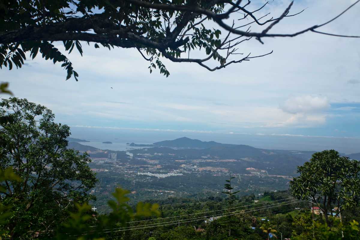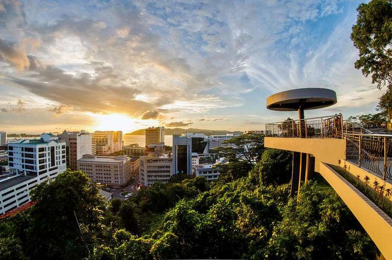
The Signal Hill Observatory Tower, located just outside the main town provides astounding views of Kota Kinabalu. The observatory platform is a high-roofed platform located shaped in the form of a UFO at the edge of Signal Hill overlooking Kota Kinabalu and the South China Sea. The observatory allows visitors to get a panoramic view of Likas Bay and the Tanjung Aru areas surrounding it and provides one of the best scenic views of Kota Kinabalu.
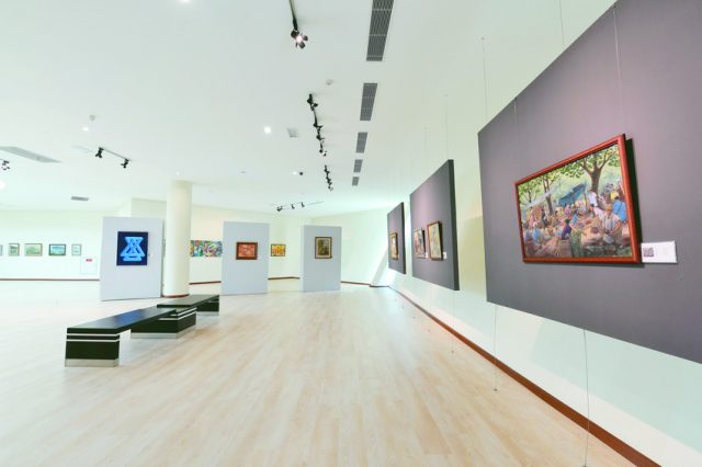
The Sabah Art Gallery or Balai Seni Lukis Sabah in Malay is an art gallery founded in 1984 by Datuk Mohd. Yaman Hj. Ahmad Mus. The building consists of two gallery spaces. The permanent exhibition of the art gallery houses more than 3,000 artworks by local and international artists with a total estimated value of around more than MYR10 million. The temporary gallery houses various exhibitions. Besides exhibitions, the gallery regularly hosts workshops, seminars, competitions etc.
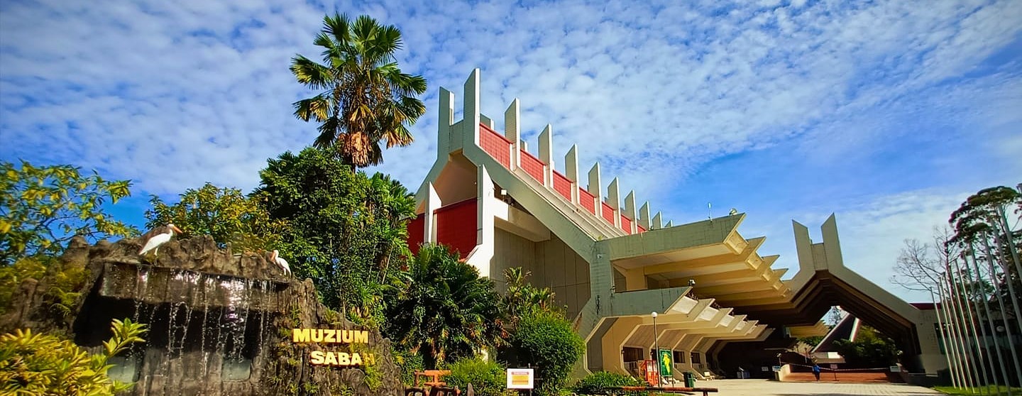
Sabah’s state museum, the Sabah Museum is located on 17 hectares of land at Bukit Istana Lama. The original Sabah Museum location was established on 15 July 1965 in a shophouse in Gaya Street largely due to the efforts of the Sabah Society. George Cathcart Woolley’s collection of photographs, diaries and other artefacts, bequeathed to the State Government of Sabah, formed the nucleus of the museum. The complex contains not only the museum proper but also an ethnobotanical garden, a zoo and a heritage village. The main building also houses the Sabah Art Gallery. Other galleries cover Islamic civilisation, archaeology and history, natural history, and ceramics and brassware. The mission of the museum is to collect, preserve, conserve and document ethnographic, archaeological, historical, numismatic, art-historical, botanical, zoological and mineralogical collections from throughout the state, and to conduct research on important and interesting aspects of Sabah’s history, culture, and social and natural history.

Merdeka Square is a square located from where the Federation of Malaysia was declared in 1963. The square was the site for sporting events during the British North Borneo Crown period. Before the Jesselton Community Hall was built in the 1950s, the square was not just used as a football field but also became a parade site, especially before the construction of the Kota Kinabalu Sports Complex. On 16 September 1963, the late Chief Minister Donald Stephens declared the formation of the Federation of Malaysia at the site. Since then, the square is only used for small ceremonies. In 2015, the square was closed for several months for renovation work. On 23 February 2018, it is one of 24 heritage sites in the state that were gazetted by Sabah’s State Heritage Council under the new enactment of State Heritage Enactment 2017.

The Petagas War Memorial or Petagas War Memorial Garden is a memorial park dedicated to the Second World War victims in Sabah, particularly the 324 resistance movement members, who were executed on 21 January 1944 at the site by the Japanese occupying forces of North Borneo for their involvement in the Jesselton Revolt. The park was built on the site where the massacre took place and where the victims were initially buried. On 21 January 1946, the Chinese War Victims Relief Association, CWVRA held a memorial service at the execution site on the second anniversary of the massacre. The park grounds and marble memorial were built in 1948 at the behest of the West Coast Memorial Fund Residential Committee, WCMFRC. At the same time, it was decided that the site of the massacre and its burial sites should be a permanent place of remembrance for all North Borneo’s victims of World War II. The inauguration of the memorial took place on the fourth anniversary of the massacre on 21 January 1948. In 1949, the remains of the men who were murdered by the Japanese military police, kenpeitai and interred in Labuan were reburied at Petagas. Since the opening of the Petagas War Memorial site, an annual memorial service has been held on 21 January with the participation of high-ranking state politicians, families of the victims and the general population. At the 1998 service, a representative of the Japanese government and the Japanese consul in Kota Kinabalu attended the ceremony for the first time.

The Double Six Monument is a memorial located in the Sembulan neighbourhood which marks the site of the 6 June 1976 fatal plane crash known as the Double Six Tragedy bearing the first Chief Minister of Sabah, Tun Fuad Stephens, as well as six other State ministers.

Tanjung Aru Beach, located near the west coast of Kota Kinabalu is one of the most iconic attractions in Sabah. It is a great place for all types of visitors, from couples to families. Tanjung Aru Beach is one of the best spots to catch a breathtaking sunset. The beautiful beach is divided into three parts, and are known as the First, Second and Third Beaches respectively. With lively music and entertainment everywhere, the nighttime at Tanjung Aru Beach is a stark contrast to its beautiful daytime vibes.
First Beach is located next to the Shangri-La’s Tanjung Aru Resort and Spa and is the most popular beach in Tanjung. There are plenty of food stalls and restaurants in First Beach and it is always buzzing with visitors. It features an open food court and offers a variety of delicacies to its visitors. Tourists are also allowed to use the barbeque pits at the beachfront to cook their meals. Second Beach is a great spot to catch the sunset. However, it is advised to look out for jellyfish as it is quite common around these areas. Third Beach in Tanjung Aru Beach is a great spot for surfers and the beach also provides surfing lessons on the beach.

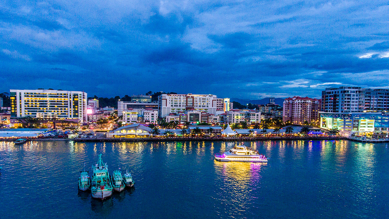
The Kota Kinabalu Waterfront is a mixed development project with a mall, hotels, restaurants, resort homes and a boardwalk between Filipino Market and Oceanus Mall. Also known as KK Waterfront, it is situated in the heart of the city offering an unmatchable experience of the mesmerising sunset, nightlife and an array of restaurants, bars, and small eating and massage joints.

Bustling with the hustle of locals and tourists, the Gaya Street Sunday Market is a weekly market set in Gaya Street. It has been an important place for farmers, fishermen and other traders for more than a hundred years. The Sunday Street Market is famous for providing a large number of unique, handcrafted, organic and herbal items along with plants, flowers, stylish and colourful clothes, jewellery and other items of local, cultural and traditional importance. The market opens early in the morning and one can stroll around to shop and also try the authentic Malaysian and international cuisine at the roadside stalls.
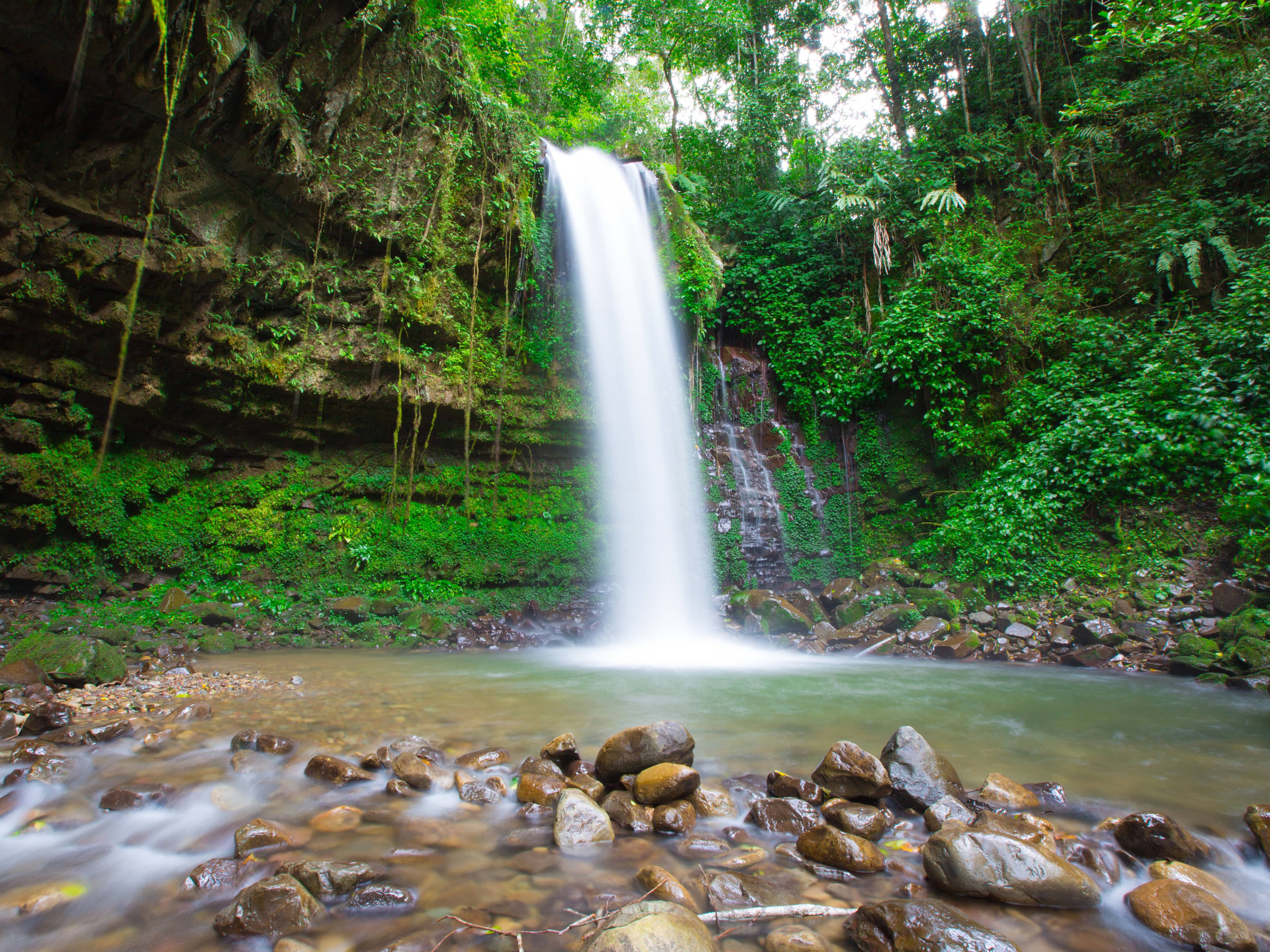
Tucked into Patau Village’s virgin forests, Mahua Waterfall sits inside Crocker Range National Park. It is a plunge-type waterfall cascading from a height of 17 metres and is among Sabah’s best ecotourism attractions for trekking and camping. In addition, there is a 1.2-metre-deep natural pool for swimming. The waterfall is open from 8 am to 6 pm and has an entry fee of RM 15 per person.

Kota Kinabalu Wetland Centre is 24 hectares of the only remains of mangrove forest that once existed extensively along the coastal region of Kota Kinabalu. Previously known as Likas Swamp or Likas Mangrove and later Kota Kinabalu City Bird Sanctuary, the Centre came foremost out of 20 wetlands selected by the Sabah Wetlands Inventory Committee in 1986. The Centre is an important refuge and feeding ground for many species of resident birds, as well as several migratory bird species from Northern Asia. In addition, it is a breeding ground for marine life protected by the Fishery Department of Sabah.
Apart from providing shelter and food for both resident and migratory species of wildlife, wetlands also prevent salt build-up in surrounding freshwater supplies, stabilising sedimentation, storing nutrients and removing toxins. More than 80 different species of birds have been identified in the wetlands so far. Tourists are also thrilled to spot many colourful butterflies, mudskippers, weaver ants, jellyfish, water snakes and other amphibian or aquatic animals within this region.

Walking amidst nature while being close to the city is a rarity that the visitors to this centre love to experience. Tourists marvel at the thick foliage and often come across many sea creatures with the chirping of birds and insects being the only sound heard inside the mangrove forest. The centre is reckoned as a paradise for avid bird watchers with numerous species of birds being spotted in the forested area during the morning hours or in the breeding season. Both local people, as well as tourists, are educated about the uses of mangrove forests and their importance. The voluntary guardian program is undertaken by voluntary workers who train nature lovers to take an active part in conservation. Enthusiastic participants are guided by the volunteers so that they get to understand the concept of ecology and the conservation of the mangrove. Most of the work is done indoors with the participants provided with extensive training. The centre is closed on Mondays and on other days is open from 8 am to 6 pm.
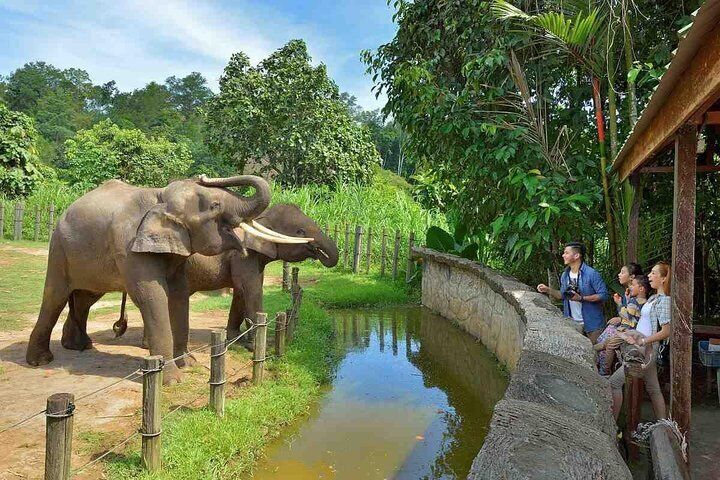
Lok Kawi Wildlife Park is a famous natural wildlife park that is divided into two sections – zoological and botanical and houses many species of flora and fauna. The zoological part of the park houses many animals while the botanical part of the wildlife park offers an opportunity for a nature hike and also a chance to witness various types of flowers and trees along with insects, some of them indigenous to Malaysia.

The Pulau Tiga National Park consists of a group of coral reef-ed islands surrounded by the South China Sea, opposite the swamps of the Klias Peninsula. The park has three main islands, as the name suggests. These islands were formed by eruptions of mud volcanoes, namely the Tiga Islands, Kalampunian Damit and Kalampunian Besar. The region had peaked its fame when the reality show ‘Survivor’ featured it in their documentary, naming it popularly as Survivor Island. The desert island national park covers an area of 158 sq km whilst being surrounded by Kota Kinabalu and Labuan. Tropical Pulau Tiga is a refreshing and isolated family or romantic weekend getaway destination from the mundane life with its mesmerizing beaches of white sand, crystal waters and bubbling mud pools.
Tiga Island has a lot of dense tropical vegetation in the area. The volcanic steam of methane and bubbling mud volcanoes can still be seen and experienced in many places here. Kalampunian Besar has some soft white sand beaches and crystal clear water along with wreathes of sandbar action all across the island that have been eroded spectacularly by the waves. Scuba diving and snorkelling are some of the more popular activities that happen here. Kalampunian Damit is a smaller island, a little larger than a humongous rock. The island is popularly known as Snake Island because of the poisonous slippery inhabitants that live here and is a mating location.

Pulau Tiga is well known for hosting ground-dwelling megapodes that bury their eggs in the sandy beaches. There is also a diverse marine life including sharks and barracudas, in the greenish–blue sea beaches of the islands, that one can spot while swimming or strolling down the sands. There is also an abundance of vegetation present in Pulau Tiga.
Diving and snorkelling are some of the most sought-after activities when the tide sets. The dive centre on the island provides a course for beginners and intermediate learners. One can spot the seven km of colourful coral reefs along the beaches. There is also a mangrove lagoon and two pole-like trees called the giant ranggu that one must see. There are various bubbling mud pools, scurries and mud volcanic caves that one can visit. The island is located 5 km southwest of Kota Kinabalu. The day trip takes a total of around 11-12 hours when travelling independently.
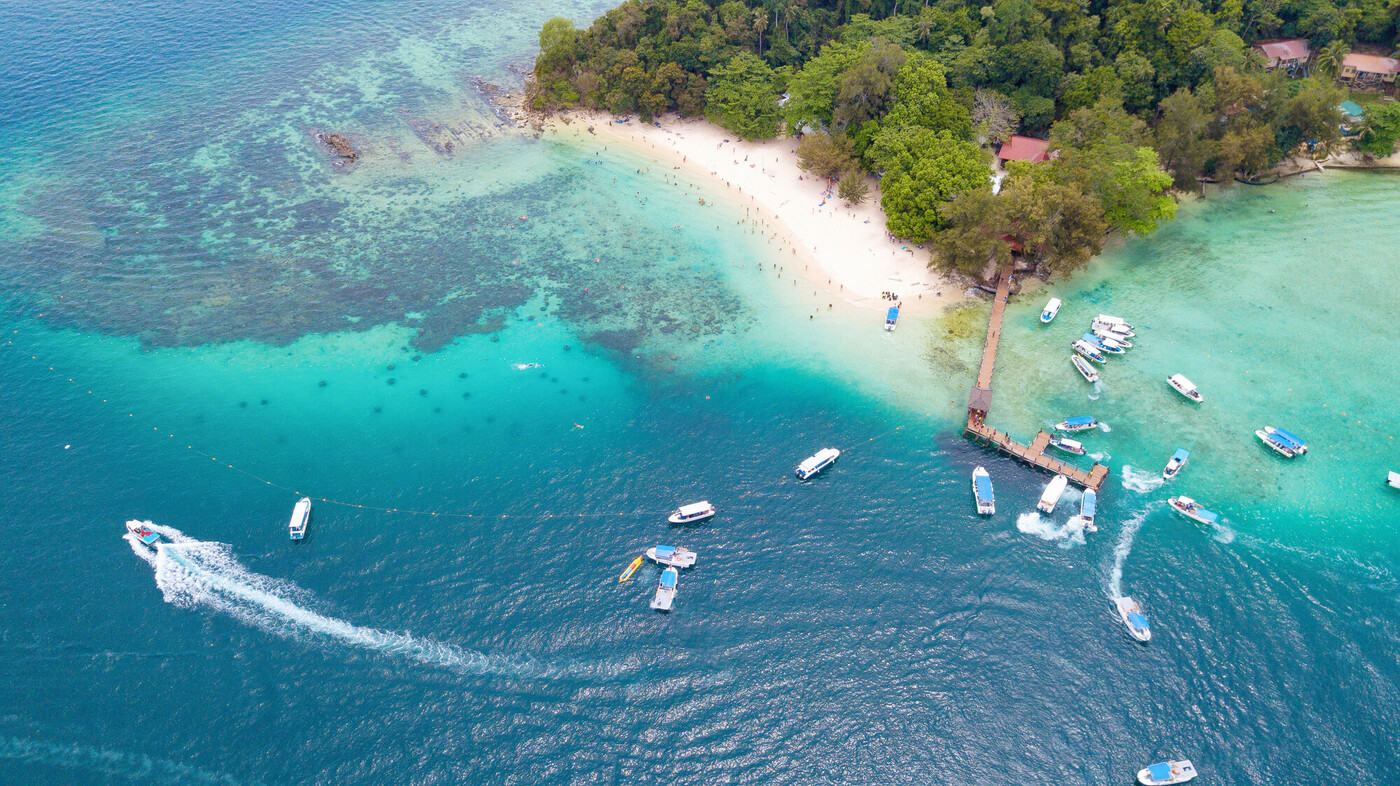
The Tunku Abdul Rahman National Park comprises a group of five islands located close to Kota Kinabalu. The park is spread over 4,929 hectares, two-thirds of which cover the sea. Before the Ice Age, it formed part of the Crocker Range mass of sandstone and sedimentary rock on the mainland. However, about one million years ago, the melting ice brought about changes in the sea level and parts of the mainland were cut off by the sea to form the islands of Gaya, Sapi, Manukan, Mamutik and Sulug. Evidence of this can be seen from the exposed sandstone of the coastline forming the cliffs, caves, honeycombs and deep crevices. The park was named after Tunku Abdul Rahman, Malaysia’s first Prime Minister.
The ferry station for visitors travelling to the islands in Tunku Abdul Rahman National Park is located in downtown Kota Kinabalu. This ferry terminal is also the departure point for patrons staying at either Manukan Island Resort, Gayana Resort or Bunga Raya Resort.

One of the biggest attractions of the islands is the wide variety of aquatic life found in the waters surrounding the islands, and travellers who love natural beauty and the underwater experience will love a trip to the marine park which has many attractive diving and snorkelling sites where incredible untouched reefs attract a multitude of aquatic animals. Some of the islands also have resorts where travellers can spend a few days, like in Gaya. One can also choose to set up camp with tents on the islands and spend the night under the stars.
The marine park is comprised of a total of five islands, all of which are a short boat ride away from each other. Gaya Island is named because it is the largest of the islands. Gaya means big, but even though it is the largest, it is not the most developed. It has light forest trails for trekking activities. At Manukan Island, the word Manukan means fish and is named for the varied aquatic life in its surrounding waters. It is the second-largest island in the park and the most developed. Sapi Island is named after the sound of a mowing buffalo. It is another one of the most developed islands in the park with the most services and amenities and tends to be the most popular island of all. Sulug Island is named for the Sulug people of Sabah. This is one of the least developed islands and has nearly no facilities. Mamutik Island is named for the wide array of seashells that can be found on its beaches. This is another one of the lesser developed islands and has few amenities, except for some basic forms of accommodation, but tends to be much quieter and is ideal for relaxation and snorkelling. The only way to reach the islands within the Tunku Abdul Rahman Park is by ferry. Every hour, boats depart from the Jesselton Point Ferry Terminal. A trip from Jesselton Point to the park takes about 15-20 mins, depending on the island. The first boats to the islands depart at 7:30 am and the last at 4:30 pm.

Mantanani Islands are a collection of three stunning islands with gold beaches and ringed with nearly untouched coral reefs, located off the northwest coast of Sabah. The islands are a perfect getaway from the city and have recently become increasingly popular among travellers and locals alike. The scenic Mantanani Islands have small resorts for those wishing the spend the night under the skies and maybe explore the scenic beauty at night. It also houses some of the most diverse aquatic life that travellers can experience for themselves through underwater activities like diving and snorkelling.

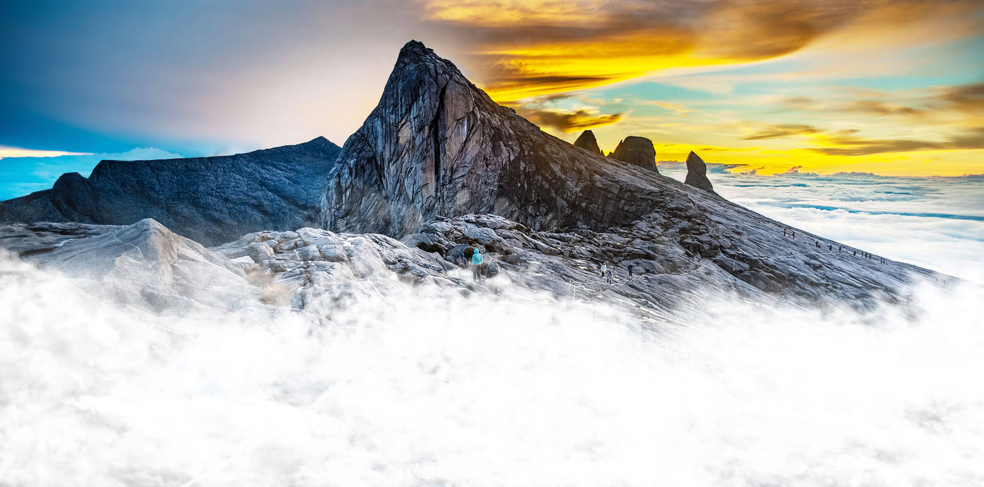
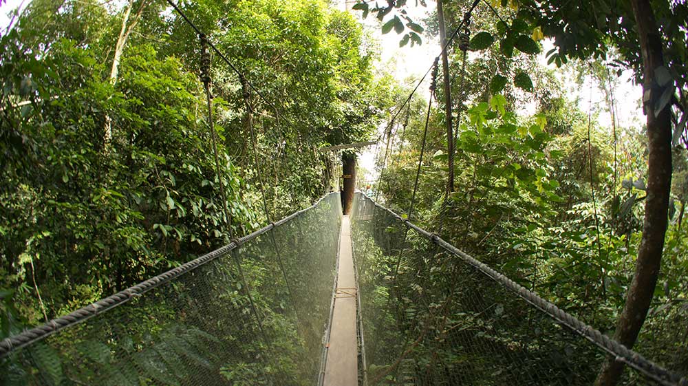
Crocker Range National Park was established in 1984, although the area had previously been under protection as a forest reserve. It covers the north-south Crocker Range, of 1200-1800 metre mountains in Sabah. In the vicinity of the park headquarters, there is a resort that provides accommodation and food services. Other visitor facilities such as an exhibition centre, insectarium, fernarium, observation tower and trekking trail can also be found. The park covers 1,399 sq km, making it the largest park in Sabah. The park consists of both hill and mountain forests, with many species of flora and fauna endemic to Borneo. Maintenance of this forest cover is essential to ensuring a pure water supply for many of the towns and communities in Sabah. The park contains at least five species of primates, such as the orang-utan, gibbons and the furry tarsier with its enormous round eyes, and extremely sociable long-tailed macaques. The Padas River bisects the range between Beaufort and Tenom.
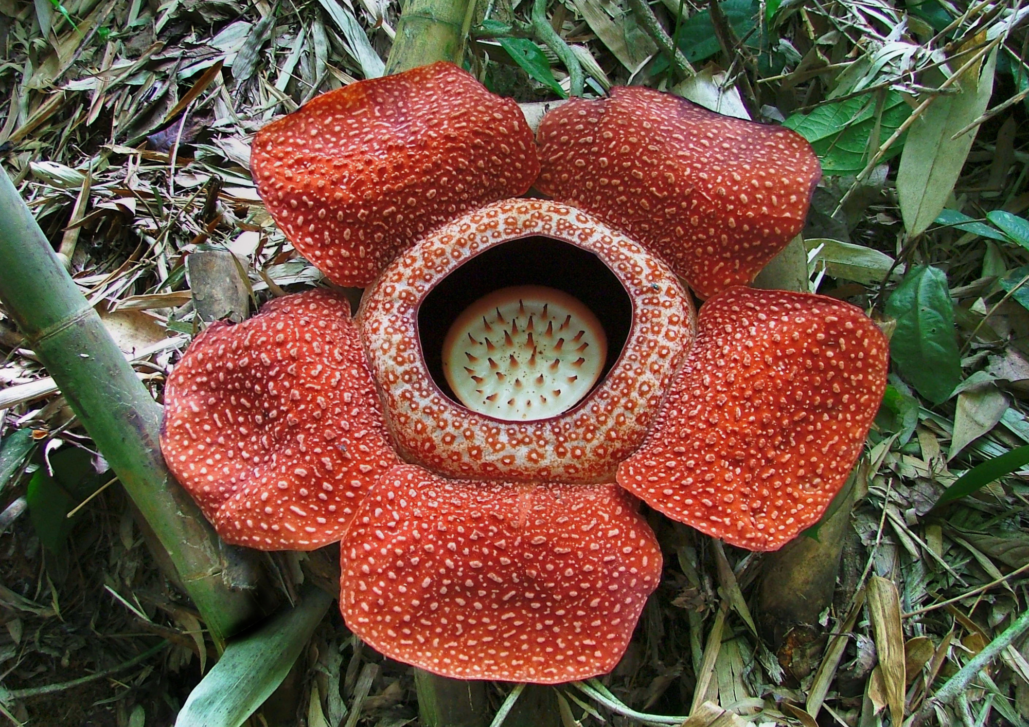
The Rafflesia Forest Reserve is a Virgin Jungle Reserve, VJR that covers an area of 356 hectares in Tambunan. The reserve was first established in 1967 as part of the Crocker Range Forest Reserve and in 1984, it was made a separate reserve to protect the area’s Rafflesia flowers. The Rafflesia Information Centre is located along the road from Kota Kinabalu to Tambunan. Several sites with wild specimens of the parasitic flowering plant Rafflesia pricei are reachable via hiking trails from the centre. The reserve is home to many insect species endemic to Borneo.

Kudat
Located on the Kudat Peninsula, about 190 km north of Kota Kinabalu, Kudat is near the northernmost point of Borneo. It is the largest town in the heartland of the Rungus people which is a sub-ethnic group of the majority Kadazan-Dusun race and is therefore a major centre of Rungus culture. It is also notable for being one of the first parts of Sabah to be settled by Chinese Malaysians, particularly from the Hakka dialect group. Kudat is the northernmost Malaysian city.
What is now the Kudat, was originally named Tomborungan by the local indigenous Rungus. It was named after the Tomborungus River, which has since disappeared. According to local lore, when the early British settlers asked for the name of the place, the local Rungus people misunderstood them and thought that they were asking for the name of a species of coarse grass which grows in abundance in the area. The grass is known as kutad in the Rungus dialect. This was eventually corrupted to Kudat and replaced the old name of Tomborungan.
The original inhabitants of Kudat are the native Rungus people, a sub-group of the Dusun people, who traditionally lived inland in longhouse communities to stay beyond the reach of the pirates who frequented the coastline. In the late 19th century, Franz Witti, an explorer in the employ of the British North Borneo Chartered Company, discovered oil 26 km outside the present-day Kudat town. This may have been a reason why the Company chose Kudat as the site for their first settlement in British North Borneo. The town of Kudat was officially founded on 7 December 1881. Company officers began clearing the land with the aid of several Brunei Malays in preparation for the declaration of Kudat as the first capital of British North Borneo. This was eventually made official in 1882. The British settlers ensured that they would live in peace with their native neighbours by signing a peace agreement with Temenggung Kurantud, the then Chieftain of the Rungus people and Datu Harun, the then leader of the Muslim community of Kudat.
The company brought in foreign workers from China. During World War II, the Japanese Imperial Army built and maintained an airfield in Kudat with the help of locals and forced labour from Java, Indonesia. The runway was built using coral stones as a base. In 1945, the United States Far East Air Force repeatedly bombed the airfield putting it out of action. After World War II, Kudat received little attention from the rest of British North Borneo, having long been eclipsed by the rapid growth of Sandakan and Kota Kinabalu, then known as Jesselton. Exacerbating Kudat’s isolation was the fact that it was only accessible by sea until a road was built in the 1960s linking Kudat with Kota Kinabalu. Locals concentrated largely on the coconut and seafood industries until the 1990s when small numbers of visitors began coming to Kudat to experience traditional Rungus culture.

In the early 2000s, Kudat underwent a period of rapid development. A raft of projects gave Kudat several new hotels, a sports centre, the Sidek Esplanade and a new road linking the town with the Pan-Borneo Highway.
Kudat is home to a significant Hakka Chinese minority which is among the oldest Hakka communities in Sabah. Hakka involvement in Kudat began in the 1880s with Walter Medhurst’s offer of free passage to British North Borneo to prospective migrants in southern China.
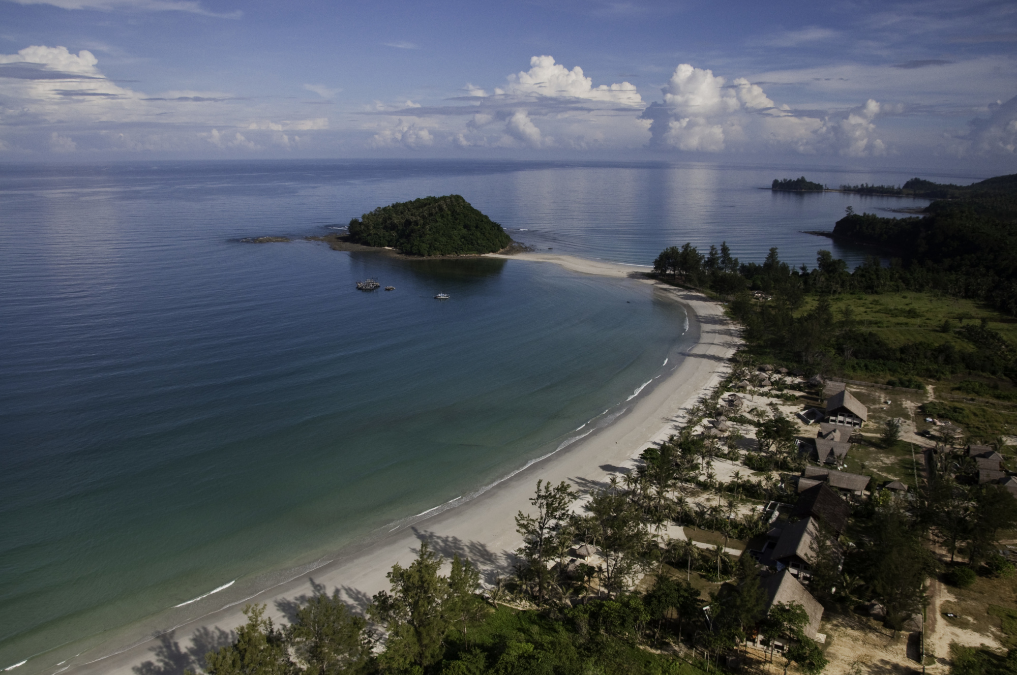
The small but important tourism industry in Kudat town revolves largely around its laid-back atmosphere and its proximity to the sea. Visitors come to purchase its fresh seafood and experience the charms of a typical Sabahan country town. Tourist attractions located in the town proper include the Kudat Golf Club, Sidek Esplanade, central market and fish market. Kudat is famous for its beaches, which are among the most unspoilt in Sabah. Some of the better-known beaches include Bak Bak, Pasir Putih, Kalampunian and Torungkungan.

Kudat is also notable for its proximity to Tanjung Simpang Mengayau, a headland which forms the northernmost point of the island of Borneo. The Tip of Borneo marks the meeting point of the South China Sea and the Sulu Sea. The tip as part of the Kudat Peninsula was formed through the Kudat formation in the Early Miocene age.
The original name of Tanjung Sampang Mangazou comes from the language of the indigenous Rungus. The words Tanjung or cape, Sampang or union and Mangazou or battle refer to this location of a battle that occurred when the ethnic Rungus defended their territory against the attack from Moro Pirates. According to legend, this place was a favourite landing point for the pirates. Local Chinese people refer to the place as Den Foh Liew, which in Hakka means a lighthouse due to a lighthouse on a nearby island of Kalampunian Island that can be seen from here.

The tip is one of Sabah’s popular tourist attractions. Within the area, there is a park-like grounds with a Malaysian flag pole and a large bronze globe which opened in 2004. The bronze globe marks the location of the Borneo Island tip at latitude 7 degrees north and longitude 116 degrees east with a map featuring the island embossed in bronze and laid on a flat surface at an angle with inscriptions to mark the tip. Over the years, infrastructure and public amenities have been erected at the site including a public rest area with a café, souvenir shop and washrooms. The park-like grounds has become a place to view sunsets and full moons.
Several villages along the Kota Kinabalu – Kudat road each showcase one particular aspect of Rungus culture. In Kampung Gombizau, visitors can observe the production of honey and gathering of traditional Rungus herbs, whereas Kampung Sumangkap is famous for its gong-making industry. Kampung Bavanggazo on the other hand is noted for its traditional Rungus longhouses, which are part of a community project offering tourists the chance to experience and learn about the culture and lifestyle of the Rungus people. Rungus culture can also be experienced at the Misompuru Homestay Programme, which is centred around Kampung Minyak.