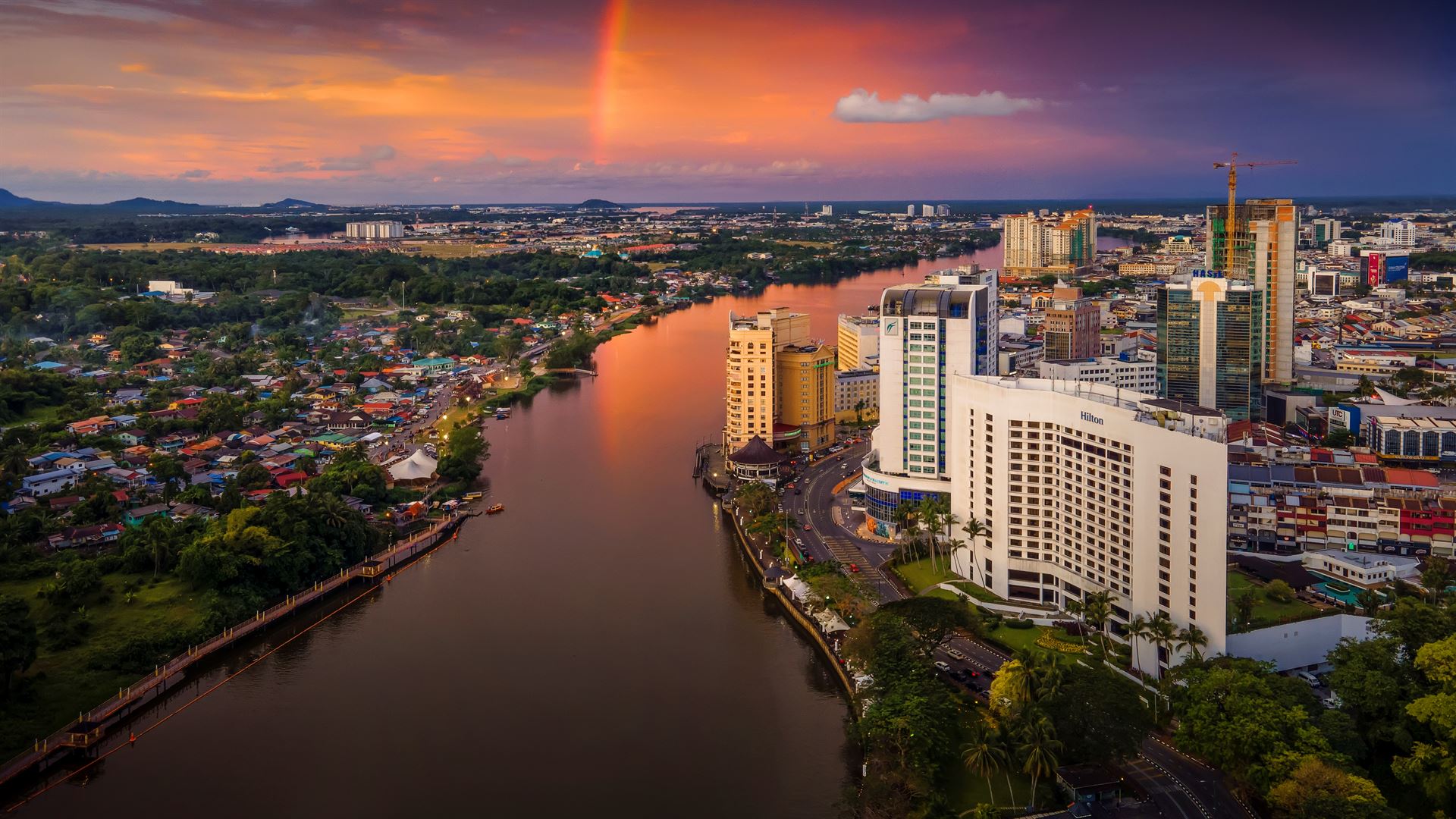
Travel Bucket List: Malaysia Part 46 – Sarawak Part 3

Bau
A gold mining town, Bau has a rich, but violent history. On 1 May 1837, the Skrang Ibans invaded the Jagoi-Bratak Bidayuh settlement on top of Bratak Peak, killing over 2,000 Jagoi-Bratak Bidayuh men and taking 1,000 women captive. Panglima Kulow, head of the Jagoi-Bratak Bidayuh community, and a handful of his followers survived the massacre. In 1841 James Brooke, who was then the newly installed White Rajah of Sarawak, was able to rescue some of the women taken captive. Each year on 1 May, descendants of the survivors of the 1837 massacre hold Jagoi-Bratak Day on top of Bratak Peak in Bau in memory of their ancestors. A memorial stone was erected on 1 May 1988, to mark the day.

The Chinese first began gold mining in Bau in the 1800s, centred at Pangkalan Tebang. In 1850, more Chinese came from Pemangkat in Dutch Borneo to escape from inter-Chinese Kongsi rivalry there. The friction of the jurisdiction and taxation of Chinese Kongsi with the Brooke government and the $150 fine for smuggling opium imposed by the Brookes led to the Bau uprising on 19 February 1857. About 600 gold miners, led by Liu Shan Bang, took over Kuching town, the administrative centre of the Brooke government. The Sarawak Treasury was ransacked, including $6,359 belonging to the Borneo Company. The gold miners called a meeting where agreements were signed. On 23 February, a BCL steamship named Sir James Brooke returned from Singapore and flanked by a flotilla of small boats, the steamship sailed upriver in pursuit of the retreating Chinese gold miners. James Brooke retook the town of Kuching on the same day and Charles Brooke led several hundreds of Dayaks from Skrang and Saribas in pursuit of the 2,000 Chinese gold miners that retreated to Sambas in Dutch Borneo and by 15 March 1857 peace was restored.

After the uprising was quashed by the Brookes, the mining operations were gradually taken over by The Borneo Company with the last Chinese syndicate being bought out in 1884. In 1898, The Borneo Company introduced the cyanide process for extracting gold, which led to increased environmental pollution. The mines were closed in 1921 because most of the minerals, easily reachable by existing techniques, had been removed. However, during the Great Depression, Chinese miners continued to artisanally mine the deposits. The mines were reopened in the late 1970s when world gold prices soared but were closed down again in 1996 when the Asian financial crisis started. The last mining occurred at the Tai Parit open-pit mine.

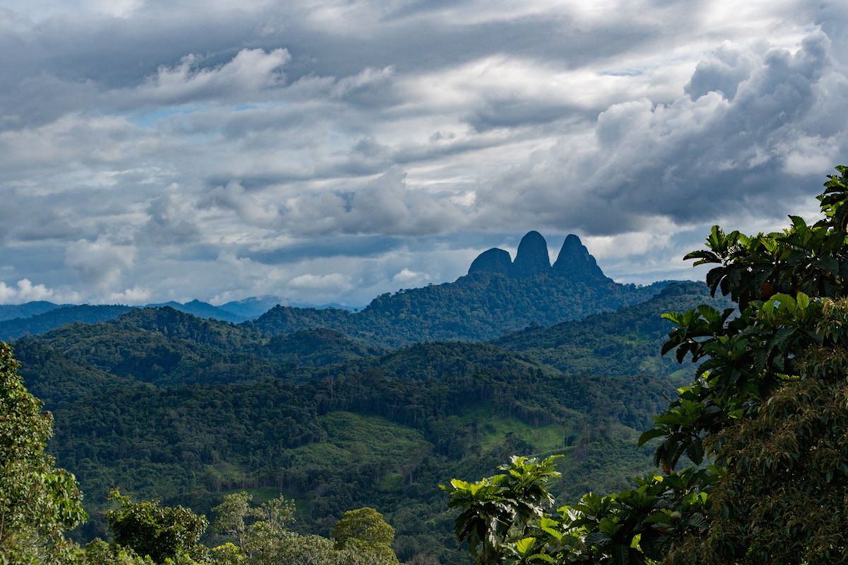
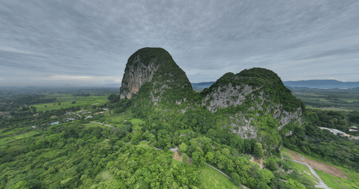
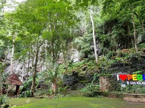
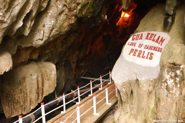
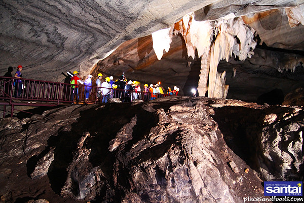
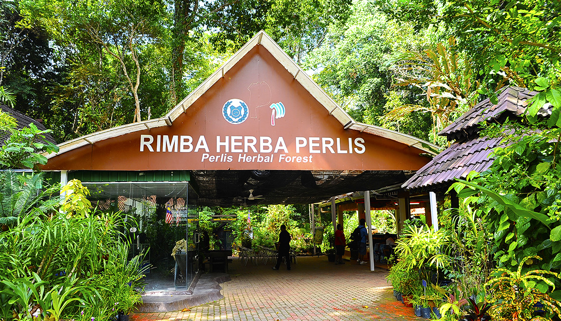
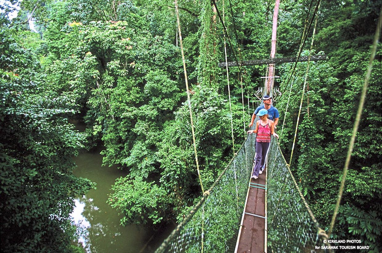
Located 40 km southwest of Kuching, near the former Bau gold mining settlement, Fairy Cave is a limestone cave with unique rock formations. It is commonly known as Gau Pari and can be accessed after climbing a four-storey staircase. According to experts, Fairy Cave was formed around 200 million years ago during the Jurassic era. The stalactites and stalagmites within the cave have taken interesting shapes. It is believed that this structure got its name from a stalagmite that has a resemblance to a Chinese Goddess. The cave is massive and there are walkways for tourists who are willing to explore it. Visitors can take part in many adventure activities that take place on the cliff face. The most popular among them is rock climbing with different degrees of difficulty. A short drive from the iconic Wind Cave will take you to the Fairy Cave. Both the caves are visited together and can be covered in a half-day trip.

To reach the Fairy Cave entrance, visitors have to climb a four-storey staircase made from concrete. From the entrance, the cave looks dark and spooky with abundant greenery everywhere. The winding wooden stairs lead inside the cave. Make way through the steep and slippery steps into the main chamber with a huge opening that allows sunlight to burst in. This place is very beautiful and looks straight out of the postcard. The intimidating sight of the formations has a strange way of making connections. Besides the formations, ferns, mosses and bats cover this space. The water dripping from above feeds the tiny plants and the bats’ poop makes the soil fertile. From the massive opening, one also enjoys a breathtaking view of the surrounding areas.

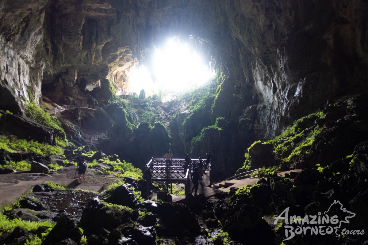
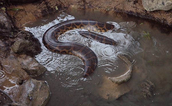
A short drive from Fairy Cave is the Sarawak Wind Cave. It stands on the banks of River Sarawak and strikes visitors with stalactites and stalagmites formed over the centuries. Both of these caves are very different from one another and can be covered in a half-day trip. Wind Cave has three unlit tunnels and the interior is pitch dark. Unlike Fairy Cave, cars can be parked right at the entrance of the cave. For the convenience of the visitors, a 1000-metre plank-walk runs throughout the cave interiors. Wind Cave is also a natural habitat for rare species of plants and animals. Presently, there are 14 bat species and 12 snail species living within its dark walls.

For moving around in this cave one has to completely rely on torchlight. The routes are lined with reflective stickers and there are hand railings on both sides, hence there is a lesser probability of getting lost or falling off. Notice boards are installed at various points that provide information on different species in the cave. At the end of the passage, a path takes one down to one of the tributaries of the Sarawak River. There is a thin stretch of sand with public changing rooms. Hence, a refreshing dip is the best way to rejuvenate the senses after this exploration. The cave is open between 8:30 am and 4 pm.

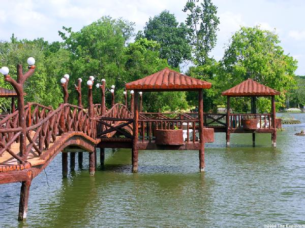
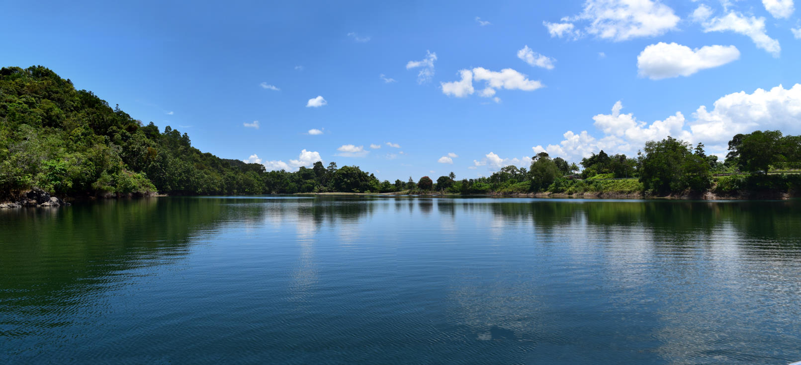
The Blue Lake, also known as Tasik Biru, is located at a distance of 35 km from the Kuching City Centre in Bau. This lake was once an open-pit gold mine. However, since the gold mine got flooded, it was converted into an artificial lake. Tasik Biru is a scintillating turquoise lake and is about 91 meters deep. The scenic lake has deep and sharp edges and is surrounded by greenery. A floating platform is also constructed at the lake which allows visitors to get closer to the water. Although people can take part in a few water sports activities at the lake, the water is unsuitable for drinking since it contains arsenic contaminants.

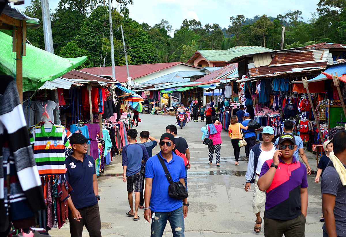
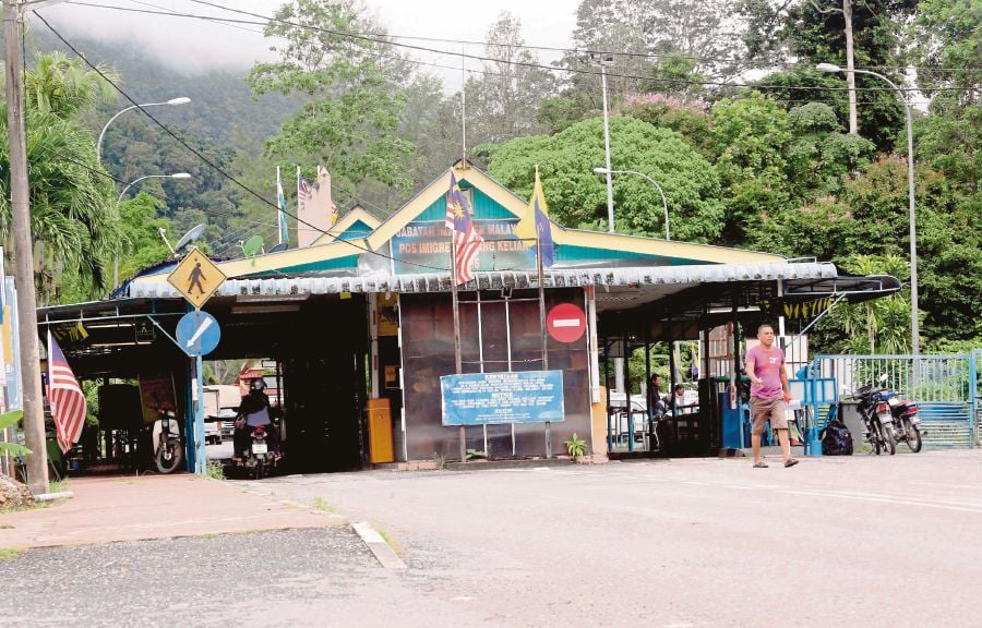
Situated near the border of Malaysia and Indonesia in Bau, the Serikin Weekend Market attracts several people who wish to purchase goods from Indonesian sellers. These sellers come from Kalimantan on their bikes. Since there is no customs post here, the Indonesian goods become available at competitive prices. Some of the items that are sold at the Serikin Weekend Market include fabrics, handicrafts, antiques, rattan furniture and clothes. Further, authentic Bornean food is also available here.

Sibu
Known as the gateway to Batang Rejang, Sibu is a charming town with a vibrant culture and a bustling waterfront and has some of the best food in Sarawak. Around 190 km northeast of Kuching, Sibu is a popular day stop before or after venturing into the wild interiors of Borneo. One distinctive feature of Sibu is the Iban longhouses. Tourists can visit Iban longhouses and even have a stay to experience the Iban Tribal Life. Sibu is characterised by its diverse population, with a significant portion being of Chinese descent, primarily from the Fuzhou region.

Sibu is well known for the biggest town square in Malaysia, the Sibu Town Square. It also has the Lanang Bridge which connects Sibu to Sarikei and is the longest in Sarawak. Malaysia’s first and only medical museum, Lau King Howe Hospital Memorial Museum is located in Sibu. The city’s mascot is the swan which is an ancient Chinese symbol of health and good fortune. Swan statues can be seen dotted around town.

The city’s history dates back to its founding in 1862 by James Brooke, who built a fort to protect against attacks by indigenous Dayak people. Subsequently, a small group of Chinese Hokkien settlers established themselves around the fort, engaging in various business activities. In 1901, Wong Nai Siong led a significant migration of 1,118 Fuzhou Chinese from Fujian, China, to Sibu. Over time, infrastructure development took place, including the construction of the first hospital, Sibu bazaars, Methodist schools, and churches.

Sibu faced significant challenges in its history, enduring fires in 1889 and 1928 that destroyed the town. However, it was successfully rebuilt on both occasions. During the Second World War, Sibu fell under Japanese occupation, resulting in a renaming of the city to Sibu-shu in August 1942. After the Japanese surrender in 1945, Sarawak became a British Crown Colony. This led to unrest among young Melanau individuals in Sibu who were in favour of independence, culminating in the assassination of Sir Duncan George Stewart, the second British Governor of Sarawak, during his visit to Sibu in December 1949. The perpetrator, Rosli Dhoby, was subsequently executed in 1950.

In the post-war period, Sibu and the Rajang basin became a centre of communist activities, which continued even after Sarawak gained independence in 1963. The establishment of the Rajang Security Command or RASCOM aimed to curb communist activities in the area, and the communist insurgency in Sarawak was eventually suppressed in 1973, coming to a complete end in 1990. The city celebrated the 110th anniversary of the Fuzhou settlement in 2011.

Before 1873, Sibu was known as Maling, a name derived from a bend in the Rajang River referred to as Tanjung Maling. This bend was located opposite the present-day town of Sibu and near the confluence of the Igan and Rajang rivers. The area was named after this prominent geographical feature. The name Sibu itself was derived from the native Pulasan fruit, which was abundant in the region. In the Iban language, this fruit is known as Buah Sibau. Consequently, it was named after the Pulasan fruit, reflecting the rich natural resources and cultural significance of the area.

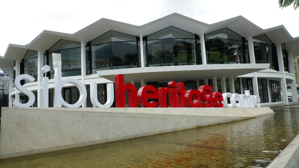
The Sibu Heritage Centre is worth visiting with its collection of antiques and chronological history. It unveils the cultural life and heritage of the people of the central region. The heritage centre is an educational place that houses a local museum which chronicles extensive information about the early Chinese settlements and other races along with the history of the local folk tribes inhabiting the town. The centre has a few shops selling beautiful local handicraft items with intricate patterns and some lovely souvenirs to take back home.

An initiative of the Sibu Heritage Centre, the Sibu Heritage Trail was launched in 2012 to encourage tourism in Sibu and celebrate the cultural ethnicity of the city. The trail largely covers nine heritage sites some of which include the Old Muslim Cemetery, Tua Pek Kong Temple, Masjid An-nur, Rosli Dhobi Warriors Memorial and Hoover Memorial Square among others. The trail stretches along approximately 4 km covering almost all heritage sites in the town. One can avail the walking maps, brochures and more information about these sites from the tourist information centre, hotels or travel agents in the area.

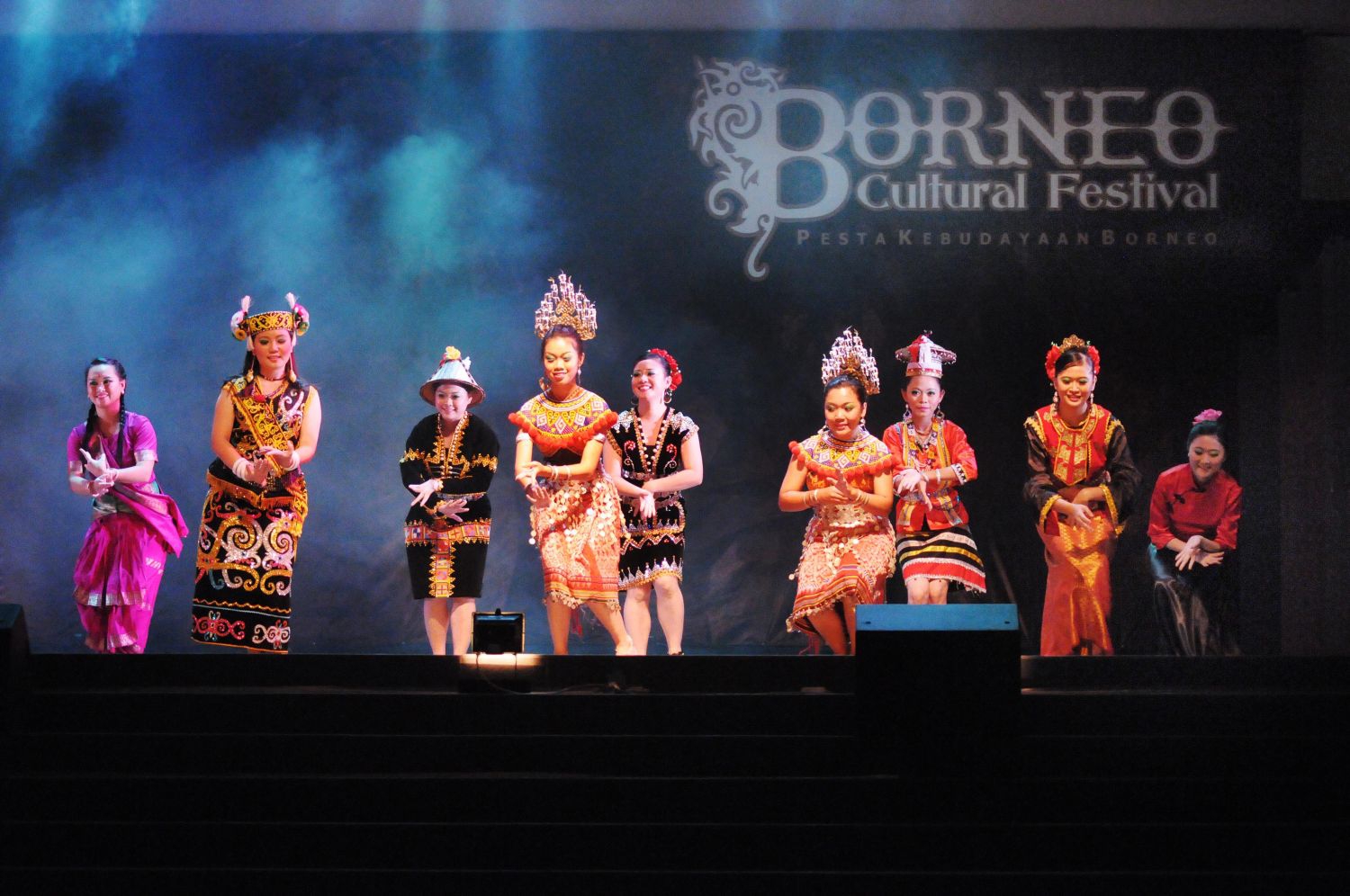
The Borneo Cultural Festival is one of the most famous festivals of Sibu which takes place in July and August and is the best time to visit. The festival is a week-long event which celebrates the tribal diversity of the area with dance, music and food.

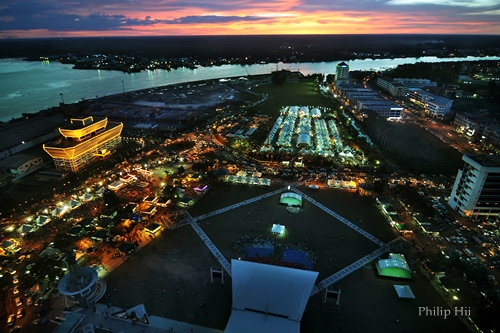
Since 2005, the Borneo Cultural Festival or BCF has been held by the Sibu Municipal Council in July every year at the Sibu Town Square, for 10 days. It is a celebration of traditional music, dances, contests, beauty pageants, food stalls, fun fairs, and product exhibitions. There are 3 separate stages for Iban, Chinese, and Malay performances. It draws around 20,000 people every year. The festival was stopped briefly in 2011 before it was resumed in 2012.

One of the oldest Iban settlements in Sibu, Bawang Assan Longhouse Village is located about 40 minutes away from Sibu’s main town. One can drive up here or enjoy a cruise ride along the beautiful Ranjang River. Bawan Assan has a series of nine longhouses ranging from fusion traditional dating to the 18th century to modern houses that visitors are allowed to stay at and experience the cultural ethnicity and traditional delicacies at this place. The houses are well-maintained and offer excellent views of the area.

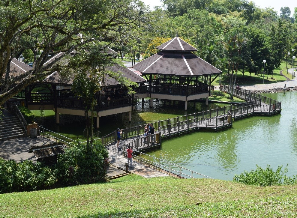
The beautiful Rejang Esplanade along Malaysia’s largest river is a stunning riverfront promenade stretching from the Express Boat Passenger Terminal to the Kingwood Hotel. It is an attractive spot among locals and tourists that offers picturesque views of the flowing river and a grass-occupied waterfront with fishing boats parked across the esplanade. The place has a spectacular Swan statue that also happens to be the symbol of Sibu.

Formerly a well-equipped hospital used to treat people from all ethnic tribes, the Lau King Howe Memorial Museum is now a museum that showcases an array of collections of antique hospital instruments and tools, uniforms of nurses and caretakers, etc. It offers a fun detailed explanation of the life and history of the hospital, its doctors and its workers. The place was built by donations of Lau King Howe and is conveniently located close to the Rejang River. One can enter the place by knocking at the main entrance.

Stretching approximately 1.2 km over the Rajang River connecting the town of Sibu and Sarikei, the Lanang bridge was built in 2003 to replace the ferry facilities to get across the river. Initially, a toll bridge with expensive toll prices, the bridge started to receive criticism and the government suggested taking over and abolishing toll taxes. The bridge offers breathtaking sunset views overlooking the muddy river.

Built in the 1800s by an Indonesian king, the Masjid Al-Qadim stands in Sibu town as one of the oldest structures there. Located at Jalan Kampung Nyabor, the mosque was originally built of timber and leaf attap and continues to develop and restore its glory. However, the main house of worship remains unchanged over the years, falling in place with the monumental architecture signifying the prosperity of the Muslim culture.

Also known as the Yu Lung San Tien En Si, the Jade Dragon Temple is a Chinese temple located about a 45-minute drive from the Sibu main town. Presently the largest temple in the country, it has a worship place for Buddhists, Taoists and Confucianists bringing all three religions under one roof. The temple has a huge premises with red building pillars and spectacular Chinese architecture.

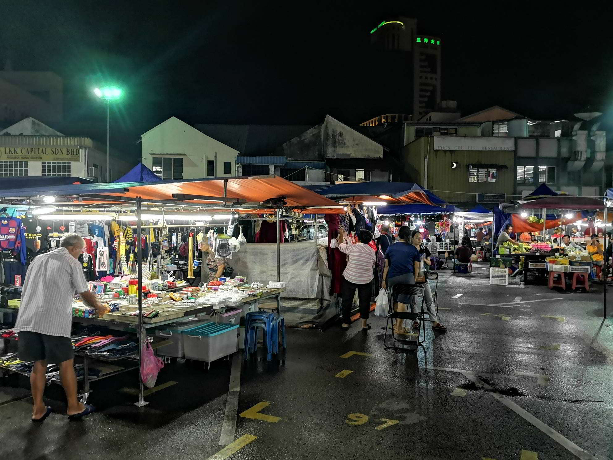
Sibu Night Market is located right in the centre of Sibu town on the market road. The stalls at this place are set up as early as 4:30 pm and offer a range of everything including toys, household items, clothes, shoes, bags, accessories, etc. However, the main attraction of this market are the mouth-watering food stalls. The shop owners serve a variety of local food along with authentic Chinese and Malay delicacies.  The market is open daily from 5 to 10 pm.

Initiated as a private event in 2012, the Sibu International Dance Festival is hosted annually at the Sibu Civic Centre & Kutien Memorial Park to actively commemorate the art of dance. They help create divine masterpieces and productions to enlighten the audiences about art education and promote economic development. The festival attracts a large number of performers and dancers from across the globe allowing them to compete in harmony and exchange cultural knowledge through dance forms.

Located about 6 km away from Sibu city centre, Bukit Lima Forest Park is a recreational park close to the Sentosa residential area. The park houses stretched out boardwalks through the tropical rainforest trees with a few monkeys, squirrels and other animals in sight. The entrance is huge with arched pillars and inside is an open space playground at the start of the park. The place has two treks, the Bukit Lima Trek and the Ta Ann Trek.

Sibu town square, as the name suggests, is right at the centre of the town and is popular among locals and tourists all year round. Although it is commonly used as a regular area by locals, the town square is famous for hosting religious events and major occasions like Sibu International Dance Festival, cultural activities, food festivals, the infamous night market, etc. Event information is usually available on the Sarawak Tourism page.

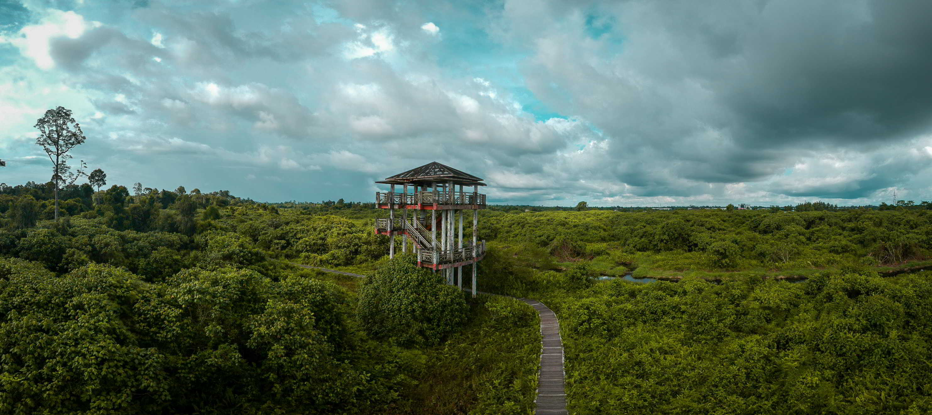
Half an hour away from the main town of Sibu, the Bukit Aup Jubilee Park is a recreational place with lush green landscapes and a crowd of hilly terrains. The entrance of the park has a wonderful pond to enjoy feeding the fish. You will find a park with fitness equipment at the foot of the hills from where you can begin hiking to the top. The climb to the top is exciting with a rope bridge to cross in the middle. It also houses a watch tower that offers splendid views of the nearby longhouses and the Igan River. The park is open daily from 8 am to 6 pm.

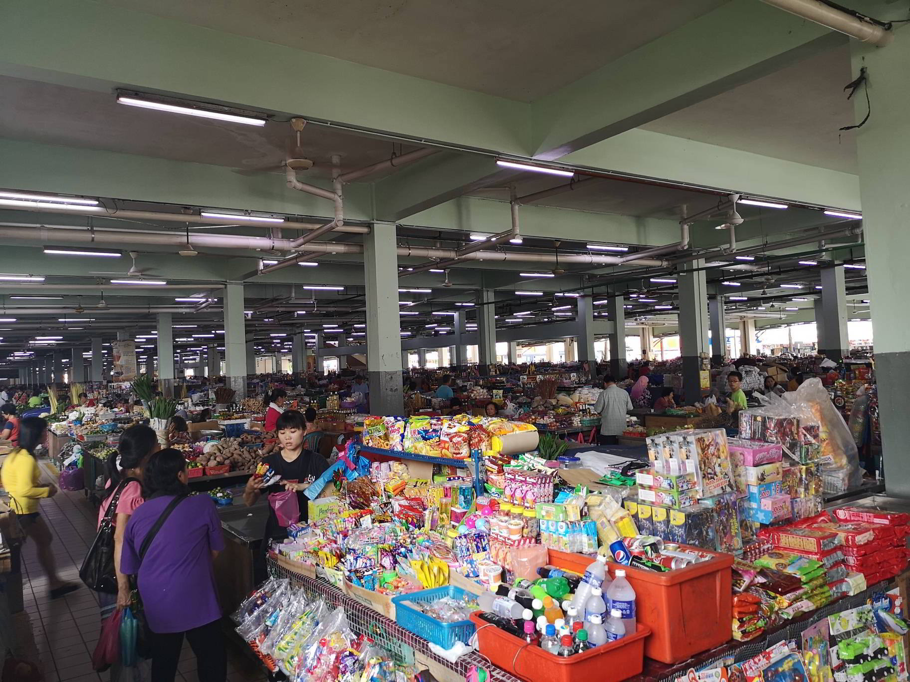
Sibu is home to Malaysia’s largest indoor market, Sibu Central Market. It has everything from apparel to souvenirs to local food to try. It is also one of the best places to buy local handicrafts. Sibu Night Market is another prime market which is famous among locals and tourists and is the liveliest in Sarawak. Bargaining is common in the night market and a myriad of options are given to buy from.

Travel Bucket List: Malaysia Part 45 – Sarawak Part 2

Kuching
Officially the City of Kuching, Kuching is the capital and the most populous city in Sarawak. The city is on the Sarawak River at the southwest tip of Sarawak on the island of Borneo and covers an area of 431 sq km. Kuching was the third capital of Sarawak in 1827 during the administration of the Bruneian Empire. In 1841, Kuching became the capital of the Kingdom of Sarawak after the territory in the area was ceded to James Brooke for helping the Bruneian empire in crushing a rebellion, particularly by the interior Borneo dwelling Land Dayak people who later became his loyal followers after most of them were pardoned by him and joined his side. The town continued to receive attention and development during the rule of Charles Brooke such as the construction of a sanitation system, hospital, prison, fort, and a bazaar. In 1941, the Brooke administration had a Centenary celebration in Kuching. During World War II, Kuching was occupied by Japanese forces from 1942 to 1945. The Japanese government set up a Batu Lintang camp near Kuching to hold prisoners of war and civilian internees. After the war, the town survived intact. However, the last Rajah of Sarawak, Sir Charles Vyner Brooke decided to cede Sarawak as part of the British Crown Colony in 1946. Kuching remained as capital during the Crown Colony period. After the formation of Malaysia in 1963, Kuching retained its status as state capital and was granted city status in 1988. Since then, the Kuching city has been divided into two administrative regions managed by two separate local authorities. Kuching is a member of UNESCO’s Creative Cities Network in the field of gastronomy. Kuching is also the main gateway for travellers visiting Sarawak and Borneo. The city has become one of the major industrial and commercial centres in East Malaysia.

The name Kuching was already in use for the city by the time Brooke arrived in 1839. There are many theories as to the derivation of the name Kuching. It was perhaps derived from the Malay word for cat, kucing or Cochin, an Indian trading port on the Malabar Coast and a generic term in China and British India for trading harbour. However, another source reported that the Kuching city was previously known as Sarawak before Brooke arrived. The settlement was renamed Sarawak proper during the kingdom’s expansion. It was only in 1872 that Charles Brooke renamed the settlement Kuching.

There was one unlikely theory based on a story on miscommunication. According to the story, James Brooke arrived in Kuching on his yacht Royalist. He then asked his local guide about the name of the town. The local guide mistakenly thought that Brooke was pointing towards a cat, and so had said the word Kuching. However, ethnic Malays in Sarawak have always used the term pusak for cats, instead of the standard Malay word kucing. Despite this etymological discrepancy, Sarawakians have adopted the animal as a symbol of their city, and it features in statues as well as the municipal council’s coat of arms – an example of heraldic canting.

Some sources also state that it was derived from a fruit called mata kucing, a fruit that grows widely in Malaysia and Indonesia. There was also a hill in the city that was named after the fruit, which is called Bukit Mata Kuching. Harriette McDougall writing to her son in the 19th century, stated that the name was derived from a stream of the same name, called Sungai Kuching or Cat River in English. The stream was situated at the foot of Bukit Mata Kuching and in front of the Tua Pek Kong Temple. In the 1950s, the river became very shallow because of silt deposits in the river which was later filled to make way for roads. There is another theory that Kuching is made up of Ku which means old and Ching or well which makes it old well in Chinese. During the Brooke administration, there was no water supply and water-borne diseases were common. In 1888, an epidemic broke out which later was known as the Great Cholera Epidemic. A well situated in the present day China Street in Main Bazaar helped to combat the disease by providing a clean water supply. Due to increased demand for a water supply, the role of the well was later replaced by a water treatment plant on Bau Road.

Sarawak was part of the Bruneian Empire since the reign of the first Sultan, Muhammad Shah and Kuching was the third capital of Sarawak, founded in 1827 by the representative of the Sultan of Brunei, Pengiran Indera Mahkota. Before the founding of Kuching, the two past capitals of Sarawak were Santubong, founded by Sultan Pengiran Tengah in 1599, and Lidah Tanah, founded by Datu Patinggi Ali in the early 1820s. Pengiran Raja Muda Hashimit later ceded the territory to a British adventurer, James Brooke as a reward for helping him to counter a rebellion. The rebellion was crushed in November 1840, and on 24 September 1841, Brooke was appointed as the Governor of Sarawak with the title of Rajah. Since that time, Kuching became the seat of the Brooke government.

As an administrative capital, it became the centre of attention and development including a sanitation system. By 1874, the city had completed several developments, including the construction of a hospital, prison, Fort Margherita, and many other buildings.

The Astana or palace, which is now the official residence of the governor of Sarawak, was constructed next to Brooke’s first residence. He had it built in 1869 as a wedding gift to his wife.  Kuching continued to prosper under Charles Vyner Brooke, who succeeded his father as the Third Rajah of Sarawak. In 1941, Kuching was the site of the Brooke Government Centenary Celebration. A few months later, the Brooke administration came to a close when the Japanese occupied Sarawak.

During the Second World War, six platoons of infantry from the 2/15 Punjab Regiment were stationed at Kuching in April 1941. The Regiment defended Kuching and the Bukit Stabar airfield from being destroyed by the Japanese. However, on 24 December 1941, Kuching was conquered by the Japanese forces and Sarawak was ruled as part of the Japanese Empire for three years and eight months, until the official Japanese surrender on 11 September 1945. From March 1942, the Japanese operated the Batu Lintang camp, for POWs and civilian internees, 5 km outside Kuching.

After the end of World War II, the town survived and was wholly undamaged. The third and last Rajah, Sir Charles Vyner Brooke later ceded Sarawak to the British Crown on 1 July 1946. Kuching was revitalised as the capital of Sarawak under the British colonial government. When Sarawak, together with North Borneo, Singapore and the Federation of Malaya, formed the Federation of Malaysia in 1963, Kuching kept its status as the state capital and was granted a city status on 1 August 1988. On 29 July 2015, Kuching was declared a City of Unity by the One Malaysia Foundation for racial harmony that existed in the city because of cross-racial marriages, multi-racial schools, fair scholarship distributions, and balanced workforce patterns.

Kuching is located on the banks of the Sarawak River in the northwestern part of the island of Borneo and has a tropical rainforest climate, moderately hot but very humid at times and receives substantial rainfall. Kuching is the wettest populated area, on average in Malaysia, with an average of 247 rainy days per year. The city is one of the main industrial and commercial centres for Sarawak.

Located across the Sarawak River, near the Astana, Fort Margherita was a fortress that is now converted into the Brooke Gallery which houses rare memorabilia of the Brooke family and history of Sarawak. Built by Charles Brook, then the ruler of Sarawak, the beautiful yet sturdy fortress is a multifaceted structure. Fort Margherita had been used for various important purposes through the years making it one of the most historical landmarks in Malaysia. Built on a hillock across the Sarawak River, the design and architecture of Fort Margherita are heavily influenced by the English Castle styles. The fort has a three-storeyed chief tower which is connected to the side of the fort instead of being constructed at the centre like the other traditional castles. The fort is guarded by high walls which are inset with glass shards with rough, jagged edges to prevent any enemy from trespassing. There are small openings and wooden windows throughout the body of the fort where cannons could be set in such a way that it wasn’t visible to any outsider and this was one of their key attacking methods. Fort Margherita also has a special execution courtyard built inside it where all the criminals, pirates and other enemies were executed.

The Brooke Gallery opened in 2016 to let visitors know more about the lives of the White Rajahs, who were the dynastic monarchy of the British Brooke Family. The various artefacts, books and belongings are displayed throughout the gallery with fun facts and description boards set up at intervals which transport us directly to the times when the Brooke Family was in its prime. The Brooke Gallery walks us through stories of the might of the Brooks and generates a feeling of awe and respect within the minds of the visitors.

Visitors should try to visit Fort Margherita during the Gawai Dayak Festival as the fort is traditionally decorated during those days and is truly a sight to behold. The best time to visit the fort is during the drier months of April to October as the Sarawak River is less choppy during those months. So, the boat rides will be smoother and more frequent. Entry fees are RM 40 per person and the combined ticket for Fort Margherita and Brooke Gallery is RM 30.

The Kuching Cat Museum or Muzium Kucing Kuching is reputed as the world’s first cat museum. Founded in 1993, it is owned by the Kuching North City Hall (DBKU). Located to the north of Kuching in the City Hall, it boasts more than 4000 artefacts including photos, exhibits, and souvenirs displayed in four different galleries. The most prominent exhibits at the museum include a mummified Egyptian cat, five wild cat species from Borneo, as well as, an entire gallery of cat-related advertising. These were brought to Kuching from the National Museum in Kuala Lumpur and were acquired by the DBKU officials. The Kuching Cat Museum is responsible for the collection and presentation of the country’s rich heritage which is valuable and intriguing. Gallery A gives a detailed history of the region including different cat breeds across the country, gallery B contains valuable cat paintings, Gallery C and D are dedicated to felines of different species and showcase prominent cartoon cat characters. The exhibits flaunt the rarest species of mummified cats that cannot be found anywhere else. The museum is open from 9 am to 5 pm daily and has an entry fee of RM 1 which includes the entry fee and one DBKU cat museum keychain. Camera fees are EM 3 while to use video cameras, it will cost RM 5.

The Sarawak State Museum is one of the oldest and most comprehensive natural history museums in Borneo. Inspired by the Normandy townhouse, the museum building houses ethnographic collections and natural history displays. The museum was a temporary settlement until the late 19th century when a more permanent structure was created. The museum has flora and fauna that are indigenous to the region and also includes the daily lifestyles and habitats of the tribes and ethnic groups of Sarawak. Some parts of the museum might be closed for restoration work, so one must make sure to follow the museum map to prevent one from getting lost. The museum is open from 9 am to 4:45 pm, Monday to Friday and over the weekend, it is open from 10 am to 4 pm. It is closed on certain public holidays and has no entry fees.

The Sarawak Islamic Heritage Museum provides a deep insight into the rich cultural heritage of Sarawak’s Muslim community. The seven galleries are the main attraction of this museum which give visitors an insight into Islamic architecture, literature, science, decorative arts, and costumes. Each of these galleries features a different theme. The museum features a Bornean-Malay style of architecture. While the museum is made out of concrete and timber, the roof is made out of bricks. This museum is adorned with a central courtyard garden, Arabic calligraphy, astrolabes, musical instruments and wood carvings. The main aim of establishing the Islamic Heritage Museum was to develop a greater sense of appreciation and understanding of Islam among the masses. While this museum was initially built for a school, it later came to be known as the James Brooke Malay College. In 1930, the museum was renamed Madrasah Melayu Sarawak. In 1992, the Chief Minister of Sarawak named it the Islamic Heritage Museum. The museum is open from 9 am to 4:45 pm, Monday to Friday and over the weekend, it is open from 10 am to 4 pm. It is closed on certain public holidays and has no entry fees.

Established by Charles Brooke the Second Rajah in 1860, the Sarawak Natural History Museum pays homage to the great naturalist Alfred Russell Wallace. Open daily, it is the oldest museum in Borneo. There are two floors displaying specimens of Sarawak fauna like reptiles, mammals, birds, ethnographic artefacts of the indigenous people, musical instruments and handicrafts. The museum is open daily from 9 am to 5 pm.

The Chinese History Museum Kuching or the Muzium Sejarah Cina Kuching showcases the history of the Chinese people in Sarawak. The museum building was constructed in 1912 and used to be the headquarters of the Sarawak Chinese Chamber of Commerce until 1921. It was later converted into the Chinese History Museum Kuching and officially opened to the public on 23 October 1993. In 2010, the museum exhibition underwent renovations which now includes short videos. The museum displays various artefacts related to Chinese affairs of Sarawak during the White Rajah era, such as musical instruments, jade, ceramics, photos etc.

The Textile Museum Sarawak is a textile museum originally built in 1907 as a medical centre. It later housed the Education Department of the Sarawak State Government. In August 2000, it was eventually turned into the Textile Museum Sarawak. The museum is housed in a three-storey building with a colonial British Renaissance theme named the Pavilion Building. The upper two floors house the permanent exhibition. The museum displays the textiles made by local communities in Sarawak, as well as traditional costumes and accessories. It also showcases the stages of textile manufacturing processes.

The Sultan Iskandar Planetarium is the first planetarium to be constructed in Malaysia. Constructed along with the Kuching Civic Centre, the planetarium was opened to the public on 1 March 1989. The planetarium has a sitting capacity of 172, is equipped with a white dome of 15 metres in diameter, fitted with four projectors, and has lighting facilities. It uses a German-made Zeiss projector which can show 5000 stars, a moon, and several special effects. The programmes organised by the planetarium include school holiday space science programmes, entourage to Sabah solar eclipse observations, camps, astroquizes, Astronomy Day, exhibitions and roadshows. The planetarium also offers industry training programmes for information technology, science, and social science students.

The Astana lies on the north bank of the Sarawak River, opposite the Kuching Waterfront. It is the official residence of the Yang di-Pertua Negeri Sarawak, the governor of Sarawak. The name is a variation of istana, meaning a palace. It was built in 1870 by the second White Rajah, Charles Brooke, as a wedding gift to his wife, Margaret Alice Lili de Windt. The palace is not normally open to the public, although the landscaped gardens are, which can be reached by a boat ride across the Sarawak River. It is part of the Kuching Heritage Trail.

The Astana, then called Government House, was built in 1870 by the second White Rajah, Charles Brooke, as a wedding gift to his wife, Margaret Alice Lili de Windt. The royal couple then occupied Astana as their main home. Brooke is said to have cultivated betel nut in a small plantation behind the Astana, so that he could offer fresh betel nut to visiting Dayak chiefs. The residence was originally three separate buildings, with each connected to the other by short and narrow passageways. Astana has since undergone major renovations and alterations befitting it as the official residence of the governor of Sarawak.

Hai Gan Street in Kuching’s Chinatown was the oldest street in the city. Today, known as Main Bazaar, the street which used to mean at the edge or lip of the sea is where visitors can find wharves and jetties.  The Hong San Si Temple and the Old Court House are located at the two ends of the street. In 1839, while Sarawak was still under the Bruneian Empire administration, the area was inhabited by only a few households while the surroundings were covered by forests. The earliest settlers in the area were the Hokkien businessmen who stayed near the Tua Pek Kong temple. By 1872, when the name Sarawak was changed to Kuching, Hai Chun Street shophouses were rebuilt by using red bricks and clay tiles. In the 1880s, Rajah Charles Brooke built a new market at Gambier Street while trying to shift traders from the old market at Hai Chun Street to here. Hainanese people came later than the Hokkien and Teochew people. The first Siang Ti Temple was built by the Teochews at Carpenter Street but was razed to the ground in 1884. A new temple was built in 1889 with a Chinese opera theatre, named Yang Choon Tai built directly opposite the temple. The Chinese Opera was built to hold thanksgiving ceremonies to the deities on the first day and the middle of every month. The theatre is still used to stage Chinese opera to this day, especially on the birthday of the deity Hiang Thian Siang Ti.

The Kuching Civic Centre is a major landmark in the city. The building was officially opened on 1 August 1988 following the proclamation of Kuching as a city status. The viewing platform at the top of the futuristic Civic Centre tower offers the best all-around views of Kuching and the surrounding areas. The city and its hinterland, Mount Serapi, Mount Santubong and even the mountains of Kalimantan are visible on a clear day.

The Tua Pek Kong Temple is an old Chinese temple situated atop a foothill, opposite the Kuching Esplanade. The focal point for the entire Chinese community in Kuching, and the oldest temple in the city, this temple serves as a major tourist attraction. Apart from the rich Chinese culture that one can explore here, the views of the river and main bazaar that the temple offers are equally enticing. The ornately decorated temple and its architecture are worth taking a look at. The temple is believed to be strong, for it is one of the few buildings that survived the 1884 Great Fire of Kuching. Another popular belief surrounding the temple is that it has the best Feng Shui location in the city. The primary deity of the temple is Tua Pek Kong, a Malaysian Chinese deity who is worshipped as the God of Prosperity. Other deities worshipped in this temple are the Bodhisattvas such as Guan Yin and Kshitigarbha. Elaborate celebrations such as the famous Wang Kang Festival is celebrated every year in the temple to commemorate the dead. The four major festivals held at this temple annually are the birthday of Tua Pek Kong, the birthday of Tua Pek Kong’s tiger that he rides on, the Hungry Ghost Festival, and the Ascension Day of Tua Pek Kong. It is ideal to visit the temple during the times of festival celebrations. The temple is open daily between 6 am to 6 pm.

The St Thomas Cathedral is an Anglican church that features a Basilian style of architecture with a bright red barrel-vaulted ceiling. The Calvary steps, Narthex, Tower and Western Courtyard are the main features of this church. St Thomas Cathedral is supported by 12 pillars, each of which is marked with consecration crosses. The white pillars are thin at the bottom and thick at the top. The church is further adorned with beautiful arches that breathe at a height of about 48 feet. The Rood Beam houses the figure of the Crucified Lord, flanked by Saint John and Saint Mary. The first series of 12 steps symbolises the childhood of the Lord up until he attained the age of 12. It symbolises the time when the Lord paid his first visit to the Temple during the Feast of the Passover. The next series of seven steps represents the adolescence of the Lord. It represents the years during which Christ attained wisdom and stature. The pilgrim ends at the 19th step since the Lord was 19 when Joseph passed away. This made the Lord responsible for his mother, Mary as well as his family business at Nazareth. The next 11 steps represent the hidden years of Jesus the Carpenter. These steps make man realise the dignity of everyday work. The final three steps represent the Ministry of Christ. It symbolises the time when Jesus began to preach at the age of 30. The church is open from 8 am to 5 pm on Monday to Friday and from 8 am to 12 noon on Saturday. It is closed on Sunday.

The Sarawak Cultural Village is a living museum that gives visitors a glimpse of the state’s indigenous tribes living in their traditional dwellings. It is located at Pantai Damai, 32 kilometres from Kuching. The village showcases the lifestyle of the major tribes of the state namely Iban, Bidayuh, Orang Ulu, Melanau, Penan, Chinese and Malay. The longhouses are the homes of these ethnic groups where they live and carry out their day-to-day activities. Today, 150 tribal people are living here who take part in folk dances to entertain the visitors. Cultural performances and interactive workshops are organised daily. Sarawak Cultural Village is also the venue for the iconic Rainforest World Music Festival.

Spread across 900 metres along the southern bank of the Sarawak River, the Kuching Waterfront is lined with hotels, restaurants, souvenir shops, entertainment areas and various historically significant buildings making it one of the most popular attractions. The walkway has excellent views of the river and the Malay kampung or village across it during the day and is an excellent spot for watching the sunset in the evening. Attractions located near the waterfront include the monument of late Charles Brooke, the first White Rajah of Sarawak, the Chinese History Museum, the iconic Square Tower, the Tua Pek Kong Temple, the Old Sarawak Steamship building, and the Darul Hana Bridge which connects the Kuching Waterfront with the North side of the river and forms the path to the Astana building.

Unarguably one of the most visited places in the city, Kuching Main Bazaar is the one-stop marketplace with the highest concentration of ethnic handicrafts and antique shops in the city. The bazaar is adjacent to the Waterfront, in the heart of old Kuching. The Main Bazaar is located on the oldest street in the city and brims with antiques and collectables. Apart from shopping, one can also enjoy the excellent views of the Sarawak River and dine at various restaurants and cafes all around the place.

Located about 35 km north of Kuching, Mount Santubong lies within a gazetted national park of the same name. Entry to the park is now via the temporary Sarawak Forestry Corporation park headquarters entrance. In 1855 a British naturalist, Alfred Russel Wallace who was staying at Santubong while collecting specimens in Sarawak, wrote a paper called Sarawak Law which can be considered as a precursor to the biological theory of evolution.

Mount Santbong rises out from the sea which is formed after a collision between the oceanic and the continental crusts. However, legends believe that this mountain has a mythological origin dating back to the centuries. A princess was punished by the king for fighting with her sister and she was cursed into Mount Santubong. Mount Santubong’s name may have been derived from the Iban word for coffin, but various Chinese derivations have also been suggested, as well as the Bidayuh, in whose lands the names of many hills start with S. Investigators have made ascents of the steep mountain to find places of archaeological interest. Around its foot are signs of Hindu occupation which are hundreds of years old and have been investigated by the Sarawak Museum. It was also the home of the early Sarawak Malays until they were driven up to Kuching in about the 1850s owing to continual attacks from the powerful Saribas Dayaks.

The mountain is made of sandstone, although it has been confused by many with limestone tower karst, or a volcanic plug: smaller versions of both appear not far inland. For a long time, it interested those in search of gold but without success. There used to be an old theory that all the gold in the First Division of Sarawak lies in a straight line between Bau and Santubong which has some support in that there is a certain amount of gold in the mountain since fishermen in the past used to depend for their livelihood during the landas season, when the sea was too rough for fishing, by panning gold in the small mountain streams from which they could expect to gain an average of twenty dollars a month.

Trekking to the summit of Mount Santubong is a much-loved activity by visitors and locals alike. This trek is often considered challenging and takes around 4 hours to reach the top and more or less the same time to descend. There are several entry points from where one can start the trek. The trek will take one through the thick tropical rainforest that is enriched with flora and fauna. One might also spot many small animals that live here. Small huts are strategically built at various points where trekkers can take shelter during thunderstorms and downpours. As one climbs higher, the gradient gets steeper and one has to climb a rope ladder to get to the top. After reaching the Mount Santubong summit, one is rewarded with sweeping views of the South China Sea and the village. There are also many tourist spots at the foot of the mountain and they look mesmerising from the top.

The town of Santubong sits under the peak of Mount Santubong and is famous for its huge expanse of sandy beaches. One must visit the town to see the Irrawaddy river dolphins and if lucky also spot the Indo-Pacific humpback or finless porpoises. Buntal fishing village is also a popular tourist attraction for its seafood and Belacan, or shrimp paste. In front of Damai Central is the very famous and busy Damai Beach known for kayaking. Other major attractions include Batu Buaya which has a myth attached to it where a mystical crocodile was killed and its face got cemented into a stone over time. Batu Bergambar, Bong Kisam and Sultan Tengah Mausoleum are among other historically known tourist spots. February to April is the pleasant weather in Santubong and hence the best time to visit. November to January is the monsoon season which must be avoided as the rainfall is very high making it ill-suited for a vacation.

Travel Bucket List: Malaysia Part 44 – Sarawak Part 1

The first state we will be exploring in East Malaysia, Sarawak is the largest among the 13 states, with an area almost equal to that of Peninsular Malaysia. Located in the region of East Malaysia in northwest Borneo, Malaysia’s only Christian-majority state, Sarawak is bordered by Sabah to the northeast, the Indonesian portion of Borneo, Kalimantan to the south, and Brunei to the north. The state capital, Kuching, is the largest city in Sarawak, the economic centre of the state, and the seat of the Sarawak state government.

The head of state is the Governor, also known as the Yang di-Pertua Negeri, while the head of government is the Premier. Sarawak is divided into administrative divisions and districts, governed by a system that is closely modelled on the Westminster parliamentary system and was the earliest state legislature system in Malaysia. Under the Malaysian constitution, Sarawak has greater autonomy than the states in Peninsular Malaysia.

Sarawak is ethnically, culturally, religiously and linguistically diverse; ethnic groups include Iban, Chinese, Malay, Bidayuh, Melanau, Orang Ulu, Indian, Eurasian and Kedayan. English and Malay are the two official languages of the state; there is no official religion.

The generally accepted explanation of the state’s name is that it is derived from the Sarawak Malay word Serawak or Cerava by Portuguese cartographers in the 16th century, which means antimony. A popular alternative explanation is that it is a contraction of the four Malay words purportedly uttered by Pangeran Muda Hashim, uncle to the Sultan of Brunei, “Saya serah pada awak” which means, I surrender it to you, when he gave Sarawak to James Brooke, an English explorer in 1841. However, the latter explanation is incorrect: the territory had been named Sarawak before the arrival of James Brooke, and the word awak was not in the vocabulary of Sarawak Malay before the formation of Malaysia.

Sarawak is nicknamed the Land of the Hornbills or Bumi Kenyalang. These birds are important cultural symbols for the Dayak people, representing the spirit of God. It is also believed that if a hornbill is seen flying over residences, it will bring good luck to the local community. Sarawak has eight of the world’s fifty-four species of hornbills, and the Rhinoceros hornbill is the state bird of Sarawak.

Foragers are known to have lived around the west mouth of the Niah Caves, located 110 km southwest of Miri, 40,000 years ago. A modern human skull found near the Niah Caves is the oldest human remains found in Malaysia and the oldest modern human skull from Southeast Asia. Chinese ceramics dating to the Tang and Song dynasties found at Santubong, near Kuching hint at its significance as a seaport.

The settlement known as Vijayapura was a vassal-state to the Buddhist Srivijaya empire and was thought to be located in Borneo’s Northwest which flourished in the 7th century. One of the earliest Chinese records of an independent kingdom in Borneo is the 977 AD letter to the Chinese emperor from the ruler of Boni, which some scholars believe refers to Borneo. The Bruneians regained their independence from Srivijaya due to the onset of a Javanese-Sumatran war. Marco Polo suggested in his memoirs that the Great Khan or the ruler of the Mongol Empire attempted and failed many times to invade “Great Java” which was the European name for Bruneian-controlled Borneo. In the 1300s the Chinese annals, Nanhai zhi, reported that Brunei invaded or administered Sarawak and Sabah as well as the Philippine kingdoms of Butuan, Sulu, Ma-i or Mindoro, Malilu, or present-day Manila, Shahuchong or present-day Siocon, Yachen or Oton, and Wenduling or present-day Mindanao, which would regain their independence at a later date.

The Bruneian Empire was established in the coastal regions of Sarawak by the mid-15th century, and the Kuching area was known to Portuguese cartographers during the 16th century as Cerava, one of the five great seaports of Borneo. It was also during this time that witnessed the birth of the Sultanate of Sarawak, a local kingdom that lasted for almost half a century before being reunited with Brunei in 1641. By the early 19th century, the Bruneian Empire was in decline, retaining only a tenuous hold along the coastal regions of Sarawak which were otherwise controlled by semi-independent Malay leaders. Away from the coast, territorial wars were fought between the Iban and a Kenyah-Kayan alliance.

The discovery of antimony ore in the Kuching region led Pengiran Indera Mahkota, a representative of the Sultan of Brunei, to increase development in the territory between 1824 and 1830. Increasing antimony production in the region led the Brunei Sultanate to demand higher taxes, which ultimately led to civil unrest. In 1839, Sultan Omar Ali Saifuddin II assigned his uncle Pengiran Muda Hashim the task of restoring order but his inability to do so caused him to request the aid of British sailor James Brooke. Brooke’s success in quelling the revolt was rewarded with antimony, property and the governorship of Sarawak, which at that time consisted only of a small area centred on Kuching.

The Brooke family, later called the White Rajahs, set about expanding the territory they had been ceded. With expansion came the need for efficient governance and thus, beginning in 1841, Sarawak was separated into the first of its administrative divisions with currency, the Sarawak dollar, beginning circulation in 1858. By 1912, a total of five divisions had been established in Sarawak, each headed by a Resident. The Brooke family generally practised a paternalistic form of government with minimal bureaucracy but were pressured to establish some form of legal framework. Since they were unfamiliar with local customs, the Brooke government created an advisory Supreme Council, mostly consisting of Malay chiefs, to provide guidance. This council is the oldest state legislative assembly in Malaysia, with the first General Council meeting taking place at Bintulu in 1867. In 1928, a Judicial Commissioner, Thomas Stirling Boyd, was appointed as the first legally trained judge. A similar system relating to matters concerning various Chinese communities was also formed. Members of the local community were encouraged by the Brooke regime to focus on particular functions within the territory: the Ibans and other Dayak people were hired as militia while Malays were primarily administrators. Chinese, both local and immigrant, were mostly employed in plantations, mines and as bureaucrats. Expanding trade led to the formation of the Borneo Company Limited in 1856. The company was involved in a wide range of businesses in Sarawak including trade, banking, agriculture, mineral exploration, and development.

Between 1853 and 1862, there were several uprisings against the Brooke government but all were successfully contained with the aid of local tribes. To guard against future uprisings, a series of forts were constructed to protect Kuching, including Fort Margherita, completed in 1871. By that time Brooke’s control of Sarawak was such that defences were largely unnecessary. Charles Anthoni Brooke succeeded his uncle in 1868 as the next White Rajah. Under his rule, Sarawak gained Limbang and the Baram and Trusan valleys from the Sultan of Brunei, later becoming a protectorate in 1888 with Britain handling foreign affairs but the Brooke government retaining administrative powers. Domestically, Brooke established the Sarawak Museum – the oldest museum in Borneo – in 1891 and brokered peace in Marudi by ending intertribal wars there. Economic development continued, with oil wells drilling from 1910 and the Brooke Dockyard opening two years later.

1941 saw the British withdrawing its air and marine forces defending Sarawak to Singapore. With Sarawak now unguarded, the Brooke regime adopted a scorched earth policy where oil installations in Miri were to be destroyed and the Kuching airfield held as long as possible before being destroyed. Nevertheless, a Japanese invasion force led by Kiyotake Kawaguchi landed in Miri on 16 December 1941 and conquered Kuching on 24 December 1941, with British ground forces retreating to Singkawang in neighbouring Dutch Borneo. After ten weeks of fighting there, the Allied forces surrendered on 1 April 1942. Charles Vyner Brooke, the last Rajah of Sarawak, had already left for Sydney, Australia; his officers were captured by the Japanese and interned at the Batu Lintang camp.

Sarawak remained part of the Empire of Japan for three years and eight months. During this time it was divided into three provinces – Kuching-shu, Sibu-shu, and Miri-shu – each under their respective Provincial Governor. The Japanese otherwise preserved the Brooke administrative structure and appointed the Japanese to important government positions. Allied forces later carried out Operation Semut to sabotage Japanese operations in Sarawak. During the battle of North Borneo, the Australian forces landed at the Lutong-Miri area on 20 June 1945 and penetrated as far as Marudi and Limbang before halting their operations in Sarawak. After the surrender of Japan, the Japanese surrendered to the Australian forces at Labuan on 10 September 1945. The following day, the Japanese forces at Kuching surrendered, and the Batu Lintang camp was liberated. Sarawak was immediately placed under British Military Administration and managed by the Australian Imperial Forces (AIF) until April 1946.

Lacking the resources to rebuild Sarawak after the war, Charles Vyner Brooke decided to cede Sarawak as British Crown Colony and a Cession Bill was put forth in the Council Negri, now Sarawak State Legislative Assembly, which was debated for three days. The bill was passed on 17 May 1946 with a narrow majority which caused hundreds of Malay civil servants to resign in protest, sparking an anti-cession movement and the assassination of the second colonial governor of Sarawak, Sir Duncan Stewart. Despite the resistance, Sarawak became a British Crown colony on 1 July 1946.  

On 27 May 1961, Tunku Abdul Rahman, the prime minister of the Federation of Malaya, announced a plan to form a greater federation together with Singapore, Sarawak, North Borneo and Brunei, to be called Malaysia. On 17 January 1962, the Cobbold Commission was formed to gauge the support of Sarawak and Sabah for the plan; the Commission reported 80 per cent support for the federation.  On 23 October 1962, five political parties in Sarawak formed a united front that supported the formation of Malaysia. Sarawak was officially granted self-government on 22 July 1963, and became federated with Malaya, North Borneo, now Sabah, and Singapore to form a federation named Malaysia on 16 September 1963. The governments of the Philippines and Indonesia opposed the new federation, as did the Brunei People’s Party and Sarawak-based communist groups, and in 1962, the Brunei Revolt broke out. Indonesian President Sukarno responded by deploying armed volunteers and, later, military forces into Sarawak. Thousands of Sarawak communist members went into Kalimantan, Indonesian Borneo, and underwent training with the Communist Party of Indonesia. The most significant engagement of the confrontation was fought at Plaman Mapu in April 1965. The defeat at Plaman Mapu ultimately resulted in the fall of Sukarno and he was replaced by Suharto as president of Indonesia. Negotiations were restarted between Malaysia and Indonesia and led to the end of the confrontation on 11 August 1966.

Sarawak is separated from Kalimantan Borneo by ranges of high hills and mountains that are part of the central mountain range of Borneo. These become loftier to the north and are highest near the source of the Baram River at the steep Mount Batu Lawi and Mount Mulu. Mount Murud is the highest point in Sarawak. Sarawak has a tropical geography with an equatorial climate and experiences two monsoon seasons – a northeast monsoon and a southwest monsoon. Sarawak is divided into three ecoregions. The coastal region is rather low-lying and flat with large areas of swamp and other wet environments. Hilly terrain accounts for much of the inhabited land and is where most of the cities and towns are found. The third region is the mountainous region along the Sarawak–Kalimantan border, where many villages are located. Sarawak can be divided into two geological zones: the Sunda Shield, which extends southwest from the Batang Lupar River, near Sri Aman and forms the southern tip of Sarawak, and the geosyncline region, which extends northeast to the Batang Lupar River, forming the central and northern regions of Sarawak.

Sarawak contains large tracts of tropical rainforest with diverse plant and animal species, including 2000 tree species. The state is the habitat of endangered animals, including the Borneo pygmy elephant, proboscis monkey, orangutans and Sumatran rhinoceroses. In 1854, Alfred Russel Wallace visited Sarawak. A year later, he formulated the “Sarawak Law” which foreshadowed the formulation of his and Darwin’s theory of evolution by natural selection three years later.

Sarawak’s rainforests are primarily threatened by the logging industry and palm oil plantations. Deforestation has affected the lives of indigenous tribes, especially the Penan, whose livelihood is heavily dependent on forest produce. This led to several blockades by indigenous tribes during the 1980s and 1990s against logging companies encroaching on their lands. Illegal logging in particular has decimated the forest regions indigenous populations depend on for their livelihoods, depleting fish, wildlife, but also traditional medicinal herbs and construction staples like Palm. There have also been cases where Native Customary Rights (NCR) lands have been given to timber and plantation companies without the permission of the locals. The indigenous people have resorted to legal means to reinstate their NCR. Through the course of 2016 over 2 million acres of forest, much of it in orangutan habitats, were declared protected areas.

Sources vary as to Sarawak’s remaining forest cover. Former chief minister Abdul Taib Mahmud declared that it fell from 70% to 48% between 2011 and 2012, the Sarawak Forest Department and the Ministry of Resource Planning and Environment both held that it remained at 80% in 2012, and Wetlands International reported that it fell by 10% between 2005 and 2010, 3.5 times faster than the rest of Asia combined.

Historically, Sarawak’s economy was stagnant during the rule of the previous three white Rajahs. After the formation of Malaysia, Sarawak’s GDP growth rate has risen due to an increase in petroleum output and the rise in global petroleum prices. However, the state economy is less diversified and still heavily dependent upon the export of primary commodities when compared to Malaysia overall. Sarawak is one of the world’s largest exporters of tropical hardwood timber, constituting 65% of the total Malaysian log exports in 2000. Tourism plays a major role in the economy of Sarawak and contributed 7.9% of the state’s GDP in 2016. The Rainforest World Music Festival is the region’s primary musical event, attracting more than 50,000 people annually.

Sarawak is Malaysia’s fifth most populous state, but because this population is distributed over a large area, Sarawak has the lowest population density in the country, with only 20 people per sq km.

Travel Bucket List: Malaysia Part 43: Perlis Part 2

Kuala Perlis
A suburb of Kangar, Kuala Perlis is the second-largest town and the main port of Perlis. It is in extreme northwest Peninsular Malaysia, near the border with Thailand. The older part of town has houses and mosques built on stilts over mangrove swamps. Along with its Kedahan counterpart, Kuala Kedah, Kuala Perlis is a transit point for tourists to embark on a ferry ride to the resort island of Langkawi. One of the popular activities here is fishing. There are also many restaurants that offer fresh seafood that is relatively cheaper than in the capital city.

Surrounded by the Kayang, Lambing Panah, Wai, Minera and Jahat Hutang limestone hills in the Kayang region, the Kota Kayang Museum, or the Muzium Kota Kayang sits on a 2-hectare of land. Initially, the land was granted from King Syed Alwi to his younger brother Syed Salim bin Syed Muhammad Al-Jafri, at the time a senior minister to the King. At the end of the 19th century, Syed Salim constructed a residence for his family to stay until 1909 when the Anglo-Siamese Treaty of 1909 was signed. Afterwards, the building became the residence for British Malaya government officers. Between 1941 and 1943, the building was taken over by the Imperial Japanese Army administration. The Royal Thai Armed Forces took over the building between 1943 and 1945, and after Malaya’s independence in 1957, the building became the official residence of the Perlis Chief Minister. In 1991, the building was demolished to make the Kota Kayang Museum. A new building was reconstructed with an exactly similar design to the former building. During the soil excavation work, artefacts from the Neolithic period were discovered in the site. The museum is divided into three galleries, including the General Gallery, the Archaeological Gallery and the Kedah and Perlis Gallery.

The single-storied three-building structure depicts the Perlis-Malay architecture style with a touch of modernisation. The wickerwork walls, along with the beams and carvings on the doors, resemble traditional existing Malay homes. The tomb of the 15th Sultan of Kedah still lies on the grounds of the museum. Besides the galleries, the outside recreational garden is refreshing, offering a magnificent view for tourists to stop by. The museum is closed on Mondays and is open from 9 am to 5 pm on Tuesdays to Sundays. It has no entry fees.

The Al Hussain Mosque is regarded as one of the most beautiful mosques in Kuala Perlis. This mosque is also referred to as the Floating Mosque since it is built on water. The 50-metre bridge that connects to the main prayer hall is the main feature of the Al Hussain Mosque. The mosque rises to a height of about 31.3m while its twin peaks breathe at a height of about 7.1m. The minarets radiate various colours at night, which is a true sight to behold. The various colours of the minaret signify a different prayer time. It is interesting to note that the walls of this breathtaking mosque are not painted but are adorned with granite, marble, corals, quartz, and pebbles. The golden-yellow-and-blue dome is made out of aluminium with a layer of Polyvinylidene Difluoride or PVDF used to protect the dome. The mosque is open daily between 4:30 am to 10 pm.

The Bukit Kubu Amenity Forest is a little more than a kilometre from Kuala Perlis. The forest is home to numerous caves and limestone formations that make for great photos. Visitors to the park can run or jog along the two pathways, one of which is an asphalt track and the other is a paved path. There are a few lookout points built throughout the forest that offer great views, and near the entrance to the cave within the forest is the natural lake of Tasik Puteri Kayangan. This forest is also home to the Dusky Leaf Monkey.

The Nipah Kipli Farm has over 2000 Nipah palm trees. Visitors can enjoy laksa and ricefield crab under palm trees in the farm and unwind at the numerous huts and swings dotted throughout it. Coconut meat and juices are also available, as is sweet Nipah juice from the trees on the farm.

Arau
Arau is the royal capital of Perlis, with a population of around 20,000. The red-roofed Istana or Royal Palace is a mixture of colonial and pseudo-Moorish architectural styles. This town is the disembarkation point for visitors travelling from Kuala Lumpur to Langkawi by train.

The Perlis State Mosque or Masjid Negeri Perlis is the state and royal mosque of Perlis. The mosque was built in 1972 on the site where the Old Arau Mosque used to stand. The mosque has a modern architectural style with Moorish influence. The floor is made of marble and covered with carpet. It is capable of accommodating 7,000 worshipers with its upper floor dedicated to a female prayer hall.

The Arau Royal Gallery is located right next to the Perlis Royal Palace and contains a history of Perlis’ rulers. At the gallery, there are artefacts like royal uniforms, glassware and bronze utensils belonging to Almarhum Raja Syed Alwi Ibni Almarhum Raja Syed Saffi, a former ruler of Perlis. The gallery offers a glimpse into the lives of the Perlis royals. While the entry is free, the gallery is not open to the public and requires a written request.

Taman Bunga Kertas Tuanku Lailatul Shahreen, or Tuanku Lailatul Shahreen’s Paper Flower Garden, is a great place to visit for all flower enthusiasts, specifically bougainvillaea enthusiasts. Dozens of colourful bougainvillaea, also known as paper flowers because they look like coloured paper, bloom in this four-hectare garden named after the Queen of Perlis. Inside the garden is a hut where visitors can rest and a running trail. There also is a pond of lilies within the premises.

Padang Besar
Padang Besar, often abbreviated as Padang or PB is a border town located in the northern part of Perlis and is also the northmost town in Malaysia. It is situated on the border with Songkhla province, Thailand, 35 km northeast of Kangar, and about 57 km southwest of Hat Yai. The town opposite Padang Besar in Thailand is also known as Padang Besar, although the locals here usually refer to the town as Pekan Siam or Siamese town. The town is a shopping heaven and a popular destination for Malaysians because of the duty-free shopping complex in between the border checkpoints of the two countries. The town attracts several thousand visitors from Peninsular Malaysia and southern Thailand every weekend and during public holidays. The Malaysian checkpoint is located to the northeast of town, about 300 m from the actual border where the Thai checkpoint is located. Both the Malaysian and Thai checkpoints have drive-through lanes.

The Padang Besar railway station has Malaysia’s only co-located or juxtaposed customs, immigration, and quarantine facility for both Malaysia and Thailand, and rail passengers are processed for exiting Malaysia and entering Thailand, or vice versa if traveling in the other direction, in the station. The Padang Besar station in Thailand only serves as a domestic station. Tourism, international trading, and the logistics sector are the most important profit sources for local citizens if compared to agriculture. Padang Besar’s industry area is one of the most important industry areas in Perlis.

The Perlis Ostrich Farm is owned and run by the State Veterinary Association of Perlis. Visitors to the Farm can interact with the ostriches by patting and feeding them. They can even buy ostrich eggs to take back home. Along with ostriches, the Farm also houses peacocks, geese, buffaloes, horses and the like. It is open daily from 9 am to 6 pm.

Kaki Bukit
Kaki Bukit is a small town with an estimated population of 3,000. It is located 26 km north of the state capital, Kangar and a few miles away from Padang Besar, the boundary between Thailand and Malaysia. Kaki Bukit is famous for its local food such as Kaya Puff, Kaya Pao, and various types of Baozi, Lo mai gai, a mixture of chicken meat and pork with glutinous rice and many local desserts.

Situated on Malaysia’s longest continuous range of limestone hills, the Nakawan Range, Perlis State Park sprawls across an area of about 5,000 hectares. It consists of the Mata Ayer and Wang Mu Forest Reserves. The park houses 600 species of flora, 70 mammal species, 35 reptile species and 200 bird species. The 500-year-old Setul limestone formation is the main attraction of the Perlis State Park. This limestone formation houses two extensive caves namely the Gua Kelam Cave and the Gua Wang Burma Cave. One can find stalactites, bats, centipedes and scorpions inside the Gua Wang Burma cave. The Perlis State Park is the only semi-deciduous forest in Malaysia. During the visit to the park, one can also indulge in activities like hiking, night trekking, caving, and bird-watching. Hotel accommodations and guided tours are also available inside the park.

Located 33 km north of Perlis in Kangar, Gua Kelam Caves is one of the most unique limestone caves in Malaysia. Also known as the Cave of Darkness, adorned by stalagmites and stalactites, is maintained by the Perlis Forestry Department. The prime highlight of Kelam Caves is the 8-foot wide wooden suspension bridge leading through the illuminated limestone path, carved inside the cavern by an Englishman in the 1930s, for transporting tin from the nearby mine.

The Gua Kelam Gallery has artefacts and collectibles from past tin-ore mining operations, giving you a glimpse of the glorious past. The enticing Gua Kelam mini-train ride from the visitor’s centre into the man-made tunnel inside the cave, exploring the upper levels of the cave is a worthwhile experience. Also, one can rest in the resting hut, indoor hall, or cafeteria, or explore the campsite in Gua Kelam.

The Gua Kelam Mini Train Ride, accommodating 20 people at a time in its 10 coaches, is an elaborative ride through the nooks and corners of the 400 m in 30 minutes. Moving forward from the Visitor’s Centre and Mining Museum Display to the man-made tunnel, one can explore the upper levels of the cave, along with the stationed runway trolleys from the past. The voluminous upper levels exhibit proof of the old mining livelihood like wooden joists, walkways, anchor points, and metal wires. Also, the existing graffiti, writing, and drawings on the cave walls by the miners, especially in the Chinese language, tell stories of the untold. Spiders, snakes, and bats hovering around the cave region, will also accompany one in the journey.

An adventurous steep decline to the Gua Kelam river passage opens a new sight of the primitive cave. Moving through the 7 m long vertical pitch and a vertical ladder to reach the walkway is intriguing for travellers. Subject to the uneven cave floor, old pipes, and wooden joists, care should be taken while one excavates the lower-level river cave. Due to heavy floods in the monsoon, travellers cannot visit the Gua Kelam Lower Level River Cave Adventure in the monsoon time, owing to risks.

During World War I, this dark cave, as the name suggests, was the prime location for tin mining by the Chinese miners. It was in 1935, that an Englishman saw possibilities in transporting the tin ore mines from the stream entrance to Kaki Bukit, the nearest town to Gua Kelam, through an underground cavern. From there on, Gua Kelam earned rapid prominence. Also, the name of the cave was given by the workers due to the extreme inherent darkness the cave possessed. In those days, carbide lamps were used to light up the caves. However, now the well-lit cave still possesses few remnants of the past operations and cave-wall graffiti by the miners of the past. The cave is open from Monday to Friday between 9 am to 5:30 pm while it is open from 9 am to 6 pm on Saturdays and Sundays. Entry fees are RM 1 for adults and RM 0.5 for children aged 4 to 12.

Located within Perlis State Park, Wang Burma Cave is known for the variety of fungi and insects found inside it. There are numerous streams inside the cave as well. The Wang Burma Cave is divided into two, one of which features stalagmites, stalactites, columns and other rock formations and is the easier one to walk through. The other cave has narrow passages, muddy tunnels, and dark hooks and turns, beyond which are some beautiful rock formations worn out by water.

Hikers will love the 2.9-kilometre-long trek up Wang Gurung, on the border between Malaysia and Thailand. The trek starts along a stretch of dirt road lined with fruit orchards and some short, steep parts, eventually passing through a forest. Rock formations follow this, with challenging near-vertical climbs. Following this is a path over rocks and boulders. Finally, a ridge near the summit offers stunning views of the Malaysian landscape on one side and Thailand and the Strait of Malacca on the other.

Located along the northern part of the Malaysia-Thailand border, the Wang Kelian View Point lets you experience the most gorgeous sunrises. The sunrises are accompanied by a carpet cloud phenomenon and cool breezes. 304 metres above sea level, the viewpoint offers panoramic views of the state of Perlis. The viewpoint is also known locally as Menara Pandang Wang Kelian.

Situated in the Wang Kelian village of Perlis, at the Malaysian-Thai border, this weekend market is dotted with about 80 stalls. The Wang Kelian Weekend Market mainly has traders from Thailand who offer a huge variety of items to visitors. The market is quite famous since the products here are quite cheap compared to other Malaysian markets. Some of the items that are available at the Wang Kelian Weekend Market include jewellery, handicrafts, toys, clothing items, fresh fruits and other food items. Malaysian as well as Thai citizens can cross the border up to 1 km on either side of the Wang Kelian Weekend Market.

This brings us to the end of the states on Peninsular Malaysia. Next week, let’s start to explore East Malaysia.

Travel Bucket List: Malaysia Part 42: Perlis Part 1

Also known by its honorific title, Perlis Indera Kayangan, Malaysia’s smallest state by area and population, Perlis lies on the northwestern coast of Peninsular Malaysia and is also the northernmost state in the country. The state borders the Thai provinces of Satun and Songkhla to the north and the Malaysian state of Kedah to the south. Perlis is the only Malaysian state that is not divided into any districts, due to its small size, but it is still divided into several communes. It was called Palit by the Siamese when it was under their influence.

Much of the state’s highlands are part of the Nakawan Range, a subrange of the Tenasserim Hills system that spans through southern Myanmar, Southern Thailand, and Peninsular Malaysia, with Mount Perlis as the highest point at 733 m. The Nakawan also forms a natural frontier between the state and Thailand.

The capital of Perlis is Kangar, and the royal capital is Arau. Another important town is Padang Besar, at the Malaysia-Thailand border and Kuala Perlis, the ferry town to Langkawi. The main port and ferry terminal is at the small village of Kuala Perlis, which links mostly to Langkawi Island. Perlis has a famous snake sanctuary and research centre at Sungai Batu Pahat. Perlis State Park and Gua Kelam are among the popular tourist attractions.

The origin of the toponym Perlis is vague. However, there are several theories. According to a Malaysian historian, Mohd Yusuf bin Adil, the name comes from the Thai phrase “phrao loi,” which means a coconut washed ashore, since there were many coconuts found on the shores of Kuala Perlis. The phrase has been shortened by locals until it sounded like “pereleh” or Perlis. It has also been suggested that Perlis may be a shortened form of a Malay word “peroleh,” meaning to obtain, as the state was a gift from Kedah since it was a part of Kedah before becoming a state on its own. According to Negeri Perlis Indera Kayangan: Sejarah Pembentukan Sebuah Negeri Berdaulat by Ahmad Ismail, the name comes from a tree of the same name, which may have gone extinct. Some researchers suggest the name is derived from a Northern Malay dialect word “perelus” which roughly translates as “foot falling into a crack”, since Perlis is said to have a wide land filled with mud, and the people’s feet may sink into the mud. Additional suggestions include being named after someone or derived from the French word “perlite,” which means “rock,” due to a huge rock near Sungai Perlis. The honorific Indera Kayangan was given by Tuanku Raja Syed Hussin Jamalullail, who ruled Perlis from 1843 to 1873, after the royal town of Indera Kayangan, where he was raised.

Perlis was originally part of Kedah, although it occasionally came under rule by Siam or Aceh. Sultan Dhiauddin II of Kedah was honorifically titled Raja Muda of Perlis and Kedah, akin to the title Prince of Wales in the United Kingdom. This fact depicts Perlis as a special realm within the Kedah sultanate. Sultan Dhiauddin then made Syed Harun Jamalullail, father of the future first Raja of Perlis, chieftain of Arau as a wedding gift for his marriage with his daughter, Tengku Sofiah.

After the Siamese conquered Kedah in 1821, the British felt their interests in Perak were threatened. This resulted in the 1826 Burney and Low Treaties formalising relations between the two Malay states and Siam, their nominal overlord. In the Burney Treaty, the exiled Sultan of Kedah, Ahmad Tajuddin, was not restored to his throne. Sultan Ahmad and his armed supporters then fought in a series of wars known as Perang Musuh Bisik for his restoration over twelve years between 1830 and 1842. Towards the end of the conflict and the death of Siam’s Ligor governor, the main authority on behalf of Siam over Kedah, in 1839, Perlis was separated from Kedah.

In 1842, the Sultan finally agreed to accept Siamese terms and was restored to his throne of Kedah. However, Siam separated Perlis into a separate principality directly vassal to Bangkok. The Siamese made Raja Long Krok the Governor of Siam in Perlis. Finally, on May 20, 1843, the Siamese made Sayyid Hussain Jamalulail, the paternal grandson of a Hadhrami Arab Sayyid immigrant and maternal grandson of the Sultan of Kedah, the first Raja of Perlis, making Perlis a sovereign state. His descendants still rule Perlis, but as rajas, instead of sultans. In 1897, Kedah, led by its Prime Minister, Wan Mat Saman, began efforts to end the sovereignty of Perlis. After several tense occasions and disputes, the Siamese King Chulalongkorn sided with Perlis. Perlis also had several disputes with the state of Setul before the 1900s.

As with Kedah, the Anglo-Siamese Treaty of 1909 forced Siam to relinquish its southern Malay vassal states of Kelantan, Trengganu, and Monthon Syburi, comprising Kedah, Perlis, and Satun, which remained with Thailand and Great Britain. The British installed a resident in the Perlis royal capital of Arau. Perlis was returned to Siam in World War II as a reward for Siam’s alliance with Japan, but this brief annexation ended with the Japanese surrender. After World War II, Perlis returned to British rule until it became part of the Malayan Union, then the Federation of Malaya in 1957, and lastly, Malaysia in 1963.

Perlis is Malaysia’s smallest state and like other west coast states, it has a coastline facing the Strait of Malacca from Kuala Sanglang near the border with Kedah’s Kubang Pasu District up north towards the Malaysia-Thailand border near Pos Batu Putih, in the vicinity of Kuala Perlis. Unlike other Malaysian monarchical states, in which the ruler is a Sultan, the Perlis ruler is called the Raja. The Pesta Air Kuala Perlis or Perlis Water Festival and the Perlis East Wind Festival are the main festivals of the state.

Kangar
The state capital of Perlis as well as its largest town, Kangar is located next to the Thailand border, in the northernmost point of Peninsular Malaysia by the Perlis River. The town is also a gathering centre for the paddy rice production of the surrounding district. The town is the smallest state capital in Malaysia and its inhabitants are mostly farmers and civil servants. Its industries include cement, saw milling, rubber, paper, and processing of sugar and prawns.

Kangar existed from about1653 when Kota Sena was built as the administrative centre for the 14th Sultan of Kedah, Sultan Muhyiddin Mansor Shah. Kangar was then a land port or pengkalan where boats and tongkangs anchor at the confluence of Perlis River, which runs through Kangar town to Kuala Perlis. The name Kangar was derived from a type of tree. It was here at the port that trading was done, under a big tree that gave shade and respite to the traders. This tree that became a witness to many business deals was called Pohon Kangar. Every trader and merchant who came and went to this place began calling it the Pohon Kangar Port, in honour of the tree. Downtown Kangar is a mixture of old and new shophouses and has an elegant colonial State Secretariat Building and clocktower from the 1930s.

Situated in Kangar, the Tasik Melati Recreational Park is a beautiful natural wetland which is famous for its crystal clear lake surrounded by lush green trees and beautiful mountains. Over 150 sandbars or islands can be spotted amidst the lake. The Tasik Melati Recreational Park features Chinese architectural elements and the park is adorned with pavilions, floating footbridges, benches, lotuses and other tropical vegetation. The footway bridge that has been constructed over Melati Lake provides a splendid view of the park. The recreational park is a great spot for picnics as well. Here, one can also indulge in activities like jogging, trekking, fishing and boating. The park also houses a playground for children. If you are interested in bird watching, you must carry a pair of binoculars.

Taman Herba is a herb garden located near the Bukit Ayer Recreational Forest. Sprawling across an area of about 12 hectares, this garden houses about 1000 species of wild herbs or medicinal plants. While some of the wild herbs are grown inside the garden, some are exported from other places. If one wishes to gain an insight into the various plant species, one can opt for a guided tour or interpretation trail of the garden. One can also take herbal treatments, herbal massages or taste herbal drinks at Taman Herba as well as bag home herbal products from the souvenir kiosks of the garden. The herb garden is open daily between 8 am and 5 pm and has entry fees of RM 2 for adults and RM 1 for children.

Situated in Sungai Batu Pahat, the Perlis Snake and Reptile Farm houses about 300 snakes belonging to 30 different species. One can also find crocodiles, lizards, horses, turtles, otters, monitor lizards, iguanas, deer, monkeys, ostriches, poultry and macaques inside the farm. The spitting cobra is the most poisonous snake on the farm, while the heaviest python weighs about 80 kg. Some of these creatures are kept inside enclosed exhibits, while others are in open-air enclosures for visitors to admire. The snake and reptile farm is open from 9 am to 5 pm on Saturdays and Thursdays, while on Fridays, it is open from 9 am to 12:15 pm and then from 2:45 to 5:30 pm. Entry fees are RM 4 for adults and RM 1 for children, while RM 1 is charged as a camera fee.

Taman Anggur Perlis, also known as the Perlis Vineyard, is located on the outskirts of Kangar. Visitors can sample the nine different kinds of grapes available in this 0.2-hectare vineyard and buy some to take them back as well. The grapes here are of a seedless variety. The vineyard is surrounded by places like the Snake Farm and Herbs Farm, and the location can make for a fun day out.

Located in the heart of Kangar, Masjid Alwi or Alwi Mosque, is named after the Raja of Perlis at that time, Raja Syed Alwi Ibni Almarhum Tuan Syed Saffi Jamalullail. The mosque was built in a unique style, including an onion-shaped dome seated on an octagonal drum. The mosque has a Mughal-style minaret and a balcony, with multiple onion-shaped domes along the entrances at the front and sides. Inside the mosque is a prayer hall with eight pointed arches and another onion-shaped mini dome, with a mihrab to its right. Efforts to collect funds to construct the mosque began in the 1920s. Construction began in 1931 and was completed in 1933. It was then officially opened by Raja Syed Alwi. The mosque was declared a national heritage site in 1988 under the National Heritage Act 2005.

Chuping
Chuping is Malaysia’s largest sugar cane growing area and one of the Malaysia Rally Championship circuit. A suburb of Kangar and a small town, it is located to the northeast of Kangar. The town has 22,000 hectares of plantations, which consist of rubber estates and the largest sugar cane plantation in Malaysia. Chuping’s name may be taken from a limestone hill in the area called Bukit Chuping. There are many limestone hills in the area, and several caves containing bats. The guano used to be collected for use as a fertiliser for crops such as rice, as it contains nitrates and iron phosphate. Chuping is considered one of the driest areas in Malaysia.

The man-made Timah Tasoh Lake is located 17 km from Kangar and 15 km from Chuping. Serving as a water catchment to surrounding areas, this 1300-hectare lake offers great views of the hills and the greenery surrounding it. During winter, over 100 species of migratory birds flock to this lake, and the lake also is a site for fish breeding and aquaculture projects.

Built as an area for research into Malaysian flora and fauna, the canopy walk at the Ayer Reserve in Perlis is open to the public all weekdays. Visitors can walk along the 100-metre route through the canopy of teak trees and enjoy the richness of nature Malaysia offers. It is open daily from 6 am to 9 pm.