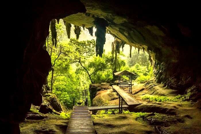
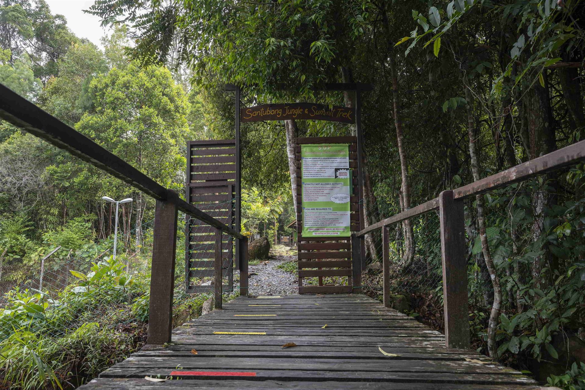
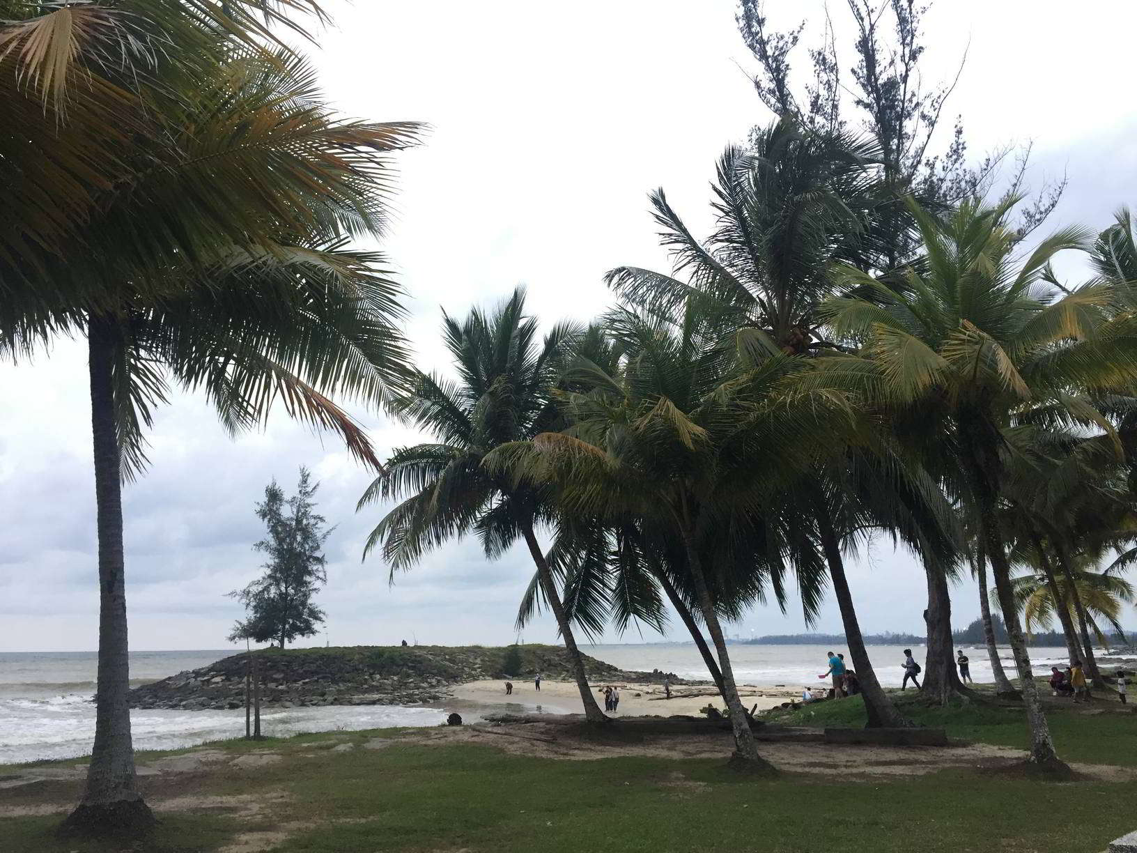
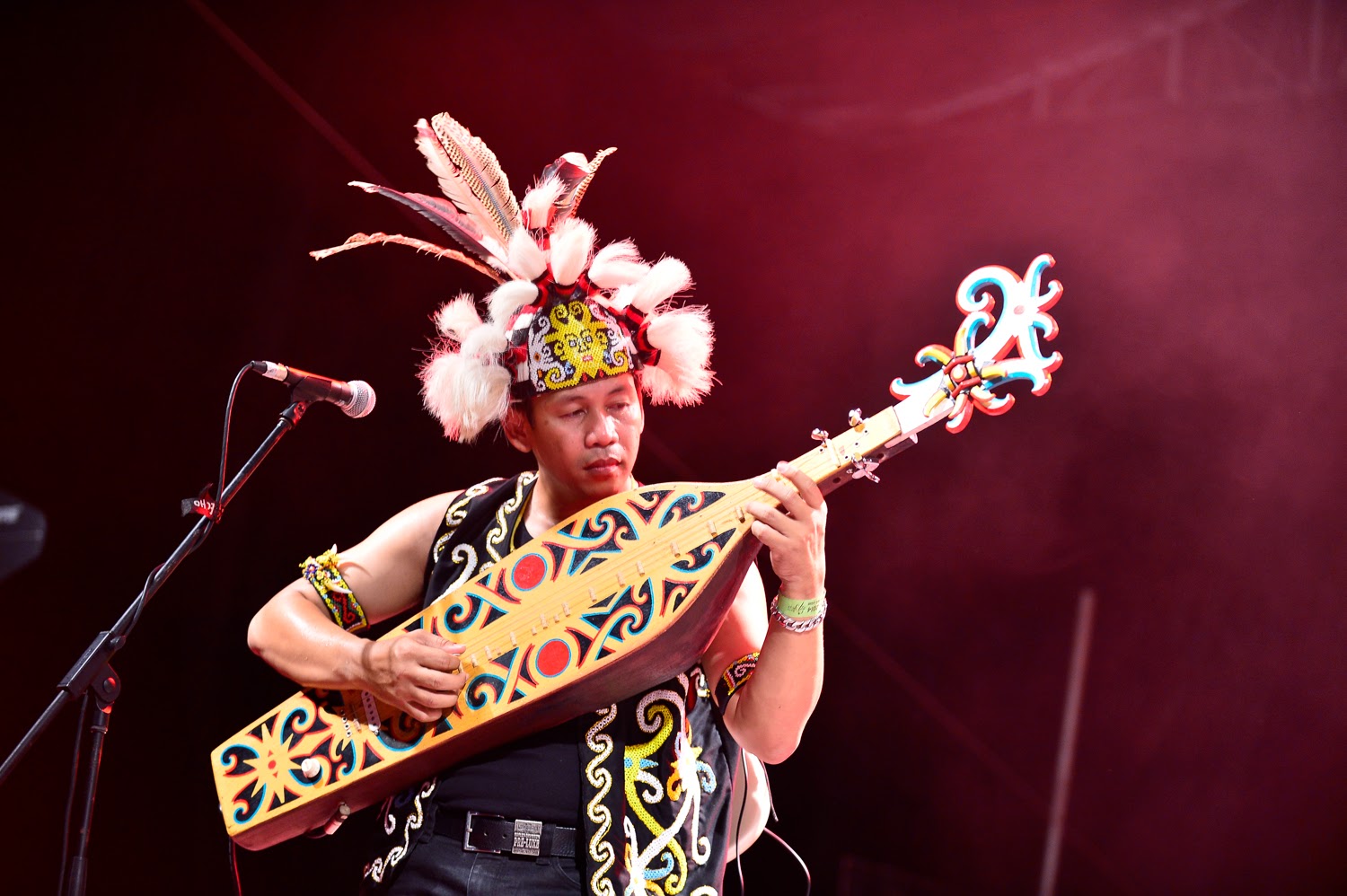
Travel Bucket List: Malaysia Part 50 – Sarawak Part 7

Niah National Park
An archaeological site that encompasses limestone caves and attracts the interest of both history and nature lovers, Niah National Park is lush green with exotic vegetation and wildlife.

Alfred Russel Wallace lived for eight months in Simunjan with a mining engineer, Robert Coulson, who had explored what is now northern Sarawak for mineral ores. Alfred Hart Everett surveyed 32 caves in three areas, including Niah/Subis near Miri and Upper Sarawak Proper to the south of Kuching, near Bau and Lundu. In the 1950s, Tom Harrisson, the curator of Sarawak State Museum was searching for evidence of ancient human activity in Sarawak. He came across Niah Cave, which showed no evidence of ancient human activity in the area. However, he inferred that since the cave was cool and dry and there were millions of bats and swiftlets which could be used as food, ancient humans could have lived in the cave. In October 1954, Harrisson with his two friends, Michael Tweedie and Hugh Gibb spent two weeks examining the Niah. They found evidence of long-term human occupation, habitation, and burial. In 1957, the Sarawak Museum organised a larger expedition with transport and equipment from Brunei Shell Petroleum and Sarawak Oilfields Ltd (Shell). Earthenware, shell scrapers, shell ornaments, stone pounders, bone tools, and food remains were found and radiocarbon dating of the charcoal layers put the site at 40,000 years old, dating back to the Paleolithic era. The expedition team led by Barbara Harrison discovered the Deep Skull in the Hell Trench, named for its unusually hot condition at 101 to 110 inches below the surface in February 1958. It is a partial skull with a maxilla, two molar teeth and a portion of the base of the skull. The skull is highly fragile and is not fossilised. The morphology of the skull suggests it belonged to a female in her late teens to mid-twenties. Near the skull, a complete left femur and right proximal tibia were found which belonged to the same individual. Harrisson also discovered Neolithic burial sites from 2,500 to 5,000 years ago. The discoveries led to more expeditions in 1959, 1965, and 1972.

In 1960, Don Brothwell concluded that the Deep Skull belonged to an adolescent male who may be closely related to an indigenous Australian from Tasmania. Another dating of the charcoal and the Deep Skull itself was done in 2000 which showed the age of the skeleton to be 37,000 years old. In 2006, studies from the Niah Cave Project found out that the ancient humans living in the Niah Caves probably used mammal and fish trapping technologies, projectile technology, tuber digging, plant detoxification, and forest burning. In 2010 and 2021, the Sarawak state government nominated the park for UNESCO’s World Heritage Site title. In 2020, all 122 pieces of Niah human remains were returned to Sarawak.

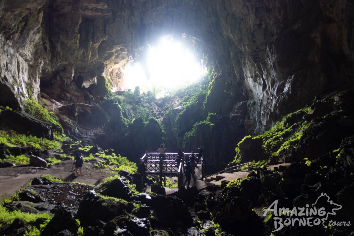
The Niah Caves are located on the northern edge of a limestone mountain named Gunung Subis or Mount Subis. The entrance is located at the west mouth of the cave, 15 km from the South China Sea and 50 m above sea level. The west mouth of the Niah Caves is 150 m wide and 75 m high.

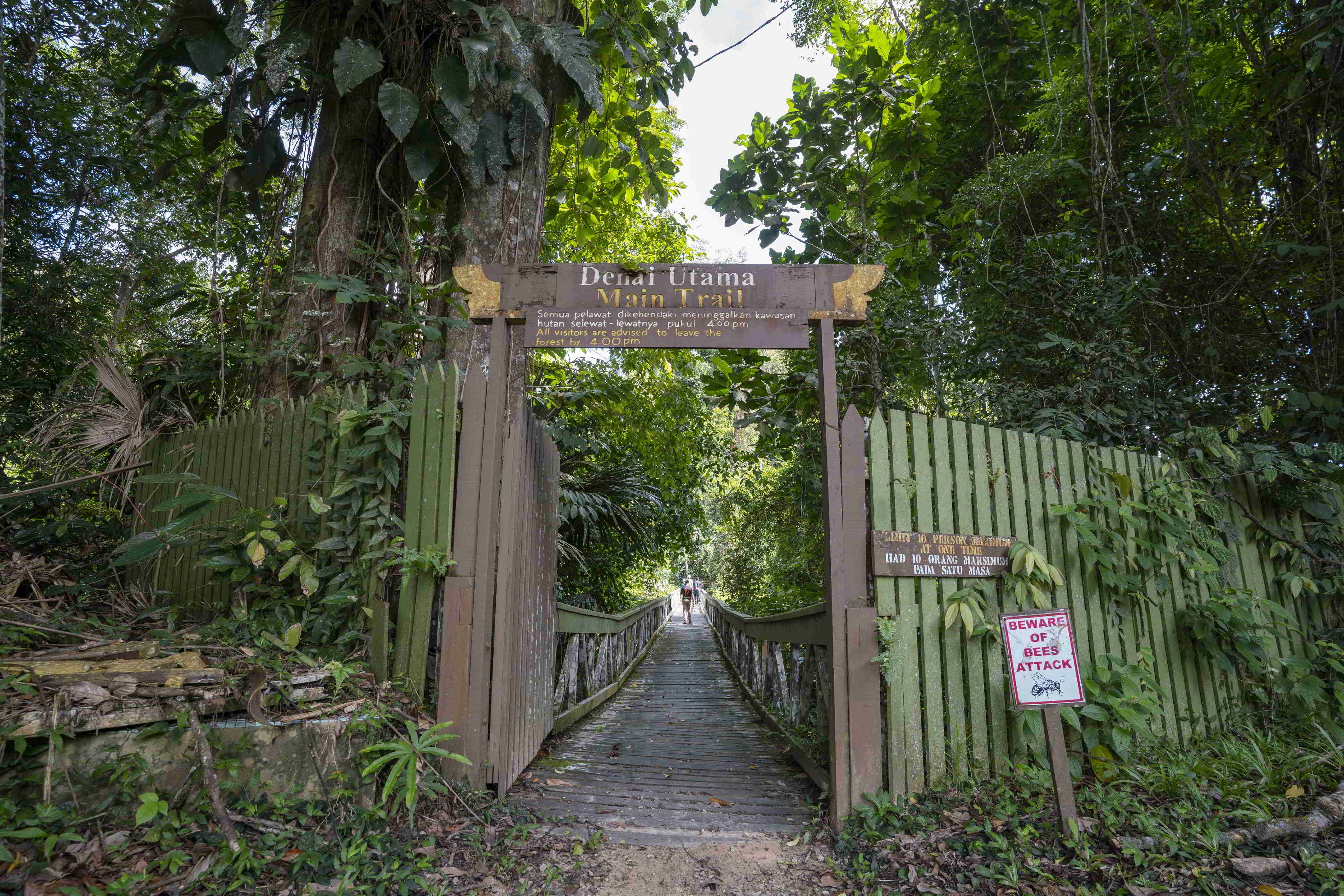
There are two trails at Niah National Park which are worth seeing. The Bukit Kasut Trail makes one witness amazing cliff vegetation clinging to limestone slopes. This trail is a bit steep as one walks up the slope. However, the view of the rainforest canopy from this vantage point is to die for. The Madu Trail near the banks of Sungai Subis which is a tributary of Sungai Niah is another beautiful trail. Here one will find plenty of wild orchids, bizarre mushrooms and giant pandanus plants. A small pathway through the forest will lead one to the Painted Cave where one can find the famous Niah paintings which portray spread-eagled human figures symbolic of warriors and hunters, animals inhabiting the forest and most importantly longboats carrying the souls of the deceased on the dangerous journey to the land of the dead. The cave is tranquil and was used in ancient times to rest.

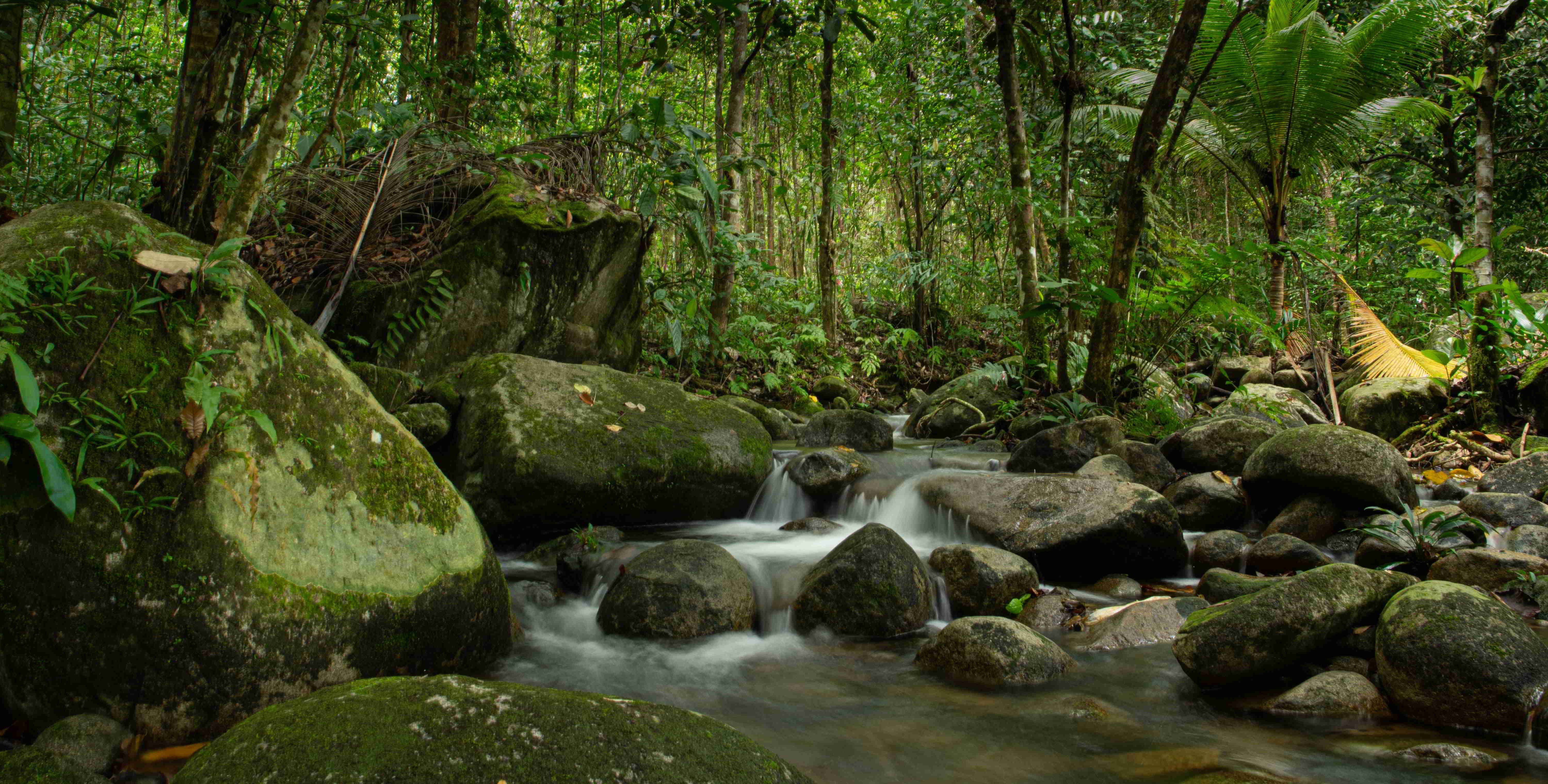
The Great Cave is sandwiched by a primary dense rainforest on both sides. A stroll along the plankwalk will take one close to giant tapang trees, huge pandanus plants, splendid orchids and tree fungi. Colourful birds, squirrels, lizards, butterflies and all manner of unusual insects and invertebrates are a common sight. Occasionally monkeys, flying lizards and hornbills can be seen.

The caves are also well known for the bird’s nest industry. Every section of the ceiling in the caves where swiftlets are roosting is privately owned and only the owner has the right to collect the nests. Collection is done twice a year, usually in January and in June. The collector climbs up hundreds of feet on a single pole to the cave ceiling and scrapes off the nest in flickering candlelight. The best time to visit the national park is between November to February. The park maintains a temperate and dry climate during these months. Monsoons should be avoided as the place gets marshy making the trek along the trails difficult thereby cutting down on the thrill and enjoyment.

The park is open from 8 am to 5 pm daily, including weekends and public holidays. Entry fees are RM 10 per person.

Gunung Mulu National Park
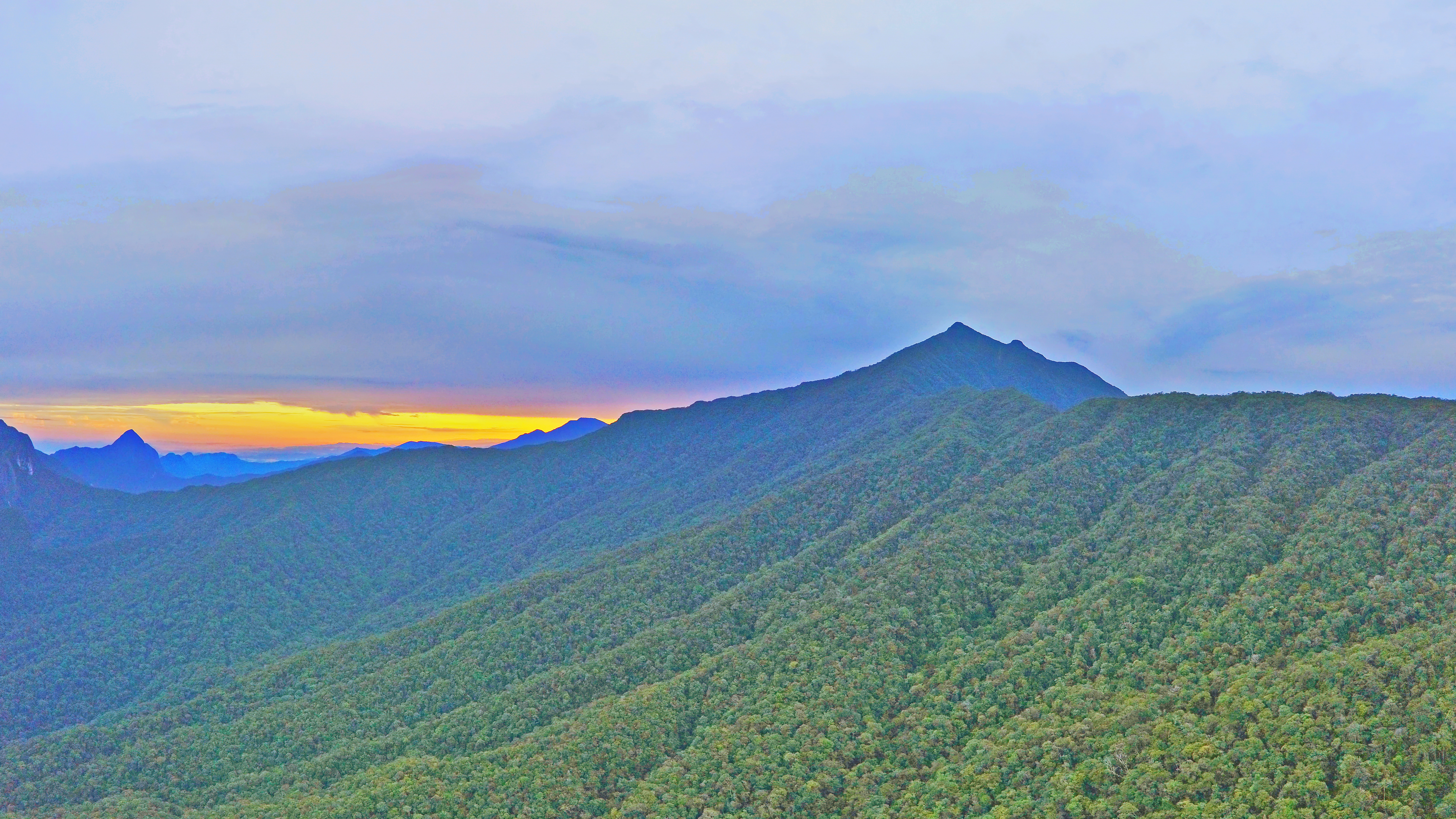
A UNESCO World Heritage Site, Gunung Mulu National Park encompasses caves and karst formations in a mountainous equatorial rainforest setting. The park is famous for its caves and the expeditions that have been mounted to explore them and their surrounding rainforest, most notably the Royal Geographical Society Expedition of 1977–1978, which saw over 100 scientists in the field for 15 months. This initiated a series of over 20 expeditions now named the Mulu Caves Project. The national park is named after Mount Mulu, the second-highest mountain in Sarawak.

The earliest reference to the Mulu caves was in 1858 when Spenser St. John, the British Consul in Brunei mentioned the detached masses of limestone, much water-worn, with caverns and natural tunnels in his book Life in the Forests of the Far East. Spenser tried to ascend Mount Mulu later but failed due to limestone cliffs, dense forests, and sharp pinnacles. In the 19th century, Charles Hose, an administrator in the Raj of Sarawak attempted to climb Mount Mulu but failed. It was only in the 1920s when a Berawan rhino hunter named Tama Nilong discovered the southwest ridge near the mountain which eventually led to the summit. In 1932, Tama Nilong led Edward Shackleton during an Oxford University Expedition to the summit of Mount Mulu. This was the first successful ascent to the summit of Mount Mulu. In 1961, G.E. Wilford, of the British Borneo Geological Survey, visited Mulu caves. He surveyed the Deer Cave and Cave of the Winds. He also predicted that more caves would be discovered in the future.

In 1974, Mount Mulu and its surrounding areas were gazetted as a national park by the Sarawak government. In 1978, the Royal Geographical Society organised a scientific expedition to the Mulu National Park, the largest such expedition ever to be dispatched from the United Kingdom. The expedition lasted for 15 months, in the course of which a small subgroup explored and surveyed 50 km of caves, including Clearwater Cave, Green Cave, Wonder Cave, and Prediction Cave. A base camp was established at Long Pala which was a three-day journey from the Miri upriver. In December 1980, another British expedition team was dispatched to Mulu Caves for 4 months. In this expedition, the Sarawak chamber, which lies in the Gua Nasib Bagus was discovered. In 1984, Gunung Mulu was designated as an ASEAN Heritage Park. In 1985, the park was officially opened to the public. In a British expedition in 1988, a link was established between Clearwater Cave and Cave of the Winds, extending the Clearwater Cave to 58 km, claimed to be the longest cave passage in Southeast Asia. Blackrock Cave was also discovered during this expedition. In 1991, a connecting passage was discovered between Blackrock Cave and Clearwater Cave, extending the Clearwater Cave passage to 102 km and making it the 7th longest cave passage in the world. Between 1993 and 2000, British expedition teams explored the eastern flank of Mount Api with several discoveries made in the Hidden Valley. Between 1995 and 2000, an American expedition team from the National Speleological Society surveyed Gunung Buda or Mount Buda. During these expeditions, Deliverance Cave was discovered.

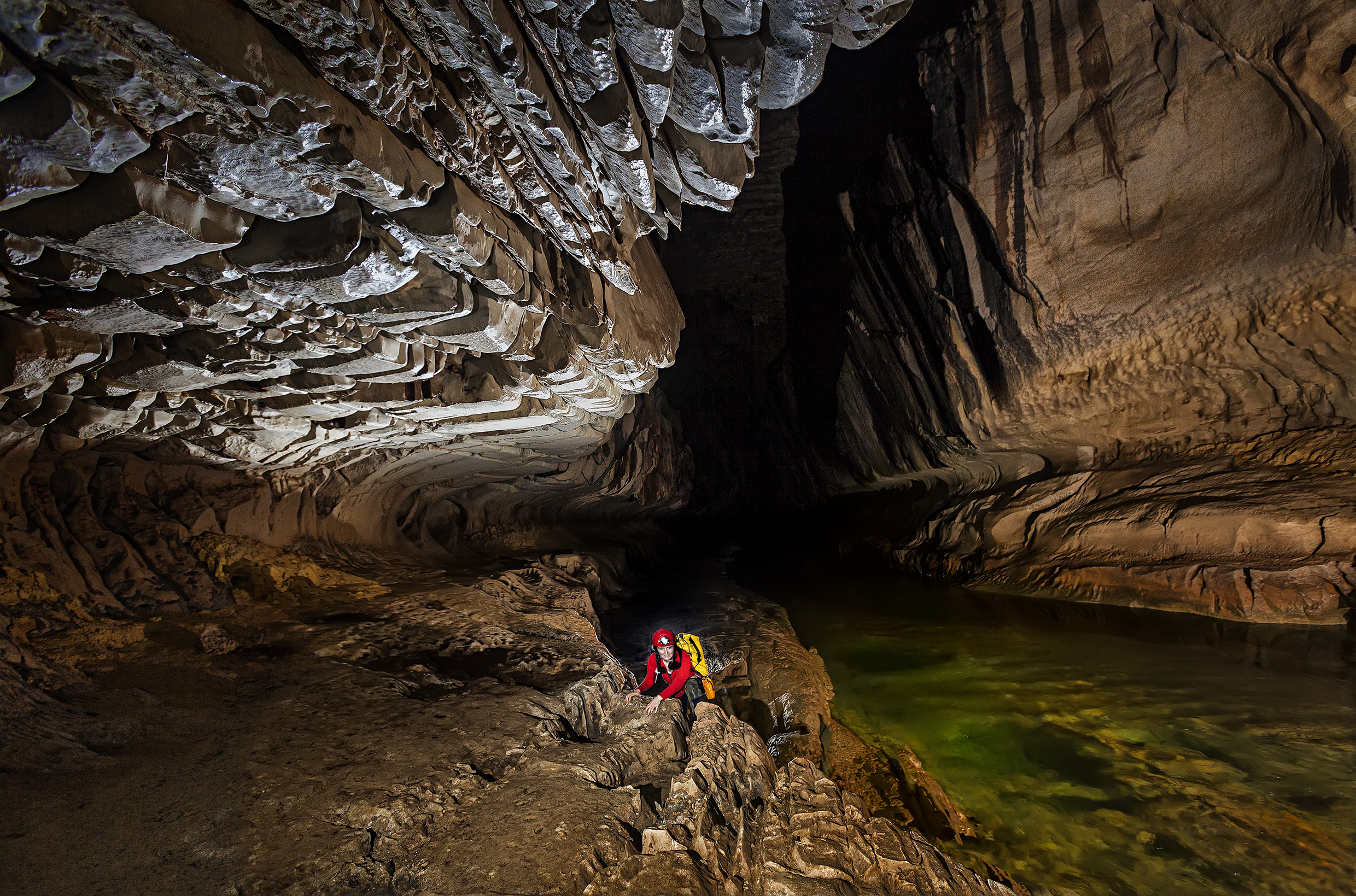
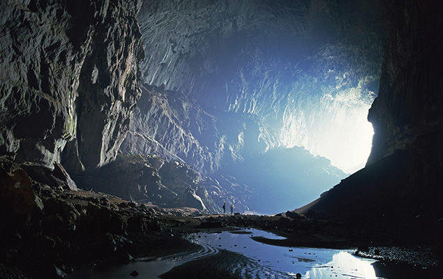
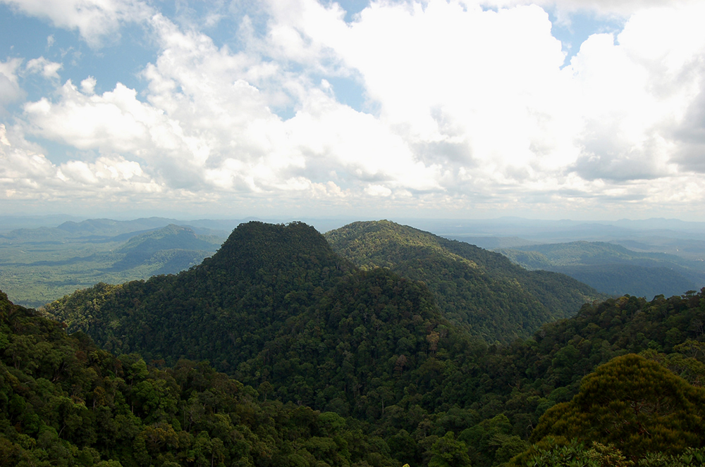
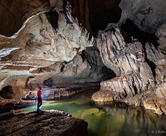
Gunung Mulu National Park is the most studied tropical karst area in the world. It has 295 km of explored caves which houses millions of bats and swiftlets. The national park lies between the headwaters of the Tutoh and the Mendalam Rivers where the latter is a tributary of the Limbang River. The western side of the park are lowland areas and the eastern side is the mountain ranges consisting of limestone and sandstone. The park is dominated by three mountains: Mount Mulu, Mount Api and Mount Benarat.

The national park has three notable caves: Sarawak Chamber, one of the world’s largest underground chambers, Deer Cave, the largest cave passage in the world, and Clearwater Cave, the longest cave system in Southeast Asia. Other caves in this area are Gua Nasib Bagus, Benarat Cavern, and Cave of the Winds.

There are 20,000 species of invertebrates, 81 species of mammals, 270 species of birds, 55 species of reptiles, 76 species of amphibians and 48 species of fish identified in the park area. Several amphibians are only known from the Gunung Mulu National Park. Gunung Mulu National Park contains a large number of plant species.

Tourists must purchase a five-day pass to visit the national park, which offers unlimited entry for the period. Malaysian adults pay RM 15 while foreigners pay RM 30.

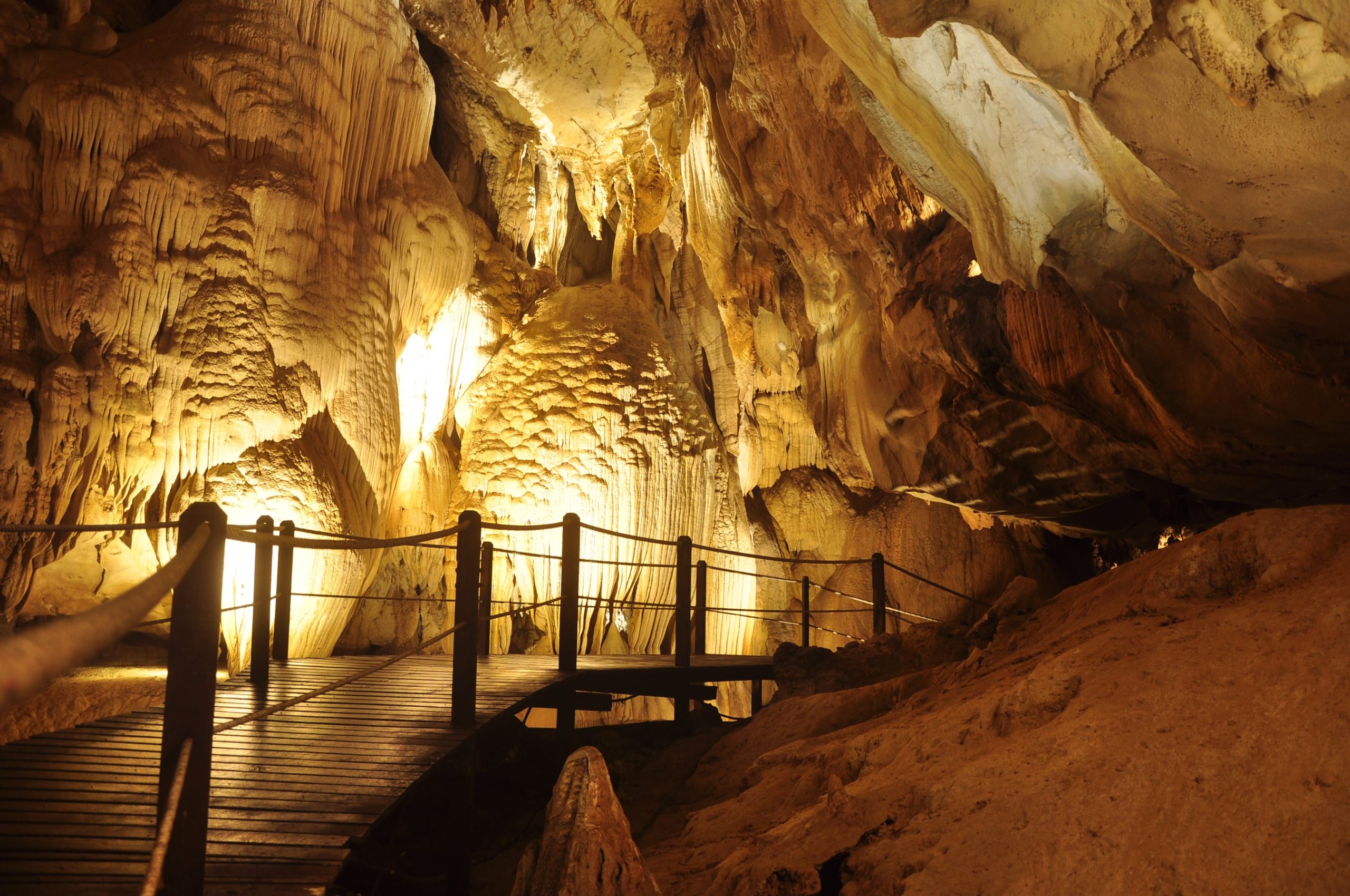
Exploring the Deer and Lang Caves will cost RM 35 per person, including the guide fee. It takes three hours and begins at 2 pm at the park HQ. Covering a distance of 9 km, the tour includes the Bat Observatory, the Deer Cave, whose high ceilings are home to over 3 million Wrinkle Lipped Bats, the Garden of Eden, and then Lang Cave, which features some wonderful limestone shawls, stalagmites, and stalactites.

The tour to Clearwater Cave and Cave of the Winds costs RM 67 per person, including the guide fee and longboat fee and takes four hours starting at 8:45 am. On this cruise, one can enjoy a cruise up the Melinau River in a longboat, and then visit the Penan longhouse, the Cave of the Winds and the Clearwater Cave. The Clearwater Cave is one of the biggest caves in the entire world and is over 220 km in length. Even though swimming inside the cave is not permitted, one can enjoy floating with the fish in the waters at the picnic deck.

The Fastlane tour costs RM 65 per person, including the guide and boat fee. Taking 2.5 hours, it begins at 2 pm and involves a boat ride up the Melinau River, and then a walk through the rainforest to finally reach the caves. The cave is home to huge amounts of prehistoric sediments, including a volcanic ash layer, and is held in great awe by the scientists. One will also be able to spot various cave fauna and some of the best formations of Mulu once inside.

The Night Walk costs RM 22 per person, including the guide fee and begins at 7 pm. One must make sure that they move very quietly to catch sight of the nocturnal animals, and remain patient throughout.

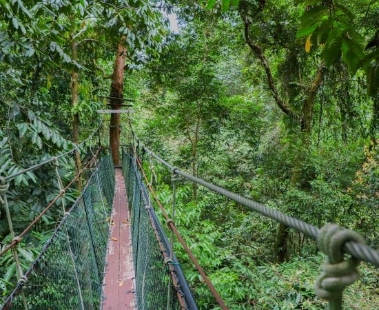
The Canopy walk that is suspended 25 m above the forest floor costs RM 45 per person, including the guide fee and begins at 7 am, 8:30 am, 10 am, 10:30 am, 1 pm and 2 pm. The longest tree-based canopy walks in the world, the Mulu Canopy Walk is an experience in itself.

Adventure Caving at Lagang Cave costs RM 160 per person. Booking is required, and a minimum of 3 people are needed for the tour with a minimum age of 12. The Lagang Cave is a scenic one with numerous stalactites, stalagmites, and cave sediments. One will have to scramble over ancient riverbeds to explore the wonders of the underground world. The best part is that there is no climbing involved, which makes the tour ideal for the entire family.

To get to the Paku Waterfall, one needs to walk about 1.5 km from Deer Cave till they reach a marked trail that will take them to the Paku River. One must wear good walking shoes and can enjoy the birds, insects, and ferns on the way. The Kenyalang Loop is a 2.5 km trail that gives one the option to explore the area without a guide. The Paku Valley Loop is an 8-km long trail, which normally takes around 5-6 hours.

The 30-meter high treetop tower is just a 10-minute walk from the headquarters and is a haven for bird watchers. One can pre-book a time slot that they prefer, though the tower remains locked for safety reasons. Additionally, one will have to pay RM 50 to take this tour, which is completely refundable once the tour ends.

A one-way walk to the observatory is 3.8 km and usually takes around 45 minutes. As the sun starts to set, bats gather at the entrance of the cave in millions and then circle higher and higher before moving out to the rainforest in spiralling ribbons.

One can only reach the national park via a plane ride because it is so isolated. Maswings, a subsidiary of Malaysian Airlines operates daily flights from Miri, Kuching and Kota Kinabalu to Mulu. Even though the Mulu area can be visited all year round, the months between June and September are the peak months.

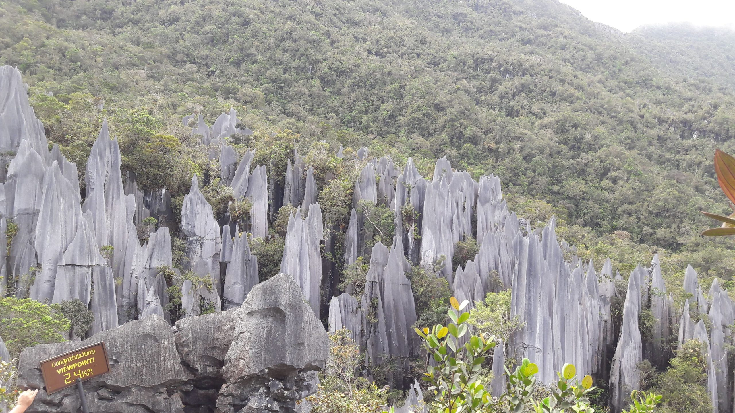
The national park has three climbing treks: The Pinnacles Summit Trek, The Headhunter’s Trail, and Gunung Mulu Summit Trek. The Pinnacles Summit Trek is a 3-day/2 night trek leading to the view of the Gunung Mulu Pinnacles. The trek usually starts with a one or two-hour boat ride from the Melinau River to Kuala Berar in the Berar Delta. The Base Camp 5 is a 7.8 km walk from Kuala Berar. Camp 5 is located near the Melinau Gorge which separates Mount Benarat from Mount Api. After Camp 5, there is a 1.2 km trek rising 1,200 m; passing from dipterocarp forest to moss forest. The last section requires ropes and ladders to help with the climb.

The Headhunter’s Trail is a route taken to enter or leave the Gunung Mulu National Park. The trail follows the route taken by the Kayan from the Melinau River to Melinau Gorge. The trail starts with a boat ride to Kuala Berar, then a trek for two to three hours to reach Camp 5. From Camp 5, there is an 11.2 km trail leading to Kuala Terikan which could last for four to five hours. The climbers can either choose to stay at a ranger station Nanga Metawai which is 15 minutes from Kuala Terikan or a longhouse named Rumah Bala Lesong which is three to four hours by longboat. After that, a boat ride further downriver would reach Nanga Medamit where there is a road leading to Limbang.

The Gunung Mulu Summit trek is the only trek to reach the summit of Mount Mulu. The summit is located 24 km away from the park headquarters. The trek starts from the national park headquarters to reach Camp 3. It is a 12 km hike through the primary forests with an elevation of 1,200 metres. The mossy forest starts from Camp 3. It will take a few hours to climb to reach Camp 4. After Camp 4, there are a few vertical climbs which require knotted ropes which eventually lead to the summit. Camp 1 is located along the descending trek from the summit of Mount Mulu. There is another 3-hour hike to reach the park headquarters from Camp 1.

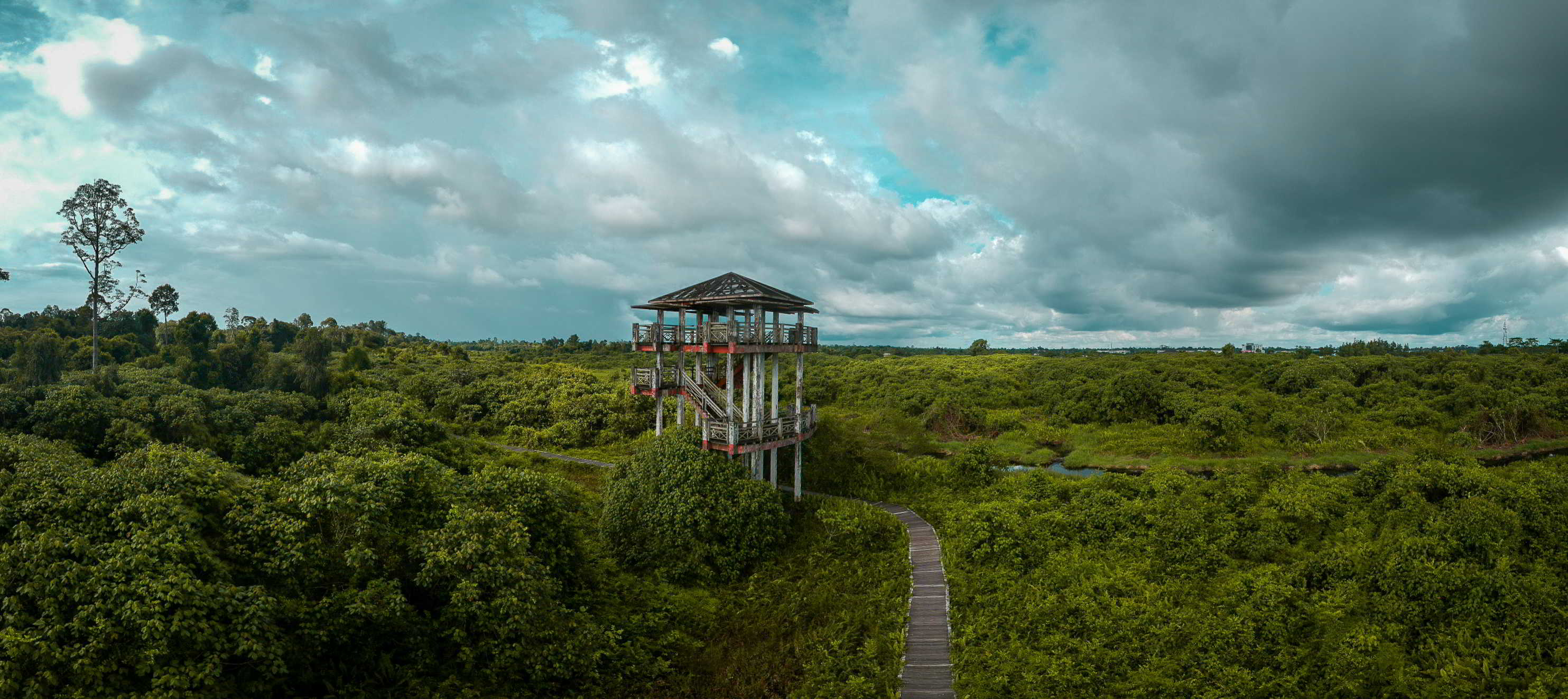
90% of the park is closed to the public and a protected area while the remaining 10% is open to visitors. There are only four show caves open to the public: Clearwater Cave, Wind Cave, Deer Cave, and Lang’s Cave. All visitors require a permit and a park guide. Visitors are required to organise into groups of ten with visiting intervals of 20 minutes at the four show caves. On the other hand, there are seven caves available for adventurous caving in groups of six if properly equipped. There is also a 480-metre skywalk through the canopy. Other activities that can be done here are rock climbing, kayaking and mountain biking.

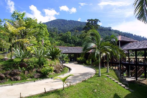
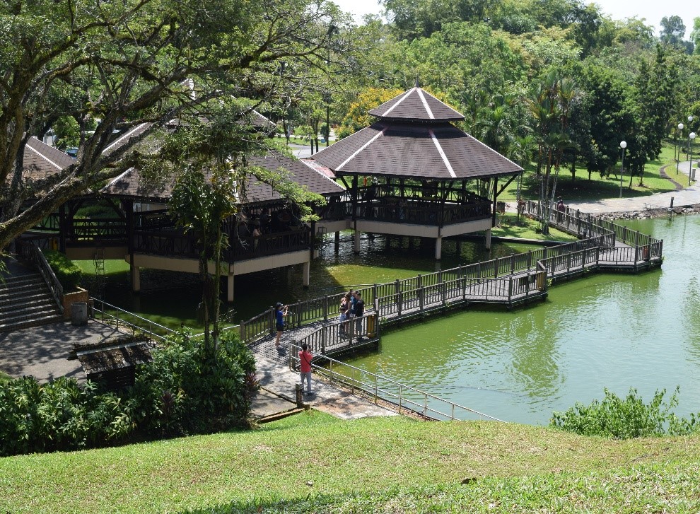
The park headquarters is located at the Melinau River, southwest of the park. It has a visitor registration building, interpretation centre, audio-visual room and washroom facilities. The 188-room Royal Mulu Resort has an air-conditioned longhouse, a guest house, four cabins and a hostel. All these facilities are located near the park entrance. The park can be accessed by air from Miri, Limbang, and Bandar Seri Begawan through the Mulu Airport; or by boat from Marudi through the Tutoh and Baram Rivers. There is no road access.

Pulong Tau National Park
Pulong Tau National Park‘s name in the In Lun Bawang and Kelabit dialect, Pulong Tau means our forests, which signifies the pride of the indigenous people in their forest heritage.

The national park was started as a community initiative in the 1970s. In 1984, Sarawak’s National Parks & Wildlife Office submitted a formal proposal with a petition letter from the local community to the

Sarawak state government. The proposal called for a 164,500-hectare park that included Mount Murud, Sarawak’s highest peak, the twin peaks of Bukit Batu Lawi, the Tama Abu mountain range, including the water catchment area of the entire northern Sarawak. Between 1984 and 1987, the Sarawak cabinet approved the proposal but the boundaries need to be redrawn to avoid conflicts with areas designated for land development. In 1986, a population of eastern Sumatran rhinoceros was discovered. It was previously thought that such a rhinoceros population would have extinct in Sarawak. During this survey, the importance of Laurel Forest in maintaining the Bornean bearded pig population was recognised. Rafflesia flowers were also found at the base of Mount Murud. Orangutan was found to enter the park occasionally. Therefore, a second proposal in 1987 argued that these areas should be included within the boundaries of the park. By 1998, when the proclamation to create the park was passed, the proposed area had been reduced to 63,700 hectares and did not include either Batu Lawi or the area where the rhinoceros was found.

When the national park was gazetted in 2005, the total protected areas were reduced to 59,917 hectares which extends from the western side of Kelabit Highlands to the Tama Abu range of mountains in the south and Mount Murud in the north.

The Kelabit Highlands were thought to have developed from the rifted continental crust where water sediments were deposited before Borneo was separated from the mainland Eurasian plate. This is evidenced by the presence of evaporite and limestone found in the area. Evidence of folding and faulting along the NE-SW axis is also found in this area. The types of stones change from oxidised iron and coal-bearing sandstones in the east of Kelabit Highlands, to mudstone and limestone of the Kelabit highlands, and grey sandstones westwards in the Mount Murud region. Pulong Tau National Park covers the water catchment area of the Baram, Belait, Limbang, Tutong, Trusan, and Padas rivers.

There are many species of orchids and Nepenthes pitcher plants. During an expedition in 1998, a total of 67 species of birds from 29 families, of which 13 species (19.4%) are endemic to Borneo was recorded. Besides, 28 species of mammals, 12 of which are endemic to Borneo were also recorded.

Lambir Hills National Park
The Lambir Hills National Park is a small national park 32 km west of Miri that is 6,952 hectares and is composed largely of mixed dipterocarp forest, with some small areas of kerangas or heath forest. Known as the world’s most ecologically diverse area, biologists have recorded 237 species of birds, 64 species of mammals, 46 species of reptiles and 20 species of frogs in the national park. Large mammals such as gibbons and sun bears are absent or very rare due to the small size of the forest and illegal hunting. More recent surveys done between 2003 and 2007 failed to find 20% of the park’s resident bird species and 22% of the mammal species, losses that include half of the park’s primate species and six out of seven hornbill species. The collapse in the population of large mammals and birds is an ecological disaster in Lambir. The park’s invertebrates include the Rajah Brooke’s Birdwing butterfly and more than 300 species of ants. Leeches are rare.

In 1991, the Sarawak Forest Department, Center for Tropical Forest Science/Harvard University, and the Plant Ecology Laboratory of Osaka City University, Japan created the Lambir Hills Forest Dynamics Plot. This is a 52-hectare area of the forest in which all trees thicker than 1.5 cm at breast height have been measured, mapped and identified. Every few years, researchers do a census of these trees so they can track their growth and changes in the population structure of each species. A census of all trees in the plot found 1175 different species. This gives Lambir Hills National Park possibly the highest diversity of trees of any forest in the Old World. The dominant family of trees in the park is the Dipterocarpaceae, whose members include Shorea and Dryobalanops species. As Lambir Hills National Park is the last intact patch of lowland dipterocarp forest left in Sarawak it is an important refuge for species that have been heavily logged elsewhere.

Among the tallest trees in the national park is the tapang, which can grow more than 80 metres tall, and which honey bees like to build their hives on. Other interesting plants in the park include several species of Macaranga that have formed a symbiotic relationship with ants. The ants live inside the plants’ hollow stems and protect them from herbivorous insects. The pitcher plant is found only in the park and its surrounding area. The park has a very high diversity of figs with nearly 80 species. Several research institutes have collaborated on long-term studies of the Lambir’s natural history and many individual MSc or PhD students have completed their fieldwork there.

In addition to the Lambir Hills Forest Dynamics Plot mentioned above, Lambir has a series of tree towers, a canopy walkway and a canopy crane that researchers use to gain access to different parts of the forest’s vertical structure.

The star attraction at Lambir Hills National Park is hiking. If one wants to go in for a full hiking experience, it will take them a minimum of four hours or maybe more depending upon their physical fitness. The best time to start the hike is around 8 am and they should remember to follow the signs and marks on the trails. If ambiguity persists, refer to the guide available at the counter.
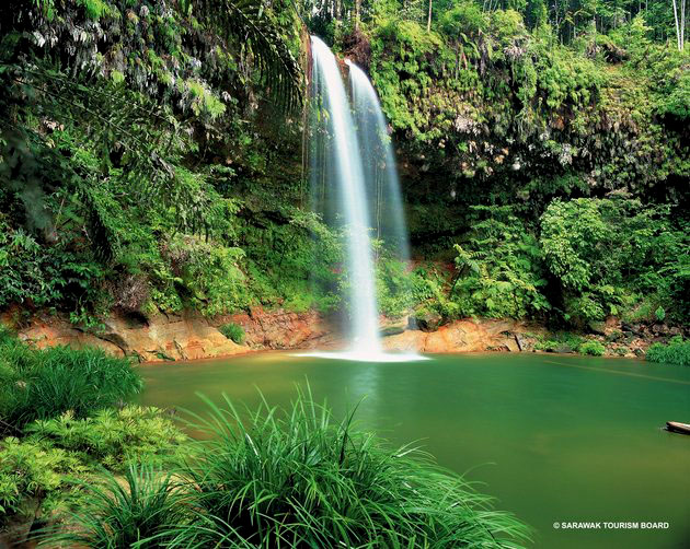
Trail guides can be hired to take hikers to the best spots through convenient routes. It is strongly recommended to go in a group for hiking instead of opting for solo hiking. Hikers should visit the Latak Waterfall as the climb to this one is relatively easy which makes it more popular amongst hikers. Another waterfall that is a hikers’ favourite and is worth visiting is the Nibong Waterfall followed by Pantu Waterfall. If one is an experienced hiker, one can consider climbing up to the summit of Bukit Lambir. However, they need to be very careful of stingy ants that accompany them through the trails.

Visitors enjoy having a picnic with family and friends. At the very entrance of the Park Headquarters, there is a picnic table and bench where people can sit and enjoy the view.

The 22-m high tree tower near the Park Headquarters is a must-see. Another unique feature of the hike is the tree ladders that one can find almost everywhere in the Lambir Hills National Park. These ladders take one up to the forest canopy which enables the visitors to soak in the magnificent view from the treetop. However, this is not meant for the faint-hearted as one is expected to climb a sky-embracing tree without any safety measures. People scared of heights too should omit climbing the tree ladders.

The park is open daily from 8 am to 5 pm. Tickets can be bought at the entrance to the Park. Entry fees are RM 10 per person for Malaysian adults and RM 5 for Malaysian children between the ages of 6 & 18 and non-Malaysians, it is RM 20 for adults and RM 10 per child.

Gunung Buda National Park
Located in Limbang, the Gunung Buda National Park is located to the north of Gunung Mulu National Park and was gazetted in 2001. Roads were also planned to connect Gunung Buda with Gunung Mulu National Park. Gunung Buda means White Hill in the Lun Bawang language.

An expedition by British cavers in 1978 found the entrances and initial passages to several large caves such as Deer Cave and Clearwater Cave at Gunung Mulu National Park. These discoveries led to further explorations of Mulu caves in the subsequent years. Americans first visited Gunung Buda when John Lane and George Prest visited the mountain to assess its potential for an American expedition in 1993. In late 1994 and early 1995, the first American expedition took place. Others followed in 1996, 1997, and 2000. Collectively the expeditions have surveyed more than 60 kilometres of cave passages beneath Gunung Buda. The 1997 expeditions were made by the members of the National Speleological Society. The highest mountain in the national park is Mount Buda, which stands at 963 m high. It is separated from Mount Benarat by the Medalem Gorge.

The rain forests of Buda and nearby Mulu host a tremendous diversity of life, including at least 300 bird species, numerous primates, more than 2,500 tree species, more than 60 snakes and many other beautiful, varied forms of life.

That is all from me about this amazing, yet unexplored state. There are two more to go before we finish up Malaysia, so keep your eyes open.

Travel Bucket List: Malaysia Part 49 – Sarawak Part 6

Bako National Park
Malaysia’s oldest national park, Bako National Park has beaches, cliffs and rock formations. Covering an area of 27 sq km, it envelops the peninsula of Muara Tebas. The wildlife of the park is exceptional with long-tailed macaque monkeys, proboscis monkeys, squirrels and monitor lizards. Proboscis monkeys, unique to Borneo, are a major highlight of this park. It is said that one can witness all the Borneo’s vegetation at Bako.

Bako is one of the smallest national parks in Sarawak. However, it features multiple biomes (including rainforest), abundant wildlife, jungle streams and waterfalls, secluded beaches, and trekking trails. A network of 16 marked walking trails of different lengths allows visitors access. In addition, various beaches are accessible by boat from Kampung Bako or Teluk Assam, as well as a geologically interesting sea stack rock formation. The range of attractions and activities in a compact area has made Bako one of the most popular parks in Sarawak.

A distinctive feature of Bako National Park is its picturesque coastlines and bays offering a unique combination of forest by the beach. The sea stack rock formations at the beaches are also among the most visited and renowned places in Bako. Trek by the well-marked trails, wildlife sighting, birding and overnight camping expeditions are some of the most popular activities here, though if one is attempting the longer trails, they have to inform the Park Headquarters before setting out.

Early mornings and just before dusk are the best times for bird sightings at Bako. Guided night walks cost RM 10 per person and let the visitors witness the incredible nocturnal wildlife of the park. Pulau Lakei is a small beautiful island located at the northern tip of the park on the Muara Tebas Peninsula and can be reached by a short boat ride from Kampung Bako.

Bako is famous for the rarely found, but endangered Proboscis monkeys which can be spotted along a few trails like Telok Paku and Telok Delima. It has an incredible variety of birds, with about 150 recorded species. Bako consists of mainly dipterocarp trees and mangrove forests. Carnivores pitcher plants along the Lintang trail are also a major component of the forest.

The Telok Pandan Kecil Trail is a one-hour trail to the Telok Pandan Kecil beach. The beach has several limestone and sandstone cliffs including the geologically famous Sea Stack. Most tourists spend their time in the cool waters at the beach after a tiring walk. However, saltwater crocodiles have been spotted in the waters lately, and swimming on the beach is not recommended. Located near the park headquarters, Telok Assam Beach is very famous among its visitors for its tranquillity and the sight of the swifts that it offers at sunset. These two beaches are also accessible by the boat service provided at the Bako village market.

Proboscis monkeys can be sighted on the Telok Paku and Telok Delima Trails. Several tourists visit the park to spot the rare and indigenous Proboscis monkey. The mangroves of Teluk Assam and the trails of Telok Paku and Telok Delima are the famous trails where these are spotted. The best time to go to these places is early morning or late afternoon. Telok Paku is an 800-meter trail that takes about 45 minutes while Telok Delima is a 250-meter trail taking about 30 minutes. The Tanjung Sapi Trail is a 30-minute 800-meter steep trek through the cliff vegetation which gives a mesmerising view of Teluk Assam and the South China Sea. The Ulu Assam Trail is about 1.4 km long from the headquarters which takes about 90 to 120 minutes to trek. The trail passes through the swamp forests and gets steep towards the end. At the end, witness a picturesque view of Bako’s Coastline. Serait is a secluded trail that is 1.2 km long and takes more than an hour to reach the end of the park’s boundary. Bukit Gondol is a 2 km long semi-circular trail that passes through the highest point of Bako, Bukit Gondol hill at 2660 meters. The Ulu Serait Trail connects the Serait Trail and the Bukit Gondol Trail and covers the area consisting of swamp forests and scrub vegetation. To take a shortcut and not climb the Bukit Gondol, switch to Paya Jelutong which consists of several softwood Jelutong trees that are used to make pencils. Lintang is one of the most famous and longest trails covering a distance of 5.5 km in about 3 to 4 hours. The trail passes through the forest, letting the visitors witness all the vegetation in one trail itself. Tajor Trail is a 2.75 km that can be covered in 2 to 3 hours. It covers the Tajor Waterfall and ends at a steep climb to a small beach. Telok Pandan Besar is a 750-meter trail that can be covered in 45 minutes, that ends at a cliff top with a hypnotising view of the beaches. Tanjung Rhu is a 1.8 km trail that diverges from the Tajor Trail towards the Rocky Formations of the Rhu peninsula. Bukit Keruing is a 2.25 km long trail that connects Bukit Gondol to Tajor Waterfalls passing through the slope of the second-highest peak in Bako, Bukit Keruing. Telok Sibur is a 5.3 km trail from the park headquarters, this trail ends at the longest beach of Bako. It passes through the Tajor Waterfall and is very steep at the end. Telok Limau is the longest trail of Bako covering around 6 km one way and 10 km from the headquarters. This trail has incredible vegetation passing through the scrubland, swamp vegetation, small hills and rainforest. Camping is allowed at Telok Limau Beach with prior permission. The Telok Keruin trail is 1.5 km but from the headquarters, it is 10 km. It is one of the rarely taken trails as it is further away from other trails. It is known for scrub vegetation and pitcher plants that come through its way. It also leads to a deserted beach which is secluded and peaceful.

After reaching Bako, tickets to the park and the boat ride have to be purchased. The boat ride from Bako Village to Bako National Park takes about 20 minutes. The Boat Service is open from 9 am to 3 pm and return from the Park has to be planned accordingly. The boat ride costs RM 40 for a return fare for foreigners and RM 30 for Malaysians. It’s RM 200 for a chartered boat return fare. The park is open daily from 8 am to 5 pm and non-Malaysian adults pay RM 20 while children pay RM 7 and Malaysian adults pay RM 10 and children pay RM 3. A permit is required for professional photography or filming.

Batang Ai National Park
A national park that can be accessed by the largest man-made lake, Batang Ai, the Batang Ai National Park is where the Iban made their first settlements. The park covers an area of 24 sq km of extensive tropical rainforest with many rare and protected animals surrounding the 24 sq km artificial lake created by the Batang Ai hydroelectric reservoir. The park was proclaimed in 1991 and has become increasingly popular with locals and tourists despite the lack of facilities with the Iban longhouses a big draw here that gives an insight into the life and history of Iban.

Access is possible by chartering a boat, a traditional boat called a Longboat, as water is the main method of transportation in the area. The ride takes approximately about 40 minutes to the Batang Ai National Park headquarters. The lush dipterocarp forests are home to the orangutan, gibbons, and hornbills. The lake creates a beautiful environment and gives a sense of peace and tranquillity. The local inhabitants are mostly Iban, and tours to nearby Iban longhouses are also a tourist diversion. This national park takes strong steps in having the local communities involved in its management. The communities have formed a cooperative called Kooperasi Serbaguna Ulu Batang Ai and are helping to conserve the park.

The Padlai Trail starts at the Nanga Lubang Baya Longhouse. It follows a 30-m climb to an old burial ground which is referred to as Pendam Sepetang. Then, it passes through the ridge between Nanga Lubang Baya, a crocodile pool, and pig wallows to reach the highest point of the Batang Ai River. Then the trail descends to the Wong Padalai Rapids reaching the picnic spot. The Bilitong Trail is a difficult trail that goes through the Tuchong Bilitong Iban burial site where six tribal leaders are buried. Then it follows the Ulu Sengai Serekong, a 320 m elevated platform. From there, Tuchong Inggai at an elevation of 420 m is an optional climb said to be protected by the spirit of Tugang. It ends at Batang Ai and Lelayang stream where boats pick up trekkers. The Sium Trail is the most difficult in Batang Ai National Park. It is a steady trek for 2.5 km followed by a ridge climb of 415 m. It crosses the Iban burial ground to reach Bukit Sium Ukap, with an elevation of 704 m. On a clear day, the Indonesian lake of Sentarum can be seen. On the way back, one can follow the Berikut River to reach the Tapang tree which is respected among the Iban for its height, white wood and broad branches. The Iban do not cut it as it is believed that cutting Tapan brings bad luck and death. A must-do is the boating in the lake to longhouses. When visiting Batang Ai National Park, one can stay at the Iban longhouse.

Though Batang Ai National Park is famous for Orangutan sightings, there are many more species of wildlife to be found. Several trails pass through the Orangutan habitation area and ensure an Orangutan sighting. Other than orangutans, one gets to witness Gibbons, Bearded Pigs, Langurs and Hornbills.

A permit is required for professional photography and filmmaking. It is to be arranged in advance from the National Park’s Booking Office. The park is open from 8 am to 5 pm on all days, including Sundays and public holidays.

Similajau National Park
Similajau National Park or Samalaju National Park is located about 30 km from Bintulu. The national park, facing the South China Sea, contains rainforests, beaches, and rocky shores. Initially, the park covered an area of 70.64 sq km, extending from Sungai Likau in the south to Sungai Similajau in the north over a distance of 30 km. On February 17, 2000, an additional 19.32 sq km was incorporated into the park, expanding its total size to 89.96 sq km along a narrow coastal stretch.

The park’s flora consists of three main types: beach, kerangas, and mixed dipterocarpaceae forest. The park has 24 recorded species of mammals, including primates such as gibbons, banded langurs, and long-tailed macaques. A total of 185 species have been identified in the park including hornbills and migratory water birds like the Storm’s stork. There are 8 species of hornbill recorded in Sarawak including the rhinoceros hornbill and the black hornbill, which can be found in the park. Occasionally, green sea turtles come ashore to lay their eggs.

12 out of the 20 marine mammals recorded in Malaysia can be found in Sarawak. These include whales, dugongs, and dolphins. Five species of dolphin have been recorded in Bintulu waters: the Irrawaddy dolphin, bottlenose dolphin, Indo-Pacific humpback dolphin, finless porpoise, and pantropical spotted dolphin. Dolphins can be seen in the park from March to September every year. They are often spotted in groups of four or more during the early morning.

The crocodiles in the Likau River consist of two species of riverine crocodiles in the park: the false gharial and saltwater crocodile. The saltwater crocodile is very dangerous and has been responsible for many fatal attacks in Sarawak. The false gharial is generally shy and passive, but on rare occasions, fatal attacks have been confirmed in Central Kalimantan and Sumatra.

The horseshoe crab often appears during the dry season from early May to October. They usually appear in pairs. The males are smaller in size compared to the females, who come to the shore to lay eggs. During the breeding season, Sagor catfishesSagor Catfishes can be seen feeding on the eggs.

Batu Mandi lies about 4 km off the shore of Kuala Sungai Likau and can be reached only by boat. It is noticeable from the park only during low tide. Batu Anchau is a black rock surface situated at the end of the Batu Anchau trail about 2 km from the park office. The Selunsur Rapids can be found at the end of the Selunsur Rapid trail, about 6.8 km from the park office. They can be seen clearly after a heavy downpour. There are two units of Turtle Beach, Turtle Beach I and II. They are located about 6 and 7 km from the park office. They are where turtles go to lay eggs from March to September annually. Sebubong Pool is a natural pool at the Sebubong River that can only be reached by boat.

The Main Trail which is marked in red covers 9.8 km and is towards Golden Beach, and can be reached by hiking or boat. The Education Trail, marked in green consists of two parts: one is a 450 m plank along the mangrove forest and another is a 600 m jungle trail. Here, park office staff teach about the various tree species. The white/red trail, the Circular Trail starts from the end of the mangrove plank walk and meets the main trail at 0.5 km with a total distance of 1.7 km. The Batu Anchau Trail marked in white has a total distance of 2.1 km and ends up at the Batu Anchau rock surface.

Miri-Sibuti Coral Reef National Park
The Miri-Sibuti Coral Reefs National Park is a protected area of coral reefs, off the island of Borneo and a popular dive destination. The Miri-Sibuti Coral Reefs National Park, lying at depths ranging from 7 to 50 metres at the seaward edge, has an average visibility of 10 to 30 metres. The best time to dive is from late March through November each year. Popular diving sites include Anemone Garden, Grouper Patch Reef, Atago Maru Wreck and Seafan Garden. There are also some wreck dives. It is one of Malaysia’s most recently discovered diving locations and the largest offshore national park created in the state.

The reefs house a wide diversity of marine creatures including soft corals like leather corals, sea whips, Bubble corals, staghorn corals, Dendronephthya and Gorgonia sea fans, as well as sponges including elephant ear sponges. Fish species include clownfish, yellow and blueback fusiliers, angelfish, butterflyfish, sea perch, lizardfish, batfish, jackfish, barracudas, Napoleon wrasse and sharks. Other creatures include feather stars, giant clams, nudibranchs, sea anemones and sea horses.

Usun Apau National Park
Usun Apau National Park was designated in 2005 and covers the Usun Apau Plateau in the highlands of central Borneo. Usun Apau is a volcanic plateau covering an area of approximately 1,550 sq km, and averaging 1000 meters in elevation. There are three extinct volcanoes in the centre of the plateau – Selidang at 1,370 m, Kenawang at 1,280 m, and Mabun at 1,280 m. The northern, eastern, and western edges of the plateau end in steep escarpments nearly 300 meters high. Three rivers drop from the northern edge of the escarpment, including the Julan River, which forms the Julan waterfall almost 245 meters high. Streams from the plateau form the headwaters of the Rajang and Baram rivers.

The plateau is covered by montane rain forests, including kerapa, a stunted forest of small trees with gnarled trunks which forms on poor soil with bad drainage, and kerangas forest, made up of tall trees with thin trunks growing on infertile volcanic soil.[2] Hill dipterocarp forest covers the lower slopes of the plateau. The plateau is home to several vulnerable and near-threatened bird species and is designated an Important Bird Area. The gracile slender toad or Ansonia teneritas is known only from the plateau and one other locality. The plateau is relatively inaccessible, with access to the base of the plateau on logging roads, and only trails and no roads on the plateau itself.

In August 2022, Sarawak’s premier announced that the Government of Sarawak would improve road access to the national park, and Julan Waterfall in particular, to open it to tourism, as part of the state’s Post-COVID-19 Development Strategy through 2030.

Bukit Tiban National Park
Bukit Tiban National Park is a national park near Bintulu that encloses the headwaters of the Sungai Nyalau and Sungai Timong Rivers in Miri and Sungai Sigrok, a tributary of Sungai Similajau in the Bintulu. While the forest in the park was logged before 1985, most of the surrounding land has been converted to palm oil plantations, making the area an important refuge for remaining wildlife. Much of the eastern half of the park has however been converted to palm oil in the years since the park was established.

Loagan Bunut National Park
Loagan Bunut National Park is located in Miri. The park was named after the Loagan Bunut Lake nearby, which is connected to the Sungai Bunut, the Sungai Baram and the Sungai Tinjar. This park occupies a space of 100 sq km and is well known for its rich biodiversity and unique aquatic ecosystem. The national park was gazetted on January 1, 1990, and was opened to the public on August 29, 1991

Santubong National Park
Santubong National Park is located 35 km north of Kuching. It contains the 810 m peak of Mount Santubong and the surrounding rainforested slopes. There are several jungle treks in the park, including to the peak. Wildlife in the park include proboscis monkeys and rhinoceros hornbills. This is one of the best places in Sarawak where one can observe the rare Irrawaddy dolphin, which chooses rivers, estuaries and shallow coastal areas as its habitat.

Rajang Mangroves National Park
Located in Sarikei, Rajang Mangroves National Park is home to species such as proboscis monkeys, silvered langurs, lesser adjutant storks, Irrawaddy dolphins and hornbills. It has a very important role in preserving the coast, from the occurrence of erosion, tidal floods and salt intrusions.

Travel Bucket List: Malaysia Part 48 – Sarawak Part 5

Sarawak has about 30 national parks, each of which is different and extraordinary, although not all are accessible. Here are some of them.

Gunung Gading National Park
Often referred to as the home of the elusive Giant Flower, Gunung Gading National Park is located near the town of Lundu. The park is considered the best place in Asia to witness the rare Rafflesia plant which produces the world’s largest flower. This parasitic plant is 1 meter huge and blooms for a few days only. Other attractive features that draw attention are its colour-coded well-marked trails where tourists can trek and hike to the waterfalls or the peaks by these trails to picturesque views for a tranquil experience. Gunung Gading National Park also has several war remnants which makes it a place of historical importance. The Summit Trail and the Rafflesia Trail require the company of a professional guide provided by the Park. The tour can be arranged through travel agents who arrange for everything including the travel and guide.

Several tourists visit the park to see the rare Rafflesia flower which flowers only for a few days. Most of the flowers are found on the lower slopes of the mountains. This trail has a plank walk which follows the way where Rafflesia can be found. The best time to witness these flowers in bloom is November, December and January. Information about blooming flowers can be acquired from the Park’s headquarters or the National Park Booking Center in Kuching. The Waterfall Trail is one of the shortest trails leading to a series of seven waterfalls, though not all the waterfalls are accessible. Tourists are allowed to dip into the waters of Waterfall 1, 3 and 7. The trek is easy with a few steep slopes on the way. A trek to the 7th waterfall takes about an hour. The last waterfall is surrounded by fig trees and has a rocky valley with a crystal-clear water pool. This is the most taken trail and perfect for a day picnic.

The Gunung Gading Summit Trail is the longest and the most difficult trail at the park. The hike to the Gading Hill summit at the height of 965 m takes about 3 to 4 hours and is worth the picturesque view. One may get to see the Rafflesia flowers at the lower slopes of the hill while trekking. However, tourists are not allowed to camp or stay overnight, so it is recommended that people set off early and return to the headquarters on time.

The summit of Gunung Gading served as the British Army Camp in the 1960s and to date has preserved remnants of the war including a water tank, helipad and barbed wire fencing. The trek to Batu Bakubu is an extension of the Gunung Gading trail towards Baku Bakubu which was where the communist camp was located during the insurgency in the 1960s. This trail takes an additional 2.5 to 3.5 hours round trip from Gunung Gading.

There is very limited wildlife to be found at the Gunung Gading National Park. However, several reptiles and insects in the park can be spotted. Millipedes and lizards are the most common sightings. Incredible species of lizards can be spotted like the blue eye Borneo angle-head lizards. Gunung Gading is known for the rarely spotted Rafflesia flower which is the biggest flower that blooms with a diameter of 1 meter. The flower blooms in the monsoon season. It takes about 9 months for it to grow and get mature and then blooms for only 4 to 5 days. Other than Rafflesia, the park is majorly composed of Dipterocarp trees and Fig trees. The vegetation includes longer trees at the base of the mountains but the height decreases with the increasing altitude. The higher peaks are majorly low shrubs and trees.

There is no cafeteria inside the park and one should carry food and snacks from the town of Lundu which is 10 minutes away. Another alternative is to get supplies and cook food in the Lodge Kitchen for those staying at the Lodge. There are a few accommodation options at the park. One can spend a night at the Forest Lodge, Forest Hostel, or at the campsite. The Forest Lodge Type 5 cost RM 150 pr unit, while the Forest Hostel costs RM 40 per room or RM 15 per bed. Camping will set visitors RM 5 per person.

Tourists are not allowed to stay overnight during the long hard seven-hour treks to the summit. The treks should be planned accordingly such that one leaves early in the morning and returns to the park headquarters by late afternoon. The only accommodations are the Lodge, Hostel and Campsite and tourists are expected to return to these by evening.

Entry fees can be purchased at the entrance of the park only. Malaysian adults pay RM 10 while children pay RM 3 and those under the age of 6 get in for free. For non-Malaysians, adults pay RM 20 while children pay RM 7. The park is open daily from 8 am to 5 pm.

Kubah National Park
Located 20 km from Kuching, against the scenic backdrop of the Matang Range, the Kubah National Park covers an area of 2230 hectares on a plateau and offers its visitors clear streams with cascading waterfalls and bathing pools. Even though the park beholds a myriad of fauna, it is famed for its flora, especially the wide range of palm species.

The park has several well-marked trails ideal for trekking. The Waterfall Trail is the most famed as it provides a wonderful time in the cool bathing pools. Over the past few years, Kubah National Park has also come to be well known for its nocturnal frogs. The Matang Wildlife Center also forms a part of Kubah National Park.

The Gunung Serapi Summit which leads to the Serapi Summit is a 5-6 hour return trip. From the Summit, one can witness the picturesque panoramic view of Mount Santubong, the coastline and the mountain range which serves as a natural border with Indonesia. The Palmetum Trail is known for the different varieties of palm trees. The Selang Trail is one of the difficult trails as the last 500 m get steep. The climb is to be done with rope which ends at Bukit Selang. The view from the top is delightful and comprehensive with the Matang range in the backdrop and Santubong peninsula beneath. The most popular trail, the Waterfall Trail ends at a dipterocarp forest with streams and swamps, and the cascading waterfall with 10 meters depth is a perfect place to rest and relax after a long trek. The Rayu trail leads towards Matang Wildlife Center passing through Bintangor trees on the way. The trail crosses through Swampy lands and clear streams finally reaching the riverside picnic spot at the wildlife center.

Kubah National Park is very diverse in terms of fauna being one of the most diverse areas comprising more than 60 species of frogs. Often referred to as the world of Palms, Kubah National Park has more than 93 recorded species of Palms. The forest is mainly dipterocarp trees with patches of Kerangas forest and shrubs. Orchids and Pitcher Plants are a common sight.

The park is famed among birdwatchers due to the diverse birds inhabiting the area. Early in the morning and the evening are considered best for bird watching. Some indigenous Borneon birds include owls and Blyth’s frogmouth, Borneon black magpie, red-bearded bee-eater, Borneon blue flycatcher and blue banded pitta can be found here.
The park has an overnight accommodation facility which can be booked online or from the Kuching office in advance. There are Chalets, Rest houses and Hotels with limited bedding which require a pre-booking.

The park is open from 8 am to 5 pm, Monday to Friday and on weekends and public holidays is open from 7:30 am to 4:30 pm. On weekdays, the cut-off time for hiking is 11 am while it is 10 am on weekends and public holidays. Entry fees for foreigners are RM 20 for adults and RM 7 for children between 7 and 18. For Malaysians, entry fees are EM 10 for adults and RM 5 for children. Children under 6 years enter for free. A permit is required for professional photography and can be arranged in advance through the National Park’s booking office.

Semenggoh Nature Reserve
Located about 20 km from Kuching, Semenggoh Nature Reserve is one of the most diverse nature reserves serving as a rehabilitation centre for the primate orangutans and several bird species. The major highlights are orangutans feeding and bird watching.

The natural reserve was initially developed to protect animals who were injured or who were previously captivated to maintain an ecological balance. Semenggoh not only allows tourists to experience surprisingly extraordinary flora and fauna but also to communicate with the animals, especially through feeding them.

The Orangutans Gallery has been created to educate visitors about the similarities between orangutans and humans and also their feeding habits. The gallery comprises graphics which illustrate the DNA structure of orangutans, their mating season and their life cycle. The park has made significant efforts in protecting orangutans that were held captive earlier or the ones that were injured. Over the years the natural reserve has provided a healthy environment and a natural habitat for the orangutans to grow and multiply considerably. The orangutan feeding hours are from 9 to 10 am and between 3 and 4 pm. Tourists can feed the orangutans. However, when the trees are full of fruits, orangutans may refuse to eat from tourists.

The Botanical Research Centre is a nursery which protects different native and international species of flora from orchids to many fruits. The research centre also comprises a bamboo garden and a pond with a floating pavilion. One can easily spot many exotic species of birds including the Hooded Pitta, the Banded Broadbill, the Green Broadbill, the Blue-winged Leafbird, the Asian Paradise Flycatcher, the Crested Jay, and the Reddish Scops Owl. The most striking feature of Semenggoh is that the birds are not caged like in most zoos or natural parks. These are mostly migratory birds which one can easily spot either on the trees or the ponds inside the natural reserve.

The Wildlife Rehabilitation Centre aims at protecting injured, weak and endangered animals. This rehabilitation centre even trains orangutans once held captive to live and fetch food for themselves in the jungles. The Semenggoh Nature Reserve makes it a point to protect several species of animals that have lost their natural habitat.

The best time to visit the reserve is between April to October to see the maximum number of orangutans. Orangutans are comparatively less visible in other months because of the fruiting season. One should also visit during the feeding time of the day so that they get to feed the orangutans. The reserve is open from 8 am to 10 am and again from 2 to 4 pm. Entry fees are RM 10 for adults, RM 5 for senior citizens and those with disabilities as well as children between the ages of 7 and 18 while children below the age of 6 enter for free.

Kuching Wetlands National Park
One of the last remains of the former Sarawak Mangrove Forest Reserve, the Kuching Wetlands National Park or Taman Negara Tanah Lembap Kuching is located about 30 km from Kuching. The park is filled with saline mangrove plantations and tourists can explore the lush greenery and vegetation of the park on a river cruise. It also houses some endangered species. The Wetlands National Park was gazetted in 1992 and covers an area of 66.1 sq km on the estuarine reaches of the Sibu Laut and Salak rivers. The park is composed of coastal, marine and freshwater ecosystems. The predominantly saline and deltaic mangrove system includes an extensive network of marine waterways and tidal creeks, formed by the interconnecting rivers of Sungei Sibu-Laut, Batang Salak and Sungei Santubong that form the boundary of the park. Some small patches of heath forest are found within the park.

The park is the home of at least three predominantly arboreal primates; the endangered proboscis monkey or Nasalis larvatus, the long-tailed macaques and the silvered langurs. White-bellied sea eagles, mudskippers and horseshoe crabs are also present. Hairy-nosed otters, Irrawaddy dolphins, and saltwater crocodiles can also be sighted. On nearby Mount Santubong, hornbills can be seen.

In the 12th century, the area was an important trading post between the interior peoples for their jungle produce predominantly animal parts valuable in Chinese medicine traded with the Chinese for their pottery and earthenwares. Past and existing excavations have unearthed remains of the former Iron smelting industries active hundreds of years past. The Impressive Mt. Santubong acted as a clear navigational point for these traders no doubt.

One should not miss the day tour spent cruising through the Salak River, passing through a Malay fishing village, catching glimpses of wild animals like crocodiles and trying to spot the infamous snub-nosed Irrawaddy dolphins. When one visits the park in the evening, it is just in time to catch the magical and romantic sunset on the water and the firefly tree known as the api-api tree which lies amidst shimmering green lights. The cruise begins at the mouth of the Santubong and Salak Rivers, the point which is known as Santubong Boat Club. The boat takes the tourists from the village of Santubong to the park through the meandering rivers of Salak and Sibu Laut. Tour operators provide pick-up options from the hotel as well, which can be availed for convenience.

Many jobs depend upon this habitat for the rich abundance of fish that are spawned and grow amongst the protection of the root systems. Timber is extracted for construction and several charcoal factories. The tourism industry is starting to grow offering wildlife cruises. The heavy decline in the proboscis monkey population caused by hunting was largely arrested by the educational efforts of the Sarawak Forestry Department protecting and banning the trade of these animals. Mangroves serve as important coastal defences absorbing strong waves and reputably up to 95% of the waves’ energy in extreme cases, such as a tsunami or king tide limiting damage. This attribute alone should be cause to justify their existence. Extensive development predominantly housing but including quarrying and retail premises is occurring outside the park boundary. These habitats are used by the many animals found in the park, thus increasing the pressure on this small reserve. As future development increases surrounding the park the existing gene pool will have to suffice since breeding between animals outside the park will no longer be possible. The park is open from 9 am to 8 pm, Mondays to Saturdays and closed on Sundays.

Talang Satang National Park
Malaysia’s first Marine National Park, Talang Satang National Park is home to an array of marine life including the endangered Green and Hawksbill Turtle. Talang Satang is the first site in the world to emphasise turtle research and management and covers the four islands Pulau Talang-Talang Besar, Pulau Talang-Talang Kecil, Pulau Satang Besar and Pulau Satang Kecil and surrounding coral reefs.. The park also has rich coral reefs and underwater life.

Talang Satang is open to nature tourism although its primary purpose is nature conservation. The park was established to protect marine turtles; four species of marine turtles are known to nest in the park, including green turtles and hawksbill turtles. Although turtles come ashore all year round, the main nesting season is from April to October.

The main attraction at the park is the Sarawak Turtle Volunteer Programme. Other activities include diving and snorkelling in the clean waters which are the ideal way to spot the rare turtles and graceful corals. Only day trips are allowed at the Park. Tourists are allowed to visit Satang Island only with restricted visits. Only volunteers are allowed at Talang Talang Kecil and Talang Talang Besar. A permit is to be arranged in advance by those who want to do professional photography or filmmaking.

The Turtle Hatchery located on the Pulau Satang Besar is a major land attraction visited by tourists. The tourist group is accompanied by a warden. The hatchery is more like a natural hatchery where one can witness the eggs and hatchlings, if lucky! The best time to visit June to August as several turtles visit the shore to lay eggs. Scuba Diving is allowed in the designated zone only. The booking for the same has to be done in advance. Diving equipment can be rented from the Sarawak Forestry Operations Office. It is compulsory to have a dive guide while engaging in this activity. The visibility in the waters is 3 meters to 10 meters. The area has several colorful coral reefs and a diverse marine life which makes it worth diving. Snorkelling is also restricted to the designated areas. While diving and snorkelling, one can witness the magnificent small and hard coral, feather stars and Gorgonian Sea Fans along with small fishes and Green Turtles.

Sarawak Forestry has a unique volunteering programme, the Sarawak Sea Turtle Programme which allows volunteers to stay and help with the work for four days. During the programme, volunteers are expected to help with the basic chores like cooking, cleaning and the accommodation is very basic. In terms of experience, volunteers get to learn new information about the turtles. The duties allotted to the volunteers include beach patrolling to locate turtle arrivals, measuring the turtles, shifting the eggs to the hatchery and then releasing the hatchlings, monitoring the nesting activities of turtles and data management. The Park mainly comprises underwater marine life with colourful coral reefs. Two major underwater vegetation include Gregorian sea fans and feather stars.

Talang Satang can be reached by a 30-minute boat ride from Sarawak Boat Club Jetty, Damai Beach, or Telaga Air Jetty. However, these boat services do not operate regularly. The tourists are only allowed to travel as organised groups with pre-booking. The park is open from 8 am to 5 pm every day, including public holidays.

Travel Bucket List: Malaysia Part 47 – Sarawak Part 4

Source

Bintulu
Bintulu is a small coastal town well-known for its golden beach and the rare endemic Irrawaddy dolphins. It is also famed for the longest kite festival in Malaysia. The town also has the best belacan shrimp sauce in Malaysia. Bintulu is a popular stopover on the way to Similajau National Park.

Masjid Assayakirin is a major spot and the biggest mosque in Bintulu. A monumental place to visit is the Negri Monument which marks the historical meeting held by the British. The Tanjung Batu Beach which is a rocky beach perfect for a relaxing day by the waters. Similajau National Park also has a breathtaking golden beach which is certainly a must-visit. The Bintulu Promenade offers a wonderful sight of the waterfront and the sunset while you reinvigorate in this recreational park.

Nearby village of Kampung Jepak gives an understanding of the traditional Malay life. It is packed with the rustic lifestyle of local people with several activities to witness and experience ranging from fish drying, cooking, manufacturing of shrimp paste, tutop and cencaluk. The very renowned Borneo International Kite Festival takes place in Bintulu in September end and October start of every year.

During the 16th century, Bintulu was named River de Burulu by Portuguese cartographers. There are several legends surrounding the name Bintulu. During the Brooke dynasty, the indigenous practised headhunting to maintain their social status in the community. They threw the heads into the Kemena River, after which the heads had to be collected from the river. The practice of collecting the heads was known as Metuk Ulow or picking heads in the local native language. Another story relates that two Iban warriors named Berengik and Jaleb built houses along the river. They and their followers frequently carried out preservation of severed heads near a small river stream branching off from Sebezaw River because the river bank was flat and wide. Therefore, the small river stream was named Metuk Ulow River. Outsiders who came to Bintulu subsequently pronounced the name as Mentulau, and later the name evolved into Bentulu and, finally, Bintulu.

James Brooke was appointed the White Rajah of Sarawak, today‘s Kuching by the Bruneian Empire in 1841. In 1861, the Sultanate of Brunei ceded the Bintulu region to Brooke. Bintulu was a small settlement at that time. A wooden fort named Fort Keppel was built in the village, named after Sir Henry Keppel, who was a close friend of the Rajah James and Charles Brooke. Sir Henry Keppel was responsible for crushing the Dayak piracy in the Saribas between 1840 and 1850. During World War II, Rajah Charles Vyner Brooke ordered the construction of airstrips in Kuching, Oya, Mukah, Bintulu, and Miri. Construction of the Bintulu airstrip was started in 1934 but discontinued in October 1938 due to financial reasons. Japanese forces landed in Miri on 16 December 1941 and Sarawak fell into Japanese hands when they conquered Kuching on 24 December 1941. When the Japanese invaded Sarawak, Charles Vyner Brooke already left for Sydney, Australia. At the same time, his officers were captured by the Japanese and interned at the Batu Lintang camp. During the Japanese occupation, the Japanese used the airstrip for military purposes. However, the airstrip was heavily bombed by Allied forces. The British began reconstruction of the airstrip after the war; during the project, many unexploded bombs were unearthed.

In the 1960s, Bintulu was still a small fishing village, with a population of 5,000. No roads were constructed in Bintulu until 1969 when the first untarred road was built to connect Bintulu to Miri. Before 1960, Bintulu was connected to Kuching by sea through a ship named Swee Joo and after 1960, the ship Chin Chin was added to the route. It took around 36 to 48 hours to reach Bintulu from Kuching, depending on the sea conditions. Large reserves of natural gas were discovered off the coast of Bintulu in 1969.

The Similajau National Park is located 30 km northeast of the town. The park was gazetted in 1976, covering an area of 89.96 sq km with sandy beaches, rocky headlands, jungle streams, and forests. Other national parks that can be accessed along the Miri–Bintulu road are the Lambir Hills National Park and Niah National Park.

Also known as the Taman Tumbina Zoo, the place is a popular combination of a botanical garden and a zoological park. It has plenty of usual birds like hornbills, parrots, doves, barbets, raptors, etc. and some animals like deer, tigers, bears and porcupines. The large park is divided into sections like the orchids garden, butterfly farm, bird garden, etc. A well-maintained park with clean roads and paths, there are some shelters and gazebo areas to rest and take shade from the hot sun. There is no cafeteria so it is advisable to carry food and water. The zoo is open from 9 am to 4:30 pm.

A 15-minute drive from Bintulu town centre, the Tanjung Batu Beach is an ideal getaway from the city’s hustle and bustle. Upon entering you will find some comfortable seats and a pathway leading to the tranquil beach. The beach is crowded on weekends with people enjoying picnics and gatherings along the blue water and cool breezy weather. The beach offers excellent sunset views and has a food centre close by.

Kampung Jepak is a traditional fisherman village well-known for its fish drying and manufacturing processes. The village lies away from Bintulu and is divided from the main town by the Sungai Kemena or the Kemena River. One can experience the authentic lifestyle of these Malay and Melanau settlers, and their occupations like sago processing, manufacturing shrimps, and making Terendak.

Situated approximately 2 km from Bintulu’s city centre, the Kuan Yin Temple is a Chinese temple dedicated to the Goddess of Mercy, Kuan Yin. The temple displays classical Chinese architecture with bright red pillars and roofs. There is an interesting sculpture animal garden with Chinese zodiacs and a beautiful koi pond just next to the temple. Being the only Chinese temple in Bintulu, the place is well-maintained and has a garden for visitors to relax.

Commonly known as Masjid Asy-Syakirin, the Assyakirin Mosque mosque is located about 3 km away from the Bintulu town centre, in the village of Asy-Syakirin. The first divisional mosque in Bintulu, it is situated at a recreational park of the same name and is known to have a fusion of classical and modern architecture. The dark blue dome structure is appealing and makes the mosque stand out. The mosque is the first in Malaysia to adapt to the idea of an open space area for naturally refreshing bright light and air flow. It hosts devotional classes, motivational speeches and camps to educate people on spirituality.

Pasar Tamu Bintulu is a large market for fruit, vegetable and grocery vendors. The marketplace is covered with an overhead cone-shaped roof that is the traditional architecture style of the Melanau settlers in Bintulu. Locally known as Ikan bilis, anchovies are commonly sold here at a very inexpensive rate. The area is located across the beautiful riverfront and next to the famous Pasar Utama.

Pasar Utama is a wet market allowing vendors to sell local meat, fresh jungle food, vegetables, fruits, snacks and seafood produce. The market is located at a pleasing riverfront area with peripheral fencing and a roof top that resembles the terendak, the local headgear of the Melanau folk. The upper level of the marketplace is a snack section and food court.

The annually held Borneo International Kite Festival is undoubtedly one of the largest kite festivals of the world attracting about 400 participants from over two dozen countries. Held over a span of three days, the town welcomes kite flying enthusiasts and aficionados to watch the beautifully created handmade kites take over the skies of Borneo. The kites are artistically prepared with vibrant colours, some animal and bird-shaped, cartoon characters, etc. The venue of the event is the Bintulu old airport and is organized every year by the Bintulu Development Authority.

The Bintulu promenade is a waterfront esplanade for tourists and locals to walk around and experience the calming weather. The promenade has an open car park area along with picturesque lush green landscapes in the background and fencing. The place offers excellent sunset views and soothing wind blows. It is a common place of interest among residents for gatherings and public events.

Bintulu Regatta is a an annual boat rowing race held over three days. The race receives hundreds of entries categorically from several neighbouring countries. The Regatta has a number of sections like the speed boat race, power boats and traditional long boat race. The venues tend to differ but it is usually held at the Sungai Kemena.

The Tanjung Batu Beach, also known as the Temasya Beach is located 3 km from the town centre. Taman Tumbina or Tumbina Park is located 4 km from the town centre. The park has a hornbill aviary, a butterfly garden, and a mini-zoo. Kidurong Tower is an observation tower located at Tanjung Kidurong offering views of the Bintulu oil and gas facilities shortly after nightfall.

Miri
Located near Malaysia’s border with Brunei, Miri lies in north-eastern Sarawak and is the state’s second-largest city. Before Miri was founded, Marudi was the administrative centre of the northern region of Sarawak. Miri was founded in 1910 when the first oil well was drilled by Royal Dutch Shell. The discovery of an oil field in Miri has led to the rapid development of the town. Miri became the administrative centre of the northern region of Sarawak by 1929. During World War II, the Miri oil fields were destroyed by the Brooke government to sabotage Japanese operations in Southeast Asia but to no avail; Miri town was the first landing point of Japanese troops in Borneo. The subsequent Japanese occupation led Miri to become a target of Allied air raids which caused the destruction of oil refinery facilities in Miri. The petroleum industry continued to be a major player in the city’s economy after the war. Oil exploration has moved offshore since the 1950s, but subsequently, new inland oil fields were found in 1989 and 2011. In 1974, the formation of Malaysian oil and gas company Petronas led to co-operation between Petronas and Shell on oil exploration in the Miri region. In 2005, Miri became the 10th city in Malaysia to be granted official city status, the first non-state-capital city to be bestowed such status.

Miri is the main tourist gateway to the world-famous UNESCO World Heritage Site, Gunung Mulu National Park; Loagan Bunut National Park; Lambir Hills National Park; Niah National Park and Miri-Sibuti Coral Reef National Park. The Gunung Mulu National Park with its Sarawak Chamber, which is the largest known cave chamber in the world by area, remains one of the favourite ecotourism destinations in Miri. Miri is also the birthplace of the Malaysian petroleum industry. Other major industries in the city include timber, oil palm and tourism.

Miri town is named after a minority ethnic group called the Jati Miriek or simply Mirek, or Miriek. This ethnic group is the earliest settlers in the region. Europeans who later came to the region for oil exploration mistakenly pronounced Miriek as Miri, and this name continues to be used today.

Charles Brooke succeeded James Brooke as the new Rajah of Sarawak in 1868. By 1883, the Sultan of Brunei ceded the Baram region, including Miri to Charles Brooke. The Miri area was still a fishing village at that time consisting of a small settlement surrounded by mangrove and Nipah palm jungles. A fort was built in Claudetown, present-day Marudi, in 1883. To restore peace among various ethnic tribes fighting in the Baram region, Charles Hose, the then resident, decided to organise a peace conference at his fort in April 1899. This peace conference also led to the birth of the first Baram Regatta, a long boat race competition among the natives which continues to be held today.

On 10 August 1910, the first oil drilling operation was started. On 22 December 1910, oil was struck after 130 metres of drilling at the well. Since then, another 624 land wells have been drilled around Miri until 1972 which are collectively known as the Miri Field. The Miri field is the only onshore field in Sarawak because oil production has shifted offshore since the late 1950s.

Source

The Brooke government had been actively lobbying for the British government to accept Sarawak as one of its protectorates in the event of a war, which finally happened in 1888. By 1938, under the leadership of Rajah Charles Vyner Brooke, airstrips were constructed in Miri, Kuching, Oya, and Mukah in preparation for an imminent war. However, by 1941, the British Royal Navy and Royal Air Force had withdrawn from Sarawak and returned to Singapore. Therefore, the British government advocated a scorched earth policy for the Brooke government in the event of a Japanese attack. A Denial Scheme was formulated to destroy oil installations in Miri and Lutong. Soon after the news of the Japanese attack on Pearl Harbour, Japanese planes were seen making reconnaissance flights over Miri. The Brooke government decided on the destruction of oilfields and airfields in Miri. All producing oil wells were sealed up with vital equipment and machinery dismantled and shipped off to Singapore. On 16 December 1941, 9 days after the Pearl Harbor bombing, Japanese troops consisting of 10,000 men landed on Tanjung Lobang Beach, Miri without much resistance. After the fall of Singapore on 15 January 1942, skilled workers who went into hiding with their equipment were sent back to Miri by the Japanese. They were immediately put to work for the Japanese oil supply service company named Nen Ryo Hai Kyu. Much of the Japanese oil drilling and refinery equipment was portable. A total of 0.75 million barrels were produced during the Japanese occupation from 1941 to 1945.

During the occupation, Miri and Lutong became a periodic subject of Allied air raids and bombings. Food, clothes, and medicine were scarce. Workers of the Japanese oil supply service were used to reconstruct and maintain the Lutong Bridge and Lutong airstrip from Allied bombing damage.

The Miri Municipal Council has adopted the seahorse as the town’s official symbol because of its distinctive figure with gentle and graceful motion. These characteristics describe multiple ethnic and cultural identities of Miri which live in peace and harmony with good values of life. It also denotes the location of Miri town near the sea and coral reefs and the city’s status as a resort paradise. Miri City Day is celebrated each year on 20 May.

Miri is situated on the alluvial plain of the Miri River on the western shore of northern Sarawak on the island of Borneo. Because of the prevailing southerly off-shore current, beach drift has built up the Peninsula Road as a barrier beach between the Miri River and the shore causing a Yazoo effect where the river runs parallel to the coast before breaking through into the South China Sea. The city is predominately located on the inland or east side of the Miri River with only a few scattered residential neighbourhoods, a Golf Club and a small airstrip on Peninsula Road.

Located at the Saberkas Commercial Centre, the Saberkas Weekend Market is set up in the evenings from Thursday to Sunday. The vibrant market hosts over 170 stalls selling household items, fresh vegetables and fruits, local handicrafts, etc. The market is bustling on weekends with good music and plenty of appealing food stalls selling drinks and classic delicacies like BBQ chicken wings, satay, grilled fish, etc.

The Miri Handicraft Centre is located at Brooke Road and features handicrafts and souvenirs of Sarawak such as colourful bags, beadwork, woodcarvings, and textiles made by local indigenous groups, Chinese, and Malay artisans.

Located in the city centre, the Miri City Fan is a recreational park widely spread out across 10 acres of land with beautiful green trees, vibrant flowers and a beautiful promenade. The place has a large pond to feed fish and a botanical garden with a civic centre, amphitheatre, and a public swimming pool. Each corner of the park is a symbolic representation of races, and the park is well-decorated and brightly lit at night.

Constructed in the 2000s, the San Ching Tian Temple located in Krokop, about 3 km from Miri, is one of the largest Taoist temples in Malaysia. The temple has splendid Chinese architecture with classic double-decker red roofs and pleasing wind chimes along with intricate artwork on the building. It is spread across 1.5 acres of land with a large open-space courtyard.

The Miri May Fest is a month-long festival hosted every year in May since 1989 and is celebrated to mark the historic change of development when the government decided to promote the town of Miri to its current city status. Miri City Day will also be held during the Miri May Fest. Tourists can experience an extensive display of community events. The council hosts social and cultural events, musicals, singing and dancing shows, etc. daily to solely entertain and commemorate the residents of Miri. Some special events like Deep Sea fishing tournaments and Jazz music festivals are a part of this celebration too.

Also known as Brighton Beach, Tanjung Lobang Beach is probably Miri’s oldest well-developed recreational park. The area has the city’s marina with pristine blue waters and sandy beaches along with two magnificent wharves that offer gorgeous views of the sunset and the coastline. The seahorse-shaped lighthouse is close to the beach which signifies the seahorse city emblem of Miri. The park offers a food court with restaurants offering mouth-watering dishes and seafood delicacies while enjoying the glorious scene.

Also known as Taman Bulatan, Miri Bulatan Park is an ideal place to visit to get some fresh air or go for a morning jog. The park has two kids’ play areas and a replica village with little roads, bus stops and gas stations for the kids to drive their toy cars around. The centre of the park sees a large pond, surrounding which are the walking tracks. Close to the play area is an open air gymnasium structure with some workout equipment and instruments. The place has two admirable fountains and often has locals doing Chinese yoga.

Located on the outskirts of the city of Miri, the Crocodile Farm and Mini Zoo is home to more than a thousand crocodiles of various species. One can explore the farm, watch the feeding show and have a fun experience feeding the crocodiles. The miniature zoo houses a huge number of monkeys, parrots, hornbills, horses, rabbits, porcupines, pythons and other endangered wildlife species. The zoo enables one to learn more about the animal’s existence, lifestyle and natural habitat.

Believed to have Canadians residing here, Canada Hill is a fantastic place to go for a jog or run. Although the hill does not stand tall, it offers some beautifully picturesque blue sky backdrops and panoramic views of the city overlooking the sea. At the top of the hill are the interesting Petroleum Museum and the monument of the Grand Old Lady. The hill also has one of the finest views of breathtaking sunrise and sunsets.

In 2005, a petroleum museum was opened in Miri to preserve the city’s roots as an oil and gas city. The petroleum museum is built at the site of the Grand Old Lady, the first oil well in Malaysia which was opened in 1910. Visitors can interact with advanced devices displayed in the museum.

Mount Mulu, the fifth-highest mountain in Malaysia, is considered the most popular tourist attraction in Sarawak. A World Heritage Site, Gunung Mulu National Park houses the picturesque Mount Mulu. Also, it’s the second-highest mountain in Sarawak. Standing at a height of 2376 metres, this sandstone and shale pinnacle is a sight to behold. The most enchanting feature of the mountain is its unique limestone karst formations. A hiking tour on Mount Mulu is a must for ardent travellers and adventure-seekers. Mount Mulu experiences rainfall almost throughout the year, the wettest period being October to January and May to June. The months from July to September are comparatively dry and are the most crowded months because the dry season allows for safer hiking.

Miri plays host to three music festivals, namely Borneo Jazz Festival, Asia Music Festival (AMF) and Miri Country Music Fest (MCMF). The Borneo Jazz Festival which was started in 2006 is a two-night festival of 4 performances each night by local and international jazz musicians at the Parkcity Everly Hotel. The Asia Music Festival is also a two-day event featuring artists and musicians from Asian countries. It was first held in 2013 at Eastwood Valley Golf and Country Club, about 5 km from the city centre. It attracts about 4,000 music lovers attending the event. The Miri Country Music Fest (MCMF) is a one-day event introduced in 2014, held at Parkcity Everly Hotel. Among the activities that can be found here are music and dance workshops, and night concerts featuring country music bands from all over the world. Stalls selling food items, games, and souvenir items are also available.

Travel Bucket List: Malaysia Part 46 – Sarawak Part 3

Bau
A gold mining town, Bau has a rich, but violent history. On 1 May 1837, the Skrang Ibans invaded the Jagoi-Bratak Bidayuh settlement on top of Bratak Peak, killing over 2,000 Jagoi-Bratak Bidayuh men and taking 1,000 women captive. Panglima Kulow, head of the Jagoi-Bratak Bidayuh community, and a handful of his followers survived the massacre. In 1841 James Brooke, who was then the newly installed White Rajah of Sarawak, was able to rescue some of the women taken captive. Each year on 1 May, descendants of the survivors of the 1837 massacre hold Jagoi-Bratak Day on top of Bratak Peak in Bau in memory of their ancestors. A memorial stone was erected on 1 May 1988, to mark the day.

The Chinese first began gold mining in Bau in the 1800s, centred at Pangkalan Tebang. In 1850, more Chinese came from Pemangkat in Dutch Borneo to escape from inter-Chinese Kongsi rivalry there. The friction of the jurisdiction and taxation of Chinese Kongsi with the Brooke government and the $150 fine for smuggling opium imposed by the Brookes led to the Bau uprising on 19 February 1857. About 600 gold miners, led by Liu Shan Bang, took over Kuching town, the administrative centre of the Brooke government. The Sarawak Treasury was ransacked, including $6,359 belonging to the Borneo Company. The gold miners called a meeting where agreements were signed. On 23 February, a BCL steamship named Sir James Brooke returned from Singapore and flanked by a flotilla of small boats, the steamship sailed upriver in pursuit of the retreating Chinese gold miners. James Brooke retook the town of Kuching on the same day and Charles Brooke led several hundreds of Dayaks from Skrang and Saribas in pursuit of the 2,000 Chinese gold miners that retreated to Sambas in Dutch Borneo and by 15 March 1857 peace was restored.

After the uprising was quashed by the Brookes, the mining operations were gradually taken over by The Borneo Company with the last Chinese syndicate being bought out in 1884. In 1898, The Borneo Company introduced the cyanide process for extracting gold, which led to increased environmental pollution. The mines were closed in 1921 because most of the minerals, easily reachable by existing techniques, had been removed. However, during the Great Depression, Chinese miners continued to artisanally mine the deposits. The mines were reopened in the late 1970s when world gold prices soared but were closed down again in 1996 when the Asian financial crisis started. The last mining occurred at the Tai Parit open-pit mine.

Located 40 km southwest of Kuching, near the former Bau gold mining settlement, Fairy Cave is a limestone cave with unique rock formations. It is commonly known as Gau Pari and can be accessed after climbing a four-storey staircase. According to experts, Fairy Cave was formed around 200 million years ago during the Jurassic era. The stalactites and stalagmites within the cave have taken interesting shapes. It is believed that this structure got its name from a stalagmite that has a resemblance to a Chinese Goddess. The cave is massive and there are walkways for tourists who are willing to explore it. Visitors can take part in many adventure activities that take place on the cliff face. The most popular among them is rock climbing with different degrees of difficulty. A short drive from the iconic Wind Cave will take you to the Fairy Cave. Both the caves are visited together and can be covered in a half-day trip.

To reach the Fairy Cave entrance, visitors have to climb a four-storey staircase made from concrete. From the entrance, the cave looks dark and spooky with abundant greenery everywhere. The winding wooden stairs lead inside the cave. Make way through the steep and slippery steps into the main chamber with a huge opening that allows sunlight to burst in. This place is very beautiful and looks straight out of the postcard. The intimidating sight of the formations has a strange way of making connections. Besides the formations, ferns, mosses and bats cover this space. The water dripping from above feeds the tiny plants and the bats’ poop makes the soil fertile. From the massive opening, one also enjoys a breathtaking view of the surrounding areas.

A short drive from Fairy Cave is the Sarawak Wind Cave. It stands on the banks of River Sarawak and strikes visitors with stalactites and stalagmites formed over the centuries. Both of these caves are very different from one another and can be covered in a half-day trip. Wind Cave has three unlit tunnels and the interior is pitch dark. Unlike Fairy Cave, cars can be parked right at the entrance of the cave. For the convenience of the visitors, a 1000-metre plank-walk runs throughout the cave interiors. Wind Cave is also a natural habitat for rare species of plants and animals. Presently, there are 14 bat species and 12 snail species living within its dark walls.

For moving around in this cave one has to completely rely on torchlight. The routes are lined with reflective stickers and there are hand railings on both sides, hence there is a lesser probability of getting lost or falling off. Notice boards are installed at various points that provide information on different species in the cave. At the end of the passage, a path takes one down to one of the tributaries of the Sarawak River. There is a thin stretch of sand with public changing rooms. Hence, a refreshing dip is the best way to rejuvenate the senses after this exploration. The cave is open between 8:30 am and 4 pm.

The Blue Lake, also known as Tasik Biru, is located at a distance of 35 km from the Kuching City Centre in Bau. This lake was once an open-pit gold mine. However, since the gold mine got flooded, it was converted into an artificial lake. Tasik Biru is a scintillating turquoise lake and is about 91 meters deep. The scenic lake has deep and sharp edges and is surrounded by greenery. A floating platform is also constructed at the lake which allows visitors to get closer to the water. Although people can take part in a few water sports activities at the lake, the water is unsuitable for drinking since it contains arsenic contaminants.

Situated near the border of Malaysia and Indonesia in Bau, the Serikin Weekend Market attracts several people who wish to purchase goods from Indonesian sellers. These sellers come from Kalimantan on their bikes. Since there is no customs post here, the Indonesian goods become available at competitive prices. Some of the items that are sold at the Serikin Weekend Market include fabrics, handicrafts, antiques, rattan furniture and clothes. Further, authentic Bornean food is also available here.

Sibu
Known as the gateway to Batang Rejang, Sibu is a charming town with a vibrant culture and a bustling waterfront and has some of the best food in Sarawak. Around 190 km northeast of Kuching, Sibu is a popular day stop before or after venturing into the wild interiors of Borneo. One distinctive feature of Sibu is the Iban longhouses. Tourists can visit Iban longhouses and even have a stay to experience the Iban Tribal Life. Sibu is characterised by its diverse population, with a significant portion being of Chinese descent, primarily from the Fuzhou region.

Sibu is well known for the biggest town square in Malaysia, the Sibu Town Square. It also has the Lanang Bridge which connects Sibu to Sarikei and is the longest in Sarawak. Malaysia’s first and only medical museum, Lau King Howe Hospital Memorial Museum is located in Sibu. The city’s mascot is the swan which is an ancient Chinese symbol of health and good fortune. Swan statues can be seen dotted around town.

The city’s history dates back to its founding in 1862 by James Brooke, who built a fort to protect against attacks by indigenous Dayak people. Subsequently, a small group of Chinese Hokkien settlers established themselves around the fort, engaging in various business activities. In 1901, Wong Nai Siong led a significant migration of 1,118 Fuzhou Chinese from Fujian, China, to Sibu. Over time, infrastructure development took place, including the construction of the first hospital, Sibu bazaars, Methodist schools, and churches.

Sibu faced significant challenges in its history, enduring fires in 1889 and 1928 that destroyed the town. However, it was successfully rebuilt on both occasions. During the Second World War, Sibu fell under Japanese occupation, resulting in a renaming of the city to Sibu-shu in August 1942. After the Japanese surrender in 1945, Sarawak became a British Crown Colony. This led to unrest among young Melanau individuals in Sibu who were in favour of independence, culminating in the assassination of Sir Duncan George Stewart, the second British Governor of Sarawak, during his visit to Sibu in December 1949. The perpetrator, Rosli Dhoby, was subsequently executed in 1950.

In the post-war period, Sibu and the Rajang basin became a centre of communist activities, which continued even after Sarawak gained independence in 1963. The establishment of the Rajang Security Command or RASCOM aimed to curb communist activities in the area, and the communist insurgency in Sarawak was eventually suppressed in 1973, coming to a complete end in 1990. The city celebrated the 110th anniversary of the Fuzhou settlement in 2011.

Before 1873, Sibu was known as Maling, a name derived from a bend in the Rajang River referred to as Tanjung Maling. This bend was located opposite the present-day town of Sibu and near the confluence of the Igan and Rajang rivers. The area was named after this prominent geographical feature. The name Sibu itself was derived from the native Pulasan fruit, which was abundant in the region. In the Iban language, this fruit is known as Buah Sibau. Consequently, it was named after the Pulasan fruit, reflecting the rich natural resources and cultural significance of the area.

The Sibu Heritage Centre is worth visiting with its collection of antiques and chronological history. It unveils the cultural life and heritage of the people of the central region. The heritage centre is an educational place that houses a local museum which chronicles extensive information about the early Chinese settlements and other races along with the history of the local folk tribes inhabiting the town. The centre has a few shops selling beautiful local handicraft items with intricate patterns and some lovely souvenirs to take back home.

An initiative of the Sibu Heritage Centre, the Sibu Heritage Trail was launched in 2012 to encourage tourism in Sibu and celebrate the cultural ethnicity of the city. The trail largely covers nine heritage sites some of which include the Old Muslim Cemetery, Tua Pek Kong Temple, Masjid An-nur, Rosli Dhobi Warriors Memorial and Hoover Memorial Square among others. The trail stretches along approximately 4 km covering almost all heritage sites in the town. One can avail the walking maps, brochures and more information about these sites from the tourist information centre, hotels or travel agents in the area.

The Borneo Cultural Festival is one of the most famous festivals of Sibu which takes place in July and August and is the best time to visit. The festival is a week-long event which celebrates the tribal diversity of the area with dance, music and food.

Since 2005, the Borneo Cultural Festival or BCF has been held by the Sibu Municipal Council in July every year at the Sibu Town Square, for 10 days. It is a celebration of traditional music, dances, contests, beauty pageants, food stalls, fun fairs, and product exhibitions. There are 3 separate stages for Iban, Chinese, and Malay performances. It draws around 20,000 people every year. The festival was stopped briefly in 2011 before it was resumed in 2012.

One of the oldest Iban settlements in Sibu, Bawang Assan Longhouse Village is located about 40 minutes away from Sibu’s main town. One can drive up here or enjoy a cruise ride along the beautiful Ranjang River. Bawan Assan has a series of nine longhouses ranging from fusion traditional dating to the 18th century to modern houses that visitors are allowed to stay at and experience the cultural ethnicity and traditional delicacies at this place. The houses are well-maintained and offer excellent views of the area.

The beautiful Rejang Esplanade along Malaysia’s largest river is a stunning riverfront promenade stretching from the Express Boat Passenger Terminal to the Kingwood Hotel. It is an attractive spot among locals and tourists that offers picturesque views of the flowing river and a grass-occupied waterfront with fishing boats parked across the esplanade. The place has a spectacular Swan statue that also happens to be the symbol of Sibu.

Formerly a well-equipped hospital used to treat people from all ethnic tribes, the Lau King Howe Memorial Museum is now a museum that showcases an array of collections of antique hospital instruments and tools, uniforms of nurses and caretakers, etc. It offers a fun detailed explanation of the life and history of the hospital, its doctors and its workers. The place was built by donations of Lau King Howe and is conveniently located close to the Rejang River. One can enter the place by knocking at the main entrance.

Stretching approximately 1.2 km over the Rajang River connecting the town of Sibu and Sarikei, the Lanang bridge was built in 2003 to replace the ferry facilities to get across the river. Initially, a toll bridge with expensive toll prices, the bridge started to receive criticism and the government suggested taking over and abolishing toll taxes. The bridge offers breathtaking sunset views overlooking the muddy river.

Built in the 1800s by an Indonesian king, the Masjid Al-Qadim stands in Sibu town as one of the oldest structures there. Located at Jalan Kampung Nyabor, the mosque was originally built of timber and leaf attap and continues to develop and restore its glory. However, the main house of worship remains unchanged over the years, falling in place with the monumental architecture signifying the prosperity of the Muslim culture.

Also known as the Yu Lung San Tien En Si, the Jade Dragon Temple is a Chinese temple located about a 45-minute drive from the Sibu main town. Presently the largest temple in the country, it has a worship place for Buddhists, Taoists and Confucianists bringing all three religions under one roof. The temple has a huge premises with red building pillars and spectacular Chinese architecture.

Sibu Night Market is located right in the centre of Sibu town on the market road. The stalls at this place are set up as early as 4:30 pm and offer a range of everything including toys, household items, clothes, shoes, bags, accessories, etc. However, the main attraction of this market are the mouth-watering food stalls. The shop owners serve a variety of local food along with authentic Chinese and Malay delicacies.  The market is open daily from 5 to 10 pm.

Initiated as a private event in 2012, the Sibu International Dance Festival is hosted annually at the Sibu Civic Centre & Kutien Memorial Park to actively commemorate the art of dance. They help create divine masterpieces and productions to enlighten the audiences about art education and promote economic development. The festival attracts a large number of performers and dancers from across the globe allowing them to compete in harmony and exchange cultural knowledge through dance forms.

Located about 6 km away from Sibu city centre, Bukit Lima Forest Park is a recreational park close to the Sentosa residential area. The park houses stretched out boardwalks through the tropical rainforest trees with a few monkeys, squirrels and other animals in sight. The entrance is huge with arched pillars and inside is an open space playground at the start of the park. The place has two treks, the Bukit Lima Trek and the Ta Ann Trek.

Sibu town square, as the name suggests, is right at the centre of the town and is popular among locals and tourists all year round. Although it is commonly used as a regular area by locals, the town square is famous for hosting religious events and major occasions like Sibu International Dance Festival, cultural activities, food festivals, the infamous night market, etc. Event information is usually available on the Sarawak Tourism page.

Half an hour away from the main town of Sibu, the Bukit Aup Jubilee Park is a recreational place with lush green landscapes and a crowd of hilly terrains. The entrance of the park has a wonderful pond to enjoy feeding the fish. You will find a park with fitness equipment at the foot of the hills from where you can begin hiking to the top. The climb to the top is exciting with a rope bridge to cross in the middle. It also houses a watch tower that offers splendid views of the nearby longhouses and the Igan River. The park is open daily from 8 am to 6 pm.

Sibu is home to Malaysia’s largest indoor market, Sibu Central Market. It has everything from apparel to souvenirs to local food to try. It is also one of the best places to buy local handicrafts. Sibu Night Market is another prime market which is famous among locals and tourists and is the liveliest in Sarawak. Bargaining is common in the night market and a myriad of options are given to buy from.