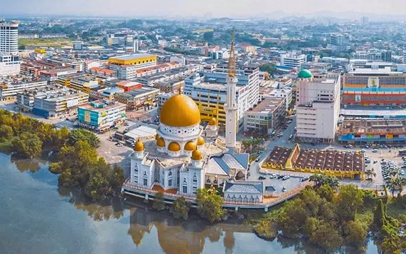
Travel Bucket List: Malaysia Part 18 – Selangor Part 4

Kuala Selangor

The largest town of the district, Kuala Selangor, lies in northwestern Selangor. The name Kuala Selangor means Estuary of the Selangor River. The town was the capital of the Sultanate of Selangor during its early years in the 18th century, which was relocated to Jugra in the Kuala Langat region in 1827, and then Klang in the 1870s.

Kuala Selangor town is located at the estuary of the Selangor River, where it drains into the Strait of Malacca. It is located 55 km north-west of downtown Kuala Lumpur, and 42 km north-west of Shah Alam, the capital of Selangor.

Kampung Kuantan is well known for its fireflies. Some people believe that these fireflies are only available at two places in the world and one of them is Kampung Kuantan. In the early 1970s, a local businessman saw the commercial potential of the fireflies. Today, the firefly adventure is handled by the Kuala Selangor District Council and has expanded with the addition of 27 small boats for visitors.

The unique firefly tour along the Selangor River allows visitors to get a magical view of the shimmering fireflies residing in the Berembang Trees flanking both sides of the river. The ticket price for the tour is RM 15 per person. The boat ride starts at 7 pm with the last boat departing at 8:30 pm and each ride goes on for around 40 minutes.

Kuala Selangor Nature Park was opened in 1987. With an area of 296 hectares, it is divided into two main parts: a 201-hectare tropical rainforest, and a swamp forest. The park is under the management of the Malaysia Nature Lovers Association, which ensures the natural environment of the park is preserved without any habitat damage.

Also known as Taman Alam, the park and forest is home to the Silvery Lutung Monkey, an endangered primate species, and are also breeding grounds for diverse marine life. The Kampung Kuantan Firefly Park, famous for fireflies, is one of the three places along with Pasir Penambang and Kampung Bukit Belimbing where one can witness fireflies. Visitors get to travel on a sampan, a traditional wooden boat to witness fireflies nearby.

The park, as part of the Selangor River estuary, is home to several large bird species and was a breeding ground of an endangered milky stork species before the program was suspended. An abandoned aviary still stands in the middle of the park. In 1997, Kuala Selangor Nature Park was recognised as a nature reserve for conservation and ecotourism and recognised as an Important Bird Area (IBA) by Birdlife International.

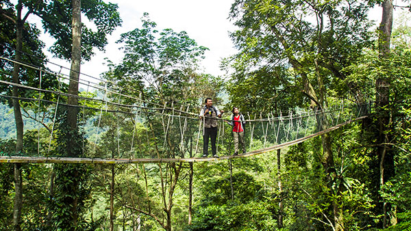
There are two trails and one walkway in the park, known as the Main Trail traversing the secondary forest, the Bund Trail encircling the lake and the Mangrove Walkway extending into the mangrove forest. These last approximately 15 minutes, 75 minutes and 55 minutes to walk respectively. Two watch towers provide views of the area, and birds and other animals can be seen from the top of the watch tower platform. There are some gazebos for rest in the park. The Park Interpretive Centre is open seven days a week including public holidays, from 9 am to 6 pm. Visitors can purchase admission tickets and souvenirs, reserve a room of accommodation, and get information about the park. Entrance fees are RM4 for adults, RM1 for children or students between 7 and 16, RM2 for senior citizens above 60 and MNS members and free for children under 6. Visitors can request to stay in the park. There are A-frame huts, chalets, dormitories, and a hostel for large groups of people. A camping site for campers is also available here upon booking.

Melawati Hill or Bukit Melawati, famous for panoramic sunsets, the silvered-lutung monkeys, and long-tailed macaque monkeys, Redang beach for its sunrise, sunsets, and migratory birds, and Remis beach are famous natural attractions to visit. Another notable attraction in Kuala Selangor is the Sasaran Sky Mirror. A growing site in terms of popularity, it is a sandbank that emerges for a few hours in the morning, only on certain dates based on the lunar month, to produce a mirror-like reflection of the sky in the water which is worth the time and visit.

A shallow-water sandbank, Sasaran Beach is located in the middle of the Malacca Sea. About 3.2 k,m from the famous fishing village of Jeram. Only accessible during low tides, the beach is extremely popular among photographers for its phenomena of picture-perfect spot Sky Mirror, where the natural reflection of the entire sky is visible on the shallow placid water. The beach is usually submerged in water during high tide days and can be reached with the help of a tour guide boat ride. Filled with seagulls and marine life the beach has ample sea clams. Dolphins can also be spotted on the beach and the beautiful seascape is often compared to the Salar de Uyuni salt flats of Bolivia. On the new moon and full moon day of every month as per the lunar calendar, Sasaran Beach witnesses a picturesque sky mirror on the stretch of the sand bar. At the perfect tide day, water becomes shallow along the coast of the beach reflecting the sky in perfect symmetry and blend. Visitors can not spot the Sky mirror themselves as it is situated along the open sea around 30 minutes away from Kuala Selangor; hence it is recommended to book a tour guide. The tour to 00 Sasaran Beach and sky mirror along with food and boat costs around RM 70 to RM 100. The charge for the tour for Malaysians is RM 80 while others pay RM 100. The tour, which is best visited on the 1st and 15th day of each month as per the lunar calendar takes about four to five days to complete.

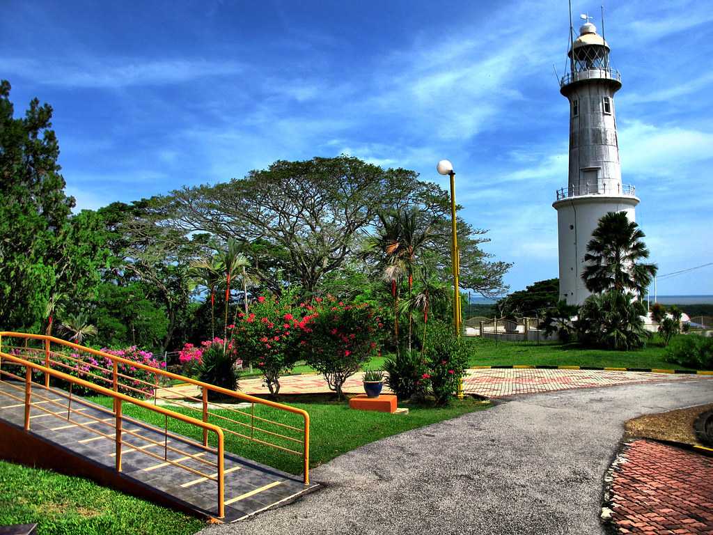
A great place to enjoy sunsets, the Altingsburg Lighthouse and its surrounding area offer a panoramic view of the Straits of Malacca. Though the lighthouse is out of bounds, it is located on Melawati Hill and is of Dutch origin.

The Kuala Selangor Historical Museum is based in the Bukit Melawati area, an hour away from Kuala Lumpur, Malaysia. Once the official residence of the District Officer, it showcases a vast collection of archaeological artefacts. The museum is located at the top of the hills offering fantastic views of town. There are unpaid guided tours available to explore the museum. The museum offers a great depth of knowledge in the early lives of the people and the administration of Kuala Selangor. There is a showcase of weapons, flags, etc. depicting the history of Kuala Selangor. It describes the rich kingdoms, affluent kings and the people there. The museum regularly hosts activities like eagle-feeding and coaster rides. Plenty of resident monkeys can be seen surrounding the museum.

The front of the Kuala Selangor Historical Museum has intense defence structures over the hills to guard the Melaka Strait, cannons, a lighthouse to direct the ships in the sea, and the Malaysian flag.  The park outside has breathtaking views of the Strait of Melaka. The museum is open between 9:30 am and 5:30 pm.

The Kuala Selangor Museum or the Sultan Alam Shah Museum, based near the Altingsburg Lighthouse, displays many artefacts, historical objects and relics, tombstones, weapons, and possessions from the Selangor Civil War. It is primarily focused on defining the power struggle between the State Sultanate, British and Dutch armies from 1867 to 1874. The museum is open from 9:30 am to 5:30 pm

Also known as the Virgin’s Grave or Keramat Rubiah, Makam Keramat Anak Dara is a shrine constructed to pay homage to a young girl by her parents. Placed on a small rocky hill of Kuala Selangor, Makam Keramat Anak Dara lies beside Lake Shima, popular for fishing and filled with lush green trees. The grave structure is entirely made of white marble padlocked in a gate. The grave can be reached by stepping on a steep wooden staircase. At the entrance of the shrine is a signboard with the folk tale about a young girl, Siti Aishah, who disappeared a night before her forced marriage. Her parents never found the girl but found her clothes hanging on the tree, so decided to build Makam Keramat Anak Dara to pay homage to their daughter.

Tanjung Keramat Fort is a historical attraction situated in Kampung Tanjung Keramat, a small village near the Selangor River. Also known as Bukit Belanda or Dutch Hill, the fort is situated on the hillock next to Lake Shima. The Fort was constructed by Sultan Ibrahim in 1830 to create a defensive position. However, the Dutch captured the fort and renamed it Fort Utrecht. The fort has a large rock on the entrance. Visitors can also take a look at the poisoned well inside the fort which was once filled with latex and bamboo juice and used to punish the guilty during the reign of Sultan Ibrahim. Cannons and large weapons from the 17th century and a picturesque garden surrounding the fort invite visitors to walk around. The fort is open at all times and is free to enter.

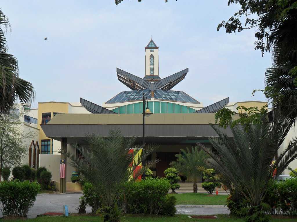
The Sri Shakti Temple, popularly known as the Sri Shakti Devasthanam is a magnificent Hindu temple established in the Bukit Rotan village. The only temple in the world with 51 Shakti illustrations crafted all over an acre of land, the temple is built keeping all the Hindu scriptures in mind, with sculptural technique, and Thundu Pattirippu Pathroba Pathram. The entrance is 18 feet high and is chiselled with lions, elephants, and other intricate sculptures and designs. The five-storeyed temple is crafted on 96 pillars which depicts the 96 Hinduism principles. The main deity of Goddess Shakti along with her 51 avatars is placed in the main hall, with architecture with different shlokas, and a massive brass bell in between.

The main highlight of the temple is the sanctum sanctorum which was constructed in eight phases. The sanctum sanctorum of the wall is decorated with 64 Sri Chakras and 64 Navratanas. Apart from this, four pillars depicting the four Vedas are embedded inside. The entrance of the temple is through a tower known as the Raja Gopuram which is 80 feet tall and crafted with elephant and lion motifs. The temple is encircled by a lush green beautiful garden where one can spot some herbs and traditional trees. The temple is open between 5:30 am and 12:30 pm and between 4:30 and 9:30 pm.

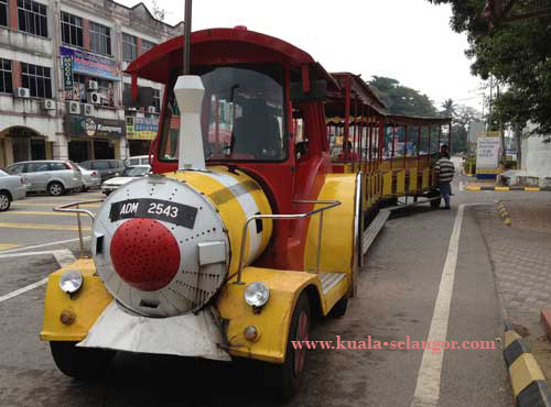
The Bukit Melawati Tram Ride is a splendid tourist tram facility enabling travel to Melawati Hill. The tram service has its pick-up point at the beautiful nature park. It offers some great views of Kuala Selangor as one goes uphill. It is mostly available on weekends and public holidays as one can drive up the hill on weekdays. Tickets are available at the tourist booth in front of the car park with a map outside for visitors to explore Kuala Selangor and its surroundings. The trams arrive and depart frequently, therefore the waiting time is just a few minutes. The tram makes pitstops at the Kota Malawati or Melawati Fort on the way to hop on or off with some shops and restaurants. The tram ride is a fun way to explore this area and get to the hilltop if visitors don’t enjoy hiking. It is an enjoyable experience for children. The destination hill has panoramic views of the Melaka Strait. The tram ride also leads up to a freshwater fish park that is included in the ticket and has a variety of fish present there. The fees for the tram ride are RM 5 per adult and RM 3 per child.

Nestled on the Melawati Hill in Kuala Selangor, the Melawati Fort is regarded as one of the highest hilltops in the area. Its history dates back to the late 1700s, during the reign of Sultan Ibrahim. Sultan Ibrahim built the Melawati Fort to protect the area from foreign invaders. The Fort offers a panoramic view of the beautiful Melawati River and the mangroves encircling it. The canons that were installed by the ruler stand tall to date. The fort also houses ancient gravesites and a flat stone that was used during beheadings. During the visit, one can catch a glimpse of several silver-leaf monkeys. The fort is open between 9:30 am and 4:30 pm and entry is free.

Sepang

Pekan Sepang is a small border town, famous for the Sepang International Circuit which lies in the western part of the town, where the Malaysian F1 Grand Prix and the Malaysian MotoGP Grand Prix are held. Malaysia’s largest airport Kuala Lumpur International Airport in the western part of the town.

The Sepang International Circuit is a motorsport race track, located approximately 45 km south of Kuala Lumpur, and close to the Kuala Lumpur International Airport. It hosted the Formula One Malaysian Grand Prix between 1999 and 2017 and is also the venue for the Malaysian Motorcycle Grand Prix, the Malaysia Merdeka Endurance Race and other major motorsport events.

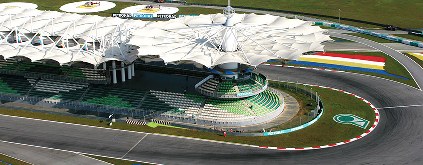
The circuit was designed by German designer Hermann Tilke, who would subsequently design other circuits in Shanghai, Sakhir, Istanbul, Marina Bay and Yas Marina. The Sepang International Circuit was constructed between 1997 and 1999 close to Putrajaya, the then-newly founded administrative capital of the country, with the intent of hosting the Malaysian Grand Prix. The Malaysian climate means the circuit is known for its unpredictable humid tropical weather, varying from clear furnace-hot days to tropical rainstorms. The track was completely resurfaced in 2016 with the support of Italian designer Dromo, with several corners reprofiled to emphasise mechanical, rather than aerodynamic grip. Notably, the final corner was raised by approximately 1 m, which officials claimed would force drivers to take a later apex and explore different racing lines through the hairpin.

The main circuit, normally raced in a clockwise direction, is 5.543 km long, and is noted for its sweeping corners and wide straights. The layout is quite unusual, with a 0.927 km long back straight separated from the pit straight by just one very tight hairpin. Other configurations of the Sepang circuit can also be used. The north circuit is also raced in a clockwise direction. It is the first half of the main circuit. The course turns back towards the pit straight after turn 6 and is 2.706 km long in total. The south circuit is the other half of the racecourse. The back straight of the main circuit becomes the pit straight when the south circuit is in use, and joins onto turn 8 of the main circuit to form a hairpin turn. Also run clockwise, this circuit is 2.609 km in length. The Sepang International Circuit also features kart racing and motocross facilities.

Located in the Chiling Fish Sanctuary, a fisheries research project undertaken by the Selangor State Fisheries Department, the Chiling Waterfall is famous for swimming and an adventurous jungle trek.

Composed of three breathtaking separate vertical waterfalls, the falls sit 400 m above sea level on the way to Fraser Hills and tumbles onto a plunge pool with colourful fish. It is bordered by a boulder resembling a Chinese guardian lion amidst wild orchids and bamboo. The trek leads one to the main lower falls. The upper fall is relatively quiet and a good place for a family picnic. The adventurous 2-km trek along the river to Chiling Waterfall starts from the Sanctuary Admin Office at the entrance and involves crossing the river six times. At some points of the trek, one will have to wade through the river to cross it. In total, it will take around one hour to reach the waterfall.  The falls are open from 8 am to 6 pm only on Fridays, Saturdays and Sundays and costs RM 1 per person.

The Paya Indah Wetlands is a wildlife sanctuary located in Dengkil town near Kuala Langat and is one of the best places in Malaysia to relax in the lap of nature. Stretched over an area of 450 hectares, the wetlands are divided into three major zones namely Conservation & Research Zone, Educational Zone, and Recreational Zone. The wetlands are home to 210 species of birds and animals and flora and fauna. The Paya Indah wetlands have a lot of activities to offer like animal feeding, cycling, kayaking, trekking, and bird watching. Visitors can also enjoy some cultural events held regularly in the Terengganu Malaysian show house of the Paya Indah wetlands. The Department of Wildlife & National Parks also has many accommodation sights like chalets, hostels, and camps for visitors to stay on pre-booking. Bird watching is free in Paya Indah wetlands between 7:30 am and 7 pm. Visitors can feed hippopotamus, crocodiles, pelicans, and porcupines under expert guidance. Daily feedings include Hippopotamus feeding at 10 am, pelican feeding at 10:30 am and porcupine feeding at 11:30 am while on weekends, visitors can feed crocodiles on weekends at 11 am. At the Paya Indah Lookout Tower, visitors can get a 360-degree view of the wetlands while the Typha Lake welcomes anglers and costs RM 10 per rod between 8 am and 6:30 pm every day, except Fridays. One can also rent a bicycle and explore the wetland park in a single go. Bicycles are rented with a charge of RM 5 for 2 hours and tricycles charges are RM 3 for 2 hours. Kayaks can be hired for lake tours either in groups or solo. Kayak charges vary from RM 6 to RM 7 for an hour. And this ends our Selangor visit. I didn’t realise how much this state has to offer and now I am seriously thinking of going there the next time we travel to Malayia. Our next state will be the Federal territories of Kuala Lumpur and Putra Jaya, both of which are enclosed within Selangor.

And that’s the end of our visit to Selangor. Our next state is the Federal Territories of Kuala Lumpur and Putrajaya, so watch this space!

Travel Bucket List: Malaysia Part 17 – Selangor Part 3

Petaling Jaya

Fondly known as PJ, Petaling Jaya was originally developed as a satellite township for Kuala Lumpur. It is part of the Greater Kuala Lumpur area and covers an area of approximately 97 sq km. It was granted city status on June 20, 2006. The city is surrounded by Kuala Lumpur to the east, Sungai Buloh to the north, Shah Alam, the capital of Selangor, Subang Jaya to the west, and Bandar Kinrara or Puchong to the south.

The city was developed during post-war British Malaya on a piece of 1,200-acre rubber estate, the Effingham Estate, around Old Klang Road to address the overpopulation of Kuala Lumpur in the 1950s. Since 1952, PJ has witnessed dramatic growth in terms of population size and geographical importance. The development of Petaling Jaya commenced in 1952 with the construction of 800 houses centred on the area known as Old Town today.

Petaling Jaya was planned to be a satellite town to prevent people from assisting the communists, hence, the earlier housing areas were fenced off from the surrounding area. The first two main roads built in Petaling Jaya were simply called Jalan 1 or Road 1 and Jalan 2 or Road 2. Road 1 was later named Jalan Templer while Road 2 was named Jalan Othman after Othman Mohamad, former Menteri Besar or Chief Minister of Selangor. Until the end of 1953, the town was administered by the Kuala Lumpur district officer. The Petaling Jaya Town Authority commenced administrating Petaling Jaya in 1954. Administratively and historically, it was considered part of Kuala Lumpur. However, Petaling Jaya ceased to be part of Kuala Lumpur when the latter became a Federal Territory, and at that point, it became a township in its own right within the state of Selangor.

Following a boundary realignment exercise in January 1997, parts of Petaling Jaya including Subang Jaya, USJ, Putra Heights, and Bandar Sunway were ceded to the newly formed Subang Jaya Municipal Council. In exchange, the MPPJ annexed Bandar Utama, Sungai Buloh, Bukit Lanjan, and Kota Damansara from the Petaling District Council, which disestablished itself after the cession. Due to the proximity of the city to the capital of Malaysia, Petaling Jaya has been the headquarters of many federal government departments.

A prominent landmark in PJ is the Kota Darul Ehsan arch, which symbolically marks the boundary between Kuala Lumpur and Petaling Jaya. This arch straddled the Federal Highway which was originally the only highway link between Petaling Jaya and Kuala Lumpur. However, many links now exist as alternatives to the congested Federal Highway. Close to the Kelana Jaya Line’s Taman Jaya station is the Petaling Jaya Museum, as well as the Thai Wat Chetawan temple, very popular amongst the Buddhist community. A short drive ahead is PJ State, the nickname for the Central Business District of Petaling Jaya with the landmark Menara MBPJ as a focal point. PJ State is more formally referred to as PJ New Town. Damansara is the main shopping hub of Petaling Jaya with many of the city’s shopping malls being located there.

The Forest Research Institute Malaysia is one of the chief institutes in tropical forestry research in the world housing a multiplicity of flora and fauna. The institute provides an opportunity for camping at Perah Campsite, trekking at natural trails and picnics at Sungei Kroh. Kepong Botanical Garden, the Ethnobotanical Garden and the Colours of FRIM allow visitors to explore. Other places worth visiting include the Research Gallery, Malay traditional houses, the Wetland area, the Arboretum and the Silicified Wood.

Situated in 1 Utama Shopping Centre, the Secret Garden is regarded as one of the largest rooftop gardens in the world. This garden sprawls across an area of about 30,000 sq ft and houses about 600 species of plants. The garden is divided into several zones based on the various species of plants. Some of the most attractive zones of the Secret Garden include the Rainforest Zone and the Victoria Amazonica Zone. The meandering pathways that are constructed between beds of plants are quite attractive, and artificial ponds and waterfalls accentuate the beauty of the place. Guided tours are also available during the first weekend of the month. The garden is open only on weekends and public holidays between 10 am and 10 pm.

Wat Chetawan is a popular Buddhist temple. A Theravada Buddhist Thai temple, with the Buddha Thammeen shrine inside, is a sight to behold, with its sparkling gold seat. People believe that this complex is built in the only true and original Thai style. Also known as the Chetawan Buddhist Temple, the temple was built in 1957 and officiated by the late King Bhumibol Adulyadej, the King of Thailand at the time. The temple is also the only Malaysian Siamese temple that has been chosen as the custodian of the Buddha sacred relics for all Malaysian Buddhists that are parts of the ancient relics discovered in Piprahwa, a village in Uttar Pradesh near the border of the Kingdom of Nepal in 1898 which were presented to King Chulalongkorn of Siam by the then British Viceroy of India, Lord Curzon.

The main shrine is heavily gilded in gold leaves and intricately decorated with multi-coloured glass tiles. The main prayer hall houses several images of Buddha while the pavilion features the four-faced God, Phra Phrom and the Bodhisattva of Compassion, Guan Yin. Another prayer hall pays tribute to abbots with Malay titles that marked their northern Malay Peninsula and southern Thai origins.

Muzium Coklat is also known as the Chocolate Museum where visitors can learn all about the history of chocolate and can watch how chocolate is processed and prepared, taste samples and even buy some to take back home.

Also called the Muzium Petaling Jaya, the Petaling Jaya Museum showcases the history and development of Petaling Jaya. The museum building was originally established in 1980 as a children’s reading house. In 1992, the reading house ceased to function due to its location and the building was taken over by the environment and development department. It was then transformed into a nature education centre and in April 2007, the building was turned into a museum. Construction and renovation work were completed in October 2007 and the museum was officially opened on November 12, 2007. It was later closed for renovation and reopened again in April 2016. The museum showcases the historical development of Petaling Jaya and is housed in three sections: the origin of Petaling Jaya, the administration of Petaling Jaya, and the expansion of Petaling Jaya. The museum is open daily except Fridays and public holidays from 9 am to 5 pm and admission is free. The museum is within walking distance of the Taman Jaya LRT Station.

Batu Caves

Batu Caves, a Mogote type of karst landform, has a series of caves and cave temples in Gombak. It takes its name from the Malay word batu, meaning rock. The cave complex is one of the most popular Hindu shrines outside India, is dedicated to Lord Murugan, and is the focal point of the Tamil festival of Thaipusam in Malaysia. The caves are also referred to as the 10th cave or hill for Murugan, as there are six important holy shrines in India and four more in Malaysia. The three others in Malaysia are Kallumalai Temple in Ipoh, Tanneermalai Temple in Penang, and Sannasimalai Temple in Malacca.

The limestone forming Batu Caves is said to be around 400 million years old, with some of the cave entrances used as shelters by the indigenous Temuan people. As early as 1860, Chinese settlers began excavating guano to fertilise their vegetable patches. However, they became famous only after the limestone hills were recorded by colonial authorities in 1878.

The cave was promoted as a place of worship by K. Thamboosamy Pillai, an Indian Tamil trader. He was inspired by the vel-shaped entrance of the main cave and was inspired to dedicate a temple to Lord Murugan within the caves. In 1890, Pillai, who also founded the Sri Mahamariamman Temple in Kuala Lumpur, installed the consecrated statue of Sri Murugan Swami in what is today known as the Temple Cave. Since 1892, the Thaipusam festival in the Tamil month of Thai, which falls in late January/early February, has been celebrated there.

Wooden steps up to the Temple Cave were built in 1920. In the 1930s, the stairs began to show signs of wear and tear, and it was proposed to build two flights of concrete stairs to the upper caves. The proposal was forwarded in 1939, and work was completed in 1940. Currently, there are 272 concrete steps. Of the various cave temples that comprise the site, the largest and best known is the Temple Cave, so named because it houses several Hindu shrines beneath its high vaulted ceiling.

In August 2018, the 272 steps were painted, with each set of steps painted in a different range of colours. At the base of the hill are two more cave temples, the Art Gallery Cave and the Museum Cave, both of which are full of Hindu statues and paintings. This complex was renovated and opened as the Cave Villa in 2008. Many of the shrines relate the story of Lord Murugan’s victory over the demon Soorapadman. An audio tour is available to visitors.

The Ramayana Cave is situated to the extreme left as one faces the sheer wall of the hill. On the way to the Ramayana Cave, there is a 15-meter-tall statue of Lord Hanuman and a temple dedicated to him. The consecration ceremony for the temple was held in November 2001. The Ramayana Cave depicts the story of Rama in the manner of a chronicle along the irregular walls of the cave. A 43 m high statue of Lord Murugan was unveiled in January 2006, having taken three years to construct. It is the second-tallest Murugan statue in the world.

The Batu Cave hill and its numerous caverns contain a wealth of plants and animals, many of which are specialised for limestone environments. A total of 269 species of vascular plants have been recorded from the site, including 56 species which are found only on limestones. Various undeveloped caves contain a diverse range of cave fauna, including some unique species. The caves have some 21 species of bats, including several species of fruit bats and is also well known for its numerous long-tailed macaques, which visitors feed — sometimes involuntarily. These monkeys may also pose a biting hazard to tourists. especially small children as they can be quite territorial.

Below the Temple Cave is the Dark Cave, with speleothems and many animals found nowhere else. It is a two-km network of relatively untouched caverns. Stalactites jutting from the cave’s ceiling and stalagmites rising from the floor form intricate formations such as cave curtains, flowstones, cave pearls, and scallops which took thousands of years to form. To maintain the cave’s ecology, access is restricted. The Malaysian Nature Society organises regular educational and adventure trips to the Dark Wet Caves.

Batu Caves has also been the centre of rock climbing development in Malaysia for the past 10 years. The caves offer more than 160 climbing routes scattered all around and are easily accessed, as most crags start from ground level. These climbing routes often start from the Northeastern side of the cave complex whereas the staircase and temple entrance face the South. This Northeastern area is known as the Damai caves. Abseiling and spelunking trips can be organised with some local adventure companies.

Batu Caves serves as the focus of the Tamil community’s yearly Thaipusam festival. They have become a pilgrimage site not only for Malaysian Hindus, but Hindus worldwide. A procession begins in the wee hours of the morning on Thaipusam from the Sri Mahamariamman Temple in Kuala Lumpur leading up to Batu Caves as a religious undertaking to Lord Murugan lasting eight hours. Devotees carry containers containing milk as an offering to Lord Murugan either by hand or in huge decorated carriers on their shoulders called Kavadis. The kavadi may be simple wooden arched semi-circular supports holding a carrier foisted with brass or clay pots of milk or huge, heavy ones which may rise to two metres, built of bowed metal frames which hold long skewers, the sharpened end of which pierce the skin of the bearers torso. The kavadi is decorated with flowers and peacock feathers imported from India. Some kavadi may weigh as much as a hundred kilograms.

After bathing in the nearby Sungai Batu or Rocky River, the devotees make their way to the Temple Cave and climb the flights of stairs to the temple in the cave. Devotees use the wider centre staircase while worshippers and onlookers throng up and down those balustrades on either side. When the kavadi bearer arrives at the foot of the 272-step stairway leading up to the Temple Cave, the devotee has to make the arduous climb. Priests attend to the kavadi bearers. Consecrated ash is sprinkled over the hooks and skewers piercing the devotees’ flesh before they are removed. No blood is shed during the piercing and removal.

In the last decade, the surrounding area has changed from a small village to industrial estates, new housing, and retail. There is also an elevated flyover across the highway. A new 515-million-ringgit KTM Komuter rail extension from Sentul to Batu Caves began operations in July 2010, serving the rebuilt Batu Caves Komuter station.

The cave is open from 6 am to 9 pm and the best and fastest way to reach the cave from Kuala Lumpur is via the commuter train which stops at the Batu Caves Komuter station opposite the cave complex. The fare from KL Sentral to Batu Caves is around RM 2.6 per person. One can also take a taxi which costs between RM 30 to RM 40, but depending on which part of KL one is coming from, take quite a bit of time, given the traffic.

Ampang Jaya

Commonly known as Ampang, Ampang Jaya is located just outside the eastern border of Kuala Lumpur Federal Territory. Ampang was one of the earliest areas in the Klang Valley to be opened for tin mining. The name Ampang is derived from the old spelling of the Malay word empangan or ampangan, which means a dam; the place referred to the miners’ dams. A road was built to connect Ampang to Kuala Lumpur which is today’s Jalan Ampang.

Between colonial rule and February 1974, Ampang was part of greater Kuala Lumpur in Selangor. Following the creation of the Federal Territory of Kuala Lumpur, Ampang was split into two; the western part, located within the Federal Territory, became Ampang Hilir, and the eastern part, which remained in Selangor, became part of Hulu Langat or Kajang.

During the height of the Malayan Emergency in the 1950s, the British established the Ampang New Village, which became one of the largest Chinese settlements in the Klang Valley. The Kau Ong Yah Lam Thian Kiong Temple in Ampang New Village is famous for the 9 Emperor Gods festival, which is celebrated annually on the 9th month of the Chinese lunar calendar, between late September and early October.

Ampang Jaya borders the remainder of Hulu Langat District in the east and south, the Federal Territory of Kuala Lumpur in the west, the Gombak District in the north, and a short border with Bentong in Pahang in the northeast.

The Zoo Negara or National Zoo is located on 110 acres of land in Ulu Klang in Gombak. It was officially opened on November 14, 1963, by the country’s first prime minister Tunku Abdul Rahman. The zoo is managed by the Malaysian Zoological Society and is home to 5,137 animals of 476 different species. When it was opened, it was known as the Zoo in the Jungle due to the lush vegetation that dominated the region. The zoo welcomed its millionth visitor on 14 November 1966, just three years after opening, and by 1986, the zoo was attracting over 1 million visitors per year. The zoo remained surrounded by dense tropical forests until the late 1970s when Kuala Lumpur experienced rapid population growth fueled by an economic boom. Nearby Ulu Klang was targeted for large-scale residential development to accommodate the expanding urban population, resulting in habitat loss in formerly wild areas surrounding the zoo. In the late 1990s and early 2000s, there were plans to move the zoo to other locations in Selangor. However, the plans were largely unpopular among the public and it was decided not to relocate the zoo.

The Reptile Park has both indoor and outdoor exhibits and includes saltwater crocodiles, false gharials, and dwarf crocodiles as well as tortoises and terrapins, including Aldabra giant tortoises which are the second largest tortoise species in the world and local Tutong or river terrapins. The Amphibian World center at the Reptile Park has a variety of frogs and toads that originate from various habitats in Malaysia. In 2014, a male and female giant panda pair named Xing Xing and Liang Liang went on public display at an air-conditioned, purpose-built Giant Panda Conservation Centre next to tram stop T5. The pandas are on a 10-year loan to Malaysia. On 26 May 2018, Yi Yi, a four-month-old female panda went on show for the first time. The cub is the second born in Malaysia. The cub’s sister, Nuan Nuan, was born in August 2015 and sent back to China in 2017 as part of Beijing’s agreement with Malaysia that cubs born in captivity must be sent back to China at the age of two. The third giant panda cub was born in June 2021.

The zoo is home to three Asian elephants: two females, Siti who was born in 1979 in Fraser’s Hill; Sibol, who was born in 1978 at Temerloh and a male, Teriang, who was born in 1980. The trio have been in the zoo since they were very young. This aviary holds over a hundred species of birds from all around the world. The Birds Photo Corner in the aviary lets visitors take souvenir photos with a variety of macaws and cockatoos on weekends. The Nocturnal Exhibits which are indoor, are home to fruit bats, the largest bat in the world, which are sometimes called flying foxes, as well as mousedeer. The Australian Plain is home to emus, agile wallabies, red kangaroos, and red-legged pademelons.

Children’s World houses a variety of mostly domestic animals including goats, rabbits, ducks, and chickens running around freely, as well as parrots and guinea pigs. It includes a mini-rainforest with a variety of plants and insects, as well as a small aviary, fish pond, miniature horse barn, and playground. The Bear Complex is home to several types of bears including Asian black bears, brown bears, and sun bears. The Savannah Walk is one of the largest open-concept exhibits in the zoo and is home to giraffes, plains zebras, ostriches, white rhinos, sable antelopes, and scimitar oryx. Zoo Negara’s Tunku Abdul Rahman Aquarium is the first ecological-based freshwater aquarium that highlights the Malaysian river and wetlands. The aquarium exhibits show the ecosystem or the habitats of Malaysian river systems in the upper, middle, and lower estuarine zones and finally, the sea. The aquarium features fish that are commonly seen in Malaysian rivers, as well as rare and endangered species including invertebrates such as crabs, prawns, corals, and aquatic insects.

Zoo Negara has also built an insect zoo where more than 200 species of insects from around the world are housed. Opened in 2010, the Hornbill Centre is a breeding centre houses 7 species of hornbills native to Malaysia, including great hornbills, Oriental pied hornbills, rhinoceros hornbills and wrinkled hornbills. Other attractions include sea lions, macaques and macaws that are part of a Multi-Animal Show that is shown twice daily. Train rides and guided tours are available on weekends.

The Mini Bee Museum is located at the heart of Zoo Negara and helps educate visitors about the many types of bees in the country. The Multi-Animal Photo Corner is located by the zoo’s main entrance and is opens on weekends. Visitors can have their pictures taken with snakes, miniature horses and birds.

The Ampang Recreational Forest or Taman Rimba Ampang in Malay is a lowland dipterocarp forest that takes its name from the Ampang River, which flows through the forest. The forest is one of the most popular nature sites in the Klang Valley with the stream and shady playgrounds popular for family outings on weekends. In 2005 the forest was included in the much-larger Selangor State Park. Numerous species of plants and animals can be seen in the forest with the forest frequented by birdwatchers. Several bridges, pedestrian walkways, toilets, playgrounds and other facilities have been built in the park over the years. A nominal fee is charged for the car park and entry to the forest. The park can be reached by taking a train to the Ampang LRT station and then taking a taxi to the park.

Nirvana Memorial Park is a private cemetery and mortuary with the longest dragon statue in Malaysia. It is 1,000 feet long and fully air-conditioned inside. It was established in 1985 by David Kong and is touted as the largest funeral service in Southeast Asia and also serves as a pet cemetery.

Travel Bucket List: Malaysia Part 16 – Selangor Part 2

Klang

Officially known as Selangor’s Royal Town, Klang is the former capital of the state. With a unique old-world charm, Klang is known for its rich heritage sites and colonial architecture. Located 45 km from Kuala Lumpur, Klang is a popular day trip for most tourists. The colourful town is split between the town and port and is small enough to explore on foot. The Klang River flows through the town and divides it into South Klang and North Klang. Port Klang is the 12th busiest transhipment port and the 12th busiest container port in the world.

Klang has been a site of human settlement since prehistoric times. Bronze Age drums, axes and other artefacts have been found in the vicinity of the town and within the town itself. Commanding the approaches to the tin-rich Klang Valley, Klang has always been of key strategic importance. It was mentioned as a dependency of other states as early as the 11th century. Klang was also mentioned in the 14th century literary work Nagarakretagama dated to the Majapahit Empire, and the Klang River was marked and named on the earliest maritime charts of Chinese Admiral Cheng Ho who visited Malacca from 1409 to 1433.

Klang was under the control of the Malacca Sultanate in the 15th century. Klang was known as a producer of tin, it produced one hundred bares of tin a year when the Portuguese occupied Malacca. Klang however remained in Malay hands after the fall of Melaka to the Portuguese in 1511 and was controlled by the Sultan of Johor-Riau. In the 17th century, the Bugis began to settle in the coastal region of Selangor including Klang, and the Selangor sultanate was created in 1766, which then controlled Klang.

In the 19th century, the importance of Klang was greatly increased by the rapid expansion of tin mining as a result of the increased demand for tin from the West. The desire to control the Klang Valley led directly to the Klang War, also called the Selangor Civil War of 1867–1874 when Raja Mahdi fought to regain what he considered his birthright as territorial chief against Raja Abdullah. During the Klang War, in 1868, the seat of power was moved to Bandar Temasya, Kuala Langat, and then to Jugra which became the royal capital of Selangor. In 1874, Selangor accepted a British Resident who would advise the Sultan, and Klang became the capital of British colonial administration for Selangor from 1875 until 1880 when the capital city was moved to Kuala Lumpur due to the growth of Kuala Lumpur.

Until the construction of Port Swettenham, now known as Port Klang in 1901, Klang remained the chief outlet for Selangor’s tin, and its position was enhanced by the completion of the Klang Valley railway to Bukit Kuda in 1886, which was then connected to Klang itself via a rail bridge, the Connaught Bridge, completed in 1890. In the 1890s its growth was further stimulated by the development of the district into the state’s leading producer of coffee, and later rubber. In 1903, the royal seat was moved back to Klang when it became the official seat of Sultan Alauddin Sulaiman Shah. The official boundary of Klang was first defined in 1895. The first road bridge over the Klang River connecting the two parts of the town, the Belfield Bridge, was constructed in 1908.

Klang may have taken its name from the Klang River which runs through the town. The entire geographical area near the river, which begins at Kuala Lumpur and runs west to Port Klang, is known as the Klang Valley. One popular theory on the origin of the name is that it is derived from the Mon–Khmer word Klong, which may mean a canal or waterway. Alternatively, it has also been argued that it means warehouses, from the Malay word Kilang as in the old days, it was full of warehouses. Today kilang means factory. Klang was also once known as Pengkalan Batu which means stone jetty. Unlike most other place names in Malaysia, the Chinese name for Klang is neither a direct transcription nor translation, but likely a transcription of another Malay word Pasang, referring to the rising tides around the Klang Valley.

The economy of Klang is closely linked with that of the greater Klang Valley conurbation which is the most densely populated, urbanised and industrialised region of Malaysia. Rubber used to be an important part of the economy of the region, but from the 1970s onwards, many rubber plantations switched to palm oil and were then converted again for urban development and infrastructure use. Port Klang forms an important part of the economy of Klang. It handled almost 50% of Malaysia’s sea-borne container trade in 2013. The Port Klang Free Zone was established in 2004 to transform Port Klang into a regional distribution hub as well as a trade and logistics centre. The port is part of the 21st century Maritime Silk Road that runs from the Chinese coast to Singapore, towards the southern tip of India to Mombasa, from there through the Red Sea via the Suez Canal to the Mediterranean, there to the Upper Adriatic region to the northern Italian hub of Trieste with its connections to Central Europe and the North Sea.

Established in 1932, the Sultan Sulaiman Royal Mosque houses the royal mausoleum. The building reflects an excellent blend of neo-classical, Western, and Mughal architecture. It was the state mosque until the opening of the Sultan Salahuddin Abdul Aziz Mosque in the new capital city of Shah Alam. Standing at the foot of a hill. The Royal Palace is located right next to the mosque but is not open to visitors. The mosque has a beautiful central hall, and it serves free food during Ramadan. Some of its interesting features include the Tangga Diraja, or royal stairs, from Istana Alam Shah and a royal mausoleum. The late Sultan Salahuddin was buried on the mosque’s grounds.

The semicircular-shaped dome of the mosque is painted egg yellow, not gold. The large dome of the main prayer space is surrounded by four smaller domes. The main dome represents the Sultan of Selangor, while the smaller domes refer to Dato’ Besar Empat Suku Selangor. Five domes at the main entrance of the mosque symbolise the Five Pillars of Islam and the five Daeng Brothers, while two umbrella-shaped domes are symbolic of the royal umbrella. There are eight smaller towers around the mosque and a large tower in the middle, with a higher entrance from the main porch. The tower is also decorated with a yellow dome at the summit. The original design of the mosque was like a crossbar when viewed from above, as is so often used in church plans in Europe, but after renovations by the Selangor Islamic Religious Department, the mosque now has a square footprint. The main prayer room is octagonal at the bottom, but it slowly smooths into a circle at a height of 10 meters. The upper floors can be accessed with a cat ladder, and there are decorative iron frames under the dome that support the multi-coloured patterned glass. The mosque was designed to accommodate about 1,000 pilgrims at a time.

Kuan Yin Teng or the Goddess of Mercy Temple, is the oldest Chinese temple in Malaysia dedicated to the Goddess Guan Yin. The temple building is a heritage structure often visited by Buddhists and a local attraction for Chinese visitors during Chinese New Year or any festive season. The temple was established in 1892 and bustles with devotees during the first day and the fifteenth day of the lunar calendar. On the eve of Chinese New Year, the temple is open all night, and the street is often packed with devotees queuing shoulder to shoulder to enter the temple hall to offer their incense to the Kwan Yin in the hope of an auspicious start to the New Year. It has marvellous exteriors with beautiful archways and carvings, along with a peaceful interior setting. The temple is open daily between 7 am and 5 pm.

The Church of Our Lady of Lourdes is a catholic church that lies in the Little India area with a lovely chapel outside and marvellously designed interiors with glass panels and dome structures housing artefacts, statues and other memorabilia describing the history of Klang.

Locally known as the Klang Perumal Temple, the Sri Sundararaja Perumal Temple is the oldest Vishnu temple in Malaysia. The 127-year-old temple was built in 1892 and reconstructed in 2015. Often referred to as the Tirupati of Southeast Asia after its famous namesake in India, it is the first granite temple in Malaysia. The gopuram, or spire, of this temple is a Klang landmark. Inside the temple, there are several complexes dedicated to different deities. At the centre of the temple is the Perumal Sannathi, where Lord Perumal and His consort, Goddess Mahalakshmi, are situated. The centre complex of Lord Perumal Sannathi contains a small gopuram with the statues of all of Lord Vishnu’s avatars surrounding it. On the right of the Perumal Sannathi is the Shivan Sannathi, which consists of Lord Shiva, Lord Parvathi, Lord Ganesh, Lord Muruga, and Lord Ayyappan. On the left side of Perumal Sannathi is Saneshwara Sannathi, where Lord Shani and the Navagrahas are situated. Adjacent to the center complex is Lord Anjaneya Sannathi and just at the corner outside the temple is Lord Nagaraja Sannathi. The temple also has a multi-purpose hall which is used by the Indian community for weddings. The temple is home to a large Navalar Mandapam and a historic Palmyra tree, which is a cultural symbol to Tamils. The temple is open from 6 to 9:30 am and then between 4 and 9:30 pm.

Built on the top of a hill, Kota Raja Mahadi is a historic site that witnessed two civil wars in the 19th century. It was built in 1866 by King Raja Mahdi to gain a power edge over his enemy Raja Abdullah. Once built as a spy fort, today, it houses Klang’s Municipality Council.

Also known as the Tugu Keris, the silver-coloured kris-shaped monument was constructed by then emperor Almarhum Sultan Salahuddin Abdul Aziz Shah to celebrate his 25th anniversary as the Sultan of Selangor. The kris is a wavy dagger and the locals believe it to be an epitome of strength and unity. Located in the Klang Royal Gardens, the monument stands tall and is visible while travelling from Kuala Lumpur. There is a playground next to the monument and is close to the Church of Our Lady of Lourdes. It was originally located along the Federal Highway near Taman Kris and the Sungai Rasau toll plaza. In September 2014, the monument was relocated to its present site because the original monument was blocked by a flyover being built just after the Sungai Rasau toll plaza.

Source

Tanjung Harapan, loosely translated to Cape of Good Hope, is located in the Northport area of Klang. The sunset views from the cape are breathtaking. A calming walk along the coastline of the well-built industrial area of Bandar Sultan Suleiman is a fantastic way to explore the area. Fronting the Straits of Malacca, the Esplanade is a seaside family recreation spot near Northport that houses several seafood restaurants. It’s a nice place to view the sunset and also for anglers to fish.

The official residence of the Sultan of Selangor is Istana Alam Shah. It is built of wood and marble and incorporates 15 iconic rooms. Between 1903 and 1957, there existed an older palace on the same site, known as Istana Mahkota Puri. It was built in 1903 during the rule of Sultan Sulaiman Shah, the fifth Sultan of Selangor, and the design closely resembles the Sultan Abdul Samad Building in Kuala Lumpur. The Sultan lived there for 35 years until he died in 1938. In the 1950s it was briefly used as a student dorm and was demolished in October 1957, soon replaced by the present-day structure. Most royal ceremonies, like the coronation of a new Sultan, involving the Selangor royal family are held in Istana Alam Shah. The palace has 15 rooms and was built using wood and marble. In early 2000, extensive renovations were carried out by Sultan Salahuddin Shah.

One of the oldest bridges in Malaysia’s Klang Valley region, the Connaught Bridge, was built in 1948 by the British. At one time, the Connaught Bridge could only be crossed by one vehicle at a time, and heavy vehicles were banned from the bridge. The wooden bridge closed in 1993–1994, and in 1995, the wooden bridge was replaced by a concrete box girder bridge. Kota Bridge is the first and only double-decker bridge in Malaysia and Southeast Asia. The bottom deck is a pedestrian walkway bridge, while the top deck is a motor vehicle bridge. The bridge was closed to car traffic in the 1990s due to high demand, which necessitated the construction of a new bridge. The new Jambatan Kota is located beside the old bridge. The old bridge was constructed between 1957 and 1960 and was officially opened in 1961 by the late Sultan of Selangor, Almarhum Sultan Salahuddin Abdul Aziz Shah, as part of the celebration of his coronation as the ninth Sultan of Selangor.

The Sultan Abdul Aziz Royal Gallery is all about the former Selangor Sultan Salahuddin Abdul Aziz Shah. The museum building was initially constructed as the Sultan Sulaeman Building in 1909. During British Malaya, the British government used the building as the land and administration office. During the Japanese rule of Malaya, it was used as a war headquarters. After independence in 1957, it was used as the Klang District office. The museum was initially opened in 1988 as the Memorial Museum and was officiated on 19 October 2007 by Sultan Sharafuddin. The gallery displays the history and heritage of the Sultanate of Selangor since 1766 with more than 2,000 artifacts.

Pulau Ketam, or Crab Island, is an island located off the coast of Port Klang in the intertidal zone, and the chief vegetation is mangrove. The island is home to two predominantly Chinese fishing villages founded in 1880. The main village on the southern side of the island is also known as Pulau Ketam. The other village on the northeastern side is called Sungai Lima or the Fifth River, its location being at the fifth inlet from the main village. The villagers are mainly Teochew and Hokkien Chinese, with Teochew, Hokkien, and Mandarin Chinese as the main dialects spoken. There is also a small, recently relocated Orang Asli community at the second inlet. The rest of the island consists of mangrove swamps. As the island is submerged during high tide, housing on the island consists of floating houses perched on wooden stilts 1 to 10 m above sea level. The main thoroughfares are narrow concrete pavements, while in the residential areas, the older, rickety wooden plank bridges can still be seen. There are no cars on the island; bicycles, some of which are motorized, are the main means of transportation within the villages. No pavement links the villages, with boats being the only means of transportation between villages. Daily ferry services link the island to Port Klang jetty on the mainland. The main economic activity on the island is fishing. The island is also a tourist spot.

The One Fathom Bank Lighthouse, Rumah Api One Fathom Bank or Rumah Api Permatang Sedepa refers to two offshore lighthouses in the Strait of Malacca, specifically, on a shoal within Malaysian waters, dubbed One Fathom Bank or Permatang Sedepa, off the coast of Selangor. The One Fathom Bank station was originally served by a lightship stationed in 1852 before a permanent screw-pile lighthouse was built in 1874; the lighthouse has since been replaced twice throughout its service, in 1907 with a concrete pile lighthouse, and 1999 when a larger modern counterpart was built parallel to the 1907 lighthouse, superseding its predecessor’s duties. The lighthouses have since been referred to as the old One Fathom Bank Lighthouse and the new One Fathom Bank Lighthouse. Due to being well out to sea, both lighthouses are only accessible by boat. While both sites of the lighthouses are open, their towers remain off-limits.

Travel Bucket List: Malaysia Part 15 – Selangor Part 1

Our next state is the state of Selangor which is also known by its Arabic honorific Darul Ehsan, or the Abode of Sincerity. Located on the west coast of Peninsular Malaysia, Selangor is bordered by Perak to the north, Pahang to the east, Negeri Sembilan to the south, and the Strait of Malacca to the west. Selangor surrounds the federal territories of Kuala Lumpur and Putrajaya, both of which were previously part of it. The state has diverse tropical rainforests and an equatorial climate and the mountain ranges in the state belong to the Titiwangsa Mountains, part of the Tenasserim Hills that cover southern Myanmar, southern Thailand and Peninsular Malaysia, with Mount Semangkok as the highest point in the state.

The state capital is Shah Alam, and its royal capital is Klang, while Kajang is the largest city. Petaling Jaya and Subang Jaya received city status in 2006 and 2019, respectively. Selangor is one of four Malaysian states that contain more than one city with official city status; the others are Sarawak, Johor, and Penang. Selangor has the largest economy in Malaysia in terms of gross domestic product or GDP, with RM 239.968 billion, equivalent to roughly $55.5 billion in 2015, comprising 22.60% of the country’s GDP. Malaysia’s most developed state, Selangor has good infrastructure, such as highways and transport, and has the largest population. It also has a high standard of living and the lowest poverty rate in the country.

Selangor is located on the west of Peninsular Malaysia, overlooking the Straits of Malacca. The state is level on the west and hilly to the east. The hill and mountain, surrounding the western edge of the state effectively form a valley and a basin area for the Klang River. This valley is called Klang Valley and this is where most of the population is centred. It is located at the heart of Peninsular Malaysia on the west coast and surrounds the Federal Territory of Kuala Lumpur and Putrajaya. Malaysia’s capital, Kuala Lumpur is located in the heart of Selangor and was once part of Selangor territory before it was ceded to the federal government to form a Federal Territory.

The origin of the name Selangor is uncertain. A common suggestion is that the name refers to the Malay word langau, which is a large fly or blowfly that is found in the marshes along the Selangor River in the state’s northwest. According to local lore, a warrior who escaped from Malacca after the Portuguese conquest took a break from his journey north and rested under a tree here. However, he was disturbed by a persistent fly, whereupon he decided to explore the area. When he found the place to his liking and chose to settle there, he named the place “satu (se) langau” meaning “a large blowfly”. Another theory is that the name may have originated from a kind of tree found in Kuala Selangor and along the Selangor River named Mentangau. And yet another theory claims the state’s name is derived from the term Salang Ur where ur means town or village in Tamil, meaning the village of the Salang people. It has also been proposed that the name is derived from a combination of salang which means stabbing, and jemur, which means to dry in the sun, indicating that it was once a place where traitors were stabbed and then left to roast in the sun.

The most important settlement in the area in the ancient period may have been Klang. Ancient artifacts, including Bronze Age axes and bronze bells dating from the 2nd century, and iron tools called tulang mawas, or ape bones, have been found in or near Klang. The Mao Kun map, dating to the Ming dynasty and used by Admiral Zheng He during his expeditions between 1405 and 1433, refers to places in Selangor such as the Klang River estuary and perhaps a hilly area. The Malay Annals indicate that the Selangor area was under the control of the Sultanate of Malacca in the 15th century; however, Selangor at that time was not a unified domain—separate river states such as Klang and Jeram existed in the region.

After the fall of Malacca to the Portuguese in 1511, the area came under the control of the Johor Sultanate. In the 17th century, Johor was involved in a war against Jambi, and the Sultan of Johor engaged the help of Bugis mercenaries from Sulawesi to fight against Jambi. After Johor won in 1679, the Bugis decided to stay and started to gain power in the region. Many Bugis began to migrate and settled along the coast of Selangor. Some Minangkabaus may have also settled in Selangor by the 17th century, perhaps earlier. The Bugis and the Minangkabaus from Sumatra struggled for control of Johor and to establish a power base, the Bugis led by Raja Salehuddin founded the present hereditary Selangor Sultanate with its capital at Kuala Selangor in 1766. Selangor is unique as the only state on the Malay Peninsula that was founded by the Bugis.

In the 19th century, Selangor’s economy boomed due to the exploitation of its tin reserves. The Selangor Civil War was fought between 1867 and 1874, which was also partly a struggle for control of the revenues from tin which had attracted a large influx of Chinese migrant labourers, and Chinese clans allied with Selangor chiefs also joined the civil war. The conflicts between Malay and Chinese factions in Perak and Selangor, as well as concerns over piracy that affected coastal trade, led to increasing British involvement in the affairs of the Malay states.

In 1874, Sultan Abdul Samad of Selangor accepted a British Resident in a system that allowed the British to govern while the Sultan remained the apparent ruler. Klang was the capital of the British colonial administration for Selangor from 1875 until 1880 when it was moved to Kuala Lumpur. Under the stability imposed by the British, Selangor again prospered. In 1896, largely through the coordination of Resident Frank Swettenham, Selangor united with Negeri Sembilan, Perak and Pahang to form the Federated Malay States, with Kuala Lumpur as its capital.

The Federated Malay States evolved into the Federation of Malaya in 1948, which became independent in 1957. The federation became known as Malaysia in 1963 when its existing states federated with the other British colonies of Sarawak, North Borneo and Singapore. The city of Kuala Lumpur functioned as the national capital of Malaysia and as the state capital of Selangor. In 1974, Selangor relinquished Kuala Lumpur to the federal government. The Sultan of Selangor commemorated the city’s transfer by building an archway on the borders of the new Federal Territory and Selangor; known as the Kota Darul Ehsan that straddles a section of the Federal Highway between Bangsar and Petaling Jaya. The state capital was moved to Shah Alam after the cession. Putrajaya, a new city designed to be the new administrative capital of Malaysia, was built by the federal government in Selangor; Sultan Salahuddin was asked again to cede land to the federal government. Putrajaya became a federal territory in 2001.

Selangor is Malaysia’s most populous state; it has the nation’s biggest conurbation, the Klang Valley. Selangor’s geographical position in the centre of Peninsular Malaysia contributed to the state’s rapid development as Malaysia’s transportation and industrial hub, creating jobs and attracting migrants from other states and Other Asian countries.

The traditional culture of Selangor’s Malay majority is also influenced by those of Bugis, Minangkabau, Mandailing, Javanese, and Banjarese ancestry; most of whom are Muslims. Javanese ancestry is dominant in west coast districts while Minangkabau descent is dominant in Gombak and Hulu Selangor. The 3,000 Mah Meri people, part of the Orang Asli—the indigenous peoples of the Peninsula—can be found on Carey Island. The economy of Selangor is a progressive market economy whose core sectors are commerce and agriculture. It is the richest state in Malaysia in terms of gross domestic product (GDP) per capita (PPP).

Shah Alam

Selangor’s capital Shah Alam is situated within the Petaling District and a small portion of the neighbouring Klang District. Shah Alam replaced Kuala Lumpur as the capital city of the state in 1978 after Kuala Lumpur was incorporated into a Federal Territory in 1974. Shah Alam was the first planned city in Malaysia after independence in 1957.

Shah Alam was once known as Sungai Renggam and was noted for its rubber and oil palm estates. Later, the same area was identified as Batu Tiga before Malaysian independence and has been a centre of rubber and palm oil trade for centuries. The Sungai Renggam Plantation was earmarked for the development of a township by the Selangor government in 1963, and under the recommendations of Vlado Antolic, a town planning advisor from the United Nations, chose the present site strategically located between Kuala Lumpur and Port Klang.

Its current name was chosen by the then-state Sultan of Selangor, Sultan Salahuddin Abdul Aziz Shah, after his late father Sultan Alam Shah. Many other monuments, buildings and even a street are named after the late Sultan. Shah Alam was opened in 1963 to make it the new administrative centre of Selangor, replacing Kuala Lumpur which was made a Federal Territory on 1 February 1974. With the consent of the Sultan, Shah Alam was proclaimed the capital of Selangor on 7 December 1978 with an initial area of 41.68 sq km, and administrated by a municipal council. Shah Alam was enlarged several times between 1983 and 1997, with the last annexation on 1 January 1997. Shah Alam was granted city status on 10 October 2000.

The Taman Botani Negara Shah Alam or the National Botanic Garden is a glorious nature park, home to plenty of vegetation, gardens, lakes, a petting zoo, a seasonal temperature house, and a public pool. The garden hosts activities from lightweight to extreme adventurous sports like hiking, horse riding, rock climbing or fox flying among other things. One is free to walk or rent a bike to explore the gardens and stop at the watchtowers to bask in the scenic views or relax and take a break at the gazebo. The garden is closed on Mondays and other days, it is open between 9 am and 5 pm

The 43-hectare Shah Alam Lake Garden is a favourite retreat of residents, with its beautiful landscape and scenic pathways. Some sections of the lake are elevated so visitors can walk over and watch the aquatic life. One may even catch a glimpse of an occasional peacock, goose, or stork. Some other popular things to do at the park include taking a splash at the waterpark, Wet World, indulging in Malaysian cuisine at the floating seafood restaurant, or going kayaking. The lake garden is open from 11 am to 7 pm on Mondays, Tuesdays, Thursdays and Fridays and between 10 am to 7 pm on Saturdays and Sundays. It is closed on Wednesdays. Entry charges are between MYR 8 to 10 per person.

Overlooking the Garden of Islamic Arts is the magnificent Sultan Salahuddin Abdul Aziz Shah Mosque, the state mosque of Selangor. It is the second-largest mosque in Southeast Asia and the largest in Malaysia. Named after Selangor’s late Sultan who commissioned it in 1982, the mosque is also known as the Blue Mosque. Four 142-meter-high minarets standing tall at each of its corners are the world’s tallest group of minarets. The mosque can accommodate around 24,000 devotees at a time. Its distinguishing feature is its large blue and silver dome, which measures 51.2 m in diameter and reaches 106.7 m above ground level. The blue stained glass of the mosque fills the ornate building with glimmering blue light. The nine galleries display an artistic blend of Islamic arts such as fine decorative calligraphy, painting and sculptures. Short clothes are not allowed inside the mosque. Blue-coloured robes are available at the mosque to wear over your clothing. The mosque is open only to Muslims on Fridays. On Mondays to Thursdays, it is open from 9 am to noon and then again between 2 to 4 pm. On Saturdays, Sundays and Public Holidays, it is open from 9 am to noon, then between 2 to 4 pm and again between 5 to 6:30 pm.

The Blue Mosque overlooks the Selangor Arts Garden Complex, a landscaped park inspired by the Quranic Garden of Paradise. This 14-hectare spiritual sanctuary houses nine galleries, including three permanent galleries exhibiting a rich array of Islamic arts such as calligraphy, sculptures, paintings and architecture. It also houses a private educational institute for higher learning of fine arts. The site is occasionally used for traditional Islamic performances and is closed on Mondays and other days, it is open from 9:30 am to 5:30 pm.

The Selangor State Museum or the Sultan Alam Shah Museum displays many treasures and artefacts related to the history of Selangor. Adjacent to the museum is the former Selangor State Library or Perpustakaan Raja Tun Uda. The Selangor Islamic Arts Complex or Kompleks Kesenian Islam Selangor or Riyadh Fannil Islam is situated nearby, housing many Islamic masterpieces and creativities. An Islamic Art College is located within the Complex. At the banks of the Lake Gardens, an art gallery and performance centre called Laman Budaya is located, where exhibitions and shows regularly take place.

Laman Seni 7 is an undiscovered gem in Shah Alam. A section of wide and narrow alleyways in the city, it features some of Malaysia’s prominent street artist creations on the concrete and building walls. The art gallery on display in Laman Seni 7 spans two blocks and is fashioned like a U. Here, each mural tells a tale, accompanied by a plaque giving a brief insight about the art and the artist.

The Setia Alam Community Trail is a 10.3 km loop trail considered a moderately challenging hike but is fairly suitable for hikers of all types of fitness levels. The locals have set up signage, so it’s highly unlikely to get lost, but you can download the Komoot App to navigate. There are two routes: Route A which is less steep and has a nice view of the Peak Garden. Route B is less crowded and has a beautiful lake on its way. It will take between 4.5 to 5 hours to complete the loop.

Subang Jaya

The third district in Petaling, Subang Jaya is the sixth largest city in Malaysia by population. Before 1974, what is today Subang Jaya was part of Klang District. Development on Subang Jaya began on 21 February 1976 by Sime UEP Properties Berhad, the property development arm of the Malaysian conglomerate Sime Darby. The site was formerly a rubber plantation called Seafield Estate. In 1997, Subang Jaya received the status of a municipality. In Dec 2019, it was officially announced that Subang Jaya’s municipality would be upgraded to a city council after a long 5-year wait since the application in 2014. Located 20 km from Kuala Lumpur, it is well-known for education and has many universities and colleges. It is most known for Sunway Lagoon Resort and Sunway Pyramid Mall. The city is very well connected by trains, buses and taxis and travelling is not an issue. Subang Jaya has a number-precinct system, so it is advised that tourists go through the system once to better understand the city while travelling and don’t face any issues while commuting.

Sunway Lagoon is a famous theme park located in Sunway City. It is popular for the Water Park, Scream Park, Wildlife Park, Amusement Park and Asia’s first-ever Nickelodeon Theme Park located on its premises. The park began operations in 1992 and was officially opened on 29 April 1993. Since its opening, the theme park has added Malaysia’s first surf simulator, the FlowRider in 2010; Malaysia’s first 5D Waterplexx in 2012 and a very large water ride, Vuvuzela, in 2013. The 88-acre park is built 150 feet below ground level on a tin mining wasteland and currently has 90 attractions spread across six parks. It has also hosted many international lifestyle, music and sporting events. The park is open from 10 am to 6 pm daily and has an entry fee of RM 202 for an adult, RM 170 for a child or a senior citizen.

Darul Ehsan Mosque is the first mosque of Subang Jaya. Adorned with beautiful interiors, marble and carpet flooring, it was built in the 1980s and was inaugurated by Almarhum Sultan Salahuddin Abdul Aziz Shah of Selangor during the silver jubilee celebrations of his reign. It is open 24 hours during the week, between 9 am to 1 pm on Saturdays and between 5 am and 9:30 pm on Sundays. Situated in the UEP Industrial Park, the Church of St Thomas More is a Roman Catholic parish. The church is open for mass at 6:15 am on Mondays to Fridays and at 5 pm on Saturdays for Novena and at 6 pm for sunset mass. On Sunday it is open for mass at 6:45 am, 8:30 am and 11:30 am. Gurdwara Sahib Subang was established in 2018 and houses a prayer hall, a langar hall, a community kitchen as well a conference rooms. It is open between 5 am and 8 pm daily.