

Historically spelt as Negri Sembilan, Negeri Sembilan lies on the western coast of Peninsular Malaysia and borders Selangor to the north, Pahang in the east, and Malacca and Johor to the south. The state has diverse tropical rainforests and an equatorial climate with mountain ranges belonging to the Titiwangsa Mountains, a southern subrange of the Tenasserim Hills that spans throughout southern Myanmar, southern Thailand and Peninsular Malaysia, with Mount Besar Hantu as the highest point. It is the fourth-smallest state in Malaysia by area as well as the second-largest in the southern region after Johor.
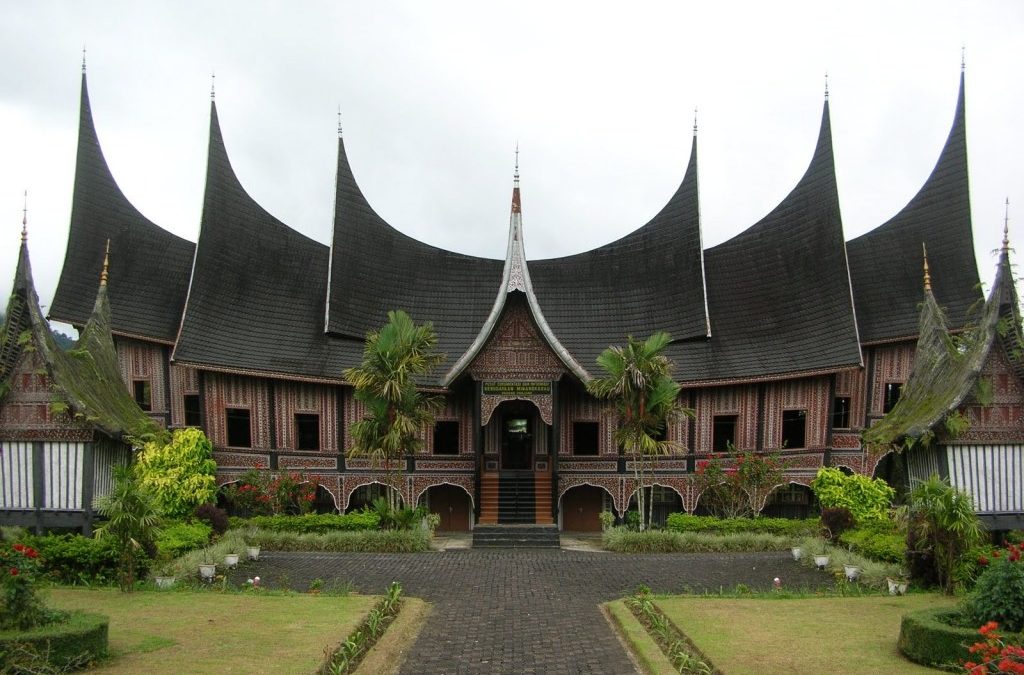
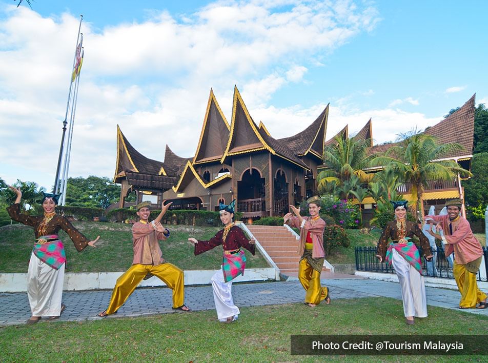
The state’s name is believed to derive from the nine or sembilan villages or nagari in the Minangkabau language that is known as Luak today settled by the Minangkabau, a people originally from West Sumatra in present-day Indonesia. Minangkabau features are still visible today in traditional architecture and the dialect of Malay spoken.
Unlike the hereditary monarchs of the other royal Malay states, the ruler of Negeri Sembilan is elected and is known as Yang di-Pertuan Besar instead of Sultan. The election of the Ruler is also unique among all Malay states. He is elected by the council of Undangs who lead the four biggest territories of Sungai Ujong, Jelebu, Johol, and Rembau, from the legitimate male members of the Pagaruyung Dynasty, with the surviving sons of the previous Yamtuan coming first in the considerations but not being obligatory to be voted on, making it one of the more democratic monarchies.
The capital of Negeri Sembilan is Seremban and the royal capital is Seri Menanti in Kuala Pilah. The Arabic honorific title of the state is Darul Khusus or the Special Abode.
The earliest possible human settlement in Negeri Sembilan can be traced back to the Pasoh Caves, a complex of karst caves near Simpang Pertang. Some of the artefacts found around the caves include stone tools and food leftovers, estimated to be used around 12,000 BC based on carbon dating. According to the Malay Annals, Parameswara reportedly visited the settlement of Sening Ujong, which was located in what is now Seremban.
The Minangkabaus from Sumatra settled in what is today Negeri Sembilan in the 15th century under the protection of the Malacca Sultanate, and later under the protection of its successor, the Sultanate of Johor. They also brought their matrilineal custom, known as Adat Perpatih, with them and made it the local custom. As Johor weakened in the 18th century, attacks by the Bugis forced the Minangkabaus to seek protection from their homeland. The Minangkabau ruler, Sultan Abdul Jalil, obliged by sending his near relative, Raja Mahmud, also known as Raja Melewar. When he arrived, he found that another royal, Raja Khatib had already established himself as ruler. He declared war against Raja Khatib and became the ruler of Negeri Sembilan. The Sultan of Johor confirmed his position by granting the title Yamtuan Seri Menanti or He Who is Highest Lord of the Seri Menanti in 1773.
Negeri Sembilan, at the dawn of her establishment, was originally a loose confederation consisting of nine luaks, hence the name. At the time of Raja Melewar’s accession, it used to cover a larger area than its modern-day boundaries. Besides modern-day Negeri Sembilan, it also spanned parts of what is today Selangor, Malacca, Pahang and Johor. The original nine chiefdoms or domains in 1773 that made up the first incarnation of Negeri Sembilan and gave the state its name are Sungai Ujong, Jelebu, Rembau, Johol, Jelai, Ulu Pahang, Naning, Segamat and Klang. The latter four chiefdoms were annexed into neighbouring states in the 19th century. Naning was annexed into the Straits Settlement of Malacca in 1832 following the Naning War; Ulu Pahang became the Bera region of Pahang, Segamat was annexed into Johor and Klang became the Kuala Langat region of Selangor.
After Raja Melewar’s death, a series of disputes arose over the succession. For a considerable period, the local nobles applied to the Minangkabau ruler in Sumatra for a ruler. However, competing interests supported different candidates, often resulting in instability and civil war. In 1874, the British intervened militarily in a leadership tussle in Sungai Ujong to preserve British economic interests and placed the domain under the control of a British Resident. Jelebu followed in 1883 and Rembau in 1887. The formation of modern Negeri Sembilan began in 1889, when the Seri Menanti domain, under the rule of Tuanku Muhammad, the son of Yamtuan Antah, combined with the domains of Tampin and Rembau, forming the Seri Menanti Confederation as a single political entity. The domains of Sungai Ujong and Jelebu joined this confederation in 1895, forming the state of Negeri Sembilan in its modern borders. Martin Lister became the new state’s first Resident, and Negeri Sembilan became part of the Federated Malay States the same year.
Negeri Sembilan endured Japanese occupation in World War II between 1942 and 1945, joined the Federation of Malaya in 1948, and became a state of Malaysia in 1963. In the 1990s and 2000s, Seremban and Nilai attracted people who moved in from the overcrowded towns of the Klang Valley. These two cities also became the sites of new factories and industrial parks, accelerating the development of the state into modern times. On 9 September 2009, the state capital of Seremban was approved to become a city or a Bandar Raya and Seremban achieved the status of a city on 20 January 2020.
Negeri Sembilan is composed of two vast plains divided by a mountainous spine in the middle, well-drained by various rivers, resulting in the state being bisected into two regions, namely western Negeri Sembilan consisting of Port Dickson, Seremban and Rembau Districts and eastern Negeri Sembilan, which covers the districts of Jelebu, Kuala Pilah, Jempol and Tampin. The western half seems to be more developed and has an intricate and concentrated road network compared to the latter, which is much more rural. Negeri Sembilan is a multiethnic state in which every ethnic group speaks their respective languages and dialects. The state has the highest percentage of Indians compared to other Malaysian states. The Negeri Sembilanese people speak a unique variety of Malay known as Negeri Sembilan Malay or in their native language as Baso Nogoghi. It is not closely related to other varieties of Malay in Peninsular Malaysia but more closely related to the Malay varieties spoken in neighbouring Sumatra especially varieties of Minangkabau. Besides Malays, the Chinese community also speak their languages and dialects. Orang Asli peoples like Temuans speak a language closely related to Malay. Standard Malay is widely used throughout the state.
The Minangkabau people brought along with them a cultural heritage which is still preserved and practised today known as the Adat Perpatih, a matrilineal system of inheritance and administration that is unique to the state. In this system, the husband is the head of the household and inheritance passes from the mother to the daughter. The Minangkabaus in Negeri Sembilan are divided into twelve sukus or clans. Each of these sukus is led by a chief, known as the Lembaga and each suku is broken down into subunits known as the Perut, where each of them is led by a chief, either known as a Buapak if a male or Ibu Soko if female. Both the Buapak and Ibu Soko play a vital role as people to refer to regarding the adat and religious matters among the subordinates of the Perut, known as Anak Buah. Marriage between members of the same clan is forbidden.
For the state of Negeri Sembilan, let’s work our way from the south to the north.

Tampin
Bordering the state of Malacca, Tampin borders the town of Pulau Sebang in Malacca. It is also situated at the southern tip of the longest mountain range in Malaysia, the Titiwangsa Mountains. The state borders between Negeri Sembilan and Malacca is demarcated by the traffic lights across Jalan Besar, as seen from the Negri side of the town.
Tampin gets its name from the container or pouch woven from the pandanus fronds. The container was used to store condiments such as the sticky dessert kelamai or dodol and the shrimp paste, belacan.
Tampin was originally part of the district of Rembau. After the Naning War in 1832, Raja Ali declared himself the ruler of Seri Menanti and his son-in-law, Syed Shaaban, as the ruler of Rembau. This enraged other rulers of Negeri Sembilan as they had no right to the posts. In a civil war in 1834, Raja Ali and Syed Shaaban retreated to Tampin and the area from Mount Tampin to Bukit Putus was removed from Rembau. The provinces of Repah, Keru, Tebong and Tampin Tengah formed the district known as Tampin. Syed Shaaban became the first ruler of Tampin and proclaimed himself the title Tunku Besar Tampin. The district is one of the original confederations of nine states collectively known as Negeri Sembilan, which means Nine States in Malay.0

On 11 March 1889, the Governor of the Straits Settlements, Sir Cecil Smith, held a meeting with the rulers of Jelebu, Sungai Ujong, Rembau, Seri Menanti and Tampin to combine the districts to better manage them under British rule. Tampin, Rembau and Seri Menanti agreed to the proposal and were united as the Seri Menanti Confederation and the newly formed confederation accepted Martin Lister as its first British Resident. After Malaya’s independence in 1957, Negeri Sembilan and its districts started forming local administrative councils.
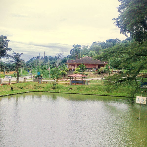
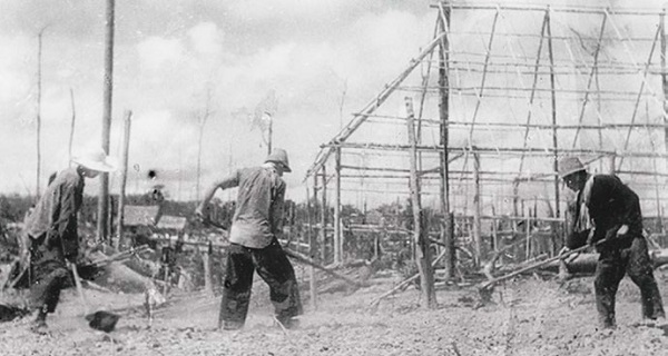
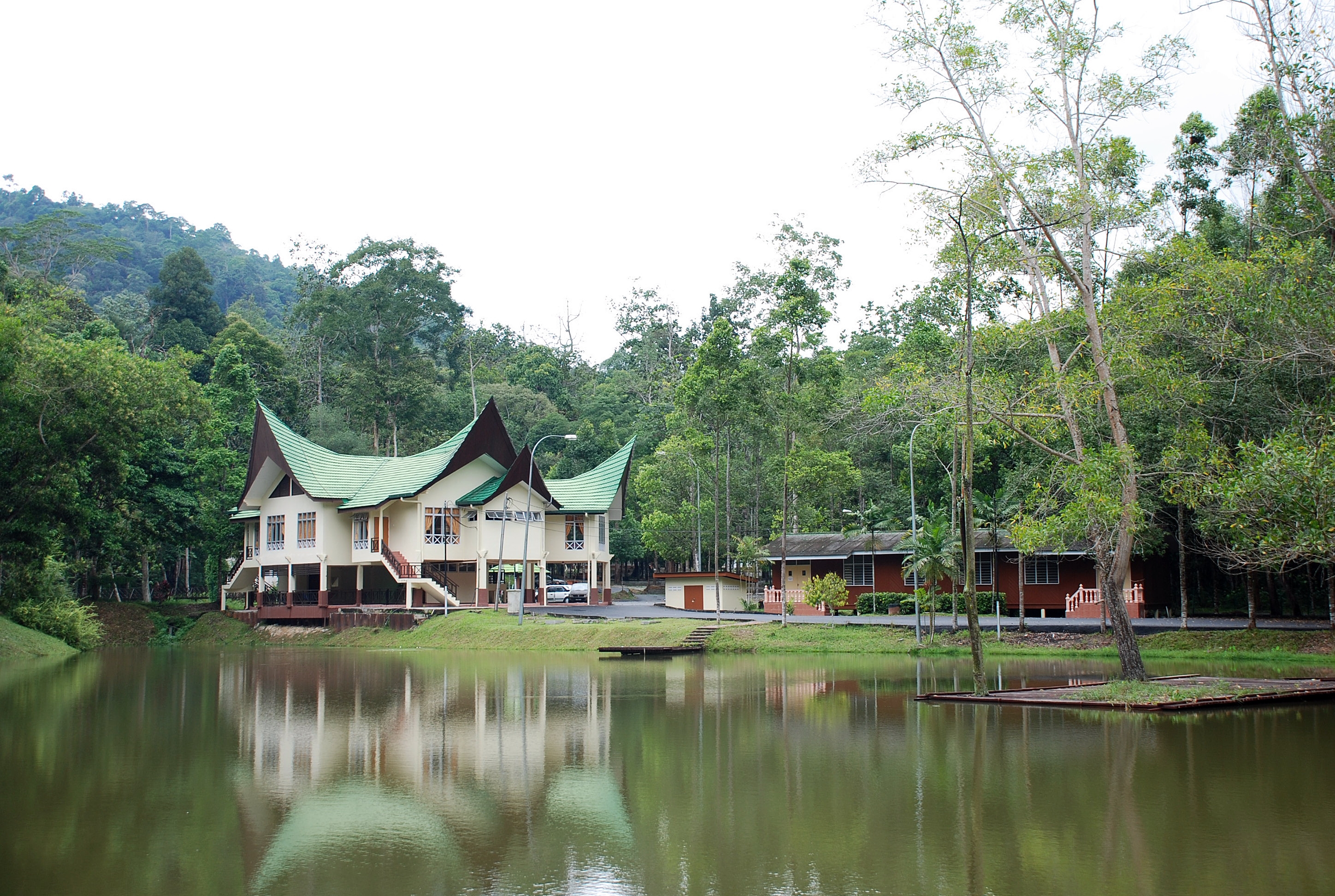
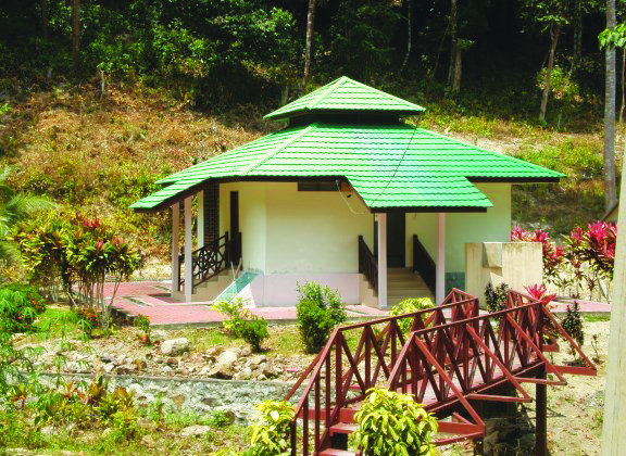
The Tampin Recreational Park is strategically located and consists of a natural lake, along with lush greenery and various facilities such as a children’s playground, badminton courts, tennis courts and jogging tracks. Tampin Square is located within the vicinity of the Tampin Sports Complex and a local favourite. The Tampin Lake Garden is located about 400 meters from the Tampin Lay By and is equipped with a children’s playground, a look-out tower, huts, benches and jogging tracks. An 8-foot marble monument was erected on the Kelamah River to commemorate the war between the Australian and Japanese military advance on 14 January 1941 during World War II.
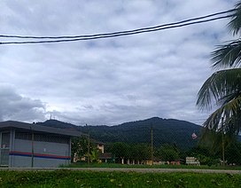
Located in the southern corner of the state, Mount Tampin is the geographical southern terminus of the Titiwangsa Mountains, at an elevation of 764 m. Man-made pools on this mountain allow visitors to enjoy the clean and clear water. The existing 5 km hiking track up to the mountain top will be transformed into a jogging and exercising track as locals frequented this mountain in the evenings and weekends.
The Balai Tunku Besar Tampin is the official residence of the ruler of Tampin, the Tunku Besar. Historically, Tampin used to be part of the district of Rembau before it was partitioned in 1836 when the southern area of Rembau around Tampin was being recognised as a new luak or state with its ruler. Unlike the other luaks in Negeri Sembilan where the ruler is known as Undang Luak, the ruler of Tampin is known as Tunku Besar and the post is a hereditary one.

Tempin is located on the junction between the east and west coast railway lines of the Keretapi Tanah Melayu Berhad’s or KTMB railway network. The Gemas Railway Museum is located in what was the former Gemas railway station, which ceased operations in 2013 after 91 years of service, when the new station building was completed, as part of the electrification and double tracking of the Seremban-Gemas section of the West Coast Line.
Jempol
The largest district in Negeri Sembilan, Jempol borders Jelebu to the northwest, Kuala Pilah to the west, Tampin to the south, Bera and the state of Pahang to the northeast and Segamat and the state of Johor to the east. Jempol is also the meeting point of the Muar and Serting Rivers which played an important transportation role in ancient times. Known historically as Jalan Penarikan, it connected trade posts west of the Malay Peninsula with population centres on the east coast and vice versa.
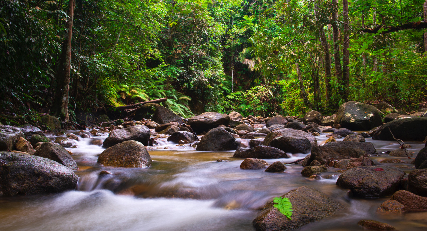
The Ulu Serting Forest Park lies about 8 km from Batu Kikir Town in Compartments 23 and 24 of the Sering Forest Reserve. It is made up of Dipterokarp Pamah and is rich with a variety of flora and fauna. Some basic amenities have been built by the State Forest Department in the form of rest huts, food stalls, and a bathing pond for the comfort of visitors.
The De Bana Forest Park is located in compartment 129 of the Pasom Forest Reserve on the road to Triang Town in Pahang. The forest park got its name from a river that flows through the middle of the forest park, the Bana River. The forest is made up of Dipterokarp Pamah and is rich with a variety of vegetation including wild orchids, and herbs such as Tongkat Ali and Kacip Fatimah. The hilly terrain offers ready-made areas for activities such as jungle trekking and hill climbing. There are basic amenities built by the Forest Department including rest huts, toilets, camping sites, and forest huts.
