
This part will showcase some of the lesser known towns in Nagaland.
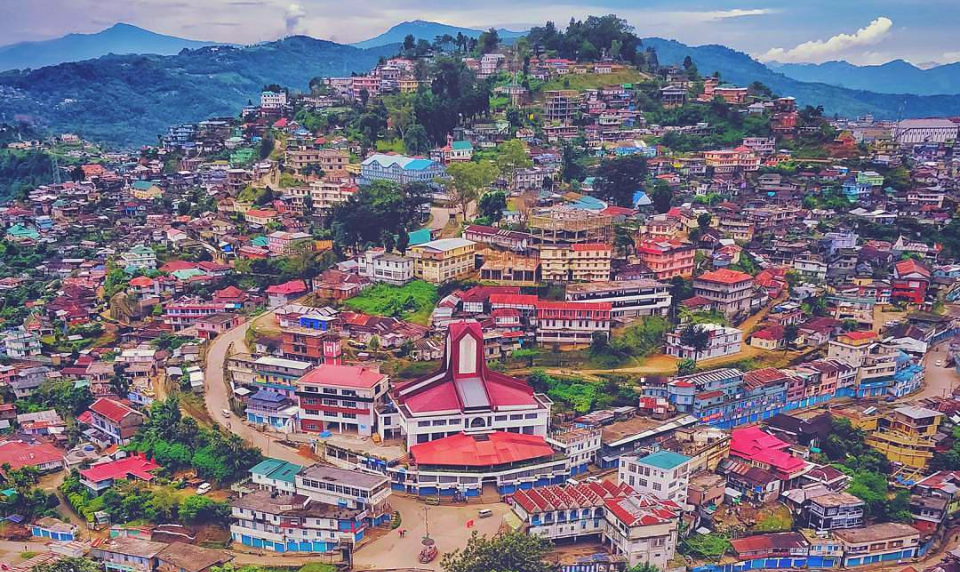
Mokokchung
The cultural nerve centre of the Ao people as well as the most important economically and politically urban centre in northern Nagaland, Mokokchung is the third most important city after Dimapur and Kohima. The intellectual and cultural capital of Nagaland, historically, Mokokchung was one of the first Naga Hills sites where the Assam Rifles, led by the British, established their outposts, then called stockades, in the latter part of the 19th century. Much of the town initially grew around this post located in DC Hil which then gradually extended eastwards towards the remoter parts of the Naga Hills. The popular tourist spots in the area include the District Museum, the Town main Park located just above the Town Centre, the Unman village, which is the oldest and largest in the area and the Ao village.
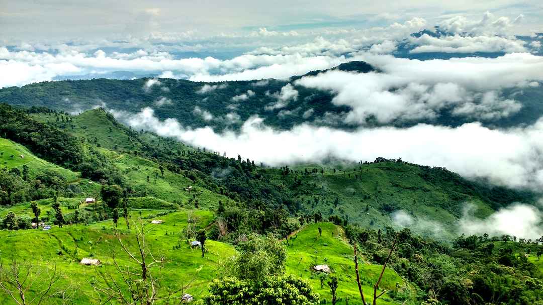
About 18 km southwest of Mokokchung lies the village of Longkhum at an altitude of 1846 m above sea level. An Aos village from the days of the headhunters, the village is strategically located and commands a view of the surrounding hills and valleys with views as far as the eastern Himalayas, Arunachal Pradesh and beyond. The Aos have a belief that Longkhum is the resting place of the spirit of the dead on their onward journey to paradise. Mongzu Ki or the eagle’s eyrie is situated on a high precipice where eagles have nested for centuries and according to Ao mythology, eagles are the manifestations of the spirits of the dead. Mata Yimkong is a beautiful hilltop where once a fortress with the AKM Student Jubilee Tower the highest point at Longkhum. At the Imkongmeren Memorial Site, one can have panoramic views of the Doyang River. The Longlangba Longlangba or the Stone Bridge is a ridge of stones that passes through the Rhododendron woods which has small holes in the rocks that were carved into the stones so that spears could be placed in them and were warning signs to attackers that they would be killed and their heads be taken off. The man-made majang or observatory point is where one can have beautiful views with the backdrop of the Doyang River and the Mongzu-Ki or Eagle’s Cave can also be viewed from here. The legend behind Tangyim Maroksay that the water from this natural spring has the power to heal sickness. During September and early October, Cherry Blossoms bloom along the route to Longkhum. Achen Dang is where wedding ceremonies were conducted.
Ungma Village is the second-largest village in Nagaland and the oldest and largest of the Ao tribe reside here and the village was believed to be the birthplace of the Ao tribe. An old log drum, a Baptist church and an astoundingly pretty park located on the outskirts of Ungma are the famous tourist spots. The Chuchuyinlang Village is renowned for the celebrations of various tribal festivals with the most famous being the Moastu Festival that lasts for 3 days and commences on 1st May.

The Langpangkong Caves are situated between the valleys of Dikhu and Tzula Rivers and near the towns of Tuli and Changtongya. The caves are located in the Langpangkong mountain range and are believed to have given shelter to an Ahom King. The caves of Peren, Fusen kei and Mongzu Ki are the well-known yet unexplored caves of the region.
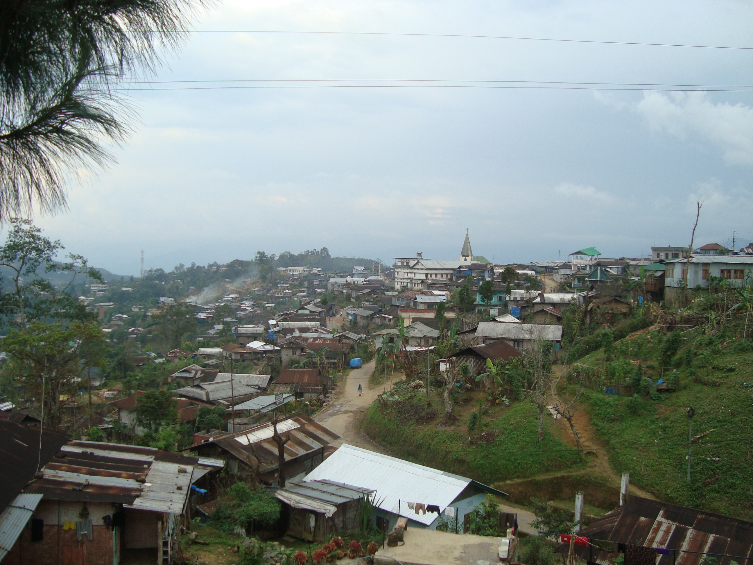
Tuensang
Tuensang was founded in 1947 to administrate the erstwhile North Eastern Frontier Agency or NEFA and lies about 227 km east of Kohima. In 1957, it was merged with the Naga Hills District to form a new administrative unit under the Ministry of External Affairs and later became a part of Nagaland. Tuensang is the headquarters of the Tuensang district, the easternmost and largest district of Nagaland, and has Myanmar to its east. It is also one of the fastest-growing towns in the state.

Noklak is a village situated on the edge of the district which is becoming popular due to its tribal festivals. It is inhabited by the Khiamniungan and is popular for its cane work, handicrafts and artefacts. Longtrok is an ancient village with remnants of the and Chungliyangti civilizations through its six celebrated stone structures. The most important ones are those of Tsongliyangti, Chungliyangti and Chungliyimti and are the most worshipped by the locals. The locals also believe that the Sangtams are the personifications of the ancient God who gave birth to other stones and moved them to different places. Between the town of Tuensang and the Hakchung village lies the very interesting village of Changsangmongko. Legend has it that this place is referred to as Changsang because of the Chang community settled here. The village is renowned for establishing a raised platform named Mullang, which is a symbol of the prosperity and well-being of mankind. An offbeat destination, Tsadang situated in the village of Longtrok is well known for its two ancient stones that picture two friends who regularly visited the village of Longtrok. They are placed in the vicinity of Tsongliyangti and Chungliyangti and are worshipped by the local people.

Phek
The name Phek is derived from the word Phekrekedze which means a watchtower. The district is inhabited by three major tribes, the Kheza, the Chokhri and the Pochury with at least five linguistics groups, namely the Chokri, the Khezha, the Pochury, the Sapu, and the Semas. Phek has moderately warm summers and cold winters. The people are expert craftsmen, excellent in making pots, baskets, sculptures and furniture. Phek is a hilly area rich in flora and fauna and the Shilloi Lake is an important attraction in the area apart from the amazing hills.
A beautiful foot-shaped lake in the heart of the Patkai range, the Shilloi Lake located in Lütsam Village has verdant valleys surrounding it. The lake is considered very important as it is believed that the spirit of a holy child rests in the bottom of the lake and it is one of the reasons why no one fishes or uses the lake water for drinking and irrigation. The four-meter deep lake spreads over an area of 250 to 300 m. There are many legends associated with the lake with one being a baby was found floating in the middle of the lake and two hands were seen bobbing the baby. It is said that the baby is the reigning queen of the lake and that the spirits of the lake are its protectors and so it is believed that no one can drown in the lake with no reported deaths by drowning in the lake. The area is known for its fishing spots with the best time to fish between June and September. The lake is also a haven for migratory birds like Siberian Cranes.

Atop Mt Zanibu near Thuvopisumi village, the Dzudu Lake is surrounded by lush greenery in the middle of dense jungles. The narrow strip of water is also called Zanibu Lake and is a paradise for bird watchers. The Phek Waterfall lies amid natural beauty in the middle of a jungle. One will have to walk quite a bit to reach the waterfall in the jungle.

About 70 km from Phek and 3 km from Pfutsero town, Glory Peak stands 2600 m above sea level overlooking the valley. From the peak, which is a local favourite picnic spot, one can also catch sight of the highest mountain in the world, Mt. Everest.

The small village of Khezhakeno is set amid picturesque surroundings. It is believed that many Naga tribes originated from Khezhakeno and migration led them to the other parts of the region. According to another popular legend, the village has a stone slab from which helps paddy miraculously multiply when placed on any drying land.

Mon
Home to the Konyaks nagas, Mon provides visitors with a unique and mesmerising view of tattooed faces wearing feathery loincloths. The district, except for the foothills, has a difficult terrain with steep slopes. Even though Mon doesn’t have a lot of sightseeing places, but it still attracts many visitors. There are numerous villages close by which offer one a closer picture of the life of the Nagas. Veda Peak and Naganimora are among the famous tourist spots here and one can see a waterfall near the Veda peak, one of the most pristine places in the region. Veda peak is located around 70 km from Mon. Among the few villages in the region that are worth visiting are Chui, Longwa and Shangynu.

Veda Peak is the highest peak in Mon and is located almost 70 km from district headquarters. The peak gives clear and stunning views of the Brahmaputra river as well as the Chindwin river which runs through Myanmar when the skies are clear. The famous waterfall at the peak is also worth visiting. The Angh’s or Chief’s house at Shangnyu Village is believed to be more than 500 years old. Chenloisho Village is one of the biggest villages in the Chen area. Located near the India-Myanmar border, this village has a small museum that houses all kinds of traditional ornaments of the region. Human skulls which are of the head-hunting days are displayed in Waloo. Longwa Village is one of the largest villages in Mon and this village is very interesting because the village lies in both India and Myanmar. The chief or the Angh’s house lies half in India and half in Myanmar. Villagers hold dual citizenship in both India and Myanmar. Four rivers flow through the river, two in India and two in Myanmar and so the natural beauty of the village is worth making the trip there.
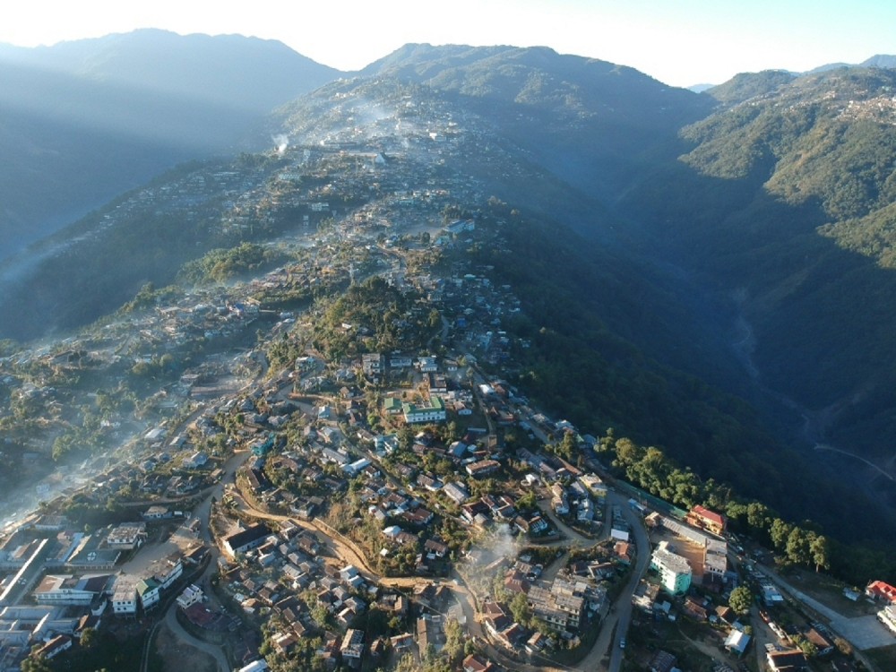
Pfutsero
Pfutsero is the highest-altitude town and the coldest inhabited place in Nagaland with the temperature dropping below zero degrees Celcius during some winter nights and is inhabited mostly by the Kuzhas and Chokris and a commercially important town. The best time to visit is between mid-October which is when harvesting begins and April. The most important festival of the Khezhas is the Tsükhenye festival celebrated in April or May which takes place at the Pfütseromi Village.
This brings us to the end of this wonderful state that I hope I get to visit one day. Let me know in the comments below if you have been here and if I have missed anything that I should put on my bucket list. Check this space for another state soon.
