

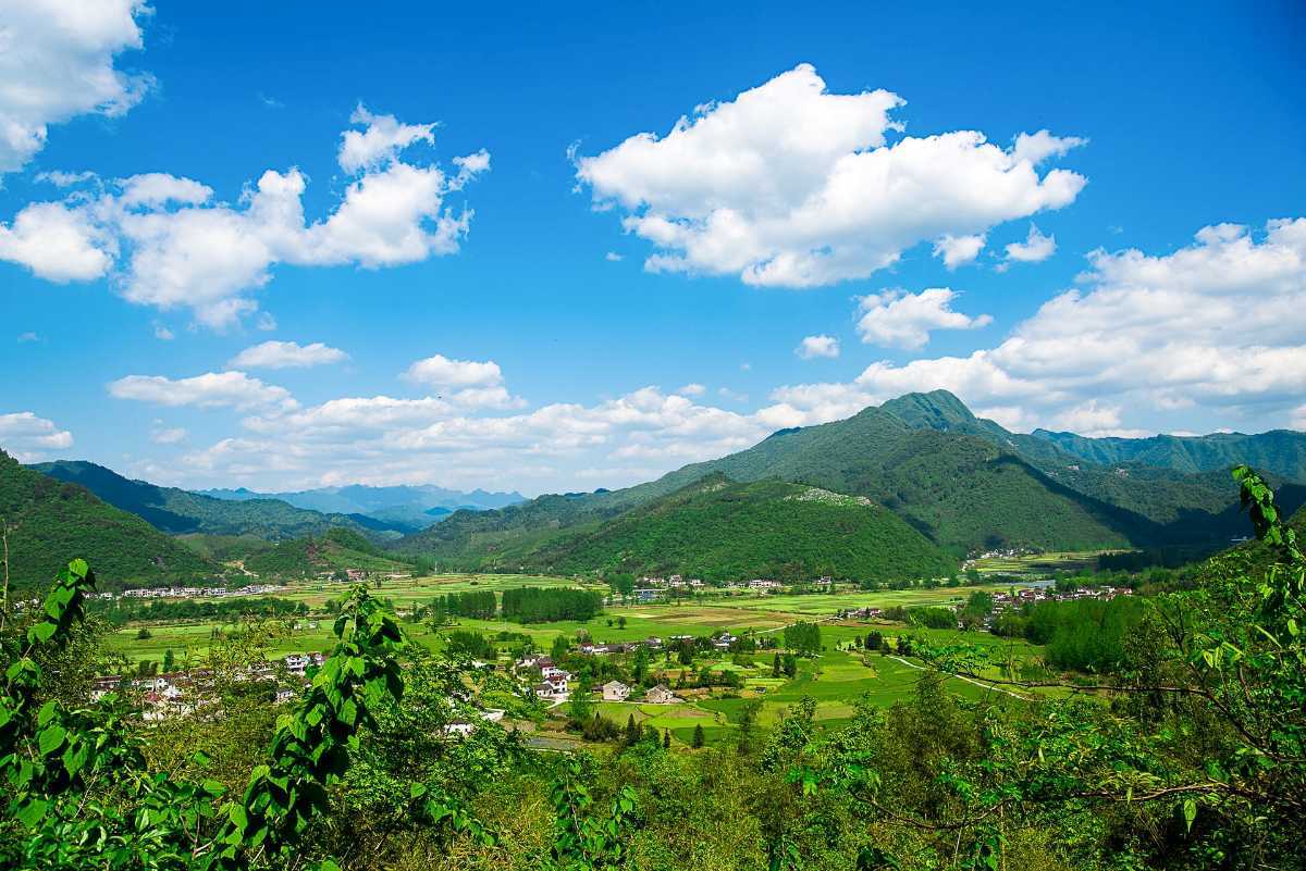
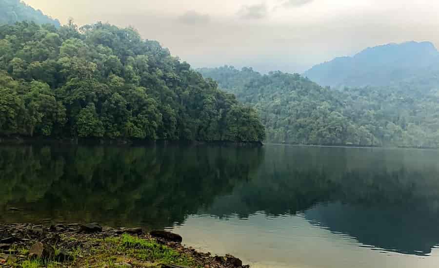
Ziro
Home of the Apa tribe and famous for its pine hills and rice fields, Ziro which lies 109 km north of Itanagar at an elevation of 1688 metres is a quaint old town and a peaceful paradise. The climate in Ziro is mild throughout the year, making it a year-round holiday destination. Ziro is included in the tentative List of UNESCO’s World Heritage Sites for the Apatani cultural landscape.
The Apatani cultural landscape comprises 32 sq km cultivable areas out of a 1058 sq km plateau. The Apatani tribe, which has inhabited this region for centuries, is known for practising ecologically sustainable existential sustenance. The Apatanis have a few unique special characteristic features which differ from other tribes in Arunachal Pradesh and the rest of India. A few of these special characteristic features include practising permanent wet paddy cultivation whereas other tribes practice shifting cultivations called Jhom cultivation and cultivating permanent wetland cultivations whereas other tribes practice dry land cultivations by clearing the forests by burning the jungles. Apatanis once practised the art of facial tattoos.

The Meghna Cave Temple is dedicated to Lord Shiva and is located close to Ziro. The 10-minute climb up the stairs is completely worth it when one reaches the 5000-year old temple 3000 feet above sea level. The temple boasts magnificent carvings and architecture and has amazing views of the area. The self-manifested Shiva Linga at Ziro with a Sfatic as garland and is 25 feet in length and 22 feet in width. This shiva linga is said to be the world’s largest which was recently discovered. Kile Pakho is a viewpoint with unique views on both sides with the Ziro plateau on one side and the snow-laden Himalayan peaks on the other. Ziro’s famous attraction is the trek to the top of the Dolo Mando to view Hapoli town and old Ziro. The hillock is situated on the western side of Ziro on Daporijo Road. Located 3 km from Ziro are pine groves known as Midey which make for an excellent picnic spot and also provide excellent trekking trails.

The 337 sq km Talley Valley Wildlife Sanctuary is home to a wide and exotic variety of flora and fauna. The endangered clouded leopards are also found here and the sanctuary has a spectrum of flora as well which includes silver fir trees, ferns, orchids, bamboo and rhododendron. Established in 1995, it ranges in elevation from 1,200 to 3,000 m and harbours subtropical and temperate broadleaved and conifer forests and have about 16 endangered plants that have survived in this area.
Yinkiong
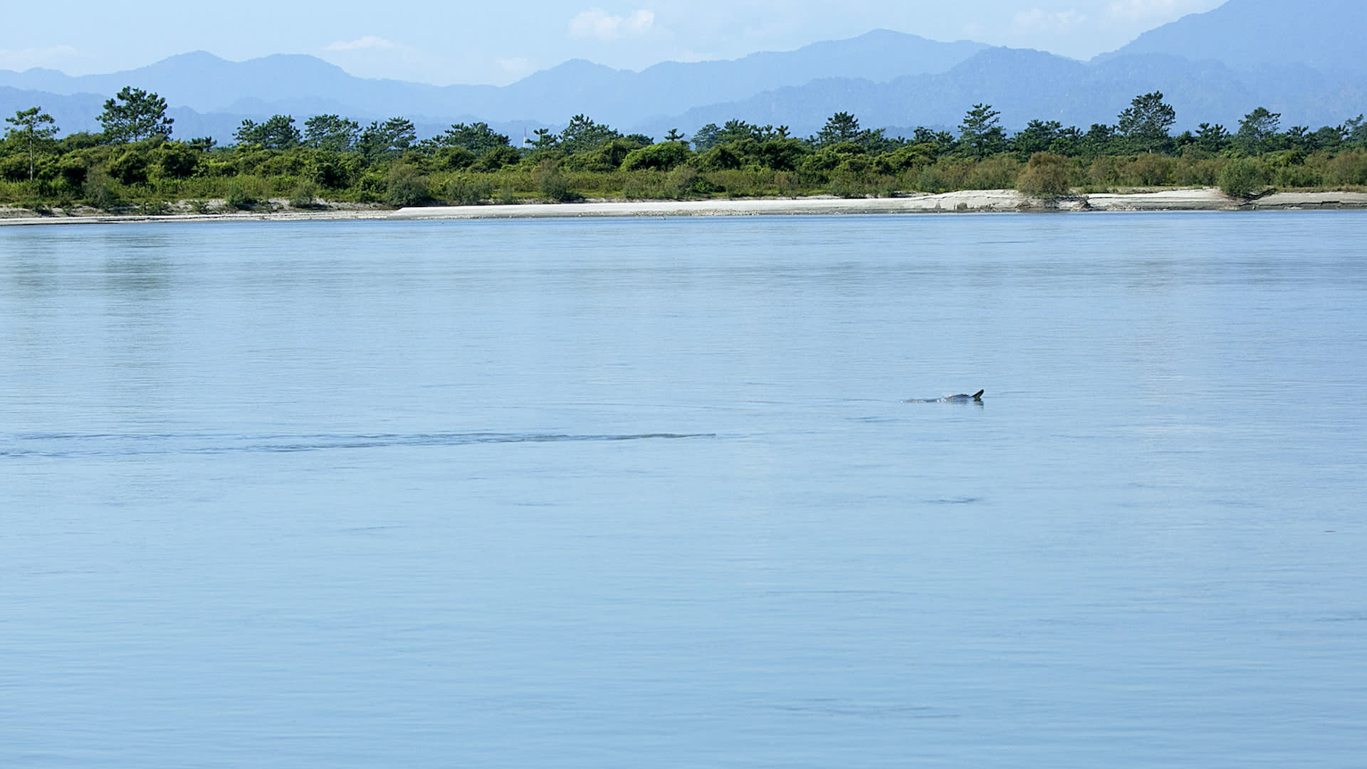
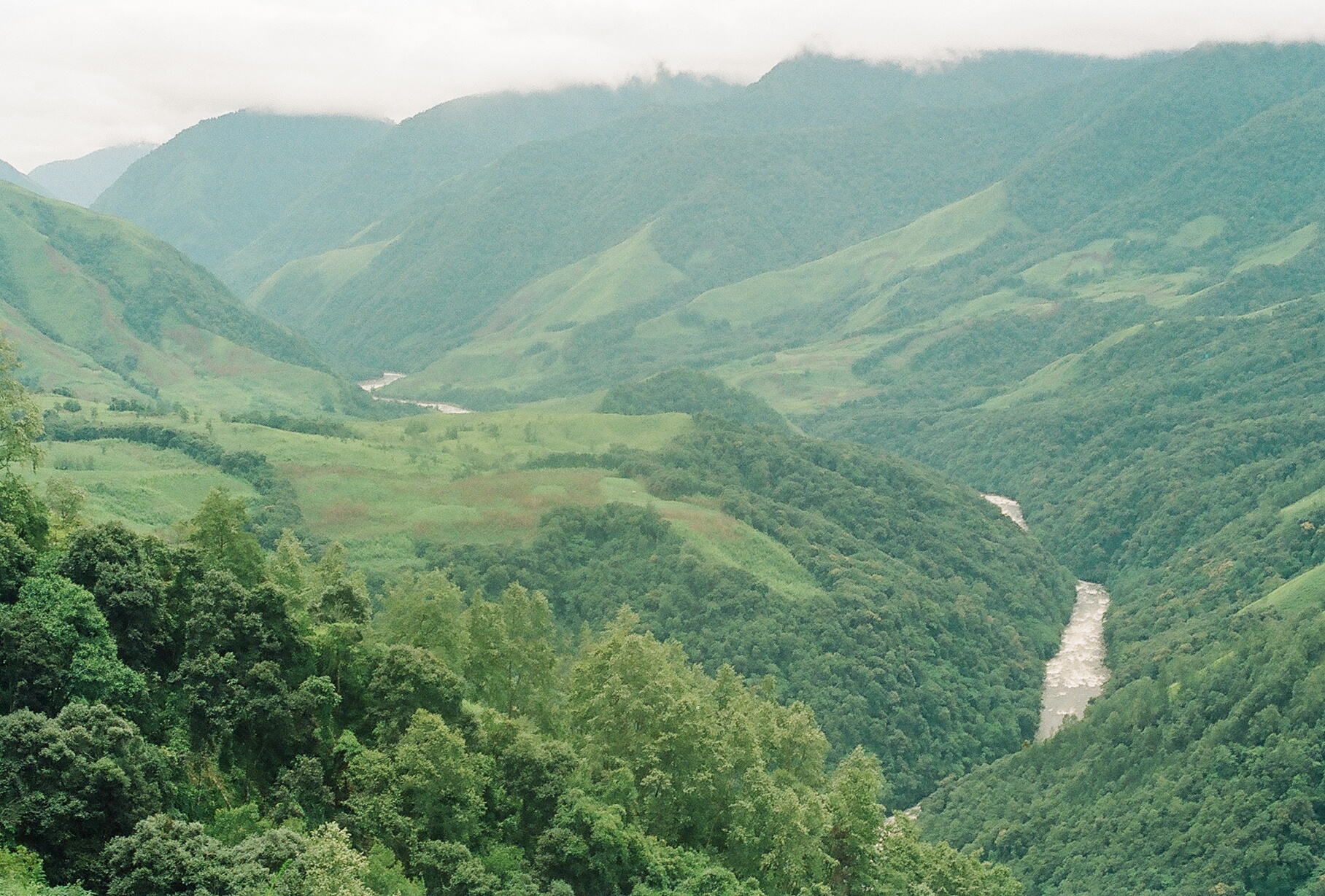
Located about 250 km north of Itanagar, Yingkiong lies just 1 km east of the River Siang. In 1911, following the Anglo–Abor wars, the British gained administrative control of the Upper Siang region. Yingkiong is characterised by its hilly terrains and river valleys and lies about 200 m above sea level. The town gets its name from the River Siang that flows beside and is known for its diverse and colourful ethnic tribes. This region has been inhabited mainly by four tribes, the Adi, the Khamba, the Mishmis and the Memba. The area is also known for its spectacular panorama with dense forests and birds with vibrant feathers.
The Dr Daying Ering Memorial Wildlife Sanctuary is spread across 190 sq km with more than 75% of the sanctuary covered by grassland and surrounded by the Siang river. It is also a bird watcher’s paradise with many endangered species found here. This sanctuary also spreads to Assam where it is known as the Khobo Ehapori.
The Mouling National Park is named after a mountain peak Mouling where Mouling is an Adi word which means red poison or red blood, which is believed to be red latex from a tree species found locally. It was the second national park to be created in the state, after Namdapha National Park in 1972. The Mouling National Park and the Dibang Wildlife Sanctuary are located fully or partly within Dihang-Dibang Biosphere Reserve. Spread across 483 sq km it has the Siang river flowing on the west and the Siring, Subong, Semong and Krobong rivers on the eastern ends. The national park is very isolated and communication is very weak and barely any transportation means. The national park covers an area of about 483 sq km forming the western part of the Dihang-Dibang Biosphere Reserve. Approach to the park is not possible via roads, due to the remoteness of the area and communication facilities in the area are poor. The area around Mouling National park is one of great bio-diversity, with a juxtaposition of different biotopes, and is often called the state’s cradle of biodiversity. With elevations ranging from 400 m to over 3000 m in the park, it forms a transition zone between tropical forests at lower altitudes to the more temperate forests at altitudes above 2800 m. The overall inaccessibility due to poor or no roads and stories associated with the forest itself has kept the core area of the national park relatively untouched by human activities.

Mechuka
The town of Mechukha or Menchukha is a town located about 6,000 ft above sea level in the Mechukha Valley of the Yargep Chu or Siyom River. In the Memba dialect, Men means medicine, Chu means a waterbody and Kha means snow and the town’s name means the land blessed with medicinal snow-fed water. Before the 1950s, the Mechuka valley was known as Pachakshiri. The Line of Actual Control or the McMahon Line between India and Tibet border is 29 km north of Menchuka. The valley is home to the people of the Memba, Adi and Tagin tribes.

The 400-year-old Samten Yongcha monastery of the Mahayana Buddhist sect is a contemporary of the much-revered Tawang Monastery. Numerous ancient statues can also be found here. A new giant flying squirrel was discovered here which was named Mechuka’s giant flying squirrel Petaurista mechukaensis. The IUCN Red List has classified it as a Data Deficient species.
The Namdapha National Park is a 1,985 sq km protected biodiversity hotspot in the Eastern Himalayas with more than 1,000 floral and about 1,400 faunal species. The national park harbours the northernmost lowland evergreen rainforests in the world at 27°N latitude and extensive dipterocarp forests, comprising the northwestern parts of the Mizoram-Manipur-Kachin rain forests ecoregion. The fourth-largest national park in India, Namdapha was originally declared a Wildlife Sanctuary in 1972, then a National Park in 1983 and became a Tiger Reserve under the Project Tiger scheme in the same year. Its name is a combination of two Singpho words where nam means water and dapha means origin and the name means the river that originates from the Dapha Bum glaciers.

Located near the international border with Myanmar, the park is located between the Dapha bum range of the Mishmi Hills and the Patkai range with a wide elevation range between 200 and 4,571 m and is crossed from east to west by the Noa Dihing River that originates at the Chaukan Pass, located on the Indo-Myanmar border. The Namdapha flying squirrel was first collected in the park and described. It is endemic to the park and critically endangered. The best time to visit the park is during the winter season because the humid subtropical climate keeps the winters mild. There is also a museum called the Miao Museum where visitors can get to see genuine animal specimens from the forest and also gain insights into the life of the villagers.
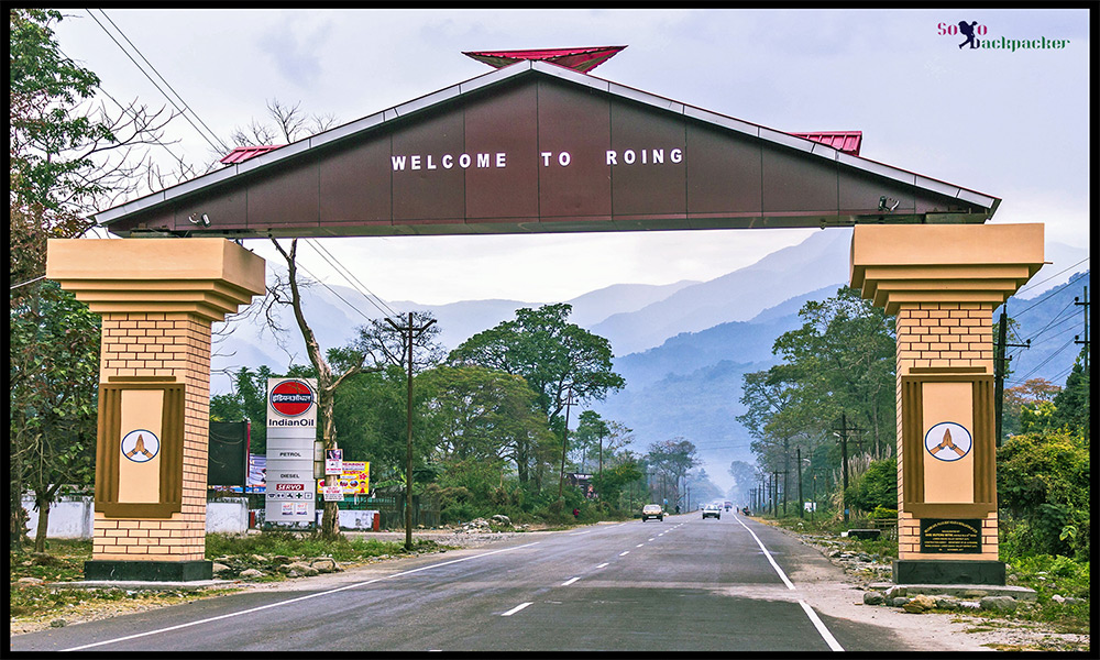
Roing
The last major township in India’s northeast, at the foothill of the Mishmi Hills, Roing lies about 350 km east of Itanagar. A natural haven with snow-peaked mountains, deep gorges, turbulent rivers cascading down the hills, numerous waterfalls, placid lakes and archaeological sites Roing is an ideal tourist destination. Located in the Lower Dibang Valley, it is home to the Adi-Padam and Idu-Mishmi tribes. The Reh festival of the Idu Mishmi is celebrated in February while the Solung festival of the Adi is celebrated in September.
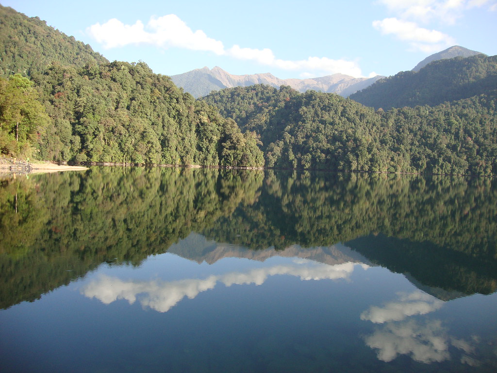
The enormous Mehao Lake is located within the Mehao Wildlife Sanctuary and about 14 km from Roing at a height of almost 3000 m and covers an area of nearly 4 sq km. The lake attracts a lot of seasonal birds and provides an ideal trekking experience and is a photographer’s delight. Because the lake is low in nutrients, there are no fish in the crystal clear lake. Trekking the small pathway leading to the lake through the virgin forest is a wonderful experience. Salley Lake is also a part of the Mehao Wildlife Sanctuary and a popular scenic spot. There are many varieties of fish in the lake which lies about 3.8 km from Roing. Itapakhur and Padum Pukhri are is a historical brick built ponds, located in Ithili village, are two famous ponds where lotuses bloom in October and November. The Kampona Pond is believed to have been the abode of the Naga King and the pond’s name translates to good looking or beautiful in the Adi dialect. Famous for fishing and angling, the Iphi Pani Ghat has amazing views of the Dibang river and valley.
Located on the banks of the Deopani River, the Nehru Van Udyan houses an exciting cactus house, an orchid area and a beautiful garden. A guest house located close to the garden is an excellent place to view the Deopani River. The park has a well-maintained garden and a few hundred meters from here is the confluence of rivers Eje and Eme.

Also called the Chimiri Fort, Rukmini Nati is located in the heart of the Chimiri Village, some 10 km from Roing and is believed to be built in the 14th century. Built with burnt bricks in the 12th century, the Bhashmaknagar Fort is an important and oldest archaeological site in the state. Various artefacts like potteries, terracotta figurines, terracotta plaques and decorative tiles that were found during its excavation process reflect upon the forward state of civilization at that time. It is believed that Rukmini, the consort of Lord Krishna is from this region, but there is no evidence to support that. The ruins of the fort which are about 30 km southeast of Roing remain and are an ideal trekking route and birdwatchers’ paradise. The remains are generally ascribed to the rule of the Chutias, a Bodo-Kachari or Tibeto-Burmese ethnic group that ruled over the region of Sadiya from the 11th to the 16th centuries. The fort, with its fortifications and buildings, is built of fired bricks. The Mipi Pene Centre was established in the year 2017 to preserve and promote the Igu system of the Idu Mishmi tribe. Mipi Pene refers to the Igu or the shaman and the centre was inaugurated in 2018.
Hunli is a small quaint town about 2 hours from Roing on way to Anini. Hunli is famous for trekking and the Temple cave at Kupunli.

Located about 56 km from Roing, the Mayodia Pass lies at an elevation of 2,655 m above sea level. Mayodia is a combination of two Idu-Mishmi words: Mayu which is the name of the mountain and Dia meaning the peak of the mountain, which makes the pass the peak of the Mayu Mountain. It is a popular local tourist attraction due to the snowfall it receives during winters.
Known as the real ocean of green paradise on Earth, the Mehao Wildlife Sanctuary is a virgin forest left largely untouched and unexplored with a large number of animals, plants, birds, fish, butterflies and reptile species. The Mishmi Hills are a birdwatcher and wildlife enthusiasts delight. The region boasts of so many rare species found only in this region in the entire Indian sub-continent. The medicinal plant Coptis Teeta or the Mishmi Teeta, an endemic species and the Taxus baccata are available here. The area is also rich in orchid varieties.
The Dihang-Dibang or Dehang-Debang is a biosphere reserve constituted in 1998. One of the eight wildlife sanctuaries in Arunachal Pradesh, the Mouling National Park and the Dibang Wildlife Sanctuary are located fully or partly within this biosphere reserve which spreads over three districts: Dibang Valley, Upper Siang, and West Siang and covers the high mountains of the Eastern Himalayas and the Mishmi Hills. This Biosphere Reserve has natural vegetation stretching in an unbroken sequence from the tropics to the mountain tundra. The reserve is rich in wildlife with rare mammals such as the Mishmi takin, the red goral, at least two sub species of the musk deer, the rare Sclater’s monal and Blyth’s tragopan, amongst others.
Tirap
Located in the southeastern part of the state about 336 km east of Itanagar, Tirap shares a state border with Assam and an international border with Myanmar. The town with its gushing rivulets, green and vibrant orchards and fresh air heals the mind and soothes the soul. The name Tirap is derived from the River Tirap which originates from a high peak in the Laju Circle and flows from the southeast to the northeast before joining the Buri-Dihing river near Ledo in Assam.
Since ancient times, Tirap has been inhabited by indigenous tribes. Japanese troops invaded and controlled the area for a brief period in 1945, until the collapse of the Japanese Empire. Recently, Tirap has been a major target for the NSCN, a Naga rebel group that aims the creation of Greater Nagaland, using military force.
