
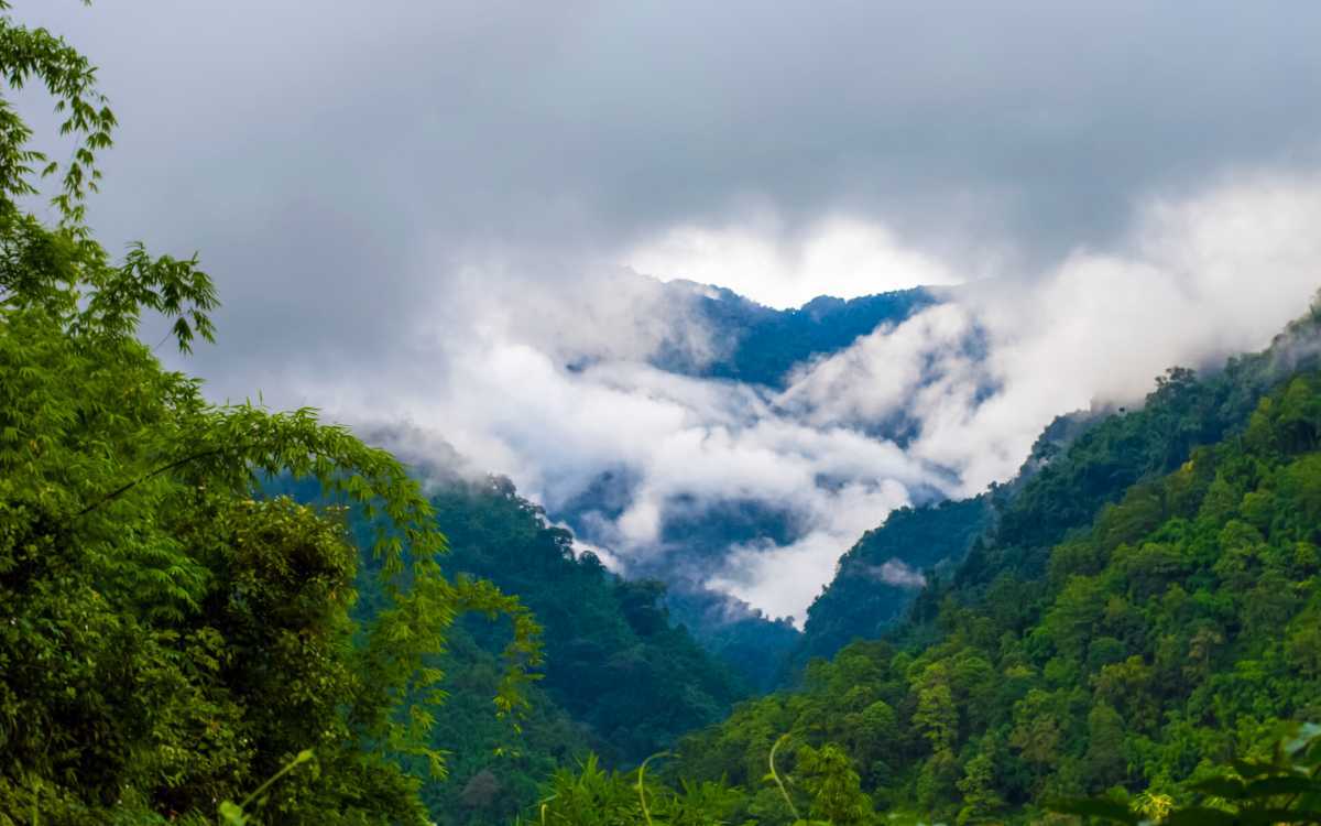
Khonsa
A hill station in a valley surrounded by the Himalayas, Khonsa was created during the British colonial rule. It borders Myanmar to the east and Assam in the south and is surrounded by panoramic views of thick forests fringed by hills. Located about 300 km east of Itanagar, Khonsa lies in the Tirap Valley at an average elevation of about 1,215 m above sea level with streams, deep gorges, dense forests and snow-clad hills.
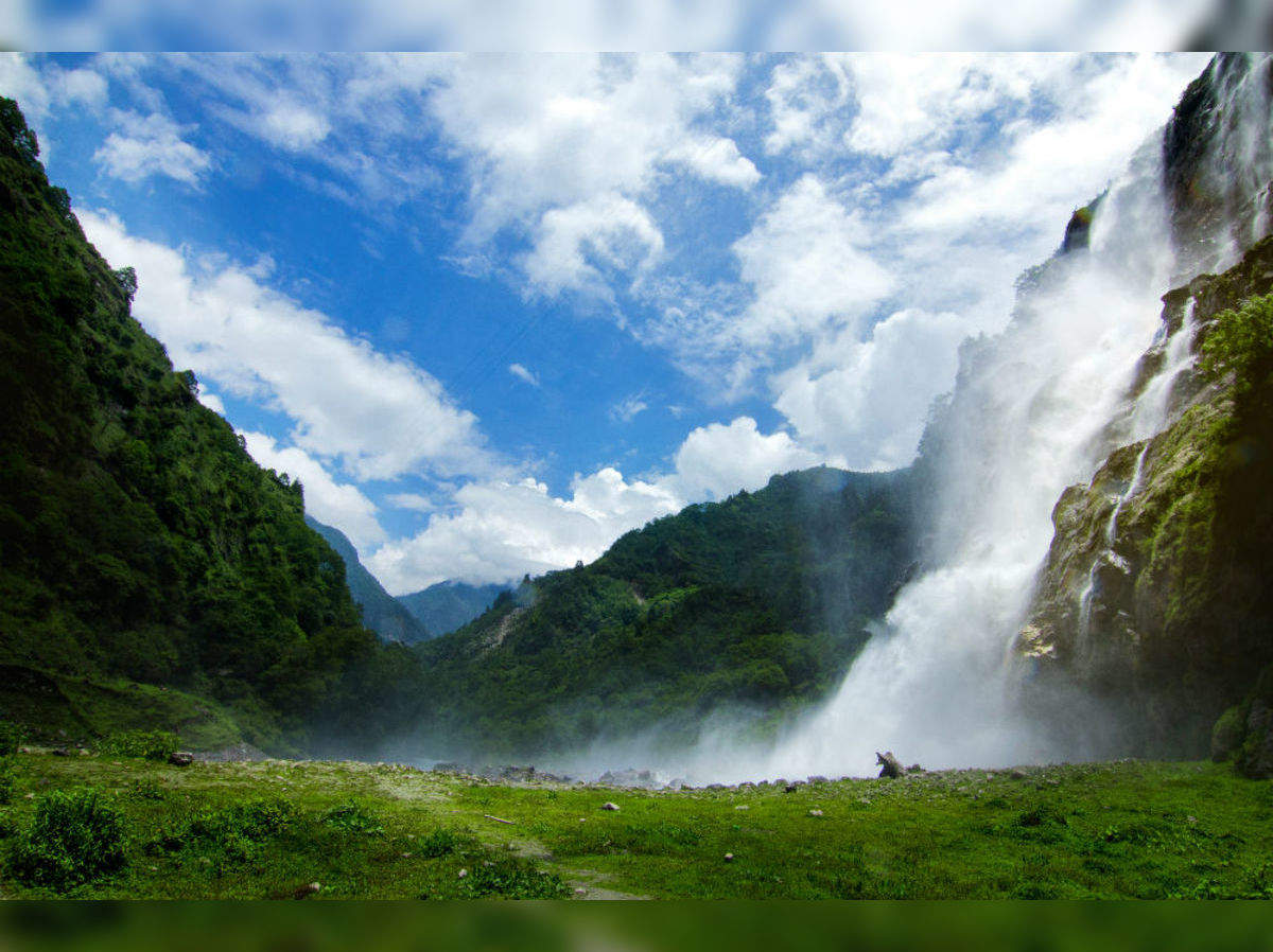
The Khonsa Museum was built in 1956 and houses some amazing artefacts representing the diverse culture of the region. Other than swords and other weapons on display here, one can also find handlooms and artefacts that represent the culture of various parts of India as well as various types of cane and bamboo works. The Kheti and Lajo villages are tribal villages, home to the Nocte, a Wancho tribe that makes up the majority of Khonsa’s inhabitants. Human skulls from the times when the tribes headhunted are hung in the village dormitories to reflect their past. The Khonsa waterfall is located in a dense forest, just a few km from Khonsa and has magnificent views of the forest. The way to the waterfall is very difficult and challenging and it can be only reached with the help of a local guide.

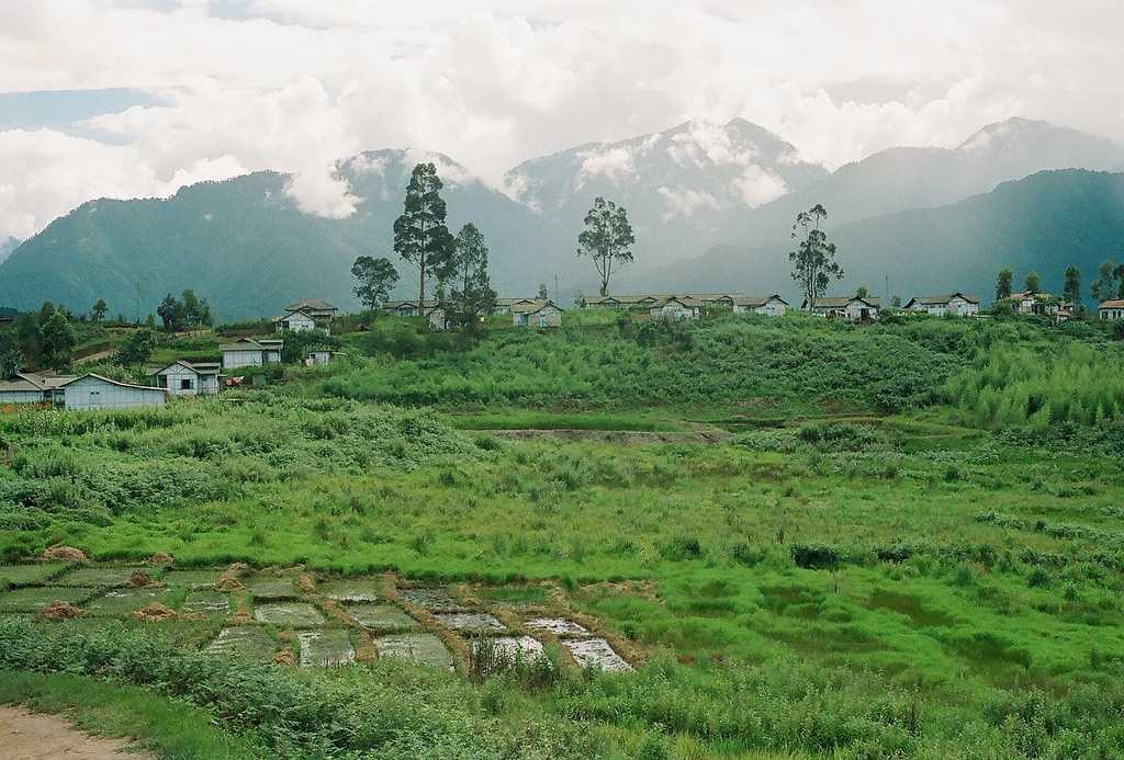
Changlang
Due to the presence of crude oil, coal and mineral resources other than tourism and hydropower, Changlang which lies 324 km east of Itanagar has become an important town in the state. Changlang shares an international boundary with Myanmar and is best known for its bio-diversity and scenic beauty and unique culture.
Visible from the Pangsau Pass, 12 km from Nampong, the Lake of No Return has this name due to the many who perished here. The spot was used for a soft landing for fighter planes during times of war after being hit by enemies with many soldiers losing their lives in the process. Depending on the weather, Nampong has been nicknamed the Hell Pass because of the difficult terrain that worsens during the monsoon season. The Indo-Myanmar border is just 12 km from Nampong where the Lake of No Return is visible. Also known as Ledo Road, Stilwell Road is a historic road as it was connected by the Americans during World War II to connect Ledo to Changlang. The route of the entire road is quite circuitous and covers a challenging path. Popularly known as the Jairampur Cemetery, the World War II Cemetery is located some 25 km from the Indo-Myanmar Border and is where soldiers who died during World War II died. Most of the graves are those which belong to the Chinese, Indian, Kachin and British soldiers, but many graves have been destroyed by wild elephants today.

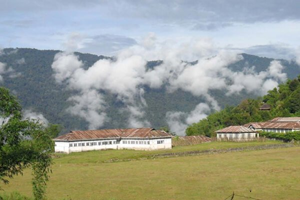
Miao
Situated 165 km east of Khonsa and about 350 km east of Itanagar, Miao is where Tibetian refugees settled down. It is also the gateway to the Namdapha National Park and an ideal spot for hiking, angling and trekking. The Patkai Bum mountain range, which is an Eastern extension of the Himalayas is what Miao is famous for and the main attractions of the town are the mini zoo and museum. There is also a Tibetan refugee settlement which sells lovely woollen carpets and the tea plantations and opium cultivation farms nearby are also popular.
Anini
A small underdeveloped remote town, Anini lies about 583 km northeast of Itanagar. The Idu Mishmi tribal people constitute a majority here. Anini’s name may have come from Inini or Innini with historical maps of Arunachal Pradesh from times before the Lower Dibang Valley district was carved out of the Dibang Valley District and before Roing was established, indicate the capital of the Dibang Valley District being Inini which have come from the Idu word Inni who is the Idu Mishmi’s supreme deity or God.
The native Idu Mishmis and other tribes were said to have migrated from ancient Tibet in the 1st century. Anini’s importance grew during World War II when supplies and troops needed to be sent to China through the Ledo Road in Assam. In 1947, Anini became a part of India, but became part of the disputed territory claimed by both India and China in 1950. Most of Anini is located on a miniature plateau between two tributaries of the Dibang river, the Dri and the Mathun rivers. The town is located on the Eurasian Plate, about 420 miles north of the junction of the Indian and the Eurasian Plates, which makes Anini earthquake-prone. The Mehao Wildlife Sanctuary nearby is a must-visit while in Anini. Anini is an important stop of the Arunachal Helicopter Service. The service connects the town to the rest of the state as well as to the Dibrugarh airport in Assam. The town is a major stop in both the Eurocopter Dauphin and the MI-172 helicopters’ schedules.
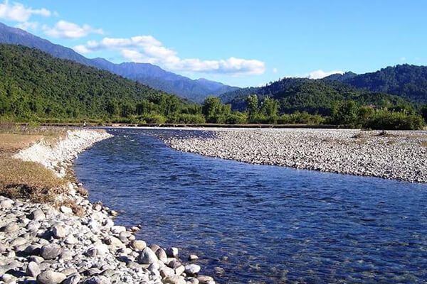
Pasighat
Situated at the eastern foothills of the Himalayas at 155 m above sea level, Pasighat is Arunachal Pradesh’s oldest town. Also known as the Gateway to Arunachal Pradesh, Pasighat is located about 265 km northeast of the capital of Itanagar, the town is also an Advance Landing Ground or ALG of the Indian Air Force.
Pasighat was founded in 1911 by the British colonial government as a gateway to the administrative convenience of the greater Abor Hills and the north area in general and settlements of Adi tribesmen still live in the villages in and around Pasighat. The town is home to the River Brahmaputra which flows down from Tibet and is a photographer’s delight.

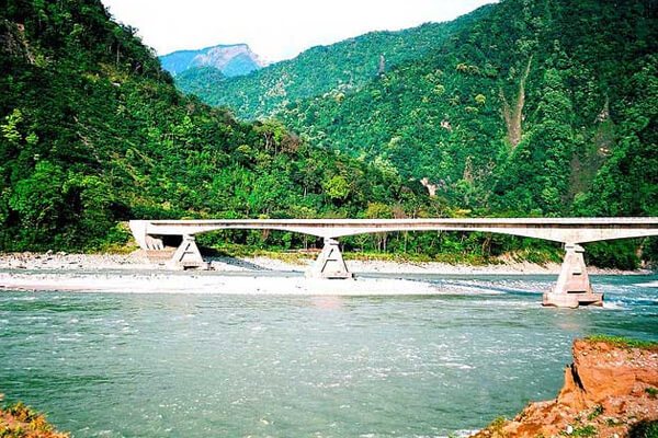
A hanging bridge on the Siang River attracts a lot of tourists around the year. Spread over an area of 190 sq km, the Daying Ering Wildlife Sanctuary is covered by alluvial grasslands which form the major area and wooded areas constitute about 15% while the remaining area or about 25% is covered with water bodies and hence attracts many migratory birds from Mongolia and Siberia. The sanctuary itself is surrounded by the Siang or the Brahmaputra River and is home to many endangered bird species.
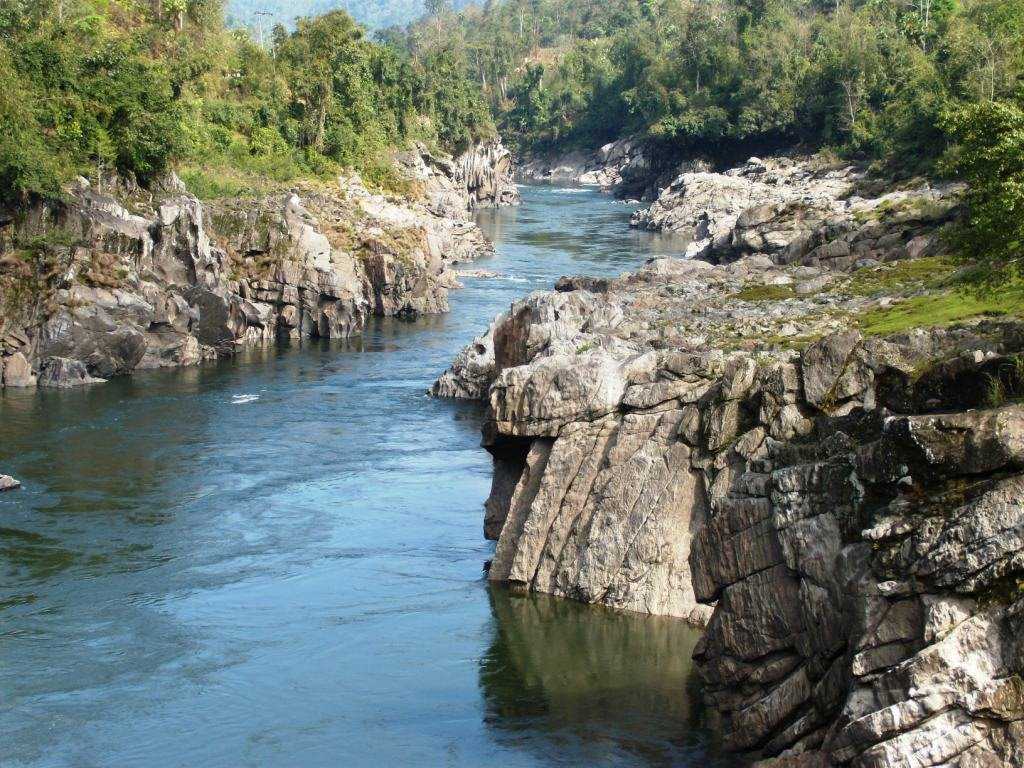
Around 60 km from Pasighat is where the green water of River Siang meets the blue water of River Siyom and presents a marvellous sight. This is Pangin where one can find many rare plants and herbs of medicinal importance. Kekar Monying is a mountain cliff near Rottung and an important historical place. In 1911, it was here that the Adi tribesmen put up a strong fight against the British. The war was a part of a punitive expedition undertaken by the British for murdering Noel Williamson, a political officer in the previous year by Matmur Jamoh, a native of Yagrung village. Komsing, a village on the left bank of the Siang is the place of Williamson’s murder. A stone epitaph bearing the name of Noel Williamson still lies near the Siang. Komlighat used to be a river port and the ghat marks the area of the colonial town of Pasighat which has been submerged into the Siang river following a flood and the river changing its course. Today, it is a popular evening spot providing a wonderful view of the river and the hills surrounding the Pasighat plains.

The Pasighat Buddhist Temple is located opposite the airstrip and serves as the only Buddhist worship place in Pasighat. The East Siang District Museum also located nearby is the district museum. Pasighat also houses the headquarters of the Adi Baane Kebang, which acts as the de facto cultural parliament governing the cultural, linguistic and traditional aspects of the Adi people.
Aalo
Formerly known as Along, the town of Aalo lies about 365 km northeast of Itanagar and about 220 km from Likabali, at the border of Assam and Arunachal Pradesh. It is also an Advance Landing Ground or ALG of the Indian Air Force. Lying close to several tiny villages, this small town is situated at the congregation of the two rivers, the Sipu and the Yomgo. With blooming orchards of oranges and pleasant cum cool weather, Aalo is best visited in the winter season. River Rafting is a major activity in Along on the Sipu and Yomgo or Siyom Rivers which flow within Aalo. The Kamaki Hydropower Dam should also be visited to take in the gorgeous views from the dam. The Ramakrishna Mission runs a beautiful missionary school in Aalo which is exceedingly pretty and well kept. The Darka Village is a major attraction, especially during the famous Mopin Festival. The village has three rivers running through it making it beautiful.
Daporijo
Daporijo is a small town on the way from Ziro to Aalo and lies about 270 km northeast of Itanagar and about 165 km northeast of Ziro and about 160 km southwest of Aalo. A small scenic town, Daporijo is situated 600 meters above sea level with the beautiful Subansiri River, a tributary of the Brahmaputra River, flowing through the town. The town is known for its varied ethnic cultures like the Tagin, the Galo the Hilmiri and the Mishmi who are believed to have existed since ancient times. Originally Dapo referred to the protection or a barrier against the epidemic or evil spirits while Rijo stood for the valley, so Daporijo means the valley which stops diseases or evil spirits.
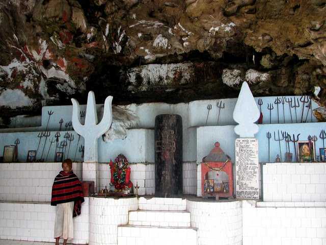
The Meghna cave Temple is dedicated to Lord Lakulisha who was the 28th embodiment of Lord Shiva and the temple is especially crowded during the Maha Shivaratri festival. The temple has some Sanskrit scriptures inside and is well known for the spectacular views surrounding the cave. With beautiful green surroundings and wild animals wandering around, the Kamala Forest Reserve is a protected forest area near Daporijo and is a favourite spot for bird lovers. The Daporijo Good Shepherd Church is a beautiful catholic church under the Itanagar diocese, controlled by tribal bishops. The Subansiri River offers visitors to do rafting which should not be missed.

Anjaw
Located 450 km northeast of Itanagar, Anjaw borders China in the north. India’s easternmost district, Anjaw is also the second least populous district in the country. During the 1962 war, parts of Anjaw were briefly occupied by China and being part of a disputed border region, the area always has an Indian military presence. The Mishmi, and the Zakhring or the Meyor as they were formerly known are the main tribes here. The area is rich in wildlife with some rare mammals and birds found in the region. The small offbeat town is rich in greenery with gleaming waterfalls, beautiful river streams and pine forests.
Kibithoo is located about 100 km northeast of Anjaw about 1305 meters above sea level on the right bank of the River Lohit. Inhabited by the two main tribes of the Zedkring and the Mishmi, the town is surrounded by rivers, waterfalls, and dense forests of pine and berries and makes for a relaxing getaway. Hawai and Hayuliang are two small towns close to Anjaw. Hawai in the Mishmi language means pond and is located 1296 meters above sea level. Hayuliang means a place of my liquor in the Mishmi language and is located 750 meters above sea level and is blessed with gorgeous views of the convergence of the Dalai and the Lohit Rivers.
Walong in the Mishmi dialect means a place full of bamboo and is situated 1094 meters above sea level on the west bank of the Lohit River. Walong holds great historical importance because many Indian soldiers lost their lives here during the 1962 war. Just 20 km from the Indo-Sino border, the town has had a massive Chinese influence. The Namti Valley has a memorial built to commemorate the fallen soldiers of the 1962 war. About 7 km from Walong lies Dong on the left bank of the Lohit River and experiences the earliest sunrise in the country. Numerous pine trees surround this town which is enriched with lush greenery. Situated on the left bank of the Dalai River, 1258 meters above sea level, Chaglogam is a great place for different adventure sports like trekking, angling, rafting and mountain climbing.
Tezu
Arunachal Pradesh’s fifth-largest town and one of its most developed, Tezu lies about 346 km northeast of Itanagar. The recently constructed airport at Tezu will be the first civilian airport in the state. Tezu also has a sizeable population of Tibetan community of about 1500 mostly residing in a settlement known as locally as Lama Camp which is located in Tindolong about 6 km from Tezu. Tezu’s beauty is in full bloom during the festival of Makar Sankranti in January as there is a grand celebration organised by the Mishmi tribe called the Tamladu Festival. People also take a dip in the holy water of the Parshuram Kund in the belief that all their sins get washed away. According to legend, when Parshuram was ordered by his father to kill his mother he threw the axe with a great fury that lead to the formation of this pond and the crack in the earth eventually became the source of the Lohit River
And so we come to the end of a very intriguing and special state, one that I am hopeful I can make a trip to visit and experience.
