

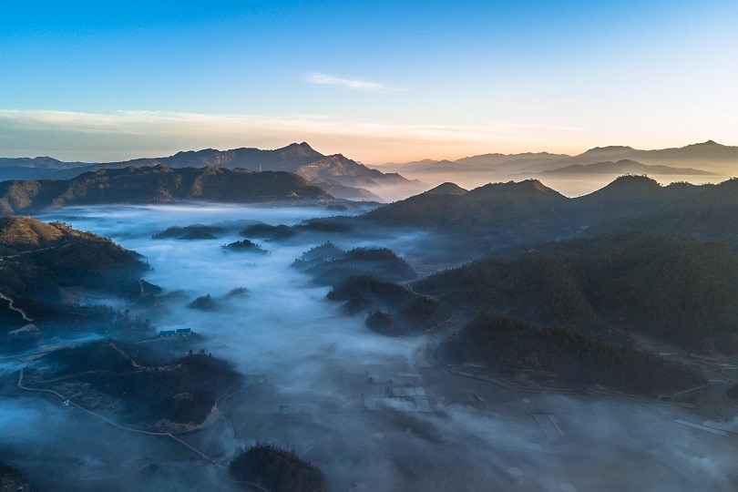
Murlen National Park
Located about 250 km east of Aizwal, the Murlen National Park is close to the Chin Hills, north of the Lengteng Wildlife Sanctuary. The park covers an area of approximately 200 sq km and the tropical, semi-evergreen, and submontane forests of Murlen are home to a rich variety of flora and fauna. About 15 species of mammals, 150 species of birds, 35 species of medicinal plants, two species of bamboo, and four species of orchids have so far been recorded in this park. Murlen National Park is located at Murlen village, which is the village of Saithuama Sailo, the Chief of Hnahlan and is a part of the Hnahlan Village. Murlen was declared a National Park in 1991.
Only about 1% of the sun’s rays can penetrate the forest on a sunny day. So the forest cover in the park can generally be compared to the Amazon region in South America. Some of the trees found in the park are 350 years old and there is an area in the park where the sun’s rays cannot penetrate. For this reason, the area has been known as the losing area of seven fellow men or the land of no return. Two species of Ceropegia belonging to the Asclepiadaceae plant family have been discovered in Murlen National Park. The national park is famous for housing animals like the hoolock gibbon, and the Himalayan Black Bear as well as leopards, tigers, and many other species.
Phawngpui
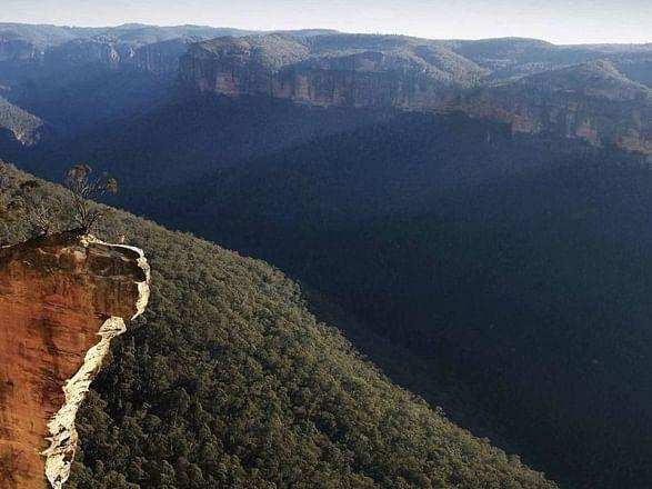
A quaint and serene village located about 300 km south of Aizwal at an elevation of 2157 m, Phawngpui proffers picturesque views surrounded by verdant trees and lofty mountains. Also known as Blue Mountain, Phawngpui is the highest mountain peak in the Mizo or Lushai Hills. It is in the southeastern region near the Myanmar border. A trek to the top of the mountain will provide amazing views of the whole place which will make one feel as if they are in heaven. The ideal time to visit Phawngpui is between November and April when the weather is pleasant and a cool breeze flows. There is a semicircular series of cliffs on the western side called Thlazuang Khàm, which have a sharp and deep fall; mountain goats live there. These cliffs are believed to be haunted by spirits. On the peak, there is a level ground of about 2 sq km in area.
A highly revered peak, considered to be the abode of local deities, Phawngpui was a major centre of folk religion and a location for folklore stories. The name is derived from the Lai language, with phong, meaning a grassland or meadow, and the suffix pui meaning, great. This was because the mountain was mostly covered with all types of meadows, hence the great meadow. The mountain was, according to the belief of the natives, the abode of several spiritual races. The most important folktale, perhaps, is that of a deity king named Sangau; the actual town at the base of the mountain which has become Sangau. Sangau had a son who married the princess of another royal family called Cherian. At the wedding was an exchange of gifts, a couple of hoolock gibbons from Sangau and a pine tree from Cherian. The base area, the main entrance of the mountain bears the name Farpak which means pine only.

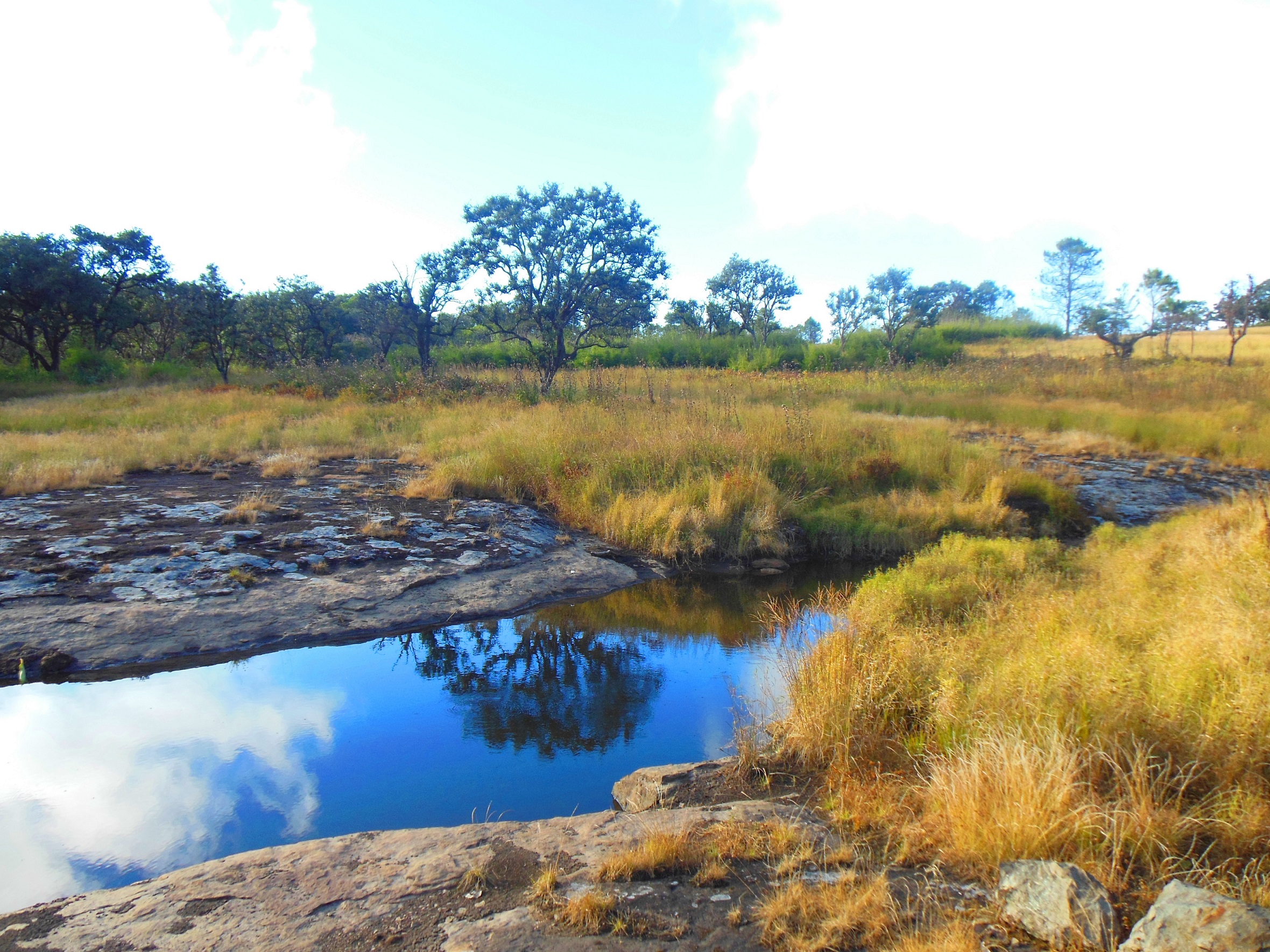
The Chhimtuipui River is a serene river that flows in Phawngpui and is the perfect place to spend some quiet time in the lap of nature. The beauty of the river is captivating during sunrises and sunsets, so if visiting Phawngpui, make time during that time of the day to visit the river. Located 7 km from Phawngpui, Farpak provides picturesque views of nature and is also the base for the trek up to Phawngpui peak. Replete with lush green trees and fauna, some of the commonly spotted animals include clouded leopards and elephants. Sangau is located 30 km from Phawngpui and is another base from where one can trek up the Phawngpui mountain.
Phawngpui National Park
The Phawngpui National Park or The Phawngpui Blue Mountain National Park is one of the two national parks in Mizoram, the other and larger being the Murlen National Park. It is about 300 km from Aizwal, towards the southeast of Mizoram relatively close to Myanmar. The park is named after the Phawngpui mountain, often called the Blue Mountain, the highest mountain peak in the state, reaching 2,157 m asl. The national park covers the entire mountain along with the surrounding reserve forest. In the Lai dialect, Phawng means a meadow and pui is the suffix for great. It is also believed by many that Phawngpui was an abode of God.
The mountain area of Phawngpui is at most times covered by a thin stretch of clouds, which makes it blue in appearance from a distance, hence the name Blue Mountain. It overlooks the River Chhimtuipui flowing towards Myanmar and the edges of the mountains are all very steep and have sharp precipices, with the most spectacular one being a semi-circular beautiful cliff on the western side called Thlazuang Khâm, which has a blunt and deep fall. The mountain ridge runs in a north-south direction covering about 10 km. The closest human settlement is Thaltlang village at the base and periphery of the park.

The Phawngpui National Park provides habitat for a range of birds including the rare Blyth’s tragopan, falcon, sunbirds, dark-rumped swift, and Mrs Hume’s pheasant, which is the Mizoram state bird, and also rare animals like the mountain goat, slow loris, tiger, leopard, leopard cat, serow, goral, Asiatic black bear, stump-tailed macaque and capped langur. In 2000, rare bird species were recorded such as mountain bamboo partridge, oriental pied hornbill, purple cochoa, striped laughing thrush, grey sibia, black eagle and large-billed crow. The clouded leopard or Neofelis nebulosa was spotted and documented for the first time in 1997. The landscape is the natural habitat of various grass and the steep slopes are covered by orchids and rhododendrons, with areas of bamboo.
Ecofriendly visits to the national park are only allowed during the dry season with permits open for six months between November to the end of April. The rest of the season is left for natural development and rejuvenation.
The highest point in the state, Phawngpui Peak is a revered mountain. Also known as the blue mountain, the peak is located within the Phawngpui National Park and oversees a wondrous landscape full of deep crevices and magnificent cliffs. Trekking to the summit of Phawngpui is an experience no adventure lover can let go of. At a height of 2100 m, Phawngpui Peak is considered to be the abode of the Goddess of the Mizo tribes. The peak is made accessible by the state only between November to April and during this time, the route is usually dry and well marked out due to animal movements. The winter months can be cold so multiple layers are needed. The peak and national park are open between 6 am and 5 pm daily and there is a minimal entry fee to the national park.

Saiha
Saiha which is also known as Siaha lies about 300 km south of Aizwal and is the headquarters of the Mara Autonomous District Council, one of the three autonomous district councils within Mizoram. The word Siaha in the local Mara language comes from Sia for Masia which means elephant and ha meaning tooth, so the name translates to an elephant’s tooth. The name came about because it was here that a large number of elephant teeth were found. Though the local people name the town as Siaha, Mizos called it by the name Saiha, which is purely a translated term in the Mizo language.
Saiha is known as the fastest-growing town in Mizoram, as the population has significantly risen in the last decade. The town lies at an average height of 729 meters above sea level and is considered to be a haven for angling enthusiasts.

Lying 130 km to the southwest of Saiha lies the Palak Wildlife Sanctuary, an exquisite display of biodiversity. It is situated in the Lakher region, which lies in the southern part of Mizoram. Not the biggest of wildlife sanctuaries, it is spread across 15.50 sq km and boasts a range of species like the sambar, barking deer, leopard, elephant and rhesus macaque.
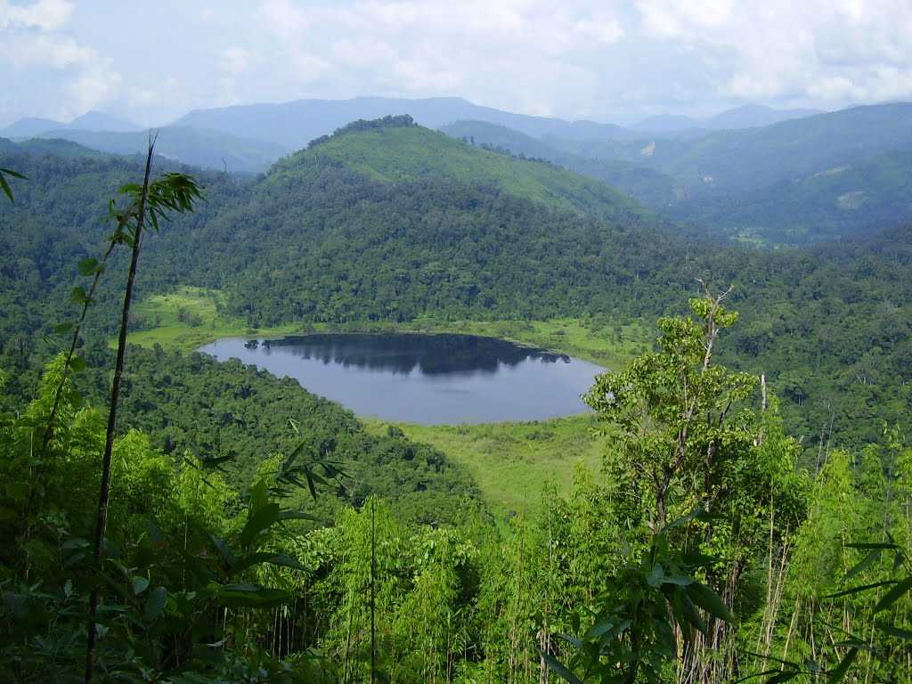
Palak Dil, also known as Pala Tipo is located in the Phura village, a few km from the main town of Saiha. The lake’s name in the Mizo language means the swallowing lake and is the largest lake in Mizoram. The lake is located in an area rich in biodiversity, given that it is located in the Indo-Burma biodiversity hotspot. As it is a major component of the Palak Wildlife Sanctuary, it is also blessed with a lot of flora and fauna. The lake covers an area of 30 hectares and is surrounded by a thick unspoilt forest.
Mount Mawma is the third-highest mountain in Mizoram and the highest mountain within the Mara Autonomous District Council. Situated in the southeastern part of Mizoram, it is just 15 km from India’s international boundary with Myanmar. Two km from Mount Mawma lies Chakhei, a town where a well-furnished guest house is located. Mount Mawma is 6,725 feet or 2,050 m above sea level. During winter, the plains of Bangladesh as well as many parts of western Myanmar, are visible from the peak of the mountain.
This brings us to the last of the seven sister states of northeast India. While on one hand, I would love the northeast of India to be more accessible and have better rail and road infrastructure, on the other hand, over-commercialisation will most likely lead to the area losing the charm it currently has. This a question we all need to think about, what is the right amount of commercialisation that an area retains the charm and beauty it is known for and at the same time, infrastructure is built to promote tourism?
The next state we will explore will be the last state I have left to explore in India, which will be Delhi, India’s capital. So look out for it.
