Family Footprints: An Unforgettable Italian Adventure – Part 1

It’s been a couple of months since I came back from my epic spring trip. So, it’s high time I wrote a trip report, and that’s what this, along with a few more posts, will be all about.

To recap, six of us cousins and sisters planned on a trip together this spring. We’d been planning this trip for a long time, and it finally came together in May. How are we related? We’re all first cousins, our mums are sisters, and we’ve been quite close all our lives. When we were younger, because of the age gap, maybe we could not be as close as we wanted to, but as adults, we have maintained a closeness and know all the highs and lows of each other’s lives.

My home for the 13 odd hours to London

The Planning
After going back and forth on locations, we finally zeroed in on Italy. Mainly because it checked all boxes, including being vegetarian and vegan-friendly. Our base would be London, where two of my cousins lived, and the others would travel to Europe. We flew in from North America and Asia. Once the location was decided, I decided to spend some days before the trip in London. I decided to travel about five days before we were supposed to fly out to continental Europe, and I was the first to arrive.

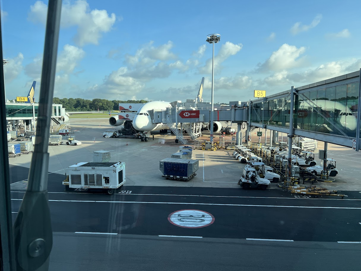
I flew Singapore’s flagship airline, Singapore Airlines. My options were nonstop flights to London or transiting in the Middle East. I decided to go the nonstop route since it was a 13-hour flight, and this would be my first long-haul flight, and I don’t do very well during flights. Even on flights to India, after about two hours, I start getting impatient and just want to land. So I rationalised that a nonstop flight would be faster, hence, it would be easier on me. Next came the choice of the airline. My choices were Singapore Airlines, which, at the time I booked my tickets, had four daily flights to Singapore, British Airways, which had two daily flights and Qantas Airlines, which had one daily flight, all flying into London Heathrow. I think Singapore Airlines also had one flight to London Gatwick, but since Heathrow was closer to my sister’s house, I didn’t look at this option. I next looked at ticket prices and all three airlines had similar prices, within $100-150 of each other. Since I have been a KrisFlyer member, and this trip would give me miles, it was a no-brainer for me to choose SIA. I booked a day flight out to London, which meant I took the flight that left Singapore around 9 am and landed in London around 3:45 pm, local time. My return flight was a late evening flight which left London at 8:30 pm, landing in Singapore the next day around 5 pm. This meant I reached London late enough that I don’t crash with jetlag and can sleep after an early dinner to be able to sightsee the next day, and the return flight meant I had almost the entire day after landing from Italy to spend more time with my sisters.

I also offered to plan the itinerary of the trip. The cousin I was staying with is an intrepid traveller, and between her practical know-how and my planning skills, we were able to plan the trip. We decided to go to three cities, Rome, Florence and Venice. We stayed in Rome for three nights, spent two nights in Florence and stayed overnight in Venice. All travel between Italian cities was conducted using their high-speed trains. We flew out of London Gatwick to Rome and from Venice into London Heathrow.

My almost 14-hour flight from Singapore to London Heathrow was uneventful. The aircraft was an A380, which meant about 500 people across multiple classes were flying together on two levels. I had booked the cheapest ticket, which came with 25 kg of checked-in baggage and 7 kg of carry-on luggage. While booking the ticket, I wanted to book the exit row seat, which came in at SGD 150 per seat per leg, but was dissuaded by my sister, who said this would open up during check-in. She was wrong. A month or so after I booked my ticket, those seats were snapped up, and I regretted not purchasing them when I could. Since I was a solo passenger and maybe because of my frequent flyer membership, I got an aisle seat (thank god) next to a lovely couple who were travelling from New Zealand to London. So at least I was able to move around during the flight. Since my flight was a day flight and we were flying west, chasing the sun, I felt the flight was boring!

I had pre-loaded my phone and tablet with entertainment and books, and also used the in-flight entertainment system, but as I mentioned earlier, I get bored easily onboard. So the walking around really helped. I could not sleep because I was well-rested and also excited, though I think I did take a couple of small naps during the flight.

Buckingham Palace

London
We landed in London on time, and immigration was a breeze. Singapore citizens need an ETA or Electronic Travel Authorisation instead of a visa, which I had gotten a week before my trip. I needed to download the UK ETA app on my phone and apply for the ETA by scanning my passport’s biometrics into it. It cost about GBP 16 or SGD 30, and approval came in less than five minutes after the application. The ETA is valid for two years, and I can stay in the UK for tourism purposes for six months at a time. So, because I had the ETA, all I needed to do was scan my passport at border control, and I was officially in the UK!

My sister picked me up from the airport, and after meeting her family, we went for a walk around 8 pm, and the sun was still shining! I laboured on till dinner and bedtime because I wanted to be fresh for the next day, my first day in London. I had about 2.5 days to explore London, after which the others would land and our trip would officially begin.

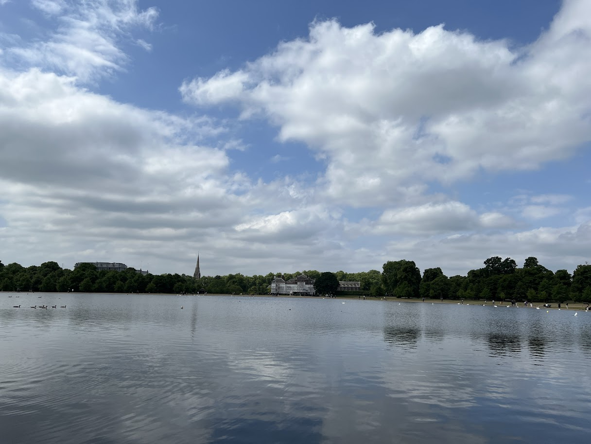
On my first full day in London, we left the house early and headed to Hyde Park. My sister lives on the outer edge of zone 1, walking distance from a tube station, so that was our mode of transport. After walking across Hyde Park, I checked out the Serpentine lake and saw Kensington Palace from outside, and then sat for a while in Kensington Gardens before walking out of the park.

Serpentine Lake at Hyde Park

Our next stop was the Victoria & Albert Museum. This museum has been on my visit list for years. When I was in my late teens or early twenties, the V&A Museum had a travelling show they took to many cities around the world, including Mumbai. I think this was to celebrate a milestone year in the museum’s history. I went to the museum twice, once alone and once with my sister, and this cousin and her sister. I was entranced and knew whenever I go to London, I had to visit the museum. And to my good fortune, my sister also enjoys museums and just the week before she had gotten membership to the V&A. This meant, in addition to the free exhibits, we could also check out their special exhibit, which was an exhibit showcasing Cartier’s jewellery over the years, which was out of the world.

After spending a few delightful hours at the museum, we went back to Hyde Park because my sister had to run some errands. We then walked to Buckingham Palace and saw it from the outside. Then walked across St James’ Park, where we spent some time admiring the views and then home. I had walked more than 23,000 steps and was feeling jet lagged at this point.

Tower of London

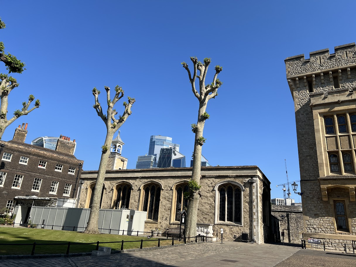
On the next day, we left home bright and early to go and visit the Tower of London. I had prebooked a slot for us for 9:30 am. The Tower of London is phenomenal. If there is only one attraction you want to pay for in London, it should be this. Rising on the north bank of the Thames, the Tower of London began in 1078 when William the Conqueror ordered the White Tower, a stark stone keep meant to cow newly conquered Londoners and guard the capital. Over nine tumultuous centuries, it expanded into a concentric fortress, royal palace, menagerie, mint, and, most famously, a high-security prison. Its walls echo with tales of intrigue and tragedy: Anne Boleyn’s final walk, Guy Fawkes’s interrogation, and the mysterious disappearance of the “Princes in the Tower.” The Tower is a UNESCO World Heritage Site today and one of Britain’s most popular museums and tourist attractions.

I wanted to see the crown jewels and especially the Koh-i-Noor diamond, but to be honest, the diamond felt a bit underwhelming to me. Maybe because of the diamond’s history, I expected it to be much more, but it didn’t speak to me like I thought it would. We also joined a Yeoman Warder’s tour, but because of the crowd, we couldn’t hear much, so left the tour less than 10 minutes after joining it.

Tower Bridge

After the Tower of London, we walked to the Tower Bridge and took some photos before our next destination, a quaint church close to the Tower Bridge called St Dubstan of the East. Set within the ruins of a Wren church, St Dunstan in the East Church Garden is a green oasis with benches and a fountain with greenery draping the historic walls. The church was originally built around 1100, a new south aisle was added in 1391 and it was repaired in 1631. It was severely damaged in 1666 by the Great Fire of London. The Church was again severely damaged in the Blitz of 1941. Wren’s tower and steeple survived the bombing. During the reorganisation of the Anglican Church after World War II, it was decided not to rebuild St Dunstan’s. In 1967, the City of London decided to turn the remains into a public garden, which opened in 1970. When we were there, it was lunchtime and we found many office workers having lunch there. I wish there were someplace like this when I worked full-time, so I could also have a breather during lunch in cool and sylvan surroundings.

St Dunstan of the East

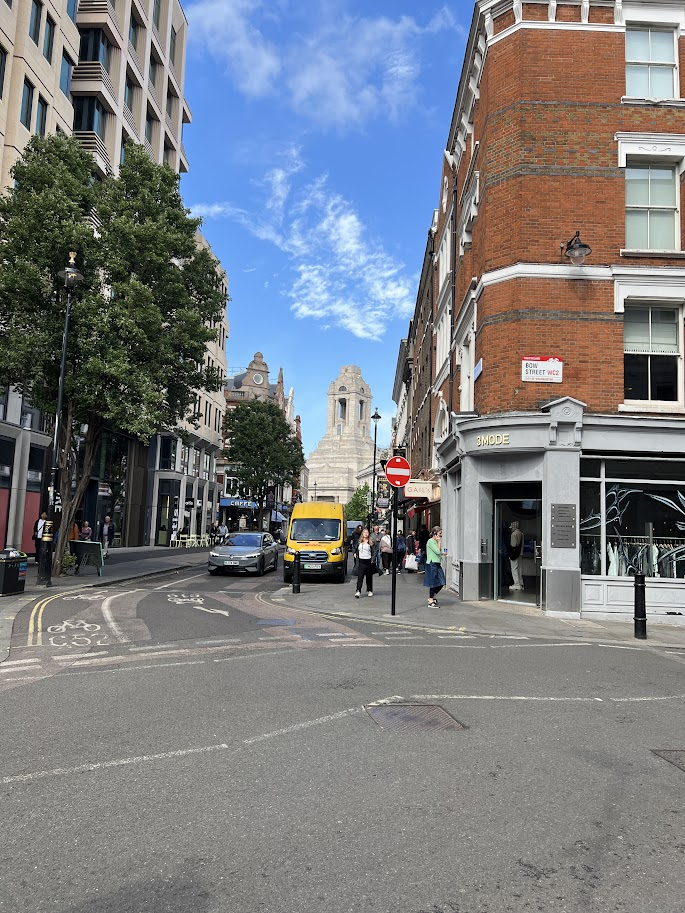
Our next destination was a place that was GG’s wish, Leadenhall Market. A huge Harry Potter fan, Leadenhall Market is where the first film of the series, Harry Potter and the Philosopher’s Stone, was partly filmed. Leadenhall Market was used to represent the area of London leading to the popular wizarding pub The Leaky Cauldron and was the inspiration for the magical shopping street Diagon Alley. It’s a charming, airy market in the heart of the city with shops, boutiques and restaurants with stunning architecture dating back to the 14th century.

City of London from Sky Garden

We were hungry at this point, and our next stop was perfect for lunch. We went to London’s highest public garden, the Sky Garden, to take in 360-degree views of the city’s iconic skyline as well as have lunch at one of the restaurants in the space. Access to the Sky Garden is free of charge, but spaces are limited and visits must be booked in advance. Here we were joined by others in the family, and it was lovely to see all the sights in the city centre with the Thames flowing past, and then have a yummy lunch.

Post lunch, we wandered across the London Bridge and walked to Borough Market. This is one of the largest and oldest food markets in London, with a market on the site dating back to at least the 12th century. The present buildings were built in the 1850s, and today the market mainly sells speciality foods to the general public. After having some dessert here, we hopped into the tube to Greenwich to take an uber for an exciting trip.

The financial district from the Uber Boat

At Greenwich, we walked down to the pier to take an Uber boat down the Thames. The only option available at that point was a boat to the Westminster Pier, so we hopped into that. It was a nice way to see London by the river, and I enjoyed the trip, soaking in the sights that I would otherwise not see. The trip took about 30-40 minutes, and we were able to pay using the same cards that we used on the tube and bus. After disembarking from the boat, we wandered around Westminster and then took the tube home.

St Paul’s Cathedral

On my third day in London, the first thing we did was to return to the airport to pick up my sister. After she came home and freshened up, we went out. Our destination was the St Paul’s Cathedral. Dominating the skyline with its gleaming dome, St Paul’s Cathedral is the masterpiece Sir Christopher Wren raised after the Great Fire of 1666, and was completed in 1710. Outside, its soaring 365-ft silhouette draws the eye, while inside, a serene Baroque nave draws the eye up to a coffered dome inspired by St Peter’s in Rome. Whisper along the interior of the Whispering Gallery to test the acoustics, then climb to the Golden Gallery for panoramic views of the Thames, the Shard and Tower Bridge. In the crypt, Admiral Nelson, the Duke of Wellington and Sir Winston Churchill lie. The cathedral hosted the funerals of Diana’s maternal grandmother, state services after the Blitz, and the wedding of Prince Charles and Lady Diana in 1981. The stairs going up are a killer to the knees, but the views from the top are spectacular.

After lunch at a Greek restaurant, my first time, we took the tube to Covent Garden, walked around the theatre district a bit, and then went to Europe’s largest shopping centre, Westfield, for some retail therapy and dinner. And that was pretty much the end of my London sojourn.

The Theatre District, somewhere near Covent Garden

The next day was spent travelling to both London Heathrow and Gatwick to pick up the last two who landed almost at the same time. So we had a mini road trip before our big trip. In the evening, we all trooped to the last sister’s place, who lived a bit further away, but closer to Gatwick which was from where we were supposed to board our flight to Rome. After a scrumptious dinner, we woke up early on flight day. The taxi to drop us at the airport was supposed to pick us up at 5:30 am, so we had an early start.

The next three parts will be all about our Italian adventure, so keep watching this space!

Travel Bucket List: Nepal – Part 17

Shivpuri National Park
Established in 2002, Shivapuri Nagarjun National Park is Nepal’s ninth national park, located in Nepal and was established in 2002. It is located in the country’s mid-hills on the northern fringe of the Kathmandu Valley and named after Shivapuri Peak at 2,732 m. It covers an area of 159 sq km.

The area has always been an important water catchment area, supplying the Kathmandu Valley with several hundred thousand cubic litres of water daily. In 1976, the area was established as a protected watershed and wildlife reserve. In 2002, it was gazetted as Shivapuri National Park, initially covering 144 sq km and in 2009 was extended by the Nagarjun Forest Reserve covering 15 sq km. The park includes some historical and religious sites, and a popular hiking route. The park is located in a transition zone between subtropical and temperate climates.

Nestled within the national park is the Tibetan nunnery called Nagi Gumpha with stunning views of the valleys below. The trek through the national park will take one through dark green forests. Mostly a cool, shaded trek, the sunlight occasionally makes its way through the canopy of broad-leaved oak trees and creates limelight on the ground. For those who love mountain biking, there are routes for them as well. Bikes can be hired from the towns downhill, no matter which route one follows.

The national park is open daily from 7 am to 5 pm. Entry fees are NPR 50 for Nepali citizens, NPR 300 for SAARC citizens, and NPR 500 for others. Those travelling in a motorbike need to pay NPR 30, while a minibus, bus or truck will cost NPR 500, and a car, jeep, taxi, or van will set one back by NPR 300. For Nepalis, the cost of a mountain bike is NPR 100, while for foreigners, it is NPR 1000.

Chitwan National Park
Nepal’s first national park, Chitwan National Park was established in 1973 as the Royal Chitwan National Park and was granted the status of a World Heritage Site in 1984. It covers an area of 952.63 sq km in the subtropical Inner Terai lowlands of south-central Nepal in Nawalpur, Chitwan, Makwanpur and Parsa districts. It ranges in elevation from about 100 m in the river valleys to 815 m in the Sivalik Hills.

In the north and west of the protected area, the Narayani-Rapti river system forms a natural boundary to human settlements. Adjacent to the east of Chitwan National Park is Parsa National Park, contiguous in the south is the Indian Tiger Reserve Valmiki National Park. The coherent protected area of 2,075 sq km represents the Tiger Conservation Unit (TCU) Chitwan-Parsa-Valmiki, which covers a 3,549 sq km huge block of alluvial grasslands and subtropical moist deciduous forests.

Apart from its biodiversity, Chitwan National Park provides a unique opportunity for cultural exploration. The indigenous Tharu community, residing harmoniously for centuries, shares their traditions and lifestyle through cultural performances, showcasing their music, dance, and art. The convergence of natural wonders and cultural richness makes Chitwan a captivating destination, offering an unparalleled glimpse into Nepal’s heritage and wildlife conservation efforts. Easily accessible via road from Kathmandu or Pokhara, Chitwan National Park remains a cherished destination, drawing global travellers with its captivating blend of nature, conservation, and cultural richness.

There are seven entrance gates to the park. Located near Sauraha, the Sauraha Gate offers entry to the eastern section of the park and is one of the primary entry points for visitors. Situated near the village of Meghauli, the Meghauli Gate provides access to the western part of the park and is ideal for visitors staying in nearby lodges or resorts. Serving as the headquarters of the park, Kasara Gate offers entry to the central region and houses park administrative offices and visitor facilities. Situated in the eastern section of the park, the Kalika Gate serves as another access point for visitors exploring this part of Chitwan. Positioned in the northern section of the park, Lothar Gate allows entry to the northern areas and offers access to distinct wildlife habitats. Located on the park’s northeastern side, Khoria Gate provides access to areas close to the convergence of the Narayani and Rapti rivers. Positioned northeast of the park, Kumroj Gate offers entry to parts near the Kumroj Community Forest.

Since the end of the 19th century, Chitwan used to be a favourite hunting ground for Nepal’s ruling class during the cool winter seasons. Until the 1950s, the journey from Kathmandu to Nepal’s south was arduous as the area could only be reached by foot and took several weeks. Comfortable camps were set up for the feudal big game hunters and their entourage, where they stayed for a couple of months shooting hundreds of tigers, rhinoceroses, elephants, leopards and sloth bears. In 1950, Chitwan’s forest and grasslands extended over more than 2,600 sq km and were home to about 800 rhinos. When poor farmers from the mid-hills moved to the Chitwan Valley in search of arable land, the area was subsequently opened for settlement, and poaching of wildlife became rampant. In 1957, the country’s first conservation law ensured the protection of rhinos and their habitat. Research on Chitwan was conducted by Edward Pritchard Gee between 1959 and 1963.

By the end of the 1960s, 70% of Chitwan’s jungles had been cleared, malaria eradicated using DDT, thousands of people had settled there, and only 95 rhinos remained. The dramatic decline of the rhino population and the extent of poaching prompted the government to institute the Gaida Gasti – a rhino reconnaissance patrol of 130 armed men and a network of guard posts all over Chitwan. To prevent the extinction of rhinos, the Chitwan National Park was gazetted in December 1970, with borders delineated the following year and established in 1973, initially encompassing an area of 544 sq km. In 1977, the park was enlarged to its present area of 952.63 sq km. In 1997, a buffer zone of 766.1 sq km was added to the north and west of the Narayani-Rapti river system, and between the south-eastern boundary of the park and the international border to India.

Jeep safaris in Chitwan National Park provide a thrilling opportunity to explore the wilderness and witness diverse wildlife. It is available twice a day, early morning and late afternoon. Early morning safari is the best time to spot Bengal Tigers and Rhinoceros. The most popular safari route is the Narayani River Route. Experienced guides lead the safari, offering insights into the park’s flora and fauna. Visitors have the chance to spot rhinoceros, deer, monkeys, and various bird species. The elephant-back ride offer a unique way to traverse the park’s terrain and observe wildlife from a different perspective. It generally last for about 1-2 hours, guided by trained mahouts or elephant handlers. Riding atop elephants, visitors can explore deeper into the jungle, increasing the chances of spotting larger animals like rhinos, sloth bears, and even tigers if lucky.

Canoe trips along the Rapti or Narayani River allow visitors to witness aquatic wildlife and birds. Canoe rides usually span 1-2 hours, led by experienced guides. Traveling silently along the river, visitors can spot crocodiles, waterfowl, and other river-dwelling creatures, offering a serene and picturesque experience. Nature walks in Chitwan National Park are guided tours led by experienced naturalists or park guides. Typically last from 1 to 3 hours, allowing visitors to explore specific trails within the park. Led by knowledgeable guides, nature walks offer close encounters with smaller wildlife, insects, and diverse plant species. Guides share insights into the park’s flora, fauna, medicinal plants, and their ecological significance. Visitors learn about animal tracks, bird calls, and the intricate balance of the park’s ecosystems.

Chitwan is a paradise for birdwatchers, home to over 550 bird species, both resident and migratory. The duration varies based on visitors’ preferences, but birdwatching can span from early mornings to late afternoons. Visitors can spot a diverse range of birds, including kingfishers, hornbills, woodpeckers, peafowl, and endangered species like Bengal florican and great hornbill. Cultural visits involve engaging with the indigenous Tharu community, known for their distinct culture, traditions, and lifestyle. Guided tours to Tharu villages offer insights into their daily life, agriculture, craftsmanship, and unique architectural styles. Explore local houses, learn about their customs, and interact with villagers to understand their traditions and practices.

It would be really unfair to come to Chitwan National Park and not visit the village of Tharus, the original residents of this place. The village can be explored on foot or one can go the traditional way and take the famous ox-cart ride. One should take a guide along to explain the nuances of everyday Tharu lives, their past and present and their culture. The Tharu Cultural Museum serves the community and houses the evolution of the Tharu people from the olden days to the present, a tale told through old and new photographs, documents, weapons, potteries and other things they have used over the years. There are handicraft shops outside, from where one can buy small souvenirs to remember the lovely trip.

The shared jeep safari runs from 12:30 to 5:30 pm with rest timing changing with season and availability of vehicles. Private jeep safari timings are between 6 am and 6 pm. The elephant safari happens in the morning, mid-morning, and evening and is for 90 minutes. Canoeing can be done from 7:30 to 9:30 am while the elephant breeding centre is open from 6 am to 6 pm. The safari can be booked from any local tour operator, the park’s headquarters in Sauraha, or one’s hotel. The cost of the safari varies depending on the duration and number of participants. It is inaccessible in monsoon between June and September and during this time only the buffer zone is open to visit. Washroom facilities are available at the Gharial Breeding Conservation Centre

Entry fees to the park is 2000 NPR for foreigners, 150 NPR for locals, 1000 NPR for SAARC citizens and free for children below the age of 10. The Jeep Safari costs 2500 NPR per person for the shared jeep safari and NPR 4000 per person for a full-day safari. The elephant safari for two people costs NPR 2500 per elephant for foreigners, NPR 200 for locals and NPR 1000 for SAARC citizens. The Elephant Breeding Center entry fee is NPR 100 for foreigners, NPR 25 for locals, and NPR 50 for SAARC passport holders. If one is interested in bathing elephants, it will be NPR 200 per person. A half-day canoe ride will cost NPR 1400 while the full-day canoe ride will set one back by NPR 1800 per person.

Sagarmatha National Park
Established in 1976, Sagarmatha National Park is located in eastern Nepal and encompasses an area of 1,148 sq km. It ranges in elevation from 2,845 to 8,848 m and includes Mount Everest. In the north, it shares the international border with Qomolangma National Nature Preserve in Tibet Autonomous Region. In the east, it is adjacent to Makalu Barun National Park, and in the south it extends to the Dudh Kosi River and is part of the Sacred Himalayan Landscape.

The UNESCO World Heritage Site has other important peaks apart from Mount Everest like Lhotse, Cho Oyu, Pumori, Ama Dablam, Thamserku, Kwangde, Kangtaiga and Gyachyung Kang. It is also a preservation site for rare species of animals and birds, like the red panda and snow leopard. The wildlife sanctuary stretches over 1100 sq km and is recognised as an eminent bird sanctuary by Bird Life International, making it a highly important tourist attraction for people who enjoy mountaineering and bird watching. Sagarmatha National Park became the country’s first national park that was inscribed as a Natural World Heritage Site in 1979. In January 2002, a Buffer Zone comprising 275 sq km was added.

The park contains the upper catchment areas of the Dudh Kosi and Bhotekoshi rivers and the Gokyo Lakes. It ranges in elevation from 2,845 m at Monjo to the top of Mount Everest at 8,848 m. Barren land above 5,000 m comprises 69% of the park while 28% is grazing land and the remaining 3% is forested. Climatic zones span from temperate and subalpine above 3,000 m to alpine above 4,000 m, which is the upper limit of vegetation growth. The nival zone begins at 5,000 m.

Visitors can indulge in various outdoor activities apart from sightseeing and enjoying the scenic beauty of the National Park. One of the most popular routes to trek along is the Everest Base Camp where tourists can visit the various landmarks within the Park while also enjoying the culturally rich Sherpa villages along the way. The trek lasts for 9-12 days and needs special permissions. Otherwise, there are plenty of other trails that are loved by most trek enthusiasts, which is usually guided by local Sherpas. Mount Taboche is a 6500 m high peak and is a scenic spot that tourists hike up to through Khumbu Valley amongst the Himalayas. The highest point on the Everest Base Camp trek is Kala Patthar, which isn’t classified as a mountain but the peak offers a spectacular view of the sunrise and a close look at the Mount Everest. Another peak on the same trail is Mount Ama Dablam, which translates to “mother’s necklace” in the local language, and has a particular structure which makes it stand out from the other peaks, and is usually hiked up by those who are trained as hikers and have technical equipment for the same. Khumjung Village is located at a height of 4000 m near Mount Khumbila and is known for the Scott Fischer memorial and the school that was built in 1961 by Sir Edmund Hillary’s Himalayan Trust.

Mount Manaslu
Also known as Kutang Kutan I in Tibetan, the meaning of which is a flat place, Mount Manaslu is the eighth-highest mountain in the world at 8,163 m above sea level. It is in the Mansiri Himal, part of the Nepalese Himalayas, in west-central Nepal. Manaslu means “mountain of the spirit” and the word is derived from the Sanskrit word manasa, meaning “intellect” or “soul”. Set in the northern Himalayan range, Manaslu is a serrated “wall of snow and ice hanging in the sky”. The three sides of the mountain fall in steps to terraces down below, which are sparsely inhabited with agricultural operations practised on the land. Apart from climbing Manaslu, trekking is popular in this mountain region, as part of the Manaslu Circuit, a notable path for trekkers in Nepal. A glacial saddle known as Larkya La, with an elevation of 5,106 m lies north of Manaslu and is bounded on the east by the Ganesh Himal and the Buri Gandaki River gorge, on the west by the deep fissures of the Marysyangdi Khola with its Annapurna range of hills, and to the south is the Gorkha town at the foot of the hill. There are six established trek routes to the peak, and the south face is reportedly the most difficult for climbing.

The Manaslu region offers a variety of trekking options. The popular Manaslu trekking route of 177 km skirts the Manaslu massif over the pass down to Annapurna. The Nepalese Government only permitted trekking on this circuit in 1991. The trekking trail follows an ancient salt-trading route along the Budhi Gandaki River. The trek requires a Manaslu Restricted Area Permit and a Manaslu Conservation Area Permit. The restricted area permit costs USD 100 per week in autumn and USD 70 per week in other seasons, whereas the conservation area permit costs USD 30 all year round. Trekkers are required to travel in a group of at least two persons with a registered guide. The trek lies on the newly developed Great Himalayan Trail. En route, 10 peaks over 6,500 m are visible, including a few over 7,000 m. The trekking route is through mountainous terrain prone to the consequences of monsoon rainfall, landslides, and landfalls. Hypothermia and altitude sickness, as well as encounters with passing yaks, are common. Trekking to Manaslu is thus a test of endurance. The highest point reached along the trek route is Larkya La at an elevation of 5,106 m. The Manaslu Conservation Area Project (MCAP) was established in 1997 with the primary objective of achieving conservation and sustainable management of the delimited area, which also includes Manaslu.

There are two ethnicities mainly inhabiting this region; Nubri and Tsum. The branching off of the river at Chhikur divides these two ethnic domains. While Nubri has been frequently visited since Nepal opened itself for tourism in 1950, Tsum still retains much of its traditional culture, art, and tradition. In the central hills of the region, Gurungs are the main ethnic group who have joined the Gurkha regiments in large numbers. Closer to Tibet, the Bhutias, also spelled Bhotias, akin to the Sherpa group, of Tibetan ethnicity dominate the scene with their flat-roofed houses, and are Buddhists. The region is dotted with austere monasteries, mani walls, chortens and other Buddhist religious landmarks.

The best season to hike the circuit is spring between March and May, just before the monsoon season begins. During this period, one can expect dry trails, stable weather, excellent visibility, and long trekking days. Similarly, autumn between September and November is another good season for the circuit, following the monsoon season.

Nepal has always been on my travel bucket list because of its proximity to India and the fact that it is mostly Hindu. I remember my grandparents visiting Kathmandu and the Pashupathinath temple in the late seventies, and after hearing stories about the country, I have always wanted to visit it. Now, after finishing this series, I want to visit the mystical country in the lap of the Himalayas more than ever.

Travel Bucket List: Nepal – Part 16

Jomsom
Also known as Dzongsam or the new fort, Jomsom is the centre of the Gharapjhong rural municipality in Mustang district and a former independent village development committee situated at an altitude of about 2,700 m in western Nepal. The soaring peaks of Dhaulagiri and Nilgiri form a backdrop to the town straddling the Kali Gandaki River, which flows right through the centre of Jomsom. Along the banks of the Kali Gandaki, black fossilised stones called shaligram, considered a symbol and reminder of Lord Vishnu can be found. Such stones are believed to be found only in the Kali Gandaki, and are considered holy by Hindus. The town is also the main hub for onward travel to Upper Mustang and Muktinath.

Jomsom lies to the north of Pokhara and is the main gateway to Upper Mustang. The trail passing through Jomsom follows the Kali Gandaki River which forms the deepest ravine in the world; on one side lies the Annapurna mountain range and on the other side is Dhaulagiri. The river freezes during winter and flows with rainwater and melting snow in summer and monsoon. With its diverse landscape, the area around Jomsom has the scenery of rocky cliffs and high peaks of the Himalayas without much presence of greenery, with the exception being forests of bright rhododendrons. The culture in Jomsom is a rich combination of Hinduism and Tibetan Buddhism.

The houses in Jomsom are designed to protect the inhabitants from the strong winds that blow in the valley every day from late morning onwards. These winds are caused by the differences in atmospheric pressure between the Tibetan plateau and the lower reaches of the valley. The best example of the unique architecture of this region is found in the village of Marpha which is a two-hour walk down from Jomsom, where one can find stone-flagged streets with an efficient underground drainage system and flat-roofed houses with a central courtyard, which best showcase the architecture of this area.

Not too far from Jomsom is Muktinath, the famous pilgrimage site for Buddhists and Hindus. For Hindus, Muktinath is a sacred place of salvation. They believe that bathing in the waters here guarantees salvation after death. The Hindu god, Lord Brahma, is said to have lit the eternal flames that burns at Muktinath. To Buddhists, Muktinath is where the great sage Guru Rinpoche or Padmasambhava who brought Buddhism to Tibet, came to meditate. The area around Jomsom is a perfect place to find fossilised ammonites, known locally as Shaligram, which are found all along the upper reaches of the Kali Gandaki.

Most of the route along the Jomsom trek forms part of the Annapurna circuit and Annapurna foothill treks. The usual starting point is Naya Pul on the Pokhara to Baglung road and from there, via Ghorepani and Tatopani, into the gorge of the Kali Gandaki. The deep valleys and high mountains encircling the giant Annapurna Himal embrace a wide range of peoples and terrain, from sub-tropical jungle to a high, dry landscape resembling the Tibetan Plateau.

Located 13 km from Jonsom, Dumba Lake is a small but picturesque attraction which is a short hike from Jomsom. Leopard Cave is an underground natural enclosure located at Thini. Rare snow leopard species are found here. Jomsom View Tower, from the height of 3750 m, offers beautiful panoramic views of the mountains of Mustang. The view tower is located at Thini, which is a short hike from Jomsom. Located on the Beni-Jomsom highway, about 40 km from Jomson, Rupse Falls is a major tourist attraction. The water falls from a height of 300 m and is surrounded by lush greenery and the world’s deepest gorge, the Kali Gandaki Gorge lies very close to the waterfall.

Kagbeni
A village in Upper Mustang, Kagbeni is located in the valley of the Kali Gandaki River and lies on the trail from Jomsom to the royal capital Lo Manthang, near the junction with the trail to Muktinath. Kagbeni is also regarded as one of the oldest villages in the Himalayas and lies between two sacred rivers Muktinath and Kali Gandaki. Officially Kagbeni is a settlement that bridges the gap between Lower and Upper Mustang, right at the feet of Muktinath Valley by the River Kali Gandaki. But spiritually, Kagbeni is a Tibetan village, stuck in the annals of time. In ancient times, Kagbeni was an important centre of trade for Tibetans and Indians. The famous Salt Trade Route between the two countries went through the village.

Kag Chode Thupten Samphel Ling Monastery, or the Red Monastery is the most famous landmark in the village. Built in 1429, the beauty of the monastery matches its surroundings. From outside, it looks colourful and desolate, just like the rest of Kagbeni. Inside there are sculptures of Buddha and friendly monks and a tranquil environment, where one can sit and meditate or listen to the silence. Photography is prohibited inside the monastery.

The Upper Mustang requires a special permit and USD 50 per day per person to stay and is why today many travellers prefer Kagbeni instead to get the ambience of high mountains. There are many trekking trails from Kagbeni, that lead up to the old royal capital of Lo Manthang. While trekking, one will come across Chortens and prayer wheels. Chortens are Buddhist tomb shrines, which are common in Tibetan culture and must always be crossed by the right side. The Tibetan Buddhists consider it bad luck to cross by the left. One will see numerous colourful Buddhist flags as well, planted here and there. From the summits, the entire valley can be seen, still like a painted picture on an artist’s canvas. A raw cold wind blows at this altitude at all times, and the view opens up to the vast expanses of mountain desert plains stretching into Tibet, it feels mysterious and intoxicating, but most importantly, insignificant. To stand there in front of the historical and unfathomable terrains of the Himalayas is as humbling an experience as it can be.

Mustang
Mustang which means a fertile plain was once part of the Kingdom of Lo-Manthang that joined the Federation of Nepal in 2008 after the abolition of the Shah dynasty. It straddles the Himalayas and extends northward onto the Tibetan Plateau is one of the remotest areas in Nepal and is second in terms of the sparsity of population. The elevation ranges from 1,372 to 8,167 m and includes Mount Dhaulagiri, the 7th highest mountain in the world, with several peaks above 7,000 meters.

Part of an ancient kingdom bordering the Tibetan plateau and sheltered by some of the world’s tallest peaks, Mustang still maintains Tibetan traditions because of strict regulations on the movement of tourists. Upper Mustang was a restricted area until 1992, which makes it one of the most preserved regions in the world due to its relative isolation from the outside world, with a majority of the population still speaking traditional Tibetic languages. Mustang is derived from the Tibetan word meaning the “Plain of Aspiration. It is a popular area for trekking and can be visited year-round, regardless of season. Lower Mustang is well-known for its natural scenery while Upper Mustang is famous for its trekking and hiking trails, monasteries, caves and local tribes.

The Kali Gandaki River is a highly important feature of Mustang. Its source is located near the Tibetan border coincides with the Tibetan border and the Ganges-Brahmaputra watershed divide. From there, it flows south towards the northern Indian plains through the ancient kingdom of Mustang, flowing through a sheer-sided, deep canyon immediately south of the Mustang capital of Lo Manthang, then widens as it approaches Kagbeni where high Himalayan ranges begin to close in. The river continues southward past Jomsom, Marpha, and Tukuche to the deepest part of the gorge about 7 km south of Tukuche in the area of Lete. The gorge then broadens past the border of Mustang and Myagdi. Geographically, Lower Mustang lies between the Tibetan Plateau in the North and the high Himalayan Mountains in the South. The region between the Tibetan Plateau and the Himalayan Mountains is called Trans-Himalaya. The Kali Gandaki Gorge or Andha Galchi, measured by the difference between the river height and the heights of the highest peaks on either side, is the world’s deepest canyon.

Much of the history of Mustang is about legends rather than documented facts. However, it is believed that Mustang or the Kingdom of Lo was once a part of the Ngari area of Tibet and a loose collection of feudal estates, their history is also tied to Tibetan religion and culture, geography, and politics. It was often closely linked to adjoining kingdoms of Western Tibet and, during other periods of history, politically linked to Lhasa, the capital of Central Tibet. Lo was incorporated into the Tibetan Empire by Songtsen Gampo, the most famous Tibetan king.

From the 15th century to the 17th century, Mustang had control over the trade between the Himalayas and India because of its strategic location. In 1380, Lo became an independent kingdom under Ame Pal. The last royal family traced its lineage for 25 generations, all the way back to Ame Pal who oversaw the founding and building of much of the Lo and Mustang capital of Lo Manthang, a walled city surprisingly little changed in appearance from that period. The only remnant of these kingdoms is the still-intact Kingdom of Lo, an area corresponding to the northern third of Mustang.

In 1769, the army of Prithvi Narayan Shah, the first King of the Gorkha Kingdom and the Shah dynasty, unified what was a land of many small kingdoms to forge the kingdom of Nepal. At the end of the 18th century, the kingdom was annexed by Nepal and became a dependency of the Kingdom of Nepal in 1795. During the late 1950s and 60s, Mustang became the centre for Tibetan guerrillas engaged in small operations against the Annexation of Tibet by the People’s Republic of China in 1959. Up until 2008, the Kingdom of Lo or Upper Mustang was an ethnic Tibetan kingdom and a suzerainty of the Kingdom of Nepal. Though still recognised by many Mustang residents, the monarchy ceased to exist on 7 October 2008, by order of the Government of Nepal. The last official and later unofficial king (raja or gyelpo) of Mustang was Jigme Dorje Palbar Bista who lived between 1930 and 2016. He died on 16 December 2016 after living a retired life largely in Kathmandu since 2008 when Nepal abolished its own monarchy.

One feature of Mustang is the thousands of cliff dwellings, some highly inaccessible. These Mustang Caves or Sky Caves of Nepal are a collection of some 10,000 man-made caves dug into the sides of valleys in the Mustang. Several groups of archaeologists and researchers have explored these stacked caves and found partially mummified human bodies and skeletons that are at least 2,000–3,000 years old. Explorations of these caves by conservators and archaeologists have also led to the discovery of valuable Buddhist paintings, sculptures, manuscripts and numerous artefacts belonging to the 12th to 14th centuries. The caves lie on the steep valley walls near the Kali Gandaki River in Upper Mustang.

Lo was out-of-bounds for foreigners until 1992. Although it is now open on a restricted basis to foreign travellers, tourism to the region is still strictly restricted and hard to access. The Nepalese government have introduced a surcharge for anyone trekking past Kagbeni, which marks the border of Upper Mustang. Foreign tourists are required by the Nepalese Department of Immigration to acquire special permits, pay fairly steep fees of US$50 per day per person, and be accompanied by a liaison guide to protect local traditions and the environment from outside influence.

The ancestral isolation of Mustang helped to retain its ancient culture largely unviolated, and it survives as one of the last bastions of traditional Tibetan life. In this ancient forbidden kingdom, traditions have survived longer than in Tibet proper following its annexation by China. The lower Mustang areas such as much of Baragaon, Panchgaon, and Thak Sat Sae along the Annapurna Circuit are among the most heavily trekked routes in Nepal. The scenery of the trail ranges from forests of bright rhododendron fields to rocky cliffs and deserts. The culture along the trek is a rich combination of Hindu and Tibetan Buddhism. The trail’s highest point is Muktinath at 3800 m, a popular Hindu and Buddhist pilgrimage site for centuries. The Kali Gandaki Gorge is part of the popular trekking route from Pokhara to Muktinath. The gorge is within the Annapurna Conservation Area.

The Muktinath Temple is significant to both Hindus and Buddhists. Located in the Muktinath Valley, the shrine is close to the rural Ranipauwa, which is often mistaken to be Muktinath. The temple’s name refers to Mukti, meaning nirvana, or salvation, and nath, which signifies master, or Lord. Among the Hindus, Muktinath temple is also referred to as the Mukti Kshetra, which translates to “the place where one receives moksha or liberation”. Of the one hundred and eight sacred Shri Vaishnava temples, Muktinath Temple holds the 106th rank among the Divya Desam, or ‘premium temples’. The ideal time to visit this temple is between March to June when the temperatures are relatively warm, and the overall weather condition is pretty pleasant.

One of the eight sacred shrines, Muktinath Temple, is built in the Pagoda-styled central temple which has a gold statue of Lord Vishnu. Even though the temple is small, the main deity is almost the size of an adult man. This central statue in the temple is seen as the manifestation of Padmapani, a compassionate embodiment of all the Buddhas. In front of the temple lie two ponds, named Lakshmi Kunda and Saraswati Kunda respectively. It is a common belief that bathing in these water bodies washes off all negative forces and karma. Muktinath temple is said to have risen on its own; therefore including it as one of the eight shrines which have supposedly existed by themselves.

The outer courtyard, or the Prakaram, houses one hundred and eight waterspouts shaped like the heads of bulls, through which the sacred water of the Kali Gandaki River flows. This water symbolises the Pushkarini waters that are believed to have descended from the one hundred and eight Divya Desams. Devotees bathe in these waters even during freezing temperatures, with the hope of washing away their sins and attaining salvation.

Because of the hundred and eight water springs, the temple is also known as Chumig Gyatsa which translates to Hundred Waters. The Buddhists consider it to be an essential place for the Dakinis, the goddesses who are also known as the Sky Dancers. Legend also says it is the place where Guru Padmasambhava had meditated for some time before moving on with his journey from India to Tibet.

Travel Bucket List: Nepal – Part 15

Shashwat Dham
Located on the East-West Highway in Devchuli, Shashwat Dham is a Hindu religious site and tourist destination. The spiritual site consists of a temple of lord Shiva and a Vedic karmakanda gurukul spread over 12 acres.

The main temple is dedicated to Lord Shiva and is known as Ekambareshwor. It is modelled in the Khajuraho style of architecture. The temple is surrounded by a pond filled with water from various holy shrines from the Indian subcontinent such as Badrinath, Kedarnath, Muktinath and Pashupatinath. The temple houses 16 deities, with the sanctum sanctorum belonging to the Shivalinga. The abode of Lord Shiva here is called Ekambareshwara, and it is surrounded by holy waters from the seven sacred rivers of Nepal – Saptagandaki.

The Manuscript Resource Centre unearths and preserves as many as possible. There are expert scholars to decode the archived manuscripts and spread the Sanatana knowledge to the masses for their understanding.

The Centre for Meditation and Yogic Sciences is a sanctuary for all seeking peace and happiness. The tranquil environment helps calm the mind and relief from the stress of the outside world, and the daily spiritual lectures, yoga sessions and satsangs help them find their true self. There is also a museum which allows visitors to learn about spiritual destinations in Nepal. One should not miss the Kamal Kund beside the Gurukul area, where there are many lotuses in bloom usually and create a lovely sight to behold. Sahastra Saligram in the north-east or Ishan Kona, as it is called in Vedic terms, is a collection of 1000 saligram stones – the most natural manifestation of Lord Krishna. The popular belief is, circumambulation of the stones energises the mind and spirit with positivity.

Shashwat Dham has a Dhunge Dhara and a water reservoir with cow-faced stone taps. The Hanuman Chhatra Temple and Dharma Kshetra, with a statue of Arjuna en route to the great war of Kurukshetra with Krishna as his charioteer in the temple complex, adds to the beauty of the place.

Gorkha
Formerly known as Prithvinarayan Municipality, Gorkha was originally named after King Prithvi Narayan Shah, who was born in Gorkha and united and founded modern Nepal. In 2009, the name was changed to Gorkha after the end of the monarchy in Nepal.

The old royal palace or Gorkha Durbar, Gorakhnath and the Kalika Temple dedicated to Goddess Kali are the main attractions of the town. The Royal Palace was destroyed in the 2015 earthquake, but the Gorakhnath shrine and Kalika temple are open with no entrance charges. The lower palace or Tallo Durbar and a modern park are other major attractions. Gorkha is also the starting point of the Manasalu Himal or Mount Manasalu and Mount Ganesh trekking route.

The Gorkha Museum’s Newari-style architecture is grander than the collection inside. The hallways inside are lined with art and craft items, some weapons and historical remnants of the Newari culture and the Shah and Malla kingdoms. It’s the corridors and galleries and hallways themselves, and the huge garden outside that steals the show.

The Manakamana Temple is one of the most sacred places and the abode of the Hindu Goddess Bhagwati, an incarnation of Goddess Parvati. This temple is much-visited because of the belief that whatever one wishes for in this shrine is granted. There is a fantastic cable car ride over the green valleys from Kurintaar to Manakamana temple.

The Manaslu trekking is the most exciting thing to look forward to. Mount Manaslu lies just towards the east of the great Annapurna massif. The highest point of the trek is at Larkya La pass, from where a breathtaking view of the Manaslu can be savoured.

Gorkha has temples dedicated to Lord Shiva, Lord Vishnu, Lord Ganesh and Lord Bhimsen, the Newari god of money and commerce and is very much revered in close vicinity. The Durbar Square is the prime attraction of the Gorkha valley, being the birthplace and early home to unified Nepal’s first ruler, Prithvi Narayan Shah. The complex is a fort, a palace and a religious destination all punched into one. Perching atop high hills, Gorkha Durbar overlooks the sprawling emerald-green Trisuli Valley. If one looks down from the edge, one can see the tiniest sliver of a stream flowing through the valley. And straight ahead, one can see the entire range of Annapurna, Manaslu, Ganesh Himal and Himalchuli, standing majestically in the distance.

The Durbar area is where the Gorkha Palace stands towards the east. To reach the palace called Dhuni Pati, one has to climb 1700 steps from the bottom of the hill. It is a taxing adventure to pursue, but for those up to the challenge, it can be quite rewarding to finally finish the hike and be surprised by the spectacular panorama. This palace is where the first ruler of a unified Nepal was born and raised. From the windows of the palace, the king as a child prince used to look out at the entire valley and imagine it as his one day – or so says the lore.

There are several other attractions in Durbar Square, of which many were not harmed in the 2015 earthquake. The western gate of the durbar leads to the 17th-century Kalika Temple, a shrine devoted to the goddess of death and doom, Goddess Kali. The architecture is a mind-blowingly psychedelic one, with peacocks, serpents, demons and angels all interwoven in the wooden carvings. Near the palace is the mausoleum of Guru Goraknath, the saint who is said to have been the mentor and guide for young Prithvi Narayan Shah. Towards the northern gate is a towering statue of Lord Hanuman, coloured vividly in orange and red. From here, one can go visit a rocky platform called Chautara, with four sets of carved footprints, believed to be of Sita, Rama, Guru Goraknath and Guru Padmasambhava.

Bandipur
Known for its preserved, old time cultural atmosphereis, Bandipur is a hilltop settlement and rural municipality in the Gandaki province. Bandipur is located on an elevation of 1030 m on a mountain saddle of the Mahabharat range approximately 700 m above the Marsyangdi River Valley, 143 km to the west of Kathmandu and 80 km to the east of Pokhara. Since 1998 it is connected by an 8 km access road from Dumre, on the Prithvi Highway. The mountain saddle, just 200m long, is barely wide enough to accommodate the main street lined by 2 –3 storey buildings on either side. Behind these houses the mountainsides steeply descend and the gardens are only accessible by stairs.

Bandipur was established as a funnelling point of trade by Newar traders from Bhaktapur in the Kathmandu valley after it had been conquered in 1768 by Prithvi Narayan Shah. They took advantage of its malaria free location to develop it into an important stop along the India-Tibet trade route. With them they brought their cultural heritage and architecture which basically has remained unchanged to this day.

Originally a simple Magar village in the early 19th century, Bandipur developed into a prosperous trading centre and a community with town-like features: substantial buildings, with their neoclassical façades and shuttered windows and streets paved with slabs of silverish slate. Bandipur had its heyday in the Rana times between 1846 and 1951, when, as a measure of its power and prestige, it was granted special permission to have its own library which still exists.

In the 1970s, trading fell into a steep decline with the construction of the Prithvi Highway. For technical reasons it was logically built in the Marsyangdi valley, leaving Bandipur isolated up on the mountain. In addition to that, as a result of its poor accessibility, Bandipur lost importance because the district headquarters of Tanahun were moved to Damauli. The tradesmen of Bandipur were forced to move down to Dumre and many even left for the Terai; Bandipur turned into a semi-ghost town. The population declined considerably.

On two occasions Bandipur has witnessed some turmoil. The people were not easily and readily sidestepped by the construction of the road and fought for a different route in the planning process. In the 1970s, when the first demonstrations for democracy took place in Nepal, the people of Bandipur stormed the little garrison. Several people were killed and the soldiers fled. Again, when the district headquarters were to be moved, the people demonstrated and occupied the administration. The civil servants fled during the night. Even the king was flown in by helicopter to calm the situation. However, the decline of the little town could not be reversed. Some relics of its wealthy past remain. Although many houses are in bad condition, the typical Newari architecture is preserved. A distinctive aspect of Bandipur’s main street is a covered veranda extending along almost the entire length on the northern side. Most of the buildings still have little shops in them. The slate slabs in the main street have been destroyed by heavy vehicles, for which they were not made, but they can still be made out along the edges and in the smaller alleys. The library still exists and was carefully renovated in 2000. Another relic is a soccer-field-sized Tundikhel to the northeast of Bandipur and the villages importance as centre for schools for the surrounding villages.

Siddha Gufa Cave is 1.5 hours trek away from the northern end of the town through a muddy and exciting road for those who love adventure. For a shorter walk, one can take the route from Bimalnagar on the Prithvi Highway, it takes only 45 minutes. Once one reaches the entrance, a ladder-like staircase will take one down from the cave’s mouth into the enormous cavern. It is hard to imagine the interior of Siddha Gufa from outside. Stalactites and stalagmites adorn the centuries-old walls of the cave. Abstract rock formations carve climbing routes inside the cave and give it a mysterious look. With a depth of 437 metres and a height of 50 metres, it is the highest cave in Nepal.

Yet another shrine, this one is not for a deity but the sword of Mukunda Sen, the 16th-century Palpa King. Now, what is so special about a sword that it needs to be enshrined? Legend says that Lord Shiva himself gifted this sword to the King and the blade is a manifestation of Adi Shakti – the feminine power of the cosmos. Once a year during Vijaya Dashami or Dasain, as they say there, the blade of the sword gets sacrificial blood.

Thani Mai is a small white temple at the top of Gurungche Hill, dedicated to the mother goddess. Visit the temple to have a stunning, 360-degree vista of the entire place, with the majestic ranges of the Himalayas rising to the sky from behind all along the horizon. The climb is only 30 minutes and not that hard, and the spectacle from up above is a reward worth savouring. Sunrises and sunsets are exceptionally beautiful from here.

Bindebasini temple is an old and ornate shrine at the northeast end of Dumre bazaar, which is the main shopping lane. The walls of the temple are carved with scriptures and shlokas, giving it a mystic look all over. The shrine is dedicated to Goddess Durga. The courtyard leading up to the temple and the shrine itself will take one back to the old days.

Visiting the silkworm farm, after a 2.5 km downhill hiking from the Heritage Guest House, is a unique experience. On request and a small donation, a professional in the farm will show you the mulberry orchards that the farm owns, which are the foods for the silkworms. The worms are reared indoors from August to December and from March to May. But the process goes on all year long, and one can see it anytime from 10 am to 4 pm, Sunday to Friday.

Padma Library is not a very well-stocked one in terms of books, but it is worth a visit because of its impressive 18th-century architecture with carved windows and beams. It stands near Bindebasini Temple, so both attractions can be combined.

Tundikhel is a large, green table-top ground open for the public. Once upon a time, this man-made plateau region was used by traders to sell off some goods before making their way to Tibet or India. The ground was also used for parade purposes by the Gorkha regiment. Today, it is open to everyone. Tundikhel offers a spectacular view of the Himalayan range behind the immediate houses and buildings. Peaks like Dhaulagiri, Langtang Lirung, Manaslu and Ganesh Himal can be spotted in the distance. It is a good place to breathe in some fresh air and enjoy a beautiful sunset.

Narayangarh
An important trading post, located in the centre of Bharatpur, Narayangarh or Narayanghat is a major transportation and commercial hub located on the bank of the Narayani River. The town is famous for Taas, a spicy fried goat-meat lunch dish served with bhuja or chiura. This moderately crowded city falls under the bigger umbrella of Bharatpur City and under the administrative jurisdiction of Chitwan district in southern Nepal.

The Narayangarh-Mugling Highway, which is the main driving route via the hills up to Pokhara and the capital Kathmandu, meets the east-to-west road called Mahendra Highway. The confluence of these two main arteries is one of the busiest places in Nepal, both for local traffic as well as tourism. Any car driving from the Indian border will have to cross the Narayangarh-Bharatpur area to reach the capital is also a driving factor behind its rising popularity. Narayngarh is most popularly known as the gateway to the Chitwan National Park. Canoeing in the Rapti River and ox-cart riding are some offbeat adventures that one can indulge in here.

The Bish Hazari Taal which translates to 20,000 lakes is called so because the water bodies in this place are divided into numerous small and big ones, which make it look like there are too many. The lake is a resting ground for a variety of bird species which fly over Nepal while migrating south, and thus a must-visit for birdwatchers. Bish Hazari Taal also has a lot of crocodiles hiding in the swamps.

The confluence of Kali Gandaki and Trishuli Rivers is considered to be a holy confluence forming the River Narayani, which is an important tributary of the Ganges. A few km drive up northeast from Narayangarh will bring one to this beautiful confluence. The village that surrounds the river confluence is called Devghat and can be reached via a suspension footbridge.

A half an hour’s drive from Narayangarh will take one to Tharu village. The Tharus are one of the largest ethnic groups of Nepal and indigenous habitats of the Terai region. The Tharu Cultural Museum is the main attraction which was built to conserve the heritage of the Tharus. The museum houses multiple models, artefacts, weapons, potteries and other articles about the cultural and ethnic history of the Tharus. There are cultural shows and festivals as well occasionally, where the Tharu people perform and sell their handmade products for the visitors.

Bharatpur
Nepal’s third most populous city and located in south central Nepal, Bharatpur is also the second largest metropolitan city in the country by area. One of the fastest-growing cities in Nepal, Bharatpur lies on the eastern bank of the Narayani River and serves as a commercial centre of the Chitwan district and the central region of Nepal.

The Chitwan National Park is home to one-horned rhinos, elephants, Bengal tigers, crocodiles, deer and many other wild animals. It is the third largest tourist destination in Nepal after Kathmandu and Pokhara. The park has been listed in the UNESCO World Heritage List since 1983.

The Narayani River flows north to south in the south of Bharatpur. It is the deepest and one of the largest rivers in Nepal. The Narayani Bridge connects the Chitwan District with the Nawalpur District of Nepal. Small islands, like Nagarban in the Narayani River, are popular picnic spots. The Rapti River flows east to southwest in the south of Bharatpur and meets the northern border of the Chitwan National Park.

The Tinkhole Monastery is a local favourite and the temple’s architecture reflects the Buddhist way of life. The Ganeshthan Temple at Baseni is the most famous Hindu temple in Bharatpur. This temple is believed to be constructed by Muni Makunda Sen, King of Palpa in the 15th century, but the modern temple was constructed in 1952 in the period of King Mahendra. The Bageshwari Temple is an ancient temple believed to have been built before Muni Makunda Sen and was renovated by Yogi Narahari Nath. The Harihar Temple lies on the banks of the Narayani River. The Mahakaleshwar Shiva Mandir is the only temple dedicated to Lord Shiva around Bharatpur. Along with the building, the temple has 108 lingams, a fire pit, a statue of Lord Hanuman statues, Satsang halls and Ganesha temples. The Gauri Kund can also be seen in the temple periphery. The Kalika Temple is located in Gaindakot and was built around 1992 on the top of the hill. The Jakhadi Mai Temple is on the eastern corner of the jungle and was constructed in 1982 by the locals. The Durga Temple was built by the police force within the compound of Bharatpur’s Police Academy in 1992 while the Rameshwar Temple was built in 1994. It is the city’s busiest temple and serves people through a health post.

Located in the old headquarters of Chitwan district, the Upardanghari Fort is believed to have been built by Satrubhanjan Shah, son of the prince Bahadur Shah, to defend the newly founded kingdom in the seventeenth century. The Kasara Durbar is an old palace built by Rana Regime inside the Chitwan National Park. Now, it is being used as an office of the park and hosts a museum. The Diyalo Bangala Palace or Aptari Bharatpur was the summer palace used by the Shah dynasty. It is located on the banks of Narayani River. The small islands on Narayani River that can be reached by launches, like Nagarban, are lovely spots for a picnic.

Travel Bucket List: Nepal – Part 14

Lumbini
The birthplace of Lord Buddha, Lumbini, aka ‘the lovely’, is a UNESCO World Heritage site as well as a Buddhist pilgrimage site. According to the sacred texts of the Buddhist Commentaries, Maya Devi gave birth to Siddhartha Gautama in Lumbini in c.624 BC, who then achieved Enlightenment, and became Shakyamuni Buddha, the founder of Buddhism. He later passed into parinirvana at the age of 80 years, in 544 BC. Lumbini is one of four most sacred pilgrimage sites pivotal in the life of the Buddha.

Lumbini has a number of old temples, including the Mayadevi Temple, and several new temples, funded by Buddhist organisations from various countries. Most of the temples have already been completed and some are still under construction. The Puskarini, or Holy Pond, is where Mayadevi, the Buddha’s mother, is believed to have taken the ritual bath prior to his birth and where the Buddha also had his first bath. At other sites near Lumbini, earlier Buddhas were born, then achieved ultimate Enlightenment and finally relinquished their earthly forms. Lumbini was made a World Heritage Site by UNESCO in 1997. The Lumbini Development Zone, designed by Japanese architect Kenzo Tange, offers a deeper dive into Buddhist heritage. Divided into eastern and western monastic zones, it houses impressive monasteries from countries like Thailand, Myanmar, China, and Japan. Beyond its spiritual and historical treasures, Lumbini is surrounded by the natural beauty of the Terai plains. The nearby Lumbini Crane Sanctuary is a haven for the endangered Sarus cranes and other wildlife, promoting conservation and offering a serene escape into nature.

In the time of the Buddha, Lumbini was situated east of Kapilavastu and south-west of Devadaha of Shakya, an oligarchic republic. According to the Buddhist tradition, it was there that the Buddha was born. The Ashoka Pillar of Lumbini, a monolithic column with an inscription in the ancient Brahmi script discovered at Rupandehi in 1896, is believed to mark the spot of Ashoka’s visit to Lumbini.

In 1896, former Commander-In-Chief of the Nepalese Army General Khadga Shamsher Jang Bahadur Rana and Alois Anton Führer discovered a great stone pillar at Rupandehi, according to historical records made by the ancient Chinese monk-pilgrim Xuanzang in the 7th century and by another ancient Chinese monk-pilgrim Faxian in the early 5th century. The Brahmi inscription on the pillar gives evidence that Ashoka, emperor of the Maurya Empire, visited the place in 3rd-century BCE and identified it as the birth-place of the Buddha.

Lumbini is 4.8 km in length and 1.6 km in width. It is bordered by a large monastic zone in which only monasteries can be built, no shops, hotels or restaurants. It is separated into an eastern and western monastic zone, the eastern having the Theravadin monasteries, the western having Mahayana and Vajrayana monasteries. There is a long water filled canal separating the western and eastern zones, with a series of brick arch bridges joining the two sides along the length. The canal is serviced by simple outboard motor boats at the north end which provides tours.

The Lumbini complex is divided into three areas: the Sacred Garden, the Monastic Zone and the Cultural Centre and New Lumbini Village. The Sacred Garden remains the epicenter of the Lumbini area and consists of the birthplace of Buddha and other monuments of archaeological and spiritual importance such as the Mayadevi Temple, the Ashoka Pillar, the Marker Stone, the Nativity Sculpture, Puskarini Sacred Pond and other structural ruins of Buddhist stupas and viharas. The Monastic Zone, spanning one square mile is divided into two zones: the East Monastic Zone which represents Theravada school of Buddhism and the West Monastic Zone which represents Mahayana and Vajrayana school of Buddhism, with their respective monasteries on the either side of a long pedestrian walkway and canal. Marking the monastic spot as a sacred pilgrimage site, many countries have established Buddhist stupas and monasteries in the monastic zone with their unique historical, cultural and spiritual designs. The Cultural Centre and New Lumbini Village comprises Lumbini Museum, Lumbini International Research Institute, World Peace Pagoda of Japan, Lumbini Crane Sanctuary and other administrative offices. New excavations in the Mayadevi temple in Lumbini in 2013 revealed a series of the most ancient Buddhist shrines in South Asia extending the history of the site to a much earlier date.

The Lumbini Monastic Site is a sacred complex dedicated to preserving the spiritual and historical significance of Lord Buddha’s birthplace. This expansive area is part of the larger Lumbini Development Zone, a UNESCO World Heritage Site. The site features an array of monasteries, meditation centres, and monuments, as well as numerous meditation centres. It is designed to accommodate pilgrims and visitors, offering them a place for meditation, study, and reflection. The site is divided into two zones: the East Monastic Zone, dedicated to Theravada Buddhism, and the West Monastic Zone, which primarily features Mahayana and Vajrayana monasteries. The Monastic Site is adjacent to the Sacred Garden, which contains the Maya Devi Temple, the Ashoka Pillar, and the sacred Bodhi tree.

The West Monastic Zone houses fourteen Mahayana Monasteries and two Vipassana meditation centres. Vajrayana includes traditions of Tantra and Mantra in Buddhism. The name is derived from a mythical weapon, Vajra, and revolves around rituals and practices using Mudras, Dharanis, Mandalas and Mantras. Vajrayana is considered one of three paths that lead to enlightenment. The Mahayana Temples are devoted to the classification & traditions of Buddhism and its philosophies. It refers to the path of the Bodhisattva where one seeks enlightenment that doesn’t just benefit them but also all the living beings. Those who have attained this stage are called Samyaksambuddha who are believed to have the ability to teach the technique and help others attain enlightenment in one lifetime.

The East Monastic Zone has monasteries where Theravada Buddhism is specifically practised and is also called the Southern Buddhism Zone. The temples in this zone function as per the principles of the senior Buddhist monks. These principles have helped maintain the true essence of Buddhism and keep it as close as possible to the genuine techniques taught by Gautama Buddha. It is one of the ways to live life in complete harmony with other living things on the planet. Up until now, they have helped devotees understand the reality behind the teachings and provided a way of attaining self-liberation by dedicating their lives to a long-term monastic way of living and genuine meditation practices.

Located 24 km from Lumbini, Tilaurakot houses remains of Kapilavstu and is considered to be where Lord Gautama Buddha spent 29 years if his life. Its unearthing is marked as a significant event that reveals the historical life of Gautama Buddha. It is set in the district of Kapilavastu which is believed to be the site of the ancient city of the Shakyas. The exposed ruins include foundations of a structure that resemble a residential complex. Studies reveal that Gautama Buddha had lived his life as a prince and received all the royal luxuries before renouncing his throne and walking out of the Eastern Gate. Tilaurakot is termed as a UNESCO tentative site and is a significant tourist attraction. It is situated on the banks of Banaganga Rice and is surrounded by trees. A small museum in the vicinity has some of the objects that were found during excavation. Tilaurakot was discovered in the 19th century when archaeologists began their search of Kapilavastu based on the information documented by two Chinese Buddhist Monks, Faxian and Xuanzang.

The Maya Devi Temple is a revered and historically significant site marking the birthplace of Siddhartha Gautama, who later became known as Buddha. Situated in the Lumbini Garden, it is a UNESCO World Heritage Site. The temple complex includes ancient ruins, stupas, and monuments dating back to the 3rd century BCE and later. Inside the temple, a marker stone is placed on the exact spot where Buddha is believed to have been born. The temple is next to the sacred pool called Pushkarini and a sacred garden. A significant bas-relief sculpture within the temple depicts Queen Maya Devi holding onto a Sal tree while giving birth to Siddhartha Gautama. This image is one of the most iconic representations of the birth of Buddha. The temple complex is surrounded by ancient stupas and pillars, including the famous Ashoka Pillar. Erected by Emperor Ashoka in 249 BC, the pillar bears inscriptions that commemorate his visit to Lumbini and the significance of the site.

The history of the temple goes back to 2013 when an international team of archaeologists found a few ruins dating back to the sixth century BC. It was the remains of an ancient tree shrine that belongs to 550 BC. The researchers found out that the site is the earliest evidence of Buddhism as well as of Gautam Buddha.

Maya Devi Temple has a number of places within its complex to explore. The famous Ashoka Pillar is located in Maya Devi Temple. The inscription says that the pillar was erected by the people who were in charge of Emperor Ashoka’s visit to the park in 249 BC. The inscription is oldest in Nepal. The sacred bathing pond is located right next to the shrine, is where Maya Devi took a bath before giving birth. The most beautiful and well-decorated sight at Maya Devi Temple is the Bodhi Tree. It is related to the ancient fig tree and is characterised by heart-shaped leaves. The heart shape refers to the time when Buddha achieved enlightenment. The Bodhi tree is kept clean and is decorated with colourful prayer flags. The temple is open daily from 6 am to 6 pm. Entry is free for Indian and Nepali citizens, SAARC passport holders pay NPR 100 while foreigners pay NPR 200.

The Japan Peace Stupa, also known as World Peace Pagoda is an early 21st century monument. Located outside the main compound, the structure is a glorious stupa with traditional pagoda style architecture. Constructed by Japanese Buddhists at a cost of US $1 million, the monument is coloured white with a golden Buddha statue. The majestic structure has a dome in the centre that can be reached by climbing one of the two flights of stairs leading to it. On the second level, there’s a corridor encircling the dome. The Symbol of Peace is open all days of the week. The pagoda is open daily between 8 am and 8 pm.

The Royal Thai Monastery in Lumbini is an imposing and stunning wat-style monastery. The gleaming building is constructed from white marble with a blue-roofed meditation centre closeby. The Dharma Swami Maharaja Buddha Vihar is a Buddhist Gompa belonging to the Sakyapa order. It was established by His Eminence Chogya Trichen Rinpoche. Every day, Tara Pooja is performed by the 600 monks residing in the monastery.

The Cambodian Monastery is an amalgamation of colourful fantasy and spiritual forces making it one of the most fascinating temples in the region. Built in a architectural design matching the famous Angkor Wat, the charming monastery is surrounded by a square railing, each having four 50m green snakes. The large compound has an outer wall covered with beautiful and intricate designs.

The Sri Lankan Monastery also known as the Sri Lanka Maha Vihara, showcases traditional Sri Lankan architectural elements. The monastery is a Theravada Buddhist establishment dedicated to Sri Lanka. It is a striking monastery nestled in the East Monastic Zone, which has a spherical raised platform with a traditional Pagoda. Underneath the Pagoda is a beautiful golden idol of Lord Buddha, seen seated in a meditating posture. This arrangement has a pathway that encircles the structure and provides an area for circumambulation. The monastery holds several critical religious events and practices, especially those followed in Sri Lanka.

The Thrangu Vajra Vidya Monastery is a monastery dedicated to Thrangu Rinpoche. He believed in the teachings of Buddha, building his principles on peace, knowledge and unity. Today, this monastery has a number of students who are aspiring monks. The monastery is open daily from 8 am to 5 pm.

A chorten created by Buddhists from Manang in Northern Nepal, the Manang Samaj Stupa is known to be one of the oldest Stupas in Nepal, dating back to the birth of Gautam Buddha in 600 BC. There is a golden Buddha Statue in the middle of this building and is surrounded by colourful murals. At present, this attraction is believed that it will go under renovation soon. The monastery is open daily from 8 am to 5 pm.

The Great Drigung Lotus Stupa is one of the most religiously important Stupas in Lumbini and was built by the German Tara Foundation. The building contains a hollow crown partly covered in glass which reveals the Buddha statue inside. The domed ceiling of the Stupa is covered with Buddhist murals. The gold, wood and carvings represent the beliefs and teachings of Buddha that spreads the message of peace and non-violence.

Dae Sung Shakya Sa, popularly known as the Korean Temple is an impressive structure built in a Korean style of architecture with colourful murals on the ceiling. It even offers community sleeping area as well as three meals a day to visitors for a few days at a minimal cost of NOR 500 per day. Meditating in the courtyard full of monks and pilgrims is a peaceful and refreshing experience. Entry fee to the monastery is NPR 400.

The Myanmar Golden Temple in Lumbini is the oldest structure of the city. Built in the Burmese style of architecture, the impressive corncob-shaped shikhara, styled after the temples of Bagan gives a regal look to the whole structure. There are three prayer halls and a Lokamani Pula Pagoda inside the building. The temples is open daily from 8 am to 12 noon and then again between 1 to 5 pm.

The Zhong Hua Chinese Buddhist Monastery, popularly known as the China Temple is an impressive structure is built in a pagoda-style of architecture and resembles the look of the famous forbidden city of China. As one enters, the perfectly manicured internal courtyard fills the heart with peace and joy. The Vietnam Phat Quoc Tu Temple has a facade flanked with artificial mountains and a grand roof.

The Supa Deurali Temple, located near Lumbini in the Arghakhanchi District is a significant Hindu shrine dedicated to the goddess Durga. It is a popular pilgrimage site, especially for those traveling to or from Lumbini. Devotees believe that worshipping at the Supa Deurali Temple brings protection, prosperity, and the fulfillment of wishes. The temple showcases traditional Nepalese architectural elements with an inner sanctum housing the idol of the Goddess Durga, where devotees offer prayers, flowers, and other offerings. The temple is built using local stone and wood, reflecting the vernacular architecture of the region. It is particularly vibrant during Hindu festivals of Dashain and Navratri. The temple is associated with numerous local legends and myths, which enhance its spiritual allure. One popular belief is that those who pray earnestly at Supa Deurali and make a vow will have their wishes fulfilled by the goddess.

Maula Kalika, a revered Hindu temple located near Gaindakot, is dedicated to the goddess Kali. Perched atop Maula Hill, the temple offers stunning panoramic views of the surrounding landscapes. While it is not in immediate proximity to Lumbini, it is accessible from the region. The journey to the temple includes ascending stone steps, which are surrounded by lush greenery. Devotees visit Maula Kalika to seek blessings, protection, and the fulfillment of their wishes. The temple holds particular importance during the festivals of Dashain and Navaratri. The temple features traditional Nepalese temple architecture with the inner sanctum housing the idol of the Goddess Kali, adorned with flowers, offerings, and traditional decorations. Symbols of the goddess’s power and presence are prominently displayed around the temple. One of the main attractions of Maula Kalika Temple is its location. From the temple, visitors can enjoy panoramic views of the Terai plains, the Trishuli River, and the distant Himalayan peaks.

Located near Butwal, Manimukunda Sen Park is a picturesque and historically significant park. Named after King Manimukunda Sen, a medieval king of the Palpa kingdom, it is easily accessible by road, making it a convenient day trip for visitors staying in Lumbini. The park is renowned for its lush greenery, well-maintained gardens, and peaceful ambiance and is a popular spot for picnics and family outings. According to local legends, the king used the area as a summer retreat. The ruins of his palace can still be seen within the park, adding a historical dimension to the natural beauty of the area. Visitors can enjoy leisurely walks along tree-lined paths, relax on well-manicured lawns, and take in the scenic views of the surrounding hills. It also features a variety of plant species, making it a haven for botany enthusiasts. The park includes a designated play area for children, equipped with swings, slides, and other playground equipment.

Lumbini Garden, the birthplace of Siddhartha Gautama or the Buddha and an important Buddhist pilgrimage site is now a sanctuary for cranes. This sanctuary is spread over the area of 6 sq km and consists of the ruins of the palace of Tilaurakot where Siddhartha Gautam spent 29 years of his life. It is one of the most unique attractions in Nepal and is definitely worth a visit. The crane sanctuary aims at protecting the endangered Sarus Cranes in and around the wetlands of this area by creating a local community for their protection and to restore their natural habitat while creating an education facility around this conversation. It is believed that Gautam Buddha fought for the preservation of this bird, around 2500 years ago, and the Lumbini Crane Sanctuary wishes to continue his noble mission.Along with the Sarus Cranes, one may get a chance to see the antelope-like blue bull. Hence, for those who are interested in Buddhism or wildlife conservation, must visit this attraction. Entry to the sanctuary is free.

Located inside the UNESCO World Heritage Site of Sacred Garden Area, the Lumbini Museum displays about 12,000 artifacts including religious manuscripts, metal sculptures, Terra cottas, coins from Maurya and Khusana dynasty and stamps from all over the world depicting Lumbini. The Lumbini International Research Institute (LIRI), located opposite the Lumbini Museum, provides research facilities for the study of Buddhism and religion in general. This museum was built in the 1970s and is now reimagined by architect Kris Yao from Taiwan and his team.