

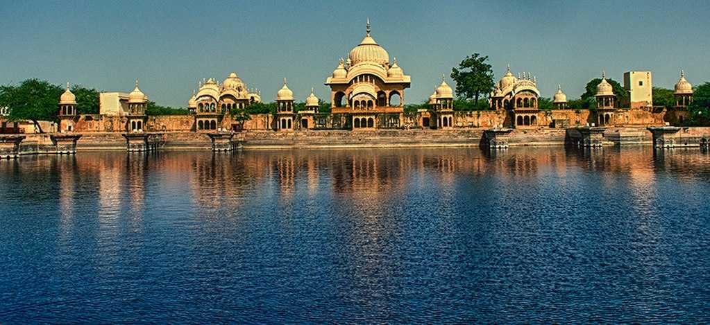
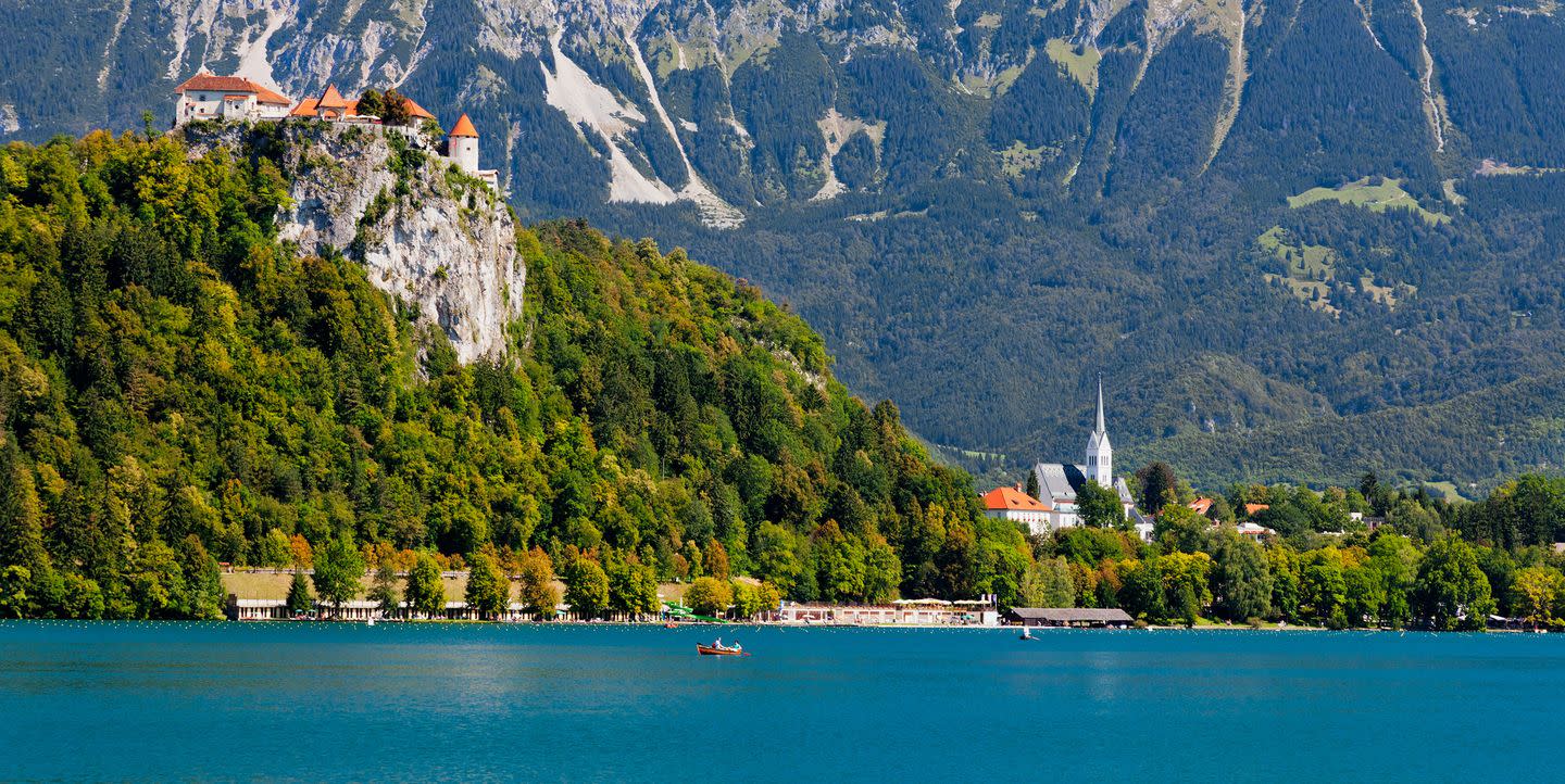
Hastinapur
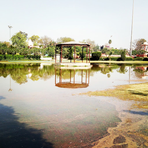
Located on the banks of an old ravine of the Ganges, Hastinapur lies less than 60 km southeast of Muzzafarnagar. An ancient city, Hastinapur is described in the Mahabharata and the Puranas as the capital of the Kuru Kingdom and is located on the right bank of the Ganga river. Translates to the City of Elephants in Sanskrit, Hastinapur’s history dates back to the period of the Mahabharata with several evidences noting that the city was named after King Hasti. The city also been known by other names, such as Gajapuram, Nagapura, Asandivata, Brahmasthalam, Shanti Nagaram and Kunjarpuram, in different ancient texts. Excavations carried out in Hastinapur in the early 1950s unearthed matrials which correlated between the text of the Mahabharata and the material remains uncovered. Hastinapur is also the birth place of three Jain Teerthankara, and it has become an important centre of pilgrimage for the Jains.
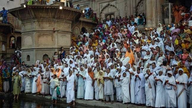
According to a popular belief, Ashtapad exists in the high mountain range of Himalayas, some 250 miles north of Badrinath and was believed that it was here that the first Jain Tirthankara, Bhagwan Rishabhdev attained his salvation. It is believed that who visits Ashtapad attains salvation and with this belief in mind, the Jains made a copy of Ashtapad in Hastinapur. Ashtapad which means eight steps, is 151ft tall with a diameter of 10 8m with the height of every step equal to the diameter.

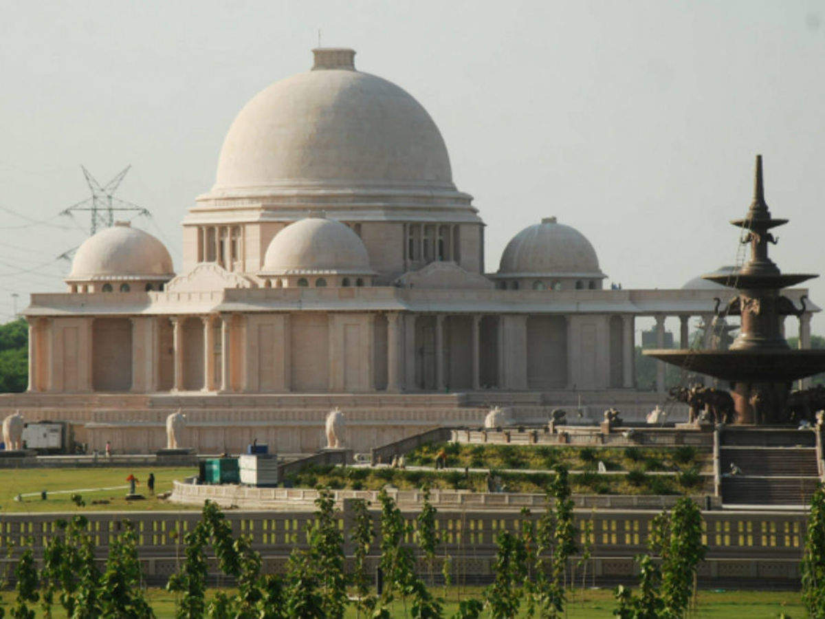
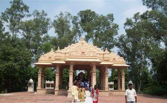
A huge complex comprising of various Jain temples designed in different designs, the Jambudweep Jain Tirth is an important pilgrimage site for those of the Jain faith. There are various temples, some of them quite big, and a meditation hall within the campus. The Sumeru Parvat, Teen Lok Temple, Lotus Temple are some of the fascinating temples inside.

The Bada Digambar Mandir is one of the oldest Jain temples and is situated on a 40 ft high hillock with a magnificent structure which sees a huge number of devotees to worship the statue of Bhagwan Shantinath in a Padmasan. It is believed that the prayer offered here are always received well. There are multiple temples in this complex including the Kailash Parvat Temple, the Nandeeshwara Dweep, the Trimurti Mandir and the Maan Stambha as well as 24 tonks, a Petrograph and various Shrines.
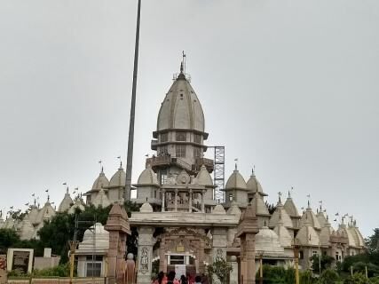
The Kailash Parvat Rachna is a 40-metre-high structure, home to several Jain temples, including the Yatri Niwas and Bhojanshala. There is also an auditorium and a helipad on the premises.
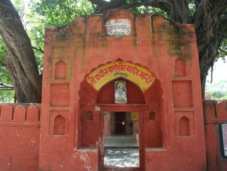
The Pandeshwar temple is dedicated to Lord Shiva and is believed to be the place where Kauravas and Pandavas received their education in the Vedas and the Puranas. A temple of the Goddess Kali and many ashramas are also present on a hillock between the ruins. Legend has it that in the Mahabharata period, Pandu’s eldest son Yudhishthira, had established the shivalinga at the Pandeshwar Mahadev temple before the war of Mahabharata and prayed to Shiva for a blessing of winning the war.

The Karna Temple is located near the Pandeshwar temple on an old ravine along the bank of the Ganges with the shivling inside the temple believed to be established by Karna, one of the prominent figures in the Mahabharata.
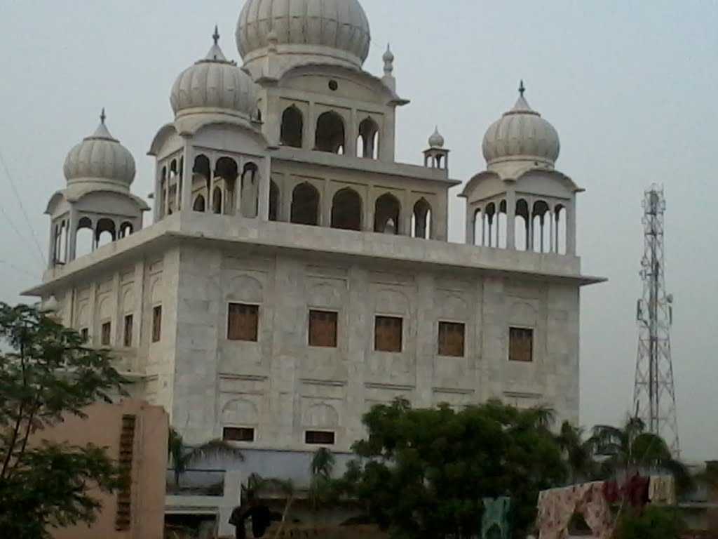
The Bhai Dharam Singh Gurudwara is located in the Saifpur village about 2.5 km from Hastinapur and is considered to be one of the holiest pilgrimage centers for the Sikh community. Established by Bhai Dharam Singh, one of the panj pyaare, instructed by Guru Gobind Singh at Anantpur Sahib for forming the nucleus of Khalsa.
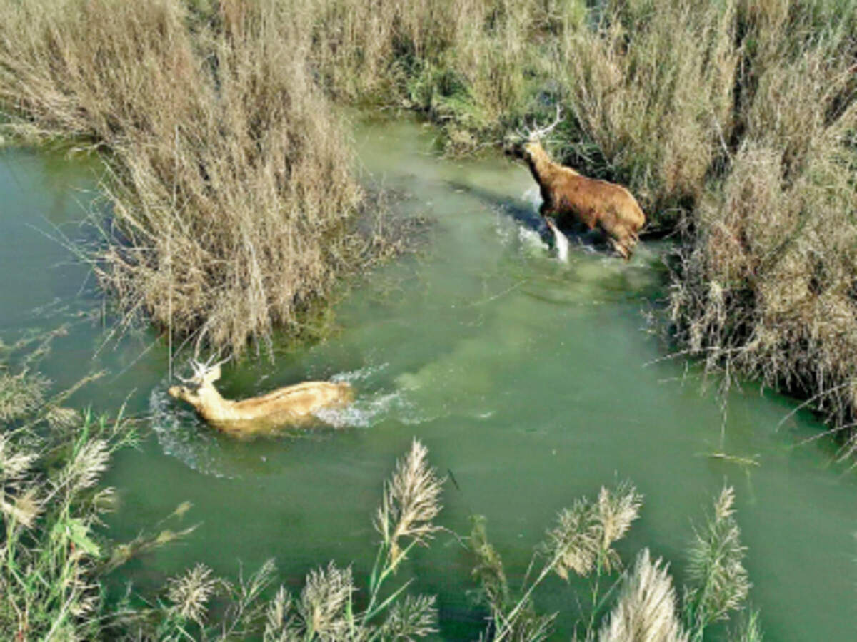
Also called as the Hastinapur National Park, the sanctuary spread across 2073 sq km was established in 1986 and is home to a wide variety of flora and fauna. Known to conserve a huge number of bird species and home to a variety of mammals, reptiles, amphibians, invertebrates, herbs and shrubs, peacocks can be spotted here in large numbers.

Vrindavan
Known as Lord Krishna’s childhood abode, Vrindavan is one of the oldest cities on the banks of Yamuna. The name of the town has been derived from Vrinda, meaning basil and van which means a grove, probably referring to the two small groves at Nidhivan and Seva Kunj. About 250 km south of our last destination, Hastinapur, the town hosts hundreds of temples dedicated to Lord Krishna and Goddess Radha scattered throughout, the most famous ones being the Banke Bihari temple and the ISKCON temple. One of the most sacred places in Vaishnavism, Vrindavan is located in the Braj Bhoomi region, and is where, according to Hinduism, Lord Krishna spent most of his childhood days and is about 15 km north from Mathura, Krishna’s birthplace.
Vrindavan was established in the 16th and 17th centuries as a result of an explicit treaty between the Muslims and Hindu Emperors. But the essence of Vrindavan was lost over time until the 16th century, when it was rediscovered by Chaitanya Mahaprabhu who visited in 1515 to locate the lost holy places associated with Lord Krishna’s life.
Vrindavan is also known as the city of widows due to the large number of widows who move into the town and its surrounding area after losing their husbands. There are an estimated 15,000 to 20,000 widows who come from the states of west Bengal, Assam and Odisha.

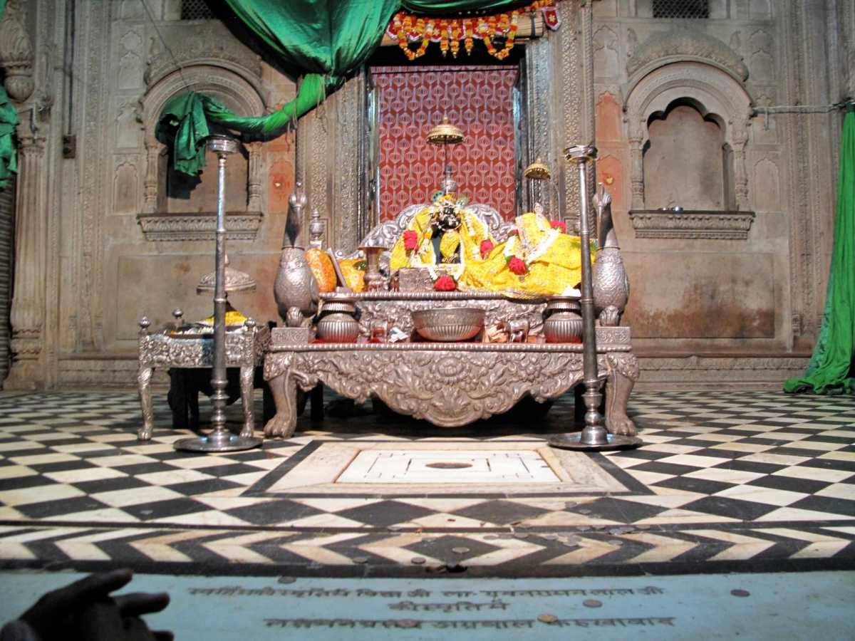
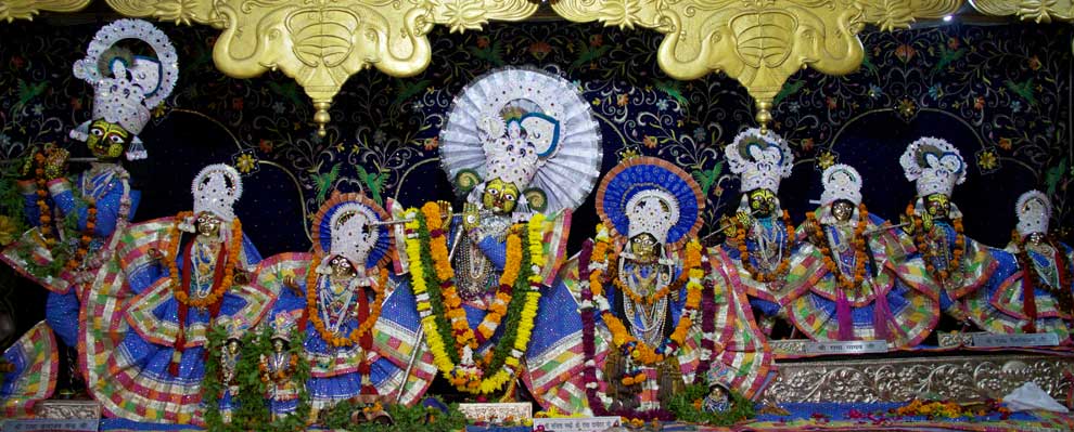
The Shri Banke Bihari Mandir is dedicated to Lord Krishna. Built in 1862, the temple is in the Rajasthani style of architecture and is adorned with arched windows and stonework. The image of Lord Krishna in the temple appears in the form of a child and is seen standing in the Tribhanga position. There are no bells or conchs in the premises, as it is believed that the Lord does not like the sound of these instruments with invocations performed by peaceful chants of Radha Naam.
The word Banke means bent in three places, while the word Bihari means supreme enjoyer. The idol in Banke Bihari Temple was originally worshipped under the name of Kunj Bihari which means the enjoyer of lakes. The lord is worshipped in three parts every day including Shringar, Rajbhog and Shayan. While Shringar, which includes bath, dressing and adornment with jewellery like crown and necklaces and Rajbhog or feast are offered in the forenoon, the Shayan Sewa which is the sleep worship is offered in the evening. In summers, the temple opens at 7 am with the morning aarti between 7:45 to 8 am and darshan from 8 am to 12 noon and then again between 5:30 to 9:30 pm. During the winter months, the darshan timings are between 8:45 am to 1 pm and then between 4:30 to 8:30 pm. The Mangala aarti is held in the temple during Janmashtami, while Akshaya Tritiya is the only day when one can see the deity’s lotus feet. The deity can be seen wearing a special crown and carrying a flute only on the full moon day in autumn. During the last five days of the Hindu month of Phalguna, the festival of Holi, the Deity comes off his altar and can be seen fully. It is also around this time that he can be seen with four gopis. The Jhulan Yatra or the swing festival of Lord Krishna is celebrated on the third day of the waxing moon, where Lord Banke Bihari is seated on a golden swing known as a hindola. The curtain is pulled shut and then opened again, every few minutes, unlike other temples. It is believed that the eyes of Banke Bihari are so brilliant at this time that it can make anyone unconscious if seen for a long time.

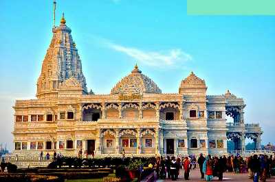
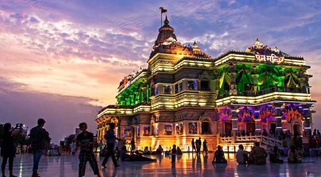
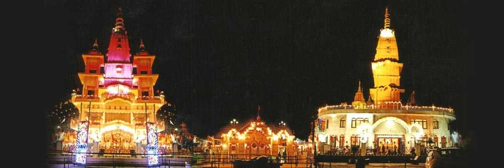
Prem Mandir is a massive temple built by Jagadguru Shri Kripaluji Maharaj in 2001. Known as the Temple of God’s Love, it’s dedicated to Radha Krishna as well as Sita Ram and made of white marble and adorned with intricate carvings. Various scenes from Lord Krishna’s life have been depicted on the periphery of the temple. Built in the Rajasthani Somnath Gujarati architectural style, the temple is situated on a 54-acre site on the outskirts of Vrindavan and constructed using Italian marble. The structure is 125 feet tall, 122 feet long and 115 feet wide. Doors and windows of the temple are beautifully carved, with the walls and floor adorned with colourful semi-precious stones depicting floral vines blooming with buds and flowers. The pillars are intricately engraved with beautiful statues depicting the Kinkari and Manjari Sakhis serving Shri Radha Krishna in a variety of ways. The temple also houses a circumambulation route, consisting of 48 panels and 84 panels on the exterior depicting the Shri Radha Krishna. The first floor of the temple has spectacular idols of Lord Krishna and Goddess Radha, while the second floor is dedicated to Lord Rama and Goddess Sita. A striking feature of the temple is the musical fountain show which takes place every evening from 7 to 7:30 pm. The temple is open daily between 5:30 am and 8:30 pm.
The Sri Radha Raman Mandir, dedicated to Lord Krishna in the Radha Raman or the giver of pleasure to Radha avatar is known to house a saligram or a self-manifested deity of Lord Krishna with a mystical smile on his face as Radha Ramana, alongside Goddess Radha. The temple is said to be one of the most significant among the seven temples of Thakur of Vrindavan and holds importance especially among the followers of Gaudiya Vaishnavism. The temple was established in 1542 and renovated in 1826. An interesting fact about this temple is that even though it is dedicated to and named after Goddess Radha, there is no deity of Radha Rani in the temple, instead a crown is kept next to Lord Krishna to signify her presence. The temple is built in the modern Hindu architectural style and the temple is open between 8 am and 12:30 pm and then again from 6 to 8 pm daily. The mangala aarti takes place at 4 am during winters and 5:30 am during the summer.

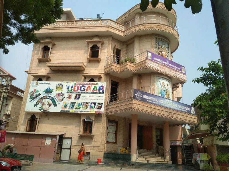
Also known as Sri Sri Krishna Balaram Mandir, the ISKCON Vrindavan is the fulfilment of the dream of Swami Prabhupada, the founder of the ISKCON movement, who wished to build a temple for the brothers, Lord Krishna and Lord Balaram where they played together several centuries ago. The three altars here are the seats of Sri Sri Gaura Nitai, Shri Krishna and Balaram and Sri Sri Radha Shyamasundara along with Lalita and Vishakha. The presiding deity of the temple, however, is Lord Krishna-Balaram with two idols on the central slab of the temple depicting Lords Krishna and Balarama. On the right dais are the idols of their friends and on the left side is a statue of Chaitanya Mahaprabhu with Nityananda, and of Bhaktivedanta Swami Prabhupada and his spiritual coach Bhaktisiddhanta Sarasvati Thakura. The Vrindavan Chandrodaya Mandir is housed in a modern geodesic structure with a traditional gopuram based on the Khajuraho style of architecture and will be the tallest temple in world on completion. The temple is constructed out of white marble and the galleries of the temple display various pictures of Lord Krishna with the courtyard having beautiful verandah surrounding it with wall paintings of Sri Radha-Krishna and Sri Gaur-Nitai. The first floor of the temple is more like a balcony with 108 flowers painted on the floor. There is guesthouse named ISKCON Guest House inside the temple campus for accommodation. The temple is open during the summer months from 4:30 am to 12:45 pm and then from 4:30 to 8 pm and from 4:30 am to 1 pm and between 4 to 8:15 pm during the winter months.
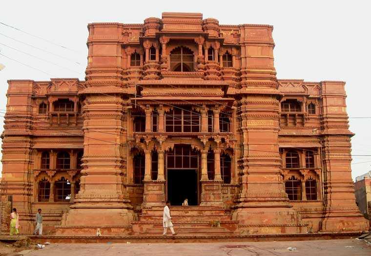
The Sri Govind Devji temple is an ancient temple built of red sandstone and dedicated to Lord Krishna. Although the original idol no longer exists in the temple, it is said that the idol of Lord Krishna in Govind Devji Temple resembled the face of the lord when he was born. The temple is one of the four temples of particular interest among the thousand within the periphery of the town and is believed to be established by King Vajranabh, the great-grandson of Sri Krishna about 5000 years back. The recorded history of the temple, however, dates back to the 16th century when Sri Rupa Goswami, a disciple of Sri Chaitanya Mahaprabhu went to Vrindavan to find the deity which was lost, at his master’s wishes. Raja Man Singh of Amer and a trusted general of the Mughal emperor, Akbar, began construction of the temple in 1590 on the occasion of Akbar’s pilgrimage to Vrindavan, but the seven-storied temple was destroyed on the orders of Akbar’s grandson, Aurangzeb in 1670, but the demolition was abandoned at three stories. Made of red standstone resembling a European cathedral, the seven-storied temple is considered as one of the most exquisite temples of North India and has an altar inside which is a blend of marble, silver and gold with a sculptured lotus flower decorating the central hall ceiling and is an amalgamation of Islamic and Hindu architecture constructed in the Dravidian style. The idol in the temple was transferred to Jaipur by Raja Jai Singh II before Aurangzeb could destroy it and so the present temple is a tourist site without any rituals being held. A replica of the Lord was installed later in a new temple beside the original structure along with the deity of Sri Radha. The temple is open daily between 4:30 am and 9 pm.
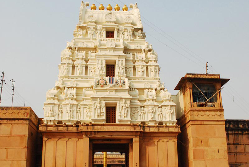
Also known as the Rangji Temple, the Sri Ranganatha Temple is dedicated to Lord Sri Goda Ranagamannar, a South Indian Vaishnava saint, and Lord Ranganatha, an incarnation of Lord Krishna. The highlight of the temple is the idol of Krishna present in the form of the groom with Goddess Goda or Goddess Andal as his bride. Andal was a famous 8th century Vaishnava saint known for composing the Tiruppuvai, a hymn for her beloved Lord Krishna and his birthplace Vrindavan. It is believed that seeing her dedication to him, Lord Krishna answered her prayers by agreeing to become her groom. This is one of the largest temples in North India and one of the 108 Divyadesams for the Vaishnavas. The temple’s east gate is the main gate but entry to the temple is allowed from both gates and a milk abhishek is done every Friday. The idol of Goddess Andal is taken out of the main sanctorum to the pond every Friday evening. The temple is open from 5:30 to 11 am and from 4 to 9 pm during summer and from 5:30 to 12 noon and between 3 to 9 pm during winter.

The Katyayani Peeth is also known as Uma Shakti Peeth and is one of the 51 Shakti Peethas. The idol of Sati is worshipped here in the form of Uma and is believed that when Lord Vishnu used his Sudarshan Chakra to cut Maa Sati’s body to relieve Lord Shiva from the sorrow of losing his wife, the ringlets of her hair fell in this place. Katyayani Peetha has five different forms of worship, Goddess Uma or Shakti, Lord Shiva or Shiva, Lord Lakshmi Narayan or Vaishnava, Lord Surya or Saurya and Lord Ganesha or Ganpataya. Jagatdhatri Devi is also worshipped here.The temple is open for worship between 7 and 11 am and again between 5:30 and 8 pm.

Situated between Keshi Ghat and the Radha Raman Temple, the Radha Gokulananda Temple contains idols of Radha Vinoda, Radha Gokulananda and Lord Chaitanya. Although the temple has no elaborate structure, it still holds great significance. The temple also houses a Govardhana-shila that was given by Lord Chaitanya to Raghunath Dasa Gosvami which bears the thumbprint of Lord Caitanya. Originally, there was no deity of Radharani in this temple, but Jahnava Devi had a deity of Radha made in Jagannatha Puri and installed it next to Radha-Vinoda. Built in the Hindu architectural style, the original deity of Radha-Vinoda is worshipped in Jaipur as it was moved to the city to protect it from Muslim invaders, with the temple now having the Pratibha-murtis of the original deities. The temple also has various samadhis placed in a small courtyard of sadhus who resided there. The temple is open from 8 am to 12 noon and from 5 to 8 pm. The mangala aarti takes place at 5 am in the summer and at 6 am during winters.

The Gopeshwar Mahadev Temple is one of the oldest temples in Vrindavan, located close to the Yamuna River and revered for the Shiva Linga established here by the great-grandson of Lord Krishna, King Vrajanabha. The temple holds the confluence of the masculine and feminine powers of nature with the Shiva Linga, the symbol of male power worshipped during the day from 6 to 10 am and and Shiv Linga dressed as a gopi with special shringar ceremonies which is worshipped at night from 5 to 9 pm at the time of the raasleela or the divine dance. The legends of Vrindavan consider Lord Shiva as the first Vaishnav ever and the guru of all Vaishnav since he was a devotee of Lord Vishnu of whom Lord Krishna was an avatar. According to legend, on the full moon night of Sharad Purnima, Lord Krishna along with Goddess Radha was performing the Raas Leela on the moonlit banks of Yamuna River near Vamshivat when Lord Shiva along with his wife, Pravati arrived there to take part in the same. Goddess Parvati was allowed to enter there but Lord Shiva was restricted from it because males were not supposed to take part in it. So, he was stopped on the outskirts of Vrindavan by Vrinda Devi, the deity of Vrindavan who told him that the reason for restricting him to enter is the lack of Sakhibhav which was a must for Raas leela which is intended to please Goddess Radha. Shiva was determined to participate in it and so he meditated with Radha in his mind. Pleased by his meditation, Radha sent her close friend Lalita to bring him over into the Rasamandal after introducing him to Sakhibhav. Lalita went over to Lord Shiva and explained the deepest secrets of Sakhibhav, post which she asked him to take a dip in the holy Yamuna with full passion to achieve Sakhibhav. When Shiva took the dip, he came back as a beautiful damsel and then Lalita took him to Rasamandal. Lord Krishna recognised Lord Shiva and named the female form of him as Gopeshwar. Shiva considered Lalita as his guru since she helped him understand the secrets of Sakhibhav. The belief prevalent about the Shiva Linga is that it was installed by Vraja Gopis themselves who worshipped him to attain Krishna as their husbands. This temple is open during the summers from 5 am to 12 noon and then from 4:30 to 9:30 pm with the aarti twice a day at 7:30 am and 7:30 pm. During the winters, it is open from 5:30 am to 12 noon and then from 4:30 to 9 pm with the aarti at 6:30 am and 6:30 pm.

The Shahji temple was built in the year 1876 by Shah Kundan Lal and is dedicated to Lord Krishna. The main deity here is known as Chhote Radha Raman. Its impressive marble structure features 12 beautiful spiral columns of a height of 15 feet each and also the Basanti Kamra which is a hall with Belgian glass chandeliers and intricate paintings placed within. Shahji Temple is mainly visited by religious devotees and tourists to admire the stunning architecture.
Chamunda Devi Temple is one of the 51 Shakti Peethas. It is believed that a hair strand of Mother Bhagwati Jagdamba fell here and according to Srimad Bhagwat, Sri Krishna visited Chamunda Devi Temple after liberating the dragon. The main highlight of the temple is that there is no idol of Maa Chamunda inside. It is said that the sage Shandilya meditated here while Sri Gorakhnath attained knowledge here. The temple is open from 6:30 am to 12 noon and then from 4 to 9 pm.
The Radha Damodar Temple is one of the seven Goswami temples, housing the Giriraj Shila which was given to Srila Sanatana Goswami by Sri Krishna. There are idols of Sri Radha Rani and Lalita Sakshi along with Sri Damodar. Devotees often perform 4 parikramas or circumambulations of the temple and it is also believed that the temple houses some fragments of the Govardhan Hill. In summers, the temple is open from 4 am to 12:45 pm and from 4:30 to 9 pm. During winters, it is open from 4:30 am to 12:45 pm and from 4 to 8:45 pm.

The Madan Mohan Temple, also known as Sri Radha Madana Mohan Temple, is the oldest temple in Vrindavan. Located close to Kaliya Ghat, on Dwadashaditya hill overlooking Yamuna River, it is 50ft high and is believed that Lord Krishna rested at this site after conquering the Kaliya Naag. The original deity of Lord Madan Gopal was shifted from the shrine to Karauli in Rajasthan for safekeeping during Aurangzeb’s rule and today a replica of the original deity is worshipped at the temple. Radha and Lalita Sakhi are worshipped here along with Lord Krishna as Madana Mohan. The temple is believed to be originally built by the great-grandson of Lord Krishna, King Vajranabh. While the central tower houses idols of Radha, Krishna and Lalita Sakhi, the right tower houses the bhajan kutir and samadhi or cenotaph of Sri Sanatana Goswami and the left tower remains closed. The Advaita Vat, the oldest banyan tree in Vrindavan is also housed inside the temple. From the temple, there are stunning views of Vrindavan. The temple is open from 7 am to 12 noon and from 4 to 8 pm in winters and from 6 to 11 am and 5 to 9:30 pm in the summers.
The Nidhivan temple has a sense of mystery or miracle attached to it. It is said that Lord Krishna visits it every night and performs Ras Leela. In the evening, after the evening aarti, no priest or devotee is allowed to step into the premises. There is no sighting of any animal or bird after 7 pm either because it is said that they move away from the area as well. Nidhivan has a unique surrounding and is flanked by unusual hollow trees that are short heightened and the branches are twisted downwards and lie in tangles with Tulsi plants also in pairs. A special corner called the Rang Mahal is decorated every evening with a bed of sandalwood spread across the area and a jar of water kept and a pan laid out. It is said that the bed looks used in the morning, and the paan and water seems to have been tasted with people claiming that it is Lord Krishna who is responsible for this. It is said that the Tulsi plants turn into Gopis at night and dance around while Krishna performs his Raas Leela and some can hear the sound of the anklets at night as well. Another mystery that surrounds the area is the rock garden which holds the footprints of young Krishna and his calf can still be seen in the mountains.
Keshi Ghat is the main ghat in Vrindavan and the only one still remaining. It is believed that in the Dwapara Yuga, Lord Krishna killed Keshi here who was a horse demon sent by Kansa. The Madanmohan Temple is located nearby while the ghat itself is one of the most significant places of worship with the Yamuna maha-aarti performed every evening. Built by Queen Lakshmi Devi of Bharatpur in the 17th century in an extravagant Rajasthani architectural style, it is believed that without performing the ritual of the Pratham Din pooja at the ghat each day, Vrindavan is incomplete. The ghat is open from 6 am to 9 pm daily.

Located about 50 km from Vrindavan, Nandgaon is a quaint little town situated at the base of the Nandisvara Hill and is highly revered as it is believed to be the home of the foster parents of Lord Krishna, Shri Nandji and Yashoda Maiyya. There is also a spacious temple situated atop the hill which is dedicated to Shri Nandji. Among the several other attractions situated in town, the most popular ones include temples dedicated to Yashoda Nandan, Nritya Gopal, Nand Nandan, Udhav Kyaro and Gopinath etc. There is also a stunning lake called Pan Sarovar from where it is believed that the cattle of Lord Krishna drank water from here. A little away from town, is also the very famous Kokilavan and the temple dedicated to Shanidev.
Mathura
Mathura lies about 14.5 km south of Vrindavan, and 22 km east of Govardhan. In ancient times, Mathura, which lies in the centre of the cultural region of Braj, was an economic hub, located at the junction of important caravan routes. Mathura is believed to be the birthplace of Lord Krishna, located at the Krishna Janmasthan Temple Complex and is one of the Sapta Puri, the seven cities considered holy by Hindus. The Kesava Deo Temple was built in ancient times on the site of Krishna’s birthplace, an underground prison and at that time, Mathura was the capital of the kingdom of Surasena, ruled by Kansa, the maternal uncle of Lord Krishna.
According to the Archaeological Survey of India plaque at the Mathura Museum, the city is mentioned in the oldest Indian epic, the Ramayana. In the epic, the Ikshwaku prince Shatrughna slays a demon called Lavanasura and claims the land. Afterwards, the place came to be known as Madhuvan as it was thickly wooded, then Madhupura and later Mathura. The most important pilgrimage site in Mathura was Katra or the market place, now referred to as Krishna Janmasthan or Lord Krishna’s birthplace. Excavations at the site revealed pottery and terracotta dating to the sixth century BC, the remains of a large Buddhist complex, including a monastery called Yasha Vihara of the Gupta period, as well as Jain sculptures of the same era.
Archaeological excavations at Mathura show the gradual growth of a village into an important city during the Vedic age. Archaeologists have discovered a fragment of Mathura red sandstone from Rakhigarhi, a site of the Indus Valley civilization dated to the third millennium BC, which was used as a grindstone.

The Shri Krishna Janmasthan Temple is built around the prison cell in which Lord Krishna’s parents, Devaki and Vasudeva were imprisoned by his evil uncle Kansa and is believed to be the birthplace of Lord Krishna. Besides the prison cell, there are other temples located within the Krishna Janmasthan Temple Complex. The temple is believed to have been first constructed by the great-grandson of Lord, Krishna Vajranabha 5000 years ago. Then, it was rebuilt in 400 AD during the reign of Chandragupta Vikramaditya. However, it was destroyed in 1017 AD by Mahmud of Ghazni. In 1150 AD, the temple was constructed for the third time during the reign of Raja Dhrupet Dev Janjua, the King of Mathura only to be destroyed by Sikandar Lodi, of the Sultanate of Delhi in the 16th century. 125 years later during the reign of Jahangir, Raja Veer Singh Bundela rebuilt it and it was destroyed by Emperor Aurangzeb in 1669 AD who built a masjid in its place. When Mathura came under British colonial rule, the temple area was auctioned off in 1815 and final reconstruction was completed in 1982.
The complex houses the Keshavdeva temple, the Garbha Griha shrine and the Bhagavata Bhavan. The Keshavdeva Temple is located south of the Shahi Eidgah and was built by Ramkrishna Dalmia in memory of his mother Jadiadevi Dalmia. The Garbha Griha Shrine is considered where Krishna is believed to be born. A marble pavilion and an underground prison cell were built on the place with a spacious veranda. There is shrine near it dedicated to the eight-handed goddess Yogmaya and is located against the rear wall of the Shahi Eidgah. The Bhagavata Bhavan is dedicated to Shrimad Bhagavata and includes five shrines. The main shrine consists of six-feet tall statues of Radha and Krishna, the shrine of Balarama, Subhadra and Jagannath on right, the temple of Rama Lakshman and Sita on left, Garuda Stambha and Chaitanya Mahaprabhu in front of Jagannatha shrine and Hanuman in front of Ram shrine, the temple of Durga and the temple with Shivalinga. The ceiling, walls and pillars of the assembly hall are adorned with frescoes depicting life events of Krishna and his devotees. There is a circumambulation path whose walls are engraved with texts from Bhagavad Gita. The Potra Kund is a large water tank which is believed to be the first place where Lord Krishna was given a bath. Other buildings in the complex include the Ayurveda Bhavan, the International Guest House, shops, library and an open space for performances. During the summer months of April to November, the temple is open between 5 am and 12 noon and 4 to 9:30 pm. During the winter months of November to April, it is open between 5:30 am and 12 noon and then from 3 to 8:30 pm. The Garbha Griha is open from 5:30 am to 8:30 pm.
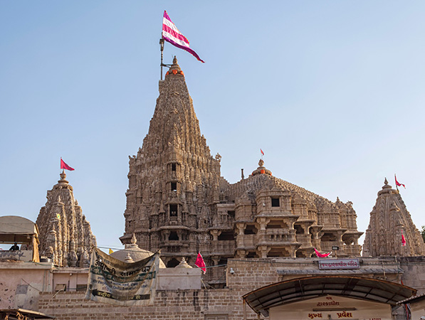
Touted as the holiest temple in Mathura, the Dwarkadhish Temple, is well known for its elaborate architecture and paintings. Built in 1814, the temple is relatively new, but highly revered. The temple is dedicated to Lord Dwarkadheesh, a form of Lord Krishna known as Dwarkanath, depicted as a black marble idol. The main building has a Rajasthani style entrance with steep steps leading to the main courtyard. In the centre of the yard are five rows of richly carved pillars supporting a beautiful painted ceiling which depict the life story of Lord Krishna. The pillars divide the courtyard into three segments; the right lane is for women and the extreme left one is for men. In the centre lane, only those with a VIP pass can enter. In the front of the yard is the garbhagriha or sanctum sanctorum where the Idol is placed. When Darshan has ended, a curtain is drawn over the entrance. The temple is open from 6:30 to 10:30 am and from 4 to 7 pm in summer and from 6:30 to 10:30 am and from 3:30 to 6 pm in winter.

The Birla Mandir is also known as the Gita Mandir and is dedicated to Lord Lakshmi Narayan, an avatar of Lord Vishnu. Located on the Vrindavan-Mathura road, the architecture of the red sandstone temple is magnificent with exquisite carvings and paintings and has the entire Bhagavad Gita inscribed on the pillars. The sanctum sanctorum enshrines Radha Krishna and there are two additional sanctum rooms enshrine Lakshmi Narayan and Ram Sita. The complex also houses Lord Krishna’s chariot and a towering Gita Stambh which has carvings of the Bhagvad Gita. Inside the premises of the temple, there is a small temple with the presiding deity as Lord Hanuman. Right opposite to the main sanctum sits the vehicle of Lord Vishnu, Garuda with folded hands. In summer, the temple is open from 5 am to 12 noon and 2 to 8 pm and in winter, it is open between 5:30 am and 12 noon and between 2 to 8:30 pm.

The Bhuteshwar Mahadev Mandir is dedicated to Lord Shiva, also known as Bhuteshwar Mahadev. It is also a Shaktipeeth where the ringlet of Sati fell after her body was destroyed. The shrine is considered auspicious and unique as it is one of the very few temples in the city which is not dedicated to Lord Krishna. Considered to be one of the oldest temples, the temple also houses the Patal Devi Cave, the goddess worshipped by King Kansa.

Kokilavan, situated near Kosi Kalan, houses the famous Shani Temple, dedicated to Shani Dev or Saturn and his guru Barkhandi Baba. Since the site is located amidst the jungle, it has also come to be known as Kokilavan Dham. Pilgrims perform a parikrama or circumbulation of the temple and take a dip in the holy kund or pond here. Saturdays are the busiest day as it is is believed that taking a dip in the Suryakund at Kokilavan leads to wishes being fulfilled. There is a sacred tree at the temple compound where devotees offer water and write their wishes on a blank wall with their fingers.

Popularly known as Ma Vaishno Devi Mandir, the Vaishno Devi Dham is dedicated to Ma Vaishno Devi who is believed to grant boons to her devotees. There is a dispensary and library attached to the temple and it also has two dharamshalas or guest houses to provide accommodation to visiting devotees. The main central hall is used for meditation and adjacent to it is the yoga hall.

The Chamunda Devi Temple is one of the 51 Shakti Peethas and is located opposite the Maa Gayatri Tapobhumi on Mathura Vrindavan road. It is believed that a hair strand of Mother Bhagwati Jagdamba fell at this sacred spot and according to the Srimad Bhagwat, Sri Krishna visited Chamunda Devi Temple after liberating the dragon. This temple is unique because there is is no idol of Maa Chamunda inside. It is at this temple that the sage Shandilya meditated and Sri Gorakhnath attained knowledge. The temple is open from 6:30 am to 12 noon and then from 4 to 9 pm.
The Dauji Mandir lies about 18 km from Mathura and is one of the revered temples in the country. Built in 1535, it is one of the oldest temples in the city with the presiding deity being Lord Balarama, the elder brother of Lord Krishna. The idol of Lord Baladev is considered as the biggest of the Braja Mandal, black in colour and having two hands. The deity is about 7 feet tall. While the left-hand holds a royal cup with Varuni or the holy drink, the right hand is elevated and can be discovered by devotees when they offer prayers. There is also a statue of Lord Balarama’s wife, Revati. Built in the typical Indian architectural style, the temple has three doors on three sides each of which give access to the calla, one of which is surmounted by a squat pyramidal tower. Inside the main sanctum, the walls display beautiful artworks as well as decorated idols of Lord Balarama and his wife, Revati. Baladeva serves as the chief deity while there is a life-sized statue of Revati as well. Dauji Mandir complex has an adjoining court, where there is a small vaulted chamber believed to be the residence to the Lord post his epiphany. Each court or Kunj bears the name of its founder. The Kshir Sagar or Sea of Milk is a tank built of bricks, but today is not in a good condition and its surface is covered with thick green scum, but pilgrims still bathe in it. The temple is open from 7 am to 12:30 pm and then from 3 to 4 pm and again from 6 to 9 pm.
The Shri Nand Bhawan is also known as the Chaurasi Khamba Temple as it rests on 84 pillars and is located in Gokul, the childhood home of Lord Krishna. It is housed in a vast complex which is known for its architecture and comprises of a kitchen, store room, dining room and bedrooms. The Chaurasi Khamba Temple comprises of 84 steps which represents the 84000 species of life in the material world. Paintings and motifs of Lord Krishna adorn the walls of the temple while there are exquisite carvings on the stone pillars. There is a huge banyan tree in the courtyard where devotees tie colourful thread or ribbons and a temple dedicated to the Goddess Kaali under the tree. In summer, the temple is open from 5 am to 12 noon and then from 2 to 9 pm. In winter, it is open from 5:30 to 12 noon and then from 2 to 8:30 pm.

The Jama Masjid was constructed in 1661 by Abd-un-Nabi Khan, a governor of emperor Aurangzeb and has four minarets, mosaic plastering along with the marvellous carvings and a raised courtyard. The highlight of the mosque is the facade inscribed with 99 names of Allah in the Persian script. The mosque is open from 5 am to 9 pm daily.

Situated near Govardhan Hill are one of the holiest places in the Braja region, the Radha and Shyam Kunds. The two holy water tanks lying next to each other are considered to contain pure and sacred waters, which have magical properties to heal for conception. The origin of Radha Kund dates to the days of Goddess Radha and Lord Krishna and legend say that Lord Krishna killed the bull demon in Radha Kund and Radha, his consort told him to wash off his sin by taking a dip in the various holy rivers. He laughed it off and struck his feet on the ground where the rivers emerged and formed up a kunda or pond. Krishna, in order to please Radha bathed in the waters and the kund was named as the Krishna Kund. Afterwards, Radha and her girl attendants also dug up a kind with their kangans or bangle and their dug up ponds were filled by the waters from Krishna Kund, since getting the pond filled up from Manasi Ganga would be difficult since it was far off. The kund was henceforth known as the Radha Kund. Krishna took a bath in this kund as well and announced that anyone who took bath in Radha kund would attain the seed of intense love, similar to what Radharani had for him. Radha also took bath in Krishna Kund and announced that those who took bath there would attain the love of Krishna, just like he had for her. Located in Radha Kund is the large temple of Krishna Janmabhoomi constructed in the place where Krishna was born in a jail. The temple is spread out in a big area and is considered to be an important pilgrimage site. The temple remains crowded massively in Janmashtami, the birthday of Lord Krishna.

Located between Govardhan and Radha Kund, Kusum Sarovar is a beautiful reservoir fringed by palatial sandstone buildings from the bygone era. The reservoir has a flight of stairs which can be used to descend in the pond. The reservoir is believed to have got its name from one of the attendants of Radha, Kusum and has several temples and ashrams in the vicinity. The water is ideal for swimming and dips. Filled with emerald green water, the pond is bordered on all sides by forest containing flowers which Lord Krishna would collect to make garlands for Goddess Radha here. The central chhatri is square-shaped, with a lofty stone terrace adorned with corner booths and lateral bays. Raised on an ornamented plinth in the centre is the principal monument. The central chhatri is flanked on both sides by two other monuments supported on a 460 feet terrace, commemorating Raja Suraj Mal’s two queens, Hansiyat Devi and Kishori Devi. There is a huge garden filled with blooming flowers of various kinds, behind this building. The building dedicated to Raja Suraj Mal has a replica of Lord Krishna and Radharani’s lotus feet with the ceiling and walls decorated with exquisite paintings depicting the life of Krishna and Radha and the events from the history of the family to which it is dedicated. Built of red sandstone, it was built Jawahar Singh in honour of Raja Suraj Mal, his father and the king of Bharatpur. In 1735, the simple pond was reconstructed by the King of Orchha city, Raja Veer Singh, which was changed into a garden by Maharaja Suraj Mal for his queen, Kishori Rani. This is the reason why Jawahar Singh considered it as a memento of his parents. The reservoir is open from 7 am to 6 pm daily.

Potara Kund is one of the four kunds and is where the baby clothes of Lord Krishna were washed in his childhood. The water tank is made in red sandstone and has steps to descend inside.

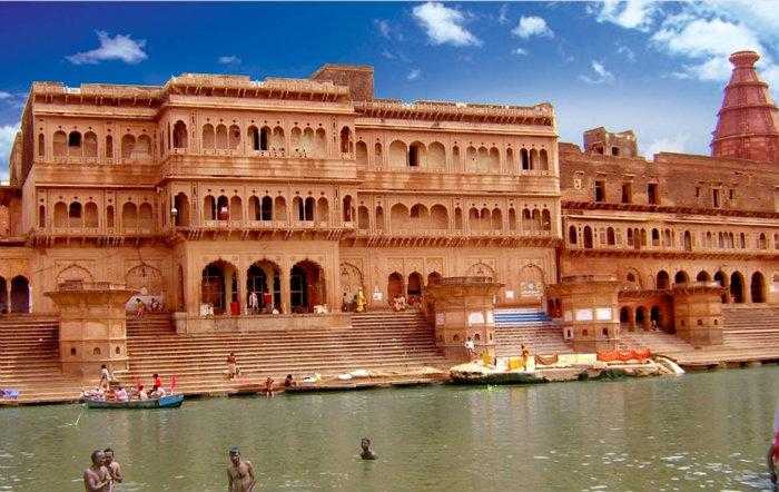
Vishram Ghat is a sacred bathing ghat on the banks of the Yamuna and is the main ghat of Mathura and is central to 25 other ghats. Pilgrims visit Vishram Ghat to bathe in its waters and perform the traditional parikrama that starts and ends here. Vishram which means rest and it is named so because Lord Krishna rested at this place after killing Kansa, the evil demon king. This is why a pilgrimage to Mathura is incomplete without a visit to Vishram Ghat and the temples dotting it. There are 12 ghats to the north of Vishram Ghat and 12 ghats to the south of it positioning it in the centre. The parikrama is the circumambulation of all the chief religious places of Mathura. It is in the evening that the ghat comes alive during the evening prayers and aarti. Devotees float oil lamps and lamps on paan leaves into the Yamuna river and also perform other rituals on this ghat, along with taking the holy dip. One of the best ways to enjoy the ghat is to take in a boat ride where one can view the entire stretch of the ghat. In summer, the aarti takes place at 7 am and 7pm and in winter at 6:45 am and 7 pm. A boat ride will set you back by INR 30-50 per person.

Govardhan Hill or the Giri Raj is situated about 25 km from Mathura and is made up of standstone and stands 80 feet high with a circumference of 38 km. Worshippers worship the rocks of the hill just like they worship his Lord Krishna. Some interesting places one gets to visit the hills including Mansi Ganga, Mukharvind, and Daan Ghati. Legend says that Lord Krishna lifted the Govardhan Hill during his childhood on one finger to save his village of Mathura from fierce rains and thunderstorm. This hill is thereby considered holy and is visited by worshipers on Guru Purnima and Govardhan Puja in devotion by walking 23 km barefoot around the mountain. The name of Govardhan Hill has two interpretations. Gau is the Hindi word for the cow and Vardhan means a cowshed. Go in Sanskrit means senses and Vardhan means to control which means that it is a place where one can keep their thoughts in control and offer their life for the salvation of Lord Krishna. One of the popular temples on Govardhan Hill is the Giriraj Temple dedicated to Lord Krishna who is also known as Giriraj Ji. Another temple is the Shri Chaitanya Temple, made of red sandstone and decorated with paintings of Krishna and Radha. The Mansi Ganga Lake is the largest lake in central Govardhan with the myth saying that one who takes a bath in Mansi Ganga is relieved off his sins and attains the purest devotion of Lord Krishna. The circumambulation of Govardhan Hill starts and ends here. The Danghati Temple’s name come from the words Daan meaning donation and ghati meaning a valley. The speciality about this temple is that the deity here is made in the form of a rock dressed up by the priests to resemble Lord Krishna holding Govardhan Parvat on his little finger.
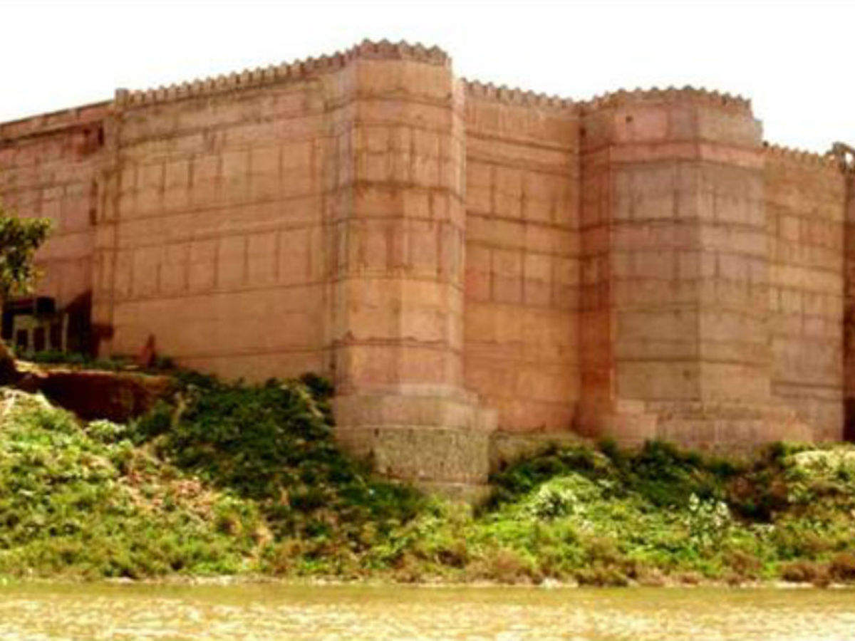
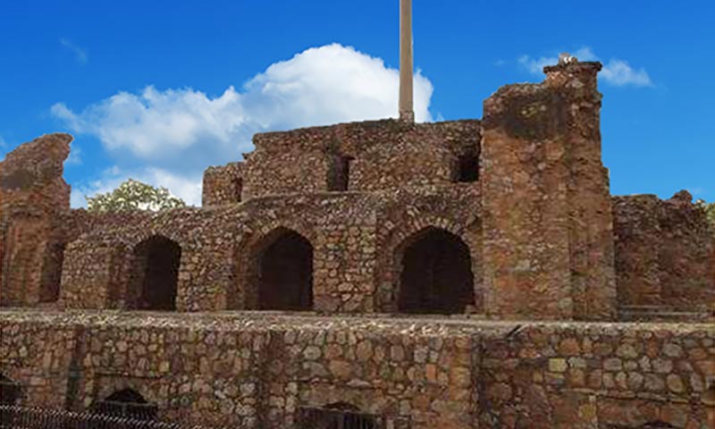
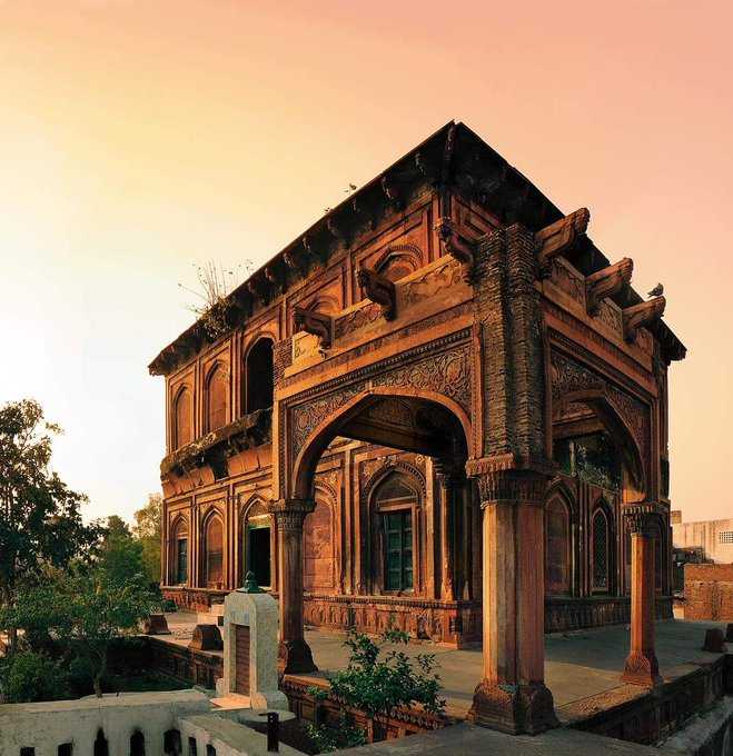
Located on the banks of the Yamuna, Kans Qila is an ancient fortress dedicated to Kans, the maternal uncle of Lord Krishna. Situated near the Krishna Ganga Ghat and Gau Ghat, the fort is a popular tourist spot and has been constructed as a fusion of Hindu and Muslim architecture styles. Kans ka Qila is in a dilapidated state due to negligence but is still thronged by tourists and alike. Also known as Purana Qila, the fort dates back to the period of the Mahabharat and has strong fortified walls. Kans Qila was renovated in the 16th century by Raja Man Singh of Amber, and later, Raja Sawai Jai Singh of Jaipur ordered an observatory to be built, which can’t be found today. The main highlight of the fortress is the audience hall divided into three separate aisles.

Previously known as the Curzon Museum of Archaeology, the Government Museum of Mathura is also known as Mathura Museum and houses a fairly big collection of ancient relics, sculptures, coins and paintings. Founded in 1874 by Sir F. S. Growse, the museum is famous for housing the ancient sculptures of the Mathura School, dating from the 3rd century BC to the 12th century AD. The museum also displays the discoveries made by noted archaeologists in and around Mathura. Today, it is one of the primary centres for study, research and preservation of Mathura’s exquisite art heritage. The museum is closed on Mondays and public holidays and on other days is open between 10:30 am and 4:30 pm.
Stay with this series as we explore the state of Uttar Pradesh in the next part.


