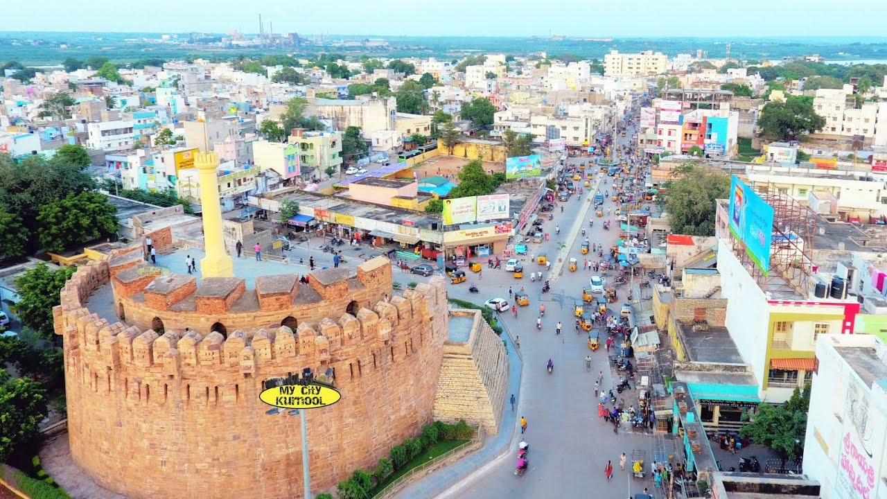
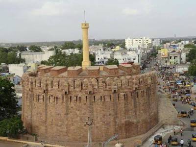
After Kurnool, Mantralayam, Gandikota, Tadipatri, Anantapur and Puttaparthi, in this last part about Andhra Pradesh, we will visit some interesting places, including the world famous Tirupati temple.
Lepakshi
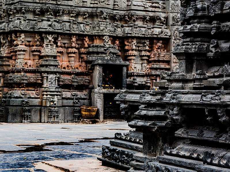
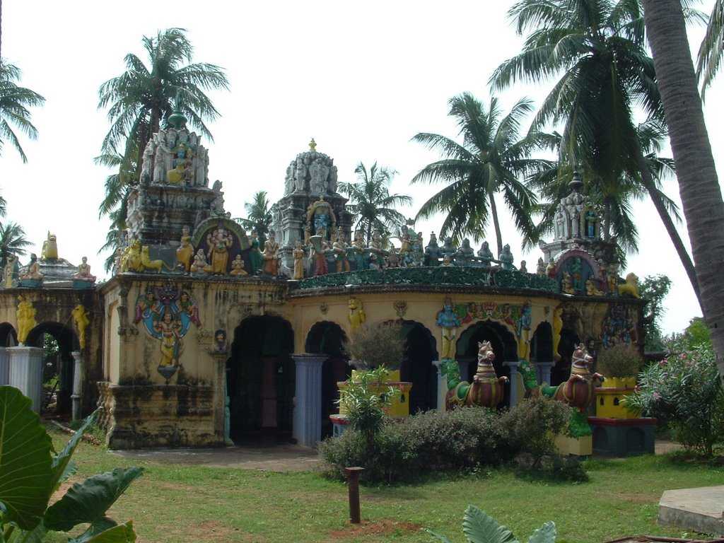
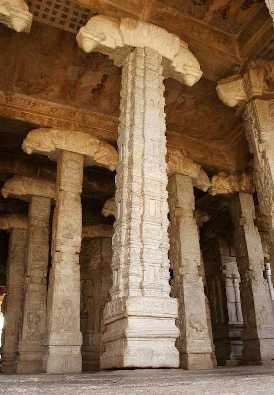
A small quaint village, Lepakshi is located at a distance of 120 km from Bangalore. Founded in 1535 AD by Maharaja Aliya Rama Raya of the Vijayanagara empire, Lepakshi is a trove of several fascinating archaeological sites, beautiful ancient temples and rich culture. Each structure narrating a story of its own, this enchanting village also derives its name from the Sanskrit language meaning rise o bird and has folklore attached to it. Locals believe that according to the legend of Ramayana, Jatayu fell in Lepakshi after getting injured by Ravana. The village is most famous as being home to the Lepakshi Temple, known for the stunning Vijaynagar style of architecture and hanging pillars. A magnificent example of timeless art and architecture, the temples of Lepakshi celebrate the might of Lord Shiva, Vishnu and Veerabhadra. Apart from richly carved temples with inscriptions in Kannada and hanging pillar, the most striking feature of Lepakshi is the largest monolithic idol of Nandi Bull in the entire subcontinent made of granite. Lepakshi is a treasure trove of a fascinating range of art forms and traditional crafts. Visitors should make sure to stop and should shop for the handicraft items which Lepakshi is famous for, including things like banjara embroidery, brassware, cotton and jute durries, kalamkari paintings, Kondapalli toys, cherial scroll paintings and Bidricraft.
The Veerabhadra temple is dedicated to Lord Veerbhadra and built back in the 16th century. Also known as the Lepakshi temple, it is famous for its architecture characterised by hanging pillars and cave chambers. Another thing that makes the temple unique and a place to must visit is a footprint that is believed to be of Goddess Sita. As soon one steps inside the temple, they get glimpses of the history of Vijayanagara kingdom by way of pictorial representations. From the figures of musicians and saints to that of Parvati and Lord Shiva, the Lepakshi Temple has everything. Apart from the architectural importance, the temple according to Skanda Purana, is a divyakshetra, in other words, an important pilgrimage destination of Lord Shiva. The highlight of the temple is the Statue of Nandi Bull, made from a single granite stone. The temple is open daily between 5 am and 9 pm.

Located near the Veerbhadra Temple is another striking feature of the village, the idol of the Nandi Bull and paintings. This monolithic sculpture of Nandi crafted out of granite stone measures 4.5m in height and 8.23 m in length and is believed to be the largest statue in India. Other than this, another brilliant craftsmanship in form of sculptures and mural paintings can be seen on the walls of Natya and Kalyana Mandapams which are also popularly referred to as dance and wedding halls. In fact these incredible carvings are regarded as the finest specimen of Vijayanagara style of architecture.
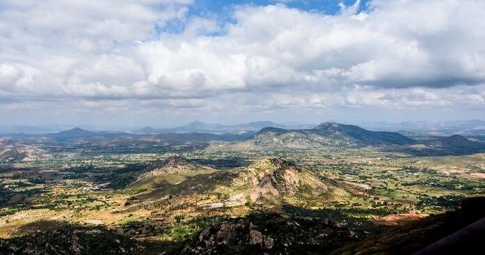
Horsley Hills
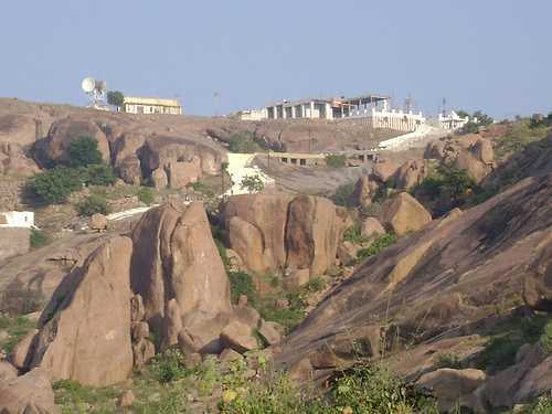
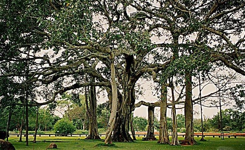
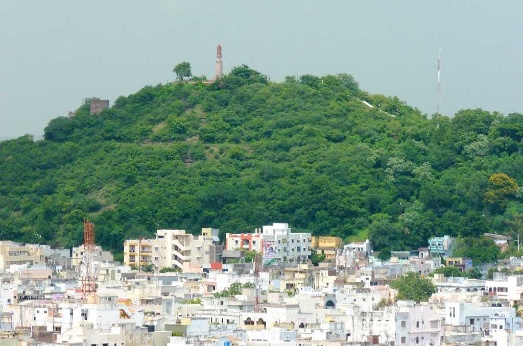
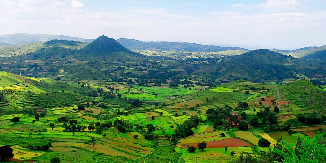
Located near the southwestern border between Andhra Pradesh and Karnataka, Horsley Hills is a hill station that is often called the Ooty of Andhra. Located at a height of 4312 metres and is well-known for its breathtaking landscapes, Horsley Hills is also called as Yenugulla Mallamma Konda. The picturesque landscape of Horsley Hills also doubles up as a destination for adventure sports and activities such as trampoline, shooting, bow and arrow, wall climbing, water walking, rappelling, swimming pool, fish spa and a mini zoo. In addition to its tranquil natural charms, it is also the land of Kalyani, the oldest known eucalyptus tree which is believed to be around 148 years and one is at it, visit the Thimmamma Marrimanu banyan tree which is said to be the world’s largest banyan tree spread covering an area of 8 acres. The highest point of the hills offers a mesmerising view of the surrounding foliage, and the sight is serene against the backdrop of the sapphire sky. Situated closeby is the Horsley Hills Environment Centre which is home to a number of animals such as deer and crocodiles. The Gurramkonda Fort and Governor’s house are other fascinating pieces of history should be a part of a weekend getaway. A part of the Eastern Ghats, the hills in the region are believed to be one of the oldest in terms of geological existence. How the hills came to be known as Horsley Hills is a story, it is said that there was once a horse that guarded the Gurramkonda fort situated closeby with such ferocity that as long as it remained there, no one dared to attack the fort. The title of the hills near the fort was hence dedicated to the selfless service of the horse, and the name Horsley Hills or Horsley Konda came to be. Some others believed that it is named after a British General with the same name who built a bungalow here.

Chittoor
Steeped in religion, devotion and architecture, Chittoor is blessed with scenic beauty, cascading waterfalls and a beautiful hill station. Also known as the Mango City, Chittoor offers multiple varities of mangoes to please its visitors.

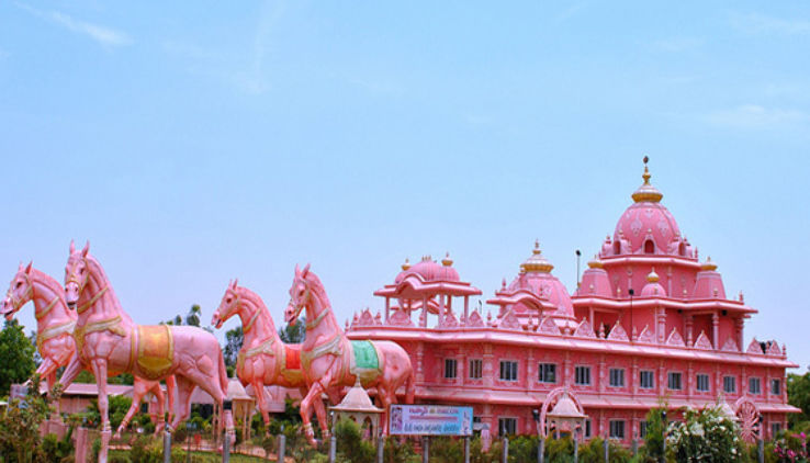
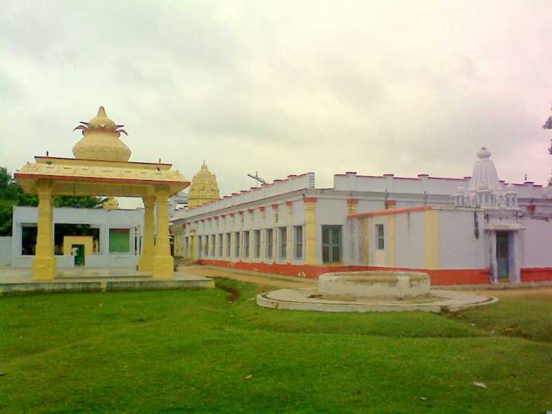
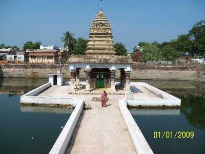
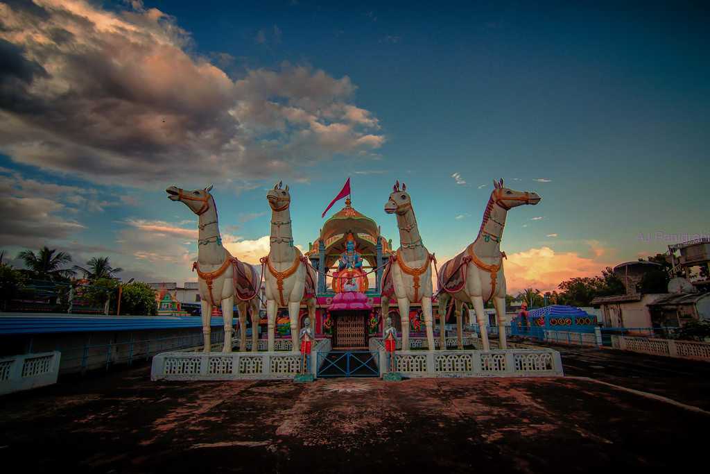
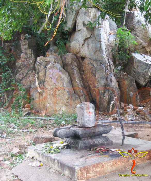
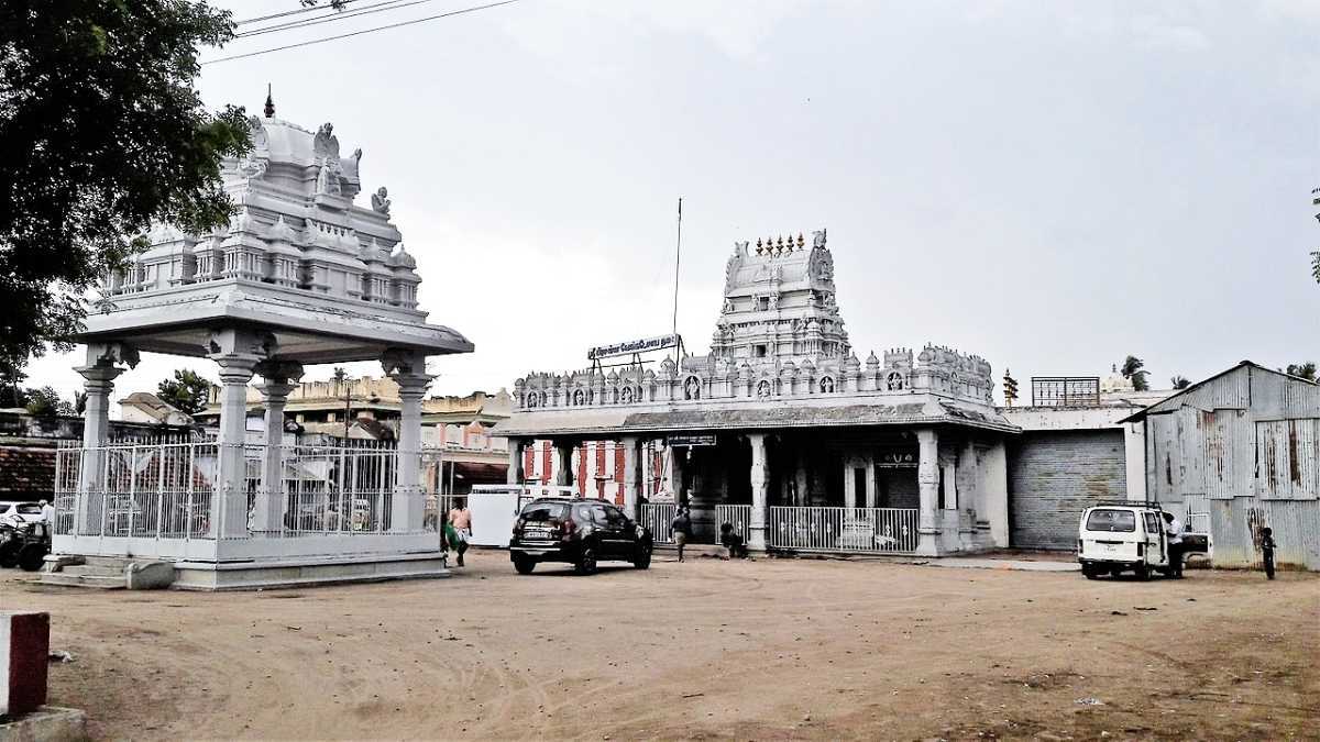
The Kanipakkam Vinayaka Temple was designed and constructed in the 11th century by Kulothunga Chola I, a revered Chola king. It was then rebuilt in 1336 by the Vijayanagara rulers. The name Kanipakam itself breaks into Kani meaning wetland and pakam meaning the flow of water into the wetland due to its presence next to river Bahuda. A Siva Temple was also created in the complex when Kulothunga Chola expanded the temple. It was to show his devotion to Lord Shiva as well as Lord Ganesha. What makes the Kanipakam temple unique is the fables and legends associated with it. It is reported that the idol of Vinayaka or Lord Ganesha grows every year so much so that the armour offered to the deity 50 years ago does not fit anymore. This historical temple with Ganesha as its primary deity is also known as Shrine of Water and is in Irala Mandal. The regal Kanipakam temple has immense religious significance and importance because of its miraculous idol. The water found in the complex is believed to be holy and can cure various deformities. Pilgrims visit this temple before going to Tirupati since it is a Vinayaka Temple. The Kanipakam temple is very well maintained by the authorities despite being a major crowd puller and is a rapidly developing complex. This unique sanctuary of Ganesha is in the middle of a river. Its significance lies in its purity and rich heritage.
The famous idol which led to the construction of the Kanipakam Vinayaka Temple has many stories linked to it. The most famous legend speaks of three farmers who were dumb, blind and deaf by birth. They needed water to irrigate their fields. They found a dried-up well and decided to dig it more. One of them started the work and was surprised to see his iron implement hitting a stone-like formation. As he continued to dig, he found that blood was oozing out of the stone. Soon the whole water had turned red because of the blood. He called out to the other two farmers to witness the event. As they had been present for such divine intervention, their deformities had disappeared. When the villagers found out about their miracle, they thronged to the well and decided to deepen it. However, they couldn’t as a self-manifested idol of Vinayakar emerged from the waters of that very well. Even today, the idol resides in the well, and its water branches are perineal and eternal. During the monsoon season, the well overflows and the water is provided to the devotees as Tirtham, holy water. The river of Bahuda, along with the banks of which the temple is built, also has a very popular story. Two brothers Sanka and Likhita were on a pilgrimage when the younger brother Likhita felt hungry. Ignoring his elder brother’s advice, he plucked a mango from the nearby mango grove and ate it. Sankha felt betrayed and reported his actions to the ruler, who in punishment deprived Likhita of both his arms. Later, when Likhita was taking a dip in the Bahuda river, a miracle occurred. Both his arms were restored! Hearing this, the ruler renamed the river as ‘Bahuda’ meaning human arm. The temple is open from 4 am to 9:30 pm with darshan timings from 6 am to 1 pm and then from 4 to 8 pm. The various poojas and sevas vary in fee from INR 116 to INR 7500 depending on the type of ritual devotees wish to perform at the temple
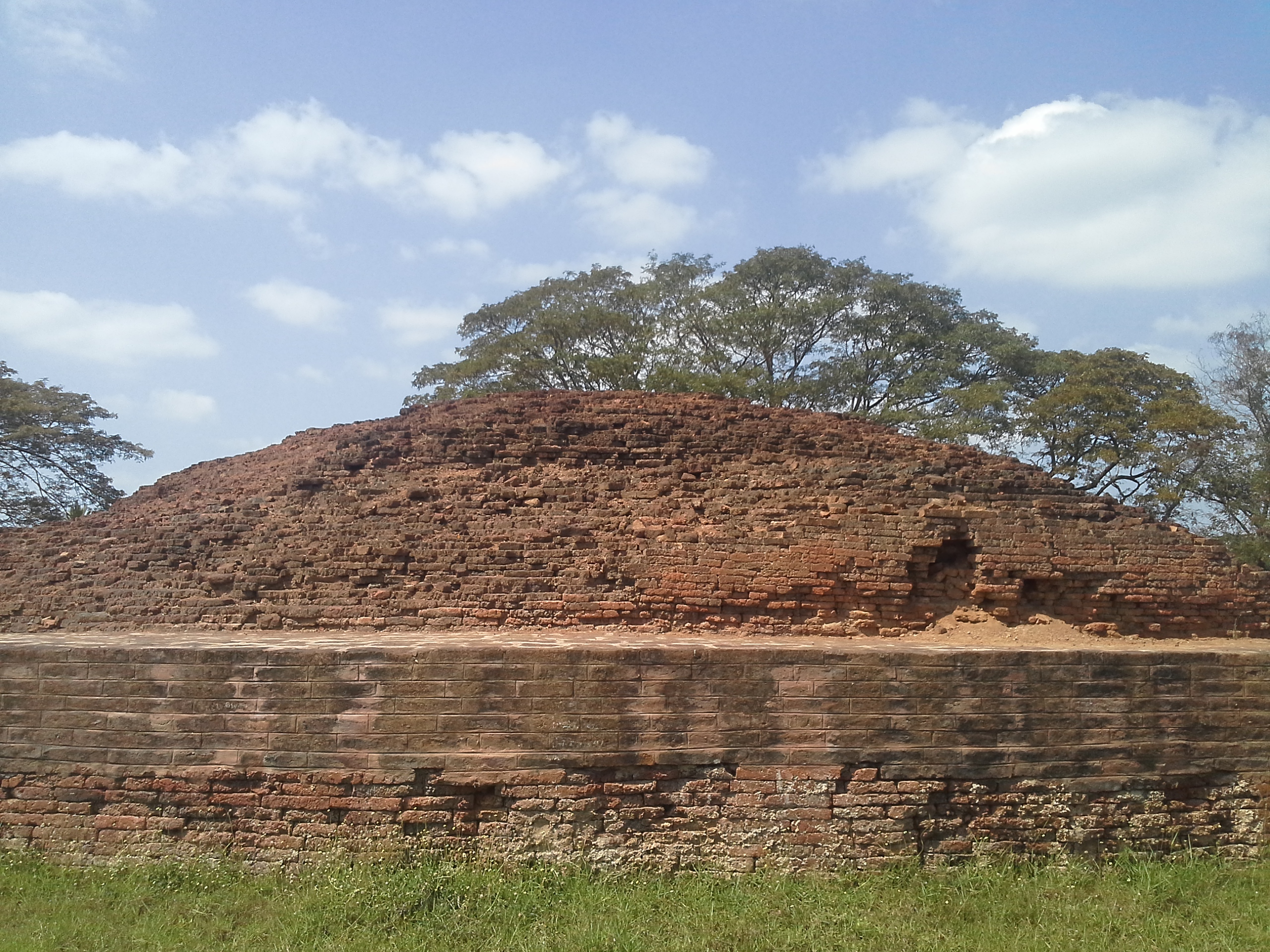
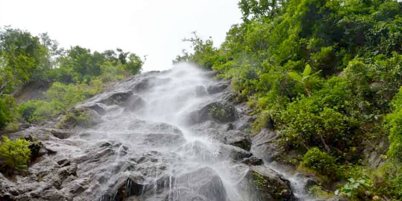
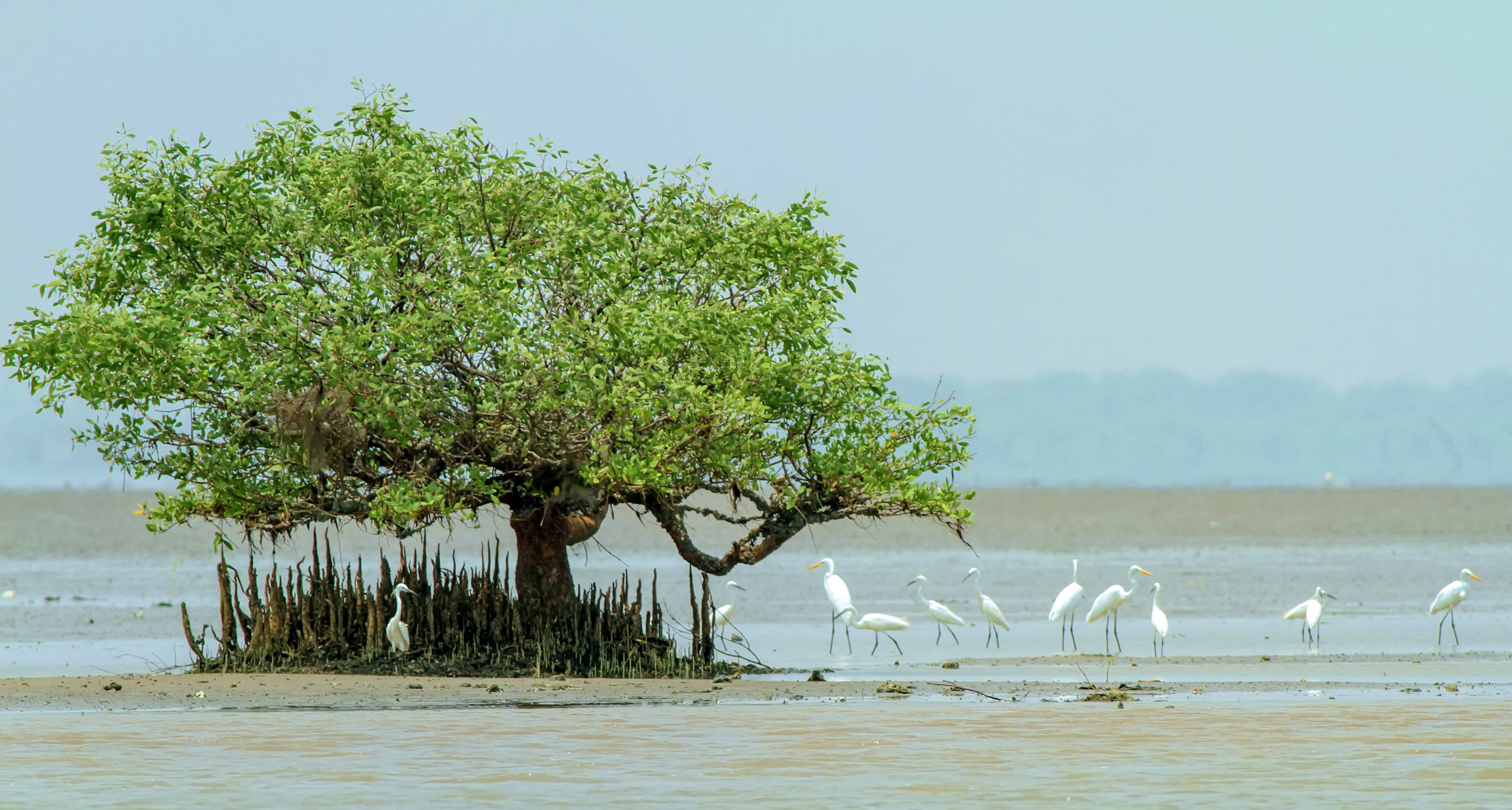
Hidden like a jewel behind the lush green forests of Andhra Pradesh lies a serene and tranquil place named Nagalapuram. Also known as Nagala Hills, it is famous for the various adventurous activities proffered in this scenic village. Nagalpuram is also known for housing the Nagalpuram Falls. A group of 3 waterfalls, it offers a great trekking opportunity and a stunning panoramic view. The trek to the waterfalls starts from the Arai Village where the journey starts from Nagala Dam. The dam welcomes the trekkers with a serene view and shows the way towards the waterfalls. The trek starts off on the simple plain ground until the water stream. The water stream is where the difficulty level elevates considerably and trekkers need to concentrate on every step there onwards. The nature of water as we know it is beautiful but also harsh at the same time. The intermittent positioning of the waterfalls and their pools are of great help to the trekkers and especially when the sun is right above the head. After sweating throughout the path, the sight of a cold water pool gives a joy uncomparable. Throwing the backpack down and getting rid of the shoes while running towards the pool and then taking off in the air to hit a perfect dive is not something that can be experienced often. Nagalapuram was built by King Krishna Deva Raya, the ruler of the Vijayanagar empire. He named the place Nagalapuram in the loving memory of his mother, Nagamamba.
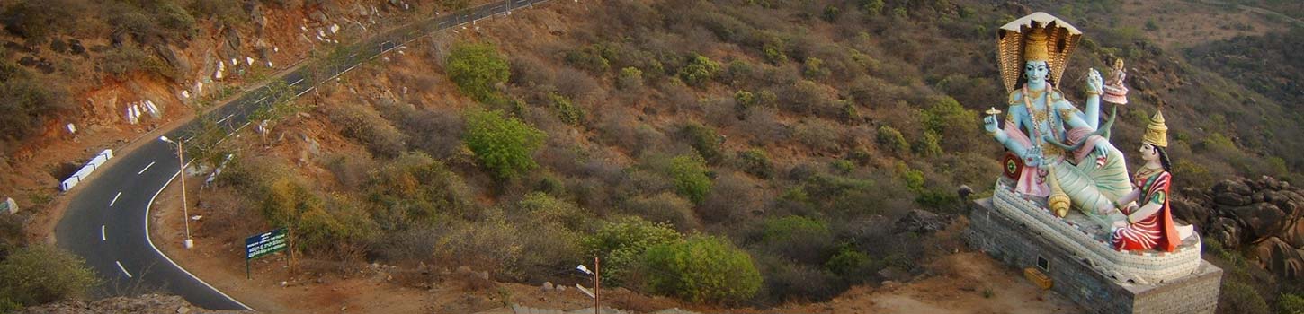
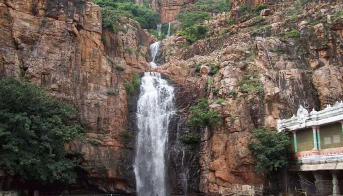
Situated in Nagari Valley near Tirupati, the Kailasakona waterfalls are a beautiful perennial waterfalls with an interesting story behind them. Legend has it that Lord Kailasanatheshwara performed the marriage of Lord Venkateshwara Swami and Goddess Padmavati and later performed penance here. The water here at the Kailasakona waterfalls is crystal clear and is rich with minerals and is believed to have medicinal properties and healing effect. The foot of the waterfall can be reached and one can only gape at the awe-inspiring sight. To reach the waterfall, look out for the 10 km milestone on the way to Puttur and take a left deviation and drive for about 2 km.
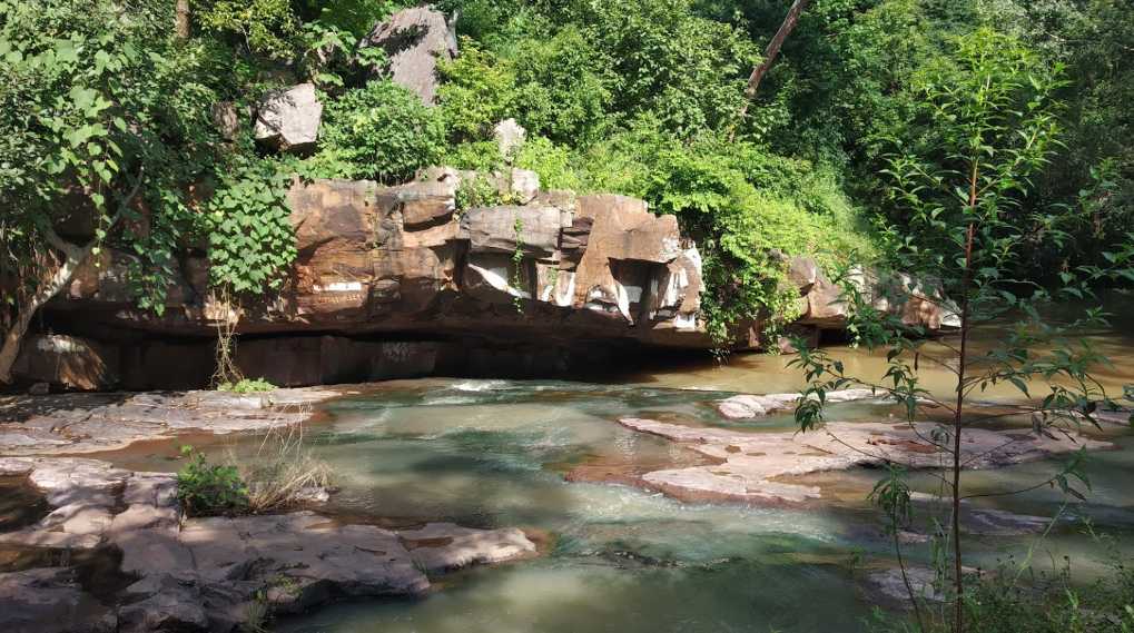
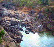
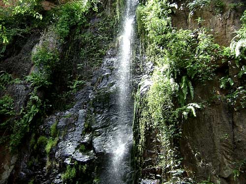
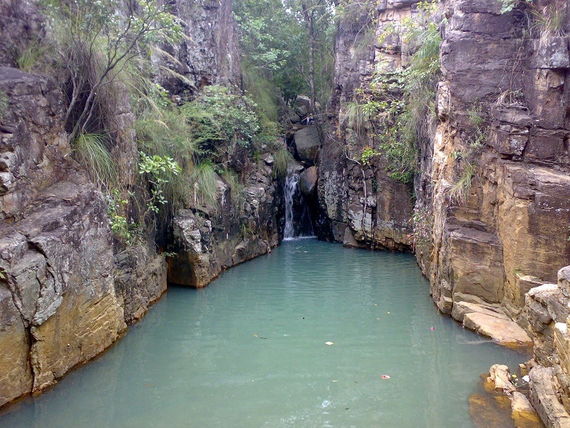
The Kaigal fall is nestled amidst the Koundinya Wildlife sanctuary and derives its name from the village Kaigal, that surrounds it. Locally known as the Dumukurallu waterfalls which is a Telugu word used for a sound resembling the sound of falling stones from above, the Kaigal falls are perennial. The waterfall is subdivided into three cascading falls and water falls from a height of approximately 40 ft. The water forms several small pools at the bottom.

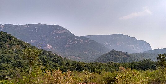
The Koundinya Wildlife Sanctuary is a wildlife sanctuary plus elephant reserve, housing exotic Asian elephants. There are around 78 elephants here, currently with an an abundance of flora and fauna. Acacia and bamboo are the two common plants that are found here. Several species of birds can be found here with the sanctuary being a popular attraction around April. There is a beautiful forest guest house which can be stayed in. The sanctuary is around 52 kms away from the Kaigal falls and will take about an hour or so to reach the sanctuary from Kaigal. High hills and deep valleys surround this immensely beautiful wildlife sanctuary. There is a shivalinga installed near the falls which the locals visit on special occasions like Shivaratri. The waterfall splits into three singular falls, one of which flows over this Shivalinga and it is a beautiful sight to view water cascading over the Shivling.

Also known as the Ubbalamudugu Falls, the Tada Falls is a gorgeous waterfall located near the near the Tricity and Oneness temple. Cascading from a towering height of around a 100 m, the crystal clear waterfall falling down the rocks is a visual delight and a sight to behold. The Siddulaiah Kona forest is nearby which is an ideal place for trekking, hiking and other foresty activities. Besides, Tada Falls is known for its an incredible landscape, lush greenery and ethereal hillocks. Also close by is the stunning Pulicat Lake and Shiva temple. Since the waterfalls are located in the woods, trekking is the most common way to reach the falls. Vehicles can be parked at the parking lot which is 10 km away from the falls before the trek. There is also a 3 km trek that goes along a clear stream for novice trekkers as well as a mid level trek up along some boulders to the base of Tada Falls. This trail is laden with dainty streams and lush green landscape sprawling all over, offering a pleasant experience and a gorgeous view.
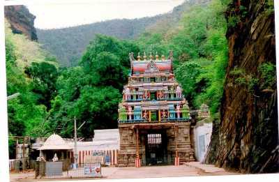
Srikalahasthi
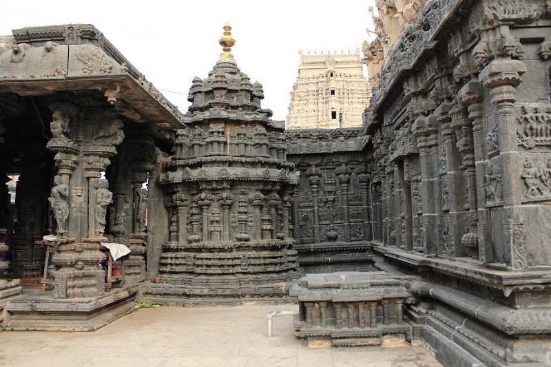
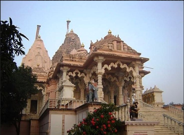
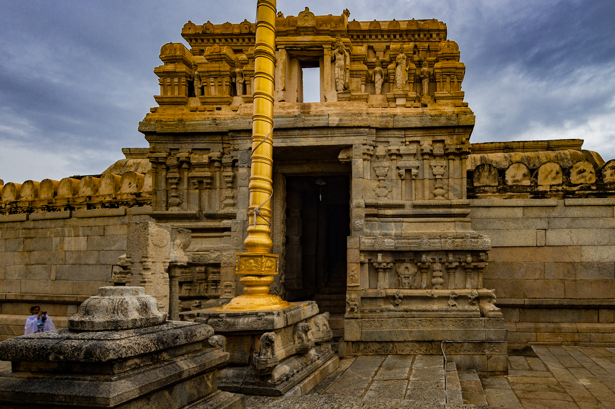
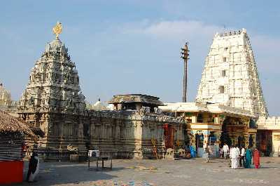
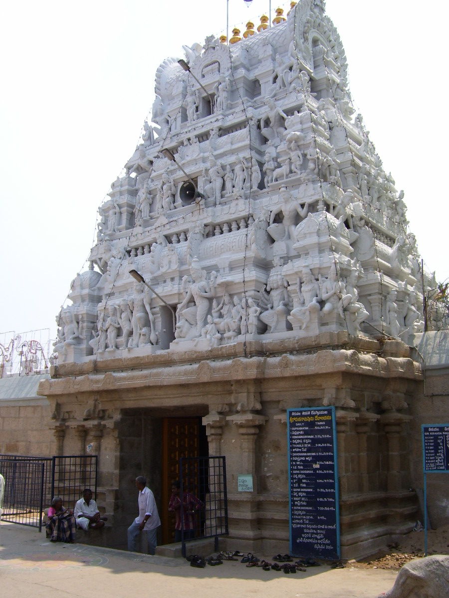
Located 37 km from Tirupati, the holy city of Srikalahasti is famous for the Srikalahasti temple. It is one of the most important Shiva temples of south India built during the ancient Pallava dynasty. The place is an excellent example of south Indian architecture with highly adorned gopurams and extensively carved interiors that unfold the charms of Dravidian style pf architecture.

The Srikalahasti temple is dedicated to Lord Shiva and was constructed in 1516 by King Krishnadevraya of the Vijayanagara empire. The elaborate structure of the temple complex is a breathtaking view right from the entrance. It has intricate carvings of numerous mythological illustrations that one can explore in the divine surroundings. This magnificent temple is often referred as the Kailasa and Kashi of the south and represents one of the five elements or the pancha bhootas, vayu or air. The temple is open from 6 am to 9 pm daily and the Rahu Kethu Sarpa Dosha Nivarana Puja which takes place in the outer courtyard costs between INR 300 – 500 while within the temple premises, it costs between INR 1500 to 2500
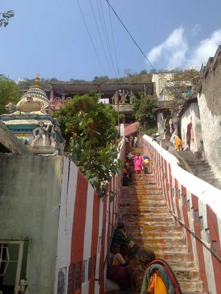
At the centre of the city, is a significant temple dedicated to Lord Murugan known as the Subrahmanya Swamy temple. A modest climb of 150 steps take you to the temple, surrounded by flattering views of the city. The temple gathers much festivity and glitter during a 8-day festival called the Aadi Krithika festival. During this time a procession is carried out where Lord Subrahmanya Swamy and his consorts Sri Valli and Devasena are taken out on various vahanams.
With hills and streams around, the Bharadwaja Tirtham is a religious site with some of the most beautiful surroundings. The statue of Vinayaka with water all around, makes the spot all the more enchanting. One of the popular attractions of the town, this is a must visit area.
The Bhakta Kannappa temple houses an idol of Bhakta Kannappa and is tied to the legend that a tribal youth called Bhakta Kannappa gave his eyes to the Lord Shiva idol in the temple. Respecting his devotion, offerings are made to Bhakta Kannappa before they are to Shiva Linga, in this temple.
Steps through a hillock, surrounded by wide views takes one to a an ancient dedicated to Goddess Durgambika. Like most areas in the area, this one too finds itself a scenic backdrop and much natural beauty around.
Literally translating into ‘the valley of the thousand lingas’, the Veyilingala Kona Waterfall is a local favourite and one that visitors also gravitate to. The water here is said to have properties that can cure skin diseases and it is believed that a dip into the pristine water here can grant one salvation and is one of the most beautiful spots in the town.
Tirupati
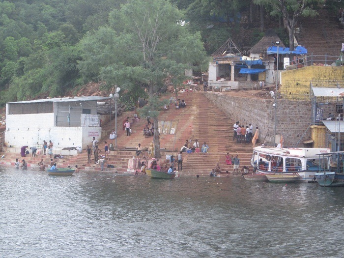
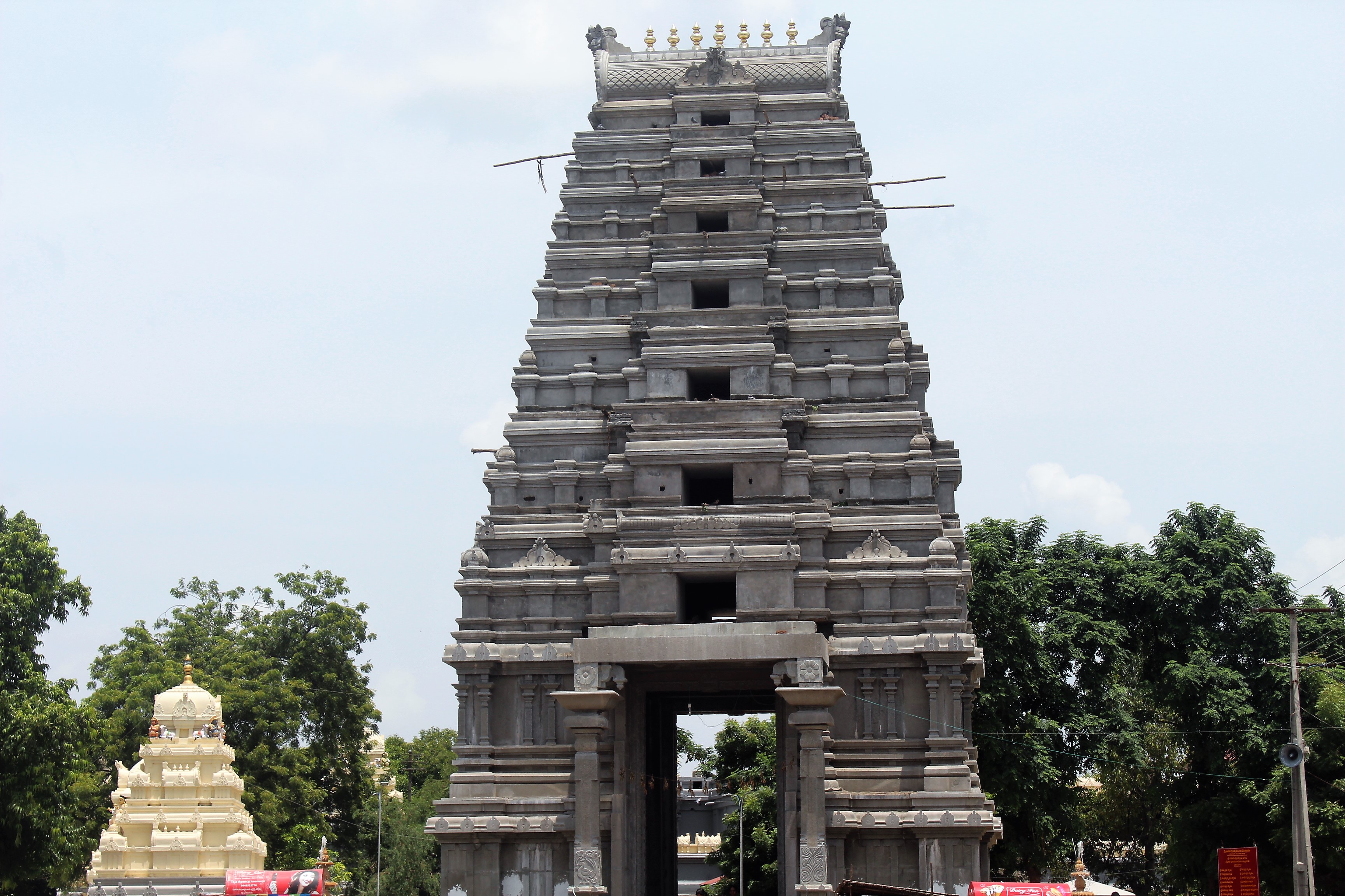
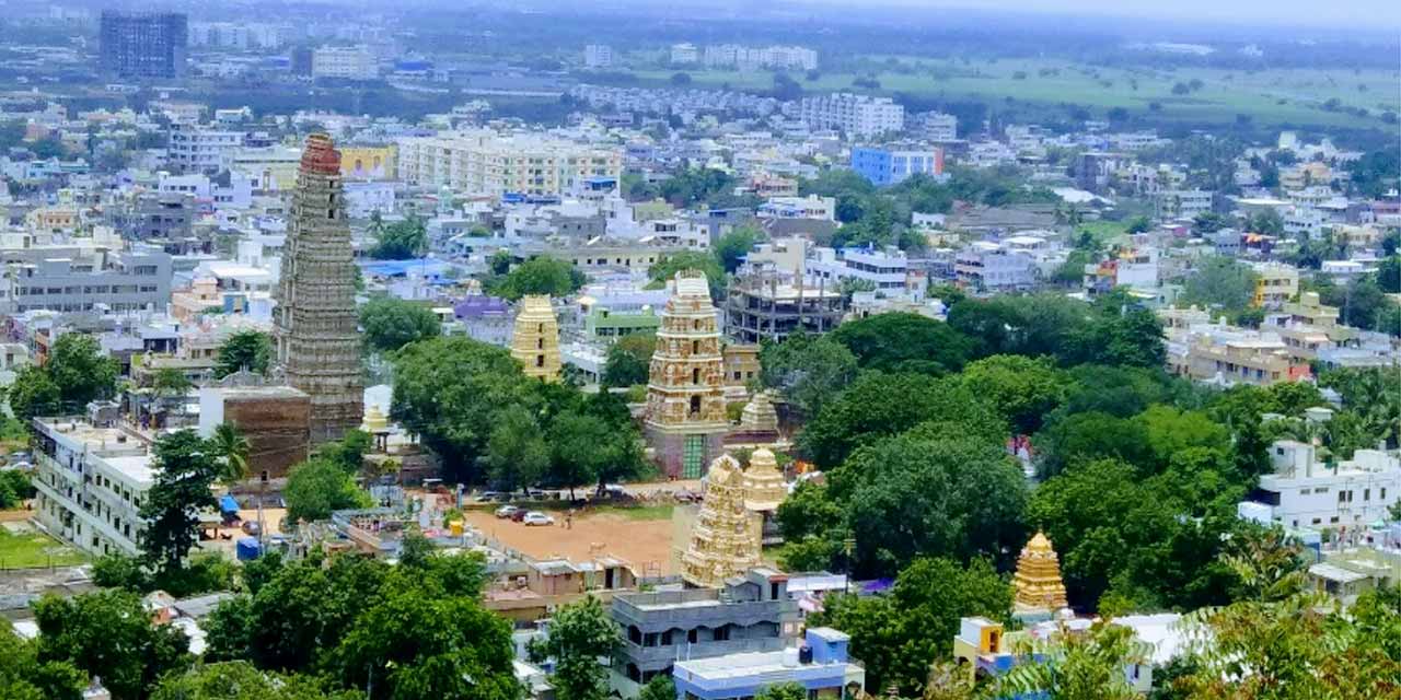
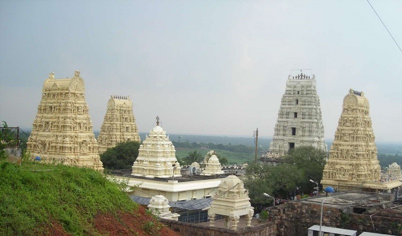
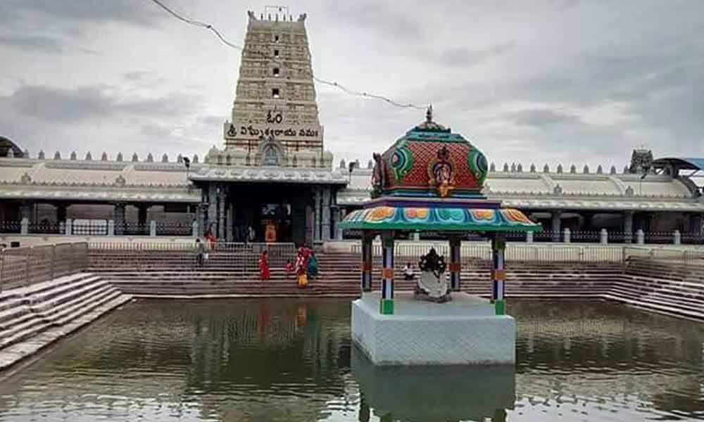
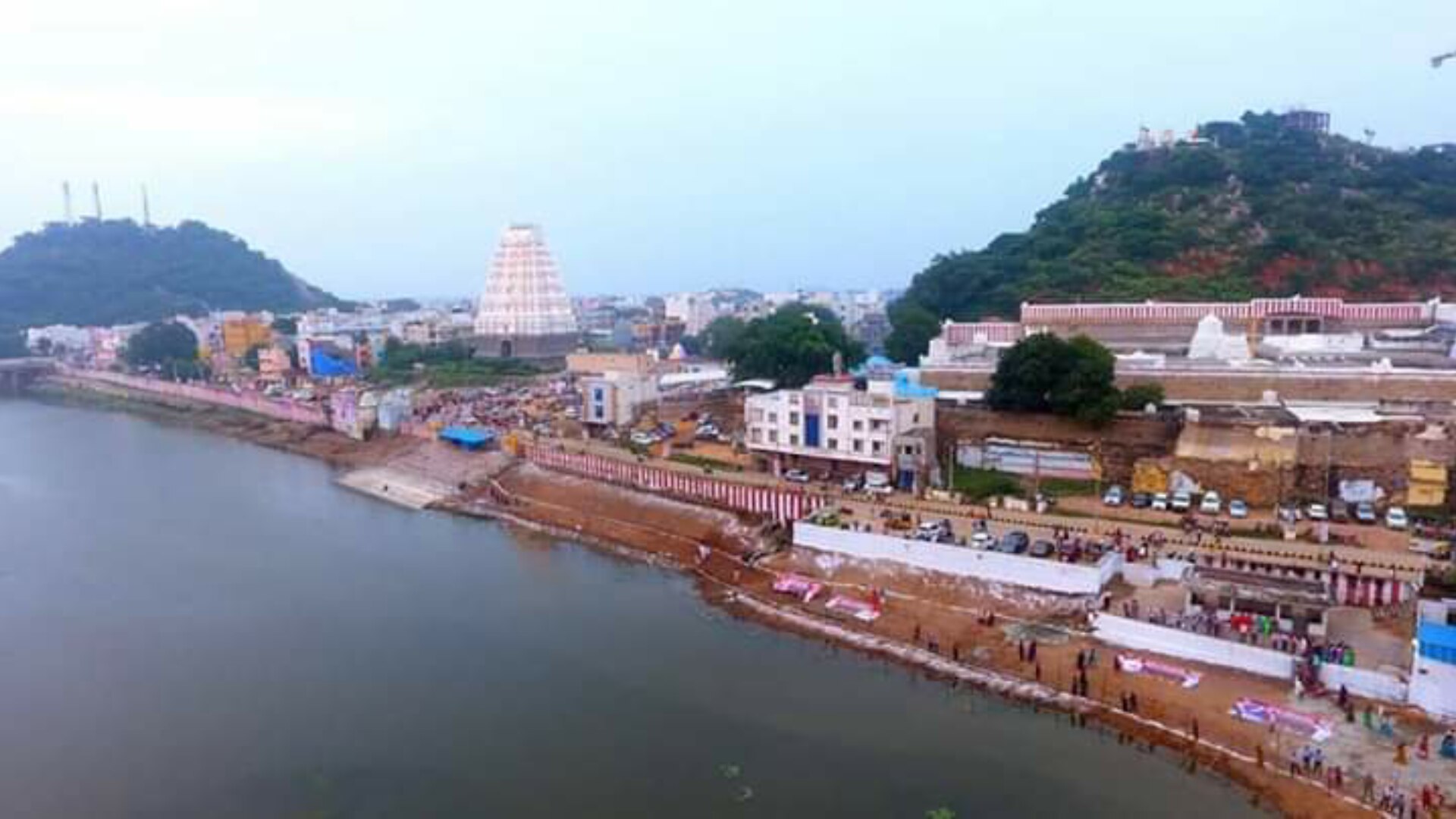
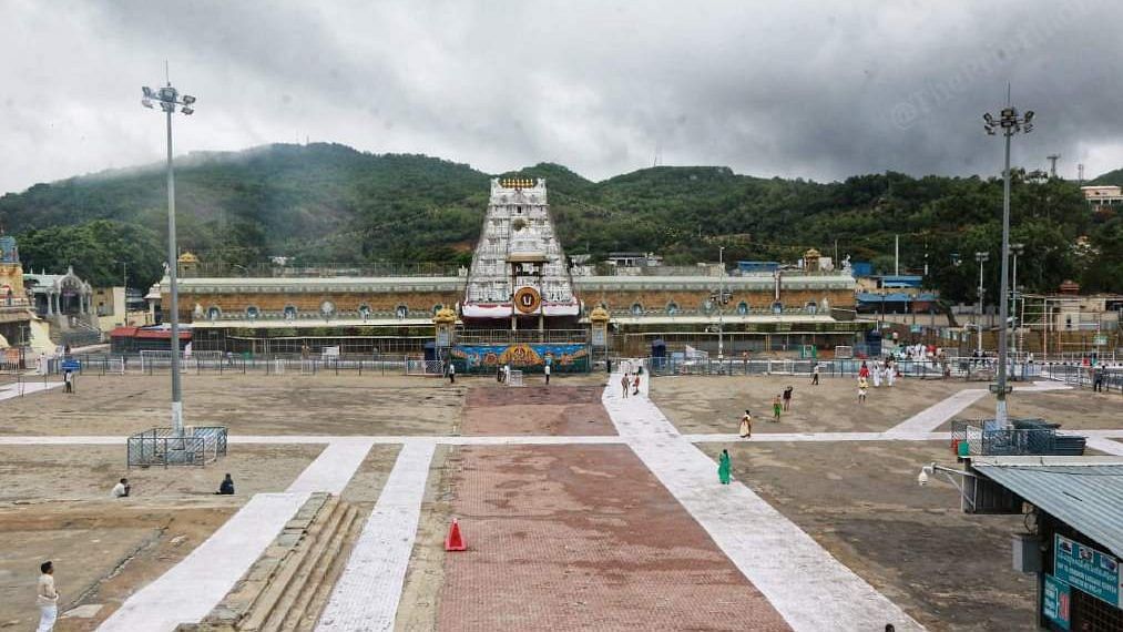
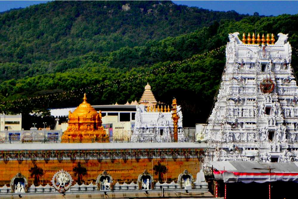
Situated in the Chittoor district of Andhra Pradesh, Tirupati is known for Lord Venkateshwara Temple, one of the most visited pilgrimage centres in the country. Tirumala is one of the seven hills in Tirupati, where the main temple is located. The temple is believed to be placed where Lord Venkateshwara took the form of an idol and is hence home to the diety Govinda. Tirupati is one of the oldest cities of India and finds mention in plenty of ancient Vedas and Puranas.
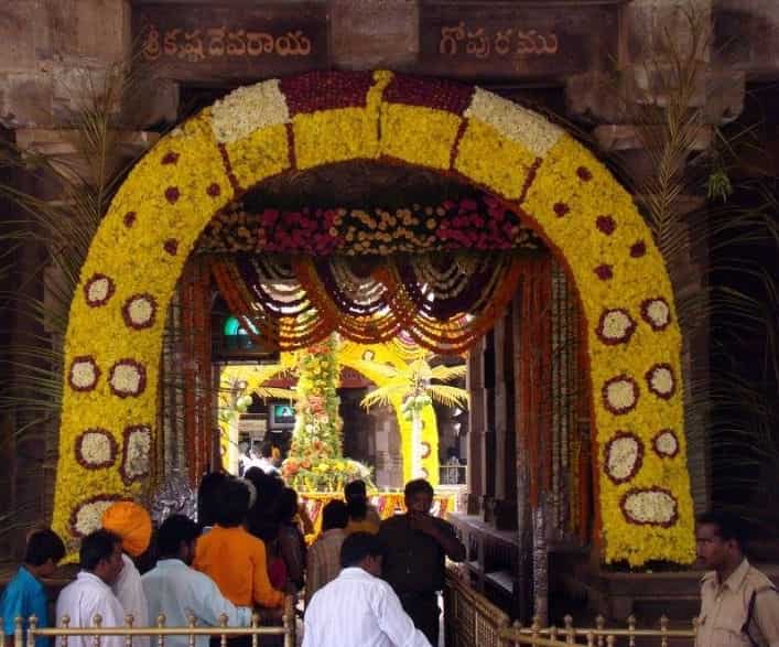
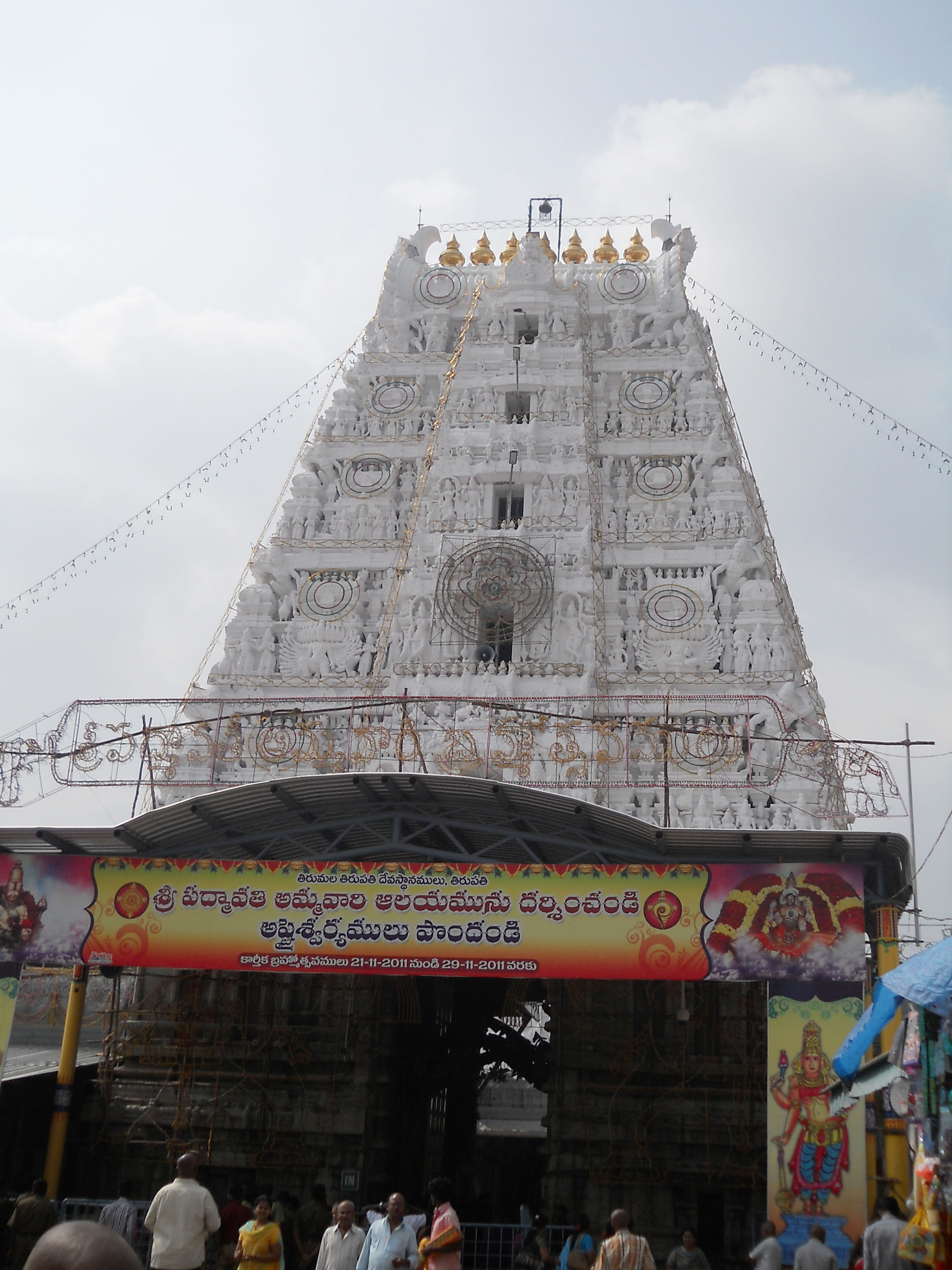
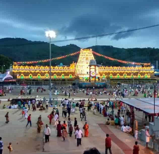
The non-stop chanting of ‘Om Namo Venkatesaya’, the mad pilgrim rush and the 8-feet tall idol of Lord Venkateshwara – everything about the Sri Venkateshwara Temple is majestic. Spread over an area of 26 kilometres and visited by nearly 50,000 pilgrims every day, the temple is also commonly referred to as the Temple of Seven Hills.
There are other temples in Tirupati too that you can visit, including the Sri Kalahasti temple, Sri Govindarajaswami Temple, the Kondandarama Temple, the Parashurameshwara Temple, and the ISKCON temple. Tirupati is home to a unique geological wonder that you shouldn’t miss out on! The Silathoranam is a natural arch formed out of rocks and is located at the Tirumala Hills.

Home to the most famous and important Vaishnavite shrine of Tirumala Venkateswara Temple and other historic temples and is referred to as the spiritual capital of Andhra Pradesh, Tirupati is one of the eight Swayam vyaktha kshetras dedicated to Lord Vishnu. Tirumala is one of the seven hills in Tirupati, where the main temple is located. The temple is believed to be placed where Lord Venkateshwara took the form of an idol and is hence home to the diety Govinda. Tirupati is one of the oldest cities of India and finds mention in plenty of ancient Vedas and Puranas. Spread over an area of 26 kilometres and visited by nearly 50,000 pilgrims every day, the temple is also commonly referred to as the Temple of Seven Hills. In Dravidian translation, Tiru means the sacred or Goddess Lakshmi and pathi means abode or husband. Tirupati or Tirumala is referred to as Pushpa-mandapa in the Acharya-Hridayam from the 13th century. According to the Varaha Purana, during the Treta Yuga, Lord Rama resided here along with Goddess Sita and Lord Lakshmana on his return from Lankapuri. As per the Purana, a loan of one crore and 11.4 million gold coins was sought by Lord Balaji from Kubera for his marriage with Padmavathi. To pay back the loan, devotees from all over India visit the temple and donate money.
The city became great Vaishnava centre during the time of Ramanujacharya in the 11th century, from where Srivaishnavism spread to other parts of the Andhra Desa. Tirupati survived the muslim invasions and during the early 1300s during the muslim invasion of south India, the deity of Sri Ranganathaswamy Temple in Srirangam was brought to Tirupati for safekeeping. The first temple at Tirumala Tirupati was built by King Thondaiman, the Tamil ruler of ancient Thondaimandalam who is said to have built the original Gopuram or tower and the Prakhara in the 8th century. The temple town for most of the medieval era part of Vijayanagara empire until the 17th century and its rulers contributed considerable resources and wealth to the temple. The city has many historical temples including the Venkateswara Temple which bears 1,150 inscriptions in Sanskrit, Tamil, Telugu and Kannada languages which specify the contributions of the Pallava Kingdom around the 9th century, the Chola kingdom around the 10th century and the Vijayanagara empire in the 14th century.

There was no human settlement at Lower Tirupati until 1500, but with the growing importance of Upper Tirupati, a village was formed at the present-day Kapilatheertham Road area and was named Kotturu. It was later shifted to the vicinity of Govindarajaswamy Temple which was consecrated around the year 1130. Later the village grew into its present-day form around the Govindaraja Swamy temple which is now the heart of the city. In 1932, the Tirumala Venkateswara Temple was handed over to Tirumala Tirupati Devasthanams by the TTD Act of 1932.
The Sri Venkateshwara temple is dedicated to Lord Venkateswara, a form of Vishnu, who is believed to have appeared here to save mankind from the trials and troubles of the Kali Yuga. Hence the place is also known as the Kaliyuga Vaikuntha and the Lord here is referred to as Kaliyuga Prathyaksha Daivam. The Tirumala hills are part of Seshachalam Hills range and are 853 metres or 2,799 ft above sea level. The Hills comprises seven peaks, representing the seven heads of Adisesha with the temple lying on the seventh peak, Venkatadri, on the southern banks of Sri Swami Pushkarini, a holy water tank. Hence the temple is also referred to as Temple of Seven Hills. The Temple is constructed in the dravidian architectural style and is believed to be constructed over a period of time starting from 300. The Garbagruha or sanctum sanctorum is called the Ananda Nilayam. Lord Venkateswara is in a standing posture and faces east in the garbha gruha. The temple follows the Vaikhanasa Agama tradition of worship and is one of the eight Vishnu Swayambhu Kshetras and is listed as 106th and the last earthly Divya Desam. The temple premises had two modern queue complex buildings to organise the pilgrim rush, the Tarigonda Vengamamba Annaprasadam complex for free meals to pilgrims, the Vaikuntam queue complex which is a series of interconnected halls that leads to the main temple, hair tonsure buildings and a number of pilgrim lodging sites. It is the richest temple in the world in terms of donations received and wealth. The temple is visited by about 50 to 100 thousand pilgrims daily or 30 to 40 million people annually on an average, while on special occasions and festivals, like the annual Brahmotsavam, the number of pilgrims shoots up to half a million making it the most-visited holy place in the world.

Standing to the north of Sri Venkateswara Temple is the Sri Varahaswami Temple which according to legend is said to belong to Sri Adi Varahaswami. It is advised to first pay a visit to this temple before visiting the Venkateswara temple, the reason being that Sri Varahaswami owned the seven hills on which the Venkateshwara temple stands. He agreed to hand the hills over to Sri Venkateswaraswami, on the condition that he too, should be worshipped. Hence, Sri Venkateswaraswami asked his devotees, to first pay a visit to Sri Varahaswami and then to him.
At a distance of about 5 km from the Tirumala temple in Tiruchanur, is the Sri Padmavathi Ammavari Temple dedicated to Goddess Padmavathi, also administered by the Tirumala Tirupati Devasthanam. Legend has it that while Akasha Raja of Thondamandalam was having a great yagna performed and had the earth ploughed, he found a little girl in a lotus flower, and hence the name, Padmavati. A voice from the skies asked him to love and bring up the child. As she grew up, she was married to Lord Venkateshwara. The temple is frequently visited by the devotees on their spiritual trail around the town.
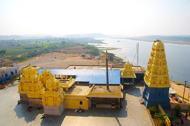
The Vedadri Narasimha Swamy temple lies at a distance of 70 km from Tirupati and was constructed by Sir Krishna Deva Raya of Vijayanagar. It holds great mythological importance and is believed to be the site where Lord Vishnu battled with the demon rasksash Somakadu, won and took over the vedas from him.

The Sri Govindarajaswami temple is a 12th century Hindu Vaishnavite shrine built by Saint Ramanujacharya and is one of the biggest temple complexes in the district. The presiding deity is Lord Vishnu, also called Govindarajaswami. The beautiful traditional Dravidian architecture and its rich culture attract tourists in quite a large number every year.
A little away from the city of Tirupati, the Sri Venugopalaswami temple is devoted to Lord Venugopalan with the idol of Sri Sita Ramula Pattabhishekam. Some of the main festivals celebrated in this temple are Annual Bhramotsava, Ugadi Asthanam and Sankranti Utsavam.
The Sri Bedi Ananjaneyaswami Temple is dedicated to Lord Hanuman. A legend states that Lord Hanuman wanted to go searching for a camel but his mother tied him with bedis and went back to the Akash Ganga. Many believe Lord Hanuman can be seen even today standing at that very location.
Dedicated to the Lord Vishnu, the Sri Veda Nayaranaswami temple is one of the few temples in the country that depict the incarnations of Lord Vishnu whose prime form, Matsya or the fish is also depicted. This is the place where Vishnu defeated demon Somaka and took the form of a fish to retrieve the Vedas thrown in the water by the demon.
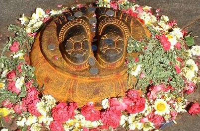
Situated on top of Narayangiri Hill amidst beautiful scenery, the Srivari Padalu temple is believed to be the place where Lord Narayan first set his foot on earth. It is an important pilgrimage and visitors flock in large numbers to offer prayers to the footprints of Lord Narayan.

The Sri Kalyana Venkateswaraswami temple is an ancient Vaishnavite temple, also considered an archaeologically important monument in India. The presiding deity is Lord Venkateswara, who is considered to be highly powerful and can absolve one of their sins, doshas and get rid of any obstacles they face in their lives.
An ancient shrine dedicated to Lord Venkateswars, the Sri Prasanna Venkateswaraswami temple is a dravidian architectural splendour with a magnificent idol of the presiding deity. It is a believed that offering prayers to the deity here relieves one of doshas or sins and removes obstacles one faces while achieving their goals.
The Sri Kodandarama Swamy temple or the Kodandarama temple is a temple in the heart of Tirupati, dedicated to Lord Rama. The Varaha Purana suggests that Lord Rama, Sita Devi and Lakshmana stayed here when returning to Ayodhya from Lanka. Built by the Cholas in the tenth century, this temple commemorates their stay here. While Ugadi and Ram Navami are celebrated on a grander scale, the Brahmotsav is also celebrated here every year. There is a sub-shrine dedicated to Anjaneya or Lord Hanuman, Lord Rama’s most devoted devotee.
Kanipakam is a village most famous for the Kanipakam Vinayak temple, built in the 11th century by King Mahavarman Sundara Pandian and for the Shiva temple which was built by King Kullotunga Chola. The rich religious significance of the temples and the stunning ancient architecture attracts visitors in large numbers each year.
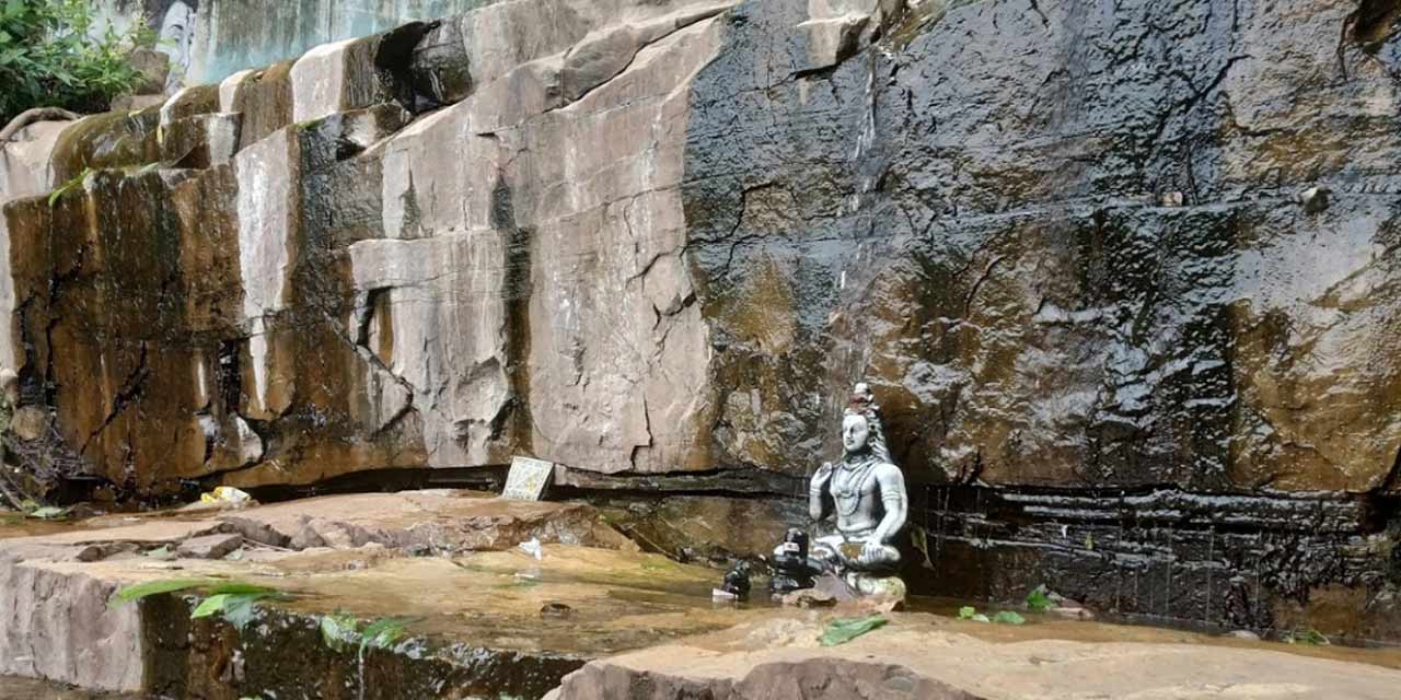
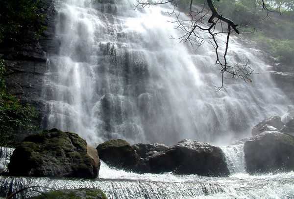
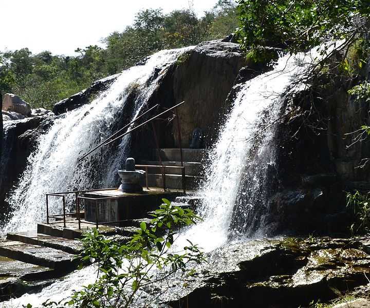
The Akasha Ganga Teertham is a waterfall, located at a distance of 3 km from the main temple which has water flowing all throughout the year and holds immense religious significance. Pilgrims can also pay homage to the Devi temple situated very close to the waterfall which is beautiful sight to see during the monsoon season. A sacred lake located amidst dense natural vegetation, the waters of the Tumbhuru Teertham is believed to have magical powers and can absolve one’s sins and help them attain moksha. The attraction is also famous for its natural beauty and is frequented by nature lovers for nature walks. A Shaivite temple, the Kapila Teertham is a famous pilgrimage in the city located at the entrance of a mountain cave at the foothills of Tirumala Hills and is a marvellous example of Dravidian architecture. The presiding deity is Lord Shiva who is locally known as Lord Kapileshwara and the idol of the deity was installed by Kapila Muni. Japali Teertham is dedicated to Lord Hanuman and is situated amidst dense forests. It is believed that Lord Hanuman used to visit the location often to quiet his mind and soak in peaceful atmosphere. It is also believed that Lord Rama and Goddess Sita also stayed here. The water of the Teertham is said to have magical powers and can wash away all the sins a human has made. It is believed that taking a dip in the holy Papavinasam Teertham can absolve one of their sins. It is also famous for its scenic beauty with the route going to the falls going through uneven rocky trails amidst beautiful surroundings making it a perfect location for nature walks.
The Chakra Teertham waterfall is a famous water body considered to have high religious importance. It is believed that Lord Brahma performed penance at this location which was later cleansed by Lord Vishnu with his Sudarshan Chakra. The place where his Chakra fell is known as Chakra Teertham. The water is said to have healing powers and can absolve one of their sins. Considered a sacred waterfall, the Vaikuntha Teertham is associated with the legend of Ramayana. It is believed that Lord Rama’s vanarsena or monkey army located the teertham. A dip in the holy waters is considered to bring luck, good fortune and absolve one of their sins. At a distance of 4 kms from the city centre, the Kapila Theertham is a popular waterfall situated inside the premises of the Kapileswara Swamy temple at the base of the Sheshadari Hills. The water cascading down of 100 metres to form a pool at the base is a gorgeously enchanting sight to see. Located in Sri Venkateswara National Park, the Talakona Waterfalls is the highest waterfall in the region and a famous picnic spot. The water is believed to have medicinal properties and comes from an unknown underground stream. The attraction is also famous for trekking and has several trekking routes running around it amidst the scenic natural surroundings.

Also known as the Natural Arch, the Silathoranam is a notified National Geo-heritage Monument and a distinctive geological feature 1 km north of the Tirumala hills temple, near the Chakra Teertham. One of only three of this kind in the world, the arch measures 8 m in width and 3 m in height, and is naturally formed in the quartzites of Cuddapah Supergroup of Middle to Upper Proterozoic due to natural erosive forces. Silathoranam comes from two Telugu words, which comes from sila meaning rock and thoranam meaning a garland. Thus it means a garland strung over a threshold, connecting two vertical columns or an ‘arch’ as in this case. Mythology related to the arch, linked to the famous Tirumala hills temple of Lord Venkateswara, has three versions. According to one version, the arch resembles the hood of a serpent, a conch and a discus, all symbols of worship in Hindu religion and considered to be the source of the idol of Lord Venkateswara or Lord Balaji at the temple. The second version is that the main deity in the Tirumala temple is of the same height as the height of the arch. The third version is that Lord Vishnu, known as Balaji or Venkateswara at the Tirumala temple town, is supposed to have put his first foot down at a place called Padalu or Sreevaripadalu which is the highest point of Tirumala hills, the second step at the location of the arch. Thereafter, the next step is stated to have been placed where his idol is now worshipped in the temple at Tirumala.
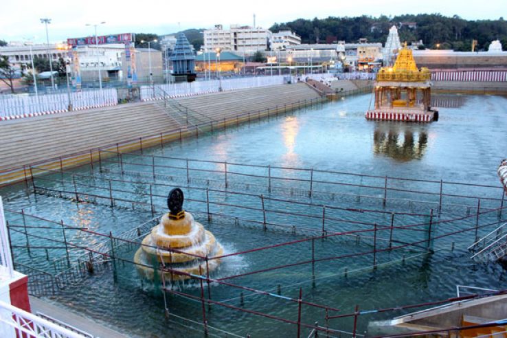
Almost neighboring the Sri Venkateshwara Temple, is Swami Pushkarini Lake. According to the legends, the lake belonged to Lord Vishnu and was located in Vaikuntham, his divine abode. It was brought to the earth by Garuda, for the sport of Sri Venkateshwara. Extremely holy, the pilgrims usually take a dip in the waters of this lake before proceeding to the main temple.
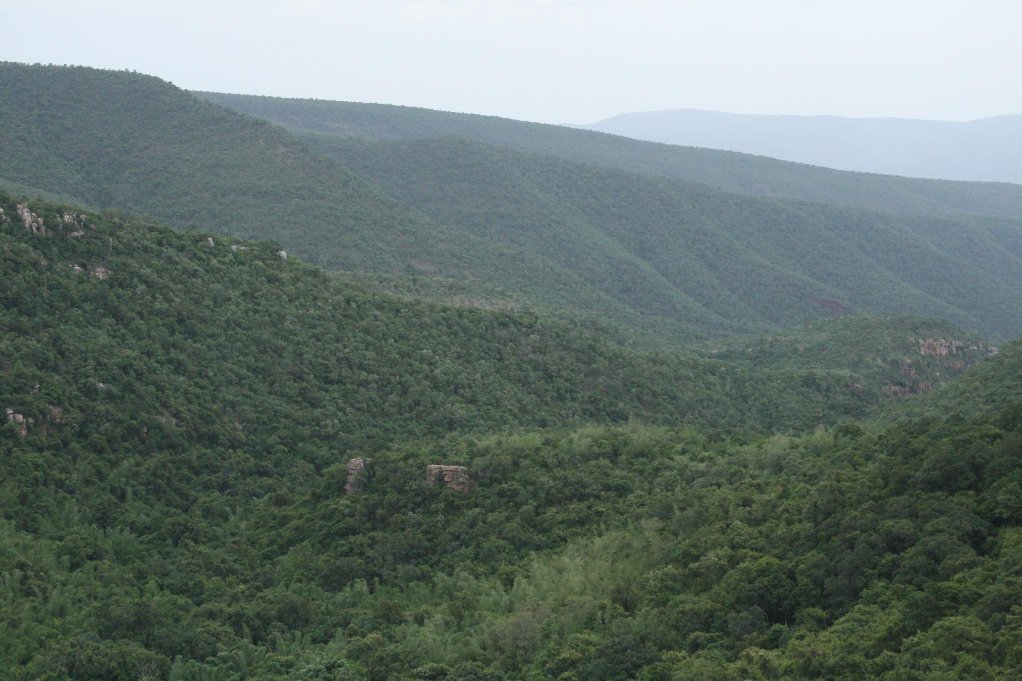
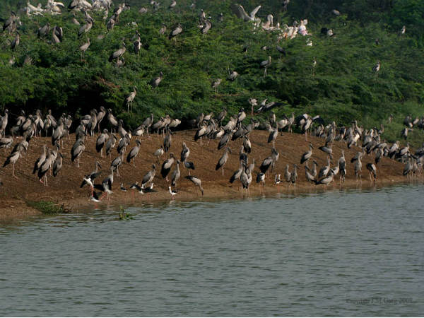
Located about 10 km from Tirupati and on the Eastern Ghats, the Venkateshwara National Park with an area pf 353 sq km and a biosphere reserve is home to endemic plant species and interesting fauna species like Slender Loris, Tree shrew, Wild dog etc. Bird watchers are also in for treats like the crested serpent eagle, the Indian roller and kingfishers etc. But the main attraction of this national park are the three waterfalls, viz, Talakona, Gundalakona and Gujana. The park is open on all days from 9 am to 5 pm with an entry fee of INR 50 for adults and INR 10 for children. The best time to visit the park is between December to March and August to November.

Located amidst the beautiful natural surroundings, the Deer Park in Tirupati houses a large number of deer and other regional flora and fauna. Tourists on their way to Tirumala often take a pit stop here and spend a few hours in the company of the deer, feed them and also watch them thrive in their natural habitat.
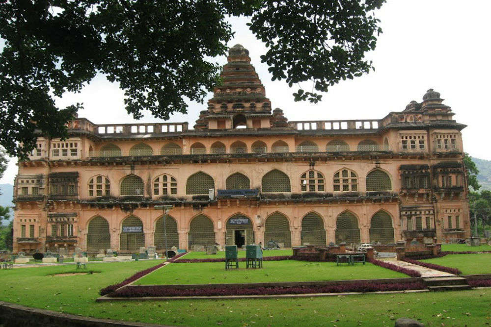
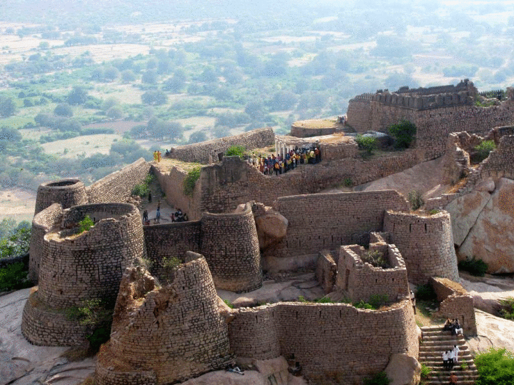
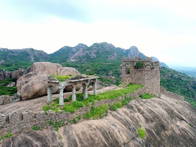
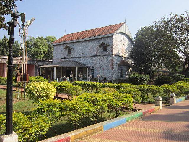
The Chandragiri Palace & Fort is a 11th century monument built by the Yadav Naidu kings and is also associated with the Vijayanagara Kingdom. The stunning structure is a perfect example of Vijayanagara architecture. Tourists are drawn by its rich history and heritage value. The attraction has fortnightly light and sound shows and the annual celebration of Madras Day.
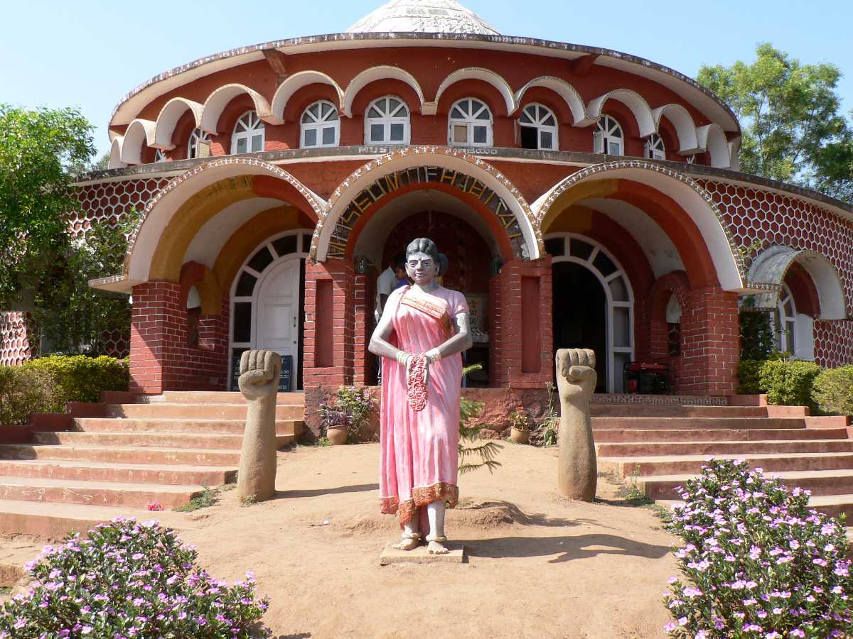
Established in the year 1980, the Sri Venkateswara Dhyana Vignan Mandiram in Tirupati is a museum that houses some of the most traditional articles that are used to perform Puja. There are many stone and wood carved items that can be found here. The museum is extremely beautiful and fills into you a sense of religious faith not easy to describe.
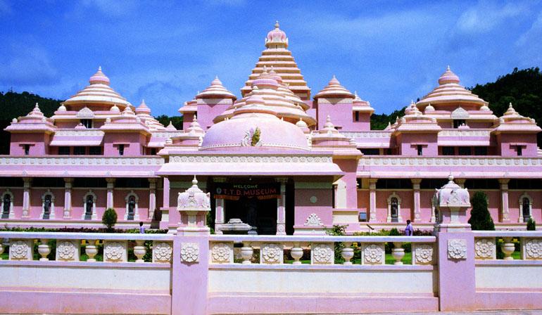
The Sri Vari Museum is where one can get a glimpse into the religious history of the region. The museum has an impressive collection of artefacts that give insights into the ancient history and architecture of the temple that includes sculptures, photographs, scriptures, temple and pooja utensils, etc.
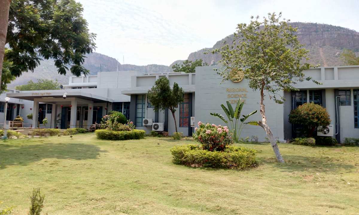
Regional Science Centre at Tirupati is a famous planetarium with a marvellous sky observation deck, galleries, parks and equipment of the highest quality. The centre also holds several demonstrations, exhibitions and shows in schools and institutes through their mobile science exhibition.
We have come to the end of our travel around Andhra Pradesh and I hope you have had as much fun reading it as I did researching and writing it. We will soon explore another state of India, so keep reading!