The Aminidivi group of islands, consisting of Androth, Amini, Kadmat, Kiltan, Chetlath, and Bitra came under the rule of Tipu Sultan in 1787 and passed to British control after the Third Anglo-Mysore War and were attached to South Canara. The rest of the islands came under the suzerainty of the Arakkal family of Cannanore in return for a payment of annual tribute which the British took over for nonpayment of arrears and were attached to the Malabar district of the Madras Presidency during the British Raj. On 1 November 1956, during the reorganization of Indian states, the Lakshadweep islands were separated from Malabar district and organised into a separate union territory for administrative purposes with the new territory called Laccadive, Minicoy, and Amindivi Islands before adopting the name Lakshadweep Islands on 1 November 1973.
The Aminidivi subgroup of islands consisting of Amini, Keltan, Chetlat, Kadamat, Bitra, and Perumal Par and the Laccadive subgroup of islands which comprises mainly of Androth, Kalpeni, Kavaratti, Pitti, and Suheli Par, have a submarine connection between them through Pitti Bank. Together with Minicoy Island, a lonely atoll located at the southern end of the 200-km-broad Nine Degree Channel, they form the Coral Islands of India in the Arabian Sea. All these islands have been built up by corals and have fringing coral reefs very close to their shores. Two banks further north, Angria Bank and Adas Bank are not considered part of the group. The Aminidivi Islands, are one of the three island subgroups in Lakshadweep and is the northern group of the Lakshadweep, separated from the Laccadive Islands subgroup roughly by the 11th parallel north. The islands of Amini, Kiltan, Chetlat, Kadmat and Bitra are inhabited with Islam being the main religion of the islanders. The islands were inhabited from ancient times by people of nearby Kerala to which were added later people of Arab descent. In the mid 16th century all the inhabited islands of the Lakshadweep were conferred as the jagir or estate of the ruling family of the Cannanore or Arakkal Kingdom by the Chirakkal or Kolattiri Raja in order to grant them protection from the Portuguese. In the latter quarter of the 18th century, the islands of the Amindivi group revolted owing to the rigours of the enforcement of the monopoly of the coir rope trade and following the uprising, the northern islands put themselves under the rule of the Kingdom of Mysore in 1784, then ruled by Tippu Sultan. The southern group of the Cannanore Islands, however, remained loyal to the Arakkal Kingdom. In 1792, as a consequence of the Third Anglo-Mysore War and the defeat of Tippu Sultan, the Amindivi Islands came under the East India Company rule following the treaty of Srirangapatna.
Cora Divh, also called Coradeeve or Little Bassas de Pedro Bank, is a submerged bank or sunken atoll and is the third largest feature of Lakshadweep, after Bassas de Pedro and Sesostris Bank. It is also the northernmost feature. Cora Divh has no emergent cays or islands and is covered by sand, coral rubble and broken shells.
Sesostris Bank is a submerged bank or sunken atoll and is the second largest feature of Lakshadweep and one of the northernmost features, after Cora Divh and Bassas de Pedro and is named after the steam frigate INS Sesostris of the Indian Navy.
Bassas de Pedro, also known as Manjappar or Pedro Bank, is a submerged bank or sunken atoll which is the largest feature of Lakshadweep. It is also one of the northernmost features, second only to Cora Divh and is in the shape of an arch open to the east with widths ranging from 15 km in the north to 33 km in the south. Its southern end is 63 km east of North Cay of Cherbaniani Reef, the closest land feature. There are no emergent cays or islands and the bank is steep-to, smooth with minor undulations in topography, and composed of sand, shells, and decayed coral. The water on the bank is not discolored.
Cherbaniani Reef, also known as Beleapani Reef and Valiyapanniyam in Malayalam, is a coral atoll and is the northwesternmost feature of Lakshadweep with a roughly oval shape. The 14 km long coral reef that encloses the lagoon has three small uninhabited islands on it composed of accumulated coral sand, shingle, cuttle-bones and sea shells. There are many land hermit crabs under the boulders and among the detritus and the atoll used to be a breeding ground for pelagic birds, including the sooty tern and brown noddy, formerly found in great numbers.
North Islet has a small mosque built and maintained by local fishermen from Bitra, Chetlat, Kiltan and Agatti islands. The fishermen came here and camp for fishing during the period between both monsoons. Lakshadweep islanders from Chetlat and Bitra sometimes visit the islands to collect guano for the gardens of the inhabited islands, gathering eggs, dumping garbage and disturbing the nestlings of pelagic birds in the process. The beaches are strewn with marine litter.
Byramgore Reef, also known as Chereapani Reef is a coral atoll whose northern part is submerged. There are a few sandbanks on the reefs, but little land is above the surface at high tide. The atoll is visited by birds, including the lesser crested tern and greater crested tern.
Chetlat Island is a coral island whose local history says that islanders were cruelly treated by Portuguese seafarers in the past. Coir twisting was the traditional occupation of the islanders and average Chetlat coir used to be equal to first-class coir of the other islands in Lakshadweep. One of the populated islands of the archipelago, Chetlat is located 37 km to the northwest of Kiltan Island and the reef and lagoon are located to the west of the island with a small scale yearly growing sand spit on the northern point of the island. Chetlat is the sole inhabited island of the township of Chetlat Island and the inhabitants are engaged in very small scale farming and fishing which are mainly for the island consumption. There is a small jetty on the west coast and a helipad on southpoint.
Bitra, also known as Bitra Par, is a coral atoll where prior to the 20th century, islanders from Kiltan and Chetlat visited to collect the eggs of birds breeding there. Until 1945, when a woman from Chetlat made this island her home, there were no attempts to settle this island permanently. There is a small shrine dedicated to an old Arab saint by the name of Malik Mulla who was buried on the island which has become a pilgrimage site. The atoll of Bitra encompasses two islands, the main Bitra Island is located at the northern end of the coral reef and the small south cay is located on the southern part. Bitra is the smallest of the populated islands of Lakshadweep with the main island having a small jetty on the south shore and a helipad on the westpoint. The inhabitants on the island are engaged in very small scale farming and fishing which are mainly for the island consumption.
Kiltan or Kilthan Island is a coral island which was settled during the early periods of immigration to the Lakshadweep islands, part of an international trade route between the Persian Gulf and Ceylon. It is also home of the Sufi saint Shaikh Ahmed Naqshabanthi. Kiltan is one of the populated islands of Lakshadweep with the reef and lagoon located to the west of the island and is also crossed by the 73rd meridian east through its landmark known as Kulikkara which is a tomb of a Lady venerated by the natives.
Kadmat Island, also known as Cardamom Island, is a coral island with seagrass and marine turtles which nest here. The island has been notified as a marine protected area for ensuring the conservation of the island’s animals, plants, organism and other resources. The only inhabited village on the island is Kadmat, which has fishing as the main economic activity with agriculture limited to 5% of the land area. Tourism is allowed even for non-Indians and the attractions are kayaking, snorkeling and leisure trips by a glass-bottomed boat for scuba diving. Kadmat Island is the central most island of the archipelago and is in the shape of a tear drop and is the longest island in the Amindivi group. There is an airport on nearby Agatti Island, in which flights operate from Cochin. From Agatti, it is a two and half hours boat ride to Kadmat. Ferry services also operate from Cochin on the coast of Kerala but involves a journey of 16 hours.
In 1960, a hoard of coins were unearthed and examined, revealing that the island has been inhabited since at least the year 200 and the island is known to have traded with the Romans, as in 1948 a Roman coin was found in a quarry on the island. Kadmat Island offers a host of activities to its guests which is why it is thronged by thousands of tourists every year. Some of the most popular activities and things to do on the island are scuba diving, kayaking, snorkelling and paragliding. One can also just sit and sun soak and admire the beautiful surroundings and use some of the many amazing spa and massage services available here.
Spread over 100 metres and surrounded by beautiful blue lagoon and shimmery white sand, Kadmat Beach is not only one of the most gorgeous beaches in the region but also, one of the most visited. One can relax on a hammock, sunbathe on the shores, stroll along the seashare and watch some of its many mesmerising sunrises and sunsets. Kayaking is another popular activity here due to the pristine nature, mostly untouched and uncommercialised with crystal clear waters. There are glass bottom boats available which can be hired for the views.
The best time to visit Kadmat Island is during the winters and early summers, between the months of October and May when there are cool sea breezes blowing, and the climate is pleasant. It is better to avoid summers and monsoons due to the high heat and humidity.
Elikalpeni Bank is a submerged bank or sunken atoll and is the easternmost geographic feature of the archipelago.
Perumal Par, also known as Peremul Par, is an uninhabited coral atoll very similar in appearance to the Cherbaniani Reef further north. It has a large lagoon devoid of islands in the encircling reef, except for 3 small sandy islets located at the eastern area. Terns of different species visit this atoll. There is some damage to the corals caused by Acanthaster planci crown-of-thorns starfish that was observed in the 1990s. Its surrounding waters are a good fishing area for baitfish and is often visited by fishermen from the inhabited islands nearby as well as tourists from the nearby Bangaram Island resort who often make excursions to this lonely atoll.
Amini Island was one of the first islands in the archipelago to be inhabited. The artisans on this island are known for making walking sticks out of coconut shells and tortoise shells as well as carved stone and coral motifs. The channel between Amini Island and Cardamom Island is safe and deep. The Amini Island Light is shown on the south point of the island. The island is oval with the long axis oriented northeast-southwest. It lies at the northeastern extremity of Pitti Bank, 42 km from the small, uninhabited Pitti Island which is not to be confused with the Pitti Islet of Kalpeni Atoll, which is located at the opposite southwestern extremity of the bank. Pitti Bank, also oriented along a northeast-southwest axis, is 49 km long and may be considered a largely submerged and sunken atoll with just the two islands Amini and Pitti remaining at its opposite ends. Kadmat island, although just 5 km northeast of Amini Island, is separated from it by a deep channel and thus forms a separate geographical unit.
In the next part, we will explore the Laccadive subgroup of the Lakshwadweep archipelago.
Lakshadweep is a group of islands in the Arabian sea, 200 to 440 km off the southwestern coast of India with the archipelago administered as a Union Territory of India. They were also known as the Laccadive Islands, although geographically this is only the name of the central subgroup of the group. Lakshadweep means one lakh island” in Sanskrit, and Malayalam is the most spoken language in the territory. The islands form the smallest Indian Union Territory and their total surface area is just 32 sq km and the lagoon area covering about 4,200 sq km. Kavaratti serves as the capital of the Union Territory and the region comes under the jurisdiction of Kerala High Court. The islands are the northernmost of the Lakshadweep–Maldives–Chagos group of islands, which are the tops of a vast undersea mountain range, the Chagos-Lakshadweep Ridge. The Lakshadweep consisted of 36 islands, but currently there are 35 islands, as the Parali 1 island submerged in water due to sea erosion.
As the islands have no aboriginal inhabitants, scholars have suggested different histories for the settlement of these islands. Archaeological evidence supports the existence of human settlement in the region around 1500 BC and the islands have long been known to sailors, as indicated by an anonymous reference from the first century to the region in Periplus of the Erythraean Sea. The islands were also mentioned in the Buddhist Jataka stories of the sixth century while Islam was established when Muslims arrived around the seventh century. During the medieval period, the region was ruled by the Chola dynasty and the Kingdom of Cannanore. The Catholic Portuguese arrived around 1498 but were expelled by 1545. The region was then ruled by the Muslim house of Arakkal, followed by Tipu Sultan. On his death in 1799, most of the region passed on to the British and with their departure, the Union Territory was formed in 1956.
Lakshwadweep is made up of 12 atolls, 3 reefs and 5 submerged banks, with a total of about 39 islanfs and islets of which 10 islands are inhabited. The reefs are in fact also atolls, although mostly submerged, with only small unvegetated sand cays above the high-water mark. The submerged banks are sunken atolls. Almost all the atolls have a northeast–southwest orientation with the islands lying on the eastern rim, and a mostly submerged reef on the western rim, enclosing a lagoon. Other than the 10 inhabited islands, 17 islands are uninhabited or are attached islets, four are newly formed islets and five are submerged reefs. The main islands are Kavaratti, Agatti, Minicoy, and Amini with Agatti having an airport with direct flights from Kochi.
The majority of the indigenous population is Muslim and most of them belong to the Shafi school of the Sunni sect. The islanders are ethnically similar to the Malayali people of the nearest Indian state of Kerala with most of the population speaking Malayalam with Mahl being the most spoken language in Minicoy island. The islands are served by an airport on Agatti Island. The main occupation of the people is fishing and coconut cultivation, with tuna being the main item of export. Everyone intending to visit Lakshadweep, including Indian nationals need a permit and once the permit is issued, Indians can visit all islands, while foreigners can only visit Agatti, Bangaram and Kadmat Islands. The archipelago is typically accessed from Kochi from where one can also get the permits.
Local traditions and legends attribute the first settlement on these islands to the period of Cheraman Perumal, the last Chera king of Kerala and the oldest inhabited islands in the group are Amini, Kalpeni Andrott, Kavaratti, and Agatti. Archaeological evidence suggests that Buddhism prevailed in the region during the 5th and 6th centuries and according to popular tradition, Islam was brought here by Ubaidullah whose grave is located on the island of Andrott, in 661. During the 11th century, the islands came under the rule of the Late Cholas and subsequently the Kingdom of Cannanore. In the 16th century, the Portuguese ruled the seas between Ormuz and the Malabar Coast and south to Ceylon. As early as 1498, they took control of the archipelago which was called Laquedivas by the Portuguese, to exploit coir production, until the islanders expelled them in 1545. In the 17th century, the islands came under the rule of the Ali Rajahs and the Arakkal Bheevi of Kannur, who received them as a gift from the Kolathiris with the islands also mentioned in great detail in the stories of the Arab traveller Ibn Batuta.
Bankura Bankura is famous for its hills and temples and is famous for its terracotta temples In the Mahabharata, Bankura was described as Suhmobhumi. The word larh or rarh was introduced after the 6th century and comes from the old Austric word rarha or rarho which means the land of red soil. Scholars differ in their opinion about the name Bankura where orah or rah means habitation. One of the most influential gods of the district, Dharmathakur is called Bankura Roy which may the be the root for the name of the place. Another legend about the name comes from Bir Hambir who was the 49th King of the Malla dynasty. Bir Bankura was one of his two sons. Raja Bir Hambir divided his kingdom into 22 tarafs or circles and gave one to his each son. Taraf Jaybelia fell to the lot of Bir Bankura who developed a town in his taraf and the town was later named as Bankura after its founder’s name. Located only a few km from the terracotta temples of Bishnupur, the Gokulchand Temple is the grandest of the few Bengal stone temples. The 64 feet high five pinnacled temple is surrounded by a high wall, giving the impression of a fort rather than a temple. Located on the banks of the Bodai River, the twin-villages of Hadal-Narayanpur is famous for the Mandal family terracotta temples that comprise of the Barataraf, Mejotaraf and the Chhototaraf temples. Barataraf also has a huge Rasmancha popularly used to stage Ras-Leela or plays based on Vishnu’s life. Mejotaraf and the Chhototaraf are studded with terracotta panels with representations of Vishnu in the Anantashayan posture. The tallest hill in this region, Biharinath hill is situated 57 km away from Bankura town and was an ancient centre of Jainism and is known for its beautiful surroundings. A tourist village, Joyrambati is famous as it was the birthplace of Sree Sarada Devi who is worshipped as the Holy Mother by the followers of Sri Ramakrishna. Jhilmili is a natural beauty also known as the Darjeeling of South Bengal. It is located at the border of Purulia, Bankura and Midnapur and just 70 km away from Bankura town. Literally translating to sparkle or twinkle in the Bengali language, the area has dense lush forests that possess breathtaking beauty. The place is situated on a hillock and amidst thick, dense forests of varying heights and the forest cover is so thick in some places that even sunlight has a hard time making its way through the labyrinth of vegetation. The Kangsabati flows right through this forest and its banks are a perfect spot to have a picnic. The watch tower offers an amazing view of the surroundings, including that of the descending elephants from the Dalma Hill during winters.
Bishnupur A small town, Bishnupur is famous for its terracota temples and rich culture including architecture, music and handicraft. The town’s name is derived from Lord Vishnu. The Baluchari saree of Bishnupur has developed a brand of its own. Stories from the mythology are designed on the sarees which are completed within a week. The oldest brick temple, Rasmancha was commissioned by the Malla King Bir Hambir in 1600. The temple has one inner chamber housing the idols of Radha-Krishna and has an elongated tower encircled by turrets which are of hut shapes. It is enclosed by a passageway and there are some big cannons which date back to Malla period. The Vaishnava Ras festival was held till 1935 before it was converted to a protected monument. The Lalji Temple is a laterite eka-ratna temple built in 1658 by Bir Singha II of the Malla dynasty on a square raised plinth which consists of ornamental stucco decorations on low relief carvings. Built by Malla King Raghunath Singh in 1655 AD, the Jorebangla Temple is of laterite bricks and has the appearance of two thatched huts joined together and surmounted by a single tower. The temple’s roofs and walls have classical Chala style of architecture in terracotta with the panels and walls depicting the lives of the royalty and stories from the epics. The Madan Mohan Temple is a eka-ratna temple built by the Malla King, Durjana Singh Dev in the late 17th century and has a square flat roof with curved cornices and a pinnacle over the top. Built by King Chaitanya Singha in 1758, the Radha Shyam Temple has a dome shaped sikhara with stucco motifs that depicts floral, geometric and life of puranas. Soaring at an altitude of 1442 feet, Susunia Hill is famous for sports like rock climbing and trekking. The hill is covered with a rich flora of shrubbery, majestic trees and rare medicinal plants. Part of the eastern ghats, this hillock is popular with trekking enthusiasts. There also stands an ancient carved monolith structure on the hill called the Narasimha Stone. The carvings on the monolith call it the oldest stone. There is a fresh spring water stream that shoots right out of it. The river Gardeshwari and its tributary the river Darakeshwar, both cut through the hill and provide many places to picnic in. The hill is also an official archaeological and fossil site with many fossils and tools used in the Stone Age found here.
Jayrambati Jayrambati is a quaint village, popularised as an important pilgrimage point among followers of Sri Ramakrishna for being where the Holy Mother Sri Sharada Devi was born. The village has a certain old-world charm to it and has several small temples all across the village with the most popular one being the Sri Sri Maitri Mandir devoted to the Holy Mother and erected exactly at the birth location of Shri Sharda Devi in the year 1923. The Holy Mother is said to have resided here up to the age of 9 with her parents and it is also where Sri Sharda Devi got married to Sri Ramakrishna. The temple houses a marble idol of Sri Sharada Devi, established in 1923 by Swami Sardananda, who built the temple. The temple has an adjoining prayer hall and a kitchen and a few of the household articles used by the holy mother are now present at the temple as sacred relics to be viewed by the devotees of the holy mother. A Shivaling was also installed in the sanctum sanctorum after it was found deep in the ground while excavating the earth for the construction of the temple. Bhanu Pishi House near the Maitri Mandir is the ancestral residence of Bhanu Pishi, a close companion of the holy mother who regarded her as an aunt during her younger days. Bhanu Pishi returned to her childhood residence after the demise of her husband and is believed to have seen a four-armed Goddess in the Holy Mother long before she was revered as a spiritual leader. The holy mother also spent some time at Bhanu Pishi House to find peace and solace on being taunted by the villagers about her husband’s mental imbalance. The property is presently managed by the Maitri Mandir.
Nutan Bari was the second home of Sharada Devi, often referred as the new house of the Holy Mother and was constructed by Swami Sardananda standing on the western face of the Punya Pukur and registered in the name of Goddess Jagaddhatri. Puratan Bari is also referred to as the old house of the holy mother and was Sharada Devi’s residence for 52 years from 1863 to 1915. Many devotees received their initiations for Bhamhacharya and Sanyasa from the holy mother here and she also worshipped Goddess Jagaddhatri when she resided here. At the time of division of ancestral properties, the house was given to her brother Prasanna Mukhopadhyay, but the holy mother continued to stay with her brother in the same house for a long time before shifting to Nutan Bari. The house was acquired by the authorities of Belur Math from the descendants of Prasanna and is overseen by the Ashram. Telo Belo is a small village between Jayrambati and Tarakeshwar, famous for housing the Dakat Kali or the Kali of Dacoits Temple built by a dacoit named Bhim. It is believed that the holy mother stayed with the dacoit and his wife during her travel to Dakshineshwar to visit her husband and addressed the dacoit as father and he was so moved by her love and affection that he left the path of robbery and led a simpler life from then. He later constructed a temple devoted to Goddess Kali because he thought Sharada Devi was an incarnation of the deity. The Mayer Dighi is one of the primary source of irrigation for the village and also where the devotees of Sharada Devi take a dip.
Village folklore says that decades ago when Sharada Devi was suffering from an acute illness she went on a fast before the temple, the goddess Simhavani appeared before her and her mother Shyamasundari in the form of a blacksmith who advised the holy mother about remedies to cure her disease. After following the blacksmith’s advice, the holy mother was completely cured of her disease, post this the holy mother preserved some amount of earth from the site where the goddess appeared before her, she took the medicines daily and also gave some to her niece Radharani. When word spread out about the healing powers of the earthfill people from neighbouring areas flocked the area to acquire the medicinal earth and seek blessings from the goddess. The goddess then became a popular figure in the region, and with time the temple got damaged. The new temple has metallic pitchers that represent the goddess Simhavani and her two companions Chandi and Mahamaya. The Dharma Thakur Temple is located at the north-west corner of Punya Pukur is a small mud-walled thatched hut that houses a shrine to Dharma Thakur, who is worshipped under two different names at two different places. In one of the chambers of the temple there is a tortoise shaped form of Lord Sundaranarayana; an Avatar of Dharma Thakur and is one of the two forms of the deity. Jayrambati Math, also known as the Ramakrishna Mission Sharada Sevashrama Yogashrama hosts an array of cultural and religious festivities throughout the year. It is believed that the Shihar Shiva Temple was the exact spot where Sharada Devi first expressed her desire to marry Sri Ramakrishna.
Koalpara is a small village located near Jayrambati that is intertwined in the life and journey of the holy mother Sharada Devi. The holy mother rested at the village during her visits to Kolkata via Bishnupur and resided here quite frequently. An Ashram was built here in the year 1909 and Sharada Devi herself installed portraits of Sri Ramakrishna and herself in the Ashram’s shrine, the portraits are worshipped at the Ashram daily. The Ashram also runs a Charitable Homeopathic Dispensary and also conducts activities for the wellness of the community like educational and medical aid. Sharada Devi also occasionally stayed at the Jagdamba Ashram, which is very close to the Koalpara Ashram. Punya Pukur is a tank on the eastern side of the Nutan Bari. Pilgrims usually visit this tank to take a bath before visiting the shrines and temples. Also known as Tal Pukur, because the pool is lined with palm trees on its periphery, Barujjey Pukur is a tank located in the south-eastern corner of the village and very close to Nutan Bari. The holy mother Sharada Devi used to take baths in the tank and also used the water for all her domestic needs. Amodar Ghat is a ghat on the banks of the rivulet Amodar, regarded as Ganga by Sharada Devi. The rivulet has formed a triangular peninsula that resembles the back of a tortoise dotted with cremation marks. Garh Mandaran Fort is an ancient fort approximately 10 km from Jayrambati, built during the Afghan era and has Afghani stylings and influences in its structure.
Kamarpukur A cluster of small villages, Kamarpukur is nestled between Vishnupur and Tarakeshwar and the birthplace of Sri Ramkrishna Paramhansa. A number of small cottage industries and temples are located here. Kamarpukur is rich in biodiversity and replete with flora and fauna. The Matri Mandir Is believed to be the birthplace of Ma Sarada and is situated in Jarambati and also called Jairamabati Math. The temple houses a beautifully constructed marble idol of Ma Sarada. The emple is open from 4 to 11 am and then from 3 to 8 pm. Translated to New House in English, Nutan Bari is located in the complex of Matri Mandir and gives a glimpse into the life of Ma Sarada who was born and brought up here. Puratan Bari translates to Old House and it was built by Swami Shradhananda for Ma Sarada so that she could live comfortably and is also located in the Matri Mandir complex. Located near the Talpukur lake, Simhavahini temple is dedicated to Goddess Simhavahini. Haldapukur tank is the birthplace of Sri Sri Thakur who was revered by the people for his knowledge and wisdom and also the place where Lord Shri Ramkrishna used bathe daily while staying in Kamarpukur. Punya Pukur located near the residence of Ma Sarada was where she took a bath daily. The Goddess Visalakshi shrine is an important pilgrimage place and was built for Goddess Visalakshi, believed to be a savior of the poor and needy. The Gopeshwar temple is dedicated to Lord Shiva and was built by ardent devotees of Lord Shiva, Sukhlal Goswami and his forefathers. The Mukundapur temple is where Sri Sri Thakur’s mother took penance so that her child could be free from insanity and become sane. Sri Ramkrishna’s mother also fasted here for a number of days to seek blessings of Lord Shiva. This temple houses a splendid shrine of Lord Shiva known for its healing and magical powers. The Sihar Shiva temple located in Sugar village is also dedicated to Lord Shiva and was a favourite of Ma Sarada and Sri Ramkrishna. Barujjey Pukur is situated on the south eastern part of the village and is also called Banerjee’s tank. The Yogi Shiva temple dedicated to Lord Shiva is where Sri Ramkrishna’s mother envisioned a divine light coming out of the idol Shiva and realised had conceived Sri Ramkrishna. Located on the outskirts of the village, the Dargah of Ismail Fuji is built in Islamic architecture with carvings of verses on the walls. Constructed in 1947, Ramkrishna Math is where Sri Ramkrishna Pramhansa was born. The Math also operates a jute mill where unemployed people of the village are trained so that they can earn a livelihood. Before merging into the sea, the Damodar river flows through Kamarpukur and is considered pious and auspicious by the villagers. The Raghuvira temple is dedicated to Lord Rama and is a beautiful temple today from what was a mud hut. The temple also houses an earthen pot believed to be used by Goddess Sita and also has a Rameshwara Shiva Lingam and a salagrama of Lord Vishnu. The Garh Mandaran is a ruined fort located near Kamarpukur and is believed to be built during the Afghan era.
Tarapith Tarapith is a famous Hindu pilgrimage site and a Shakti Peetha, believed to be the spot where Sati’s third eye fell. Tara, another form of Sati, is worshipped in the temple. Near the Dwarka river, Tarapth is also called the city of Tantra Mantra or black magic. Alegend tells the story of how Shiva drank the poison Halahala, that would save the universe. To soothe his burning throat, Tara had breast-fed Shiva and nursed him. The history of the place is steeped in black magic and there is a huge cremation ground adjacent to the powerful Shakti peeth. Chanting can be heard at the cremation grounds at all hours and a sense of mystery engulfs the village.The Tantric Hindu temple is dedicated to the goddess Tara, a fearsome Tantric aspect of the Devi, the chief temples of Shaktism. Tarapith is also famous for Sadhak Bamakhepa, known as the avadhuta or mad saint, who worshipped in the temple and resided in the cremation grounds as a mendicant and practised and perfected yoga and the tantric arts under the tutelage of another famous saint, Kailashpathi Baba. Bamakhepa dedicated his entire life to the worship of Tara Maa. His ashram is also located in bank of Dwaraka river and close to the Tara temple. The Bamakhepa Temple, a pink coloured temple dedicated to the Saint Bamakhepa. There is a tomb and samadhi right outside the temple where people offer prayers and offerings in the name of the saint. The Tarapith Temple is a small temple located on the banks of the Dwarka river and is an ancient extremely auspicious temple. One of the 51 Shakti Peeths in India, is one of the most important places where tantric rituals are followed even today. It remains busy all through the year and is often visited by the poor who come here to have a free meal. As per legend, an eyeball of Sati fell here at Tarapith, when Lord Shiva roamed the universe mourning her loss and so the name of the village was changed from Chandipur to Tarapith. The Tarapith temple represents the destructive aspect of Lord Shiva in the form of Kali. As per the Hindu traditions, Ma Tara is believed to be the second out of the ten goddesses of great wisdom and is also known as Kalika, Bhadra-Kali, and Mahakali. She is the tantric demonstration of Goddess Durga. Mahasmashana is not a usual tourist spot, but a cremation ground right besides the main temple as Goddess Tara is said to have an affinity for bones and skeleton. This is where many saints and sadhus reside permanently and perform their meditation and tantric kriya.
Falta The river town of Falta is the ideal picnic destination or weekend gateway from Kolkata as it is less than 50 km south of the metropolis. When Siraj-ud-Daulah sacked Kolkata in 1756, the English residents moved to Falta temporarily. Marked by the confluence of river Hoogly and Damodar on the south and river Rupnarayan and Hoogly on the north, Falta has been developed on the banks of the Hoogly and is known for the beautiful farmhouse like the Bose Bigyan Mandir of Acharya Jagadish Chandra Bose, the grounds of which allow visitors to picnic in. At the Falta jetty, one can watch ferries crossing the river and walks along the riverside and also go for a boat ride on the river. At a 30 minute drive is Diamond Harbor, Raichak and Gadiara Geonkhali as well as the towns of Tamluk and Haldia.
Raichak Located 50 kms away from Kolkata and yet a world apart, Raichak, is a riverside town. With the Hooghly river on its side and the numerous forts that add to its earthen charm, this town is the perfect weekend getaway. The Raichak fort, originally built during the British colonial rule is one of the most beautiful forts in all of India, especially after its restoration a few years back. For many years post independence, the fort was left ignored and was in shambles. Later, the Radisson group of hotels overtook it and converted it into a hotel. Now known as The F Fort, the Raichak Fort, though heavily commercialised today, manages to enthrall with its earthen charm and old world demeanor. Built in Anglo Indian architecture with traces of British and French styles, the fort is the best place to visit. Situated off the southern coast of Hoogly, Diamond Harbour is a popular weekend getaway near Kolkata. This is where the Ganges takes a turn towards the south to join the Bay of Bengal. There is also am old fortress goes back to Portuguese pirates and the beautiful Bakkhali beach. The Lighthouse is very close to the fort. Built a couple of decades ago, the lighthouse is still fully functional and can be seen guiding the inbound ships on a dark night. Close to Diamond Harbour, the Chingrihkali fort was built by the Portuguese, but is in ruins today, but is a stunning site, especially on a windy day. One can also see the river stretched across in the backdrop. Located near Diamond Harbour on the banks of Hooghly River, the Ashram of Ramakrishna Mission is very popular with the serene setting adding to its beauty. Close to Diamond Harbour, Joynagar is, in addition to a flourishing local market selling handicrafts, popular for housing Kalidas Dutt’s many manuscripts, terracotta figurines and black stone images of many Gods belonging to the 11th and 12th centuries. Situated on the confluence of rivers Hooghly, Rupnarayan and Damodar, Gadiara is another nice weekend destination. One must visit Gadiara for great Bengali food, leisurely walks along the village roads and boat trips with the view of sunsets and sunrises on river a scene to behold. Closeby attractions include Garchumuk and Geonkhali, which can be reached by regular ferry service.
Taki The small town of Taki lies on the banks of river Ichamati and a boat ride on the river will give one a chance to get a closer view of Bangladesh. In fact, tourists of both India and Bangladesh embark on this journey, thus giving one a chance to meet citizens from the neighbouring country. Local attractions include the ruins of Zamindar houses, Ramakrishna Mission, Kuleshwari Kali Temple, a three century old Jora Sahib Mandir and General Shankar Roy Chowdhury’s Adi Bari. A boat ride will take one to Henry’s island, and a rickshaw ride from Henry’s island will take one to Golpatar Jungle for the canopy walk. Taki is located at about 80 km from Kolkata by road.
Piyali Island Situated about 72 kms from Kolkata, Piyali is an island covered in lush greenery and is an ideal weekend getaway and is frequented by birdwatchers. Nestled at the confluence of the rivers Matla and Piyali, the mangroves covered Piyali Island can be reached by crossing a small bridge atop the Piyali river. The island is considered the gateway to the renowned Sundarbans National Park and in addition, one can spot exotic birds as the place is home to a wide variety of bird species and also go boating in the Piyali river. The place provides several accommodation options and is also a popular picnic spot in the region.
Machranga Dwip Also known as Kingfisher island, this little known day trip destination is situated in the middle of the river Ichamati, with India on one side and Bangladesh on the other. Covered by trees, this little island is perfect for nature lovers, as they can walk through the green fields and observe distant Bangladeshi rural settlements. One can picnic, take a boat ride and go swimming in the river. The sun setting on the river Ichamati is an awe-inspiring sight. Taki is about 20 minutes away and to reach Machranga Dwip, one needs to travel to Hasnabad and then use a van to reach the ferry dock for motorboats to reach the island. You can also hire motor boats from Taki to get to Machranga Dwip.
Kakdwip Kakdwip finds a special mention in the history of the state as it was here that the peasant movement during the Tehbaga movement in 1946 centred around. While it is a historically significant place, the city, located on the Ganges delta, has many exciting places in store like Henry island, Sagar island, Frederick island and Fraserganj island, among others. Henry island is a pristine white sand beach, located near Bakkhali with many red crabs can be found here and birds like whistling ducks, kingfisher and the black-rumpled flame back. Named after a British surveyor, Henry island is regarded as the best among Mandarmani, Digha, Tajpur, Puri and Bakkhali beaches. The beaches form the Ganga-Brahmaputra Delta region. There is also a watchtower near the beach, from where one can get a beautiful view of the beach and the mangrove forests. From here, one can also visit the Bakkhali beach and the adjoining crocodile and deer parks.
Sagardwip Part of the Sunderbans group of islands, Sagardwip is a small island at the confluence of the Ganges and the Bay of Bengal. The point where the Ganga meets the sea is considered holy by Hindus and thousands of pilgrims make way to Sagardwip, every year in mid-January, to take a holy dip in the river during the Ganga Sagar Fair, the second most attended fair in the world, after the Kumbh Mela.
Mousuni Island Mousuni is a tiny island attached to the Sunderbans delta near Namkhana which boasts of golden sandy shores, mesmerising orange sunsets and a beautiful view of the horizon. The island was first developed by the British to trade salt and dry fish and is considered a beautiful confluence of the river and the sea. A well kept secret of the state, Mousuni Island is considered to be a bird watchers’ paradise as a lot of birds migrate here for the winter. Salt at the southern corner of the island was where once salt was extracted from the sea. Kankramarir Chor near Baliara, is considered the best place for bird watching. December to mid April is considered the best time to visit Mousumi Island with the weather is pleasant unlike summers and the monsoons.
Bakkhali A small beach town on the coast on the Gangetic delta and close to the Sundarbans. The Bakkhali Beach is located at the most deltaic island of southern Bengal and is a crescent-shaped beach. Stretching 8 km from Bakkhali to Frasergunj, this beach has a long coastline and is famed for its sunrises, picnics and leisure walks. Jambu Dwip is an independent island, 8 km off the main coast and is uninhabited and submerges in water for some months of the year. The beach is a famous fishing spot and known for the pure drinking water found on it. The Bishhalakshmi temple at the end of the Bakkhali beach is worth a visit. The area of Fraserganj is popular because of ancient history. Lord Fraser, a British official resided in this area and was so mesmerised that he decided to build it up, but the construction never got completed, owing to the sea. Ruins of his home and a few other builds can still be seen here. There are also a large number of wind mines erected in the area. The Crocodile Park is the only crocodile reservation park in West Bengal and one of the few in the world. The Bakkhali Breeding centre has a huge collection of crocodiles, with a variant in almost every stage of life from the birth to old age.
Junput The beach at Junput is adorned with casuarina groves, accompanied by the rhythmic sound of sea waves and gentle breeze and forms a breathtaking experience. The most famous attraction is the convergence point of rivers Rasulpur and the Ganga. Other attractions include the lighthouse and museum of the fisheries department. Digha, Mandarmani, Tajpur and Talshree are all located at an hour’s drive.
Mandarmani Mandarmani is a small and upcoming beach resort town near Kolkata. With great scenery and sandy beaches, Mandarmani is the longest motorable beach in India, about 13 km long. Approximately 180 km away from Kolkata on the Kolkata-Digha route Mandarmani is a wonderful place to just lie down on the beach and watch the setting sun against thrashing waves.
Tajpur Tucked between Mandarmani and Shankarpur, Tajpur is a small town set on the Bay of Bengal’s shore, just 170 kms from Kolkata. Considered to West Bengal’s secret, the virgin beach here is hidden away from view with the highlight of the beach, the hundreds of red crabs found on the shore, which give a crimson colour to the beach. Unlike usual crescent-shaped beaches, this one is an inverted crimson fringed by dense eucalyptus, tamarisk and casuarina trees and the secluded beach is perfect for lazing on a hammock and spending time in solitude. Tajpur Beach is also known for its adventure sports and activities with the popular sports being snorkelling, kayaking, parasailing, coastal biking, water zorbing, rafting, boating and fishing. Located at a distance of just 7 km from Tajpur Beach, Digha is a major tourist attraction and is also a beach town, but unlike Tajpur Beach, the beautiful beaches in Digha are crowded. Noted for having longest motorable beach road in India, Mandarmani lies 19 kms from Tajpur Beach and is full of dense plantations. Another beach town about 7 km from Tajpur Beach is Shankarpur which is a popular fishing harbour. The best time to visit these beachside towns is at the onset of the winter season between the months of October and February when the climate is pleasant and the temperature favourable.
Shankarpur The Shankarpur beach is breath taking, with clean water, white sand and mildly blowing winds and is one of the most sought after beaches on India’s eastern coast. The small town with the lack of too many distractions, gives one the opportunity to spend as much time at the beache as possible. There are not many water sports available and the beach has a few shacks and bars, where coconut water and other drinks and sea food are available.
I really enjoyed exploring this state and I hope you enjoyed reading about it too. We’ll meet again with another state to explore.
Rishyap Also known as Rishop, Rishyap has many myths and legends associated with its name with Ri standing for a mountain peak and shop meaning age-old trees in Tibetan. A quaint village, Rishyap is located in the Neora Valley just 4 km uphill of Lava and is well known for its majestic views of the Kanchenjunga range and the Nathu la Pass. Tiffindara, a sunrise-view spot, is about 1 km from here from where one can get an amazing 300-degree view of some of the most famous peaks of the Himalayas such as Kanchenjunga, Mt. Kharg and Rakhtang among others.
Lava and Lolegaon Located about 120 kms from Siliguri, Lava and Lolegaon are 25 kms apart which offer beautiful snow capped mountains and ancient Buddhist monasteries as a backdrop to a relaxing holiday. The most beautiful forest in Lolegaon, the Canopy walk comprises of hanging bridges, suspended from one tree to another made from planks of wood and are located high enough to afford one the luxury of viewing the surroundings. The Canopy walk is best viewed in the daytime. Located about 10 km from Lava, Changey falls is a small waterfall in between Tiffin Dhara and Ghanti Dhara with crystal clear waters. Another equally beautiful viewpoint is the Jhandidhara Viewpoint which is located at the Lolegaon hilltop with magnificent views of the Kanchenjunga. Tifindara is a famous sunrise point with pine forests and provides views of the Himalayas. Located about 3 km by trek and 10 km by jeep, it has the most stunning view of the Kanchenjunga. The Lava Monastery has a four acre piece of land where hundreds of monks live and preach their beliefs. The architecture of the monastery is exactly like those in Tibet with various prayer halls, lawns, sitting areas and a huge Buddha statue. Built back in 1980s the monastery is extremely well maintained. There is an Eco Park at Lolegaon which is located in the main village, very close to the bus stand and is quite well maintained. The Nature Interpretation Centre is a small but important building at the entrance of the Neora National Park offering comprehensive information about the National Park along with information about tour guides and maps. There is also a gift shop where one can buy souvenirs and a small garden with a beautiful flowers.
Buxa Tiger Reserve Bodering Bhutan and Assam, the Buxa Tiger Reserve was set up in 1983 and was then, the 15th tiger reserve of the country. The forest constituting the reserve is the largest in the Dooars and spans 759 sq km and is irrigated by several rivers and their tributaries. It boasts of a diverse and breathtaking landscape, and because of the rocky terrain, many parts of the forest in the Buxa hills that lie in the Sinchula Range are inaccessible even by the authorities, and hence remain unexplored even after so many years. This tiger reserve serves as an international corridor for the migration of elephants between India and Bhutan because the Phipsu Wildlife Sanctuary in Bhutan is adjacent to the northern part of the Buxa Tiger Reserve. The reserve is home to 67 species of mammals, 36 species of reptiles and 230 species of unidentified avifauna and encompasses more than eight types of forests. The great diversity of mammals in this reserve makes it the second highest among all tiger reserves in India. The reserve has over 300 species of trees, 250 species of shrubs, 130 species of aquatic flora, 100 species of grass and 400 species of herbs with a rich collection of various medicinal herbs and different species of orchids. The majestic Bengal Tiger, an endangered species, has made the Buxa Tiger Reserve its home and apart from the Bengal Tiger, there are other members of the cat family here too, including leopards, fishing cats, jungle cats and leopard cats. One of the most beautiful and extremely rare mammals that is endemic to this reserve is the Clouded Leopard which are very shy members of the cat family and can rarely ever be spotted. The Chinese Pangolin and the Regal Python are also endemic to the region. The avifauna here is both endemic and migratory. The reserve constitutes a total of 38 forest villages, 49 fringe villages and four fixed demand holdings with the majority of the population in the interiors of the forests consisting of tribes such as Garo, Mechia, Madesia, Rava, Rajbanshi and Bhutia. Visitors can opt for either morning or evening safaris that last 3-4 hours each. The morning safaris start from 6 am and the evening safaris start from 3 pm with a jeep safari costing about INR 800. The Buxa Tiger Reserve remains closed to visitors from 15th June to 15th September every year because the region experiences heavy rains. A 5 km trek through the forest leads to the Buxaduar Forest Bungalow which has accomdations available. Another 4 km into the forest will bring one to Rover’s Point, a point that is 4500 ft high and known as the land of unknown birds. Rupam Valley in Bhutan, is another 12 km from Rover’s Point.
Rajabhatkawa A small town situated just outside the Buxa Tiger Reserve Rajabhatkawa is known for its natural beauty and is surrounded by forests. All the permits for the entry to the Buxa Tiger reserve can be taken from here.The name literally means (the place) where the king had a meal and folklore says that the kings of the princely state of Koch Bihar used to come here to picnic in the forests. Jayanti is a small forested village near Rajabhatkawa about 15 km near Buxa Reserve and has the magnificent Mahakal caves and the Jayanti Riverside. The Mahakal Caves are hundreds of years old and its origins are obscure. After navigating many tunnels and ladders, one will land in the middle of the cave which has a small Shiv temple which has a fantastic view of the nearby hills. The Buxa Fort has was built centuries ago and came the British India after the 2nd Dooars War of 1865 which was fought between Bhutan and the British. It is believed that during the China- Tibet disturbances in the 19th century, many Tibetan monks hid at the fort and later, during the freedom struggle of the 1900s, the fort served as refugee to many freedom fighters. Today, the fort is in ruins. The Nature Interpretation Centre is at a short distance from the Buxa reserve and provides information of numerous birds and animals in the reserve, along with information of various plants and their medicinal properties. To cover Buxa in a safari, one can easily hire a jeep or car at the forest office at Rajabhatkawa who will also provide a tour guide. There is an ancient Shiva temple located at the edge of the main town, approximately 8 km from the town which is beautiful and isolated. A lot of people walk down to the temple. Very close to the Shiva temple is another temple devoted to the Goddess Kali. The small ancient temple is surrounded with trees on all sides and is highly revered.
Jaldapara National Park The Jaldapara National Park, situated on the banks of the Torsa river was earlier known as the Jaldapara Wildlife Sanctuary and is spread over an area of around 215 km. It comprises of riverine forests as well as grasslands and is famous for its impressive population of Royal Bengal tigers, elephants, one-horned rhinoceros, and various other species of deer. To get the best out of the park, one can go for an elephant ride, which will give a chance to catch a glimpse of the animals up close. Another wildlife park that nature lovers should consider visiting is the North Bengal Wild Animals Park. This park is an integral part of the Mahanadi Wildlife Sanctuary and spread out over an area of 300 hectares and contains a wide variety of flora and fauna. However, unlike other wildlife parks and sanctuaries, the Mahanadi Wildlife Sanctuary strictly forbids visitors from feeding the animals at the park. The Bengal Safari sprawls over 297 hectares and is mainly a natural habitat for Sal and associated species. The Mixed Herbivore Safari, one can spot herbivores like the spotted deer, barking deer, sambar, hog deer, swamp deer,one horned rhinoceros, black ibis, kingfisher, peacock, red jungle fowl, emerald dove, drongo and hornbill. The Tiger Safari is a 15 min safari where one might spot tigers. There are three tigers in the park with one male and one female brought from the Nadankanan Zoological Park in Orissa and another male brought from the Tata Steel Zoological Park in Jharkhand. The Asiatic Black Bear Safari have two black bears that have been brought from the Padmaja Naidu Zoological Park in Darjeeling and also has a 15 min ride. The 15-minute Leopard Safari around a 20-hectare area has four leopards who live in the park. There is a foot trail at the park known as the Aviary trail where one can spot domestic and exotic birds like the red jungle fowl, peafowl, white peafowl, and peacocks. The Gharial & Crocodile Pond has gharials and crocodiles in natural free flowing water. There are entry fees single as well as multiple safaris and one can choose as per convienece. The park is open from 9 am to 5 pm and is closed on Mondays.
Jaldhaka A valley town in the hills of Darjeeling, Jaldhaka is close to the India – Bhutan border and will take you back to a time when life was full of simple pleasures. The Jaldhaka riverside is a must visit when visiting this valley and the clear blue flowing water set amidst trees and rocks with birds chirping in the background is one of the most serene and soothing sites in Jaldhaka. The Coronation Bridge offers a breathtaking view of the lush greenery and was constructed mainly to connect Darjeeling and Jalpaiguri. Inspired by Roman architecture the bridge spans the river Teesta and is also known as National Highway 31 and is also considered to be the lifeline between Kalimpong, Nathula and Gangtok. The bridge was constructed during the British colonial rule to commemorate the coronation of King George VI in 1937.
Chapramari Wildlife Sanctuary Located at a distance of about 20 km from the Gorumara National Park, this wildlife sanctuary has the Kanchanjungha and other Himalayan peaks as its backdrop. The name of the region comes from Chapra, a variety of small fishes found in northern Bengal, and Mari, meaning abundance and receives waters from the Teesta, the Neora, and the Murti. Known for its elephant population, the sanctuary has a a wide diversity of animals including gaur, leopards in their natural habitat. However, unlike Gorumara, the Royal Bengal Tiger is not found here. The sanctuary is closed to visitors during the monsoon season from June to September.
Gorumara National Park Situated on the banks of rivers Murti and Raidak, the Gorumara National Park is spread over 80 sq km and sits at the foothills of the Himalayan mountains. With a large variety of flora and fauna and full of riverine grasslands and moist deciduous forests, it is famous for its Asiatic one-horned rhino. The national park also houses other mammals, reptiles, insects and birds, including the majestic Asian elephants, the royal Bengal tiger and the Great Indian Hornbill. Other commonly found animals here include leopards, elephants, the Indian bison, rock pythons, deer and the Malayan Giant Squirrel and there are approximately 48 species of carnivores and herbivores animals, birds and insects in the sanctuary. During the winters, migratory birds such as teal, stork and ibis can also be seen here. There are two types of wildlife safari here that one can choose from, the Elephant Safari and the Jeep Safari which can be booked from the forest department and must have an authorised guide along while visiting the watchtowers. The jungle safari leads visitors to different watchtowers, which include the Jatraprasad watch tower, the most famous lookout, and is named after a female elephant that was legendary for her caring nature. The entry point for this watchtower is through the National Highway at the northern part of the national park and the salt lakes just below the watchtower make it an attractive place to spot wildlife, especially during early morning or late afternoon safaris. The Methla Watchtower is located at the Kalipur eco village towards the eastern fringe of the national park and a unique bullock cart driven safari is available here. The Chandrachur Watchtower is located in the midst of a vast and open grassland and has a small pond and salt lake here. Other watchtowers include the Rhino Point, Chukchuki watchtower and Chapramari watchtower. The national park is open all year round, except between 16 June and 15 September and every Thursday of the year. The best time to visit the national park is from October to May and the weather is delightful during this period.
Neora Valley National Park Established in 1986, Neora Valley National Park is spread over an area of 88 sq km and is one of the richest biological zones in eastern India. It gets its name from the river Neora that flows through it and due to the luxurious growth of forest cover, many areas in the park are still inaccessible. The Neora Valley is also known as the land of the elegant red panda and has mixed species of flora that include bamboo, oak, ferns and sal along with a wide variety of fauna such as Hodgson’s Hawk Cuckoo, Jerdon’s Baza, Bay Woodpecker, Golden-throated Barbet, and many more. The park is situated at the tri-junction of Sikkim, Bhutan, and West Bengal and is contiguous with forests of these three boundaries and reach up to an elevation of 10,600 ft at Rachel Danda, the highest point of Neora valley. One can’t enter the park without an entry permit which can be obtained from the Forest Range Office located at both Lava and Samsing and needs two to three hours and so it is advisable to start early. The forest office starts issuing permits to the national park from 6 am during summer and spring. The park is closed between June and September and day visits are open from 16 September and 15 June. When open, the park is closed on Thursdays and open between 8 am to 12 noon and then again from 1 to 4 pm and has an entry fee of INR 100 per person.
Lataguri Located outside the Gorumara National Park on National Highway No. 31, Lataguri is the perfect place to take in both the Gorumara and Champramari National Parks as well as the Buxa Tiger Reserve which is a 2 hour drive away. Permits for entering Gorumara and Chapramari Wildlife Sanctuary are given from Lataguri and the village also contains a Nature Interpretation Centre, which gives information about the flora and fauna of the area.
Purulia Located north of the Kangsabati river and West Bengal’s western most district, Purulia is blessed with natural beauty. The Baranti Reservoir or Murardi Lake is a calm lake surrounded by mountains and covered with thick greenery. It is less crowded and more peaceful and intimate and is ideal for spending some time just contemplating life. The lake lies in the beautiful Rahr countryside and offers a stunning view of the reservoir. The Maharaja of Keshargarh is known to have fought the British rule and looted the Purulia treasury. The Rakab forest used to be the hunting place of Kashipur and is popular known as the forest of 16 crosses. The Maharaja was hung to death here and the fort here is in ruins today. 42 km from Purulia via Sirkabad, Ajodhya is a woody mountain with a table land on the top with many small streams making their way through the slopes of the hill to meet the Subarnarekha river on the west and the Kangsabati and Kumari rivers from the northern slope. About 700 m above sea level, there are sparkling freshwater streams and springs here and the best activities to indulge in here are rock climbing and mountaineering and the summit has fantastic views. Gajaburu Hills are paradise for rock climbers. The slopes are hard, rough and tough which provides thrill and adventure. There is also a nature camp here which can be visited to view the beauty of the hills. On the bank of the Kangsabati in the Manbazar Panchayat Samiti, Doldanga is a popular picnic spot with a beautiful water body where one can ride boats, a deer park and an island . Another popular picnic spot, Surulia has been developed by the forest department and is popular amongst eco tourists. About 6 kms from the main town, the eco park is located on the bank on the river Kangsabati and has a deer park and tourism cottage inside. Located in the foothills of the Panchet Hills, Garpanchkot is ruined fort. There is also temple at the top of the hill. In 1740, the Nawab of Bengal challenged Alivardi Khan to a battle, but started losing the battle. To stay in the war, he had to seek help from the Maratha Rulers of Nagpur. Although the Maratha cavalry was set, they further started looting and plundering the small town and this continued on for around 10 years and it was during this time that the fort was attacked by the Maratha army and destroyed and the palace plundered. To escape the attack, the 17 wives of the King jumped in the well nearby and committed suicide and the palace has been left deserted and in ruins ever since.
Sonajhuri Forest Considered one of the cleanest forests in India, the Sonajhuri Forest is a wonderful retreat with lush green trees and blooming flowers. This picturesque place is untouched by industrialisation and is inhabited by tribals and the pristine river flowing alongside the forest makes it look magical. Sonajhuri which translates to droplets of gold in English is named because of the Sonajhuri tree located in huge numbers when in winter they shed their yellow flowers, the whole forest looks as if drops of gold has been scattered on the ground. The forest is replete with a myriad number of flora and fauna and does not include wild animals and hence is safe to wander around. Animals here include the spotted deer, jackal, foxes and elephants. Every Saturday, a market known as the Sonajhuri Sonibarer Haat is set up and a must visit. The market starts around 3 pm and continues till the sun sets. Rabindranath Tagore spent time here and composed some of his greatest works at Tagore’s Ashram. The Ashram comprises of many buildings, namely Udayan, Konarka, Shyamali, Punashcha and Udichi with each special to Tagore. There is a complex which houses splendid sculptures by Ramkinkar Baij and a museum located in the ashram which is full of artefacts, photographs and writings of Tagore. The Kopai river is a pristine river that flows through the forest and is referred to as Amader Choto Nodi. Bonerpukur Gram is the where the tribals live and is adjacent to the forest with beautiful mud huts. The Ballavpur Wildlife Sanctuary is filled with colourful birds including parrots, ducks, kingfisher and woodpeckers. A large herd of deers are the main highlight of this sanctuary. The sanctuary is closed on Wednesdays and on other days is open between 10 am and 5 pm and has an entry fee of INR 20. The Kankalitala temple is is about 10 kms away and is believed to be one of the 51 Shaktipeeths of Sati.
Deulti Situated on the bank of river Roopnarayan, Deulti is an ideal picnic spot. This small village is also close to other tourist attractions like Samtaber, the hometown of the renowned Bengali author Sarat Chandra Chattopadhyay and the temples of Madangopal and Radha, adorned with embellishments of terracotta art. Other popular townships like Kolaghat, Garchumuk and Gadiara are also located close to Deulti which is about 51 km from Howrah by road.
Sundarbans The Sundarbans is a mangrove area in the delta formed by the confluence of the Ganges, Brahmaputra and Meghna Rivers in the Bay of Bengal and spans from the Hooghly River in West Bengal to the Baleswar River in Bangladesh. It comprises closed and open mangrove forests, land used for agricultural purpose, mudflats and barren land, and is intersected by multiple tidal streams and channels. There are four protected areas in the Sundarbans which are UNESCO World Heritage Sites, the Sundarbans National Park, Sundarbans West, Sundarbans South and Sundarbans East Wildlife Sanctuaries. Despite this, the Indian Sundarbans were considered endangered in a 2020 assessment under the IUCN Red List of Ecosystems framework. The Sundarbans mangrove forest covers an area of about 10,000 sq km with the most abundant tree species being the sundri or Heritiera fomes and gewa or Excoecaria agallocha. The forests provide habitat to 453 faunal wildlife, including 290 bird, 120 fish, 42 mammal, 35 reptile and eight amphibian species. The Sundarbans National Park is also a Tiger Reserve and a Biosphere reserve.
The Sundarbans which mean beautiful forest, are the last remaining stands of the mighty jungles which once covered the Gangetic plain. Since 1966, the Sundarbans have been a wildlife sanctuary, and it is estimated that there are over 400 Royal Bengal Tigers and about 30, 000 spotted deer in the area. Other endangered species in the bioreserve include the Batagur baska, King Crabs and the Olive Ridley Turtles. The Nilkamalor Hiron Point and Katka viewpoints offer fantastic views of the animals while the mud-flats called Chargheri Char is where one can enjoy coastal trekking. Marichjhanpi is one of the islands within the Sundarbans and is is known as an island of atrocities. Ghoramara Island is one of the tiny islands of the Sundarban delta and is shrinking at exorbitant rates due to global warming and the rising of water levels in the Bay of Bengal. New Moore or India’s Purbasha or Bangladesh’s South Talapatti is an offshore sandbar island off the coast of the Sundarbans. Two kilometres away from the mouth of the Haribhanga River, the 25,000sq.m. island was completely submerged under the Bay of Bengal waters for years.
Mayapur Previously known as Miyapur, Mayapur is located at the confluence of two rivers, where the waters of the Jalangi River mix with the Hoogly river, a distributary of the Ganges, about 130 km north of Kolkata. Along with Nabadwip, it is considered a spiritual place by the adherents of Gaudiya Vaishnavism. It was founded by the Bhakti saint Vinod Thakur and is believed that Lord Krishna’s incarnate Sri Chaitanya Mahaprabhu was born here in 1486. The word Mayapur derives from Miyapur, the Bengali name of a village, which was settled by Muslim fishermen. The ISKCON Chandrodaya Temple is one of the over 650 temples that the International Society for Krishna Consciousness has established all across the globe. The key areas in the temple complex include the main temple, an idol of the founder of ISKCON, Acharya Srila Prabhupada, the presiding deities Sri Sri Radha Madhava and an idol of Lord Nrisimhadeva that finds its way in the centre of the compound. The highlight of the temple, is Srila Prabhupada’s Pushpa Samadhi Mandir or shrine which is a marble dome. The small idols of the Gods in the altar are taken out in processions during Ratha-Yatras, Jhula-Yatras, or the boat festival and they also come out in a procession every Saturday evening during winters, after the Sandhya Aarti, on a chariot, from the beginning of the Kartika month up to Gaura-Purnima. After the temple was attacked by dacoits in 1986, an idol of Lord Nrisimhadeva was installed in the centre of the premise. This rare form of the Lord, with bent knees and eyes red in anger, ready to spring out of the pillar to attack demons and protect his devotees is known as Sthanu- Nrisimha. The ISKCON Temple at Mayapur is the only place where this form of the Lord is worshipped. An interesting area inside the temple is the Chaitanya exhibition, where all of Lord Chaitanya Mahaprabhu’s pastimes are artistically painted and depicted on the walls through the medium of bas-reliefs. A dramatic narration of the same in Bengali is played through an audio system in the background. The exhibition is open from 10 am to 1 pm and then from 4 to 6 pm. The temple is open from early morning till 1 pm and then again from 4 to 8:30 pm. The Mangala Aarti takes place between 4:30 to 5 am, the Darsana Aarti at 7 am, the Srila Prabhupada Guru Puja at 7:30 am, a class of the Srimad- Bhagavatam which is held in English and Begali seperately at 8 am, the Bhoga Aarti at noon, the Sandhya Aarti at 6:30 pm and finally a class on the Bhagavad Gita in Bengali at 7:45 pm. The Yoga Peeth is the birth place of Chaitanya Mahaprabhu, and is built in white marbled and towers 30 m high. It is a centre of excellence teaching in yoga, the vedas and meditation. It is assumed that Chaitanya was born under a neem tree which is still seen in the premise of the Yoga Peeth. There is a hut which contains the clay models and statues displaying the life and philosophies of the saint and a small shrine devoted to Srila Bhaktivinoda Thakur who raised the fund for building the original temple. Founded by Acharya of the Gaudiya Math named Srila Bhaktisiddhanta Sarasvati Maharaja, the Sri Chaitanya Math is dedicated to Radha Govinda and has four altars dedicated to the Vaishnava acharyas namely Sri Nimbarka, Sri Madhvacarya, Sri Ramanujacarya and Sri Visnuswami. The Sri Devananda Gaudiya Math is an ancient temple situated at Champahatti in one of the islands in Navadvipa known as Koladvipa and was established by Srila Bhaktisiddhanta Maharaja. It is home to Lord Gaura and Gadadhara. Chand Kazi, a muslim, was the magistrate of Navadvipa who opposed the Harinam Sankirtana movement in Mayapur and broke the mridanga of Srivash Pandit, who led the Sankritana. Later Kazi became an ardent disciple of Shree Chaitanya Prabhu and the Chand Kazi Samadhi commemorates his transformation.
Nabadwipa Nabadwip or Navadvipa is an heritage town where Chaitanya Mahaprabhu was born and is famous for the Rass festival where city is li with lights and idols of Gods and Goddesses are made on each corner of the town. Located on the western bank of the Hooghly River, it is considered to have been established in 1063, and served as the old capital of the Sena dynasty and it is still noted for its traditional Sanskrit schools. Many who follow Gaudiya Vaishnavism visit Nabadwip to celebrate the auspicious birthday day of Shri Mahaprabhu, which, as per lunal calculations, occurs on Phalguni Purnima i.e. on the Full moon day in February – March and is known as Gaura-Purnima. The Bhagirathi river originally flowed down the west of Nabadwip in the past, but with time it has shifted its course to where it is at present, cutting the city off from the rest of the district. The name of the town is derived from the conjugation of the Bengali words naba or new and dwipa or island which means new-island. With almost 200 temples concentrated in this small rural setting, Navadwipa is a spiritual setting. The Sri Chaitanya Saraswat Math devoted to Lord Chaitanya, a reincarnation of Lord Krishna, said to have been born here is the main reason that many come to Nabadwipa. The foundation for the temple was laid 1941 with a mere hut but over the years, the temple has grown to become one of the most magnificent sights. The ISKCON Temple at Navadvipa is built by the International Society of Krishna Consciousness (ISKCON) is a beautiful temple that houses many Krishna idols. In addition to the main temple, the complex also has various book shops and a guest house where devotees can stay. One of the most popular temples of Nabadwipa, the Radha Rani Temple is a symbol of Goddess Radha’s love for Lord Krishna. The tale behind the temple is that Radha got angry with Lord Krishna and went into the jungle to avoid him. Lord Krishna spent many days looking for her and finally found her on a full moon night. Hence, devotees have a special belief of visiting this town on full moon nights, to commemorate their eternal love. Another folklore surrounding the place is that it is believed to have appeared on its own and not built by anyone. Dedicated to deities Lord Gaura and Lord Gadadhara, the Shri Devananda Gaudiya Math temple is a few hundred years old, built in Champahatti in one of the islands known as Koladvipa. The temple underwent some much needed renovation a few years ago through which much of its charm has been preserved. One of the most revered temples of Navadwipa, the Sri Mahaprabhu Mandir is located in Srivasa Angan and is subdivided into three shrines. The first is devoted Radha Krishna and Lord Chaitanya, the second to Sri Chaitanya Mahaprabhu, for his maha-prakasa-lila, the time when he became the supreme personality of God and the third is dedicated to Sri Sri Gaura-Nitai. The Pushpa Samadhi Mandir is a memorial to ISKCON’s Founder Srila Prabhupada, with the main shrine surrounded by a museum depicting his life using different exhibits. Located a about 8 km off Navadwipa, the Purbasthali Bird Sanctuary can be made as a day trip from Nadabwipa. With its 3 km long oxbow lake, the sanctuary has hundreds of species of birds and is known to have the clearest waters in all of the wetlands and is a photographers delight.
Bakreswar The village of Bakreshwar is a place of geological interest with as many as ten hot springs. The word Bakreshwar comes from the name of Lord Shiva worshipped locally with Bakra or Vakra meaning bent or curved and Ishwar meaning God. Mythologically it is said that in the Satya Yuga during the marriage ceremony of Lakshmi and Narayan, Ashtavakra Muni, then known as Subrata Muni was insulted by Lord Indra. The muni was so enraged that he developed 8 deformities in his body as Ashtavakra Muni means a sage with 8 curved deformities. Ashtavakra Muni was blessed by lord Shiva here after many years of meditation. Bakreswar is also famous as one of the 51 Shakti Peethas where there is a temple dedicated to Adi Shakti and is a major pilgrimage spot for Hindus. The Mahishamardini Temple is at a distance of about 60 km from the main town that belongs to one of the forty-seven Shakti Peetha temples scattered across the Indian subcontinent. This site of worship, dedicated to an incarnation Goddess Durga known as Bakranath, is steeped in mythology. The story goes that the temple is built on the point where the forehead and eyebrows of Sati fell. Additionally, there are more than a hundred subsidiary shrines to Shiva nearby. The Bakreswar Temple is located fairly close to the Mahishamardini Temple, and is dedicated to the worship of Lord Shiva. Deriving influence from architecture from Odisha, this ancient temple contains two different lingas corresponding to its outer and inner sanctum. Bakreswar has ten natural hot water pools with temperatures ranging from a soothing 90 to a steaming 200 degrees. At a temperature of about 200 degrees, Agni Kunda is the hottest spring located right next to the Bakreswar Temple. Agni which means fire is rich in many minerals including sodium, potassium, calcium, silicates, chlorides, bicarbonates and sulphates which are said to have medicinal properties. It might also contain traces of radioactive elements.The other springs are the Paphara Ganga, the Baitarini Ganga, the Khar Kunda which has water at 66 degrees celcius, Bhairav Kunda where the water is 65 degrees Celsius, Dudh Kunda where the water is of a dull white hue during the early mornings, probably due to ozone concentrations and is at 61 degrees celcius and is why it is named as dudh means milk. The Surya kunda which means the sun has water at 61 degrees Celsius and the Shwet Ganga, the Brahma Kunda and the Amrita kunda.
In our next part, the last part of exploring this fascinating state, we explore some more religious places and then the wonderful seaside towns and beaches.
Kurseong Located at an altitude of 1,482.55 metres, Kurseong is about halfway between Darjeeling and Siliguiri. The origin of the name Kurseong is unclear, but stories suggest it comes from the Lepcha language word for small orchid, kurson-rip because of the little white orchids dotting the valleys, or perhaps the term for a stick made out of a local cane. The original inhabitants were the Lepcha people, who named their home Kurseong, because every spring it was alive and bright with the Kurson-Rip orchids. In the past, Kurseong was a part of the Kingdom of Sikkim, and in 1780 the Nepalese conquered and annexed Kurseong and its surrounding areas. After the Gurkha War of 1817 which the Nepalese lost, Jurseong was restored to Sikkim by the Treaty of Titalia.
Kurseong is famous for its waterfalls, temples and Buddhist gompas apart from the excellent views. Just like the tea gardens of Darjeeling, the sprawling tea plants in their estates add a certain charm to Kurseong. The two big tea estates are Makaibari or Ambotia and the estates offer guided tours where visitors can meet the workers, get to know the history, art and the science behind tea processing. Patrons can also take part in tea-tasting sessions. A full conducted tour generally costs INR 500. Once a temporary residence of Netaji Subhas Chandra Bose, the Netaji Subash Chandra Bose Museum is located in Netaji’s older brother’s residence and has pictures, documents and articles related to Netaji during his house imprisonment by the British. Today, the museum also acts as an institute for Himalayan Language & Culture Studies and offers excellent views of the valley and is open between 9:30 am and 4:30 pm and has no entry fee. Maintained by the forest department of the state, the Forest Museum stores exhibits of animals skins, bones, hides and photographs of fauna which once thrived in the Dow Hill region. Located close to Deer Park, one can also find on display wooden artefacts. Those intrigued by nature will find themselves at home here. Visitors can also enjoy a stroll through the small park of the museum. The museum does not maintain regular visiting hours and does not have any entry fees. There are a total of three Darjeeling Himalayan Railway Museums, the other two being museums in Darjeeling and Sukna which house rare pictures, sketches, miniature structures of trains and also have regular toy train rides to nearby places which are very scenic. Located inside the Ambotia Tea Estate, the Ambotia Shiv Mandir is one of the holiest places of worship in Kurseong. There is a lovely orange orchard is located adjacent to the temple, and visitors can also enjoy excellent views from the temple premises. The Churches in Kurseong are from the British colonial times and are heritage buildings. St. Paul’s church, St. Andrew’s church and St. Mary’s Hill church are some of the must-visit churches in Kurseong.
Mirik Located on the banks of a huge lake, the hill town of Mirik began life as Mirik Bazar, a commercial centre in the region where people from the surrounding villages and tea gardens came to trade and buy their necessities. The present lake area was a marshland with thick growth of sweet flag, locally called bojho with a playground stood in the present garden area where the British officers played polo.The name Mirik comes from the Lepcha words Mir-Yok meaning a place burnt by fire. The most prominent place in Mirik is the Sumendu Lake, which is beautiful, calm and yet invigorating. The lake also has an 80 foot bridge running over it for people who don’t wish to walk around it. Boating in the lake and a pony ride on the lakeside are are local and visitor favourites. The lake is strategically located so everything in the town is at a walking distance from the lake. The Mirik valley is full of tea bushes and almost throughout the year, you can see workers picking ripe leaves or watering the bushes. Mirik also has numerous beautiful orange plantations spread across the town. Bunkulung, the agricultural hub of Mirik cannot be accessed on foot. One will need to hire a vehicle which takes a few minutes to get to. Located on the edge of the valley, with hills looming in every direction, the place is full of farm lands, fisheries and lush forests. Rameetay Dhara is a beautiful viewpoint with stunning views of the Kanchenjunga as the backdrop and the valley at the bottom. The Devi Stan temple houses idols of Goddess Singla Devi, Lord Shiva, Hanuman and Goddess Kali and is just a few minutes walk from the Sumendu lake and another few minutes away from Bokar Monastery. The Bokar Monastery is the seat of the venerable Kyabje Bokar Rinpoche and belongs to the Kagyud order. It is one of the few in India that have retained its traditional beliefs and environment from the very beginning. Constructed in the Chinese architectural style with sprawling lawns, the monastery is a few minutes walk from the Mirik Lake.
Darjeeling One of India’s most beautiful hillstations, Darjeeling is nestled amidst acres of lush green tea plantations and spread over a steep mountain ridge in the lesser Himalayas at the height of 2,050 meters above sea level. Known as the Queen of the Himalayas, there are over 86 tea estates here responsible for producing the worldwide famous Darjeeling tea. Darjeeling was the summer capital of India during the British colonial rule and the toy train established in 1881 is a UNESCO World Heritage site with the third highest peak in the world and the highest in India, the Kanchenjunga peak clearly visible from the town. The recorded history of the town starts from the early 19th century when the colonial administration under the British Raj set up a sanatorium and a military depot in the region. Subsequently, extensive tea plantations were established in the region and tea growers developed hybrids of black tea and created new fermentation techniques. The resultant distinctive Darjeeling tea is internationally recognised and ranks among the most popular black teas in the world. The varied culture of the town reflects its diverse demographic milieu comprising Lepcha, Khampa, Gorkha, Kirati, Newar, Sherpa, Bhutia, Bengali and other mainland Indian ethno-linguistic groups. The name Darjeeling comes from Tajenglung, a Yakthung Limbu terminology that means the stones that talk to each other and also from the Tibetan words Dorje, which is the thunderbolt sceptre of the Hindu deity Indra, and ling, which means a place or land.
Lying at an altitude of 2590 meters, Tiger Hill is famous for its sunrise where one can see the peaks of Kanchenjunga. Tiger Hill is also the summit of Ghoom, which is the highest railway station in the Darjeeling Himalayan Railway, a UNESCO World Heritage Site. One must leave Darjeeling by 3:30 am to reach Tiger Hill by 4:15 am to reach in time for sunrise, though this is delayed a bit during winters. The roads get blocked by traffic during the peak season. To get up to the sunrise spot, it requires a short climb on foot from the parking spot. During sunrise and sunset, Kanchenjunga is lit up in a mesmerising display of colours and one can also see Mt Everest and several other mountain peaks belonging to the 8000+ m from this hilltop. Tea is synonymous with Darjeeling and with over 80 tea plantations, a visit to at least one tea garden is a must-visit.
The Happy Valley Tea Estate, the second oldest tea estate is the only garden that allows tourists to view the subtler nuances of producing and processing tea with their tea factory guided tour daily from 9:30 am to 4:30 pm during which one can observe how fresh tea leaves are withered, rolled, fermented, dried, sorted and finally graded to produce the different varieties of tea. A tea-tasting session is also held here, where first-timers are privy to experiencing the subtleties involved in distinguishing the various groups of tea and one can also buy the tea products from the shop in the estate. The factory tour is INR 100 per person and the tour is not conducted between November to February as tea plucking does not happen during the winters.
An exquisite spot terraced with natural fall known as the Chunnu Summer Fall, the Rock Garden is located 10 km from Darjeeling and is also known as the Barbotey Rock Garden. The garden is surrounded by beautiful hill stream along with the slope covered with flower gardens and sitting arrangements at various level. The way to the rock garden is filled with rocky hills and greenery shared by sharp hairpins and extremely steep roads. While at the rock garden, one musn’t miss the Ganga Maya Park which 3 km from the garden. There is a a small lake that offers a boating services to visitors and there are performances of Gorkha folk dancers. The rock garden is open from 10 am to 4 pm and entry fee for Indians have an entry fee of INR 10 while foreigners pay INR 50.
The Nightingale Park is a public park area with gorgeous views of the Kanchenjunga ranges. Previously known as The Shrubbery when it was a private courtyard of Sir Thomas Tartan’s Bungalow, during the British colonial rule. Flanked by a covered archway, the entrance leads one to pebbled walkways around the oval-shaped park. Since the Nightingale Park is at a slightly elevated terrain, one needs to climb a few steps to reach the entry. The park was closed for renovation for about four years and has reopened for the public since 2011. There is a giant statue of Lord Shiva and a musical fountain. The park is open all days of the week from 7 am to 8 pm and has an entry fee of INR 10 per person for adults.
The Observatory Hill is situated above Chowrasta square, just above the Mall Road offers a panoramic view of the mountains and various Hindu and Buddhist temples including the Kanchenjunga Temple, the Mahakal temple and the Tibetian Memorial Shrine. It takes around 15 minutes to walk to Observatory Hill from the Mall Road and in the narrow and steep uphill path, one has to go through a small cave. The walk is filled with colourful flag and small yet noticeable shrines. Built in 1765 by Lama Dorje Rinzing of the Bhutia Basti monastery, the oldest monastery in Darjeeling. The monastery was devastated by the Gorkha invasion in 1815 and was rebuilt in 1861 and again demolished by an earthquake in 1934 and currently owes its existence to the Raja of Sikkim. The ancient Mahakal temple located on the top of the hill, dedicated to Lord Shiva. There is also a small Siddhi Sai Baba temple located on the side of the road and right next to it, another temple dedicated to Lord Hanuman. The hill is open from 7 am to 7 pm.
The Darjeeling Ropeway gives passengers superb views as they travel across the valley. Established in 1968, the Darjeeling Ropeway is India’s first cable car system, and serves as a tourist attraction. With 16 cable cars and each car accommodating 6 people, the cable car travels from the North Point in Singamari to the Singla Bazaar, situated by the banks of the Ramman river at an altitude of 7000 feet. The view of the numerous tea estates of Darjeeling, the cascading waterfalls, and the majestic Kanchenjunga makes this experience an essential to every visitor to Darjeeling. At the bottom end of the trip, the cable car halts for a while, where visitors may explore the lovely tea gardens, or relax at the small mountain cafe, before proceeding back to the Singamari base station. The Ropeway is closed on the 19th of every month for maintenance. During the winter and monsoon seasons, the ropeway is open between 10 am to 2 pm while during summer and autumn, it is open from 10 am to 4 pm. There is an entry fee of INR 200 per person for an adult and INR 100 for children between between the ages of 3 and 8.
The Darjeeling Himalayan Railway also referred to as the DHR, and the Darjeeling Toy Train is a 2 feet narrow gauge train that runs between New Jalpaiguri and Darjeeling. Construction of this 88-kilometre long railway line took place between 1879 and 1881 and was declared as a UNESCO World Heritage Site in 1999. Later, two more lines were added and came to be known as the Mountain Railways of India. The trip between Darjeeling and Ghum and back is a two-hour round trip that covers a distance of 14 km. Located at the height of 2225.7 metres above the sea level, Ghum is the highest altitude station. The train stops for 10 minutes at the Batasia Loop, where it makes a loop around a beautiful and well-maintained garden from where one can get a bird’s eye view of Darjeeling, and the snow-capped Kanchenjunga peaks. The War Memorial in honour of the Gorkha soldiers is also located here, in the centre of the garden. The train also stops for 30 minutes for a visit to the Darjeeling Himalayan Railway museum which is located on the station premises and boasts of having the oldest toy train engine safely preserved here. A total of 18 rides takes place throughout the day, beginning at 7:40 am. The last ride commences at 4:20 pm. Visitors can choose a steam engine hauled train or one that has a diesel engine. The steam engine train offers an authentic and traditional experience but is costlier than the diesel engine train rides. Both the trains only have first class seats and the disel engine train has a fare of INR 800 for a round trip while the steam engine train has a fare of INR 1,300 for a round trip. All fares include the entry to the DHR museum. Children below five get in free. The Toy Train Jungle Safari operates between Siliguri Junction and Rangtong Station with the three-hour round trip taking one to Rangtong, a small village located at an altitude of 1,404 feet, 16 km away from Siliguri Junction. The ride takes passengers through the Mahananda Wildlife Sanctuary, located around Sukna and Rangtong station. The train leaves Siliguri Junction at 10:30 am and reaches Rangtong at 11:50 am where it halts for 20 minutes and arrives back at Siliguri Junction at 1:35 pm. A round trip in a first class coach costs INR 610 per person.
The Batasia Loop is a lush green toy train pathway that is meant to minimise the elevation of the Darjeeling Himalayan Railway. The unique design of this attraction allows the track to wrap around itself through a hilltop tunnel and one of the most enchanting aspects of the Batasia Loop is its natural beauty from where one can enjoy a panoramic view of the Darjeeling. The Eco Garden features organic farming and plantations with many rare and unheard of species like Rhododendrons, silver firs and Gingko Biloba. There is a war memorial located close to Batasia Loop to honour the sacrifice of Gorkha soldiers of Darjeeling, with a cenotaph and a statue of a Gorkha soldier.
Lamahatta is a scenic village 23km from Darjeeling. Lamhatta which means Monl’s Hermitage has an eco park, the Lamahatta Eco Park that was created in 2012. The eco-park has wooden & bamboo gazebos that overlook Lamahatta. The manicured garden, known as the Roadside Garden has flowers of various seasonal plants including white and yellow orchids.
The Yiga Choeling or old Ghoom Monastery is the oldest Tibetan Buddhist Monastery in Darjeeling. Established in 1850 by Lama Sherab Gyatso, this shrine is part of the Yellow Hat sect known as Gelupka who worship the Coming Buddha or the Maitreyi Buddha. Also known as the Sakhya monastery, there is a 15-foot high statue of the Maitreyi Buddha is seen in the central hall, made entirely of clay brought from Tibet. One can also find many rare Buddhist manuscripts. From the monastery, one can see the majestic Kanchenjunga. In front of the Maitreya Buddha statue hang two huge oil lamps which keep burning throughout the year. The walls of the monastery are elaborately painted with depictions and art of Tibetan Buddhism, with different images of bodhisattvas placed in a symmetrical manner. The hilltop above the monastery holds the Ma Kali temple, where devotees come to offer prayer every full moon day and on the fifteenth of every month of the Tibetan calendar. The monastery is open between 9 am and 6 pm daily and has no entry fee, but visitors need to pay INR 10 for a camera and INR 50 for a video camera.
Located on the slopes of Jalapahar hills, the Peace Pagoda or the Japanese Peace Pagoda is designed to establish unity, harmony and goodwill amongst people belonging to different sects of society. Famous for its tranquillity, it offers stunning views of snow-clad peaks including the Kanchenjunga peak. The Peace Pagoda was built by Nichidatsu Fujii, a Buddhist monk from Japan and designed by M. Ohka. The pagoda houses the four avatars of Buddha including Maitreya Buddha and is the tallest free standing structure in Darjeeling at a height of 28.5 meters. Two concrete lions stand on both sides of the staircase and the avatars of Buddha are carved in the walls and polished in gold colour which show the Buddha sitting, sleeping, standing and meditating. Beautiful artwork depicting the life of Buddha and his relics is etched on sandstones that look like wooden framework. There are mythological depictions like the Gift of Mango Grove by Amrapali at Vaishali and the Great departure of Siddhartha. The pagoda is open between 4 am and 7 pm and the prayer timings are between 4:30 to 6 am and then again from 4:30 to 6 pm daily and does not have any entry fees.
The Himalayan Mountaineering Institute is recognised as one of the best mountaineering institutes in the world and was established in 1954. The primary purpose of the institute was to encourage, enhance and support the interest of the people in the sport of mountaineering and to channel their energy into a productive and self-awarding sport. The magnificent view of the 8586-meter high peak of Kanchenjunga, the third highest peak in the world, from this institute is mesmerising. The institute is open between 9 am to 1 pm and then again between 2 to 5 pm. It’s closed on Tuesdays and during the off-season and has an entry fee of INR 40 and a camera fee of INR 10.
The Bengal Natural History Museum has has more than 4000 specimens and is located in the heart of Darjeeling at the Padmaja Naidu Himalayan Zoological Park. Originally started as a small building in the Botanical Garden meant to showcase the varieties of butterflies and birds of the hills, today, one can find preserved remains of the bird species, reptiles, insects, fishes, and mammals displayed in a replication of their natural habitats. An attractive display of the various minerals of the region is also present here. There are two sections at the museum, one at the ground level and the other in the basement. There is also a large collection of birds’ nests and eggs and a specialised taxidermy unit to oversee the curing, stuffing and preparation of the birds and animals to be displayed as exhibits. There is also a small library where one might find many interesting books, including the 125 volume series titled The fauna of British India. The museum is closed on Thursdays and national holidays and on other days, it is open between 10 am to 4 pm. One needs to purchase a combined ticket for the Bengal Natural History Museum, Darjeeling Zoo and Himalayan Mountaineering Institute for INR 60.
The Padmaja Naidu Zoological Park houses a wide variety of animals and is also known as the Darjeeling Zoo and includes an off-display breeding centre for snow leopards and red pandas. Set up in 1958 and named after the former governor of West Bengal, Padmaja Naidu, it is the largest high altitude zoo in India. The zoo serves as the central hub for Central Zoo Authority of India’s red panda program. There are Siberian Tigers, Yaks and the Himalayan Black Bears among other animals and also maintains Himalayan flora.
The zoo is open from 8:30 am to 4:30 pm during summers and from 8:30 am to 4 pm during winters. It is closed on Thursdays and has an entry fee of INR 20 for Indians and SAARC country residents and INR 50 for foreigners while a camera incurs a INR 10 charge.
Located at an altitude of more than 7000 feet above the sea in the Singalila range, the Singalila National Park is the highest national park in the state. Initially, a wildlife sanctuary, the national park encompasses beautiful, 78.60 sq km of virgin rhododendron forests, alpine valley and rare species of animals and orchids. It provides panoramic views of the Himalayas from Nepal to Sikkim and up to Bhutan. Singalila is home to the very rare and exotic Red panda and the Himalayan black bear. The national park is also part of a trekking route and derives its name from the Singalila spur, which runs through the park, descending from Mount Kanchenjunga in the north and running south to the northern fringe of the Gangetic Plains. Visitors need to get a permit from the forest department before entering the core area of the national park. The permit can be acquired either from the Forest Department office at Manebhanjan or at the entrance to the national park about 1km from Tumling. Within the park, it is necessary for visitors to be accompanied by trained and registered guides of the wildlife department. One of the most popular treks is along the Singalila Ridge to Sandakphu and Phalut which provides a grand vista of the Kangchenjunga and the Everest ranges and one can also see the seasonal wildflower blooms and birds. The jeep safari through the Singalila National Park and the surrounding forest is the best way to get around with the route ringed by stretches of greenery, with lofty pine trees and vibrant rhododendrons. The fare for the safari is around INR 3000 which can be through a Darjeeling based tour operator. The national park is closed from 16 June to 15 September and when open is open from 6 am to 7 pm. The entry fee is INR 100 for Indians, INR 200 for foreigners, INR 100 for a camera and INR 500 for a video camera. A small village around 19km from Darjeeling located at a height of 6,956 ft, Lepchajagat lies amidst dense forests of pines, oaks and rhododendrons and is now part of a reserved forest area.
Tinchuley At a distance of about 32 km from Darjeeling, Tinchuley is an offbeat hamlet situated close to the West Bengal-Sikkim border at an altitude of 5550 ft. The name Tinchuley is derived from the words tin and chula, which translates as three ovens because the trio of hills resembling mud ovens. The rivers Teesta and Ranjeet also intersect quite close to it. While famous for its tea plantations and fresh fruit orchards, Tinchuley is quieter and more obscure place than Darjeeling. In Tinchuley, one can engage in rock climbing, trekking, sightseeing, all against a scenic green mountainscape that seems like something out of a film set. The Sunrise View Point is where one can catch the young and majestic peaks of Eastern Himalayas that comprise the Teesta Valley especially during sunrises and sunsets. Starting from Peshoke Road, a quick, half an hour stroll through gorgeous pine forests and ferns will land one in Gumbadara, another vantage point in Tinchuley. Here one can get to explore ancient Himalayan caves whose surrounding rocks offers some fun rock climbing. One can not only see the Teesta river flowing down in the valley below but also the bordering state of Sikkim. Tinchuley cultivates export-quality tea and there are six tea gardens in the village. Tinchuley’s economy is also dependent on the numerous orange orchards in the village including a factory that produces fresh marmalade, orange juices and pickles. Established centuries ago by a monk purportedly in the order of Nalanda, the Tinchuley Monastery is a centre of spirituality. As per legend associated with the monastery, a lama meditated here for 17 years. Every morning, cymbals in the monastery are loudly rung in order venerate the ancestors and appease their spirits. Downhill from Tinchuley, the village of Chotamangwa began become popular recently.
Dooars The Dooars or Duars are the alluvial floodplains in eastern-northeastern India that lie south of the outer foothills of the Himalayas and north of the Brahmaputra River basin. This region is about 30 km wide and stretches over about 350 km from the Teesta river in West Bengal to the Dhansiri River in Assam. The region forms the gateway to Bhutan and is part of the Terai-Duar savanna and grasslands ecoregion. Dooars means doors in Assamese, Bengali, Maithili, Bhojpuri, and Magahi languages. There are 18 passages or gateways between the hills in Bhutan and the plains in India and the region is divided by the Sankosh river into eastern and western Dooars with the western Dooars also known as the Bengal Dooars, and the eastern Dooars also known as the Assam Dooars. The Dooars belonged to the Kamata Kingdom under the Koch dynasty; and taking advantage of the weakness of the Koch kingdom in subsequent times, Bhutan took possession of the Dooars. This region was controlled by the kingdom of Bhutan when the British annexed it in 1865 after the Bhutan War and the area was divided into two parts with the eastern part merged with Goalpara district in Assam and the western part turned into a new district named Western Dooars which was changed to Jalpaiguri district in 1869. After independence, the Dooars acceded into India and merged into India in 1949.The Dooars comprises of several towns and districts and is blessed with the mighty range of Eastern Himalayas as a backdrop, a band of thick forests, rich in species of flora and fauna, tea gardens, and water bodies.
Mahanada Wildlife Sanctuary located at the foothills of Himalayas in the Terai region, is spread across the lower catchment area of the Mahanada river. With a thick forest cover, it is home to rare species of animals like the one horn rhino, bison, elephants, tigers, leopards, sambar and cheetals. The Chapramari Wildlife Sanctuary at Lataguri is located about 20 km from the Gorumara National Park. With the Kanchanjungha and other Himalayan peaks as its backdrop, visitors can see a wide diversity of animals like elephants, gaur, leopards in their natural habitat here. This park is closed during the monsoon season between June and September, but during the other months, overnight accommodations are available in the Rest House. 81 km from Siliguiri, in the middle of a forest are two forest bunglows called Sumsing and Suntalekhola. With the hills in the backdrop and the constant splashing noises of the numerous streams as they flow, visitors can step out of the bungalow and listen to early morning chirping of birds and whispers of the forest for a relaxing holiday from the world. Latpanchore is a small village at the top of a hill top on the Mahanada Wildlife Sanctuary, surrounded by forest and rich in the Cinchona plantation. There is a British bungalow in the middle of this, which now serves as a forest bungalow. Trekkers trek from here up to Namthing Pokhri with the sunrise from the Aahal Pick an absolute delight to watch.
Kalimpong Previously a gateway in the trade between Tibet and India before China’s annexation of Tibet and the Sino-Indian War, Kalimpong is known for its educational institutions, many of which were established during the British colonial era. Kalimpong sits on a ridge on the Shivalik range overlooking the Teesta river and is renowned for its panoramic valley views, Buddhists monasteries and churches and Tibetan handicrafts. Dotted with ancient Buddhist monasteries, centuries old churches and exquisite revered temples Kalimpong marks the Bhutanese history till it was wrested by the British.
Morgan House, built in the 1930s is an archetypal example of colonial architecture. There are many legends about this house being haunted and today it is a tourist lodge and is near the New Jalpaiguri Railway Station. Located on the sixteenth-acre estate on top of Durpindara Mountain, it lies at a distance of 3 km from the town of Kalimpong and gives a clear view of the Kangchenjunga range. Kalimpong cantonment area surrounds the mansion and provides a view of the Relli, Kapher, Deolo as well as Labha valleys. Locals believe the house to be hanunted with legend saying this house was built by George Morgan in the 1930s, and he lived in the home until the death of Lady Morgan whose spiriti is still is believed to haunt the house with some people reported to hearing sounds of high heels clicking against the wooden passage of the house. Another British bungalow, Galingka offers spectacular views of the Kanchenjunga peak. Built by the British wool traders in the 18th century, Crockety is a bungalow famous for its architectural design and breathtaking surroundings. Nobel Laureate Rabindra Nath Tagore broadcasted his work Janmadin on his birthday on All India Radio from behind Crockety. Offering the panoramic view of Kalimpong, the snow-clad Himalayan ranges of west Sikkim, the Teesta river and its valleys, Durpin Dara Hill also has a golf course and the Zang Dhok Palri Monastery as well as a famous botanical garden. The Deolo Hills are located at an elevation of around 2000 m and provide panoramic views of Kalimpong. There are also proper view points which are located at the ridge edges for the best views of the sunsets and sunrises. As the land of the largest number of commercial flower nurseries, Kalimpong nurseries specialise in the cultivation of exotic beautiful flowers and export these flowers to different parts of the country. There are numerous nurseries across the town so one can enjoy time there, especially for those with a green thumb. The Pine View Nursery is famous for exotic cactus.
Consecrated by Dalai Lama in 1976, the Jang Dong Palriffo Brang Gompa is also known as Durpin Monastery and is built in the Buddhist architectural style with beautiful paintings on the walls and the sacred Kunguyar. The Thongsa Gompa is the oldest Bhutanese Monastery established in 1692 and also known as the Bhutanese Monastery. Founded in 1912, the Tharpa Choeling Monastery is situated at Tirpai Hills and is one of the oldest gompas here. The monastery is famous for housing several ancient scriptures and other literary works. Built by local craftsmen the St.Theresa Catholic Church resembles a Bhutanese Gompa and it is built in Tibetan architectural design. While the walls are enriched with paintings and inscriptions from the Bible the doors of the church have carvings which resemble tashi tagye or the 8 auspicious symbols of Himalayan Buddhism.
Linking humans to nature, the Nature Interpretation Centre was established and is managed by the forest department and conducts research on the impact of human activities on the environment. The museum contains information, pictures, photographs and books on ecology and environment. The Sericulture Research Institute is known for its research in sericulture and breeding of silkworms. It works closely with the farmers in developing self-help groups and in the cultivation and sale of different stages of silk production. As an initiative to preserve the Lepcha tribe’s culture, the Lepcha Museum has relics and objects of everyday use like articles of worship, musical instruments, handicrafts items, manuscripts etc. all used by the Lepcha people. This tribe can be seen Darjeeling, Kalimpong, Sikkim, Nepal and Bhutan.
Ramdhura is a small village around 15km from Kalimpong. A scenic getaway, one can see the Kanchenjunga peaks, the Teesta River, pine foresrs and Cinconha plantations here. There is also a large variety of birds and butterflies in this village which is known for its tranquility and is ideal for short trekking or mountaineering trips. The name Ramdhura means Lord Rama’s village and is made up of Lord Rama’s name and Dhura which means a village.
Rishikhola or Reshi Khola is a riverside camp site that lies between Kalimpong and the Sikkim border, about 36 km from Kalimpong. The river Reshi meanders through this picturesque spot where the Himalayan Bulbul and White Capped Water Redstart are often spotted and blooming rhododendrons can be spotted here during the summer months. Rishikhola is also a starting point for many treks.
More mountains and nature reserves coming your way in Part 5

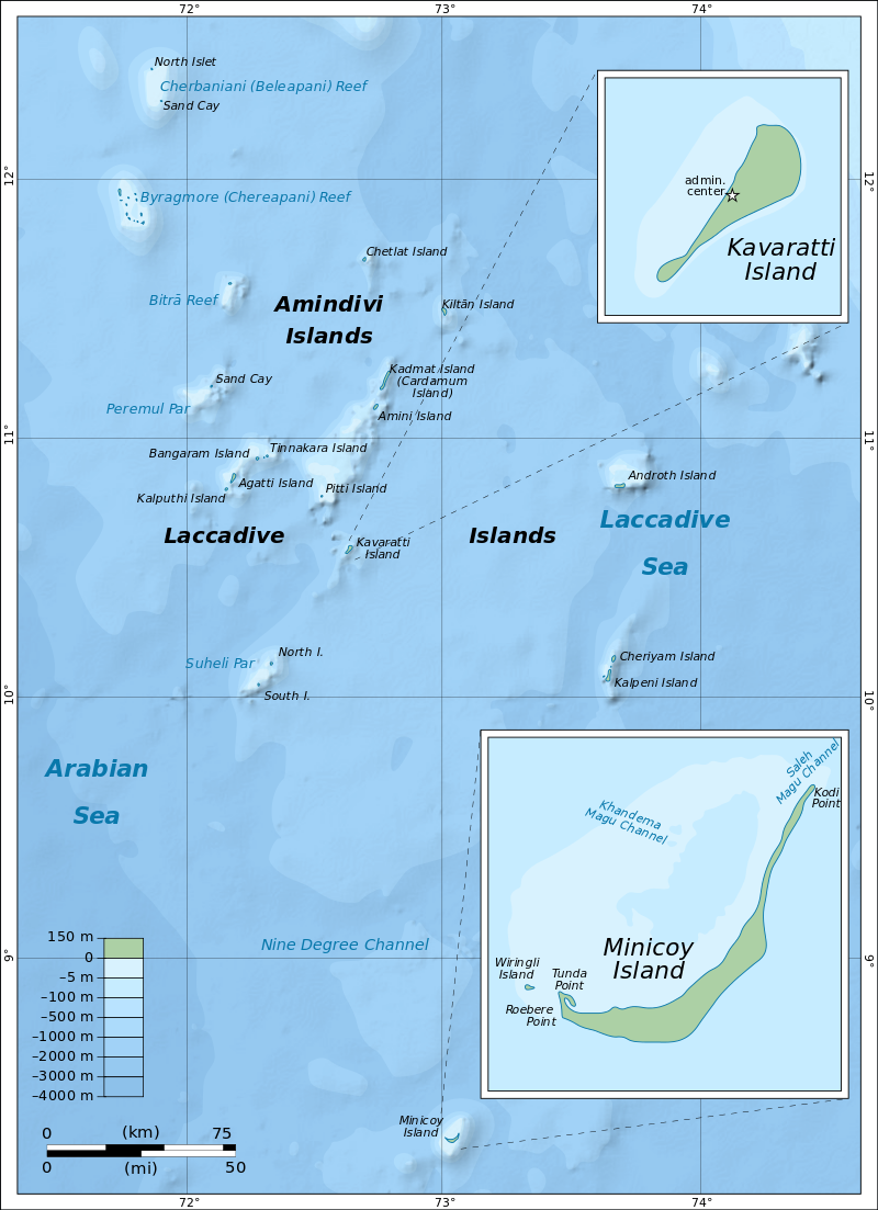
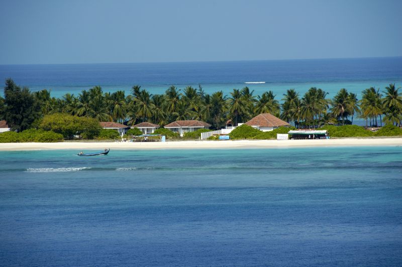


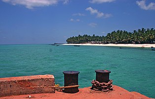

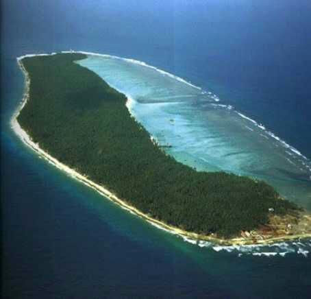

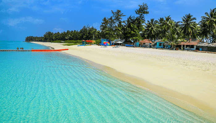


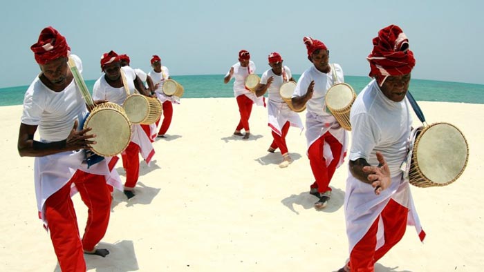

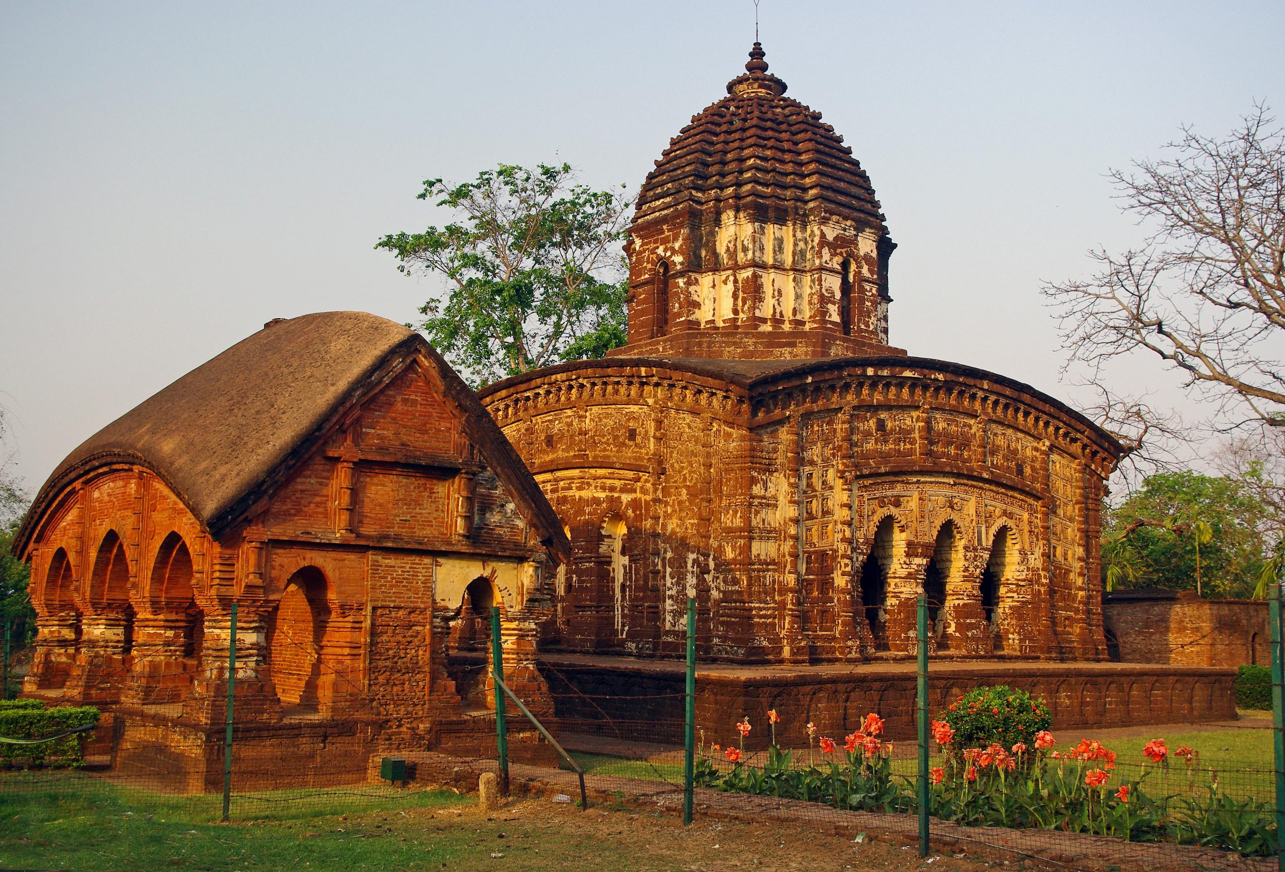
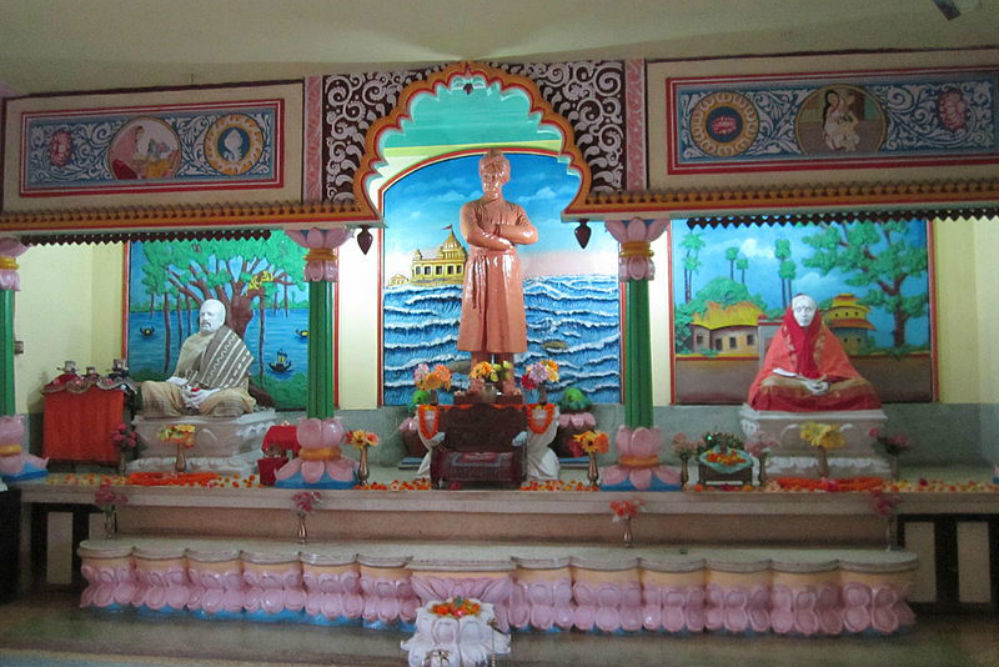


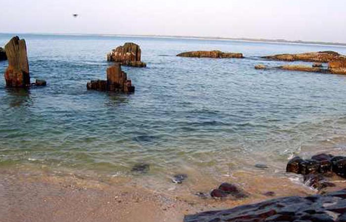


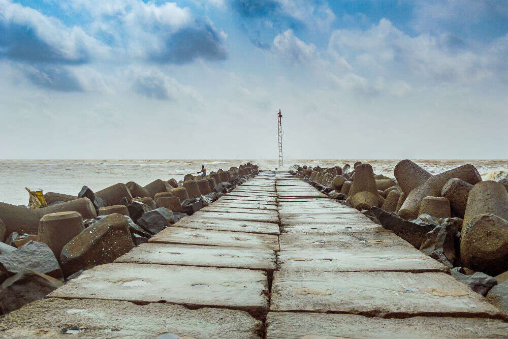

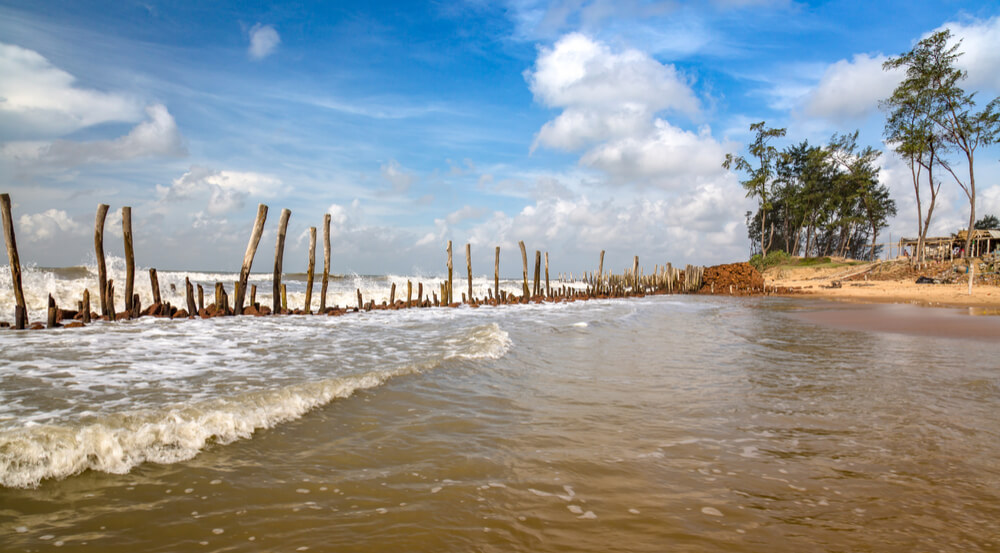
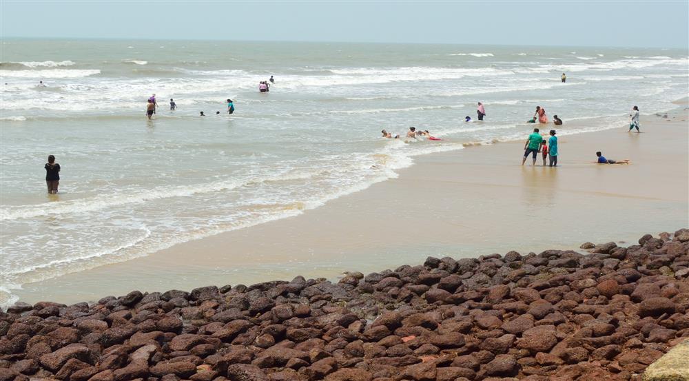

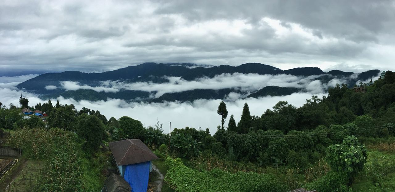

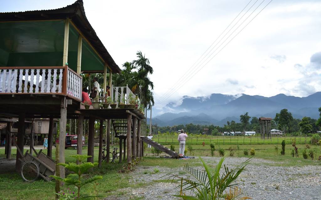
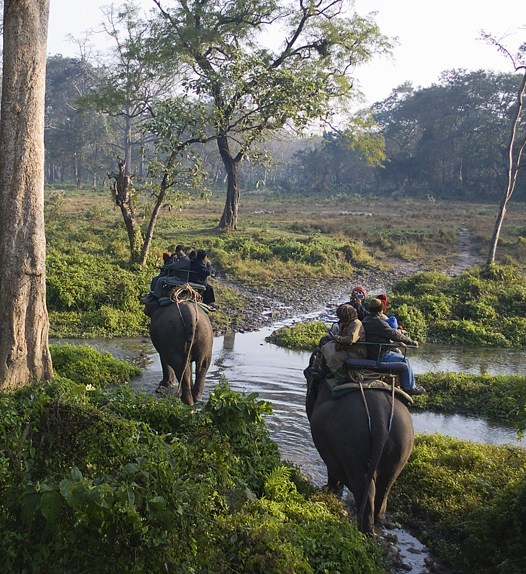
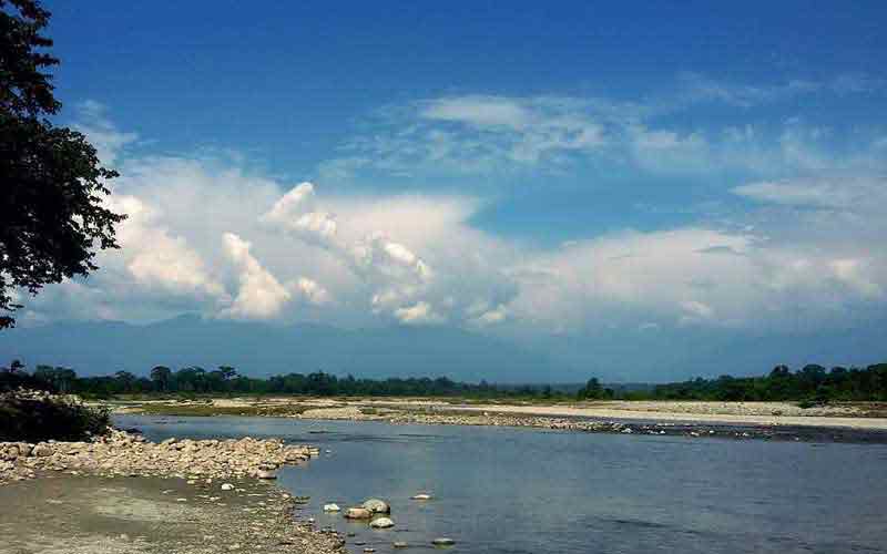


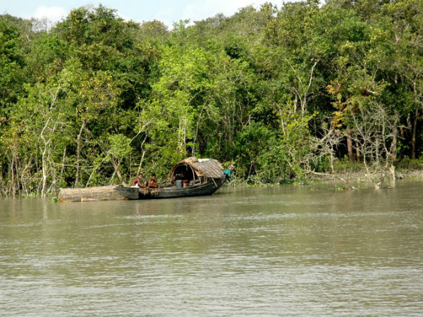
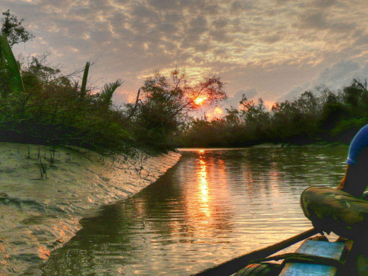


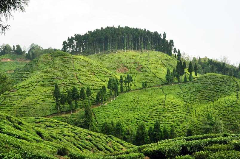
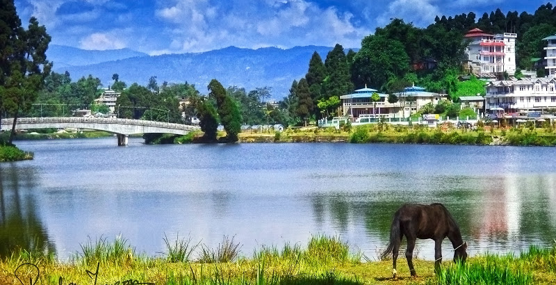
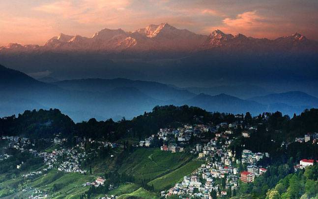
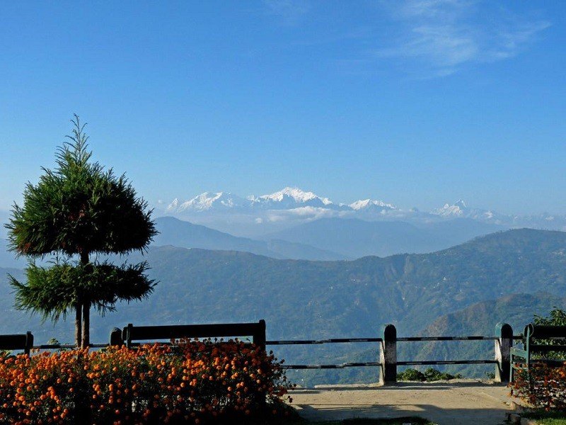

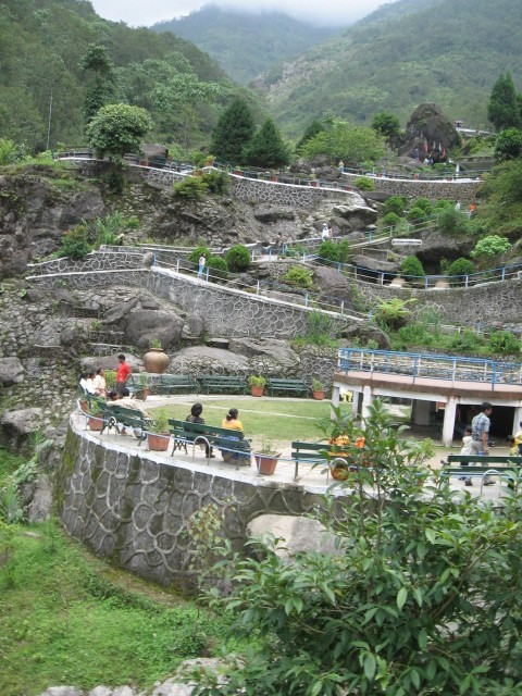
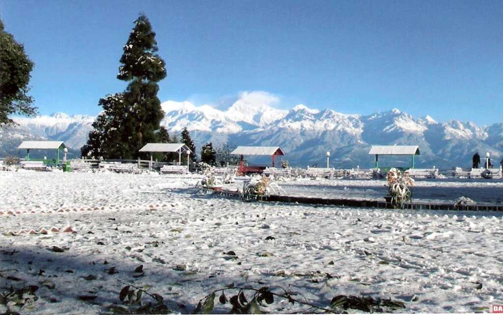

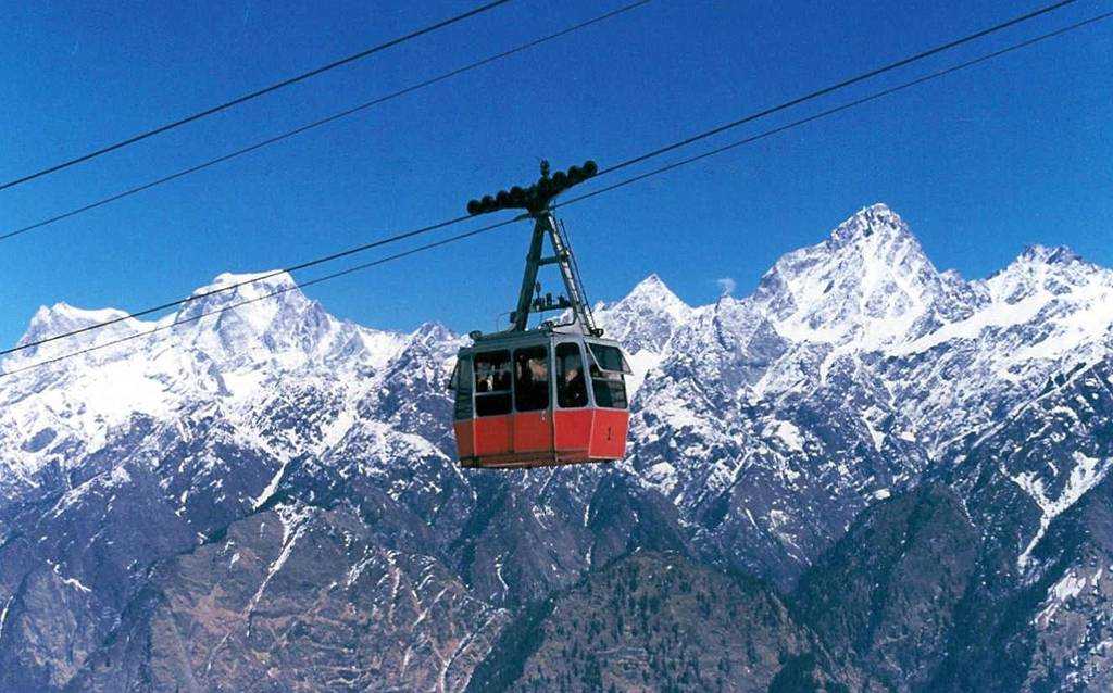
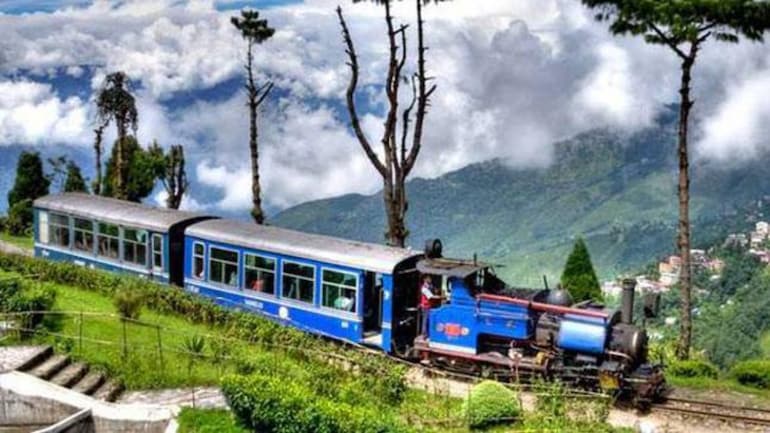


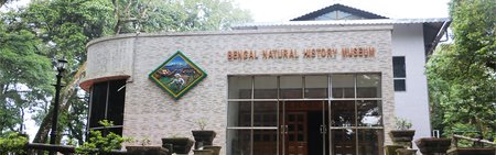
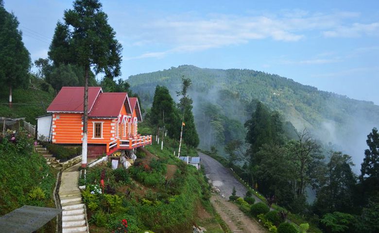

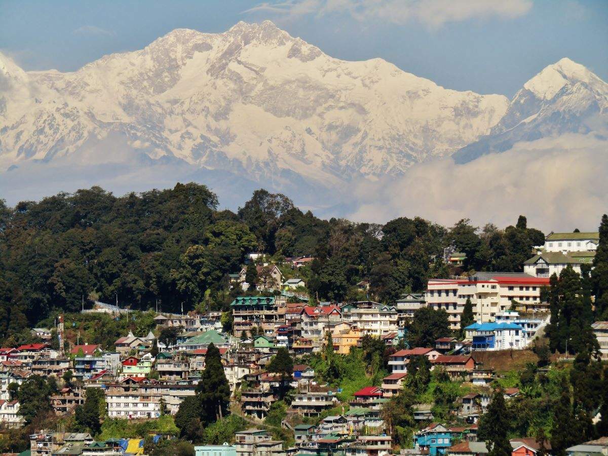
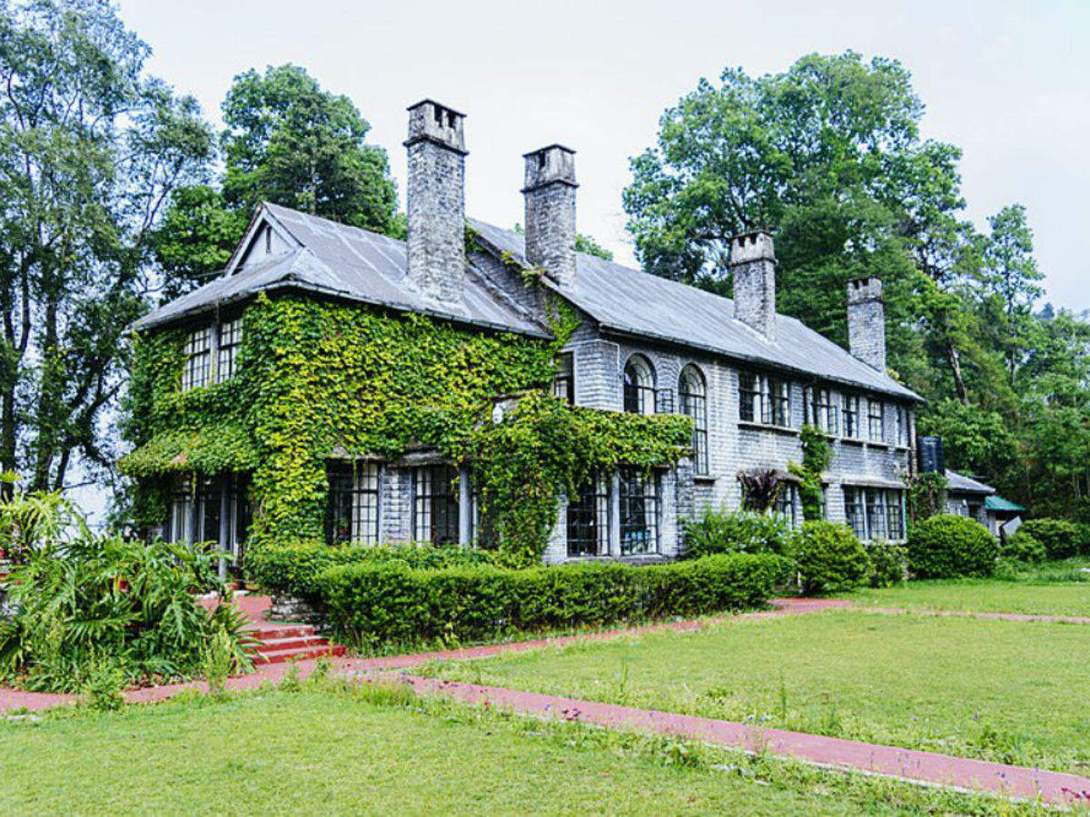
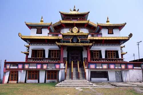
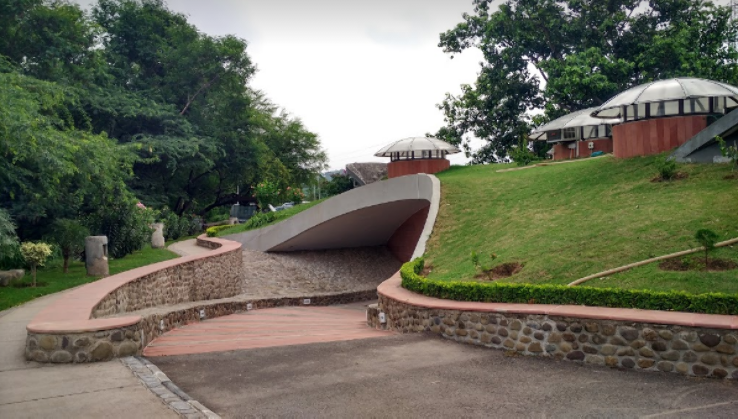
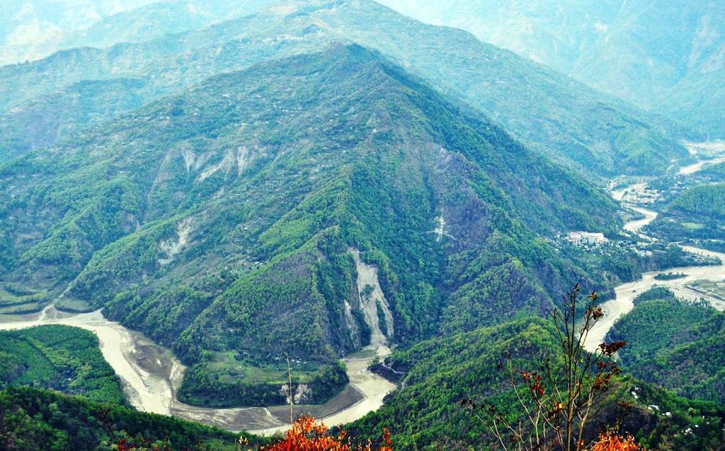
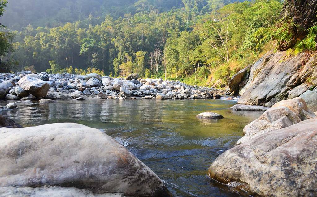

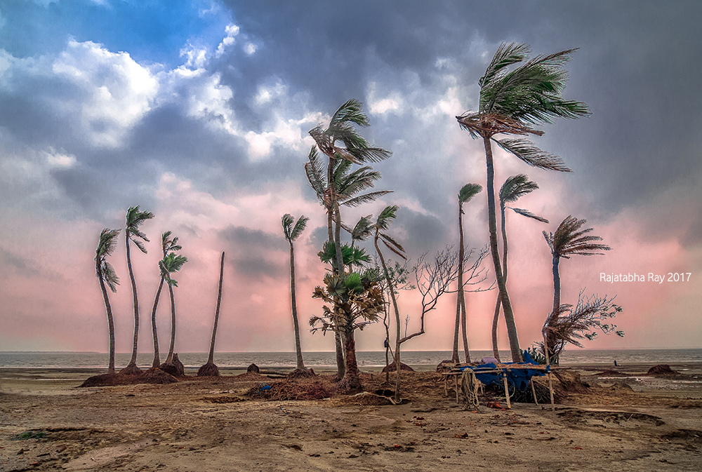
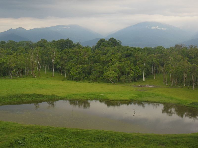