
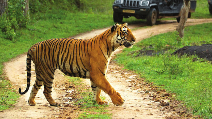
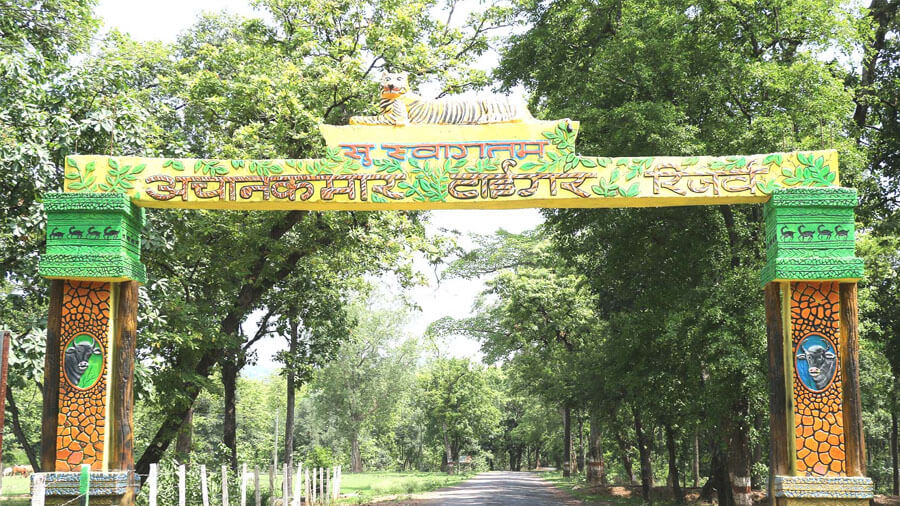
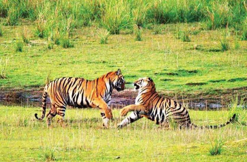
Achanakmar Tiger Reserve
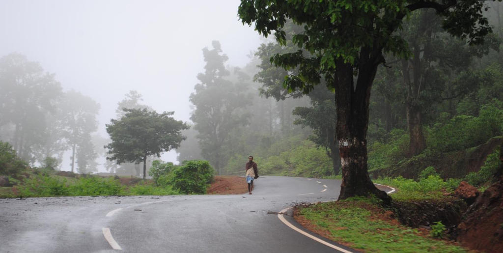
The Achanakmar Wildlife Sanctuary is a sanctuary about 146 km north of Chattisgarh’s capital, Raipur. It was established in 1975, under the provisions of the Indian Wildlife Protection Act of 1972, and declared as a Tiger Reserve under Project Tiger, in 2009. It is a part of the Achanakmar-Amarkantak Biosphere Reserve. As of 2021, the area is reported to be under heavy Maoist influence.
Linked by the hilly Kanha-Achanakmar Corridor to the tiger reserve in Kanha in Madhya Pradesh, the sanctuary comprises 557.55 sq km of forest. The park is part of the Mungeli and Bilaspur Forest Division in northwest Chhattisgarh. The sanctuary is close to Amarkantak, the source of the Son River and Narmada River.
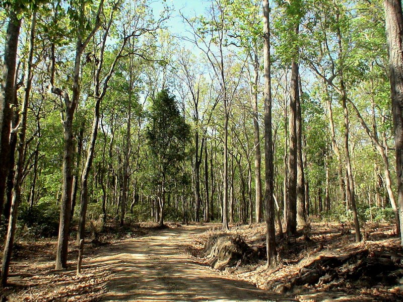
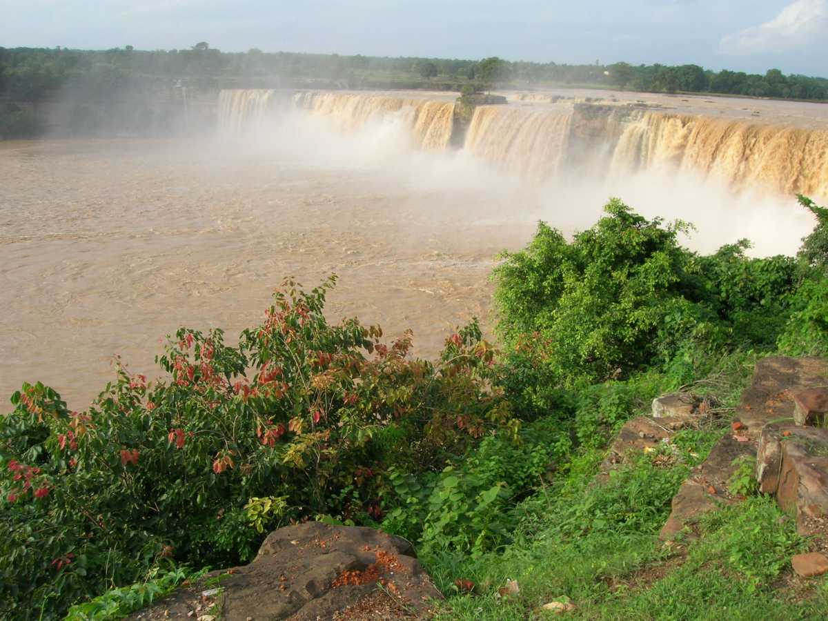
Categorised as a tropical deciduous forest, Achanakmar Tiger Reserve is breathtakingly beautiful with the most varied flora and fauna. This tiger reserve is a part of the huge Achanakmar-Amarkantak Biosphere Reserve, and hence, it is home to more than 600 species of different medicinal plants. The scenic Maniyari River flows right from the centre of this reserve which is the lifeline of the forest.
The Achanakmar Wildlife Sanctuary was established in the Mungeli district in 1975, under the Indian Wildlife Protection Act and its provisions. It was declared a Tiger Reserve under the Project Tiger initiative of 2009. A short trek through the park is enough to reveal its outstanding biodiversity and mesmerise the visitors. This prominent wild tourist hub is spread over 557 sq km of area. The natural sanctuary attracts wildlife enthusiasts from several places and promises to astonish you with its varied biodiversity. The wildlife sanctuary also has a restaurant, coffee house and other facilities on its premises. There are forest cottages and resorts that provide accommodation to visitors. Travellers are advised to make their bookings in advance if they are planning on staying.
A visit to Achanakmar Tiger Reserve would be incomplete without a jungle safari which starts each year from November and go on till June, however, the peak tourist period is between November and January. The park remains closed during the monsoons, between June and October. There are two safari options and one can take either a bus or a jeep safari. The jeep safari runs between 6 and 10 and then again between 3 to 7 pm. The costs range from INR 2,000 to INR 3,000 per jeep and each jeep can carry six tourists, one guide and one driver. The bus safari timings are the same as the jeep safari and the cost is INR 500 per person. A bus safari carries 20 tourists plus the driver.

Bilaspur
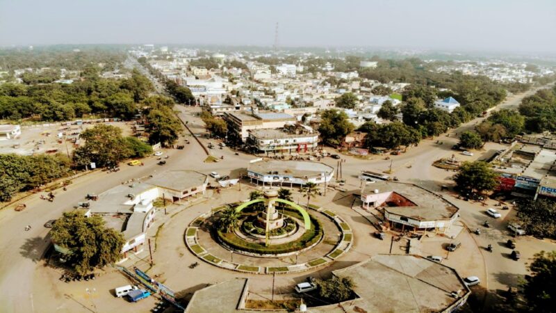
Also known as the City of Festivals, Bilaspur lies about 117 km northeast of Raipur and is the administrative headquarters of the Bilaspur District and Bilaspur Division. Situated on the banks of the rain-fed Arpa River, which originates from the Maikal Range of Central India, Bilaspur is a dolomite-rich region surrounded by dense forests in the north and the coal mines of the Hasdeo Valley in the east. It is also known as Chhattisgarh’s Law Capital because the state’s High Court is located here. This city is the commercial centre and business hub of the northeast Chhattisgarh region and an important city for the Indian Railways, as it is the headquarters for South East Central Railway Zone or SECR and the Bilaspur Railway Division. Chhattisgarh’s biggest power plant operated by NTPC is in Sipat which pools electricity from other power plants in the region and transmits electricity to Delhi via one of the longest HVDC lines. Bilaspur is known for its aromatic rice variety known as Doobraj rice and handloom woven colourful soft Kosa silk sarees.
Historically, Bilaspur was part of Dakshina Kosala and was near the capital of Malhar. From the 5th century onwards it was controlled by the Kalachuri dynasty of Ratanpur, the historical capital of Chhatisgarh state for many different dynasties. Bilaspur city, however, came into prominence around 1741, the year of the Maratha Empire rule, when a Maratha official took up his abode there to control the dynasty of Ratanpur. The British took over Bilaspur under the British East India Company in 1818 after Bhosales lost territory in the Third Anglo-Maratha War. After India’s independence, the Bilaspur district was constituted in 1861, followed by the Bilaspur municipality in 1867.

Guru Ghasidas who lived between 1756 and 1836 started a religious movement, Satnamis meaning the worshippers of Satnam, between 1820 and 1830 primarily around the Sonakhan forests. This religious movement preached against idol worship and instead stressed that God is synonymous with truth. His community was a farming community. The university at Bilaspur is named after him as Guru Ghasidas University.
Historical records like Imperial Gazetteer of India, Vol 8, 1908 note that the city is said to be named after a fisherwoman by the name of Bilasa who lived in the 17th century, and for a long period it consisted only of a few fishermen’s huts. Another book called The highlands of Central India authored by James Forsyth and published in 1889 states that Bilaspur is named after the Palash tree or the Flame of the Forest which is found in abundance in the area.
Bilaspur is rich in archaeological sites and temples that attract tourists from all over the world. There are more than 20 centrally protected monuments and sites by the Archaeological Survey of India nearby. The Achanakmar Wildlife sanctuary is one of the renowned ecotourism spots in the state while the Hasdev Bango Dam which lies 105 km from Bilaspur is also a must-visit place.

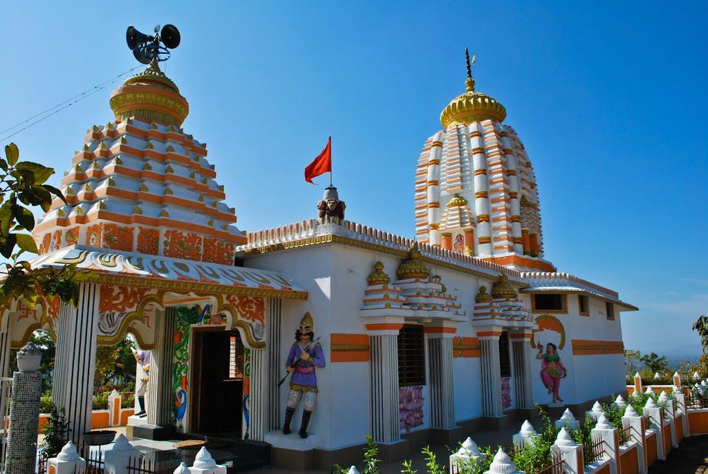
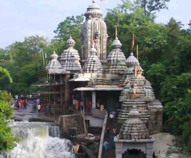
Malhar and Ratanpur are centres of archaeology with ruins of forts and ancient temples found here. Malhar is of historical significance, as it was visited by Xuanzang, the Chinese historian and is situated about 40 km from Bilaspur. Many ancient temples have been found such as the Pataleshwar temple, the Devri temple and the Dindeshwari temple. The four-handed idol of Lord Vishnu is also significant as it is the earliest sculptural representation of Lord Vishnu. There is also a museum at Malhar. Ratanpur is well known for its Mahamaya temple and Ram Tekri Mandir. Talagram is where the Deorani-Jethani temple is located while Tala which lies about 20 km away, is famous for the Rudra Shiva temple. There is an ancient Shiva temple near Kirari Godhi, which is from the 11th or 12th centuries as well as the Dhoom Nath temple dedicated to Lord Shiva which is said to belong to the 12th century and is constructed by the Kalchuri dynasty.
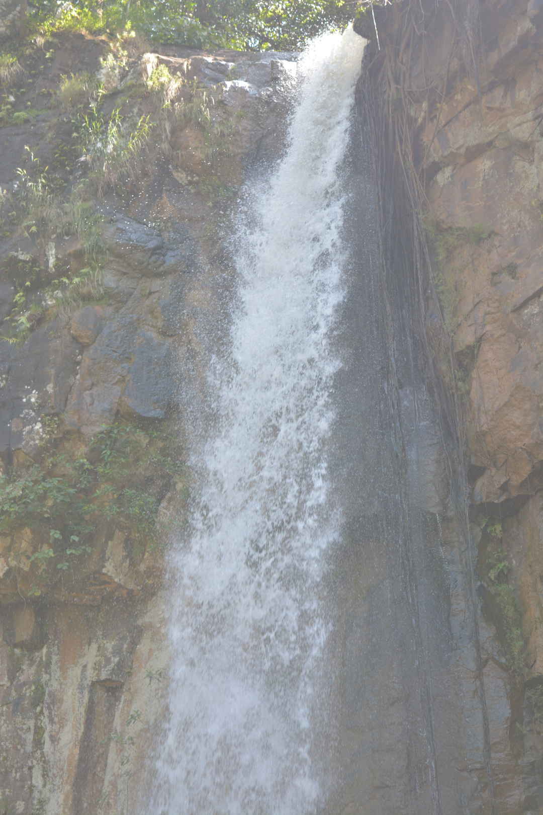
Belpan has a huge pond as well as samadhi while Khutaghat is a scenic spot and is frequented by nature lovers. Forests, dams and hills surround Khutaghat and the Kabir Chobutara about 41 km from Bilaspur is a hub for saints. Sonmuda is another tourist attraction which gives a panoramic view of valleys, hills and forests. The River Sone originates here while the Narmada and Son Rivers originate in Amarkantak.

Raigarh
Known as Chattisgarh’s Cultural Capital or Sanskardhani, Raigarh lies in the eastern part of the state about 246 km northeast of Raipur. It is also known for its coal reserves and power generation for the state as well as the country. A rapidly growing industrial city and home to one of the oldest jute mills in India, Raigarh is also a major producer of steel and iron ore as well as a major rice-producing district.
The tradition preserved by the ruling family of the erstwhile state of Raigarh maintains that the Raj Gond family migrated to this region from Bairagarh or Wariagarh of the Chanda district of Maharashtra around the beginning of the 18th century and first stayed at Phuljhar and from there Madan Singh, the head of the family migrated to Banda of the present-day Raigarh. Before Indian Independence, Raigarh was the capital of the princely State of Raigarh and after independence, the state was one of the first to join the Union of India. The palace, Moti Mahal is in dilapidated condition and has recently been declared a heritage site by the state government. The Rajas of Raigarh also owned the estate of Bargarh and so held the title of Chief of Bargarh. Around 1625, the Raja of Sambalpur installed Daryo Singh as the Raja of Raigarh. However, under the British, it became a princely state only in 1911, during the reign of Raja Bahadur Bhup Deo Singh. The last ruler was Lalit Kumar Singh, his son succeeded him to the throne of Raigarh and ruled briefly before Raigarh State was merged into the Union of India.
Raigarh derives its name from the fort named Rai, hence Raigarh and was established by Raja Madan Singh at Munga near the river Mahanadi. Raigarh is well known for its Kosa or Tussar, a kind of fine silk created by the silkworm feeding on mulberry fruit. Dhokra or bell metal casting is the world acclaimed art form of Raigarh. Based in the village of Ektaal, the bell metal structures are noted for their aesthetic value. The leaf of the tendu tree or the Asian ebony tree which is widely found in central India and used to make bidis, the poor man’s cigarette is one of the major sources of income for villagers in the district. Places to visit in Raigarh include the Pahad Mandir at Gajmar Pahadi, the Ram Jharna in Bhupdeopur, Teepa Khol, and the Maa Chandrasini Devi Temple at Chandrapur, and the Banjari Mandir situated in the Raigarh-Tamnar road.
Korba
Previously part of Bilaspur district, Korba lies about 205 km northeast of Raipur and is an industrial town. Known as Chhatisgarh’s power capital due to its coal reserves and thermal power plants, Korba also has Asia’s second-largest and India’s largest open-cast coal mine in the Gevra area of Korba Coalfield. Korba produces 140 million tonnes of coal annually which accounts for 17% of the country’s total coal production and 85% of Chhattisgarh’s coal production. Korba is home to the protected tribal tribe Korwa or Pahadi Korwa and is blessed by lush green forests all around and is a tribal majority district situated in the north-central part of Chhattisgarh. 68% of the population engages in agriculture with paddy being the major crop.

Located on the banks of the Chornai River, Devapahari is located about 58 km northeast of Korba and has a beautiful waterfall known as Govind Kunj. Chaithurgarh or Lafagarh is a fort that is located around 70 km from Korba at a height of 3060 feet on the top of a hill. It was constructed by Raja Pratwidev the first and archaeologists consider it one of the strongest natural forts. The fort has three main entrances which are named Menaka, Humkara, and Simhadwar.
.jpeg)
The Madwarani Mandir is situated on the Korba-Champa Road at a distance of 22 km from Korba and is dedicated to Goddess Madwarani at the top of the hill. The legend behind this temple is that during the Navaratri festival, jowar or sorghum was growing under the Kalmi trees near the temple. During the Navratri festival, there is a fair celebrated by the locals. The Shiv Mandir at Pali is situated around 50 km from Korba and it is believed that Pali was where King Vikramaditya belonging to the Banna dynasty used to worship. There is an ancient temple dedicated to Lord Shivs at the side of a large pond. Many other remnants can also be seen here. This temple faces east and its entrance is octagonal with the plinth of this temple stood upon 5 platforms. A famous temple, Sarvamangala is dedicated to Goddess Durga. The temple was built by the ancestors of Rajeshwar Dayal, a zamindar or landowner and is surrounded by the Trilokinath Mandir, the Kali Mandir and the Jyoti Kalash Bhavan. There is also a cave, which goes under the river and comes out on the other side. Rani Dhanraj Kunwar Devi used to use this cave for her daily visits to the temples.
Kudurmal is a small village around 15 km from Korba and is of historical importance. There is a tomb of one of Saint Kabir’s disciples that is about 500 years old. There is also a temple named Sankatmochan Hanuman Mandir, built by Mahatma Kevlal Patel, who was a prominent Saint. An idol of Lord Hanuman has been installed in the centre of the temple. Surrounding the temple there are many smaller temples dedicated to various gods and goddesses and a fair is held each year in January and February on the occasion of Magh Purnima.
Kanki is a village on the banks of the Hasdeo river near Urga, about 20 km from Korba and is famous by the name of Kankeshwar or the Chakreshwar Mahadev temple. It is believed that the temple was built around 1857 by the zamindars of Korba. The temple is adorned with many beautiful images made of stone as well as many idols of various gods and goddesses. There is also an ancient temple dedicated to Goddess Durga. This village is surrounded by dense forest and several ponds can be found there. The area is visited by migratory birds who visit here to breed.
At Mouhargarh, the remnants of the fort can be found at the height of 2000 ft on the Pouna Khara hill, which is situated around 15 km northeast of the Rajgamar coal mines. Ancient writing can be found on one of the pillars on the hill and there are also some idols there. The dense forest around the fort is home to various wild animals and birds.
Tuman is a small village with a rich history. According to ancient history, Tuman was the capital of the kings of the Haihaya dynasty. There is an ancient temple here dedicated to Lord Shiva and it is believed that the temple was built during the reign of the Kalchuris around the 12th century by King Ratnadev the First.

Chaithurgarh or Lafagarh, located about 70 km from Korba town is situated at a height of 3060 ft on a hilltop. It was constructed by Raja Pratwidev the First and archaeologists consider it one of the strongest natural forts. Since the fort was protected by strong natural walls, walls were only built in some places. The fort has three main entrances known as Menaka, Humkara, and Simhadwar. Outside the fort, on the hilltop, there is an open area of 5 sq km where there are five ponds, of which three are perennially filled with water. The famous Mahishasur Mardini temple is also located here. The idol of Mahishasur Mardini with 12 hands is installed in the sanctum sanctorum and the Shankar cave is situated 3 km from the temple. This cave which is like a tunnel is 25 ft long and one can go inside the cave only by creeping since the cave is very narrow. There is a visitor rest house here and the temple also has some rooms for tourists. The temple has special prayers during the Navratri festival. At Kendai, a village located about 85 km from Korba, there is a beautiful waterfall that falls from a height of 75 feet and is also a local favourite picnic spot.

Ambikapur
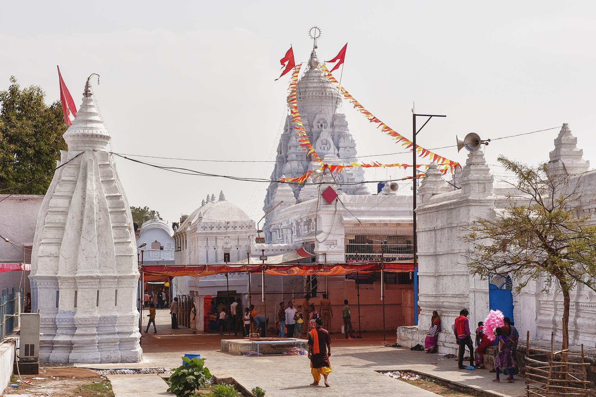
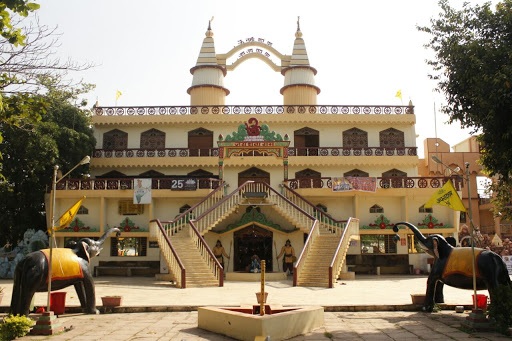
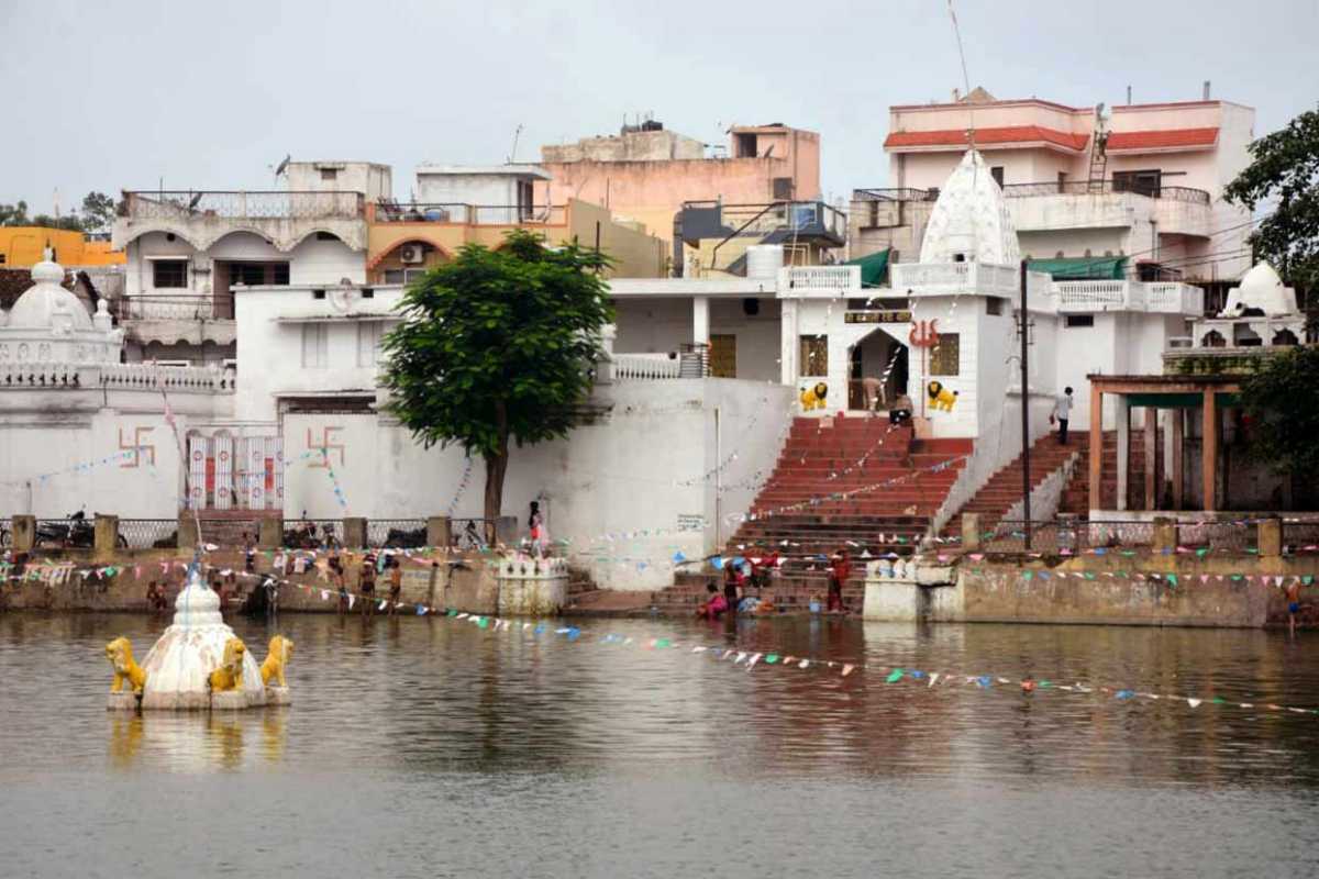
One of Chhatisgarh’s oldest cities, Ambikapur lies about 338 km northeast of Raipur. Ambikapur was the capital of the princely state of Surguja before Indian independence. The city’s name is derived from the Hindu goddess Ambika or Mahamaya Devi, who is the central figure of worship in the area. As of Swachh Survekshan 2020, Ambikapur is the cleanest city in Chhattisgarh as well as the cleanest city in India amongst cities with a population of 1 to 10 lakhs.

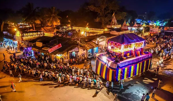
Also known as the Raghunath Palace, Surguja palace is one of the prime palaces in Ambikapur. It is a white, two-storey palace and is open to the public only on the day of Dussehra annually. It is an old tradition that the heir of the royal family of Surguja meets and greets the visitors on Dussehra and the festival is celebrated lavishly.

Barnawapara Wildlife Sanctuary
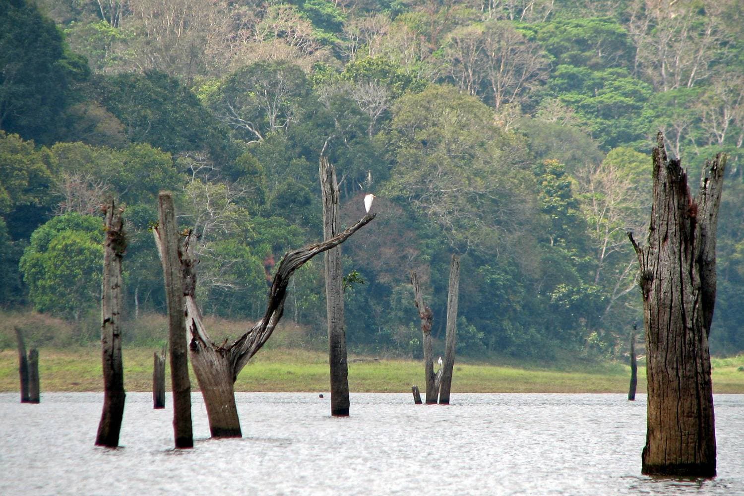
The Barnawapara Wildlife Sanctuary is located about 130 km northeast of Raipur. It was established in 1976 and the Jonk River flows through the sanctuary, which is a tributary of the Mahanadi River. The sanctuary is spread over an area of about 245 sq km. The Balamdehi River forms the western boundary and the Jonk River forms the north-eastern boundary of the Sanctuary. The sanctuary has undulating terrain dotted with numerous low and high hillocks. The sanctuary is filled with tropical dry deciduous forests with bamboo amongst the most commonly spotted tree here. The sanctuary has a large number of wildlife and a large population of birds. Bird watching in Barnawapara is one of the most enjoyed and popular activities.
There are several scenic waterfalls in the sanctuary, like the Dhaskund waterfall, the Siddhakhol Waterfall and the Nakuti Darha waterfall. Other tourist attractions include the Gond Nagarjuna caves, which the local Gondi people consider as sacred and have been worshipping there. The Gonds call it Chanda Dai and it is said the Dalai Lama meditated here once. Other places like Turturiya Dham are situated on the northern boundary of the sanctuary beside the Balamdehi river is believed to have been the abode of Sage Valmiki and where Goddess Sita lived in exile and gave birth to her twins, Luv and Kush. The Barnawapara Wildlife Sanctuary is home to the Bar and Nawapura forest villages established in 1976 and is spread over an area of 245 sq km. The landscape is mostly flat terrain with occasional low and high hillocks.

The Barnawapara Wildlife Sanctuary is open from 6:45 to 11 am and then again between 2:30 and 5:30 pm during the summer months. During the winter season, the sanctuary is open between 6 to 10:30 am and then between 3 to 6:30 pm. The sanctuary remains closed from July 01 to October 31, due to the monsoon season. The best time to visit the Barnawapara Wildlife Sanctuary is between November and June when the weather conditions remain pleasant.
Entry fees are INR 55 per person for Indian tourists and INR 200 per person for foreign tourists. A guide can be requested at an additional cost of INR 250. A safari is also available at different rates depending on the kind of vehicle opted for. However, booking for the safari will have to be done in advance through resorts or tour operators. Charges for 30 km can vary from INR 1300 to INR 2800 for an eight-seater vehicle. There is no fee charged for photography or videography for non-commercial purposes.
Mainpat
366 km northeast of Raipur, Mainpat is an underrated hill station with green pastures, deep valleys, breathtaking waterfalls, dense forests and untouched rivulets. The hill station hasn’t been completely commercialised yet and receives a relatively smaller influx of tourists compared to its counterparts. Often called the Shimla of Chhattisgarh and Mini Tibet owing to its huge Tibetan population and influence over the area, Mainpat has a large number of Tibetan refugees who were rehabilitated in Mainpat after the Chinese invasion of Tibet and have since found a home here.
Mainpat is famous for the Ulta Pani or Bisar Paani which seems to defy gravity and where the water seems to flow upstream. The locals have made a canal for watering crops and water flows upward 30 ft on its own.
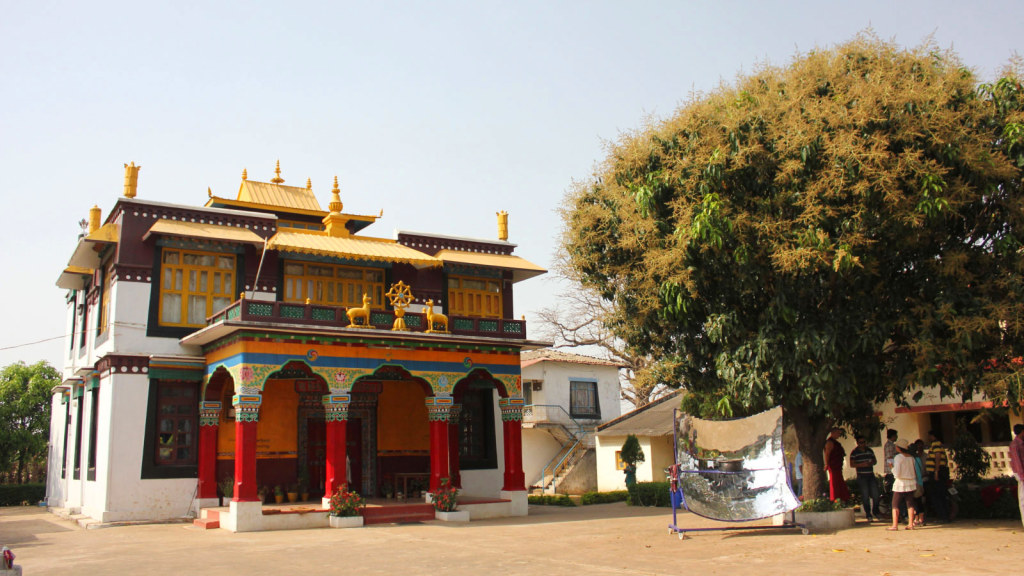
The Dhakpo Shedupling Monastery is the most prominent in Mainpat and belongs to the Gelug order. It is relatively smaller than its northeastern and Nepalese counterparts and has Buddhist relics and artefacts. Fish Point lies around 17 km from Mainpat, nestled amidst hills with stunning panoramic views. This viewpoint has a flowing river called Machali Nadi which ends in a waterfall with a descent height of 80 metres in the same area. The tourist attraction was named after a specific species of fish found in the Machali Nadi. Tiger Point is another scenic waterfall 7 km from Mainpat and originates from the Mahadev Muda river and is encircled by thick jungles on all sides. Local legend says that there were a few tigers spotted at this sight years ago, which resulted in the falls named Tiger Point Falls. The water plunges from a height of 60 metres from atop the cliff into an underlying pond. The falls are visible from road level but there is also a stairway that leads to the bottom of the falls and offers a better view. Although the stairway leads to a better view, the path is unkempt and slippery and one may exercise caution whilst taking that route.

Mercury Falls are relatively untouched falls nestled in the hills of Mainpat and are a little difficult to reach with no proper pathway. The falls are said to be the tallest waterfalls in Mainpat with a height of over 400 feet. The water stream glides over eight steps to form a gorgeous cascade. Daroga Jharna is another offbeat place located 6 km from the Mainpat bus stand. The place has an abundance of water and offers a plethora and tranquil settings away from the more mainstream tourist spots. Bhutahi Jalprapat located 6 k, from Mainpat bus stand is a flowing stream of water that is said to resemble the movements of a snake as it makes its way in a zig-zag pathway. The flowing stream looks white as a pearl and moves with sheer force that it produces a loud sound. This characteristic sound is also the reason behind the name of the place Bhutahi Jharna
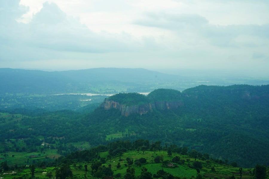
Parpatiya Sunset Point lies about 30 km from Mainpat and is famous for its unparalleled views during sunsets, and it is said that the neighbouring hills appear as cubes from this point. The drive up to this point is filled with scenic views and is reason enough to visit. Mehta Point is yet another viewpoint offering a bird’s-eye view of the sprawling lush landscapes and the green-covered hills, the viewpoint is set at a higher altitude and has a fair amount of clouds at the top almost giving one the sense of walking amidst clouds. Jaljali which is located about 10 km from Mainpat, is a natural wonder with the land having a trampoline-like surface and behaves exactly like one when one jumps on it and produces subtle vibrations. It is often referred to as the bouncing land and is a treat for kids and adults alike.

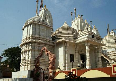
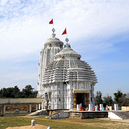
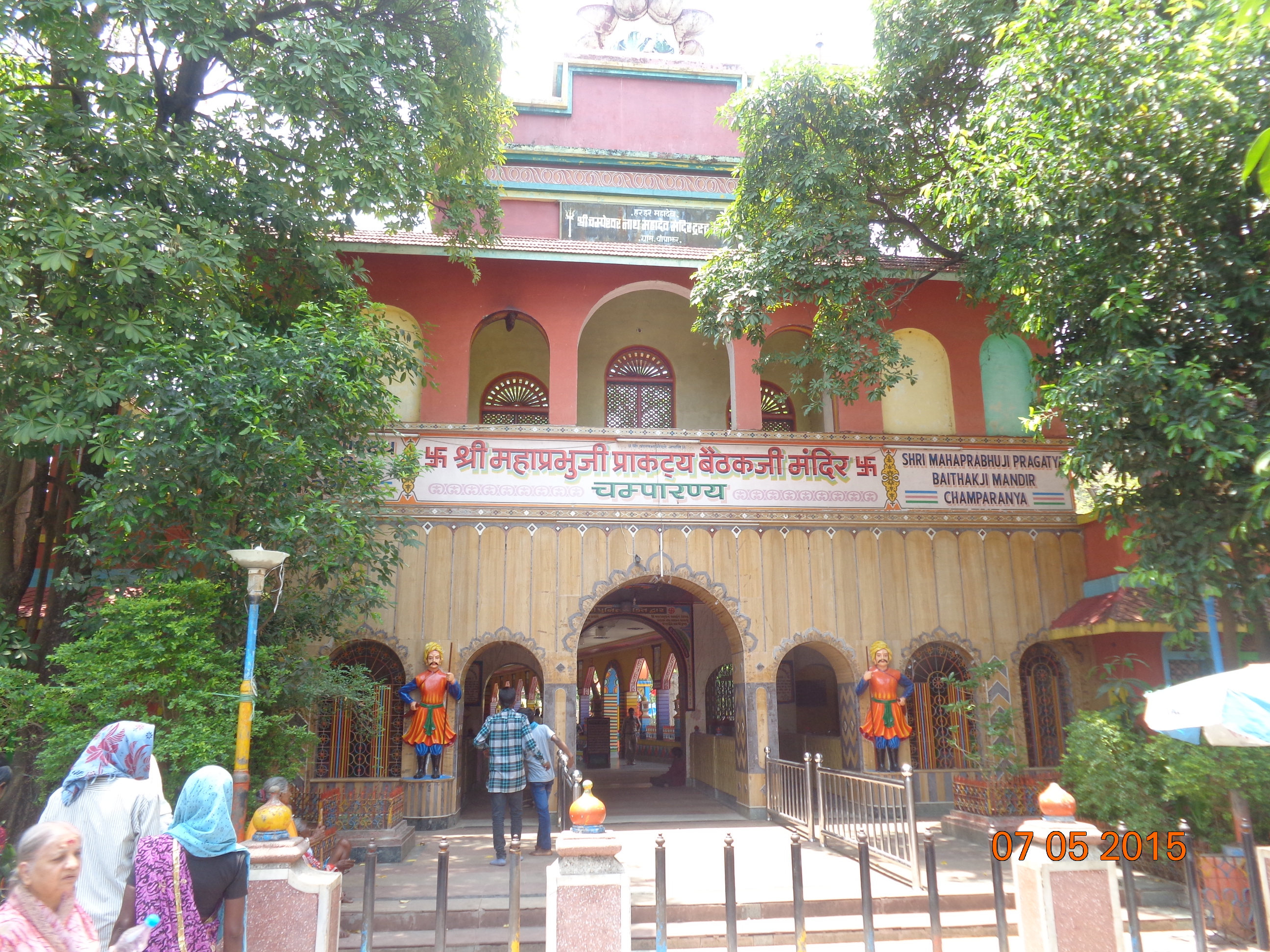
Malhar
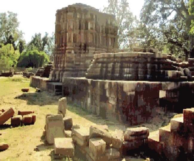
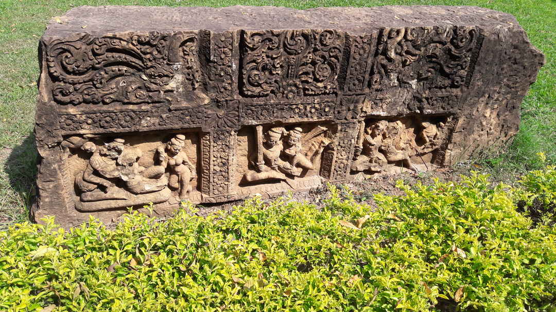
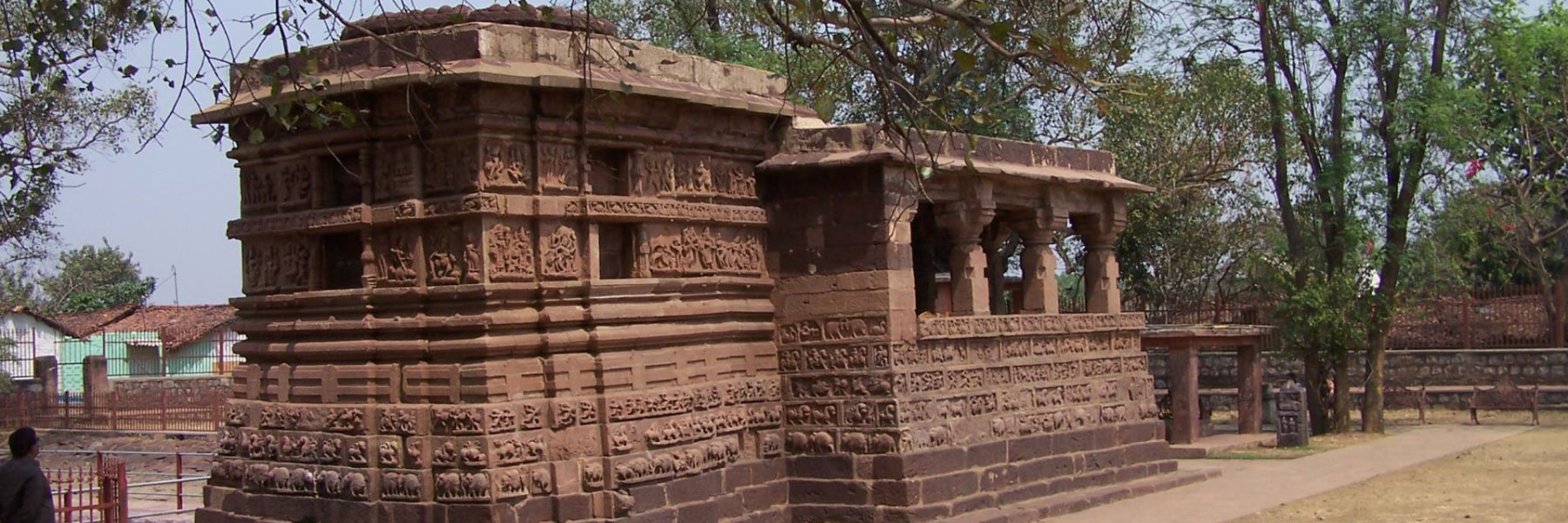
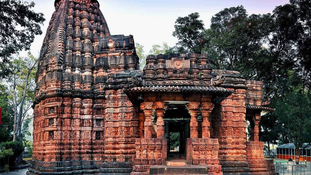
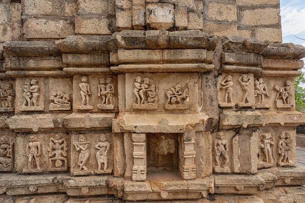
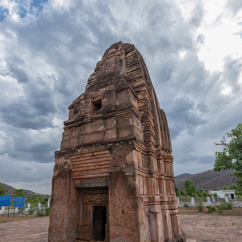
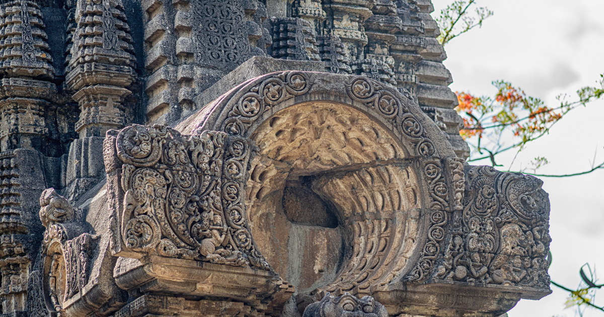
Chhatisgarh’s most historic town, Malhar lying 144 km northeast of Raipur is of utmost archaeological prominence. It has a spot in the Ancient Monuments and Archaeological Sites and Remains of National Importance list that is maintained by the Archaeological Survey of India. A few of the remains found in Malhar date back to 1000 century BC and are attributed to the Kalchuri regime. Malhar was once a major city and served as a capital in the 1st millennium and has been referred to as Mallar, Mallari and Sarabhapur in inscriptions and Indian literature. In contemporary times, it is more of a village with mounds and the ruins of an ancient fort, two restored Shiva temples and a museum with the ruins of a major group of Hindu, Jain and Buddhist temples.
There are many references to the ancient Kosala Kingdom of northern India in ancient Indian literature and the Surya Vanshi Ikshvaku dynasty kings ruled Kosala with Ayodhya as their capital. After Lord Rama, the kingdom was divided among his two sons, Lava and Kusha with North Kosala going to Lava with Shravasti Nagari as his capital and Kusha receiving South Kosala. Kusha established his new capital, Kushasthalipura on the river Kushavrate near the Vindhya mountain range, which divides north and south India. Kushasthalipura is identified as near Malhar.

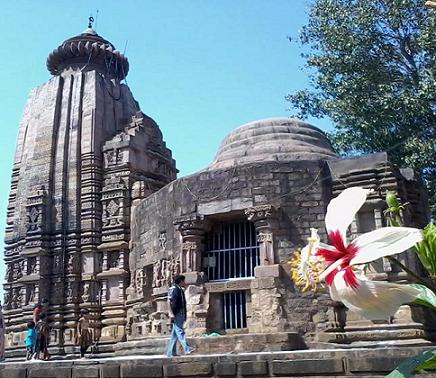
In Malhar, many ancient temples have been found, such as the Pataleshwar temple, the Devri temple & the Dindeshwari temple. Ancient deposits and Jain memorials were also found here. The four-handed idol of Vishnu is significant. The remains found here are of the period from approximately 1000 BCE to the Ratnapura Kalachuri regime. Temples of the 10th and 11th centuries are also conspicuous here, among them, the Pataleshwar Kedar temple is one, where the Gomukhi Shivling is the main attraction. The Dindeshwari temple of the Kalachuri regime is also significant. Artistic idols are present in the Deor temple.
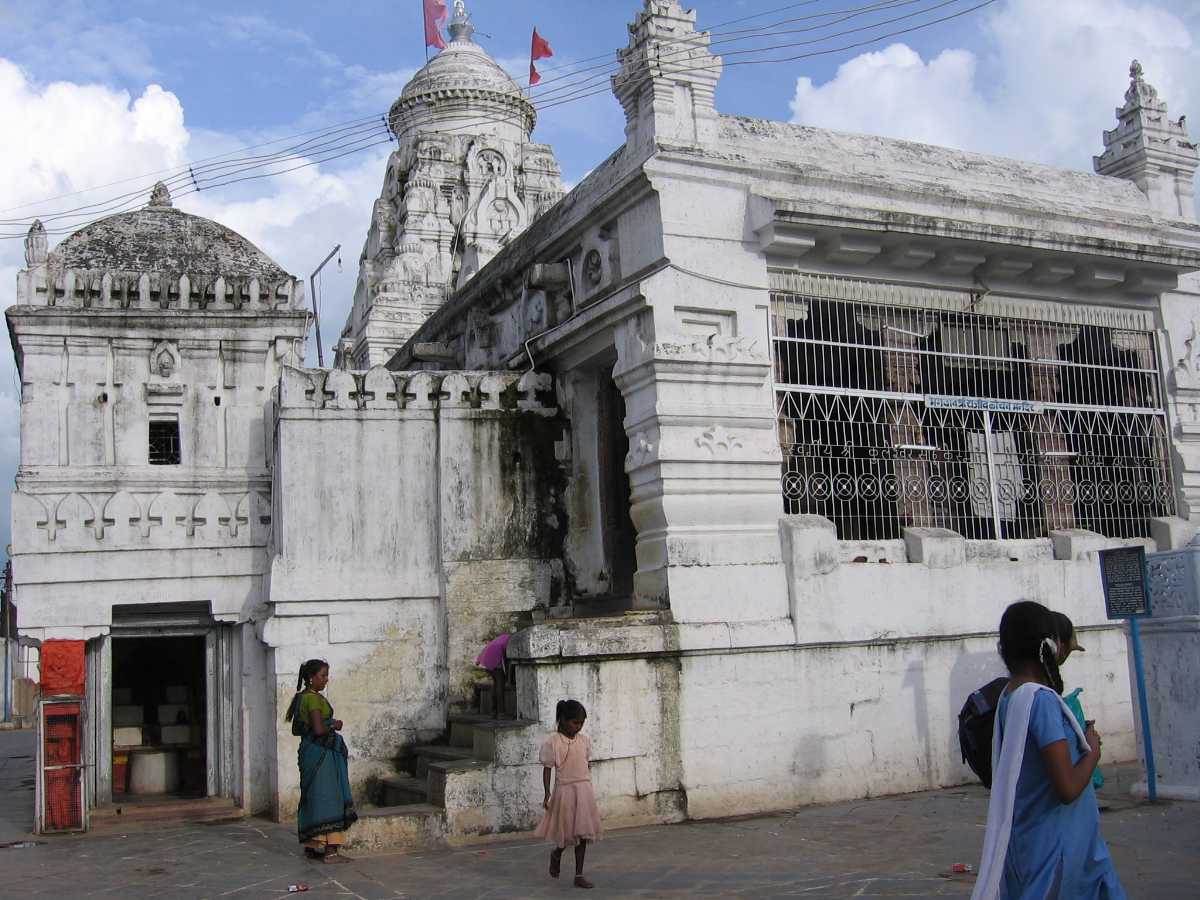
The Pataleshwar Temple is the main attraction of Malhar. The temple structure is presently under the protection of the Archaeological Survey of India and major renovation and repair activities have taken place in the temple. It was constructed on a high-raised platform and entrances having been provided from three sides. The sanctum is situated below the ground floor and hence the name of the temple. The doorway of the sanctum flaunts life-size statues of river goddesses and dvarpalas and the sanctum has a Shiva linga in it, with an open Nandi mandapa constructed in front of the temple.
Jain religious memorials have also been excavated here. Malhar also has a museum that is managed by the Government of India. It displays a good collection of sculptures that were discovered in this region.


