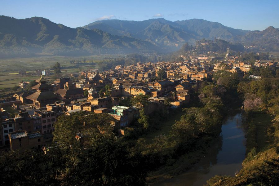
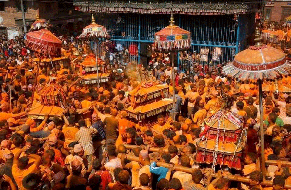
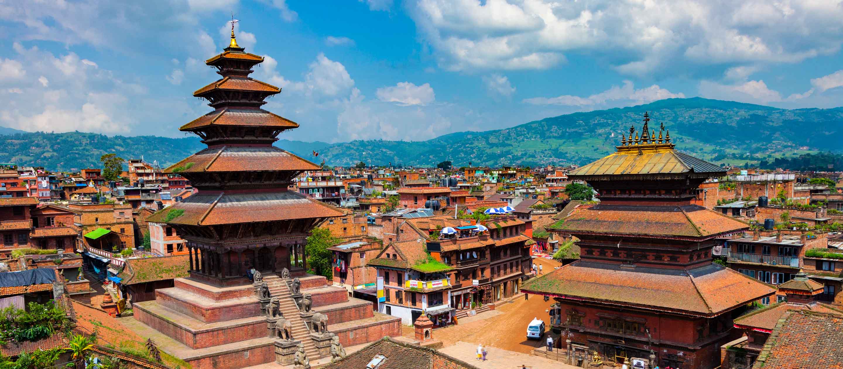
Continuing on learning more about Pokhara…
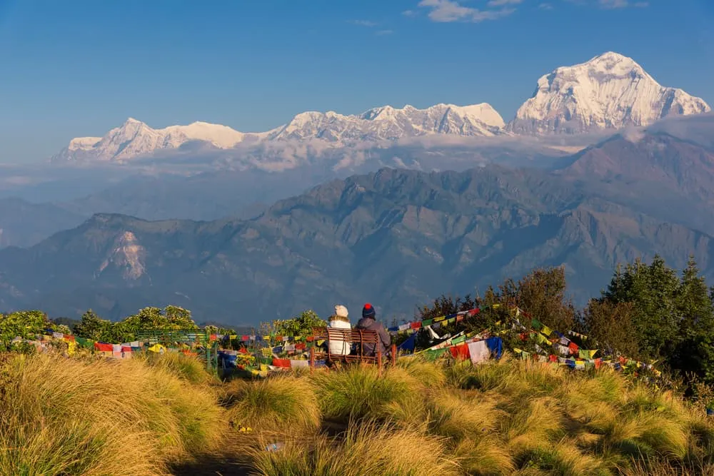
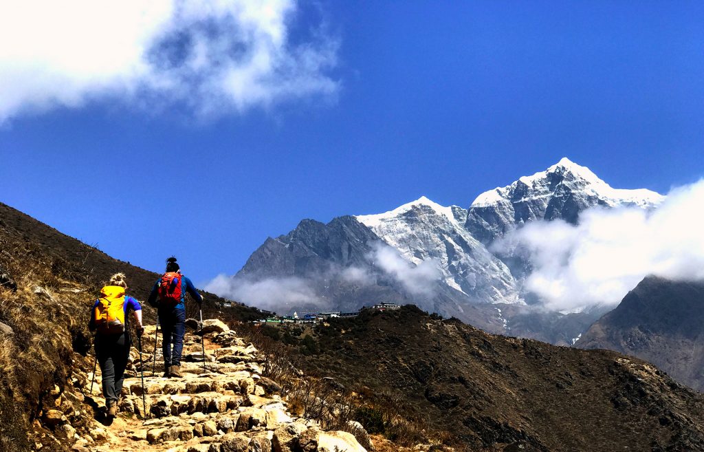
Situated at an altitude of 3210 m, Poon Hill is a popular short trekking destination, offering an wonderful views of sunrises and sunsets. Most trekkers hike here from the village of Ghorepani to enjoy the spectacular view of Annapurna and Dhaulagiri ranges. The terrain is comparatively easier and leads to the Annapurna Mountain Ranges. The trekking trail covered with rhododendron forest, an amazing landscape, is perfect for modest trekkers. From the top of the hill, one can get a fabulous view of the Gangapurna, Annapurna I, Annapurna South, the Dhaulagiri, and the Hiunchuli Mountains.
The most preferred and famous trek in the region is the Ghorepani-Poon Hill-Ghandruk trek. It begins at Nayapul which is about 44 kilometres away from Pokhara and goes through Ulleri, Ghorepani and Ghandruk via the uneven terrain. The mountainous trails are traversed by foot through the rhododendron forests and regions inhabited by the Gurangs and the Magars. As the trek progresses, one would come across the terraces used for cultivating rice and the enchanting waterfalls in the regions. The hilltop, at 3210 metres above sea level, is the best place to get a stunning view of the Himalayan Peaks. If only Poon hill is to be explored, one can be assured that this is an easy level of trekking in the region. The best time to go on a trek on the Poon Hill is between March and May and between September and November.

At an elevation of 3210 metres above sea level, Ghorepani Hill is the most preferred trekking trail in Nepal. Also known as Nepal’s classic Himalaya Trek, it has been an important attraction with slightly elaborate treks that last for little over a week and begin at Pokhara and pass through Ghorepani, and some even continue to the Poon Hill. The trail consists of the ancient Trans-Himalayan salt trade route and runs through regions of paddy fields, forests, gorges and waterfalls. On a clear sunny day, the bright blue skies and the white cotton-like clouds are a treat to watch above the snow-laden mountain peaks. Local shepherds get their sheep to graze on the hill slopes every day, and there is a high chance that trekkers meet herds of sheep while passing by.
The rhododendron forests, the stone passages and stairs add to the level of difficulty but also make the activity more exciting. As one climbs through the region, they would notice they are actually trekking through the villages located on the hill slopes. If a break is required, feel free to stop by at one of these villages and interact with the lovely people before enjoying the mind-stirring view from the top of the Ghorepani Hill.
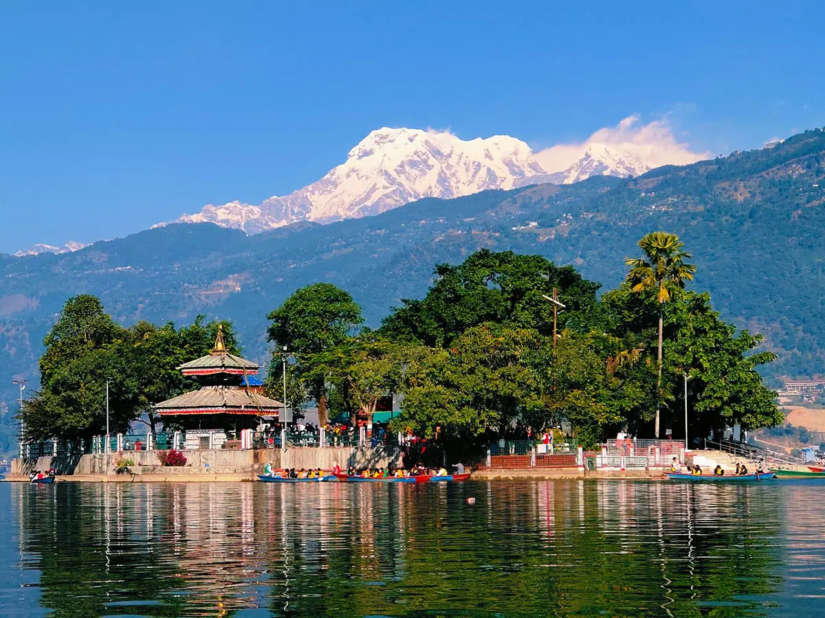
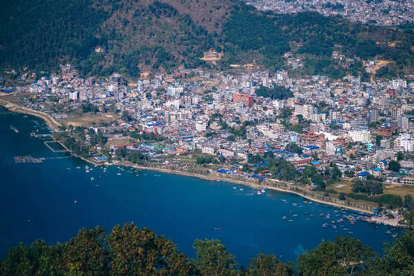
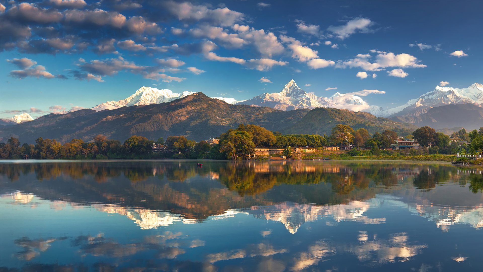
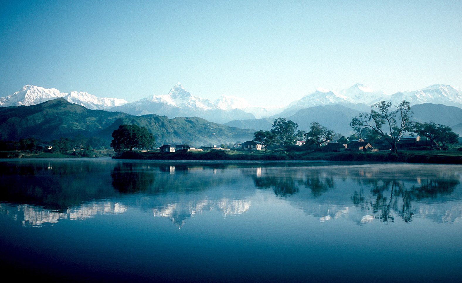
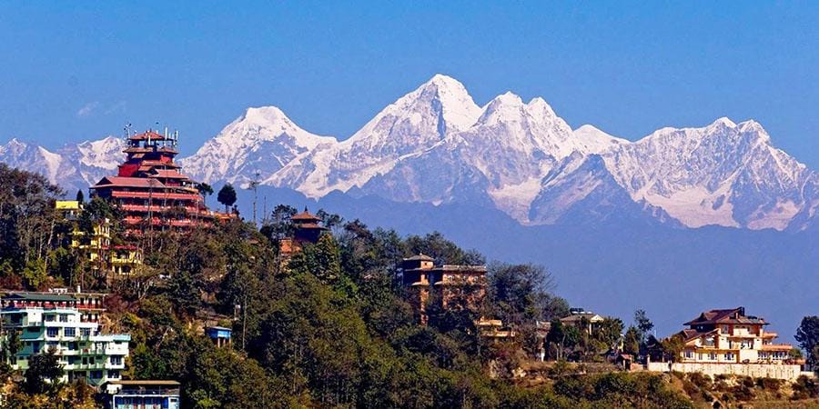
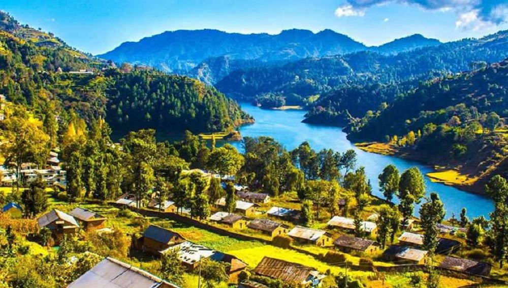
The city of Pokhara can be divided in two: the charming Lakeside Pokhara, and the Old City. The Lakeside part offers many tourist attractions and beautiful views, while the Old City is the city’s commercial hub. The Lakeside is further divided into the North and the Southside and is is named as it surrounds the Phewa Lake or Phewa Tal, a gorgeous freshwater lake which is eerily similar to a mirror! The lake gained popularity for its breathtaking reflection of the blue skies and the towering Mt. Machhapuchhre of the Annapurna range.

Built after World War II by Buddhist monks from the Nipponzan Myohoji organisation of Japan, the towering World Peace Pagoda stands on a ledge overlooking Phewa Lake. This destination can be reached by rowing on the Phewa Tal, and trekking for about an hour on the other side. The views are breathtakingly beautiful, and the serenity is bound to make one contemplate and meditate. Revered as the holiest Hindu shrine in Pokhara, the beautiful Varahi Mandir temple is located right in the middle of Phewa Lake, on a small island. One can access the temple by rowboat from Varahi Ghat and pay their respects to the fierce Varahi, who is known to grant all wishes. The Devi’s Falls is a special waterfall because half of it is underground. On the surface, it is a small stream which swells during the monsoon, but the water leads into an underground tunnel, surfacing at the Gupteshwor Mahadev Cave near the World Peace Pagoda. Patale Chhango is the actual name of this waterfall, but it is locally known as Devi’s Falls. Head over there and discover the local lore of how the waterfall got its name!

The Gurkha Museum, located near Mahendra Pul, chronicles the valiant achievements of the Gurkha regiment and has an interactive display as well. The AV show details the nuances of the regiment, and the exhibits contain many medals, artefacts and weapons used. There is also a wall of fame, naming prominent Gurkha soldiers. The museum is open daily from 8:30 am to 4:30 pm and foreigners need to pay NPR 200, while SAARC citizens pay NPR 100 and a camera can cost you NPR 20 to take inside. The International Mountain Museum is devoted to the Himalayas and her explorers. Containing the mountain scaling equipment of yore, champion trekkers and other exciting details, the museum also holds exhibits of the unique flora and fauna of the Himalayas. Outside, visitoes can try their luck at mountain climbing, by trying to scale a replica of Mt Manaslu. The museum is open from 9 am to 5 pm and foreigners need to pay NPR 400, while SAARC citizens pay NPR 200 and Nepalis need to pay NPR 80. A garden tour will set one back by NPR 20.
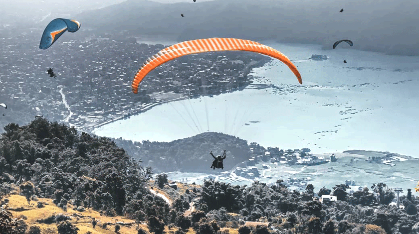
Pokhara is one of the most popular paragliding destinations in the world. One can take off at Sarangkot, near Lakeside where one can find most paragliding companies with very competitive prices. Solo and tandem flights can be taken all year round in conducive weather. Cost for a solo flight is USD 65 while a tandem flight will cost between USD 85 to USD 150 and lessons can be taken at USD 390.
As Lakeside Pokhara is the starting point for trekkers attempting to scale the Annapurna range, this is a welcome opportunity to meet like-minded people and trek with them. October to December is the best time to trek the Annapurna Circuit, which is a famous route. A minimum of three days is required to cover at least a part of this route – ideally, it takes 21 days to complete. One will need to have a permit card from the Annapurna Conservation Area Project, which costs NPR 2000, before one can attempt this route. Guided tours start from USD 25.

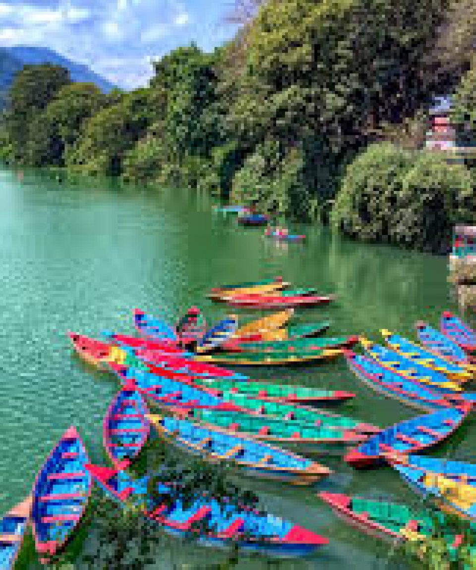
There are two rivers one can raft on near Lakeside, which are the Seti and Narayani. Many agencies near the rivers offer kayaking options, starting at USD 40 for a single trip. One can take a kayak from the Narayani River all the way to Chitwan National Park and most agencies rent all kayaking equipment for a price. One can also hire a Doonga, a brightly painted boat, to take them around the picturesque Phewa Lake.

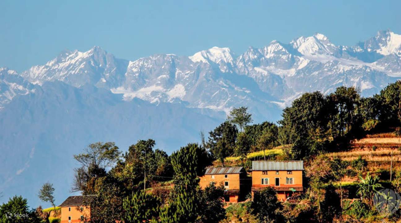
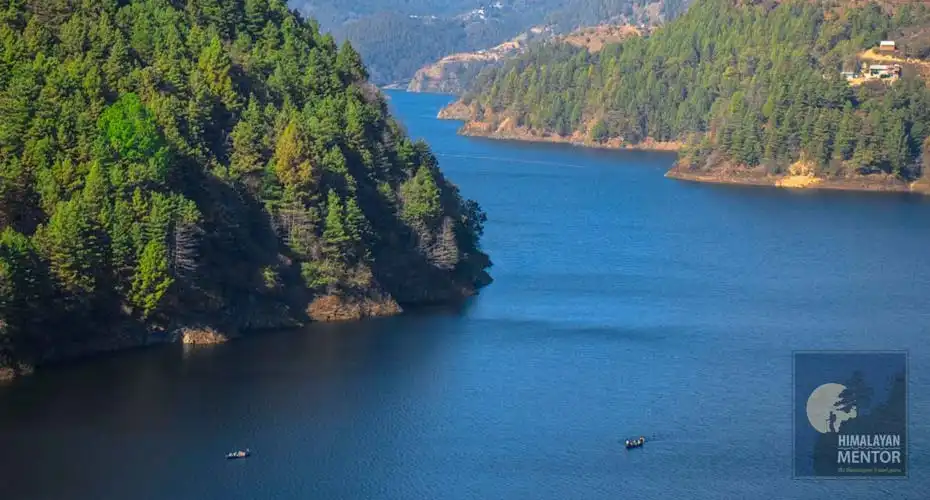
Pokhara Valley’s second largest lake, Begnas Lake is a popular freshwater lake with beautiful natural surroundings. On a clear day, at the foothills of the Himalayas, the lake waters reflect the surrounding mountain ranges. One may choose to take a leisurely stroll on the banks or rest. The lake is also the third-largest lake in Nepal. Begnas, the twin of Rupa Tal, is the largest of the two situated to the south-east of the valley. A dam, Khudi Khola, built on the western stream regulates the level of the lake water providing enough for irrigation purposes in all the seasons other than the monsoons. The swamps around the lake have been converted into lush green paddy fields, and some sections of the water body are used for fish farming. The waters from the lake help the locals earn a major chunk of their livelihood. One may go for a long boat ride or go paddling solo in the calm waters. The lake has several resorts and guesthouses where tourists can stay for as long as they want and breathe in the freshness in the air and enjoy the stunning view of the valley and the Begnas Tal.
Rupa Tal is the only freshwater lake of Nepal and is located at an altitude of 600 m. The beautiful lake is famous for the variety of flora and fauna that it supports and has boating facilities available. One can even engage in fishing activities.
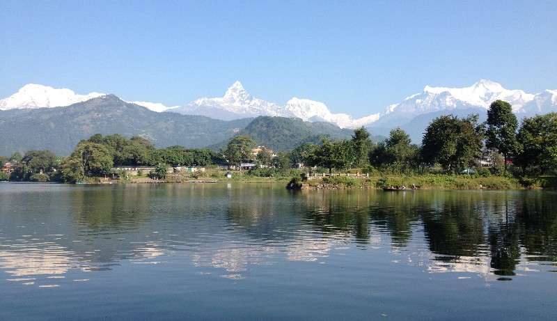
The second largest lake in Nepal, Phewa Lake is a semi-natural freshwater lake enveloped by Rani Ban or the Queen’s Forest and stunning reflections of the Annapurna and Dhaulagiri mountain ranges in the clear lake waters. It is also a perfect place to experience the ever so glorious Himalayan sunrises. One can hire a colourful boat called doonga and sail through the lake for a relaxing ride. It has some religious significance too as it is known for the sacred Tal Barahi Temple located on an island in the lake. Baidam or lakeside of Pokhara on the eastern part has some amazing lodges, restaurants, cafes and bookshops. The densely forested region around the lake has thrilling trails that lead up to higher grounds.
Phewa Lake is flocked by tourists, nature lovers and photographers. One may choose to rent a canoe or a paddleboat for NPR 500 approximately to explore and capture the scenic beauty to their heart’s content as they sail through the serene waters. When tired, a stop at the Tal Barahi Temple just to absorb the divine vibe or to offer prayers to the Goddess before setting sail ahead is quite recommended. There are also exciting trails in the thick forests surrounding the Lake that make it a perfect destination for nature walks, bird watching and treks. The forests house a variety of flora and fauna that one can explore while they rest on the shore in between their boat rides. One of these trails leads up to the World Peace Pagoda from where one can enjoy a splendid view of the lake and the mountain ranges. If the natural light is right, one may even see the reflection of the mountain peaks in the water.

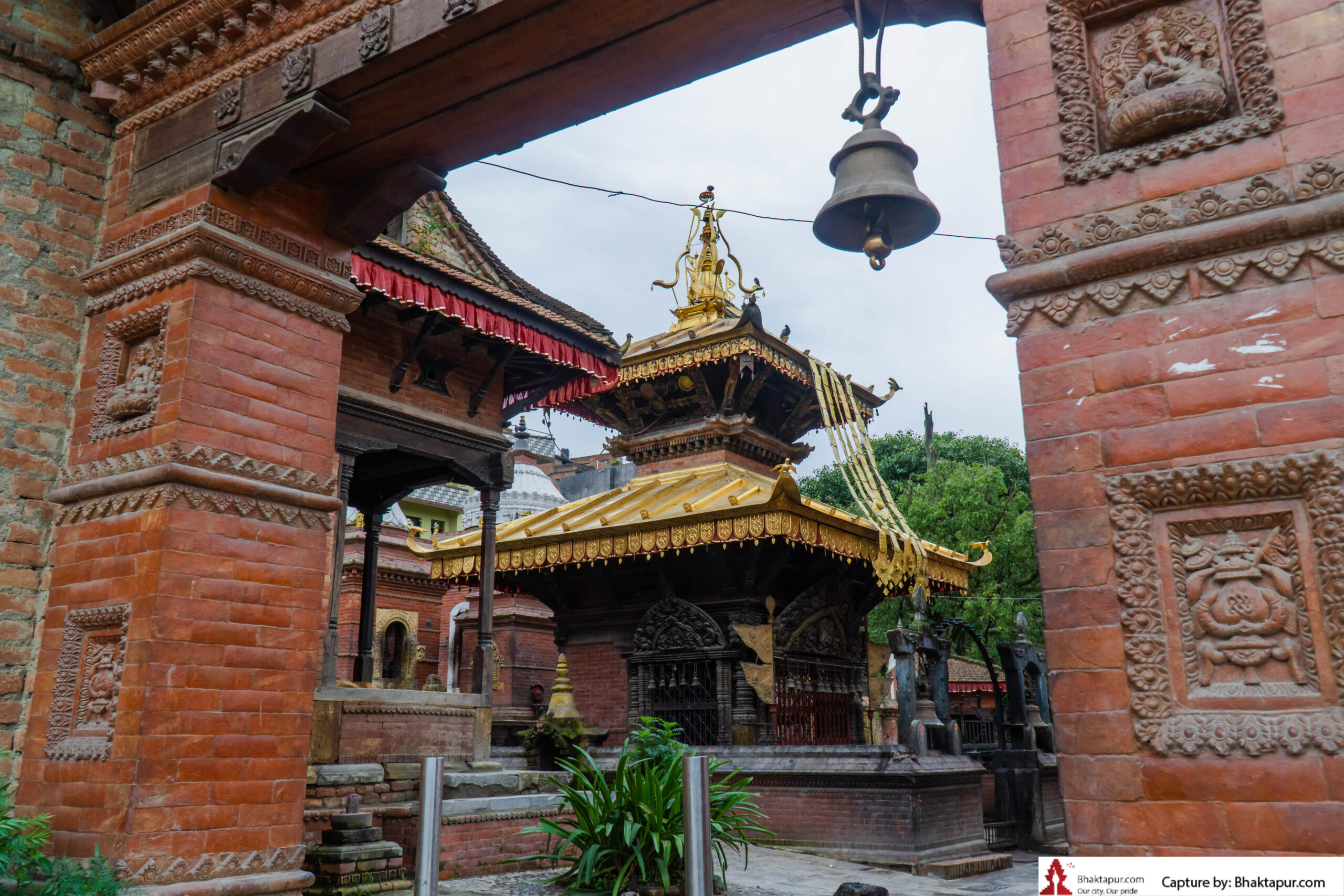
The Tal Barahi Temple is located in the middle of Phewa Lake surrounded by nature and tranquillity. It is a sacred shrine dedicated to Goddess Durga who is considered to be the protector of all Gods and a symbol of Shakti/Strength. Barahi means Boar, an avatar which Goddess Durga manifested, also called Ajima, to kill the demons with her tusks. According to a legend, the deity came to visit the place and was so captivated by its natural beauty and the people that she decided to reside here. The temple was built in 1864 by the first Shah King of Kaski, King Kulmandhan Shah, who was an ardent devotee of Goddess Durga. The beautiful shrine has two-storey traditional pagoda-style architecture made of stone and wood and stands strong on an island in the lake which was formed after the dam was built. The temple is open daily between 9 am and 5 pm and the best time to visit the temple is between September and May.
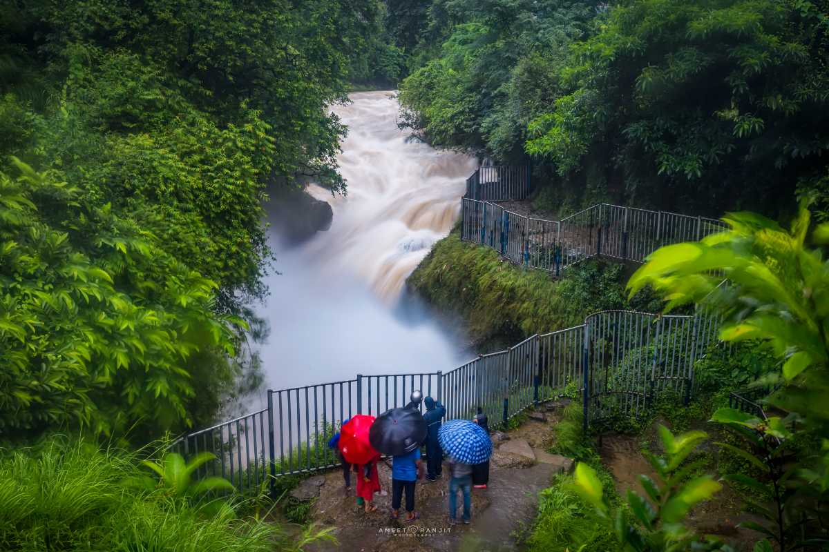
Davis’ Fall is an extraordinary waterfall which creates a 500 feet long underground tunnel as it reaches its bottom. This tunnel has brought the fall its name, Patale Chango in the Nepalese language, which means underground waterfall. Fed by the Phewa Lake Dam, the waterfall is surrounded by abundant flora. A landmark of Pokhara, Devi’s waterfall is a must-visit when in Nepal. The fall marks the point where the Pardi Khola stream disappears underground and leaves no clue of its existence. When the monsoons are at full power, the splashes of water against the boulders create a terrific sight.
On July 31, 1961, a Swiss couple named Davis made their visit here. While swimming in its waters, the overflow pushed the woman in a sinkhole where she drowned. Her body was recovered after three days. It was at her father’s request that the fall was named Davi’s Fall. Some people even say that it was not only the woman who drowned but also her husband. The fall got a local reference by the name of Devi’s Falls, hence the name by which it is mostly known.
As the name suggests, Gupteshwor Mahadev is a the name suggests is a a cave beneath the ground that acts as the source via which the fall’s water passes after exiting the tunnel. The ancient cave beside the fall is known for its unique designs. People tend to forget the way through which they enter; hence, one should be careful and use one’s presence of mind while in the cave. Visitors usually try impressing their fortune by throwing or placing a coin at the deity’s statue in the luck pond. Devil’s Fall is open daily from 5 am to 7 pm.
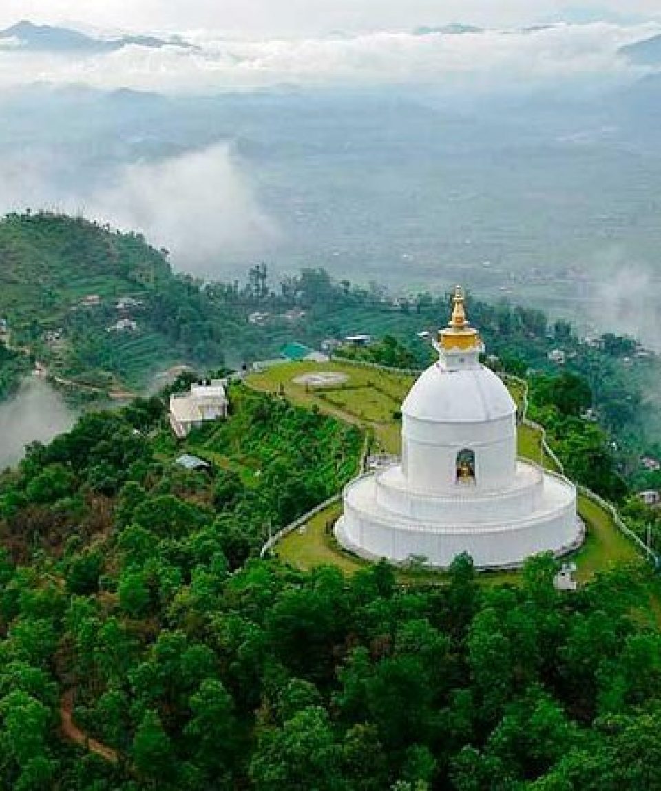
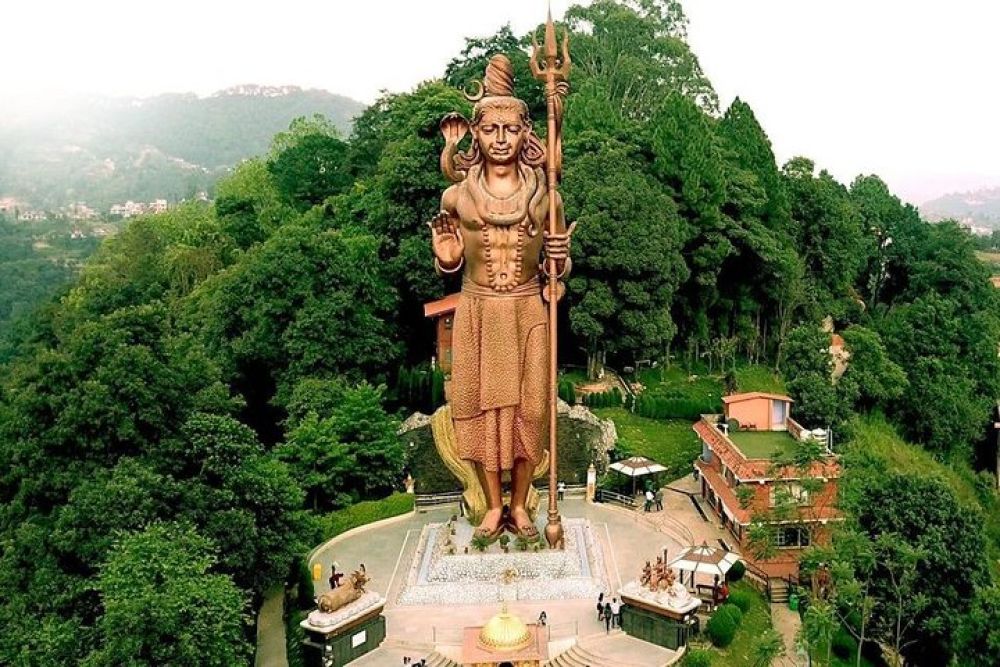
Shanti Stupa, also known as the Peace Pagoda, is a stunning monument located on the Anadu Hill overlooking the Phewa Lake with the charming Annapurna Mountain range in the backdrop. One can either cycle through one of the tracks that lead to the top of the hill, take the road to the Stupa, or enjoy a drive through the scenic location. The surroundings have several trekking trails to cross to Phewa Lake and explore the Himalayas. It is a popular tourist attraction, striking landmark, or pleasant pit stop for intrepid climbers. The picturesque beauty is quite captivating, and the tranquil vibe of the monument is worth a visit for those seeking it.
The pristine white coloured monument is a classic example of the traditional pagoda style of architecture. The striking colour helps in spotting the pagoda from metres away. This is the first peace pagoda in Nepal and was built by a Nipponzan Myohoji monk named Morioko Sonin. The spectacular symbol of peace is the 71st peace pagoda in the world standing 115 feet tall and having a diameter of 344 feet. Visitors need to climb a flight of stairs to reach the top of the monument. There are two tiers to the structure with separate passages to circumambulate. It houses relics and four striking statues of Lord Buddha that represent significant events in his life. These statues were received as souvenirs from different countries.
The four striking statues of Gautama Buddha representing important milestones in Lord Buddha’s life are installed on the second tier of Shanti Stupa. These four figures gifted by four countries include the Dharmachakra Mudra which was gifted by Japan, Kushinagar from Thailand, Bodh Gaya from Sri Lanka and Lumbini from Nepal. On the very top of this arrangement is the pinnacle, also called gajur, that holds the crystal stone from Sri Lanka. This stone symbolises grace and intellect. Below the gajur is the Dharmachakra signifying the wheel of life, the teachings of Lord Buddha and Dharma. A prayer hall called the Dhamma Hall is located near the Shanti Stupa that houses the statues of Lord Buddha and where rituals and poojas are performed on auspicious days by the devotees. One may choose to explore this section of the Pagoda to get a glimpse into the regional culture. The stupa can be visited daily between 8 am and 8 pm.

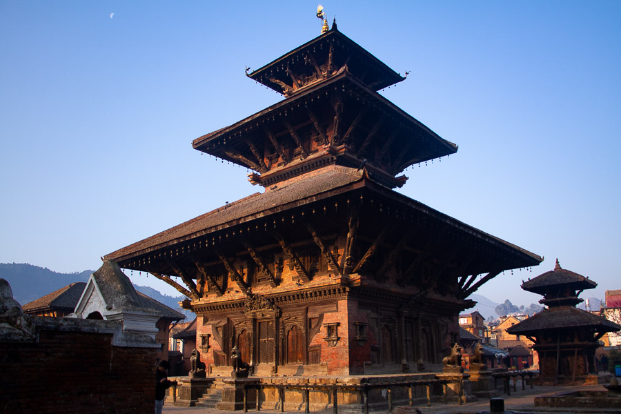
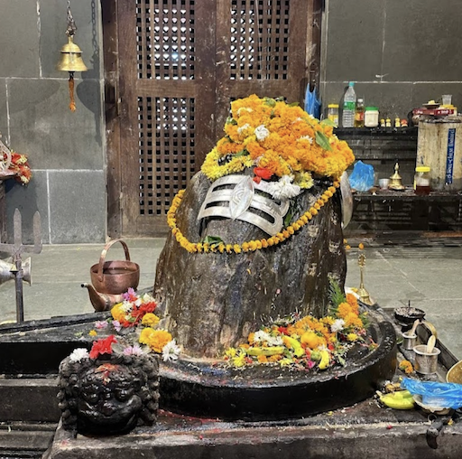
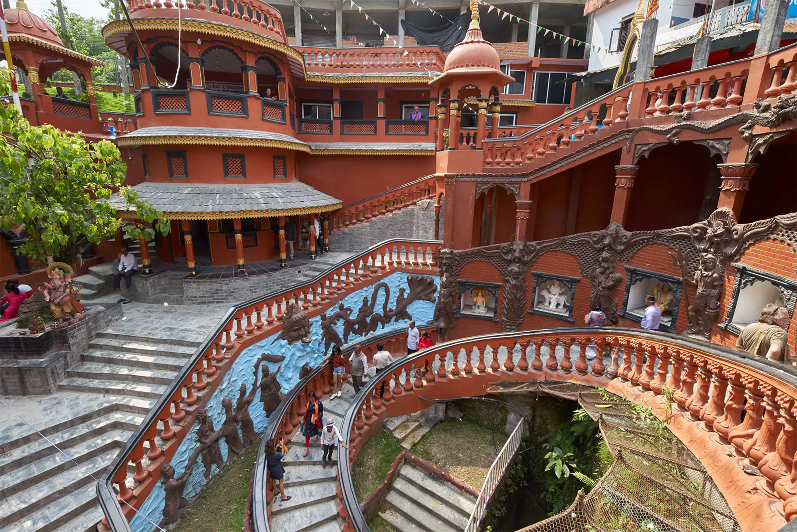
The ancient Bindhyabasini Temple stands on top of a small hill. This temple is dedicated to Goddess Durga, an incarnation of Devi Parvati. The Goddess worshipped is in the form of a Shaligram. According to a local legend, King Siddhi Narayan Shah bought the idol from Bindhyachal in India. The Gopteshwar Mahadev Mandir is a cave temple dedicated to Lord Shiva near the place where Seti River emerges from underground. A self-emerging Shiva Lingam was found in the 3 km long cave during the 16th century. Apart from the temple, the long, deep and dark cave offer an excellent opportunity to explore the natural wonders in its truest form. The 200-year-old Bhimsen Temple is dedicated to the Newari God of trade and commerce. It is said to be the oldest temple in the city and it replicates the pagoda style of architecture. The exterior of the temple is covered with intricate erotic carvings and exquisite woodcarvings on doors, windows, pillars and struts.

The Tal Barahi Temple, also known as Lake Temple or Varahi Temple, is a two-story pagoda temple on a small island on Phewa Lake. Dedicated to Goddess Varahi, who is an incarnation of Goddess Durga, both Hindu and Buddhist followers visit here for worship. It is believed that the temple was built by King Kulmandhan Shah because of a dream that he saw. Goddess Varahi is an avatar of Goddess Durga who is believed to be the symbol of strength or Shakti. Varahi or Barahi means a boar in Nepali and it is the form which was taken by Goddess Durga to kill the destructive demons. She is believed to have fought the mighty demons with her tusks and killed them all. After the fight, she is believed to have visited the Pokhara Valley and found it so enticing that she wanted to stay there. Ever since, this powerful form of Goddess Durga has been an important deity for the Hindu community in Nepal. Locals also state that the temple was in fact, built by an ardent worshipper of Goddess Varahi, King Kulmandhan Shah of the Shah Dynasty. It was made during his resign in 1864, and he chose the spot on an island in the middle of Phewa Lake for the temple to be built. The island was actually formed after the inflow of water to Phewa Lake was controlled by a dam built nearby. The main shrine set has traditional pagoda-type architecture, mostly made of wood, bricks, and stone, and has a premise large enough to accommodate a number of devotees. The premise also has decent seats where one can sit for a moment before returning to the city. When visiting Phewa Lake, sailing to the island and exploring the temple are highly recommended. Shree Gaden Dhargay Ling Monastery is a Tibetan Buddhist Monastery established to spread Buddhist teachings and Tibetan influence in the country.
Next week, we continue exploring Nepal’s tourism city