Travel Bucket List: India – Assam Part 1

Source

My post on northeast India written more than two years back was the genesis for this series and so lately I have been thinking that I have been unfair about lumping all the eight states as one being, especially when I have researched in detail the other states. So, to overcome this, I will be doing each state in detail and will be starting with the state of Assam, one of the larger states.

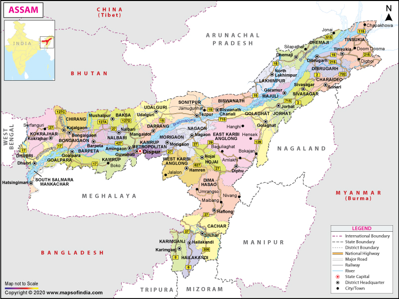
Located south of the eastern Himalayas along the Brahmaputra and Barak River valleys in north-eastern India, Assam is bordered by Bhutan and Arunachal Pradesh to the north; Nagaland and Manipur to the east; Meghalaya, Tripura, Mizoram and Bangladesh to the south; and West Bengal to the west via the Siliguri Corridor, a 22 km wide strip of land that connects the state to the rest of India. The state language is Assamese, followed by Bengali, which is official in the Barak Valley and Bodo which is official in Bodoland Territorial Region.

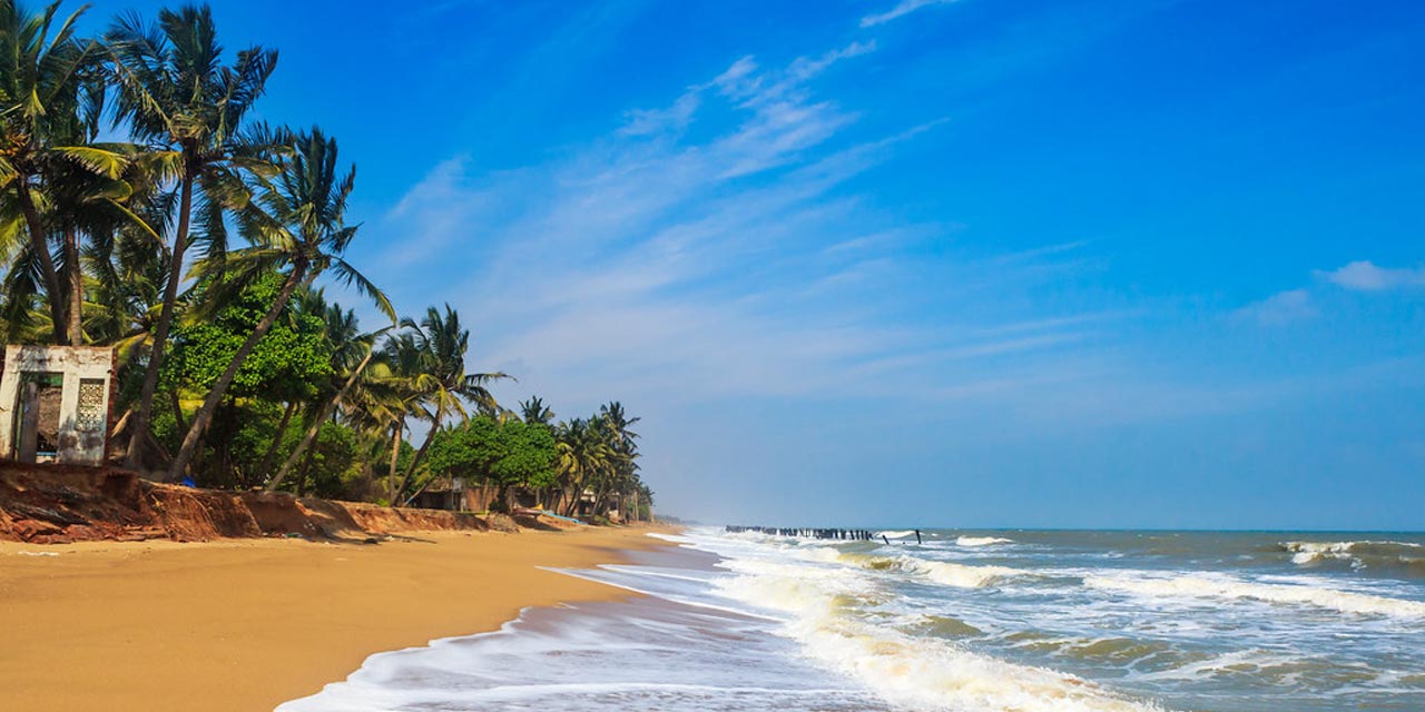
Known for its tea and silk, the state was the first site for oil drilling in Asia. Assam is home to the one-horned Indian rhinoceros, along with the wild water buffalo, pygmy hog, tiger and various species of Asiatic birds, and provides one of the last wild habitats for the Asian elephant. The Assamese economy is aided by wildlife tourism to the Kaziranga National Park and the Manas National Park, which are UNESCO World Heritage Sites. Assam receives more rainfall than most parts of India; this rain feeds the Brahmaputra River, whose tributaries and oxbow lakes provide the region with a hydro-geomorphic environment.

Assam and adjoining regions have evidence of human settlement from the beginning of the Stone Age. The first dated mention of the region comes from Periplus of the Erythraean Sea in the 1st century and Ptolemy’s Geographia in the 2nd century which calls the region Kirrhadia after the Kirata population. In the classical period and up to the 12th century the region east of the Karatoya river, largely congruent to present-day Assam, was called Kamarupa, and alternatively, Pragjyotisha. Though a western portion of Assam as a region continued to be called Kamrup, the Ahom kingdom that emerged in the east, and which came to dominate the entire Brahmaputra valley, was called Assam; and the British province too was called Assam. Though the precise etymology of Assam is not clear, the name Assam is associated with the Ahom people, originally called Shyam or Shan.

According to a late text, the Kalika Purana from around the 9th to the 10th century, the earliest ruler of Assam was Mahiranga Danav of the Danava dynasty, who was removed by Naraka of Mithila and established the Bhauma dynasty. The last of these rulers, also Naraka, was slain by Lord Krishna. Naraka’s son Bhagadatta became the king, who, it is mentioned in the Mahabharata fought for the Kauravas in the battle of Kurukshetra with an army of kiratas, chinas and dwellers of the eastern coast. At the same time towards the east in central Assam, the Asura Kingdom was ruled by another line of kings. Evidence indicates the presence of civilization in Assam around the 2nd century with a rock-cut stupa at Sri Surya Pahar that has been dated to 200 BC contemporary with the rock-cut Karle and Bhaja caves of Maharashtra. Samudragupta’s 4th century Allahabad pillar inscription mentions Kamarupa and Davaka in central Assam as frontier kingdoms of the Gupta Empire. Davaka was later absorbed by Kamarupa, which grew into a large kingdom that spanned from Karatoya river to near present Sadiya and covered the entire Brahmaputra valley, North Bengal, parts of Bangladesh and, at times Purnea and parts of West Bengal. The kingdom was ruled by three dynasties who traced their lineage from a mleccha or Kirata Naraka; the Varmanas, the Mlechchha dynasty and the Kamarupa-Palas, from their capitals in present-day Guwahati or Pragjyotishpura, Tezpur or Haruppeswara and North Gauhati or Durjaya respectively. All three dynasties claimed descent from Narakasura.

The Ahoms, a Tai group, ruled Upper Assam. The Shans built their kingdom and consolidated their power in Eastern Assam with the modern town of Sibsagar as their capital. Until the early 1500s, the Ahoms ruled a small kingdom in Sibsagar district and suddenly expanded during King Suhungmung’s rule taking advantage of the weakening rule of Chutia and Dimasa kingdoms. By 1681, the whole track down to the border of the modern district of Goalpara came permanently under their sway. Ahoms ruled for nearly 600 years between 1228 and 1826 with major expansions in the early 16th century. The Koch, another Bodo-Kachari dynasty, established sovereignty in 1510. The Koch kingdom in Western Assam and present-day North Bengal was at its zenith in the early reign of Nara Narayan between 1540 and 1587 and later split into two, the western part as a Mughal vassal and the eastern as an Ahom satellite state and later in 1682, Koch Hajo was entirely annexed by the Ahoms.

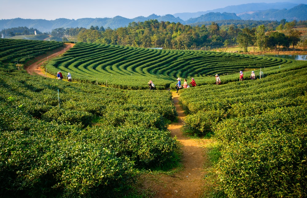
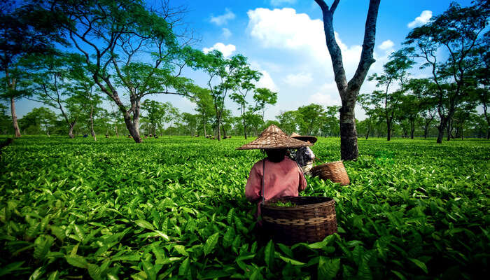
Despite numerous invasions, mostly by the Muslim rulers, no western power ruled Assam until the arrival of the British with the Mughals making seventeen unsuccessful attempts to invade. The discovery of Camellia sinensis in 1834 in Assam was followed by testing in 1836–37 in London. The British allowed companies to rent land from 1839 onwards and then tea plantations proliferated in Eastern Assam, where the soil and the climate were most suitable. Problems with the imported Han Chinese labourers from China and hostility from native Assamese resulted in the migration of forced labourers from central and eastern parts of India. After initial trial and error with planting the Chinese and the Assamese-Chinese hybrid varieties, the planters later accepted the local Camellia assamica as the most suitable variety for Assam. By the 1850s, the industry started seeing some profits. The industry saw initial growth when in 1861, investors were allowed to own land in Assam and it saw substantial progress with the invention of new technologies and machinery for preparing processed tea during the 1870s. In the later part of the 18th century, Ahom occupied Assam was captured by the Burmese who then leashed a reign of terror on the Assamese people who fled to neighbouring kingdoms and British-ruled Bengal after which the First Anglo-Burmese War took place in 1824 and ended under the Treaty of Yandabo in 1826, with the Company taking control of Western Assam and installing Purandar Singha as king of Upper Assam in 1833 under an arrangement that lasted till 1838 after which the British gradually annexed the entire region.

Initially, Assam was made a part of the Bengal Presidency, then in 1906 it was made a part of Eastern Bengal and Assam province, and in 1912 it was reconstituted into a chief commissioners’ province. The Assam territory was first separated from Bengal in 1874 as the North-East Frontier non-regulation province, also known as the Assam Chief-Commissionership. It was incorporated into the new province of Eastern Bengal and Assam in 1905 after the partition of Bengal between 1905 and 1911 and re-established in 1912 as Assam Province. After India’s independence, the Indian government divided Assam into several states beginning in 1970 within the borders of what was then Assam. In 1963, the Naga Hills district became the 16th state of India under the name of Nagaland and a part of Tuensang was added to the new state. In 1970, the districts containing the Khasi Hills, Jaintia Hills, and Garo Hills were formed into an autonomous state within Assam which then became the state of Meghalaya in 1972 and the same year, Arunachal Pradesh or the North-East Frontier Agency and Mizoram, from the Mizo Hills in the south were separated from Assam as union territories, with both becoming full states in 1986.

A significant geographical aspect of Assam is that it contains three of six physiographic divisions of India: the Northern Himalayas or the Eastern Hills, The Northern Plains or the Brahmaputra plains and Deccan Plateau or the Karbi Anglong. The climate is cold and there is rainfall most of the year. Geomorphic studies conclude that the Brahmaputra, the lifeline of Assam, is an antecedent river older than the Himalayas. Assam is one of the richest biodiversity zones in the world and consists of tropical rainforests, deciduous forests, riverine grasslands, bamboo orchards and numerous wetland ecosystems with many now protected as national parks and reserved forests. Assam has conserved the one-horned Indian rhinoceros from near extinction, along with the pygmy hog, tiger and numerous species of birds, and it provides one of the last wild habitats for the Asian elephant. The state has the largest population of wild water buffalo in the world as well as the highest diversity of birds in India with around 820 species which go up to 946 when subspecies are included.

Assam’s economy is based on agriculture and oil with Assam producing more than half of India’s tea. The Assam-Arakan basin holds about a quarter of the country’s oil reserves and produces about 12% of its total petroleum. The Assamese culture is traditionally a hybrid one developed due to assimilation of ethnocultural groups of Austric, Dravidian, Tibeto-Burman and Tai origin in the past. Therefore, both local elements or the local elements in Sanskritised forms are distinctly found.

We shall start our exploration of the state with its largest city Guwahati as well as its capital Dispur, which is a circuit city region located within Guwahati.

Guwahati

The largest city in Assam and also the largest metropolis in northeastern India, Guwahati is a major riverine port city along with hills and is called the Gateway to Northeast India. Dispur, the capital of Assam, is in the circuit city region located within Guwahati and is the seat of the Assam government. The city is also called the City of Temples because of the many ancient Hindu temples in the city. The city of Guwahati lies between the banks of the Brahmaputra River and the foothills of the Shillong plateau with the northern bank of the Brahmaputra, being gradually incorporated into the city limits. Guwahati is the largest city in Northeast India and the region hosts diverse wildlife including rare animals, primate species and endangered birds.

Once known as Pragjyotishpura or the light of the east, Guwahati was the capital of the ancient kingdom of Kamarupa and derives its name from the Assamese word Guva which is derived from the Sanskrit word Guvaka, meaning areca nut and its plant and Hati meaning rows with the city’s name translating to the rows of the areca nut tree. Guwahati’s myths and history go back several thousands of years, though the exact date of the city’s beginning is unknown, references in the epics, Puranas, and other traditional histories of India, lead many to assume that it is one of the ancient cities of Asia with the Kalika Purana mentioning that Kamarupa was inhabited by Kiratas. The city was the seat of the Borphukan, the civil-military authority of the Lower Assam region appointed by the Ahom kings. The Mughals invaded Assam seventeen times but were defeated by the Ahoms in the Battle of Itakhuli and the Battle of Saraighat on the outskirts of Guwahati. In 1972, the capital of Assam was moved to Dispur, a neighbourhood in Guwahati.

The Brahmaputra river flows to the north of the city which is bordered on the south by the foothills of the Shillong plateau and to the east by the Amchang Wildlife Sanctuary. The Bharalu River, a tributary of the Brahmaputra, flows right through the heart of the city and to the south-west of the city lies Dipor Bil, a permanent freshwater lake with no prominent inflows apart from monsoon run-off from the hills that lie to the south of the lake and drains into the Brahmaputra, acting as a natural stormwater reservoir for the city. There are also multiple hills within the city limits.

The Umananda Temple is located on Peacock Island that lies on the Brahmaputra River and is named after and dedicated to Lord Shiva. The name Umananda comes from the words, Uma, another name for Goddess Parvati and Ananda meaning happiness. Peacock Island is one of the smallest inhabited islands with the temple and its surroundings a haven for nature lovers. . The Island is home to a very rare and endangered species called the Golden Langur who are considered highly sacred. The temple is situated on top of a hill called Bhasmakala or Bhasmakuta. The island was originally built in 1694 by King Gadadhar Singha but was destroyed by an earthquake in 1897 and later rebuilt by a wealthy local merchant. The Umananda temple was crafted beautifully by the skilled Assamese workmen and aside from Lord Shiva, there are 10 other Hindu Gods whose idols reside in the shrines. The sanctum sanctorum encloses the rock on which Lord Shiva is said to have sat to meditate. According to a legend, Lord Shiva resided on this island as Bhayananda and it is said that at the beginning of creation, Lord Shiva sprinkled ashes here and imparted the supreme knowledge to his wife, Goddess Parvati. It is said that the Goddess Urvasi resides on this island and brings Amrit or nectar to Goddess Kamakhya which is why the island is also called Urvasi island. Even the Bhasmakuta hill on which the temple is located has a story. Legend says that when Kamadeva disturbed Lord Shiva during his meditation, he turned him into ash on this hillock, hence earning it the name of Bhasmakuta. The temple can be reached by a winding flight of stairs and is an ode to the mastery of the Assamese craftsmen and architects. Avoid visiting the island during monsoons as access to the island can be denied due to the rising water levels of the River Brahmaputra as well as due to flash floods. The temple is open from 5:30 am to 6 pm every day.

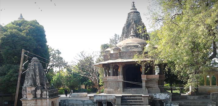
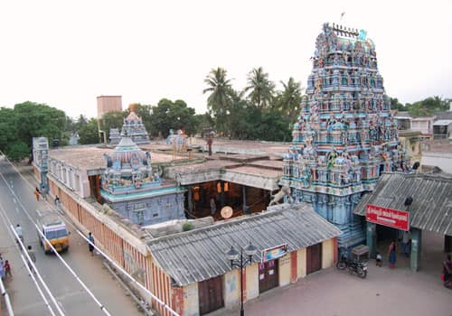
Located on the Nilanchal Hill in the western part of Guwahati,  the Kamakhya Temple is one of the most revered shrines of Goddess Shakti in India. According to the Hindu scriptures, there are four important Shakti Peethas or temples with the highest powers of divinity in the country and the Kamakhya Temple is one of them. The temple celebrates the power of the woman to give birth and is regarded as extremely auspicious among the followers of the Tantrik sect of Hinduism and was built and reconstructed multiple times between the 8th and 17th centuries. The main entrance of the temple is designed with carvings decorated with flowers and the temple has a massive dome and is decked up during the Ambubachi Festival and Fair held in June. One of the oldest temples in the country, the Kamakhya Temple has a long history. It is believed that this temple was built during the Mleccha dynasty in the 8th or 9th centuries. The Kamarupa Kings from Indra Pala to Dharma Pala were ardent followers of the Tantrik cult and at that time this temple became an important destination for Tantrikism. The Kalika Purana was composed in the 10th century and enhanced the importance of the temple as a seat for Tantrik sacrifices and sorcery. Mystic Buddhism or Vajrayana emerged here around that time and several Buddhist professors in Tibet were known to belong to Kamakhya.

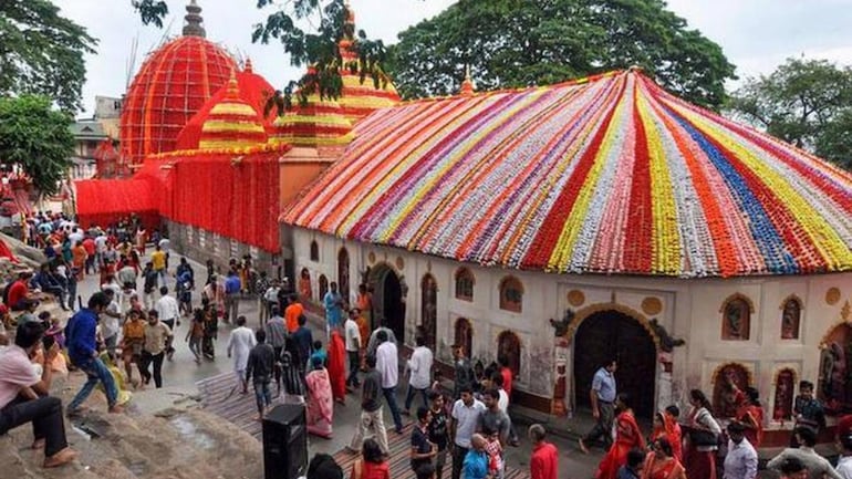
The Kamakhya temple was destroyed during Hussein Sha’s invasion of the Kamata kingdom, the ruins remaining undiscovered until the 1500s when King Vishwasingha revived the temple as a site of worship. The Kamakhya temple was reconstructed in 1565 during the reign of his son and ever since then, the shrine has been an important religious centre for Hindus. The current structure of the temple is said to be of the Nilachal type, another word for architecture with a hemispherical dome and a cruciform shaped base. The temple has four chambers aligned from east to west and is described as the Garbhagriha or the main sanctum sanctorum rests on a base that has several sunken panels embellished with the sculptures of Ganesha and other Hindu deities. The lower parts of the Garbhagriha are made of stone while the zenith is in the shape of an octagon and is made out of bricks. The Garbhariha is situated below ground level and can be reached by a series of rock-cut steps. A rock fissure in the shape of a vulva-shaped depression is present here and worshipped as the goddess Kamakhya. The depression is filled with water from an underground spring and this is the general pattern of all the Garbhagrihas in this temple. Towards the west of the Kamakhya temple lies the Calantha, which is a square-shaped chamber of the atchala type. Small moveable idols of Gods and Goddesses are found here, while the walls of this chamber have many images and inscriptions carved onto its surface. To the west of the Calantha is the Panchratna which is a large rectangular construction having a flat roof and five small spires protruding from its roof. Towards the west of the Pancharatna is the last structure of Natamandir which has an apsidal end and ridged roof of the Ranghar type Ahom style. The walls of the Natamandir has inscriptions from Rajewas Singha and Gaurinath Singha inscribed upon them.

Legend has it that during the month of Ashadh or June according to the Gregorian Calendar, the Bramhaputra River that flows beside the temple turns red. It is believed that this is a divine phenomenon and that it happens because the Goddess menstruates during this time. While some people claim it is due to the high iron and Cinnabar deposits in the water, others continue to believe in the miracle and so every year during the Ambubachi Mela, the river and the temple attracts thousands of devotees. The Ambubachi Festival is a celebration of the Goddess’ fertility and the celebration hinges on the belief that the Mother Goddess, Kamakhya, Shiva’s young bride, is menstruating at this time. The Temple remains closed and the Goddess is bathed after those three days after which the normal activities of the temple are resumed. It is believed that at the time of monsoon when this festival is observed, Mother Earth is at her fertile best due to the rain nurturing her womb aka the soil.

On regular days, the temple remains open from 8 am to 1 pm and then again between 2:30 to 5:30 p. Entry fees for the general public are free while for the special entry it is INR 101 and direct entry is INR 501.

The ISKCON temple in Guwahati is known as the Shri Shri Rukmini Krishna, after Rukmani, the wife of Lord Krishna. It is located on a hilltop of the Ulubari Chariali area and is constructed of white marble. The interiors of the temple include the deities of Lord Krishna and Rukmani and there are various halls inside the temple for preaching the teaching of the society which is based on Vaishnavism. The temple is surrounded by lush green gardens which inspires quiet contemplation of the divine.

Dedicated to Goddess Bhuvaneshwari, the white shrine is perched atop a hill adjacent to the. The Bhubaneswari Temple provides visitors with a magnificent panoramic view of the city with the sunset views on the Brahmaputra River as viewed from the hill a must-see when in Guwahati. Though the temple is high upon a hill, it requires a 20-minute walk from the bus stop.

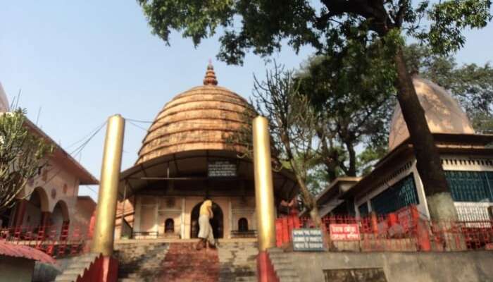
Perched on top of the Chitrachal or Navagraha Hill, the Navagraha Temple is dedicated to the nine celestial bodies. Believed to be the dwelling of the Sun, the temple enshrines nine Shiva Lingas in different coloured clothes representing planetary gods including Chandra or the Moon, Mangala or Mars, Budha or Mercury, Brihaspati or Jupiter, Shukra or Venus, Shani or Saturn, Rahu or the North Lunar Node and Ketu or the South Lunar Node surrounding the Sun or Surya in the middle. Built in 1752 by the Asom King, Raja Rajesvar Singha, the Navagraha Temple is built in the old Shikara style and is known to have survived major earthquakes. Instead of a roof, there is a huge dome with a beehive pattern. The temple premises are also used as a research centre for both astronomy and astrology and offer spectacular views of the Brahmaputra river and the valley below. The temple is open from sunrise to sunset daily.

Perched on the Sukreshwar or Itakhuli Hill on the southern bank of the Brahmaputra river, the Sukreshwar Temple is dedicated to Lord Shiva. Built in 1744, by the Ahom King Pramatta Singha, the temple was improvised and financial changes were made in 1759 by Rajeswar Singha. The temple offers an enchanting view of the valley below with a few steps leading down to the river and is popular for the spectacular sunrise and sunset. The temple is popular for conducting post-death rituals and there is a common belief that rituals here can help the dead attain peace or moksha. The temple complex also houses a Vishnu temple and a few chambers to conduct religious ceremonies. It is also said to house the largest Shivalinga in India. As per Kalika Purana, this hill was originally shaped like a hump of an elephant and hence known as Hastagiri. Open all through the year from 6 am to 7 pm, the best time to visit is during Mahashivaratri.

The Ugra Tara Temple enshrines the deity of Tara Devi. Built in 1725 by the Ahom ruler Siva Singh, the Shakti temple is unique in the sense that it does not have an idol like other temples do, instead, the inner sanctum sanctorum houses a small pit of water which is worshipped as Goddess Tara who is believed to be an incarnation of Goddess Parvati. There is also a water tank called Jorepukhuri, situated to the east of the temple which survived a devastating earthquake that destroyed the upper part of the temple. Goddess Ugra Tara is revered as Goddess Kamakhya and is showered with offerings and sacrifices and it is believed that the Goddess likes consuming meat, coconut and liquor; hence, get offered the same. According to legend, the navel of Goddess Sati is said to have fallen here while another legend suggests that when Lord Yama, the God of Hell complained to Lord Brahma that nobody was being sent to hell from the Kamarupa region because of its sacredness, Lord Brahma, in turn, went to Lord Shiva, and he, in turn, sent Goddess Ugra to drive away from her people and she sent in her army to bring them back. The army met Sage Vashishtha on its way back and disturbed his meditation. In anguish and rage, the sage cursed Goddess Ugra and Lord Shiva and from then on, all the Vedic sadhanas were given up in the Kamarupa region and people started worshipping the Goddess who became a Goddess of the Vamachara sadhana and the army became the Mlecchas. Goddess Ugratara is also worshipped in Buddhism. The temple is open between 5:30 am and 8 pm daily.

Perched on the hillock of Shukleshwar on the Shukleshwar ghats of the Brahmaputra river, the Janardana Temple is dedicated to Lord Vishnu. While the origin of the temple cannot be traced, it is believed to have been renovated sometime in the 17th century. The temple is an amalgamation of Buddhist and Hindu architectural styles, incorporating design elements from both with milky white interior walls with elaborate carvings of deities. The sanctum sanctorum of the temple enshrines a Buddhist statue and is revered as a place of meditation and worship by both Hindu and Buddhists. According to the myth associated with the temple, Lord Buddha is believed to be an incarnation of Lord Vishnu and he is known as Lord Janardana. Lord Janandana once fought and defeated the mighty demon Raja Bali in the disguise of a Vamana or a dwarf to protect the people from the wrath of the asuras or the demons. The battle spot came to be known as Janardana Tirtha and later, a temple was constructed around it known as the Janardana Temple. The temple is open from sunrise to sunset every day.

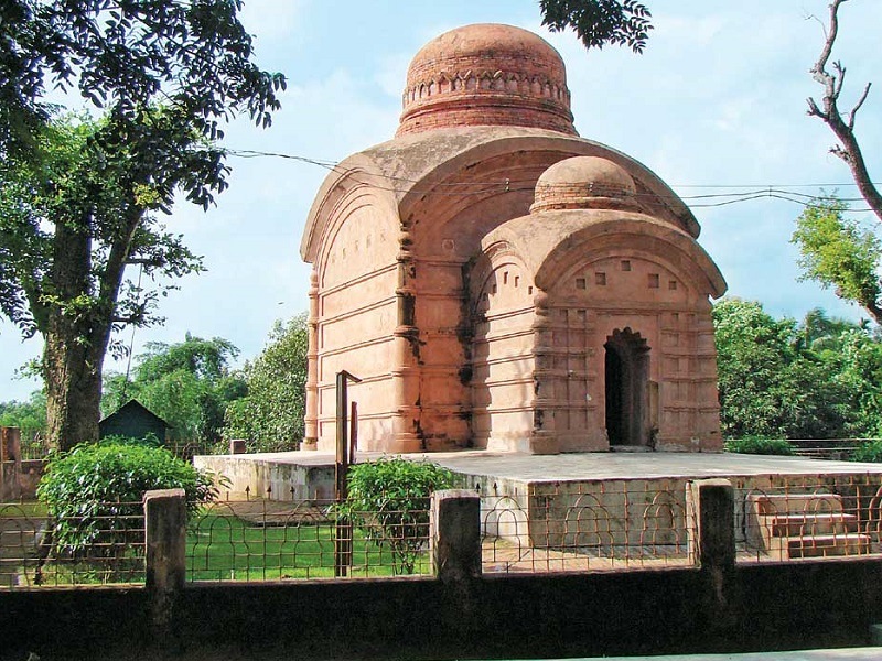
Located 40 km north of Guwahati, the Madan Kamdev Temple is an archaeological find in Baihata Chariali and is spread over an area of 500 metres, perched on top of a hillock. Here, the idols and sculptures of Madan Kamdev are scattered all over and the idols have detailed architecture and carvings on them.

Assam’s capital since 1973, Dispur is a suburb of Guwahati and houses some of the important buildings of the state like Assam Secretariat, State Emergency Operations Center and State Assembly House. Dispur is also famous as a tea auction market and is has beautiful weather throughout the year.

Pandu is another Guwahati suburb and is named after King Pandu, the father of the Pandavas. The Tila Hills here has a temple dedicated to Pandu known as the Pandunath temple. Five Ganesha idols representing the five Pandavas are found here and it is believed that during their exile, the Pandavas hid here under the disguise of Ganesha. The place also presents various other idols.

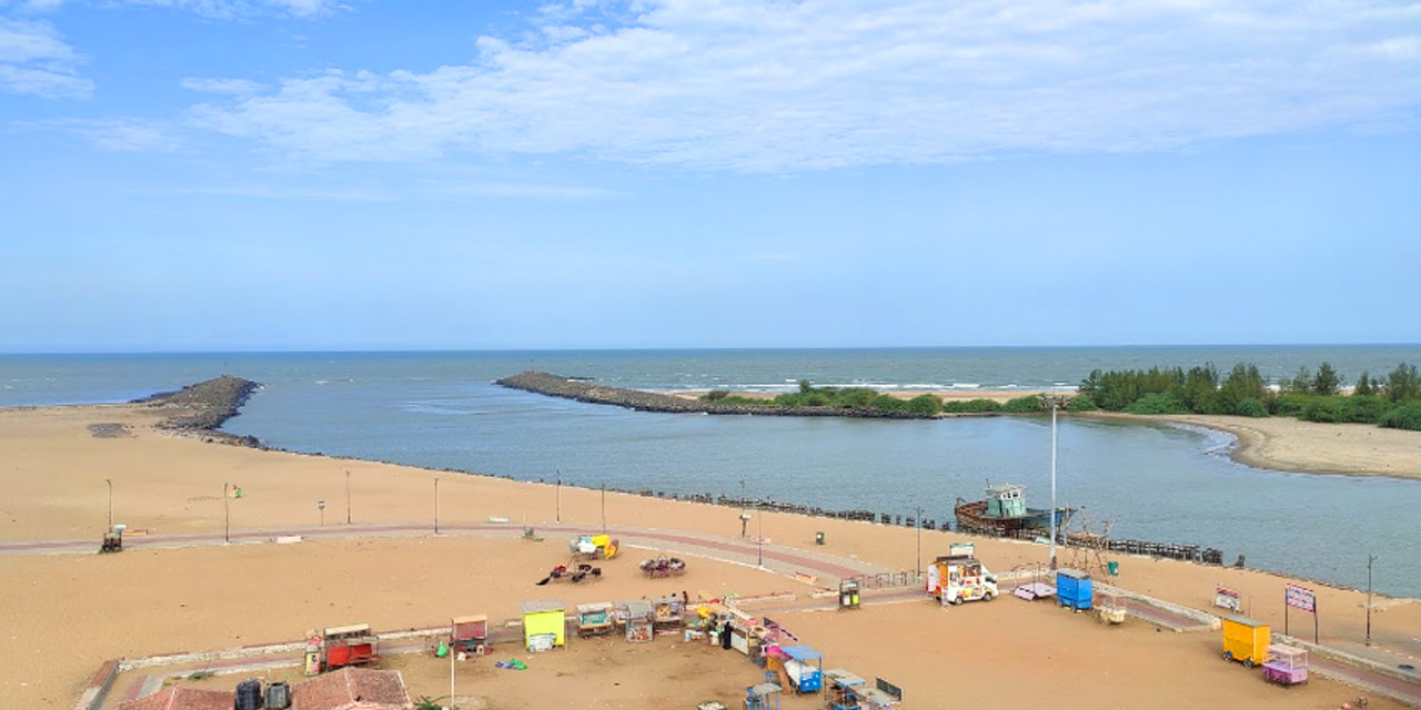
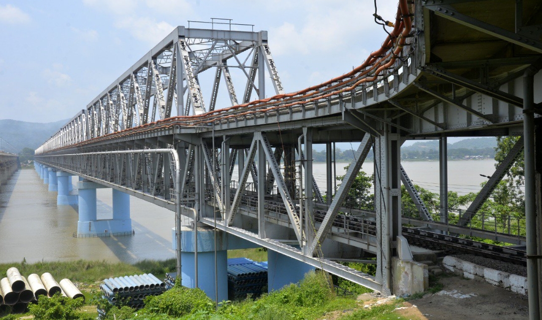
Built over the Brahmaputra River, the Saraighat Bridge is the first railway-cum-road bridge. The construction of the bridge was started in 1958 and it was first inaugurated for goods trucks in 1962, by then Prime Minister, Pandit Jawaharlal Nehru. A year later, on 7th June 1963, it was open to public traffic. The double-decker bridge has a road highway on top with a rail line below. Originally built for the North Frontier Railway, the bridge is a vital link between the North East region and the rest of the country; it has Lachit Borphukan Park situated on the south end and Chilarai Park situated on the north end. The 1.4 km long bridge connects both banks of the Brahmaputra river in Saraighat, a small town famous for the huge war between Ahoms and Mughals. An adjacent three-lane concrete bridge was also created and inaugurated in 2017.

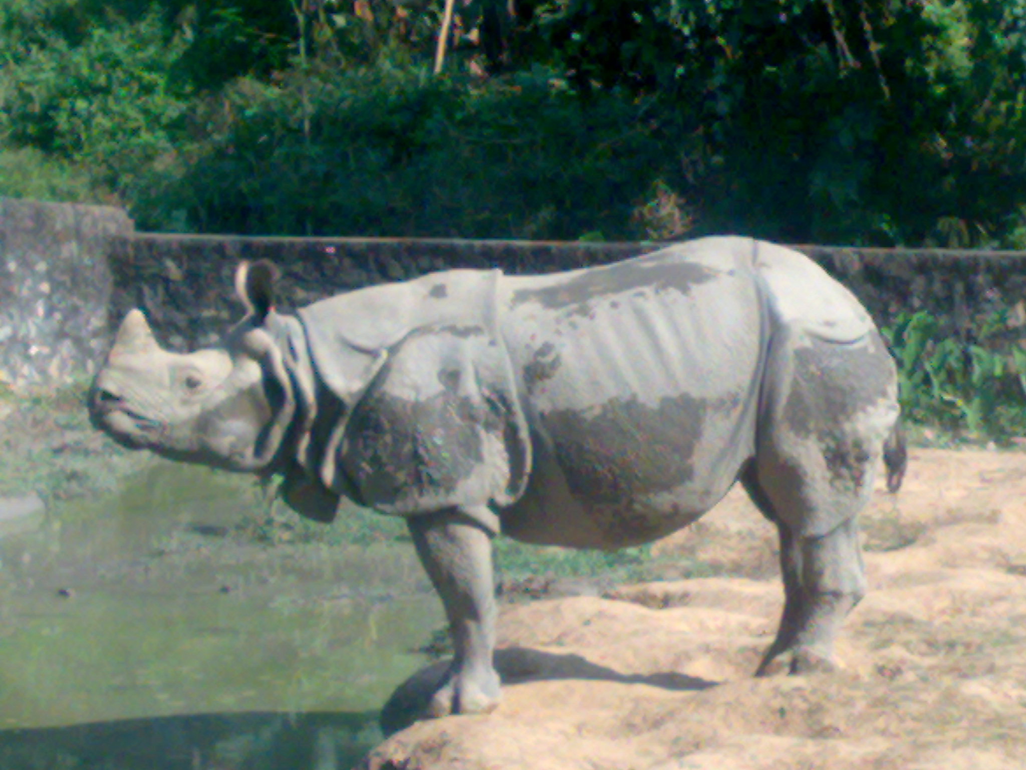
The Assam State Zoo cum Botanical Garden or the Guwahati Zoo as it is popularly known spreads over an area of 430 acres of a densely vegetated forest area known as the Hengrabari Forest Area in the centre of Guwahati. Often referred to as the green lung of the city, the zoo is the largest of its kind in the North-East region and has landscape gardens, wildlife and a serene environment. Established in 1958, it is home to 113 different species of animal, with more than 900 animals, birds and reptiles. Over the years, the zoo has created a charming botanical garden in its vicinity. The main attractions of the zoo are the fauna exhibits, the botanical garden, a museum, a reptile house and a herbarium collection. The zoo has started several captive breeding programs to increase the population of endangered species like the one-horned rhinoceros, gharials and white tigers.

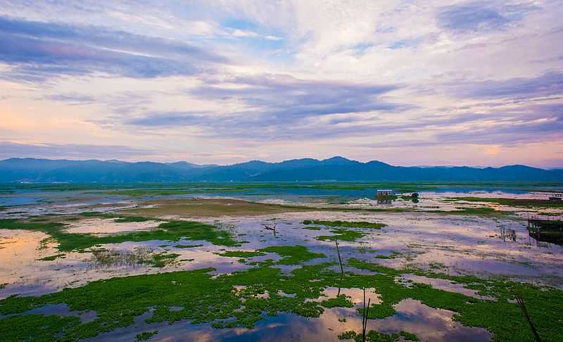
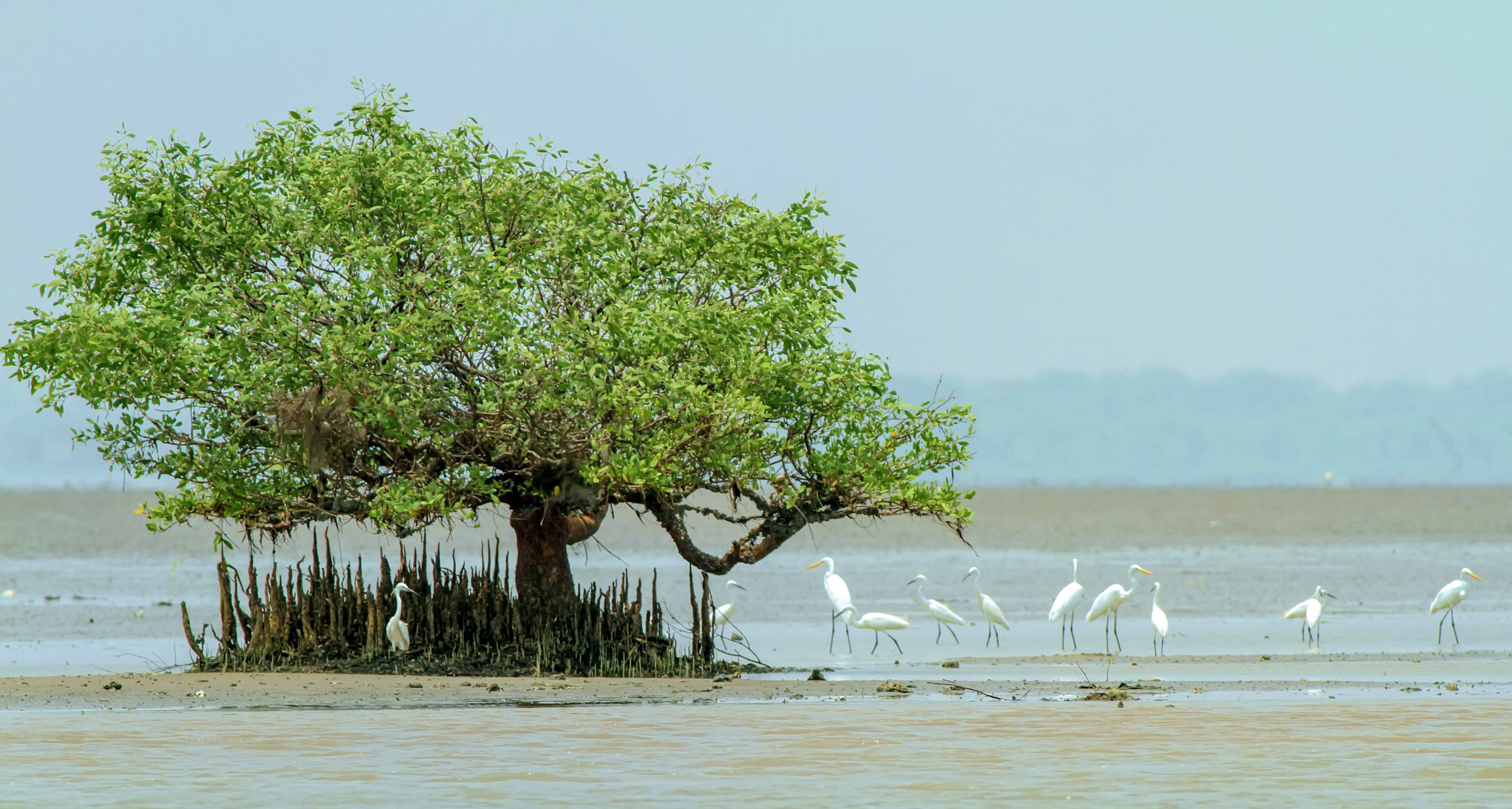
Located 18 km southwest of Guwahati, Dipor Bil or Deepor Beel is a freshwater lake in the former channel of the Brahmaputra river. Sprawling over an area of 40 sq km, the lake was declared as a Bird Sanctuary in 1989 owing to its rich biodiversity and heritage and is home to a vast variety of bird species. Dipor Bil offers a spectacular view of the fascinating wetland and rich forest ecosystem with as many as 19,000 different species of rare and endangered birds. In 2002, the Ramsar Convention listed it as a Ramsar site and Birdlife International has also declared it as Important Bird Area (IBA). Winters are the best time to visit as the weather conditions attract hibernating birds from far west and south countries. As per research 18 varieties of phytoplanktons have been found at the site including rare plants like Euryale Ferox, Potamogeton crispus etc. Dipor Bil has been derived from the Sanskrit word Dipor meaning elephants and bil meaning wetland or lake. It is believed that the lakeside was once an important dockyard for the Tai- Ahom and the Mughals and at one point in time, the Kampitha and Rambrai Syiemship which was the political authority of Meghalaya had control over this site. Known to be the largest lake or beel in the Brahmaputra valley of Western Assam, Dipor Bil has also been classified as representative of wetland type under the Burma Monsoon Forest biogeographic region.

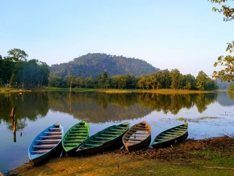
Chandubi Lake is a natural lake born when an earthquake hit the region in 1897 and the forest that was there vanished and became the lake. It is located at the foot of the Garo Hills and is surrounded by tea gardens, deep forests and tiny villages and is free from pollution because it is slightly inaccessible. Spread over 2000 hectares, it is a lovely picnic spot that attracts a large number of migratory birds during the winter months. The lake forms the breeding ground of the birds, both residential and migratory. Chandubi which means the setting sun is thought to have gotten the name because an unknown British officer was mesmerised by the sunset here. Another version claims that the legendary merchant Chanda Sadagar used this beautiful lake as a transit point for his business and as the lake grew popular because of the merchant, it eventually came to be associated with his name.  The prominent feature of the lake is the natural lagoon that was formed. The Chandubi Festival usually takes place in the first week of January when local villagers come together to perform traditional dance forms and celebrate their unique culture.

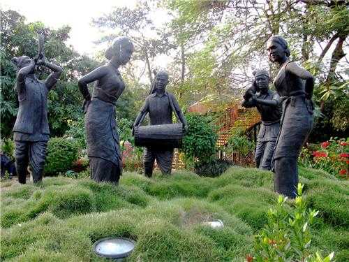
Located in the heart of the city, Nehru Park is a charming garden built in 2000 and named after India’s first Prime Minister, Pandit Jawaharlal Nehru. The park was originally a church with several cemeteries, which was later converted into a park. Nehru Park boasts of 45 sculptures carved out of concrete depicting various dance forms of the state as well as an open-air theatre, a rock garden, a charming lawn and a few artificial ponds. There is also a jogging track and a children’s garden with rides. The musical fountain which starts once night has fallen is a local favourite. The park is closed on Thursdays and other days is open between 10 am and 8 pm. The entry fee for adults is INR 10 per person and a child pays INR 5.

Source

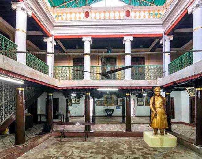
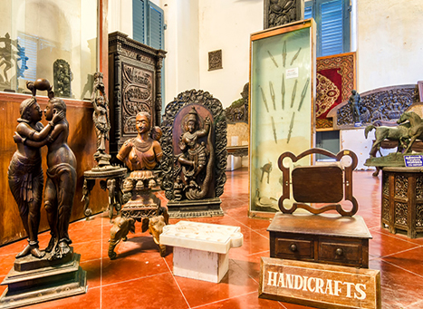
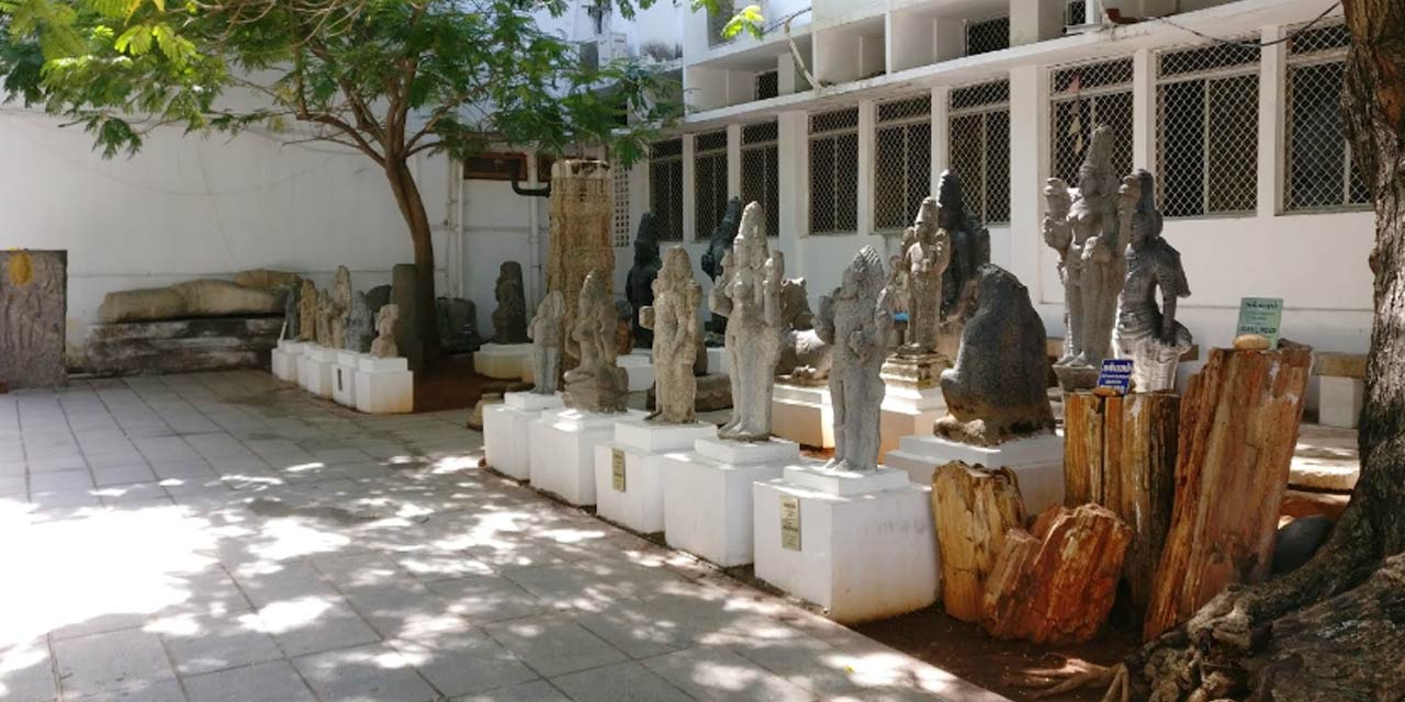
The Assam State Museum or the Assam Rajyik State Museum is one of the most famous museums of Northeast India that gives insights into the ancient and modern history of the region. The museum was established during the British colonial rule in 1940 and set up by the Kamarupa Anusandhan Samiti, Assam research society to showcase the history, sculptures, and handicrafts of Northeast India. The Museum offers an extensive collection of artefacts and sculptures dating back to the 5th to the 12th centuries to World War II and is divided into various sections each one showcasing a different era in history. The manuscript section displays the ancient manuscripts in Assamese, Tai and Myanmarese with a collection of these documents written on the bark of old trees and well-preserved. The arms and ammunition section has a vast collection of swords and armours from the Medieval to the Mughal period including the Ahom dynasty from the 1200s as well as a collection of ammunition from World War II. The prehistoric terracotta section has on display statues from the Indus Valley Civilization and various terracotta objects extracted from the different parts of Northeast India. The numismatics and metallic sculptures section have a collection of metal relics of Lord Vishnu, Goddess Durga and the Buddha along with a collection of coins from the Mughal and Ahom dynasties. The epigraphy section has a collection of stone and copper inscriptions belonging from the 5th to the 18th centuries while the natural history gallery has the collection of the natural biodiversity of the state including the life of a one-horned rhino. The museum also has on display the various handicrafts and handmade objects of Northeast India along with reconstructed tribal huts. Opened in June 1984, the conservation lab helps to conserve the present collection. During the summer months, the museum is open between 10 am and 5 pm while it is open from 10 am to 4:30 pm during the winter months. The entry fee is INR 5 while a camera fee of INR 10 is levied in case visitors want to photograph the exhibits.

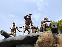
The Guwahati War Memorial opened to the public in December 2016 and is a local favourite. The memorial houses a replica of the Amar Jawan or the eternal soldier and depictions of the Battle of Saraighat between the Mughals and the Ahoms. The entrance is decorated with an army tank used in the war donated by the Indian Army and the Indian Air Force.  There are also a few sculptures on a boat showcasing war scenes on the water. The memorial also displays scenes from the Kargil war, the attack on Karachi by the Indian Navy in 1971 and the Sino-Indian war.

The Regional Science Centre is one of the 27 such centres maintained and administered by the Government of India’s National Council of Science Museums. Locally known as the Science Museum, this is a wonderful initiative to educate, enlighten and entertain the visitors through the medium of science and technology. Established in 1994, the museum houses rare instruments, machinery, rare science equipment and demo experiment setups. The science centre also boasts of interactive displays to learn from, both for kids and adults, ranging from everyday activities to prehistoric exhibits and non-formal science education. In addition to the permanent galleries showcasing various exhibits, the museum also has a dynamic science park, a mock prehistoric park, a superb 3D animation theatre, a spacious auditorium and an inbuilt aquarium. The Science Centre was the first in the entire northeast to have a stereoscopic digital 3D cinema projection facility and another highlight is the Digital Planetarium which provides one with a unique experience of artificial sky gazing. The Magic and Miracle Show enlighten visitors against the misuse and superstitions of magic and in the process educates them to the wonders of science through which magic is possible. The Super Cold Show demonstrates experiments on different elements to exhibit different behaviours on being exposed to super cold conditions while the Sky Observation Programmes enable visitors to witness celestial bodies with the help of a 6-inch refractive telescope. There is also a tiny butterfly park that demonstrates the lifecycle of a butterfly. The science centre is open between 10 am and 5:30 pm but the ticket counter closes at 5 pm. Charges are INR 25 per person for Indians and INR 50 for foreigners. The planetarium show takes place between 12 noon and 3 pm and has a fee of INR 20 while the Super Cold Show which takes place between 11 am and 4 pm has a ticket fee of INR 10. The 3D Film Show and the mock coal mine have multiple timings and have a ticket fee of INR 25 and INR 10 respectively.

At the Guwahati Planetarium, apart from the regular Sky watching sessions, special shows are projected on a dome-shaped overhead screen. These shows are available in Hindi, English as well as Assamese.

Named after the poet-playwright and reformer, the Srimanta Sankardev Kalakshetra is a cultural institution whose aim is to promote the culture, art and tradition of Assam. Built in 1990, the Kalakshetra showcases the artistic excellence of the Northeast and is sprawled over a vast area, boasting a museum, a library, an art gallery and a children’s park among others. The complex has been constructed in the conventional Assamese design and showcases the lives of the local people, groups and sub-groups of the state. The Kalakshetra is open between 10 am and 7:30 pm and has an entry fee of INR 30 for Indian adults, INR 10 for children below the age of 14 while foreigners need to pay INR 100. There are camera charges of INR 10 for a still camera and INR 100 for a video camera.

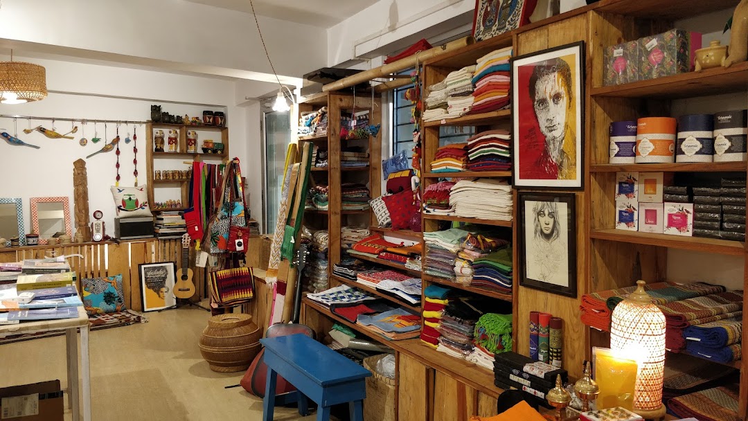
The Maati Centre is an initiative by a former World Bank employee Pabitra Lama Sarmah and her husband, Rishi Raj Sarmah. Established to promote the talents and hand crafted works of local artisans from nonprofit organizations like Tihar Jail and Dastakar Ranthambore, the centre has emerged as a wonderful blend of local culture and regional arts. With the idea to promote handicrafts and heritage, Maati Centre provides a platform to showcase young and independent artists and gives them a broader exposure. The centre protects, documents and maps the oral and folk and tribal arts to restore the long lost culture.

In My Hands Today…

Paris to the Moon – Adam Gopnik

Paris. The name alone conjures images of chestnut-lined boulevards, sidewalk cafés, breathtaking façades around every corner–in short, an exquisite romanticism that has captured the American imagination for as long as there have been Americans.

In 1995, Adam Gopnik, his wife, and their infant son left the familiar comforts and hassles of New York City for the urbane glamour of the City of Light. Gopnik is a longtime New Yorker writer, and the magazine has sent its writers to Paris for decades–but his was above all a personal pilgrimage to the place that had for so long been the undisputed capital of everything cultural and beautiful. It was also the opportunity to raise a child who would know what it was to romp in the Luxembourg Gardens, to enjoy a croque monsieur in a Left Bank café–a child (and perhaps a father, too) who would have a grasp of that Parisian sense of style we Americans find so elusive.

So, in the grand tradition of the American abroad, Gopnik walked the paths of the Tuileries, enjoyed philosophical discussions at his local bistro, wrote as violet twilight fell on the arrondissements. Of course, as readers of Gopnik’s beloved and award-winning “Paris Journals” in The New Yorker know, there was also the matter of raising a child and carrying on with day-to-day, not-so-fabled life. Evenings with French intellectuals preceded middle-of-the-night baby feedings; afternoons were filled with trips to the Musée d’Orsay and pinball games; weekday leftovers were eaten while three-star chefs debated a “culinary crisis.”

As Gopnik describes in this funny and tender book, the dual processes of navigating a foreign city and becoming a parent are not completely dissimilar journeys–both hold new routines, new languages, a new set of rules by which everyday life is lived. With singular wit and insight, Gopnik weaves the magical with the mundane in a wholly delightful, often hilarious look at what it was to be an American family man in Paris at the end of the twentieth century. “We went to Paris for a sentimental reeducation – I did anyway – even though the sentiments we were instructed in were not the ones we were expecting to learn, which I believe is why they call it an education.”

In My Hands Today…

Tracks: A Woman’s Solo Trek Across 1700 Miles of Australian Outback – Robyn Davidson

Robyn Davidson’s opens the memoir of her perilous journey across 1,700 miles of hostile Australian desert to the sea with only four camels and a dog for company with the following words: “I experienced that sinking feeling you get when you know you have conned yourself into doing something difficult and there’s no going back.”

Enduring sweltering heat, fending off poisonous snakes and lecherous men, chasing her camels when they get skittish and nursing them when they are injured, Davidson emerges as an extraordinarily courageous heroine driven by a love of Australia’s landscape, an empathy for its indigenous people, and a willingness to cast away the trappings of her former identity. Tracks is the compelling, candid story of her odyssey of discovery and transformation.

Travel Bucket List: India – Puducherry Part 2

In this second and last part, we will visit the other French colonies which make up the Union Territory of Puducherry.

Karaikal

Karaikal is also an enclave of Tamil Nadu and occupies an area of 160 sq km. A small coastal enclave, Karaikal is bound on three sides by districts of Tamil Nadu and the Bay of Bengal on the east.It is about 132 km south of Puducherry. Karaikal became a French Colony in 1674 who controlled the enclave, with occasional interruption from the British and Dutch, until 1954, when it was incorporated into the Republic of India, along with Chandernagore, Mahé, Yanaon, and Pondichéry. Forming a part of the fertile Cauvery delta, the region is completely covered by the distributaries of Cauvery and the group of rocks known as Cuddalore formations met with in the area contiguous to Karaikal region in Nagappattinam district.

The origin of the word Karaikal is uncertain with the British probably meaning it means a fish pass. But both the words, Karai and Kal have multiple meanings, of which the more acceptable ones are lime mix and canal respectively and it has been suggested that the name may mean a canal built of lime mix, however, no trace of such a canal is evident.

Before 1739, Karaikal was under the regime and control of Raja Pratap Singh of Tanjore. In 1738, the French negotiated with Sahuji of Thanjavur for possession of Karaikal, the fortress of Karakalcheri and five village for 40,000 chakras and took possession of Karaikal town, the fort of Karakalcheri and eight dependent villages on 14 February 1739. By a treaty signed on 12 January 1750 Pratap Singh ceded to the French 81 villages around Karaikal and cancelled the annual rent payable for the villages. This was all the territory the French possessed around Thanjavur when they surrendered to the British in 1761. The territory then passed twice to British control before it was finally handed over to the French in 1816/1817 under the Treaty of Paris of 1814.

In 1947, after the rest of India became independent, the French territories also started their struggle until 31 October when the French flag was lowered with due military honours and the de facto transfer of power took place on 1 November 1954 followed by de jure transfer on 16 August 1962.

The breathtaking views from Karaikal Beach is what makes it so popular. It is a natural beach that lies on the Bay of Bengal and is an excellent spot for a dip and for evening walks. An ideal place to witness the sunset, there is a rocky path here to walk on, fishing boats to watch and plenty of opportunities for nature photography. The beach is perfect for water activities like swimming, canoeing and kayaking with the boat club allowing visitors to rent motor boats, peddle boats and rowing boats. There is a lighthouse on the premises that attracts large crowds with several fountains adding to the area’s appeal. There is also a children’s park and a tennis court close by. A walk or drive from the Arasalar Bridge provides an opportunity to admire the water, the hills around and the mangroves near the backwaters.

Source

Mahé

Mahé is an enclave of Kerala and the smallest district by size and the sixth least populous district of India. It is bound on three sides by districts of Kerala and the Arabian Sea on the west and geographically is part of North Malabar. Also known as Mayyazhi, Mahé is situated at the mouth of the Mahé River.

The name Mahé derives from Mayyazhi, the name given to the local river and region in the Malayalam. It was also called variously from the early 1720s as Mayé, Mahé and Mahié until the early 19th century when Mahé became the how the town was spelt.  Before the arrival of the European trading companies, this area was part of the Kolathu Nadu which comprised of Thulunadu, Chirakkal and Kadathanadu. The French East India Company constructed a fort on the site of Mahé in 1724, because of an accord between André Mollandin and Raja Vazhunnavar of Vatakara three years earlier. In 1741, the French retook the town after a short period of occupation by the Marathas. In 1761 the British captured Mahé, and the settlement was handed over to the Rajah of Kadathanadu. The British restored Mahé to the French as a part of the 1763 Treaty of Paris and in 1779, the French lost Mahé in the Anglo-French war. In 1783, the British agreed to restore to the French their settlements in India, and Mahé was handed over to the French in 1785 and captured it in 1793 and then restored it back to the French in 1816 as part of the 1814 Treaty of Paris. After Indian independence, it continued to be French-ruled until 13 June 1954, when a long anti-colonial struggle culminated in it joining the Indian Union as a district of Puducherry Union Territory.

The Sri Puthalam Bhagavathy Temple is an ancient historic temple dedicated to Goddess Bhagavathi. The temple’s legend is based on events that occurred during the conflict between the French and Indian armies. The historic St Theresa Church was constructed in 1757 as a part of the Mahe Mission. Mooppenkunnu is a hillock and a popular picnic spot with pavements to walk on, benches to rest and a restroom facility. The hillock contains the historic Lighthouse and is a famous sunset view point.

Source

The walkway on the banks of Mahé river is a major tourist attraction which surrounds the landscape and has park benches to relax and enjoy the beauty of the river. Azhimukham is the estuary of the Mahe river and the Arabian Sea. There is a small park named Tagore Park here and the reconstruction of a 2-km walkway along the bank of river from the estuary towards Mahe Bridge.

Located close to Kannur, Mahe Beach is a quiet and clean beach, part of Kerala’s northern coast. Lined with tall palm trees, the beach is a must-visit during the early hours of the morning to witness the gorgeous sunrise. Ideal not just for swimming, but also for beach sports, the view of the sunrises and sunsets are absolutely spectacular. There are several fishermen villages around the beach because of which there are always numerous colourful boats around. Dharmadam Island is ideal for watching the sunrise or sunset which can be reached by a short boat ride.

Yanam

An enclave of Andhra Pradesh, Yanam is one of the four districts of the Union Territory of Puducherry in India and occupies an area of 20 sq km. It is located south of Kakinada port on the north bank of the Godavari River, slightly inland and is surrounded by the East Godavari district of Andhra Pradesh. Yanam is covered with coconut trees and is located over the banks of the Gauthami Godavari River, one of the main branches of the river Godavari when it enters the Bay of Bengal after flowing about 12 km through Yanam.  Indigo wells or Neelikundilu are still found in the west of Yanam.

Yanam or Yanaon as it was called during the French colonial times, is located in the East Godavari district in Andhra Pradesh with a population of 35,000, most of whom speak Telugu. A French colony for nearly 200 years, it possesses a blend of French and Telugu culture, and is nicknamed Frelugu. During French rule, the Tuesday market, the Marché du mardi or Mangalavaram Santa was popular among residents of the the Madras Presidency, who used to visit Yanam to buy foreign and smuggled goods during Yanam People’s Festival held annually in January. After the implementation of the Child Marriage Restraint Act, 1929 in British India, people often travelled to Yanam to conduct child marriages, which remained legal under the French administration.

Yanaon was a Dutch colony prior to French takeover in the 1720s and the Dutch built a fort, used to store their currency, which was minted at nearby Neelapalli. The location of the fort is today referred to by locals as the Saali Kota or Saalivandru, meaning shawl-hut, since after the Dutch moved out, the building was taken over by cloth weavers. The region was presented to the by the king of Vizianagaram as a token of gratitude for their help in his fight against the rulers of Bobbili. Yanaon was the third French colony established in India, though it was officially confirmed as one only by 1751. It went to the British after the Anglo-French war of 1758 which was won by the British and was restored again to the French in 1785. During 1793 and 1816 it was under British control and after the Napoleonic wars, by the Treaty of Paris of 1814, Yanam along with the factory at Machilipatnam was finally returned to the French on 26 September 1816. From then it was continuously under French control until its transfer to India in 1954.

The Lord Sri Rajarajeswara Temple on the bank of Atreya Godavari, which is also known as the Corangi river. The temple was built by the Chalukya kings of Rajamahendravaram or Rajahmundry in the 15th century with sculptures of that period present in the temple. The main festivals in the temple are the Kalyanotsavam and the Rathostavam which have been performed for centuries with devotees singing slogans and bhajans. The Kalyanotsavam festival celebrated in January/February is when Lord Srī Rajarajeswara becomes a groom and has a procession on the streets of the town with chariots each day. The Kalyaṇam, Rathotsavam and Trisulatirtham are the important events of the festival with the Vahana Samprokshaṇa or the ritual cleansing of the chariot done by priests every day for each of the chariots used for the procession.

The Venkanna Babu Temple is a temple dedicated to Lord Vishnu known as Venkanna Babu, Chaldikudu Venkanna and Meesala Venkanna. The speciality of the temple is that the Lord’s idol has a big moustache like that of Lord Sathyanarayana Swamy of Annavaram. The temple was built by the Chalukya kings of Rajamahendravaram or Rajahmundry in the 15th century. This temple used to perform child marriages and when the Child Marriage Act was passed in British India, people from nearby areas used to come here to conduct such marriages as the French allowed such practices.

The site for the Grand Mosque was donated by the French Government in 1848 and a small mosque was constructed there and in 1956, it was remodelled. It was demolished in 1978 and a new mosque constructed and in 1999–2000, the mosque was expanded to become the Grand Mosque. Around 200 persons can pray in this mosque at a time.

The French Catholic are linked with the Catholic Church in Yanam, the St. Ann’s Catholic Church. Built in the European style, in 1846 by French missionaries, all furniture and decoration articles were imported from France. The church holds a Catholic Festival in March

Yanam Beach is the best getaway to spend quiet time away from the crowds. Also known as the Rajiv Gandhi Beach, one can take boat rides at the beach as well as walks along the Ferry Road. There are many packages available including a ride over the Godavari River, cruises to a few islands, visiting the Sangam where the river meets the sea or a ride to the mangrove forest on the Gowthami Godavari River. There are also houseboat services that begin from Rajiv Gandhi Arch Road near the Shiva Linga. The Yanam Ferry Road inaugurated in 2000 is a walking trail along the beach with elephant statues guarding the Shiva Linga from the entrance to the pathway. The Nagoor Meera Sahib Mandir on the Ferry Road is built as a ship.

The Palais de Justice or the French courthouse and St. Ann’s Catholic Church are around 1 km away from the beach. The Court building is situated in an ancient white monument building of French architecture and has two floors, the ground floor is the court and the first floor is the residential quarters of the judge and was renovated in 1967. The Sivalayam on the banks of the Corangi River is 3 km away from the beach and is a religious hub. The Fete de Pondicherry is a three-day cultural event conducted by the government of Puducherry.

The Coringa Wildlife Sanctuary is 21 km away from Yanam Beach and is a great spot for bird lovers. The sanctuary shelters more than 120 bird species and endangered species, such as the long-billed vulture and the white-backed vulture are found here.

This short, but interesting series on the Union Territory of Puducherry was quite illunimating to me as I hope it was for you. I learnt a lot about the former French colonies of India, especially Karaikal, Mahe and Yanam, which I barely knew about previously.

Travel Bucket List: India – Puducherry Part 1

Also known as the Riviera of the East, the Union Territory of Puducherry, formerly known as Pondicherry is one of the seven Union Territories in India formed out of four territories of former French India, namely Pondichéry or Pondicherry named Puducherry today, Karikal or Karaikal, Mahé and Yanaon or Yanam, excluding Chandannagar. It is named after the largest district, Puducherry. Historically known as Pondicherry or Paṇṭicceri, the territory changed its official name to Puducherry on 20 September 2006. The Union Territory lies in the southern part of the Indian Peninsula with the areas of the Puducherry and Karaikal districts bound by the state of Tamil Nadu, while the Yanam and Mahé districts are enclosed by the states of Andhra Pradesh and Kerala, respectively. Puducherry is the third most densely populated among the states and union territories.

The earliest recorded history of Puducherry can be traced to the second century. The Periplus of the Erythraean Sea mentions a marketplace named Poduke, which seems to suggest a location about 3 km from modern Puducherry, possibly the location of Arikamedu which is today part of Ariyankuppam. According to archaeologists, Roman pottery was found at Arikamedu which was a trading station to which goods of Roman manufacture were imported between the third or second century BC to the eighth century AD.

In 1674, the municipality of Pondicherry became a French colony of the French colonial empire. Together with Chandernagor which was already French since 1673, Mahé which was French since 1721, Yanam which was in French possession since 1731, Karaikal, in French possession since 1739 and Masulipatam which belonged to the French since 1760, it formed the French colony of French India, under a single French governor in Pondicherry, although French rule over one or more of these enclaves was repeatedly interrupted by British occupations. The territories of French India were completely transferred to the Republic of India de facto on 1 November 1954, and de jure on 16 August 1962, when French India ceased to exist, becoming the present Indian constituent union territory of Pondicherry, combining four coastal enclaves, with the exception of Chandannagar, which merged with the state of West Bengal in 1954.

Puducherry and Karaikal have the largest areas and population. Some of Puducherry’s regions are themselves amalgamations of non-contiguous enclaves, called pockets in India. The Puducherry region is made of 11 such pockets, some of which are very small and entirely surrounded by the territory of Tamil Nadu. The Mahé region is made up of three pockets and this unusual geography is a legacy of the colonial period with Puducherry retaining the borders of former French India. All four regions of Puducherry are located in the coastal region with five rivers in the Puducherry district, seven in the Karaikal district, two in the Mahé district and one in the Yanam district draining into the sea, but none of them originates within the territory.

The streets of the French Quarter of Pondicherry, also known as White Town, are dotted with charming mustard-yellow colonial structures with bougainvillaea laden walls. These are interspersed with cosy cafes and chic boutiques that offer delectable French cuisine and beverages. Simply strolling down these streets, can give the traveller an insight into the fairytale charm of Pondicherry.

Puducherry
The Puducherry district is an enclave of Tamil Nadu with Puducherry city the capital and the most-populous city of the Union Territory. The city is on the southeast coast of India and is surrounded by the state of Tamil Nadu, with which it shares most of its culture, heritage and language

The history of Puducherry is recorded only after the arrival of the Dutch, Portuguese, British and French traders. By contrast, nearby places such as Arikamedu, Ariyankuppam, Kakayanthoppe, Villianur and Bahour, which were colonised by the French East India Company over a period of time and later became the union territory of Pondicherry, have recorded histories that predate the colonial period.

The area was part of the Pallava Kingdom of Kanchipuram in the 4th century and the Cholas of Thanjavur held it from the 10th to the 13th centuries until it was replaced by the Pandya Kingdom in the 13th century. The Vijayanagar Empire took control of almost all of the south of India in the 14th century and maintained control until 1638 when they were supplanted by the Sultan of Bijapur. In 1674 the French East India Company set up a trading centre at Pondicherry and this outpost eventually became the chief French settlement in India. Five trading posts were established along the south Indian coast between 1668 and 1674 and the city was separated by a canal into the French Quarter and the Indian Quarter. In 1693, during the Nine Years’ War, Pondicherry was captured by the Dutch and at the Peace of Ryswick it was agreed by all parties to return conquered territories and in 1699 Pondicherry was handed back to the French. In 1761, the British captured Pondicherry from the French, but it was returned under the Treaty of Paris in 1763 at the end of the Seven Years’ War. The British took control of the area again in 1793 at the Siege of Pondicherry amid the Wars of the French Revolution, and returned it to France in 1814. In 1954, resolutions were passed in Pondicherry and Karaikal for immediate merger with India which took place on 1 November 1954 and was established as the Union Territory of Pondicherry. The treaty effecting the de jure transfer was signed in 1956, but got ratified by the French National Assembly only on 16 August 1962.

A tourist destination today, Puducherry has many colonial buildings, churches, temples and statues which, combined with the town planning and French style avenues in the old part of town, still preserve much of the colonial ambiance.

Source

The Sri Aurobindo Ashram is one of the most important ashrams in India, founded by the renowned spiritual philosopher Sri Aurobindo Ghosh. Auroville or the City of Dawn is an experimental township located 8 km north-west of Puducherry in the area known as White Town. The ashram was set up to help people attain moksha and inner peace. Some of the facilities at the Ashram includes the library and the main building which can be accessed only after receiving a gate pass from the Bureau Central or guest houses of the Ashram. In addition to this, the ashram also has a spiritual centre which consists of four houses which were inhabited by the Mother and Sri Aurobindo for different intervals of time. There exists a samadhi as well in the courtyard under the frangipani tree where the bodies of Mother and Sri Aurobindo were buried. The ashram is open between 4:30 am and 11 pm while visitors can enter the ashram from 8 am to 12 noon and then between 2 to 4 pm.

Auroville founded in 1968 by Mirra Alfassa, a disciple of Sri Aurobindo and fondly known as the Mother of the Sri Aurobindo Society. The best way to experience Auroville is to actually just sit in one of the cafes and talk to residents. Conceived as the Universal Town, Auroville is an experimental township where people from all over the world and cultures come and live together in peace with people from more than 195 countries, including India here. Aurovilleans as they call themselves live together on the principles of peace, harmony, sustainable living and ‘divine consciousness which was the philosophy of the Mother.

Previously known as Palais du Government, the Raj Niwas is an 18th century building presently serving as the residence of the Lieutenant Governor of Puducherry. Not open to the general public, there is an old court featuring the Legislative Assembly situated within the building’s premises. But the prime attraction at Raj Niwas are the monolithic pillars which were brought from the Gingee Fort after it was captured in 1751. A few more pillars from the Gingee Fort also surround the Gandhi Mandapam on Promenade Beach. There is a water monument lying amid the well-maintained garden.

Located on the Ranga Pillai Street, opposite the Grand Bazaar, Ananda Ranga Pillai Mansion is an ancient heritage building, built in 1735 and named after the courtier Ananda Ranga Pillai of the French Governor, Joseph Francois Dupleix. Also known as the Native Quarters, the privately occupied mansion is among the handful buildings known to have survived the British invasion and boasts of a marvellous architecture which is a striking amalgamation of the Indian and Gothic styles. Today, only the ground floor is accessible to tourists which is constructed in traditional Tamil style with ab elaborate courtyard and carved wooden pillars in the Chettinad style. The spacious courtyard also houses a magnificent statue of Ananda Ranga Pillai. Built in European style pattern with an open terrace and native French patterns, the first floor is personal and not open for tourists. The house is currently occupied by the descendants of Ananda Pillai and if one is lucky, they can meet one of them and get a detailed tour. The mansion is open from 10 am to 6 pm and does not have any entrance fees.

Arikamedu is an ancient Roman trading centre which means eroding mount and the glass bead manufacturing factory of Arikamedu is called the mother of all bead centres in the world. The first dig in Arikamedu took place in the 1940s, and since then excavations are continuously being carried out. Currently, the town does not have much to it other than the two perpendicular walls which were laid open and the French Jesuit Mission House which was constructed in the 18th century. The site also comprises of numerous amphorae having the mark of the Roman schools including VIBII, Camuri and IITA present there where one can see the final few columns, bricks and mortars of the structure in ruins. Imports in the port town include wines contained in amphora jars, cups and plates made up of red roman clay pots, olive oil, and ceramic products.

The French War Memorial is a stylish structure dedicated to soldiers who lost their lives in the First World War. There is an annual commemoration ceremony held here on July 14 when the monument is beautifully illuminated.

The Statue of Dupleix was commissioned in 1870 to honour Francois Dupleix who governed Pondicherry until 1754. The 3-meter-high statue located at the Place du Republique is built over amazing granite columns and overlooks a lovely children’s park lying at the southern end of the Goubert Avenue.

At the centre of the Bharathi Park stands the Aayi Mandapam, a pearly white edifice built during the reign of Napolean III, Emperor of France. The monument was built in the honour of the female courtesan Ayi who tore down her own house to build a water reservoir for the city. The pavilion is constructed in a Greco-Roman architectural style and is set amidst beautiful well-maintained lawns, gorgeous fountains and blooming flowers, dotted with quaint little benches. The pavilion is open from 8 am to 8 pm daily.

The four-meter-high statue of Mahatma Gandhi is surrounded by eight granite pillars, which were supposedly brought from Gingee, a fort 70 km from Puducherry. The statue is placed in the middle of a garden and attracts tourists in large number.

Arulmigu Manakula Vinayagar Devasthanam on Manakula Vinayagar Street is an ancient temple dedicated to Lord Ganesha called Vellakkaran Pillai. The temple is said to be over 500 years old and in existence before the French settled down in the city. The temple attracts a large number of devotees especially on the 18th day of the Brahmotsavam festival and on Ganesh Chaturthi. According to a local legend, a Frenchman made several attempts tried to remove the Ganesha idol from the temple, but each time the idol was removed, it reappeared on its own. After witnessing this, the Frenchman became an ardent devotee. The temple is open from 5:45 am to 12:30 pm and then again between 4 to 9:30 pm.

The Sengazhuneer Amman Temple at Veerampattinam village is one of the oldest temples in the Union Territory, about 7 km away from the city centre. The car festival conducted in mid-August is famous in Puducherry and other neighbouring states. The festival takes place on the fifth Friday of the start of the Tamil month of Aadi which approximates to mid-June to mid-July. The temple car festival is the only one where the head of the state pulls the temple car and this tradition follows from the days of the French rule.

The Thirukaameeswarar Temple is an ancient temple located in Villianur about 10 km from Puducherry. This temple is renowned as a Periya Koil or a Big Temple and is dedicated to Lord Shiva and Goddess Kokilambigai and as well as other deities in the temple. Locals put the age at more than 1000 years old and is thought to have been built by one of the Chola kings and the temple has a huge pond in the premises. The Ther Thiruvizha or the chariot procession is celebrated with a 15-meter-high chariot pulled by devotees through the streets of the town.

The Varadaraja Perumal Temple is another ancient temple dating back to 600 AD. Built in the typical Dravidian style, complete with brightly coloured gopurams or towers and sculpted pillars, the temple is dedicated to Lord Vishnu. Legend has it, that the temple was originally built for the idols of Lord Rama, Goddess Sita, Lord Lakshman and Lord Hanuman which were brought to the present site by fishermen, from the sea. The main deity here is Varadaraja Perumal or Lord Vishnu and right behind that is a separate shrine for Narashima, an avatar of Lord Vishnu.

The Kanniga Parameswari Temple is dedicated to the Goddess Shakti and has a blend of both Tamil and French architecture. With its arched walls, ionic columns, stained glass windows and even some angel decorations, it is reminiscent of a French building. However, the inner ceiling supported by the more traditional granite pillars and the sanctum sanctoram, which has a typical Tamil design, highlights the more traditional Tamil features.

The Sri Karneshwar Nataraja Temple is an unusual and yet beautiful temple. Constructed in a pyramid shape, the temple is built to resemble the great pyramids of Egypt and is dedicated to Lord Shiva. Originally built in 2000, the temple was destroyed by the tsunami of 2004 and the new pyramid temple that was built was bigger and better. The presiding deity, Lord Shiva, is housed in a central chamber under the pointed dome with the centre axis so that the third eye is exactly at a distance of one-third from the base of the temple and the structure pointed northwards to generate maximum energy. The entrance of the shrine faces south because Lord Shiva is also called Dakshinamoorht or teacher of the south.

The Basilica of the Sacred Heart of Jesus, situated on the south boulevard contains rare stained glass panels depicting events from the life of Christ. Erected by French missionaries in 1908, the church was given the status of a Basilica in 2011. The church has words from the Bible engraved in the entrance in Latin along with the images of Jesus and Mother Mary on the door of the entrance. The Basilica is 50 meters in length with a width of 48 meters and a height of 18 meters with beautiful glass windows along with two spires and a big exterior and terracotta craft encircled glass windows. The huge interiors are held together by 24 columns and inside there are 28 glass paintings of Catholic saints and statue of the Madonna on the right side of the altar draped in a blue sari. The Basilica is open from 7 am to 6:30 pm from Mondays to Saturdays and from 8 am to 6:30 pm on Sundays.

The Eglise de Notre Dame des Anges or The Church of Our Lady of Angels is notable for its masonry, which uses the finest of limestone mixed with white of the egg, making for a texture identical to that of white marble. It is modelled on the Basilica at Lourdes, in southern France and the imposing façade presents paired Doric columns below and ionic above. In front of the church is a statue of Our Lady with the infant Jesus in her arms. The interior of the church consists of eight barrel vaults and a central dome pierced with eight circular openings. First built in 1692, the church took it’s current shape in 1791.

The Meeran Mosque is the oldest mosque in Puducherry and was built over 350 years back in the old Gothic Islamic architecture style. It was built by the Arcot nawab with four lofty pillars below its dome. There is a bronze Kallasas in the top of the minaret’s facade minaret and graves of Meeran, the person who built this mosque and that of Suubhi Errai Perrar Mullah. The Kuthbha or Preaching Mosque was the first mosque in Puducherry and is said that during the 17th century, as the mosque was in the white area, the French ordered it and the Islamic neighbourhood shifted to the southern end of the town. The mosque has the daarga of Moulla Saiubum and is mostly frequented by Tamil speaking Muslims. Next to Kuthba Mosque is Muhamadia Mosque which is older and frequented by Urdu speaking Muslims. The Maulah Sahib Dargha is in between the two mosques.

The Puducherry Botanical Garden’s gate leading to the garden is reminiscent of French architecture and stands out from its immediate surroundings because it is in the middle of the old Tamil town. The Botanical Gardens were laid out in 1826 in the ornate French style, with pruned trees, flower beds and gravel lined paths and fountains. The French introduced many exotic plants from all over the world. The Aquarium houses a diverse collection of aquatic organisms as well as fish flora. One can also see the different methods of fishing adopted in the coastal areas being showcased here. The gardens also have a musical fountain which is active over the weekends, with two shows in the evening.

The Ousteri Wetland and National Park lies in both Tamil Nadu and Pondicherry, about 10 km from Puducherry and covers an area of about 4 sq km with a wide range of aquatic species and is mainly a bird sanctuary. The vegetation ranges from small herbs to trees, which supports migratory avifauna as well as native birds during the summer and winter months. Visitors can also avail the house boat facilities available in the national park.

The Government Park or Bharati Park is in the green centre of the town in the old colonial town with the Aayi Mandapam at the centre of the park. The significance of this park is derived from the fact that it is surrounded by some of the most important government buildings like the Lt. Governor’s Palace, the Legislative Assembly, Government Hospital, Ashram Dining Room, the Cercle de Pondichéry private club, and the old Hotel Qualite. The park has some very gorgeous water fountains, flower beds and is dotted with quaint little granite benches. There is also a children’s play area, a tiny artificial pond and a traffic park with massive statues of the famous people. The park is open daily from 8 am to 8 pm.

The Puducherry Science Centre & Planetarium is also known as the Puducherry Science Park and was designed, developed and set up by the National Council of Science Museums. The Science Demonstration Corner has provisions to conduct live demonstrations and experiments while the children’s corner is where children can enjoy simple experiments with a variety of puzzles and science kits.

Located in the Bharathi Park, the Pondicherry Museum houses a fantastic collection of sculptures and remains of the archaeological findings from the Arikamedu Roman settlement. The museum also has a collection of rare bronzes and stone sculptures from the Pallava and Chola dynasties as well as a wide variety of temple lamps, handicrafts and art.

The Pudhuvai Museum is a non-governmental museum operated by a non-profit organisation. Adjacent to the Botanical Gardens, the museum is run with the help of the National Heritage Trust. The map gallery, houses thousands of maps and is named after Indian cartographer Nine Singh Rawat with 100 maps on display currently.

The Bharathidasan Museum, is the former house of the Pondicherry-born poet and playwright – Bharathidasan who lived between 1891 and 1960. Bharthidasan, whose name means a disciple of Bharathi was a poet whose poems compare with Bharathi’s in literary achievement and poetic fervour. He also wrote scripts for films on issues such as the Dravidian culture and the rights of women.

Subramanya Bharathi who lived between 1882 and 1921 and commonly known as Bharathiyar, was a Tamil poet-patriot who arrived in Pondicherry in 1908, a fugitive from British India. The French colony brought out the best in Bharathi and some of his finest patriotic and romantic compositions were written here. Bharathi’s home also known as the Bharathi Museum and is almost a place of pilgrimage today for the Tamil people.

The Jawahar Toy Museum is located next to the old lighthouse and is open on all days except Mondays. With a collection of over 120 dolls, each dressed in costumes from the various Indian states, the museum also has a display of a little fairyland with a tiny Lord Ganesha watching over everything and everyone. The Children’s Museum is located next to the Botanical Gardens and has collections of snail shells from the Pondicherry region.

Puducherry has two lighthouses, an old one and a new one with the former closed to the public today, but the latter, the Pondicherry Lighthouse is famous for the amazing views it offers visitors. During the 19th century, the only landmark for sailors arriving in Pondicherry was the Red Hills, about three km towards the west of the town and so the French planned a lighthouse here to provide a reference point to them. The old lighthouse was erected in 1836 but closed to the public in 1979 and the new lighthouse was opened the same year. The base of the new lighthouse isn’t a simple rectangular one but a two-storied circular construction.

Chunambar is a quaint little hamlet around 8 km from Puducherry and is famous for its Paradise Beach which is situated near the mouth of the backwaters with pristine sand and crystallized waters. Also known as Plage Paradiso, the Paradise Beach is located in Chunnambar and is slightly out of the way with a 30-minute ferry across the breakwaters the way to get there. The backwaters are green with thick mangrove forests. Short cruises are also organised here which gives beautiful views and one can spot dolphins in the water. The water alongside Chunambar is a natural stream and is not very deep and there is a small shelter provided which can keep bags and offers some food and water with changing rooms provided as well.

One of the things that does justice to Puducherry’s French roots is its beautiful Seaside Promenade. Well maintained, clean and beautiful, one can actually feel the foam spray on their faces there.

The Promenade Beach is a famous stretch of beachfront that extends for 1.2 km from the War Memorial to the Dupleix Park. The beach is often crowded especially during the evenings and is usually characterised by ocean sprays, waterscape and waves of chatters. There are many significant landmarks nearby, namely the War Memorial, the statue of Joan of Arc, the heritage Town Hall, old lighthouse, the statue of Mahatma Gandhi, the remains of the old pier, Dupleix Statue and the old Customs House. The beach can be easily distinguished from other beaches due to the presence of a long wall of rocks along its shore to prevent the erosion and subsiding shoreline.

Located 10 kms, on the outskirts on Puducherry in Kottakuppam, Serenity Beach gets its name from the Spa-Resort-Inn located at the spot with the same name. Originally, the beach was called Thanthirayan Kuppam Beach or Kottakuppam Beach. The beach is isolated and little known and popular among fishermen. A few surfing schools located in the vicinity, offer coaching for the same.

Auroville Beach, also known as the Auro Beach is part of the Auroville Ashram and is situated about 10 km from the city. A very popular beach, Auro Beach attracts a lot of tourists and locals. The beach closes at every day 6:30 pm.

Located on the outskirts of Puducherry in the largest coastal village of Veerampattinam, Veerampattinam Beach has an extensive coastline and is little known with minimal tourists and boasts of golden sand. The most popular festival celebrated at the beach is the temple car festival.

In the next part, which is the last part, we will explore the other French colonies which constitute the Puducherry Union Territory.