Travel Bucket List: Malaysia Part 10 – Negeri Sembilan Part 3

Jelebu

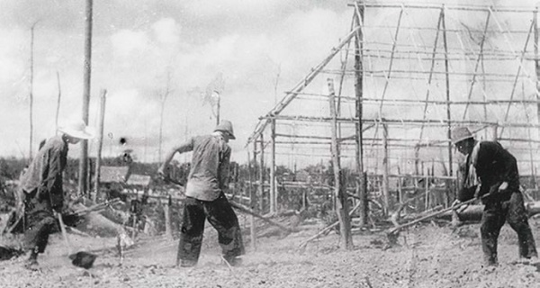
The second largest district in the state, Jelebu borders Seremban to its west and Kuala Pilah to its south, Jempol to its southeast, Bentong and Bera plus Pahang to its east and Hulu Langat in Selangor to the north. Jelebu has a somewhat blossoming semi-agricultural industry with Kuala Klawang the principal town of the district. Jelebu has an infamous recorded history of British and Japanese colonisation as compared to other parts of Negeri Sembilan. Numerous colonial artefacts were discovered in the small semi-agricultural town of Sungai Muntoh, which was once a prosperous mining town a century ago. These artefacts are now displayed in the state museum. The booming tin industry was one of the main reasons for the massacre in Titi, where more than 1,500 people, mainly Chinese, were killed. Altogether, about 5,000 people were killed by the Japanese-led army during World War II.

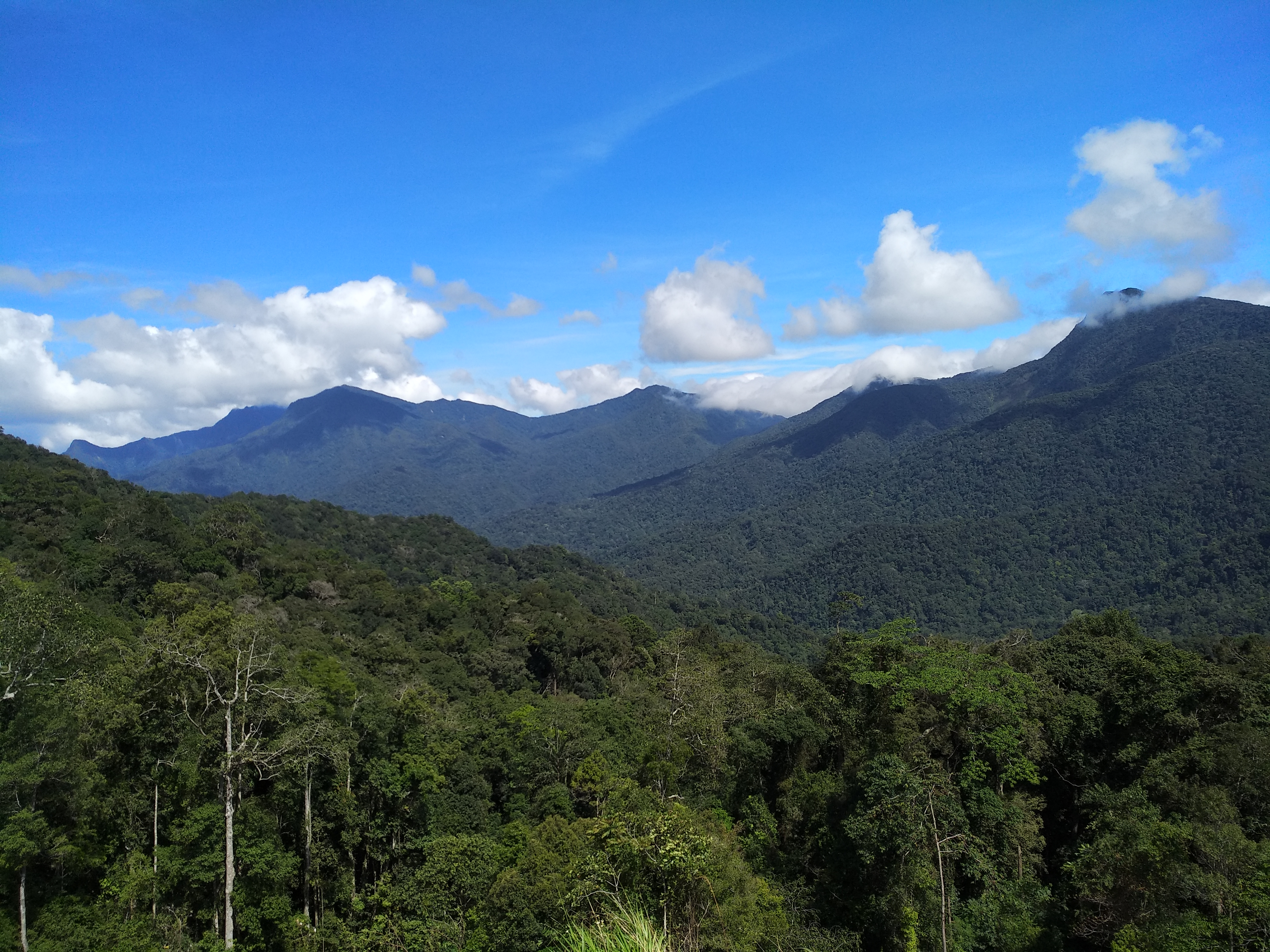
The Titiwangsa Mountains, the longest mountain range in Malaysia, transverses through Jelebu and so most of its terrain is generally heavily forested and mountainous, specifically in its northern and western regions. Jelebu has the warmest climate recorded in Malaysian history. The southwestern part of Jelebu is considered the driest place in Malaysia.

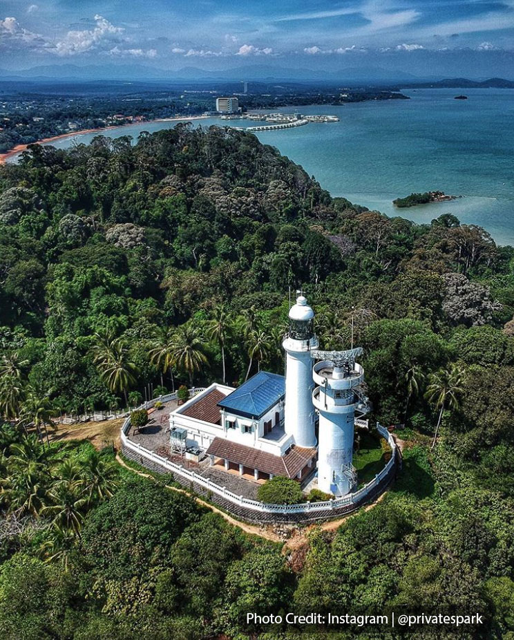
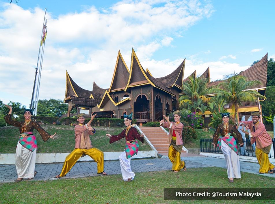
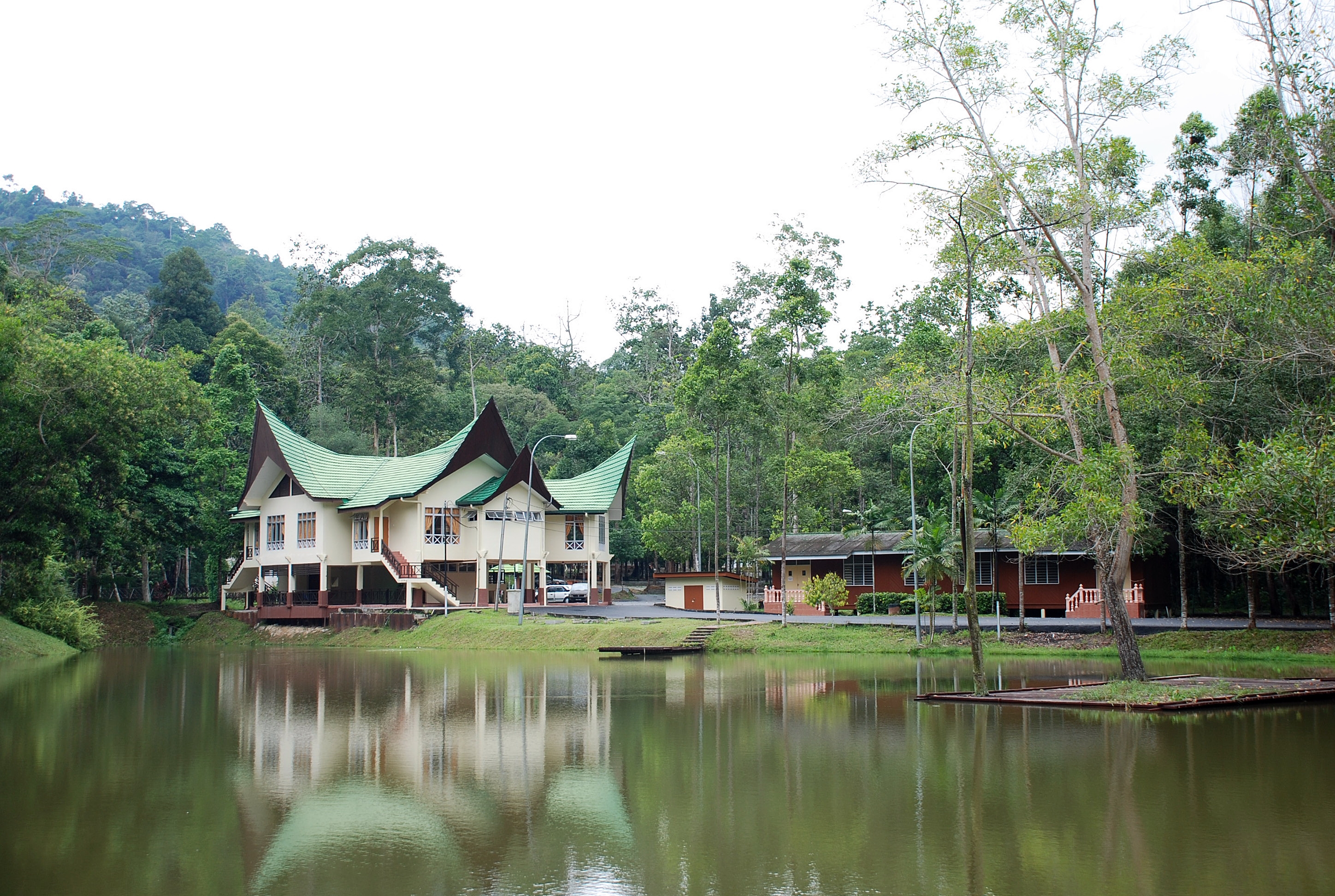
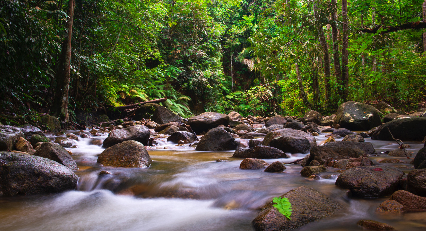
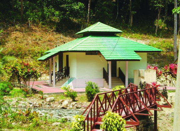
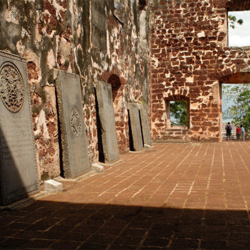
The Pasoh Caves, the southernmost limestone cave complex in Malaysia, is also located in Jelebu.  The caves are also known for being the first Paleolithic site in southern Peninsular Malaysia, as well as the southernmost in Malaysia. Some of the artefacts discovered here in an excavation are as old as 14,000 years. The Kenaboi State Park is nestled in the lush million-year-old rainforest amidst peaks of the Titiwangsa Mountains. The nature reserve is famous for being the main entry point to the tallest mountain in Negeri Sembilan, Mount Besar Hantu at 1,462 m and natural landmarks such as Lata Kijang, Lata Dinding and Lata Berungut. The Customs Museum or the Muzium Adat is a museum that exhibits the facets and lifestyle of the people of Negeri Sembilan. It was constructed in 2005 and officially opened on 2 February 2008. The museum is housed in a four-story building, with a giant replica of a Malay headdress at the top of its entrance and consists of four galleries, which include the introduction of customs, life cycle, intellectual tradition, government and power and Pepatih customs.

Seremban

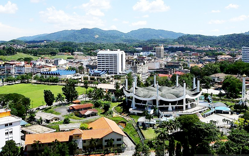
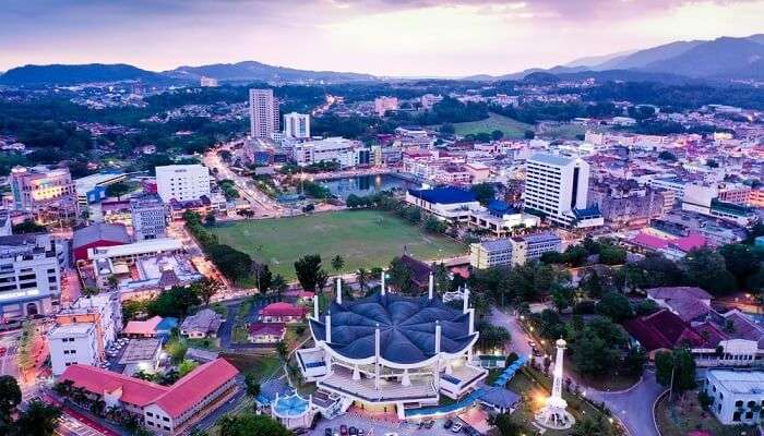
Originally founded as Sungei Ujong, Seremban is the capital of Negeri Sembilan and is named after a nearby river of the same name. The town gained its city status on 20 January 2020. Sungei Ujon still exists as road names and the name of the luak or chiefdom that formed Negeri Sembilan. Among the Chinese-speaking community, the city is known as Fùhyùhng in Cantonese and Fúróng in Mandarin which means hibiscus, which comes from a phonetic approximation of Ujong. Seremban lies about 60 km south of the country’s capital, Kuala Lumpur, about 55 km south of Malaysia’s administrative centre, Putrajaya and 40 km from the Kuala Lumpur International Airport. 

Sungai Ujong, or Sening Ujong, as it was originally known, was an ancient settlement. It has been said in the Malay Annals that King Parameswara reportedly visited Sening Ujong after fleeing the kingdom of Singapura before ultimately establishing the Malacca Sultanate. It was also referred to as Sang Hyang Ujong in Javanese accounts, notably the Nagarakretagama, as well as Suneujon in Godinho de Erédia’s cartographic records, which dates back to 1613. Growth took off after the discovery of tin ore in the 1870s and the discovery of tin in Rasah saw an influx of Arab, Malay and Chinese immigrants to work in the mines and trade there.

Renamed Seremban, the town flourished not only as a mining area but also as a business centre. The Linggi River served as the sole outlet to ferry tin and supplies in and out of the town. Revenue came not only from the tin trade but also from the large amount of taxes collected, much to the displeasure of the traders and the British in the neighbouring port of Malacca. Because of the local chieftains were at odds with each other, the British were able to assert their influence and authority in Negeri Sembilan.

Before 2020, Seremban was one of four state capitals that had yet to be elevated to city status; the other three being Kota Bharu in Kelantan, Kuantan in Pahang and Kangar in Perlis. To achieve city status, the Nilai Municipal Council and Seremban Municipal Council were merged to form a new local authority, Seremban City Council.

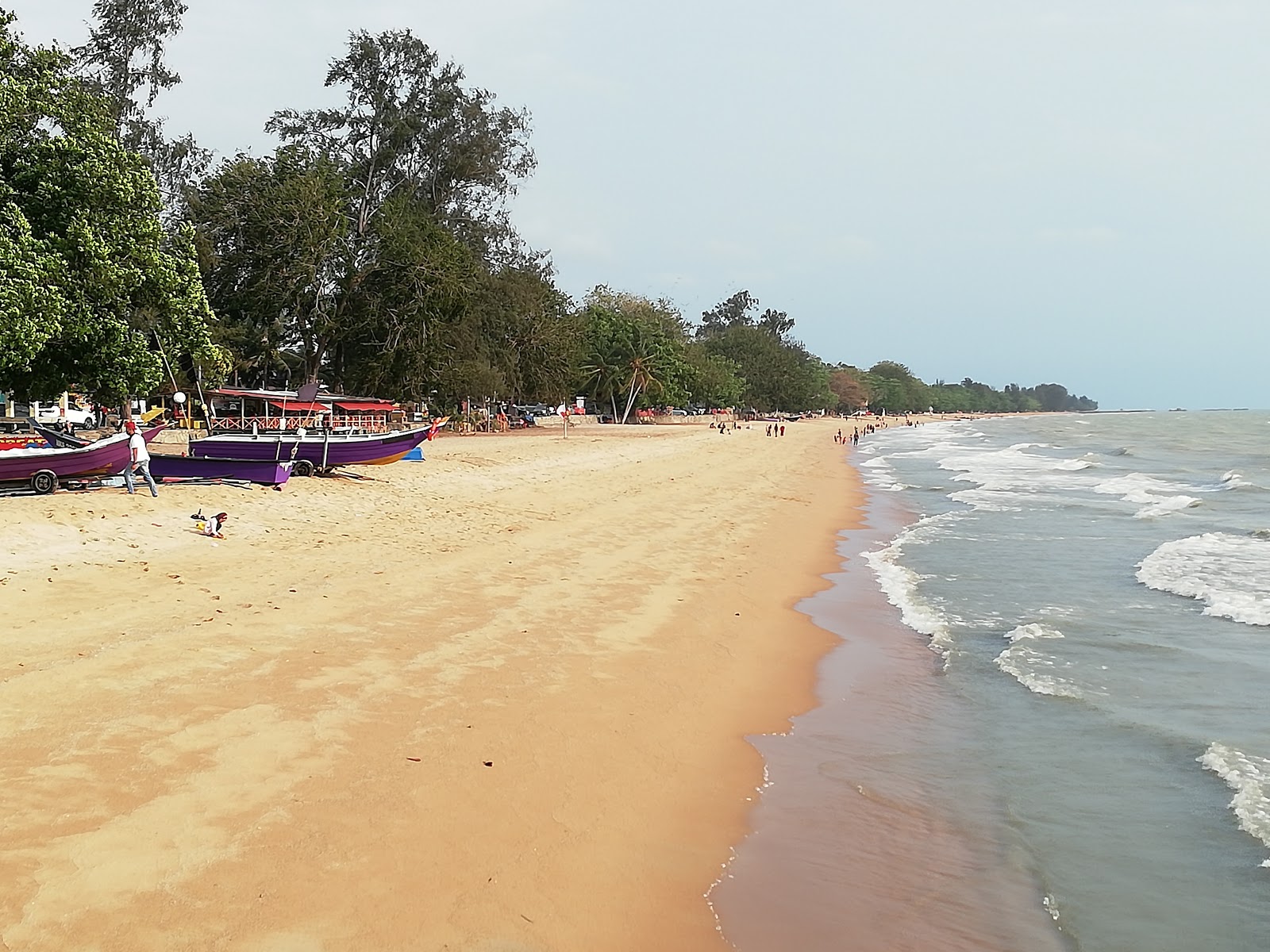
Seremban is situated about 60 kilometres south of Kuala Lumpur, the capital city of Malaysia, 50 kilometres south of the administrative capital Putrajaya, and about 30 kilometres inland from the coast. Part of the Malaysia Vision Valley corridor and the National Growth Conurbation, Seremban is considered to be the southern limit of the Greater Kuala Lumpur metropolitan area.[14][15] It is located in the Linggi River valley, at the western fringes of the Titiwangsa Mountains. The terrain is generally hilly, and the soil is mostly reddish laterite soil, suitable for the cultivation of rubber and palm oil, thus making Seremban the agricultural centre for the state. Since the establishment of Seremban, the Linggi River has played an important role in the city’s growth. During the boom period of tin mining, the Linggi River served as the major transportation route for tin traders. Today, it is one of the major sources of water for the Seremban metropolitan area and Negeri Sembilan.

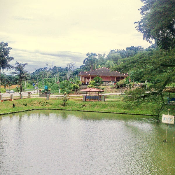
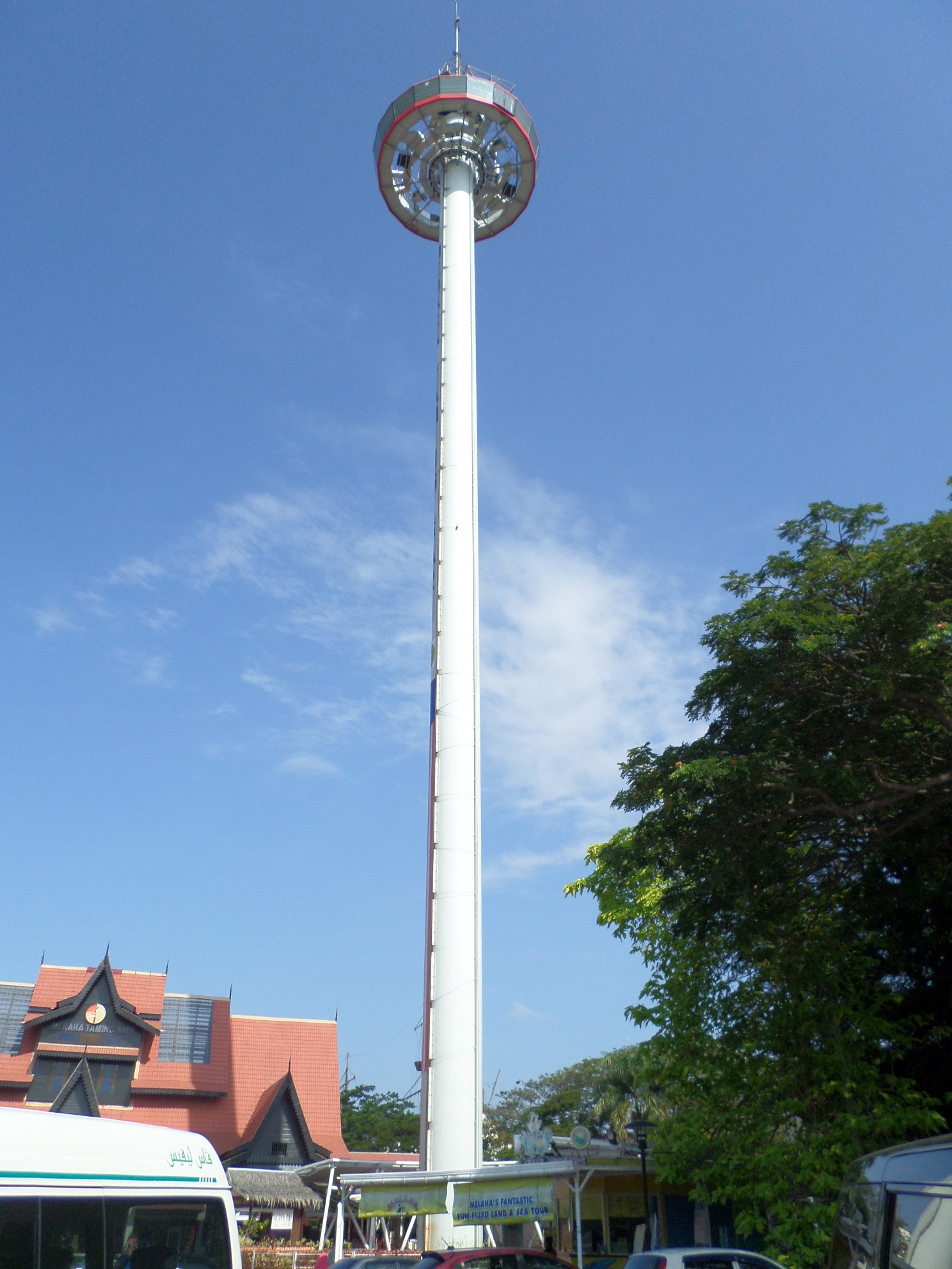
Dubbed the fish pond, Seremban Square is an area of open land in the downtown Seremban area which recently been given a new look. From a barren, neglected piece of land which was the breeding ground for mosquitoes, today it is known as Seremban Square, which decorates the main entrance to Seremban. Here, the Malaysian flag is raised on a flagpole standing 100 feet high. Taman Tasik Seremban which is also known as Seremban Lake Garden is one of Seremban’s major attractions. Surrounded by two lakes and a lush green garden, it is a jogging favourite and many local families like to come here, especially over the weekends and public holidays. One of Malaysia’s oldest natural gardens, the garden has a children’s playground and walking tracks as well as a floating stage on the lake which hosts performances over weekends. The Seremban 2 Recreational Park is another popular destination during weekends or school holidays. At this six-acre area, visitors will be greeted with breathtaking landscapes as well as a variety of colourful kite decorations flying freely in the sky.

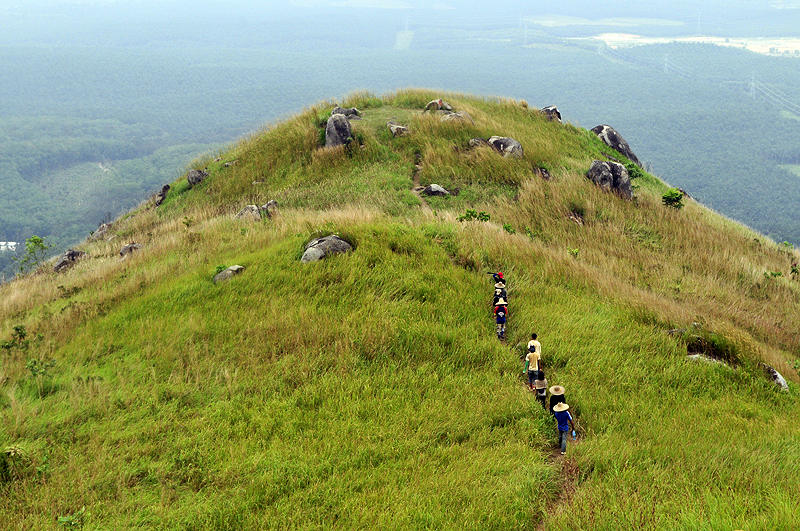
At the border of Selangor and Negeri Sembilan lies the small town of Broga, on which lies the Bukit Broga Hill. The hill is known for its beautiful views covered with lalang grass and palm oil plantations and is famous for its steep and adventurous hike uphill, giving a mesmerising view of sunrise and sunset. To experience the magical view while walking on the trail, walk about ten minutes after which the tiring trail starts being marked by the archway of the RHB Bank. The bank board also provides three halting and viewing points at 880 feet, 1150 feet, and 1312 feet. Over the years there has been an evident amount of damage to the pathway, so one should be careful on the main path and avoid any further damage. And because of this, it is best to avoid the hill during the monsoon season and when it rains as the path gets muddy and slippery as well as during the weekends when it gets crowded. Because it can get tiring in the sun, the best time to visit is between 9:30 am and 12 noon before the day is at its hottest. Proper hiking shoes are necessary as the way to the hill is slanted and it can be difficult to climb without proper shoes and other amenities. Parking is free and the entrance fee is RM 1 per person.

The Masjid Negeri Seremban or the State Mosque is located near the Lake Gardens. The nine pillars of this mosque symbolize the nine original states of Negeri Sembilan. The mosque features modern architectural elements as well as traditional Minangkabau architectural design. It is lit up at night when it is at its best.

The first French missionary church in Seremban, the Church of the Visitation was constructed in 1848 on two acres, surrounded by a tranquil panorama. Inspired by neo-gothic architecture, the church houses a historical Parochial House, Visitation Hall, and Formation Centres. The main hall is decorated with mosaics and stained glass windows. The church’s permanent structure was constructed in 1899 with new additions made over the years. The daily mass takes place on weekdays at 6:45 am while on Saturday, it is at 6 am and 7 am on Sundays.

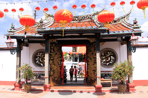
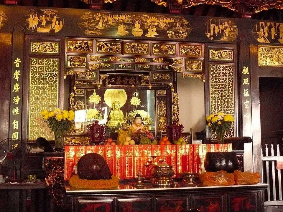
Perched on top of the Wu Gong Hill in Ulu Temiang, the Centipede Temple or the Then Sze Temple is set atop 264 steps. Centipedes roamed freely in and out of the temple grounds, and it is believed that if one spots a centipede, one can expect some good fortune. The centipede stone statue is the main attraction of this temple. The statue of Lord Yue Lao or the God of Marriage is also housed inside. Several couples hook red strings and lockets here and pray for a long union. Some of the other attractions include the tortoise pool, the Guan Yin statue, a pavilion dedicated to Guan Di, the Datuk Altar, and the Eight Immortals. While the Centipede Temple is a Taoist temple, it also contains Chinese and Buddhist elements. This temple is further adorned with ceiling hangings, a Qing Dynasty bell, beautiful lanterns, a drum, and an intricately decorated door. The temple is open daily between 7 am and 7 pm.

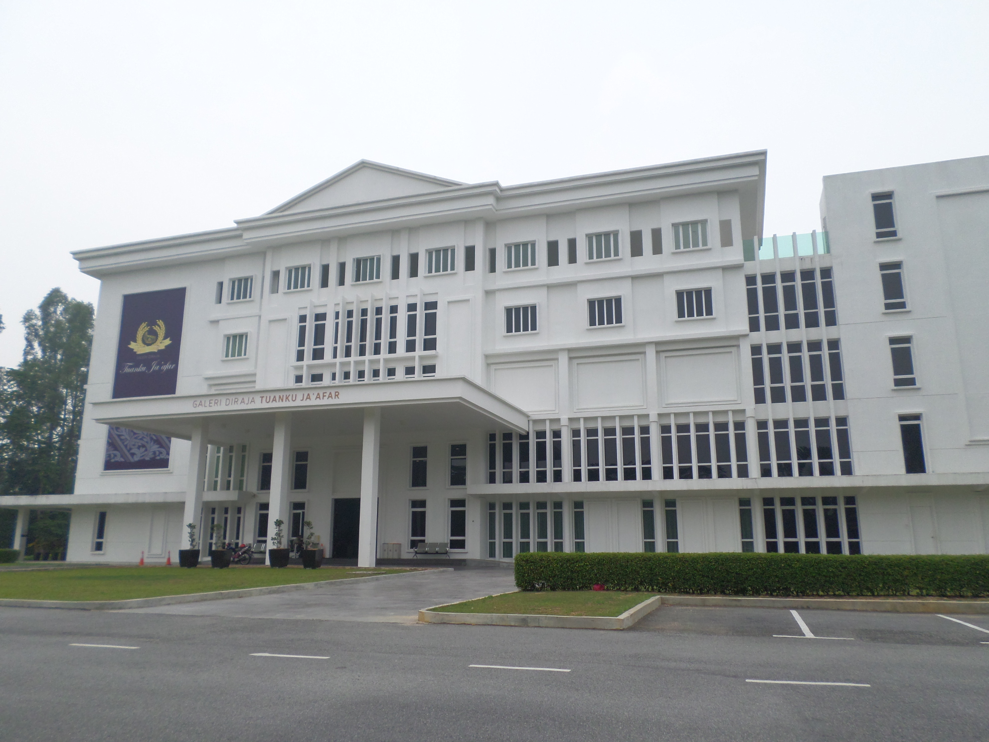
To know more about the former Negeri Sembilan Yang di-Pertuan Besar Tuanku Ja’afar, one must visit the Galeri Diraja Tuanku Ja’afar. He was the 10th Yang di-Pertuan Agong or constitutional monarch who ruled Negeri Sembilan for 42 years. Spanning across 3 storeys, this gallery is adorned with a colonial style of architecture and private collections of the late Malaysian ruler. There are nine exhibition halls, depicting the life of Tuanku Ja’afar inside the gallery. These exhibition halls depict the life of the ruler in chronological order.  Some of the details that have been showcased in the gallery include his early life, schooling, higher education, and hobbies. Photographs showcasing his meetings with famous world leaders and politicians are also housed inside the exhibition halls. The gallery also houses paintings made by the ruler himself. The museum is closed on Mondays and other days, it is open between 10 am and 5 pm. Entry fees are RM 10 for adults and RM 5 for children.

The Negeri Sembilan Museum was established in 1953 when the 8th Yamtuan or Ruler of Negeri Sembilan, Tuanku Abdul Rahman gave his consent for the relocation of the Ampang Tinggi Palace from Kuala Pilah to the Taman Bunga at Jalan Dato’ Hamzah, Seremban and this was turned into the State Museum.

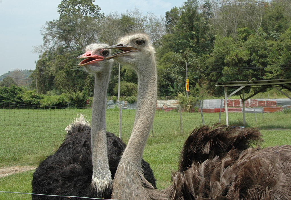
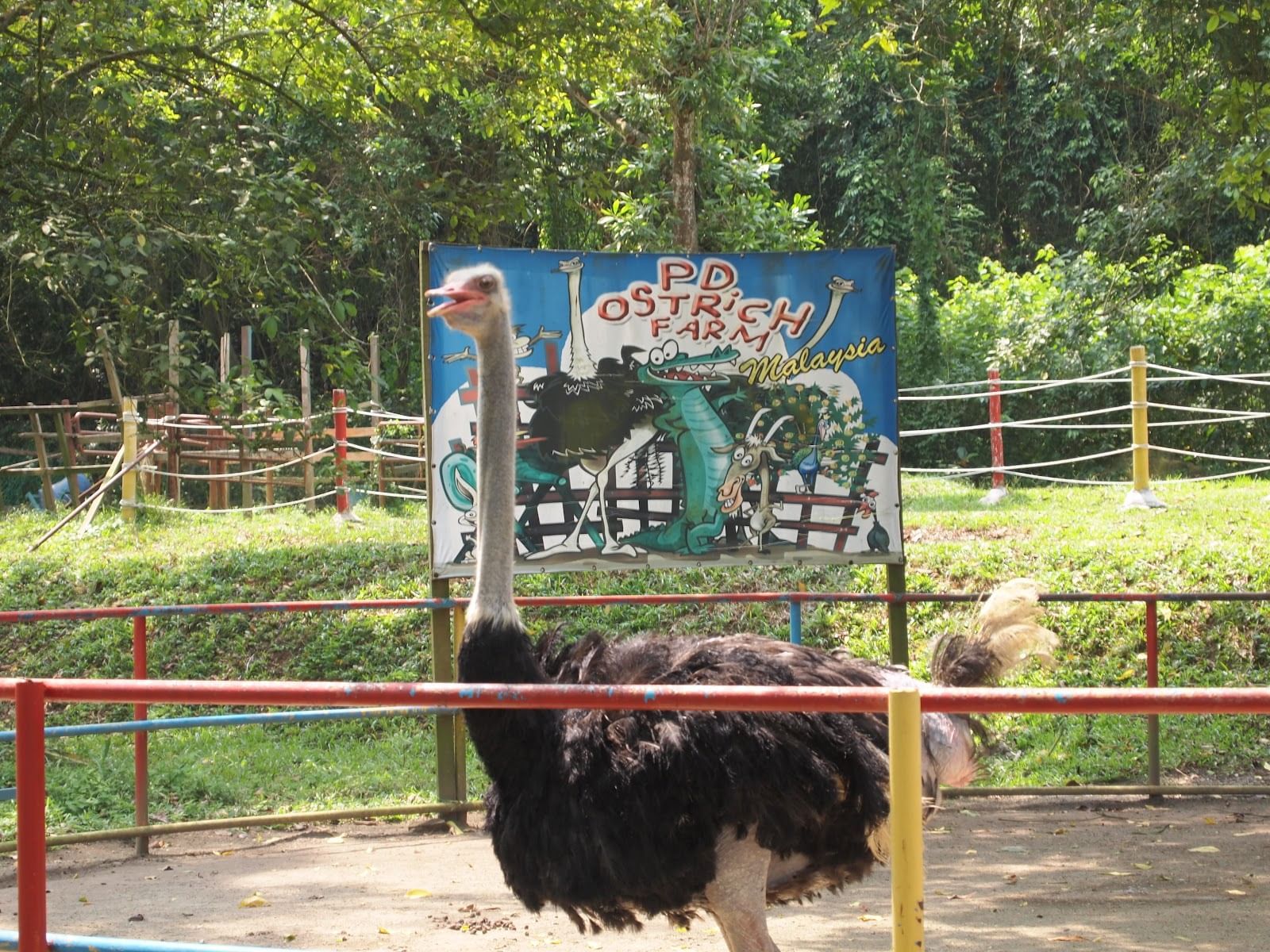
The Jelita Ostrich Farm is Malaysia’s first ostrich farm as certified by the Malaysian Book of Records. It is located on the outskirts of Seremban and is famous for its ostriches. This farm is also a haven for many other animals and birds like goats, geese, ducks, turkeys and horses. A walking tour is available to explore the farm. Visitors can compete in the man-against-egg challenge where visitors bag a chance to stand on the hard-to-break ostrich egg. The farm houses a souvenir shop selling an exclusive range of ostrich oil-based hair and skin care products and some ostrich essence. Entry fees are RM 8 for adults and RM 6 for children and the farm is open daily from 9 am to 5 pm.

Sri Menanti

The royal capital of Negeri Sembilan, Seri Menanti is located 33 km northeast of the state capital of Seremban. The town houses the seat of the Yang Di-Pertuan Besar of Negeri Sembilan or Yamtuan Besar, the ruler of the state. The royal palace is known as Istana Besar. The area under which Seri Menanti is known as the Adat Circle or Adat Lingkungan in Malay. Seri Menanti also governs the surrounding chiefdoms or luaks of Terachi, Gunung Pasir, Ulu Muar, Jempol and Inas, of which they are collectively known as Luak Tanah Mengandung.

The Minangkabau people moved to the wider area of Negeri Sembilan during the 14th century as part of the Minang practice of merantau. Around the 15th century, they moved further inland from Rembau and explored the area that is known today as Seri Menanti. Among the explorers was Datuk Puteh of Pagar Ruyung. According to legend, they found three stalks of fresh green paddy and thus Datuk Puteh christened the area Padi Menanti which means awaiting paddy. Over time the name changed to Seri Menanti. It is believed that the word Seri means the Goddess of rice in the ancient Javanese tradition.

Raja Melewar arrived in Negeri Sembilan in 1773 and was installed and proclaimed as the first Yamtuan Besar in Kampung Penajis in Rembau. He later moved his palace to Seri Menanti which remains the royal town of Negeri Sembilan.

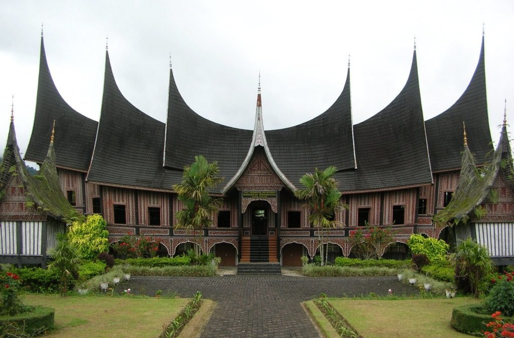
A few traditionally styled houses, a derivative of the Minangkabau design Rumah Gadang remain standing around Seri Menanti and in the adjacent villages. A significant portion of the land in Seri Menanti is Malay Reserve and Malay Customary Land or Tanah Adat.

The incumbent Tunku Besar of Seri Menanti is Tunku Ali Redhauddin, the eldest son of the Yang Di-Pertuan Besar of Negeri Sembilan Tuanku Muhriz ibni Almarhum Tuanku Munawir. The title of Tunku Besar Seri Menanti is the most senior of the Putera Yang Empat or the Four Princes. This is the third time in 120 years that the Tunku Besar Seri Menanti has been appointed. The official palace of the Yang Di-Pertuan Besar Negeri Sembilan is the Istana Besar. Completed in 1932, palace has numerous facilities with gardens that oversee the Straits of Johor. The palace complex consists of the Main Palace, the Throne Room or Balairong Seri, and the Royal Banquet Hall. However, it is not open to the public to visit but instead hosts royal banquets and events. Istana Seri Menanti is a beautiful 4-storied Malay architectural structure that was built without any nails. The palace exhibits costumes, weaponry, bed chambers as well as documents on the royal lineage on display in the museum.

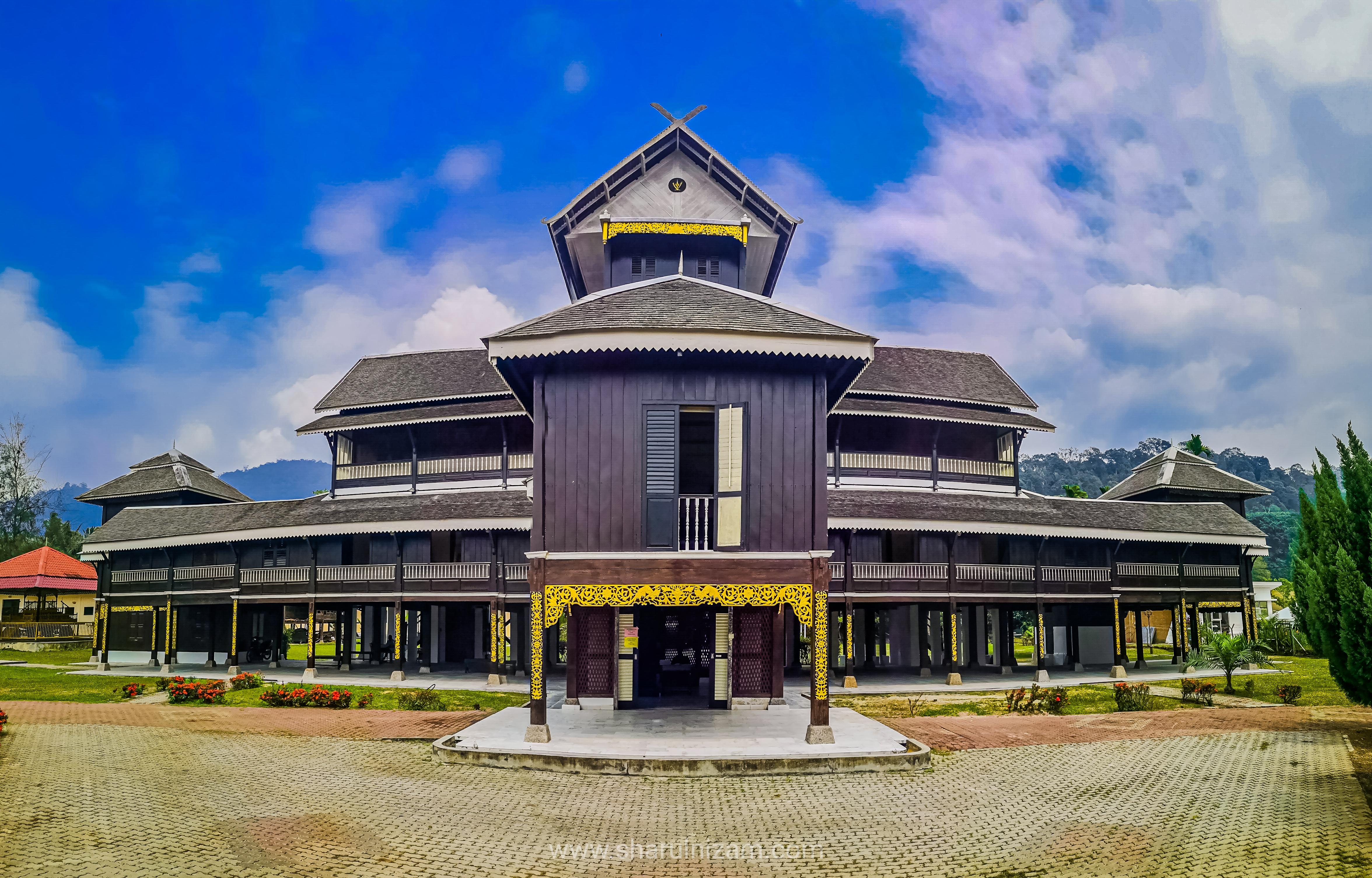
The old wooden palace, known as Istana Lama, was built and officiated during the reign of Yang Di-Pertuan Besar Tuanku Muhammad Shah ibni Almarhum Tuanku Antah who reigned between 1888 and 1933. It is made in part of Chengal or Penak wood Neobalanocarpus and ironwood or Belian wood and held together using only wooden pegs. The palace took six years to build and was completed in 1908 for $45,000. The design has subtle hints of Minangkabau architecture, with five levels rising to a height of sixty-seven feet or approximately twenty meters high and has ninety-nine columns to support the main structure. The Istana Lama was a replacement for the Istana Pulih which was burned down by the British. This palace was used until 1932 after which the Yang Di-Pertuan Besar moved to the Istana Besar. The Istana Lama has been designated as a national heritage site and was converted into a Royal Museum in 1992.

The Tuanku Munawir Royal Mosque, which was built in 1964 is located next to the Royal Palace. The architectural design has been credited to the Mughals, with golden domes roofs, minarets and triangular arches. There is a verandah and a serambi that shows the local intricacies.

And this brings us to the end of this delightful state which has something for everyone. Keep watching this space as we move to explore the state of Pahang next.

In My Hands Today…

Tamarind City: Where Modern India Began – Bishwanath Ghosh

‘While in other big cities tradition stays mothballed in trunks, taken out only during festivals and weddings, tradition here is worn round the year.’

This is just one of the author’s many keen observations of Chennai. With mordant wit, this biography of a city spares neither half of its split-personality: from moody, magical Madras to bursting-at-the-seams, tech-savvy Chennai. And, a minute into the book, the reader knows they are inseparable-and Bishwanath Ghosh refuses to take sides.

And yet, he tells us, while Chennai is usually known as conservative and orthodox, almost every modern institution in India-from the army to the judiciary, from medicine to engineering-traces its roots to Madras’s Fort St George, which was built when Delhi had only just become the capital of the Mughal Empire, and Calcutta and Bombay weren’t even born. Today, the city once again figures prominently on the global map as ‘India’s Detroit’, a manufacturing giant, and a hub of medical tourism. There have been sweeping changes since pre-Independent India, but even as Chennai embraces change, its people hold its age-old customs and traditions close to their heart. ‘This is what makes Chennai unique,’ says Ghosh, ‘the marriage of tradition and technology’.

Bishwanath Ghosh wears a reporter’s cap and explores the city he has made his home, delving into its past, roaming its historic sites and neighbourhoods, and meeting a wide variety of people-from a top vocalist to a top sexologist, from a yoga teacher to a hip transsexual, from a yesteryear film star to his own eighty-five-year-old neighbour, from the ghosts of Clive, Wellesley, Hastings and Yale to those of Periyar and MGR, two people who redefined the political skyline of Tamil Nadu.

What emerges is an evocative portrait of this unique city, drawn without reservation-sometimes with humour, sometimes with irony-but always with love.

Travel Bucket List: Malaysia Part 9 – Negeri Sembilan Part 2

Port Dickson

A beach resort and the second largest urban area in Negeri Sembilan after Seremban, Port Dickson is named after the British officer, John Frederick Dickson in 1989 and is a favourite weekend getaway for those from Seremban, Port Klang and Kuala Lumpur and even Singapore. The town is known for its high-end hotel establishments, army bases, pristine beaches facing the Strait of Malacca, and a lot more.

The town used to produce charcoal and therefore was called Arang which in Malay means charcoal. There used to be a carbon mine at the first mile of the coast road which was named Jalan Pantai, but was later developed as a small port by the British during the Straits Settlement period. Port Dickson was also known as Tanjung which means a Cape in Malay, alluding to the town centre’s location on a small peninsula. The oldest shophouses were the four situated presently at Jalan Lama.

Historically what is today Port Dickson and nearby Lukut were then part of the Luak of Kelang, one of the original nine chiefdoms or luaks that formed the first iteration of Negeri Sembilan in 1773. By the early 1800s, it was then part of Selangor. On 30 July 1880, a meeting was held in Singapore between Sultan Abdul Samad, then Sultan of Selangor, Raja Bot, the ruler of Lukut district, Dato’ Kelana of Sungai Ujong as well as the British, in which Selangor ceded the district of Lukut to Sungai Ujong which later became the modern-day Negeri Sembilan.

Tin ore was plentiful in Lukut, an area within the Port Dickson district, during the 1820s, and it attracted Chinese immigrant miners. The British considered the area to have great potential as a harbour and it was intended to supersede the port in Pengkalan Kempas. The officer in charge was named Dickson, and the town was named Port Dickson after him. Others claim that Sir John Frederick Dickson, colonial secretary, and a senior official of the Federated Malay States founded Port Dickson and Pulau Arang in 1889. Soon Port Dickson evolved into a busy trading centre and railways were constructed to facilitate the growth and development of the town. Although Port Dickson experienced rapid development, its beaches are fairly well preserved.

Port Dickson, as a resort town, thrives primarily on tourism, but other sectors also contribute to the town’s economic growth. Along with Seremban, Port Dickson is part of the 1530 sq km Malaysia Vision Valley, a growth corridor initiated by the state government which aims to develop the western half of Negeri Sembilan to complement the existing development in the neighbouring Klang Valley and the Greater Kuala Lumpur area. Port Dickson has two refineries which make significant contributions to the local economy.

A former mining town, most attractions in Port Dickson are concentrated around the coast – the beautiful beaches of Pantai Cahaya Negeri, Tanjung Tuan, Teluk Kemang, Saujana, and Bagan Pinang present a host of adventures and fun for families and adrenaline junkies. The 18 km long beach from Tanjung Gemuk to Tanjung Tuan is a holiday destination for locals, especially those who come from the Klang Valley. Many Singaporeans have invested in holiday homes in and around Port Dickson and over the years, many hotels and resorts were opened to capitalise on the tourist draw. In the 1990s, Port Dickson boomed with new hotels and resorts being planned and constructed. Due to the Asian financial crisis of 1997, however, many of these projects stalled, leaving many unfinished buildings scattered along the Port Dickson coastline. While some of these half-constructed resorts are still abandoned, with the improving economy of the 2000s, many of the projects were eventually revived and completed.

The newer five-star Admiral Marina & Leisure Club has good dock facilities for yacht travellers, sailboats and luxury cruisers and is a transit point for racing sailboats joining the Raja Muda Selangor International Regatta, the Royal Langkawi International Regatta and Thailand’s Phuket Kings Cup regattas.

Lying about 17 km south of Port Dickson right before Cape Rachado, the Blue Lagoon is a compact yet quite popular beach in the area. Locally referred to as Tanjung Biru, the beach is surrounded by a dense cover of hills and vegetation which makes the beach stand apart. Due to its proximity to the Tanjung Tuan Forest Reserve, wildlife sightings especially migratory birds, monkeys and squirrels are a common sight in this region. The water at the beach remains calm and is shallow which makes it safe for kids to play around in. This also makes for a great location for water sports. Hidden under the beach water lie several coral reefs which add to the ambience of the beach and are an attraction for divers. Blue Lagoon Beach also accommodates several market stalls, food vendors and a hawker centre which make it a great picnic spot. The best time to visit the beach is on a weekday between 10 am and 5 pm.

Located on a coastal strip between the 5th and 6th mile of Port Dickson, about 8 km away, Cahaya Negeri or Pantai Cahaya Negeri is a white-sandy gleaming beach. This shimmering beach features an artificial cape with a recreational park that accommodates some soothing picnic spots. This crowd-pleasing venue is quite popular for its phenomenal sunset views. There is a beautiful wooden bridge called Lover’s Bridge constructed on the eastern edge of the beach’s entrance which is a wonderful spot to take photographs and the bridge leads you to Pulau Burung or Bird Island a coastal mangrove area. On this island, there’s a wonderful watchtower which offers a jaw-dropping view of the coastline of Port Dickson. Activities like camping, hiking, water sports, boating, fishing, and barbeques can be done at the beach. There are public toilets available here which charge between 50 sen to RM 1.

Located on the 7th mile of the Port Dickson coastal road, Wan Loong Chinese Temple is a Buddhist Chinese Temple. Wan Loong means the Dragon of the Clouds and has been built to honour several deities including the Monkey King and Kuan Yin or the Goddess of Mercy. The temple has an aesthetic colourful appeal with its traditional architecture comprising carved Chinese motifs and dragons. The fortress wall of the temple and the pools full of colourful fishes and a giant turtle are its exclusive features. There is a tortoise in the temple pond which is believed to bring good luck when visitors touch it. It is recommended to visit the Wan Loong Temple between 9 am and 1 on to avoid excessive crowds.

Sri Anjaneyar Temple is a temple dedicated to the monkey god, Lord Hanuman and is quite famous owing to the mystical stories attached to it. It’s believed that the Hanuman statue placed in the shrine had itself turned its head to face the town of Rameswaram in Tamil Nadu in India. The head-shifting occurrence is said to have happened in 1996 when a foreign photographer was clicking pictures of the shrine. And when he returned to click some more shots, he was shocked to see the change in the position of the idol’s head. Some believe that due to the strong bond that Lord Hanuman shared with Lord Ram, the idol turned its head towards Rameswaram. According to others, the idol turned its head because Lord Hanuman was against the meat and alcohol that was originally offered in the temple. The temple is open daily, from 7:30 to 9 am and then again between 7:30 to 9 pm.

Cape Rachado is an enclave of the state of Malacca about 18 km from Port Dickson. It is the  Portuguese name for Tanjung Tuan and is the only coastal forest in Malaysia. Cape Rachado was declared a permanent forest reserve by the Forest Department of Melaka in 1921 and was also gazetted as an International Bird Area and a Wildlife Sanctuary. The forest reserve attracts bird watchers from all over and is visited by more than 300,000 migratory birds and more than 177 species of flora. It is well known for its iconic Cape Rachado Lighthouse. It’s a great place for visitors who want to experience the evergreen forest and the beautiful ocean in the same place. The Cape Rachado Lighthouse was built by the Portuguese in 1511 and was used to guide ships along the Straits of Melaka. It was rebuilt in 1863 and offers a spectacular view of the sea and the Straits of Melaka. With a height of 24 meters, the masonry tower is accessible only by foot and is located in an enclosed woodland, which makes it a perfect spot for bird watching. March would be the ideal time to visit Cape Rachado as the Raptors Watch takes place during this time of the year. The morning hours of the day are usually the ideal time to visit the place as it’s cooler. There is an entry fee of RM 1 to access the place.

The Lukut Fort and Museum is a historical recreational site in Port Dickson. The fort was built in 1847 by Raja Jumaat and is in ruins today. Its antiquities are displayed in the Lukut Museum which was built in 1999. Located 6 km from Port Dickson, the Lukut Fort and Museum is now a recreational historical site with a park and gazebos maintained by the government. The entrance is free to the fort and museum. The museum is situated in a former bungalow of a district officer. This double-storey building has 4 galleries housing artefacts relating to the local history dating back to the tin mining era, culture and traditions. One of the artefacts on display includes a Portuguese bronze canon from a shipwreck during the Battle of Cape Rachado. Other displays include pottery shards, stoneware plates, porcelain belonging to the Qing Dynasty and clay floor tiles. Gallery C & D are temporary exhibition galleries displaying exhibits relating to different themes every year. The fort and museum are open between 9 am and 6 pm and entrance is free.

Set in two old army buildings, the Port Dickson Army Museum is dedicated to Malaysian army artefacts. Also known as Muzium Tentera Darat, it houses 9 galleries along with outdoor exhibits that trace the army from the 16th century Melaka Sultanate to the British era. One very interesting exhibit is the CPM or the Communist Party of Malaya Tunnel which has been recreated underground similar to the one used by the bandits who conducted all their activities here during the Emergency. There’s a collection of various military aircraft and helicopters, armoured vehicles, field guns, artillery pieces and a steam locomotive on display here. Another gallery focuses on the modern army and its UN peacekeeping missions. The museum has a cafe, a souvenir shop, toilets and a surau as well. The museum has free entry fees and is open between 9:30 am and 6 pm.

Home to paintings and optical illusions, the Alive 3D Art Gallery leaves visitors amused and enthralled. The paintings are three-dimensional which let the people be a part of the painting. The paintings are divided into five zones. The Wild West Cowboy Indoor Theme Park is a must-visit if one is planning to go to the gallery. The gallery is open from 11 am to 10 am on weekdays and Sundays and from 10 am to 11 pm on Saturdays. The Wild West Cowboy Theme Park is open from 12 noon to 10 pm on weekdays, 10 am to 11 pm on Saturdays and 10 am to 10 pm on Sundays and Public holidays. It is closed on Tuesdays unless it is Malaysia School Holiday or Public Holiday.

The Teluk Kemang Observatory, also known as the Baitul Hilal Complex is a modern space observatory and is one of the most reputed observatories in the region and boasts of an extensive collection of sophisticated telescopes. The observatory provides a jaw-dropping view of the Straits of Melaka and is a perfect setting for stargazing. It is a popular place for astronomical gatherings and observations. One of its telescopes, a 24-inch spectacular beauty was purchased for RM 2 million and is well known for its accurate observations. The view from the telescope is dependent on the weather and the night sky, however, visitors can even see Saturn or Jupiter on a clear day. The observatory is open between 3 and 5 pm and again between 10:30 pm and midnight.

Pusat Ikan Hiasan is a fish centre located at the northern end of Port Dickson in Teluk Kemang. The centre boasts a wide diversity of fish species and also acts as a breeding and conservation centre for marine life. It is famous for its sea turtles on display and traces their lifecycle from hatchlings to adulthood. The port is being managed by the Department of Fisheries and also holds an incubator site for commercial coral reef entrepreneurs. The market is open from 8:30 am to 4:30 pm on weekdays and is closed for a prayer break on Fridays between 12:15 and 2:45 pm. On weekends it is open from 10 am to 4 pm.

The PD Ostrich Show Farm is an ostrich farm popular for ostrich and pony rides. The show farm offers activities like petting and feeding ostriches, rabbits, horses, peacocks and guinea pigs and learning interesting facts about ostriches. Children particularly have a wonderful time at the PD Ostrich Show Farm where they get to run around rabbits and enjoy ostrich rides. The show farm has a cafeteria where one can enjoy the signature Ostrich Satay. It is open between 9 am and 6 pm every day. Entry fees are RM 15 for Malaysian adults and RM 10 for children who are Malaysian. For foreigners, adults pay RM 20 while children pay RM 10.

Kuala Pilah

Kuala Pilah lies 40 km east of Seremban. The charm of this old valley town lies in its Chinese shophouses surrounded by traditional Malay village houses built on stilts. The countryside is a breath of fresh air with clear fresh water from Mount Angsi. A wonderful dragon fruit cultivation can also be seen here with beautiful kampongs and paddy fields on the way. Kuala Pilah is also known for its Minangkabau houses with a sloping buffalo horn roofline. There are rows of small shopping outlets in the newer and central suburbs.

Located in Johol, the Batu Maloi Cave is a 2.4-kilometre-long talus cave made up of fallen boulders of granite with a river flowing through it. It is said to be the longest granite cave in Malaysia and is popular among cavers. The Ulu Bendul Recreation is one of the most popular tourist attractions in Kuala Pilah. It is situated in the Angsi Forest Reserve, compartments 45 and 52 and is about 16 km away from Seremban. The site was established in 1972 and is a fun spot to hike and trek in the jungle paths. The Martin Lister Memorial, an arch designed in Chinese fashion, was established in 1901. It is a historical site that one can visit to pay respects and commemorate the Late Martin Lister who was killed for his efforts to end the violence and conflict of the secret Chinese societies that tortured Chinese migrants. The Sikh Gurudwara Sahib and the Sri Kanthasamy Temple as well as the Masjid India are places of worship in the town.

Travel Bucket List: Malaysia Part 8 – Negeri Sembilan Part 1

Historically spelt as Negri Sembilan, Negeri Sembilan lies on the western coast of Peninsular Malaysia and borders Selangor to the north, Pahang in the east, and Malacca and Johor to the south. The state has diverse tropical rainforests and an equatorial climate with mountain ranges belonging to the Titiwangsa Mountains, a southern subrange of the Tenasserim Hills that spans throughout southern Myanmar, southern Thailand and Peninsular Malaysia, with Mount Besar Hantu as the highest point. It is the fourth-smallest state in Malaysia by area as well as the second-largest in the southern region after Johor.

The state’s name is believed to derive from the nine or sembilan villages or nagari in the Minangkabau language that is known as Luak today settled by the Minangkabau, a people originally from West Sumatra in present-day Indonesia. Minangkabau features are still visible today in traditional architecture and the dialect of Malay spoken.

Unlike the hereditary monarchs of the other royal Malay states, the ruler of Negeri Sembilan is elected and is known as Yang di-Pertuan Besar instead of Sultan. The election of the Ruler is also unique among all Malay states. He is elected by the council of Undangs who lead the four biggest territories of Sungai Ujong, Jelebu, Johol, and Rembau, from the legitimate male members of the Pagaruyung Dynasty, with the surviving sons of the previous Yamtuan coming first in the considerations but not being obligatory to be voted on, making it one of the more democratic monarchies.

The capital of Negeri Sembilan is Seremban and the royal capital is Seri Menanti in Kuala Pilah. The Arabic honorific title of the state is Darul Khusus or the Special Abode.

The earliest possible human settlement in Negeri Sembilan can be traced back to the Pasoh Caves, a complex of karst caves near Simpang Pertang. Some of the artefacts found around the caves include stone tools and food leftovers, estimated to be used around 12,000 BC based on carbon dating.  According to the Malay Annals, Parameswara reportedly visited the settlement of Sening Ujong, which was located in what is now Seremban.

The Minangkabaus from Sumatra settled in what is today Negeri Sembilan in the 15th century under the protection of the Malacca Sultanate, and later under the protection of its successor, the Sultanate of Johor. They also brought their matrilineal custom, known as Adat Perpatih, with them and made it the local custom. As Johor weakened in the 18th century, attacks by the Bugis forced the Minangkabaus to seek protection from their homeland. The Minangkabau ruler, Sultan Abdul Jalil, obliged by sending his near relative, Raja Mahmud, also known as Raja Melewar. When he arrived, he found that another royal, Raja Khatib had already established himself as ruler. He declared war against Raja Khatib and became the ruler of Negeri Sembilan. The Sultan of Johor confirmed his position by granting the title Yamtuan Seri Menanti or He Who is Highest Lord of the Seri Menanti in 1773.

Negeri Sembilan, at the dawn of her establishment, was originally a loose confederation consisting of nine luaks, hence the name. At the time of Raja Melewar’s accession, it used to cover a larger area than its modern-day boundaries. Besides modern-day Negeri Sembilan, it also spanned parts of what is today Selangor, Malacca, Pahang and Johor. The original nine chiefdoms or domains in 1773 that made up the first incarnation of Negeri Sembilan and gave the state its name are Sungai Ujong, Jelebu, Rembau, Johol, Jelai, Ulu Pahang, Naning, Segamat and Klang. The latter four chiefdoms were annexed into neighbouring states in the 19th century. Naning was annexed into the Straits Settlement of Malacca in 1832 following the Naning War; Ulu Pahang became the Bera region of Pahang, Segamat was annexed into Johor and Klang became the Kuala Langat region of Selangor.

After Raja Melewar’s death, a series of disputes arose over the succession. For a considerable period, the local nobles applied to the Minangkabau ruler in Sumatra for a ruler. However, competing interests supported different candidates, often resulting in instability and civil war. In 1874, the British intervened militarily in a leadership tussle in Sungai Ujong to preserve British economic interests and placed the domain under the control of a British Resident. Jelebu followed in 1883 and Rembau in 1887. The formation of modern Negeri Sembilan began in 1889, when the Seri Menanti domain, under the rule of Tuanku Muhammad, the son of Yamtuan Antah, combined with the domains of Tampin and Rembau, forming the Seri Menanti Confederation as a single political entity. The domains of Sungai Ujong and Jelebu joined this confederation in 1895, forming the state of Negeri Sembilan in its modern borders. Martin Lister became the new state’s first Resident, and Negeri Sembilan became part of the Federated Malay States the same year.

Negeri Sembilan endured Japanese occupation in World War II between 1942 and 1945, joined the Federation of Malaya in 1948, and became a state of Malaysia in 1963. In the 1990s and 2000s, Seremban and Nilai attracted people who moved in from the overcrowded towns of the Klang Valley. These two cities also became the sites of new factories and industrial parks, accelerating the development of the state into modern times. On 9 September 2009, the state capital of Seremban was approved to become a city or a Bandar Raya and Seremban achieved the status of a city on 20 January 2020.

Negeri Sembilan is composed of two vast plains divided by a mountainous spine in the middle, well-drained by various rivers, resulting in the state being bisected into two regions, namely western Negeri Sembilan consisting of Port Dickson, Seremban and Rembau Districts and eastern Negeri Sembilan, which covers the districts of Jelebu, Kuala Pilah, Jempol and Tampin. The western half seems to be more developed and has an intricate and concentrated road network compared to the latter, which is much more rural. Negeri Sembilan is a multiethnic state in which every ethnic group speaks their respective languages and dialects. The state has the highest percentage of Indians compared to other Malaysian states. The Negeri Sembilanese people speak a unique variety of Malay known as Negeri Sembilan Malay or in their native language as Baso Nogoghi. It is not closely related to other varieties of Malay in Peninsular Malaysia but more closely related to the Malay varieties spoken in neighbouring Sumatra especially varieties of Minangkabau. Besides Malays, the Chinese community also speak their languages and dialects. Orang Asli peoples like Temuans speak a language closely related to Malay. Standard Malay is widely used throughout the state.

The Minangkabau people brought along with them a cultural heritage which is still preserved and practised today known as the Adat Perpatih, a matrilineal system of inheritance and administration that is unique to the state. In this system, the husband is the head of the household and inheritance passes from the mother to the daughter. The Minangkabaus in Negeri Sembilan are divided into twelve sukus or clans. Each of these sukus is led by a chief, known as the Lembaga and each suku is broken down into subunits known as the Perut, where each of them is led by a chief, either known as a Buapak if a male or Ibu Soko if female. Both the Buapak and Ibu Soko play a vital role as people to refer to regarding the adat and religious matters among the subordinates of the Perut, known as Anak Buah. Marriage between members of the same clan is forbidden.

For the state of Negeri Sembilan, let’s work our way from the south to the north.

Source

Tampin

Bordering the state of Malacca, Tampin borders the town of Pulau Sebang in Malacca. It is also situated at the southern tip of the longest mountain range in Malaysia, the Titiwangsa Mountains. The state borders between Negeri Sembilan and Malacca is demarcated by the traffic lights across Jalan Besar, as seen from the Negri side of the town.

Tampin gets its name from the container or pouch woven from the pandanus fronds. The container was used to store condiments such as the sticky dessert kelamai or dodol and the shrimp paste, belacan.

Tampin was originally part of the district of Rembau. After the Naning War in 1832, Raja Ali declared himself the ruler of Seri Menanti and his son-in-law, Syed Shaaban, as the ruler of Rembau. This enraged other rulers of Negeri Sembilan as they had no right to the posts. In a civil war in 1834, Raja Ali and Syed Shaaban retreated to Tampin and the area from Mount Tampin to Bukit Putus was removed from Rembau. The provinces of Repah, Keru, Tebong and Tampin Tengah formed the district known as Tampin. Syed Shaaban became the first ruler of Tampin and proclaimed himself the title Tunku Besar Tampin. The district is one of the original confederations of nine states collectively known as Negeri Sembilan, which means Nine States in Malay.0

On 11 March 1889, the Governor of the Straits Settlements, Sir Cecil Smith, held a meeting with the rulers of Jelebu, Sungai Ujong, Rembau, Seri Menanti and Tampin to combine the districts to better manage them under British rule. Tampin, Rembau and Seri Menanti agreed to the proposal and were united as the Seri Menanti Confederation and the newly formed confederation accepted Martin Lister as its first British Resident. After Malaya’s independence in 1957, Negeri Sembilan and its districts started forming local administrative councils.

Source

The Tampin Recreational Park is strategically located and consists of a natural lake, along with lush greenery and various facilities such as a children’s playground, badminton courts, tennis courts and jogging tracks. Tampin Square is located within the vicinity of the Tampin Sports Complex and a local favourite. The Tampin Lake Garden is located about 400 meters from the Tampin Lay By and is equipped with a children’s playground, a look-out tower, huts, benches and jogging tracks. An 8-foot marble monument was erected on the Kelamah River to commemorate the war between the Australian and Japanese military advance on 14 January 1941 during World War II.

Located in the southern corner of the state, Mount Tampin is the geographical southern terminus of the Titiwangsa Mountains, at an elevation of 764 m. Man-made pools on this mountain allow visitors to enjoy the clean and clear water. The existing 5 km hiking track up to the mountain top will be transformed into a jogging and exercising track as locals frequented this mountain in the evenings and weekends.

The Balai Tunku Besar Tampin is the official residence of the ruler of Tampin, the Tunku Besar. Historically, Tampin used to be part of the district of Rembau before it was partitioned in 1836 when the southern area of Rembau around Tampin was being recognised as a new luak or state with its ruler. Unlike the other luaks in Negeri Sembilan where the ruler is known as Undang Luak, the ruler of Tampin is known as Tunku Besar and the post is a hereditary one.

Tempin is located on the junction between the east and west coast railway lines of the Keretapi Tanah Melayu Berhad’s or KTMB railway network. The Gemas Railway Museum is located in what was the former Gemas railway station, which ceased operations in 2013 after 91 years of service, when the new station building was completed, as part of the electrification and double tracking of the Seremban-Gemas section of the West Coast Line.

Jempol 

The largest district in Negeri Sembilan, Jempol borders Jelebu to the northwest, Kuala Pilah to the west, Tampin to the south, Bera and the state of Pahang to the northeast and Segamat and the state of Johor to the east. Jempol is also the meeting point of the Muar and Serting Rivers which played an important transportation role in ancient times. Known historically as Jalan Penarikan, it connected trade posts west of the Malay Peninsula with population centres on the east coast and vice versa.

The Ulu Serting Forest Park lies about 8 km from Batu Kikir Town in Compartments 23 and 24 of the Sering Forest Reserve. It is made up of Dipterokarp Pamah and is rich with a variety of flora and fauna. Some basic amenities have been built by the State Forest Department in the form of rest huts, food stalls, and a bathing pond for the comfort of visitors.

The De Bana Forest Park is located in compartment 129 of the Pasom Forest Reserve on the road to Triang Town in Pahang. The forest park got its name from a river that flows through the middle of the forest park, the Bana River. The forest is made up of Dipterokarp Pamah and is rich with a variety of vegetation including wild orchids, and herbs such as Tongkat Ali and Kacip Fatimah. The hilly terrain offers ready-made areas for activities such as jungle trekking and hill climbing. There are basic amenities built by the Forest Department including rest huts, toilets, camping sites, and forest huts.

Travel Bucket List: Malaysia Part 7 – Malacca Part 3

Melaka River Walk
The clear and narrow Melaka River flows through the middle of Melaka city from Negeri Sembilan, ending in the Straits of Melaka. Dubbed the Venice of the East, the River Walk is a promenade with food joints and shops on both sides and is pleasant to walk around. The river and beautiful paintings drawn on the buildings provide a contemporary look. The best time to visit is during dusk when the surroundings glow with colourful decorations and lights.

Melaka River Cruise
The Malacca River, near its mouth, flows in the middle of Malacca City. This section of the river was developed as a tourist attraction in the city as the Malacca River Cruise, of which tourists would hop on a boat and embark on a 45-minute sightseeing tour of the city and its historic core as it cruises along the river, from Pengkalan Rama in the east to Bandar Hilir near the coast of the Strait of Malacca. The day cruise provides a detailed view of the natural surroundings and the night view is for enjoying the man-made creations. It is best to visit at night when the surroundings glow with decorative lights. There are three main types of cruises. On the Dinner Cruise, one can explore the vibrant and historical surroundings while enjoying a delicious meal in the riverboat. There are individual bookings available along with bookings for special and private events. The river cruise runs between 9 am to 11 pm every day. VIP Cruises can be booked in advance and provides facilities like live entertainment along with enjoying the surroundings. The VIP cruise runs between 8 am to 11 pm on Fridays and Saturdays. There is also a Water Taxi which allows visitors to explore the beauty of Pulau Udan, Pulau Upeh, Pulau Nangka, and Hanyut dan Pulau Besar and runs between 9 am and 11 pm daily. Tickets can be purchased from the counter near the Spice Garden Jetty or Melaka River Square Jetty and can be purchased both online as well as offline onsite. Ticket charges are RM 30 for foreigners above 12 years, while it is RM 25 for those between 2 and 12. For Malaysians aged 12 and above, the cost is RM 25 and children between 2 and 12 need to pay RM 15.

Bridges at Melaka River that one passes during the cruise include the Tan Boon Seng Bridge which is a bridge with historical importance as the river passes the bridge coming from the Dutch Square and it was closed to cut communications between both sides when the Portuguese invaders came to Melaka. The Ghost Bridge of Melaka connecting Kampung Pantai and Kampung Jawa, was a place of violence and destruction during the invasion of the Japanese. Therefore, this pedestrian bridge was given such a name. The Old Market Bridge is a pedestrian bridge linking Kampung Hulu with the Old Market area. The Chan Koon Cheng Bridge helps in connecting the two parts of Chinatown linking Kampung Jawa. Cathay Bridge is used by those who want to walk from the Old Bus Terminal to the other side of the River which is known as Old Cathay. Jalan Hang Tuah Bridge near the Old Plaza Inn, connects Jalan Abdullah with Jalan Hang Tuah and hence it has been named after it. The Tan Kim Seng Bridge connects the residential and commercial zone to St. Paul Civic Zone, providing the link to both sides of the river.

The cruise also passes by attractions like the Red Building, Stadhuys, Bastion Middleburg, Jonker Street, pre-war buildings, colorful murals, the Water Wheel, Panggung Bangsawan, Kampung Hulu Mosque, Kampung Morten, Church of St. Francis Xavier, and the Bakau Route.

Saint Paul’s Church
Built in 1521, St. Paul’s Church is the oldest in Southeast Asia and Malaysia. It is located at the summit of St. Paul’s Hill and is today part of the Malacca Museum Complex comprising the A Famosa ruins, the Stadthuys and other historical buildings.

The original structure was a simple chapel built in 1521 dedicated to the Virgin Mary and known as the Nossa Senhora da Annunciada or Our Lady of the Annunciation. The chapel was built by a Portuguese fidalgo or nobleman, Duarte Coelho, as an act of gratitude following his escape from a storm in the South China Sea. The chapel was deeded to the Society of Jesus in 1548 by the Bishop of Goa, with the title deeds received by St. Francis Xavier. The chapel was then further enlarged in 1556 with the addition of a second floor, and a belfry tower was added in 1590. The chapel was then renamed the Igreja de Madre de Deus or the Church of the Mother of God. A burial vault was opened in 1592. In 1548, St. Francis Xavier established a school on the premises of the chapel known as St. Paul’s College. This was perhaps the first school in the modern sense to be established on the Malay peninsula. St. Francis Xavier used the church as his base for his missionary journeys to China and Japan and during one of those journeys, he fell sick and died in 1552 in Shangchuan Island, China. In 1553, the body of Xavier was disinterred from Shangchuan Island and temporarily buried at the church before it was finally shipped to Goa. An open grave in the church still exists today marking the place of Xavier’s burial.

After the conquest of Malacca by the Dutch in 1641, the church was reconsecrated for Dutch Reformed use as St. Paul’s Church and was also known as the Bovenkerk or High Church. The church remained in use as the main church of the Dutch community until the new Bovenkerk, better known today as Christ Church Malacca was completed in 1753. The old church was then subsequently deconsecrated and the structure was modified and strengthened as part of the fortifications of Malacca. The nave of the church was then used as a churchyard.

When the British occupied Malacca in 1824, the church was used as a powder magazine and was allowed to deteriorate further. In 1849, a now-defunct lighthouse, which consists mainly of a lantern and gallery mounted on an arched base and is solely accessible from ground level via a small ladder, was installed in front of the church as an additional beacon for ships travelling along the Strait of Malacca. It is an approximately 13-metre high, three-storey square white tower, which adopted basic elements from neoclassical architecture with no outbuildings, assuming an angular form different from many of its cylindrical and cone-shaped counterparts throughout the region. In 1924, the old Portuguese burial vault in the chancel of the church was partially uncovered. It was in this period that the tombstones that were scattered around in the vicinity of the church were affixed to the walls.

In 1952, a statue of St. Francis Xavier was erected in front of the ruins of the church in commemoration of the 400th anniversary of his sojourn in Malacca. A day after the statue was consecrated, a large casuarina tree fell on it, breaking off its right arm.

Christ Church
An 18th-century Dutch-built Anglican church which was originally Dutch Reformed, Christ Church is the oldest functioning Protestant church in Malaysia. The Dutch conquest of Malacca from the Portuguese Empire in 1641 saw the proscription of Roman Catholicism and the conversion of existing churches to Dutch Reformed use. The old St. Paul’s Church at the summit of St. Paul Hill was renamed the Bovenkerk or the Upper Church and used as the main parish church of the Dutch community.

In 1741, in commemoration of the centenary of the capture of Malacca from the Portuguese, the Dutch burgher community decided to build a new church to replace the ageing Bovenkerk. The church was completed 12 years later in 1753 and replaced the Bovenkerk as the primary Dutch Reformed Church in Dutch Malacca. With the signing of the Anglo-Dutch Treaty of 1824, possession of Malacca was transferred to the British East India Company and in 1838, the church was re-consecrated with the rites of the Church of England and renamed Christ Church. The maintenance of the church was taken over by the Government of the Straits Settlements in 1858. Originally painted white, the church and the neighbouring Stadthuys building were painted red in 1911 and this distinctive colour scheme has remained the hallmark of Malacca’s Dutch-era buildings since then.

The church is built in the Dutch Colonial architecture style and is laid out in a simple rectangle of 82 feet by 42 feet. The ceiling rises to 40 feet and is spanned by wooden beams, each carved from a single tree. The roof is covered with Dutch tiles and the walls were raised using Dutch bricks built on local laterite blocks and then coated with Chinese plaster. The floors of the church are paved with granite blocks originally used as ballast for merchant ships. The original Dutch windows were reduced and ornamented after the British takeover of Malacca and the porch and vestry were built only in the mid-19th century. The floors of the church also incorporate various tombstones with Portuguese and Armenian inscriptions used as paving blocks. Memorial plaques in Dutch, Armenian and English also adorn the interior of the church. The church bell is inscribed with the date 1698 suggesting that it was used for another purpose before the completion of the church. Silver altar vessels dating back to the early Dutch period are also in the possession of the church but are kept in storage and rarely taken out for display. The altar Bible has a cover made of brass inscribed with the passage from John 1:1 in Dutch.

The church’s collection of Kerk Boek or Church Book, Resolutie Boek or Resolution Book, Rapporten or Reports as well as the Doop Boek or the Baptism Register going back to the earliest Dutch times in Malacca have survived through the centuries and today are kept in the National Archives of Malaysia. Photography is prohibited inside the church. There are two Sunday services here at 8:30 am in English, 10:30 am in Mandarin and 4:30 pm in Malay. The church is open daily from 8:30 am to 5 pm.

Church of St Francis Xavier
The 19th-century twin-spired neo-Gothic St. Xavier Church is a catholic church facing the Melaka River. It is well known for its Catholic Masses and is one of the most popular churches in Melaka.

The church was built in 1849 on the site of an old Portuguese church by a French priest, Father Farvé. The finishing touches of the building were completed in 1856, with the present-day presbytery built in 1874. The church is a twin-spired neo-gothic structure and it is believed that the church was modelled after the Cathedral of St. Peter in Montpellier, Southern France, which closely followed the older church’s original construction, except for a portico which was added on in 1963. The interior of the church features a cemented floor which was completed in 1920 and encompasses white walls and coloured glass windows. There are two statues in front of the church, one belonging to St. Francis Xavier, after whom the church is named. The other statue is named after Yajiro Anjero, a Japanese samurai who met St. Francis Xavier and gave rise to the idea that Japan can be a suitable place to spread Christianity. Visitors are allowed to attend church masses and explore the premises.. The best time to visit is during the night hour when the church is illuminated by a faint blue glow. The church is open between 9 am and 5 pm daily.

Cheng Hoon Teng Temple
Also known as the Temple of Green Cloud, the Cheng Hoon Teng Temple is a Chinese temple practising the Three Doctrinal Systems of Buddhism, Confucianism and Taoism and is the oldest functioning temple in the country.

The temple site was founded during Dutch rule by the Chinese Kapitans Tay Kie Ki Tay Hong Yong in 1645. Additional structures were then constructed in 1673 with materials imported from China. The temple served as the main place of worship for the local Hoklo or Hokkien community. The main hall was constructed in 1704 and in 1801, the temple structures were renovated with additional structures. In 1962, then abbot Seck Kim Seng ordained Houn Jiyu-Kennett, a Zen nun from England and the future founder of the Order of Buddhist Contemplatives, at this temple. The temple was awarded a UNESCO award for outstanding architectural restoration in 2003.

The temple is situated close to Jalan Tukang Emas, also known as Harmony Street because of its proximity to the Kampung Kling Mosque and Sri Poyatha Moorthi Temple, covering an area of 4,600 sq m. Featuring a magnificent main gate along Jalan Tokong, the temple consists of a complex of several prayer halls with a large main prayer hall dedicated to the goddess of mercy, Guan Yin. Additional smaller prayer quarters were added later with one of these dedicated to the Chinese deities of wealth, longevity and propagation, while another dedicated to ancestral tablets. The main prayer hall has a high saddles roof with stunning architecture. To the left of the main hall is the altar dedicated to Confucius, and in the back, there are ancestral local Chinese tablets. One of the main features of the temple is the seven-metre red flag pole facing the left wing of the main prayer hall, which houses the remains of two of the three Kapitans who contributed to the construction of the temple. Across the road is a traditional opera theatre which forms a part of the temple complex. The building conforms to the principles of feng shui where the complex is laid out to ensure a view of the river and high ground on either side. The temple can be visited at any time of the year. However, it is during the Chinese New Year in January or February, that the true beauty of the temple comes to light.

Melaka Straits Mosque
Also referred to as the Masjid Selat Melaka, the Malacca Straits Mosque is a mosque located on the man-made Malacca Island and was opened on 24 November 2006 by the Malaysian King. It was constructed at a cost of about MYR10 million using a mix of Middle Eastern and Malay craftsmanship. Built on stilts, the mosque looks like a floating structure when the water level is high and has two intersecting archways leading to the main entrance and stained glass which covers the space in between the arches. The mosque compound has a 30-metre-tall minaret that is also used as a lighthouse. Four small domes are present in the corner with a sizeable prayer room accommodating 1500 people at once.

Kampung Hulu Mosque
The Kampung Hulu Mosque is a mosque situated at the Kampong Hulu Village. It is the oldest mosque in Malacca and among the oldest in the country, having originally been built between 1720 and 1728 and underwent renovation in 1892. The architectural design of the mosque is a cross between Javanese, Malay, Sumateran, and Sini styles of architecture. There are three ascending layers of pyramidal levels with winged roofs, separated by gaps to allow the free flow of air and light. Each level has its spiritual significance. The distinct ceramics in the mosque are imported materials from the Chinese Qing Dynasty. A small section of the porch, that serves as iwan, juts out from the front of the mosque. The minaret, ablution pool and entrance arch were built at the same time as the main building. The minaret resembles a pagoda in the style of Balai Nobat Melayu. An ancient cemetery lies next to the mosque where some notable preachers and missionaries are buried.

Source

Pantai Klebang
Pantai Klebang is a popular Melaka beach near 1 Malaysian Square. The beach is well known for its white sand dunes and is a perfect backdrop for photographs. It is great for fun-filled family activities such as horse riding, flying kites, and enjoying the beautiful beach. The beach also has a playground for children, and several food trucks beside the playground serve delicious snacks. It is particularly famous for its coconut shakes and food trucks.

The 10m to 20m high sand dunes at Klebang Beach are a result of the unfinished developments in the area. The beach was originally envisioned to be a beachfront surrounded by several resorts, but because of the instability of the area and groundwork, the project was called off. This left several dunes on the beach which are also known as the White Sand Dunes of Melaka. The sand dunes are a perfect backdrop for photographers Since there is no shade on the beach, visitors are recommended to wear hiking sandals and carry sunblock. The best time to visit Pantai Klebang is during the evening hours, as visitors can spend time at the beach with a pleasant climate while watching the spectacular sunset.

Melaka Butterfly and Reptile Sanctuary
Locally known as the Taman Rama-Rama dan Reptilia Malacca, the Melaka Butterfly and Reptile Sanctuary is an 11-acre butterfly and reptile sanctuary and zoo in Ayer Keroh. Earlier known as the Butterfly Park Melaka, it is one of the most famous natural attractions in the city.

The sanctuary is divided into four sections – Larva Center, Pupa House, Tarantula Adventure and Bugs Kingdom, each of these housing different types of species, like butterflies, reptiles, insects, koi fish, etc. The sanctuary is also home to the two rare golden leopards and almost instinct Raja Brooke which is the national butterfly of Malaysia. There is free parking is available outside the sanctuary and tour guides are also available inside. The sanctuary is open between 8:30 am and 5:30 pm and entry fees are RM 22 for an adult and RM 16 for a child between 3 and 12.

Malacca Tower
Menara Taming Sari is a 110-meter-high tower and is also known as Taming Sari Tower. It is the first and only gyro tower in Malaysia. The revolving tower has a viewing platform that offers visitors a 360-degree view of Melaka’s UNESCO World Heritage City with spectacular views at night. The viewing platform can carry 80 passengers at a time. Once all the passengers have boarded the ride, the platform rises to a height of 80 meters and slowly rotates for 7 minutes. The glass cabin revolves as it rises from the ground to the top. This gives viewers ample time to take a look at the city of Melaka while clicking spectacular photographs. Visitors can even see the Straits of Melaka and the Melaka River when the sky is clear. The tower is named after Taming Sari, a weapon which belonged to the legendary Malay warrior, Hang Tuah. Even the architecture is designed in the shape of the weapon it’s named after. The tower also has cafes and restaurants and souvenir shops. The tower is open from 10 am to 11 pm on weekdays and from 9 am to 11 pm on weekends and public holidays. Entry fees for foreign adult tourists are RM 23 while a child below 12 years needs to pay RM 15. For a Malaysian adult, the entry fee is RM 17 and the child fee is RM 11.

The Shore Sky Tower
The Shore Sky Tower is the tallest building in Melaka, located in the Kampung Bunga Paya Pantai area. Housing an observation deck on the 43rd floor, it offers a breathtaking view of up to 50 km on every side with six units of telescopes around the roof and glass deck. The 42nd level of Tower 1 is the residential and commercial hub with two hotel towers and two residential towers having a shopping gallery at the top and an observation deck at the 43rd level. The glass floor of the Shore Sky Tower is not for the soft-hearted with a ledge hanging from the building for the adventure lovers. The best time to visit is during the evening when the whole city glows with colourful and magical lights. Mobile phones are not allowed in the glass deck due to safety concerns, though a professional photographer is present there. A maximum of five people are allowed at the deck at any one time. The tower is a non-smoking zone with no outside food or drinks being allowed inside. There is also no refund policy in case of an injury or any natural calamity or extreme weather like heavy rains. Damaged tickets are also not valid. The tower is wheelchair accessible. The tower is open between 8 am and 11 pm and entry fees are RM 23.50 for an adult and RM 17 for a child. The entry fee includes a pack of souvenir postcards.

Skytrex Adventure Melaka
Located close to the exit toll of PLUS highway along Jalan Ayer Keroh, Skytrex Adventure Melaka is an ideal day-out destination for fitness enthusiasts and adrenaline junkies. The park houses the first Skybike in Malaysia, along with other adventure courses like the UFO and the Tarzan Bungee Swing. It is also the first park to offer nighttime camping called Skynight. The first difficulty level, Little Dino, is for children. It involves getting past climbing and walking nets, rolling barrels, hug pipes, floating tires, vertical ropes, and gondolas. Adults can pick from the intermediate level called Pahlawan Thrill or the advanced level called Extreme Warrior. The first includes obstacles like ladder-ups, plank bridges, flying foxes, cable walks, U-ropes, Tarzan swings, zig-zag bridges, and more. The advanced course has similar obstacles but is set at a much more difficult level. The first departure starts at 9 am while the last departure is at 3 pm. On selected nights, Skynight is open from 8:30 to 11 pm. One must check the different time slots for each difficulty level before purchasing tickets on the official website. Entry fees are varied starting from MYR 60 for the beginner level to MYR 100 per person for Skynight. All participants must weigh under 100kg while SkyNight requires advanced online booking. Walk-ins are not allowed.

Outside of the main city of Malacca, one should visit the following sites.

Cape Rachado Lighthouse
The Cape Rachado Lighthouse or Rumah Api Tanjung Tuan in Malay is a lighthouse located in Cape Rachado, also known as Tanjung Tuan in Malay. It lies about 61 km north of Malacca, in an enclave within the state of Negeri Sembilan. The lighthouse is believed to be the oldest in the country, its history allegedly dating back to Portuguese rule of Malacca during the 16th century. The early history of the lighthouse remains largely unverified, with unofficial accounts by locals tracing the lighthouse’s history back to a period following the conquest of Malacca by Portugal in 1511. The Portuguese government in Malacca vested interest in the construction of a lighthouse to guide its ships through the narrow Straits of Malacca, completing the first iteration of the structure on Cape Rachado, a name given by the Portuguese, meaning Broken Cape in the 16th century. Possession of the lighthouse was handed over to the Dutch VOC, alongside Malacca in entirety in 1641, and a second version of the building was claimed to have been built in 1817, during the temporary rule by the British under William Farquhar, seven years before Malacca’s total changeover to the British in 1824. The present lighthouse was constructed in 1863, during Malacca’s status as a British-ruled Straits Settlement, and currently remains active. In 1990, a concrete tower was built close to the original lighthouse to house a MEASAT radar.

The current lighthouse consists of a 24-metre high circular tower with a lantern and gallery, and an adjoining double-storey keeper’s house at the base, both constructed of masonry and whitewashed. An additional tower completed in 1990 was constructed using reinforced concrete and holds a MEASAT radar, designed to monitor ship traffic in the Strait of Malacca and aid in communications, at the top of the structure. The lighthouse is entirely based on a fort-like foundation. The lighthouse is located on a summit at Cape Rachado roughly 100 meters inland, and is enclosed within woodland, which makes the lighthouse’s location an ideal area for birdwatching. Access to the lighthouse is largely restricted to travel by foot, with the immediate site accessible only via two stairwells: a spiral staircase with 72 steps and a stone staircase behind the lighthouse, the latter serving as an easier access point to the lighthouse.

Gadek Hot Spring
The Gadek Hot Spring or Kolam Air Panas Gadek in Malay is a hot spring in Alor Gajah about 30 km northeast of Malacca. The area around the hot spring was first developed in the 1980s and has been improved over time as a popular tourist attraction. The hot spring has a surface temperature of 56 °C with an average water flow of 5.4 litres per minute, containing hydrogen sulphite gas. The hot spring is equipped with a restaurant, food stalls, a children’s playground, an outdoor swimming pool, and bathrooms. The hot spring opens every day from 7 am to 9 pm.

Pengkalan Balak Beach
Pengkalan Balak Beach or Pantai Pengkalan Balak in Malay is a beach in the town of Masjid Tanah, about 36 km north of Malacca. It is one of the important landing sites of the hawksbill turtles in the state. A turtle conservation and information centre was set up by the Department of Fisheries at the fishing village Kampung Padang Kemunting to protect the species. The beach features turtle sculptures. The beach is popular amongst tourists who come there to picnic, swimming, fishing, and camping.

One of my favourite holiday destinations to drive from Singapore, Malacca is a wonderful travel destination and after researching the state for this series, I have learnt more about this state and want to explore it as soon as possible.