
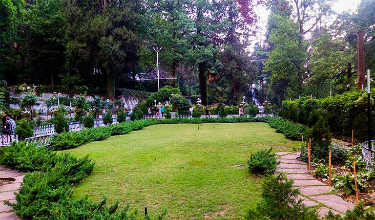
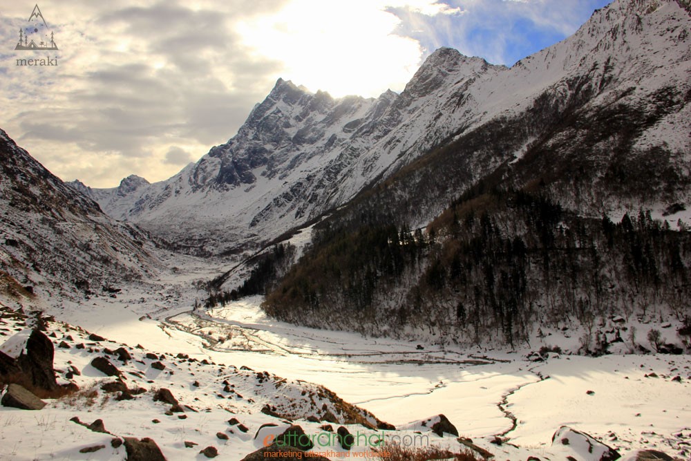
A cluster of seven fresh water lakes set against the captivating surroundings of dense oak and pine woods, Sattal offers visitors the rustic beauty of the lower Himalayas. Situated in Kumaon Region at an elevation of 1370 m above the sea level, the area boasts of its cluster of seven interconnected lakes namely: Panna, Naldaymanti Tal, Ram, Sita, Lakshman, Bharat and Sukha Tal whose sources are underground spring and which are flanked by lush green cover of oaks and pines. One of the few unspoiled and unpolluted freshwater biomes in India, the Sattal lakes are a paradise for migratory birds. With pleasant weather throughout the year, a visit to this destination away from the noise of cities is an experience not to be missed. During the British Raj, the area had a tea plantation, one of four in the Kumaon area at that time. Subhash Dhara is a fresh water natural spring that lies bundled in the dense forest of oaks. It offers its visitors a sight to behold with its pristine clear water attracting tourists in large number. The Butterfly Farm at Sattal is a museum at the John Estate that houses nearly 110 species of insect and over 2500 varied species of butterflies and was created by Federic Smetacek known as the butterfly man.
We next move on to Bhimtal, which is just about 14 km east of Sattal.

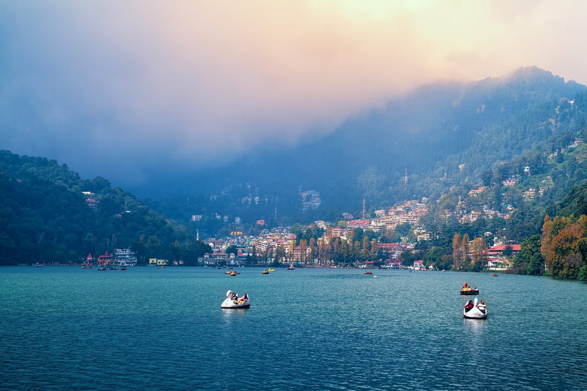
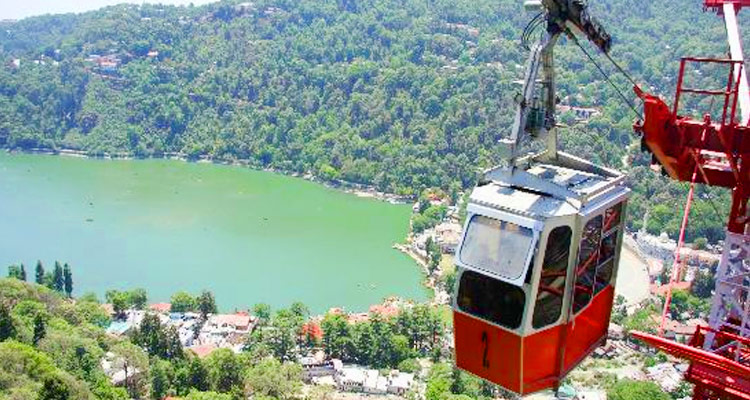
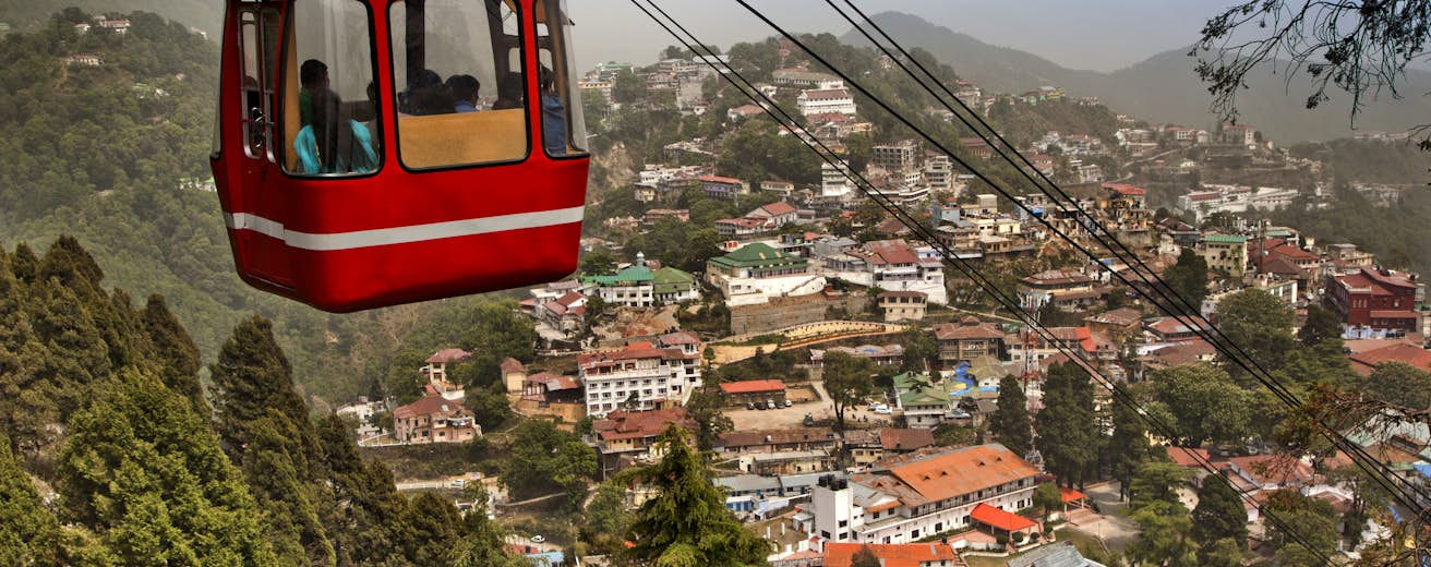
Bhimtal is an idyllic and less-crowded version of Nainital, whose charm lies in its off-beat, tranquil atmosphere. The picturesque Bhimtal Lake is a popular attraction for paddle boating, birding and nature walk. Bounded by a dense forest of oaks, pine and shrubs, it is also known for a few ancient temples. The 17th-century Bhimeshwar Temple is a must-visit spot in the hilltown. The Bhimtal Lake, with an island at the centre of the lake which houses an aquarium and a temple is a must-visit place here. A ‘C’ shaped lake over 47 hectares, the surroundings are well maintained and clean offering a pleasant experience to everyone visiting it. The lake is open from 9 am to 6 pm every day. Located on the bank of the lake is the 40-feet high Victoria Dam with its flower gardens on either side making it look quite entrancing. The Hidimba Parvat is a beautiful hill, located 5 km from Bhimtal which gets its name from Hidimba, the wife of Prince Bhima from the epic the Mahabharata. This hill also houses a wildlife asylum called Vankhandi Ashram, a habitat developed by Vankhnadi Maharaj, an environmentalist and monk who lives there. Situated on the banks of the Bhimtal Lake, the Bhimeshwar Mahadev Temple is an ancient temple dedicated to Lord Shiva. Believed to be already in existence during the visit of Pandavas while on exile, today it is often flooded with visitors. A small natural lake located about 2 km from Bhimtal, the Nal Damyanti lake contains shallow waters and is a perfect spot for enjoying some me-time. Though the trek route for reaching the lake is not very good, the amazing scenery around will make up for it. There are several old houses showcasing traditional Kumaoni architecture present here. The Karkotaka temple which is located on the top of the hill by the same name is dedicated to the serpent god, Nag Karkotaka Maharaja and this temple is especially crowded on the occasion of Rishi Panchami. Locals believe that the serpent god protects the villagers from snakes. The Folk Culture Museum at Bhimtal is an amazing place to explore traditions, culture and past of the state. Also referred to as the Lok Sanskriti Sangrahalaya, this place displays interesting artifacts, information on traditional customs and rituals and stone implements and other items of archeological importance including a fascinating collection of rock art and photographs.
Moving on, let’s make our way to Naukuchiatal, which lies less than 10 km from Bhimtal.

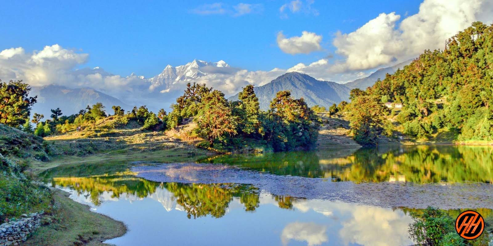
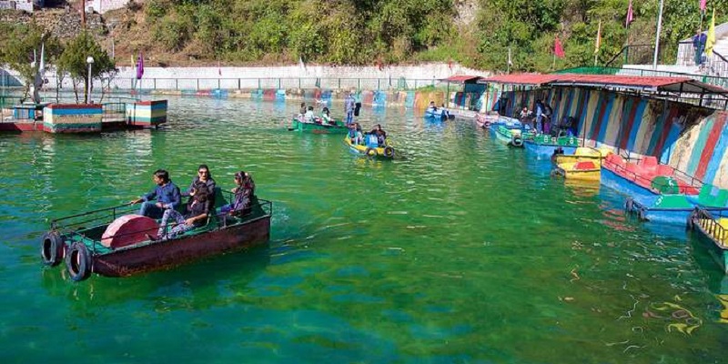
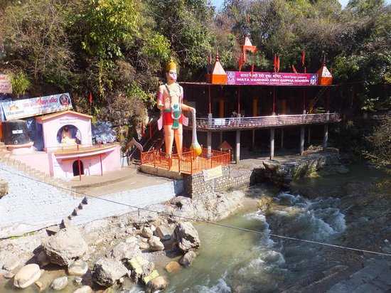
Naukuchiatal or the lake of nine corners is a small hill station near Nainital. The lake is 175 feet deep and is situated at 1,220 metres above sea level. It is covered in trees and shrubs also is said to have a hidden route under the lake to China. It is the deepest of all the lakes in the Nainital region with a length of the lake being 983 metres, breadth being 693 metres and a depth of 40.3 metres. Within the valley are opportunities for angling and bird watching. Other activities include parasailing, paragliding, fishing, rowing, paddling or yachting. The lake is fed by an underground perennial spring. Naukuchiatal is also known for the ‘escape festival’ which happens once every year in the month of May. It is believed that this lake was created after the hard worship of Lord Brahma and a small temple dedicated to him exists nearby. According to locals anyone performing a parikarma or circumulation of the lake will be blessed by Lord Brahma. A legend says that one glimpse of all nine corners of lake with both feet on the earth can make the viewer disappear into smoke and achieve nirvana. Lake Naukuchiatal is located at an altitude of 3996 ft above sea level and is regularly filled by the underwater stream. The lake is a magnet for numerous exotic bird species. Activities like paragliding, boating, biking, swimming, fishing and parasailing attracts tourists. Jungliagaon is a photographer’s paradise located 8kms from Naukuchiatal and is an ideal spot for angling, bird watching and wildlife photography. The Hanuman temple, also known as the Vaishno Devi temple has a 52 feet statue of Lord Hanuman at its entrance. The artificially made caves further lead to the famous Vaishno Devi Shrine which surrounds the temple and gives way to different parts. The temple complex consists of many sections like three temples in main complex, the meditation room, Shani Temple, Ram Darbar Temple and the resting area for pilgrims.
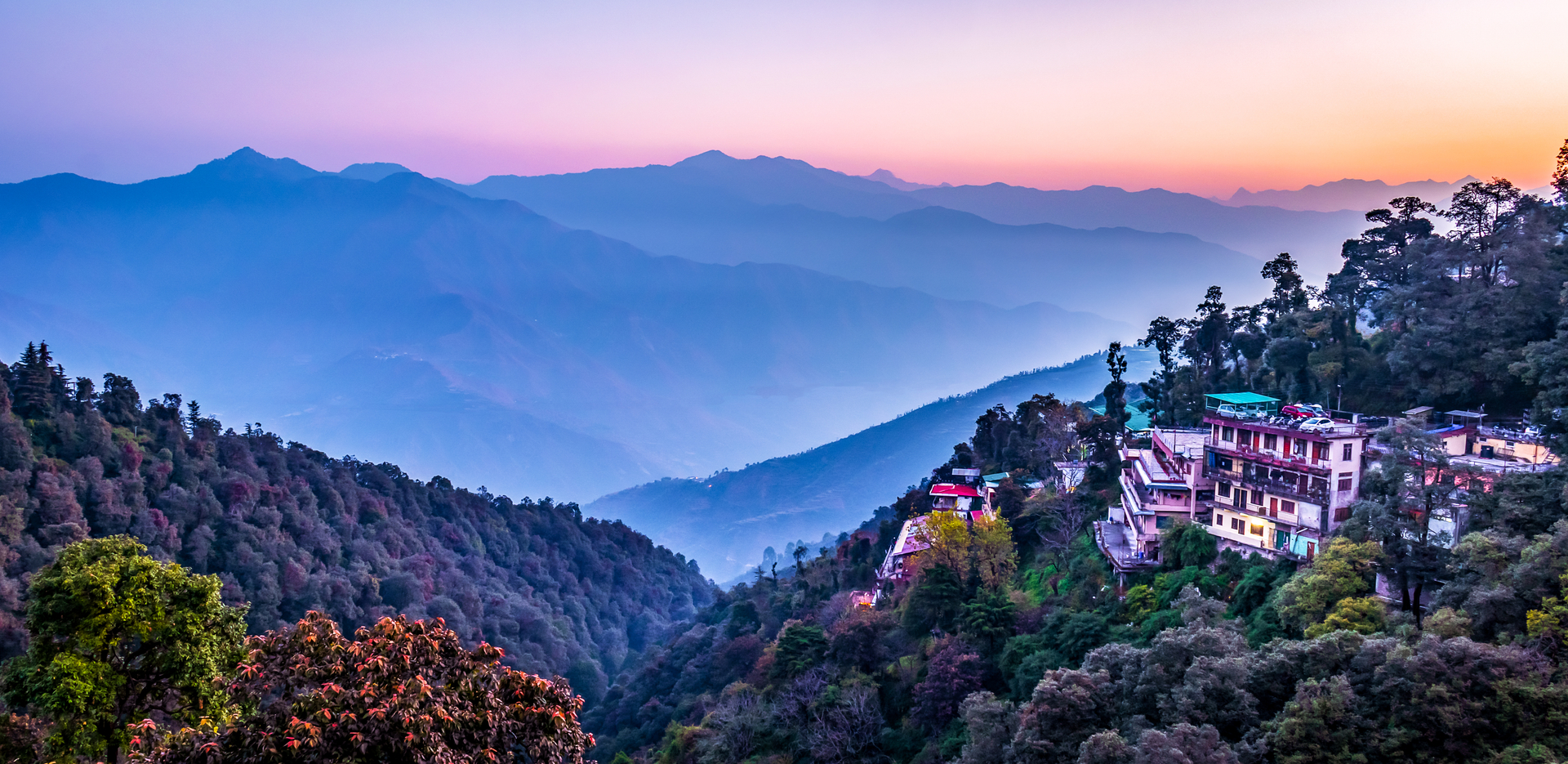
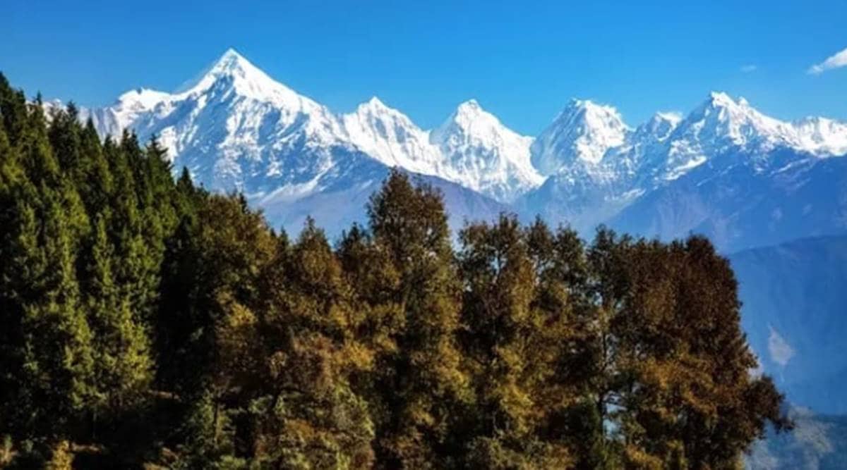
We now move 120 km north to Kausani.

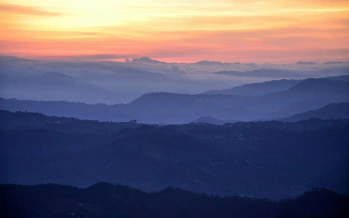
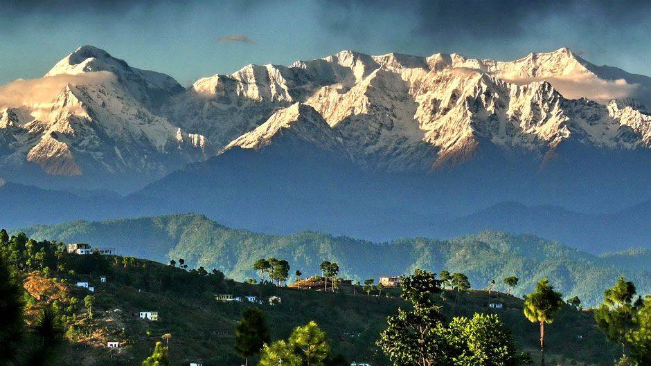
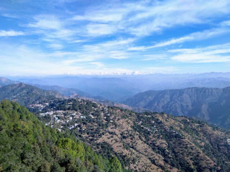
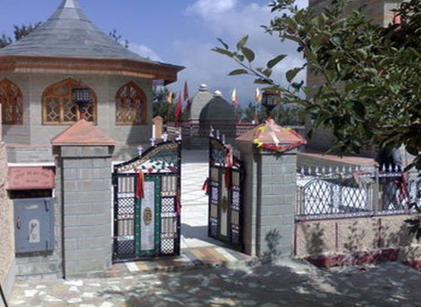
Also known as the Switzerland of India because of a similar landscape, Kausani is a hill station famous for its scenic splendour and its spectacular 300 km-wide panoramic view of Himalayan peaks like Trisul, Nanda Devi and Panchchuli. After India’s Independence, Kausani was part of the Almora district until 1997 when the Bageshwar district was carved out of Almora. Situated at an altitude of 1890m with Pine tree forests, meandering creek, Kausani is ideal for honeymooners, nature lovers and travellers. Previously known as Valna, Kausani receives snowfall during the winter months. Some of the common trek routes from Kausani are the Adi Kailash trek, the base Kausani trek and the Bageshwar- Sunderdhunda trek. The Rudradhari Falls and Caves which lie at a distance of 12 km is bounded by paddy fields and green pine forests. Located on the trekking way to Adi Kailash region, one can also explore the mysteries of the ancient caves lying near the falls. According to the legend, this place holds connection with Lord Shiva and Lord Vishnu. The Shiva Temple of Someshwar lies in the proximity to the waterfalls. The presiding deity here is Lord Shiva and it is a highly revered temple among locals. The rock-cut shrine of Someshwar is rustic and humble in construction, with the hills that surround the temple offering a unique experience. The temple has a wishing well nearby which is believed to grant all the wishes of devotees. A beautiful, quaint and sleepy village sandwiched between Garhwal and Kumaon, Gwaldam is full of forests and small lakes providing the setting for a peaceful retreat. Nestled amongst the pine forests and apple orchards at an altitude of 1700 meters, the village is tucked in the middle of Kumaon and Garhwal and offers some wide and enchanting views of peaks such as Nanda Devi, Trishul and Nanda Ghuti. There are dazzling hills covered by tall pine trees, terraced farms on the enchanting hill slopes and little wooden houses scattered in the middle of it as far as the eyes can see. The entire area is full of orchids rendering the whole scenery charming. The most famous trekking expedition here is the Roopkund Lake trek. Another beautiful ancient town tucked in the eastern half of the Garhwal Himalayas, Baijnath is popular for the Baijnath Temple and other ancient temples, a lot of which are now in ruins. Situated in the easternmost corner of Uttarakhand on the banks of River Gomti Baijnath was the capital of the erstwhile Katyuri Kingdom. The temple which is the heartbeat of the town is dedicated to Lord Shiva and was built around the 12th century and is remarkably well preserved. The Kausani Tea Estate located 5 km away from the main town is spread across the area of 208 hectares arranges short tours to show their process guided by their staff. One can also taste and buy different flavored tea. Note that it is closed from November to March. The Sumitranandan Pant Museum in Kausani is the place dedicated to the famous Hindi poet who was born in Kausani. It offers a wide range of his creative work on display from manuscripts of poems and draft work of her literary work to his awards and letters written by and to him. There is also a large collection of his books in English and Hindi showcased in a glass shelves. To celebrate his birth anniversary, every year a poetry discussion is organised in the museum. High up in the majestic Himalayas at Kausani, lies the Stargate Observatory, dedicated to the observation of celestial objects. Located at an altitude of about 1800 meters, visitors can get spectacular views of the Himalayas from here and engage in stargazing and learn the nuances of astrophotography. The observatory is open from 5:30 am to 11:30 pm and has an entry fee of INR 100 per pax.
Our next destination is Ranikhet, about 60 km south of Kausani.

Ranikhet, meaning the Queen’s Farm is a hill station developed by the British around ancient temples, undulating Himalayan hills and forests. Maintained by the Indian Army, it is the home for the Military Hospital, Kumaon Regiment and Naga Regiment and lies at an altitude of 1,869 m above sea level and within sight of the western peaks of the Himalayas. Ranikhet is popular for its views of the Nanda Devi Peak, trekking ranges, mountainous climbs, golf courses, orchards and temples. Giving a glimpse of the majestic Sonya peak, Majhkhali en-route to Almora is endowed with scenic beauty and lovely weather. About 6 km from Ranikhet is the small town of Kalika which is surrounded by thick, lush green forests and snow-capped mountains and is famous for the Kalika Temple and golf course. The backyard of the erstwhile Katyuri kings, Manila today is home to the popular Maa Manila devi Temple and this small town is a mesmerising place with wide and panoramic views of the Himalayas. Dwarahat is an ancient town full of beautiful temples which is just 35 km from Ranikhet. Home to some 55 odd ancient temples built in the medieval ages by the Katyuri Kings, Dwarahat is not only historically significant, but these temples house some of the most revered deities in Hindu mythology.
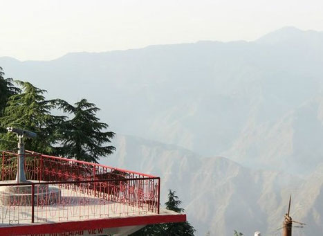
Ranikhet is home to numerous sunset points that offer wonderful views of the snow covered Himalayas. The best ones among them are Machkhali, located near woodvilla point between the Transit Camp and Ganiadeoli and the one on the road from Jhoola Devi Temple to Bhargaon. The place is best visited between February and November to witness these breathtaking mountains and sunsets in all their glory. An artificial lake surrounded by idyllic forests, the Bhalu dam is the perfect spot for a picnic complete with birds, breeze and snow-capped valleys. However, the water is typically low or negligible except during monsoon season and one needs to trek for 3 km to reach this reservoir. Originally built for rainwater harvesting, the Rani Jheel is a vast artificial lake that is located amidst natural ridges and woods and is located at an altitude of 7,500 feet above sea level. Dedicated to Haidakhan, who is believed to be an incarnation of Lord Shiva, the Haidakhan Bababji Temple was constructed by Haidakhan himself. Other than the main temple, the complex also has five guest houses, along with an Italian temple, Sri Babaji’s Kutir and the Sri Baba Research Hospital. The temple is a must visit during Navratris and in the evenings on all days. Situated near the Chaubatia Gardens, the Ram Mandir is perched on the top of a hill and can be reached by using a flight of stairs. The temple also has a monastery where students learn ancient Vedas and Vedic and modern mathematics under the tutelage of Sant Sri Mouni Maharaj. The Binsar Mahadev Mandir is an ancient temple in Bisaona built by King Pithu in the 10th century, and is dedicated to Lord Shiva, who is worshipped as Bindeshwar in the temple. One can also find the idols of Lord Ganesha, Goddess Gauri and Goddess Mahisasuramardini in the temple, along with the idol of Mahisasuramardini. Also known as Katarmal, the Sun Temple in Ranikhet dates back to over 800 years, and can be reached by a small yet exciting trekking route. The temple is surrounded by a total of 44 small shrines with ancient architectural patterns and exquisite stone carvings. The Dunagiri Temple is a famous shrine dedicated to Maa Dunagiri or Maa Durga and is located 8000 feet above sea level and is known as a Shakti Temple. People often visit this temple during the Chaitra and Ashwin months of Navratri. It is believed that when Lord Hanuman was carrying the mountain with the Sanjeevani herb for Lord Laxman, a piece of it fell on this location and since then, it has been called Doonagiri. Visitors need to climb a total of 365 steps to reach the temple. Dunagiri is one of the two Vaishnavi Shakti Peeths, the other one being Vaishno Devi temple in Jammu and Kashmir. The Kumaon Regimental Centre was built in the 1970s to showcase the rich legacy of the Kumaon region. Established by Kumaon Regiment of the Indian Army, the museum houses war artefacts of historical importance that exhibit the glory and achievements of the Garhwal and Kumaon regiments including displays of photographs of wars, weapons used by the armed forces, medals and uniforms as well as flags, stone tablets and other objects. It also houses valuables such as silver sceptres of Rani Jhansi and documents and pictures associated with Kargil War, a wireless field telephone used in World War II by the Japanese and Chinese rifles captured in the 1962 war. The KRC golf course is another major attraction.
We now travel 45 km east from Ranikhet to Almora.

Considered the cultural heart of the Kumaon region, Almora is located on a ridge at the southern edge of the Kumaon Hills of the Himalaya range. Founded in 1568 by King Kalyan Chand, Almora got its name from Bhilmora, a kind of sorrel, a short plant commonly found there. Prior to that the region was under the control of Katyuri King Bhaichaldeo who donated a part of Almora to Sri Chand Tiwari. There are also accounts of human settlements in the hills and surrounding region in the Hindu epic Mahabharata. According to local tradition, the earliest inhabitants in Almora were Tewaris who were required to supply Sorrel daily for cleansing the vessels of sun temple at Katarmal. The Chand dynasty from their inception in 953 A.D. to their ouster in the late 18th century present a saga of strife, with horrifying series of wars with rulers of Garhwal culminating in the destruction of this prosperous land and establishment of inglorious Gurkha rule. In 1791, the Gorkhas of Nepal while expanding their kingdom westwards across Kali River, invaded and overran Almora. The Gorkha rule lasted for twenty-four years. The Anglo-Gorkha war of 1814 resulted in the defeat of the Gorkhas and subsequently led to the signing of the Treaty of Sugauli in 1816, according to which, Nepal had to cede all those territories which the Gorkhas had annexed to the British East India Company. This agrarian town has two major rivers, Koshi also known as Kaushaki and Suyal or Salmali flowing through it.

Binsar: Located at a distance of 33 km from Almora, Binsar is a small town known for the beauty of the snow-laden Himalayan peaks. Set amid forests covered with oak, pine, rhododendrons and deodar trees, Binsar is home to beautiful green meadows, temples and the famous Binsar wildlife sanctuary. You can also visit Zero Point which is the highest point at an elevation of 2412 m which has beautiful views during both sunrise and sunset. One can see a 360-degree panoramic view of the Himalayas including peaks like the Kedarnath Peak, Shivling, and Nanda Devi. To reach Zero Point, one has to walk inside the sanctuary for 1.5 kilometres. A guided trek up to Zero Point is the recommended way to explore the green beauty of the Binsar Wildlife Sanctuary. It is also a great location for bird-watching. Situated at the height of 2420 metres, the weather of Binsar remains pleasant throughout the year. Besides the Binsar wildlife sanctuary, one can also visit the Kasar Devi temple and the Bineshwar Mahadev temple.

Jalna: A small and sleepy village, Jalna is the place for some trekking and exploring. A small scenic village, a few kilometers from Almora, Jalna is situated at an altitude of 1700 meters amidst the wild of the Himalayas. The sleepy hamlet is a wonderful place for trekking and exploring the natural forest cover of the area. Entry to Jalna has to be before sunset.
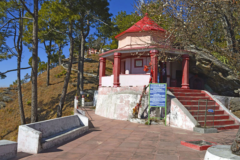
Kasar Devi: Splendid views of the of Himalayas, from Nanda Devi to the five snow-capped peaks of Panchachuli surround the town of Kasar Devi. The place is famous for its namesake temple, the Kasar Devi Temple. The area is home to pine and deodar trees, offering a panoramic view of the Himalayas along with an eye-pleasing view of Hawabagh Valley. A single road runs up high with 200 houses on each side. The village derives its name from the namesake deity Kasar Devi, with the Kasar Devi Temple dating back to the 2nd century. In the 1890s, Swami Vivekananda visited the place and meditated here for days and this place became a powerhouse for the counter culture that erupted in the ’60s. The region around Kasar Devi has an enormous geomagnetic field as the region comes under the Van Allen belt. The Kasar Devi fair is a large fair organised every year on Kartik Poornima as per the Hindu calendar. People often trek up to the temple from the town of Kalimath, through cosy little alleys carved in the hills.
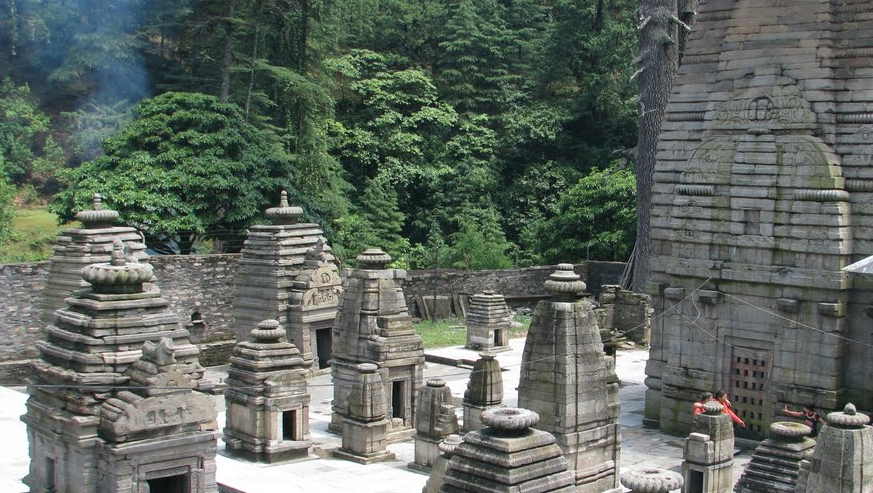
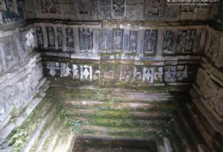
Jageshwar: A small town with equisitely carved temples, Jageshwar has about 124 exceptionally well preserved temples. Mostly built in the 9th century, the temples will leave you feeling enchanted, with an unquenchable thirst of exploring beyond. The most visited one is the Jageshwar Mahadev Temple, situated in the Jataganga Valley, dedicated to the incarnation of Shiva in the form of a child. The story goes as Shiva being an attractive alpha male was attractive to all the women folk of the village, where he used to meditate. To not offend the men of the village, Shiva incarnated himself as a child. The temple itself is divided into two parts, with one dedicated to Shiva, and the other to his consort, Goddess Parvati. The entrance is flanked by the idols of the keepers of the sanctum sanctorum, Nandi and Skandi, complete with all the armaments, adding to the majestic bearing of the temple as well. The Mahamrityunjaya Temple is is made from three words. Maha, meaning great, mrityun, meaning death, and jaya, meaning victory. Hence the word itself literally translates to the great victory over death. The idol itself, is one of a kind carving, with no similar representation anywhere in the country. An epitome of Nagar style architecture, the Dandeshwar Temple is as tall as you can crane your neck, quite literally. It is believed to house the shrine of Lord Shiva as the staff bearer, hence the name Dandeshwar, or the bearer of the ‘dand’, the staff. The idol of the deity is in the form of a large uncut natural rock, following the prevalent custom of worshipping the Gods in their unaltered natural form. The Archaeological Museum at Jageshwar, maintained by the Archaeological Survey of India, houses an exquisite collection of the ancient carved idols and old world representations of the deities. With galleries containing pieces dating back to the 9th and 13th centuries, the most prominent figures are those of Uma and Maheshwar or Parvati and Shiva and the Sun god as well as the Nav Graha, or the nine planets. The museum is worth a visit, The most noteworthy figure is of one of the rulers of the area, Pona Raja, who is still well respected and remembered in the region.
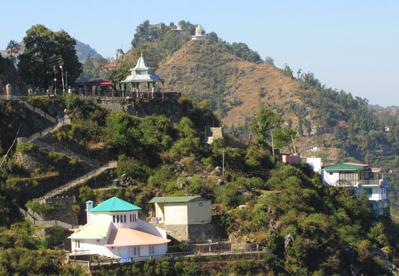
Bright End Corner: Situated about 3 km from Almora, Bright End Corner offers breathtaking views of sunset and sunrise. This place is dedicated to Swami Vivekanand, who spent few days during his stay in the Himalayas and the viewpoint has a Vivekanand library situated very close to it.
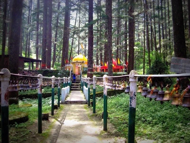
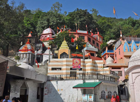
Chitai Temple: Locally known as the Golu Devata Chitai Temple, the Chitai Temple is located 9 km from Almora City. This Temple is dedicated to Gollu or Goljyu Devta, an avatar or incarnation of Lord Shiva in the form of Gaur Bhairav, built during the Chand regime. The temple is known as the abode of the God of Justice and there are various beliefs that cause people to come and pray here. There are many bells hung by devotees as an act of offerings, wishing or thanksgiving which can be heard far and wide and this is why the temple is also called the temple of a million bells.

Katarmal Sun Temple: Located at an altitude of 2,116 m, the Sun Temple in Katarmal village is considered the second most beautiful shrine dedicated to the Sun God or Lord Surya in India. Around 19 kilometres away from Almora, this temple complex where the main temple is dedicated to the the incarnation of Lord Surya, Vraddhaditya. This shrine is lightened at dawn as it receives the first rays of the sun. Its very location amidst the Kumaon hills interrupted by the Kosi river, makes this site extremely photogenic and an absolute delight. This 9th century temple complex dates back to when Katarmalla, a Katyuri ruler used to rule the region. This 800-year-old temple has one main temple and 45 smaller shrines. Other smaller shrines have idols of Shiva, his consort Parvati, Lakshmana and Narayana, enshrined in them.
Gobind Vallabh Pant Museum: Holding some of the legacies of the Katyuri and Chand dynasties, the museum on Mall Road also has beautiful collections of folk style painting known as Aspen and Kumaoni antiquities.
Moving on, let’s head to Champawat, which lies about 130 km east of Almora.

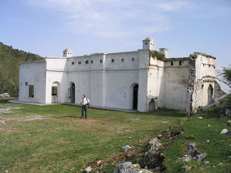
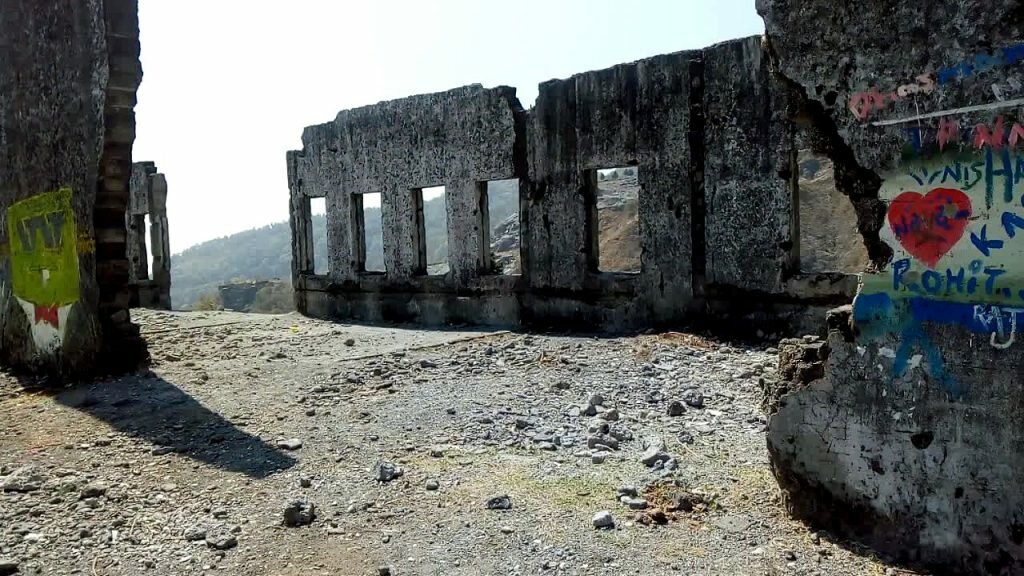
Champawat is an intrepid town perched 5,299 feet above the sea level and was the former capital of the Kumaon Kingdom. The place holds historical and religious significance because It is believed to be the place where the Kurmavtar or the turtle incarnation of Lord Vishnu took place. Today, there is a temple called Kranteshwar Mandir, which is dedicated to lord Shiva. It is also believed that the head of Ghatotkacha, the son of Bhima and the demon Hidimba fell here after he died in the battle of Kurukshetra in the Mahabharata with the Gahtku Mandir the temple dedicated to Ghatotkacha. There is a famous temple called the Shaani Mandir or Manokamna Purn Mandir Kaula in the village of Maurari. The only structure in the area said to have been constructed in the medieval time, Banasur ka Kila is about 20 km from Champawat. It is believed to be the capital of demon Vanasur who faced his defeat at the hands of Lord Krishna. Banasur ka Kila was constructed in the memory of Banasur, the eldest son of the mythologically famous King Bali because he was assassinated here by Lord Krishna when Banasur had tried to kill Krishna’s grandson Aniruddha. The fort is based on the name of a boon-bestowed Banasur, the man with the thousand arms; whereas the fort gives an air of disintegration and dilapidation.
The Lohawati River also originates from this site and is located alongside the Bhowali Road. Ek Hathiya ka Naula is one of those structures, that is known not only because of its uniqueness, but also for its creators. A single handedly carved architectural marvel, situated about 5 km away from Champawat, Ek Hathiya ka Naula is named so, because it was literally carved by an artisan who had only one hand, over the span of a single night. One of the oldest temples in Champawat, the Baleshwar temple, dedicated to Lord Shiva was built around 10th century by the rulers of Chand Dynasty. Among the two temples in the campus, one is dedicated to Ratneshwar while the other is dedicated to Goddess Durga. An amazing example of architecture, the temple complex is mostly built of stone. The Kranteshwar Mahadev Temple which lies at a distance of about 6 kms from Champawat is a small complex of stone made structures and is locally known as the Kandev or Kurmapad. It is atop a hill at a height of 6000 meters and there is the ever blooming red blossoms in the temple complex which provide a one of its kind visual treat. The panoramic view of the temple is simply majestic and worth the trip. The Nagnath temple is a wooden carved double storey structure that is also the oldest and the most well preserved shrine of Lord Shiva. According to locals, they worships Lord Shiva in his perpetual form of the wielder of the serpentine creatures, signifying his detachment to the world, but also his love for the outcast creatures, the nag or the India cobra. The Nagnath Temple was built by Guru Gorakhnath, a noted sage of the hills. Despite the destruction caused by the Rohilla and Gorkha tribes, the temple has been restored and sports a very intricately carved wooden doorway of the 18th century Kumaoni style architecture. Gwal Devta, more popularly known as Goll Devta or Goril Devta, is a deity of enormous significance in the area, and is known to deliver justice and instill faith in his populace as their ruler prince. However, he became a victim of his cruel stepmother’s plans and was drowned in a river nearby, locked in an iron cage. His faithful people bullt the temple in his memory, and believe he still presides over the town and metts out justice to the helpless and the needy. The temple at Golchaurh receives quite a lot of pilgrims throughout the year and is held in high esteem by all devotees. Lohaghat is a beautiful hill station located near Champawat and this ancient town is an important place for temples with historical and mythological significance. Situated on the banks of Lohawati River and at an altitude of 1800 meters, Lohaghat is blessed with natural beauty in abundance. Situated at an altitude of 1500 meters in the foothills of Garhwal Himalayas, Shyamla Tal is a beautiful lake town with umpteen amounts of greenery and freshness to it. Alongside the lake there is a Swami Vivekanand Ashram which is one of the highlights of the place and is a great for some meditation and self-exploration. The lake has been named so as it looks like a mirror to the sky reflecting its blue tint all over itself.
Lets now drive 200 km north from Champawat to Munsiyari.

Often referred to as Little Kashmir, Munsiyari is a cosy hamlet located in Pithoragarh. Situated at an altitude of 2298 metres, the pretty little hill town is known for its panorama of snow-capped Himalayan Range and some adventurous trekking trails. Perched between the borders of India, Tibet and Nepal, Munsiyari is a base for three glaciers namely Namik, Milam and Ralam glaciers. The scenic village with the stunning backdrop of the Panchachuli or the five peaks, Nanda Devi and Nanda Kot is also dubbed the Gateway to Johar Valley’ as Munsiyari is the starting point of Johar Valley which was the ancient trade route between Tibet and India. In local parlance, the name Munsiyari refers to a place with snow. Situated on the banks of Goriganga river, it is commonly used as a trekking hub or base camp. Munsiyari also falls on the ancient salt route from Tibet and is at the entrance of the Johar Valley, which extends along the path of the Gori Ganga river to its source at the Milam Glacier. The upper part of Munsiyari is called Malla Johar, which comprises 14 trans-humant alpine villages, that are seasonally occupied during the months of May to early November.

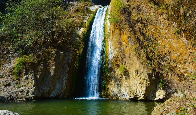
Falling from the height of 126m, Birthi Falls which is located about 35 km from Munsiyari offers an extremely refreshing experience. With lush green surroundings blooming in various colors, it makes for an ideal place to sit and enjoy some time alone. A beautiful place with a very fascinating legend attached to it, Maheshwari Kund is just a few km walk from Munsiyari. Once cursed by a Yakshi who use to live in a small lake there, the place faced drought for several years. After the villagers apologized to the Yakshi for not letting him marry the sarpanch daughter and emptying the lake in form of revenge, the ritual is practiced even today and there is a pond there now offering nature in its absolutely raw form and a incredible view of Panchachuli Peak which is a prominent peak which looks majestic from Munsiyari. The Thamari Kund is an enrapturing natural lake bound by alpine and paper trees as well as many Musk Deer and enriched in variety of flora. Located at a distance of 15 km from Munsiyari on the way from Birthi, Kalamuni Top is 9,500 feet tall and famous for its Kali Temple dedicated to the Naga God. The fantastic view of Panchachuli peak from there flanked by the sprawling pine forest makes this place a must visit. Situated at a height of 9,000 ft, Betulidhar is covered with red rhododendrons in full bloom. However, the best feature of this place is absolutely gorgeous sunsets and sunrises with an entrancing view of snow covered Himalayas and the Balati and Ralam Glaciers. A small quaint village just 6km from Munisyari, Darkot is a paradise for shoppers offering a varied range of articles to buy, the most famous being pashmina shawls and sheep wool blankets. The Nanda Devi temple at Munisyari is a structure of typical Kumaoni architecture dating back to 1000 years, and naturally well preserved. The Nanda Devi Fair, that started in the 16th century, continues here, and falls every August, much to the delight to all the lovers of lesser known mythologies.
Let’s now travel 130 km south to Pithorgarh
Situated in a beautiful Soar valley and flanked by Nepal in the east and Tibet in the north, Pithoragarh is a small urban town which is a prime example of raw beauty of nature. A gateway to Himalayan range, this town also serves as the stop over for pilgrims on their way to Kailash Mansarover. With the river Kali flowing through the town which is prettily adorned with tranquil temples, villages, fort, lush green forests and natural resources, this place is a blessing in disguise for travel enthusiasts. Pithoragarh and its surrounding areas were part of the Manaskhand region, which extended from the Kailash Mountain in the north to Bhabar & Terai in the south, as mentioned in the Skanda Purana. The Asuras and Nagas appear to be the earliest inhabitants of the region, who were later superseded by the Kiratas, Khasas and the Kunindas. The Kushana Kings held their sway over the region in the last quarter of the 1st century after which the region came under the Kurmanchal kingdom, which had its capital first at Jyotirmath and then at Karikeyapura which is today Baijnath in the Katyur Valley.
Upon the disintegration of the Katyuris and the fall of kingdom in the 13th century, Pithoragarh came under the rule of Bam kings of Saur. In the 15th century, King Bharti Chand of Champawat amassed a huge army, and started plundering and killing in the regions ruled by the Doti Kings. The resultant war, lasting 12 years, ended with a victory for the Chands. The kingdom of Saur came under direct control of the kingdom of Kumaon in the 16th century during the rule of King Balo Kalyan Chand, when it was gifted to him by the Raika king of Doti as dowry for marrying his daughter. Legend has it that during the reign of the Chand Rajas of Kumaon, one Piru, also called Prithvi Gosain, built a fort here and named it Prithvigarh which, in the course of time, got changed to Pithoragarh.
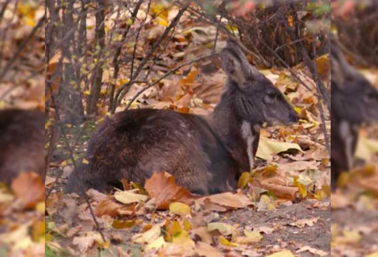
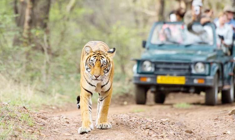
Chandak is a hill with an opportunity for a small trek situated on the north side of the Soar Valley. Located at a distance of 8 km from Pithoragarh, this beautiful place also offers hang gliding adventures. The Mostamanu Temple is about 2 kms away on foot. This temple attracts a lot of visitors during August and September when a fair is organized. Tucked away in the eastern corner of Uttarakhand, Didihat is a wondrous and pristine hillock full of natural beauty. The place is known for its ruins of forts and temples belonging to a bygone era as well for being a halting point on the Kailash Mansoravar Yatra. Situated at an altitude of 1800 meters, Didihat is blessed with infinite natural beauty and some great viewpoints of the mighty Himalayas. Didihat also has some remnants of its glorious past in the ruins of the forts and temples belonging to the Doti and Chand rulers and is known to provide some amazing views of mighty Himalayan peaks such as the Panchachuli and Trishul peaks. Gangolihat is famous for hosting the Shakti Peethas of Goddess Kali. A very small town located near important tourist spots such as Patal Bhuveneshwar, Binsar and Abott Mount, it is located at an altitude of 1800 meters. Nestled at an elevation of 1106 metres, the small town of Askot borders Nepal and China, and is known for its rhododendron carpeted hills, enchanting valleys, meandering streams and picture perfect settings. Enveloped by the Chhiplakot and the Panchchuli ranges, the offbeat hilly hamlet is popular for its Askot Musk Deer Sanctuary. The rocky mountains offer perfect trekking opportunities for both amateurs and professionals. Patal Bhuvaneshwar is known for its deep caves underground and is 82 km away from Pithoragarh. The Kapilaswar cave is a cave temple dedicated to Lord Shiva and offers breathtaking views of the Soar Valley and the equally bewitching sight of snow covered peaks of the great Himalayas. Situated 3 km from Pithoragarh, the cave houses many tunnels to the temple which are now closed. To worship the deity placed in the complex, one has to travel 10 m into the cave. Another temple dedicated to Lord Shiva is also situated about half a km away. Pithoragarh Fort affords spectacular views of the Kali Kumaon and was established in year 1789 by the Gorkhas after the invasion of town. Surrounded by views of the majestic Himalayas, the Dhwaj temple is dedicated to Lord Shiva and Maa Jayanti and is 10 km from Pithoragarh. Visitors can also hike to the temple which is 4 km across the terrain. A heaven for wildlife lovers and botany enthusiasts, the Askot Sanctuary has a wide range of flora and fauna. Located at the height of 5412 m and at a distance of 54 km from Pithoragarh, one can witness vivid kinds of animals like chirs, pheasants, koklas, bharals, Himalayan black bear, chukors, snow leopards and musk deers here. Apart from the wildlife, Askot is also dotted with many temples.
From Pithoragarh, our next destination is Bageshwar


