The Audacity of Hope: Thoughts on Reclaiming the American Dream – Barack Obama
The Audacity of Hope is Barack Obama’s call for a new kind of politics—a politics that builds upon those shared understandings that pull us together as Americans.
Lucid in his vision of America’s place in the world, refreshingly candid about his family life and his time in the Senate, Obama here sets out his political convictions and inspires us to trust in the dogged optimism that has long defined us and that is our best hope going forward.
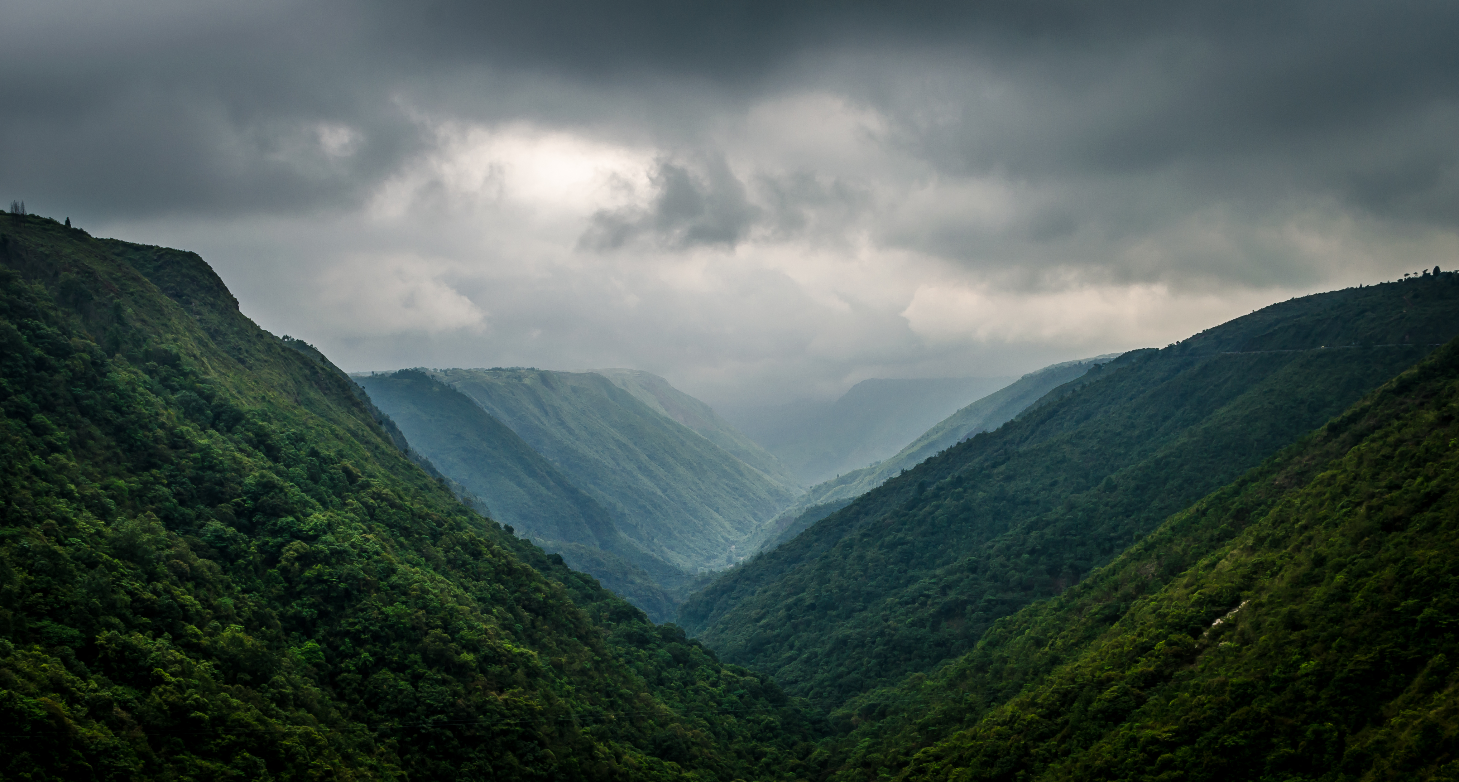
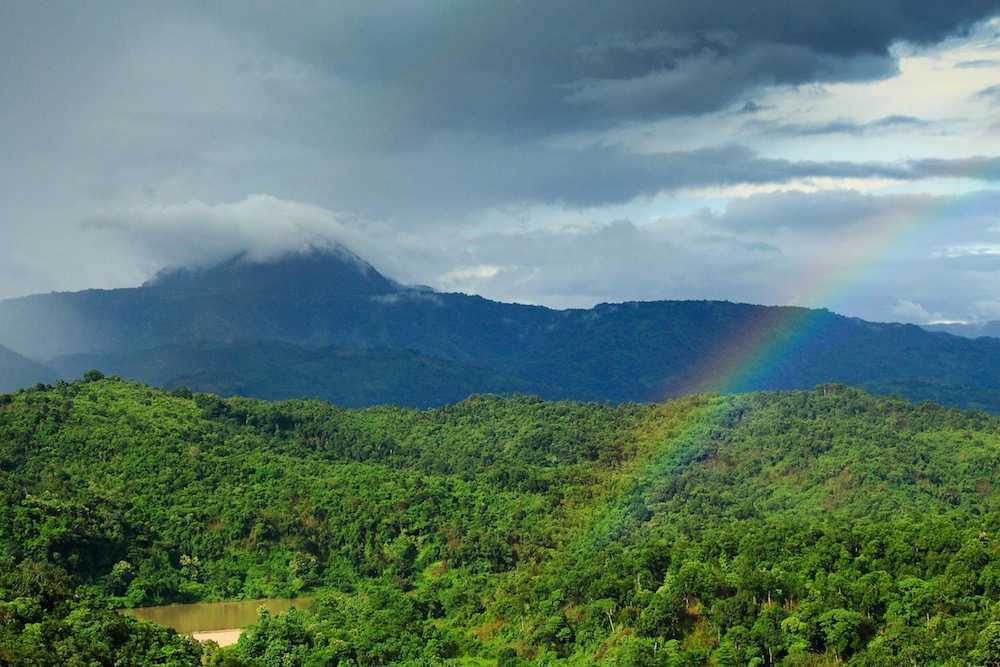
Named after the Khasi tribe, the Khasi Hills are a low mountain formation on the Shillong Plateau part of the Garo-Khasi range and connect with the Purvanchal Range and larger Patkai Range, a series of hills found across the Indo-Myanmar border. The Khasi Hills is and further east. Khasi Hills, and the whole Garo-Khasi-Jaintia range, are in the Meghalaya subtropical forests ecoregion.
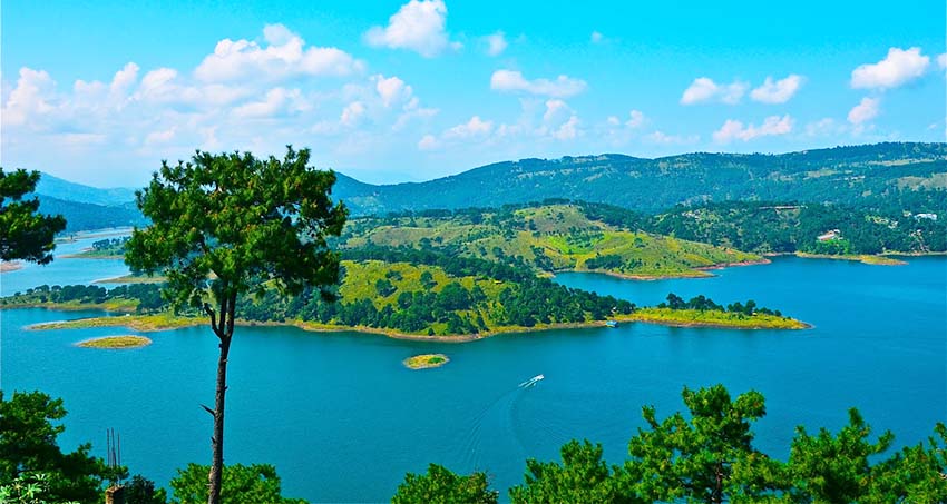
With deep lush valleys and conical peaks, these hills are famous for housing the Sohra or Cherrapunjee scarp, one of the regions with the highest annual rainfall in the world. The Nongkhum island, the second largest river island in Asia, is also located within this area. The dense forests mingling with tributaries that eventually drain out into the Brahmaputra, combined with the rich biodiversity of the region have earned the Khasi Hills the title of Scotland of the East.
The Khasi Hills are a great convergence of lush forests, endless verdant grasslands, majestic hills surrounded by playful clouds, waterfalls, and rivers flowing through the creeks, and ancient monoliths filled with mystical caves. Complemented by the abundance of diverse wildlife seen throughout the area, the Khasi Hills region is world-famous for being a prime ecological hotspot.
The region is inhabited mainly by tribal Khasi dwellers, which are traditionally in various chieftainships, states known as the Khasi Hill States. One of its capitals, Sohra, is considered one of the wettest places in the world. The majority of Khasis are Presbyterians followed by Catholics and Anglicans. The highest peak is Lum Shyllong which is 1,968 meters or 6,457 ft high.
The best time to visit the Khasi Hills is from October until April. During this period one will be able to enjoy the natural beauty of the land with waterfalls brimming with life due to the recent monsoon rains, and the flora & fauna will be soothing to the soul. The winters can be chilly, so adequate coverage is required. Avoid going during monsoons, as they are marked by heavy showers, which may prove to be inconvenient.
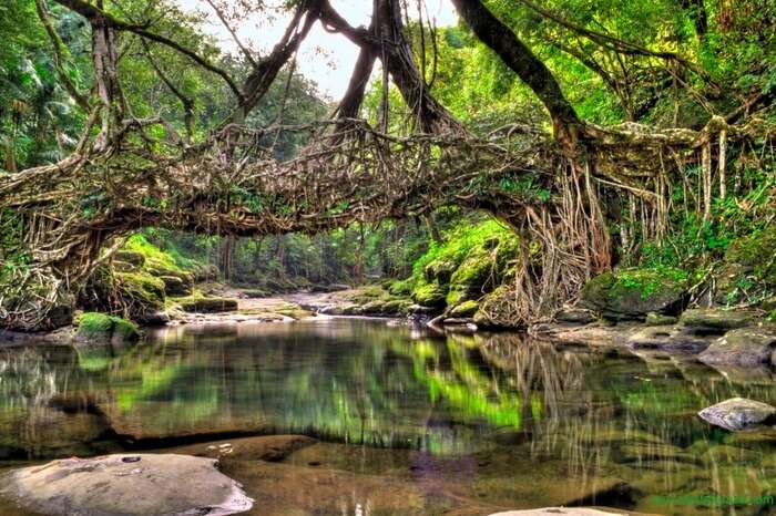
Places to Visit in East Khasi Hills include Asia’s cleanest village, Mawlynnong as well as Smit which can be reached through the winding roads offering an elegant view of the mountains. The village of Laitkynsew is famous for the 53 feet-long living root bridge which is over a hundred years old known as the Jingkieng Deingjri. The Khasi Hills are an adventurer’s fantasy come to life, with countless caves, peaks, and viewpoints spread across its entirety. Private treks are organised all across the Khasi hill range which is rich with the thriving greenery infused within the hills and accessorised by lakes and waterfalls.
With Meghalaya housing one of the largest cave networks in the world, the labyrinth of rock formations is a sight to behold, with years of mineral deposits from the tributaries of the Brahmaputra creating incredible stalagmites. The excess of impressive structures like monoliths and mighty hills offers tourists a chance to engage in the sport of rock-climbing with the giant monolith Kyllang Rock a favourite amongst rock-climbers and trekkers. The abundance of lakes offer tourists the rare opportunities to enjoy a nice relaxing picnic as well as boating services to immerse oneself in the tranquillity of the area. With its amazing ecological diversity, the region is home to numerous natural parks, where one can marvel at the lush greenery which has been so beautifully maintained by the locals.
Located further east of the Khasi Hills, the Jaintia Hills used to be a part of the Jaintia Hills District. The district has been bifurcated into two separate districts, namely, East Jaintia Hills and West Jaintia Hills on 31 July 2012. Part of the former Jaintia Kingdom, the Jaintia Hills is a land of majestic hills filled with rich natural vegetation and mineral deposits. It is part of the Patkai hill range that extends across the Indo-Myanmar borders and is a relatively smaller hill district as compared to the Khasi and Garo Hills. The twelve Chiefs of the elaka or the tribal province of the Pnars, a Khasi Sub-tribe are styled Dolloi, and the land is called after them in Khasi: Ka Ri Khadar Dolloi or the Land of 12 Tribal Chiefs. The Jaintia hills comprise of two districts: the East Jaintia Hills and West Jaintia Hills. The only princely ruler of the area was the Raja of the Jaintia Kingdom whose winter capital, Jaintiapur is today in Bangladesh, while his summer residence shifted from Sutnga where the family started as Syiems to Nartiang and also has a palace in the commercial centre Borghat.
The best time to visit the Jaintia Hills is during the summer season, when it is mostly warm, with little or no rainfall. The hills receive heavy rainfall during the monsoons. The Jaintia Hills is home to one of the most beautiful waterfalls of India, the Krang Suri Falls. Set against the backdrop of the rugged rocks with the verdant creepers and trees, the unreal shade of blue taken on by the water inspires the artistic side of anyone who views it. The beautiful village of Nartiang is also situated in these fascinating Jaintia hills where one can find the remnants of the Summer Palace of the Jaintia King. The Nartiang Monoliths, a large collection of mighty stones set since the stone age may also be found here. Jowai, the administrative headquarters, is the most developed town in this region and is the only place connected to other towns outside the hills. Krem Liat Prah is the longest cave, and Synrang Pamiang is the deepest cave, both which are located in the Jaintia Hills. Thadlaskein Lake is a man-made lake, popular among the locals as a picnic spot. The lake is considered to be holy by the people of Raid Mukhla who worship and offer sacrifices near the lake. A popular place among the locals, Khim Moo Sniang is significant for the pig-shaped rock that lies here and is worshipped by the Jaintia community. It is believed that the stone has the power to protect them. Syndai is famous for many caves and caverns in the limestone-borne area which were used as hiding spots during the war between Jaintia Hills and foreign intruders. Borghat village is situated close to the Bangladesh border and the temple there has a significant history because sacrifices were offered here and the temple was damaged during the 1987 earthquake. The Ruparsor Bathing Ghat was made for the recreational purposes of the Royal family. The ghat is made with granite and the water it gets is from the Ruparsor stream, which flows through a Ridge resembling the curved trunk of an elephant.
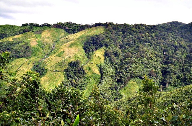
Situated close to the Indo-Bangladesh Border, the Garo hills are part of the Patkai hill range, which extends across the Indo-Myanmar border. The hills get their name from the Garo tribe who inhabit the area. The Garo Hills, spanning 8000 sq meters, offers magnificent viewpoints, densely populated with subtropical forests and rare endemic species of animals and birds. The area has been divided into five districts. The Nokrek peak is the highest peak of this hill range, but the Arabella hills and the Tura peak also offer some breathtaking scenery. The Nokrek Biosphere Reserve, one of the most important national parks of international importance, is located in this nature-rich area. The hills are also decked with splendid waterfalls, enriching the ecological coherence of the place. It is one of the wettest places in the world and part of the Meghalaya subtropical forests ecoregion.
The Garo tribe are a culturally rich ethnic group, attaching tradition and significance to many parts of their natural surrounding. In doing so, they protect and respect their habitat, thereby preserving the immaculate allure of their surroundings. The tree of Boldak Matchu Karam, the rock of Naka Chikong, and the lake of Napak are all examples of these traditions, and the maintenance of the same attracts hordes of tourists all year round. Between September and December, the post-harvest festival of 100 Drums Wangala is celebrated with great pomp at the Asnang village, now becoming a multicultural attraction with neighbouring tribes participating in the festivities with great enthusiasm as well. The largest town in the hills is Tura, which is also the most developed area and home to all the important administrative buildings.
The society is matrilineal like the Khasis and the Jaintias. From birth to death, an individual belongs to the mother’s family, irrespective of sex, even after marriage. Marriage within the clan is completely prohibited and severely punishable for both the Khasis and the Garos. The institution of bachelors dormitories which are gradually disappearing is found in the Garo villages. In such dormitories, young people stay and live together till they are married. They receive various training like making various A’chik music instruments, wrestling or traditional sports, and the making of traditional bamboo baskets. This institution is similar to the ancient agoges of Sparta. Today the Khasis and Garos are mostly Christians but were nature worshipers previously.
The Garo Hills is known for its abundance of wildlife and attracts naturalists and photographers. Two mountain ranges, the Arabella range, and the Tura range pass through the Garo Hills, forming the great Balpakram valley in between. The headquarters town of Tura at an altitude of 657 m. The highest point in the Garo Hills is Nokrek Peak at an elevation of 1412 m.
The Garo Hills is a hub of ecological biodiversity. The Nokrek Biosphere Reserve was added to UNESCO’s official list of biosphere reserves in 2009 and is the home of the plant Citrus Indica, first discovered by researchers in this region. The Balphakram National Park is famous for its canopy-covered gorge and unique physical and biological formations and is an ecological hotspot. The Siju Caves is the third longest cave system in India, made of limestone deposits over centuries, by the Simsang river. One can find rare bat species here. A tributary of the Simsang River, the Rongbang Falls is flanked on either side by massive verdant hills of bamboo.
The Garo hills are a hotspot for natural biodiversity, evidenced by the large Nokrek Biosphere reserve and the neighbouring Balphakram National Park. The Selbalgre Hoolock Gibbon Reserve is a great spot to view the rare Hoolock Gibbon. There are several picturesque waterfalls around the hills as well. With limited road connectivity, one must trek through this scenic landscape to reach many villages past the outskirts of Tura. The Tura Peak and Arabella range offer magnificent views from the top, with the Tura peak being relatively easier to scale. Nongkhnum Island located in the West Khasi Hills district is the biggest river island in Meghalaya and the second biggest in Asia. The island is formed by the bifurcation of Kynshi River into the Phanliang River and the Namliang River. Adjacent to the sandy beach the Phanliang River forms a lake. The river then moves along and before reaching a deep gorge, forms a waterfall about 60 meters high called Shadthum Fall. Located near Sohra, the Kshaid Dain Thlen Falls are the falls where the mythical monster of Khasi legend was finally butchered. The axe marks made on the rocks where Thlen was butchered are still intact and visible. On the top of Diengiei, there is a huge hollow, shaped like a cup, believed to be the crater of an extinct pre-historic volcano. A scenic pool with wide, rocky sandbanks located on a stream alongside the Umroi-Bhoilymbong Road is known as Dwarksuid or Devil’s doorway. The highest point of the Garo Hills region of the State, Nokrek Peak stands 1412 m above sea level. The mother germoplasm of Citrus-indica has been discovered by scientific researchers within Nokrek Range which led to the establishment of the National CitrusGene Sanctuary-cum-Biosphere Reserve at Nokrek covering an area of 47 sq km. Imilchang Dare is a waterfall with a deep, wide pool at the bottom making it an exciting swimming pool, full of fish of varied sizes and colours.
After this series, I realise that Meghalaya has so much natural beauty and I am itching to explore this beautiful state soon. The state has so many unexplored places that one may feel like an explorer making a grand discovery. Hopefully, I get to explore this state soon.
Remembering Shanghai: A Memoir of Socialites, Scholars and Scoundrels – Claire Chao and Isabel Sun Chao
A high position bestowed by China’s empress dowager grants power and wealth to the Sun family. For Isabel, growing up in glamorous 1930s and ’40s Shanghai, it is a life of utmost privilege. But while her scholar father and fashionable mother shelter her from civil war and Japanese occupation, they cannot shield the family forever.
When Mao comes to power, eighteen-year-old Isabel journeys to Hong Kong, not realizing that she will make it her home–and that she will never see her father again. Meanwhile, the family she has left behind struggles to survive, only to have their world shattered by the Cultural Revolution. Isabel returns to Shanghai fifty years later with her daughter, Claire, to confront their family’s past–one they discover is filled with love and betrayal, kidnappers and concubines, glittering pleasure palaces and underworld crime bosses.
Lavishly illustrated and meticulously researched, Remembering Shanghai follows five generations from a hardscrabble village to vibrant Shanghai to the bright lights of Hong Kong. By turns harrowing and heartwarming, this vivid memoir explores identity, loss and the unpredictable nature of life against the epic backdrop of a nation and a people in turmoil.
The headquarters of the West Jaintia Hills, Jowai is located about 65 km east of Shillong and about 50 km from the Indo-Bangladesh border and is home to the Pnar, a sub-tribe of the Khasi people and a matrilineal society. It is located on a plateau surrounded on three sides by the Myntdu river bordering Bangladesh to the south. Jowai is famous for its bucolic setting and breathtaking views, boasting of lakes, vast open valleys and waterfalls.
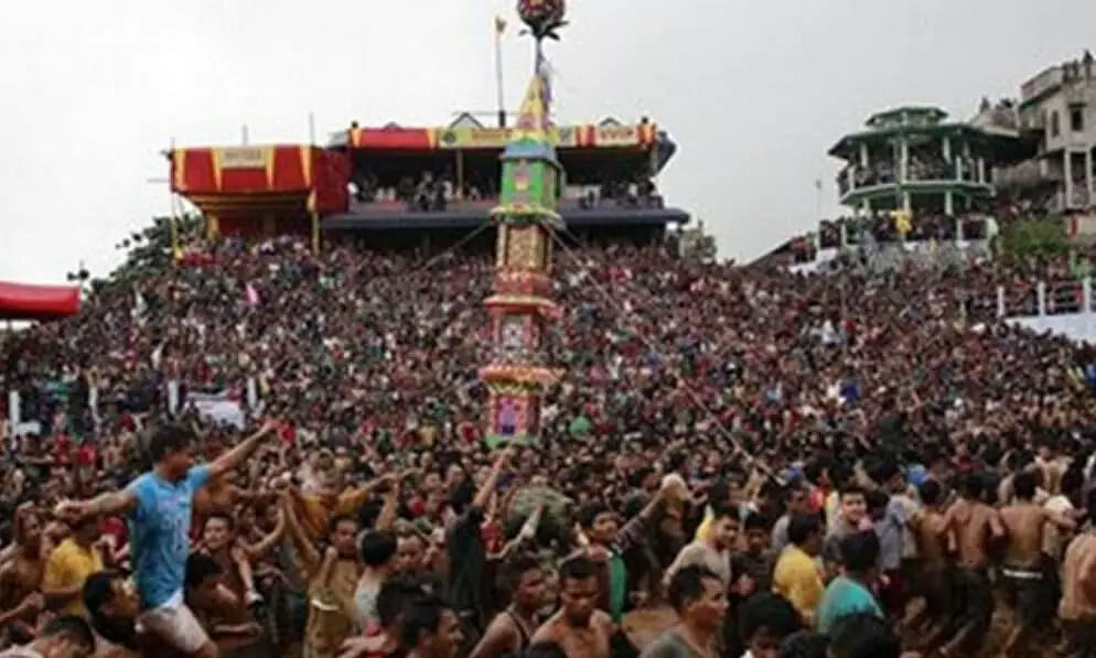
Festivals such as Behdeinkhlam, Chad Sukra and Laho Dance attract many tourists each year. Behdeinkhlam, a major festival of the Pnars, is a 4-day event that takes place during July. Behdienkhlam means to drive away evils and plague and is celebrated in all parts of the Jaintia Hills. Dancing takes place in the street to the accompaniment of drums and pipe playing. Although women do not participate in dancing, they have an important role to play at home by offering sacrificial food to the spirits of the ancestors. Each locality prepares a decorative tower-like pillar structure called a rath, carried by 30 to 40 people to a small lake at Aitnar for immersion. The festival culminates when the khnong or the sacred tree is brought to the centre of each locality. In the afternoon, Datlawakor, a form of soccer with a wooden ball, is played between two teams from the upper and lower valleys of the Myntdu River. Those in the team who wins are believed to be blessed with a good harvest. Other festivals include Laho Dance and Chad Sukra.
The Tryshi Falls are often compared to the Elephant falls of Shillong and is located about 8 km from the heart of Jowai. A bridge connects the waterfall’s surroundings with an expanse of green paddy fields. A breathtaking panoramic view of the Pynthor Nein is visible from the bridge. A trek to the bottom of the falls is amazing too. The Krang Suri Falls are located in Amlarem and have chiselled and gravelled footpaths and view points to enable visitors to better appreciate the beauty of the waterfall and its surroundings.
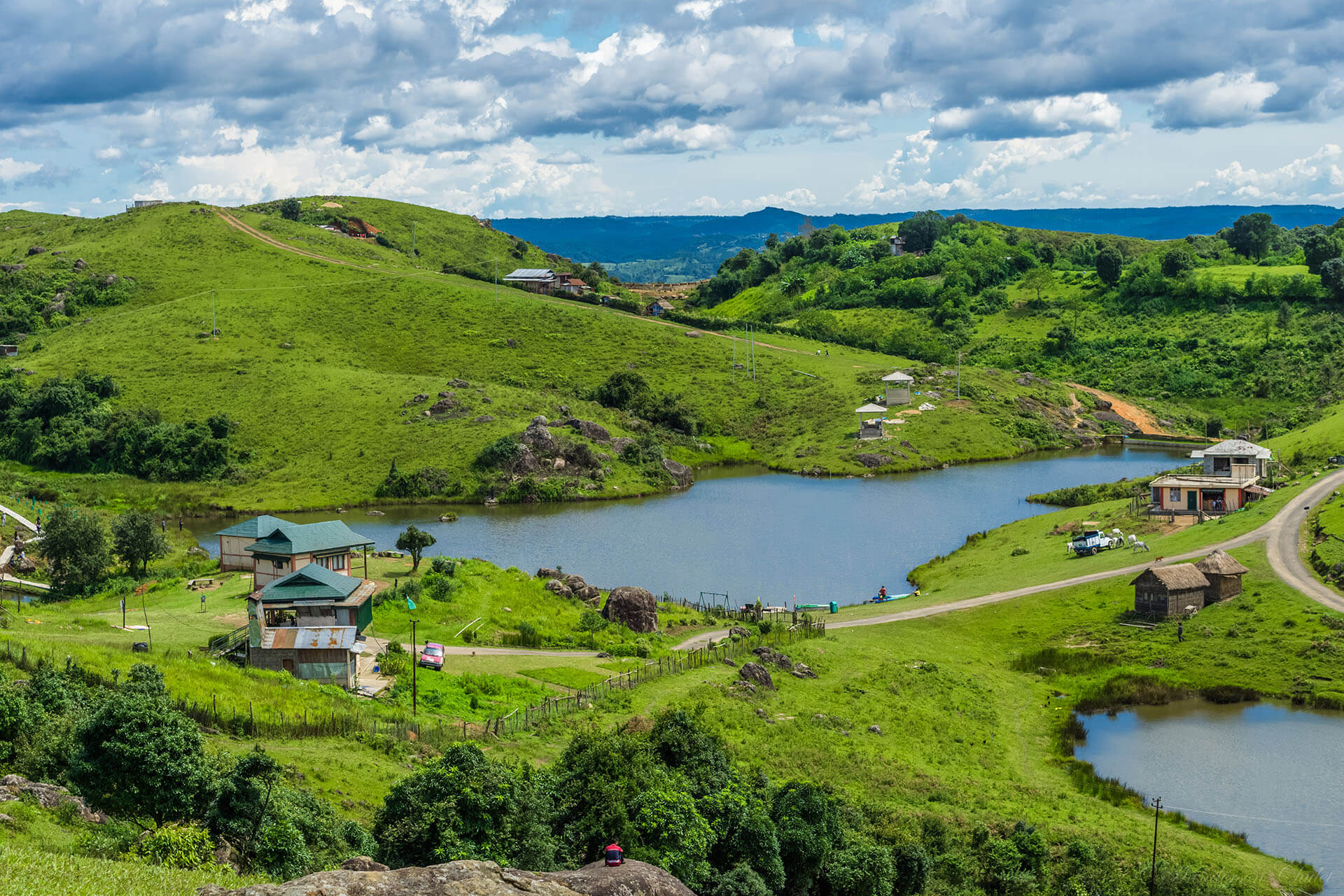
Located at Mukhla, about 20 km from Jowai, the Thadlaskein Lake is a beautiful lake with anthropological importance. A popular tourist spot, the lake is crystal clear and reflects the sky. Unharmed and untouched by man the lake has been turned into a popular picnic spot. A small hotel managed by Meghalaya Tourism is just across the road which offers clean and good service. The lake was constructed by Sajar Nangli, a follower of the former Jaintia King. Surrounded by Pitcher Plants, the Jarain Pitcher Plant Lake, spread over 50,000 sq m, has boat rides which allow one to navigate the plants and is a unique sight. A fountain shaped like a pitcher plant has been installed in the middle of the lake which sits amid gravelled footpaths, arch bridges, a pitcher plant garden and a greenhouse interpretation centre.
Famous for its sacred groves and the beautiful Pynthorwah Valley, the Lalong Park has become popular in recent times. A water eco-park with a view of the Pynthor Wah valley and the Myntdu river is also taking shape to change Lalong into a major tourism hub.
An ancient and famous temple, the Durga temple which is more than five centuries old is located near the remnants of the Summer Palace. In ancient times, human heads were offered to the goddess at the temple as human sacrifice. During British colonial rule, this practice was abandoned. The oldest church in Jaintia Hills, the Jowai Presbyterian Church was built by the Welsh Presbyterian Mission in the latter part of the 19th century and is one of the few structures in town that retain British architectural influence.
Monoliths exist throughout the length and breadth of the Khasi and Jaintia Hills. However, the largest collection of monoliths are the Nartiang Monoliths. Here also lie the remnants of the Summer Palace with the archway of the site made using red bricks.
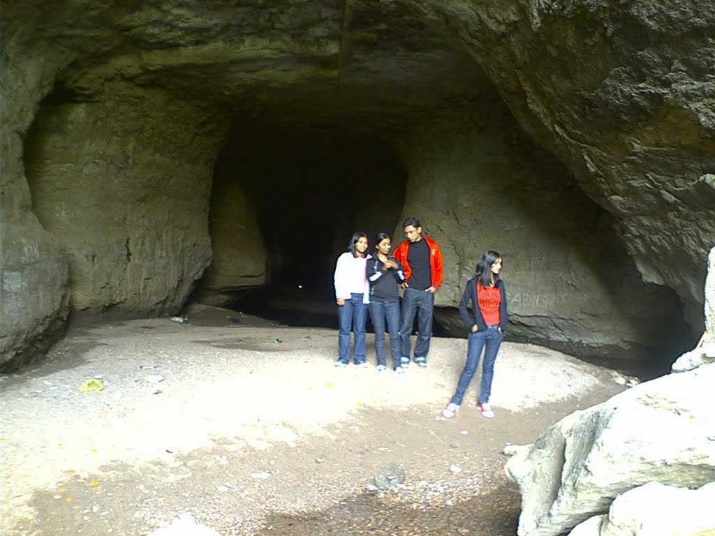
The Umlawan Caves are the subcontinent’s deepest and largest caves. These caves are interconnected with the Kot Sati and Umskor Caves and have many stalagmites and stalactites. The caves are 100 m deep and 21km long. Meaning the flower of gold, Syntu Ksair is located on the banks of the Myntdu River and is the centre of the freedom struggle led by Kiang Nanbagh. A memorial has also been set up here in honour of him. Also known as Madan Madiah or Uncle’s Ground, Syntu Ksiar is a valley well irrigated by the Myntdu River. Today, the ground has a monument of U Kiang Nangbah, a fighter of the Khasi people. The Stone Bridge is an old historic stone bridge used by the Jaintia Rajas to cross while travelling from their Summer Capital in Nartiang to their Winter Capital in Jaintiapur, now in Bangladesh. The structure was broken once when an elephant tried crossing it.
Source
Mawlynnong
A small village located close to the India-Bangladesh border in the East Khasi Hills about 75 km south of Shillong, Mawlynnong has been declared Asia’s Cleanest Village in 2003 by Discovery India. Also known as God’s own Garden, Mawlynnong is a community-based eco-tourism initiative where the entire community made collective efforts in making and maintaining the cleanliness of the village. Mawlynnong offers a picturesque natural beauty with lush green valleys, crystal clear water in the river, an abundance of flowering orchids hanging from the trees and extremely clean roads which makes this small village worth visiting. Mawlynnong also offers pleasant weather throughout the year and especially during monsoon.
Mawlynnong also follows the tradition of a matrilineal society and as per the tradition of the Kasi people, property and wealth are passed from the mother to the youngest of her daughters, who also keeps the mother’s surname. Mawlynnong is known for its cleanliness. The waste is collected in the dustbins made of bamboo, directed to a pit and then used as manure. A community initiative mandates that all residents should participate in cleaning up the village. Smoking and use of polythene are banned while rainwater harvesting is encouraged. The reputation as Asia’s cleanest village boosted local tourism and in 2017 it was reported that, according to the village headman, incomes had increased by 60 per cent due to the increase in eco-tourism.
The Dawki River, which is known to be very clean and crystal clear is located about 35 km east of Mawlynnong. Between Mawlynnong and Dawki, one comes across the Bophill Falls. The water falls at a very incredible force to form a river in the Sylhet border area of Bangladesh, making the water appears milky white. Known as the Sky View or Sky Walk, this is a popular attraction at Mawlynnong which is made up of cane and bamboo that offers a complete view of the Indo-Bangladesh border along with the village. To get to this 85 feet tower, one will be charged INR 10 per person. There is another mid-size waterfall within the village which is considered an amazing picnic spot is known as the Mawlynnong Waterfall. The Riwai Village is located 2 km east and is well known for the beautiful trekking it has through rainforests. However, the most popular tourist destination in the village is the small living root bridge made up of the aerial roots of rubber fig trees.
96 km southeast of Shillong, Dawki is a border town in the West Jaintia Hills and the gateway to Bangladesh. The town offers scenic views of some of the tallest mountain ranges in Meghalaya and the Bangladesh borderlands. The Dawki Integrated Check Post or the Dawki border crossing on Dawki-Tamabil is one of the few road border crossings between India and Bangladesh. It is used mainly for coal transportation to Bangladesh with some 500 trucks crossing the border every day during peak season.
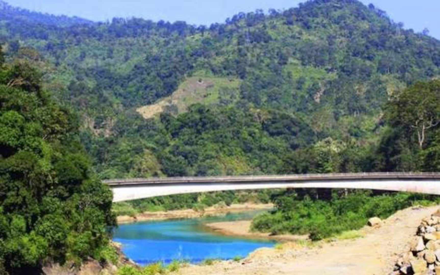
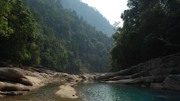
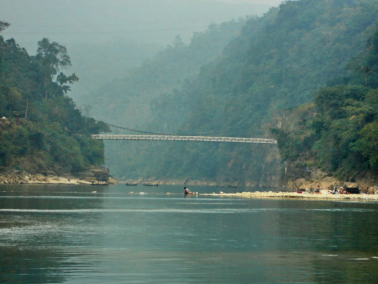
The Umngot River, also known as the Dawki River and Wah Umngot, is a river which flows through Dawki. The Umngot, a beautiful river with crystal clear waters is arguably one of India’s cleanest rivers and an important fishing spot for local fishermen. The river sits on the India-Bangladesh border, and a white portion of the river, caused by a rise in the current, marks the unofficial boundary between the two countries. A suspension bridge, the Dawki Bridge, hangs over the Umngot River that was constructed in 1932 and is a place of interest. Dawki is popular as a day trip from Shillong with many visitors coming here for the colourful annual boat race during spring on the Umngot River. Boating at the Umngot river is a must at Dawki. The water is so clean and clear that the boats seem to be floating on the river bed, a once-in-a-lifetime experience. The boating charges are around INR 600 for a 40-minute ride. Also known as Dawki Falls, the Umgrem Falls is another waterfall situated very close to the road that marks the border between India and Bangladesh and is highly popular among visitors.
In April 2021, the Meghalaya government decided to construct a dam on the river, because of an electricity shortage. The project was the proposed 210 MW Umngot Hydroelectric Project, which received loads of backlash and opposition from the local villagers, who feared that its construction would disrupt tourism and the project was eventually scrapped.
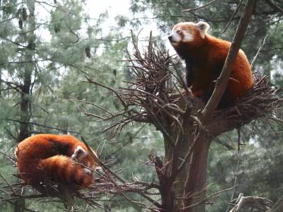
Located at an altitude of about 910 m or 3,000 ft close to the international border with Bangladesh, the Balpakram National Park was inaugurated in December 1987 and is home to wide species of plants and animals. Located in the southern Garo Hills in Meghalaya, about 167 km from Tura, and about 195 km from Shillong, the park’s vegetation consists of subtropical, grassland, bamboo forest, tropical deciduous trees, and carnivorous plants like the pitcher plant and Drosera. In the southern part of the Garo Hills, species in the national park include the Indian elephant, chital deer, wild water buffalo, red panda, Bengal tiger, and marbled cat. The rivers and lakes in the wildlife reserve are home to various species of birds. A variety of very rare medicinal herbs, which are locally known as dikges, also grow abundantly in Balpakram. The Central government of India has nominated the Garo Hills Conservation Area (GHCA), straddling the South and West Garo Hills, for a World Heritage Site, which includes Balpakram National Park and this has been listed in the UNESCO World Heritage tentative list.
The word Balpakram means the land of perpetual winds, and the national park is blessed with charming grace and breathtaking scenes. The Balpakram National Park is home to many endangered and endemic species of plants and animals. The area is full of sprawling vegetation of deciduous and subtropical trees. The region is also famous for the pitcher plant and other plants of crucial medicinal value that eee commonly found here.
One can find a deep gorge in Balpakram, which is popularly compared to the Grand Canyon of the United States of America. The gorge is referred to as the land of the spirits since it is believed that the spirits of the dead live here temporarily before finally embarking on the journey towards their final abode. Numerous mysterious phenomenon takes place at the Balpakram National Park, for which modern science cannot give any reason, logic, or account. It is widely believed that the ghosts of the dead inhabit the gorge at the national park. There is also a thick schimawallichi tree in the national park, which has a depression on its trunk which seems to be the outcome of the constant tethering of animals and the work of harsh weather. Whenever a tree falls due to the strong winds, another tree situated close by gets affected with the same symptoms. One can also find a massive magnetic rock in the national park. This stone has a hollow space on its surface, which has a powerful magnetic force. Any animal or bird that wanders close to the rock is magnetically drawn towards the hallow, and they are never able to escape from there. Consequently, the animals die. Interestingly, this magnetic force does not affect humans. The steep rock cliffs that can be found in the canyon are supposed to be the natural habitats of the gonchos or evil spirits. These gonchos are believed to carry away people and lead them over steep precipices and inaccessible rock cliffs. They, however, do not cause any harm to their victims.
Source
The Balpakram National Park is also quite famous for its caves, which are complete with beautiful limestone formations of stalagmite and stalactite. The Siju-Dobkhakol Cave is situated on the bank of the Simsang River, just below the village of Siju, around 30 km to the north of Baghmara. This cave is 4772 m long and is renowned for being the third longest cave in India. It contains some of the most beautiful river passages that can be found all across the globe. The Tetengkol-Balwakol Cave, or the Cave of Dwarfs with inverted feet, is situated in Nengkhong village and is the second longest cave in India. Other prominent caves that can be found here include the Dobhakol Chibe Nala and Bok Bak Dobhakol.
The best time to come to Balpakram National Park is from late October to March when the weather is pleasant with little to no rainfall. One can enjoy watching animals during these months when they come to drink water in the rivers and lakes in the national park. There are no entry fees to the park which is open between 7 am to 6 pm daily. Balpakram National Park is a protected place, and prior permission has to be taken from the wildlife authorities before entering the area. One can easily obtain a permit to visit the National park from the DFO office in Baghmara free of cost.
Formerly known as Simsanggre, Williamnagar is the headquarters of the East Garo Hills and is named after Captain Williamson A. Sangma, the founding Chief Minister of the State of Meghalaya. The township was planned around the erstwhile village of Simsanggre, on the vast plainlands along the banks of the Simsang River, in 1976 after the Garo Hills district of yesteryear was reorganised to carve out a new district called East Garo Hills District.
Where Williamnagar is located has historical importance as it was here that the Garos made their last major resistance to the British intrusion into Garo Hills in 1837. The legendary Garo leader Pa Togan Nengminja Sangma was felled by the British, in a skirmish, at Chisobibra, on the outskirts of Williamnagar, on 12 December 1837. Located about km west of the state capital, Shillong, Williamnagar is a very remote area known for its abundance of natural beauty, being flanked by the mountains and has a rich composition of both water and vegetation.
The Chamera Lake and the Simsang River are must-visit places while at Williamnagar because of their beauty. The conifers carpeting the banks and the clean air make this an unforgettable place. One should make sure they go for a boat ride and soak in the vast expanse of natural beauty. The breathtaking, magnificent and vibrant Domre Falls is a wonderful place to chill and let go of worries. Mrik Wari is close to the Simsang River famous for its rock formations. Some of the formations depict the shape of a baby elephant and its mother. According to legends, the elephants turned into stones after drinking the water from the river at daybreak. There are also several other formations in addition to the scenic view of the river and its beautiful surroundings. 120 km from Williamnagar, is Naka Chikong, a big rock with deep hollows, in the middle of the Ildek river in Badaka village. This big rock is mythologically believed to be swarming with fish, and there is a belief that if anyone inadvertently touches the big rock under whose hole the fish are, all the fish immediately disappear from the river. Home to many rare and protected birds along with other animals, the Siju Sanctuary is also known as Siju Bird Sanctuary. The Simsang Festival is a cultural event held in December which calls upon the best artists of the state with many smaller events taking place.
Located very close to the border with Bangladesh, Baghmara is the headquarters of the South Garo Hills district, about 286 km west of Shillong. The name Baghmara is derived from the fight that took place between Bong Lasker and a wild Bengal tiger where he killed the tiger by crushing its jaws. Therefore the name Baghmara where bagh means a tiger and mara means to kill or die. To honour Bong Lasker, a tomb was built in the heart of the town which was previously known as Barokar, which means 12 streams with baro meaning 12 and kar meaning a stream in Bengali.
Baghmara is not only rich in flora and fauna but also boasts many small lakes, rivers, and rolling hills. Flanked by the South Garo hills and fed by the Simsang river, this town is host to hordes of tourists every year. The Balphakram National Park lies around 66 km away and being a major trade hub with Bangladesh, Baghmara is known for its fish delicacies. The Someshwari River, also known as the Simsang in the Garo language, flows through the town. The famous Siju Cave is about 45 km away and to get to Siju one needs to go through Baghmara. The famous Balphakram National Park is 66 km away and one needs to pass through this town to get there. The town is home to the carnivorous pitcher plant and has the Pitcher plant sanctuary located at Dilsa Hill colony. The town viewpoint is also located on the same spot inside the tourist lodge with a breathtaking view of Baghmara. 4 km from the town of Baghmara lies the Baghmara Reserve Forest, inhabited by elephants, birds, and langurs. There is a provision for elephant rides in the reserve forest. The Baghmara Tyisam Fest is a 3-day fest that kicks off in December with lots of activities from drumming to beach football to fancy dress competitions.
One of the largest towns in Meghalaya, Tura is located in the foothills of the Tura range of the Garo Hills. Located about 311 west of Shillong, Tura was known as Dura before the Britishers came to the Garo Hills and the name was corrupted to Tura as Tura was easier to pronounce. The climate in Tura is moderate throughout the year and their God Duma is believed to reside in the hills. Filled with small rivulets and green valleys all around, the principal languages spoken in Tura are Garo and English. Tura is relatively deeply rooted in its native Garo roots and boasts of rich undisturbed biodiversity and natural attractions.
The main attraction of the town is the Nokrek National Park which is 12 km from the town where various animals such as the leopard, golden cat, wild buffalo, pheasant, and many more reside. The Nokrek National Park is located close to the National Citrus Gene Sanctuary-cum-Biosphere and this region comprises mainly deciduous and evergreen forests filled with different varieties of trees including the Tura peak which lends its name to the place, insectivorous plants, ferns, rare orchids, and medicinal varieties. In May 2009, Nokrek National Park was added by UNESCO to its list of Biosphere Reserves. The forests also have many fruit trees like plums, peaches, pears, and oranges as well as spices such as ginger, turmeric, and cinnamon. One may also visit the Rongbang Dar Falls, while a trip to this area, without visiting the Siju caves, would remain somewhat incomplete.
Tura Peak, part of a reserve forest is an excellent destination for treks and sightseeing, as it allows panoramic views of the valley from the observatory accompanying it. About 7 km away from Tura, Pelga Falls is famous for angling and is also an excellent picnic spot. It is relatively free from crowds most of the time, making it ideal for those who want some quiet time. The best time to visit the falls is during the monsoon season when the flow is at its peak. Another popular tourist site, situated nearby, is the traditionally constructed Garo Bamboo Bridge, built over the Ganol River. The Rongbang Dar Waterfalls, also known as the Rongbang Dare, are located close to the Chinabat Village, about 39 km west of Tura. At a height of over 120 ft, this waterfall has fantastic visual appeal, especially during the monsoon season when the flow is large and speedy. Located close to the Siju Wildlife Sanctuary, Naphak Lake is a pristine location, excellent for bird watching and fishing. Many of the birds who reside or migrate to the Siju Wildlife Sanctuary can also be spotted here. It is located around 112 km from Tura and can easily be driven to. Tura Peak lies about 872m above sea level and there is a reserve forest at this mountain peak along with a tourist bungalow, a cinchona plantation, and an observatory. The massive yellow plains of Bangladesh welcome you at the peak which is an unforgettable sight. It is also possible to trek to the top of the peak.
The Foundling – Paul Joseph Fronczak and Alex Tresniowski
The Foundling tells the incredible and inspiring true story of Paul Fronczak, a man who recently discovered via a DNA test that he was not who he thought he was—and set out to solve two fifty-year-old mysteries at once. Along the way he upturned the genealogy industry, unearthed his family’s deepest secrets, and broke open the second longest cold-case in US history, all in a desperate bid to find out who he really is.
In 1964, a woman pretending to be a nurse kidnapped an infant boy named Paul Fronczak from a Chicago hospital.
Two years later, police found a boy abandoned outside a variety store in New Jersey. The FBI tracked down Dora Fronczak, the kidnapped infant’s mother, and she identified the abandoned boy as her son. The family spent the next fifty years believing they were whole again—but Paul was always unsure about his true identity.
Then, five years ago—spurred on by the birth of his first child, Emma Faith—Paul took a DNA test. The test revealed definitively that he was not Paul Fronczak. From that moment on, Paul has been on a tireless mission to find the man whose life he’s been living—and to discover who abandoned him, and why.
This is the story of Paul’s heart-wrenching and tortuous journey to solve both mysteries and finally learn the truth about his identity.


