Travel Bucket List: India – Mizoram Part 4

Murlen National Park
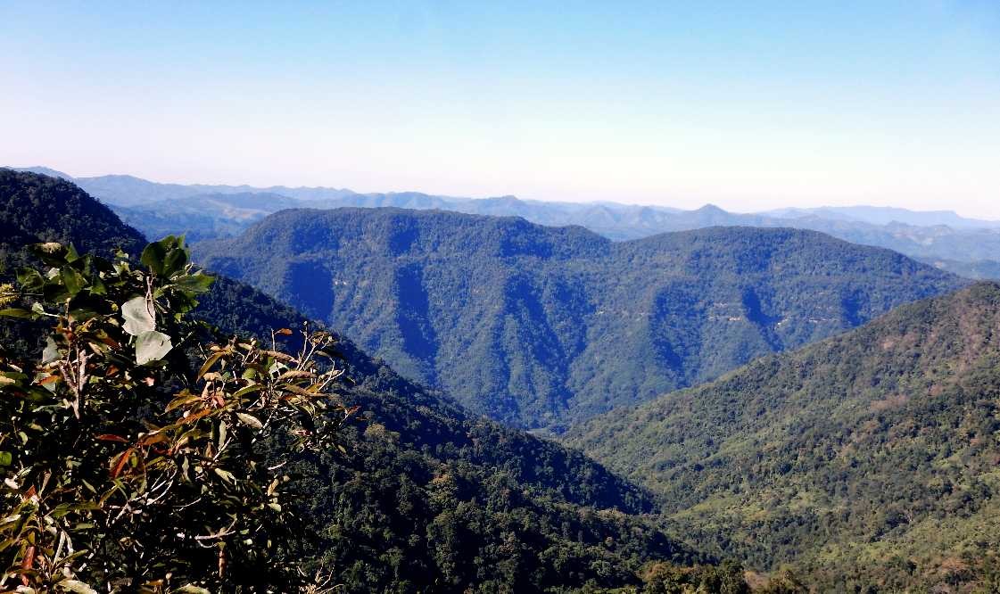
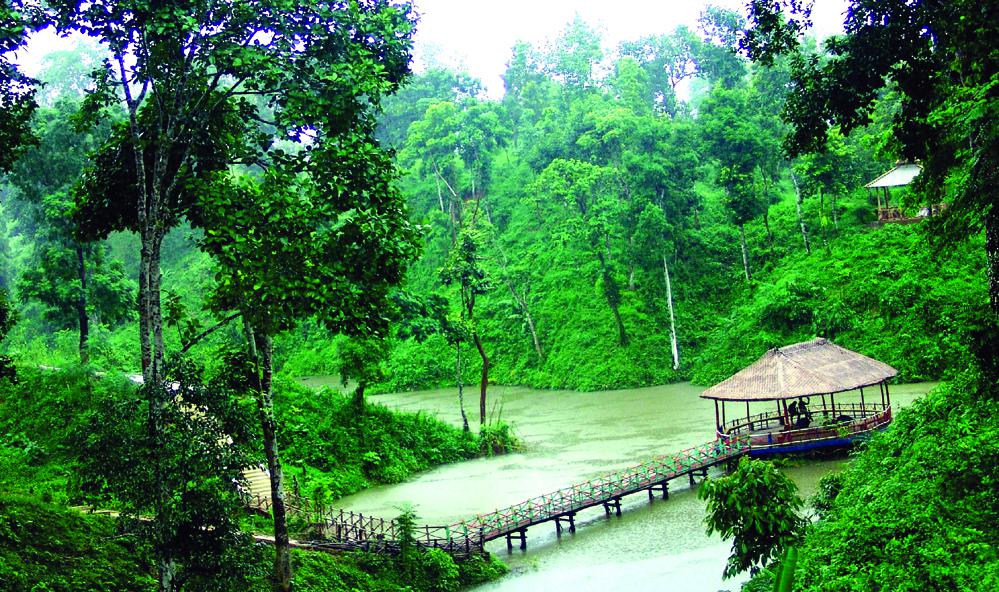
Located about 250 km east of Aizwal, the Murlen National Park is close to the Chin Hills, north of the Lengteng Wildlife Sanctuary. The park covers an area of approximately 200 sq km and the tropical, semi-evergreen, and submontane forests of Murlen are home to a rich variety of flora and fauna. About 15 species of mammals, 150 species of birds, 35 species of medicinal plants, two species of bamboo, and four species of orchids have so far been recorded in this park. Murlen National Park is located at Murlen village, which is the village of Saithuama Sailo, the Chief of Hnahlan and is a part of the Hnahlan Village. Murlen was declared a National Park in 1991.

Only about 1% of the sun’s rays can penetrate the forest on a sunny day. So the forest cover in the park can generally be compared to the Amazon region in South America. Some of the trees found in the park are 350 years old and there is an area in the park where the sun’s rays cannot penetrate. For this reason, the area has been known as the losing area of seven fellow men or the land of no return. Two species of Ceropegia belonging to the Asclepiadaceae plant family have been discovered in Murlen National Park. The national park is famous for housing animals like the hoolock gibbon, and the Himalayan Black Bear as well as leopards, tigers, and many other species.
Phawngpui
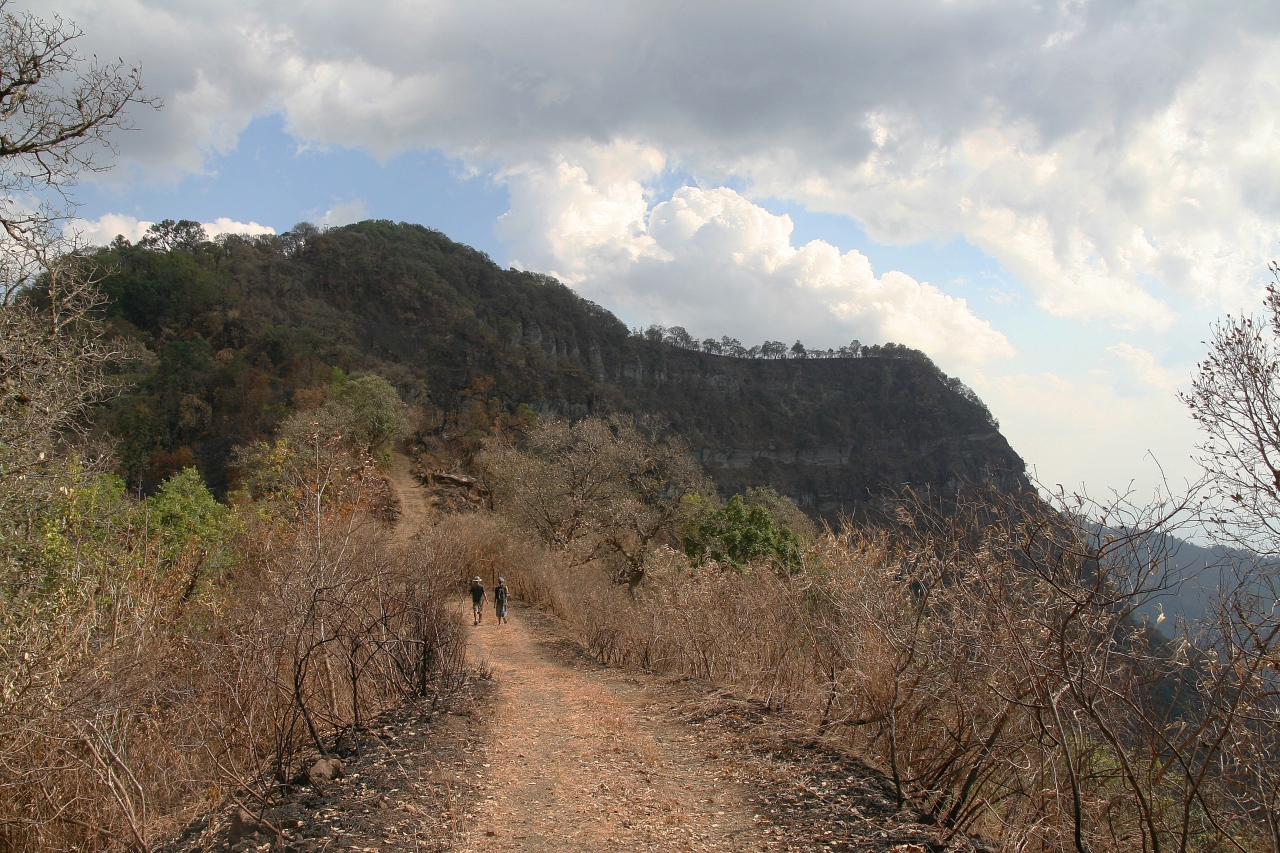
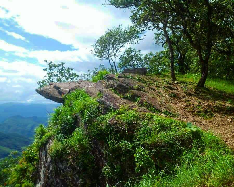
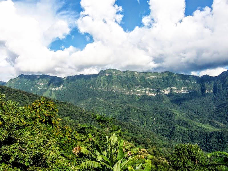
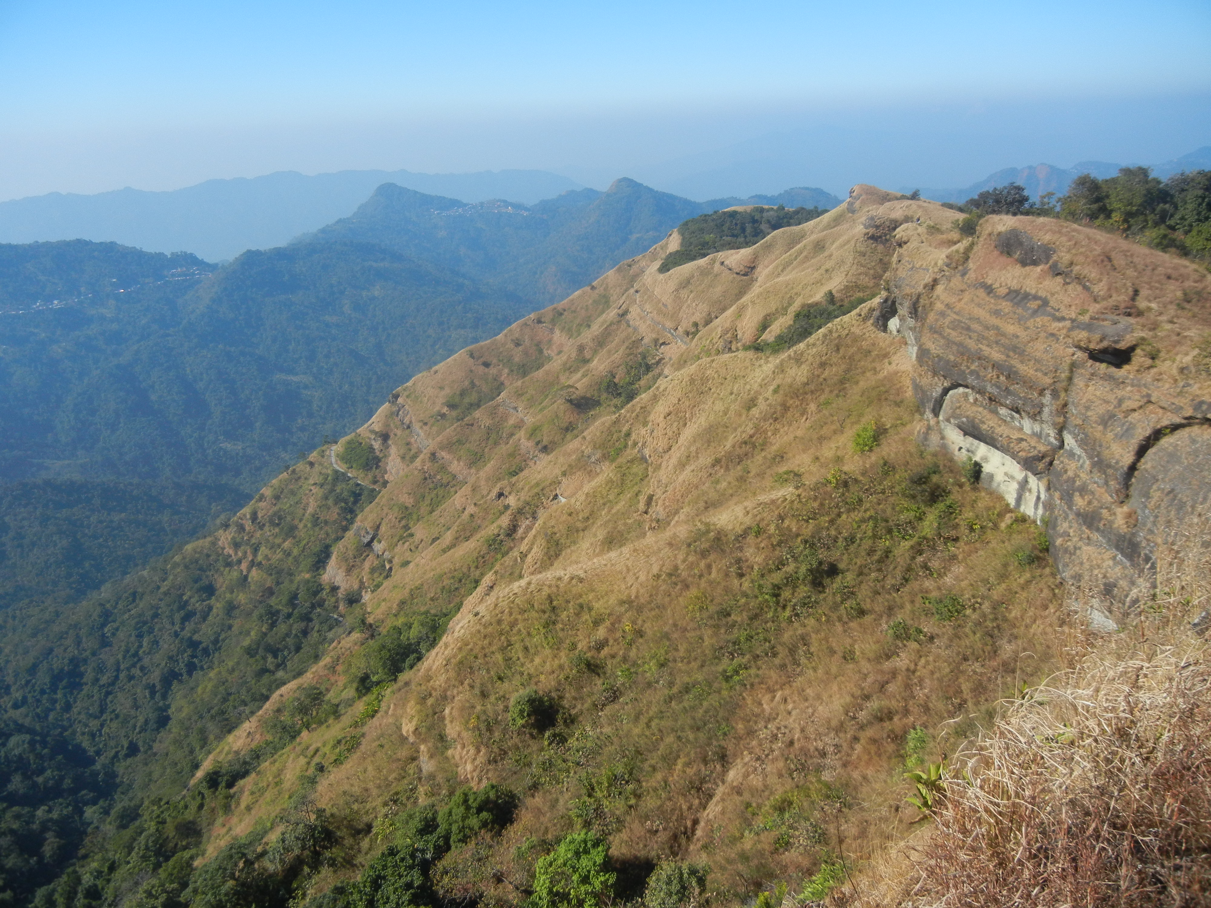
A quaint and serene village located about 300 km south of Aizwal at an elevation of 2157 m, Phawngpui proffers picturesque views surrounded by verdant trees and lofty mountains. Also known as Blue Mountain, Phawngpui is the highest mountain peak in the Mizo or Lushai Hills. It is in the southeastern region near the Myanmar border. A trek to the top of the mountain will provide amazing views of the whole place which will make one feel as if they are in heaven. The ideal time to visit Phawngpui is between November and April when the weather is pleasant and a cool breeze flows. There is a semicircular series of cliffs on the western side called Thlazuang Khàm, which have a sharp and deep fall; mountain goats live there. These cliffs are believed to be haunted by spirits. On the peak, there is a level ground of about 2 sq km in area.

A highly revered peak, considered to be the abode of local deities, Phawngpui was a major centre of folk religion and a location for folklore stories. The name is derived from the Lai language, with phong, meaning a grassland or meadow, and the suffix pui meaning, great. This was because the mountain was mostly covered with all types of meadows, hence the great meadow. The mountain was, according to the belief of the natives, the abode of several spiritual races. The most important folktale, perhaps, is that of a deity king named Sangau; the actual town at the base of the mountain which has become Sangau. Sangau had a son who married the princess of another royal family called Cherian. At the wedding was an exchange of gifts, a couple of hoolock gibbons from Sangau and a pine tree from Cherian. The base area, the main entrance of the mountain bears the name Farpak which means pine only.

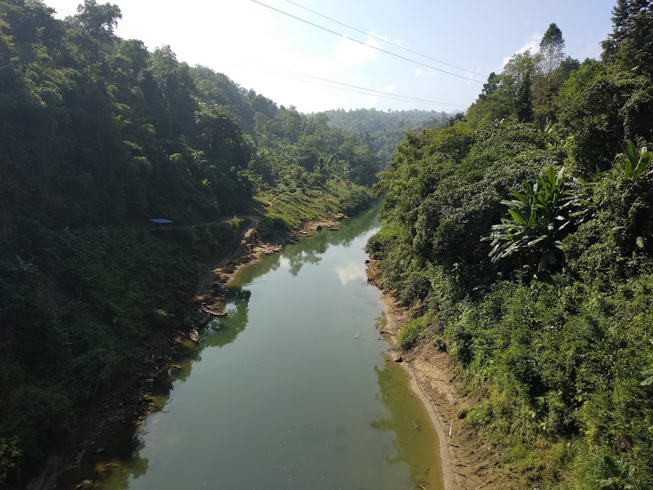
The Chhimtuipui River is a serene river that flows in Phawngpui and is the perfect place to spend some quiet time in the lap of nature. The beauty of the river is captivating during sunrises and sunsets, so if visiting Phawngpui, make time during that time of the day to visit the river. Located 7 km from Phawngpui, Farpak provides picturesque views of nature and is also the base for the trek up to Phawngpui peak. Replete with lush green trees and fauna, some of the commonly spotted animals include clouded leopards and elephants. Sangau is located 30 km from Phawngpui and is another base from where one can trek up the Phawngpui mountain.
Phawngpui National Park
The Phawngpui National Park or The Phawngpui Blue Mountain National Park is one of the two national parks in Mizoram, the other and larger being the Murlen National Park. It is about 300 km from Aizwal, towards the southeast of Mizoram relatively close to Myanmar. The park is named after the Phawngpui mountain, often called the Blue Mountain, the highest mountain peak in the state, reaching 2,157 m asl. The national park covers the entire mountain along with the surrounding reserve forest. In the Lai dialect, Phawng means a meadow and pui is the suffix for great. It is also believed by many that Phawngpui was an abode of God.

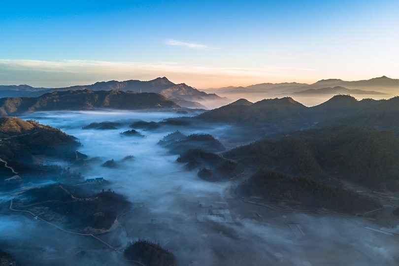
The mountain area of Phawngpui is at most times covered by a thin stretch of clouds, which makes it blue in appearance from a distance, hence the name Blue Mountain. It overlooks the River Chhimtuipui flowing towards Myanmar and the edges of the mountains are all very steep and have sharp precipices, with the most spectacular one being a semi-circular beautiful cliff on the western side called Thlazuang Khâm, which has a blunt and deep fall. The mountain ridge runs in a north-south direction covering about 10 km. The closest human settlement is Thaltlang village at the base and periphery of the park.

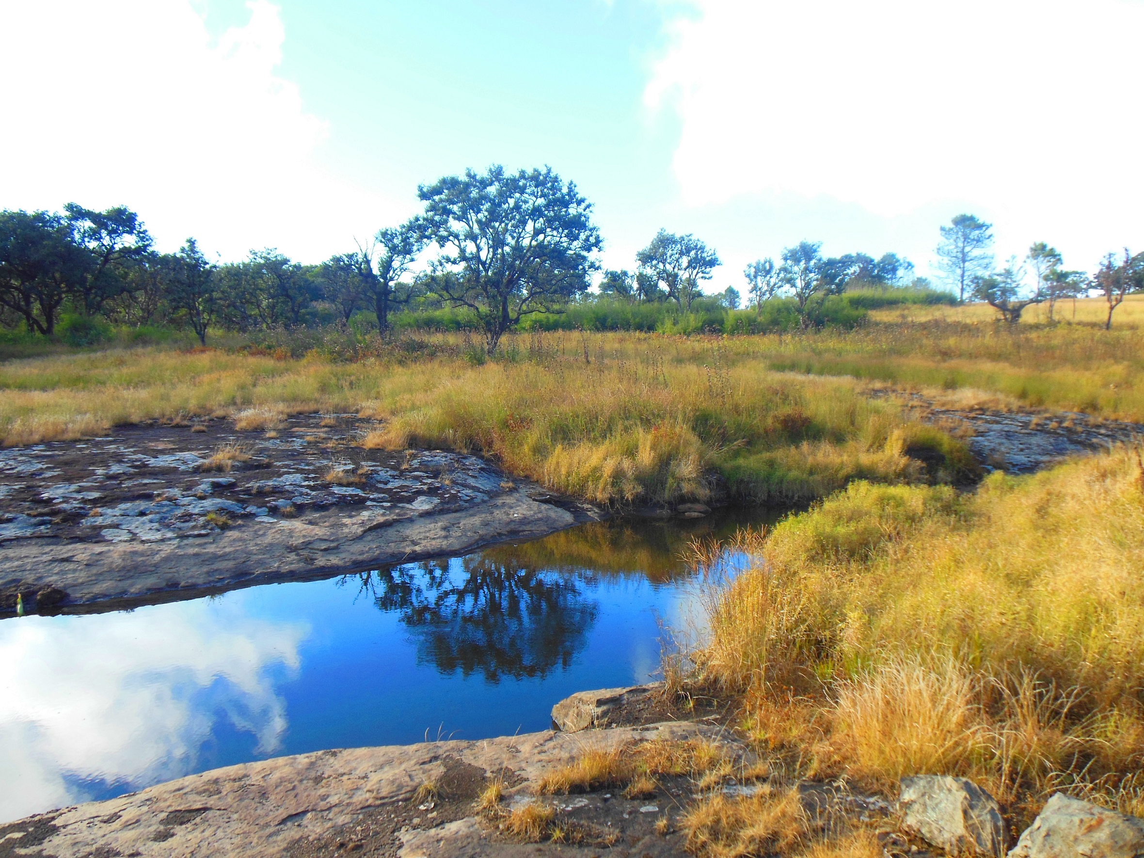
The Phawngpui National Park provides habitat for a range of birds including the rare Blyth’s tragopan, falcon, sunbirds, dark-rumped swift, and Mrs Hume’s pheasant, which is the Mizoram state bird, and also rare animals like the mountain goat, slow loris, tiger, leopard, leopard cat, serow, goral, Asiatic black bear, stump-tailed macaque and capped langur. In 2000, rare bird species were recorded such as mountain bamboo partridge, oriental pied hornbill, purple cochoa, striped laughing thrush, grey sibia, black eagle and large-billed crow. The clouded leopard or Neofelis nebulosa was spotted and documented for the first time in 1997. The landscape is the natural habitat of various grass and the steep slopes are covered by orchids and rhododendrons, with areas of bamboo.

Ecofriendly visits to the national park are only allowed during the dry season with permits open for six months between November to the end of April. The rest of the season is left for natural development and rejuvenation.
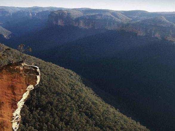
The highest point in the state, Phawngpui Peak is a revered mountain. Also known as the blue mountain, the peak is located within the Phawngpui National Park and oversees a wondrous landscape full of deep crevices and magnificent cliffs. Trekking to the summit of Phawngpui is an experience no adventure lover can let go of. At a height of 2100 m, Phawngpui Peak is considered to be the abode of the Goddess of the Mizo tribes. The peak is made accessible by the state only between November to April and during this time, the route is usually dry and well marked out due to animal movements. The winter months can be cold so multiple layers are needed. The peak and national park are open between 6 am and 5 pm daily and there is a minimal entry fee to the national park.

Saiha
Saiha which is also known as Siaha lies about 300 km south of Aizwal and is the headquarters of the Mara Autonomous District Council, one of the three autonomous district councils within Mizoram. The word Siaha in the local Mara language comes from Sia for Masia which means elephant and ha meaning tooth, so the name translates to an elephant’s tooth. The name came about because it was here that a large number of elephant teeth were found. Though the local people name the town as Siaha, Mizos called it by the name Saiha, which is purely a translated term in the Mizo language.

Saiha is known as the fastest-growing town in Mizoram, as the population has significantly risen in the last decade. The town lies at an average height of 729 meters above sea level and is considered to be a haven for angling enthusiasts.

Lying 130 km to the southwest of Saiha lies the Palak Wildlife Sanctuary, an exquisite display of biodiversity. It is situated in the Lakher region, which lies in the southern part of Mizoram. Not the biggest of wildlife sanctuaries, it is spread across 15.50 sq km and boasts a range of species like the sambar, barking deer, leopard, elephant and rhesus macaque.
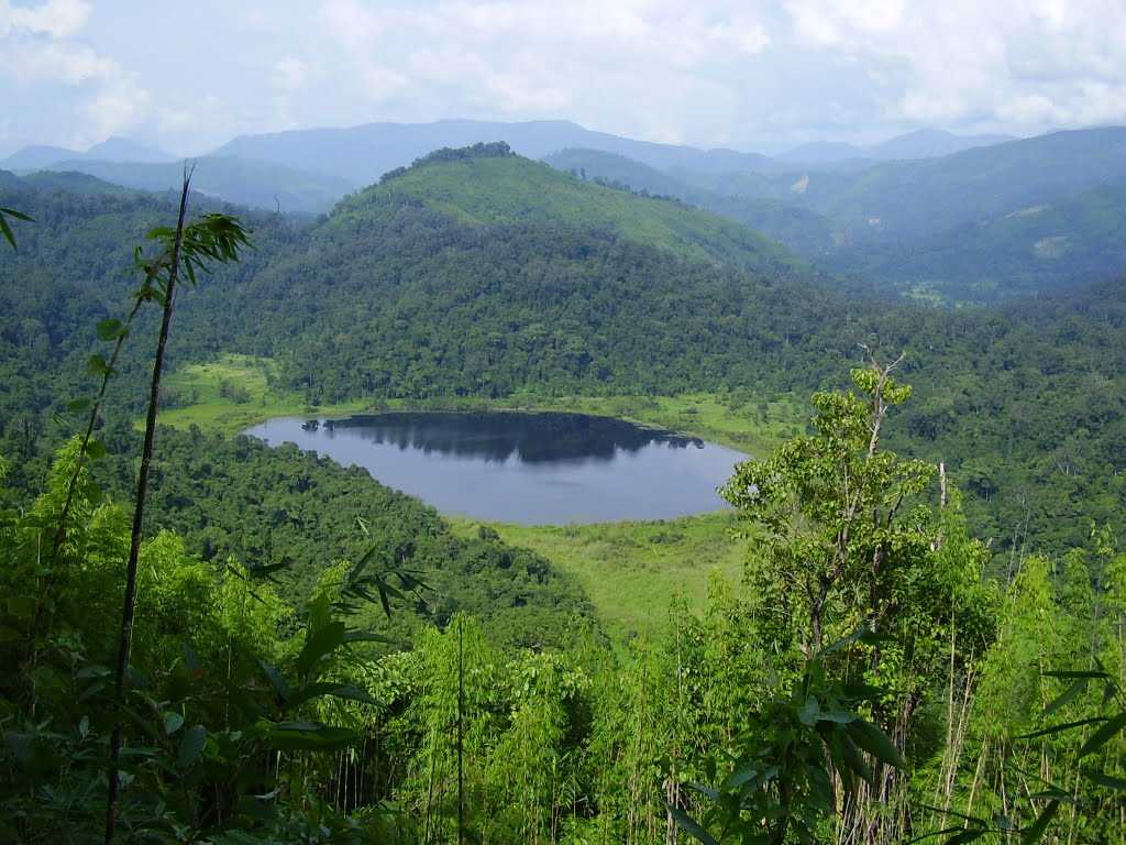
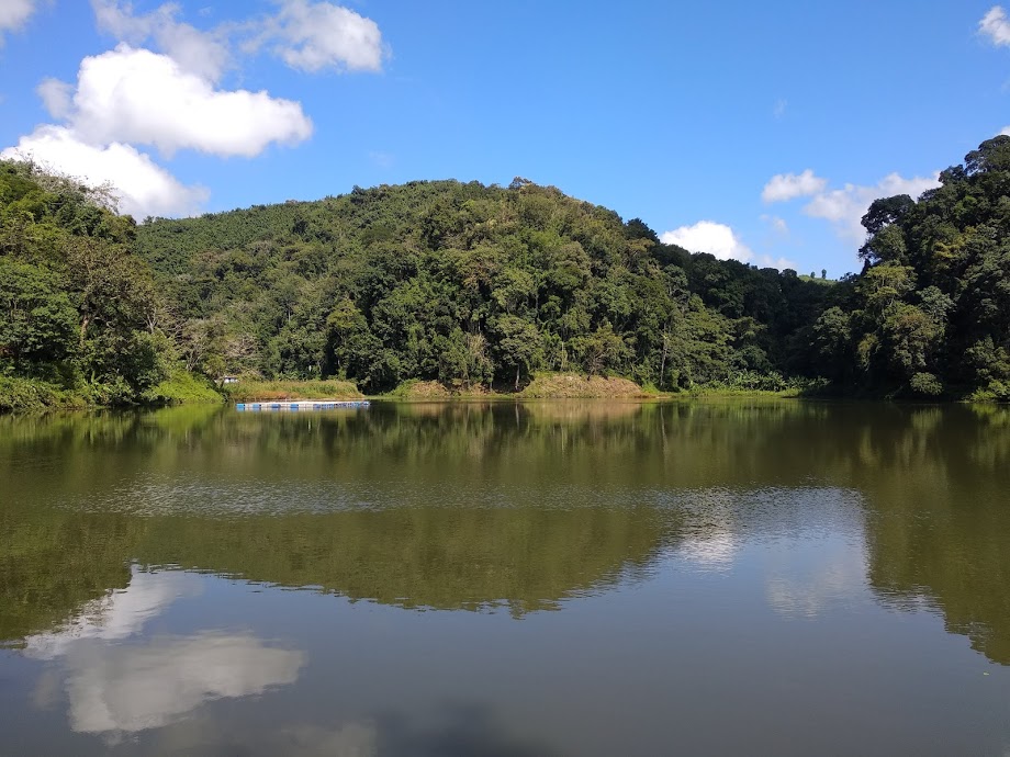
Palak Dil, also known as Pala Tipo is located in the Phura village, a few km from the main town of Saiha. The lake’s name in the Mizo language means the swallowing lake and is the largest lake in Mizoram. The lake is located in an area rich in biodiversity, given that it is located in the Indo-Burma biodiversity hotspot. As it is a major component of the Palak Wildlife Sanctuary, it is also blessed with a lot of flora and fauna. The lake covers an area of 30 hectares and is surrounded by a thick unspoilt forest.
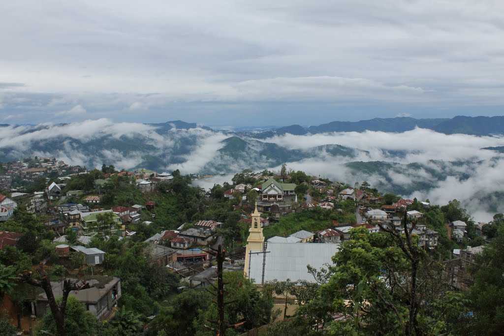
Mount Mawma is the third-highest mountain in Mizoram and the highest mountain within the Mara Autonomous District Council. Situated in the southeastern part of Mizoram, it is just 15 km from India’s international boundary with Myanmar. Two km from Mount Mawma lies Chakhei, a town where a well-furnished guest house is located. Mount Mawma is 6,725 feet or 2,050 m above sea level. During winter, the plains of Bangladesh as well as many parts of western Myanmar, are visible from the peak of the mountain.

This brings us to the last of the seven sister states of northeast India. While on one hand, I would love the northeast of India to be more accessible and have better rail and road infrastructure, on the other hand, over-commercialisation will most likely lead to the area losing the charm it currently has. This a question we all need to think about, what is the right amount of commercialisation that an area retains the charm and beauty it is known for and at the same time, infrastructure is built to promote tourism?

The next state we will explore will be the last state I have left to explore in India, which will be Delhi, India’s capital. So look out for it.
Travel Bucket List: India – Mizoram Part 3

Dampa Tiger Reserve
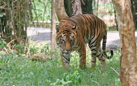
Located amidst deep and dense forests, the Dampa Tiger Reserve is located about 120 km southwest of Aizwal and is rich with a variety of flora and fauna. The wildlife sanctuary covers a sprawling area of over 500 sq km in the Lushai Hills at an altitude of between 800 to 1,100 m on the western side of Mizoram and touches the international boundaries with Bangladesh. It was declared a tiger reserve in 1994 and is part of Project Tiger. The name Dampa means lonely men and refers to a local narrative about a village, where a lot of the women died.

The protected area was initially established as a wildlife sanctuary in 1985 with an area of about 680 sq km, which was reduced to about 340 sq km. In 1994, it received the status of a Tiger Reserve with an area of 500 sq km and thus became part of Project Tiger. The jurisdiction of the reserve is under two ranges, namely the Teirei Range and the Phuldungsei Range. The hills around the wildlife sanctuary are known to be the bio-geographic highway that connects India to certain regions of Mayanmar and China.

The tropical forests of the Dampa Tiger Reserve are home to diverse flora and fauna consisting of forests interpolated with steep precipitous hills, deep valleys, jungle streams, ripping rivulets, and natural salt licks. The reserve is not easily accessible unlike other parks where one can ride on a four-wheeler but one has to walk through the forest if one wishes to sight animals.

Dampa is home to the sloth bear, the serow, the hoolock gibbon, the slow loris, the endangered Phayre’s leaf monkey, the India leopard and the clouded leopard to name a few. The Bengal tiger was said to be extinct here until very recently when in May 2021 a camera trap finally captured a definite picture of a Bengal tiger. The last such recording was seven years ago, and before that, tiger scat was the only proof of their existence.

The Blue Pitta which belongs to the Pittidae family and is one of the 30 species on Earth is one of the main attractions here. Studies suggest that only 6 out of these 30 species of Pitta are found in India. There are about 54 species of birds that reside in the protected area out of which only 25 species have been identified by biologists researching the fauna of the reserve. Out of these 25, two species are in the nearly threatened category, and one is on the verge of extinction.

Dampa wildlife sanctuary is famous for its Jungle Safari. A part of the Safari includes taking detours in the deep, dense forests of the reserve. During the safari, one can spot leopards and tigers. A large variety of deer and bears are a common sight around the national park. Apart from this, Dampa also houses an exquisite variety of birds. One can book safari tours in advance and also opt to stay at one of the guesthouses available nearby at Dampa Hills.

Dampa Tiger Reserveis the largest wildlife sanctuary in Mizoram, was notified in 1985 and declared a tiger reserve in 1994. It is situated in the western part of Mizoram state, on the international border with Bangladesh about 127 km from Aizawl. It covers an area of approximately 550 sq km. The tropical Forests of Dampa are home to rich flora and fauna. It consists of forest interpolated with steep precipitous hills, deep valleys, jungle streams, ripping rivulets, natural salts licks, with an altitudinal zone of 200 m to 800 m. Dampa Tiger Reserve is a part of Project Tiger funded by the Government of India

Lunglei
Situated in the south-central part of Mizoram, which means the bridge of rock got its name from a bridge-like rock found in the riverine area around Nghasih – a small tributary of the River Tlawng, the longest river in Mizoram. It is the largest town after the capital, Aizawl, and is located about 165 km south of Aizawl.

Lunglei was the capital of the South Lushai Hill Districts for 10 years from 1888, as was Aizawl for the North Hill Districts. The two were united in 1898. Until India’s partition, Lunglei had direct access to Chittagong, a big city in what is today Bangladesh which made Lunglei the commercial and educational centre. The first Jeepable road to Lunglei was made only in the 1950s.

Source

Lunglei is famous for its scenic beauty and natural setting and is an ideal offbeat destination for those who love natural beauty and adventure activities bundled into one. Trekking, bird watching and camping are among the popular activities opted for by tourists visiting Lunglei. Lunglei is a biodiverse region, home to the Thorangtlang Wildlife Sanctuary and the Saza Wildlife Sanctuary. While the Saza Wildlife Sanctuary is famous for hosting migratory and endemic bird species, the Thorangtlang Wildlife Sanctuary is home to several animal species such as leopards, tigers, porcupines and leaf monkeys among others. Visiting the Lunglei Rock Bridge at the Nghasih stream is another popular activity while here.

On a rocky portion on the southern edge of Tawikhawthlir hill near Mualcheng village, about 65 km south of Lunglei, there are three figurines of persons in meditational poses which the local people call Lung Milem or the Stone Figures. It is not known who created them and it remains a mystery to date as no other relics of Buddhism are found elsewhere in the state.

Ui Lung is a monolith famous for its remarkably intricate carvings. It was erected in the whereabouts of 1800 by a certain Chinzah chieftain and his citizens in an expression of their longing for their fellow clansmen who perished in a severe famine. Their former village called Dawn is now in the Myanmar Republic. The stone features intricate carvings of animal heads, gongs, and human figures with spears and other weapons. It is a landmark in the historical wealth of the state. One may also visit Chhura leh Naa Vawk, a monolith with carvings portraying Mizo historical stories close to Ui Lung.

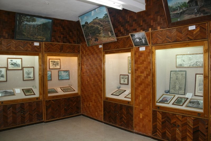
The District Museum at Lunglei is well-known as a storehouse of the ethnic culture and traditions of the state. There are exhibits of armour, jewellery, utensils, paintings, and other native art.

Lying about 84 km northeast of Lunglei, Khawnglung is a mountain situated near Pangzawl and a village of the same name used to be located on the ridge and was the scene of one of the bloodiest massacres during the days of internecine feuds between the Sailo chiefs in the middle of the nineteenth century. Intertwined with this event is the tragic love story of Chalkunga and Thanghniangi, a beautiful maiden who happened to be one of the many female captives taken by the raiders. Chalkunga later rescued her in a daring lone foray, only to lose her on the way home in the flooding Tiau river which swept her away from his grasp while they were attempting to cross it. With sheer cliffs on all sides, the mountain has always been a natural shelter for man and animals for ages. Declared a wildlife sanctuary in 2000, Khawnglung covers an area of 35 sq km and is rich in flora and fauna, particularly primates and birds. It however requires trekking for about 10 km to reach the sanctuary. The best time to visit is between October and March.

Champhai
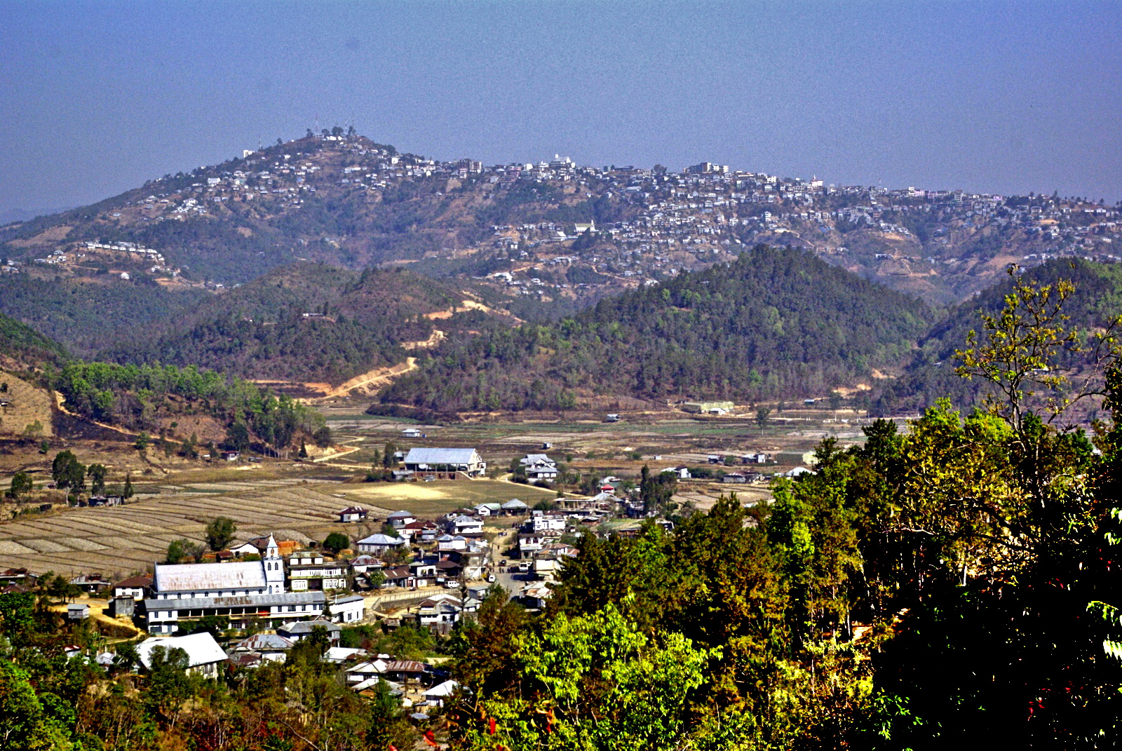
A bustling commercial town at the Indo – Myanmar border, Champhai is a beautiful place and a storehouse of ancient relics, monuments, legends and folklore. Located about 186 km east of Aizwal, Champhai is also considered the fast-emerging fruit bowl of Mizoram. Well-tended vineyards, passion fruit and the recently introduced kiwi fruit plantations in the surrounding hill slopes provide a kaleidoscope of colours. Champhai is believed to be the entry point and the settlement of the first Mizo migrants to India. At the base of the town, towards the Myanmar border is the Champhai Valley. Surrounded by undulating hills, is a wide expanse of rice fields, popularly known as the rice bowl of Mizoram. Because of Champhai’s strategically important location, it is the main business corridor for India and Myanmar in the area.

Champhai was the headquarters of Lalbura Sailo, the son of Vanhnuailiana, a Mizo Chief against whom the British Expedition of 1871–72 was directed. It was accorded the status of a fort during British colonial rule. The Champhai Valley was once a lake and was gradually silted to obliterate the lake. The soil of the plain was still uncultivated during the Lushai Expedition of 1872. Irrigated rice cultivation started in Champhai in 1898 encouraged by the British colonial authorities to supply rice to their soldiers and labourers.

Champhai has several tourist attractions mostly including natural settings, including Kungawrhi Puk, a cave, the river Tiau Lui and the Rih Dil lake. Adventure enthusiasts can indulge in some trekking at the Thasiama Seno Neihna which is about 83 km south of Champhai.

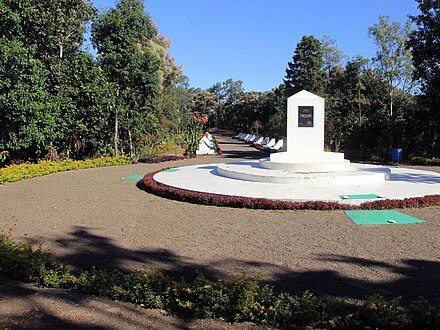
Hla Kungpui Mual is a monument to commemorate Mizo poets, writers, and composers. It was set up in 1986 at the southern edge of the Khawbung Village in the Champhai district. Here, the monuments of Mizo laureate poets and writers are erected at intervals of 10 years. There is a Mizo Poets Square Archive and Library within the compound where the belongings of the poets are preserved. Currently, a total of 36 monuments call the Poet’s Square home.

Once upon a time, on the legendary Lianchhiari Lunglen Tlang cliff, the love-smitten Lianchhiari used to look out for her lover, Chawngfiang, who had migrated to a distant village. With its idyllic view, this perilously protruding cliff has it has found a natural home in a plethora of romantic lore. It lies South of Champhai on the way to Khawbung.

Located to the northeast of Champhai, Mt. Lengteng and its surroundings have been declared a wildlife sanctuary. The second-highest mountain in the region is filled with broad leaf and tropical evergreen forests, and sheer rocky cliffs. It is home to the endangered state bird, Vavu or Mrs Hume’s Pheasant and hornbills and endangered mammals like the slow loris, the leopard, the leopard cat, the serow, the goral and the Asiatic black bear. The sanctuary boasts orchids of various hues and beautiful flowering trees like rhododendrons and cherries. The Lengteng Wildlife Sanctuary is very close to the Murlen National Park which is spread over an area of 100 sq km with sub-tropical evergreen forests.

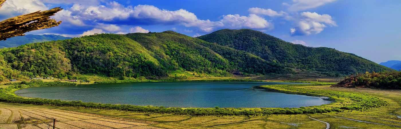
The Rih Lake is the largest in Mizoram and is often contested to be situated in Myanmar. It is a beautiful heart-shaped lake, believed to be the passage of souls to their eternal abode and is 14 miles from Champhai in Mizoram and 63 miles from Falam, Myanmar. Because it lies in a sensitive area, it cannot be visited without prior permission from the Deputy Commissioner’s Office.

Travel Bucket List: India – Mizoram Part 2

Reiek
A mountain and tourist spot, Reiek is located about 29 km southwest of Aizawl at an elevation of 1,465 m. Overlooking Aizawl and offering a view of the surrounding valleys and hills, on a clear day, the plains of Bangladesh can be seen from the top of the hill. Reiek Hill is surrounded by thick lush green temperate trees and bushes. The best time to visit Reiek is in April. Apart from sightseeing, the hill is also a haven for birdwatchers. While climbing up the hill one will come across nests and chirping of the native birds including the Peregrine Falcon which is known to make nests at the rocky edges.

Reik also has a Heritage Village which is a typical Mizo village consisting of the distinctive traditional huts of the different Mizo sub-tribes, a Mizo chieftain’s house, a bachelor’s dormitory and of widows has been created and maintained by the Tourism Department. There is also a cafeteria and a resort providing decent food and accommodation.

Reiek is also the venue for the annual Anthurium festival which takes place each year in September. The Anthurium Festival is a festival promoting the Anthurium grown in Mizoram and the rich Mizo customs and traditions at Reiek Tlang. The festival is organised by the Tourism and the Horticulture Department and has the dual purpose of promoting the cultivation and marketing of the enthralling flower and attracting more tourists to the state and showcasing the rich and rhythmic cultural dances and games of Mizoram as well as fashion shows which are also a regular feature of the festival.

Hmuifang
One of Mizoram’s beautiful destinations, Hmuifang or Hmuifang Tlang is a hill station with a lot to offer. Located 50 km from Aizawl at an elevation of 1619 m, Hmuifang is a hill town at the heart of the state and is known for its adventure and wildlife-related activities. A land of virginal green forests and slopes, Hmuifang is also famous for the Thalfavang Kut, a festival that gives one a peek into the Mizo culture by showcasing various dances such as the Cheraw, the Sawlakai, the Siktuithiang lam and the Chheihlam

The Hmuifang Tourist Resort built on the former land of the erstwhile Mizo chief is located at the scenic peak of the mountain and is maintained by the State Government. The resort has comfortable accommodations offering 6 double rooms and a cafeteria. The patches of grasslands on the peak are also ideal for picnics and outdoor camping. The resort is also the venue of the annual Anthurium Festival and Thalfavang Kut. From here, one can visit the Mizo villages situated on the hillsides, namely Hmuifang village, Sumsuih village, Lamchhip village and Chamring village, to see typical Mizo rural life. The mountain also has beautiful cliffs and offers great views of the surrounding hills with the forests abounding with varieties of flora including rare orchids and wildlife, especially avifauna.

Winters are the best time to visit Hmuifang because of the misty hills and the chilly air but it can be visited any time of the year with temperate temperatures.

Source

Kolasib
A quaint town away from the commercialised cities, Kolasib is one of the newer districts in Mizoram and lies in the northern part about 78 km north of Aizwal. In the absence of any written or any other form of authentic records, as is the case of many places in Mizoram, nothing is authentically known about the ancient or medieval ages of the history of the place. Written or authentic records were kept only after the state came under the occupation of British colonial rule in the 2nd half of the nineteenth century. It is said that a chief named Kawla was ruling the village now known as Kolasib and so the village was referred to as the Kawla Chief Village which then became Kolasib during British rule and the name stuck.

Kolasib which is part of the Aizwal Mountainous Region of the Eastern Hill Zones has an average literacy rate of 93.50%, higher than the national average of 74.04%. November to March is the best time to visit Kolasib and the climate is quite temperate and not extreme.

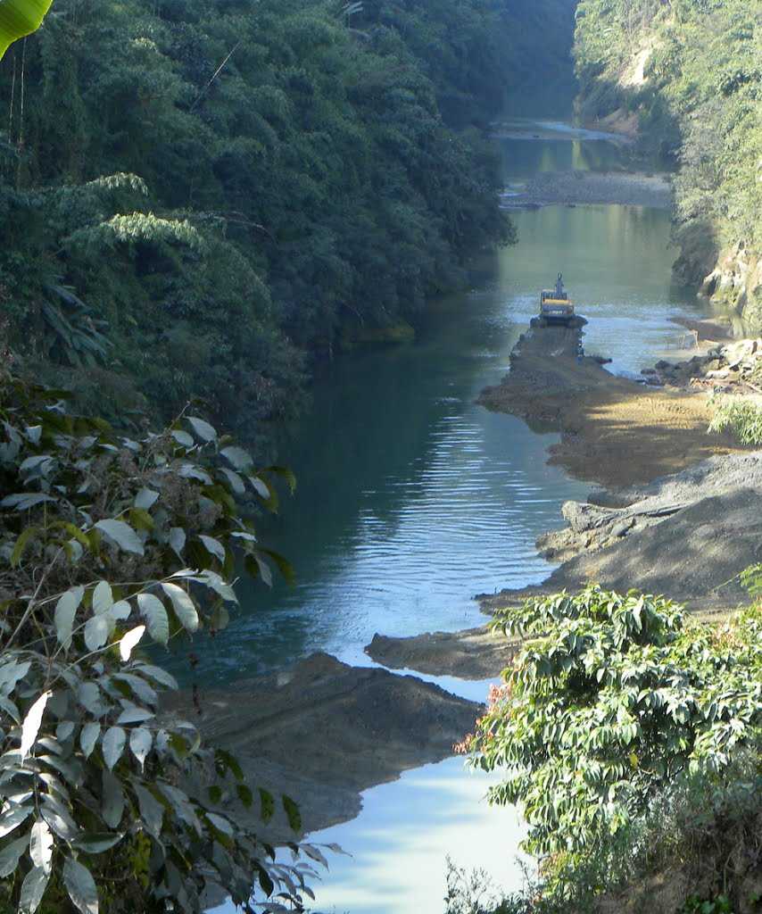
The River Tlawng is Kolasib’s best attraction with its beautiful river banks and adjoining forests serving as a countryside getaway. Close to Tamdil Lake, the river is considered to be Mizoram’s longest river and is spread across 185 km and is also known as Katakha or Dhaleswari in the local dialect. There is leisure boating available which can be done by requesting locals who would be willing to ferry around tourists.

Source

Tamdil or Tam Lake
The largest lake in the state of Mizoram, Tamdil or Tam Lake is a man-made lake developed as an important pisciculture centre and a holiday resort by the state government. The name Tamdil which translates to Lake of Mustard is located about 6 km from Saitual village and 87 km east of Aizwal and is a local favourite. The lake is tucked between evergreen thick forests and are home to wide species of trees, plants and animals as well as has a magnificent landscape, clear, blue waters and a serene environment. A new species of frog called Leptolalax tamdil was described from this lake in 2010.

The origin and etymology of Ṭam Dil are shrouded in myth. Folklore has it that a married couple had a jhum plot in this small valley surrounded by small steep hills. The man, unfortunately, died leaving the wife to care for the crops alone. In the middle of the field was a robust mustard plant, conspicuously bigger than any other plant. One night the widow has a visitation by her husband, who informed her to take special care of the giant mustard plant as it was a harbinger of immense blessing. She did as she was told, and the plant thrived very well and grew bigger and bigger. After some time, the widow remarried but her new husband did not like her to keep anything that would remind her of her former husband and so he pulled the plant up by its roots and threw it away. Out of the hole left in the ground, water flowed out immediately and filled the valley to become a large and beautiful lake. Hence the name of Ṭam Dil, for the Lake of the Mustard.

The place is a local favourite for relaxation and allows one to be away from the crowd, in the lap of nature. One can also boat in the lake, walk around its shores or just spread a carpet, lie down and read a book.

Mamit
Emerging from the regrouping of villages, Mamit lies about 88 km northwest of Aizwal at an average elevation of 718 m. The Mamit District was etched out from the erstwhile Aizawl District in 1998. The dominant tribe within the district is Mizo followed by Chakma and Reang. Mamit is famous for the production of oranges and is known as the Orange Garden of Mizoram. The fourth largest district in Mizoram, Mamit is known for its exquisite scenic locales. The Dampa Tiger Reserve is a popular tourist attraction as is the longest cave network of Mizoram in Pukzing.

Saitlaw is a small town situated around 11 km away to the west of Mamit, in the northeastern part of the state and is surrounded by the Rengdil village to the west and the Bualpui village to the north. West Phaileng is a village situated a few km away from Mamit at an altitude of around 1,290 feet above sea level. The Dampa Sanctuary is in very close proximity to this town which is flanked by dense forest and teak plantations. Kanghmun is a village in the southeastern part of Mamit district at a height of 2,841 feet above sea level. It is known for its cultural values and traditions of the Mamit district. Home to the biggest cave in the state, the 25 m wide Pukzing Cave is in the village of Pukzing at a distance of 12 km north of one of the most famous villages in Mamit, Phuldungsei. Lungkulh is famous for its artificial lake that boasts activities like fishing and boating. It is a brick structure that resembles a mound or a knoll and makes for a beautiful picturesque location.

Vantawng Falls
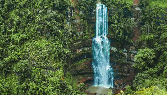
The highest waterfall in the state and the 13th highest in the country, Vantawng Waterfalls is one of the most mesmerizing waterfalls in Northeast India. One of Mizoram’s best attractions, Vantawng Falls is located about 100 km south of Aizwal and about 39 km north of Serchhip. Tucked between the verdant valleys with thick greenery around, the fall seems like a river of white milk from a distance.

Vantawng Khawhthla or Vantawng Falls is the highest and most spectacular of the waterfalls and cascades in the fast-flowing Vanva River near Thenzawl and is named after Vantawnga, who was said to be an excellent swimmer. So good a swimmer was Vantawnga that he could hover in the cascading water like a fish, but unfortunately, during one of such performances, a drifting log fell from above and killed him. The height of the fall is recorded as 324 feet and it is difficult to get close to it because of the sheer forested hillsides surrounding it, hence a viewing tower has been constructed. September to January are the best months to visit the Vantawng Falls because the weather is cold and the falls are visible flowing at their full might through the verdant Mizo Hills. The winters are cold in the Mizo mountains, so protection is required.

Serchhip
Headquarters of the Serchhip district and about 107 km south of Aizwal, Serchhip lies in the central part of Mizoram. The district has the highest literacy in India. The origin of Serchhip’s name comes from the citrus trees found on top of the first hill of the then-Serchhip village. The word meaning of Ser-chhip is ‘citrus-on-top’. In addition to the former Serchhip village, the Town Area now included New Serchhip and Chhiahtlang villages.

Serchhip is at an average elevation of 888 m and lies between the two very important rivers of Mat and Tuikum. River Tuikum is a public drinking water for Serchhip and River Mat is an irrigation water for Zawlpui, the rice bowl of Serchhip.

The first settlement within the Serchhip area can be traced back to Lallula, a Mizo chief, who set up a settlement at Kawlri. Lallula massacred Thlânrâwn Pawi at Zopui. After this incident, afraid of revenge from Thlânrâwn, he fled towards Artahkawn to Lunglei Zobawk. And from there, he migrated towards the north and reached Serchhip Kawlri. The second settlement at Serchhip was founded by Bengkhuaia, son of Lalpuithanga, Chief of Bâwngchâwm, a great Mizo chief. From Kawlri he made a raid on Assam valley in 1871 and captured Mary Winchester, the daughter of James Winchester, which led to the First Lushai Expedition in 1872.

The district consists of many towns and villages lying around Serchhip. Thenzawl is the second biggest town after Serchhip and is one of the few flat areas with a beautiful grassy landscape. Close to Thenzawl is the spectacular Vantawng Falls.

Zoluti Hriatrengna Lung or Memory Stone is dedicated to Mary Winchester who was known as Zoluti by the Mizo people. The spot where Zoluti was handed back to British officials on 21 January 1872 is Aw-A Mual at Kawlri Tlang near Serchhip Kawnpui. Here, there is a stone erected on 5 January 1994 in memory of Zoluti, daughter of Dr Winchester, a manager in one of the Assam Tea Gardens.

Chhingpuii Thlan which means the Tomb of the Unmarried Woman is a stone erected in memory of Chhingpuii about 4 km north of Chhingchhip. This stone is named after a beautiful woman Chhingpuii who married Kaptuanga but was kidnapped and killed during the second civil war. It is after this that Kaptuanga was devastated and committed suicide.

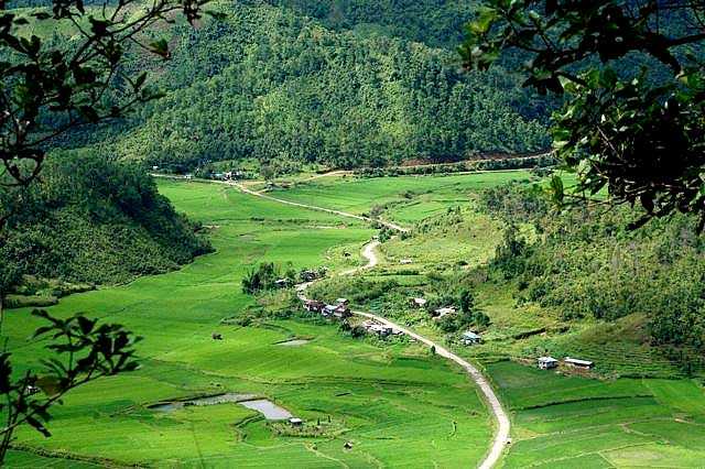
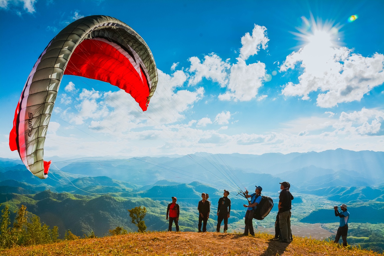
Paragliding has become popular in Serchhip and can be practised at Chuanhnuai which lies between Serchhip and Keitum Village. It has now become so popular that a Paragliding Festival was organised attracting paragliders from other states as well. This is the only paragliding location available in Mizoram. Paragliders take off from Chuanhnuai and land in a very beautiful valley called Zawlpui leilet.

Travel Bucket List: India – Mizoram Part 1

Known as the Songbird of India and one of India’s easternmost states, Mizoram is the southernmost of the seven sister states, sharing borders with the Indian states of Tripura, Manipur and Assam and also international borders with Bangladesh and Myanmar.

The name of the state is derived from Mizo, the self-described name of the native inhabitants, and Ram, which in the Mizo language means land. Thus Mizoram means the land of the Mizos. A landlocked state, Mizoram is India’s fifth smallest state with the Tropic of Cancer running through the state nearly to its middle.

Like several other northeastern states of India, Mizoram was previously part of Assam until 1972, when it was carved out as a Union Territory. In 1986 the Indian Parliament adopted the 53rd amendment of the Indian Constitution, which allowed for the creation of the State of Mizoram on 20 February 1987, as India’s 23rd state. Mizoram is the 2nd least populous state in the country and covers an area of approximately 21,087 sq km, of which approximately 91% is forested.

About 95% of Mizoram’s population descends from a diverse tribal origin. Mizos first began to settle in the area in the 16th century, coming in waves of immigration from Southeast Asia. This immigration lasted through the 18th century. Mizoram has the highest concentration of tribal people in India and the people of Mizoram are protected under the Indian constitution as a Scheduled Tribe. Mizoram is one of three states in India with a Christian majority with about 87% of the population following Christianity with people belonging to various denominations, mostly Presbyterians in the north and Baptists in the south. Mizoram is a highly literate agrarian economy with about 20% of the state’s population living below the poverty line.

Because of the sensitive nature of the state, so close to international borders, Indians need an Inner Line Permit or ILP to enter the state which cost INR 170 for a 15-day permit. The process to get an extension is slightly difficult. One can also get ILP documentation done at the Lengpui Airport in Aizwal.
Mizoram is derived from two Mizo words, Mizo and Ram where Mizo refers to native inhabitants and Ram means land. There is a dispute on the term zo. According to one view, zo means a highland or hill and Mizoram means the land of the Mizo people. There is also a view that says zo may also mean a cold region and therefore, Mizo may also signify people of the cold region. As with other tribes of northeastern India, the origin of the Mizos is shrouded in mystery. The people living in the Mizo Hills were generally referred to as the Cucis or Kukis by their neighbouring ethnic groups which was also a term adopted by the British. The majority of the tribes classified as Mizo today most likely migrated to their present territories from the neighbouring countries in several waves, starting around 1500. Before the British colonial rule, the various Mizo clans lived in autonomous villages with the tribal chiefs enjoying an eminent position in the gerontocratic Mizo society. The chiefs were the absolute rulers of their respective clans’ territories, although they remained under the nominal political jurisdictions of the Rajas of Manipur, Tripura and Burma.

The Mizo Hills formally became part of British India in 1895, and practices such as head-hunting were banned in Mizoram as well as neighbouring regions. The northern and southern Mizo Hills became the Lushai Hills, with Aizawl as their headquarters by declaring the whole area as an excluded area till Indian independence. After Christian missionaries arrived, the majority of the population became Christians in the first half of the 20th century.

Post-Indian independence, the number of tribal chiefs had increased to over 200 with the educated elites campaigning against the tribal chiefdoms under the banner of the Mizo Union. As a result, the hereditary rights of the 259 chiefs were abolished under the Assam-Lushai District Act, 1954. Village courts were re-implemented in the Mizo region along with other parts of Assam.

A period of protests and armed insurgency followed in the 1960s, which resulted in the Mizo National Front or MNF seeking independence from India which failed to garner public support or participation. In an attempt to counter these insurgency threats, the Indian government bombed state areas affected by insurgency, which is the only known bombing of India on its soil on 5 March 1966. In 1971, the government agreed to convert the Mizo Hills into a Union Territory, which became Mizoram in 1972. Following the Mizoram Peace Accord of 1986 between the Government and the MNF, Mizoram became a full-fledged state of India in 1987.

Geographically, Mizoram is a land of rolling hills, valleys, rivers and lakes. As many as 21 major hill ranges or peaks of different heights run through the length and breadth of the state, with plains scattered here and there. Phawngpui Tlang also known as the Blue Mountain, situated in the southeastern part of the state, is the highest peak in Mizoram at 2,210 m or 7,250 ft. About 76% of the state is covered by forests, 8% is fallow land, 3% is barren and considered uncultivable area, while cultivable and sown area constitutes the rest. Slash-and-burn or jhum cultivation, though discouraged, remains in practice in Mizoram and affects its topography. According to the Ministry of Environment, Forest and Climate Change, as of 2021, Mizoram has the highest forest cover as a percentage of its geographical area of any Indian state, at 84.53% forest.

Aizwal
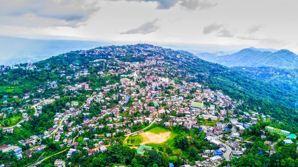
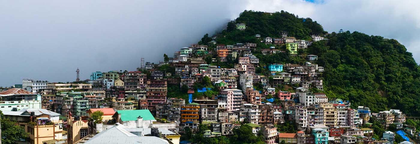
Mizoram’s capital, Aizawl was officially established on 25 February 1890 and is the largest city in the state as well as the centre of administration, the state assembly house and the civil secretariat. Located north of the Tropic of Cancer in the northern part of Mizoram, Aizwal is situated on a ridge 1,132 m above sea level, with the Tlawng river valley to its west and the Tuirial river valley to its east.

In 1871–72, the disorderly conduct of Khalkom, a Mizo chief, compelled the British to establish an outpost that later became Aizawl village about 14 km from Sairang from where one could travel by flat-bottomed boat. In 1892-95 Aizawl became accessible from Silchar by a fair-weather road. The Indian Air Force carried out air strikes on the town during the March 1966 Mizo National Front uprising, following which the MNF withdrew to Lunglei. Until 1966, Aizawl was a large village but the regrouping of Mizo villages after the uprising made it become a larger town and then a city. Aizawl has become the centre of the Mizoram road network connecting the north and south, east and west of the state. More than 25% of the state’s population resides in Aizawl.

Primarily dominated by the Mizo Tribe, Aizawl and its surrounding areas are lush with rolling hills and abundant greenery. An Inner Line Pass or ILP is required for entry into Mizoram which is available in Guwahati, Silchar, Shillong, New Delhi, and Kolkata.

The Durtlang Hills is located in the northern part of Aizawl and is a popular attraction with viewpoints offering panoramic views of the capital city. One can drive to the destination and once there engage in a bit of light hiking and trekking. The best time to visit the Durtlang Hills would be in the morning when the sun is not as harsh as it would be during the afternoon.

Located in Kidron Valley, the Solomon Temple is a grand church constructed by the religious group Kohhran Thianghlim, as The Holy Church. The church was founded in 1984 and is one of the largest in the state. The Temple is a square site measuring 180 ft on each side with the interior measuring 120 ft. A verandah 30 ft wide is attached to the exterior of the main hall on all four sides and is called the porch of Solomon’s Temple. The main building has twelve main doors and above the porch are four pillars, each carrying seven stars of David, meant to represent the seven churches of the Book of Revelation. On each of the pillars is a picture of the Cross of Jesus Christ and the emblem of the Holy Church is embedded. Atop the porch is an idol of two Angels blowing trumpets which face the top of the pillar and flank the northern side of the pillar, which is now used as the main entrance. The temple has four towers, one on each corner with each tower topped with a crown, representing the Crown of Salvation, the Crown of Righteousness, the Crown of Life and the Crown of the Overcomer. Two intersecting horizontal ridges cross in the middle of the pitched roof such that when viewed from the air they form a cross, representing the new covenant. There is a park with the complex as well as a restaurant, an educational institute and a social service centre. The Salvation Army Temple has wonderful bell chimes and these can be heard throughout the city on quiet mornings.

A popular picnic spot, the Berawtlang Tourist Complex is located around 7 km from Aizwal and hosts multiple ceremonial functions and houses cottages as well as restaurants. Fairs are frequently conducted here, with various cultural activities, serving as a recreational centre. This place is

Located right in the centre of the city, the Mizoram State Museum displays the rich heritage of Mizoram. Along with the numerous archaeological artefacts, photographs and natural history specimens, an entire gallery here is dedicated to the Mizo tribes. An ethnographic museum with multipurpose collections on display, the museum has five galleries, namely the Textile Gallery, Ethnology, History, Anthropology, Natural History, and an Archaeology Terrace occupying four floors. The museum was established in April 1977 by the Tribal Research Institute under the Education Department. In 1989, it came under the Art and Culture department. The museum was earlier housed in a rented building but on 14 July 1990, it was moved to a new building.

Falkawn Village
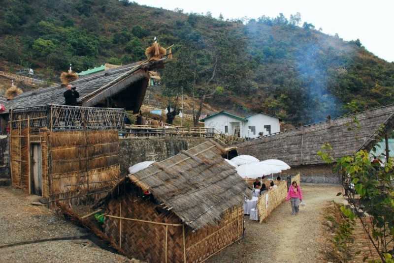
Located just 18 km south of Aizwal, Falkawn Village is a model village depicting the lifestyle of the Mizo people and is frequented by tourists. A unique cultural extravaganza for first-time visitors to Mizoram. Falkawn village depicts the livelihood and culture of the Mizo people, who form the biggest tribe in the state. The Art & Culture Department of the state government has set up a Cultural Centre or Zokhua at Falkawn in 1992 which is a mini live museum where the Zawlbuk or the dormitory, the Lal In or the Chief’s House, the Pum or the Blacksmith and other typical Mizo houses are erected. There are freedom fighter memorial stones and a Taitesena commemoration stone. Entry fees are INR 20 for adults and INR 10 for children.

Travel Bucket List: India – Tripura Part 4

Baramura Eco Park
Nestled in the verdant forest at the fringes of Baramura–Deotamura reserve forest where Baramura hill range meets the plains at a distance of about 37 km east of Agartala, the Baramura Eco Park located at the foothills of the Baramura hills is a manifestation of the conservation need of the ecological biodiversity of the Baramura hills. The Baramura hills are a breathtakingly beautiful expanse of rolling hills characterised by thickly forested hill ridges varying in altitude between 90 m to 136 m and valleys with dense bamboo patched, herbs & shrubs that is home to astoundingly diverse ecological biodiversity. The forest also supports the livelihood needs of nearly 2,500 tribal families.

Kalapania Nature Park
Located about 116 km south of Agartala in Sabroom in South Tripura, the Kalapania Nature Park was established in 2004 covering 21 hectares of deserted land into a nature’s paradise set amidst a charming ambience of natural beauty. A lake with serene blue water in midst of two hillocks in the park’s centre divides it into two halves. There is a boating service as well as beautiful cottages around the small hills surrounding the water body. The main attraction of the park is a nature interpretation centre located in the middle of the park.

Tepania Eco Park
Established in 1995 inside RadhaKishorepur Reserve Forest, the Tepania Eco-Park lies about 47 km south of Agartala and 5 km from Agartala Udaipur. Over the years the Eco Park set amidst a charming ambience of natural beauty has been upgraded and today has an area of 155 hectares and has turned out to be a huge tourist attraction. The Eco Park has a modern well maintained orchid house which houses 225 species of orchids. There is a cactus House which has 250 samples collected from various parts of the country. A treehouse inside the park offers a night stay facility in a sylvan environment. The other attractions include a unique wooden hanging bridge, a medicinal garden and a watch tower for viewing the wildlife.

Khumulwang Eco Park
Located on the outskirts of Agartala within the Tripura Tribal Areas Autonomous District Council, Head Quarter Khumulwng, the Khumulwng Eco Park has been raised in the lap of nature covering an area of 14.5 hectares of land. Khumulwang, which means the valley of flowers, the park is well organised in different sections such as the flower park, the children’s park and the science park. Boating facilities are also available. The Tribal Museum cum Heritage Centre is located at Khumulwng which has models of the 19 tribes of the state.

Jampui Hills
Located about 200 km east of Agartala, the Jampui Hills are the highest hill range in the state bordering Mizoram at an altitude of 3000 feet above sea level. Jampui is famous for its charming landscapes and bracing climate. The excellent climatic condition, green forests, beautiful orange gardens, views of the rising and setting sun are wonderful sights for tourists. The hill range has 11 villages inhabited by the Mizo or Lushai tribes and also by the Reang tribes. The main occupation of the villagers is orange cultivation.

The view of the rising and setting sun from the various viewpoints in Jampui Hills is a wonderful sight for visitors. The various viewpoints in the hill range provide excellent panoramic views of the valley and villages of Mizoram. From the watchtower at the highest peak, Betlingchip at 3200 feet above sea level, one can view the Chittagong Hill Tracts, the Kanchanpur – Dasda valley and other hill ranges of Tripura and Mizoram unfold. Every November, the unique Orange & Tourism festival is celebrated here which attracts a large number of tourists, both domestic and foreign. During the monsoon season, the hill is covered with floating clouds and it provides a rare experience for tourists. The formation of clouds at the bottom of the hill range and its gradual ascendance from the bottom to the top slowly engulfing the whole hill range in its mystic lap is an experience to treasure. The Tourist Department of the Government of Tripura has constructed a very modern tourist lodge, The Eden Tourist Lodge at the Vanghmun village in the Jampui hills which has a capacity of 20 persons and is well equipped with all modern amenities.

Dumboor Lake, Dhalai
A charming water body about 135 km southeast of Agartala, Dumboor Lake is located in Amarpur. The lake is shaped like a tabor-shaped small drum, or the Dumboor of Lord Shiva from which the name Dumboor originates. The lake is spread over an area of 41 sq km and there are 48 islets inside the lake. The surrounding hills and the islets are enchantingly emerald green and present a captivating scenic spectacle. The winter months attract hundreds of migratory birds which gives the lake the status of healthy wetland habitat. There is a hydel project near the lake where the River Gomati originates and the area is called Tirthamukh where a big fair is held every year on Pous Sankranti on 14th January. The Lake is on the confluence of the rivers Raima and Saima. Boating facilities are available in Dumboor Lake.

Rudrasagar Lake
Also known as Twijilikma, the Rudrasagar Lake is located in Melaghar and is a picturesque lake that has lately been recognised as one of the wetlands of national importance for the conservation of resources and their sustainable use. Also known as Rudijala, three rivers named Noacherra, Kemrali Cherra and Durlavnaraya form the lake. The highlight of the lake is the magnificent Neermahal Palace built in 1930 which is situated on the northeast bank of the lake. The lake occupies an area of 2.4 sq km and is situated about 52 km south of Agartala. Rudrasagar Lake is a natural sedimentation reservoir, which receives flow from three perennial streams. After settling the sediment from the received flow, clear water discharges into the river Gumati through a connective channel, Kachigang. Rudrasagar is a potential Important Bird Area and attracts a large number of waterfowl in winter. Among the rarer species recorded are the endangered Baer’s pochard and near-threatened ferruginous duck.

Sepahijala Wildlife Sanctuary & Clouded Leopard National Park
Home to a variety of wildlife especially birds and primates, the Sepahijala Wildlife Sanctuary & Clouded Leopard National Park is not just a wildlife sanctuary but also an academic and research centre. Spread over an area of 18.5 sq km about 27 km south of Agartala, the sanctuary came into existence in 1972 to conserve and propagate the biodiversity of the area. With the addition of a Botanical Garden, a deer park and a zoo, the bio complex was subsequently upgraded as the Sepahijala Wildlife Sanctuary in early 1987. More than 150 species of residential birds, migratory birds, orchid gardens, boating facilities, wildlife, botanical garden, zoo, elephant joy-rides, and rubber and coffee plantations beckon the tourists all through the year. The added incentive for animal lovers is the famous spectacled monkey which is now a rare species. The sanctuary has more than 456 plant species, many kinds of bamboo and a variety of grasses and medicinal plants as well as a rich population of birds and animals. The sanctuary also offers spectacular views of coffee and rubber plantations and has boating facilities in the lake and a joyride in the toy train. The Clouded Leopard National Park is a part of the Sipahijala Wildlife Sanctuary and was established in 2007 with an area of 5 sq km.

Trishna Wildlife Sanctuary
Located about 111 km south of Agartala, the Trishna Wildlife Sanctuary is a wildlife and biodiversity sanctuary spread over an area of 164 sq km. Founded in 1988, this sanctuary is famous for the sizeable population of the Gaur or Indian Bison. The sanctuary also harbours a good stock of avifauna population which is integral to the prevalent ecosystem. Trishna Wildlife Sanctuary is also the habitat of and home to the highly endangered and only ape species of the Indian subcontinent, the Hoolock Gibbon and primates like the Capped Langur and the Golden Langur. The sanctuary has several perennial water rivulets, water bodies and grasslands with patches of virgin forests that are rich in rare vegetation. Closed on Tuesdays, the sanctuary is open between 9 am and 5 pm on other days.

Rajbari National Park
Situated in the Trishna Wildlife Sanctuary, the Rajbari National Park is spread over 31.63 sq km. The park is very famous owing to its picturesque surroundings and is one of the many places where one can witness Mother Nature at her best. One can expect to come across various wild animals including the world-famous Indian Gaur, also known as bison, deer, Golden langurs, Pheasants, and many such species. The Bison reserve was entrenched in the Sanctuary to protect the endangered species. With the establishment of this reserve, the primary goal was to restore the natural living habitat of the Bison and strengthen laws put forth for their protection from poachers. The park receives plenty of water from the many rivulets and water bodies situated in the sanctuary which ensures a regular and constant supply for the nourishment of the plant and animal species. It is also extremely abundant in forest reserves and is credited as one of the most conservative reserves that boast of rich biodiversity. The vegetation found in the sanctuary is of great diversity with several herbs, shrubs, tree species and climbers. Four types of forests can be found here including the tropical semi-evergreen forest, the east Himalayan lower Bhabar sal, moist mixed deciduous forest and Savannah woodlands. Bamboo is abundantly available. The safari at the Rajbari National Park is a must and is one of the best ways to experience the beauty of the park. Jeep safaris and wildlife trips are organised regularly to impart knowledge and awareness regarding the environment and its inhabitants to visitors. The magnificent lake situated in the park is a beautiful spot to enjoy a picnic with your friends and family. The park offers boating facilities available at nominal rates as well. The park is open daily between 10 am to 5 pm on all days except Fridays when the park is closed. Entry fees are INR 10 per person.

Rowa Wildlife Sanctuary
Notified in 1988 by the Forest Department, the Rowa Wildlife Sanctuary lies about 160 km northeast of Agartala. It is spread over an area of only 0.86 sq km and was part of the erstwhile protected forests in Mouja Rowa. The sanctuary, despite its small size, has over the years gained a great deal of popularity because of its natural beauty and is the only wildlife sanctuary in North Tripura. The sanctuary is particularly rich in birds and reptiles with large flocks of migratory waterfowl congregating in the several water reservoirs in the protected area. The sanctuary is also home to a large variety of plant species including several species of medicinal value. Rowa Wildlife Sanctuary is open to visitors throughout the year.

Gomati Wildlife Sanctuary
Also known as the Gumti Wildlife Sanctuary, the Gomati Wildlife Sanctuary is the largest sanctuary in Tripura, located in the southeast corner of the state, about 135 km southeast of Agartala. It is spread over an area of 390 sq km. Adjoining the sanctuary, there is a vast water reservoir covering approximately 300 sq km which attracts many local and migratory water birds. The sanctuary also has elephants, bison, sambars and barking deer as well as other animals and reptiles. One of the landmarks of this sanctuary is Lake Dumbur, which attracts around 17 migratory bird species and 126 native bird species in the cold winters, but the number of bird visits has declined significantly in recent years.

And this brings us to the end of this exotic and underrated state. Do drop me a line if I have missed any must-see places and also what are your favorite places to visit in Tripura.