Travel Bucket List: India – Haryana Part 3

Hisar
About 66 km northwest of Meham lies Hisar, known for its steel industry. Hisar was ruled by several major powers, including the Mauryas in the third century BC, the Tughlaqs in the 14th century, the Mughals in the 16th century, and the British in the 19th century. After India’s independence, it became part of the Punjab state and when Punjab was divided in 1966, Hisar became part of Haryana.

Hisar comes from Hisar-e-Firoza, which was given to the town in 1354 by Firoz Shah Tughlaq, the Sultan of Delhi from 1351 to 1388. The word Hisar means fort or castle in Persian with Hisar-e-Frioza meaning the fort of Firoze. Timur invaded the city in 1398 AD and his soldiers set fire to the fort.

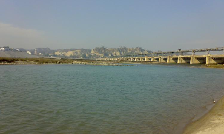
The Ghaggar and Drishadvati Rivers once flowed through the city, but they have now changed their course. Archaeological excavations at the nearby locations of Rakhigarhi (7000 BC), Siswal (4000 BC), and Lohari Ragho suggest the presence of human habitation from the pre-Harappan period. Later, the Aryan people settled around the Drsadvati River. The Jain literature Uttaradhayana Sutra from about 468 BC mentions a town Isukara, believed to be the earlier name of Hisar. The kingdom of Hisar, with its capital at Agroha, possibly assisted Chandragupta Maurya in his war against the Greeks. The kingdom was then included in the Mauryan Empire, as evidenced by the discovery of Ashokan pillars in the vicinity of the city and later came under the Kushan and Gupta Empires. The city later came under the rule of Sayyid dynasty and Lodi dynasties before Babur defeated Ibrahim Lodi in the first battle of Panipat and remained under the rule of the Mughals until 1760.

The region came under the rule of the British East India Company in 1803 and remained so until the Indian Rebellion of 1857 when Muhammad Azim and Rao Tula Ram conquered it away for a short period. Between 1803 and 1879, the British constructed a 4,000-km-long Great Hedge of India, for the levy of customs duty on salt and sugar, that ran through Hisar and Hansi. The city remained as a major centre of the Indian independence movement from the rebellion of 1857 until independence.

Source

Signs of pre-Harappan settlements have been found at Siswal, Lohari Ragho and Mingni Khera near Hisar. The Rakhigarhi settlement covers 2180 hectares, making it the largest Harappan site in India and the second-biggest overall after Mohenjodaro. Agroha, located about 24 km from the city was once the capital of king Agrasena, believed to have lived during the last stages of the Dvapara Yuga during the time of the Mahabharata era. Remains of his capital have been excavated, known as Agroha Mound or locally as Ther, and belong to around 3000 BC. The city was also a major centre during the Mauryan period as Buddhist and Jain temples have also been revealed in the excavations.

The now lost ancient Drishadvati river, a tributary of ancient Sarasvati River used to flow through Hisar. Today it flows as a remnant via the Ghaggar-Hakra River. The historic Agroha Mound and Agroha Dham is located on the outskirts of the city about 22 km away. A local deity Banbhori is worshipped by the locals who believe in her power.

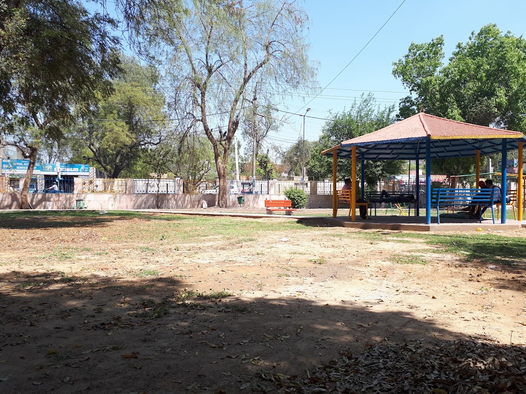
The oldest park located in the city is the Krantiman Park, located across the historic St. Thomas Church. The park was built in the 19th century and was then known as Company Bagh. Other parks include Madhuban Park, Town Park, and O. P. Jindal Knowledge Center, which includes a museum, library, park and houses a 25-storied steel tower, one of the tallest structures in the town and modelled on the Space Needle Centre in Seattle. The Haryana Rural Antique Museum exhibits the evolution of agriculture and vanishing antiques. The Jahaj Kothi Museum, named after George Thomas, is located inside the Firoz Shah Palace Complex while the Rakhigarhi Indus Valley Civilisation Museum is located at Rakhigarhi, an Indus Valley Civilisation site 60 km away.

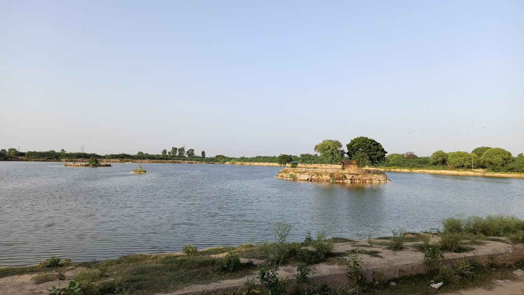
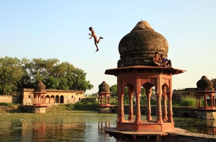
Blue Bird Lake is an artificial lake and tourist complex maintained by the Haryana Tourism Department and offers boating and watersport facilities, bird watching and options to picnic. The deer park and Shatavar Vatika Herbal Park are located on the outskirts of the city and was established in 1971. Endangered species such as blackbucks, chitals, sambars, and nilgais can be found here.

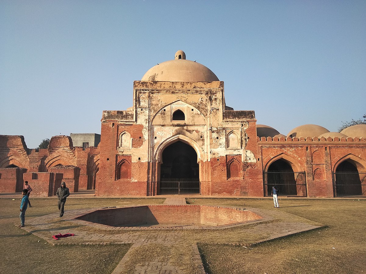
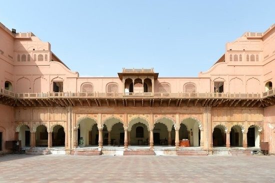
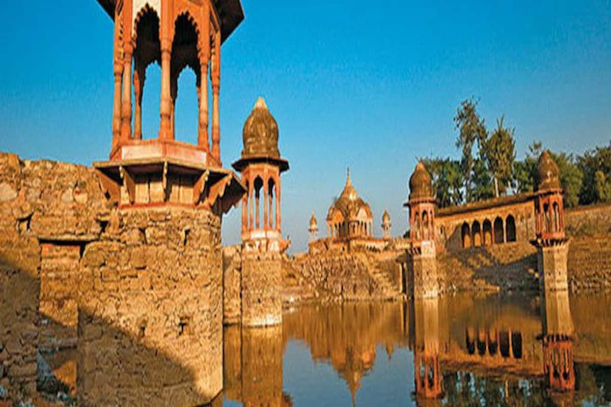
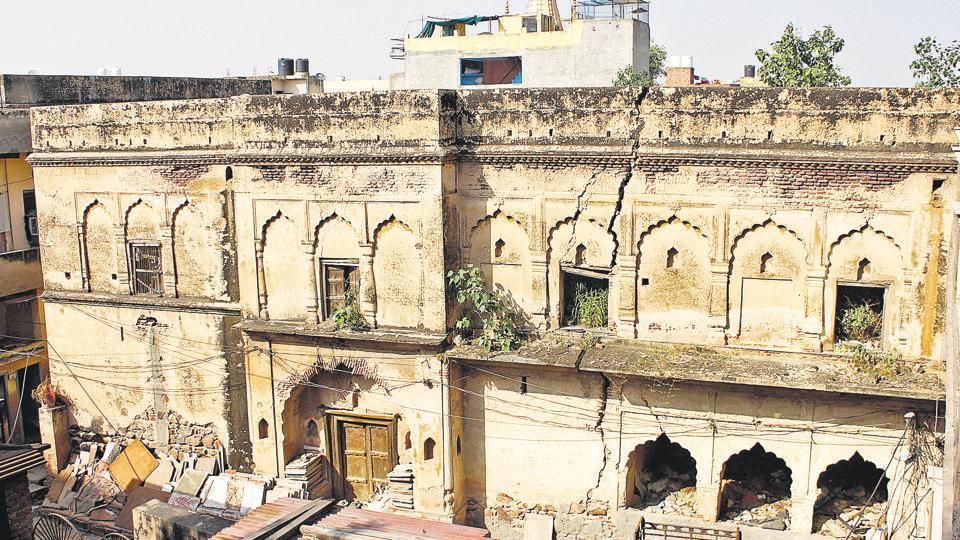
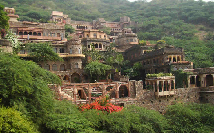
Hisar Fort was built with four gates, the Delhi Gate and Mori Gate to the east, the Nagori Gate to the south, and the Talaqi Gate to the west and was completed in 256. In the middle of the fort stood the Firoz Shah Palace, built of red sandstone consisted of a mosque, a Diwan-e-Aam, a palace for the shah’s wife, underground apartments and a granary. The artwork in the fort synthesizes Islamic and Indian architecture while the mosque is an example of Seljuk architecture. The Shahi Darwaza entrance to the palace faces east and is still standing. Shahi Darwaza which in Persian means royal gate was reserved for the royal family. The Talagi gate faces west, with access to the ancient Agroha Mound and Sirsa, and still stands across from the main bus station of Hisar. The Nagauri gate, now demolished, led south to Nagaur and on to Jodhpur in Rajasthan. The Mori gate faced east with a water channel, entering the fort complex through a hole to supply water. Both the gate and the water hole no longer exist. The Delhi gate also no longer exists today. The royal palace is a rectangular three-storied building of stone masonry with two floors above ground and one underground. On the far north and west sides of the royal palace complex, a watchtower with three stories above ground and one underground doubled as a staircase, connecting all floors of the palace and serving as a corner passage between the north and west sides of the building and was the tallest structure in the complex. The central courtyard which served as an open-air private audience hall was known as the Diwan-e-Khas. Immediately to the right of the royal gate is the Diwan-e-Aam, or audience chamber. The Lat ki Masjid to the east is within its courtyard, and the Ashoka pillar or lat is in the middle of the courtyard. An L-shaped ablution pool lies in the south corner of the courtyard. In the northwest corner is a raised Takht-i-shahi or Muluk-khana platform on four smaller red stone pillars, where the throne of the king used to be. The throne can be reached by five red sandstone steps. Under the platform is a dried-up well. The most visible part of what now remains of the palace is the Baradari on the upper level, so named for the twelve doorways, three on each side. It was used for social gatherings. Four pillars inside the chamber support the roof.

Jahaj Kothi Museum, a later era building that was originally a Jain temple which was later used as a residence by George Thomas, is located inside Firoz Shah Palace Complex and maintained by the Archaeological Survey of India. The Haryana Rural Antique Museum in Hisar aims to preserve the vanishing antiques of rural Haryana and was extended in 2010. The museum houses the collection of antiquities showcasing the development of agriculture and rural society in the state with the collection including clothes, agricultural and farm tools and implements, rural tools and equipment, rural music instruments, Haryanvi folk dresses for men and women and farm vehicles.

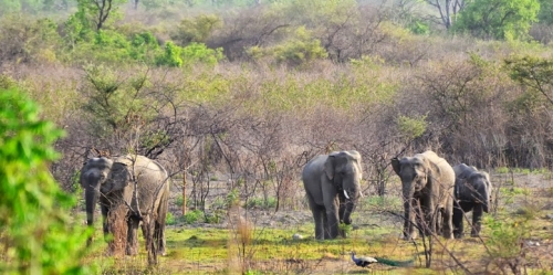
The Bir Bara Ban Wildlife Sanctuary is located about 69 km east of Hisar and is spread over an area of 4.2 sq km. The sanctuary has several species of birds, animals and mammals and was notified as a sanctuary on 11 October 2007.

Panipat
A historic city, Panipat lies about 95 km north of Delhi and 169 km south of Chandigarh. The city is well known by every Indian child for the three major battles fought in 1526, 1556 and 1761 that took place near the city. The city is famous in India as the City of Weavers and Textile City and is also known as the cast-off capital due to being the global centre for recycling textiles. Panipat was one of the five cities or prasthas founded by the Pandava brothers.

Panipat was the scene of three pivotal battles in Indian history. The First Battle of Panipat was fought on 21 April 1526 between Ibrahim Lodhi, the Afghan Sultan of Delhi, and the Turko-Mongol warlord Babur, who later established Mughal rule over the Northern Indian subcontinent. Babur’s force defeated Ibrahim’s much larger force and marked the beginning of Mughal rule in India. The Second Battle of Panipat was fought on 5 November 1556 between the forces of Akbar and Hem Chandra Vikramaditya, the last Hindu emperor of Delhi. The place of martyrdom of Raja Hemu is now a famous shrine in Panipat. The Third Battle of Panipat was fought on 14 January 1761 between the Maratha Empire and the Afghan and Baloch invaders. The Maratha Empire forces were led by Sadashivrao Bhau and the Afghans were led by Ahmad Shah Abdali. On 14 January, over 100,000 soldiers died resulting in the victory for the Afghans. However, after the victory, the Afghans facing a hostile North India, retreated to Afghanistan to avoid casualties. This battle served as a precursor for the East India Company to establish Company rule in India as most of North and Northwest Indian princely states were weakened.

The term Panipat Syndrome, coined by Air Commodore Jasjit Singh has entered the lexicon as the lack of strategic thinking, preparedness and decisive action by Indian leaders thus allowing an invading army to enter well inside their territory. This is based on the fact that in the three battles fought here, the defending armies were decisively defeated each time.

King Hemu’s Samadhi Sthal or the place where he was beheaded by Emperor Akbar’s general Bairam Khan at Shodapur on Jind Road. Hemu’s head was sent to Kabul where it was hung outside the Delhi Darwaza while his body was placed in a gibbet outside Purana Quila in Delhi to terrorise his supporters, who were mainly his subjects, both the Muslims and Hindus.

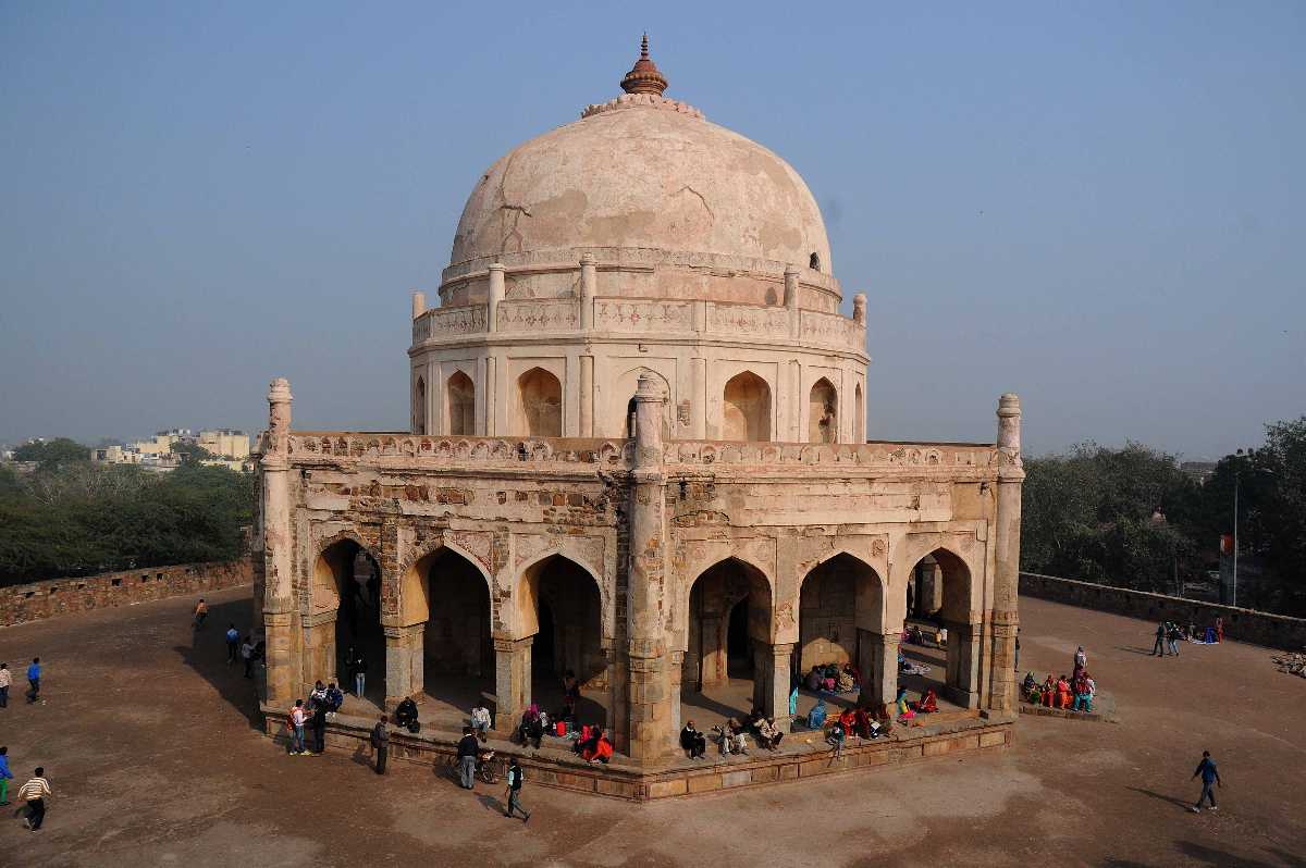
It was one of Sher Shah Suri’s dying regrets that he could never fulfil his intention of erecting a tomb to the fallen monarch Ibrahim Lodhi. The tomb is a simple rectangular structure on a high platform approached by a flight of steps. Much later, in 1866, the British relocated the tomb which was just a simple grave during construction of the Grand Trunk Road and added a platform to it with an inscription highlighting Ibrahim Lodhi’s death in the Battle of Panipat.

The garden of Kabuli Bagh along with the Kabuli Bagh Mosque and a tank were built by the Mughal emperor Babur after the First Battle of Panipat to commemorate his victory over Ibrahim Lodhi. Some years later when Humayun defeated Sher Shah Suri near Panipat, he added a masonry platform to it and called it Chabutra Fateh Mubarak, bearing the inscription 934 Hijri which corresponds to 1557. These buildings and the garden still exist under the name of Kabuli Bagh called so after Babur’s wife, Mussammat Kabuli begum.

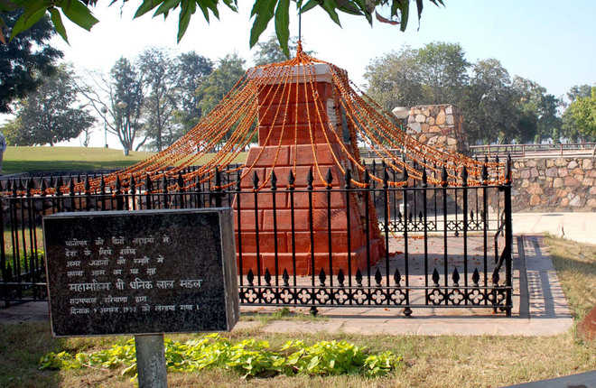
According to tradition, the Kala Amb Memorial lies about 8 km from Panipat and is where Sadashiv Rao Bhau commanded his Maratha forces during the Third Battle of Panipat and was marked by a black Mango Tree or Kala Amb which has since disappeared. The dark colour of its foliage was probably the origin of the name. If legends are to be believed, the war ground, as well as the other plantations in the vicinity, turned black due to the uncontrolled bloodshed that took place and the mango tree situated in the centre of the ground started to bear back fruits, and thus the name Kala Amb.

The site has a brick Pillar with a red obelisk which marks the spot where the Maratha commander Sadashiv Rao Bhau passed away and is surrounded by an iron fence. The site is being developed and beautified by a society presided over by the Governor of Haryana. The Kala Amb Smarak is a popular spot of interest at the Kala Amb. Built in the shape of a pillar that looks like a small tower, with one rod on the top jammed vertically into the pillar, it is made up of red coloured bricks, and its circumference decreases as the height increases, which means that from the bottom, it is much wider than at the top.

On the banks of a large tank lies the Devi Temple, dedicated to a local deity. Besides this, there is a Shiva temple which is believed to have been built by a Maratha named Mangal Raghunath who had remained in Panipat after the third battle and defeat of the Maratha forces. Dedicated to Lord Rama, the Shri Ram Sharanam is a prayer hall inaugurated by Swami Satya Nandji in 1960. Currently, it is headed by his disciples of Maa Shakuntala Devi and Maa Darshi Devi.

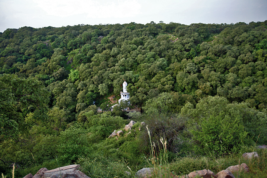
Standing for over seven hundred years, the tomb of Bu-Ali Shah Kalandar, a Sufi saint born in 1190, is also known as the Dargah of Shah Kalandar Khizar Khan, the son of Allau-din Khilji. Enclosed at Qalandar chowk, this tomb’s architecture matches the likes of the Ajmer Dargah in Ajmer and the Hazrat Nizamuddin Dargah in Delhi. The mausoleum was during the Mughal era by Emperor Jahangir’s general, Mahabat Khan in the memory of Hazrat Shareefuddin Bu Ali Shah Qalandar.

Set up by the Battle of Panipat Memorial Society, the Panipat Museum has been specially established for disseminating information about archaeology, history, art and crafts of Haryana with special emphasis on the Battles of Panipat which marked the turning point in Indian history. The museum displays antiquities, inscriptions, sculptures, arms and armours, Pottery, old and valuable documents, jewellery and art and craft objects aided by modern maps, write-ups photographs and slides. Enlarged photographs of a large number of important miniatures, mostly from Babur-Nama and Akbar-Nama, relating to these battles and personalities have been obtained from the National Museum of New Delhi, the British Library and the Victoria and Albert Museum of London. A Large number of contemporary weapons, armoury, guns, etc. have been acquired through a loan from the Archaeological Survey of India.

Karnal
36 km north of Panipat, and nestled on the banks of the Yamuna River, Karnal is popularly called the Rice Bowl of India for its vast rice fields. The Battle of Karnal between Nader Shah of Persia and the Mughal Empire took place in this city in 1739 and the town was used by the East India Company army as a refuge during the Indian Rebellion of 1857.

The city associates itself with the warrior from the Mahabharat, Karna and has recently set up a large statue of the great donor and a powerful warrior. A tank in the city also bears the name Karna Tal and a town gate is called Karna gate. At the end of the 6th century, the area was under the rule of the Vardhanas of Thanesar while the 7th century was a period of eclecticism in religion with the decline of Buddhism and the resurgence of Hinduism in the Indo-Gangetic plains. The region was under Kanauj rule under the Pala Emperor of Bengal with the authority of Mihira Bhoja, the Pratihara ruler of Kanauj penetrating as far as Pehowa, including Karnal.

The Sikhs appeared on the scene in the 18th century when the importance of Karnal grew during the rule of Raja Gajpat Singh of Jind State who after its capture in 1763 built the boundary wall and a fort and under whose rule the town increased considerably in size. On 14 January 1764, Sikh Chiefs defeated and killed Zain Khan Sirhindi, the Durrani Governor, and took possession of the whole of Sirhind province as far south as Panipat including Karnal.

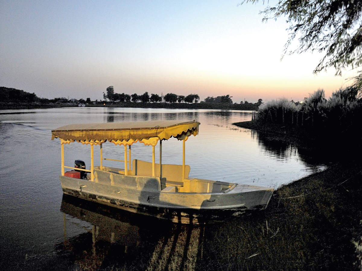
A popular tourist attraction, Karna Lake is also called the Karna Tal. Known for its spectacular sunsets, Karna Lake is named after the warrior Karna from the Mahabharata and is man-made with the beautifully landscaped Karna Lake Tourist Complex adjacent to it. Boating is a local favourite and the complex has swings and other rides for children. It is said that it was here that Karna decided to give away his protective armour to Lord Indra. The period from October to March is the best time to visit the lake when weather conditions are extremely pleasant and offer an ideal atmosphere for a picnic by the lake.

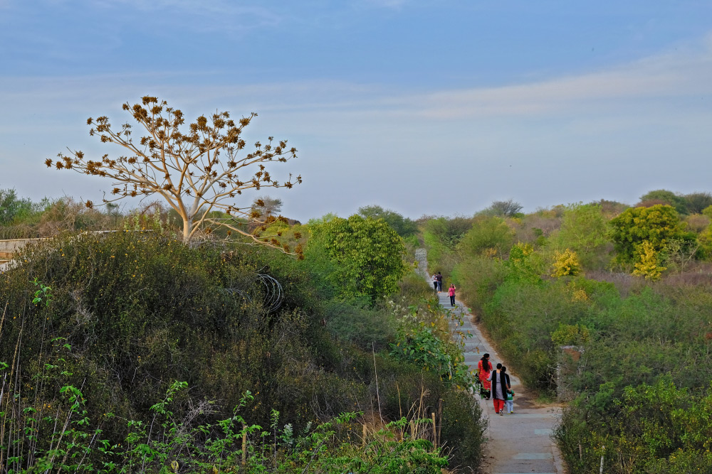
Atal Park is spread over an area of 55 acres, including a lake spread over 4 acres. It has an open-air gym, a lily pond, a few fountains which are illuminated with lights in the evening and a children’s playground. There is a modest Sarawati Temple inside the park and other nearby attractions include the Cantonment Church Tower, Karna Lake, Karneshwar Mahadev Temple and the Durga Bhawani Mandir. The park is open from 4 am to 10 pm and there is no entry fee.

The Durga Bhavani temple houses the powerful embodiment of female cosmic power or Shakti. The Navratri festival in the temple is especially popular and Dusshera is marked by large processions of the deity on the road and tall statues of the goddess. Don’t forget to shop for handicrafts and local delicacies in the nearby markets with metal jewellery and other trinkets especially favourite buys. The Sita Mai temple is the only temple dedicated to Goddess Sita in India and is built in an intricate Nepali architectural style with elaborate carvings on the bricks. Local lore has it that the temple marks the exact spot where Mother Earth is said to have taken Lady Sita into herself when she was asked to prove her chastity to Lord Ram.

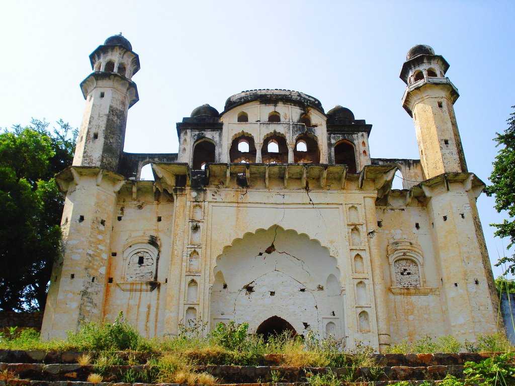
Built-in 1528 by the Mughal emperor Babur to commemorate his victory over Ibrahim Lodhi, Babur’s Masjid is a must-visit. The walled mosque was home to a stunning garden too and at its peak, the mosque boasted of three octagonal towers and domes in addition to the central dome, but only one remains now. The resident well is still replenished by cold water, although the outer structure is in ruins. The magnificent Kalander Shah’s Tomb houses fountains, gardens and a serene tomb. Built by Ghiyas-ud-din, the Emperor of Delhi, the Dargah holds the memory of the Sufi sage Bo-Ali-Qalandar Shah who is famous for conjuring up a cow that ate a tiger. Emperor Alamgir also added to the construction and the Persian and Mughal influences are obvious in the architecture, adding to the charm. A mosque is also built in the vicinity that one can visit.

Miran Sahib’s tomb celebrates the mystic saint Miran. Syed Mohammed or Miran Sahib was a mystic saint who was hailed for his unique compositions and philanthropy and who rejected all the norms of caste and religious discrimination and took up the cause of the poor and downtrodden. When a King took a local Brahmin girl hostage, Miran Sahib is said to have paid an enormous sum of money to retrieve her. Interestingly, only his head is believed to have been buried at Karnal. After he was killed in battle, his body was buried at Muzaffarnagar in neighbouring Uttar Pradesh, while his head was brought to Karnal. The stunning mosque within the tomb complex is worth a visit too.

The Gurudwara Manji Sahib is associated with the first Sikh guru, Guru Nanak Dev Ji. It is famous for its celebrations during all Sikh festivals. The first Guru, Guru Nanak Dev Ji is believed to have visited Karnal during his travels in 1515 and stayed in a garden, where he sat and recited several hymns in praise of the Lord. Guru Harkrishan Sahib Ji, the Sixth Guru, is also said to have visited Karnal.

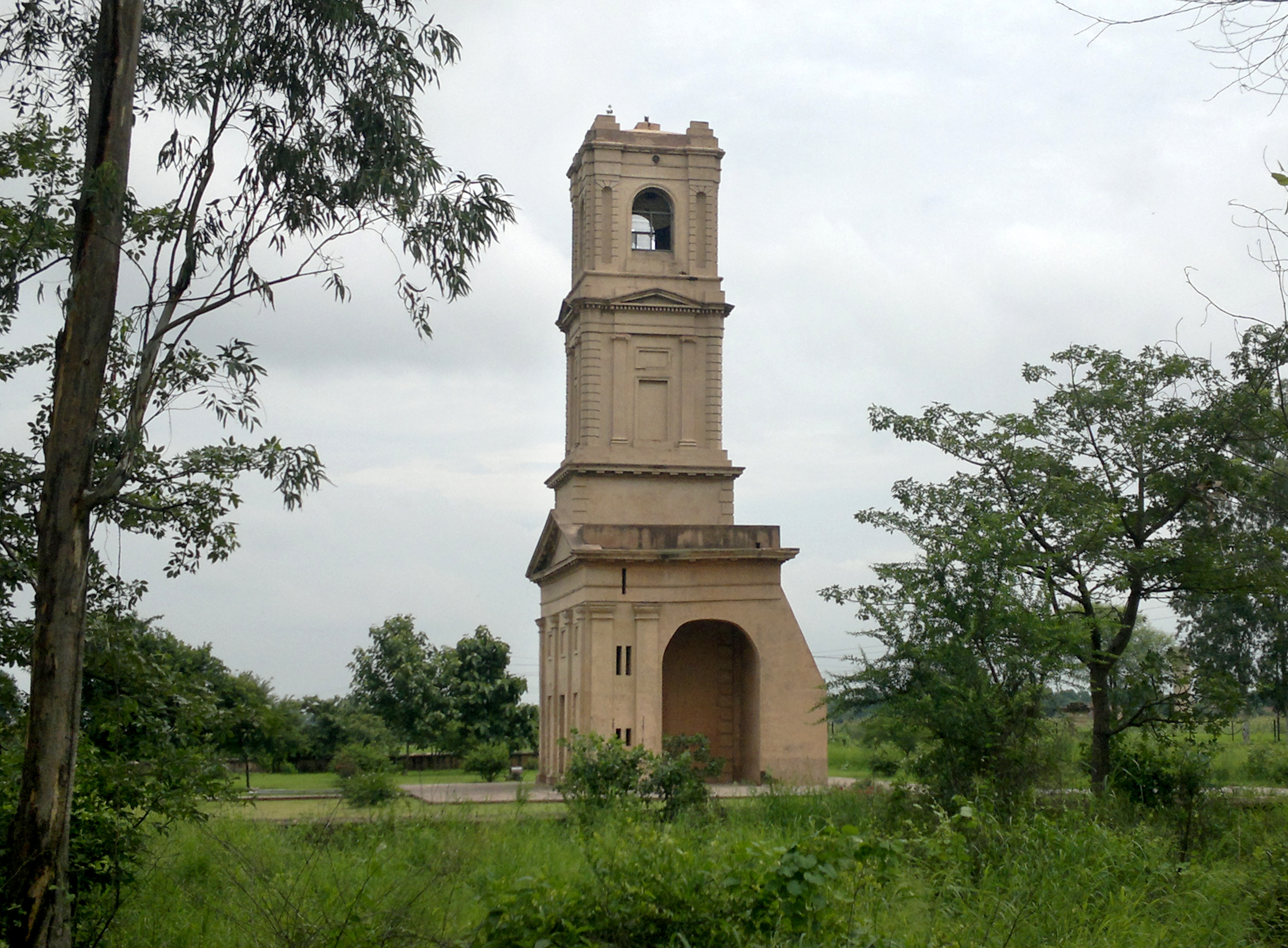
The Karnal Cantonment Church Tower is built in a Roman style. Formerly a part of St James Church, the major part of the area was dismantled as the cantonment was shifted before independence. The four-storeyed tower can be seen from km away and holds a spectacular ornamental cross on the top. Towering at the height of thirty-five metres, the Karnal Cantonment Church Tower is one of the most prominent landmarks of the region.

Travel Bucket List: India – Haryana Part 2

Faridabad
Haryana’s most populous city, Faridabad is a part of the Delhi NCR region, located about 41 km south of the capital and is one of the capital’s major satellite cities. The river Yamuna forms the eastern boundary with Uttar Pradesh and the city is one of India’s fastest-growing cities. Faridabad is the state’s major industrial hub with 50% of income tax collected in Haryana from Faridabad and Gurgaon. The city is famous for henna production from the agricultural sector, while tractors, motorcycles, switch gears, refrigerators, shoes, tyres and garments constitute its primary industrial products.

The city was founded in 1607 by Sheikh Farīd, treasurer to the Mughal emperor Jahangir, to protect the Grand Trunk Road between Delhi and Agra, and lies in the cultural region of Braj. A project for Pakistani refugee resettlement and light industrial development was initiated in the city in 1950. After India’s independence, Faridabad was initially a part of the Gurgaon district and later made an independent district. Close to Faridabad lies Tilpat, then known as Tilprastha, one of the five villages demanded by Pandavas to avert a disastrous war in the epic, the Mahabharata.

A lake fringed by the Aravalli hills, Badkhal Lake was a man-made embankment which has now dried up. Located in Badkhal village, the lake complex, spread over 40 acres, was constructed in 1969 and revived in 2015. CITM Lake is a beautiful water body formed by rainwater collected in the stone mines and a local favourite picnic spot. The tranquil location, the scenic natural landscape surrounding the body and the sparkling blue waters of the lake are a treat to nature lovers and photographers. Swimming is not advisable as the lake runs deep and has rugged stone underwater topography. Dhauj Lake is a naturally formed water body situated amidst the scenic Aravalli Hills and is famous for being one of the best sites for adventure sports in the region.

Surajkund is a 10th-century water reservoir believed to have been built by the Tomar King Surajpal. It is well known for its annual fair, the Surajkund International Crafts Mela which attracts millions of visitors, both domestically and internationally. The lake is surrounded by rock-cut steps and the embankment is constructed in a semi-circular fashion and doubles up as a picnic spot. The pond is surrounded by the ruins of an ancient sun temple, coupled with a beautiful garden and pool called the Siddha Kund. Historians also claim that King Surajpal, son of Anang Pal I, built the lake in 686 A.D. for his daughter, and it is probably after his name that the lake is called so. Another theory about the name of the reservoir is that the kund or lake is named after the Sun Temple that existed on the eastern side of the lake. During the rule of Feroz Shah Tughlaq, who belonged to the Tughlaq Dynasty, the reservoir was renovated, and the steps and terraces were rebuilt with stones in lime mortar. A cave-like structure was also built on the western side of the reservoir, close to the Sun Temple. Rainfall was captured here to create a repository, which was a hunting forest resort in the past, and now proves to be a great spectacle. Even though the reservoir dries up in the scorching summer heat before the onset of the monsoon rains, it gets filled up during monsoons and abounds in dancing peacocks.

The Anagpur Dam is located close to Anagpur village, also called Arangpur, about 2 km from Surajkund. This unique hydraulic engineering structure was built during the reign of King Anangpal of the Tomar dynasty in the 8th century. It is approachable by road from Delhi by the Delhi – Mathura road. The ruins of the fortifications found in Anangpur village establish by an inference that it was built by Anangpal as part of the Lal Kot that was developed as the first city of Delhi in the 8th century.

Also known as the Ballabgarh Fort, the Raja Nahar Singh Fort is located on the main road as one enters the main market of Ballabgarh. It was built by Raja Nahar Singh’s ancestor Raja Rao Balram who ascended the throne in 1739 and died in the war of Independence of 1857. The palace is known to have been constructed in parts until 1850 and today has been renovated into a beautiful palace having air-conditioned rooms, restaurants, bars and lounges, courtyards and gardens. The famous Kartik Cultural Fest here as well as weddings, musical nights and exhibitions are organised here regularly.

It is believed that Faridabad is named after Baba Farid, a popular Sufi saint and his tomb is a popular pilgrimage attraction with pilgrims coming from different regions here.

The Sri Shirdi Sai Baba Temple is dedicated to the saint, Sai baba and is spread over 3 acres of land. There is also a deity of Lord Sai Ram which is 5 feet tall made of pure white marble. The temple also houses the idols of Dwaraka Mayee and Dhuni

Also known as the Maharishi Parashar Tapo Bhumi, the Parson Temple is an ancient shrine dedicated to Maharishi Parashar. It is situated in the beautiful Aravalli Hills and is believed to be the location where the Maharishi performed penance and meditated. Located away from the bustling city, the temple has a tranquil vibe to help calm troubled souls.

Nuh
Located 40 km south of Gurgaon, Nuh lies on the National Highway 248 or NH 48. According to the epic, Mahabharata, the area was gifted by the eldest Pandava King Yudhishthira to their teacher Dronacharya and passed from the hands of the Maurya empire to invaders such as Parthian and Kushan, and later Yaudheya, after they expelled the Kushanas from the area between the Yamuna and Satluj. In 1156, it was conquered by King Visaladeva Chauhan of the Chauhan Dynasty and after the defeat of Prithviraj Chauhan in 1192, the area came under Qutb al-Din Aibak of the Delhi Sultanate who defeated and killed Prithviraj’s son Hemraj, who had invaded Mewat from Alwar. At the time of the invasion of Timur in 1398, Bahadur Nahar, formerly known as Sonpar Pal, was the prominent king of the area, who constructed the Kotla Bahadur Nahar fort near Kotla lake at the Kotla village of Nuh. Sonpar Pal converted to Islam in 1355 and was given a new name of Raja Nahar Khan by Sultan Firuz Shah Tughlaq and became the founder of the Khanzada Rajputs. After the fall of Tughlaq dynasty in 1398, Nahar Khan reconciled with Timur and in 1420, during the era of Nahar Khan’s grandson, Khanzada Feroz Khan, Mewat was attacked by Sultan Khizr Khan of Delhi Sayyid dynasty. In 1425, the great-grandsons of Bahadur Nahar, revolted against Dehli Sultanate but were defeated by Sultan Mubarak Shah

The Mughal emperor Aurangzeb tried to crush the revolting Khanzada chief and after the death of Aurangzeb, Bahadurgarh and Farrukhnagar in the north were under the Baloch Nawab. During the Maratha Empire, the area was conquered by French generals in the late 18th century and Nuh remained under the Bharatpur Jat Kings and their vassal relatives, one of whom was Nahar Singh. The town assumed importance at the time of Bahadur Singh of Ghasera because of the salt trade manufactured in neighbouring villages. To the west of the town is a masonry tank of red sandstone featuring a chhatri adorned with floral designs. The tomb of Sheikh Musa combines Muslim and Rajput forms of architecture and is about 2.5 km from the town. In 2018, five monuments were noted as state-protected monuments, including the Ghasera fort, the Chuhi Mal Ka Taalab, the Old Tehsil building in Nuh, the Kotla mosque, and a group of monuments at Meoli.

The ruined Ghasera Fort, a state-protected monument, lies at Ghasera village 14 km from Nuh city on the Nun-Sohna road. The Nalhar Pandava Reservoir and the Nalhshwar Mahadev Temple or the Nalhar Shiv temple are located 2 km from Nuh city within the U-shaped Nalhar valley surrounded by several picturesque peaks near Nalhar village in the foothills of Nalhar hills of the Aravalli range. It can be reached through a large ceremonial Hindu religious gate a short distance from the temple. There is also a natural reservoir at the base of a Kadamb tree higher up in the Nalhar hill, which can be reached by climbing 250 paved and iron stairsteps behind the Nalhar Shiva Temple. According to the popular oral tradition, the Pandavas stayed here, prayed to Lord Shiva and drank water from this reservoir during a visit in their 14 years long exile. The Nalhar hill also has amazing views. The temple was restored by Swami Gyan Giri and installed a natural lingam here which has the images of Aum, Shiva, Ganesha, Ganges, Janau and Naga.

The Kotla Fort and Tomb of Raja Nahar Khan in the Kotla Mosque is 6.5 km from Nuh city in the Kotla village. The square-shaped Kotla mosque, which dates to 1392-1400 rests on a plinth, with grey quartzite tomb and red carved sandstone jalis and has inscriptions on the ruined gateway. The tomb was notified as a state-protected monument in 2018.

The Nuh System of Lakes is a collection of several lakes lying in each other’s vicinity, and includes the permanent swamp of Khalilpur lake which gets flooded during rains and lies north-west of Nuh around the Khalilpur and Indari villages, the Chandaini lake which lies 10 km west of Khalilpur village, the Sangil-Ujina lake which is not a clearly defined basin of the lake as it carried only the overflow water in the rainy season from Khalilpur lake and other lakes, and the Kotla Dahar lake at the foothills of Aravalli Range which is the largest lake which is 5 km broad and 4 km long and lies across Nuh and Ferozpur Jhirka. With floral carvings and chattris or cenotaphs in redstone, the ancient tank of Chui Mai in Nallad is a natural reservoir and a sight to behold.

A fine blend of Muslim and Rajput style of architecture, Sheikh Musa is famous for its shaking minarets of the Tomb of Sheikh Musa. This man-made marvel is also known for its brilliant engineering techniques such as – if a person shakes one pyramid, the other person can feel the vibrations in the next one.Despite its ruined conditions due to lack of maintenance, these pyramids attract many visitors.

Close to Sheikh Musa is the Temple of Hathor which is believed to be of the Third dynasty of Tuthmosis of Egypt. Several Greek and demotic papyri were found by archaeologists in the temple complex.

Murthal
Murthal is located about 45 km from the national capital New Delhi, and 202 km southwest of Chandigarh, the state capital and is most well known for its parathas or Indian flatbreads. Situated on National Highway 1 connecting Delhi to Amritsar, Murthal is a large village that started life as a pit stop for truck drivers. Soon, its dhabas, or roadside restaurants gained popularity. Murthal has more than 50 dhabas and restaurants each famous for their special types of Parathas. Usually a year-round getaway, Murthal is most often visited during the evenings during summers. In the winter months, people visit early in the morning for parathas and tea.

Rohtak
Rohtak lies 70 km northwest of New Delhi and 250 km south of the state capital of Chandigarh on NH 9 and forms a part of the National Capital Region (NCR). Rohtak is the sixth most populous city in Haryana as per the 2011 census.

Clay mounds of coins discovered at Khokhrakot have thrown light on the process of casting coins in ancient India. The coin moulds of the later Yaudheyas of the 3rd or 4th century have been discovered in large numbers here, along with several clay seals of the same and subsequent dates. A Gupta terracotta plaque and head of later date have also been discovered. The town continued to flourish till the 10th century, as coins of King Samanta Deva of the Hindu Shahi dynasty of Kabul have been found here.

A centuries-old fort in present-day Qilla Mohallah was built by the Sheikhs of Yemen under Qazi Sultan Muhammad Surkh Zulqarni during the Ghauri Dynasty kings. The fort of Rohtak was besieged by Syed Khizer Khan in 1410 which could only succeed after a long seizure lasting six months. There have been many rumours regarding the name of the city and its origins with evidence suggesting that the old town is as old as the Indus Valley Civilization.

Asthal Bohar is a well-known Math located 7 kms from Rohtak in the eastern outskirt of the city and serves as a shelter to the followers of Guru Gorakh Nath, a fervent devotee of Lord Shiva and home to ancient discoveries, books and relics. The Durga Bhawan Mandir is a major religious shrine in Rohtak. The temple is grandly decorated during Navratri with lights and lamps. Gurudwara Bangla Sahib is dedicated to the Sikh Guru Teg Bahadur, the ninth Sikh Guru. The Gurudwara comes alive during Guru Teg Bahadur’s birth anniversary. The All Saints Church was constructed by the British in 1867. There are some tombstones, with dated inscriptions in the graveyard near the mini secretariat building of Rohtak. Previously it was said to be surrounded by a garden, but today only has a narrow strip of land. There are 180-year-old historic tombstones, here which is today in a deserted condition with a thick thorny vegetation growth covering the tombstones.

Rohtak has some of the most beautiful lakes like the Bhindawas Lake and the Tilyar Lake. Bhindawas lake is a man-made lake that has transformed itself into a bird sanctuary and is a favourite bird watching venue. Tilyar Lake is spread over 20 acres surrounded by water shrubs and forest. The lake attracts a vast array of birds along which attracts visitors. The Tilyar Lake complex houses a zoo in its vast compound which also includes a restaurant, mini train, a park for kids and retail shops. Visitors enjoy boating, angling and Kayaking while the zoo is the favourite part of the complex for children. The angling permit in the lake costs INR 200, and one can fish between 7 am and 6 pm during the summer months and between 8 am and 5 pm during the winter months. The entry fee to the zoo is INR 10 for adults and INR 5 for children and is open between 7 am and 6 pm during summer and between 8 am and 5 pm during winters.The Khaparwas Bird Sanctuary lies about 49 km south of Rohtak and about 60 km west of Gurgaon. The reserve covers 0.8 sq km and is an important part of the ecological corridor along the route of the Sahibi River which traverses from the Aravalli hills in Rajasthan to the Yamuna. It was declared a wildlife sanctuary on 30 January 1987. The Bhindawas Wildlife Sanctuary lies about 1.5 km from this sanctuary.

Source

Meham
Also spelt as Maham, Meham, is a small town about 33 km west of Rohtak well known for its archaeological sites and is one of the few sites that have preserved the existence of the Indus Valley Civilization which are in the form of large dunes about five km away on the city’s western fringe. In ancient times, the area’s name was Mahahattam and had about two big ponds and a dozen smaller ones that were were created by the Indus Valley Civilisation to trap runoff rainwater, which could last for a full year until the next rainfall replenished the supply. Archaeological excavations in the region have yielded well-documented finds, which have shed light on the pre-Harappan settlements, particularly at Madina and Farmana Khas. Maham suffered a setback during the invasion of the Ghaznavids under the command of Sultan Mahmud and later when his son Mas’ud I sacked the town. A few centuries later, during the reign of the Turkic Muslim ruler Firuz Shah Tughlaq, the town was resettled, and agricultural operations resumed.

During the Mughal rule, a garrison commander was posted at Maham who built a small fort known as Maham Fort which is now in complete ruins except for its ramparts. Colloquially known as Choro ki Baoli or the thieves’ stepwell and Jyani Chor ki Surang or Jayani the thief’s tunnel, Shahjahan ki Baoli was in 1559 by the Mughal courtier Saidu Kalal during the reign of Shah Jahan. It is an old baoli or stepwell made of lakhori bricks with 101 steps. Several rooms in the subterranean pavilion flank both sides of the well’s steps. Today, it lies in partial ruins and faces neglect. The structure itself contains three separate chambers to hold increasing amounts of water. As rainwater was collected, one level at a time would be filled.

Two mosques, the Jama Masjid and the Pirzada Masjid were built during the Mughal rule and are currently in ruins. Parts of them have been demolished by the villagers and used for the making, drying and storing of hand-made dried cow dung cakes or as fuel for cooking. The tombs of Shah Muhammad Ramzan Mahami and Shah Ghulam Hussain Mahami lie partially ruined today though the latter, that of a Muslim saint has been partially restored by locals and religious structures erected near it.

There is also a temple named Sheetalpuri Mandir, which is about 500 years old, in the centre of Maham. In Bharan, a village near Maham, an annual religious festival celebrating Goga Navmi is held in the Goga Ji temple with wrestling tournaments organised nearby. Five km from Maham, a large village named Behlba contains an old temple named Baba Khali Nath Temple.

Travel Bucket List: India – Haryana Part 1

Located in north India, Haryana is a land-locked state which was carved out of the former state of East Punjab on 1 November 1966 on a linguistic basis. It shares its state capital of Chandigarh with Punjab while its most populous city is Faridabad, part of the National Capital Region and the city of Gurgaon among India’s largest financial and technology hubs. The 11th highest among Indian states in the human development index, Haryana’s economy is the 13th largest in India and has the country’s 5th highest GSDP per capita.

The state, which is bordered by Himachal Pradesh to the north-east, by the river Yamuna along its eastern border with Uttar Pradesh, by Rajasthan to the west and south, and the Ghaggar-Hakra River which flows along its northern border with Punjab is rich in history, monuments, heritage, flora and fauna. Since Haryana surrounds the country’s capital Delhi on three sides, north, west and south, large areas of the state are included in the economically important National Capital Region for planning and development.

Experts say that Haryana was known by the name because in the post-Mahabharata period the Abhiras lived here who developed special skills in the art of agriculture and so Haryana came to be derived from Abhirayana. The villages of Rakhigarhi in Hisar and Bhirrana in Fatehabad are home to one of the oldest and largest ancient civilisation sites, the Indus Valley Civilization, dating over 9,000 years old. Evidence of paved roads, a drainage system, a large-scale rainwater collection storage system, terracotta brick and statue production, and skilled metalworking, in both bronze and precious metals have been uncovered. According to archaeologists, Rakhigarhi may be the origin of the Harappan civilisation, which arose in the Ghaggar basin in Haryana and gradually and slowly moved to the Indus valley. During the Vedic era, Haryana was the site of the Kuru Kingdom, one of India’s great Mahajanapadas and the south of the state is the claimed location of the Vedic Brahmavarta region.

Ancient bronze and stone idols of Jain Tirthankara were found in multiple areas of the state. The Pushyabhuti dynasty ruled parts of northern India in the 7th century with its capital at Thanesar, on the outskirts of Kurukshetra and the Tomara dynasty ruled the south Haryana region in the 10th century. The area that is now Haryana has been ruled by some of the major empires of India. Panipat is known for the three seminal battles in the history of India. In the First Battle of Panipat in 1526, Babur defeated the Lodis. In the Second Battle of Panipat in 1556, Akbar defeated the local Haryanvi Hindu Emperor of Delhi, who belonged to Rewari. Hem Chandra Vikramaditya had earlier won 22 battles across India from Punjab to Bengal, defeating Mughals and Afghans. Hemu had defeated Akbar’s forces twice at Agra and the Battle of Delhi in 1556 to become the last Hindu Emperor of India with a formal coronation at Purana Quila in Delhi on 7 October 1556. In the Third Battle of Panipat which took place in 1761, the Afghan king Ahmad Shah Abdali defeated the Marathas.

Compared to a national average of 22%, Haryana has only 4% of the area under forests. The state has four main geographical features. The Yamuna-Ghaggar plain forming the largest part of the state is also called Delhi Doab and consists of the Sutlej-Ghaggar Doab between Sutlej in the north in Punjab and the Ghaggar river flowing through northern Haryana, the Ghaggar-Hakra Doab which lies between the Ghaggar river and the Hakra or Drishadvati river which is the paleochannel of the Saraswati River and the Hakra-Yamuna Doab between the Hakra and the Yamuna Rivers, the Lower Shivalik Hills to the northeast in the foothills of the Himalayas, the Bagar tract semi-desert dry sandy plain to the south-west and the Aravali Range’s northernmost low rise isolated non-continuous outcrops in the south.

Often known as the Land of Milk and Butter, Haryana has witnessed some of the most critical events in the course of Indian history, aptly giving it its title of being the land of lore, myth and ancient history. October to March is the best time to visit the state because starts getting colder and pleasant around this time making it a perfect time for sightseeing. We have spoken in detail about Haryana’s shared capital of Chandigarh when we saw what Punjab had to offer us, so let’s dive into the rest of the state.

Gurgaon
Officially known as Gurugram, Gurgaon is situated near the Delhi–Haryana border, about 30 km southwest of the national capital. It is one of the major satellite cities of Delhi and is part of the National Capital Region of India. Gurgaon is India’s second-largest information technology hub and third-largest financial and banking hub and also home to India’s largest medical tourism industry. Despite being India’s 56th largest city in terms of population, Gurgaon is the 8th largest city in the country in terms of total wealth. The city serves as the headquarters of many of India’s largest companies, is home to thousands of startup companies and has local offices for more than 250 Fortune 500 companies and accounts for almost 70% of the total annual economic investments in the state.

The region of Gurgaon originally fell under the Kuru Kingdom with the early people to inhabit the region Hindus ruled over by the Ahir clan and the Yadu tribes were also a part of this clan. In the late 4th century BC, the city was absorbed by the Mauryan Empire as part of Chandragupta Maurya’s earliest expansions of his kingdom. It is also said that the Gurgaon of today may be the same as the Gudapura town mentioned in the 12th-century text Prithviraja Vijaya, according to which Nagarjuna, a cousin of the Chahamana king Prithviraj Chauhan, rebelled against the king and captured the town, after which King Prithviraj crushed the rebellion and recaptured the town.

During the Mughal and the initial years of the British colonial era, Gurgaon was just a small village. There are mentions of a stone pillar at Gurgaon of a local feudal lord, Durgga Naga dating back to 672 or 871. After coming into direct British rule, the British established a civil line at Jharsa and a cavalry cantonment at Hiyadatpur. In 2016, the name of the city was officially renamed from Gurgaon to Gurugram, though Gurgaon still lingers in colloquial usage.

24 km south of Gurgaon lies the beautiful Damdama Lake which was commissioned by the British in 1947 for rainwater harvesting. Today, the lake is home to over 190 species of native and migratory birds and in the monsoons, when water levels reach as high as fifty feet is when most of the migratory birds are spotted. The lake is the biggest in Haryana and stretches to almost three thousand acres and is a popular place for picnics as well as for on-site training for corporate team-building exercises. Surrounded by the rocky Aravalli hills and uneven but exciting topography, this scenic lake is a perfect getaway for people in and around New Delhi, Delhi, and Gurgaon. There are many resorts near the lake that offer adventure sports and paddle boating. Other attractions here include kayaking, parasailing, angling, cycling, fishing, hot air ballooning, rowing and nature walks.
Resorts also offer activities like artificial rock climbing, cricket, volleyball, flying fox and darts in packaged deals. The best months to visit Damdama Lake are between August and February because many endangered bird species can be spotted here then. Summers are not advisable because of the heat and reduced water levels.

A perfect weekend getaway, the Sultanpur Bird Sanctuary is the perfect getaway for nature lovers and birding enthusiasts. Home to several migratory birds, it is a great spot for spotting various species, especially during the winter months. The sanctuary is home to more than 250 species of birds, especially during the peak season. The birds travel long distances from Europe, Siberia and Central Asia. The sanctuary also has four towers at different points of the sanctuary. The Sultanpur sanctuary is named after Rajput Chauhan Sultan Singh, the great-grandson of Harsh Dev Chauhan, the ruler of this area. Sultanpur was the centre of salt production till the 19th century and on April 2, 1971, the Sultanpur Jheel with an area of 1.21 sq km was provided with sanctuary status and the sanctuary was upgraded to a National Park and the simultaneously the area was increased to 1.42 sq km. The National Park comprises the lands of Sadhrana, Chandu, Sultanpur and Saidpur villages. For bird watchers, early morning or late evenings are the best time as the migratory birds fly out of their nests at sunrise and return at sunset.

Set over 1.54 sq km, the Aravalli Biodiversity Park was established to ecologically restore and preserve the vegetation on the desert and arid land areas in the region. Inaugurated on the occasion of the World Environment Day in June 2010, after a Supreme Court Ban on stone mining in the region, the biodiversity park has about 160 plant species, over 170 species of birds and animals.

The Tau Devi Lal Biodiversity Park is mostly used for recreational purposes with a walkway used for morning or evening walks. There is also a rose garden with colourful and fragrant roses and the greenery attracts birds and so is preferred by bird watchers as well.

Qutub Khan’s Tomb is an 18th-century structure built in the memory of Adam Khan who served as a general to Emperor Akbar. The tomb has a unique octagonal structure and is an example of Mughal architecture. In 1830, Blake, a British Officer chose to reside at the location and removed all the graves. The tomb was later restored by Lord Curzon after Blake’s death.

Dedicated to Sai Baba, the Sai Ka Angan Temple sprawls over an area of 3344 sq m and is built in the shape of a cave with important points of Sai Baba’s life in Shirdi replicated. The idol of Sai Baba is installed under a Neem tree and lit with oil lamps.

The Sheetla Mata Mandir is dedicated to Mata Sheetala, a Hindu goddess widely worshipped in North India, West Bengal, Nepal, Bangladesh and Pakistan as the pox-goddess. She is the Goddess of sores, ghouls, pustules and diseases in Hindu mythology. The temple is popular for its festival in the Chaitra month of the Hindu calendar i.e. between March and April.

Source

A palaeolithic archaeological site and sacred grove hill forest next to the Mangar village on the Delhi-Haryana border, Mangar Bani lies in the South Delhi Ridge of the Aravalli mountain range, the oldest plateau mountains in India. It is the Indian subcontinent’s largest neolithic South Asian Stone Age site and tool-making factory dating back to 100,000 years Before Present or BP, the first ever site with cave painting in the Aravalli range dating back to 20,000-40,000 BP, making it the oldest human habitation discovered in Haryana and the Delhi NCR. Mangar Bani is spread across 5000 hectares and it is surrounded by the larger forested Aravali range. Archaeologists discovered cave paintings in the Mangar Bani hill forest in May 2021 with the tools found estimated to be 100,000 years old.

Contiguous to the Asola Bhatti Wildlife Sanctuary, it is an important biodiversity area within the Northern Aravalli leopard wildlife corridor stretching from the Sariska Tiger Reserve to Delhi with several wetlands. Formed in the abandoned open-pit mines in and around the area and significant to migratory birds are the Badkhal Lake, the 10th century ancient Surajkund reservoir and Anangpur Dam, Damdama Lake, Tughlaqabad Fort and Adilabad ruins, both of which lie in Delhi proper. Mangar Bani is one of the last remaining natural tropical forests in the Aravalli range with more than 30 native tree species along with the 100 native shrubs and herbs, which acts as an important source of groundwater recharge.

Mangar Bani, is a Haryanvi dialect term that means the Mangar Vana in Hindi or Sanskrit and the Mangar Forest in English. The Mangar Tribal Jewellery Museum, established by Sterre Sharma, the wife of former union minister Satish Sharma, has jewellery from all over India including the tribes of northeast India with jewellery made from glass, bone, brass, white metal, silver and gold plate, all finding a home here. Mangar Bani is also a sacred grove as it surrounds the Gudariya Das Baba temple, within the forest and lies 2 km to the northwest of Mangar village. This ancient temple provides the status of a sacred grove to Mangar Bani and according to local oral tradition, the baba or saint Gudariya Das protects this bani or forest and punishes anyone who damages this forest. The Lulu Lake wetland is nestled on the hills of Mangar Bani, 6 km to the southwest of Mangar village and 4 km south of Gudariya Das Baba temple, close to Mount Gaga Lulu, a small hill.

The Lohagarh Farms was established to create self-sustaining rural communities and create employment opportunities. It also serves as a platform for village artists to exhibit and sell their arts and handicrafts and visitors can participate in activities like farming, pottery and trekking to get closer to nature. The farms offer activities and accommodations away from the urban life for one to connect with the basics of human nature.

The NeverEnuf Garden Railway is an enchanting infotainment park with miniatures of all sorts of vehicles, including boats, trains, buildings and landscapes. Some of these models are controlled with the help of a remote and add an interactive touch to the display. The park also has lawns and gardens where one can take a long relaxing stroll.

Tikli Bottom is a private guest house that offers a feel of living on a hill station. A haveli or mansion with four bedrooms, a beautifully maintained garden with trees and a swimming pool, one can get magnificent views of the Aravalli Hills from the property.

Founded by the renowned painter, sculptor and historian, K.C Aryan, the Museum of Folk & Tribal Art has a splendid collection of tribal handicrafts made of iron, wood & stone, embroidered fabrics, colourful murals and terracotta objects. Some artefacts with religious importance are also displayed at the museum. The complete collection gives a sneak peek into the culture and art of the tribals who live in and around Gurgaon.

The Vintage Car Museum was established to explore the history of transportation in India and exhibits a stunning collection of actual pre-mechanised and mechanised transportation including automobiles, railways, aircraft, etc. Technology buffs, especially those interested in the history of transportation in India, should visit the museum which partners with schools and research centres to provide material for research and documentation on the subject.

Manesar
Lying just 15 km south of Gurgaon’s city centre, Manesar is a town, an industrial hub and part of the National Capital Region of Delhi. The original village of Manesar was a sleepy village of about 1000 houses on the Delhi-Jaipur highway. The early people to inhabit the region were Hindus ruled over by the Ahir clan and since the late 1990s, it has been transformed into a boomtown with growth helped by the government’s drive to move out factories from Delhi as well as the growth of Gurgaon. Farmers have become millionaires or multi-millionaires. Manesar is famous for its rustic life and the majestic views of the wonderful Aravali Hills. The town is best visited between November and February which is wintertime in the region where the temperature is pleasant and sometimes bracing. Must-visit places in Manesar include the Gujarat Haveli, Sultanpur National Park, the Never Enough Garden Railway, the Rajon Ki Baoli, Damadam Lake, Sanskrit Museum of Everyday Art, Garden of Five Senses and the Heritage Transport Museum which is situated on 3 acres of land. The museum spread over four floors houses the exhibition galleries, library and reference centre, conference rooms, mini auditorium, the museum shop, and a restaurant.

Sohna
The town of Sohna is a popular tourist weekend destination and conference retreat on the highway from Gurgaon to Alwar, about 25 km south of Gurgaon. The town derives its name from the word Sona or gold, which refers to the gold dust that blows in the area, especially after heavy rainfall. Sohna is known for its hot springs and a Shiva temple and is part of the Ahirwal region. According to historical records, Sohna traces its origin from the 11th century and was occupied by three races in succession – the Kambhos, the Khanzadas and the Rajputs. Gazetteers mention that Nawab Qutb Khan Khanzada defeated the Hindu Kambhos and took over the town in 1570 who were then expelled in 1620 by the Sisodia Rajputs who migrated to Sohna, obeying the orders of their patron saint who appeared in their dream indicating Sohna as their place of settlement.

The Sohna Hotsprings, in the foothills of the Aravali Range, also has an ancient Shiva temple built by the Baba Lakhi Shah Banjara Banjara. A Gangasnan Mela or fair is held each November at the temple, and a fair is held each July and August to celebrate the festival of Teej. The hot springs are strongly sulphurous and according to legend, the Pandava prince Arjun dug the wells when he was thirsty. Sohna is believed to have been the abode of hermits and the main tank or kund, the Shiva Kund, is said to have medicinal properties. Devotees consider it sacred, and during eclipses and the Somavati Amavasya they gather here to bathe in the water. The hilltop Barbet Resort, operated by Haryana Tourism, has sauna and steam-bath facilities, a small swimming pool, a park, lodging and a restaurant overlooking the town.

The Gora Barak Mosque has a minaret while the Quto Khan ki Masjid, built from local red sandstone, is in ruins. The Shah Nazam al haq Tomb was built over a Hindu temple with the tomb having an inscription dating it to 1461, during the reign of Bahlul Khan Lodi of the Lodi dynasty of the Delhi Sultanate. The Lal Gumbaz or the Red Dome and Kala Gumbaz or Black Dome of Sohna lie west of the town with the 400-year-old tomb called Lal Gumbad located in the vicinity of the Ansal’s Orchid Estate. Made entirely of stone, the structure has a 12-pillared hall in the entrance arcade that is made of red sandstone crowned with a dome. Attached behind this is the main tomb in stone masonry with a larger dome, exhibiting hybrid architectural styles from Tughlaq and Lodhi periods.

Sohna is also famous for being the site of the annual vintage car rally held annually in February with car collectors from all over India coming to display their collection of vintage beauties including Rolls Royce, Aston Martins, and Austins. The rally also awards trophies to car owners based on their performance, maintenance, and restoration. Every year, the event draws hundreds of tourists who throng to witness these vintage beauties in action.

Tucked away in a distant part of the small town, the Sohna adventure camp offers its visitors an exciting life of camping, trekking and rock climbing. The camp also has a rope course, paintball area and mountain rappelling, making it a popular site for corporate getaways. Living in temporary tents gives the feeling of living at a hill station just a few hours away from the national capital. Foods and snacks available at the nearby eateries are also very delicious.

The Sohna Hill Fort or the Bharatpur Hill Fort is a semi-finished fort on the Aravalli Ranges. It was built by the king of Bharatpur State between 1700 and 1857. Demolished and rebuilt several times, the fort is the best place to spend a quiet and lonely evening.

Travel Bucket List: India – Nagaland Part 3

This part will showcase some of the lesser known towns in Nagaland.

Mokokchung
The cultural nerve centre of the Ao people as well as the most important economically and politically urban centre in northern Nagaland, Mokokchung is the third most important city after Dimapur and Kohima. The intellectual and cultural capital of Nagaland, historically, Mokokchung was one of the first Naga Hills sites where the Assam Rifles, led by the British, established their outposts, then called stockades, in the latter part of the 19th century. Much of the town initially grew around this post located in DC Hil which then gradually extended eastwards towards the remoter parts of the Naga Hills. The popular tourist spots in the area include the District Museum, the Town main Park located just above the Town Centre, the Unman village, which is the oldest and largest in the area and the Ao village.

About 18 km southwest of Mokokchung lies the village of Longkhum at an altitude of 1846 m above sea level. An Aos village from the days of the headhunters, the village is strategically located and commands a view of the surrounding hills and valleys with views as far as the eastern Himalayas, Arunachal Pradesh and beyond. The Aos have a belief that Longkhum is the resting place of the spirit of the dead on their onward journey to paradise. Mongzu Ki or the eagle’s eyrie is situated on a high precipice where eagles have nested for centuries and according to Ao mythology, eagles are the manifestations of the spirits of the dead. Mata Yimkong is a beautiful hilltop where once a fortress with the AKM Student Jubilee Tower the highest point at Longkhum. At the Imkongmeren Memorial Site, one can have panoramic views of the Doyang River. The Longlangba Longlangba or the Stone Bridge is a ridge of stones that passes through the Rhododendron woods which has small holes in the rocks that were carved into the stones so that spears could be placed in them and were warning signs to attackers that they would be killed and their heads be taken off. The man-made majang or observatory point is where one can have beautiful views with the backdrop of the Doyang River and the Mongzu-Ki or Eagle’s Cave can also be viewed from here. The legend behind Tangyim Maroksay that the water from this natural spring has the power to heal sickness. During September and early October, Cherry Blossoms bloom along the route to Longkhum. Achen Dang is where wedding ceremonies were conducted.

Ungma Village is the second-largest village in Nagaland and the oldest and largest of the Ao tribe reside here and the village was believed to be the birthplace of the Ao tribe. An old log drum, a Baptist church and an astoundingly pretty park located on the outskirts of Ungma are the famous tourist spots. The Chuchuyinlang Village is renowned for the celebrations of various tribal festivals with the most famous being the Moastu Festival that lasts for 3 days and commences on 1st May.

The Langpangkong Caves are situated between the valleys of Dikhu and Tzula Rivers and near the towns of Tuli and Changtongya. The caves are located in the Langpangkong mountain range and are believed to have given shelter to an Ahom King. The caves of Peren, Fusen kei and Mongzu Ki are the well-known yet unexplored caves of the region.

Tuensang
Tuensang was founded in 1947 to administrate the erstwhile North Eastern Frontier Agency or NEFA and lies about 227 km east of Kohima. In 1957, it was merged with the Naga Hills District to form a new administrative unit under the Ministry of External Affairs and later became a part of Nagaland. Tuensang is the headquarters of the Tuensang district, the easternmost and largest district of Nagaland, and has Myanmar to its east. It is also one of the fastest-growing towns in the state.

Noklak is a village situated on the edge of the district which is becoming popular due to its tribal festivals. It is inhabited by the Khiamniungan and is popular for its cane work, handicrafts and artefacts. Longtrok is an ancient village with remnants of the and Chungliyangti civilizations through its six celebrated stone structures. The most important ones are those of Tsongliyangti, Chungliyangti and Chungliyimti and are the most worshipped by the locals. The locals also believe that the Sangtams are the personifications of the ancient God who gave birth to other stones and moved them to different places. Between the town of Tuensang and the Hakchung village lies the very interesting village of Changsangmongko. Legend has it that this place is referred to as Changsang because of the Chang community settled here. The village is renowned for establishing a raised platform named Mullang, which is a symbol of the prosperity and well-being of mankind. An offbeat destination, Tsadang situated in the village of Longtrok is well known for its two ancient stones that picture two friends who regularly visited the village of Longtrok. They are placed in the vicinity of Tsongliyangti and Chungliyangti and are worshipped by the local people.

Phek
The name Phek is derived from the word Phekrekedze which means a watchtower. The district is inhabited by three major tribes, the Kheza, the Chokhri and the Pochury with at least five linguistics groups, namely the Chokri, the Khezha, the Pochury, the Sapu, and the Semas. Phek has moderately warm summers and cold winters. The people are expert craftsmen, excellent in making pots, baskets, sculptures and furniture. Phek is a hilly area rich in flora and fauna and the Shilloi Lake is an important attraction in the area apart from the amazing hills.

A beautiful foot-shaped lake in the heart of the Patkai range, the Shilloi Lake located in Lütsam Village has verdant valleys surrounding it. The lake is considered very important as it is believed that the spirit of a holy child rests in the bottom of the lake and it is one of the reasons why no one fishes or uses the lake water for drinking and irrigation. The four-meter deep lake spreads over an area of 250 to 300 m. There are many legends associated with the lake with one being a baby was found floating in the middle of the lake and two hands were seen bobbing the baby. It is said that the baby is the reigning queen of the lake and that the spirits of the lake are its protectors and so it is believed that no one can drown in the lake with no reported deaths by drowning in the lake. The area is known for its fishing spots with the best time to fish between June and September. The lake is also a haven for migratory birds like Siberian Cranes.

Atop Mt Zanibu near Thuvopisumi village, the Dzudu Lake is surrounded by lush greenery in the middle of dense jungles. The narrow strip of water is also called Zanibu Lake and is a paradise for bird watchers. The Phek Waterfall lies amid natural beauty in the middle of a jungle. One will have to walk quite a bit to reach the waterfall in the jungle.

About 70 km from Phek and 3 km from Pfutsero town, Glory Peak stands 2600 m above sea level overlooking the valley. From the peak, which is a local favourite picnic spot, one can also catch sight of the highest mountain in the world, Mt. Everest.

The small village of Khezhakeno is set amid picturesque surroundings. It is believed that many Naga tribes originated from Khezhakeno and migration led them to the other parts of the region. According to another popular legend, the village has a stone slab from which helps paddy miraculously multiply when placed on any drying land.

Mon
Home to the Konyaks nagas, Mon provides visitors with a unique and mesmerising view of tattooed faces wearing feathery loincloths. The district, except for the foothills, has a difficult terrain with steep slopes. Even though Mon doesn’t have a lot of sightseeing places, but it still attracts many visitors. There are numerous villages close by which offer one a closer picture of the life of the Nagas. Veda Peak and Naganimora are among the famous tourist spots here and one can see a waterfall near the Veda peak, one of the most pristine places in the region. Veda peak is located around 70 km from Mon. Among the few villages in the region that are worth visiting are Chui, Longwa and Shangynu.

Veda Peak is the highest peak in Mon and is located almost 70 km from district headquarters. The peak gives clear and stunning views of the Brahmaputra river as well as the Chindwin river which runs through Myanmar when the skies are clear. The famous waterfall at the peak is also worth visiting. The Angh’s or Chief’s house at Shangnyu Village is believed to be more than 500 years old. Chenloisho Village is one of the biggest villages in the Chen area. Located near the India-Myanmar border, this village has a small museum that houses all kinds of traditional ornaments of the region. Human skulls which are of the head-hunting days are displayed in Waloo. Longwa Village is one of the largest villages in Mon and this village is very interesting because the village lies in both India and Myanmar. The chief or the Angh’s house lies half in India and half in Myanmar. Villagers hold dual citizenship in both India and Myanmar. Four rivers flow through the river, two in India and two in Myanmar and so the natural beauty of the village is worth making the trip there.

Pfutsero
Pfutsero is the highest-altitude town and the coldest inhabited place in Nagaland with the temperature dropping below zero degrees Celcius during some winter nights and is inhabited mostly by the Kuzhas and Chokris and a commercially important town. The best time to visit is between mid-October which is when harvesting begins and April. The most important festival of the Khezhas is the Tsükhenye festival celebrated in April or May which takes place at the Pfütseromi Village.

This brings us to the end of this wonderful state that I hope I get to visit one day. Let me know in the comments below if you have been here and if I have missed anything that I should put on my bucket list. Check this space for another state soon.

Travel Bucket List: India – Nagaland Part 2

This part is all about Nagaland’s capital city, Kohima.

Kohima
The capital of Nagaland, Kohima is the second-largest city in the state. Originally known as Kewhira, Kohima was founded in 1878 when the British colonial rulers established its headquarters of the then Naga Hills District of Assam Province. It officially became the capital of the state after the state of Nagaland was inaugurated in 1963. Kohima was the site of one of the bloodiest battles of World War II and the battle is often referred to as the Stalingrad of the East. In 2013, the British National Army Museum voted the Battle of Kohima to be Britain’s Greatest Battle. Located in the foothills of the Japfü rang, the city has an average elevation of 1,261 m.

Kohima was originally known as Kewhi–ra which is an Angami name that means the land where the Kewhi flower grows. The name, Kohima, came about as the British could not pronounce the Angami name of Kewhi–ra, but most locals still prefer to use Kewhi–ra when speaking about the capital city.

Kohima was originally a large village named Kewhira, located in the northeastern part of the present-day Kohima urban area and was divided into four large clans or thinuos. The East India Company administration started to expand into Kohima beginning of the 1840s and continued to annex the region after the Indian Rebellion of 1857. Kohima was the first seat of modern administration as the Headquarters of Naga Hills District, then under Assam.

In 1944 during World War II, the Battle of Kohima along with the simultaneous Battle of Imphal was the turning point in the Burma Campaign. For the first time in South-East Asia, the Japanese lost the initiative to the Allies, which the Allies then retained until the end of the war. This hand-to-hand battle and slaughter prevented the Japanese Army from gaining a base from which they might have easily gone into the plains of India.

When Nagaland became a full-fledged state on 1 December 1963, Kohima became the state capital. On 20 March 1986, two students were killed in indiscriminate firing by the Nagaland Police when they participated in a peaceful protest called by the Naga Students’ Federation or NSF to rally against the state government’s decision on the introduction of the Indian Police Service cadres and the extension of the Disturbed Area Belt from 5 to 20 km along the Indo-Myanmar border. The event was so tumultuous that it led three Cabinet ministers and five state ministers of Nagaland to resign.

On a green and verdant hillock, lies the township of Touphema. Built by the local community in partnership with the Tourism Department of Nagaland, Touphema Village is a collection of small huts built and decorated in traditional Naga design which gives visitors the feel of living in a Naga tribal house. A very popular tourist attraction, the village is a wonderful recreation of a traditional AngamiNaga village set up with cabins and rooms that have been built to look like traditional huts and cottages. A short walk around the village can transport one way back in time when Naga tribes lived. The AngamiSekrenyi annual festival is celebrated with great fervour in the village in February. Most of the traditional village buildings have roofs made of corrugated iron without chimneys. Located on a gentle hillock with a panoramic view of the surrounding valleys, Touphema offers a chance to stay in quaint little huts, enjoy pleasant evenings around bonfires with cultural dances just adding to the rustic feel of the entire place and offer some of the best photo opportunities. A recently refurbished museum inside the village offers an extensive ethnographic collection including wood carvings, musical instruments, textiles, handicrafts traditional artefacts, jewellery, and archaeological finds.

A town belonging to the Angami Naga tribe, Khonoma Village is a one-of-its-kind project located about 20 km from the state capital. In a Green Village, where all forms of hunting have been abolished for a more sustainable ecosystem, the residents live a more sustainable way of living. Nestled on the base of the mountains, this eco-friendly, conservation-based village also provides fantastic views of misty valleys, gently sloping hillocks, and terraced farms.

The Naga Heritage Village in Kisama on the outskirts of Kohima seeks to preserve and promote the culture and traditions of the Naga people. The name Kisama itself is an amalgamation of the Naga villages, Kigwema (Ki), Phesama (Sa), and the word Ma which means a village. The venue for the famed Hornbill Festival, the village is designed in the form of an ancient Naga village to give an authentic feel of a true Naga village and the experience of travelling back in time. The village is opened to the public for a week in December, during the Hornbill festival which is the best time to visit. The Hornbill Festival is the biggest annual festival in North East India. The festival is held every year from 1 to 10 December with the purpose to promote the richness of the Naga heritage and traditions. It is also called the ‘Festival of Festivals’. The week-long festival unites one and all in Nagaland and people enjoy the colourful performances, crafts, sports, food fairs, games and ceremonies. Traditional arts which include paintings, wood carvings, and sculptures are also on display. The festival highlights include the traditional Naga Morungs exhibition and the sale of arts and crafts, food stalls, herbal medicine stalls, flower shows and sales, cultural medley – songs and dances, fashion shows, the Miss Nagaland beauty contest, traditional archery, Naga wrestling, indigenous games, and a musical concert.

The Kohima Cathedral also known as the Help of Christians Cathedral is a prominent Kohima landmark in Kohima. The church is noted for its architecture which incorporates many elements of traditional Naga houses, including its facade which resembles that of a Naga house and the architecture blends into the hill on which it is situated. The 16 feet high carved wood crucifix is one of Asia’s largest crosses. Conceptualised by Kohima’s first bishop, the cathedral complex also contains his tomb and was constructed in 1998. After the battle of Kohima, the Japanese contributed to the making of this church in memory of their loved ones.

The enchanting Dzükou valley with its emerald green rolling hills, interspersed by a gently flowing stream, is tucked away at an altitude of 2,438.4 m, about 30 km south of Kohima. A trekker’s delight, Dzükou is known for its bio-diversity with the bamboo bush its predominant plant and looks likes a fully mown lawn from afar. The valley is considered to be the base of the crater of an old volcano and is well known for its natural environment, seasonal flowers, flora, and fauna with the North Eastern Valley of Flowers a sight to behold.

The second-highest peak in Nagaland, Japfu Peak stands 3048 m above sea level and is about 15 km south of Kohima. The best seasons for climbing this mountain are between November to March. In the Japfu range, one can find the tallest Rhododendron tree, featured in the Guinness Book of World Records, over 109 ft tall and the girth at its best measures more than 11 ft. The sight of the sunrise from the hump of Japfu peak in November is something that needs to be experienced.

The Kohima Museum takes visitors closer to the lives of the tribals living in Nagaland. Built to introduce visitors to the rich culture and tradition of the 16 tribal groups of Nagaland, the Kohima Museum is located in Upper Bayavu Hills and displays gateposts, endemic regional animals and birds, statues, jewellery items and pillars. The museum also houses life-size models depicting costumes, weapons and jewellery worn by the people.

The Kohima State Museum allows visitors to get a deeper insight into the history and culture of the tribes residing in the state. Established in 1970, the museum houses rare artefacts belonging to the 16 tribes of Nagaland. From tribal attires and weapons to jewellery and sculptures, the exhibits of the museum leave visitors fascinated. There is an art gallery, which displays amazing paintings made by local artists as well as showcases musical instruments used by the Naga tribes. One of the best attractions of the museum is the models of traditional Naga huts known as Naga Morung. The museum also houses a rare collection of precious stones like cornelian and tourmaline along with brass artefacts and silver bells.

Set amidst picturesque surroundings, the Kohima War Cemetery was built in April 1944 to honour the brave soldiers of the 2nd British Division of the Allied Forces who lost their lives during World War II. The war cemetery houses 1,420 graves and is well-maintained by the Commonwealth War Graves Commission. The cemetery was built in the tennis court of the then deputy commissioner’s residence, the exact place where one of the fiercest battles against the Japanese was fought. Popularly remembered as the Stalingrad of the East, the battle of Kohima was fought from April 4 to June 22, 1944, and offers gorgeous panoramic views of Kohima. The cemetery’s top also houses a dome-like memorial raised to honour the 917 Hindu and Sikh soldiers who lost their lives in the battle and were cremated according to their faith. The cemetery is well kept with lush green, mowed lawns and well-groomed flowers. There is also a War Museum as well as the Kohima Cathedral nearby.

The Kohima Zoo houses the state bird, the rare Tragopan, and the state animal, the wild buffalo. The zoo is created on a hill and the hill has been beautifully used to provide natural landscapes for the animals. The golden langurs and Blythe’s tragopan are the biggest attractions of the zoo with a section of the zoo turned into a special area for kids with a play zone and fun facts about the animals.

Established in 1923, the Ntangki Wildlife Sanctuary was declared a reserved forest in 1975 and converted into a national park in 1993. Located about 29 km from Kohima, the national park is said to be home to several animals including elephants, wild buffalos, the rare Hoolok gibbon, sloth bear, barking deer and black storks. The 200 km national park has a natural and protected habitat.

In the next part, our last part about this wonderful state, we will explore some of the lesser known towns in the state.