Travel Bucket List: India – Nagaland Part 1

After I pass through Manipur, my next destination will be the mist-shrouded state of Nagaland.

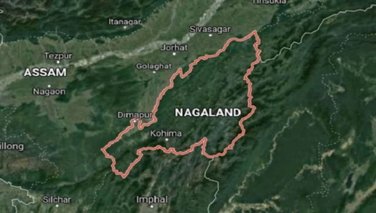
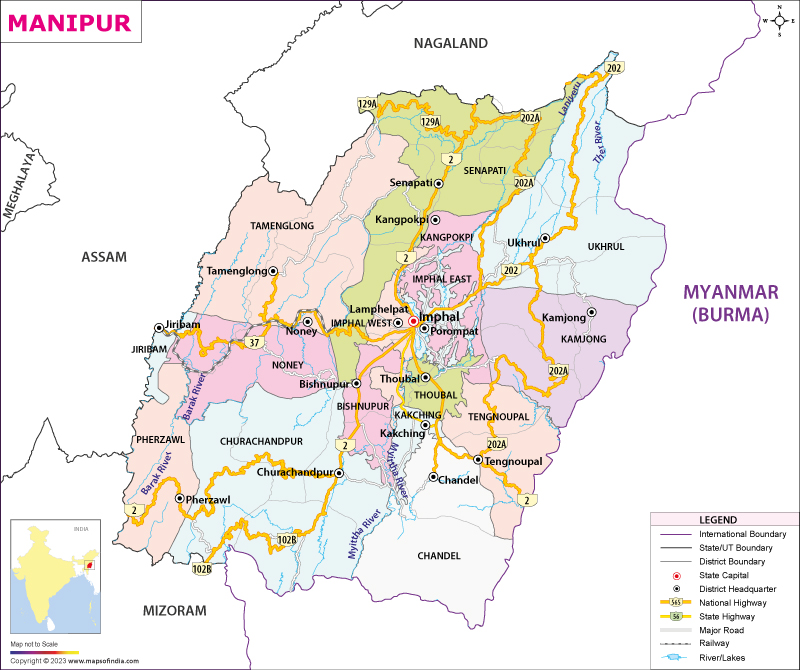
Bordered by Arunachal Pradesh to the north, Assam to the west, Manipur to the south and the Sagaing Region of Myanmar to the east Nagaland’s capital is Kohima and its largest city Dimapur. One of India’s smallest states, Nagaland became the 16th state of India on 1 December 1963 and has experienced insurgency and inter-ethnic conflicts since the 1950s, limiting its economic development. Agriculture is its most important economic activity, accounting for over 70% of its economy and other significant activities include forestry, tourism, insurance, real estate, and miscellaneous cottage industries. Home to a rich variety of flora and fauna, Nagaland lies between the parallels of 98 and 96 degrees east longitude and 26.6 and 27.4 degrees latitude north.

The ancient history of the Nagas is unclear with tribes migrating at different times, each settling in the northeastern part of present-day India and establishing their respective sovereign mountain terrains and village-states. There are no records of whether they came from the northern Mongolian region, southeast Asia or southwest China, except that their origins are from the east of India and that historical records show the present-day Naga people settled before the arrival of the Ahoms in 1228.

The origin of the word Naga is also unclear, with a popularly accepted, but controversial view being that it originated from the Burmese word Na-Ka or naga, meaning the people with earrings while others suggest it means pierced noses. Both Naka and Naga are pronounced the same way in Burmese.

Before the European colonialism of South Asia, there were many incursions from the Burmese on the Nagas, the Meitei, and others in India’s northeast where the invaders head-hunted and the Burmese word Naka was used for them which became Naga and has been in use since then.

British troops recorded 10 military expeditions between 1839 and 1850 and after the bloody battle at Kikrüma in 1851, the British adopted a policy of caution and non-interference with Naga tribes. Between 1851 and 1865, Naga tribes continued to raid the British in Assam. In 1866, the British India administration established a post at Samaguting with the goal of ending intertribal warfare and tribal raids on property and personnel. In 1878, the headquarters were transferred to Kohima which created a city that remains an important center of administration, commerce, and culture for Nagaland. Between 1880 and 1922, the British administration consolidated its position over a large area of the Naga Hills and integrated it into its Assam operations and in 1926, it became a part of Pakokku Hill Tracts Districts of Burma until 4 January 1948. Since the mid-19th century, Christian missionaries from the United States and Europe, reached Nagaland and its neighboring states, converting Nagaland’s Naga tribes from animism to Christianity.

In 1944 during World War II, the Japanese Army, with the help of the Indian National Army led by Netaji Subhash Chandra Bose, invaded Burma and attempted to take India through Kohima. The Allied soldiers defended Kohima and successfully repelled the Japanese troops in a battle that was fought from 4 April to 22 June 1944.

After India’s independence, Nagaland remained a part of Assam, but after the Phizo-led Naga National Council demanded a political union of their ancestral and native groups, it led to a series of violent incidents, that damaged government and civil infrastructure, attacked government officials and civilians and so the army in 1955 to restore order. In 1957, an agreement was reached between Naga leaders and the Indian government, creating a single separate region of the Naga Hills and it became a union territory directly administered by the central government with a large degree of autonomy. This was not satisfactory, however, and agitation with violence increased across the state. In July 1960, Nagaland became a full state with the state formally inaugurated on 1 December 1963, and Kohima was declared as the state capital.

The state has continued to see violence and insurgency. In March 1975, a direct presidential rule was imposed the state has seen President’s Rule imposed four times since its creation, though today the state is not under such directive.

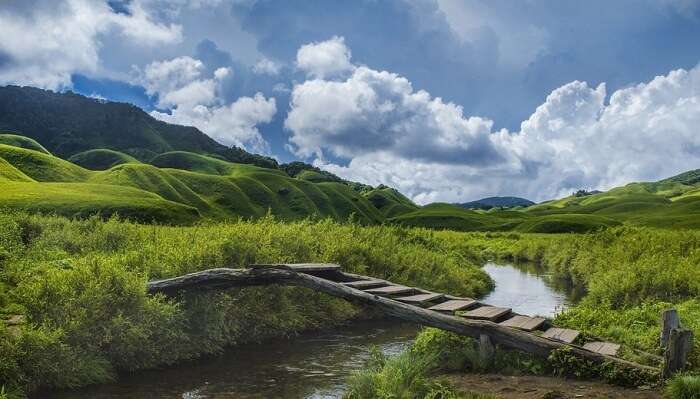
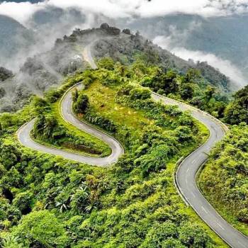
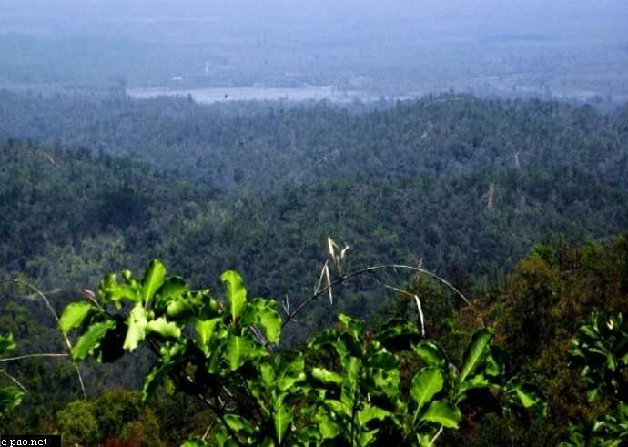
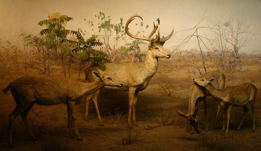
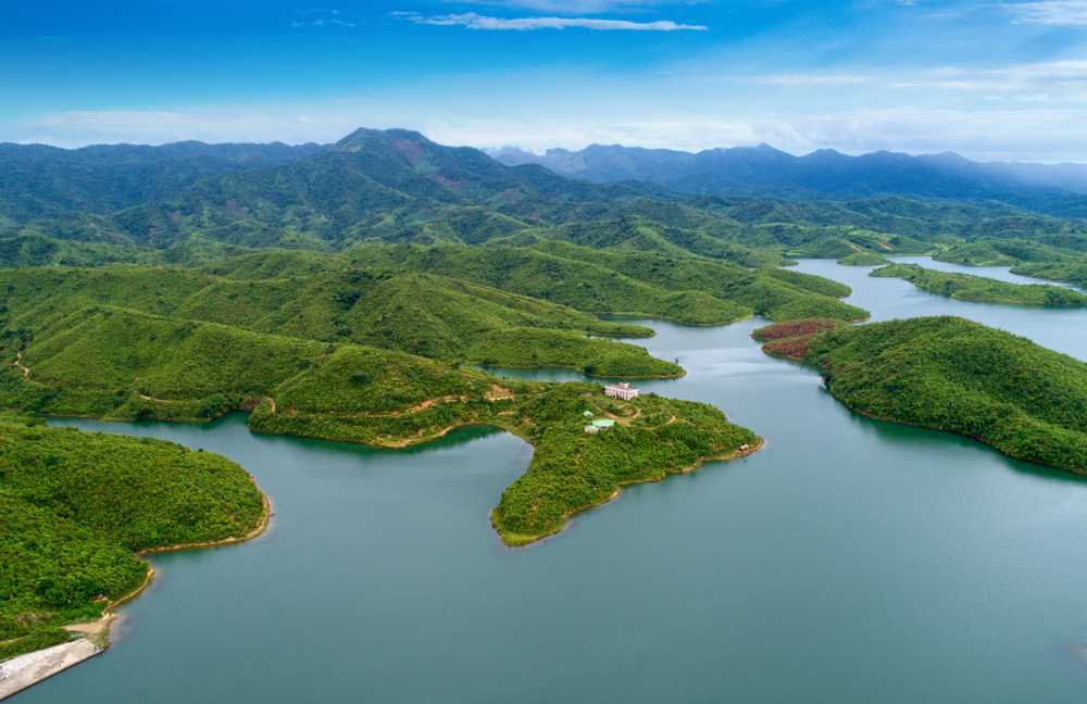
A largely mountainous state, about one-sixth of Nagaland, is covered by tropical and sub-tropical evergreen forests—including palms, bamboo, rattan as well as timber and mahogany forests. The Naga Hills rise from the Brahmaputra Valley in Assam to about 610 m and rise further to the southeast, as high as 1,800 m with Mount Saramati at an elevation of 3,841 m the state’s highest peak where the Naga Hills merge with the Patkai Range forming the boundary with Myanmar. Rivers such as the Doyang and Diphu to the north and the Barak river in the southwest dissect the entire state with 20% of the state’s land area covered with wooded forest. Nagaland has a rich birdlife with more than 490 species. Blyth’s Tragopan or the grey-bellied tragopan, a vulnerable species of galliform, is the state bird and the state is also known as the falcon capital of the world. The Mithun, a semi-domesticated gaur is the state animal and has been adopted as the official seal of the government.

The people of Nagaland live a largely rural life with 71.14% of the population living in rural regions belonging to 16 major and some minor tribes. The state is also home to the bhut jolokia or the ghost pepper, one of the hottest chilis in the world at 855,000 SHU on the Scoville scale.

Let’s start our exploration of the state with the state’s largest city, Dimapur.

Dimapur
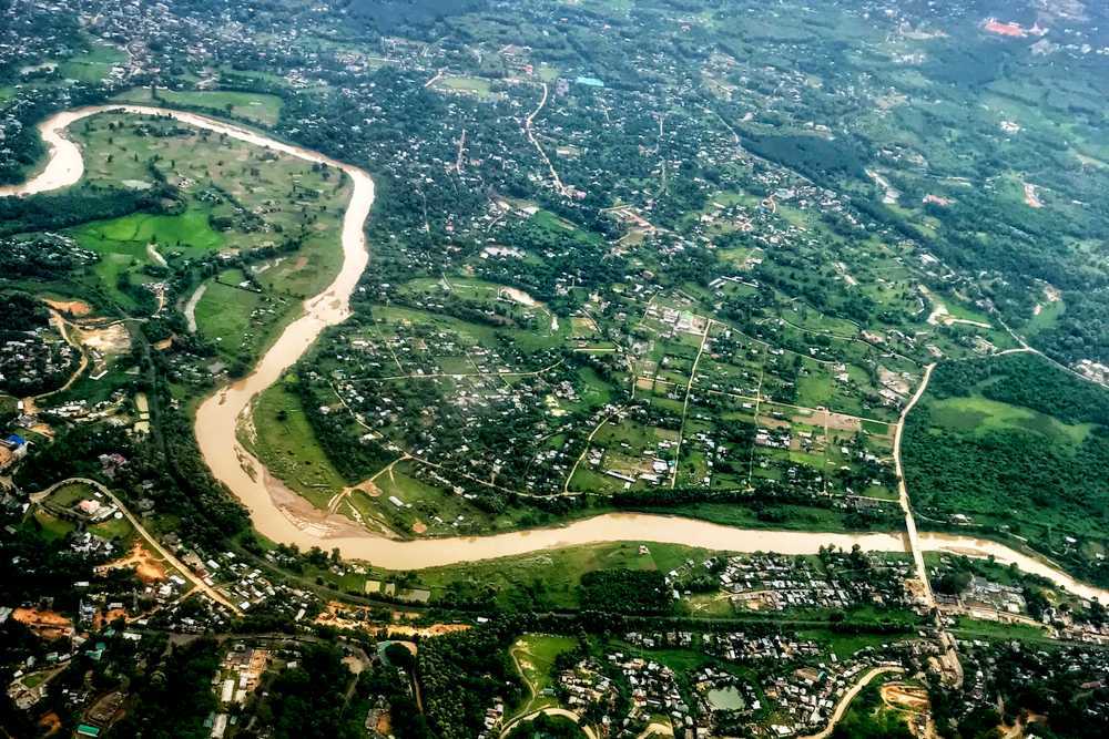
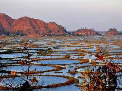
Nagaland’s largest city, Dimapur is the state’s main gateway and commercial centre, located in southwest Nagaland. Located near the border with Assam along the banks of the Dhansiri River, Dimapur is the only plains tract of hilly Nagaland and also has the only airport in the state for connectivity and economic activity. Its main railway station is the second busiest station in Northeast India.

The name Dimapur is derived from the Dimasa words Di which means water, ma which means large and pur which is a Sanskritised word which means a city, translating to the big river city, and associated with the word Kachari which means the people of the river valley after the river Dhansiri which flows through it. Others contend that Dimapur is a corruption of Hidimbapur, meaning the city of Hidimbi from the Mahabharata who was the demoness turned woman whose marriage to the Pandava prince Bhima that led to the birth of Ghatotkacha, which was the Hindu lineage created for the rulers of Dimasa by the Brahmin pandits at Khaspur. Hidimbapur is said to have been abbreviated to Dimbapur and subsequently to have lost a consonant to become Dimapur. In the Ahom Chronicles, Dimapur Is referred to sometimes as Che-din-chi-pen or the town earth burn make which means the brick town and its rulers as Timisa which is a distorted word for Dimas.

In the 13th century, the city was the capital of the Dimasa kingdom. During World War II, Dimapur was the centre of action between the Allied and Japanese forces and the staging post for the Allied offensive. The airport at Dimapur was also used for supplies to the allied forces in Burma. In 1918, Dimapur was leased to then Naga Hills district, which is today’s Nagaland by then erstwhile Assam Province of British of India for 30 years for the construction of railways lines. In 1963, it was once again leased to the state of Nagaland for 99 years. There is controversy surrounding this claim, as both state governments have not come forward to comment on the matter. Present-day Dimapur has far outgrown its old town area and is a contiguous urban sprawl from the Assam border at Dilai Gate and the new field check gate up to the foothills of Chümoukedima, the designated district headquarters of Dimapur district.

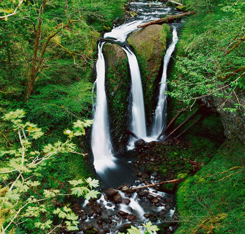
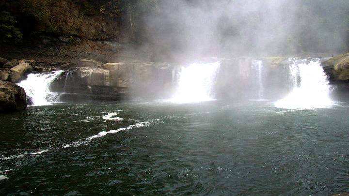
Located in Seithekima village, the Triple Falls are three glistening water streams trickling down from a height of 280 ft to a natural pool. The stunning fall area is maintained by the tourist department of Nagaland and also serves as a lovely trekking spot. Situated on the foothills of the Naga Hills, Chumukedima is an ancient village famous for waterfalls.

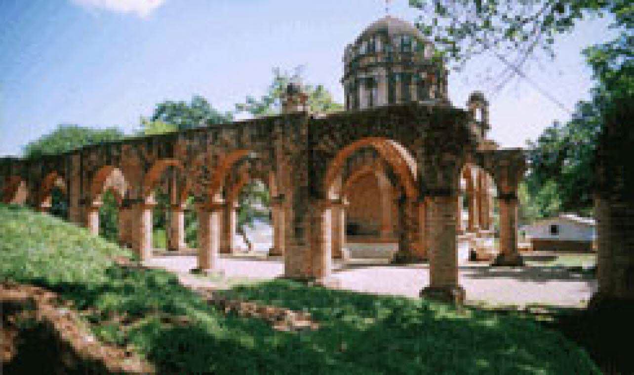
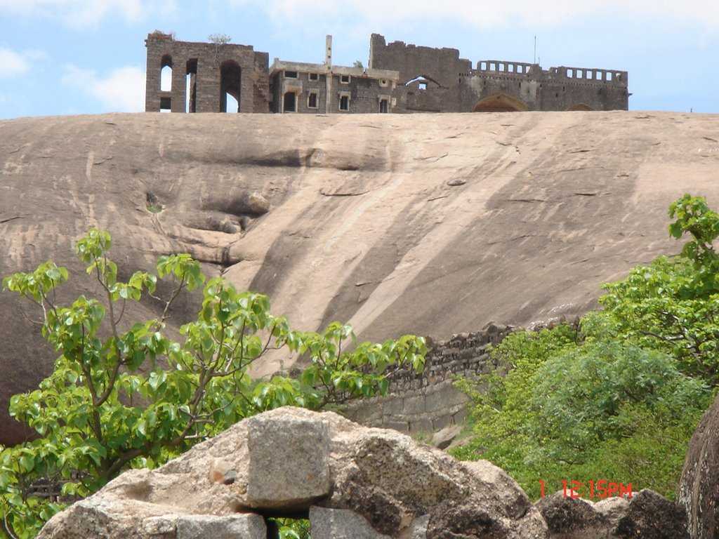
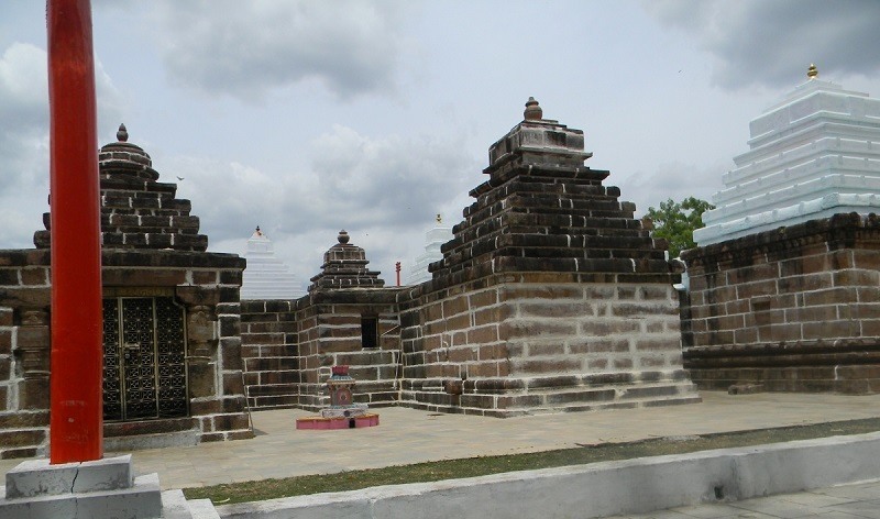
The Kachari Rajbari ruins are famous for their monoliths. It is believed that the scattered stones and bricks are the remains of temples and embankments. Although is left in ruins after centuries of abandonment, after facing conflict with the Ahom King in the 18th century, today, it lies in the centre of the town and signifies great historical importance for the northeast region.

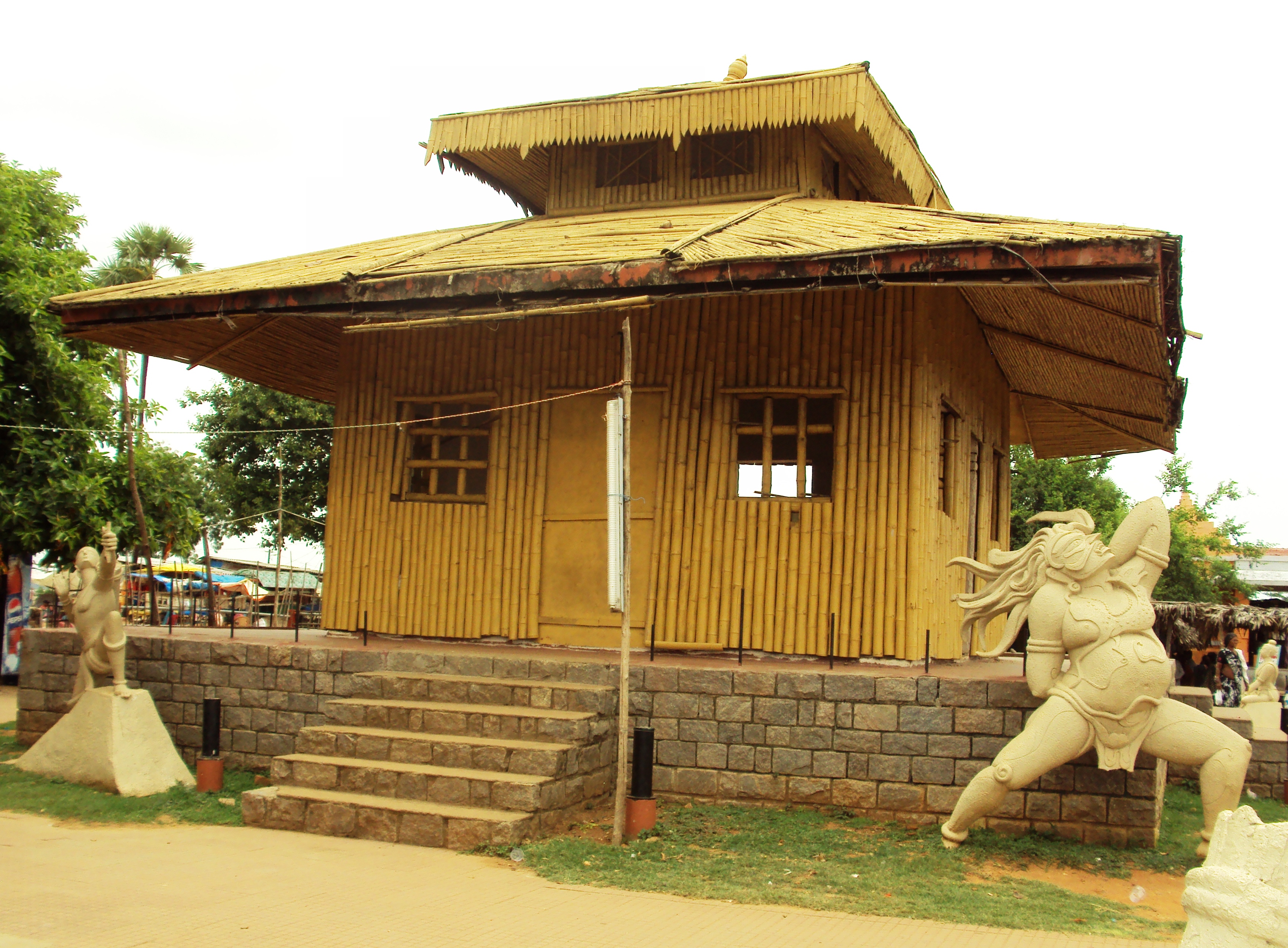
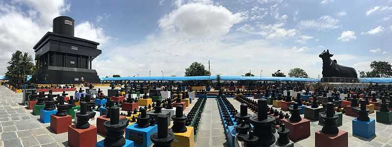
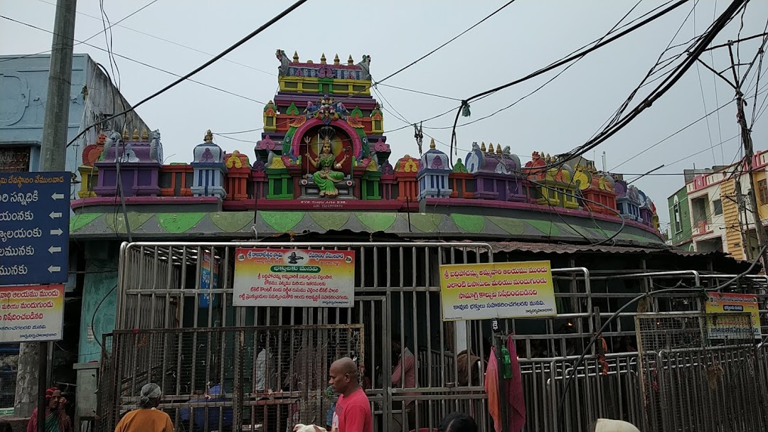
The Shiva temple is located in Singrijan and is believed to have been built by the local villagers in 1961. It is said that once, one of the villagers went to the Rangapahar Reserve Forest and found a stone which he sharpened later with his knife. He realised some liquid was released from the stone and later dreamt that the stone was a manifestation of Lord Shiva. Soon, the villagers started worshipping the stone as a Shivalinga.

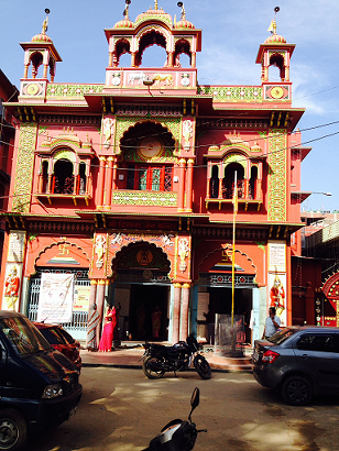
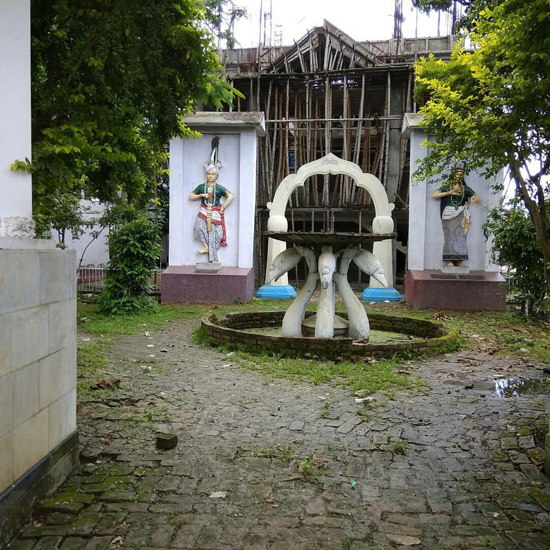
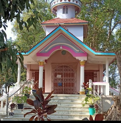
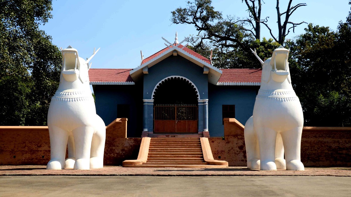
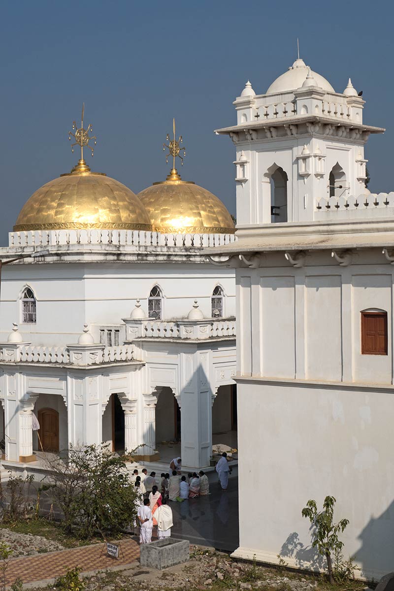
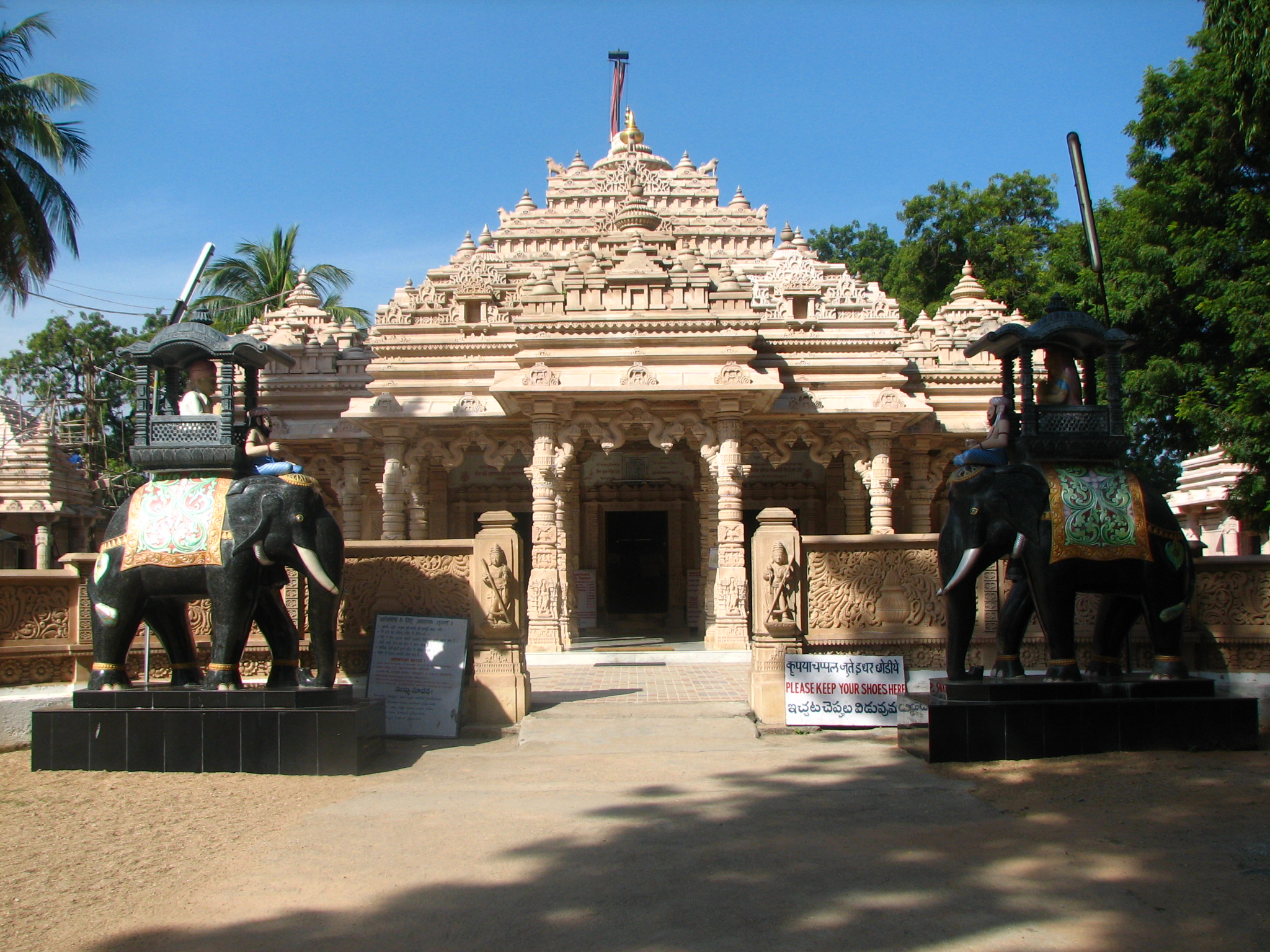
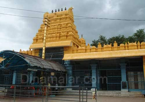
The Dimapur Jain Temple was built in 1947 and has intricate glasswork. The temple is considered very auspicious with intricate architecture. The main deity of the temple is Lord Mahavira. In the back portion of the temple, built-in 1989, there are statues of Lord Adinath, Lord Bahubali and Lord Bharat Swami. On the first floor are the Samavsaran and the Chaubisi which are the idols of all the twenty-four Tirthankaras.

The Nagaland Science Centre aims to promote creative learning through its three galleries, our sense, fun science and the children’s corner. Besides, there is an inflatable dome, the Tara Mandal which lets one peak deeper into the sky at night. The science centre has some specially designed exhibits that increase learning tendencies.

Diezephe Village, located about 13 km south of Dimapur is well known for its handlooms and handicrafts as well as the many workshops organised here. The craft and development society also houses tools that could be used by craftsmen at the rate of Rs 150 per day. The village also has beautiful artefacts made from wood, bamboo and cane.

The Rangapahar Reserve Forest located just 7 km from the city, on its outskirts is known for its wildlife and is famous for its variety of plants, especially those relevant to medicine. There is a variety of unique birds in this reserve which attracts many bird watchers.

In the next part, we will explore Nagaland’s capital city of Kohima.

Travel Bucket List: India – Manipur Part 3

Chandel
64 km south of Imphal lies the tiny, but scenic town of Chandel, also known as Lamka. Not very far from India’s border with Myanmar, it is also known as the Gateway to Myanmar and is famous for being home to more than 20 native tribes with each tribe offering a unique identity to the area. Chandel is also known for its numerous varieties of Orchids, ornamental plants, and some very useful medicinal plants. Some of the must-visit spots here include the Tengnoupal, which is the highest point in the area and can offer some stunning sceneries and views.

Founded in 1989, the Yangoupokpi – Lokchao Wildlife Sanctuary covers an area of 185 sq km and is home to multiple species of mammals, birds, reptiles, amphibians as well as fish. This sanctuary is one of the nine Identified Important Bird Areas or IBAs in Manipur, where the IBA is of critical importance for environmental conservationists and bird watchers as it is the only place where the endangered Green Peafowl can still be sighted. It is also one of those rare forests where communities of people live in tandem with nature. Seven forest villages are presently housed in the sanctuary and the villagers are dependent on the natural resources of the forest for their livelihood. The sanctuary is located at the India-Myanmar border, housing a mix of riverine and terrestrial ecosystems.

The sanctuary is home to many rare varieties of wild orchids, most of them unknown to the world as yet. Other trees forming the forest cover include the Dipterocarpus Turbinatus or Gurjan, the Tectona Grandis or Teak, the Melanorrhoea Usitata or Burmese Lacquer, the Terminalia Chebula or Black Myrobalan, the Emblica Officinalis or the Indian Gooseberry, the Cedrella Toona or the Indian Cedar, the Quercus Spp or the Oak, the Bauhinea, the Dillenia, and many varieties of bamboo. The wildlife sanctuary is home to 42 mammal species, 74 bird species, 29 reptile species, 6 amphibian species, and 86 fish species. The Hoolock Gibbon, the only variety of the ape found in India as well as the Snow Leopard and Golden Cat, which make rare appearances during the night, are also found here. Around the border area, the extremely rare Malayan Sun Bear can also be found. The best time to visit the Yangoupokpi Lokchao Wildlife Sanctuary is between October to April.

Tengnoupal
Located about 70 km southeast of Imphal and 20 km from Chandel is the hilly town of Tengnoupal which lies at the highest point of the NH-2 between Imphal and Moreh at the end of northwestern Myanmar and the ASEAN Highway passes through the village. The climate is cold all throughout the year and remains foggy during the rainy season and the village was founded by Pu Houlim Loikhom Mate and it is the largest village of the Kuki people settlement in the district. Due to its strategic importance, the village has seen many battles in the course of history including World War II. The main attraction here is the Tengnoupal which provides a bird’s eye view of the entire valley, from an altitude of 2,500 to 10,000 feet and is the highest point in the state. The Barak and Manipur rivers flow through the town, traversing from north to south.

The story of Tengnoupal is fragmented by the rule and control of different clans and countries. Long ruled by the Pakhanga dynasty, starting from the year 33; it was occupied by the Chinese in 1631. In 1942, it was bombed during World War II by the Japanese. The name Tengnoupal is derived from cactus fencing where teng means cactus and pal is a fence. Tengnou means tender cactus in the local language. It was named after the Awa Laan or the Manipur-Burmese War in the 16th century as cacti were planted as a fence in the Tengnoupal Hill range. The villagers of the then Tengnoupal and surrounding villages fought against the Burmese who invaded the Meitei kingdom of the Imphal Valley and many young warriors of Tengnoupal were killed and taken as a hostage to Burma. In the 19th century, Tengnoupal was the epicentre of the Anglo-Kuki war where more than 30 personnel of the British force were annihilated under the command of Pu Chomsho Mate, the younger brother of Pu Loikhom Mate, Chief of Tengnoupal. After that incident, the British Army captured Tengnoupal and then became the Army and Administrative HQ of the then British colonial government.

During World War II the people of Tengnoupal supported the Indian National Army or the INA led by Subhas Chandra Bose. The INA and the Japanese Army even brought in tanks and other heavy war equipment with the help of the local people led by Pu Sholim Mate and they were about to capture the Imphal Valley. Knowing the advancement of the INA and the Japanese Army, after occupying strategic locations at Tengnoupal the British Royal Air Force or RAF bombarded the hill ranges of Tengnoupal where many INA, Japanese and local volunteers were killed.

Moreh
Located about 108 km southeast of Imphal, Moreh is a border town located on the India–Myanmar border and is also known for its natural beauty. A strategically important town, due to its location at the Indo-Myanmar border Moreh is a sizable commercial hub in North-Eastern India, bringing in traders for cross-border trade. Tamu in Myanmar, just across the Menal river from Moreh, is connected to Moreh via 2 road bridges: The Indo-Myanmar Friendship Bridge and a newer Moreh ICP Bridge which connects the Moreh Integrated Check Post. Tamu in Myanmar connects Moreh in India to Kalewa-Yagyi-Mandalay in Myanmar and Mae Sot in Thailand through the India–Myanmar–Thailand Trilateral Highway. Moreh is also popular for its shopping arcade at Namphanglong, which sells Chinese and Thai goods at cheap prices. Being a border trade and transit town, Moreh plays a key role in the development of the economy of the state with border haat as well as international trade. A significant portion of the economy of Moreh depends on smuggling, including illegal teak smuggled from Myanmar.

Kaina
Located 24 km southeast of Imphal, Kaina is a hillock about 921 m above sea level and is a sacred place for Manipuri Vaishnava Hindus. According to legend, Shri Govindajee appeared in the dream of his devotee, Shri Jai Singh Maharaja, the 18th century King of Manipur and asked him to install in a temple with an image of Shri Govindajee. The image was to be carved out of a jack fruit tree, which was then growing at Kaina. Kaina is famous for the grand feasts performed as well as for the scenic beauty of the hillside.

The Sacred Jackfruit Tree is the tree on Kaina hill from which seven images of Lord Krishna were carved and installed in various temples in Manipur and in the neighbouring state of Assam, including the Shree Govindajee Temple at Imphal. In the past, Kaina Hill was known as Lakhai Phandong Ching and was the royal orchard of the palace. The original location of the jackfruit tree has been declared a historical and archaeological site by the Archaeological Department of Manipur.

Ukhrul
A hill station, Ukhrul is almost akin to paradise with mountains, brooks and waterfalls at every turn. Also known as Hunphun, Ukhrul is the home of the Tangkhul Naga and lies 81 km northeast of the state capital, Imphal. The Khangkhui Cave is a natural limestone cave located in the village of Khagkui, about 16 km from Ukhrul. The ancient pre-historic limestone cave locally called Khangkhui Mangsor, when excavated yielded evidence of habitation of Stone Age communities. According to local folklore, the big hall in the cave is the darbar hall of the Devil King living deep inside while the northern hall is the royal bedroom. During World War II, villagers sought shelter here and the cave can be reached after about an hour’s trek from Khangkui village.

The Shirohi National Park located on the top of Shirui hill lies about 19 km from Ukhrul. It is the only habitat of the beautiful terrestrial lily, Shirui lily or Lilium macklineae, found nowhere in the world except in this park. The park was established in 1982 and among the animals that make their home here include the tragopan, the tiger and the leopard. The main peak of Siroy abounds with flowers during the monsoon and it is a veritable paradise. The Shirui Kashong Peak near Ukhrul is a marvellous hilltop viewpoint located at a height of 2,835 meters above sea level. Several rivers originate from the cracks and slopes of this peak. The exotic Shirui lily flower blooms on the hilltop in May/June and attracts hundreds of scientists and tourists every year. In the park natural life is supported by an undisturbed biological system which has a dense tropical forest all over and temperate forest in the hilltops.

Manipur’s Hills
Manipur’s topology means it is abundant in hills and valleys, many of which are considered sacred by the local tribes. Mount Tempu or Mount Iso is the highest peak in Manipur with the Dzuko Valley below it.

Mount Koubru, one of the highest peaks in Northeast India is easily identified by its humped back like a cow. A place of great religious significance by the adherents of the Sanamahi faith, Mount Koubru also known as Mount Koupalu. It is considered to be the abode of God Lainingthou Koubru, the protector deity of the Northern Kanglei world and Goddess Kounu in Manipuri mythology. It is said that God Lainingthou Koubru lives here with his consort Goddess Kounu and their sacred animal Shamu Laishaa Angouba, the White Elephant. The town of Sapormeina lies below the peak and is one of the most visited pilgrimage sites in Manipur. The mythology of ancient Meitei concerns the study of cosmology as well as that of the human body with Mount Koubru considered to be the head of the body. Many letters of the ancient Meetei Mayek exist atop this mountain. Mount Koubru is considered to be one of the primary pilgrimage sites by the Meitei people; the stone-formations at the peak are believed to be parts of a single human face, resembling the 27 alphabets of the Meitei language. The mountain is also noted for mountain hiking as well as mountain climbing.

Baruni Hill, Nongmaiching Hill, Selloi Langmai Hill or the Sunday Mountain is a hill range and the abode of God Lainingthou Nongpok Ningthou and his consort Panthoibi in Manipuri mythology. The hill is one of the most important pilgrimage sites for followers of the Sanamahi faith and is best known for adventure activities including mountain hiking and mountain climbing. The hill is believed to be the abode of Lord Lainingthou Nongpok Ningthou and his beloved consort Goddess Panthoibi. After the advent of Hinduism in the Kanglei world, the attributes of Lord Lainingthou Nongpok Ningthou was identified as Lord Shiva of Hinduism. The Sanamahi Kiyong Temple, which is the abode of Lord Lainingthou Sanamahi and his mother Goddess Leimarel Sidabi is the most visited one. At the peak of the hill, there is the Khalong Temple, the abode of Nongmai Kainou Chingsomba and in the periphery is the Baruni Mahadeva Temple. Manipuri people climb the hill annually after Yaoshang and the temple is a sacred pilgrimage site of the Kabui, Tangkhul, Kom, Hmar, Chothe, Zeliangrong, Meitei and Bishnupriya Manipuri people and the followers of Sanamahi faith.

The Thangjing Hill is a hill range and the abode of God Eputhou Thangjing and other Meitei deities in Meitei mythology. The temple of Lord Eputhou Thangjing at the hilltop is a major pilgrimage site for followers of the Sanamahi faith. In Meitei mythology, the hill is mainly associated with the deity Lord Eputhou Thangjing who is the guardian of the mountain and the protector of the south of the Kanglei world. The hill is also mentioned in the great Meitei epic poetry, Khamba Thoibi.

The Sadu Chiru waterfall, near the Ichum Keirap village, about 27 km from Imphal, consists of three falls with the first falling from about 98 feet high and has the Agape Park in the vicinity.

With this, the series on Manipur comes to an end. I do hope this has inspired some of you to make a trip to this lovely state when things are better. I know I will.

Travel Bucket List: India – Manipur Part 2

Moirang
A small town, about 45 km south of Imphal, Moirang is famous for the ancient temple of Lord Thangjing and the legendary love story of Khamba Thoibi with the clothes used by Khamba and Nogban still preserved in the village of Ngangkhaleikai. The epic story is between a beautiful princess Thoibi, daughter of King Wangon Ningthou Chingkhu Naha Telheiba and an orphan boy Khamba, who was raised by his sister when orphaned.

In ancient times, the King of Moirang was considered the most powerful among the seven clan kings of Manipur. Till the end of the Khamba-Thoibi era, the Burmese King paid the annual war reparations money to the Moirang kings. During World War II, Moirang was the headquarters of the Indian National Army (INA). Colonel Shaukat Malik of the Indian National Army hoisted the tricolour for the first time on Indian soil on 14 April 1944, in Moirang. The INA Museum at Moirang displays some wartime relics and photographs.

Since Moirang houses a serene lake and a national park, it is bound to be abundant in flora and fauna. A large number of animals and birds live here and can be spotted easily. Animals including sambar, barking deer, monkeys and Sangai deer as well as birds such as hornbills, ducks, crows and kingfishers and migratory birds can be found here.

The largest freshwater lake in the country, Loktak Lake and the Sendra Island on it, are located about 50 km from Imphal, in Moirang in the Imphal valley. Loktak which means the end stream is famous for the phumdis or the heterogeneous mass of vegetation, soil and organic matter at various stages of decomposition floating over it. The largest of all the phumdis, Sendra Island covers an area of 40 sq km and is situated on the south-eastern shore of the lake. Located on this phumdi is the Keibul Lamjao National Park, the only floating national park in the world which is the last natural refuge of the endangered Sangai, the state animal, the Manipur brow-antlered deer, one of three subspecies of Eld’s deer.

The ancient lake plays an important role in the economy of Manipur and serves as a source of water for hydropower generation, irrigation and drinking water supply as well is a source of livelihood for the rural fishermen who live in the surrounding areas and on the phumdis, also known as phumshongs. The lake was initially designated as a wetland of international importance under the Ramsar Convention on 23 March 1990 and also listed under the Montreux Record on 16 June 1993.

The Lake is divided into two zones, namely, the Core Zone which is the no-development zone or totally protected zone comprising 70.3 sq km and the balance area is called the Buffer Zone. Within the lake and on its periphery, there are 14 hills of varying size and elevation with the Sendra, Ithing and Thanga islands on the southern part of the lake. Geographically, in terms of biodiversity and pressure of human activities, the lake is broadly divided into northern, central and southern zones.

Thanga Island is the largest island in Loktak Lake as well as a religious destination for both Hindu and Sanamahists due to its numerous temples and sacred sites. Karang Island is the second-largest island in the lake and is famous for the Ebudhou Khuman Apokpa Temple and the Ibudhou Khumanpokpa Temple, temples of the ancestral deities of the Khuman Dynasty of Manipur. Ithing Islet is a human-inhabited islet situated on the way to Thanga Island.

The Northern Zone has five main streams or rivers flowing into the lake and is separated from the central zone by large phumdis that stretch from the northwest to the southeast. The Central Zone encloses prominent islands of Thanga, Karang and Ithing and is the main open water zone of the lake, which was relatively free from phumdis in the past, but over the years athaphums or artificially created phumdis for fishing constructed by villagers for fishing have proliferated choking the entire lake. The Southern Zone encompasses the Keibul Lamjao National Park, Ungamel and Kumbi pats at the southern part of the lake and the zone is linked with Khuga River by the Ungamel channel. Loktak Day is observed every year on the 15th of October at the periphery of the lake. The lake is open daily between 8 am to 6 pm.

The only floating national park in the world, the Keibul Lamjao National Park is a vital part of the Loktak Lake. Created in 1966 as a wildlife sanctuary to preserve the natural habitat of the endangered Eld’s deer or Cervus eldi eldi, locally known as Sangai and gazetted as a national park in 1977, it is characterised by floating decomposed plant material locally called phumdi. The brow-antlered deer, first discovered in Manipur in 1839 was reported an extinct species in 1951. It was re–discovered in the Keibul Lamjao Park area and so this area was declared a national park to protect and conserve the deer now called Eld’s deer’s subspecies brow-antlered deer. From a small herd of 14 in 1975, its population was reportedly 260 in 2016.

Covering an area of over 40 sq km, the Keibul Lamjao National Park is home to various species of plants and animals, including migratory visitors and hosts over 450 varieties of orchids and over 100 species of aquatic flora and numerous species of birds. The floating marshes or the Phumdis consist of vegetation that is about 120 cms thick.

The best time to visit Keibul Lamjao National Park is between October and March as the Lake water levels are suitable to explore the park.

It is best to visit the park from 6 to 10 am and between 3:30 and 6 pm as this is when the Sangai deer come out to feed in herds. A boat trip along the labyrinthine boat routes passing through colourful water plants would also be a good way to see the park. The park itself is open from 7:30 am to 5:30 pm and entry fees for Indians is INR 30 per person while foreigners would need to pay INR 200 per person. Camera Charges for Indians are INR 50 per person while it is INR 250 for foreigners and car park charges are INR 100 per vehicle.

Sendra Island encompasses a small hillock that is surrounded by water. Although a small hillock entangled by the lake water on all sides, it is linked to the mainland through a pathway. There is a tourist lodge on the hilltop. The serene water around the hillock and the verdant trees magnify the beauty of this place making it picturesque.

The Indian National Army Complex was once used as the unofficial headquarters of the Indian National Army. The INA Memorial Complex was built to honour the soldiers who had sacrificed their lives for the country with letters, photographs and other artefacts available here. There is a bronze statue of Netaji Subhas Chandra Bose erected in the complex which is open from 8 am to 6 pm daily.

Moirang is also a land of temples as a lot of beautifully constructed temples with pristine aura are located here. The Pakhangba Temple, the Loktak Maru Temple, the Ibudhou Thangnarel Temple, the Oknarel Temple, the Radha Mandhop Temple and the Gopinath temple are some of the famous ones.

The Ibudhou Thangjing Temple or the Lord Thangjing Temple is an ancient temple dedicated to Lord Eputhou Thangjing, the ancient national deity of the ancient kingdom of Moirang. The best time to visit the temple is between May and July during the onset of the great mega music and dance religious festival of Lai Haraoba which attracts thousands of tourists every year especially historians and archaeologists. The temple is where the great Khamba Thoibi dance was performed for the first time according to a famous legend.

Located near the western borders of Loktak Lake, about 5 km from Moirang, Phubala has many attractions and can be combined with a trip to the lake. The two islands at Phubala has water sports activities and visitors can also enjoy picturesque views of the lake.

Tamenglong
Located about 145 km west of Imphal, Tamenglong is a hilly district covered by valleys and ranges. It lies on the hilltop from which descends the Barak River. The town is described as a biodiversity hub with a variety of exotic and rare species of birds and animals. This town is known for the oranges grown here and is home to some of the most unique plants and animals. The vibrant forest here provides a habitat for hog deers, leopards, wild dogs, hyenas, tigers and many more. The forest covers can be distinguished into three different types namely the bamboo brakes, the tropical evergreen forest and subtropical forests. Attractions include the Barak Waterfall which takes visitors through a series of seven waterfalls, the Zeilad Lake famous for many pythons, fish, water birds, large tortoises and ducks, the Buning Meadows and the Tharon Caves.

The tribal population in Tamenglong, comprises the Zeliangrong Nagas and the Kukis. Festivals celebrated in the town include the Orange Festival, the Gudui-Ngai, the Rih-Ngai or the Chaga Ngai, the Banruhmei and the Tarang. The best time to visit the town is between October and March.

The Tharon Cave is a 655.6 m long cave which can be explored with the help of the map drawn outside the cave. Also spelt as the Thaeuluan Cave, it is located about 27 km from Tamenglong. The cave has five exits and 34 joints. The Tharon Cave was once used as a shelter and excavations inside the cave have items related to the Hoabinhian culture of North Vietnam. The cave is an abode for fruit bats with about 12 caves located underneath.

Also known as N-piulong Valley, Buning Meadow is coloured with beautiful lilies and orchids making the place look stunning. The Meadow is filled with multitudes of birds and animals including Hoolock, gibbons and foxes. The summer months between March and June are the best time to visit the meadow when it is in full glory.

Situated near the Zeliadjung or Atenba village on a high platform up on the hill, the Zeilad Lake is a must-visit tourist attraction. Home to pythons, fish, tortoises and water and migratory birds, this is why the lake is a tourist favourite. Naga tales reveal that Zeilad Lake is where paddy originated. The lake has recently been declared as one of the four wildlife sanctuaries of Manipur and is also known as the Zeilad Wildlife Sanctuary. The best time to visit the lake is between October and April as the weather remains cool and pleasant.

The Barak Waterfalls are a must-visit place where seven other waterfalls are located close to each other. A local favourite to picnic, the aqua green falls and the sight of the cool water gushing from the hills to the plains is something that needs to be seen and experienced.

Thoubal
Located about 23 km south of the capital Imphal, Thoubal town’s name comes from the word Athouba meaning brave people symbolising the courageous people here. It is one of the larger towns of Manipur and has an idyllic feel to it with many lakes and rivers, paddy fields, and gardens. It is also the window to South-East Asia as the Trans-Asian highway (AH1) passes through it.

Thoubal is ideal for trekking, hiking and picnics given the abundance of the green landscape and is famous for the temples and the numerous water bodies with many lakes dotting the landscape. There is a diverse variety of trees and bamboos and plantains can be seen all around.

The main attractions include the Chinga Lairembi temple, the Tomjing Ching, the Panthoibee temple, the Thoubal bazaar, the Tangjeng ching from where one can have a bird’s eye view of the Waithou Lake and the Khangabok Menjor Garden. Thoubal also has the distinction of having the first and only subway in Manipur.

The Ikop Lake, located at an altitude of 772 m above sea level has a saucer-shaped basin and a silted bottom. The Lousi Lake spreads over an area of 18.64 sq km and features a wetland ecosystem. It is a major source of water for the locals. Pumlenpat lake is a freshwater lake and is also known as the Pumlen Pa. It spreads over an area of 19 sq km and is covered by phumdis and floating soil and vegetation, similar to the Loktak Lake. The lake is the second largest lake in Manipur after the Loktak Lake and is located about 68 km south of Imphal and about 45 km from Thoubal and plays an important role in the lives of the people nearby. There are plenty of small islands on this lake and once people started settling on these islands, the lake is now on the verge of extinction due to human encroachment.

The historically important Khongjom marks the site where Major General Paona along with his soldiers fought against the British invasion, ending in complete British control over Manipur. There is an open-air gallery in which a 78 feet long boat called the Hiyang Hiren can be viewed. Science fairs and exhibitions are also organised here.

Travel Bucket List: India – Manipur Part 1

Earlier this month, I finally reached India in my walk from my home in Singapore to my childhood home in Mumbai. For those who are new to this page, I am using the distance between Singapore to Mumbai as an impetus to walk my daily steps and I track these steps on a Google map. Since my first state in India is the state of Manipur, I decided to start this year with the same state.

One of India’s easternmost states, Manipur lies in Northeast India, bound by the states of Nagaland to the north, Mizoram to the south and Assam to the west. It also borders two regions of Myanmar, the Sagaing Region to the east and the Chin State to the south. Manipur has been at the crossroads of Asian economic and cultural exchange for more than 2,500 years and has long connected the Indian subcontinent and Central Asia to Southeast Asia, China, East Asia, Siberia, Micronesia, and Polynesia, enabling the migration of people, culture and religions. Manipur’s state bird is the Nongin, its state flower is the Siroi Lily and the Phoebe hainesiana or Uningthou, which is native to the state is a state tree.

The word Manipur is made up of two Sanskrit words Maṇi, which means jewel and Purǝ, which means land or place and so Manipur is translated as the jewelled land. Manipur is mentioned in historic texts as Kangleipak or Meeteileipak. The name Manipur was adopted in the 18th century by officials during the reign of Meidingu Pamheiba. Neighbouring cultures each had differing names for Manipur and its people. The Shan or Pong called the area Cassay, the Burmese called it Kathe and the Assamese called it Meklee. In the first treaty between the British East India Company and Meidingu Chingthangkhomba or Bhagyachandra, signed in 1762, the kingdom was referred to as Meckley. Bhagyachandra and his successors issued coins engraved with Manipureshwar or Lord of Manipur, and the British discarded the name Meckley. The term Kanglei, the meaning of Manipur or Kangleipak, is used to refer to items associated with the state while the term Manipuri is a recently given name. The Meitei ethnic group represents around 53% of the population of Manipur, followed by various Naga tribes at 24% and various Kuki-Zo tribes at 16%. Meiteilon or Manipuri is the state’s official language and tribals constitute about 41% of the state population.

The history of Manipur Meities is chronicled in the Puyas or Puwaris which are stories about the forefathers in the archaic Meitei script, comparable to the Thai script. By the medieval period, marriage alliances between royal families of the Manipur kingdom, the Ahom kingdom of Assam and Burma had become common. Medieval era Manipur manuscripts discovered in the 20th century, particularly the Puya, provide evidence that Hindus from the Indian subcontinent had married Manipur royalty by at least the 14th century. Another manuscript suggests that Muslims arrived in Manipur in the 17th century, from what is now Bangladesh, during the reign of Meidingu Khagemba. Ancient Manipuri mythology is indigenous to the kingdom and is also related to the local religion or Sanamahism, which includes thousands of Gods and Goddesses.

In 1891, after the defeat of the Meiteis by the British in the Anglo-Manipuri war of Khongjom, the sovereignty of Manipur which it had maintained for more than three millenniums, was lost. In 1926, it became a part of the Pakokku Hill Tracts districts of British Burma until 4 January 1947. During the British colonial rule, Manipur was a princely state with the people of Manipur pressing for democracy between 1917 and 1939. By the late 1930s, the state of Manipur negotiated with the British administration its preference to continue to be part of India, rather than become part of Burma, which was being separated from India. These negotiations were cut short with the outbreak of World War II in 1939 and on 11 August 1947, Maharaja Budhachandra, the King of Manipur signed an Instrument of Accession, joining the Indian Union and on 21 September 1949, he signed a merger agreement, merging the kingdom into India. During World War II, Manipur was the scene of many fierce battles between the Japanese invaders and the British Indian forces. The Japanese were beaten back before they could enter Imphal and this was one of the turning points of the overall war in South Asia. Manipur’s merger with India was later disputed by groups in Manipur, as having been completed without consensus and under duress and has resulted in a 50-year insurgency in the state for independence from India, as well as in repeated episodes of violence among ethnic groups in the state.

Imphal, the state’s capital lies in an oval-shaped valley surrounded by blue mountains, at an elevation of 790 metres above sea level with the slope of the valley from north to south. The mountain ranges create a moderated climate, preventing the cold winds from the north from reaching the valley and barring cyclonic storms. The state has four major river basins: the Barak River Basin or the Barak Valley to the west, the Manipur River Basin in central Manipur, the Yu River Basin in the east, and a portion of the Lanye River Basin in the north. Manipur may be characterised as two distinct physical regions: an outlying area of rugged hills and narrow valleys, and the inner area of flat plain, with all associated landforms with both areas distinct in physical features and conspicuous in flora and fauna. The tourist season in the state is from October to February when it is often sunny without being hot and humid.

The Manipuri dance is also known as Jagoi and is one of the major Indian classical dance forms, named after the state of Manipur. It is particularly known for its Hindu Vaishnavism themes, and exquisite performances of the love-inspired dance drama of Radha-Krishna called Raslila. However, the dance is also performed to themes related to Shaivism, Shaktism and regional deities such as Umang Lai during Lai Haraoba. The roots of Manipur dance, as with all classical Indian dances, is the ancient Hindu Sanskrit text Natya Shastra, but with influences from the culture fusion between India and Southeast Asia, East Asia, Siberia, Micronesia and Polynesia.

Imphal
Manipur’s capital Imphal was initially ruled by Kin Khaba and then ruled by the Pakhangba leaders when the Ningthouja tribe originated. The Ningthouja tribe quickly expanded and dominated the region in politics and war. The Kangla Palace was built by King Khagemba and his son Khunjaoba and was later destroyed by the British during the Anglo-Manipur War. During the reign of Maharaja Bhagyachandra, there were several Burmese invasions. However, the kingdom survived with the help of Maharaj Gambhir Singh.

Imphal remained peaceful until 1891 when internal differences in the royal family resulted in the 1891 Anglo-Manipur War, which the British won. The Battle of Imphal took place between March and July 1944, during World War II between the Japanese and Allied forces when the Japanese invaded Imphal to destroy the Allied forces and then invade India. But they were defeated and forced to retreat and the attack made the British realise the militarily strategic position of Imphal.

Also known as the Kangla Fort, the Kangla Palace is an old palace situated today on the west bank of the Imphal river and served as the royal palace of the former Manipur Kingdom and King Pakhangba. Originally located on both the banks of the river, today it is located in the centre of Imphal and the ruins of the palace are surrounded by a moat. Kangla which means dry land in old Meetei was the traditional seat of the Meetei rulers of Manipur. The fort is one of the oldest existing forts in the world, with its earliest record of existence dating back to 1445 BC.

One of the holiest places for the Manipuris, Kangla is a pilgrimage centre and it is believed that Lord Pakhangba resides under Kangla and ruled the Kingdom of Manipur as well as the universe. It is also believed that there are 360 important holy and sacred places in Kangla, some of which include the Nungjeng Pukhri, a sacred pond believed to be the abode of Lord Pakhangba located to the north-west of the Uttra where religious rituals are performed. Nunggoibi is another sacred place of worship of the Goddess of War and is where the Huyein Lalu Chanba ritual was performed whenever a King emerged victorious in battle. Manglen is where all the Kings of Manipur are cremated and is believed to have been developed by Maharaj Garibaniwaz in 1738. The Kangla Men Surung is where the kings performed their coronation ceremony and it is believed that the King’s ability to rule would depend on the results of the ceremony. Located to the south-eastern corner is the Wangbaren where ceremonies in connection with flood and natural calamities were performed.

Amongst the various ruins in the Kangla are the ruins of the citadel built-in 1611 during the reign of King Khagemba. The citadel enclosure had three entrances, two on the western side and one on the southern side. The Uttra was the ancestral coronation hall of the kings which also housed the coronation hall and was destroyed during the Second World War. Two huge Kangla Sha or dragons made of brick used to stand in front of the Uttra but just beyond the flight of steps leading to the Uttra on either side of the path leading to the Uttra. The dragon was the emblem of the Meiteis and was originally said to be erected by the Chinese war captives. The Kangla Sha were blown to pieces by the British after their occupation of the fort in 1891. The fort has been open to the public since 2003. Bihu Loukon is an ancient star-shaped mud fort situated in Maklang.

Langthabal, located about 9 km south of Imphal is most famous for its magnificent temples and historical monuments. Situated tall on a hill Langthabal is popularly known for the relics of the historical palace, traditional dwellings and architecturally complex and accomplished temples of importance. The place was created as a corridor surrounded by symmetric jackfruit and pine plantations. The hill overlooks the Manipur University campus which presents a mesmerizing view of the surroundings. The historic Langthabal Palace which was a listed monument does not seem like a protected area, instead, it has become a vast dumping ground. The Memorial site of Maharaj Gambhir Singh at Langthabal located at Manipur University campus was once the Royal Palace during the reign of Maharaj Gambhir Singh, the then Maharaja of Manipur. The complex also includes the Memorial House or Meetei Yumjao symbolising the shrine of the king.

The Ima Keithel or the Mother’s Market or Nupi Keithel or the Women’s Market is a market run exclusively by women. A popular tourist attraction, over the years, it has shifted its location within the city and is currently located in Khawairaband Bazaar. The market was established in the 16th century, following the imposition of the labour system, lallup-kaba in 1533 and hosts around 5,000 to 6,000 women vendors who sell a variety of products such as vegetables, fruits, textiles, toys fish, spices and utensils and is the largest all-women market in Asia. Lallup-kaba was a forced labour system in Manipur that required male members of the Meitei community to work in distant lands or to serve in the army and as a result of which, women had to support their households by cultivating their fields or weaving textiles and then selling the products on improvised markets which then led to the formation of the organized Ima Keithel. The Hapta Kangjeibung is the world’s oldest polo ground and is also the main venue of Manipur’s Sangai festival which takes place between 21 and 30 November annually.

The highest mud dam in the world, the Singda Dam is located 16 km from Imphal and is a popular picnic spot, with its scenic views, and relative calm. A multipurpose project constructed on the Singda river in Kangchup, it is one of the highest earthen dams in India. The dam is 490 m in length and 60 m in height and provides drinking water and irrigation to the greater Imphal area.

Situated near the royal palace, the Shri Govindji Temple is one of the major temples in the state constructed in the Nagara style of architecture. The largest Hindu Vaishnavite temple in the state, it is dedicated to Shree Govindajee or Lord Krishna along with various other Gods and Goddesses. The temple is also where the classic Manipuri form of dance style was first performed, dedicated to Shri Govindajee. Within the complex, the temple of Shree or Shree Govindajee was originally built in 1846, during the reign of Maharaj Nara Singh. It was severely damaged in the earthquake of 1868 with the idols of Radha Govinda damaged when parts of the temple collapsed. The temple was reconstructed by Maharaj Chandrakriti with two domes and a raised congregation hall.

The Sanamahi Temple or the Sanamahi Sanglen is a temple dedicated to Lord Lainingthou Sanamahi, the supreme deity of Sanamahism. It is located in the Sanakhwa Yaima Kollup near the Kangla Palace and is one of the oldest temples in Asia. It is often confused with the Sanamahi Kiyong Temple, situated on the hilltop of the Nongmaiching Hill and is one of the largest Kanglei temples in the state. It was reconstructed during the reign of King Kulachandra Singh in 1891 and is built in a Gothic style of architecture with a flying advance on the southern side and raised in an octagonal base. Today, the temple is located on the grounds of the 1st Manipur Rifles. The temple is a major tourist attraction as well as a religious destination of the followers of Sanamahism, including the Meitei, Kabui, Bishnupriya Manipuri people and Zeliangrong people.

The Shri Radha Raman Temple is situated at Kanchipur The Gopinath Mandir is the second-largest Hindu temple in Manipur and is also a grand premise for the performance of the great Manipuri dance, dedicated to Shri Gopinath. The Hiyangthang Lairembi Temple Complex is noted for its annual Durga Puja festival in September or October.

The 11 m tall Shaheed Minar is situated in the centre of the Bir Tirkendrajit Park and is a memorial for those who died against the British while fighting in the Meitei Revolt of 1891. The Imphal War Cemetery with over 1600 graves of those who died fighting World War II is maintained by the Commonwealth War Graves Commission is located in Dewlahland, 10 km away from Imphal International Airport. Red Hill or Maibam Lokpa Ching is a hillock and a memorial site of the World War II Battle of Imphal. It was here that a war took place between the Allied and Japanese troops. The Japan War Memorial Complex is also present in the foothills, constructed by the Government of Japan.

Specialised in the preservation and breeding of rare species, the Manipur Zoological Gardens, with its lush greenery and calm atmosphere is surrounded by hills and was established in 1976. The Manipur State Museum was set up in 1969 and caters to various categories of artefacts such as ethnology, archaeology, natural history and painting. It showcases articles owned by the Manipuri rulers.

Known as the lungs of the Imphal Valley, the Langol Reserved Forest is known for its wide-stretching area spanning in the Imphal valley. It is also famous for the sacred groves preserved since ancient times. The Langol Lairembi Temple and the Langol Ningthou Temple are sacred sites for those who follow the Sanamahi Faith.

Travel Bucket List: India – Telangana Part 6

Nalgonda
Located about 100 km southeast of Hyderabad, Nalgonda used to be known as Nilagiri and was renamed to Nalgunda during the reign of the Bahmani Kingdom and to Nalgonda during the rule of the Nizams of Hyderabad. The name Nalgonda is derived from a combination of two Telugu words, Nalla and Konda meaning the Black Hills. There is archaeological evidence that Paleolithic people lived in the area with some of their implements found in the Nalgonda area, similar to those discovered at the Sloan archaeological site in Arkansas. Traces of Neolithic culture were found at Chota Yelupu, where sling stones and other contemporary objects were excavated. Evidence of Megalithic culture was also found via the discovery of innumerable burials at various places around Nalgonda. The political history of Nalgonda commences with the Mauryas. During the reign of Ashoka, the Great, the Mauryas maintained control over the Nalgonda region. Later, the Satavahanas ruled between 230 BC and 218 BC and during this period, the region established trade contacts with the Roman Empire. In the year 227, the Ikshvaku dynasty took control of the region and it was during this period when members of various Saka tribes migrated to the area and Buddhism flourished. After the Ikshvakus, the Pallavas and Yadavas fought for supremacy over the region. However, after Samudragupta invaded and conquered most of India, the area fell under the control of his Gupta Empire which fell in the 6th century. From the 6th century, the Chalukya dynasty ruled this region, as well as much of southern and central India and a major portion of the area, appears to have passed from the Chalukyas of Badami to the Rashtrakutas which fell in 973, and power shifted to the Chalukyas of Kalyani who continued to rule until the end of the 12th century. After this, the Kakatiya dynasty took control from the western Chalukyas and during the reign of Prataparudra II, in 1323, the kingdom was annexed to the Tughluq Empire and during this period, the region was annexed to the Bahmani Kingdom after which it was conquered first by the Mughals and then the Asaf Jahi dynasty.

Panagal is an important village located 3 km from the main city and in the 11th, century served as the capital of the Kakatiya Dynasty. The village has many temples with two most sought-after Shiva temples namely the Chaya Someswara Swamy Temple and Pachala Someswara Temple. The Chaya Someswara Swami temple is adorned with 66 pillars and a huge Nandi sculpture right in front of the central mandapa and is detailed with intricate sculptures displaying episodes from Mahabharata and Ramayana. There are also several other sculptures of Gods and Goddesses dating back from the 1st century to the Ikshvaku dynasty.

Mattapalli or Mattampalli is a small quaint village on the banks of the River Krishna and is renowned for its Narasimha Swami Temple. Counted as one of the Pancha Narasimha Kshetras out of a total of five, this beautiful temple is dedicated to Sri Yogananda Lakshmi Narasimha Swami, Sri Chenchu Lakshmi Thaayar and Sri Rajya Lakshmi Thaayar. Established by the King of Thangeda, the temple attracts devotees in large numbers during the festivals of Vykunta Ekadasi and Kalyana Mahotsav celebrated in January and May respectively.

Nestled at the confluence of the Rivers Musi and Krishna, Vaadapalli is a quaint village that is renowned for its famed Sri Venkateswara Swamy Temple and its annual celebration of the Brahmotsavam Festival. The presiding deity of the temple is also referred to as Kalyana Venkateswara.

A small village of great religious as well as archaeological significance, Nandikonda is nestled along the banks of River Krishna near the Nagarjuna Sagar Dam. The village was once the home to the Ikshvaku dynasty, but today, Nandikonda is the site of several important Buddhist excavations and structures that were unearthed during the establishment of the town.

The world’s largest masonry dam protected by 26 gates measuring 14 m in height and 13 m in width, the Nagarjunasagar Dam, built across the River Krishna has a storage capacity of nearly 11,472 million cubic meters with an irrigation capacity for 10 acres of land. Lying about 152 km southeast of the city, the dam is 150 m tall and 16 km in length. It is among the first irrigation projects started by the Indian government as part of the green revolution. Today, it is also a source of hydroelectricity and the dam attracts a large number of tourists offering captivating views of the cover of dense green surrounding it. The best time to visit the dam is between October to February and there is an entrance fee of INR 20 for an adult and INR 15 for a child. Visitors can boat on the dam on all days of the week except Fridays at 9 am, 11:30 am and 1:30 pm.

Located about 150 km southwest of Nalgonda and a hidden gem untouched by industrialisation, Mallela Theertham falls from a height of about 150 feet. The fall is a meandering one surrounded by lush green trees adorned with blooming flowers. It is believed that several sages performed penance here to please and worship Lord Shiva who was content with their prayers and penance appeared in front of them. The dense forest of Mallela Theethram is rich in flora and fauna with a large number of wild animals here with bears and tigers easily spotted near the waterfall. There is a Shiva Lingam
on the top of the waterfall which locals believe to possess magical powers. One needs to trek down about 300 steps to get to the falls. The falls are open daily from 8 am to 5 pm and there is an entrance fee of INR 10 per person with INR 20 as a cark park fee.

Surendrapuri is a theme park spanning an area of 3 km and is also known as the Mythological Awareness Centre. Located near Yadagirigutta, it was created by Kunda Satyanarayana to commemorate the memory of his son Surendra. Surendrapuri aims to promote interest in Indian mythology with the park filled with sculptures and carvings that showcase the episodes of the Bhagavatha, Ramayana, Mahabharata and other Puranas. The park has recreated a mini world of every important mythological event, temple and the seven portals of the Vishnulok. Locally known as Kunda Satyanarayana Kala Dhamam, it also gives one the opportunity to worship all the deities of the major pilgrimage centres in India.

The Bhuvanagiri Fort is a majestic structure that was constructed in 1076 by Tribhuvanamalla Vikramaditya VI, a Chalukya ruler. Sprawling over an area of 40 acres, the fort is nestled atop of a hill nearly 500 feet above ground level. Renowned for its geometric structure, the fort is oval-shaped and comprises two entry points and is bastioned with fosse making it impregnable. There are also underground chambers, secret weapon caches, trap doors and stables. Two ponds and some deep wells are also found within the premises of the fort and situated at the entrance is an idol of Sardar Sarvai Panappa, a one-time ruler of the fort as well as the monarch of the Goud community. Visitors need to take the stairway or trek along the steep path to reach the fort. The fort is open all days from 10 am to 5 pm and the entrance fee for adults is INR 10 and INR 5 for children.

Believed to be the abode of Lord Narasimha, Yadagiri Gutta is dedicated to Lord Vishnu. Located around 86 km north of Nalgonda, Yadagiri Gutta is also known as the Lakshmi Narasimha Temple. Lord Narasimha is known here as a Vaidya Narasimha or doctor, and it is believed that he cures anyone visiting the temple of any chronic or longstanding disease. The temple complex is made of stone and it spreads over an area of 14 acres and has gorgeous views because it is set atop a hill. The temple boasts of a Dravidian style of architecture and lies inside a cave about 12 feet high and 30 feet long. A stairway leads down to the chamber where the deities are manifested into the walls. One will see Jwalanarasimha in the shape of a serpent and Yogananda Narasimha resting in a meditating pose. Next to the temple, towards the right, is another temple dedicated to Lord Hanuman. A long horizontal gap, just below the deity of Hanuman, is where the Gandebharanda Narasimha manifested. The temple is open from 4 am to 9:45 pm daily.

A popular Jain shrine, the Kolanpaku Jain Temple or Sri Shwethambar Jain Mandir is located in Kolanpaku village about 100 km north of Nalgonda, close to the ancient town of Aleru Mandal. The temple features the idol of three Jain Tirthankaras, Lord Mahaveera, Lord Neminath and Lord Adinath and 21 other idols of Theerthankaras. Crafted out of red sandstone and with pillars of white marble, the temple was renovated in the early 2000s by the Jain communities of Rajasthan, Andhra Pradesh, and Gujarat.

A popular Buddhist site, Phanigiri is situated about 62 km from Nalgonda and comprises of a Buddhist complex adorned with a massive Stupa along with two apsidal halls with stupas in them. Two large footprints found in the complex are believed to belong to Lord Buddha. The place also houses three viharas which once served as the dwelling for the monks with the viharas lying on the hilltop known as the Serpent’s Hood Hill which derives its name from its shape.

Bhadrachalam
An important pilgrimage town, Bhadrachalam is located about 312 km east of Hyderabad on the banks of the Godavari River. The town has a documented history of the Lord Sri Rama temple that was constructed in the 17th-century y Kancherla Gopanna, popularly known as Bhadradri Ramadasu or Bhadrachala Ramadasu, a 17th-century Indian devotee of Rama and a composer of Carnatic music. There are several temples connected with the epic Ramayana around Bhadrachalam. The Sri Sita Ramachandra Swamy Temple, dedicated to Lord Vishnu, depicts all incarnations of Lord Vishnu in its intricate wall carvings. Also, found in the temple are some idols that one does not see every day. At the temple, one can find an enthralling idol of Lord Rama with a bow, depicting both Lord Vishnu and Lord Rama at the same time. Another rare sight here is the idol of Lord Ram and Goddess Sita, where Goddess Sita is sitting on his lap. Dedicated to Lord Hanuman, the Abhaya Anjaneya Swamy Temple is a recent beautiful addition that is usually crowded on Tuesdays. Built in 1998, the highlight of the temple is said to be the sculptures, which though crafted by cement, appear as though are made of wood. The temple has an entry fee of INR 10 per person and is open daily from 5:30 am to 12 noon and then again between 5 to 9 pm.

Parnasala is a popular village, about 32 km from Bhadrachalam on the banks of the River Godavari. It is said one can find the footprint of Lord Rama here. A small hut in Parnasala consists of beautifully painted sculptures of Lord Rama, Goddess Sita and Lord Lakshman. It was believed that in the 14th year of exile, Lord Rama, his wife and brother stayed in this village which is also known as Shoka Rama as it depicts the sorrowful mood of Lord Rama. The village depicts the sadness of Lord Rama when the demon king Ravana kidnapped Goddess Sita. There are footprints around the town depicting the traces of Lord Rama’s stay as well as footprints of the golden deer and wheels of King Ravana’s chariot in which he kidnapped Goddess Sita. Dhammakka, also known as Sabari was a tribal woman and a great devotee of Lord Rama who was granted salvation by Lord Rama. Hence, Sabari took the form of a river, which later joined the River Godavari before joining the Bay of Bengal. Every year in October, a Sabari Smruti Yatra takes place which celebrates the devotion of Sabari to Lord Rama. During this festival, Adivasis or tribals from different communities, clad in traditional attire come together in Bhadrachalam to participate They perform traditional performances like the Kommu Koya accompanied by loud drumbeats and offer fruits and flowers from their traditional habitat to the deity. Adivasis youth sport distinctive headgear while demonstrating a spectacle of bows and arrows, symbolising their expertise in archery.

Source

Koti Linga
A pilgrimage site, Kotilingala is located on the banks of the Godavari River and is well known for the Koteswara Siddeswara Temple about 217 km northeast of Hyderabad. Archaeological discoveries at Kotilingala indicate that it was an important town during the period of the Assaka Mahajanapada and the Satavahanas. Nestled in the lap of nature, amidst hills and lush greenery, it is considered one of the 16 great Janapadas and remains especially crowded during the festival of Mahashivratri. The word Koti means many or several, while Linga in scriptures is used for lord Shiva and so the name of the place means a place devoted to Lord Shiva.

Source

Kotilingala’s archaeological site has a mud fort with several gates 1054 metres long and 330 metres wide. There is a watchtower located in the south-eastern corner and ancient pottery, beads, bricks querns, and other artefacts have been found at the site. A lot of punch-marked coins attributed to the 2nd and 3rd centuries have been found issued by Gobhada and Samagopa, believed to be local pre-Satavahana rulers. The mud fortification, protected by a stream on its east and the Godavari River on its west, indicate its high political and commercial significance and suggests the existence of long-distance trade. The Sri Koteswara Siddheshwar Swami Devasthanam Temple attracts several pilgrims throughout the year and is dedicated to Lord Shiva. Set against a beautiful backdrop, the temple lies in Velgatoor Mandal, near Koti Lingala approximately 3 km from the main road. Photography is not allowed inside the temple. The temple is located inside the Koti Lingala Fort which is made of mud and dates to the 2nd and 3rd centuries. There are several gates to the fort as well as a watchtower at the fort constructed during the reign of the Satavahana dynasty. Boating facilities have also been started from the bank of the Godavari with two tourist boats with a capacity of 50 and 35 seats. The fare is INR 50 for adults and INR 30 for children.

Somasila
170 km south of Hyderabad, Somasila is a small village known for the Sri Lalitha Someswara Swamy Temple. Believed to have been built during the 7th century, it is dedicated to Lord Shiva with the temple festival, celebrated once every 12 years a major draw during which the Pushkara Snanam, a dip in the Krishna River is considered auspicious. It is home to 15 temples, all housing Shivalingas which were shifted from the old Somasila village to higher land to protect it from being submerged in the waters of the Krishna. A local favourite for picnics, Somasila is popular with pilgrims from Karnataka and Maharashtra. Other than the Lalitha Someswara Swamy Temple, other important temples in Somasila include the Venkateswara Swamy Temple, the Veerabrahmendra Swamy Temple, the Sangameswara Temple, built in the middle of the Somasila Reservoir which can only be visited in April and May only, when the water levels are low as the temple is submerged otherwise. Today, there is boating facilities in the reservoir and a museum displaying idols of Gods, sculptures.

Vemulawada
An ancient historical and famous pilgrimage town, about 150 km north of Hyderabad, Vemulawada is famous for the Sri Raja Rajeswara Swamy Temple, constructed between 760 and 973. It also has ancient temples of Bheemeswara, Nagareswara and Pochamma close to the main temple and was the capital of the Vemulawada Chalukyas, who ruled present-day Telangana, parts of Andhra Pradesh, Karnataka and Maharashtra between the 7th and 10th centuries. The town attracts a large number of pilgrims from South India as well as Maharashtra, Odisha and Chhattisgarh, especially during the festivals of Mahashivaratri and Sri Rama Navami. The famous floral festival of Telangana, Bathukamma is believed to have originated from this place. Vemulawada is often referred to as Dakshin Kashi and southern Benaras and was previously known as Lemulavatika and Lembulavade. Local folklore say that Lord Shiva resided at Vemulawada after his stays at Kashi, Kedareswar and Chidambaram, explaining the strong influence of Lord Shiva over the temples and the town. The best time to visit Vemulawada is during the months of February to April, these are usually the months Mahashivratri and Ram Navami so you might be able to see all the celebrations and festivities during your visit.

The Raja Rajeshwara Swamy Temple is the main temple at Vemulawada and is also known as the Dakshin Kashi temple. The presiding deity here is Sri Raja Rajeshwara Swamy, known as Rajanna among the locals and is accompanied by idols of Goddess Sri Raja Rajeshwary Devi and Sri Laxmi Sahitha Siddhi Vinayaka. The temple also has a shrine of Lord Rama and Lord Krishna which are placed within smaller temples within the same premises. What is unique about this temple is that the main premises also house a mosque. Devotees make a unique offering to Rajanna called Kode Mokku wherein the devotees perform pradakshina or circumambulation around the temple with a bull. The main temple also has a water tank that the devotees can take a dive in before offering their prayers to the deity as it is said to cleanse one of their sins. The temple is open from 6 am to 9 pm daily.

The Bhimeswara Swamy Temple was built by a Chalukya King Baddega and is easily walkable from the Raja Rajeshwara Swamy Temple. Also dedicated to Lord Shiva, it is not as popular as the Raja Rajeshwara Swamy temple, which means one can commune with the Lord in peace. The temple, built in the Nagara style has not been renovated much, allowing one to appreciate this style of architecture.

Built by a Rashtrakuta King Baddiga Bhupathi, the Baddi Pochamma Temple is an ancient Sitala Devi temple referred to as Baddi Pochamma by the locals and is also dedicated to Pochamma Devi, a local village deity. The devotees offer Bonams to the goddess during Ram Navami and a huge procession is carried out from the Rajanna temple to the Baddi Pochamma temple, where devotees carry stacks of Bonam or decorative pots that they stack on their heads and walk up to the Badi Pochamma Temple and make their offerings.

Located at Nampally Gutta, the Lakshmi Narasimha Temple is situated atop a small hill along the Vemulawada Karimnagar Highway. The presiding deity at the temple is Lakshmi Narsimha, said to be an incarnation of Lord Vishnu with the idol made of a single piece of stone and the temple built around the idol instead of the conventionally done way. The temple can be accessed by a stairway with roughly a few hundred steps and there is a temple dedicated to the snake god, the Naga Devtha temple was constructed to appear like a snake on the way to the temple. Visitors enter the temple through the snake’s belly.

And this brings us to the end of our sojourn through the state of Telangana. Watch this space for another state soon.