Festivals of India: Lai Haraoba

The Lai Haraoba Festival is one of the oldest and most important events in Manipur, India. Rooted in the beliefs of the Meitei people, this festival is deeply connected to their earliest stories about the world’s creation. Every part of the festival, from its dances and music to its careful rituals, is a living link to ancient times. But it’s also a festival that keeps changing with each generation.

Lai Haraoba means “Merry-making of the Gods” or “Pleasing the Deities.” The festival started long before Hindu traditions arrived in Manipur. It goes back to a time when the Meiteis followed their own religion, Sanamahism, and honored a vast group of native deities called Umang Lai, meaning “forest gods.”

Lai Haraoba isn’t just a celebration for the gods. It’s a reenactment of the Meitei creation story. Performers act out how the world was formed: land, water, plants, animals, and humanity all came to life according to Meitei myth. And it’s not just one single deity who’s honoured. There are about 364 Umang Lai, each with their own legends and special rituals in villages and neighborhoods across Manipur.

Central to Lai Haraoba is the creation myth. In these stories, godly figures such as Sanamahi, Nongpok Ningthou, and Panthoibi are credited with creating the universe and everything within it. According to legend, the gods once performed Lai Haraoba themselves on Kubru Hill so that their descendants, humans, would know how to honour and imitate them. The rite shows how close the relationship is between the people and their deities, as well as between the residents of Manipur’s hills and plains.

Much of the festival plays out the love story of Nongpok Ningthou and Panthoibi. This divine couple symbolises cosmic forces and the cycle of creation. Their courtship, love, and union are performed in ritual dance and song, showing how the world’s forces come together to create and sustain life.

There are four main types of Lai Haraoba, each with its own local traditions:

  • Kanglei Haraoba: Common in many parts of Manipur’s valley region.
  • Moirang Haraoba: Centred in Moirang.
  • Kakching Haraoba: Celebrated in Kakching.
  • Chakpa Haraoba: Held in villages like Andro, Phayeng, Sekmai, and others.

The main structure of the festival is similar everywhere, but the details, specific hymns, dances, and local customs can differ. This variety keeps the festival both rooted and flexible from one community to another.

The celebration of Lai Haraoba is carefully structured into three major parts: the beginning (Lai Eekouba), the middle (Haraoba), and the end (Lairoi). The order and number of days can vary, from just a few to more than three weeks.

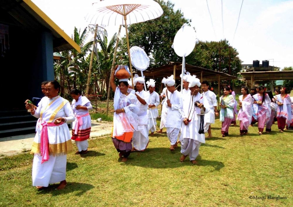
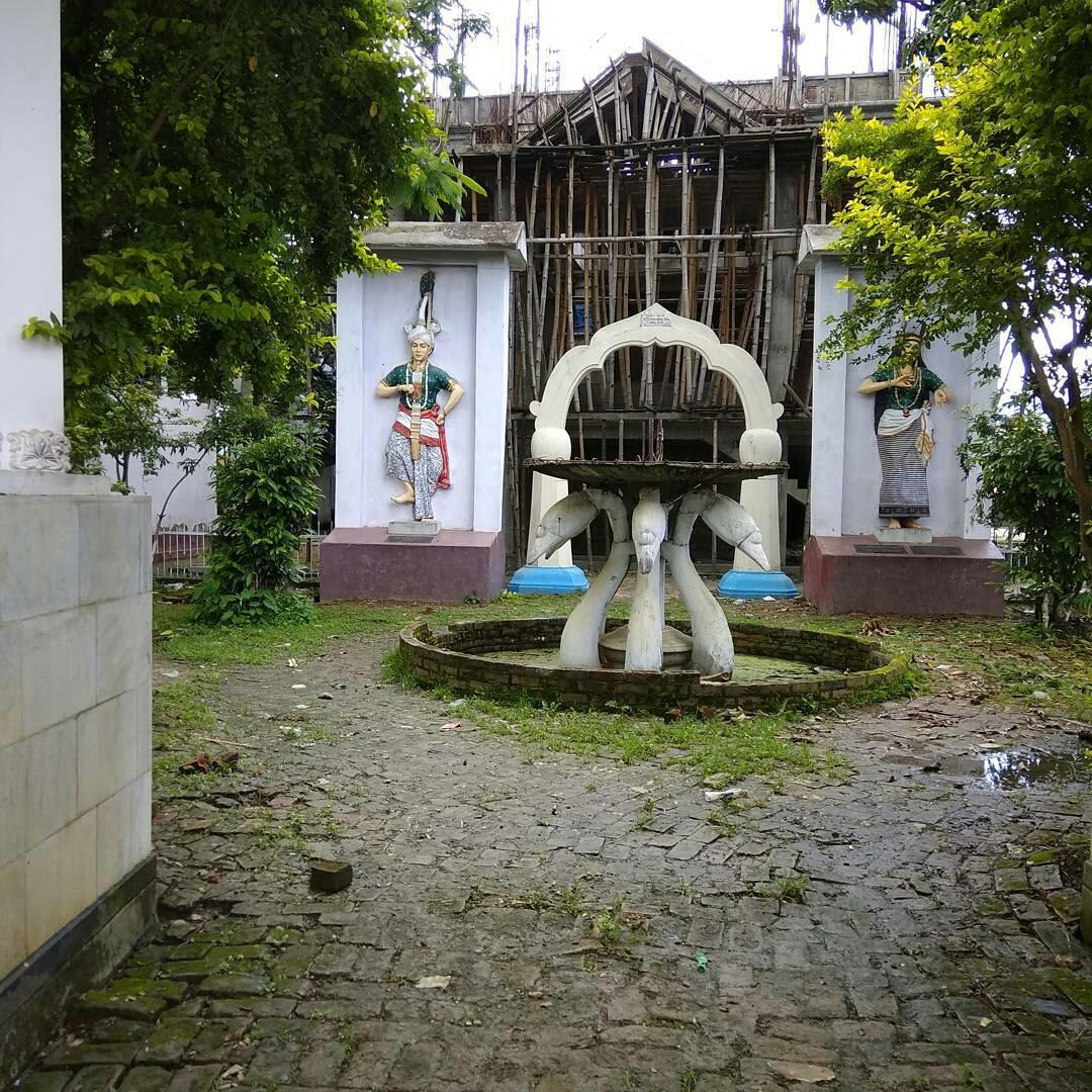
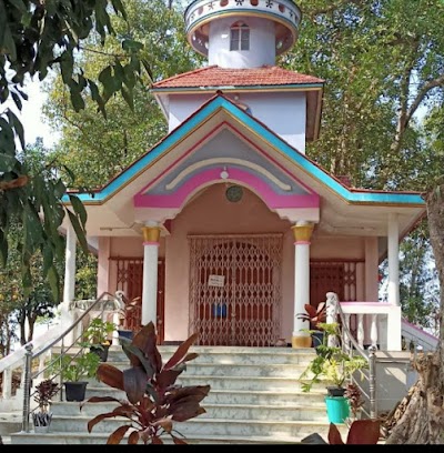
Opening the Shrine or Lai Eekouba: The festival starts by opening the usually locked doors of the community shrine, an action considered highly sacred. The inside is cleaned and prepared, with special songs and ritual washing of sacred objects and clothes. Sometimes, preparations start days beforehand, such as fermenting rice for rice beer, a key ritual item.

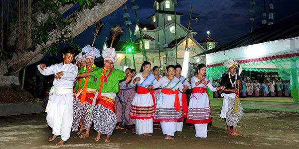
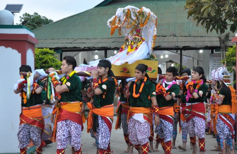
A procession led by the maibi (priestess) and sometimes maiba (male priest) heads to a river or pond. They bring sacred objects, make offerings, and invite the deity’s presence through water and chanting. The maibi might enter a trance and deliver oracles from the gods. The night ends with the pena, a traditional fiddle, playing music intended to “rest” the deities.

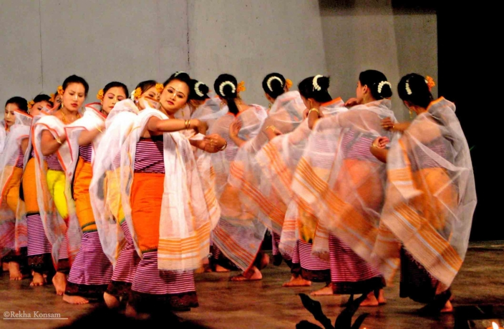
The Ritual Dance of Creation or Laibou: Dances and rituals performed during Lai Haraoba are called laibou, meaning “work done for the gods.” These are the heart of the festival, staged before the assembled village, often near the shrine or a sacred tree. Every aspect of human life and creation is re-enacted through dance, forming the human body, birth, farming, spinning, weaving, house-building, and other necessities. Each process, even the act of drawing the baby’s eyes or forming a fist, is acted out slowly and symbolically by the maibi.

Following the creation story, the ritual dances proceed through making a house, growing and weaving cotton, and preparing clothing. At one point, fishing is performed as a symbol of adulthood and desires. All the movements are slow, careful, and filled with ancient meaning.

Music is a constant feature. The pena, a simple fiddle, is played every day, marking morning and evening rituals. There are collective songs such as the “hoi laoba” and “wakol laoba,” with all participants shouting or singing together. The maibi delivers oracles: messages said to come straight from the deities. These can include advice for the year, warnings, or encouragement.

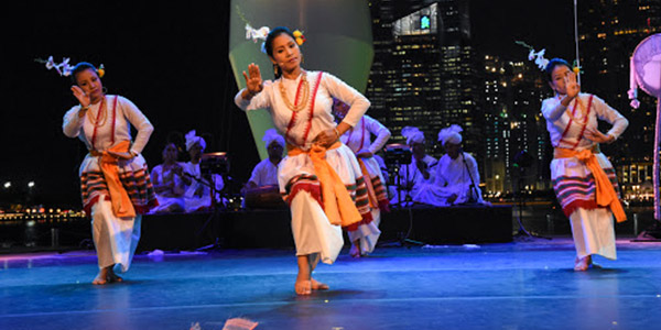
Several ritual dances have become icons of Lai Haraoba. The most significant are

  • Laiching Jagoi: Performed by maibis to “invite” the gods.
  • Khamba-Thoibi Jagoi: Tells the story of legendary lovers Khamba and Thoibi, replacing the older Panthoibi Jagoi in some places.
  • Tang Jagoi: A dance with fire and holy knives to drive out evil spirits.
  • Panthoibi Jagoi: The original romantic duet dance that honors the divine love story.

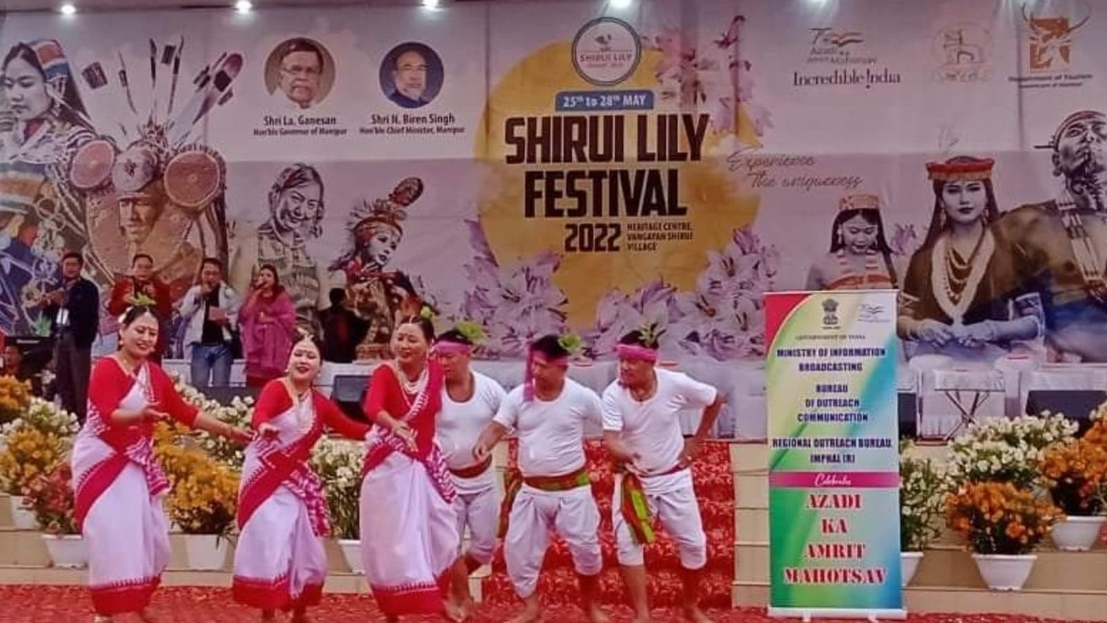
Modern celebrations can also include other folk, martial, and sometimes even Bollywood-inspired dances, adapting to today’s audiences.

The spiritual work of the festival is led by the maibi (woman priest) and maiba (man priest). Maibis, in particular, occupy a unique place as living channels between world and spirit. They lead most of the key rituals, dances, and oracles, sometimes entering trance to “speak” for the gods.

Rice beer, fruits, flowers, and hand-woven cloths are common offerings. The presentation of these gifts is an important act, meant to please the deities and ensure blessings for the coming year. Each offering has its own order and significance and is usually placed on banana leaves or in traditional baskets.

The festival is not just a religious event but a key part of social life. Each family or clan takes responsibility for certain rituals or offerings, and the festival provides a place for all generations to participate, from children to elders. It’s a practical lesson in Meitei life: how to build, weave, farm, worship, and come together as a community.

The story of Nongpok Ningthou and Panthoibi is a favorite, often dramatised as a flirtatious, complex drama. Sometimes, this story is merged with other folk legends, like Khamba and Thoibi of Moirang. In some versions, Panthoibi is portrayed as a Tangkhul (hill tribe) girl, illustrating the ancient bond between the people of the hills and plains. This is just one example of how the festival weaves together history, myth, and lived experience.

Though deeply traditional, Lai Haraoba is not frozen in time. As society evolves, so do the celebrations. Some villages add new performances or blend in more accessible forms of music and dance. The use of modern lighting and sound is more common now. But the old forms still remain at the heart, especially in more remote or tradition-focused communities.

During the festival, certain taboos and customs are observed, like periods of fasting or avoiding “unclean” acts. Community feasts are common, where all take part regardless of social status. Men, women, and children all join in some aspect of the ritual or celebration. And while the festival is religious, it’s also a time for courtship, gossip, settling disputes, and reinforcing social norms.

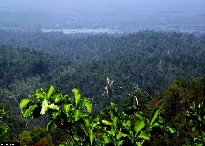
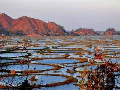
Lai Haraoba usually happens in the spring and summer, following the local lunar calendar. It can be held at any one of the many neighborhood shrines dedicated to an Umang Lai, so multiple celebrations may happen across Manipur at once, or even, nowadays, in other parts of India and among the Manipuri diaspora.

Lai Haraoba is more than ritual; it’s Manipur’s living cultural memory. It teaches the origins of life, the skills for survival, and the values to live by. Some see it as a form of community education, where children learn through watching, imitating, and participating.

And yet, the festival doesn’t ignore reality. There is room for fun, for complaints, and even for critical jokes about the village’s leaders. It holds both the grave and the playful. For as long as the festival is kept, the past remains present, and Manipur’s stories continue to unfold.

Festivals of India – Shirui Lily Festival

The Shirui Lily Festival celebrates the state flower of Manipur and is part of the state’s efforts to develop and implement sustainable and responsible tourism in the state and also to save and increase awareness about the endangered species of Manipur’s Shirui Lily found only in the Shirui Hills. The festival is organized every year around April-May. The 5th edition of the festival will take place between 17 to 20 May at Ukhrul.

In celebration of the stunning and rare Shirui Lily, a beautiful flower that grows only in the region of Shirui Hill in Manipur, the festival is a celebration of the beauty and richness of the local culture and attracts tourists from all over the world to this region.

The festival starts with a parade through the streets of the city, with participants dressed in traditional attire, dancing and singing to the beat of the drum. The parade is led by the Queen of the festival, who is usually a local girl selected for her beauty and grace. The Queen is adorned with a crown made of Shirui Lily, which is a symbol of her royalty and is considered a great honour.

The Shirui Lily grows on top of the Shirui hills in Manipur and cannot be replanted anywhere else in the world. It fills the air with its pleasant fragrance during the blooming season. The festival is observed to spread awareness and conserve the endangered state flower.

Climbing the Shirui hills is one of the most interesting treks in Manipur and a chance to see the rare flower. It is the ultimate treat for nature and adventure lovers.

One of the most fascinating aspects of the Shirui Lily Festival is the display of the Shirui Lily. The flower is considered a symbol of purity and beauty and is used extensively in various rituals and ceremonies. During the festival, the flower is displayed in various forms, such as garlands, bouquets, and arrangements, and is admired by tourists and locals alike. Another highlight of the Shirui Lily Festival is the traditional music and dance performances. The local folk dances, such as the Rasa Dance and the Khamba-Thoibi Dance, are performed with great passion and enthusiasm. The music, which is accompanied by instruments such as the pena and the drum, is a fusion of traditional and contemporary styles and creates a unique and mesmerizing sound.

In addition to the cultural events, the Shirui Lily Festival is also a time for people to come together and enjoy the delicious local cuisine. Events during the festival include live music concerts, folk performances, traditional dances, indigenous games and competitions, art and handicraft exhibitions, ethnic food eateries and various adventure activities like camping, biking and a lot more. Shirock, the musical extravaganza of live music concerts and competitions is one of the major highlights of the festival that attracts a large number of crowds not only from different corners of the state, and even from neighbouring states.

The Shirui Lily Festival is not just a celebration of the beauty of the Shirui Lily, but it is also a celebration of the local culture and heritage. Visitors to the festival can experience the traditional way of life of the people of Manipur, and learn about their customs, traditions, and beliefs. The festival is a time for people to come together and celebrate the richness of their culture and to share it with others.

One of the most unique and exciting aspects of the Shirui Lily Festival is the opportunity to trek to Shirui Hill, where the Shirui Lily grows in abundance. This trek is a challenging but rewarding experience, as visitors can admire the breathtaking beauty of the region and see the Shirui Lily in its natural habitat. The trek is also a great opportunity for adventure enthusiasts, as the route is surrounded by stunning natural scenery and offers a glimpse into the rich and diverse flora and fauna of the region.

Travel Bucket List: India – Consolidated List of all States

As I started planning my travel, I started relying on my research for where to go and found it slightly ungainly to search through all the material I have to reach a specific destination. So here’s a consolidated list of all Indian states, in alphabetical order with the cities and towns next to each part which makes it easier to get to the place you are interested in.

Photo by Ravigopal Kesari on Unsplash

Andaman and Nicobar Islands
Part 1 – Introduction and Overview
Part 2 – Port Blair
Part 3 – Corbyn’s Cove Beach, Wandoor Beach, Viper Island, Ross Island, North Bay Island, Red Skin Island, Middle Andaman Island, Long Island, Baratang Island, Parrot Island, North Passage Island, Guitar Island
Part 4 – Aves Island, North Andaman Island, Diglipur, Stewart Island, Ross & Smith Island, Jolly Buoy Island, Havelock Island
Part 5 – Neil Island, South Andaman Island, Rutland Island, Little Andaman Island, Cinque Island, Barren Island, Narcondom Island, Kathchal Island, Campell Bay & Indira Point
Part 6 – Mahatma Gandhi Marine National Park, Chidiya Tapu, The Chidiya Tapu Biological Park, Mount Harriet National Park, Saddle Peak National Park, Campbell Bay National Park, Galathea National Park, Middle Button Island National Park, North Button Island National Park, South Button Island National Park

Photo by Gowrisha CV on Unsplash

Andhra Pradesh
Part 1: Introduction and Overview, Vishakhapatnam
Part 2: Araku Valley, Vizianagaram, Annavaram, Samalkot, Kakinada, Rajahmundry
Part 3: Amaravathi, Vijayawada, Machilipatnam
Part 4: Guntur, Chirala, Nagarjunakonda, Srisailam, Cumbum, Nellore
Part 5: Kurnool, Mantralayam, Gandikota, Tadipatri, Anantapur, Puttaparthi
Part 6: Lepakshi, Horsley Hills, Chittoor, Srikalahasthi, Tirupati

Photo by Mayur More on Unsplash

Arunachal Pradesh
Part 1: Introduction and Overview, Itanagar, Bhalukpong
Part 2: Bomdila, Tawang
Part 3: Ziro, Yinkiong, Mechuka, Roing, Tirap
Part 4: Khonsa, Changlang, Miao, Anini, Pasighat, Aalo, Daporijo, Anjaw, Tezu

Photo by Nilotpal Kalita on Unsplash

Assam
Part 1: Introduction and Overview, Guwahati, Dispur
Part 2: Kokrajhar, Bongaigaon, Goalpura, Barpeta, Nalbari, Hajo, Sualkuchi
Part 3: Darrang, Mayong and Morigaon, Nagaon, Tezpur, Jorhat
Part 4: Sivasagar, Majuli, Dhemaji, Dibrugarh, Tinsukia, Digboi
Part 5: Sadiya, Haflong, Jatinga, Diphu, Karimganj, Hailakandi, Silchar
Part 6: Raimona National Park, Manas National Park, Orang National Park, Kaziranga National Park, Nameri National Park, Dibru Saikhowa National Park, Dihing Patkai National Park

Photo by ARTO SURAJ on Unsplash

Bihar
Part 1: Introduction and Overview
Part 2: Patna
Part 3: Hajipur, Nalanda
Part 4: Rajgir, Sasaram, Kaimur
Part 5: Bodh Gaya, Vaishali
Part 6: Muzzafarpur, Sitamarhi, Madhubani, Lauriya Nandangarh, Bhagalpur, Valmiki National Park Tiger Reserve and Wildlife Sanctuary

Photo by Ayiman Mohanty on Unsplash

Chhattisgarh
Part 1: Introduction and Overview, Raipur, Champaran
Part 2: Bhilai, Durg, Rajnandgaon, Chirmiri, Madku Dweep, Bhoramdeo Temple, Guru Ghasidas National Park
Part 3: Achanakmar Tiger Reserve, Bilaspur, Raigarh, Korba, Ambikapur, Barnawapara Wildlife Sanctuary, Mainpat, Malhar
Part 4: Mahasamund, Sirpur, Rajim, Jagdalpur, Dhamtari, Dhamtari, Dantewada, Kanger Ghati National Park

Dadra and Nagar Haveli and Daman and Diu
Part 1: Introduction and Overview, Daman
Part 2: Diu
Part 3: Dadra and Nagar Haveli

Delhi
Part 1: Introduction and Overview, India Gate, Red Fort, Qutub Minar, Jantar Mantar, Rajghat
Part 2: Iron Pillar, National War Memorial, Rajpath, Rashtrapati Bhavan, Agrasen Ki Baoli, Ghalib Ki Haveli, Alai Darwaza/Minar, Bhool Bhulaiya ka Mahal, Purana Qila,
Part 3: Tughlaqabad Fort. Siri Fort, Feroza Kotla Fort, Swaminarayan Akshardham Temple, ISKON Mandir, Birla Temple, Chhatrapur Temple, Kalkaji Temple, Kali Bari Temple, Yogmaya Temple, Sri Digambar Jain Lal Mandir, Lotus Temple
Part 4: Jama Masjid, Quwwat-ul-Islam Mosque, Fatehpuri Masjid, Jamali Kamali Mosque and Tomb, Nizamuddin Dargah, Humayun’s Tomb, Safdarjung’s Tomb, Isa Khan’s Tomb, Hijron ka Khanqah, Nicholson Cemetery
Part 5: Gurudwara Bangla Sahib, Gurudwara Sis Ganj Sahib, Rakab Ganj Gurdwara, Sunder Nursery, Lodhi Gardens, Garden of Five Senses, National Rose Garden, Mehrauli Archaeological Park, Pradhanmantri Sangrahalaya, National Museum, Nehru Memorial Museum and Library, Rashtrapati Bhavan Museum, Indian War Memorial Museum, National Handicrafts Museum
Part 6: Indira Gandhi Memorial Museum, Sanskriti Museums, Charkha Museum, Sulabh International Museum of Toilets, Shankar’s International Dolls Museum, Museum of Archaeology, National Railway Museum, Museo Camera, National Gallery of Modern Art, Kiran Nadar Museum of Art, Museum of Illusions, National Zoological Park, National Bal Bhavan, Connaught Place, Chandni Chowk, Dilli Haat, Sarojini Market, Lajpat Nagar, Majnu ka Tila, Pragati Maidan

Photo by Sarang Pande on Unsplash

Goa
Part 1: Introduction and Overview
Part 2: North Goa, Vagator Beach, Anjuna Beach, Calangute Beach, Sinquerim Beach, Candolim Beach, Arambol Beach, Mandrem Beach, Morjim Beach, Miramar Beach, Siridao Beach, Bogdeshwara Temple, Mangeshi Temple, Mahalaxmi Temple, Fort Aguada, Chapora Fort, Reis Magos Fort, Basilica of Bom Jesus, Church of Our Lady of Immaculate Conception, Chapel of St. Catherine, Church of Mae De Deus, Goa State Museum, Houses of Goa Museum, Museum of Christian Art, Casino Palms, Chorao Island, Harvalem Waterfalls
Part 3: South Goa, Butterfly Beach, Betalbatim Beach, Agonda Beach, Mobor Beach, Hollant Beach, Palolem Beach, Cansaulim Beach, Colva Beach, Talpona Beach, Kakolem Beach, Benaulim Beach, Our Lady of Remedios Church, Saviour of the World Church, St. Alex Church, Shantadurga Temple, Tambdi Surla Mahadev Temple, Chandreshwar Bhoothnath Temple, Naval Aviation Museum, Goa Chitra Museum, Big Foot Museum, The Grande Island, Pequeno Island, Bhagwan Mahaveer Wildlife Sanctuary, Netravali Wildlife Sanctuary, Cotigao Wildlife Sanctuary, Dudhsagar Falls, Bamanbudo Waterfalls, Netravali Bubbling Lake, Cabo de Rama Fort, Chandor

Photo by Parth Kateliya on Unsplash

Gujarat
Part 1: Introduction and Overview
Part 2: Surat, Vapi, Udvada, Valsad, Bilimora, Navsari, Bharuch, Saputara
Part 3: Ahmedabad, Lothal, Vadodara, Anand
Part 4: Gandhinagar, Patan, Mehsana, Palanpur
Part 5: Rajkot, Jamnagar, Dwarka, Porbandar, Junagadh, Bhavnagar, Palitana,
Part 6: Kutch, Bhuj, Mandvi, Rann of Kutch, Anjar

Photo by Sooraj Dev on Unsplash

Haryana
Part 1: Introduction and Overview, Gurugram, Manesar, Sohna
Part 2: Faridabad, Nuh, Murthal, Rohtak, Meham
Part 3: Hisar, Panipat, Karnal
Part 4: Kurukshetra, Ambala
Part 5: Panchkula, Morni Hills, Narnaul

Photo by Naman Pandey on Unsplash

Himachal Pradesh
Part 1: Introduction and Overview, Shimla, Kufri, Fagu, Theog, Hatkoti Valley, Chanshal Valley
Part 2: Chail, Solan, Barog, Nahan, Sirmour, Paonta Sahib, Shoghi, Kasauli, Arki, Nalagarh, Dadasiba, Bilaspur, Dalhousie,
Part 3: Kangra, Khajjiar, Bharmour, Chamba, Tattapani, Jalori Pass, Jibhi, Mandi
Part 4: Trithan Valley, Bhuntar, Sainj Valley, Barot, Bir Billing, Palampur, Kasol, Nagar, Manikaran Sahib, Tosh, Parvati Valley
Part 5: Kullu, Manali, Dharamsala, McLeodganj
Part 6: Keylong, Pin Valley National Park, Spiti Valley, Narkanda, Mashroba, Kinnaur, Sarahan, Sangla Valley, Kalpa, Pangi Valley, Nako

Jammu & Kashmir and Ladakh
Part 1: Introduction and Overview, Kashmir, Srinagar, Gulmarg, Sonmarg, Pahalgam, Amarnath, Pulwama, Kupwara, Poonch, Anantnag, Baramulla, Dachigam National Park
Part 2: Jammu, Patnitop, Rajouri, Udhampur, Kathua, Katra, Vaishno Devi, Kishtwar
Part 3: Ladakh, Leh, Leh Palace, Thiksey Gompa, Pangong Lake, Magnetic Hill, Nubra Valley and Khardung La Pass, Kargil, Drass, Hemis High Altitude Wildlife Sanctuary, Lamayuru, Lake Tso Moriri

Photo by Aryan Singh on Unsplash

Jharkhand
Part 1: Introduction and Overview, Ranchi
Part 2: Hazaribagh, Bokaro Steel City
Part 3: Jamshedpur, Neterhat
Part 4: Dhanbad, Shikarji, Deoghar, Dumka

Karnataka
Part 1: Introduction and Overview
Part 2: Bengaluru
Part 3: Mysuru, Mangalore, Belgaum
Part 4: Hubli-Dharwad, Gulbarga, Bidar, Badami, Bijapur, Hassan, Shimoga, Hampi, Sharavathi Valley Wildlife Sanctuary, Bhadra Wildlife Sanctuary, Brahmagiri Wildlife Sanctuary, Nagarhole National Park, Bandipur National Park, Ranganathittu Bird Sanctuary, Jog Falls, Shivanasamudra Falls, Kodasalli Backwater
Part 5: Coorg, Chikmagalur, Sakleshpur, Kudremukh, Kemmanagundi, Kotagiri, Masinagudi, Devarayanadurga, Karwar, Devbagh, Kumta, Netrani Island, Murudeshwar, Maravanthe, St. Mary’s Island, Udipi
Part 6: Udipi, Kollur, Sringeri, Dharmasthala, Horanadu, Talakadu, Belur, Shravanbelagola, Gokarna, Murudeshwar, Koodli, Srirangapatna, Pattadakal, Aihole, Kalasa

Kerala
Part 1: Introduction and Overview
Part 2: Kasaragod, Kannur, Kozhikode
Part 3: Wayanad, Mallapuram, Palakkad
Part 4: Thrissur, Ernakulam, Alappuzha
Part 5: Kottayam, Idukki, Patanamthitta
Part 6: Kollam, Tiruvanathapuram

Photo by Sachin Benny on Unsplash

Lakshadweep Islands
Part 1: Introduction and Overview
Part 2: Aminidivi, Cora Divh, Sesostris Bank, Bassas de Pedro, Cherbaniani Reef, North Islet, Byramgore Reef, Chetlat Island, Bitra Par, Kilthan Island, Kadmat Island, Kadmat Beach, Elikalpeni Bank, Perumal Par, Amini Island
Part 3: Laccadive, Amindivi, Agatti Island, Bangaram, Pakshipitti, Andrott Island, Kavaratti, Kalpeni, Suheli Par
Part 4: Minicoy, Maliku Atoll, Investigator Bank, Viringili

Madhya Pradesh
Part 1: Introduction and Overview
Part 2: Bhopal
Part 3: Indore, Ujjain, Alampur
Part 4: Maheshwar, Omkareshwar, Mandu, Burhanpur
Part 5: Chanderi, Shivpuri, Orchha, Khajurao
Part 6: Gwalior, Jabalpur, Bhedaghat, Panchmarhi, Amarkantak, Bandhavgarh National Park, Kanha National Park, Pench National Park

Photo by Raj Rana on Unsplash

Maharashtra
Part 1: Introduction and Overview, Mumbai
Part 2: Pune
Part 3: Matheran, Lonavala, Khandala, Rajmachi, Lavasa, Kamshet, Mahabaleshwar, Panchgani, Kaas Plateau, Maval, Bhandardara, Chikhaldara, Bhimashankar
Part 4: Amravati, Aurangabad, Ajanta and Ellora Caves, Lonar, Chiplun, Kolhapur, Nagpur, Nanded, Nashik, Triambakeshwar, Shirdi, Shani Shinganapur, Raigad, Ratnagiri, Satara
Part 5: Dahanu, Alibaug, Kashid, Diveagar, Harihareshwar, Murud, Karade, Ganpatipule, Tarkarli, Vengurla, Tadoba National Park, Bhamragarh Wildlife Sanctuary, Chandoli National Park, Gugumal National Park, Navegaon National Park, Malvan Marine Sanctuary, Rehekuri Blackbuck Sanctuary

Photo by WAIKHOM JAMES on Unsplash

Manipur
Part 1: Introduction and Overview, Imphal
Part 2: Moirang, Tamenglong, Thoubal
Part 3: Chandel, Tengnoupal, Moreh, Kaina, Ukhrul, Mount Koubru, Baruni Hill, Thangjing Hill, Sadu Chiru Waterfall

Photo by Utkarsh B on Unsplash

Meghalaya
Part 1: Introduction and Overview
Part 2: Shillong
Part 3: Mawphlang, Cherrapunji, Nongpoh, Mawsynram
Part 4: Jowai, Mawlynnong, Dawki, Balpakram National Park, Williamnagar, Baghmara, Tura
Part 5: Khasi Hills, Jaintia Hills, Garo Hills

Photo by Vanlaldin puia on Unsplash

Mizoram
Part 1: Introduction and Overview, Aizwal, Falkawn Village
Part 2: Reiek, Hmuifang, Kolasib, Tamdil or Tam Lake, Mamit, Vantawng Falls, Serchhip
Part 3: Dampa Tiger Reserve, Lunglei, Champhai
Part 4: Murlen National Park, Phawngpui, Phawngpui National Park, Saiha,

Photo by Suraj Jadhav on Unsplash

Nagaland
Part 1: Introduction and Overview, Dimapur
Part 2: Kohima
Part 3: Mokokchung, Tuensang, Phek, Mon, Pfutsero

Photo by Ayiman Mohanty on Unsplash

Odisha
Part 1: Introduction and Overview, Bhubaneshwar, Dhauli
Part 2: Cuttack, Rayagada, Daringbadi, Berhampur, Jeypore
Part 3: Puri, Baripada, Sambalpur, Rourkela
Part 4: Konark, Paradeep, Gopalpur, Chandipur
Part 5: Lake Chilika, Tikarpada Wildlife Sanctuary, Satkosia Tiger Reserve, Bhitarkanika National Park & Wildlife Sanctuary, Simlipal National Park, Duduma Waterfalls, Chandaka Forest, Kotgarh Elephant Reserve, Karlapat Wildlife Sanctuary

Photo by nullvoid on Unsplash

Puducherry
Part 1: Introduction and Overview, Puducherry
Part 2: Karaikal, Mahé, Yanam

Photo by Prerna Sharma on Unsplash

Punjab
Part 1: Introduction and Overview
Part 2: Chandigarh, Sirhind
Part 3: Rupnagar, Patiala
Part 4: Ludhiana, Bhatinda
Part 5: Jalandhar, Kapurthala
Part 6: Pathankot, Amritsar

Rajasthan
Part 1: Introduction and Overview, Jaipur, Udaipur
Part 2: Jodhpur, Jaisalmer, Sawai Madhopur, Pushkar

Photo by Apurba Nag on Unsplash

Sikkim
Part 1: Introduction and Overview
Part 2: Gangtok
Part 3: Tinkitam Rayong, Namchi, Barsey Rhododendron Sanctuary, Kabi Longstok, Tendong Hill, Aritar, Zuluk, Pangolakha Wildlife Sanctuary, Pelling, Yuksom, Ravangla
Part 4: Maenam Wildlife Sanctuary, Geyzing, Yangtey, Borong, Mangan, Chopta Valley, Lachung, Lachen, Yumthang Valley, Thangu Valley, Gurudongmar Lake, Cholamu Lake, Shingba Rhododendron Sanctuary, Khangchendzonga National Park, Fambong Lho Wildlife Sanctuary, Goecha La

Tamil Nadu
Part 1: Introduction and Overview, Chennai
Part 2: Coimbatore, Tiruchirappalli, Tiruppur, Tirunelveli
Part 3: Ooty, Kodaikanal, Yercaud, Coonoor, Yelagiri, Bellikkal
Part 4: Kanchipuram, Tiruvannamalai, Chidambaram, Vaitheeshwaran Kovil,
Part 5: Kumbakonam, Thanjavur, Swamimalai, Rameshwaram, Madurai
Part 6: Mahabalipuram, Kanyakumari, Mudumalai Wildlife Sanctuary, Hogenakkal Falls, Kutralam Falls

Photo by Aman Upadhyay on Unsplash

Telangana
Part 1: Introduction and Overview, Hyderabad Part 1
Part 2: Hyderabad Part 2
Part 3: Secunderabad
Part 4: Warangal, Nizamabad
Part 5: Khammam, Karimnagar, Adilabad, Mahbubnagar, Medak
Part 6: Nalgonda, Bhadrachalam, Koti Linga, Somasila, Vemulawada

Photo by Sourav Debnath on Unsplash

Tripura
Part 1: Introduction and Overview
Part 2: Agartala
Part 3: Kailashahar, Unakoti, Udaipur, Ambassa, Pilak Archaeological Sites, Chabimura, Mahamuni Pagoda, Manubankul, Buddhist Stupa, Boxanagar
Part 4: Baramura Eco Park, Kalapania Nature Park, Tepania Eco Park, Khumulwang Eco Park, Jampui Hills, Dumboor Lake, Dhalai, Rudrasagar Lake, Sepahijala Wildlife Sanctuary & Clouded Leopard National Park, Trishna Wildlife Sanctuary, Rajbari National Park, Rowa Wildlife Sanctuary, Gomati Wildlife Sanctuary

Uttar Pradesh
Part 1: Introduction and Overview, Noida, Loni, Ghaziabad, Meerut, Muzzafarnagar
Part 2: Hastinapur, Vrindavan, Mathura
Part 3: Fatehpur Sikri, Agra, Garhmukteshwar
Part 4: Aligarh, Firozabad, Jhansi, Piilbhit, Bithoor, Naimisharanya
Part 5: Kanpur, Lucknow
Part 6: Ayodhya, Sravasti, Prayagraj
Part 7: Chitrakoot, Vindhyachal, Varanasi, Sarnath, Kushinagar

Photo by Akshay syal on Unsplash

Uttarakhand
Part 1: Introduction and Overview, Dehradun
Part 2: Mussoorie, Dhanaulti
Part 3: Auli, Joshimath, Chopta, Tungnath, Ukhimath, Lansdowne, Nainital
Part 4: Sattal, Bhimtal, Naukuchiatal, Kausani, Ranikhet, Almora, Binsar, Jalna, Kasar Devi, Jageshwar, Champawat, Munsiyari, Pithorgarh
Part 5: Bageshwar, Chamoli, Mana, Badrinath, Pandukeshwar, Hemkund Sahib, Kedarnath, Gomukh, Madhyamaheshwar, Gangotri, Gauri Kund, Yamunotri
Part 6: Rudranath, Guptakashi, Nandprayag, Rudraprayag, Devprayag, Rishikesh, Haridwar, Roopkund Lake, Nelong Valley, Gangotri National Park, Kedarnath Wild Life Sanctuary, Valley of Flowers, Nanda Devi National Park, Govind Pashu Vihar Wildlife Sanctuary, Rajaji National Park, Jim Corbett National Park

Photo by Nitish Narayan on Unsplash

West Bengal
Part 1: Introduction and Overview, Kolkata
Part 2: Howrah, Barrackpore, Chandan Nagar, Chinsurah, Bardhaman, Haldia, Midnapore
Part 3: Shantiniketan, Durgapur, Jhargram, Asansol, Murshidabad, Mukutmanipur, Malda, Siliguri, Jalpaiguri, Cooch Behar, Bagdogra
Part 4: Kurseong, Mirik, Darjeeling, Tinchuley, Dooars, Kalimpong
Part 5: Rishyap, Lava and Lolegaon, Buxa Tiger Reserve, Rajabhatkawa, Jaldapara National Park, Jaldhaka, Chapramari Wildlife Sanctuary, Gorumara National Park, Neora Valley National Park, Lataguri, Purulia, Sonajhuri Forest, Deulti, Sundarbans, Mayapur, Nabadwipa, Bakreswar
Part 6: Bankura, Bishnupur, Jayrambati, Kamarpukur, Tarapith, Falta, Raichak, Taki, Piyali Island, Machranga Dwip, Kakdwip, Mousuni Island, Bakkhali, Junput, Mandarmani, Tajpur, Shankarpur

Travel Bucket List: India – Manipur Part 3

Chandel
64 km south of Imphal lies the tiny, but scenic town of Chandel, also known as Lamka. Not very far from India’s border with Myanmar, it is also known as the Gateway to Myanmar and is famous for being home to more than 20 native tribes with each tribe offering a unique identity to the area. Chandel is also known for its numerous varieties of Orchids, ornamental plants, and some very useful medicinal plants. Some of the must-visit spots here include the Tengnoupal, which is the highest point in the area and can offer some stunning sceneries and views.

Founded in 1989, the Yangoupokpi – Lokchao Wildlife Sanctuary covers an area of 185 sq km and is home to multiple species of mammals, birds, reptiles, amphibians as well as fish. This sanctuary is one of the nine Identified Important Bird Areas or IBAs in Manipur, where the IBA is of critical importance for environmental conservationists and bird watchers as it is the only place where the endangered Green Peafowl can still be sighted. It is also one of those rare forests where communities of people live in tandem with nature. Seven forest villages are presently housed in the sanctuary and the villagers are dependent on the natural resources of the forest for their livelihood. The sanctuary is located at the India-Myanmar border, housing a mix of riverine and terrestrial ecosystems.

The sanctuary is home to many rare varieties of wild orchids, most of them unknown to the world as yet. Other trees forming the forest cover include the Dipterocarpus Turbinatus or Gurjan, the Tectona Grandis or Teak, the Melanorrhoea Usitata or Burmese Lacquer, the Terminalia Chebula or Black Myrobalan, the Emblica Officinalis or the Indian Gooseberry, the Cedrella Toona or the Indian Cedar, the Quercus Spp or the Oak, the Bauhinea, the Dillenia, and many varieties of bamboo. The wildlife sanctuary is home to 42 mammal species, 74 bird species, 29 reptile species, 6 amphibian species, and 86 fish species. The Hoolock Gibbon, the only variety of the ape found in India as well as the Snow Leopard and Golden Cat, which make rare appearances during the night, are also found here. Around the border area, the extremely rare Malayan Sun Bear can also be found. The best time to visit the Yangoupokpi Lokchao Wildlife Sanctuary is between October to April.

Tengnoupal
Located about 70 km southeast of Imphal and 20 km from Chandel is the hilly town of Tengnoupal which lies at the highest point of the NH-2 between Imphal and Moreh at the end of northwestern Myanmar and the ASEAN Highway passes through the village. The climate is cold all throughout the year and remains foggy during the rainy season and the village was founded by Pu Houlim Loikhom Mate and it is the largest village of the Kuki people settlement in the district. Due to its strategic importance, the village has seen many battles in the course of history including World War II. The main attraction here is the Tengnoupal which provides a bird’s eye view of the entire valley, from an altitude of 2,500 to 10,000 feet and is the highest point in the state. The Barak and Manipur rivers flow through the town, traversing from north to south.

The story of Tengnoupal is fragmented by the rule and control of different clans and countries. Long ruled by the Pakhanga dynasty, starting from the year 33; it was occupied by the Chinese in 1631. In 1942, it was bombed during World War II by the Japanese. The name Tengnoupal is derived from cactus fencing where teng means cactus and pal is a fence. Tengnou means tender cactus in the local language. It was named after the Awa Laan or the Manipur-Burmese War in the 16th century as cacti were planted as a fence in the Tengnoupal Hill range. The villagers of the then Tengnoupal and surrounding villages fought against the Burmese who invaded the Meitei kingdom of the Imphal Valley and many young warriors of Tengnoupal were killed and taken as a hostage to Burma. In the 19th century, Tengnoupal was the epicentre of the Anglo-Kuki war where more than 30 personnel of the British force were annihilated under the command of Pu Chomsho Mate, the younger brother of Pu Loikhom Mate, Chief of Tengnoupal. After that incident, the British Army captured Tengnoupal and then became the Army and Administrative HQ of the then British colonial government.

During World War II the people of Tengnoupal supported the Indian National Army or the INA led by Subhas Chandra Bose. The INA and the Japanese Army even brought in tanks and other heavy war equipment with the help of the local people led by Pu Sholim Mate and they were about to capture the Imphal Valley. Knowing the advancement of the INA and the Japanese Army, after occupying strategic locations at Tengnoupal the British Royal Air Force or RAF bombarded the hill ranges of Tengnoupal where many INA, Japanese and local volunteers were killed.

Moreh
Located about 108 km southeast of Imphal, Moreh is a border town located on the India–Myanmar border and is also known for its natural beauty. A strategically important town, due to its location at the Indo-Myanmar border Moreh is a sizable commercial hub in North-Eastern India, bringing in traders for cross-border trade. Tamu in Myanmar, just across the Menal river from Moreh, is connected to Moreh via 2 road bridges: The Indo-Myanmar Friendship Bridge and a newer Moreh ICP Bridge which connects the Moreh Integrated Check Post. Tamu in Myanmar connects Moreh in India to Kalewa-Yagyi-Mandalay in Myanmar and Mae Sot in Thailand through the India–Myanmar–Thailand Trilateral Highway. Moreh is also popular for its shopping arcade at Namphanglong, which sells Chinese and Thai goods at cheap prices. Being a border trade and transit town, Moreh plays a key role in the development of the economy of the state with border haat as well as international trade. A significant portion of the economy of Moreh depends on smuggling, including illegal teak smuggled from Myanmar.

Kaina
Located 24 km southeast of Imphal, Kaina is a hillock about 921 m above sea level and is a sacred place for Manipuri Vaishnava Hindus. According to legend, Shri Govindajee appeared in the dream of his devotee, Shri Jai Singh Maharaja, the 18th century King of Manipur and asked him to install in a temple with an image of Shri Govindajee. The image was to be carved out of a jack fruit tree, which was then growing at Kaina. Kaina is famous for the grand feasts performed as well as for the scenic beauty of the hillside.

The Sacred Jackfruit Tree is the tree on Kaina hill from which seven images of Lord Krishna were carved and installed in various temples in Manipur and in the neighbouring state of Assam, including the Shree Govindajee Temple at Imphal. In the past, Kaina Hill was known as Lakhai Phandong Ching and was the royal orchard of the palace. The original location of the jackfruit tree has been declared a historical and archaeological site by the Archaeological Department of Manipur.

Ukhrul
A hill station, Ukhrul is almost akin to paradise with mountains, brooks and waterfalls at every turn. Also known as Hunphun, Ukhrul is the home of the Tangkhul Naga and lies 81 km northeast of the state capital, Imphal. The Khangkhui Cave is a natural limestone cave located in the village of Khagkui, about 16 km from Ukhrul. The ancient pre-historic limestone cave locally called Khangkhui Mangsor, when excavated yielded evidence of habitation of Stone Age communities. According to local folklore, the big hall in the cave is the darbar hall of the Devil King living deep inside while the northern hall is the royal bedroom. During World War II, villagers sought shelter here and the cave can be reached after about an hour’s trek from Khangkui village.

The Shirohi National Park located on the top of Shirui hill lies about 19 km from Ukhrul. It is the only habitat of the beautiful terrestrial lily, Shirui lily or Lilium macklineae, found nowhere in the world except in this park. The park was established in 1982 and among the animals that make their home here include the tragopan, the tiger and the leopard. The main peak of Siroy abounds with flowers during the monsoon and it is a veritable paradise. The Shirui Kashong Peak near Ukhrul is a marvellous hilltop viewpoint located at a height of 2,835 meters above sea level. Several rivers originate from the cracks and slopes of this peak. The exotic Shirui lily flower blooms on the hilltop in May/June and attracts hundreds of scientists and tourists every year. In the park natural life is supported by an undisturbed biological system which has a dense tropical forest all over and temperate forest in the hilltops.

Manipur’s Hills
Manipur’s topology means it is abundant in hills and valleys, many of which are considered sacred by the local tribes. Mount Tempu or Mount Iso is the highest peak in Manipur with the Dzuko Valley below it.

Mount Koubru, one of the highest peaks in Northeast India is easily identified by its humped back like a cow. A place of great religious significance by the adherents of the Sanamahi faith, Mount Koubru also known as Mount Koupalu. It is considered to be the abode of God Lainingthou Koubru, the protector deity of the Northern Kanglei world and Goddess Kounu in Manipuri mythology. It is said that God Lainingthou Koubru lives here with his consort Goddess Kounu and their sacred animal Shamu Laishaa Angouba, the White Elephant. The town of Sapormeina lies below the peak and is one of the most visited pilgrimage sites in Manipur. The mythology of ancient Meitei concerns the study of cosmology as well as that of the human body with Mount Koubru considered to be the head of the body. Many letters of the ancient Meetei Mayek exist atop this mountain. Mount Koubru is considered to be one of the primary pilgrimage sites by the Meitei people; the stone-formations at the peak are believed to be parts of a single human face, resembling the 27 alphabets of the Meitei language. The mountain is also noted for mountain hiking as well as mountain climbing.

Baruni Hill, Nongmaiching Hill, Selloi Langmai Hill or the Sunday Mountain is a hill range and the abode of God Lainingthou Nongpok Ningthou and his consort Panthoibi in Manipuri mythology. The hill is one of the most important pilgrimage sites for followers of the Sanamahi faith and is best known for adventure activities including mountain hiking and mountain climbing. The hill is believed to be the abode of Lord Lainingthou Nongpok Ningthou and his beloved consort Goddess Panthoibi. After the advent of Hinduism in the Kanglei world, the attributes of Lord Lainingthou Nongpok Ningthou was identified as Lord Shiva of Hinduism. The Sanamahi Kiyong Temple, which is the abode of Lord Lainingthou Sanamahi and his mother Goddess Leimarel Sidabi is the most visited one. At the peak of the hill, there is the Khalong Temple, the abode of Nongmai Kainou Chingsomba and in the periphery is the Baruni Mahadeva Temple. Manipuri people climb the hill annually after Yaoshang and the temple is a sacred pilgrimage site of the Kabui, Tangkhul, Kom, Hmar, Chothe, Zeliangrong, Meitei and Bishnupriya Manipuri people and the followers of Sanamahi faith.

The Thangjing Hill is a hill range and the abode of God Eputhou Thangjing and other Meitei deities in Meitei mythology. The temple of Lord Eputhou Thangjing at the hilltop is a major pilgrimage site for followers of the Sanamahi faith. In Meitei mythology, the hill is mainly associated with the deity Lord Eputhou Thangjing who is the guardian of the mountain and the protector of the south of the Kanglei world. The hill is also mentioned in the great Meitei epic poetry, Khamba Thoibi.

The Sadu Chiru waterfall, near the Ichum Keirap village, about 27 km from Imphal, consists of three falls with the first falling from about 98 feet high and has the Agape Park in the vicinity.

With this, the series on Manipur comes to an end. I do hope this has inspired some of you to make a trip to this lovely state when things are better. I know I will.

Travel Bucket List: India – Manipur Part 2

Moirang
A small town, about 45 km south of Imphal, Moirang is famous for the ancient temple of Lord Thangjing and the legendary love story of Khamba Thoibi with the clothes used by Khamba and Nogban still preserved in the village of Ngangkhaleikai. The epic story is between a beautiful princess Thoibi, daughter of King Wangon Ningthou Chingkhu Naha Telheiba and an orphan boy Khamba, who was raised by his sister when orphaned.

In ancient times, the King of Moirang was considered the most powerful among the seven clan kings of Manipur. Till the end of the Khamba-Thoibi era, the Burmese King paid the annual war reparations money to the Moirang kings. During World War II, Moirang was the headquarters of the Indian National Army (INA). Colonel Shaukat Malik of the Indian National Army hoisted the tricolour for the first time on Indian soil on 14 April 1944, in Moirang. The INA Museum at Moirang displays some wartime relics and photographs.

Since Moirang houses a serene lake and a national park, it is bound to be abundant in flora and fauna. A large number of animals and birds live here and can be spotted easily. Animals including sambar, barking deer, monkeys and Sangai deer as well as birds such as hornbills, ducks, crows and kingfishers and migratory birds can be found here.

The largest freshwater lake in the country, Loktak Lake and the Sendra Island on it, are located about 50 km from Imphal, in Moirang in the Imphal valley. Loktak which means the end stream is famous for the phumdis or the heterogeneous mass of vegetation, soil and organic matter at various stages of decomposition floating over it. The largest of all the phumdis, Sendra Island covers an area of 40 sq km and is situated on the south-eastern shore of the lake. Located on this phumdi is the Keibul Lamjao National Park, the only floating national park in the world which is the last natural refuge of the endangered Sangai, the state animal, the Manipur brow-antlered deer, one of three subspecies of Eld’s deer.

The ancient lake plays an important role in the economy of Manipur and serves as a source of water for hydropower generation, irrigation and drinking water supply as well is a source of livelihood for the rural fishermen who live in the surrounding areas and on the phumdis, also known as phumshongs. The lake was initially designated as a wetland of international importance under the Ramsar Convention on 23 March 1990 and also listed under the Montreux Record on 16 June 1993.

The Lake is divided into two zones, namely, the Core Zone which is the no-development zone or totally protected zone comprising 70.3 sq km and the balance area is called the Buffer Zone. Within the lake and on its periphery, there are 14 hills of varying size and elevation with the Sendra, Ithing and Thanga islands on the southern part of the lake. Geographically, in terms of biodiversity and pressure of human activities, the lake is broadly divided into northern, central and southern zones.

Thanga Island is the largest island in Loktak Lake as well as a religious destination for both Hindu and Sanamahists due to its numerous temples and sacred sites. Karang Island is the second-largest island in the lake and is famous for the Ebudhou Khuman Apokpa Temple and the Ibudhou Khumanpokpa Temple, temples of the ancestral deities of the Khuman Dynasty of Manipur. Ithing Islet is a human-inhabited islet situated on the way to Thanga Island.

The Northern Zone has five main streams or rivers flowing into the lake and is separated from the central zone by large phumdis that stretch from the northwest to the southeast. The Central Zone encloses prominent islands of Thanga, Karang and Ithing and is the main open water zone of the lake, which was relatively free from phumdis in the past, but over the years athaphums or artificially created phumdis for fishing constructed by villagers for fishing have proliferated choking the entire lake. The Southern Zone encompasses the Keibul Lamjao National Park, Ungamel and Kumbi pats at the southern part of the lake and the zone is linked with Khuga River by the Ungamel channel. Loktak Day is observed every year on the 15th of October at the periphery of the lake. The lake is open daily between 8 am to 6 pm.

The only floating national park in the world, the Keibul Lamjao National Park is a vital part of the Loktak Lake. Created in 1966 as a wildlife sanctuary to preserve the natural habitat of the endangered Eld’s deer or Cervus eldi eldi, locally known as Sangai and gazetted as a national park in 1977, it is characterised by floating decomposed plant material locally called phumdi. The brow-antlered deer, first discovered in Manipur in 1839 was reported an extinct species in 1951. It was re–discovered in the Keibul Lamjao Park area and so this area was declared a national park to protect and conserve the deer now called Eld’s deer’s subspecies brow-antlered deer. From a small herd of 14 in 1975, its population was reportedly 260 in 2016.

Covering an area of over 40 sq km, the Keibul Lamjao National Park is home to various species of plants and animals, including migratory visitors and hosts over 450 varieties of orchids and over 100 species of aquatic flora and numerous species of birds. The floating marshes or the Phumdis consist of vegetation that is about 120 cms thick.

The best time to visit Keibul Lamjao National Park is between October and March as the Lake water levels are suitable to explore the park.

It is best to visit the park from 6 to 10 am and between 3:30 and 6 pm as this is when the Sangai deer come out to feed in herds. A boat trip along the labyrinthine boat routes passing through colourful water plants would also be a good way to see the park. The park itself is open from 7:30 am to 5:30 pm and entry fees for Indians is INR 30 per person while foreigners would need to pay INR 200 per person. Camera Charges for Indians are INR 50 per person while it is INR 250 for foreigners and car park charges are INR 100 per vehicle.

Sendra Island encompasses a small hillock that is surrounded by water. Although a small hillock entangled by the lake water on all sides, it is linked to the mainland through a pathway. There is a tourist lodge on the hilltop. The serene water around the hillock and the verdant trees magnify the beauty of this place making it picturesque.

The Indian National Army Complex was once used as the unofficial headquarters of the Indian National Army. The INA Memorial Complex was built to honour the soldiers who had sacrificed their lives for the country with letters, photographs and other artefacts available here. There is a bronze statue of Netaji Subhas Chandra Bose erected in the complex which is open from 8 am to 6 pm daily.

Moirang is also a land of temples as a lot of beautifully constructed temples with pristine aura are located here. The Pakhangba Temple, the Loktak Maru Temple, the Ibudhou Thangnarel Temple, the Oknarel Temple, the Radha Mandhop Temple and the Gopinath temple are some of the famous ones.

The Ibudhou Thangjing Temple or the Lord Thangjing Temple is an ancient temple dedicated to Lord Eputhou Thangjing, the ancient national deity of the ancient kingdom of Moirang. The best time to visit the temple is between May and July during the onset of the great mega music and dance religious festival of Lai Haraoba which attracts thousands of tourists every year especially historians and archaeologists. The temple is where the great Khamba Thoibi dance was performed for the first time according to a famous legend.

Located near the western borders of Loktak Lake, about 5 km from Moirang, Phubala has many attractions and can be combined with a trip to the lake. The two islands at Phubala has water sports activities and visitors can also enjoy picturesque views of the lake.

Tamenglong
Located about 145 km west of Imphal, Tamenglong is a hilly district covered by valleys and ranges. It lies on the hilltop from which descends the Barak River. The town is described as a biodiversity hub with a variety of exotic and rare species of birds and animals. This town is known for the oranges grown here and is home to some of the most unique plants and animals. The vibrant forest here provides a habitat for hog deers, leopards, wild dogs, hyenas, tigers and many more. The forest covers can be distinguished into three different types namely the bamboo brakes, the tropical evergreen forest and subtropical forests. Attractions include the Barak Waterfall which takes visitors through a series of seven waterfalls, the Zeilad Lake famous for many pythons, fish, water birds, large tortoises and ducks, the Buning Meadows and the Tharon Caves.

The tribal population in Tamenglong, comprises the Zeliangrong Nagas and the Kukis. Festivals celebrated in the town include the Orange Festival, the Gudui-Ngai, the Rih-Ngai or the Chaga Ngai, the Banruhmei and the Tarang. The best time to visit the town is between October and March.

The Tharon Cave is a 655.6 m long cave which can be explored with the help of the map drawn outside the cave. Also spelt as the Thaeuluan Cave, it is located about 27 km from Tamenglong. The cave has five exits and 34 joints. The Tharon Cave was once used as a shelter and excavations inside the cave have items related to the Hoabinhian culture of North Vietnam. The cave is an abode for fruit bats with about 12 caves located underneath.

Also known as N-piulong Valley, Buning Meadow is coloured with beautiful lilies and orchids making the place look stunning. The Meadow is filled with multitudes of birds and animals including Hoolock, gibbons and foxes. The summer months between March and June are the best time to visit the meadow when it is in full glory.

Situated near the Zeliadjung or Atenba village on a high platform up on the hill, the Zeilad Lake is a must-visit tourist attraction. Home to pythons, fish, tortoises and water and migratory birds, this is why the lake is a tourist favourite. Naga tales reveal that Zeilad Lake is where paddy originated. The lake has recently been declared as one of the four wildlife sanctuaries of Manipur and is also known as the Zeilad Wildlife Sanctuary. The best time to visit the lake is between October and April as the weather remains cool and pleasant.

The Barak Waterfalls are a must-visit place where seven other waterfalls are located close to each other. A local favourite to picnic, the aqua green falls and the sight of the cool water gushing from the hills to the plains is something that needs to be seen and experienced.

Thoubal
Located about 23 km south of the capital Imphal, Thoubal town’s name comes from the word Athouba meaning brave people symbolising the courageous people here. It is one of the larger towns of Manipur and has an idyllic feel to it with many lakes and rivers, paddy fields, and gardens. It is also the window to South-East Asia as the Trans-Asian highway (AH1) passes through it.

Thoubal is ideal for trekking, hiking and picnics given the abundance of the green landscape and is famous for the temples and the numerous water bodies with many lakes dotting the landscape. There is a diverse variety of trees and bamboos and plantains can be seen all around.

The main attractions include the Chinga Lairembi temple, the Tomjing Ching, the Panthoibee temple, the Thoubal bazaar, the Tangjeng ching from where one can have a bird’s eye view of the Waithou Lake and the Khangabok Menjor Garden. Thoubal also has the distinction of having the first and only subway in Manipur.

The Ikop Lake, located at an altitude of 772 m above sea level has a saucer-shaped basin and a silted bottom. The Lousi Lake spreads over an area of 18.64 sq km and features a wetland ecosystem. It is a major source of water for the locals. Pumlenpat lake is a freshwater lake and is also known as the Pumlen Pa. It spreads over an area of 19 sq km and is covered by phumdis and floating soil and vegetation, similar to the Loktak Lake. The lake is the second largest lake in Manipur after the Loktak Lake and is located about 68 km south of Imphal and about 45 km from Thoubal and plays an important role in the lives of the people nearby. There are plenty of small islands on this lake and once people started settling on these islands, the lake is now on the verge of extinction due to human encroachment.

The historically important Khongjom marks the site where Major General Paona along with his soldiers fought against the British invasion, ending in complete British control over Manipur. There is an open-air gallery in which a 78 feet long boat called the Hiyang Hiren can be viewed. Science fairs and exhibitions are also organised here.