In My Hands Today…

Maphead: Charting the Wide, Weird World of Geography Wonks – Ken Jennings

In a world where geography only makes the headlines when college students are (endlessly) discovered to be bad at it, these hardy souls somehow thrive. Some crisscross the map working an endless geographic checklist: visiting all 3,143 U.S. counties, for example, or all 936 UNESCO World Heritage Sites. Some pore over million-dollar collections of the rarest maps of the past; others embrace the future by hunting real-world cartographic treasures like “geocaches” or “degree confluences” with GPS device in hand. Some even draw thousands of their own imaginary maps, lovingly detailing worlds that never were.

Ken Jennings was a map nerd from a young age himself, you will not be surprised to learn, even sleeping with a bulky Hammond atlas at the side of his pillow, in lieu of the traditional Teddy bear. As he travels the nation meeting others of his tribe–map librarians, publishers, “roadgeeks,” pint-sized National Geographic Bee prodigies, the computer geniuses behind Google Maps and other geo-technologies–he comes to admire these geographic obsessives. Now that technology and geographic illiteracy are increasingly insulating us from the lay of the land around us, we are going to be needing these people more than ever. Mapheads are the ones who always know exactly where they are–and where everything else is as well.

In My Hands Today…

Histories of Nations: How Their Identities Were Forged – edited by Peter Furtado

Global histories tend to be written from the narrow viewpoint of a single author and a single perspective, with the inevitable bias that it entails. But in this thought-provoking collection, twenty-eight writers and scholars give engaging, often passionate accounts of their own nation’s history.

The countries have been selected to represent every continent and every type of state: large and small; mature democracies and religious autocracies; states that have existed for thousands of years; and those born as recently as the twentieth century. Together, they contain two-thirds of the world’s population.

In the United States, for example, the myth of the nation’s “historylessness” remains strong, but in China, history is seen to play a crucial role in legitimising three thousand years of imperial authority.

“History wars” over the content of textbooks rage in countries as diverse as Australia, Russia, and Japan. Some countries, such as Iran or Egypt, are blessed—or cursed—with a glorious ancient history that the present cannot equal; others, such as Germany, must find ways of approaching and reconciling the pain of the recent past.

In My Hands Today…

The Map That Changed the World: William Smith and the Birth of Modern Geology – Simon Winchester

William Smith was not rich or well connected, but his passion for rocks and fossils, and his twenty-year obsession with single-handedly mapping the geology of Britain made him one of the most significant men of the nineteenth century.

However his vision cost him dear – his wife went mad, his work was stolen by jealous colleagues who eventually ruined him, and he was imprisoned for debt.

Simon Winchester tells the fascinating story of ‘Strata’ Smith, a man who crossed boundaries of class, wealth and science to produce a map that fundamentally changed the way we view the world.

In My Hands Today…

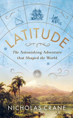
Latitude: The astonishing journey to discover the shape of the earth – Nicholas Crane

The year is 1735.
Twelve unruly men board ships bound for South America.
Their mission? To discover the true shape of the earth.
They will be exposed to a wilderness of dangers none can imagine.
The survivors won’t return for ten years.

They knew the world wasn’t a sphere. Either it stretched at the poles or it bulged at the equator. But which?

They needed to know because accurate maps saved lives at sea and made money on land. But measuring the earth was so difficult that most thought it impossible.

The world’s first international team of scientists was sent to a continent of unmapped rainforests and ice-shrouded volcanoes where they attempted to measure the length on the ground of one degree of latitude.

Beset by egos and disease, storms and earthquakes, mutiny and murder, they struggled for ten years to reach the single figure they sought.

Latitude is an epic story of survival and science set in mountain camps and remote observatories. A breathtaking tale of courage in adversity, it is celebrated today as the first modern exploring expedition.

The Uniqueness of India’s Geography

India, a country of over 1.3 billion people, is a land of incredible diversity, and its geography is no exception. From the snow-capped Himalayas to the sun-kissed beaches of the Indian Ocean, India’s geography is a testament to the country’s rich cultural and natural heritage. To celebrate India’s 77th Independence Day, here is something about this incredible diversity:

The Himalayas: The Roof of the World
The world’s highest mountain range, the Himalayas, stretches across India’s northern border, covering over 2,500 kilometres. They are home to nine of the world’s highest peaks, including Mount Everest, the highest peak on Earth. The Himalayas are not only a natural wonder but also play a crucial role in India’s climate and ecosystem. They act as a barrier, blocking the cold winds from Central Asia and keeping India’s climate relatively mild.

The Indo-Gangetic Plain: The Breadbasket of India
Stretching from the Himalayas to the Deccan Plateau, the Indo-Gangetic Plain, is one of the most fertile regions in the world. This plain is home to some of India’s most populous cities, including Delhi, Kolkata, and Lucknow. The Indo-Gangetic Plain is also the breadbasket of India, with the Ganges River and its tributaries providing water for irrigation and supporting agriculture.

The Deccan Plateau: A Land of Volcanic Origin
Covering 40% of India’s landmass, the Deccan Plateau is a region of volcanic origin. The plateau is triangular in shape and is characterised by its unique landscape of volcanic rocks, hills, and valleys. Located in the southern part of India, the Deccan Plateau is home to some of India’s most important cities, including Mumbai, Pune, and Hyderabad.

The Eastern and Western Ghats: The Spine of India
The Eastern and Western Ghats, two mountain ranges running parallel to the Deccan Plateau, are known for their unique biodiversity and geographical features. The Ghats are home to a wide range of flora and fauna, including many endangered species. The Ghats also play a crucial role in India’s climate, with the Western Ghats being responsible for the heavy rainfall in the region.

The Indian Ocean: A Vital Waterway
The Indian Ocean, which borders India to the south, is a vital waterway that connects India to the rest of the world. The Indian Ocean is home to many important ports, including Mumbai, Chennai, and Kochi. The ocean also plays a crucial role in India’s climate, with the monsoon winds bringing much-needed rainfall to the region.

The Thar Desert: A Harsh but Beautiful Landscape
Covering 10% of India’s landmass, the Thar Desert, also known as the Great Indian Desert, is one of the harshest environments in the world. The desert is characterised by its extreme temperatures, limited vegetation, and scarce water resources. Despite its harsh conditions, the Thar Desert is also home to a unique and diverse range of flora and fauna.

Coastlines: Long and Covering Two Seas and an Ocean
India has a long coastline that stretches over 7,500 kilometres, with the Arabian Sea to the west, the Bay of Bengal to the east, and the Indian Ocean to the south.

The Islands of India: A Treasure Trove of Biodiversity
India’s islands, including the Andaman and Nicobar Islands, the Lakshadweep Islands, and the Diu and Daman Islands, are a treasure trove of biodiversity. These islands are home to a wide range of unique and endemic species, including the Andamanese and Nicobarese tribes. The Andaman and Nicobar Islands are a group of islands in the Bay of Bengal, known for their unique flora and fauna, and their strategic location near the Malacca Strait.

The Rivers of India: The Lifeblood of the Nation
India’s rivers, including the Ganges, the Brahmaputra, and the Indus, are the lifeblood of the nation. These rivers provide water for irrigation, support agriculture, and are a source of hydroelectric power. The rivers also play a crucial role in India’s culture and spirituality, with many rivers being considered sacred. The Brahmaputra River is one of the longest rivers in the world, flowing through India, China, and Bangladesh, and is known for its unique geological features and biodiversity.

Wetlands: Diverse Ecolands
India has several wetlands, including the Sundarbans, the Vembanad-Kol Wetland, and the Chilka Lake. These wetlands are home to a wide range of flora and fauna and play a crucial role in maintaining the country’s ecosystem. The Sundarbans is the world’s largest mangrove forest, located in the Ganges Delta, and home to the Bengal tiger and other endangered species.

Roads: The Lifeline of the Country
India’s road network is the second largest in the world, spanning approximately 667 thousand kilometres. This extensive network includes national highways, state highways, district roads, and rural roads, ensuring connectivity across various regions of the country.

The Climate of India: A Region of Contrasts
India’s climate is a region of contrasts, with the country experiencing a wide range of temperatures, rainfall, and weather patterns. The climate varies from the tropical south to the temperate north, with the Himalayas acting as a barrier to the cold winds from Central Asia.

Geological Features
India’s geological features are diverse, with rocks from the Precambrian era to the present day. The country is home to several unique geological formations, including the Deccan Traps and the Himalayan mountain range. Mawsynram in Meghalaya is the wettest place on Earth, with an average annual rainfall of 11,873 millimetres. India has the world’s only floating post office on Dal Lake in Srinagar, which includes a philately museum.

India’s geography is a unique and fascinating topic that showcases the country’s incredible diversity and natural beauty. From the snow-capped Himalayas to the sun-kissed beaches of the Indian Ocean, India’s geography is a testament to the country’s rich cultural and natural heritage.