Mahasamund
One of Chaatisgarh’s largest and most important cities, Mahasamund is located about 55 km east of Raipur. It is also the biggest city in the Trans-Mahanadi area. Tourist sites in and around Mahasamund include Sirpur, the ancient capital of South Kosal and famous for its Lakshman temple, Buddha Vihar and many archaeological sites. The state government has decided to develop this area as a World Heritage site. Other nearby tourist sites include Kodar Dam, Rajim Kumbh, Rajiv Lochan Temple, and Khallari Temple. The birthplace of Mahaprabhu Vallabhacharya is in nearby Champaran.
Sirpur
Sirpur also referred to as Shripur, Sripura or Sripur which means a city of auspiciousness and abundance or Goddess Lakshmi is a small village located about 83 km east of Raipur and 38 km north of Mahasamund on the banks of river Mahanadi. The village is an archaeological wonder and is rich in its temple culture. The Buddhist monasteries of this village are said to be one of the most significant in India. The Chhattisgarh Tourism Board organises a music and dance festival here to promote Buddhist sites and celebrate its culture. There is also a major fair held here during Mahashivaratri.
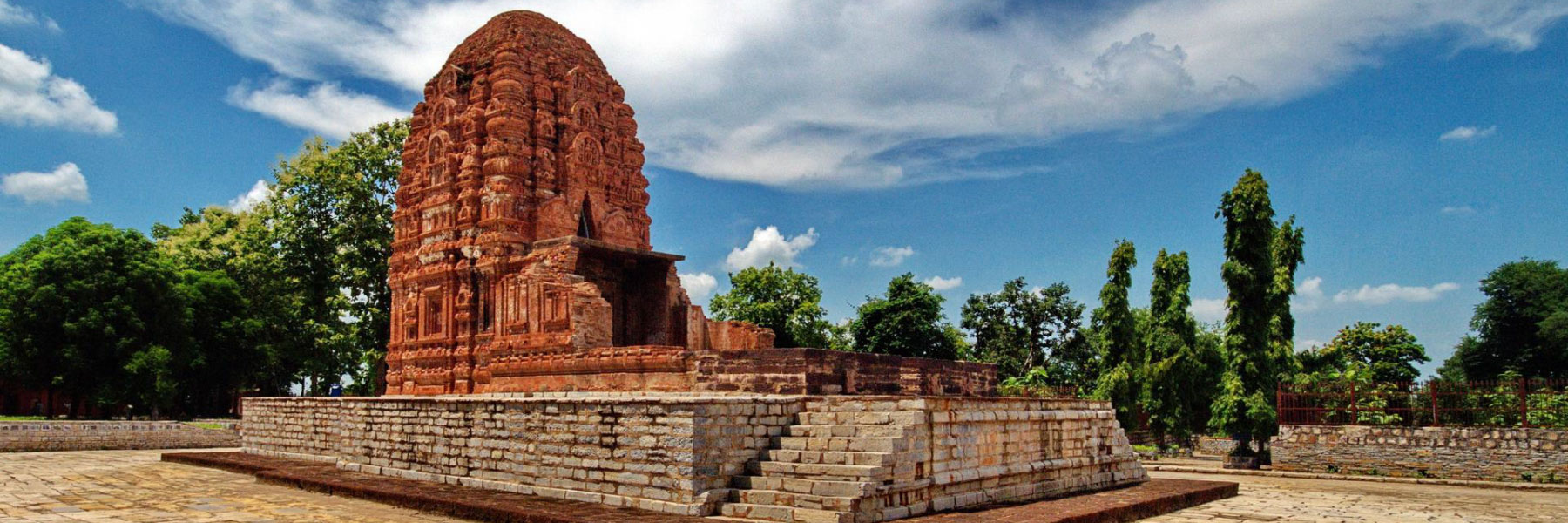
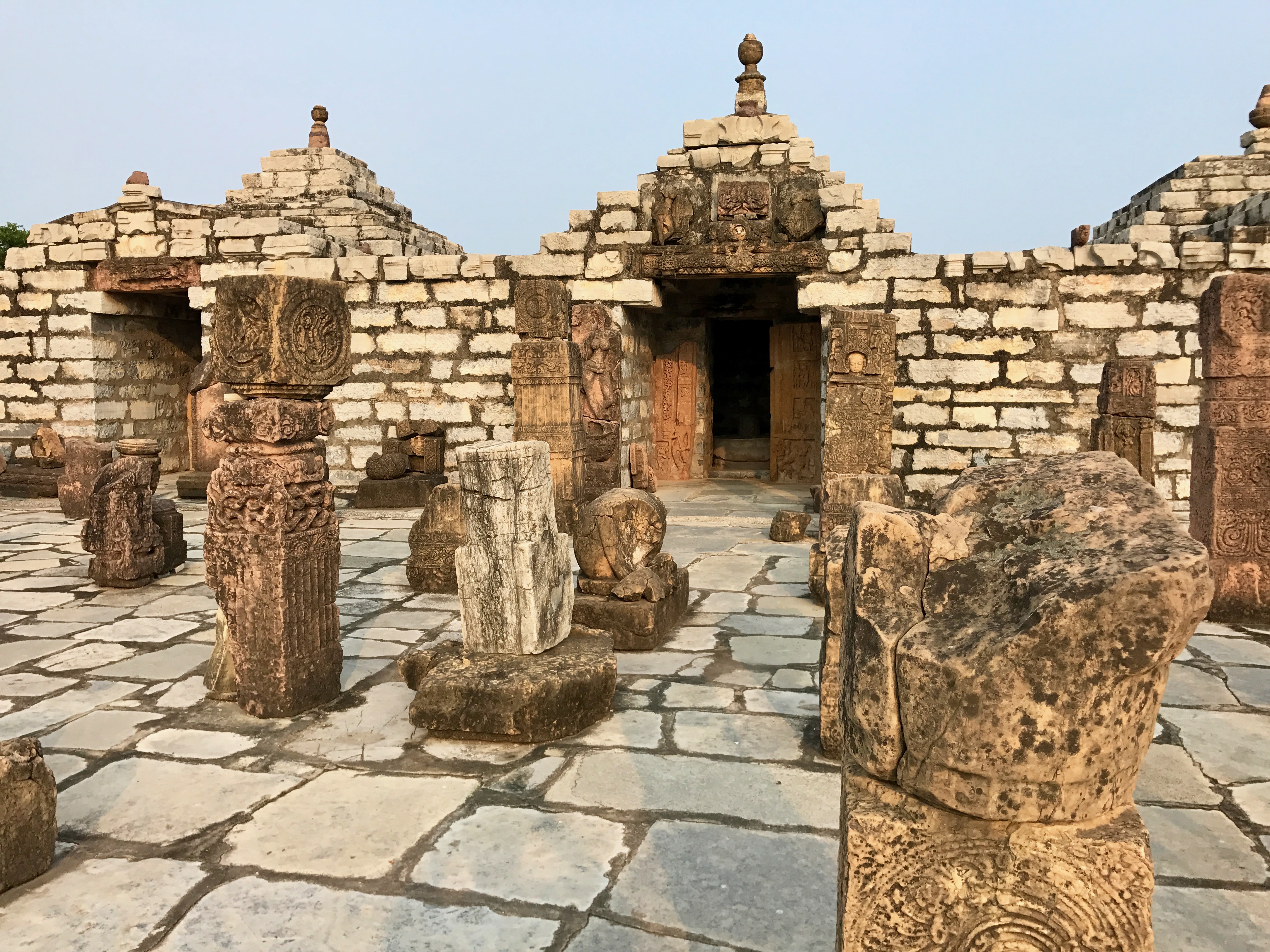
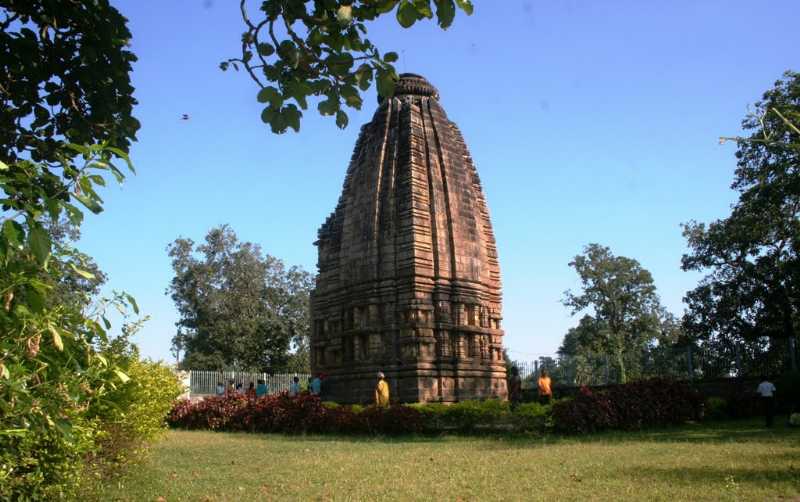
Sirpur was the capital of the Panduvanshi dynasty in ancient times and hosts the Sirpur Group of Monuments consisting of Buddhist, Hindu and Jain temples and monasteries that date from the 5th to the 12th centuries. The site has been significant for its temple ruins of Lord Rama and Lord Lakshmana, as well as those related to Shaivism, Shaktism, Buddhism and Jainism. In the second half of the 1st millennium CE, it was the capital city with major commercial and religious significance for the Dakshina Kosala kingdom. The earliest documented evidence states that it was first the capital of the Sharabhapuriya dynasty, followed by the Panduvamshi dynasty. The Sharabhapuriya dynasty itself is dated to the late 5th century CE, but inscriptions mention its first capital to be Sharabhapura, as yet an unknown site. The abundant inscriptions of the mid-6th century CE in the region mention the Hindu Shaiva king Teevardeva and 8th-century King Shivagupta Balarjuna establishing temples and monasteries for Hindus, Buddhists and Jains in his kingdom.
The Sirpur Group of Monuments are an archaeological and tourism site containing Hindu, Jain and Buddhist monuments from the 5th to the 12th centuries spread near the banks of the river Mahanadi. The site excavations after 1950, particularly after 2003, have yielded 22 Shiva temples, 5 Vishnu temples, 10 Buddha Viharas, 3 Jain Viharas, a 6th or 7th-century market and a snana-kund or bathhouse. The site shows extensive syncretism, where Buddhist and Jain statues or motifs intermingle with Shiva, Vishnu and Devi temples. The location is mentioned in the memoirs of the Chinese traveller Xuanzang as a location of monasteries and temples. A report by Alexander Cunningham, a British India colonial official in 1872 on a Lakshmana temple at Sirpur brought it to international attention.
The Lakshman Temple is one of the most popular spots in this village, and the architecture of this temple has been a constant inspiration for many architects. Believed to be lost, the Baleshwar Temple was excavated recently. It is named after king Mahashivgupt Balarjun, who built the temple and many of his items have been unearthed in the recently conducted excavation. Another interesting fact about this temple is that there are not one but three more temples in this place and they are all dedicated to the great Shiva. The Rama Temple is one of the oldest ones and is believed to be dedicated to Lords Ram and Lakshman. A popular attraction, it has a star-shaped platform called Jagati and the place is situated near the Lakshmana Temple. Popularly known as the Sirpur Buddha Vihara, the Buddha Vihara is an 8th-century Buddhist temple built by Bhikshu Anand Prabhu. Not far from the Lakshmana temple, Teevardev is a Buddhist monastery that had Buddhist artworks, statues and Hindu themes such as tales of Panchatantra. A beautiful meeting of Buddhist and Hindu architecture, this temple is believed to be built by Shaiva Khan and his Buddhist Queen.
The ASI Museum has a rich collection of artefacts collected over the years in the various site excavations conducted. The museum is situated right in the Lakshmana temple so it’s easily accessible and a must-visit.
Rajim
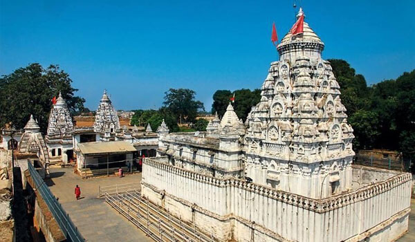
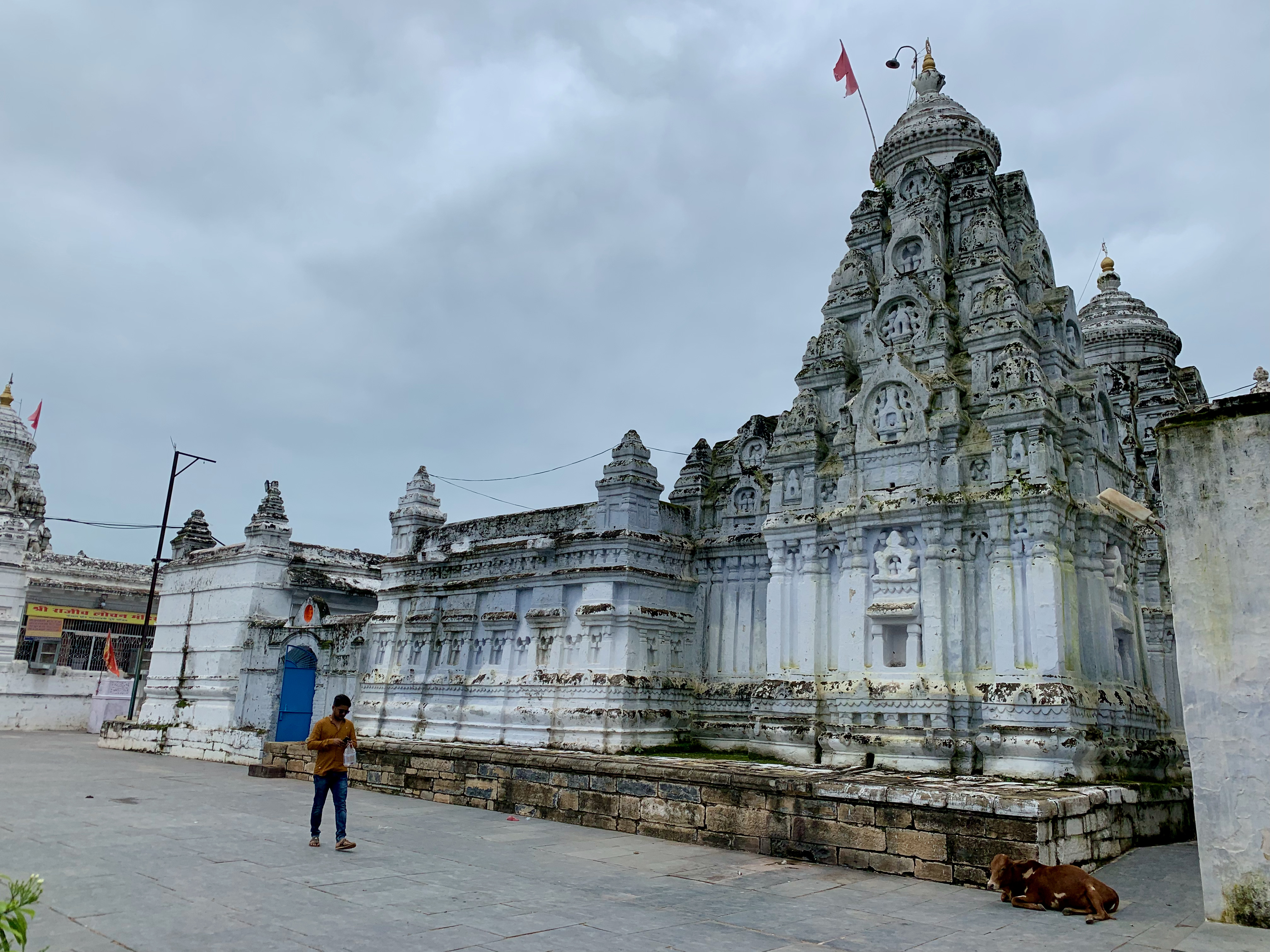
Rajim lies 52 km southeast of Raipur and is named after the Rajiv Lochan Mandir which is Rajim’s principal temple dedicated to Lord Vishnu. There is also the ancient Kuleshwar Mahadev Mandir dedicated to Lord Shiva in the Triveni Sangam. The town hosts the Triveni Sangam or confluence of Mahanadi, and Pairi Rivers, both physically & the Sondor river virtually. It is also known as the Prayag of Chhattisgarh. The Chhattisgarh Kumbh Mela takes place over here from Magh Poornima to Mahashivaratri every year. Pilgrims come together from several places across the country to take part in this auspicious event.
The Rajiv Lochan Vishnu Mandir is an ancient temple dedicated to Lord Vishnu. A 7th-century inscription recording the construction of the temple, dated to the reign of King Vilasatunga, has been found here. Vilasatunga probably belonged to a branch of the Nala dynasty. This temple is a notable example of the Panchayana Shaili or architecture. The temple structure is supported by twelve-towered columns embroidered with stone carvings, which bear the faces of the various gods of Hindu mythology. The temple is an important religious construct visited by devotees from all over the globe who arrive to offer their prayers to the Lord Vishnu. The statue of Lord Buddha in the meditative position under the Bodhi tree carved out of black stone is also popular in the city.
The Rajesvar Temple is located opposite the western entrance of the Rajiv Lochan Temple and comprises a mandapa, an antarala and a garba-griha. Its architectural style is regarded to be similar to the Rajiv Lochan temple. Other temples dedicated to the various incarnations of Lord Vishnu like the Vamana and the Narasimha are close to the Rajiv Lochan Mandir. The Kuleshwar Mahadeva Mandir stands in glory in the city even at night. The Ghatoria Mahakali Mandir is another temple on the banks of Mahanadi river. The Bhagavan Parashvanath Temple was constructed about 15 years back when some people found a 2000-old-year idol of Parshavanatha Bhagwan.
The Rajim Kumbh is celebrated every year around mid-Feb to March spread over 15 days and attracts thousands of Naga Sadhus, Sants, Mahatmas, Rishis, Munis and Margdarshak Gurus from across India and beyond. The Rajim Kumbh is arranged at the confluence of the three rivers in Rajim also known as Triveni Sangam. Within the same festival, the Rajim Lochan Mahotsav is held between 16 February and 1 March and has various music and dance performances showcasing Rajim’s rich culture.
Jagdalpur
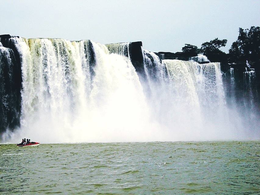
Previously the capital of the former princely state of Bastar, Jagdalpur is the fourth largest city in Chhattisgarh as well as the commercial, financial and political hub of south Chhattisgarh. Jagdalpur has a rich history of political activism and has developed a very rich culture over time. Today, it is most famous for the monuments and palaces in the city as well as the natural wonders like lakes, waterfalls and forests that are still untouched by tourist activity. Jagdalpur so one of the emerging destinations that are being aggressively promoted by the state tourism department. The town has a primarily agrarian economy and it is the second biggest market after Raipur in the state. It also has many small-scale and large-scale industries as well with furniture factories and rice mills being the most common industries in this region. Tourism is also a major source of revenue for the town which has plenty of wildlife, temples, waterfalls, caves, lakes, museums and historic monuments to cater to everyone’s tastes. The Indian Tourism Ministry has identified the Jagdalpur-Teerathgarh-Chitrakoot-Barsur-Dantewada-Teerathgarh Circuit as one of the 45 Mega Tourist Destinations and Circuits in India because of footfall and future tourism potential.
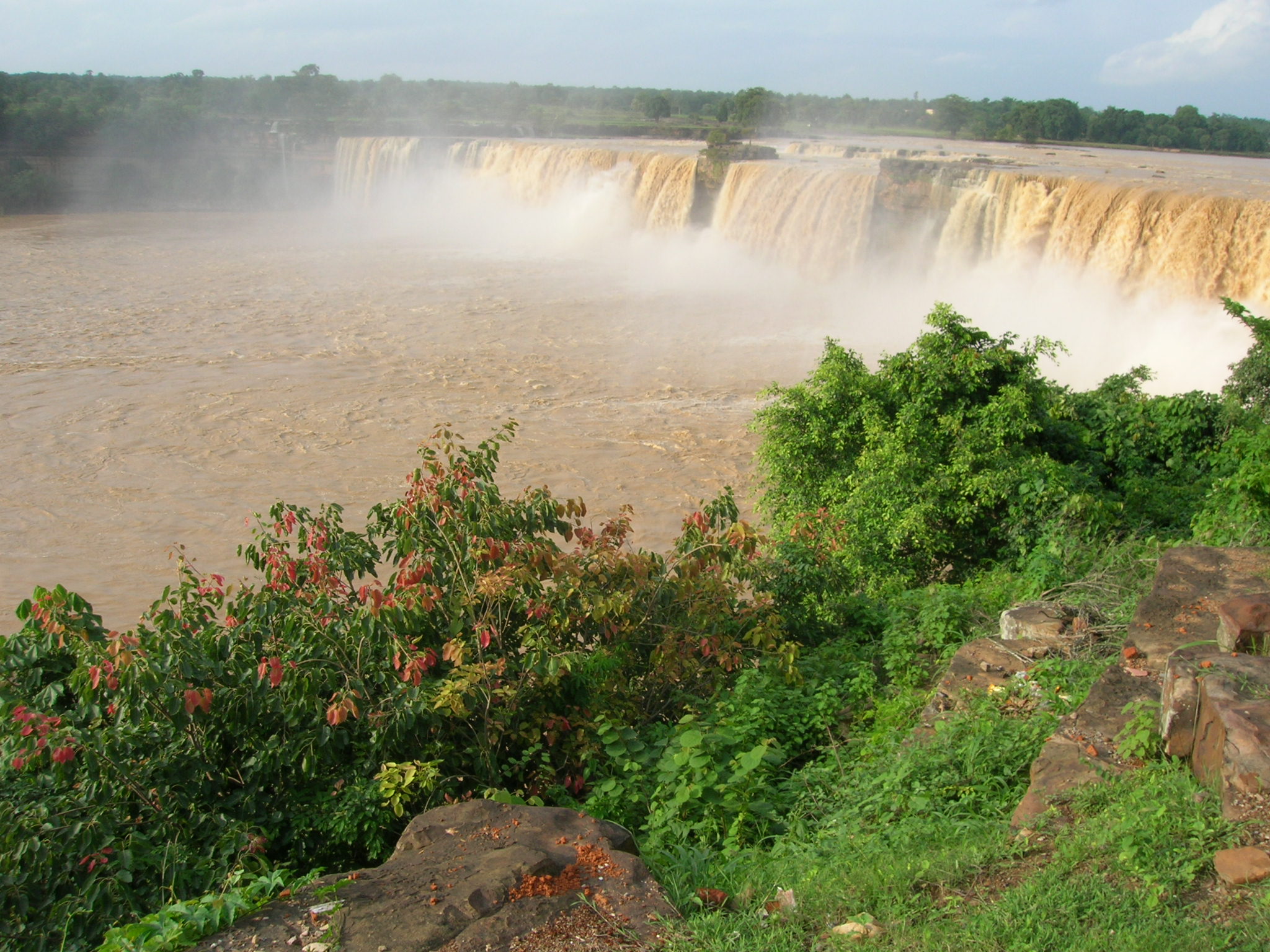
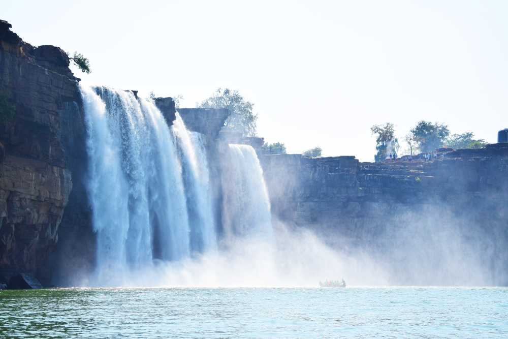
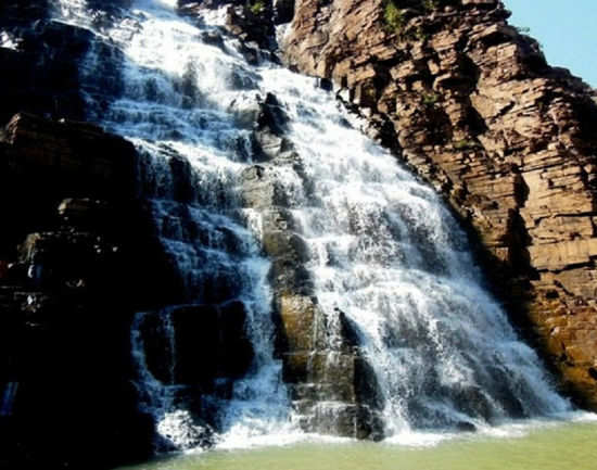
The broadest waterfall in India, Chitrakote is popularly known as the Niagara of India, because of its width. Situated on the western part of Jagdalpur, this waterfall originates from the Indravati river. The falls drop from a height of about 30 m with a width of 985 feet, and during monsoons, one can watch the falls at their full glory cascading from the top of the cliff in 3 streams during the summer months. A significant attraction below the fall is the shrine of Lord Shiva with many small shiva lingas. During the low season, locals and tourists are seen to be swimming, bathing or even using paddle boats on the river. The boat ride in the pool formed at the bottom of the waterfalls offers stunning views of the waterfall and boatmen can also take visitors up to the sprays and let them experience the gushing mist that emerges from the waterfalls. There is a flight of stairs that have to be climbed down to take the boat ride, the view from the bottom of the stairway is the best and provides for a great photo op.
A recent discovery, the Tamra Ghoomar Waterfalls are tucked away in a sequestered spot away from the city and surrounded by lush green pastures on both sides. A natural waterfall that falls from a height of more than 100 feet, the falls are usually formed during the monsoon showers. It is a 20-minute drive from Chitrakote falls and a perfect spot for a picnic. The Mendri Ghoomar Waterfall is another natural waterfall that forms during the monsoon months and is around 11 km from Chitrakote falls. Mendri Ghoomar is nestled between Chitrakote Barasur and Tirtha and is located in Jagdalpur. The height of descent of the falls is approximately 70 m with lush green covers enveloping the waterfall which overflows during the rains and has a more relaxed flow during the summer months.
A beautiful picnic spot, the Chitradhara fall is like a gorgeous white cascade of water gushing down the hill. Situated in the small and remote village of Potanar, the Chitradhara fall takes the form of a horseshoe and the water is seen to be gushing down at a breakneck and exciting pace, making it an excellent spot for outdoor and adventure lovers. Not as glorious and big like the Chitrakote falls, Chitradhara is less popular and gives the tourist an experience of a remote village and surrounded by serenity.
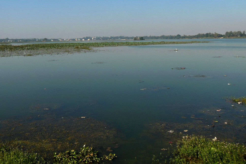
Chhatisgarh’s biggest artificial lake on the River Indravati, Dalpat Sagar is a 400-year-old lake built primarily to harvest rainwater and is now also being used mainly for fishing and tourism. There is an artificial island built in the middle of the lake for visitors to enjoy picnics and the island has a light tower, a musical fountain and even a temple surrounded by nature. The government has also started boating facilities for tourists so that they can enjoy the gorgeous sunsets. Spread over an area of 350 hectares, this lake was built by Raja Dalpat Deo Kakatiya so that the collected rainwater could be used for irrigation, washing and drinking. The surroundings of the lake have some rare and beautiful flora and fauna too. Dalpat Sagar is constructed across 350 hectares of land in the river Indravati. It is situated in the Bastar region and was built 400 years ago by Raja Dalpat Deo Kakatiya for harvesting rainwater. The lake undergoes maintenance by the Government of Chhattisgarh. There is an island constructed in the centre of the lake which is accessible by boats. There are also platforms built across the lake at different points for the boats. All this makes it very convenient for the visitors to enjoy their visit to the lake.
The Danteshwari Temple is dedicated to Goddess Danteshwari, the deity of the earlier Kakatiya rulers, also known as an incarnation of Shakti. Built in the 14th century, the temple was constructed in a typical south Indian style of architecture. Chiselled out of black stone, the idol of the Goddess is supposed to possess divine powers. Every year during Dusshera, all tribals and locals from the surrounding towns and villages come here to pay respect to the Goddess. Situated in the middle of a spacious courtyard with beautiful pillars, the temple has four parts that a visitor can explore. An important spiritual centre, the temple is known to represent the cultural and religious beliefs and the history of the Bastar region. The temple is considered one of the fifty-two Shakti Peethas of Sati, and it is believed that the tooth of Sati fell here. The temple is divided into four parts which include the Garbh Griha, the Maha Mandap, the Mukhya Mandap and the Sabha Mandap. The Garbha Griha and Maha Mandap are made of stone pieces and there is a Garuda pillar located at the entrance of the temple. The idol of Goddess Danteshwari is chiselled out of black stone.
Popularly known as the Balaji temple, the Venkateshwara Swamy temple is dedicated to Lord Balaji or Shri Venkateshwara Swamy, the lord of the universe. The temple architecture is typical of the South Indian style and is very impressive. Initially a famous pilgrimage destination for only locals, today this temple attracts visitors and Hindu pilgrims from all over.
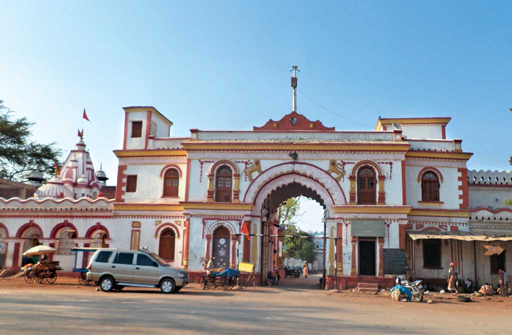
Dating back to prehistoric times, the Bastar palace used to be the chief administrative building of the Bastar district. Constructed by the kings of Bastar, this palace is home to some of the most beautiful figurines, etchings and drawings on the ceilings and walls. With wide corridors and a beautiful garden in the front, the palace makes for a perfect day trip from Jagdalpur. The main visitor room has been transformed into a museum which consists of thrones and paintings. The palace is lit up during the Dussehra festival. There are vibrant and green enclosures located outside the palace that includes a variety of flora which enhances the surroundings.
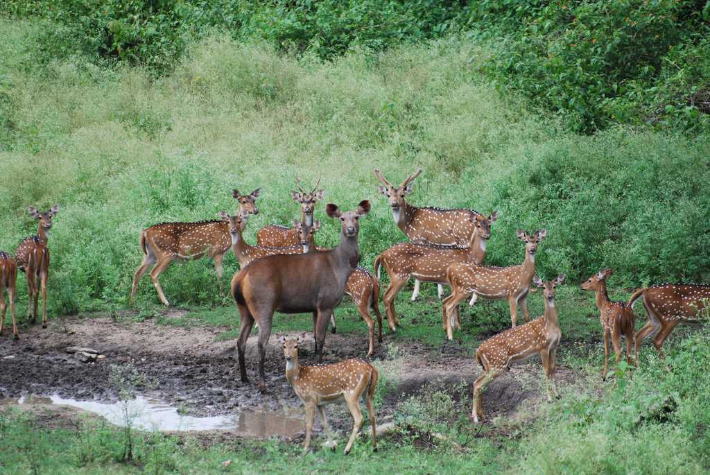
Deriving its name from the Indravati River, the Indravati National Park is located about 386 km south of Raipur. The Indravati River flows from east to west and forms the northern boundary of the reserve with Maharashtra. One of Chhatisgarh’s three Project Tiger reserves and home to one of the last remaining populations of the endangered wild water buffalo, the park has a total area of approximately 2799.08 sq km. Indravati attained the status of a national park in 1981 and a tiger reserve in 1983. As of 2022, the park is reported to be largely under Naxal control.
The park is best visited during the winter and summer seasons between November to June. Indravati National Park is easily approachable from Jagdalpur with Kutrue as the main entry point which is about 145.6 km from Jagdalpur. The park is open daily from 7 am to 6 pm.
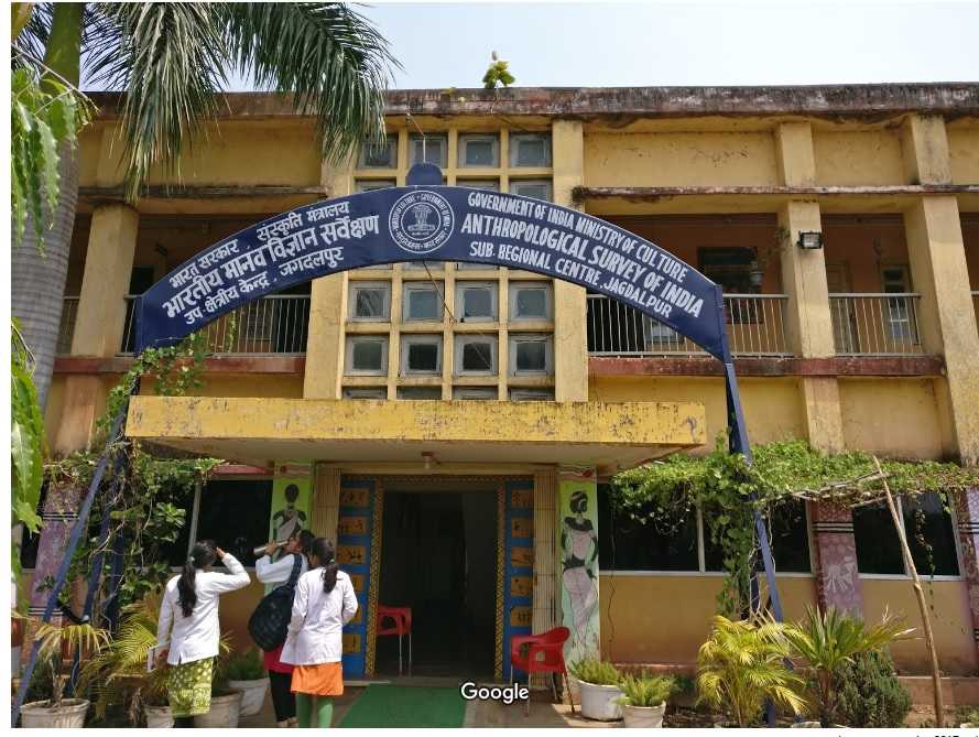
The Zonal Anthropological museum situated in the office of the Anthropological Survey of India, located 4 km away from the town was established in Jagdalpur in 1972, to provide an insight into the culture and lifestyle of the Bastar tribe. The museum has a brilliant and well-curated collection of ethnographic items that shed light on the life of the Bastar tribes. Artworks depicting their daily life, sculptures, and a variety of objects like clothes, footwear, headgear, ornaments, wood carvings, weapons, utensils and masks among many others can be seen here. The museum is open from 10 am to 1:30 pm and then between 2 to 5:30 pm.
Dhamtari
Dhamtari which lies about 80 km south of Raipur was home to the Chalukya empire of the 14th century and is an important tourist town known for its temples. Its name comes from Dhamma and Tarai which means the plain of Dhamma, which alludes to its Buddhist origins. Situated in the fertile plains of Chhattisgarh due to the presence of many rivers and their tributaries, the chief crop of this region is paddy. Asia’s first-ever Siphon dam was built in 1914 at Madamsilli. The town attracts many tourists every year, particularly during the monsoon season to the Ravishankar Water Dam and is also famous for its folk culture and wildlife sanctuary. Formerly a part of the Raipur district in Madhya Pradesh, Dhamtari later became part of the new state of Chattisgarh and was a popular stop on the Bombay-Calcutta railway line passing through it.
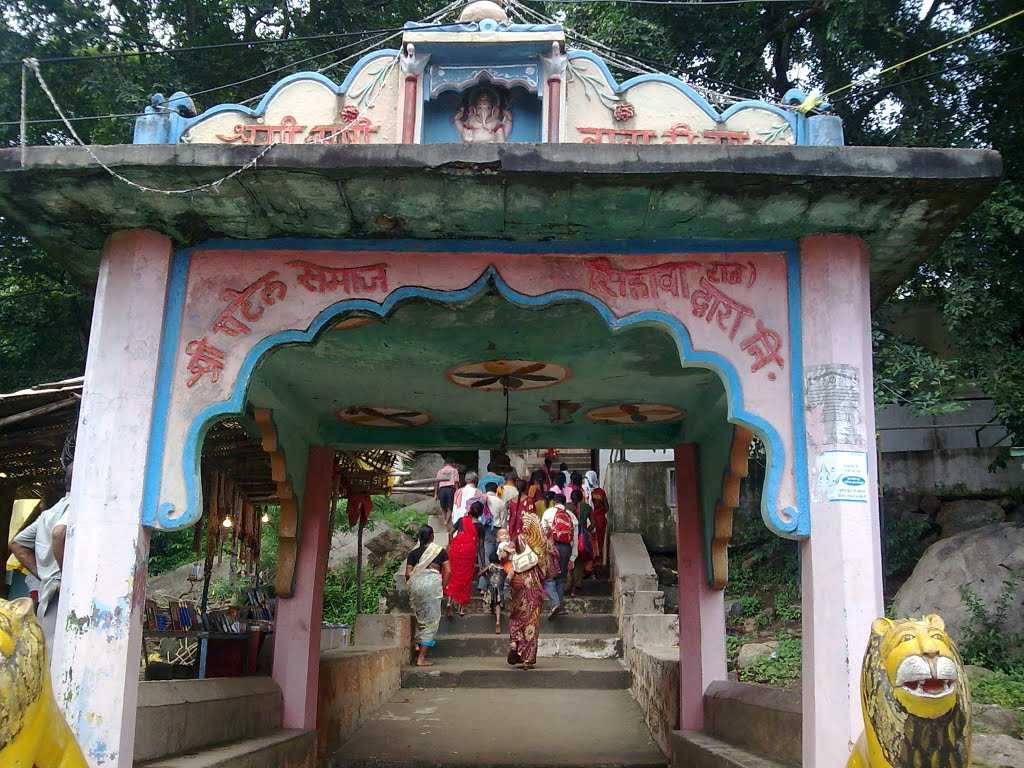
Sihava is one of the most important pilgrimage centres situated on the banks of the Mahanadi River and is surrounded by forests and mountains. Amrit Kund, the Danteshwari Cave, Ganesh Ghat, the Karbeshwar Temple and the Ashram of Hringi Hathi Khot are other major attractions in this area. The Bilai Mata Mandir is dedicated to Goddess Durga and is a beautiful temple known for its exquisite architectural carvings.
Rudri was believed to be the capital of the Kanker Kingdom during the reign of Rudra Dev. Located on the banks of River Mahanadi is its prime tourist attraction is the Rudreshwar Temple and there is also a large reservoir built nearby.
Gangrel Dam is the longest in Chhatisgarh and has been built across the Mahanadi River. A stunning feat of architecture, the dam length is a whopping 1,830 m, approximately 15 km from Dhamtari. The dam overlooks the swift torrents of the Mahanadi River making it an enjoyable sight. On the banks of the waters, there are several resorts and sandbanks. The dam was built to perform various activities such as irrigation, generating power and also to provide water to the Bhilai Steel Plant and the city of Raipur. The immediate surroundings of the dam are well-maintained and have landscaped gardens and a beautiful view of the catchment area. Water sports are a recent addition and visitors can go jet skiing, paddle boating and speed boating in the catchment area. The best time to visit Gangrel Dam would be during the monsoon season from July to September as the reservoir fills up and the high tides are a beautiful sight. The views of sunrise and sunset here are also popular.
The Charre Marre Waterfalls is a refreshing and offbeat place to visit where the waterfall is 16 m high and the clear water falling is a sight to see. The bountiful and pristine Jogidhara river is the reason behind the waterfall. The reservoir that forms at the bottom of the waterfall is perfect to take a dip in. The Shivani Temple is an important pilgrim place dedicated to Goddess Shivani and is visited by a large number of devotees every day. The falls are perfect for picnics and a perfect getaway destination to rejuvenate the body and soul. The monsoon season between October to December is the best time to visit the falls.
Dantewada
Also known as Dantewara, Dantewada lies about 357 km south of Raipur. Dantewada was known as Tarlapal and Dantawali in pre-historical days. It is the fourth largest city in the Bastar region and the town is named after the Goddess Danteshwari, the presiding deity of the Danteshwari Temple located in the town.
Encompassing hilly tracks, dales & valleys, numerous brooks & rivers, and lush green and virgin forests, Dantewada is a paradise to nature lovers. Apart from the Goddess Danteshwari Temple, Dantewada has many ancient and historically important temples and structures. Dantewada is inhabited by several tribal groups and watching the famous Dandami Mariyas or Gonds of Bison Horn dancing in groups, wearing a turban with the Bison Horns is certainly a treat to the eyes. The town also houses the recently developed stretch of Rowghat mines. However, currently, the area is affected by Naxalism and well-versed research is advisable before heading out into the area.
One of the Shaktipeethas, the Danteshwari temple is dedicated to Goddess Danteshwari. This 600-year-old temple has been constructed in South Indian style of temple architecture in the 14th century by the rulers of the Chalukya Dynasty. The goddess is worshipped as an incarnation of Shakti and the temple is held to be one of the fifty-two sacred Shakti Peethas. it is believed that the tooth of Sati fell here. The temple is known for its black stone idol and a Garuda pillar and is segregated into four zones, namely the Garbha Griha, Mukhya Mandap, Maha Mandap and the Sabha Mandap. It is located at the confluence of the holy rivers Shankini & Dhankini. The Bastar Dusshera is the longest festival in the world which is the world’s longest festival.
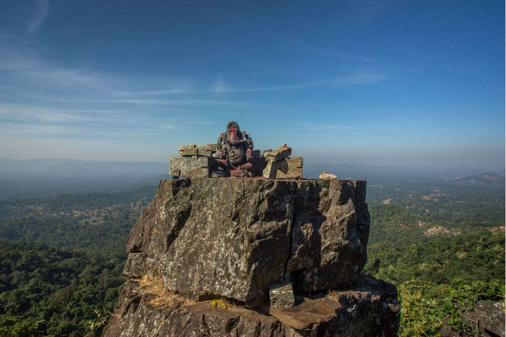
Dholkal Ganesh is a beautiful spot located 3000 feet high in the Bailadila mountain ranges. A 3 feet beautiful stone idol of Lord Ganesha believed to be made during the Naga dynasty between the 10th and 11th centuries is the main attraction here. Located 13 km from Dantewada, this is the perfect spot for nature lovers, and for those who love to trek amidst lush green hillocks.
Once the capital of Nagavansh Raja Banasur, Barsur is filled with archaeological treasures. The town of the Gangawanshi rulers who ruled in the 9th century, Barsur is located on the banks of the river Indravati and is known as the city of temples and ponds because of the 147 temples and 147 ponds located here. Along with the ruins of various temples, the Battisa Temple, the Mama-Bhanjaa Temple and the Chandraditya Temple can also be visited. The Chandraditya Temple crafted out of sandstone is a major attraction here. Besides a huge statue of Lord Ganesha, an ancient pond can also be visited. Housing idols of Lord Ganesha and Lord Narasimha, an incarnation of Lord Vishnu, the Dravidian-style Mama-Bhanjaa Temple is well known for its sculpted murals and the dome that is 50 ft high. There is also Shiva Temple and a Ganesha Temple situated close to the Mama-Bhanjaa Temple.
The Fulpad Waterfall is a waterfall located in a lush green hilly area. Recently, the administration started river rappelling to boost tourism in the area. The Saathdhara Waterfalls are located about six km from Barsur with a bridge which connects Abujhmarh with Barsur. The bridge is on the Indravati river and reaching the bridge, there is a trek of around two km to reach the waterfall. The Indravati river streams are separated by seven sub-streams and flow through rocky terrain and form the Saathdhara waterfall.
Kanger Ghati National Park
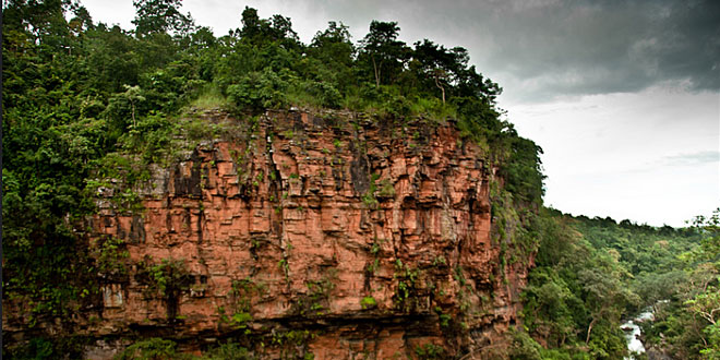
Known as one of the densest national parks in India, the Kanger Ghati National Park lies about 320 km south of Raipur and offers rich biodiversity, breathtaking landscapes, natural waterfalls, and beautiful limestone caves. It is also home to Chhatisgarh’s state bird, the Hill Myna. The park is spread over 200 sq km and is a biosphere reserve nestled amidst the stunning Kanger Valley which stretches for 34 km. The park consists mainly of aberrant terrain and is home to a sizeable tribal population.
The park is named after the river Kanger, which flows through it. It was declared a national park in 1982 and the park has notable geographic diversity with land formations ranging from gentle low areas to valleys, steep slopes, streams and more. And because of this, there is a wide variety of flora and fauna inside the park, making it a prominent biodiversity hotspot in India. The River Kanger is the lifeline of this park as the park is dependent on the river for electricity generation.
The Kanger Valley happens to be one of the last regions where virgin and pure forests are still left. There are According to various surveys, there are 555 herbaceous species in the park, out of which 45 species are said to be rare, and 12 species are new and recently added. Moist deciduous forests mainly cover the forest area of the park. November to April is the best time to visit the park when the temperatures are cold with a clear to cloudy sky. The park has about 50 species of mammals, 145 species of birds, 56 species of fish, 16 species of amphibians, 90 species of butterflies, 110 species of spiders, and 25 species of moths.
Bhainsa Darha is a pure and natural water pool. Bhainsa means buffaloes and Darha translates to water pools created by rivers. Crocodiles and tortoises found in the water make a great attraction and because the pool is covered with lush greenery in all directions, it is ideal for a picnic or hike. The Darha remains closed during the rainy season, so the ideal time to visit this place is during the winter months. Travelling by bikes and other two-wheeled vehicles can get risky as roads here are narrow and slippery and so it is advisable to travel in a car.
The Kanger Dhara Waterfall is a picnic spot located inside the park. Permission from the District Forest Office is required and this can be gotten at the entry gate of the park to enter the waterfall area. The cascading falls are attractive to look at and one can also take a bath in the natural waters. Summers are the best time to visit the waterfall when the water temperature is comfortable to take a dip. The falls remain closed during monsoons.
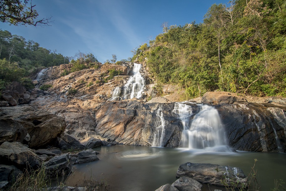
Tirathgarh Falls is one of the most frequented tourist spots in Chhattisgarh and provides one with the perfect blend of entertainment, fun, picnic and adventure. Tirathgarh Falls is also regarded as one of the best picnic spots in Jagdalpur with the fall’s unique feature being that it splits into multiple falls on its way down, offering a spectacular view to visitors. This block-type waterfall plunges 300 ft in one drop. This mesmerising waterfall is also named the milky fall as the water takes on a white colour while gushing downward. There is a small temple located beside the falls, and the lush, green forest surrounds the entire region. Tourists can also climb down to the base of the fall and indulge in a bath with two hundred and ten steps leading the way to the bottom. The waterfalls are surrounded by a dense cover of trees and hence the temperature is moderate. The best time to visit the Tirathgarh falls is during the early winter season as the temperature during this time is cool and pleasant. During this period, the flow of water is strong and wide and hence the falls have many tourists visiting.
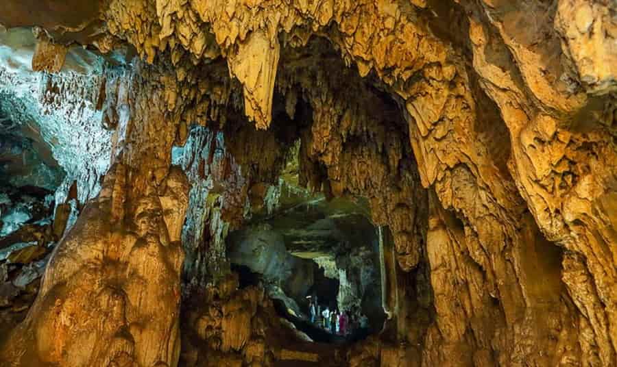
The park has vast limestone deposits. Some are in the form of caves and the rest are in the form of beds or layers. The limestone caves are a significant tourist attraction and are spectacular to look at with the main ones being the Kailash Cave, the Devgiri Cave, the Dandak Cave, and the Kotumsar Cave. These structures take millions of years to form and there are still some caves in the park which do not have an opening and remain undiscovered.
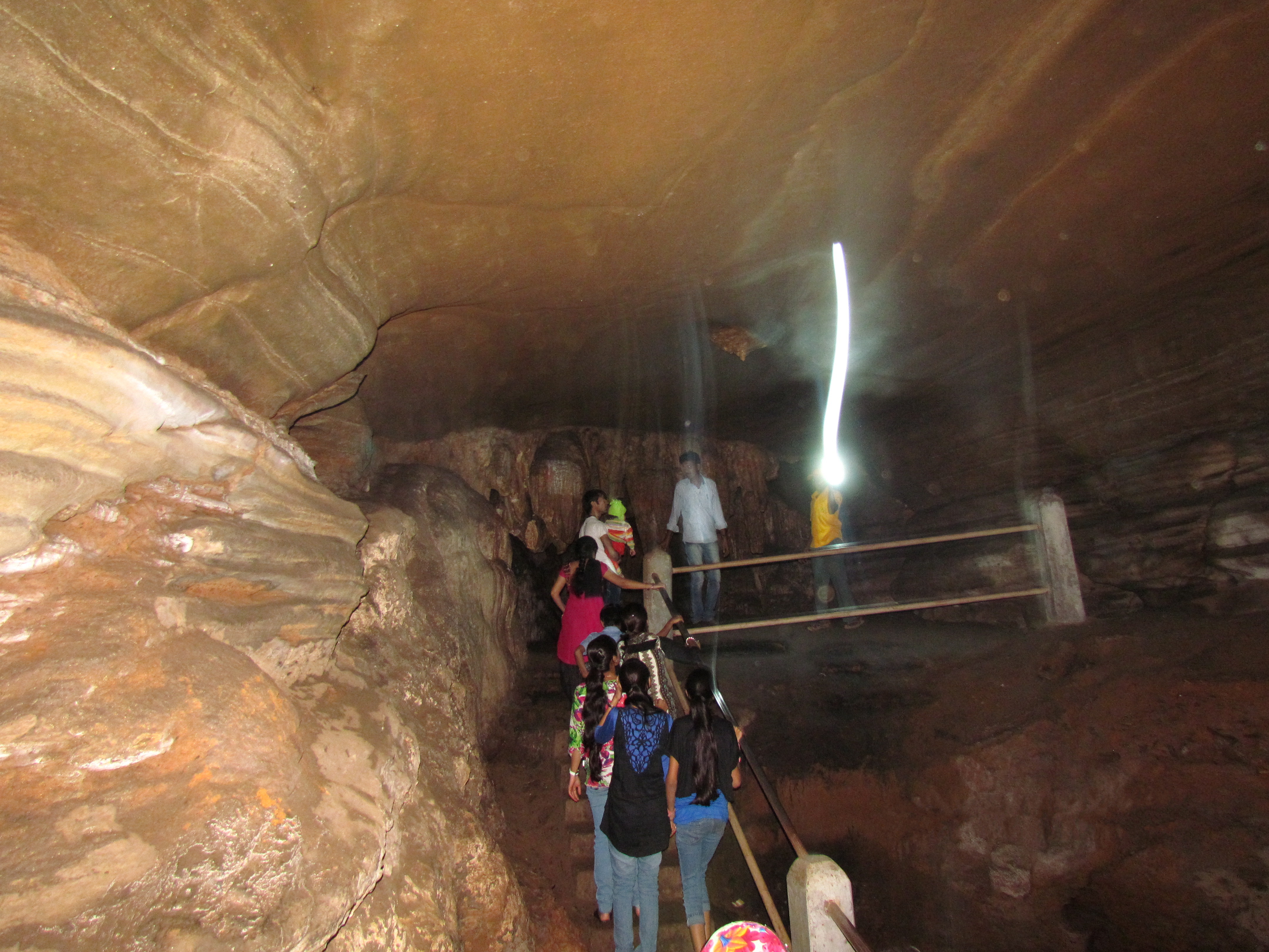
Located near Tirathgarh falls, the Kailash and Kutumsar caves are underground caves situated 35 meters below the ground level. With a length of two km, these are considered to be the second-longest natural caves in the world. With incredible formations of stalactites and stalagmites, the caves contain five chambers. The caves have rocky floors with water pools in several spots and have no natural light inside the cave. There is one stalagmite formation in the shape of a shiva linga towards the end of the cave. The Kailash and Kutumsar caves are only accessible to a certain extent because of the lack of oxygen.
The Kotumsar Cave stretches for about 1370 m and has frequent depositions of limestone since it lies in the Kanger limestone belt. The cave also has significant ecological importance and has also attracted researchers. The enormous vertical fissure formed in the wall of the hill acts as an entry point to the cave. There is a concrete path created which extends to the end of the cave. The main tunnel of the cave is 200 m long with many lateral and downward passes. The cave is one of the most biologically explored caves in India and many new species of living creatures including plants and animals have been considered to be sourced from these caves. Recently in 2011, a new chamber has been discovered by groups of forest officials, but because of its low accessibility and other potential dangers, it is not open to tourists. There are several interesting tribal tales attached to the caves. The caves also house several species of reptiles and insects.
The Kailash Caves were discovered in 1993 and are around 250 m long and 40 m underground, these limestone caves have religious links attached to them. At the end of the caves, one will find a magnificent structure in the shape of a Shiva ling with hollow walls of the cave. When struck, the walls reverberate soothing and acoustic musical sounds. The best time to visit the caves is during the winter season. This is due to the weather being cold and pleasant. The monsoon season is considered the offseason because there is heavy precipitation in the valley and the accumulation of water in the cave makes it dangerous to visit the cave for the tourists.
And this brings us to the end of this yet unexplored state known for its natural beauty and remoteness. I didn’t have any idea of how much this state has to offer before I started working on this mini-series, but now that I know, I can’t wait to explore it further. Let me know if you have been to Chhatisgarh and let me know if I have missed any place that must be seen and visited.


