Travel Bucket List: India – Chattisgarh Part 3

Achanakmar Tiger Reserve
The Achanakmar Wildlife Sanctuary is a sanctuary about 146 km north of Chattisgarh’s capital, Raipur. It was established in 1975, under the provisions of the Indian Wildlife Protection Act of 1972, and declared as a Tiger Reserve under Project Tiger, in 2009. It is a part of the Achanakmar-Amarkantak Biosphere Reserve. As of 2021, the area is reported to be under heavy Maoist influence.

Linked by the hilly Kanha-Achanakmar Corridor to the tiger reserve in Kanha in Madhya Pradesh, the sanctuary comprises 557.55 sq km of forest. The park is part of the Mungeli and Bilaspur Forest Division in northwest Chhattisgarh. The sanctuary is close to Amarkantak, the source of the Son River and Narmada River.

Categorised as a tropical deciduous forest, Achanakmar Tiger Reserve is breathtakingly beautiful with the most varied flora and fauna. This tiger reserve is a part of the huge Achanakmar-Amarkantak Biosphere Reserve, and hence, it is home to more than 600 species of different medicinal plants. The scenic Maniyari River flows right from the centre of this reserve which is the lifeline of the forest.

The Achanakmar Wildlife Sanctuary was established in the Mungeli district in 1975, under the Indian Wildlife Protection Act and its provisions. It was declared a Tiger Reserve under the Project Tiger initiative of 2009. A short trek through the park is enough to reveal its outstanding biodiversity and mesmerise the visitors. This prominent wild tourist hub is spread over 557 sq km of area. The natural sanctuary attracts wildlife enthusiasts from several places and promises to astonish you with its varied biodiversity. The wildlife sanctuary also has a restaurant, coffee house and other facilities on its premises. There are forest cottages and resorts that provide accommodation to visitors. Travellers are advised to make their bookings in advance if they are planning on staying.

A visit to Achanakmar Tiger Reserve would be incomplete without a jungle safari which starts each year from November and go on till June, however, the peak tourist period is between November and January. The park remains closed during the monsoons, between June and October. There are two safari options and one can take either a bus or a jeep safari. The jeep safari runs between 6 and 10 and then again between 3 to 7 pm. The costs range from INR 2,000 to INR 3,000 per jeep and each jeep can carry six tourists, one guide and one driver. The bus safari timings are the same as the jeep safari and the cost is INR 500 per person. A bus safari carries 20 tourists plus the driver.

Bilaspur
Also known as the City of Festivals, Bilaspur lies about 117 km northeast of Raipur and is the administrative headquarters of the Bilaspur District and Bilaspur Division. Situated on the banks of the rain-fed Arpa River, which originates from the Maikal Range of Central India, Bilaspur is a dolomite-rich region surrounded by dense forests in the north and the coal mines of the Hasdeo Valley in the east. It is also known as Chhattisgarh’s Law Capital because the state’s High Court is located here. This city is the commercial centre and business hub of the northeast Chhattisgarh region and an important city for the Indian Railways, as it is the headquarters for South East Central Railway Zone or SECR and the Bilaspur Railway Division. Chhattisgarh’s biggest power plant operated by NTPC is in Sipat which pools electricity from other power plants in the region and transmits electricity to Delhi via one of the longest HVDC lines. Bilaspur is known for its aromatic rice variety known as Doobraj rice and handloom woven colourful soft Kosa silk sarees.

Historically, Bilaspur was part of Dakshina Kosala and was near the capital of Malhar. From the 5th century onwards it was controlled by the Kalachuri dynasty of Ratanpur, the historical capital of Chhatisgarh state for many different dynasties. Bilaspur city, however, came into prominence around 1741, the year of the Maratha Empire rule, when a Maratha official took up his abode there to control the dynasty of Ratanpur. The British took over Bilaspur under the British East India Company in 1818 after Bhosales lost territory in the Third Anglo-Maratha War. After India’s independence, the Bilaspur district was constituted in 1861, followed by the Bilaspur municipality in 1867.

Guru Ghasidas who lived between 1756 and 1836 started a religious movement, Satnamis meaning the worshippers of Satnam, between 1820 and 1830 primarily around the Sonakhan forests. This religious movement preached against idol worship and instead stressed that God is synonymous with truth. His community was a farming community. The university at Bilaspur is named after him as Guru Ghasidas University.

Historical records like Imperial Gazetteer of India, Vol 8, 1908 note that the city is said to be named after a fisherwoman by the name of Bilasa who lived in the 17th century, and for a long period it consisted only of a few fishermen’s huts. Another book called The highlands of Central India authored by James Forsyth and published in 1889 states that Bilaspur is named after the Palash tree or the Flame of the Forest which is found in abundance in the area.

Bilaspur is rich in archaeological sites and temples that attract tourists from all over the world. There are more than 20 centrally protected monuments and sites by the Archaeological Survey of India nearby. The Achanakmar Wildlife sanctuary is one of the renowned ecotourism spots in the state while the Hasdev Bango Dam which lies 105 km from Bilaspur is also a must-visit place.

Malhar and Ratanpur are centres of archaeology with ruins of forts and ancient temples found here. Malhar is of historical significance, as it was visited by Xuanzang, the Chinese historian and is situated about 40 km from Bilaspur. Many ancient temples have been found such as the Pataleshwar temple, the Devri temple and the Dindeshwari temple. The four-handed idol of Lord Vishnu is also significant as it is the earliest sculptural representation of Lord Vishnu. There is also a museum at Malhar. Ratanpur is well known for its Mahamaya temple and Ram Tekri Mandir. Talagram is where the Deorani-Jethani temple is located while Tala which lies about 20 km away, is famous for the Rudra Shiva temple. There is an ancient Shiva temple near Kirari Godhi, which is from the 11th or 12th centuries as well as the Dhoom Nath temple dedicated to Lord Shiva which is said to belong to the 12th century and is constructed by the Kalchuri dynasty.

Source

Belpan has a huge pond as well as samadhi while Khutaghat is a scenic spot and is frequented by nature lovers. Forests, dams and hills surround Khutaghat and the Kabir Chobutara about 41 km from Bilaspur is a hub for saints. Sonmuda is another tourist attraction which gives a panoramic view of valleys, hills and forests. The River Sone originates here while the Narmada and Son Rivers originate in Amarkantak.

Raigarh
Known as Chattisgarh’s Cultural Capital or Sanskardhani, Raigarh lies in the eastern part of the state about 246 km northeast of Raipur. It is also known for its coal reserves and power generation for the state as well as the country. A rapidly growing industrial city and home to one of the oldest jute mills in India, Raigarh is also a major producer of steel and iron ore as well as a major rice-producing district.

The tradition preserved by the ruling family of the erstwhile state of Raigarh maintains that the Raj Gond family migrated to this region from Bairagarh or Wariagarh of the Chanda district of Maharashtra around the beginning of the 18th century and first stayed at Phuljhar and from there Madan Singh, the head of the family migrated to Banda of the present-day Raigarh. Before Indian Independence, Raigarh was the capital of the princely State of Raigarh and after independence, the state was one of the first to join the Union of India. The palace, Moti Mahal is in dilapidated condition and has recently been declared a heritage site by the state government. The Rajas of Raigarh also owned the estate of Bargarh and so held the title of Chief of Bargarh. Around 1625, the Raja of Sambalpur installed Daryo Singh as the Raja of Raigarh. However, under the British, it became a princely state only in 1911, during the reign of Raja Bahadur Bhup Deo Singh. The last ruler was Lalit Kumar Singh, his son succeeded him to the throne of Raigarh and ruled briefly before Raigarh State was merged into the Union of India.

Raigarh derives its name from the fort named Rai, hence Raigarh and was established by Raja Madan Singh at Munga near the river Mahanadi. Raigarh is well known for its Kosa or Tussar, a kind of fine silk created by the silkworm feeding on mulberry fruit. Dhokra or bell metal casting is the world acclaimed art form of Raigarh. Based in the village of Ektaal, the bell metal structures are noted for their aesthetic value. The leaf of the tendu tree or the Asian ebony tree which is widely found in central India and used to make bidis, the poor man’s cigarette is one of the major sources of income for villagers in the district. Places to visit in Raigarh include the Pahad Mandir at Gajmar Pahadi, the Ram Jharna in Bhupdeopur, Teepa Khol, and the Maa Chandrasini Devi Temple at Chandrapur, and the Banjari Mandir situated in the Raigarh-Tamnar road.

Korba
Previously part of Bilaspur district, Korba lies about 205 km northeast of Raipur and is an industrial town. Known as Chhatisgarh’s power capital due to its coal reserves and thermal power plants, Korba also has Asia’s second-largest and India’s largest open-cast coal mine in the Gevra area of Korba Coalfield. Korba produces 140 million tonnes of coal annually which accounts for 17% of the country’s total coal production and 85% of Chhattisgarh’s coal production. Korba is home to the protected tribal tribe Korwa or Pahadi Korwa and is blessed by lush green forests all around and is a tribal majority district situated in the north-central part of Chhattisgarh. 68% of the population engages in agriculture with paddy being the major crop.

Located on the banks of the Chornai River, Devapahari is located about 58 km northeast of Korba and has a beautiful waterfall known as Govind Kunj. Chaithurgarh or Lafagarh is a fort that is located around 70 km from Korba at a height of 3060 feet on the top of a hill. It was constructed by Raja Pratwidev the first and archaeologists consider it one of the strongest natural forts. The fort has three main entrances which are named Menaka, Humkara, and Simhadwar.

The Madwarani Mandir is situated on the Korba-Champa Road at a distance of 22 km from Korba and is dedicated to Goddess Madwarani at the top of the hill. The legend behind this temple is that during the Navaratri festival, jowar or sorghum was growing under the Kalmi trees near the temple. During the Navratri festival, there is a fair celebrated by the locals. The Shiv Mandir at Pali is situated around 50 km from Korba and it is believed that Pali was where King Vikramaditya belonging to the Banna dynasty used to worship. There is an ancient temple dedicated to Lord Shivs at the side of a large pond. Many other remnants can also be seen here. This temple faces east and its entrance is octagonal with the plinth of this temple stood upon 5 platforms. A famous temple, Sarvamangala is dedicated to Goddess Durga. The temple was built by the ancestors of Rajeshwar Dayal, a zamindar or landowner and is surrounded by the Trilokinath Mandir, the Kali Mandir and the Jyoti Kalash Bhavan. There is also a cave, which goes under the river and comes out on the other side. Rani Dhanraj Kunwar Devi used to use this cave for her daily visits to the temples.

Kudurmal is a small village around 15 km from Korba and is of historical importance. There is a tomb of one of Saint Kabir’s disciples that is about 500 years old. There is also a temple named Sankatmochan Hanuman Mandir, built by Mahatma Kevlal Patel, who was a prominent Saint. An idol of Lord Hanuman has been installed in the centre of the temple. Surrounding the temple there are many smaller temples dedicated to various gods and goddesses and a fair is held each year in January and February on the occasion of Magh Purnima.

Source

Kanki is a village on the banks of the Hasdeo river near Urga, about 20 km from Korba and is famous by the name of Kankeshwar or the Chakreshwar Mahadev temple. It is believed that the temple was built around 1857 by the zamindars of Korba. The temple is adorned with many beautiful images made of stone as well as many idols of various gods and goddesses. There is also an ancient temple dedicated to Goddess Durga. This village is surrounded by dense forest and several ponds can be found there. The area is visited by migratory birds who visit here to breed.

At Mouhargarh, the remnants of the fort can be found at the height of 2000 ft on the Pouna Khara hill, which is situated around 15 km northeast of the Rajgamar coal mines. Ancient writing can be found on one of the pillars on the hill and there are also some idols there. The dense forest around the fort is home to various wild animals and birds.

Tuman is a small village with a rich history. According to ancient history, Tuman was the capital of the kings of the Haihaya dynasty. There is an ancient temple here dedicated to Lord Shiva and it is believed that the temple was built during the reign of the Kalchuris around the 12th century by King Ratnadev the First.

Chaithurgarh or Lafagarh, located about 70 km from Korba town is situated at a height of 3060 ft on a hilltop. It was constructed by Raja Pratwidev the First and archaeologists consider it one of the strongest natural forts. Since the fort was protected by strong natural walls, walls were only built in some places. The fort has three main entrances known as Menaka, Humkara, and Simhadwar. Outside the fort, on the hilltop, there is an open area of 5 sq km where there are five ponds, of which three are perennially filled with water. The famous Mahishasur Mardini temple is also located here. The idol of Mahishasur Mardini with 12 hands is installed in the sanctum sanctorum and the Shankar cave is situated 3 km from the temple. This cave which is like a tunnel is 25 ft long and one can go inside the cave only by creeping since the cave is very narrow. There is a visitor rest house here and the temple also has some rooms for tourists. The temple has special prayers during the Navratri festival. At Kendai, a village located about 85 km from Korba, there is a beautiful waterfall that falls from a height of 75 feet and is also a local favourite picnic spot.

Ambikapur
One of Chhatisgarh’s oldest cities, Ambikapur lies about 338 km northeast of Raipur. Ambikapur was the capital of the princely state of Surguja before Indian independence. The city’s name is derived from the Hindu goddess Ambika or Mahamaya Devi, who is the central figure of worship in the area. As of Swachh Survekshan 2020, Ambikapur is the cleanest city in Chhattisgarh as well as the cleanest city in India amongst cities with a population of 1 to 10 lakhs.

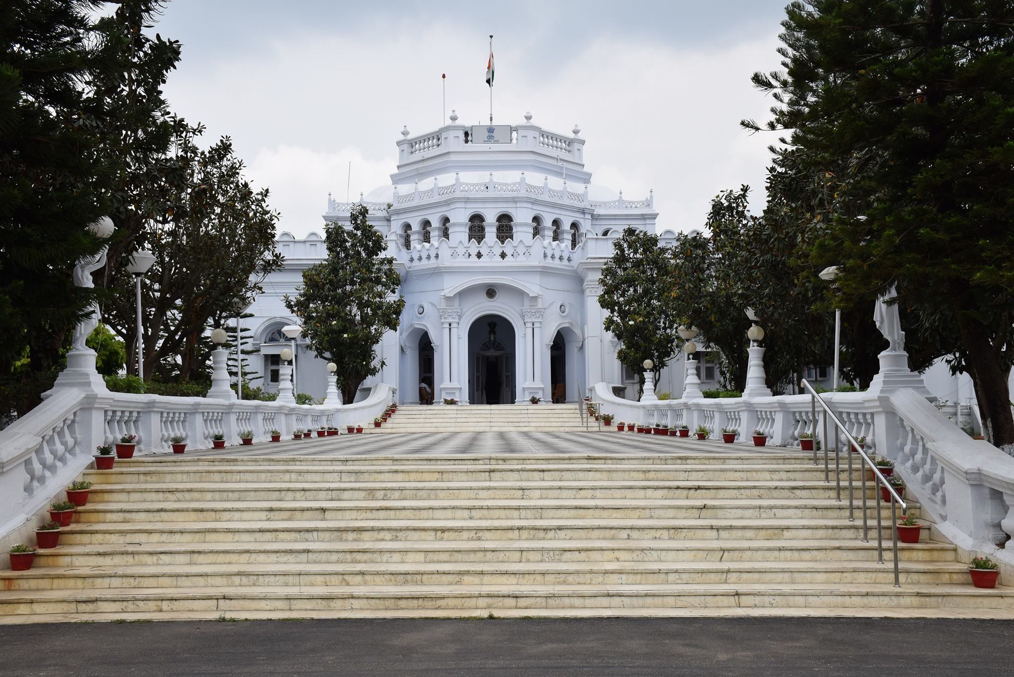
Also known as the Raghunath Palace, Surguja palace is one of the prime palaces in Ambikapur. It is a white, two-storey palace and is open to the public only on the day of Dussehra annually. It is an old tradition that the heir of the royal family of Surguja meets and greets the visitors on Dussehra and the festival is celebrated lavishly.

Barnawapara Wildlife Sanctuary
The Barnawapara Wildlife Sanctuary is located about 130 km northeast of Raipur. It was established in 1976 and the Jonk River flows through the sanctuary, which is a tributary of the Mahanadi River. The sanctuary is spread over an area of about 245 sq km. The Balamdehi River forms the western boundary and the Jonk River forms the north-eastern boundary of the Sanctuary. The sanctuary has undulating terrain dotted with numerous low and high hillocks. The sanctuary is filled with tropical dry deciduous forests with bamboo amongst the most commonly spotted tree here. The sanctuary has a large number of wildlife and a large population of birds. Bird watching in Barnawapara is one of the most enjoyed and popular activities.

There are several scenic waterfalls in the sanctuary, like the Dhaskund waterfall, the Siddhakhol Waterfall and the Nakuti Darha waterfall. Other tourist attractions include the Gond Nagarjuna caves, which the local Gondi people consider as sacred and have been worshipping there. The Gonds call it Chanda Dai and it is said the Dalai Lama meditated here once. Other places like Turturiya Dham are situated on the northern boundary of the sanctuary beside the Balamdehi river is believed to have been the abode of Sage Valmiki and where Goddess Sita lived in exile and gave birth to her twins, Luv and Kush. The Barnawapara Wildlife Sanctuary is home to the Bar and Nawapura forest villages established in 1976 and is spread over an area of 245 sq km. The landscape is mostly flat terrain with occasional low and high hillocks.

The Barnawapara Wildlife Sanctuary is open from 6:45 to 11 am and then again between 2:30 and 5:30 pm during the summer months. During the winter season, the sanctuary is open between 6 to 10:30 am and then between 3 to 6:30 pm. The sanctuary remains closed from July 01 to October 31, due to the monsoon season. The best time to visit the Barnawapara Wildlife Sanctuary is between November and June when the weather conditions remain pleasant.

Entry fees are INR 55 per person for Indian tourists and INR 200 per person for foreign tourists. A guide can be requested at an additional cost of INR 250. A safari is also available at different rates depending on the kind of vehicle opted for. However, booking for the safari will have to be done in advance through resorts or tour operators. Charges for 30 km can vary from INR 1300 to INR 2800 for an eight-seater vehicle. There is no fee charged for photography or videography for non-commercial purposes.

Mainpat
366 km northeast of Raipur, Mainpat is an underrated hill station with green pastures, deep valleys, breathtaking waterfalls, dense forests and untouched rivulets. The hill station hasn’t been completely commercialised yet and receives a relatively smaller influx of tourists compared to its counterparts. Often called the Shimla of Chhattisgarh and Mini Tibet owing to its huge Tibetan population and influence over the area, Mainpat has a large number of Tibetan refugees who were rehabilitated in Mainpat after the Chinese invasion of Tibet and have since found a home here.

Mainpat is famous for the Ulta Pani or Bisar Paani which seems to defy gravity and where the water seems to flow upstream. The locals have made a canal for watering crops and water flows upward 30 ft on its own.

The Dhakpo Shedupling Monastery is the most prominent in Mainpat and belongs to the Gelug order. It is relatively smaller than its northeastern and Nepalese counterparts and has Buddhist relics and artefacts. Fish Point lies around 17 km from Mainpat, nestled amidst hills with stunning panoramic views. This viewpoint has a flowing river called Machali Nadi which ends in a waterfall with a descent height of 80 metres in the same area. The tourist attraction was named after a specific species of fish found in the Machali Nadi. Tiger Point is another scenic waterfall 7 km from Mainpat and originates from the Mahadev Muda river and is encircled by thick jungles on all sides. Local legend says that there were a few tigers spotted at this sight years ago, which resulted in the falls named Tiger Point Falls. The water plunges from a height of 60 metres from atop the cliff into an underlying pond. The falls are visible from road level but there is also a stairway that leads to the bottom of the falls and offers a better view. Although the stairway leads to a better view, the path is unkempt and slippery and one may exercise caution whilst taking that route.

Mercury Falls are relatively untouched falls nestled in the hills of Mainpat and are a little difficult to reach with no proper pathway. The falls are said to be the tallest waterfalls in Mainpat with a height of over 400 feet. The water stream glides over eight steps to form a gorgeous cascade. Daroga Jharna is another offbeat place located 6 km from the Mainpat bus stand. The place has an abundance of water and offers a plethora and tranquil settings away from the more mainstream tourist spots. Bhutahi Jalprapat located 6 k, from Mainpat bus stand is a flowing stream of water that is said to resemble the movements of a snake as it makes its way in a zig-zag pathway. The flowing stream looks white as a pearl and moves with sheer force that it produces a loud sound. This characteristic sound is also the reason behind the name of the place Bhutahi Jharna

Parpatiya Sunset Point lies about 30 km from Mainpat and is famous for its unparalleled views during sunsets, and it is said that the neighbouring hills appear as cubes from this point. The drive up to this point is filled with scenic views and is reason enough to visit. Mehta Point is yet another viewpoint offering a bird’s-eye view of the sprawling lush landscapes and the green-covered hills, the viewpoint is set at a higher altitude and has a fair amount of clouds at the top almost giving one the sense of walking amidst clouds. Jaljali which is located about 10 km from Mainpat, is a natural wonder with the land having a trampoline-like surface and behaves exactly like one when one jumps on it and produces subtle vibrations. It is often referred to as the bouncing land and is a treat for kids and adults alike.

Malhar
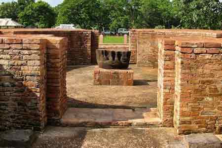
Chhatisgarh’s most historic town, Malhar lying 144 km northeast of Raipur is of utmost archaeological prominence. It has a spot in the Ancient Monuments and Archaeological Sites and Remains of National Importance list that is maintained by the Archaeological Survey of India. A few of the remains found in Malhar date back to 1000 century BC and are attributed to the Kalchuri regime. Malhar was once a major city and served as a capital in the 1st millennium and has been referred to as Mallar, Mallari and Sarabhapur in inscriptions and Indian literature. In contemporary times, it is more of a village with mounds and the ruins of an ancient fort, two restored Shiva temples and a museum with the ruins of a major group of Hindu, Jain and Buddhist temples.

There are many references to the ancient Kosala Kingdom of northern India in ancient Indian literature and the Surya Vanshi Ikshvaku dynasty kings ruled Kosala with Ayodhya as their capital. After Lord Rama, the kingdom was divided among his two sons, Lava and Kusha with North Kosala going to Lava with Shravasti Nagari as his capital and Kusha receiving South Kosala. Kusha established his new capital, Kushasthalipura on the river Kushavrate near the Vindhya mountain range, which divides north and south India. Kushasthalipura is identified as near Malhar.

In Malhar, many ancient temples have been found, such as the Pataleshwar temple, the Devri temple & the Dindeshwari temple. Ancient deposits and Jain memorials were also found here. The four-handed idol of Vishnu is significant. The remains found here are of the period from approximately 1000 BCE to the Ratnapura Kalachuri regime. Temples of the 10th and 11th centuries are also conspicuous here, among them, the Pataleshwar Kedar temple is one, where the Gomukhi Shivling is the main attraction. The Dindeshwari temple of the Kalachuri regime is also significant. Artistic idols are present in the Deor temple.

The Pataleshwar Temple is the main attraction of Malhar. The temple structure is presently under the protection of the Archaeological Survey of India and major renovation and repair activities have taken place in the temple. It was constructed on a high-raised platform and entrances having been provided from three sides. The sanctum is situated below the ground floor and hence the name of the temple. The doorway of the sanctum flaunts life-size statues of river goddesses and dvarpalas and the sanctum has a Shiva linga in it, with an open Nandi mandapa constructed in front of the temple.

Jain religious memorials have also been excavated here. Malhar also has a museum that is managed by the Government of India. It displays a good collection of sculptures that were discovered in this region.

In My Hands Today…

Chai, Chai: 1 – Bishwanath Ghosh

Biswanath Ghosh paints an amazing and mystical picture in this book, where he starts his journey from the Itarsi Station, Madhya Pradesh.

Chai, Chai: Travels in Places Where You Stop But Never Get Off allows the reader to join the author-narrator while he experiences new places and faces. The beautiful sun, the rich cultural history and the people are all rendered with humor and love. One can almost feel the narrator going through the little lanes in Kanpur and then end up in Madras.

Whether one is drinking tea at a local café or sitting with numerous people in a local train, Ghosh breathes life into every moment. While speculating on life’s little moments, the author also realizes the amount of hours spent in waiting at railway junctions. The destinations are not just stations and stops for trains to drop commuters off. They represent a different life and a new adventure everyday.

There are little towns that people have never heard of which Ghosh talks extensively about such as Shoranpur, Arakkonam, Itarsi, Jhansi and Mughal Sarai. What makes this work unique is that these places are described in terms of the people encountered. Trains play an important role in bringing people from all parts of the country and all walks of life together. This is where the true story lies.

Ghosh enriches this story with various descriptions and personal insights. The book is witty, humorous and helps rediscover those areas of India which most have forgotten about due to commercial tourism. No matter how obscure a town maybe, it still holds a rich cultural history which Ghosh describes with avid details.

Travel Bucket List: India – Chattisgarh Part 2

Bhilai and Durg
Known as twin cities, Bhilai and Durg are approximately about 32 km and 50 km west of Raipur. With a population exceeding 1 million, Bhilai is the second-largest urban area in Chhattisgarh after Raipur as well as a major industrial city and an education hub of central India. Durg lies east of the Shivnath River and is part of the Durg-Bhilai urban agglomeration and is the headquarters of the Durg District. Bhilai is home to several industries as well as the Indian Institute of Technology Bhilai. The Jama Masjid in Bhilai is one of the largest mosques in India and the state’s oldest zoo, Maitri Bagh lies in Bhilai.

It is believed that Bhilai is derived from the Bhil tribe which originally inhabited this region and continues to dwell in the nearby forests even today. The Bhilai word means the Bhils arrived. Bhilai was a small village and a part of the Haihaiyavansi Kingdom until 1740 when it was conquered by the Marathas. The foundation of the modern city of Bhilai was laid in 1955 when the Indian government signed a historic agreement with the Soviet Union in Magnitogorsk to establish a steel plant near the village. The first blast furnace of the plant was commissioned in 1959 by the first President of India, Dr Rajendra Prasad. The number of steel rails produced by the facility till 2007 can go around the circumference of the earth 7.5 times and this is depicted on the monument at Globe Square in the heart of the city. The facility underwent modernization and expansion and is amongst the leading manufacturers of iron and steel in Asia.

An ancient fort and a temple, Dhamdha is located nearly 35 km from Bhilai on the way to Bemetara. There are several restaurants and hotels for overnight stays, should one want to do that. Lying 60 km from Bhilai, Tandula is known for a man-made dam built over the Tandula River. Serving as a perfect picnic spot, this place is flocked by tourists, especially during winters. The Irrigation department has guest houses for visitors to stay overnight. About 100 km from Bhilai, amid a dense forest, tunnels and hills, Hajra Falls offers a spectacular view falling from a height of 150 m. Famous as a picnic spot among locals as well as tourists, one can also find accommodation in form of a Forest Bungalow.

Maitri Bagh, which translates to a Garden of Friendship, is a zoo cum park that caters to both adults and children. It is the biggest zoo in the region and offers a wide array of options for entertainment. Maitri Bagh was established as a symbol of friendship between the USSR and India, in 1972 and was developed by the Bhilai Steel Plant and the Steel Authority of India Ltd. The entrance to the zoo has a pair of giraffes that welcome visitors. The zoo is spread over an area of about 167 acres and is home to about 39 species of animals, birds and reptiles, including some endangered species with the white tiger the main attraction of the zoo. There is a musical fountain situated on the island in the artificial lake of Maitri Bagh and is lit in colour during the show that takes place each night. There is a toy train called Maitrey Express that covers the entire zoo and is a hit among children. There is also a flower show held annually. The entry fee to the Maitri Bagh Zoo is INR 20 for Indian nationals and INR 10 for Indian children while adult foreigners need to pay INR 20 and their children can enter free. Maitri Bagh remains closed on all Mondays while on other days, the zoo is open between 10 am to 5 pm while the park is open between 10 am to 7:30 pm and the musical fountain takes place from 7 pm onwards only on Saturdays and Sundays. The operating hours of the toy train ride are from 3 pm to 6 pm on the days Maitri Bagh is open. Guides are available on request.

Lying amid a picturesque location, Siyadevi is known for its Sita Maiya Temple. And for those visiting between July and February, one can enjoy the beautiful views of the natural waterfall. Named after the devout wife of Lord Ram, Goddess Sita, Siyadevi is believed to be one of the places where Lord Ram, Lord Laxman and Goddess Sita lived during their vanvaas or exile. Housing an ancient Shiva Temple, Deobalod is situated about 3 km from Bhilai. Located about 60 km from Bhilai, the Ganga Maiya Temple at Jhalmala has a very interesting legend attached to it. According to the legend, a local fisherman found the deity of the temple in his net but ignored it instead of recovering it. Later, a villager from the same village had a dream in which the idol ordered the person to retrieve and keep it in a hut near the village. Sometime later, a temple was established there by Bhikam Chanda Tiwari.

Source

Situated on the bank of river Sheonath, amidst entrancing natural scenery, the Uwasaggharam Parshwa Teerth is the shrine of the 23rd Teerthankar Lord Shri Parshwanath and commemorates his visit to this region about 3000 years ago as a Shraman or a wandering mendicant dedicated to self-realization through self-sacrifice. Founded in 1995, the temple is also home to a garden, temples, a Yoga centre and a guest house all built on the banks of the River Sheonath. The entrance to the resplendent marble temple of Shri Parshwanath is through a 30 feet gate that has the idol of Parshwanath, supported by four pillars representing the four essentials of spiritual atonement, wisdom, introspection, good conduct and penance, being worshipped by two elephants. Sacred water or amiya, oozes from the idol here and hundreds of pilgrims visit this shrine on the day of the full moon.

Rajnandgaon
Located about 72 km west of Raipur, the district of Rajnandgaon came into existence on 26 January 1973, as a result of the division of the Durg district. Originally known as Nandgram, Rajnandgaon State was ruled by the Somvanshis, the Kalachuris of Tripuri and the Marathas. The palaces in the town showcase tales of the rulers, their society and culture, and their traditions.

The city was ruled by a dynasty of Hindu caretakers or Bairagis, who bore the title Vaishnav and Gond rajas or chiefs. Succession was by adoption and the foundation of the dynasty is traced to a religious celibate who came from Punjab towards the end of the 18th century. From the founder, it passed through a succession of chosen disciples until 1879 when the British government recognised the ruler as a hereditary chief and it came to be known as the princely state of Raj Nandgaon and the heir was conferred the title of Raja Bahadur. The first ruler Mahant Ghasi Das was recognised as a feudal chief by the British government in 1865 and was granted a letter of adoption. Later the British conferred the title of Raja on the ruling mahant.

In ancient times Rajnandgaon, like the rest of the Chhattisgarh plain, was part of Dakshina Kosala and part of the Mauryan empire during Emperor Ashoka’s time. Coins of the Indo-Sassanians have been found near Rajnandgaon dating from the 3rd century, implying the region had indirect contact with the rest of the world. In the 4th century, Dakshina Kosala was one of the regions which were subdued by Samudra Gupta on his southern expedition. However it was unlikely the Guptas ever directly controlled this territory south of the Mahanadi, rather the local rulers acknowledged Gupta overlordship. Gupta coins have been found in Dakshina Kosala. Parts of the region were controlled by the Nalas of Bastar at times, while other areas were controlled by the Vakatakas for periods in the 5th century. In the 6th century, the area was under the control of the Somavamshis while it fell back into Nala hands in the 7th century. In the 10th century, the Somavamshis returned to power, but were soon overthrown by the Kalachuris, who claimed Haihaiya origin. In the 12th and 13th centuries, the southern part of the district fell into the control of chieftains from Kanker. The Kalachuris or Haihaiyavansis continued ruling the district until the 18th century. Khairagarh and the northern part of the district were ruled by the Raj Gonds of Garha-Mandla. After the struggle of Rani Durgavati, these rulers, as well as the Kalachuris of Raipur who ruled the southern part of the district, became vassals of the Mughals. In 1742, the Marathas under the Bhonsles of Nagpur invaded Chhattisgarh and quickly overthrew the last king of the Haihaiyavansis and took over what is now Rajnandagaon district. In 1753, the Bhonsles of Nagpur confiscated all the territory that is now Chhattisgarh, and Raghoji gave the area to his son, Bimbaji, who ruled it virtually independently. The territory continued to be controlled by the Marathas until the Third Anglo-Maratha War when it fell into British hands who then returned the territory to Maratha hands. Until 1836 it was administered by a series of subadars obedient to the Nagpur state. In 1853, Nagpur was annexed by the British under the Doctrine of Lapse and Rajnandgaon fell under direct British administration under the Central Provinces and Berar. Rajnandgaon remained a Princely State in independent India and in 1948, was merged into the Durg District of Madhya Bharat, later Madhya Pradesh. Rajnandgaon district was carved out from the erstwhile Durg district on 26 January 1973. Later, Kabirdham district was carved out from this district on 1 July 1998. Rajnandgaon is a part of the Red Corridor.

Situated on a hilltop at a height of about 490 m about 26 km from Rajnandgaon, is a significant religious site. Also referred to as Badi Bambleshwari, the temple is located in Dongargarh and is half a km from the main temple complex at the foot of the hill known as Chotti Bambleshwari. Thousands of devotees from in and around Chhattisgarh flock to the shrine during the ten days of Navratri in September and October as well as during Ramnavmi in April. During this time, fairs which are run 24 hours are organised in the temple premises. It is said that about 2,220 years ago, a local king, Raja Veersen performed several Pujas and worshipped the gods to be blessed by an offspring. When after a year, the queen gave birth to a son, the king who believed it to be a blessing from Lord Shiva and Parvati, constructed the temple here.

Another site of interest is the ancient place of Mata Sheetala Devi Shakti Peetha. This temple, which is more than 2200 years old, lies 1.5 km from the railway station. Pragyagiri, a famous Buddhist Vihara is another attraction as is Barfani Dham where pilgrims throng. Other places of interest are Ambagarh Chowki, Ambagarh Devi Mandir, Mongara Dem and Sankar Dahara Tipagarh Pahadi.

Chirmiri
Chirmiri is a hill station about 298 km north of Raipur and not far from its border with Madhya Pradesh. It was a part of the Koriya district until 15 August 2021 when the separate Manendragarh-Chirmiri-Bharatpur district was created. Chirmiri is known for its coal extraction as the area is rich in coal. Chirimiri is referred to as the Heaven of Chhattisgarh due to its lush greenery, mountains, and rivers that make it a perfect getaway destination. There are several temples and other places famous among tourists. Located at an altitude of 579 m above sea level, Chirimiri lies along the banks of the Hasdeo River, one of the most prominent tributaries of the Mahanadi River. Chirmiri’s weather is pleasant all year round, and there are dense forests in the region housing exotic flora and fauna. The best time to visit Chirmiri is March just in time to celebrate Shivratri with the locals. It is one of the most popular festivals in the region. Otherwise, the monsoon season between October to April is when the city is clean and green with the dirt and grime washed away.

One of the chief tourist attractions of the region is the Lord Jagannath Temple which is a replica of the Jagannath temple in Puri, Odisha. The Kalibadi Temple is located in Haldibadi on a hill and is very close to the main train station. Baigapara is a temple located in Bartunga where there is also an ancient Sati temple dedicated to the Goddess Sati. The Gufa Mandir is located in Godaripara while the Maha Maya Temple in Ratanpur is one of the 52 Shakthi Peeths, and is dedicated to Goddess Lakshmi and Goddess Saraswati. The temple was built by the Kalachuri King Ratnadeva in the 12th or 13th century. The architecture is of the Nagara art, facing north with a big water tank. There are also temples dedicated to Lord Shiva and Lord Hanuman respectively on the premises. The oldest temple here, built in 1039 is a temple dedicated to Kantideval and is said to be constructed by an ascetic known as Santhosh Giri. The temple is guarded by Kalabhairava residing in another temple on the approach road. There are also ruins of an 11th-century Kadaeideol Shiva temple on a hilltop near a fort.

17 km from Chirmiri lie Amrit Dhara Falls which are located in Barbaspur. There is a famous temple dedicated to Lord Shiva near the waterfalls. The falls are also a favourite picnic spot for locals. Apart from being a famous waterfall, the place is used for picnics by the locals. The local authority has developed the banks of the Hasdeo River and now this is a preferred picnic spot.

Source

Madku Dweep
A beautiful island, Madku Dweep lies on the River Shivnath about 87 km north of Raipur and about 40 km south of Bilaspur. The name Madku came about because the island has the shape of a frog. The picturesque Madku Dweep has an area of around 24 hectares and is full of greenery and is famous for its ancient temples and their historical and archaeological importance.

Archaeologists have discovered prehistoric stone tools, epigraphs, and coins on this island. Stone inscriptions have also been found, which are believed to date back to the 3rd century. One stone inscription was in Brahmi script and another in the Shankha script. Madku Dweep is also home to several ancient and unique idols of Lord Shiva, Ganesha, Shiv-Parvati, Nandi, and various other Gods have been found. There are temples, both old and new, that are frequented equally by devotees from across the globe. Madku Dweep is popularly known as Kedar Tirth and Harihar Kshetra Kedar Dweep. Archaeologists have successfully excavated 19 temples on the island of which 18 face east, whereas the middle temple is the only one that faces west. The architectural style of these temples along with the sculptures and idols is believed to be similar to that of the Great Kalchuris. The festivals of Mahashivratri and Hanuman Jayanti are celebrated enthusiatically and there is a seven day fair held with utmost devotion on this island. There is also a 7-day mela or fair that is held in January during Paosh Purnima.

Mudku Island is divided into two parts of the river Shivnath river. Two very ancient Shiva temples from the 10th and the 11th centuries are situated on the smaller island. One of them is situated at Dhanmanteshwar and to its right side is an ancient valley located in the north, which drains the water. Two ancient inscriptions have been found at this place. The first inscription is the Brahma inscription of about 3rd century while the Akshaya found and the second inscription has letters of the Shankhalipi script. A statue of a man without a head appears to be from the 10th or the 11th centuries. Archaeological excavations have found ancient idols of Gupta and Calcutta carvings. The statue of the Culturary Chattrabhuji dance is found in the statue of Ganesh under the tree of Bakul which dates to the 11th century.

Bhoramdeo Temple
Bearing a striking resemblance to the Konark Sun Temple, the Bhoramdeo Temple is located about 135 km north of Raipur and is believed to have been constructed between the 7th to the 12th centuries and is popularly known as the Khajuraho of Chhattisgarh as it also resembles the Khajuraho Temple in Madhya Pradesh. The Bhoramdeo Temple is a complex of temples dedicated to Lord Shiva in Bhoramdeo and comprises a group of four temples of which the earliest is a brick temple. The Bhoramdeao temple complex is built at the foot of the thickly forested scenic backdrop of the Maikal range of hills, in the Daksina Kosala region.

The temple complex, rich in history and archaeological details, is dated to the Kalachuri period between the 10th and 12th centuries, which ruled over areas in Central India in west Madhya Pradesh, Rajasthan and were called Chedi, Haihaya or Heyheya or the northern branch with a close identity with the sculptures found in nearby archaeological sites such as Janjgir, Kalachuri, Narayanpur and Ratanpur sites. The brick temples were built during the rule of Pandus and are similar to those built in Kharod, Palari, Rajim and Sirpur in the state.

The temple was built by Laxman Dev Rai & Gopal Dev of the Faninagvansh Dynasty. The temple complex, highlighted as scintillating poetry in stone, is credited to the Nagwanshi Kings who practised tantrism and who ruled in the then Southern Koshal region, which is now the state of Chhattisgarh. Its construction is dated between the 7th and 12th centuries and the temple is named Bhoramdeo because the Gond Tribals of the area worshipped Lord Shiva whom they called Bhoramdeo.

The main temple is the Bhoramdeo temple built in stone and is older than the Khajurao complex and has an abundance of carved images on its walls, especially the exterior ones. The structural uniqueness of the temple stems from having receding rows placed consecutively upwards in the upper part of the temple tower. It has the standard Hindu temple composition of a mandapa, followed by a passage leading to the sanctum sanctorum or Garbhagriha. The sanctum sanctorum is the primary enclosure of the temple where the presiding deity Shiva, in the form of a Shiva linga, is worshipped. Four main central pillars support the mandapa, along with several peripheral pillars. All the enclosures are linked through passageways. The temple is built facing the East, with an entry door that faces the same direction. In addition to this, two more doors open in the South and North directions. However, there is no door facing the Western direction. The main entrance door of the temple flaunts sculpted images of Ganga and Yamuna. The entrance to the sanctum sanctorum or Garbhagriha has finely sculpted images of all the ten avatars of Lord Vishnu. Intricately sculpted images of Lord Shiva and Lord Ganesha can also be found.

Another temple about 1 km from Bhoramdeo, which is mentioned along with the Bhoramdeo complex is the Madwa Mahal, which means marriage hall in the local dialect, also known as Dullhadeo. It was built in 1349 during the reign of Ramchandra Deo of the Nagavanshi dynasty and has a unique Shiva Linga erected over 16 pillars. It was built to commemorate the wedding of the Nagwanshi king, Ramachandra Dev, and the Haihawanshi Queen, Raj Kumari Ambika Devi. Interestingly, this temple is west-facing. Since this temple’s structure is similar to a marriage hall or pandal, it gets its name Madwa. The entrance of this temple flaunts traditional architectural embellishments.

The Istaliq temple or the temple built with dried or burnt clay bricks adjoins the main Bharamdeo temple. It was the first temple built between the 2nd and 3rd centuries. This temple is in a dilapidated condition and only has sanctum sanctorum without an entrance hall or mandap. The tower above the sanctum sanctorum is extant only to half its height and there is a wall projecting out of this temple which is known as the Allinda. Other existing structural features seen in the sanctum sanctorum are a few sculpted pillars as well as a sculpted Shiva Linga that is deified here along with images of Uma Maheswar and that of the king and queen standing in a worshipful pose.

Cherki Mahal, the last temple in the complex, is not easily locatable as it is situated in a thinly forested area. A Shiva Linga form, not carved is deified in this temple. The roof of the sanctum of the temple has lotus decoration. The entrance porch has many aesthetic repeated patterns. A temple washed in red colour was recently built for the deity Hanuman, located on one side of the temple courtyard.

An open-air museum is located within the temple complex that is home to a massive collection of archaeological artefacts that were unearthed in this area, some even dating back to the 2nd or 3rd centuries. The Sati Pillars are also on display here that have a unique architectural motif, showing couples in squatting amorous postures. The museum complex also boasts collections such as dilapidated images and friezes of Linga and Nandi.

Guru Ghasidas National Park
A beautifully protected reserve located about 320 km north of Raipur, the Guru Ghasidas National Park is also known as the Sanjay National Park as it used to be part of Madhya Pradesh’s Sanjay National Park. After Chhatisgarh’s formation, 60% of the park came under the new state and was renamed Guru Ghasidas National Park.

Stretching over an area of 1441 sq km, the park is a must-visit while in Chattisgarh and is part of the Sanjay-Dubri Tiger Reserve, located in the Narmada Valley dry deciduous forests ecoregion. The park has a network of small streams cutting through forests which contain distinct flora and fauna. The park also offers safaris which highlight the park’s excellent features and allows picnics to be held inside the premises, with a choice of backdrop for the meal.

The history of Guru Ghasidas National Park dates back to 1981 when it was established. During this time, Guru Ghasidas was called Sanjay National Park and was a more significant area in Madhya Pradesh. The area of the park was then divided into two parts during the formation of the state of Chhattisgarh in 2000. During this time 60 per cent of Sanjay National Park fell under the district of Koriya in Chhattisgarh and this part of the park was then renamed Guru Ghasidas National Park after the famous Satnami reformist hero. The national park is now an individualistic thriving community of different plant and animal species under one roof.

The park is mostly composed of tropical forests of Sakhua or Sal trees. Many species are to be found here including the Bengal tiger and the Indian leopard as well as 309 species of birds, including the Golden Hooded Oriole and the Racket-tailed Drongo, among others and the park and its environs is the last known territory of the Asiatic cheetah in India.

The national park is smack in the middle of two very prominent tiger reserves, the Bandhavgarh Tiger Reserve in Madhya Pradesh and the Palaman Tiger Reserve in Jharkhand. The geographical topography of the national parks includes several small hills that are separated by grassy, open plain areas as well as sandy soils. The forest area is mostly a mixed deciduous type along with patches of mixed subtropical vegetation. Aside from the array of streams that criss-cross through the terrain, the primary source of water for the animals is from two important rivers on the premises. These rivers include the Banas River in the west of the Guru Ghasidas National Park which is renowned for its diverse flora and fauna that spreads through the area.

The Guru Ghasidas National Park is open between 8 am and 6 pm daily and has an entry fee of INR 100 per adult and INR 50 per child. Guides who have extensive knowledge of the national park and its inhabitants are also available during the safari.

Hindi Diwas

Every year Hindi Diwas or Hindi Day is celebrated in India to commemorate the date on which a compromise was reached, during the drafting of the Constitution of India, on the languages that were to have official status in the Republic of India on 14 September 1949. The compromise, usually called the Munshi-Ayyangar formula, after the drafting committee members, K. M. Munshi and N. Gopalaswami Ayyangar, was voted by the Constituent Assembly of India after three years of debate between two opposing camps. The Hindi protagonists wanted Hindi, written in the devanagari script, to be the sole national language of India while the delegates from South India preferred English to have a place in the Constitution. The Munshi-Ayyangar formula declared Hindi to be the official language of India’s federal government and that English to be an associate official language for 15 years during which Hindi’s formal lexicon would be developed and the international form of the Hindu-Arabic numerals to be the official numerals. The compromise resolution became articles 343–351 of India’s constitution, which went into effect on 26 January 1950. In 1965, when the 15 years were up, the Government of India announced that English would continue to be the de facto formal language of India.

The first Prime Minister of the country, Pandit Jawaharlal Nehru, decided to celebrate Hindi Diwas on September 14. One of the reasons behind celebrating this day is to prevent the increasing trend of the English language in the nation and the neglect of Hindi. Mahatma Gandhi called Hindi the language of the masses and also spoke about making Hindi the national language of the nation and first floated the idea in 1918 during the Hindi Sahitya Sammelan. The Constitution of India recognises Hindi as an official language under Article 343. Officially, the first Hindi Day was celebrated on September 14, 1953. The reason behind adopting Hindi as one of the official languages was to simplify administration in a nation with multiple languages.

To mark Hindi Diwas, the entire week starting from 14 September to 21 September is celebrated as Rajbhasha or State Language Week. Many literary and cultural events are organised on this day across the nation, wherein people celebrate the great works of Hindi literature. The Rajbhasha Kirti Puraskar and the Rajbhasha Gaurav Puraskar awards are also given to ministries, departments, public sector units, nationalised banks and citizens on Hindi Diwas for their contribution and promotion of Hindi. Many schools and colleges organise various literary and cultural programmes, as well as competitions to showcase the importance of the day and raise awareness about the language. The President of India honours people for their contributions to the language at a function held in Delhi’s Vigyan Bhawan.

Hindi Diwas also marks the birth anniversary of Beohar Rajendra Simha, an acclaimed Indian scholar, historian, theologian, littérateur, polyglot, Hindi-stalwart, Sanskritist, Ramayana-authority, Sarvodaya-activist, Gandhian and, to a lesser extent, a journalist and a politician. On his 50th birthday, Hindi was adopted as the official language.

Today, in India alone, according to the 2011 census, 43.6% of speakers identify Hindi as their mother tongue. An Indo-Aryan language that is spoken chiefly in the Hindi Belt region encompassing parts of northern, central, eastern, and western India, Hindi has been described as a standardised and Sanskritised register of the Hindustani language, which itself is based primarily on the Khariboli dialect of Delhi and neighbouring areas of North India. Hindi, written in the Devanagari script, is one of the two official languages of the Government of India, along with English. It is an official language in 9 states and 3 union territories and an additional official language in 3 other states as well as one of the 22 scheduled languages of the country. Apart from the script and formal vocabulary, standard Hindi is mutually intelligible with Standard Urdu, another recognised register of Hindustani as both share a common colloquial base. Hindi is the fourth most-spoken first language in the world, after Mandarin, Spanish and English and Hindi alongside Urdu as Hindustani is the third most-spoken language in the world, after Mandarin and English. The term Hindi is a Persian word and the first poem in the language was written by the famous poet, Amir Khusro. The term Hindi in Persian roughly means the land of the Indus River or belonging to Hind as India is known as in the language.

I remember writing the Rastrabhasha exams while in school and while the first few stages aka Prarthamik and Prarambhik were relatively easy, the last stage or the Pravesh stage was tough. Though it is supposed to be an optional exam, in my school, all of us had to take the exam and get the certificate. I am not sure now, but previously if you worked in the government sector, especially the central government, you had to pass all stages to get promoted beyond a certain level. BB & GG also learnt Hindi as their Mother Tongue language and regular and old readers will know of their struggles and triumphs.

So today, read something in Hindi, watch a Bollywood movie or just speak to someone in the language to commemorate the day.

Travel Bucket List: India – Meghalaya Part 5

Khasi Hills

Named after the Khasi tribe, the Khasi Hills are a low mountain formation on the Shillong Plateau part of the Garo-Khasi range and connect with the Purvanchal Range and larger Patkai Range, a series of hills found across the Indo-Myanmar border. The Khasi Hills is and further east. Khasi Hills, and the whole Garo-Khasi-Jaintia range, are in the Meghalaya subtropical forests ecoregion.

With deep lush valleys and conical peaks, these hills are famous for housing the Sohra or Cherrapunjee scarp, one of the regions with the highest annual rainfall in the world. The Nongkhum island, the second largest river island in Asia, is also located within this area. The dense forests mingling with tributaries that eventually drain out into the Brahmaputra, combined with the rich biodiversity of the region have earned the Khasi Hills the title of Scotland of the East.

The Khasi Hills are a great convergence of lush forests, endless verdant grasslands, majestic hills surrounded by playful clouds, waterfalls, and rivers flowing through the creeks, and ancient monoliths filled with mystical caves. Complemented by the abundance of diverse wildlife seen throughout the area, the Khasi Hills region is world-famous for being a prime ecological hotspot.

The region is inhabited mainly by tribal Khasi dwellers, which are traditionally in various chieftainships, states known as the Khasi Hill States. One of its capitals, Sohra, is considered one of the wettest places in the world. The majority of Khasis are Presbyterians followed by Catholics and Anglicans. The highest peak is Lum Shyllong which is 1,968 meters or 6,457 ft high.

The best time to visit the Khasi Hills is from October until April. During this period one will be able to enjoy the natural beauty of the land with waterfalls brimming with life due to the recent monsoon rains, and the flora & fauna will be soothing to the soul. The winters can be chilly, so adequate coverage is required. Avoid going during monsoons, as they are marked by heavy showers, which may prove to be inconvenient.

Places to Visit in East Khasi Hills include Asia’s cleanest village, Mawlynnong as well as Smit which can be reached through the winding roads offering an elegant view of the mountains. The village of Laitkynsew is famous for the 53 feet-long living root bridge which is over a hundred years old known as the Jingkieng Deingjri. The Khasi Hills are an adventurer’s fantasy come to life, with countless caves, peaks, and viewpoints spread across its entirety. Private treks are organised all across the Khasi hill range which is rich with the thriving greenery infused within the hills and accessorised by lakes and waterfalls.

With Meghalaya housing one of the largest cave networks in the world, the labyrinth of rock formations is a sight to behold, with years of mineral deposits from the tributaries of the Brahmaputra creating incredible stalagmites. The excess of impressive structures like monoliths and mighty hills offers tourists a chance to engage in the sport of rock-climbing with the giant monolith Kyllang Rock a favourite amongst rock-climbers and trekkers. The abundance of lakes offer tourists the rare opportunities to enjoy a nice relaxing picnic as well as boating services to immerse oneself in the tranquillity of the area. With its amazing ecological diversity, the region is home to numerous natural parks, where one can marvel at the lush greenery which has been so beautifully maintained by the locals.

Jaintia Hills

Located further east of the Khasi Hills, the Jaintia Hills used to be a part of the Jaintia Hills District. The district has been bifurcated into two separate districts, namely, East Jaintia Hills and West Jaintia Hills on 31 July 2012. Part of the former Jaintia Kingdom, the Jaintia Hills is a land of majestic hills filled with rich natural vegetation and mineral deposits. It is part of the Patkai hill range that extends across the Indo-Myanmar borders and is a relatively smaller hill district as compared to the Khasi and Garo Hills. The twelve Chiefs of the elaka or the tribal province of the Pnars, a Khasi Sub-tribe are styled Dolloi, and the land is called after them in Khasi: Ka Ri Khadar Dolloi or the Land of 12 Tribal Chiefs. The Jaintia hills comprise of two districts: the East Jaintia Hills and West Jaintia Hills. The only princely ruler of the area was the Raja of the Jaintia Kingdom whose winter capital, Jaintiapur is today in Bangladesh, while his summer residence shifted from Sutnga where the family started as Syiems to Nartiang and also has a palace in the commercial centre Borghat.

The best time to visit the Jaintia Hills is during the summer season, when it is mostly warm, with little or no rainfall. The hills receive heavy rainfall during the monsoons. The Jaintia Hills is home to one of the most beautiful waterfalls of India, the Krang Suri Falls. Set against the backdrop of the rugged rocks with the verdant creepers and trees, the unreal shade of blue taken on by the water inspires the artistic side of anyone who views it. The beautiful village of Nartiang is also situated in these fascinating Jaintia hills where one can find the remnants of the Summer Palace of the Jaintia King. The Nartiang Monoliths, a large collection of mighty stones set since the stone age may also be found here. Jowai, the administrative headquarters, is the most developed town in this region and is the only place connected to other towns outside the hills.  Krem Liat Prah is the longest cave, and Synrang Pamiang is the deepest cave, both which are located in the Jaintia Hills. Thadlaskein Lake is a man-made lake, popular among the locals as a picnic spot. The lake is considered to be holy by the people of Raid Mukhla who worship and offer sacrifices near the lake. A popular place among the locals, Khim Moo Sniang is significant for the pig-shaped rock that lies here and is worshipped by the Jaintia community. It is believed that the stone has the power to protect them. Syndai is famous for many caves and caverns in the limestone-borne area which were used as hiding spots during the war between Jaintia Hills and foreign intruders. Borghat village is situated close to the Bangladesh border and the temple there has a significant history because sacrifices were offered here and the temple was damaged during the 1987 earthquake. The Ruparsor Bathing Ghat was made for the recreational purposes of the Royal family. The ghat is made with granite and the water it gets is from the Ruparsor stream, which flows through a Ridge resembling the curved trunk of an elephant.

Garo Hills

Situated close to the Indo-Bangladesh Border, the Garo hills are part of the Patkai hill range, which extends across the Indo-Myanmar border. The hills get their name from the Garo tribe who inhabit the area. The Garo Hills, spanning 8000 sq meters, offers magnificent viewpoints, densely populated with subtropical forests and rare endemic species of animals and birds. The area has been divided into five districts. The Nokrek peak is the highest peak of this hill range, but the Arabella hills and the Tura peak also offer some breathtaking scenery. The Nokrek Biosphere Reserve, one of the most important national parks of international importance, is located in this nature-rich area. The hills are also decked with splendid waterfalls, enriching the ecological coherence of the place. It is one of the wettest places in the world and part of the Meghalaya subtropical forests ecoregion.

The Garo tribe are a culturally rich ethnic group, attaching tradition and significance to many parts of their natural surrounding. In doing so, they protect and respect their habitat, thereby preserving the immaculate allure of their surroundings. The tree of Boldak Matchu Karam, the rock of Naka Chikong, and the lake of Napak are all examples of these traditions, and the maintenance of the same attracts hordes of tourists all year round. Between September and December, the post-harvest festival of 100 Drums Wangala is celebrated with great pomp at the Asnang village, now becoming a multicultural attraction with neighbouring tribes participating in the festivities with great enthusiasm as well. The largest town in the hills is Tura, which is also the most developed area and home to all the important administrative buildings.

The society is matrilineal like the Khasis and the Jaintias. From birth to death, an individual belongs to the mother’s family, irrespective of sex, even after marriage. Marriage within the clan is completely prohibited and severely punishable for both the Khasis and the Garos. The institution of bachelors dormitories which are gradually disappearing is found in the Garo villages. In such dormitories, young people stay and live together till they are married. They receive various training like making various A’chik music instruments, wrestling or traditional sports, and the making of traditional bamboo baskets. This institution is similar to the ancient agoges of Sparta. Today the Khasis and Garos are mostly Christians but were nature worshipers previously.

The Garo Hills is known for its abundance of wildlife and attracts naturalists and photographers. Two mountain ranges, the Arabella range, and the Tura range pass through the Garo Hills, forming the great Balpakram valley in between. The headquarters town of Tura at an altitude of 657 m. The highest point in the Garo Hills is Nokrek Peak at an elevation of 1412 m.

The Garo Hills is a hub of ecological biodiversity. The Nokrek Biosphere Reserve was added to UNESCO’s official list of biosphere reserves in 2009 and is the home of the plant Citrus Indica, first discovered by researchers in this region. The Balphakram National Park is famous for its canopy-covered gorge and unique physical and biological formations and is an ecological hotspot. The Siju Caves is the third longest cave system in India, made of limestone deposits over centuries, by the Simsang river. One can find rare bat species here. A tributary of the Simsang River, the Rongbang Falls is flanked on either side by massive verdant hills of bamboo.

The Garo hills are a hotspot for natural biodiversity, evidenced by the large Nokrek Biosphere reserve and the neighbouring Balphakram National Park. The Selbalgre Hoolock Gibbon Reserve is a great spot to view the rare Hoolock Gibbon. There are several picturesque waterfalls around the hills as well. With limited road connectivity, one must trek through this scenic landscape to reach many villages past the outskirts of Tura. The Tura Peak and Arabella range offer magnificent views from the top, with the Tura peak being relatively easier to scale. Nongkhnum Island located in the West Khasi Hills district is the biggest river island in Meghalaya and the second biggest in Asia. The island is formed by the bifurcation of Kynshi River into the Phanliang River and the Namliang River. Adjacent to the sandy beach the Phanliang River forms a lake. The river then moves along and before reaching a deep gorge, forms a waterfall about 60 meters high called Shadthum Fall. Located near Sohra, the Kshaid Dain Thlen Falls are the falls where the mythical monster of Khasi legend was finally butchered. The axe marks made on the rocks where Thlen was butchered are still intact and visible. On the top of Diengiei, there is a huge hollow, shaped like a cup, believed to be the crater of an extinct pre-historic volcano. A scenic pool with wide, rocky sandbanks located on a stream alongside the Umroi-Bhoilymbong Road is known as Dwarksuid or Devil’s doorway. The highest point of the Garo Hills region of the State, Nokrek Peak stands 1412 m above sea level. The mother germoplasm of Citrus-indica has been discovered by scientific researchers within Nokrek Range which led to the establishment of the National CitrusGene Sanctuary-cum-Biosphere Reserve at Nokrek covering an area of 47 sq km. Imilchang Dare is a waterfall with a deep, wide pool at the bottom making it an exciting swimming pool, full of fish of varied sizes and colours.

After this series, I realise that Meghalaya has so much natural beauty and I am itching to explore this beautiful state soon. The state has so many unexplored places that one may feel like an explorer making a grand discovery. Hopefully, I get to explore this state soon.