Travel Bucket List: India – Arunachal Pradesh Part 2

Bomdila

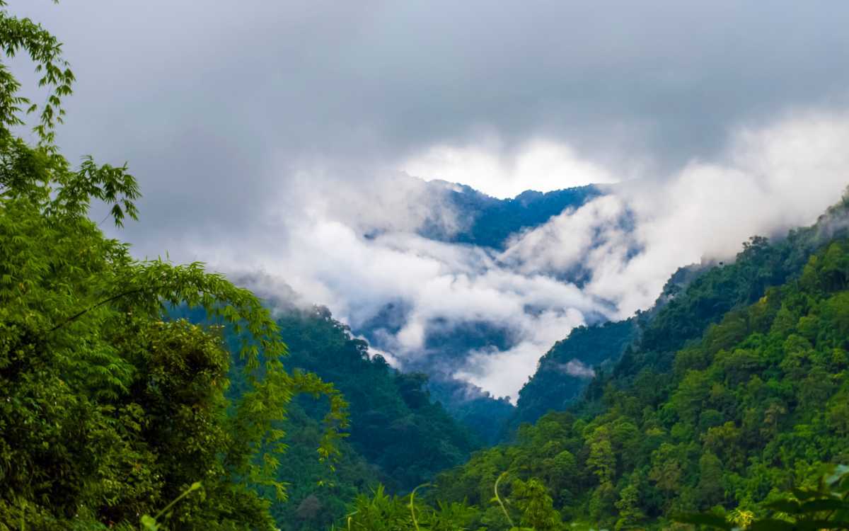
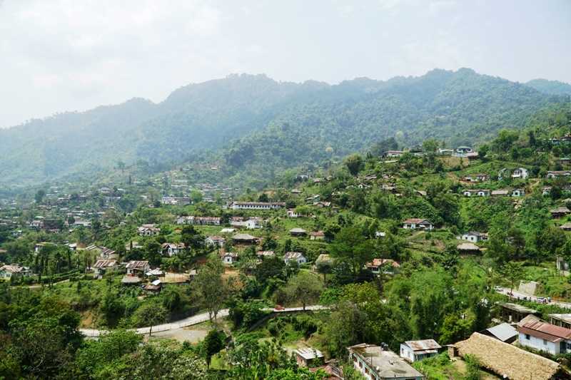
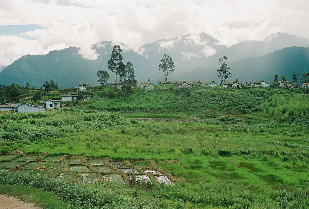
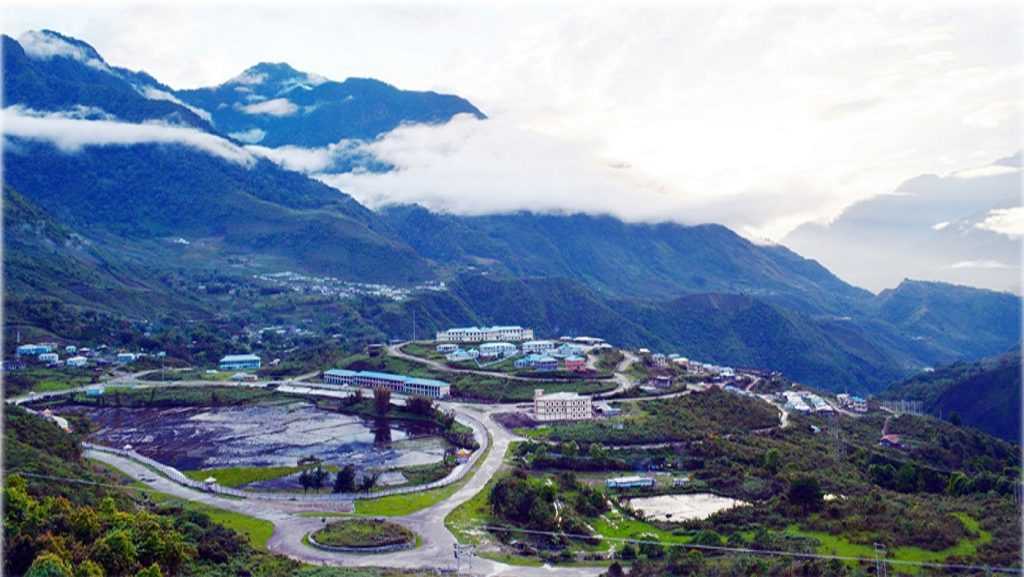
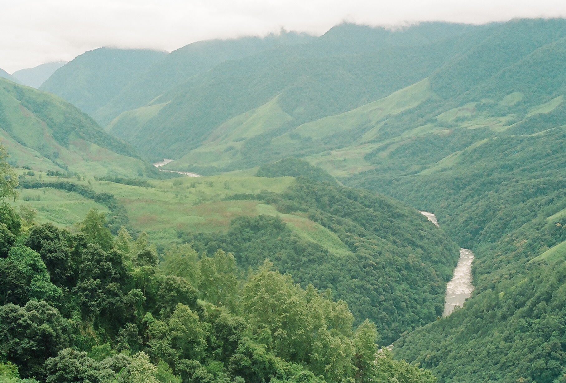
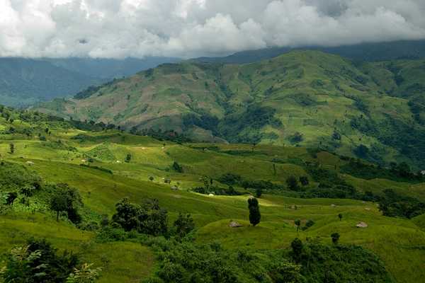
270 km west of Itanagar, Bomdila is a lesser-known destination set in the eastern Himalayas with beautiful views amidst nature. It is also well known for its apple orchards and many Buddhist monasteries. Bomdila was ruled by tribal rulers until the arrival of the British who made it part of Arunachal Pradesh in 1873. The Bomdila Monastery also known as Gontse Gaden Rabgyel Lling monastery and the Eaglenest Wildlife Sanctuaries are the major attractions. Tourism is on the rise here and Bomdila has become a halt station for tourists travelling to Tawang. The Bomdila pass offers views of Kangto and Gorichen Peaks, the highest in the state.

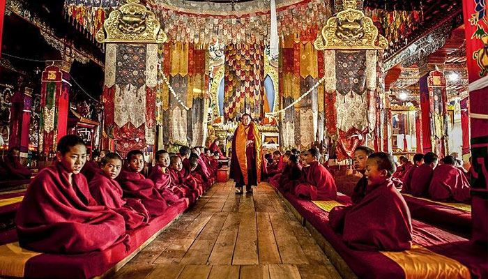
Also known as Gentse Gaden Rabgyel Lling monastery, the Bombdila monastery was built in 1965 by the twelfth incarnation of the TsonaGontse Rinpoche. And was rebuilt by the thirteenth reincarnation, TsonaGontseRinponche who renovated the monastery by building a larger prayer hall. Inside the Gompa, there’s a huge prayer, which is used by the lamas for praying; the temple of Buddha, and a tiny quarter of monks. Apart from its religious significance, the monastery is also known for its natural beauty with stunning vistas that are fabulous and breathtaking. The Upper Gompa is located atop a steep hill. There is a monk school, a prayer hall as well as a temple dedicated to Lord Buddha on the premises. The Lower Gompa is located at the end of Bazaar Street and the main attraction is the marvellous Tibetan architecture and massive prayer hall inside. There is also a craft centre located opposite it which should be visited. R.R Hill is the highest point of Bomdila and from this height, visitors can see the roads leading to the Bhutan border as well as the one up Tawang.

The Eagle’s Nest Wildlife Sanctuary lies between the Sessa Orchid Sanctuary and the Pakhui Tiger Reserve. It’s a great place for bird watching with over 450 species spotted here. The sanctuary conjoins the Sessa Orchid Sanctuary to the northeast and the Pakhui Tiger Reserve across the Kameng river to the east. Altitude ranges here are extreme, from 500 m to 3,250 m and are part of the Kameng Elephant Reserve. The sanctuary derives its name from the Red Eagle Division of the Indian army which was posted in the area in the 1950s. Eaglenest is bounded to the north by the Eaglenest Ridge and the reserved forests of the Bugun community and adjoins the Tawang district to the north. There are no distinct geographical features delineating its western boundary along the Bhutan border and the southern boundary. Eaglenest has an unpaved road running from its base to Eaglenest pass at 2,800 m allowing good access to the entire altitudinal range, making it accessible to the military, scientists and ecotourists.

Eaglenest Wildlife Sanctuary is well known as a major birding area and is home to at least 454 species of birds. The sanctuary has the distinction of having three tragopan species, perhaps unique in India and is where the Bugun liocichla was first discovered in 1995 and again observed and described in 2006. The sanctuary is also home to a wide variety of herpetofauna including at least 34 species of amphibians, 24 species of snakes and 7 species of lizards as well as at least 165 species of butterflies. This area is extremely important for the continued well-being of the Asian elephant. Elephants regularly move up from the Assam plains to the Eaglenest ridge at 3250 m in summer, perhaps the highest altitude that elephants reach in India.

Tawang

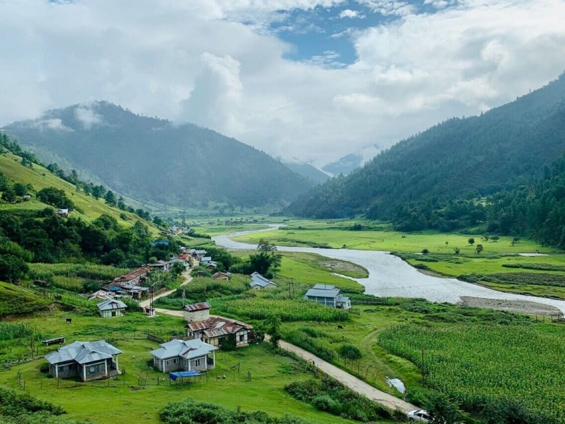
The town of Tawang or Dawang is located about 450 km northwest of Itanagar at an elevation of approximately 3,048 m to the north of the Tawang Chu river valley, roughly 16 km south of the Line of Actual Control with China. In 1989, the present-day Tawang district to the north of the Sela Pass was split off as a separate district. Tawang is inhabited by the Monpa people.

Historically, Tawang was under the control of Tibet. During the 1914 Simla Conference, Tibet and British India signed an agreement delineating their common boundary in the Assam Himalaya region, which came to be known as the McMahon Line. By this agreement, Tibet relinquished several hundred square miles of its territory, including Tawang, to the British. This agreement was not recognised by China and records show that the Tibetans regarded the border agreed upon in 1914 as being conditional upon China accepting the Simla Convention. Since the British were unable to get China’s acceptance, the Tibetans regarded the MacMahon line as invalid. The British did not implement the McMahon Line for over two decades, during which Tawang continued to be administered by Tibet. In November 1935, the British government demanded that Tibet implement the border agreement which was met with resistance from the Tibetan government implying that China’s acceptance of the Simla Convention was a prerequisite to all such concerns. Tibet refused to surrender Tawang, partly because of the importance attached to the Tawang Monastery. In 1938 the British tried to assert sovereignty over Tawang by sending a small military column which was met with strong resistance from the Tibetan government and a serious protest was lodged against the British Indian government.

After the Sino-Japanese war in 1941, the Assam government tightened its hold on the area of the Nort-East Frontier Agency, NEFA which later became Arunachal Pradesh. In 1944 administrative control was extended over the area of the Tawang tract lying South of the Sela Pass Though the Tibetan tax-collectors packing and protests were brushed aside, no steps were taken to evict Tibet from the area north of the pass which contained Tawang town. This situation continued after India’s independence but underwent a decisive change in 1950 when Tibet lost its autonomy and was incorporated into the newly established People’s Republic of China. In February 1951, India sent an official with a small escort and several hundred porters to Tawang and took control of the remainder of the Tawang tract from the Tibetans, removing the Tibetan administration. During the Sino-Indian war of 1962, Tawang fell briefly under Chinese control, but China voluntarily withdrew its troops at the end of the war and Tawang returned to Indian administration. But China has not relinquished its claims on most of Arunachal Pradesh including Tawang.

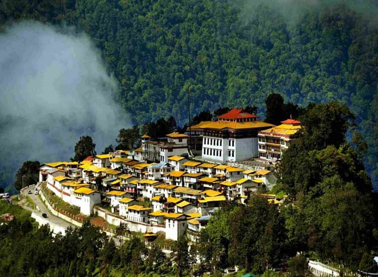
The Tawang Monastery was founded by the Merak Lama Lodre Gyatso in 1681 following the wishes of the 5th Dalai Lama, Ngawang Lobsang Gyatso. To fix the perimeter of the Dzong, the Dalai Lama had also given a ball of yarn, the length of which was to form the limit of the monastery. Perched at the height of 3,000 metres above sea level, the monastery belongs to the Gelugpa sect and is the largest Buddhist monastery in India and the biggest Buddhist monastery in the world outside of Lhasa, Tibet. It is a major holy site for Tibetan Buddhists as it was the birthplace of the sixth Dalai Lama, Tsangyang Gyatso. The monastery is believed to be 400 years old and has control over 17 gompas in the region.

Offering breathtaking views of the Tawang-Chu Valley, the monastery is built as a large three-storeyed mansion enclosed by a 925 feet long compound wall and is home to over 300 monks. The most prominent attraction in the monastery is the massive statue of Lord Buddha which is 8 m in height. The main temple, Dukhang, boasts magnificent interiors with beautiful artwork while the inner walls contain sketches and paintings of Bodhisattvas. The library is stocked with valuable old scriptures like Kangyur and Tengyur and all primary structures are built in the traditional style of Buddhist architecture. The Tawang Manuscript Conservation Centre was established in the monastery in August 2006, which has curated 200 manuscripts, and 31 manuscripts have been treated for preservation.

The full name of the monastery is Tawang Galdan Namgye Lhatse where Ta means horse and wang means chosen, which together form the word Tawang, meaning the location selected by a horse. Gadan means paradise, Namgyal means a complete victory and Lhatse means divine. Thus, the full meaning of the Tawang Galdan Namgye Lhatse is the site chosen by the horse is the divine paradise of complete victory.

There are three legends which speak of the establishment of the monastery. In the first legend, it is said that the location of the present Monastery was selected by a horse which belonged to Merag Lama Lodre Gyatso who was on a mission assigned by the 5th Dalai Lama to establish a monastery. After an intense search, when he failed to locate a suitable place, he retired to a cave to offer prayers seeking divine intervention to choose the site. When he came out of the cave, he found his horse missing. He then went in search of the horse and finally found it grazing at the top of a mountain called Tana Mandekhang, which in the past was the palace of King Kala Wangpo. He took this as a divine and auspicious guidance and decided to establish the monastery at that location. Seeking the help of the local people, Mera Lama established the monastery at that location in the latter part of 1681. The second legend of the derivation of the name Tawang is linked to Terton Pemalingpa, the diviner of treasures. Here, he is stated to have given initiations of Tamdin and Kagyad, which resulted in the name Tawang where Ta is an abbreviated form for Tamdin and Wang means initiation. According to the third legend, a white horse of the Prince of Lhasa had wandered into Monpa region. People, who went in search of the horse, found the horse grazing at the present location of the monastery. The people of the area then worshipped the horse and the location where it was found and venerated it every year. Eventually, to honour the sacred site, the Tawang Monastery was built at the site. There is one more legend narrated about the Goddess painted on a thangka in the monastery which is that of Palden Lhamo. This female deity is compared to the Hindu Goddess Kali. Like Goddess Kali, Palden Lhamo’s thangka is drawn in black colour, with flaming eyes, dressed in a skirt made of tiger skin, and a garland of skulls around her neck. A moon disc adorns her hair, similar to the one seen on Shiva. She is also associated with Goddess Saraswati and Ma Tara. Legend also states that in the past she had lived in Sri Lanka as the consort of a demon king who practised human sacrifice. As she was not supportive of this practice she fled from the kingdom. As she was running away, the king shot her with an arrow, which struck the backside of the mule that she was riding. When she drew out the arrow, it left a gaping hole in the mule’s back, and through this gap, Palden Lhamo could watch the teachings of Lord Buddha.

At the entrance to the monastery, there is a colourful gate structure, known as the Kakaling, built in the shape of a hut-like structure, with the roof featuring mandalas. A distinctive mural is of Ningmecahn, the protector deity of the Bon religion, who is considered the guardian deity of the Tawang region. A notable feature on the wall of the front porch on the ground floor is a footprint on a stone slab said to have belonged to a resident, a water carrier, known as Chitenpa who served in the monastery for a long time and on one day announced that he had completed his service to the monastery and then stamped his left foot on the stone slab which created a dented formation of his step. This step is venerated as a miracle.

Torgya, also known as Tawang-Torgya, is an annual festival held in the monastery whose objective is to seek protection from evil spirits and pray for the prosperity and happiness of the people in the coming year. The famous dance, Losjer Chungiye is performed by the monks at the festival. The monastery is open daily between 7 am and 7 pm.

Arunachal Pradesh’s lifeline, Sela Pass connects Tawang to the rest of the country. Not just important geographically, Sela Pass is breathtakingly beautiful always covered in snow providing gorgeous views of the eastern Himalayan range. The rocky pass is also home to one of the state’s most beautiful lakes, the Sela Lake. One needs an inner line permit to visit Sela Pass. Located at an altitude of 4170 m, Sela Pass and Sela Lake lie on on your way to Tawang which is about 80 km from the pass. Also known as Se La where La means a pass, the pass is usually covered in snow and supports scarce amounts of vegetation. Sela Lake, near the summit of the pass, is one of approximately 101 lakes in the area that are sacred in Tibetan Buddhism. Sela Lake is a large lake located on the north side of the pass at an elevation of 4,160 m and often freezes during winter and is drained in the Nuranang River, a tributary of the Tawang River. Limited vegetation grows around the lake which is used as a grazing site for yaks during the summer. Construction of the Sela Tunnel which is underway will bring Tawang on the railway map through the Bhalukpong–Tawang railway line.

According to legend, a sepoy of the Indian Army named Jaswant Singh Rawat fought alone against the Chinese soldiers near the pass during the 1962 Sino-Indian War. A tribal woman named Sela who had brought food and water to him is said to have killed herself upon seeing the dead body of Jaswant Singh Rawat. Singh was posthumously awarded the Maha Vir Chakra for his courage and devotion to duty. Even though the pass is open throughout the year, the best months to visit are October, November, March, April and May as there are fewer chances of the route being snowed in.

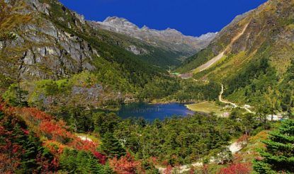
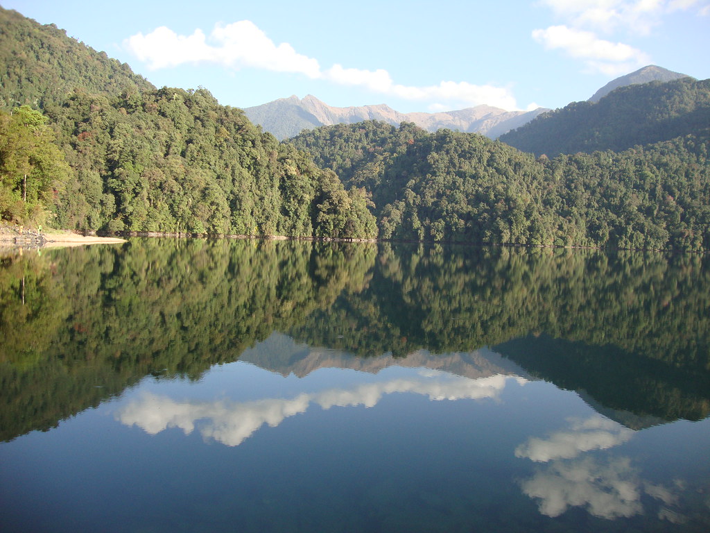
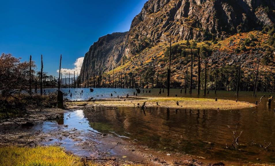
One of India’s remotest lakes, Madhuri Lake or Sangetsar Lake is a gorgeous lake against the Himalayas. The lake was made popular due to its appearance in a Bollywood movie and is known after its lead actress Madhuri Dixit who danced on its shores. The lake was previously known as Shonga-tser Lake and is located on the way from Tawang to Bum La Pass at an altitude of 12,000 ft above sea level just 30 km northeast of Tawang. The lake was created by falling rocks, boulders and trees in an earthquake and is tucked between huge mountains with many upright tree trunks standing in its belly as if guarding the lake and is special to Buddhists of India and Tibet who come here every year to pray. The best months to visit the lake are during October, November, March, April and May as the cold at this time subsides a little to allow normal tourist activities. Visits by civilians are only possible with permission from the Indian Army. The track is very treacherous, only SUVs advisable, and that too only on clear days with no snowfall or rainfall. Located almost 25 km from Tawang, the immensely picturesque P.T. Tso Lake is a perfect picnic spot, depending on the weather.

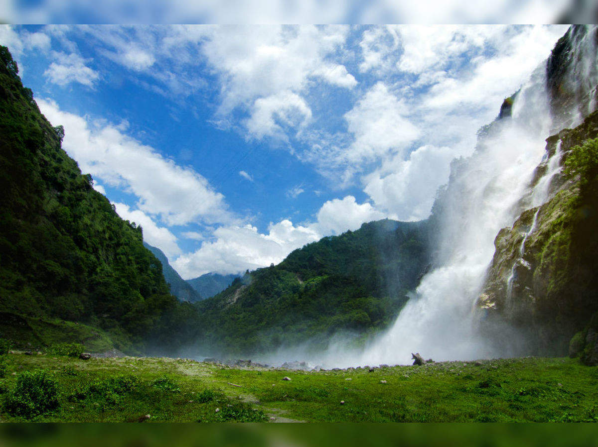
Largely known, the Nuranang Falls lie deep in the forest of Tawang and is one of the most spectacular waterfalls in the country. A beautiful white sheet of water that descends from the height of about 100 meters, it is a part of the Nuranang River which originates at the Sela Pass and just after the falls, merges with the Tawang River. Popularly known as the BTK waterfall, the Bap Ten Kang has crystal clear waters inside a lush green forest. The scenery around the falls is dotted by high hills all around, covered in thick greenery and mist hanging about. At the falls, one can visit the Hydel plant.

Gorichen Peak is Arunachal Pradesh highest peak and is located between Tawang and West Kameng at an altitude of 22,500 f above sea level, roughly about 164 km from Tawang. The peak is locally known as Sa-Nga Phu, which means the Kingdom of the Deity and is considered to be one of the sacred peaks protecting the people from the evils according to the local Monpa tribe.

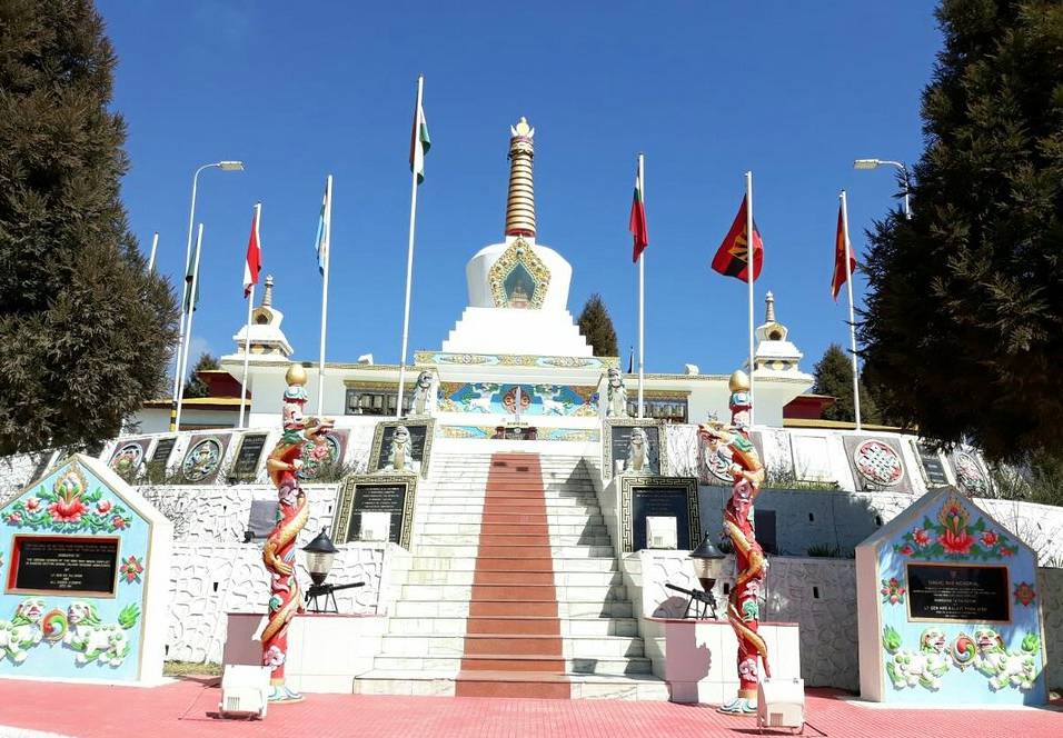
The Tawang War Memorial is a 40 feet colourful structure dedicated to the martyrs of the Sino-India War of 1962 overlooking the scenic Tawang-Chu valley.

In My Hands Today…

Koh-I-Noor: The History of the World’s Most Infamous Diamond – William Dalrymple and Anita Anand

On 29 March 1849, the ten-year-old Maharajah of the Punjab was ushered into the magnificent Mirrored Hall at the centre of the great Fort in Lahore. There, in a public ceremony, the frightened but dignified child handed over to the British East India Company in a formal Act of Submission to Queen Victoria not only swathes of the richest land in India, but also arguably the single most valuable object in the subcontinent: the celebrated Koh-i Noor diamond. The Mountain of Light.

The history of the Koh-i-Noor that was then commissioned by the British may have been one woven together from gossip of Delhi Bazaars, but it was to be become the accepted version. Only now is it finally challenged, freeing the diamond from the fog of mythology which has clung to it for so long. The resulting history is one of greed, murder, torture, colonialism and appropriation through an impressive slice of south and central Asian history. It ends with the jewel in its current controversial setting: in the crown of Queen Elizabeth the Queen Mother.

Travel Bucket List: India – Arunachal Pradesh Part 1

Also known as the Land of the Dawn-lit Mountains in Sanskrit, Arunachal Pradesh in northeast India was formed from the erstwhile North-East Frontier Agency (NEFA) region and became a state on 20 February 1987. It borders the states of Assam and Nagaland to the south and shares international borders with Bhutan in the west, Myanmar in the east, and a disputed border with China in the north at the McMahon Line. Arunachal Pradesh is the largest of the Seven Sister States of Northeast India by area and shares a 1,129 km border with China’s Tibet Autonomous Region. Itanagar is the state’s capital and its largest city. The area around the border is heavily fortified. Under the Foreigners (Protected Areas) Order of 1958, Inner Line Permits (ILPs) are required to enter Arunachal Pradesh through any of its check posts on the state’s border with Assam.

An ethnically diverse state, the Monpa people are predominant in the west, the Tani people in the centre, the Mishmi and Tai people in the east, and the Naga people in the southeast of the state. About 26 major tribes and 100 sub-tribes live in the state with the main tribes being the Adi, the Nyshi, the Singpho, the Galo, the Tagin, and the Apatani.

A major part of the state is claimed by the People’s Republic of China as part of the region of South Tibet. During the 1962 Sino-Indian War, most of Arunachal Pradesh was captured and temporarily controlled by the Chinese People’s Liberation Army.

In the ancient and medieval periods, Northwestern parts of this area came under the control of the Monpa kingdom of Monyul, which flourished between 500 BC and 600 CE. The Monpa and Sherdukpen keep historical records of the existence of local chiefdoms in the northwest as well and the remaining parts of the state, especially the foothills and the plains, were under the control of the Chutia kings of Assam. Recent excavations of ruins of Hindu temples indicate they were built during the Chutia reign. The 400-year-old Tawang Monastery in the extreme north-west of the state provides historical evidence of the Buddhist tribal people with the sixth Dalai Lama, Tsangyang Gyatso born in Tawang.

In 1912–13, the North-East Frontier Tracts were established by the British colonial rule with agreement from the indigenous peoples and the area was divided into three sections, which eventually came to be called the Ballipara Frontier Tract, the Lakhimpur Frontier Tract and the Sadiya Frontier Tract. Around 1913–1914, representatives of the de facto independent state of Tibet and Great Britain met in India to define the borders of Outer Tibet, concerning China. The British administrator Sir Henry McMahon drew the 890 km McMahon Line as the border between British India and Tibet, placing Tawang and other areas within British India. The representatives devised the Simla Accord including the McMahon Line, but the Chinese representatives did not concur. The Chinese position was that Tibet was not independent of China and could not sign treaties, so the Accord was invalid, like the Anglo-Chinese Convention of 1906 and the Anglo-Russian Convention of 1907. British records show that the condition for the Tibetan government to accept the new border was that China must accept the Simla Convention. As Britain was not able to get acceptance from China, Tibetans considered the MacMahon line invalid.

During the time that China did not exercise power in Tibet, the line had no serious challenges, but in 1935, it was discovered that the McMahon Line was not drawn on official maps. The Survey of India published a map showing the McMahon Line as the official boundary in 1937 and in 1938, two decades after the Simla Conference, the British finally published the Simla Accord as a bilateral accord and the Survey of India published a detailed map showing the McMahon Line as a border of India. In 1944, Britain established administrations in the area, from Dirang Dzong in the west to Walong in the east. After India’s independence in 1947 and the establishment of the People’s Republic of China in 1949, the new Chinese government still considered the McMahon Line invalid.  In November 1950, the PRC was poised to take over Tibet by force, and India supported Tibet.

What is now Arunachal Pradesh was established as the North-East Frontier Agency (NEFA) in 1954 and Sino-Indian relations were cordial until 1960. The resurgence of the border disagreement was a factor leading to the Sino-Indian War in 1962, during which China captured most of Arunachal Pradesh. However, China soon declared victory, withdrew back to the McMahon Line and returned Indian prisoners of war in 1963. The war resulted in the termination of barter trade with Tibet.

The North-East Frontier Agency was renamed Arunachal Pradesh on 20 January 1972, and it became a union territory. The state of Arunachal Pradesh came into being on 20 February 1987. In 2003, the Dalai Lama said that Arunachal was part of Tibet and in January 2007, he said that both Britain and Tibet had recognised the McMahon Line in 1914. In 2008, underscored that Arunachal Pradesh was a part of India under the agreement signed by Tibetan and British representatives. In recent years, China has occasionally asserted its claims on Tawang with India rebutting these claims and informing the Chinese government that Tawang is an integral part of India.

The state is primarily a hilly tract area nestled in the foothills of the Himalayas with almost 95% of the land under forest cover. Arunachal Pradesh has among the highest diversity of mammals and birds in India with around 750 species of birds and more than 200 species of mammals in the state. Arunachal’s forests account for one-third of the habitat area within the Himalayan biodiversity hot-spot. There are two tiger reserves in the state: a reserve in Namdapha National Park and Pakke Tiger Reserve.

The state is mentioned in the literature of the Kalika Purana and the Mahabharata. It is supposed to be the Prabhu Mountains of the Puranas and it was here that the sage Parashuram washed away his sins, sage Vyasa meditated, King Bhishmaka founded his kingdom and Lord Krishna married his consort Rukmini. The widely scattered archaeological remains at different places in Arunachal bear testimony to its rich cultural heritage. The climate varies from hot and humid to heavy rainfall in the Shivalik range. It becomes progressively cold as one moves northwards to higher altitudes.

Itanagar

Arunachal Pradesh’s capital and largest city, Itanagar is the seat of the state’s seat of government, as well as the seat of the Guwahati High Court’s permanent bench at Naharlagun. The city is inhabited by several tribes like the Nyishi, the Adi, the Apatani, the Tagin, the Galo and the Nyishis who are the original inhabitants.

One of the most historical sites in Arunachal Pradesh, Itanagar is named after Ita Fort which means a fort made of bricks where Ita is Ahom for bricks. Built around the 14th or 15th centuries, the fort has an irregular shape, built with bricks identified by scholars as built during the rule of the Chutiya Kingdom. The fort has three different entrances at three different sides, the western, eastern, and southern sides. The eastern gate has large blocks of sandstone at the foundation, on top of which bricks are placed which are similar to the walls of the Tamreswari temple and Rukmini Nagar. The Ita Fort is thought to be one of the early forts which the Chutia King Ratnadhwajpal built all around his kingdom from Biswanath to Disang. The bricks used in the fort hint at later repairs around the 14th and 15th centuries with the ruins of a hill fort on the banks of the Buroi River bearing the same builder’s marks as the ones found in the ruins of the Tamreswari Temple near Sadiya, which might indicate that the Chutia fortifications were spread till Biswanath. The location of the Ita Fort well to the east of Buroi shows that the Ita Fort was also one of the Chutia hill forts. Archaeological finds from the site are displayed at the Jawaharlal Nehru Museum.

The Indira Gandhi Park is a local recreational garden with a lot of scenic areas and greenery all around. The Polo Park is a botanical park at the top of the ridge and is a must-visit for tourists. There is a small zoo in the vicinity as well which is worth a look. The park overlooks Itanagar and is well known for its excellent views.

The Itanagar Wild Life Sanctuary is a major tourist attraction. The sanctuary is an expansive reserve with a delightful display of trees, foliage and wildlife. Unique species such as macaque, red pandas, capped langur, slow loris, porcupines and many more can be seen here. It is also a bird watcher’s paradise and there are safaris in the reserve. Tourists can be lucky to spot the red panda and porcupines.

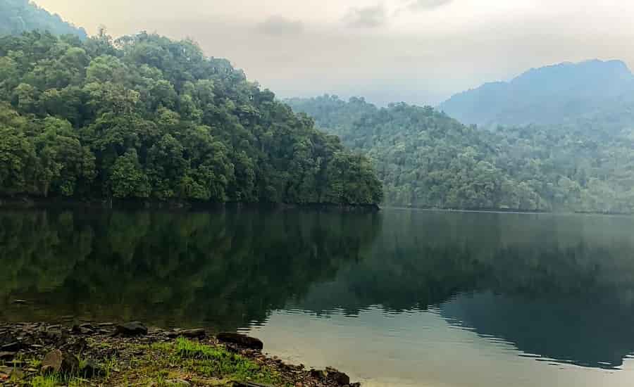
Gekar Sinyi or Ganga Lake is a beautiful natural lake which means confined lake in the Nyishi dialect. It is surrounded by a landmass of hard rock and primaeval vegetation, orchids masses on tall trees and tree ferns contribute to its popularity as a picnic spot and recreation hub. The pristine clear water and the shadows of the Himalayas highlight the beauty of the lake. Boating facilities and a swimming pool are also available at the lake.

The Gompa Buddhist Temple is one of the major tourist spots in Itanagar and the temple’s USP is its striking yellow roof which identifies the temple from afar. The roof is contrasted by the green carpets that surround the shrine.

The Jawaharlal Nehru Museum is known for showcasing the rich tribal culture of the state. Established in the 1980s, it showcases aspects of tribal life including clothing, headdress, weapons, handicraft, musical instruments, jewellery and other artefacts of daily use and culture, in addition to archaeological finds. The ground floor of the museum houses an extensive ethnographic collection, including traditional art, musical instruments, religious objects, and handicrafts, like wood carving and cane products, while the first floor has archaeological objects found at the Ita Fort, Noksparbat and Malinithan in the West Siang district. Apart from its collection, the museum runs a workshop for traditional cane products at its Handicrafts Centre and also sells tribal handicrafts.

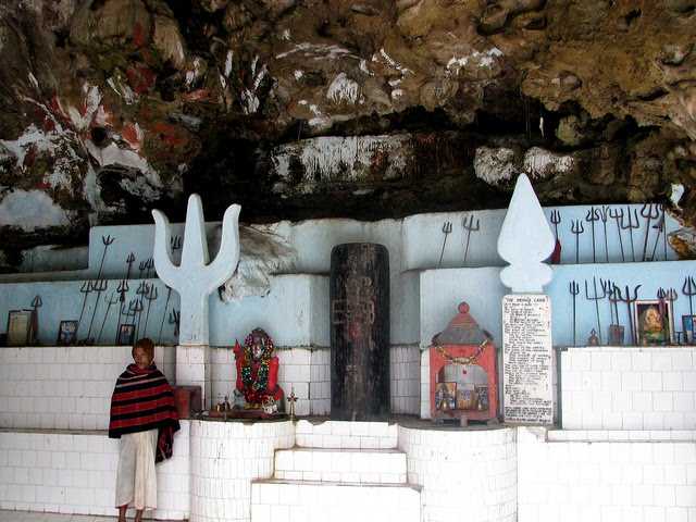
Lying at a distance of approximately 20 km from Itanagar, the quaint hill station of Rupa is a must-visit. Untouched, Rupa lies on the banks of the Tenga and is filled with verdant greenery, bright blue skies and crisp mountain air. The best way to explore Rupa is to take a morning or evening drive when the sun is slightly dancing over the horizon and paints the valley in kaleidoscopic of colours that glisten through the thick forest cover. Rupa is best known for its charming grasslands and gently rolling mountains that make it a perfect weekend getaway. The Rupa Monastery is a monastery in the Gelugpa school of Tibetan Buddhism while Shertukpen is a tribal village where one can experience the culture and lifestyle of locals. The Guru Rinpoche Cave is also situated nearby which can be explored. The first mention of Rupa is found somewhere around the 7th century with King Tsongtsen Gambo of Tibet.  The Chillipam Gomba or the Sang-Ngag Choekar Dargyeling Monastery overlooks a panoramic view of the surrounding valley. Built in the typical Chinese-Tibetan style, the monastery is a delicately designed edifice that is covered in colourful mosaics and paintings narrating stories of the Gods. The eight auspicious signs of Tibetan Buddhism also embellish the Gompa.
Bhalukpong

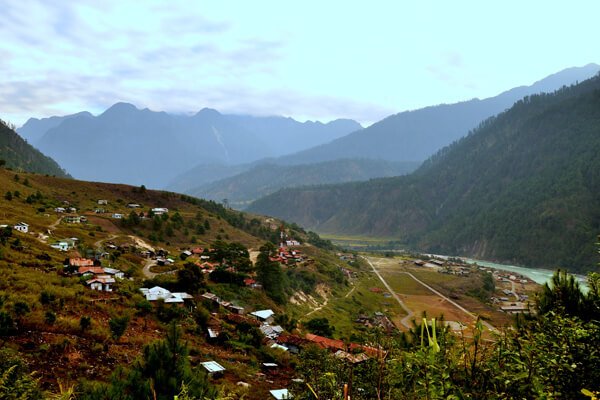
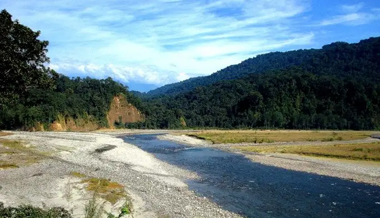
A small town on the southern reaches of the Himalayas, Bhalukpung lies about 174 km west of Itanagar and is the location of the inner line check post. Bhalukpung was governed by local tribal Aka rulers, with occasional political dominance from Bhutan and Assam. The Ahom rulers of Assam did not interfere with the local tribals, except for retaliatory raids into the tribal territory. In 1873, the British declared the area around Bhalukpung off-limits.

Fish angling and river rafting are the principal tourist activities in Bhalukpung and tourist attractions include the Pakhui Game Sanctuary and the Tipi Orchidarium, which hosts over 2600 cultivated orchids from 80 different species. The Kameng River running in the forest surrounding the town makes it even more attractive. Bhalukpung is inhabited by members of the Aka Tribes whose annual festival Nyethidow is celebrated in January.

The 100 sq km Sessa Orchid Sanctuary is full of lush greenery and colourful orchids with various varieties of orchids growing in the sanctuary. Also known as the Tipi Orchidarium, the reserve has over 2600 cultivated orchids from 80 different species. The sanctuary conjoins the Eaglenest Wildlife Sanctuary to the southwest and is a part of the Kameng Protected Area Complex (KPAC), an Elephant Reserve and the largest contiguous closed-canopy forest tract in the state, which includes the Sessa, the Eaglenest, the Pakke, the Nameri, and the Sonai Rupai sanctuaries and associated reserved forest blocks. The complex covers 3500 sq km in area and ranges from 100 m to 3,300 m in altitude.  There are trekking routes for visitors to enjoy the natural habitats of orchids with deep gorges and valleys, high peaks and rugged terrain that is rewarding for both nature lovers and adventure tourists. A nursery includes representative specimens of various orchid species of the sanctuary and a demonstration farm of the Cymbidium hybrids for cut-flower production. Most of Sessa has traditionally been claimed by the Bugun tribe as part of their territory. The Sessa and Eaglenest ridges rise to 3,250 m and 2,700 m respectively and are the first major barriers to the monsoon as it moves north from the plains of Assam. The Sessa sanctuary is drained by the Tippi Naala which joins the Kameng river at Tippi village.

The Critical Ecosystem Partnership Fund (CEPF), a consortium of major international and regional organizations, has identified the Eastern Himalayan region around Arunachal Pradesh including Nepal, Bhutan and all of North-East India as a critical global biodiversity-rich area deserving of conservation focus. They identified the North-Bank Landscape, that is the north bank of the Brahmaputra, extending up the Eaglenest and Sessa slopes and the Tawang region as worthy of particular focus. Sessa is within the Conservation International Himalaya Biodiversity Hotspot area and the BirdLife International has designated the Sessa and Eaglenest Sanctuaries as an Important Bird Area, with the Blyth’s tragopan identified as a vulnerable species of the area.

The royal Pakhui Wildlife Sanctuary is home to the Royal Bengal Tiger and other varieties of flora and fauna with at least 40 mammal species and 300 bird species making the sanctuary their home. Also known as the Pakke Tiger Reserve, the sanctuary is a Project Tiger reserve and is about 862 sq km in size. This Tiger Reserve in the undulating and hilly foothills of the Eastern Himalayas has won the India Biodiversity Award 2016 for its Hornbill Nest Adoption Programme. It is bounded by the Bhareli or Kameng Rivers in the west and north, and by the Pakke River in the east and is surrounded by contiguous forests on most sides. To the east lies the Papum Reserve Forest towards the south and southeast, the sanctuary adjoins reserve forests and Assam’s Nameri National Park. To the west, it is bounded by Doimara Reserve Forest and the Eaglenest Wildlife Sanctuary; and to the north by the Shergaon Forest Division.  

Initially constituted as Pakhui Reserve Forest in 1966 and declared a game reserve in 1977, it was renamed the Pakhui Wildlife Sanctuary and became Pakhui Tiger Reserve in 2002. The reserve’s elevations range from 100 to 2,000 m with rugged terrain with mountainous ranges in the north and narrow plains and sloping hill valleys in the south. Three large cats – the Bengal tiger, Indian leopard and clouded leopard share space with two canids – the wild dog and Asiatic jackal. Among bird species, the globally endangered white-winged wood duck, the unique ibisbill, and the rare Oriental bay owl can be found here. Of the over 1500 butterfly species found in India, it is estimated that Pakke Tiger Reserve could be home to at least 500 species as well as about 36 reptile species and 30 amphibian species. The Assam roofed turtle, a highly endangered species, is commonly sighted. The people living around the park belong to the Nyishi community who have joined hands with civil society and the forest department to protect hornbill nests.

In My Hands Today…

My Homage to All – Kanan Devi, translated by Indranee Ghosh

One of the most powerful women in the movies was thousands of miles from Hollywood.

Kanan Devi, one of the early singing stars, came into the film world in the silent era and, unlike many others, survived the transition to talkies. The product of a troubled childhood, her life took a dramatic turn when she was offered a film role and, encouraged by her uncle, took it.

In this lively and candid account of her experiences, originally published in 1973, Kanan Devi recalls the early days of cinema in Bengal, comparing conditions of film acting in the early 1930s with what she experienced two or three decades later when she herself was a producer and director, with her own film company, Shrimati Pictures.

Her fascinating and unusual story offers not only a different perspective on the growth of the film industry in Bengal but also a first-hand account of the position of women in the early decades of the last century.

India’s most Mysterious Places

India is an ancient civilisation and as with such a history, there are bound to be many mysteries associated with the country. Owing to India’s vast size, cultural differences, and mythological stories, it became a land of strange tales, some born out of rumours and some the result of the imagination. Some stories and myths are so strange they have to be true. So after my post on the world’s mysterious places, how can I ignore India? So here are some of India’s most mysterious places. Some of these have been mentioned in my bucket list series while the others are new even to me. The places are listed in alphabetical order, by state.

The Hanging Pillar of Lepakshi, Andhra Pradesh
The beautiful 16th-century Veerabhadra temple, also known as Lepakshi temple, is located in the small historical village of Lepakshi. Built in the typical style of Vijayanagara architecture, the temple features many exquisite sculptures of Gods, Goddesses, dancers and musicians, and hundreds of paintings all over the walls, columns and ceiling depicting stories from the epics of the Mahabharata, the Ramayana, and the Puranas, including a 24 by 14 feet fresco of Veerabhadra, the fiery God created by Shiva, on the ceiling, which is the largest fresco of any single figure in India. At the front of the temple is a large Nandi (bull), the mount of Shiva, which is carved from a single block of stone, and is said to be one of the largest of its type in the world.

Among the 70 stone pillars, there is one that hangs from the ceiling. The base of the pillar barely touches the ground and is possible to pass objects such as a thin sheet of paper or a piece of cloth from one side to the other. It is said that the pillar is a bit dislodged from its original position when a British engineer tried to move it in an unsuccessful attempt to uncover the secret of its support.

Kamakhya Devi Temple, Assam
A beautiful ancient hilltop temple dedicated to the mother goddess, Kamkhya, the Kamkhya Temple is is one one of the oldest and most revered centres of Tantric practices. It is also one of the Shakti Peethas or places, where Goddess Sati’s body parts fell on Earth. Legend has it that the Kamakhya Temple is built on the spot where Sati’s yoni or vagina fell. Every year, a very mysterious thing happens in the temple for three days in a specific month. It is believed that the goddess goes through her menstrual cycle and the water of the Brahmaputra river, which flows near the temple, turns red with her blood.

Jatinga, Assam
In the small and quaint Assamese town of Jatinga, over the last hundred years, thousands and thousands of birds have flown to their death over a particular strip of land here. Why this strip of land has become the Bermuda triangle for birds is still unexplained. However, every year after the monsoons in September or October, from 6 to 9:30 pm on moonless nights, the birds in the area seem to get agitated and disoriented. During the dark and foggy nights in monsoons, migratory birds flying over the village, dive headlong into trees, buildings, poles, and other structures, crashing to death. This phenomenon is not confined to a single species, with the birds mostly juvenile. According to ornithologists, the dense fog and high altitude daze the birds and due to this they end up crashing into trees and buildings. The birds, mostly juveniles and local migrants, are disturbed by high-velocity winds at their roost. When the disturbed birds fly towards lights as refuge they are hit with bamboo poles and killed or injured.

Khooni Nadi, Delhi
Who would imagine that in the heart of India’s capital is a bloody river or the Khooni Nadi, a small stream surrounded by trees and green vegetation? The river is believed to be haunted with many terrifying accounts of people being sucked into the water, never to be seen again. It is believed that anyone touching the water of the river will get sucked inside, only to turn into ghosts and wander around the stream. It is also said that anyone loitering around the river during sunset can also hear unusual sounds of crying people. Even though the depth of the stream is shallower compared o other rivers, people still drown here.

Agrasen Ki Baoli, Delhi
Also known as Ugrasen Ki Baoli, Agrasen Ki Baoli is a 60-meter long and 15-meter wide historical step well in the heart of New Delhi. It is believed to be originally built by the legendary king Agrasen in 3000 BC and rebuilt in the 14th century during the Tughlag or Lodi period of the Delhi Sultanate. This Baoli, with 108 steps, is among a few of its kind in Delhi. The baoli has many legends to its credit with one saying that the water collected used to turn black and ghostly demons used to hide out here in its walls. It is also said that when people approached the black water in the well, they would be enticed by it and were compelled to commit suicide. As they leapt from the well into the depths of the black water below, the water would rise and spill over, oozing the blood of its victim. Many people complain about being ‘followed’ in the stepwell as they can hear footsteps behind them. But, this can be explained away by the echoes caused by the acoustics in the architecture.

Dumas Beach, Gujarat
Located in Surat, in the western state of Gujarat, Dumas Beach on the Arabian Sea looks like a gorgeous slice of paradise during the day. But once the sun does down, it becomes deserted with those staying on the beach overnight either never coming back or having horrible experiences. Famous for its black sand, the beach was once used as a Hindu burial ground and hence is said to be possessed by several spirits that never left the region. According to local folklore, the existence of black sand is because of the amount of ash created by burning the dead which got mixed with the white sand of the beach and it turned dark. People strolling on the beach hear whispers and find no one when they look around for the source. There have even been reports of disappearances on the beach.

Jwala Ji Temple, Himachal Pradesh
Located in the lower Himalayas in Kangra, the Jwala Ji temple is a holy shrine typical of other Jwala Ji shrines in the country. But what is unique and mysterious about this temple is the eternal flame that burns inside the shrine. There is a central pit of hollowed stone inside the shrine where the flame burns. The temple is also a Shaktipeeth and it is where Sati’s tongue fell and the Goddess is manifest as tiny flames that burn flawless blue through fissures in the rock. This flame has been burning for centuries. It is theorised that the flame is burning off a supply of natural gases like methane under its surface.

Gyanganj, Himalayas
More than an actual destination, Gyanganj is a belief. There is a belief in the existence of a mysterious city of immortal beings. It is believed that Gyanganj is hidden from sight, far out of the reaches of modern mapping and technology as it is probably camouflaged or even may exist in another dimension. According to the legends, Gyanganj is believed to be an antediluvian Indian and Tibet tale of a city-kingdom of enigmatic eternal beings that remain concealed from the world. It is said that they exist deep in the Himalayas, however, have an influence over mankind in several clandestine ways. Gyanganj is said to be in an isolated valley in the Himalayas and is called Shangri-La, Siddhashram or Shambhala. A point to note is that one can not access Gyanganj unless they have a Karmic Connection with it. Tibetan Buddhists believe that this mysterious region is hidden in some obscure place in Central Asia. What’s more interesting is the Tibetan Buddhist mythos says that when the world falls into a chasm of ravenousness and war, the 25th ruler of Shambhala will appear to escort the blue planet into a better future.

Talakadu Mini Desert, Karnataka
Located on the banks of river Kaveri, in the Chamarajanagar district, a village lies buried deep in the sand. Talakadu is believed to have been home to about 30 temples once, five of which are Lingams representing the 5 faces of Lord Shiva. It is believed that a widowed devotee of Lord Shiva named Allemalamma in the 16th century had once cursed Talakadu, following which the village turned into a desert and the River Kaveri became a swirling whirlpool at Malangi. The curse also included the Wodeyar dynasty of Mysore which was cursed with childlessness, all of which is true today.

Shettihalli, Karnataka
Also known as the Submerged Church and the Floating Church, the Shettihalli Church was built in the 1860s by French missionaries in the Gothic style of architecture. After the construction of the Hemavati Dam and Reservoir in 1960, the church was submerged under water and has since become a famous tourist spot where people flock to see the half-submerged church during the monsoons.

Village of Twins, Kerala
Kodinhi is a small village in Kerala, about 35 km from Calicut. Around 2000 families live here and almost every family has a pair of twins. The village is renowned for its inexplicable number of twin births since 1949 and today there are 200 pairs of twins and three pairs of triplets in the village. Also known as the Village of Twins, women from the village who marry outside also have twins or triplets. Despite several studies being conducted, the exact cause of this phenomenon is yet to be ascertained. According to medical experts, this phenomenon is due to the chemicals present in the water in the area. According to locals, the oldest known twin pair in the village was born in 1949.

Source

Idukki, Kerala
Idukki is a small town in the Wayanad district of the Malabar region. On Monday, 15 July 1957, rain that was red in colour or blood rain as it was called occurred here. The rain subsequently turned yellow. After this time, blood rain happened again between 25 July to 23 September 2001 when heavy downpours of red-coloured rain fell sporadically, staining clothes pink. Yellow, green and black rain was also reported. Coloured rain was also reported in Kerala in 1896 and several times since, most recently in June 2012. Following a light-microscopy examination in 2001, it was initially thought that the rains were coloured by fallout from a hypothetical meteor burst, but a study commissioned by the Government of India concluded that the rains had been coloured by airborne spores from a locally prolific terrestrial green algae from the genus Trentepohlia.

Magnetic Hill, Ladakh
Magnetic hills, or gravity hills, are optical illusions in which a road that looks like it’s sloping uphill due to the surrounding landscape is sloping downhill, so cars, buses and other vehicles appear to roll uphill in defiance of gravity. Local superstition holds that the magnetic hill outside of Leh, India, leads people to heaven, and visitors flock here to test this strange natural phenomenon for themselves. Cars have been known to reach speeds of 20 kmph while climbing uphill of their own volition. According to science, the mountain has a strong magnetic field that pulls these cars and there is also likely to be an optical illusion where the road actually goes downhill but seems otherwise.

Kongka La Pass, Ladakh
At an elevation of 16,970 feet, the Kongka La Pass is a low mountain pass on the Line of Actual Control between India and China in eastern Ladakh. There have been many UFO and strange humanoid figure sightings there and locals believe that the area is home to aliens.

Shaniwarwada Fort, Maharashtra
A historical fortification in Pune, Shaniwar Wada was the seat of the Peshwas of the Maratha empire. Built in 1732, and following the rise of the Maratha Empire, the palace became the centre of Indian politics in the 18th century. The fort itself was largely destroyed in 1828 by an unexplained fire, but the surviving structures are now maintained as a tourist site. When 16-year-old Narayan Rao acquired the throne at the Shaniwar Wada Fort, conspiracies began surrounding him to dethrone him. An uncle and aunt sought the help of the head of the Gardis, a tribe of hunters who killed the young Peshwa, chopped his body into pieces, and tossed them into a nearby river. It is believed that the fort is now populated by lost souls who died within its walls and locals who live nearby also claim that you can hear the heart-wrenching screams of the young Peshwa on full moon nights. The fort is one of those places that forbid entry after 6.30 pm.

Shivapur Levitating Stone, Maharashtra
The Hazrat Qamar Ali Darvesh is known for a special rock that weighs 70 kg and can only be lifted by one means. To lift the rock, 11 people are required to gather around it, touch it with their forefingers, and loudly call out the name of the saint who placed a curse on it, following which the stone rises in the air magically. The stone cannot be lifted by any other means, no matter how strong it is. It is believed that a Sufi saint named Qamar Ali placed a curse on this stone that was being used for bodybuilding about 800 years ago.

Lonar Crater Lake, Maharashtra
Lonar is an unassuming village in Maharashtra known for being the site of a meteor impact crater. The crater is a notified National Geo-heritage Monument, created by a meteorite collision impact during the Pleistocene Epoch. It is one of the four known, hyper-velocity, impact craters in basaltic rock on Earth with the other three basaltic impact structures in southern Brazil. Over the years, the crater has become a lake, which is both alkaline and saline at the same time and creates an ecosystem for several organisms that are rarely found elsewhere. There seems to be no known source of the perennial springs that feed the lake. In many parts of the lake, compasses don’t work, and no one knows what lies at its bottom. In a 2019 study, conducted by IIT Bombay it was found that the minerals in the lake soil are very similar to the minerals found in moon rocks brought back during the Apollo Program. The lake was declared a protected Ramsar site in November 2020.

Shani Shingnapur, Maharashtra
A small village about 35 km from Ahmednagar Shani Shingnapuris famous for its temple dedicated to Lord Shani, the God associated with the planet Saturn. But that’s not all that is famous about this village. But what is the village most famous for is that none of the houses, or any building in the village has a door, only a door frame. Despite this, officially no theft was reported in the village although there were reports of theft in 2010 and 2011. The temple is believed to be a Jagrut Devasthan or an alive temple which means that a deity still resides in the temple icon. The deity here is Swayambhu or self-evolved that is self emerged from earth in the form of a black, imposing stone. Found by shepherds of the hamlet, the stone statue is believed to be in existence for a few thousand years. Villagers believe that Lord Shani punishes anyone attempting theft, hence the lack of doors in the village and the near-zero crime rate.

Shetpal, Maharashtra
Shetpal, or Shetphal is a small village about 200 km south of Pune which is famous for snake worship. The village has established a custom, wherein it is mandatory for every household to have a resting place for cobras in the rafters of their ceilings. Snakes are worshipped daily in every home in this village and have no restriction in their movements and none of the 2,600 plus villagers harm them in any way. Cobras are welcomed in every house as a member of the family and neither the cobras nor the residents live in fear of each other. If anyone in the village constructs a new house, he makes sure to devote a hollow portion of the dwelling as a devasthanam or a holy abode for the snakes. Snakes are treated as pets in this village, and even visit the schools when a class is in progress. Since adopting this relationship with the snakes, the locals have experienced virtually no problems with them, bar the occasional occupation of the bathroom.

Bhangarh Fort, Rajasthan
A 16th-century fort in Rajasthan, Bhangarh Fort was built by Bhagwant Das for his younger son Madho Singh and even today the fort and its precincts are well preserved. The fort is said to be haunted by the presence of a cursed princess and her captor, the wizard Sinhai. According to legend, a wizard adept in black magic named Sinhai fell in love with Ratnavati, a beautiful Bhangarh princess with many suitors. One day, the wizard followed her to the marketplace and offered her a love potion; however, she refused it, throwing it onto a large rock that consequently rolled onto the wizard and crushed him to death, but not before he cursed all the inhabitants of Bhangarh. According to another tale, a Sadhu or sage named Baba Balak Nath lived within the fort area, and it was his injunction that any house built in the precinct of the fort should not be taller than his own, and if the shadow of any such house fell on his, it would result in the destruction of the fort town. Today, the complex is considered one of the most haunted spots in India and the Archaeological Survey of India forbids visitors from entering the fort after sunset with locals reporting deaths as a result of the continued curse.

The Abandoned Village of Kuldhara, Rajasthan
A prosperous village established in the 13th century, Kuldhara was home to more than 1500 Paliwal Brahmans, descendants of a tribe that had lived there for more than 5 centuries. One night, in the 18th century, Kuldhara was suddenly abandoned by its population of about 1,500 people. The local legend claims that while deserting the village, the Paliwals imposed a curse that no one would be able to re-occupy the village. Those who tried to re-populate the village experienced paranormal activities, and therefore, the village remains uninhabited. Tourists who visit Kuldhara encounter an uneasy feeling when they set foot inside the village.

Jal Mahal, Rajasthan
Jal Mahal which means Water Palace is a palace in the middle of the Man Sagar Lake in Jaipur. The palace was originally constructed in 1699 as a hunting lodge with the building and the lake around it later renovated and enlarged in the 18th century by Maharaja Jai Singh II of Amber. However, when the King of Amber decided to build a dam between the two surrounding hills to save the city from floods in the 18th century, the depression around the palace started filling up with water. Today, when one looks across the Man Sagar Lake, one can see this palace in the middle, with one floor and plant life peeking from above its roof. Water hides 4 more floors below it and little else is known about this structure which has no chambers but a pavilion and a terrace garden. Nowadays, visitors can get to the palace using boats specially designed to match the appearance of the building. On the roof, there are various plants, including a few fully grown trees that can be seen from the shore.

Karni Mata Temple, Rajasthan
Dedicated to Goddess Karni Mata, the temple which lies about 30 km from Bikaner is also known as the Temple of Rats. The temple is famous for the approximately 25,000 black rats and a few white rats, which are very rare, and are revered, in the temple. These holy rats are considered as Depawat charan in a previous birth, these both take birth in a cycle of Depawat charan and Rats respectively. Many people travel great distances to pay their respects. Visitors are not allowed to kill, hurt, or even scare them away. These rats, or kabbas, as they’re called there, are considered to be highly auspicious, are worshipped, and safeguarded, which is why they hold more value than the humans visiting the shrine. The rats are believed to be the reincarnated relatives and family members of Karni Mata with the rare, white mice considered to be her sons. The temple draws visitors from across the country for blessings, as well as curious tourists from around the world.

The Shrine Of the Bullet Baba, Rajasthan
About 46 km from Jodhpur near the Chotila village there is an extremely unique shrine located known as the Shri Om Banna Shrine or the Shrine of the Bullet Baba. What’s unique about this shrine is that the main deity is not the usual statue of a God or Goddess, instead, it is a motorcycle, specifically a 350cc Royal Enfield Bullet with the license plate RNJ 7773. The story behind the shrine is that a man named Om Singh Rathore, or Om Banna, died at this spot in a tragic accident while riding back home on his bullet. What followed was a series of unusual happenings where the police would take away the bike, empty its fuel tank, and bind it in chains, but it would return to the same spot before daybreak and this happened every single time. When the authorities finally gave up, the locals built a temple around this bike. Today, hundreds of devotees turn up every day to pray for a safe journey.

The Floating Stones Of Rameshwaram, Tamil Nadu
A holy place at the southern tip of India. Rameshwaram holds immense importance in Hindu mythology, as it is where, according to the Ramayana, Lord Rama’s Vanara Sena or Monkey Army built a bridge of floating stones to Sri Lanka to fight the ruler, King Ravana who had abducted his wife Goddess Sita. According to the Ramayana, the bridge was built of stones that would stay afloat once the name of Lord Rama was scribbled on it. There is a bridge made of such stones, as they are still found around here. The weight of each stone is 10 to 20 kgs which are kept in the ancient Rama Temple. The stones that are found in the coastal regions will be similar to that of all other stone and has the same features. The ancient bridge between India and Sri Lanka can still be found on Google Maps and is known as Adam’s Bridge, a chain of limestone shoals & sand bars in the ocean between mainland India & Sri Lanka.

Chilkur Temple, Telangana
Also known as the Visa Balaji Temple, the Chilkur Balaji Temple is an ancient Hindu temple dedicated to Lord Balaji on the banks of the Osman Sagar near Hyderabad. This temple has no hundi and neither accepts any money from devotees. The temple became popular in 2000 as it became known to fulfill the wishes of devotees wanting to go overseas. In the quest of visiting abroad, thousands of devotees from across the country visit the temple every week. Apart from offering prayers for visas, devotees also pray at the temple for clearing exams and marriage. Once their wishes are fulfilled, devotees make sure that they visit the temple to thank the deity and perform circumambulations around the temple.

Roopkund, Uttarakhand
Also known as the Mystery Lake or Skeleton Lake, Roopkund is a high-altitude glacial lake in the lap of the Trishul massif in the Himalayas at an altitude of about 5,020 m surrounded by rock-strewn glaciers and snow-clad mountains. With a depth of about 3 metres, Roopkund is widely known for the hundreds of ancient human skeletons found at the edge of the lake. The human skeletal remains are visible at its bottom when the snow melts. Initial investigations led some to believe they were the remains of a semi-legendary event when a single group was killed in a sudden and violent hailstorm in the 9th century, but scientific research has subsequently shown that the remains belong to three distinct groups who died in two independent events. Because of the human remains, the lake has been called Skeleton Lake in recent times. Locals believe that the corpses belong to a then King and Queen of Kanauj, who were going on a pilgrimage but plunged into the lake due to a severe hailstorm and died.

Bara Imambara, Uttar Pradesh
Built by Asaf-ud-Daula, the Nawab of Awadh in 1784, Bara Imambara is also known as Asfi Imambara. Bara means big and this Imambara or congregation hall is the second largest after the Nizamat Imambara. With a blend of Arabic and European architecture, the Imambara’s central arched hall is about 50 metres in length and almost 3 stories high but has no pillars or beams supporting it and is one of the largest such arched constructions in the world. The main hall is also famous for its unique interlocking brick structure and the Bhulbhulaiya, a dense labyrinth.

Morgan House, West Bengal
Morgan House is a mansion of British colonial architecture built by an English jute baron Mr George Morgan in the 1930s on the hill station of Kalimpong to celebrate his wedding with an indigo plantation owner. After the wedding, Mr and Mrs Morgan occupied the British colonial mansion. Mrs Morgan died a premature death, and Mr Morgan left the house soon after. A trust took the ownership of the house after its abandonment and after India attained Independence the government took control of the property. It is now being maintained as a boutique hotel. Mrs Morgan’s sudden demise is believed to be because her husband tortured her before she died, and hence, her unhappy soul still haunts the house. Although there have been no sightings of Mrs Morgan’s ghost, people have heard the tapping of high-heeled footwear in the corridors of the lodge.
Aleya Ghost Lights, West Bengal
The Sundarbans are a mangrove area in the delta formed by the confluence of the Padma, Brahmaputra and Meghna Rivers in the Bay of Bengal. There are many sightings of unnatural glowing lights of different colours hovering over these marshes. Referred to as Aleya Lights for many years now, these lights are a nightmare for fishermen, as they usually end up confusing them and they would lose their way. In many cases, various fishermen have even lost their lives due to these strange lights. According to local belief, these lights are emanated from the stranded spirits of dead fishermen who lost their lives in these swamps. According to scientists, these lights are natural phenomena such as bioluminescence or chemiluminescence, caused by the oxidation of methane produced by organic decay or due to geological faulting.

I’ve enjoyed putting together this mini-series on mysterious places and hope to get to see as many as I can, especially those that are born of natural phenomena. Mother Nature at her best, don’t you think?