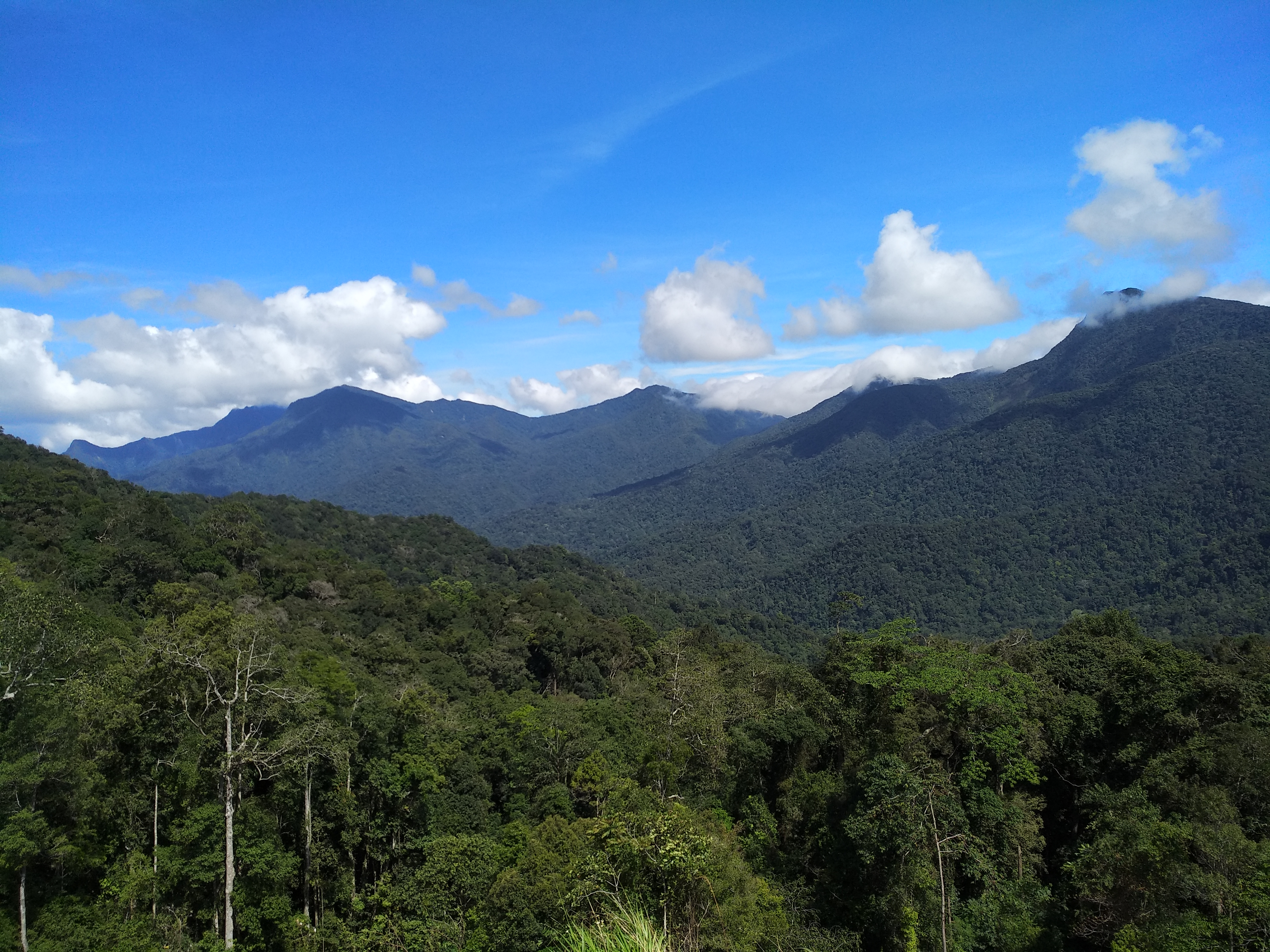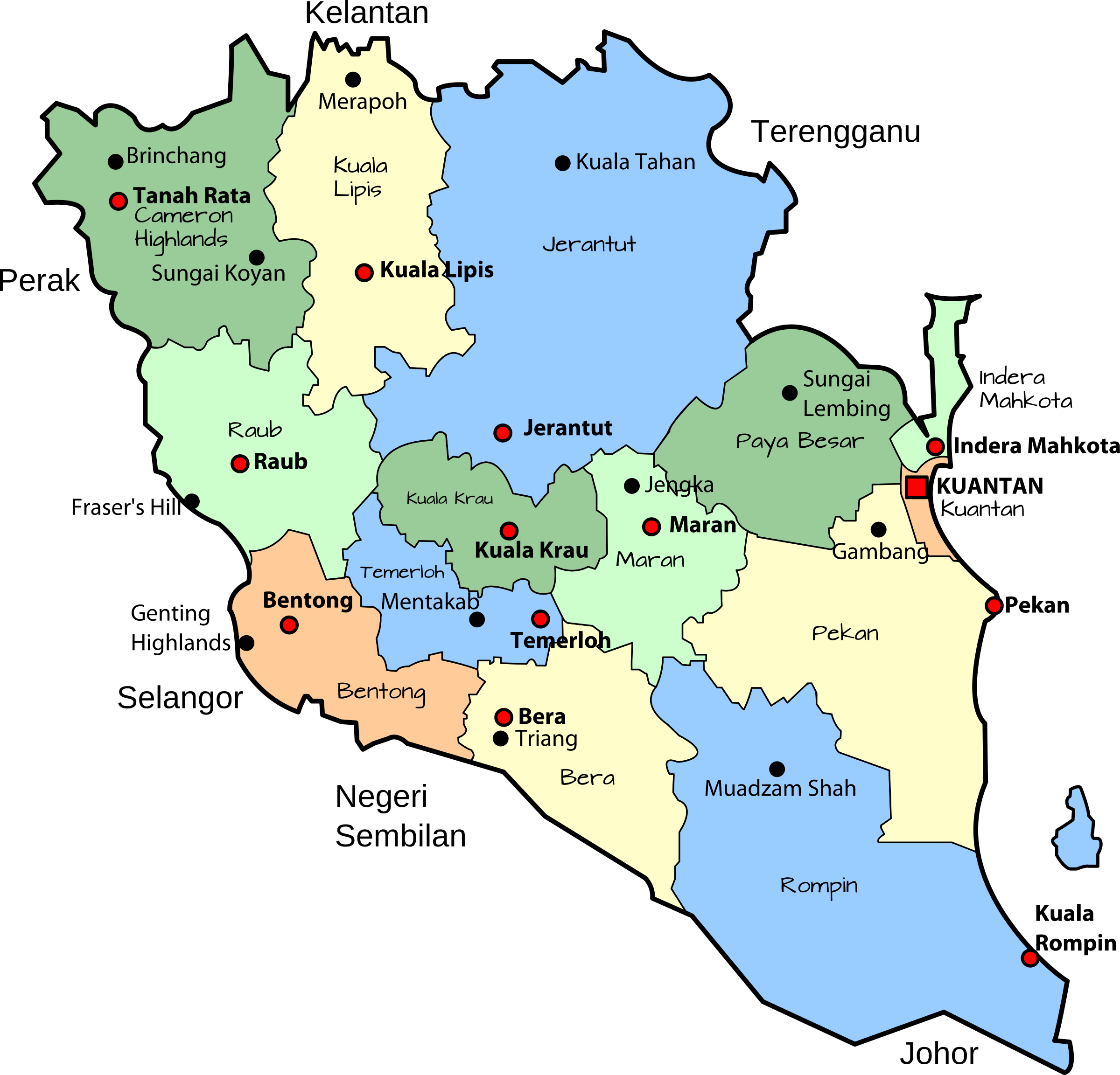
Officially known as Pahang Darul Makmir or the Abode of Tranquility, Pahang is Malaysia’s third-largest state by area and the largest in peninsular Malaysia as well as the ninth-largest by population. The state occupies the basin of the Pahang River and a stretch of the east coast as far south as Endau. Geographically located in the East Coast region of Peninsular Malaysia, the state shares its borders with Kelantan and Terengganu to the north, Perak, Selangor and Negeri Sembilan to the west, Johor to the south, and the South China Sea to the east. The Titiwangsa mountain range that forms a natural divider between the Peninsula’s east and west coasts is spread along the north and south of the state, peaking at Mount Tahan, which is 2,187 m high & the famous Kuantan 188, which is 188 m high. Although two-thirds of the state is covered by dense rainforests, its central plains are intersected by numerous rivers, and along the coast, there is a 32-km wide expanse of alluvial soil that includes the deltas and estuarine plains of the Kuantan, Pahang, Rompin, Endau, and Mersing rivers.
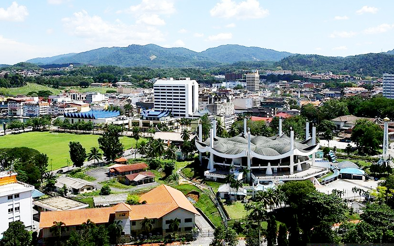
Pahang’s capital and largest city, Kuantan, is the eighth-largest urban agglomeration by population in Malaysia. The royal capital and the official seat of the Sultan of Pahang is located at Pekan, or the old town, which was also the old state capital and was known historically as Inderapura. The head of state is the Sultan of Pahang, while the head of government is the Menteri Besar. The government system is closely modelled on the Westminster parliamentary system.
Archaeological evidence revealed the existence of human habitation in what is today Pahang from as early as the palaeolithic age. The early settlements gradually developed into an ancient maritime trading state by the 3rd century. In the 5th century, Old Pahang sent envoys to the Liu Song court. During the time of Langkasuka, Srivijaya and Ligor, Pahang was one of the outlying dependencies. In the 15th century, the Pahang Sultanate became an autonomous kingdom within the Melaka Sultanate and was centred in modern-day Pekan. At the height of its influence, the Sultanate was an important power in Southeast Asian history and controlled the entire Pahang basin, bordering to the north the Pattani Sultanate, and adjoins to that of Johor Sultanate to the south. To the west, it also extended jurisdiction over parts of modern-day Selangor and Negeri Sembilan. Pahang entered into a dynastic union with Johor Empire in the early 17th century and later emerged as an autonomous kingdom in the late 18th century. Following the bloody Pahang Civil War that ended in 1863, the state under Tun Ahmad of the Bendahara dynasty was eventually restored as a Sultanate in 1881.
In 1895, Pahang became a British protectorate along with the states of Perak, Selangor and Negeri Sembilan. During World War II, Pahang and other states of Malaya were occupied by the Empire of Japan from 1941 to 1945. After the war, Pahang became part of the temporary Malayan Union before being absorbed into the Federation of Malayas and gained full independence through the federation. On 16 September 1963, the federation was enlarged with the inclusion of new states of North Borneo, Sarawak and Singapore, which was expelled in 1965. The federation was opposed by neighbouring Indonesia, which led to the Indonesia–Malaysia confrontation over three years, along with the continuous war against local Communist insurgents.
The Khmer word for tin is pāhang, and it is phonetically identical to the old Jawi word for Pahang. Since the tin mines at Sungai Lembing were known since ancient times and the Malay peninsula was within the sphere of influence of Khmer civilization, William Linehan hypothesized that the name of the state was named after the Khmer term of the mineral. There were many variations of the name Pahang outside the Malay world. The transition from Inderapura to Pahang, approximately around the Song period, indicates that Khmer influence on the state was weakened and displaced by that of Srivijaya and Majapahit. Arabs and Europeans, on the other hand, transliterated Pahang to Pam, Pan, Paam, Paon, Phaan, Phang, Paham, Pahan, Pahaun, Phaung and Phahangh.
The Pahang River basin connects with Malaysia’s two largest natural freshwater lakes, Bera and Chini. Described as a wetland of international importance, Bera Lake was accepted as Malaysia’s first Ramsar site in 1994. The highest peak, Mount Tahan, reaches 2,187 m in elevation, which is also the highest point in Peninsular Malaysia. Pahang is home to Malaysia’s two important national parks, Taman Negara and Endau-Rompin, both located in the north and south of the state, respectively. These large primary rainforests are extensive and are home to many rare or endangered animals. Popular hill resorts located along these main highland areas are Cameron Highlands, Genting Highlands, Fraser’s Hill and Bukit Tinggi. Cameron Highlands is home to extensive tea plantations and is also a major supplier of legumes and vegetables to both Malaysia and Singapore. Pahang’s long, scenic coastline is a paradise of swaying palms and sandy beaches like Cherating, Teluk Cempedak, Beserah, Batu Hitam and Tanjung Sepat. Also located along the coastal plain is a 32 sq km wide expanse of alluvial soil that includes the deltas and estuarine plains of the Kuantan, Pahang, Rompin, Endau, and Mersing rivers. About 58 km off the coast of Pahang lies Tioman Island, an alluring holiday paradise in the South China Sea, acclaimed as one of the best island getaways in the world.
Malaysia is considered one of the most biodiverse countries on earth. Pahang maintains a protected network of managed areas rich in flora, fauna, and natural resources, despite deforestation, rapid industrialisation and an ever-growing population. Pahang has about 74 forest reserves, including ten virgin-jungle reserves and 13 different amenity forests, wildlife reserves, national parks and offshore marine parks. Of these, the Pahang segment of Taman Negara is the most outstanding. Others include the Krau Wildlife Reserve, the Bera Lake Ramsar Site, Tioman Island Marine Park and the Cameron Highlands Wildlife Sanctuary. The total forest area in Pahang is about 66% of the land area, of which 89% is a dryland forest, 10% peat swamp forest, and 1% mangroves. About 56% of the total forest is within the Permanent Forest Estate, including almost the full range of forest types found in Malaysia, although some of the more unique environments such as the heath forest or the forest on ultrabasic rocks exist only in fragmented areas of Pahang. The protected forest within Taman Negara and Krau Wildlife Reserve includes small areas of extreme lowland alluvial plains. Virtually every species of bird and mammal known from Peninsular Malaysia has been recorded in Pahang, other than a few confined to the north of the country or the west coast.
Pahang River is the longest river in the Peninsula, and from its headwaters to the estuary, it includes virtually all of the natural river types. The huge network of rivers in Pahang is home to freshwater aquatic biodiversity, which is important to the economy of the state. Connecting to this riverine system are several natural freshwater lakes, most notably the Bera and Chini lakes. Surrounded by a patchwork of dry lowland dipterocarp forests, the lake environment stretches into islands of peat swamp forests. Rich in wildlife and vegetation, the lakes provide an ecosystem which supports not only a diversity of animal and plant life but sustains the livelihood of the Orang Asal, the aboriginal people inhabiting the wetlands. Most of the coastline is sandy, with rocky headlands at intervals. Mangroves and nipah swamps are confined to estuaries and do not occur along the exposed coast. There are many islands off the east coast, the largest being Tioman and Seri Buat islands. Besides the island populations of fauna and flora, which sometimes differ genetically from mainland forms of the same species, these islands are of value for the reefs and other bottom features which support marine biological diversity. Tioman, Chebeh, Tulai, Sembilang, and Seri Buat islands constitute the Tioman group of islands within the Marine Parks system of Peninsular Malaysia.
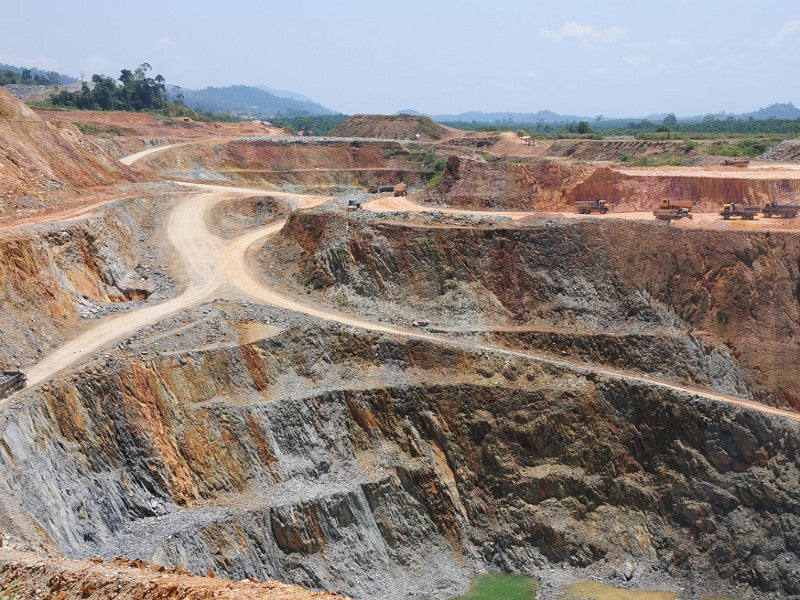
Modern Pahang is an economically important state with main activities in the services, manufacturing and agricultural sectors. Over the years, the state has attracted much investment, both local and foreign, in the mineral sector, including iron ore, gold, tin and bauxite. Malaysia’s substantial oil and natural gas fields lie offshore in the South China Sea. At one time, timber resources also brought much wealth to the state.
Historically, by the 19th century, Pahang’s economy, like in ancient times, was still heavily dependent on the export of gold. Gold mines can be found from Bera to the Jelai River River basin. Systematic mining started in 1889 during the British protectorate when the Raub Australian Gold mine was established. Extensive underground mining took place in the area, and this continued until 1985, during which time the mine at Raub produced nearly 1 million ounces, 85% of the production of Peninsular Malaysia. Tin was also mined on a large scale with production primarily concentrated at Sungai Lembing, where during its heyday, the operations saw the excavation of deep shaft mines that were among the largest, longest and deepest in the world. The growth of the mining industry had a significant impact on Pahang’s society and economy towards the end of the 19th century. Thousands worked in the mines, which became an important trading centre in the state. Today, the mining industry, along with quarrying, only accounted for 1.6% of the total state GDP in 2016. Pahang accounts for more than 70% of Malaysia’s estimated 109.1 million tonnes of bauxite reserves. The services sector, which constitutes 49% of the total Pahang GDP, is primarily driven by the wholesale and retail trade, food and beverage and accommodation while manufacturing accounts for 22% of the state economy and tourism contributes approximately 26% of the overall state economy.
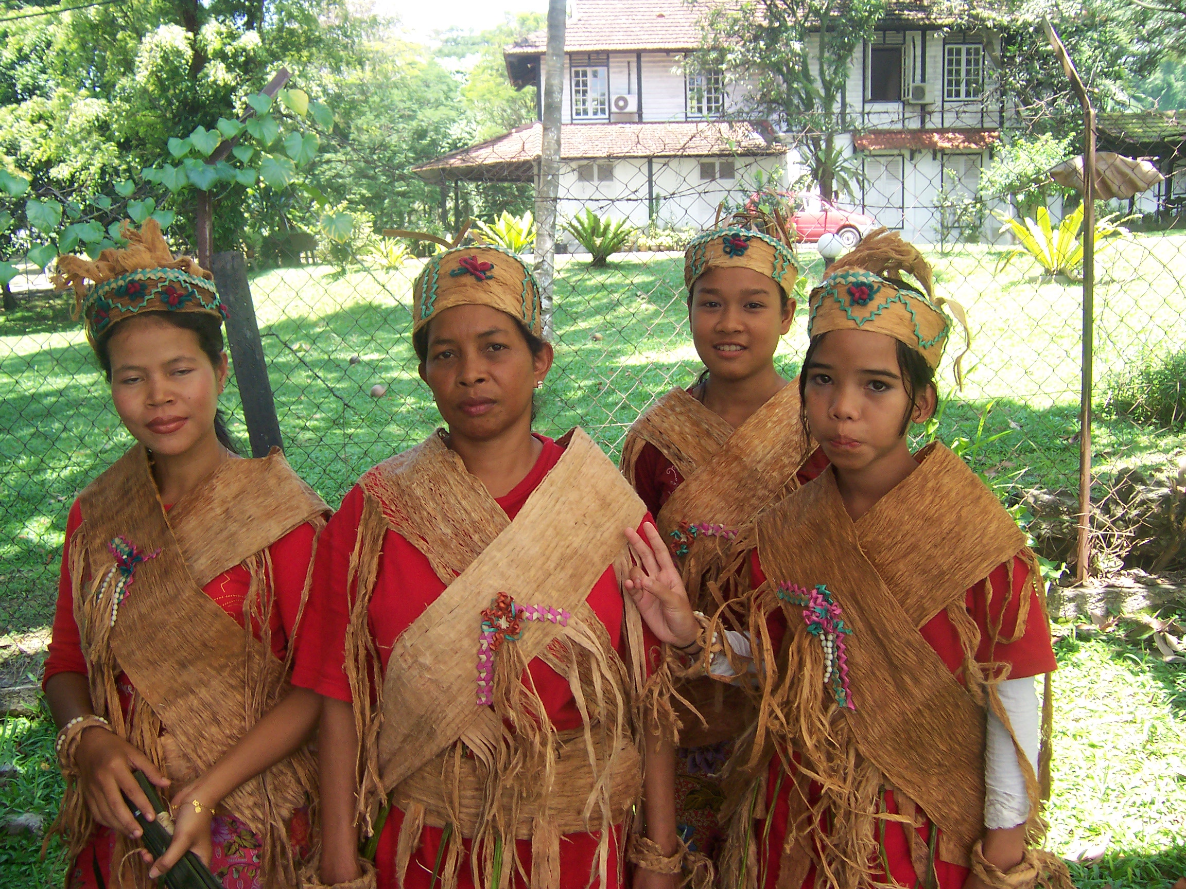
As a less ethnically diverse state, the traditional culture of Pahang is largely predominated by the indigenous culture of both Malays and Orang Asli. Both cultures trace their origin from the early settlers consisting primarily various Malayic-speaking Austronesians and Mon-Khmer-speaking Austroasiatic tribes. Around the opening of the common era, Mahayana Buddhism was introduced to the region, where it flourished with the establishment of a Buddhist state from the 5th century. Malayic cultures flourished during the Srivijayan era, and Malayisation intensified after Pahang was established as a Malay-Muslim Sultanate in 1470. Pahang Malays share similar cultural traits with other sub-groups of Malay people native to the Malay peninsula, in particular, closely affiliated to the people of the east coast of the peninsula like Thai Malays, Terengganu Malays and Kelantanese Malays. The cultural features of the Orang Asli are represented by significantly diverse tribal identities. Before 1960, the various indigenous groups did not consciously adopt a common ethnic marker to differentiate themselves from the Malays. The label Orang Asli itself historically came from the British. Each tribe has its language and culture and perceives itself as different from the others. This micro identity was largely derived spatially from the geographical area they traditionally settled. Their cultural distinctiveness was relative only to other Orang Asli communities, and these perceived differences were great enough for each group to regard itself as unique from the other.

Kuantan
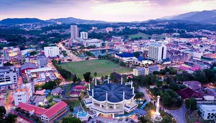
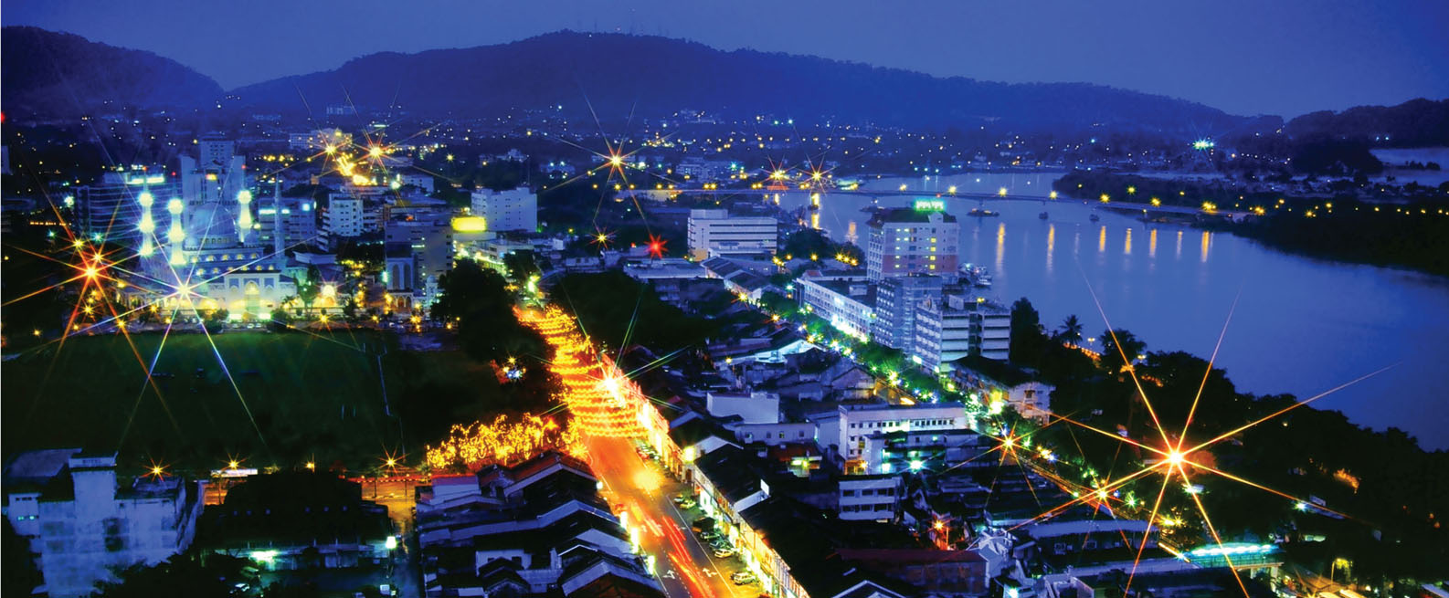
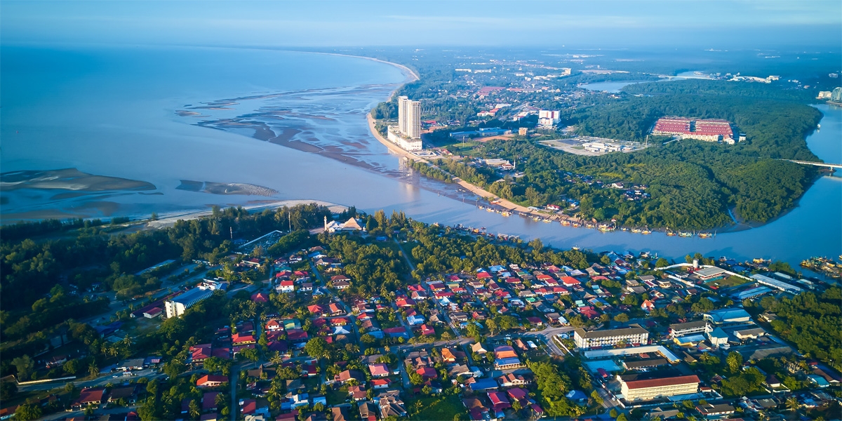
The capital of Pahang, Kuantan is located near the mouth of the Kuantan River. It is the 18th largest city in Malaysia and the largest city on the East Coast of Peninsular Malaysia. The administrative centre of Pahang was officially relocated to Kuantan on 27 August 1955 from Kuala Lipis.
During the first century, Kuantan was a part of the Chih-Tu empire. In the 11th century, the land was conquered by another small empire called Pheng-Kheng before being taken over by the Siamese during the 12th century. During the 15th century, Kuantan was ruled by the Malacca Empire.
Kuantan is said to have been founded in the 1850s. In its early days, it was known as Kampung Teruntum or Teruntum Village. The village was situated at the mouth of the Teruntum River, which is in front of the current hospital, and it was established by Haji Senik and his followers in the 1850s. Early primary economic activities included fishing and small businesses. The main evidence of the establishment of the village is the cemetery that is situated near Taman Esplanade in front of the current Hospital Tengku Ampuan Afzan. Towards the late 19th century, the arrival of Chinese miners and traders saw the establishment of a township in Kuantan and nearby tin mining areas such as Gambang and Sungai Lembing. Similar to what occurred in other states in Peninsular Malaysia, rubber plantations attracted Indian settlers as well. The sinking of HMS Prince of Wales and HMS Repulse took place off the coast of Kuantan on 10 December 1941. Kuantan was declared a full-fledged city by Sultan Abdullah of Pahang on 21 February 2021, and its town council was officially renamed the Kuantan City Council or MBK.
One of Kuantan’s major economic activities is tourism. Domestically, it is famous for the production of handicrafts, batik, keropok or dried fish crackers and salted fish. The timber industry, the ice cream and the fishing industry also play major roles in the local economy.
Kuantan is famous among locals and tourists for its fish crackers called keropok in Malay and salted fish, where the fish is marinated mainly with salt and left out to dry in the sun for days and sold at the market, Serambi Teruntum in Tanjung Lumpur.

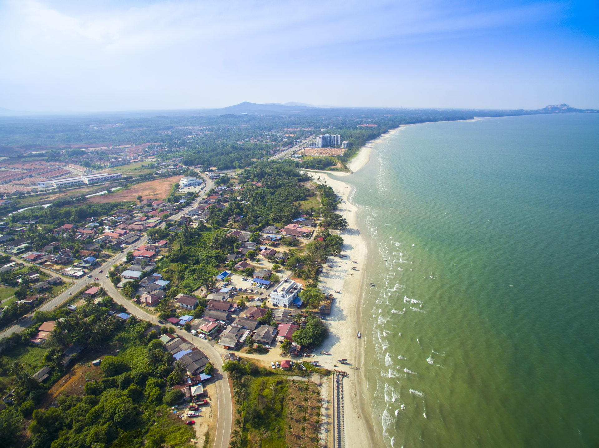
Also known as Palm Beach, Teluk Chempedak is Kuantan’s main sightseeing attraction. It is a beautiful white sandy beach located 5 km from Kuantan. The boardwalk here offers amazing views of the beach with the jungle on the other side and connects to Missionary Beach. Geologically, Chempedak Beach is quite special since it witnessed volcanic activity a long time back. This led to the formation of three-layer rocks made up of basalt, dolerite and granite. The beach also has a bunker dating back to World War II. For children, there is a playground equipped with decent playing facilities. The beach is ideal for jet-skiing, surfing and swimming. Swimming is strictly forbidden during the monsoon season between November and February. A 24-hour open convenience store known as 7-Eleven is located at the beach that also has toilet facilities. Other popular scenic beaches in the city’s vicinity include Batu Hitam, Balok, Chenor, Pantai Sepat, Beserah, and Cherating. Near Cherating, there are turtle sanctuaries, and a few kilometres away from Cherating is Pulau Ular or Snake Island.

Located about 10 km from Kuantan, Pantai Batu Hitam or the Black Rock Beach, is a beach with white sands and black volcanic rocks. The beach is famous not only for its unique rocky, sandy surface but also for its therapeutic benefits and calming surroundings. For the ones looking for some fun activities to indulge in, Batu Hitam has a batik workshop as well as various sports activities to participate in. There are several resorts around the beach which offer spa facilities with natural ingredients and minerals extracted from the cleansing volcanic rocks.

Taman Gelora, is one of Malaysia’s most beautiful seaside parks. It is widely popular because of the scenic view, a natural jogging path, a huge playground and a magnificent pond with blooming water lilies. One of the major attractions at Taman Gelora is probably the daily 10,000-step challenge which not only allows the visitors to get into good health in a fun way but also takes them through the various parts of this beautifully created park and gives them the perfect escape from the hustle and bustle of life.

Taman Esplanade is a 1-km-long paved walkway and public space along the Kuantan River at Jalan Besar. People come here for a walk along the river while enjoying the gentle breeze of the sea. Lined with palm trees, Taman Esplanade stretches from Shahbandar Jetty to Mega View Hotel. The walkway is well-lit with lamp-posts, and many people come here for jogging and exercising. A great spot for fishing, Taman Esplanade also has a children’s playground with swings, slides, see-saws and other playing facilities for kids to enjoy their time here while you take a rest on the benches. In the middle of the Esplanade, one can find a food court with local delicacies.

The beautiful Taman Bandar is a recreational park providing a mesmerising lake view along with housing proper jogging pathways and exercising areas. Situated in front of the Kuantan Immigration Office, the best time to visit is before 6:30 pm to experience scenic beauty. To relax and destress, one can feed fish in the lake or grab some snacks from nearby restaurants.

Kuantan is known for its waterfalls. The most well-known is the Sungai Pandan Waterfall, located about 25 km from the centre of Kuantan and also known as Panching Waterfall; this 100 m high majestic waterfall is part of Sungai Pandan under one of Malaysia’s Forest Reservation Area. There is a fish spa near the waterfall, which is the perfect antidote to a stressful life. The waterfall makes for a great picnic spot. The suspension bridge near the falls allows visitors to get amazing views of the waterfall. Visitors are allowed to swim in the pool located at the bottom of the waterfall, as its shallow depth makes it a child-friendly place. One can also try their hand at barbeques as there are designated barbeque grill areas in the reserve. Visitors are also free to explore the trails leading up to the waterfall or buy some souvenirs from nearby stalls. The waterfall is open between 9 am to 5 pm on Mondays to Thursdays and is between 9 am and 6 pm on Saturdays and Sundays. It is closed on Fridays. Other waterfalls near Kuantan include the Sungai Berkelah Waterfall and the Jerangkang Waterfall. One can also go on a river cruise on the Kuantan River from the small jetty there.

Also known as Sultan Ahmad Shah State Mosque, the Masjid Sultan Ahmed Shah mosque is the state mosque of Pahang. Seen from afar, the mosque looks magnificent, especially when lit up at night. The first structure and style of the mosque were that of a big dome with a minaret. However, this construction style started having serious leakage problems during the rainy season. In 1992, the mosque was demolished, and a new mosque with a new design consisting of four rocket-like minarets with a large dome encircled by four smaller domes was constructed, and the new mosque was reinaugurated in 1994. The mosque is surrounded by a huge open green area and is built in Ottoman-Moorish Islamic architectural style. The mosque is spacious from the inside and has a huge hall which is big enough to accommodate eight thousand people at any given time. The mosque is open between 5 am and 10:30 pm daily.

Dedicated to the Supreme Patriarch of Taoism, the Lao Zi Temple is located along the Kuantan-Sungai Lembing road. Its 823 meters long Golden Dragon Structure is the main attraction, with it being listed in the Malaysia Book of Records as the country’s longest dragon statue. Inside the dragon walls, a 5000-word scripture, Book of Tao & its Virtues, is written. At the exit, one will come across a ball called the Dragon’s Pearl. It is believed that touching the ball brings good luck. The temple compound features many statues of Chinese zodiac creatures, deities and a 7-meter-tall statue of Laozi himself. To reach Lao Zi Temple, one will have to walk inside the dragon structure by entering through its tail and then emerging out of its mouth. If one chooses to walk through the dragon to reach the temple, the ticket is RM 5, but if they take the shortcut by climbing the stairs, they’ll have to pay RM 3.
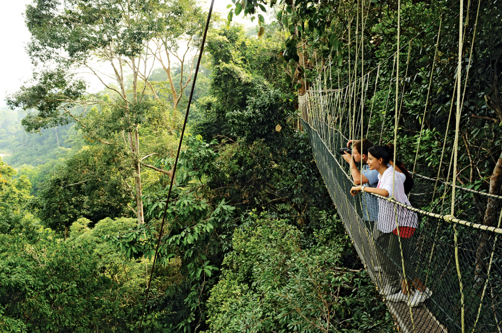
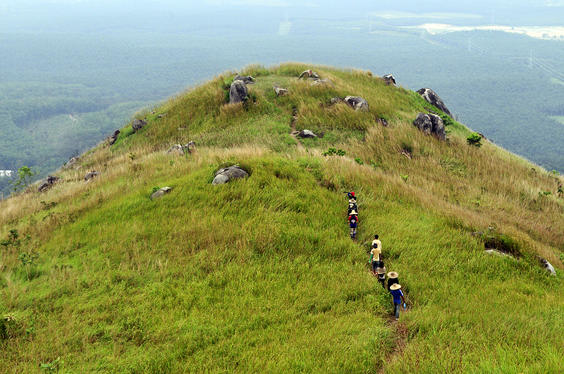
The Taman Negara, which is around 130 million years old, is a rainforest that boasts of being the oldest one on Earth. The national park covers an area of 4343 sq km and is renowned not only for its rainforest but also for its birds and insects. Visitors can traverse the longest rope walkway in the world and enjoy birds and animals in their natural habitat. At the rainforest, one can climb Teresk Hill using one of the two trails leading up to the 334-meter high hill. The boardwalk route along the east of the river is relatively easy to walk on, while the route to the west is tougher and leads through muddy paths full of leeches. But the upside of this trek is the variety of wildlife one can see on the way up. The canopy walk on the suspension bridge on Bukit Teresek is the longest in the world at a height of 530 meters. Taman Negara offers treks of various lengths, which can last up to 9 days, and visitors are free to choose whatever suits them the best according to their previous trekking experience and expertise levels. Visitors can also visit Orang Asli settlements in the rainforest. Orang Asli translates to original people in Malay, and many settlements belonging to the Orang Asli lie along the trail, some of which can only be reached via a short boat ride. Visitors can opt for a night walking safari or a night 4WD Safari and view nocturnal plants and animals. Other than these, visitors can also opt to fish, explore caves, bird watching, mountain climb or camp at the national park.
A must-visit at Taman Negara is the Lata Berkoh and waterfall cascades. The waterfall is a popular spot for swimming, with a boat ride for RM 160. On the way up, one should visit the Kelah Fish Sanctuary. The national park also plays videos on flora and fauna, which are shown in the Interpretive Room at 9 am, 3 pm and 5 pm daily. The best time to visit the park is between February and September, when it is the dry season. However, many visitors visit between April and August, which happens to be the tourist season.

Kuantan 188, previously known as Teruntum Tower is a 3-story, 188-meter-tall tower, Malaysia’s second-tallest tower after the Kuala Lumpur Tower and the second-tallest in the East Coast Economic Region after the newly completed Grand Ion Majestic in Genting Highlands, which is Pahang’s tallest building. Its construction was started in August 2017 and completed on 3 September 2019. It features an observation deck at 92 m, a restaurant at 98 m and an open sky deck at 104 m. The tower offers a 360-degree view of Kuantan River and Kuantan City. The design of the tower was inspired by the spearhead which is one of the elements on Pahang’s Coat of Arms while the tower’s porch is inspired by the Lumnitzera Tree. The tower’s porch symbolises the diversity of the people of Kuantan and Pahang. The five connected steel posts of the spire represent the five principles of the Rukun Negara as the core of people’s unity. It also represents the five Pillars of Islam. The golden tower’s pinnacle symbolises the sovereignty of the Sultan of Pahang.
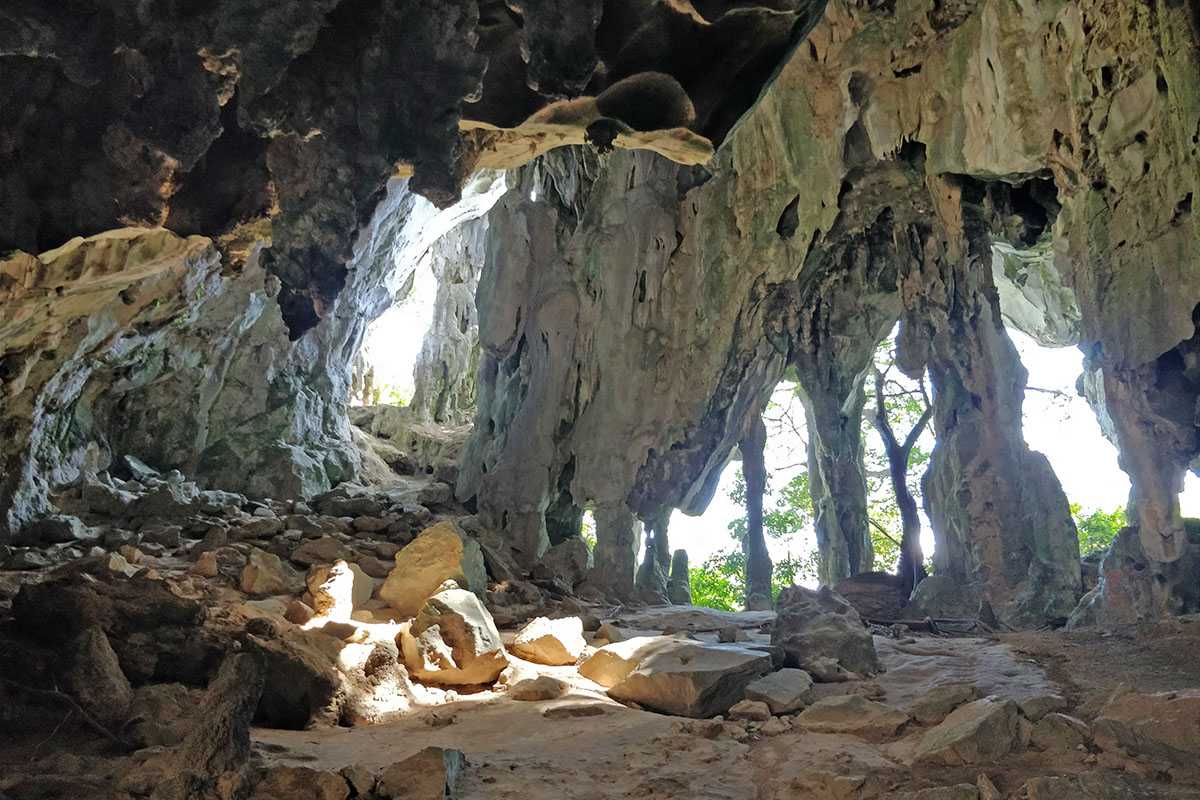
Gua Charas is a limestone cave formed millions of years ago and holds great religious importance for both Hindus as well as Buddhists. This temple cave is located inside a limestone hill known as Bukit Charas and is located around 25 km northwest of Kuantan. The 400 million-year-old granite and limestone massif reaches 355 meters in height and is dotted with symbols and statues of Hinduism and Buddhism. Inside the temple cave, one can find an idol of the Sleeping Buddha, as well as the Jala Lingam, which represents the Hindu deity, Lord Shiva. Other than the main temple cave, one can also explore other open-sided caves located further up on the mountain.
After the car park, visitors should climb up to the mouth of the caves. They should take the stairs that lead up to the cave. The insides of the cave are untidy, and the walls are of a greenish hue because of the moss. After climbing the first 100 cemented steps or so, one reaches the lower cave. Inside one of these caves is the famous statue of the reclining or sleeping Buddha. The cave is lit up beautifully, and other than the statue, there are some notable rock formations in the cave. These include formations that resemble the goddess Kwan Yin, a fish, a nostril, a royal tombstone, an elephant and a combing princess. Further ahead, there are various other caves with openings. Inside one of these caves is a black pillar which is known as Jala Lingam, which represents Lord Shiva. From here, one can get a bird’s eye view of the plain and Kuantan. One of the cave walls also features some graffiti that is around forty-seven years old. Interestingly, this graffiti is considered to be more of heritage than vandalism, given that it has existed for such a long time now. The odour of bat droppings can be quite overwhelming, so those with allergies should refrain from visiting Gua Charas. It is also to be noted that all visitors should be free from any allergy related to limestone also. Heart patients and claustrophobic people should indulge in only limited activities at the cave. The cave is open between 8:30 am and 5 pm daily and has an entry fee of RM 2 for adults and RM 1 for children.