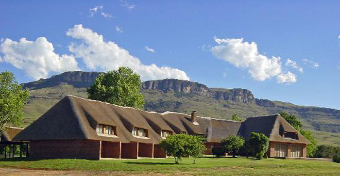
Located about 104 km north of Ranchi, Hazaribagh is considered a health resort and is also popular for the Hazaribagh Wildlife Sanctuary which lies about 17 km from the city. Located in the Chhota Nagpur plateau about 2,000 m above sea level on the middle plateau, Hazaribagh is a beautiful place with dense forests and natural formations including rock formations and lakes.
Hazaribagh’s name is derived from two Persian words: Hazar meaning one thousand and bagh meaning garden and the town’s name means a city of a thousand gardens. In ancient times the district was covered with inaccessible forests inhabited by tribes that remained independent. The entire territory of Chhotanagpur, now known as Jharkhand was presumably beyond the pale of outside influence in ancient India. Throughout the Turko-Afghan period, up to 1526, the area remained virtually free from external influence and it was only with the accession of Emperor Akbar to the throne of Delhi in 1557 that Muslim influence penetrated Jharkhand, then known to the Mughals as Kokrah. After the death of Emperor Akbar in 1605, the area presumably regained its independence which necessitated an expedition in 1616 by Ibrahim Khan Fateh Jang, the Governor of Bihar and brother of Queen Noorjehan who defeated and captured Durjan Sal, the 46th Raja of Chotanagpur. In 1632, Chotanagpur was given as an endowment to the Governor at Patna for an annual payment of Rs.136,000 which was raised to Rs.161,000 in 1636. After the Kol uprising in 1831 the territories of Ramgarh, Kharagdiha, Kendi and Kunda became parts of the South-West Frontier Agency and were formed into a division with Hazaribagh as the administrative headquarters. In 1855-56 there was the great uprising of the Santhals against the British which was brutally suppressed. In 1912, a new province of Bihar and Orissa was split from Bengal Province and in 1936, the province was split into separate provinces of Bihar and Orissa, with the Chota Nagpur division being a part of Bihar. Bihar’s boundaries remained mostly unchanged after Indian Independence in 1947. In 2000, Jharkhand was separated from Bihar to become India’s 28th state. A small but effective Bengali community settled at Hazaribagh in the 19th century when the area was in Bengal Presidency.
The Hazaribagh National Park is one of the oldest wildlife sanctuaries in India, established in 1954 to conserve wildlife and provide a home for rare and endangered species of flora and fauna. The wildlife sanctuary’s landscape is full of steep hills, spectacular countryside, thick tropical forest and lovely meadows. Located about 19 km from Hazaribagh, the interiors of the park are very well-connected by internal roads of 111 km that allow animals to go about their daily business. Spread over an area of 184 sq km at an altitude of 615 m, the park did not get much tourist attention until 2007 when the deputy CM of the state announced the construction of a state-of-the-art elephant project that aimed at attracting more tourists.
The park is abode to a variety of rare and endangered flora and fauna including animals like the Sambar, Nilgai, Bison, Spotted deer, Cheetah, Wild Boar and Kakkar which can be easily seen at dawn and dusk, enjoying the water holes. If one is lucky, they might even see a sloth or a panther. At one time, Hazaribagh Wildlife sanctuary was famous for its enormous population of tigers, but now one would be lucky to catch a glimpse. The tiger population is fast dwindling and has been a matter of concern. According to the 1991 census, there were only 14 tigers in the park. The natural vegetation consists primarily of grass meadows and thick tropical forests with the entire area covered with Sal and other trees during the spring season. Plenty of water resources in small form rivers and artificial lakes also adorn the sanctuary. Many watchtowers facilitate wildlife watching built near water holes, that provide breathtaking top views. One can also take a jeep safari to explore the sanctuary which has a tribal hamlet inside. The safari can be done using a private vehicle or by hiring a jeep. For private vehicles, there is a nominal fee of INR 100. The park is open between 6 am and 8 pm and Indians need to pay an entry fee of INR 50 while foreigners will pay INR 100.
Canary Hills is an ideal escape from bustling city life. As one climbs up the hill walking past a dense forest filled with lush greenery and a lake they will reach a spot that has a magnificent view of the eastern Hazaribagh. One can also drive to the hill to a rest house and view the western part of Hazaribagh which is the main town. Hazaribagh Jheel or Lake is a famous local picnic spot divided into four parts with the third lake having the best views of sunrise and sunset. Just 6 km from Hazaribagh in the village of Kahapriama, is a famous temple dedicated to Lord Narsimha, an incarnation of Lord Vishnu and is known as Narsimhasthan. The beautiful temple also has a Shivalingam.
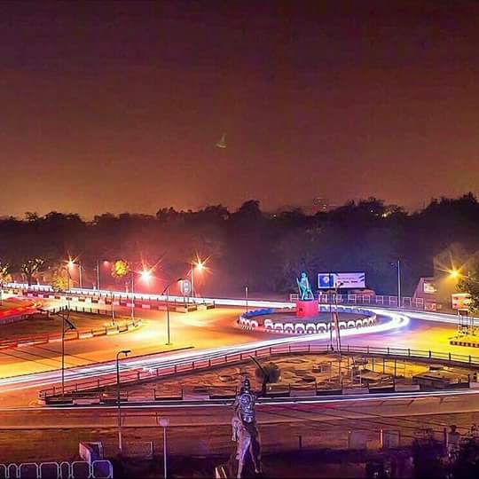
119 km northeast of Ranchi and about 130 km southeast of Hazaribagh, Bokaro is officially known as Bokaro Steel City is the fourth largest and most populous city in the state. One of India’s planned cities, it is located on the banks of the Garga River and the fringes of the Bokaro River, surrounded by the hill ranges in the Giridih and Ramgarh districts.
Marafari is the oldest settlement in Bokaro which was just a village during the time of the Mughals and various sultanates. India’s first Global Active City or GAC, Bokaro has emerged as a commercial, industrial, healthcare, sports, educational, and startup hub. The city is filled with lakes, greenery, and beautiful parks and has a significant Bengali influence because it is close to the state’s border with West Bengal.
Established in the 1980s, the Jawaharlal Nehru Biological Park became famous for its rare collection of big cats such as the white tigers and the Asiatic lions but due to a lack of adequate infrastructure, some of them had to be moved to zoos in other parts of the world. The zoo houses many species of animals and plants and also has a toy train and a boating facility in its artificial lake. One giant artificial lake and three artificial islands along with some amazing greenery are what constitute the City Park of Bokaro which also has many boating activities. The River Garga is a tributary of the Damodar River that flows on the southern parts of the city of Bokaro. A dam was constructed on it in the 1950s to make it the first such river valley project in the country. Known as the Garga Dam, power is generated from the dam, and the water is used for Bokaro’s use.
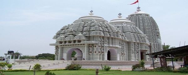
Named after the 23rd Tirthankara of the Jains, Parasnath is a popular Jain pilgrimage centre. It is believed that 20 out of 24 Teerthankars have attained their deliverance here on the highest peak in this range, Sammet Sikhar. There are as many as 20 temples here, some of which were built more than 2000 years ago. The Rajrappa temple on the confluence of the Damodar and Bhairavi rivers is influenced by the Tantric style of architecture and is a major pilgrimage site.
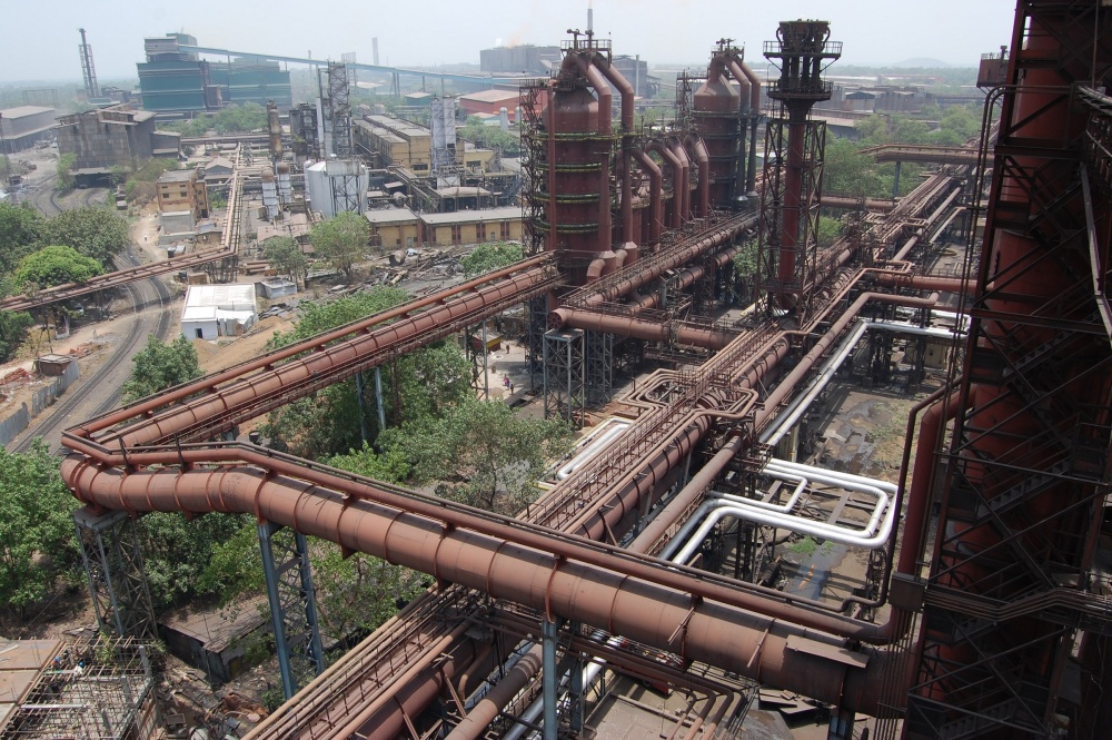
India’s largest iron and steel complex, Bokaro Steel Plant is regarded as the country’s first Swadeshi Steel Plant with maximum investment going into materials, equipment and R & D. The plant was conceived as to grant the country freedom from dependency on foreign sources to induce a measure of confidence and self-reliance. The plant was the country’s first indigenous project of its kind that utilised local material, manpower, and intellectual resources in all places possible. Located along the Damodar River, the plant is famous for its tours where one can witness all the processes involved in the manufacture of steel.
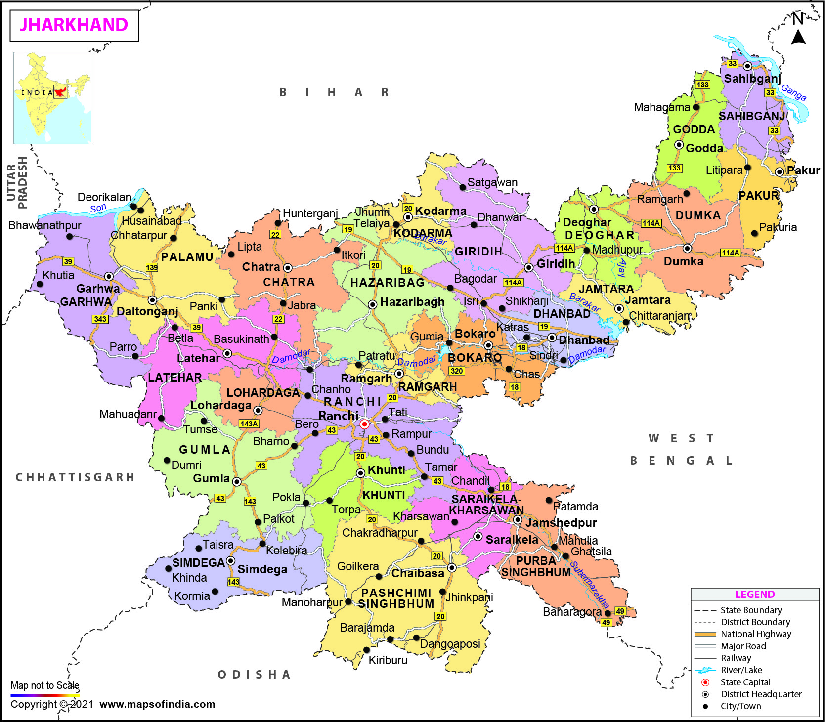
Our next state is not known in the tourism circuit but is one of India’s hidden gems. With a name meaning the land of forests, Jharkhand is bordered by West Bengal to the east, Chhattisgarh to the west, Uttar Pradesh to the northwest, Bihar to the north and Odisha to the south. It was created in 2000 from the territory that had previously been part of the state of Bihar. The 15th largest state by area and the 14th largest by population, Jharkhand’s capital is the city of Ranchi and Dumka the sub-capital. Hindi is the state’s official language and the state is known for its waterfalls, hills and holy places. Much of Jharkhand lies on the Chota Nagpur Plateau with many rivers passing through the plateau.
Jharkhand suffers from what is sometimes termed a resource curse: it accounts for more than 40% of the mineral resources of India, but 39.1% of its population is below the poverty line and 19.6% of children under five years of age are malnourished. The state is primarily rural, with about 24% of its population living in cities, but today is amongst the leading states in terms of economic growth with the state’s GDP growth rate in 2017–18 at 10.22%.
The region has been inhabited since the Mesolithic-Chalcolithic period. During the 2nd millennium BC, the use of copper tools spread in the Chota Nagpur Plateau and these are known as the Copper Hoard Culture. In the Kabra-Kala mound at the confluence of the Son and North Koel rivers in the Palamu district, various antiquities and art objects have been found which are from the Neolithic to the medieval period and the pot-sherds of redware, black and redware, blackware, black slipped ware and NBP ware that are from the Chalcolithic to the late medieval period. During the age of the Mahajanpadas around 500 BC, Jharkhand was a part of the Magadha and Anga empires while in the Mauryan period, this region was ruled by several states, which were collectively known as the Atavika or forest states who accepted the suzerainty of the Maurya empire during Emperor Ashoka’s reign. In the 7th century, the Chinese traveller Xuanzang passed through the region and described the kingdom as Karnasuvarna with Shashanka as its ruler. The region was invaded during the reign of Emperor Akbar in 1574.
During the 18th century, the region became part of the East India Company. The Princely states in Chota Nagpur Plateau, came within the sphere of influence of the Maratha Empire, but they became tributary states of the British East India Company as a result of the Anglo-Maratha Wars known as Chota Nagpur Tributary States. After the Indian Rebellion of 1857, the rule of the British East India Company was transferred to the Crown in the person of Queen Victoria, who, in 1876, was proclaimed Empress of India.
After Indian independence in 1947, the rulers of the states chose to accede to the Dominion of India. Changbhakar, Jashpur, Koriya, Surguja and Udaipur later became part of Madhya Pradesh state, but Gangpur and Bonai became part of Orissa state and Kharsawan and Saraikela part of Bihar state. In 1912, the state of Jharkhand was first proposed by a student of St.Columba’s College in Hazaribagh. In 1955, the Jharkhand Party led by Jaipal Singh Munda submitted memorandum to States Reorganization Commission for a separate Jharkhand state, but it was rejected because there were many languages and no link language in the region, the tribals were not in majority and there would be an adverse effect on the economy after separation from Bihar. In 1998, when the separate state movement was falling apart, the Union government decided to send the bill concerning the formation of the Jharkhand state to the Bihar Legislative Assembly to which Bihar’s ex-chief Minister, Lalu Prasad Yadav said that the state would be divided over his dead body. The voting on Jharkhand Act was to be done on 21 September 1998 in Bihar legislation which was finally cleared during the monsoon session of the Parliament that year paving the way for the creation of a separate Jharkhand state comprising the Chota Nagpur Division and the Santhal Pargana Division of South Bihar.
Jharkhand has been at the centre of the Naxalite-Maoist insurgency. Despite having a presence in almost 7.80% of India’s geographical area, Jharkhand is part of the Naxal Belt where the highest concentration of the group’s estimated 20,000 combatants fights. Part of this is because the state harbours an abundance of natural resources, while its people live in abject poverty and destitution with the impoverished state providing ample recruits. The state has immense mineral resources with minerals including iron ore, coal, copper ore, mica, bauxite, manganese, limestone, china clay, fire clay, graphite, kainite, chromite, asbestos, thorium, sillimanite, uranium and gold, silver and several other minerals.
Jharkhand’s capital Ranchi was at the centre of the Jharkhand movement, which called for a separate state for the tribal regions of South Bihar, northern Orissa, western West Bengal and the eastern area of what is present-day Chhattisgarh. The Jharkhand state was formed on 15 November 2000 by carving out the Bihar divisions of Chota Nagpur and Santhal Parganas. During the British colonial rule, Ranchi was the summer capital of Bihar, due to its cold climate during the winter season. One of the oldest cities in Jharkhand, Ranchi is today a developing economy and is also known as the city of waterfalls.
In his book The Mundas and Their Country, anthropologist Sarat Chandra Roy writes that the name of Ranchi is derived from the Mundari word aranchi or a short stick used in driving cattle. According to another local story, the name Ranchi comes from a local bird named Rici or a Black Kite which was found in the Pahari Mandir premise which is also Rici Buru or the hill of the kites, and the city originated on the foothills of Rici Buru with the construction of Bada Talab by Commissioner Thomas Wilkinson at the same site. According to a popular tale, Captain Wilkinson choose Archi an Oraon tribal village as his headquarters. Archi means a bamboo forest in the local Nagpuri dialect and the name eventually became Ranchi.
The early evidence of the use of many iron slags, pot sheds, and iron tools was found in the Chota Nagpur region around 1400. The Magadha Empire exercised indirect control over the territory, which lasted until the reign of the Ashoka. In the 4th century, the Nagvanshi king Raja Pratap Rai chose Chutia as his capital which is today a place in Ranchi. With the expansion of the Mughal Empire, the sovereign status of the Nagvanshi dynasty was technically affected, but they continued to rule and administer independently.
After the Battle of Buxar, Nagvanshi became a vassal of the East India Company which reduced the Nagvanshi rulers to Jamindars in 1817. In 1833, Captain Wilkinson established the headquarters of the South-West Frontier agency in the village of Kishunpur, which he renamed Ranchi after the hamlet located at the foot of the Hill. In 1912, Jyotirindranath Tagore, the oldest brother of the Nobel laureate Rabindranath Tagore, settled in Ranchi and Tagore Hill, where his house was located, has been named after him. After Independence, Ranchi saw a significant increase in its population because of increased industrial and educational institutions being set up, as well as the arrival of the post-partition refugees. Ranchi became an administrative-cum-industrial town in 1958 when Heavy Engineering Corporation was set up and over the years, Ranchi became the headquarters of the Steel Authority of India Ltd and Central Coalfields Ltd. The city remained the summer capital of Bihar till the creation of Jharkhand in 2000 when Ranchi became the capital of the new state.
Ranchi has a hilly topography and the dense tropical forests combine to produce a relatively moderate climate compared to the rest of the state. However, due to the uncontrolled deforestation and development of the city, the average temperature has increased.
Located near the Taimara village, Dasham Falls, also known as Dassam Falls are spectacular waterfalls which is a natural cascade across the Kanchi River, a tributary of the Subarnarekha River. Cascading down a height of 144 ft, the waterfall boasts serenity, peace and calm with the surrounding area infused in greenery, making it a great picnic spot. The word Dasham or Dassam is a derivative of the Mundari language word Da Song which means the process of pouring water where Da means water and song means pouring. Over the years it became known as called Dasham or Dassam. The waterfall, also known as a Knick Point has been developed over the years due to the break in the rocky slopes in a longitudinal manner because of which there are very strong currents and an uneven ground, which makes swimming and even entering the water dangerous. To reach the falls, one has to climb a flight of stairs. The best time to visit the falls is between July and March, especially during the monsoons.
Plunging from a height of about 45 meters, the Johna Falls is surrounded by a canopy of dense trees and thick shrubbery. The waters of the Rivers Ganga and Raru come together to form the roaring falls. Also known as the Gautamdhara Falls because of a Buddhist shrine that lies in proximity to the falls, the falls are situated at the edge of the Ranchi plateau and is an example of a hanging valley falls. The Gunga River hangs over its master stream, the Raru River and forms the falls. One has to descend 722 steps to admire the surroundings with the water in the falls dropping from a height of 43 m. The Johna Falls are also an example of a nick point which is caused by rejuvenation and represents breaks in slopes in the longitudinal profile of a river caused by rejuvenation which allows water to fall vertically giving rise to a waterfall. There is a tourist rest house which encloses a Buddhist shrine with a deity of Lord Gautama Buddha. A temple and an ashram dedicated to Lord Buddha were built atop Gautam Pahar by the sons of Raja Baldevdas Birla and there is a fair organised in Jonha every Tuesday and Saturday.
The Panch Gagh Falls which means five falls as panch means five is a stunning tourist destination that has five waterfalls cascading through tall and steep hills near the village of Khunti. The foot of the waterfalls has a very calm and serene atmosphere and is an ideal location for picnics and weekend getaways. Situated in Latehar, around 195 km from Ranchi, the Lodh Falls is the highest waterfall in the state and the 21st highest in the country. The 143 metres waterfalls drop in several tiers over the River Burha and are nestled in the dense woods of the Chota Nagpur Plateau.
The Murga Mahadev waterfalls are situated 143 km from Ranchi, within the premises of a temple dedicated to Lord Shiva, which is a revered place of worship and is especially crowded with pilgrims in the winter season in addition to regular tourists visiting the place. The Sita Falls is a slightly unknown waterfall situated on the outskirts of Ranchi. Originating from the River Kanchi and dropping from a height of almost 44 m amidst gorgeous landscapes and dense woods, the falls are a popular trekking spot for adventure enthusiasts.
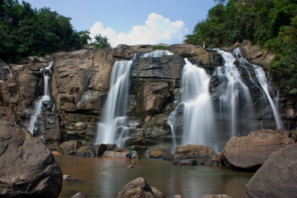
The River Subarnekha while flowing through Ranchi forms a lot of waterfalls, but the most beautiful of them is the Hudru Falls. Falling from a height of 320 feet, the falls create a spectacular landscape and is extremely popular with tourists. Bathing at the foot of the waterfall can be a very refreshing experience and is highly recommended. The different formations of rock due to the erosion by the constantly falling water have added to the beauty of the place. The falls at one of the edges of the Ranchi plateau is one of the several scarp falls in the region which takes on a formidable form during the rainy season, but in the dry season becomes a picnic spot.
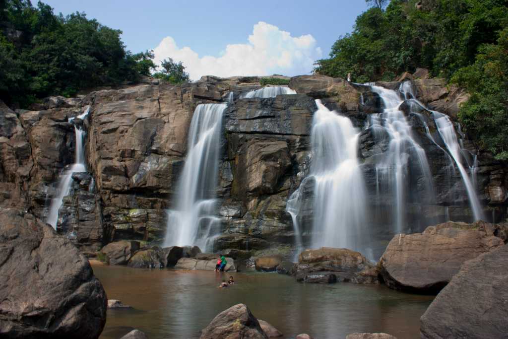
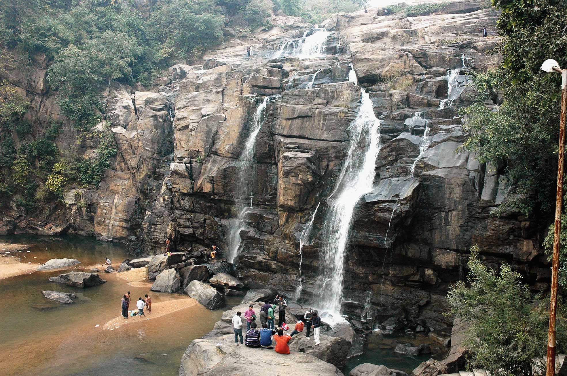
Hirni Falls lies about 60 km from Ranchi amidst the thick foliages of a dense forest and from the head of the falls, one can enjoy a panoramic view of the city. Located about 68 km from Ranchi lie the Rajrappa Falls. The Bhairavi or Bhera river falls from a height and joins the Damodar River with the silver cascading water a popular attraction in the region.
Complete with waterfalls, sculptures, art and scenic beauty, the Rock Garden is the perfect place to spend a weekend. The major attraction here is an iron footbridge that stands on only two poles. The garden is situated on a hillock by the Kanke Dam and is surrounded by lush environs, where one can relax while enjoying a stunning view of the city. Decked with greenery and flowers, Nakshatra Van has a beautiful fountain that lies in the centre of the garden and looks especially mesmerising in the evenings. Situated in front of Raj Bhawan the garden is an urban park and is very popular. The park is closed on Mondays and on other days the park is open between 9:30 am and 6:30 pm. The Biodiversity Park is a local picnic favourite and strives to preserve and protect medicinal plants and herbs.
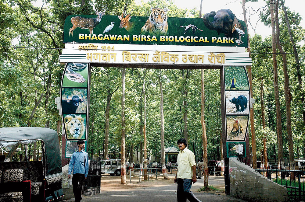
The Birsa Zoological Park is also known as the Birsa Jaivik Udyan and houses a wide variety of wild animals. It is located on the Ranchi-Patna National Highway near Ormanjhi and is a must-visit for all wildlife enthusiasts. As part of the animal adoption program, one can also adopt an animal and contribute to wildlife preservation. Established in 1994 on the banks of the Getalsud Dam, the park has two divisions, the zoological section which is spread over 83 hectares and the botanical section spread over 21 hectares. The zoo also offers battery-operated vehicles and a boating facility in addition to other facilities.
Source
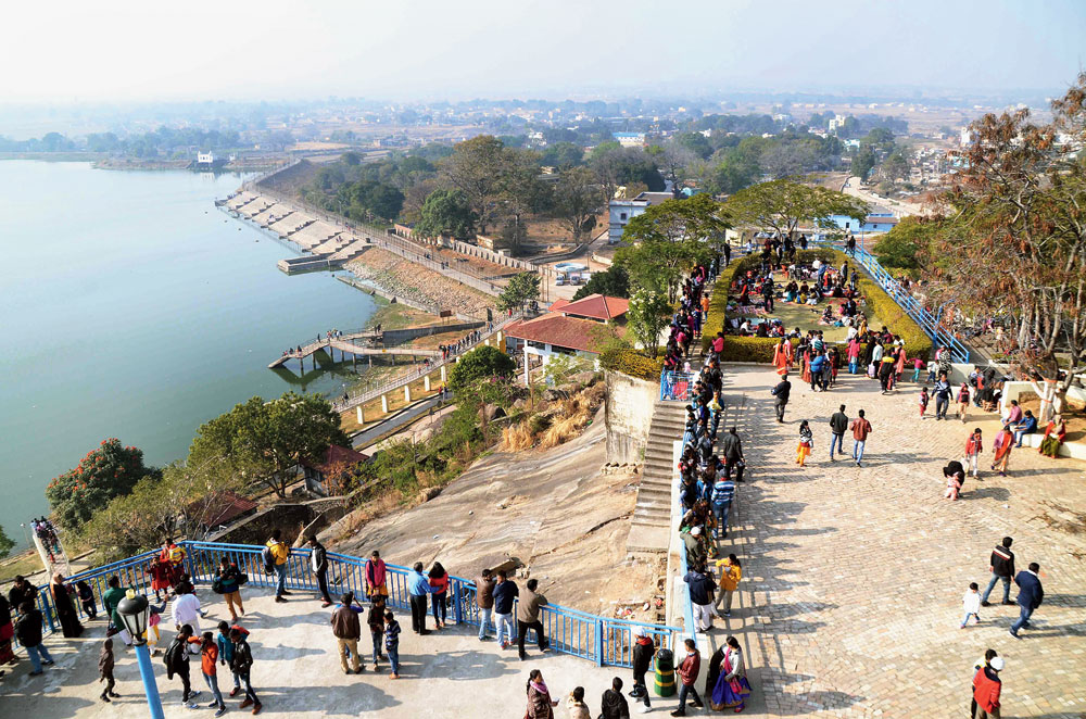
Lying about 33 km north of Ranchi’s city limits. Patratu Valley is a local weekend getaway. With the sparkling waters of the Patratu Dam on one side and lush green trees on the other, driving along the ghats of the valley is truly an experience. However, it is advised not to venture into these roads after dark because of the rampant Naxalite influence in the area. The magnificent Patratu Dam is the highlight of the Patratu Valley which stores the waters of the Nalkari River. The underground tunnel connected two villages near Patratu: Labga and Hariharpur, which could be traversed, but today, due to security reasons, has been shut down. There is also boating in the dam which is a must-do at the valley. The best time to visit is during winters when the climate is at its best.
Situated in Morabadi, Tagore Hill is also known as Morabadi Hill and has been associated with the brother of the poet and Nobel Laureate Rabindranath Tagore, Jyotidranath Tagore. Engulfed in greenery and boasting gorgeous panoramic vistas, the vantage point stands at a height of 300 feet and is an ideal picnic spot. One can reach the top by climbing a flight of 200 – 250 stairs and enjoy stunning views of the town below. At the foot of the hill is also situated the Ramakrishna Ashram and a centre of Divyayan and the Agararian Vocational Institute. It is believed that the younger brother of Rabindranath Tagore, Jyotindranath Tagore was very upset after the untimely death of his young wife who committed suicide. He procured the land here and spent most of his time uphill in seclusion, solitude and quietude. He built two structures at the top – Bramha Sthal and Shanti Dham, the latter of which was also used as his residence.
Located at the base of the Ranchi Hill, the Ranchi Lake was constructed in 1842 by a British Colonel named Onsely. Centrally located, the lake is well maintained and has boating facilities. There is also a temple dedicated to Lord Shiva at the top of the hill from where one can get panoramic views of the city.
Perched on a hilltop, the Jagannath Temple dates back to 1691 and is a smaller replica of the Jagannath Temple in Puri. The temple is decked with intricate carvings and a unique blend of coloured stones and the Rath Yatra festival sees a footfall of thousands of tourists each year. The temple was built by King of Barkagarh Jagannathpur Thakur Ani Nath Shahdeo and is located about 10 km from the main town. To reach the top visitors can climb the stairs or take the vehicle route. The view of the city from the top is breathtaking. In August 1990, the temple collapsed, but with the help of the Bihar government, it has been fully restored today.
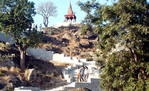
The Angrabadi Temple Complex is situated in Khunti, a small village near Ranchi and houses the idols of Lord Ganesh, Lord Shiva, Lord Ram and his consort, Goddess Sita and Lord Hanuman. Dedicated to Lord Shiva, the Pahari Mandir sits at an altitude of 2140 feet and offers a bird’s eye view of the city. One has to climb about 300 steps to reach the temple, but the beauty of the temple and the stunning view is worth it. The story of the hill temple is very interesting. This temple of Lord Shiva situated on the mountain was in the possession of the British before India’s independence and they used to hang freedom fighters here. Since India’s independence, the national flag is also hoisted on the occasion of Independence Day and Republic Day along with religious flags of the temple and this is the first temple in the country where the tricolour is hoisted. There is a stone here on which a message was written on the eve of India’s independence on the midnight of 15 August 1947.
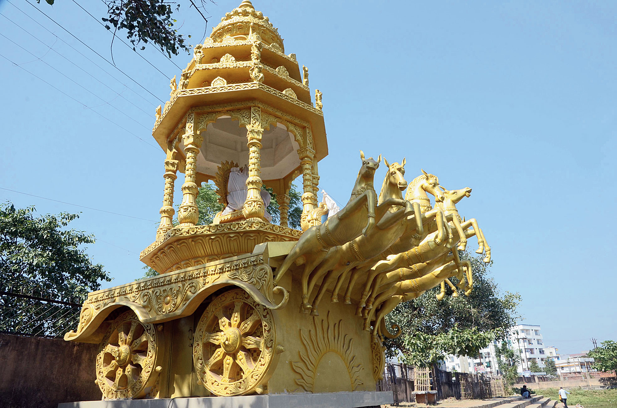
The Sun Temple has captivating architecture in the shape of a giant vehicle with 18 wheels driven by seven horses. The temple complex also has a holy pond which is highly revered. The temple is located amidst lush greenery and is worth a visit.
Set right next to the Rock Garden, the Kanke Dam is the perfect getaway. The dam has a boating facility which is also very popular. Getalsud Dam is an artificial reservoir situated in Ormanjhi, and was constructed across the Subarnarekha River and was opened in 1971. It is a popular picnic spot and supports a small-scale fishing industry. Located on the north-eastern edge of the Chota Nagpur Plateau, the dam meets the drinking water demands of Ranchi as well as the industrial requirements of the area.
The Ranchi Science Centre is the first science centre in the state and comprises a two-storied building that houses three permanent thematic galleries and was inaugurated on 29 November 2010. The State Museum Hotwar is a cultural museum whose original name was Ranchi Museum. It was established on the premises of the Tribal Research Institute in 1974 and moved to the new site in Hotwar in 2009. Built to showcase the cultural heritage of Jharkhand, the museum has ten galleries and contains paintings by artists from across the country as well as a well-equipped library that can house up to 300 people.
Most of our trips to Mumbai have been evening flights and so there was nothing to see outside. We’ve done day flights regionally, but I can only remember two other daytime flights to Mumbai in the last 20 odd years. Both times, we flew Singapore Airlines and both flights were in wide-bodied planes, perhaps an Airbus. Earlier this year, when I flew to India, I flew Vistara, the airline that was created due to a partnership between Singapore Airlines and the Indian conglomerate, the Tata Group. Vistara uses a smaller aircraft which is single aisle and so probably flies much lower in the air compared to Singapore Airlines flights. So this time around, I enjoyed the flight because I could see the ground while flying. Up until we entered the Bay of Bengal, I enjoyed the scenery below and took many photographs of the journey. This photographic essay is the result of that trip. My apologies if I shared some photos previously.
This scene greeted me almost as soon as the plane took off from Singapore’s Changi airport. You can see the buildings of Changi in the left and the National Service Resort & Country Club in the front and centre.
A minute later, this is one of Singapore’s offshore islands, maybe Pulau Ubin or Pulau Tekong.
About 30 minutes into the flight, we were flying over the Malaysian peninsula, probably flying over the North South expressway, on the way to the country’s capital of Kuala Lumpur.
About 45 into the flight, you can clearly see the island of Penang and the famous Penag bridge.
The next island is the island of Langkawi, which lies almost on the border between Malaysia and Thailand. We visited the island more than a decade back and have very fond memories of the place and hope to visit it again soon.
About an hour and 40 minutes into the flight, we flew over the Thai island of Krabi.
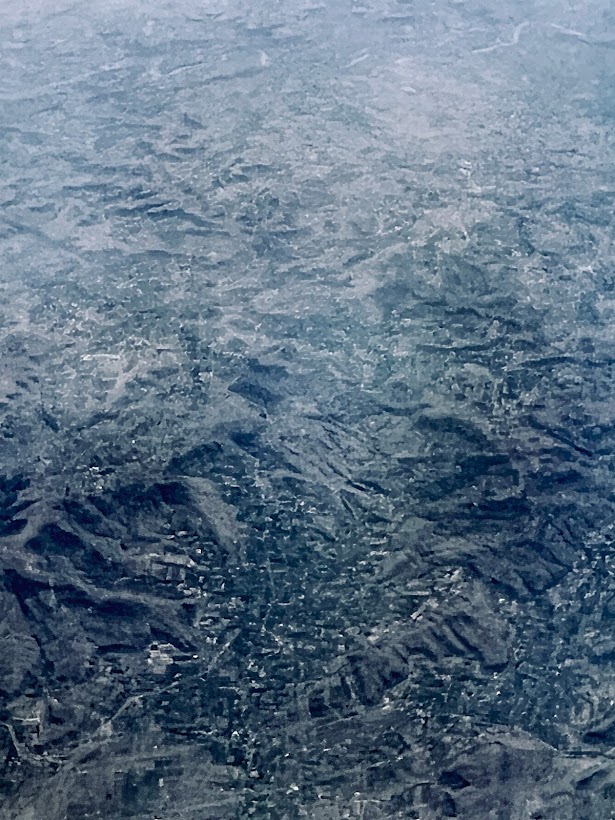
After Thailand, we veered course to fly over the Bay of Bengal and try as I much wanted to, I could not see much out of the window and the next time I saw something interesting, we were flying over Ahmednagar in my home state of Maharashtra, about 20-25 minutes before we landed in Mumbai.
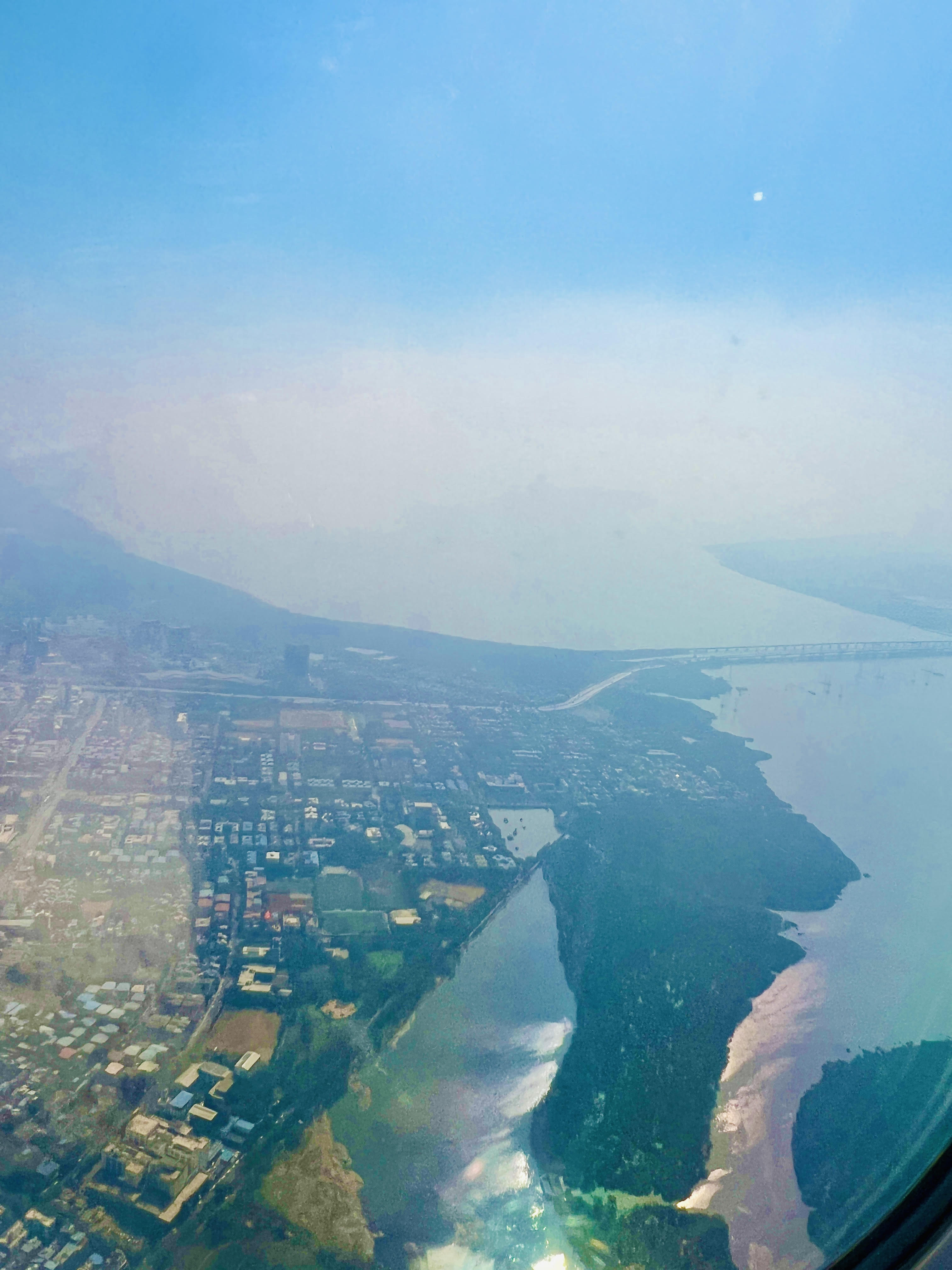
This photo was taken as we approach Chhatrapati Shivaji Maharaj Terminus for landing into Mumbai. This is the Vashi Bridge which seperates Mumbai from Navi Mumbai or New Bombay, the planned city and part of the Mumbai Metropolitan Region (MMR). Seeing the bridge brought back so many Mumbai memories of school trips and seeing the bridge I know we are on the verge of landing into Mumbai.
We were on our descent for landing and this is taken just a couple of minutes before touchdown. This is most likely the Eastern Express Highway in Vikhroli East, a few seconds before landing in Mumbai.
And finally touchdown after flying about 5.5 hours. I was back in the city of my birth after more than two years. But now I doubt I will fly into Bombay anytime soon, but never say never!
I hope you enjoyed this photographic journey as much as I liked searching through the photos I took during the flight and remembered my journey.
China Road: A Journey into the Future of a Rising Power – Rob Gifford
Route 312 is the Chinese Route 66. It flows three thousand miles from east to west, passing through the factory towns of the coastal areas, through the rural heart of China, then up into the Gobi Desert, where it merges with the Old Silk Road. The highway witnesses every part of the social and economic revolution that is turning China upside down.
In this utterly surprising and deeply personal book, acclaimed National Public Radio reporter Rob Gifford, a fluent Mandarin speaker, takes the dramatic journey along Route 312 from its start in the boomtown of Shanghai to its end on the border with Kazakhstan. Gifford reveals the rich mosaic of modern Chinese life in all its contradictions, as he poses the crucial questions that all of us are asking about China: Will it really be the next global superpower? Is it as solid and as powerful as it looks from the outside? And who are the ordinary Chinese people, to whom the twenty-first century is supposed to belong?
Gifford is not alone on his journey. The largest migration in human history is taking place along highways such as Route 312, as tens of millions of people leave their homes in search of work. He sees signs of the booming urban economy everywhere, but he also uncovers many of the country’s frailties, and some of the deep-seated problems that could derail China’s rise.
The whole compelling adventure is told through the cast of colorful characters Gifford meets: garrulous talk-show hosts and ambitious yuppies, impoverished peasants and tragic prostitutes, cell-phone salesmen, AIDS patients, and Tibetan monks. He rides with members of a Shanghai jeep club, hitchhikes across the Gobi desert, and sings karaoke with migrant workers at truck stops along the way.
As he recounts his travels along Route 312, Rob Gifford gives a face to what has historically, for Westerners, been a faceless country and breathes life into a nation that is so often reduced to economic statistics. Finally, he sounds a warning that all is not well in the Chinese heartlands, that serious problems lie ahead, and that the future of the West has become inextricably linked with the fate of 1.3 billion Chinese people.
The Emperor Far Away: Travels at the Edge of China – David Eimer
In 1949, Mao Zedong announced the birth of the People’s Republic of China, a proclamation to the world that, after centuries of war and social conflict, China had emerged as one nation. Since then, this idea has been constantly propagated for the benefit of the international community. For many living in the vast country, however, the old Chinese adage holds true: “the mountains are high and the emperor is far away.”
Few Westerners make it far beyond the major cities—the Chinese government has made it difficult to do so. David Eimer undertook a dangerous journey to China’s unexplored frontiers (it borders on fourteen other countries), to the outer reaches where Beijing’s power has little influence.
His chronicle shines new light on the world’s most populous nation, showing clearly that China remains in many ways a divided state. Traveling through the Islamic areas of Xinjiang province, into the forbidden zone of Tibet and across Route 219, which runs the rough boundary shared with India, the only disputed frontier in China, Eimer exposes the country’s inner conflict. All the tensions in China today—from its war against drugs and terrorism and the unstable relationships it maintains with Russia and Korea to its internal social issues—take on new meaning when seen from China’s most remote corners. A brilliant melding of journalism and history, The Emperor Far Away is essential reading for anyone interested in contemporary China.