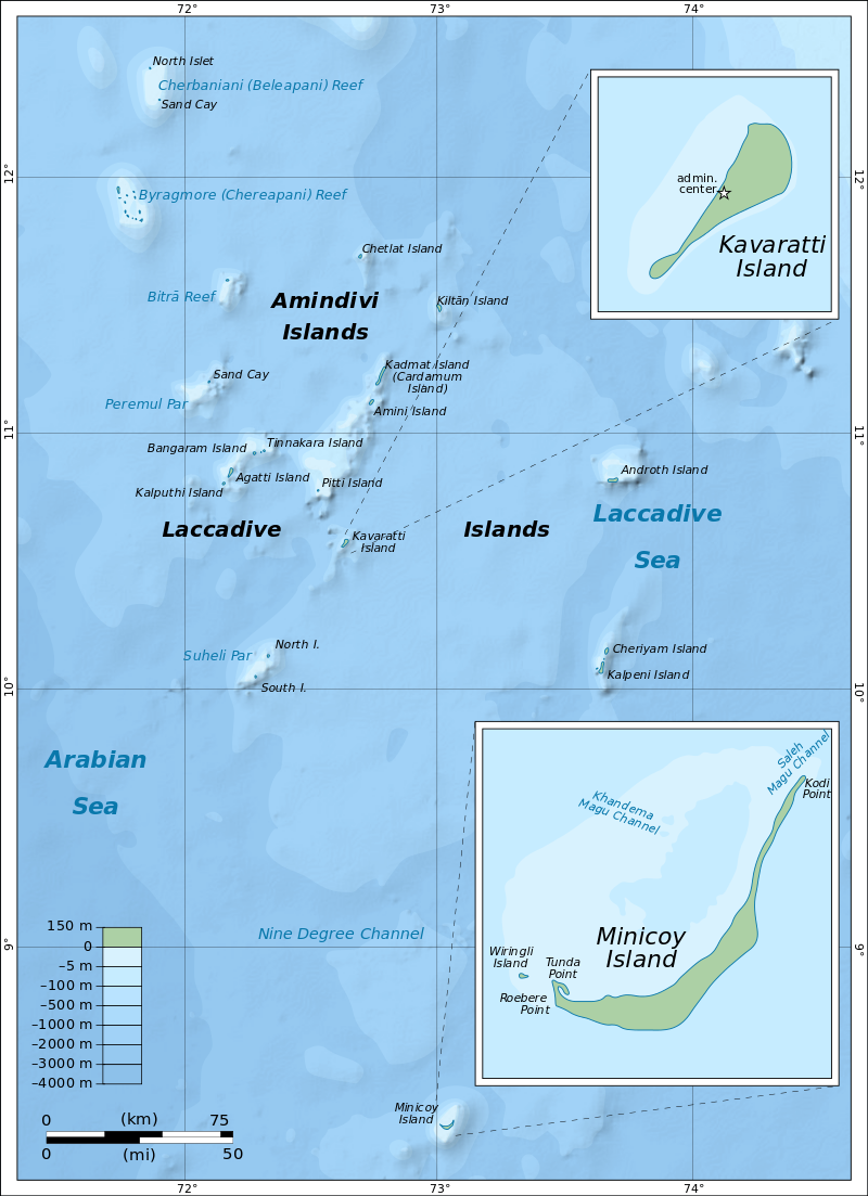
The Laccadive subgroup had been known earlier as the Cannanore Islands after the coastal town of Cannanore or Kannur are one of the three island subgroups in the archipelago. The name originated in the fact that while the northern group of Amindivi had in 1784 stopped being a vassal state of the Cannanore or the Arakkal kingdom in exchange to fealty to Tippu Sultan’s kingdom of Mysore, the southern group remained loyal to Cannanore. The Laccadive subgroup includes the island of Agatti, with the Agatti airport, the only airport in Lakshadweep, as well as Bangaram Atoll which has a tourist resort in Bangaram, its largest island. The islands of Agatti, Androth, Kavaratti and Kalpeni are inhabited and Islam is the main religion of the islanders. The Laccadive Islands subgroup is the central subgroup of the Lakswadweep consists mostly of atolls with islands, as well as part of one submerged bank. The Amindivi and the Laccadive subgroups have a submarine connection between them through Pitti Bank, a largely sunken atoll. The Laccadive subgroup is separated from the Amindivi Islands subgroup roughly by the 11th parallel north and from the atoll of Minicoy far to the south by the 9 Degree or Mamala Channel.
In the same manner as the Amindivi Islands further north, the islands of the Laccadive subgroup were settled from ancient times by people of nearby Kerala to which were added later people of Arab descent. Vasco da Gama visited these islands around 1498 and in the mid 16th century, all the inhabited islands of the Lakshadweep put themselves under the rule of the Arakkal kingdom in order to obtain protection from the Portuguese. In 1697, the notorious pirate Captain Kidd and his crew brought their ship, the Adventure Galley, to the Laccadive Islands, chopped up local boats for firewood and raped local women. When the locals retaliated by killing the ship’s cooper, the pirates attacked the village and beat up the people who lived there. Almost 100 years later, in 1784, the Amindivi group of islands rejected the protection of Cannanore and became a vassal state of the Kingdom of Mysore while the southern group remained loyal to the rule of Cannanore. Following the defeat of Tippu Sultan and the 1792 treaty of Srirangapatam, the southern subgroup was permitted by the East India Company to remain under the rule of the Cannanore Kingdom in exchange for a yearly tribute of INR 15,000. Since the tributary payments were often in arrears, the islands were put under direct rule of the British Government, first between 1855 and 1860, and then finally annexed in 1877 by virtue of the doctrine of lapse and became attached to the Malabar district.
One of the most habited islands of Lakshadweep; Amindivi is a group of islands lying in North Lakshadweep and is famous for its coir products, but due to government regulations, foreign tourists are not allowed to visit this island.
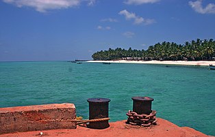
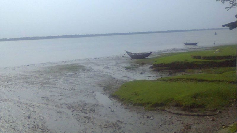
Agatti Island is situated on a coral atoll called Agatti atoll with another island, Kalpatti located at the southern end on the same reef. Agatti is one of the Lakshadweep islands open to tourism with visitors only allowed on the Island under certain restrictions, including an Entry Permit from the Lakshadweep Administration for entering or visiting the island. Entry Permits are issued based on the visitor having a confirmed place to stay as there are only two hotels or resorts in Agatti, Agatti Island Beach Resort and Sea Shells Beach Resort. A road runs through the island, which can be best enjoyed by hiring a bicycle available at many places. Stretching over an area of 8 km, the island is sparsely populated with around 8000 inhabitants. The Agatti airport, the only one in the archipeglo, is located in the southwestern part of the island. The locals mostly speak English and Malayalam, and Islam is the main religion with the primary occupation of the people being fishing.
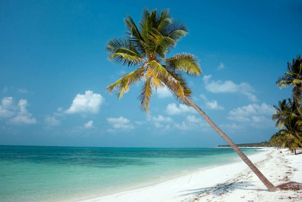
The island has splendid beaches with the tropical climate apt for sunbathing. One can also go on long strolls on the beach which are fringed with tall coconut trees. Adventure enthusiasts can indulge in water sports such as snorkelling, scuba diving, swimming, kayaking, and water skiing and one can even give deep sea fishing a go. Scuba diving and glass bottom boat rides are very popular and are a must-try while on the island. The best time to visit Agatti Island between October and March as the weather stays pleasant throughout the months and the sea stays calm making it safe to explore the island. During summers, between April and May, the temperature goes as high as 35 degrees celcius and the island receives intermittent to heavy rainfall during the monsoons. Alcoholic beverages are prohibited on the islands and only Indian nationals are allowed to visit and stay on Agatti Island with foreigners permitted to stay on Bangaram, Minicoy and Thinnikara Islands.
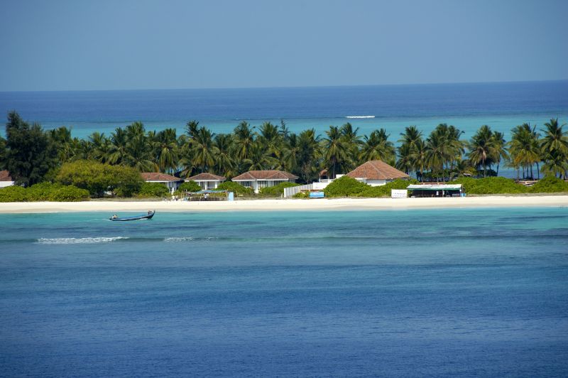
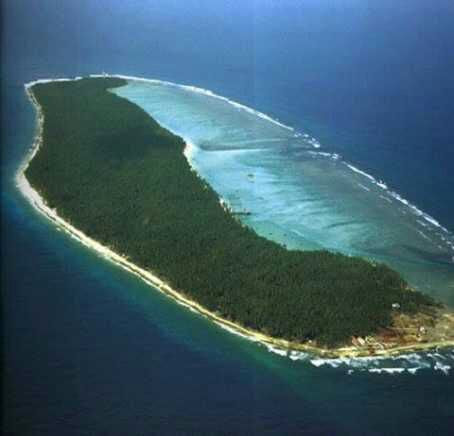
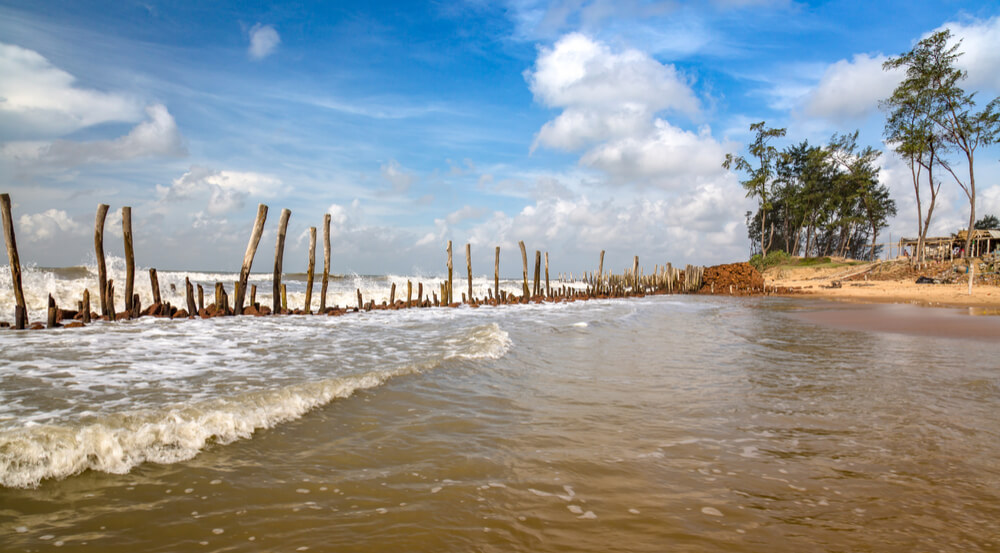
Bangaram is an atoll which is roughly rectangular shape northeast of Agatti island connected to the reef of Agatti through a shallow submarine ridge. Bangaram Island is the largest island in the atoll with a long brackish pond in the center of the island fringed by screwpine and coconut palms. South Bangaram Cay is a small sand cay and Thinnakara is another large island in the atoll. Parali 1, Parali 2 and Parali 3 are three small islets at the eastern fringe of the reef, but Parali 1 was washed away in 2017. The Bangaram Island Beach Resort was opened to tourists in 1974, but lack of commercial flights made access difficult. Tourism took off after the Agatti airport on the nearby Agatti island was commissioned and regular commercial flights from Kochi were established. Current alcohol regulations in Lakshadweep allow consumption of alcoholic drinks only on Bangaram Atoll. Thinnakara offers numerous adventure activities, including scuba diving, snorkelling, deep sea fishing beside white sand beaches, a calm lagoon and a sparkling, clear coral reef. The Atoll has numerous species of tropical birds found on the island. Bangaram Island forms a part of the terrestrial ecoregion of the Lakshadweep archipelago with many species of marine, terrestrial and aerial living beings including fishes, crabs, lobsters, gastropods, bivalves, turtles, seaweed and birds . It is also a region of ecological importance due to the presence of the coral reef around the island. The best time to visit Bangaram Island is between October and March as the weather is pleasant and the sea is calm most of the times. Tourists need a special permit to enter the island. If one cannot get space at the only resort at Bangaram Island, the best way to explore this island is by arranging a stay at one the hotels on Agatti island and visiting Bangaram as a day trip.
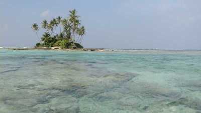
Pakshipitti where pakshi means bird in Malayalam, Telugu and Tamil, is an uninhabited coral islet, devoid of vegetation, about 24 km north of Kavaratti. The island is low and arid and lacks adequate anchorage points and is difficult to access. There is another island with the same name part of the Kalpeni Atoll. There is a dark rock on the eastern side and several stone cairns. Pakshipitti is an important nesting place for birds such as the sooty tern, the greater crested tern and the brown noddy. The birds nest side by side, but not intermixed, on the dry coral rubble. Since it has no protecting reef surrounding it, the islet is periodically rinsed by wave action and there is no accumulation of guano on it.
Paksipitti Bank is located at the southern end of Pakshipitti Bank and is a largely submerged atoll on the same bank as Amini Island. It may be considered a largely submerged and sunken atoll with just the two islands Amini and Paksipitti remaining at its opposite ends.
Also known as Androth, Andrott Island is a small inhabited island known as Divanduru in the past, a name that is found in some old French maps. Unlike other islands, Andretti islands are orientated in the east-west direction. Today, it is a protected territory and not a tourist destination. Andrott Island is the nearest to the mainland among all the islands in the group as well as the longest and the biggest. Most of the inhabitants are Muslims with a Hindu minority. The saint Ubaidullah who is believed to have preached Islam in Lakshadweep Islands, died here and his remains are entombed in the Jumah mosque. The island also houses several Buddhist archaeological remains.
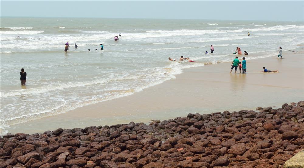
Kavaratti is the capital of Lakshadweep and also the name of the atoll upon which the town stands. Well known for its pristine white sand beaches and calm lagoons, it is a popular tourist destination with the calm lagoons on the island ideal for water sports and swimming. The waters around the coral atoll are rich in diverse marine life and the Kavaratti Aquarium has a rich collection of corals and a vast collection of tropical fish specimens. The other major industries on the island are fisheries and agriculture with coconut the dominant crop. The island is home to 12 atolls, five submerged banks, and three coral reefs. On the island, one can also visit the Urja mosque, the only sacred place on the island of a sculptor of the 17th century.
Also known as Koefaini, Kalpeni is an inhabited atoll 71 km south of Andrott and 201 km north-northeast of Minicoy, with the broad Nine Degree Channel between them. The islands are a group of three islands and is one of the most picturesque areas of Lakshadweep. It forms a single coral atoll along with the uninhabited islands of Cheriyam, Tilakkam, Kodithala and Pitti islet with the eastern and southern shorelines of the island having accumulations of coral debris, the result of a violent storm that hit the area in 1847. Kalpeni is the main island, with Kodithala immediately to the north and Cheriyam the northernmost island, the largest of Kalpeni’s satellite islands. The Tilakkam group are a group of islands off the west of Kalpeni and Koomel is a small islet off the west tip of Kalpeni. Kalpeni was the first island in the Union Territory where women were allowed to go to school and get an education. There is a beach at the northern tip of the island called Tip Beach where one snorkel, sea bathw and kayak. Because of the coral reefs present in the sea near the beach, the water is shallow and calm, making it an excellent spot for beach activities. There is a 37-metre-high lighthouse in Kalpeni from which top one can see a bird’s eye view of the island, the lagoon with the smaller islands, the reef and the surrounding ocean.
Suheli Par is a coral atoll in an oval shape surrounded by a zone of rich marine fauna. There are three islands on the reef encircling the lagoon. Valiyakara is located at the northern end of the lagoon and has retained most of its original vegetation. It has also has some largely stunted, unkempt coconut trees and is visited occasionally by workers who collect the coconuts. Hermit crabs are found in abundance and there is a lighthouse on this island. Cheriyakara is located on the southeastern side of the lagoon and slightly smaller than Valiyakara. It has a large coconut plantation. Between mid-October and mid-April, fishermen of Agatti and Kavaratti stay in temporary settlements on this island when they catch tuna in the surrounding waters of the atoll and process it on the island. Indira-Shastri Dweep is a long sandbank located between the two islands and was used as a breeding ground by terns. The grey heron and the black-capped kingfisher have been observed in this atoll and owing to the rich marine life there was a proposal to declare Suheli Par a marine national park. In 2006 a ship from Seychelles ran aground on this atoll, but there was no oil spill reported.
In the next part, our last part for this series, we’ll explore the Minicoy Atoll.
The Aminidivi group of islands, consisting of Androth, Amini, Kadmat, Kiltan, Chetlath, and Bitra came under the rule of Tipu Sultan in 1787 and passed to British control after the Third Anglo-Mysore War and were attached to South Canara. The rest of the islands came under the suzerainty of the Arakkal family of Cannanore in return for a payment of annual tribute which the British took over for nonpayment of arrears and were attached to the Malabar district of the Madras Presidency during the British Raj. On 1 November 1956, during the reorganization of Indian states, the Lakshadweep islands were separated from Malabar district and organised into a separate union territory for administrative purposes with the new territory called Laccadive, Minicoy, and Amindivi Islands before adopting the name Lakshadweep Islands on 1 November 1973.
The Aminidivi subgroup of islands consisting of Amini, Keltan, Chetlat, Kadamat, Bitra, and Perumal Par and the Laccadive subgroup of islands which comprises mainly of Androth, Kalpeni, Kavaratti, Pitti, and Suheli Par, have a submarine connection between them through Pitti Bank. Together with Minicoy Island, a lonely atoll located at the southern end of the 200-km-broad Nine Degree Channel, they form the Coral Islands of India in the Arabian Sea. All these islands have been built up by corals and have fringing coral reefs very close to their shores. Two banks further north, Angria Bank and Adas Bank are not considered part of the group. The Aminidivi Islands, are one of the three island subgroups in Lakshadweep and is the northern group of the Lakshadweep, separated from the Laccadive Islands subgroup roughly by the 11th parallel north. The islands of Amini, Kiltan, Chetlat, Kadmat and Bitra are inhabited with Islam being the main religion of the islanders. The islands were inhabited from ancient times by people of nearby Kerala to which were added later people of Arab descent. In the mid 16th century all the inhabited islands of the Lakshadweep were conferred as the jagir or estate of the ruling family of the Cannanore or Arakkal Kingdom by the Chirakkal or Kolattiri Raja in order to grant them protection from the Portuguese. In the latter quarter of the 18th century, the islands of the Amindivi group revolted owing to the rigours of the enforcement of the monopoly of the coir rope trade and following the uprising, the northern islands put themselves under the rule of the Kingdom of Mysore in 1784, then ruled by Tippu Sultan. The southern group of the Cannanore Islands, however, remained loyal to the Arakkal Kingdom. In 1792, as a consequence of the Third Anglo-Mysore War and the defeat of Tippu Sultan, the Amindivi Islands came under the East India Company rule following the treaty of Srirangapatna.
Cora Divh, also called Coradeeve or Little Bassas de Pedro Bank, is a submerged bank or sunken atoll and is the third largest feature of Lakshadweep, after Bassas de Pedro and Sesostris Bank. It is also the northernmost feature. Cora Divh has no emergent cays or islands and is covered by sand, coral rubble and broken shells.
Sesostris Bank is a submerged bank or sunken atoll and is the second largest feature of Lakshadweep and one of the northernmost features, after Cora Divh and Bassas de Pedro and is named after the steam frigate INS Sesostris of the Indian Navy.
Bassas de Pedro, also known as Manjappar or Pedro Bank, is a submerged bank or sunken atoll which is the largest feature of Lakshadweep. It is also one of the northernmost features, second only to Cora Divh and is in the shape of an arch open to the east with widths ranging from 15 km in the north to 33 km in the south. Its southern end is 63 km east of North Cay of Cherbaniani Reef, the closest land feature. There are no emergent cays or islands and the bank is steep-to, smooth with minor undulations in topography, and composed of sand, shells, and decayed coral. The water on the bank is not discolored.
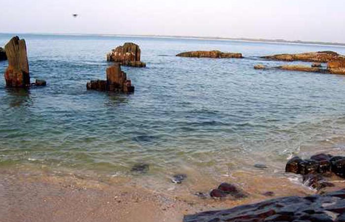
Cherbaniani Reef, also known as Beleapani Reef and Valiyapanniyam in Malayalam, is a coral atoll and is the northwesternmost feature of Lakshadweep with a roughly oval shape. The 14 km long coral reef that encloses the lagoon has three small uninhabited islands on it composed of accumulated coral sand, shingle, cuttle-bones and sea shells. There are many land hermit crabs under the boulders and among the detritus and the atoll used to be a breeding ground for pelagic birds, including the sooty tern and brown noddy, formerly found in great numbers.
North Islet has a small mosque built and maintained by local fishermen from Bitra, Chetlat, Kiltan and Agatti islands. The fishermen came here and camp for fishing during the period between both monsoons. Lakshadweep islanders from Chetlat and Bitra sometimes visit the islands to collect guano for the gardens of the inhabited islands, gathering eggs, dumping garbage and disturbing the nestlings of pelagic birds in the process. The beaches are strewn with marine litter.
Byramgore Reef, also known as Chereapani Reef is a coral atoll whose northern part is submerged. There are a few sandbanks on the reefs, but little land is above the surface at high tide. The atoll is visited by birds, including the lesser crested tern and greater crested tern.
Chetlat Island is a coral island whose local history says that islanders were cruelly treated by Portuguese seafarers in the past. Coir twisting was the traditional occupation of the islanders and average Chetlat coir used to be equal to first-class coir of the other islands in Lakshadweep. One of the populated islands of the archipelago, Chetlat is located 37 km to the northwest of Kiltan Island and the reef and lagoon are located to the west of the island with a small scale yearly growing sand spit on the northern point of the island. Chetlat is the sole inhabited island of the township of Chetlat Island and the inhabitants are engaged in very small scale farming and fishing which are mainly for the island consumption. There is a small jetty on the west coast and a helipad on southpoint.
Bitra, also known as Bitra Par, is a coral atoll where prior to the 20th century, islanders from Kiltan and Chetlat visited to collect the eggs of birds breeding there. Until 1945, when a woman from Chetlat made this island her home, there were no attempts to settle this island permanently. There is a small shrine dedicated to an old Arab saint by the name of Malik Mulla who was buried on the island which has become a pilgrimage site. The atoll of Bitra encompasses two islands, the main Bitra Island is located at the northern end of the coral reef and the small south cay is located on the southern part. Bitra is the smallest of the populated islands of Lakshadweep with the main island having a small jetty on the south shore and a helipad on the westpoint. The inhabitants on the island are engaged in very small scale farming and fishing which are mainly for the island consumption.
Kiltan or Kilthan Island is a coral island which was settled during the early periods of immigration to the Lakshadweep islands, part of an international trade route between the Persian Gulf and Ceylon. It is also home of the Sufi saint Shaikh Ahmed Naqshabanthi. Kiltan is one of the populated islands of Lakshadweep with the reef and lagoon located to the west of the island and is also crossed by the 73rd meridian east through its landmark known as Kulikkara which is a tomb of a Lady venerated by the natives.
Kadmat Island, also known as Cardamom Island, is a coral island with seagrass and marine turtles which nest here. The island has been notified as a marine protected area for ensuring the conservation of the island’s animals, plants, organism and other resources. The only inhabited village on the island is Kadmat, which has fishing as the main economic activity with agriculture limited to 5% of the land area. Tourism is allowed even for non-Indians and the attractions are kayaking, snorkeling and leisure trips by a glass-bottomed boat for scuba diving. Kadmat Island is the central most island of the archipelago and is in the shape of a tear drop and is the longest island in the Amindivi group. There is an airport on nearby Agatti Island, in which flights operate from Cochin. From Agatti, it is a two and half hours boat ride to Kadmat. Ferry services also operate from Cochin on the coast of Kerala but involves a journey of 16 hours.
In 1960, a hoard of coins were unearthed and examined, revealing that the island has been inhabited since at least the year 200 and the island is known to have traded with the Romans, as in 1948 a Roman coin was found in a quarry on the island. Kadmat Island offers a host of activities to its guests which is why it is thronged by thousands of tourists every year. Some of the most popular activities and things to do on the island are scuba diving, kayaking, snorkelling and paragliding. One can also just sit and sun soak and admire the beautiful surroundings and use some of the many amazing spa and massage services available here.
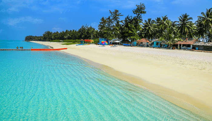
Spread over 100 metres and surrounded by beautiful blue lagoon and shimmery white sand, Kadmat Beach is not only one of the most gorgeous beaches in the region but also, one of the most visited. One can relax on a hammock, sunbathe on the shores, stroll along the seashare and watch some of its many mesmerising sunrises and sunsets. Kayaking is another popular activity here due to the pristine nature, mostly untouched and uncommercialised with crystal clear waters. There are glass bottom boats available which can be hired for the views.
The best time to visit Kadmat Island is during the winters and early summers, between the months of October and May when there are cool sea breezes blowing, and the climate is pleasant. It is better to avoid summers and monsoons due to the high heat and humidity.
Elikalpeni Bank is a submerged bank or sunken atoll and is the easternmost geographic feature of the archipelago.
Perumal Par, also known as Peremul Par, is an uninhabited coral atoll very similar in appearance to the Cherbaniani Reef further north. It has a large lagoon devoid of islands in the encircling reef, except for 3 small sandy islets located at the eastern area. Terns of different species visit this atoll. There is some damage to the corals caused by Acanthaster planci crown-of-thorns starfish that was observed in the 1990s. Its surrounding waters are a good fishing area for baitfish and is often visited by fishermen from the inhabited islands nearby as well as tourists from the nearby Bangaram Island resort who often make excursions to this lonely atoll.
Amini Island was one of the first islands in the archipelago to be inhabited. The artisans on this island are known for making walking sticks out of coconut shells and tortoise shells as well as carved stone and coral motifs. The channel between Amini Island and Cardamom Island is safe and deep. The Amini Island Light is shown on the south point of the island. The island is oval with the long axis oriented northeast-southwest. It lies at the northeastern extremity of Pitti Bank, 42 km from the small, uninhabited Pitti Island which is not to be confused with the Pitti Islet of Kalpeni Atoll, which is located at the opposite southwestern extremity of the bank. Pitti Bank, also oriented along a northeast-southwest axis, is 49 km long and may be considered a largely submerged and sunken atoll with just the two islands Amini and Pitti remaining at its opposite ends. Kadmat island, although just 5 km northeast of Amini Island, is separated from it by a deep channel and thus forms a separate geographical unit.
In the next part, we will explore the Laccadive subgroup of the Lakshwadweep archipelago.
Lakshadweep is a group of islands in the Arabian sea, 200 to 440 km off the southwestern coast of India with the archipelago administered as a Union Territory of India. They were also known as the Laccadive Islands, although geographically this is only the name of the central subgroup of the group. Lakshadweep means one lakh island” in Sanskrit, and Malayalam is the most spoken language in the territory. The islands form the smallest Indian Union Territory and their total surface area is just 32 sq km and the lagoon area covering about 4,200 sq km. Kavaratti serves as the capital of the Union Territory and the region comes under the jurisdiction of Kerala High Court. The islands are the northernmost of the Lakshadweep–Maldives–Chagos group of islands, which are the tops of a vast undersea mountain range, the Chagos-Lakshadweep Ridge. The Lakshadweep consisted of 36 islands, but currently there are 35 islands, as the Parali 1 island submerged in water due to sea erosion.
As the islands have no aboriginal inhabitants, scholars have suggested different histories for the settlement of these islands. Archaeological evidence supports the existence of human settlement in the region around 1500 BC and the islands have long been known to sailors, as indicated by an anonymous reference from the first century to the region in Periplus of the Erythraean Sea. The islands were also mentioned in the Buddhist Jataka stories of the sixth century while Islam was established when Muslims arrived around the seventh century. During the medieval period, the region was ruled by the Chola dynasty and the Kingdom of Cannanore. The Catholic Portuguese arrived around 1498 but were expelled by 1545. The region was then ruled by the Muslim house of Arakkal, followed by Tipu Sultan. On his death in 1799, most of the region passed on to the British and with their departure, the Union Territory was formed in 1956.
Lakshwadweep is made up of 12 atolls, 3 reefs and 5 submerged banks, with a total of about 39 islanfs and islets of which 10 islands are inhabited. The reefs are in fact also atolls, although mostly submerged, with only small unvegetated sand cays above the high-water mark. The submerged banks are sunken atolls. Almost all the atolls have a northeast–southwest orientation with the islands lying on the eastern rim, and a mostly submerged reef on the western rim, enclosing a lagoon. Other than the 10 inhabited islands, 17 islands are uninhabited or are attached islets, four are newly formed islets and five are submerged reefs. The main islands are Kavaratti, Agatti, Minicoy, and Amini with Agatti having an airport with direct flights from Kochi.
The majority of the indigenous population is Muslim and most of them belong to the Shafi school of the Sunni sect. The islanders are ethnically similar to the Malayali people of the nearest Indian state of Kerala with most of the population speaking Malayalam with Mahl being the most spoken language in Minicoy island. The islands are served by an airport on Agatti Island. The main occupation of the people is fishing and coconut cultivation, with tuna being the main item of export. Everyone intending to visit Lakshadweep, including Indian nationals need a permit and once the permit is issued, Indians can visit all islands, while foreigners can only visit Agatti, Bangaram and Kadmat Islands. The archipelago is typically accessed from Kochi from where one can also get the permits.
Local traditions and legends attribute the first settlement on these islands to the period of Cheraman Perumal, the last Chera king of Kerala and the oldest inhabited islands in the group are Amini, Kalpeni Andrott, Kavaratti, and Agatti. Archaeological evidence suggests that Buddhism prevailed in the region during the 5th and 6th centuries and according to popular tradition, Islam was brought here by Ubaidullah whose grave is located on the island of Andrott, in 661. During the 11th century, the islands came under the rule of the Late Cholas and subsequently the Kingdom of Cannanore. In the 16th century, the Portuguese ruled the seas between Ormuz and the Malabar Coast and south to Ceylon. As early as 1498, they took control of the archipelago which was called Laquedivas by the Portuguese, to exploit coir production, until the islanders expelled them in 1545. In the 17th century, the islands came under the rule of the Ali Rajahs and the Arakkal Bheevi of Kannur, who received them as a gift from the Kolathiris with the islands also mentioned in great detail in the stories of the Arab traveller Ibn Batuta.
Open Mic Night in Moscow: And Other Stories from My Search for Black Markets, Soviet Architecture, and Emotionally Unavailable Russian Men – Audrey Murray
The raucous and surprisingly poignant story of a young, Russia-obsessed American writer and comedian who embarked on a solo tour of the former Soviet Republics, never imagining that it would involve kidnappers, garbage bags of money, and encounters with the weird and wonderful from Mongolia to Tajikistan.
Kazakhstan, Belarus, and Siberia are not the typical tourist destinations of a twenty-something, nor the places one usually goes to eat, pray, and/or love. But the mix of imperial Russian opulence and Soviet decay, and the allure of emotionally unavailable Russian men proved strangely irresistible to comedian Audrey Murray.
At age twenty-eight, while her friends were settling into corporate jobs and serious relationships, Audrey was on a one-way flight to Kazakhstan, the first leg of a nine-month solo voyage through the former USSR. A blend of memoir and offbeat travel guide (black markets in Uzbekistan: 5 stars; getting kidnapped in Turkmenistan: 1 star) this thoughtful, hilarious catalog of a young comedian’s adventures is also a diary of her emotional discoveries about home, love, patriotism, loneliness, and independence.
Sometimes surprising, often disconcerting, and always entertaining, Open Mic Night in Moscow will inspire you to take the leap and embark on your own journey into the unknown. And, if you want to visit Chernobyl by way of an insane-asylum-themed bar in Kiev, Audrey can assure you that there’s no other guidebook out there. (She’s looked.)
Bankura Bankura is famous for its hills and temples and is famous for its terracotta temples In the Mahabharata, Bankura was described as Suhmobhumi. The word larh or rarh was introduced after the 6th century and comes from the old Austric word rarha or rarho which means the land of red soil. Scholars differ in their opinion about the name Bankura where orah or rah means habitation. One of the most influential gods of the district, Dharmathakur is called Bankura Roy which may the be the root for the name of the place. Another legend about the name comes from Bir Hambir who was the 49th King of the Malla dynasty. Bir Bankura was one of his two sons. Raja Bir Hambir divided his kingdom into 22 tarafs or circles and gave one to his each son. Taraf Jaybelia fell to the lot of Bir Bankura who developed a town in his taraf and the town was later named as Bankura after its founder’s name. Located only a few km from the terracotta temples of Bishnupur, the Gokulchand Temple is the grandest of the few Bengal stone temples. The 64 feet high five pinnacled temple is surrounded by a high wall, giving the impression of a fort rather than a temple. Located on the banks of the Bodai River, the twin-villages of Hadal-Narayanpur is famous for the Mandal family terracotta temples that comprise of the Barataraf, Mejotaraf and the Chhototaraf temples. Barataraf also has a huge Rasmancha popularly used to stage Ras-Leela or plays based on Vishnu’s life. Mejotaraf and the Chhototaraf are studded with terracotta panels with representations of Vishnu in the Anantashayan posture. The tallest hill in this region, Biharinath hill is situated 57 km away from Bankura town and was an ancient centre of Jainism and is known for its beautiful surroundings. A tourist village, Joyrambati is famous as it was the birthplace of Sree Sarada Devi who is worshipped as the Holy Mother by the followers of Sri Ramakrishna. Jhilmili is a natural beauty also known as the Darjeeling of South Bengal. It is located at the border of Purulia, Bankura and Midnapur and just 70 km away from Bankura town. Literally translating to sparkle or twinkle in the Bengali language, the area has dense lush forests that possess breathtaking beauty. The place is situated on a hillock and amidst thick, dense forests of varying heights and the forest cover is so thick in some places that even sunlight has a hard time making its way through the labyrinth of vegetation. The Kangsabati flows right through this forest and its banks are a perfect spot to have a picnic. The watch tower offers an amazing view of the surroundings, including that of the descending elephants from the Dalma Hill during winters.
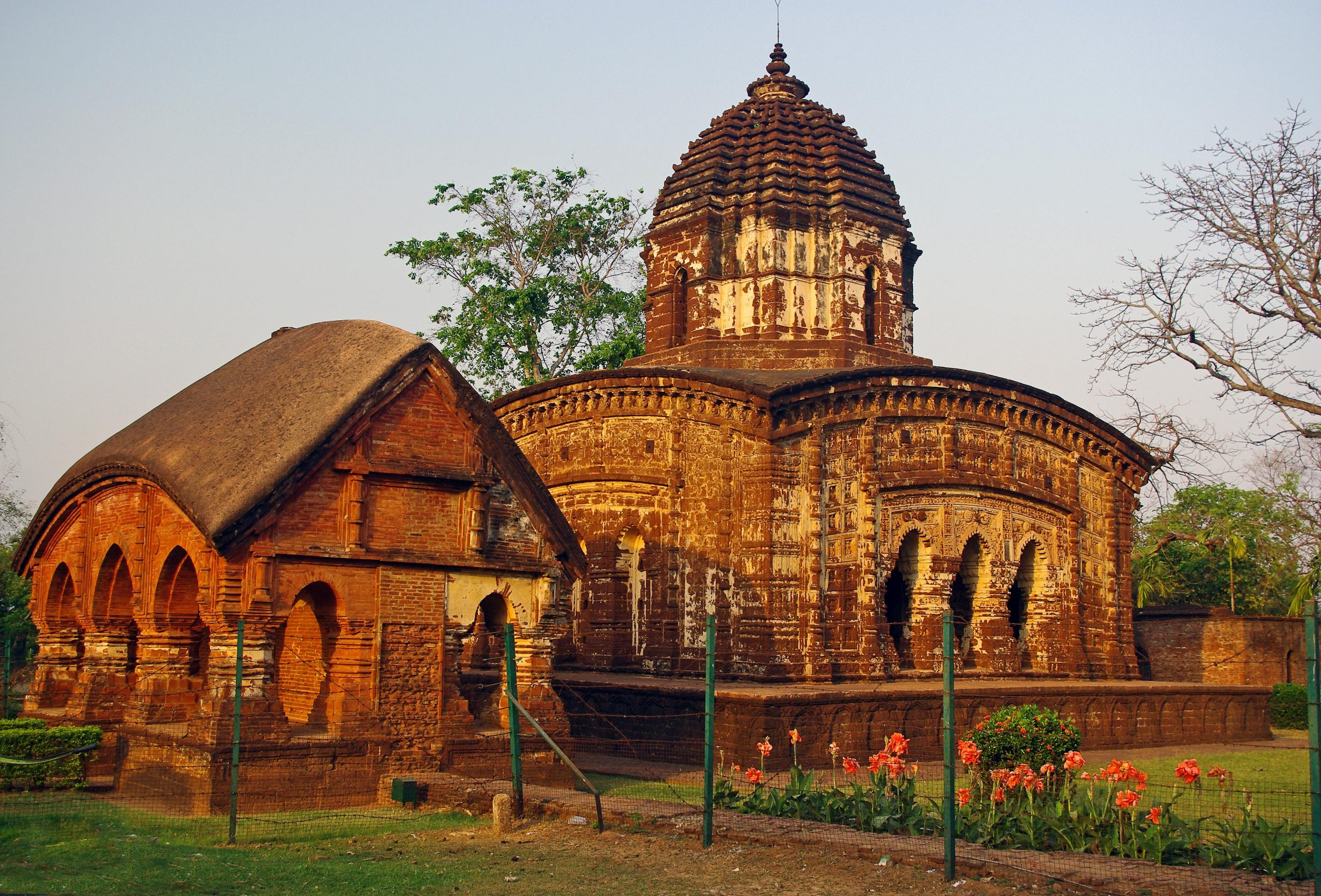
Bishnupur A small town, Bishnupur is famous for its terracota temples and rich culture including architecture, music and handicraft. The town’s name is derived from Lord Vishnu. The Baluchari saree of Bishnupur has developed a brand of its own. Stories from the mythology are designed on the sarees which are completed within a week. The oldest brick temple, Rasmancha was commissioned by the Malla King Bir Hambir in 1600. The temple has one inner chamber housing the idols of Radha-Krishna and has an elongated tower encircled by turrets which are of hut shapes. It is enclosed by a passageway and there are some big cannons which date back to Malla period. The Vaishnava Ras festival was held till 1935 before it was converted to a protected monument. The Lalji Temple is a laterite eka-ratna temple built in 1658 by Bir Singha II of the Malla dynasty on a square raised plinth which consists of ornamental stucco decorations on low relief carvings. Built by Malla King Raghunath Singh in 1655 AD, the Jorebangla Temple is of laterite bricks and has the appearance of two thatched huts joined together and surmounted by a single tower. The temple’s roofs and walls have classical Chala style of architecture in terracotta with the panels and walls depicting the lives of the royalty and stories from the epics. The Madan Mohan Temple is a eka-ratna temple built by the Malla King, Durjana Singh Dev in the late 17th century and has a square flat roof with curved cornices and a pinnacle over the top. Built by King Chaitanya Singha in 1758, the Radha Shyam Temple has a dome shaped sikhara with stucco motifs that depicts floral, geometric and life of puranas. Soaring at an altitude of 1442 feet, Susunia Hill is famous for sports like rock climbing and trekking. The hill is covered with a rich flora of shrubbery, majestic trees and rare medicinal plants. Part of the eastern ghats, this hillock is popular with trekking enthusiasts. There also stands an ancient carved monolith structure on the hill called the Narasimha Stone. The carvings on the monolith call it the oldest stone. There is a fresh spring water stream that shoots right out of it. The river Gardeshwari and its tributary the river Darakeshwar, both cut through the hill and provide many places to picnic in. The hill is also an official archaeological and fossil site with many fossils and tools used in the Stone Age found here.
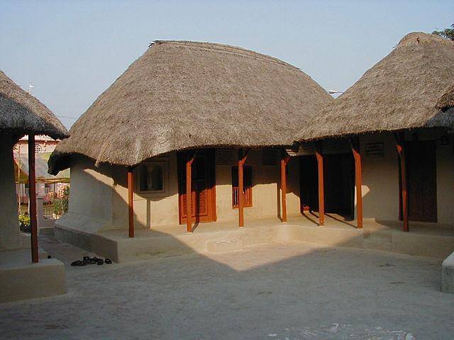
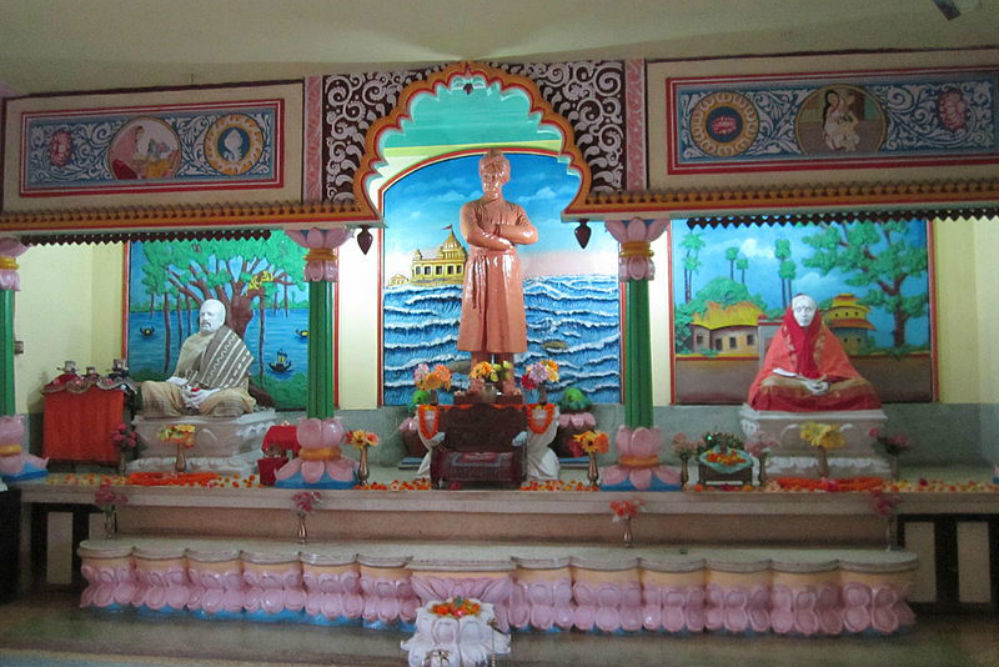
Jayrambati Jayrambati is a quaint village, popularised as an important pilgrimage point among followers of Sri Ramakrishna for being where the Holy Mother Sri Sharada Devi was born. The village has a certain old-world charm to it and has several small temples all across the village with the most popular one being the Sri Sri Maitri Mandir devoted to the Holy Mother and erected exactly at the birth location of Shri Sharda Devi in the year 1923. The Holy Mother is said to have resided here up to the age of 9 with her parents and it is also where Sri Sharda Devi got married to Sri Ramakrishna. The temple houses a marble idol of Sri Sharada Devi, established in 1923 by Swami Sardananda, who built the temple. The temple has an adjoining prayer hall and a kitchen and a few of the household articles used by the holy mother are now present at the temple as sacred relics to be viewed by the devotees of the holy mother. A Shivaling was also installed in the sanctum sanctorum after it was found deep in the ground while excavating the earth for the construction of the temple. Bhanu Pishi House near the Maitri Mandir is the ancestral residence of Bhanu Pishi, a close companion of the holy mother who regarded her as an aunt during her younger days. Bhanu Pishi returned to her childhood residence after the demise of her husband and is believed to have seen a four-armed Goddess in the Holy Mother long before she was revered as a spiritual leader. The holy mother also spent some time at Bhanu Pishi House to find peace and solace on being taunted by the villagers about her husband’s mental imbalance. The property is presently managed by the Maitri Mandir.
Nutan Bari was the second home of Sharada Devi, often referred as the new house of the Holy Mother and was constructed by Swami Sardananda standing on the western face of the Punya Pukur and registered in the name of Goddess Jagaddhatri. Puratan Bari is also referred to as the old house of the holy mother and was Sharada Devi’s residence for 52 years from 1863 to 1915. Many devotees received their initiations for Bhamhacharya and Sanyasa from the holy mother here and she also worshipped Goddess Jagaddhatri when she resided here. At the time of division of ancestral properties, the house was given to her brother Prasanna Mukhopadhyay, but the holy mother continued to stay with her brother in the same house for a long time before shifting to Nutan Bari. The house was acquired by the authorities of Belur Math from the descendants of Prasanna and is overseen by the Ashram. Telo Belo is a small village between Jayrambati and Tarakeshwar, famous for housing the Dakat Kali or the Kali of Dacoits Temple built by a dacoit named Bhim. It is believed that the holy mother stayed with the dacoit and his wife during her travel to Dakshineshwar to visit her husband and addressed the dacoit as father and he was so moved by her love and affection that he left the path of robbery and led a simpler life from then. He later constructed a temple devoted to Goddess Kali because he thought Sharada Devi was an incarnation of the deity. The Mayer Dighi is one of the primary source of irrigation for the village and also where the devotees of Sharada Devi take a dip.
Village folklore says that decades ago when Sharada Devi was suffering from an acute illness she went on a fast before the temple, the goddess Simhavani appeared before her and her mother Shyamasundari in the form of a blacksmith who advised the holy mother about remedies to cure her disease. After following the blacksmith’s advice, the holy mother was completely cured of her disease, post this the holy mother preserved some amount of earth from the site where the goddess appeared before her, she took the medicines daily and also gave some to her niece Radharani. When word spread out about the healing powers of the earthfill people from neighbouring areas flocked the area to acquire the medicinal earth and seek blessings from the goddess. The goddess then became a popular figure in the region, and with time the temple got damaged. The new temple has metallic pitchers that represent the goddess Simhavani and her two companions Chandi and Mahamaya. The Dharma Thakur Temple is located at the north-west corner of Punya Pukur is a small mud-walled thatched hut that houses a shrine to Dharma Thakur, who is worshipped under two different names at two different places. In one of the chambers of the temple there is a tortoise shaped form of Lord Sundaranarayana; an Avatar of Dharma Thakur and is one of the two forms of the deity. Jayrambati Math, also known as the Ramakrishna Mission Sharada Sevashrama Yogashrama hosts an array of cultural and religious festivities throughout the year. It is believed that the Shihar Shiva Temple was the exact spot where Sharada Devi first expressed her desire to marry Sri Ramakrishna.
Koalpara is a small village located near Jayrambati that is intertwined in the life and journey of the holy mother Sharada Devi. The holy mother rested at the village during her visits to Kolkata via Bishnupur and resided here quite frequently. An Ashram was built here in the year 1909 and Sharada Devi herself installed portraits of Sri Ramakrishna and herself in the Ashram’s shrine, the portraits are worshipped at the Ashram daily. The Ashram also runs a Charitable Homeopathic Dispensary and also conducts activities for the wellness of the community like educational and medical aid. Sharada Devi also occasionally stayed at the Jagdamba Ashram, which is very close to the Koalpara Ashram. Punya Pukur is a tank on the eastern side of the Nutan Bari. Pilgrims usually visit this tank to take a bath before visiting the shrines and temples. Also known as Tal Pukur, because the pool is lined with palm trees on its periphery, Barujjey Pukur is a tank located in the south-eastern corner of the village and very close to Nutan Bari. The holy mother Sharada Devi used to take baths in the tank and also used the water for all her domestic needs. Amodar Ghat is a ghat on the banks of the rivulet Amodar, regarded as Ganga by Sharada Devi. The rivulet has formed a triangular peninsula that resembles the back of a tortoise dotted with cremation marks. Garh Mandaran Fort is an ancient fort approximately 10 km from Jayrambati, built during the Afghan era and has Afghani stylings and influences in its structure.
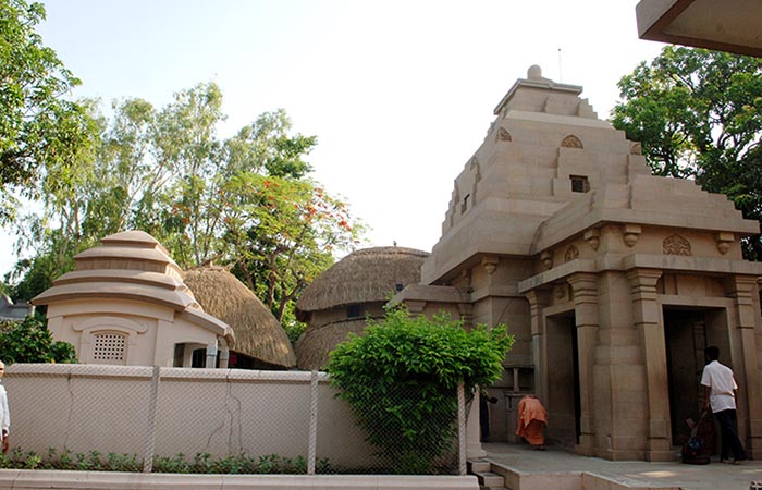
Kamarpukur A cluster of small villages, Kamarpukur is nestled between Vishnupur and Tarakeshwar and the birthplace of Sri Ramkrishna Paramhansa. A number of small cottage industries and temples are located here. Kamarpukur is rich in biodiversity and replete with flora and fauna. The Matri Mandir Is believed to be the birthplace of Ma Sarada and is situated in Jarambati and also called Jairamabati Math. The temple houses a beautifully constructed marble idol of Ma Sarada. The emple is open from 4 to 11 am and then from 3 to 8 pm. Translated to New House in English, Nutan Bari is located in the complex of Matri Mandir and gives a glimpse into the life of Ma Sarada who was born and brought up here. Puratan Bari translates to Old House and it was built by Swami Shradhananda for Ma Sarada so that she could live comfortably and is also located in the Matri Mandir complex. Located near the Talpukur lake, Simhavahini temple is dedicated to Goddess Simhavahini. Haldapukur tank is the birthplace of Sri Sri Thakur who was revered by the people for his knowledge and wisdom and also the place where Lord Shri Ramkrishna used bathe daily while staying in Kamarpukur. Punya Pukur located near the residence of Ma Sarada was where she took a bath daily. The Goddess Visalakshi shrine is an important pilgrimage place and was built for Goddess Visalakshi, believed to be a savior of the poor and needy. The Gopeshwar temple is dedicated to Lord Shiva and was built by ardent devotees of Lord Shiva, Sukhlal Goswami and his forefathers. The Mukundapur temple is where Sri Sri Thakur’s mother took penance so that her child could be free from insanity and become sane. Sri Ramkrishna’s mother also fasted here for a number of days to seek blessings of Lord Shiva. This temple houses a splendid shrine of Lord Shiva known for its healing and magical powers. The Sihar Shiva temple located in Sugar village is also dedicated to Lord Shiva and was a favourite of Ma Sarada and Sri Ramkrishna. Barujjey Pukur is situated on the south eastern part of the village and is also called Banerjee’s tank. The Yogi Shiva temple dedicated to Lord Shiva is where Sri Ramkrishna’s mother envisioned a divine light coming out of the idol Shiva and realised had conceived Sri Ramkrishna. Located on the outskirts of the village, the Dargah of Ismail Fuji is built in Islamic architecture with carvings of verses on the walls. Constructed in 1947, Ramkrishna Math is where Sri Ramkrishna Pramhansa was born. The Math also operates a jute mill where unemployed people of the village are trained so that they can earn a livelihood. Before merging into the sea, the Damodar river flows through Kamarpukur and is considered pious and auspicious by the villagers. The Raghuvira temple is dedicated to Lord Rama and is a beautiful temple today from what was a mud hut. The temple also houses an earthen pot believed to be used by Goddess Sita and also has a Rameshwara Shiva Lingam and a salagrama of Lord Vishnu. The Garh Mandaran is a ruined fort located near Kamarpukur and is believed to be built during the Afghan era.
Tarapith Tarapith is a famous Hindu pilgrimage site and a Shakti Peetha, believed to be the spot where Sati’s third eye fell. Tara, another form of Sati, is worshipped in the temple. Near the Dwarka river, Tarapth is also called the city of Tantra Mantra or black magic. Alegend tells the story of how Shiva drank the poison Halahala, that would save the universe. To soothe his burning throat, Tara had breast-fed Shiva and nursed him. The history of the place is steeped in black magic and there is a huge cremation ground adjacent to the powerful Shakti peeth. Chanting can be heard at the cremation grounds at all hours and a sense of mystery engulfs the village.The Tantric Hindu temple is dedicated to the goddess Tara, a fearsome Tantric aspect of the Devi, the chief temples of Shaktism. Tarapith is also famous for Sadhak Bamakhepa, known as the avadhuta or mad saint, who worshipped in the temple and resided in the cremation grounds as a mendicant and practised and perfected yoga and the tantric arts under the tutelage of another famous saint, Kailashpathi Baba. Bamakhepa dedicated his entire life to the worship of Tara Maa. His ashram is also located in bank of Dwaraka river and close to the Tara temple. The Bamakhepa Temple, a pink coloured temple dedicated to the Saint Bamakhepa. There is a tomb and samadhi right outside the temple where people offer prayers and offerings in the name of the saint. The Tarapith Temple is a small temple located on the banks of the Dwarka river and is an ancient extremely auspicious temple. One of the 51 Shakti Peeths in India, is one of the most important places where tantric rituals are followed even today. It remains busy all through the year and is often visited by the poor who come here to have a free meal. As per legend, an eyeball of Sati fell here at Tarapith, when Lord Shiva roamed the universe mourning her loss and so the name of the village was changed from Chandipur to Tarapith. The Tarapith temple represents the destructive aspect of Lord Shiva in the form of Kali. As per the Hindu traditions, Ma Tara is believed to be the second out of the ten goddesses of great wisdom and is also known as Kalika, Bhadra-Kali, and Mahakali. She is the tantric demonstration of Goddess Durga. Mahasmashana is not a usual tourist spot, but a cremation ground right besides the main temple as Goddess Tara is said to have an affinity for bones and skeleton. This is where many saints and sadhus reside permanently and perform their meditation and tantric kriya.
Falta The river town of Falta is the ideal picnic destination or weekend gateway from Kolkata as it is less than 50 km south of the metropolis. When Siraj-ud-Daulah sacked Kolkata in 1756, the English residents moved to Falta temporarily. Marked by the confluence of river Hoogly and Damodar on the south and river Rupnarayan and Hoogly on the north, Falta has been developed on the banks of the Hoogly and is known for the beautiful farmhouse like the Bose Bigyan Mandir of Acharya Jagadish Chandra Bose, the grounds of which allow visitors to picnic in. At the Falta jetty, one can watch ferries crossing the river and walks along the riverside and also go for a boat ride on the river. At a 30 minute drive is Diamond Harbor, Raichak and Gadiara Geonkhali as well as the towns of Tamluk and Haldia.
Raichak Located 50 kms away from Kolkata and yet a world apart, Raichak, is a riverside town. With the Hooghly river on its side and the numerous forts that add to its earthen charm, this town is the perfect weekend getaway. The Raichak fort, originally built during the British colonial rule is one of the most beautiful forts in all of India, especially after its restoration a few years back. For many years post independence, the fort was left ignored and was in shambles. Later, the Radisson group of hotels overtook it and converted it into a hotel. Now known as The F Fort, the Raichak Fort, though heavily commercialised today, manages to enthrall with its earthen charm and old world demeanor. Built in Anglo Indian architecture with traces of British and French styles, the fort is the best place to visit. Situated off the southern coast of Hoogly, Diamond Harbour is a popular weekend getaway near Kolkata. This is where the Ganges takes a turn towards the south to join the Bay of Bengal. There is also am old fortress goes back to Portuguese pirates and the beautiful Bakkhali beach. The Lighthouse is very close to the fort. Built a couple of decades ago, the lighthouse is still fully functional and can be seen guiding the inbound ships on a dark night. Close to Diamond Harbour, the Chingrihkali fort was built by the Portuguese, but is in ruins today, but is a stunning site, especially on a windy day. One can also see the river stretched across in the backdrop. Located near Diamond Harbour on the banks of Hooghly River, the Ashram of Ramakrishna Mission is very popular with the serene setting adding to its beauty. Close to Diamond Harbour, Joynagar is, in addition to a flourishing local market selling handicrafts, popular for housing Kalidas Dutt’s many manuscripts, terracotta figurines and black stone images of many Gods belonging to the 11th and 12th centuries. Situated on the confluence of rivers Hooghly, Rupnarayan and Damodar, Gadiara is another nice weekend destination. One must visit Gadiara for great Bengali food, leisurely walks along the village roads and boat trips with the view of sunsets and sunrises on river a scene to behold. Closeby attractions include Garchumuk and Geonkhali, which can be reached by regular ferry service.
Taki The small town of Taki lies on the banks of river Ichamati and a boat ride on the river will give one a chance to get a closer view of Bangladesh. In fact, tourists of both India and Bangladesh embark on this journey, thus giving one a chance to meet citizens from the neighbouring country. Local attractions include the ruins of Zamindar houses, Ramakrishna Mission, Kuleshwari Kali Temple, a three century old Jora Sahib Mandir and General Shankar Roy Chowdhury’s Adi Bari. A boat ride will take one to Henry’s island, and a rickshaw ride from Henry’s island will take one to Golpatar Jungle for the canopy walk. Taki is located at about 80 km from Kolkata by road.
Piyali Island Situated about 72 kms from Kolkata, Piyali is an island covered in lush greenery and is an ideal weekend getaway and is frequented by birdwatchers. Nestled at the confluence of the rivers Matla and Piyali, the mangroves covered Piyali Island can be reached by crossing a small bridge atop the Piyali river. The island is considered the gateway to the renowned Sundarbans National Park and in addition, one can spot exotic birds as the place is home to a wide variety of bird species and also go boating in the Piyali river. The place provides several accommodation options and is also a popular picnic spot in the region.
Machranga Dwip Also known as Kingfisher island, this little known day trip destination is situated in the middle of the river Ichamati, with India on one side and Bangladesh on the other. Covered by trees, this little island is perfect for nature lovers, as they can walk through the green fields and observe distant Bangladeshi rural settlements. One can picnic, take a boat ride and go swimming in the river. The sun setting on the river Ichamati is an awe-inspiring sight. Taki is about 20 minutes away and to reach Machranga Dwip, one needs to travel to Hasnabad and then use a van to reach the ferry dock for motorboats to reach the island. You can also hire motor boats from Taki to get to Machranga Dwip.
Kakdwip Kakdwip finds a special mention in the history of the state as it was here that the peasant movement during the Tehbaga movement in 1946 centred around. While it is a historically significant place, the city, located on the Ganges delta, has many exciting places in store like Henry island, Sagar island, Frederick island and Fraserganj island, among others. Henry island is a pristine white sand beach, located near Bakkhali with many red crabs can be found here and birds like whistling ducks, kingfisher and the black-rumpled flame back. Named after a British surveyor, Henry island is regarded as the best among Mandarmani, Digha, Tajpur, Puri and Bakkhali beaches. The beaches form the Ganga-Brahmaputra Delta region. There is also a watchtower near the beach, from where one can get a beautiful view of the beach and the mangrove forests. From here, one can also visit the Bakkhali beach and the adjoining crocodile and deer parks.
Sagardwip Part of the Sunderbans group of islands, Sagardwip is a small island at the confluence of the Ganges and the Bay of Bengal. The point where the Ganga meets the sea is considered holy by Hindus and thousands of pilgrims make way to Sagardwip, every year in mid-January, to take a holy dip in the river during the Ganga Sagar Fair, the second most attended fair in the world, after the Kumbh Mela.
Mousuni Island Mousuni is a tiny island attached to the Sunderbans delta near Namkhana which boasts of golden sandy shores, mesmerising orange sunsets and a beautiful view of the horizon. The island was first developed by the British to trade salt and dry fish and is considered a beautiful confluence of the river and the sea. A well kept secret of the state, Mousuni Island is considered to be a bird watchers’ paradise as a lot of birds migrate here for the winter. Salt at the southern corner of the island was where once salt was extracted from the sea. Kankramarir Chor near Baliara, is considered the best place for bird watching. December to mid April is considered the best time to visit Mousumi Island with the weather is pleasant unlike summers and the monsoons.
Bakkhali A small beach town on the coast on the Gangetic delta and close to the Sundarbans. The Bakkhali Beach is located at the most deltaic island of southern Bengal and is a crescent-shaped beach. Stretching 8 km from Bakkhali to Frasergunj, this beach has a long coastline and is famed for its sunrises, picnics and leisure walks. Jambu Dwip is an independent island, 8 km off the main coast and is uninhabited and submerges in water for some months of the year. The beach is a famous fishing spot and known for the pure drinking water found on it. The Bishhalakshmi temple at the end of the Bakkhali beach is worth a visit. The area of Fraserganj is popular because of ancient history. Lord Fraser, a British official resided in this area and was so mesmerised that he decided to build it up, but the construction never got completed, owing to the sea. Ruins of his home and a few other builds can still be seen here. There are also a large number of wind mines erected in the area. The Crocodile Park is the only crocodile reservation park in West Bengal and one of the few in the world. The Bakkhali Breeding centre has a huge collection of crocodiles, with a variant in almost every stage of life from the birth to old age.
Junput The beach at Junput is adorned with casuarina groves, accompanied by the rhythmic sound of sea waves and gentle breeze and forms a breathtaking experience. The most famous attraction is the convergence point of rivers Rasulpur and the Ganga. Other attractions include the lighthouse and museum of the fisheries department. Digha, Mandarmani, Tajpur and Talshree are all located at an hour’s drive.
Mandarmani Mandarmani is a small and upcoming beach resort town near Kolkata. With great scenery and sandy beaches, Mandarmani is the longest motorable beach in India, about 13 km long. Approximately 180 km away from Kolkata on the Kolkata-Digha route Mandarmani is a wonderful place to just lie down on the beach and watch the setting sun against thrashing waves.
Tajpur Tucked between Mandarmani and Shankarpur, Tajpur is a small town set on the Bay of Bengal’s shore, just 170 kms from Kolkata. Considered to West Bengal’s secret, the virgin beach here is hidden away from view with the highlight of the beach, the hundreds of red crabs found on the shore, which give a crimson colour to the beach. Unlike usual crescent-shaped beaches, this one is an inverted crimson fringed by dense eucalyptus, tamarisk and casuarina trees and the secluded beach is perfect for lazing on a hammock and spending time in solitude. Tajpur Beach is also known for its adventure sports and activities with the popular sports being snorkelling, kayaking, parasailing, coastal biking, water zorbing, rafting, boating and fishing. Located at a distance of just 7 km from Tajpur Beach, Digha is a major tourist attraction and is also a beach town, but unlike Tajpur Beach, the beautiful beaches in Digha are crowded. Noted for having longest motorable beach road in India, Mandarmani lies 19 kms from Tajpur Beach and is full of dense plantations. Another beach town about 7 km from Tajpur Beach is Shankarpur which is a popular fishing harbour. The best time to visit these beachside towns is at the onset of the winter season between the months of October and February when the climate is pleasant and the temperature favourable.
Shankarpur The Shankarpur beach is breath taking, with clean water, white sand and mildly blowing winds and is one of the most sought after beaches on India’s eastern coast. The small town with the lack of too many distractions, gives one the opportunity to spend as much time at the beache as possible. There are not many water sports available and the beach has a few shacks and bars, where coconut water and other drinks and sea food are available.
I really enjoyed exploring this state and I hope you enjoyed reading about it too. We’ll meet again with another state to explore.


