Travel Bucket List: India – Meghalaya Part 2

Shillong

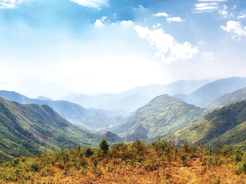
The capital of Meghalaya, Shillong is also referred to as the Scotland of the East for the rolling hills that surround the town as well as India’s Rock Capital because of the locals’ passion for music and the number of concerts held in the town. Shillong is named after the God of the Khasis, U Blei Shillong.

Since being made the civil station of the Khasi and Jaintia Hills in 1864 by the British, Shillong has steadily grown in size. In 1874, on the formation of Assam as the Chief Commissioner’s Province, it was chosen as the headquarters of the new administration because of its convenient location between the Brahmaputra and Surma valleys and also because Shillong’s climate was much cooler than tropical India. Shillong remained the capital of undivided Assam until the creation of the new state of Meghalaya on 21 January 1972, when Shillong became the capital of Meghalaya, and Assam moved its capital to Dispur in Guwahati.

During the First Anglo-Burmese War, the British authorities felt the need for a road to connect Sylhet and Assam which would traverse the Khasi and Jaintia Hills. Impressed by the favourable cool climate of Khasi Hills, the authorities negotiated with the Syiem of Sohra in 1829 for a sanatorium for the British and this began the consolidation of British interests in the Khasi-Jaintia Hills. A serious uprising by the Khasis against foreign occupation followed which began in early 1829 and continued till January 1833. Eventually, the Khasi confederate chiefs were no match against the British and they surrender with the leader of the Khasi resistance, Tirot Sing, taken to Dacca or present-day Dhaka for detention. After the resistance of the Khasis, a political agent was posted in the hills, with its headquarters at Sohra, also known by the name Cherrapunjee. But the climatic condition and facilities of Sohra did not make the British happy who then moved out to Shillong.

In 1874, a separate Chief Commissionership was formed with Shillong as the seat of administration. The new administration included Sylhet, now a part of Bangladesh. Also included in the Chief Commissionership were the Naga Hills in present-day Nagaland, the Lushai Hills in present-day Mizoram as well as the Khasi, Jaintia, and Garo Hills.

Shillong was also the subject of the great earthquake that occurred on 12 June 1897. With an estimated magnitude of 8.1 on the Richter scale, the earthquake caused twenty-seven lives to be lost as well as a major part of Shillong destroyed. Lying on the Shillong Plateau, it is the only major uplifted structure in the northern Indian shield. The city lies in the centre of the plateau and is surrounded by hills, three of which are revered in Khasi tradition – Lum Sohpetbneng, Lum Diengiei, and Lum Shyllong. The Umiam lake lies between Shillong and Guwahati which lies about 100 km north of the town.
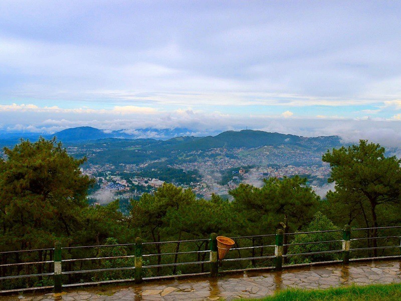
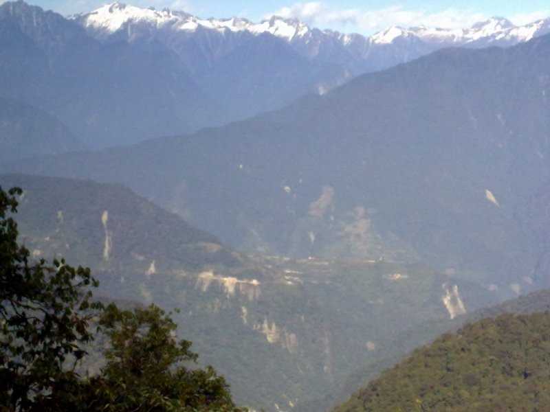
At the height of 6449 ft above sea level, Shillong Peak is the highest point of Shillong. It offers a breathtaking panoramic view of the entire city, the Himalayas, the waterfalls as well as the plains of Bangladesh. A telescope is available to get a bird’s eye view. Trekking up to this semi-circular Shillong Peak is highly recommended for the best views but it is often bounded by heavy fog. It is said that Shillong gets its name from Shillong Peak with a local legend that tells us of the patron deity Leishyllong who resides in the hills and protects the city from all evils. The U Shulong site at the top of the peak is sacred and every spring, a ritual is organised there. The peak is part of an airport base and features a radar station of the Indian Air Force. Due to security reasons, heavy checking is done at the gates, and tourists are asked to deposit their cameras. The peak is open between 9 am to 5 pm and entry is free. The telescope service charges INR 10 per person.
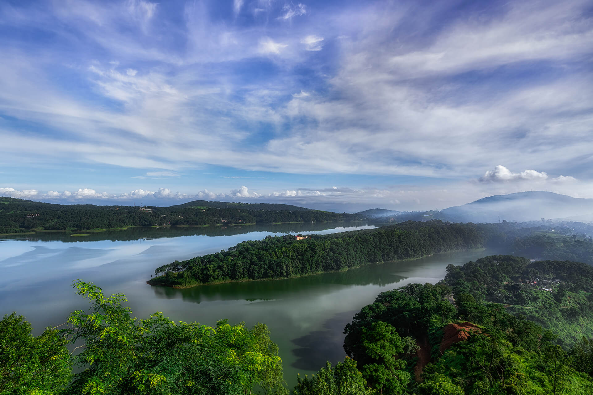
With a name that means the navel of heaven, Sohpetbneng lies 1343m above sea level and offers breathtaking views of Shillong. Diengiei Peak is located on the western part of Shillong at an altitude of 6200 ft Because of the peak’s steep and precipitous gradient, it makes for excellent mountain climbing as well as other adventurous sports like rock climbing and rappelling.
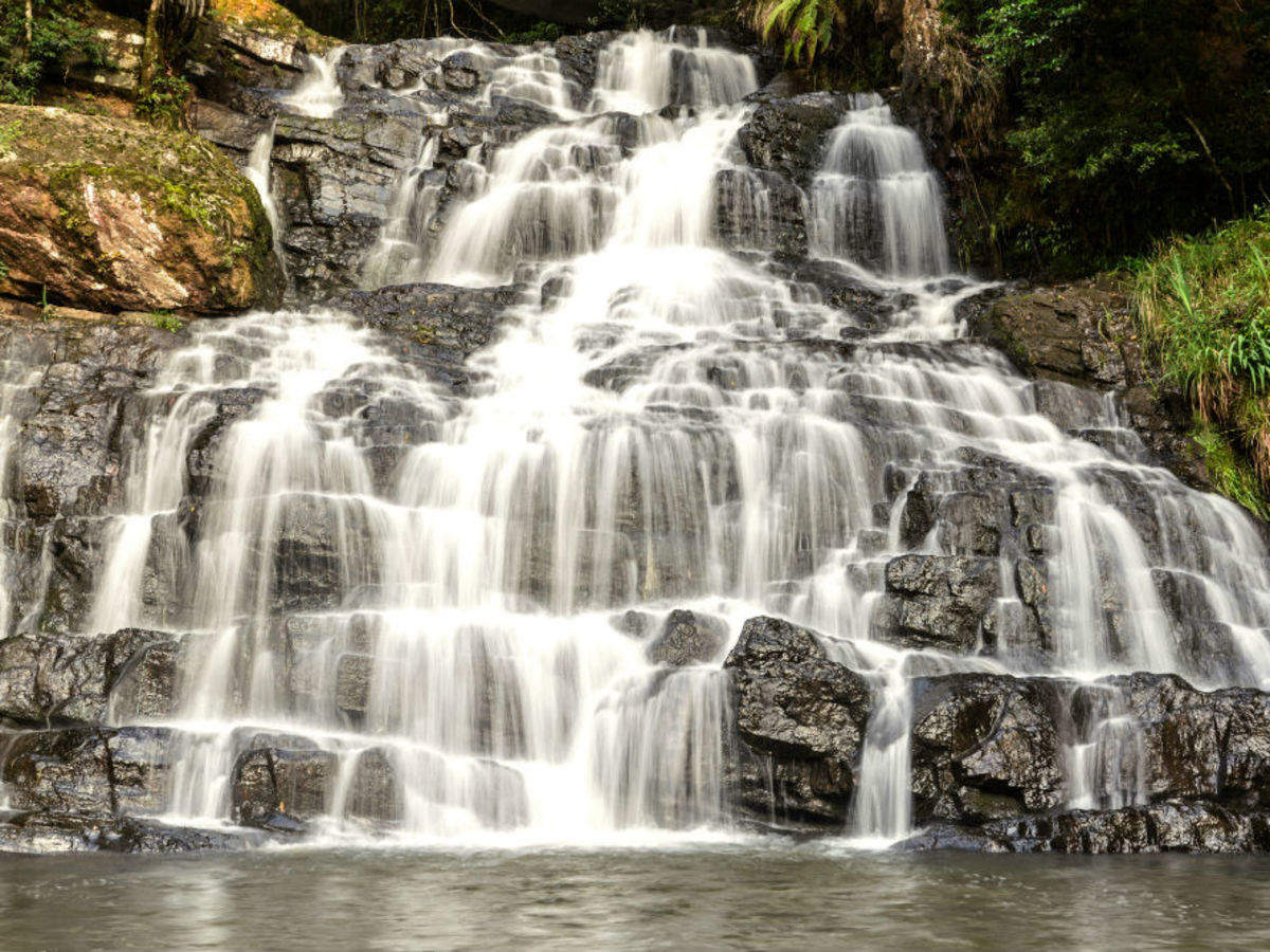
Named after an Elephant-like stone at its base, Elephant Falls are amongst the most popular falls in the North-East, located about 12 km from Shillong. The falls are a tourists’ paradise with three layers of the falls accessible from different vantage points. The stone for which the falls are named disintegrated and was washed away due to an earthquake in 1897.  Also known as the Ka Kshaid Lai Pateng Khohsiew or the Three-Step Waterfall by the local Khasi people, the falls consist of three falls in succession. The first of the three waterfalls is tucked between the dense trees and is very broad. The second waterfall reduces to thin strands of water and is almost negligible in winters due to the receding water levels. The third and the most visible waterfall is the tallest with clear water flowing like a sheet of milk on the dark rocks in the backdrop. Out of the three, the third waterfall tends to strike the visitors as the most impressive. The best time to visit the falls is just after the end of the monsoon as the water flows at full strength. Closed on Sundays, the falls are open between 10 am and 6 pm daily and have no entrance fee.
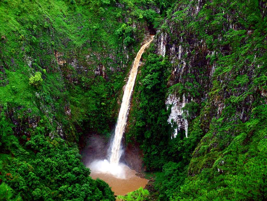
One of the country’s steepest and most mesmerising falls, Sweet Falls is located about 5 km from Happy Valley at a height of 96 metres. The route to the waterfall is not well maintained and is quite treacherous, surrounded by slippery stones resulting in some tragic stories. Unlike the tiered waterfalls of Meghalaya, Sweet Falls is a thick rush of water falling from a great height making it impossible to stand below or take a bath in the falls. Sweet Falls is also believed to be haunted by the locals who believe that if people visit the site in odd numbers, they return in even numbers. Surrounded by verdant greenery, Sweet Falls is a popular picnic spot which has a butterfly museum and a mini zoo nearby. While there is no entry fee, vehicles need to pay a fee of INR 70 to reach the falls.
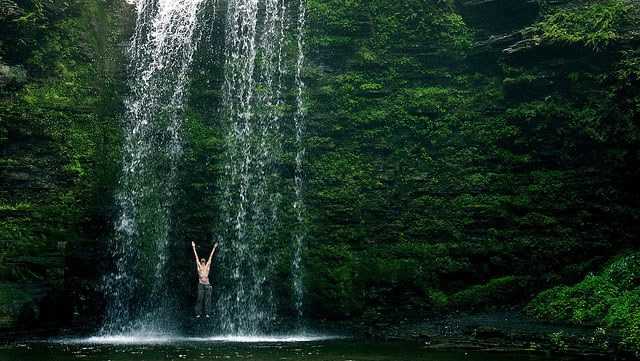
Located in the East Khasi District about 6 km from Shillong, Spread Eagle Falls are considered to be the widest in all of Shillong. Also known as Sati Falls or Urkaliar because of the belief that Ka Liar slipped into it, the majestic waterfall gushes down steep hills, towering three sides into a massive pool of water which is ideal to sit and lounge. The Spread Eagle Falls, which looks like an eagle with its wings spread wide, hence the name is a popular picnic site amongst the locals.
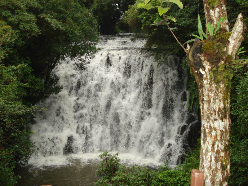
Crinoline Falls are also called the Blue Heaven Falls and are a stunning waterfall situated near Lady Hydari Park. Located amid the forest the falls make for a breathtaking view and a great swimming experience. The waterfall cascades down from a height of about 40 feet and creates a pool at the base which is surrounded by beautiful orchids. The trip to the waterfall can be made by trekking through the green forest and it is the perfect location to relax in complete tranquillity. Trekkers can follow the water as it flows through the forest, enjoy listening to the sounds of gushing water, take photographs and also have a picnic here. There is a restaurant nearby where people can grab a bite to eat and evening programs are often organised nearby too. The falls are open between 10 am and 6 pm daily.

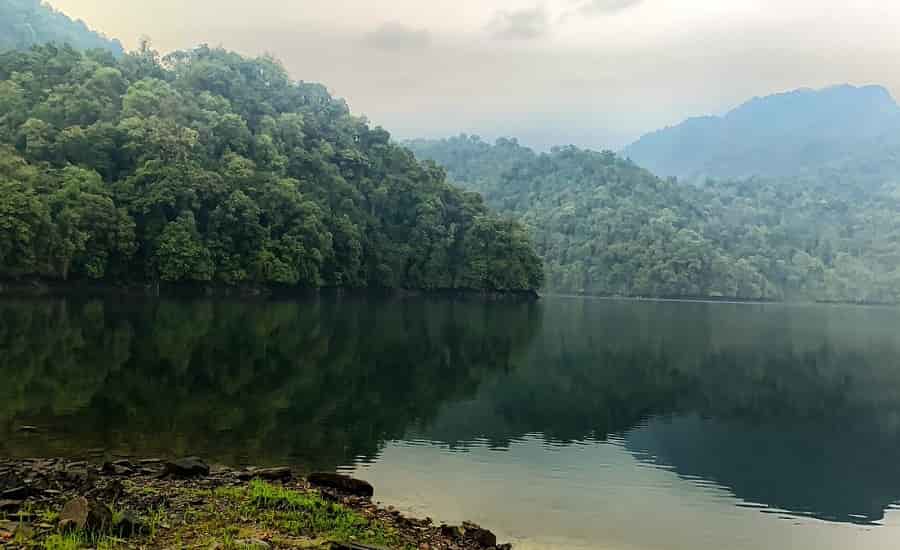
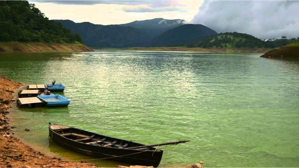
A man-made reservoir, Umiam Lake is located at a distance of 15 km north and was formed after a dam was constructed to generate hydroelectric power. The scenic Umiam Lake is encircled by the lush green East Khasi hills that form one of the best panoramic sights in the country. The sunrise at the lake is a treat to watch and shouldn’t be missed. There is a park adjoining the lake which is a picnic hotspot. The lake and reservoir are surrounded by thick coniferous forests and expand over an area of about 222 sq km. There is boating and other water sports available at the lake. In summers, the shores are adorned by beautiful Gulmohar trees while in winters, the water level recedes and turns azure. The name Umiam means water of tears in Khasi, and according to legend, there were once two sisters who began their journey from heaven to descend to Meghalaya. The younger sister lost her way during the journey and the grief of not being able to find her sister was unbearable for the elder sister who shed tears continuously which formed the Umiam Lake. The lake is famous for its lovely little boathouse on a lake island, Lumpongden Island. Visitors have to book the Boat House in advance and at any given time, only a group of six people can stay there. At the lake, visitors have to take a boat ride to the island which will cost about INR 1200 for both ways. While the lake is open all the time, water sports activities are open from 9 am to 5 pm. Fees for a pedal boat or a canoe or a kayak for 30 mins is INR 20, while skiing will cost INR 200, while scooters and river buses cost INR 50, and yachting will set one back by INR 100

Lying in the centre of Shillong, Ward’s Lake is an artificial lake surrounded by a prolific green garden and is a major tourist attraction around which the city has been planned. Also known as Pollock’s Lake, the lake is a popular picnic spot. In the middle of Ward’s Lake is a small bridge which allows visitors to have a panoramic view of the lake or feed the tiny fishes floating around in the water for which puffed rice is available at the entrance of the lake. The major highlight of the lake is paddle boating. Ward’s Lake is named after the Chief Commissioner of Assam, Sir William Ward, who initiated the construction of this lake. The lake is open from 8:30 am to 5:30 pm between November and February and from 8:30 am to 7 pm between March and October. Entry fees are INR 10 for adults and INR 5 for children.
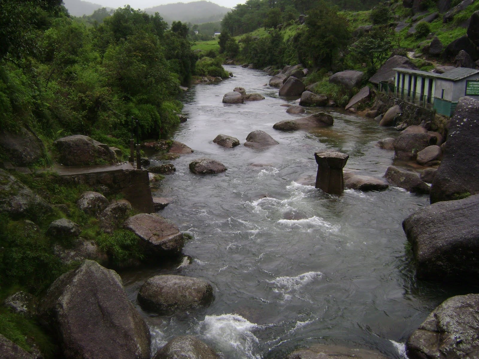
A famous sulphur hot water spring, Jakrem is located about 64 km from Shillong and is believed to have curative medicinal properties. Also developed into a health resort and popular picnic spot, Jakrem can be easily reached using a local taxi or bus.

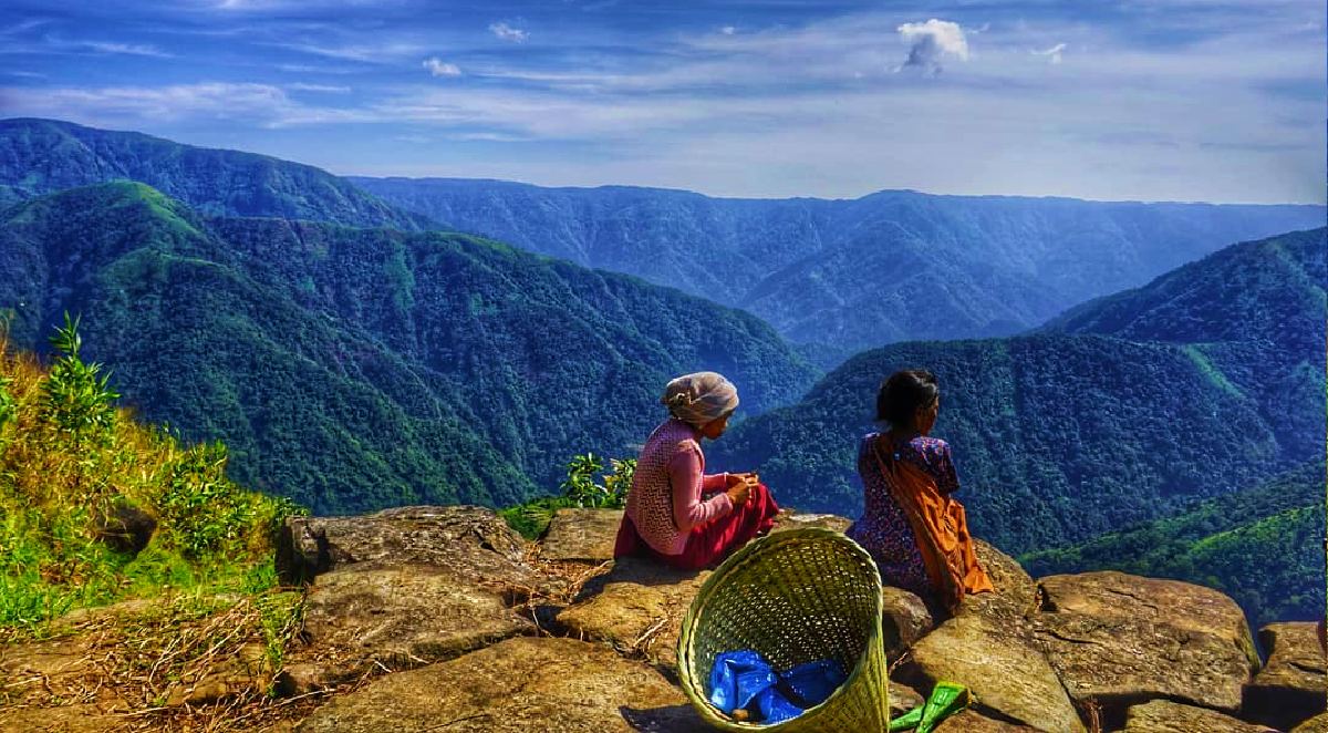
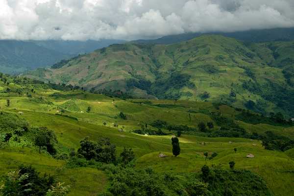
Perched on the East Khasi Hills, Laitlum Canyons are located about 21 km south of Shillong and is a less explored but eautiful tourist and trekking destination. Translating to the end of the hills, the canyons offer the best views of the whole of Meghalaya hedged by hills and valleys. It is ideal for quiet and peaceful getaways and to catch the canyons at their best, it is best visited during sunrises or sunsets. One has to hike for about 2 km via the shorter route or more than that via the longer route to reach Laitlum Canyons. From the top of the Canyon, one can also catch a view of Rasong, a small hamlet nestled deep in the ridges of the Laitlum gorge. It is a must-visit for nature lovers and photographers. There is also a challenging, yet interesting trekking opportunity down to the Smit village, which is about 6 km away from the Canyons. The flowing Laitlum stream, underneath an ancient-looking bridge en route promises wonderful views and a lush green path. There is also a 270-degree viewpoint where one can stop and stare, as well as click photographs of the four waterfalls nearby. Laitlum Canyons are open between 6 am to 5 pm and the best time to visit it is in the afternoon hours since during the mornings and evenings, it is covered with fog and one cannot catch clear views.
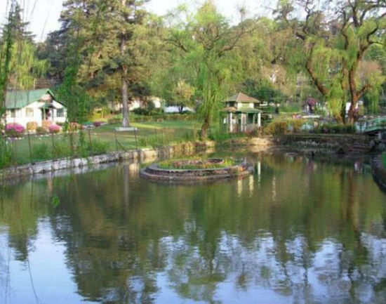
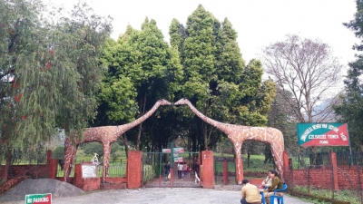
The popular Lady Hydari Park is named after the first lady of the state and wife of the Governor of Assam, Lady Hydari. Built in the form of a Japanese garden, the garden is filled with round-shaped hedges, willow trees with leaves touching the ground as well as many scattered small ponds. There is also a small lake where one can find ducks and colourful fish. The park has a children’s zone with swings and slides. There is also a small zoo inside the park which houses over 73 species of birds and over 100 reptiles including the Himalayan black bear, leopards, jackals, porcupines, serows, hornbills and kites. This zoo is the only zoo in Shillong and so is always crowded. The park is also home to a small museum that displays photographs of rare species of wildlife and exhibits such as the skins of elephants and a giant python and aims to highlight the state’s rich biodiversity. This sprawling park is located in the heart of the city and is a local favourite destination and picnic spot.
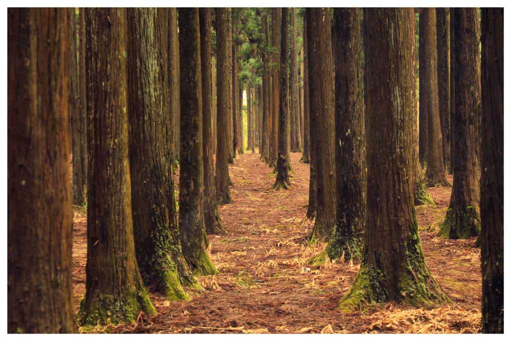
The Malki Forest is locally known as Khlaw Malki and is popular amongst those who want to take a break and spend some time amidst nature. Home to towering trees, especially British pine, which create a covering and provide shade to those exploring it, there are a few trails through Malki Forest which make it ideal for walking or trekking as well as different kinds of flora like wild flowers and mushrooms. There are also tiny streams that flow throughout the forest which also act as water sources. The best time to visit is early in the morning when all is quiet, sunlight peaks through the trees and one can hear the sound of birds chirping. It is also a great place for nature photography.
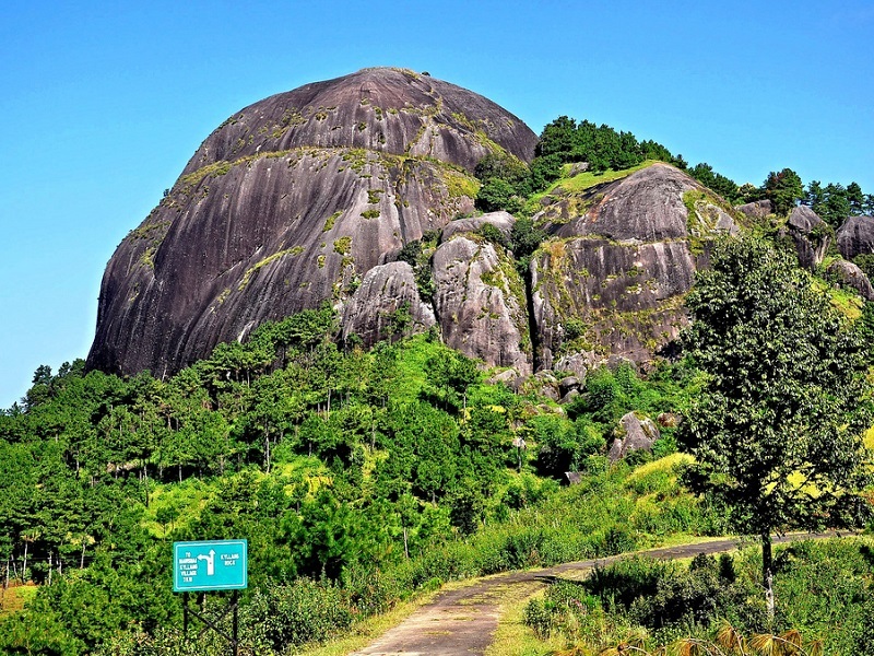
Some 78 km away from Shillong, a unique giant rock made out of red granite, Kyllang Rock is a giant dome in the West Khasi Hills. The Rock which is 5400 ft above sea level and has a width of around 1000 ft is a mammoth block of granite which is part of the Khasi folklore and is beautiful in shape. Surrounded by red rhododendrons, Kyllang Rock is said to have a special magnetic field that makes sure that people don’t fall off it. The mammoth dome is inaccessible from its southern side whereas the northern side is full of rhododendrons and bushes. Rock climbing lovers flock to Kyllang Rock to test their skills and enjoy some unhindered adventure. Trekking to the top of the rock takes around 30 minutes but the view from the top is worth it. One can also climb to the top by the staircase at the site. The rock can be visited any time of the year, barring the monsoon season when the ground is slick and wet.

Motphran, also known as the Monument of France was erected in memory of the 26th Khasi Labour Corps who served under the British in France during World War I. It bears the words of the Latin poet Horace, Dulce et decorum est pro patria mori which can be roughly translated as it is sweet and honourable to die for one’s country. Due to government neglect and public apathy, this monument is now in a dilapidated condition.

Shillong has one of the largest natural golf courses in Asia known as the Gleneagles of the East. The Shillong Golf Course enjoys the rare distinction of being one of the few natural golf courses in Asia. Not only is the golf course scenic and enjoyable, but it is also challenging. A group of British civil service officers introduced golf to Shillong in 1898 by constructing a nine-hole course and the present 18-hole course was inaugurated in 1924. The course is set in a valley covered with pine and rhododendron trees. The tight fairways, carpeted with local grass which hardens the soil, are difficult to negotiate. The number of out-of-bounds streams that criss-cross every fairway makes it all the more trying. Obstructions come in the form of bunkers, trees and rain. The longest hole is the 6th, which is a gruelling 594 yards. It was set in a valley at an altitude of 5,200 ft in 1898 as a nine-hole course and later converted into an 18-hole course in 1924 by Captain Jackson and C. K. Rhodes.

The Cathedral of Mary Help of Christians, also known as the Laitumkhrah Church is Shillong’s most beautiful church built on a steep plateau that requires one to climb a set of steps to reach and is named after Mother Mary, the mother of Jesus Christ. The church with its towering arches and big stained-glass windows has two levels: a chapel and a huge cathedral. A distinguishing fact about the church is that it is constructed to resist earthquakes. The church is erected on the same site where the first-ever church of Shillong was built. It was made into a shrine in 1980 and it also houses the grave of the first archbishop of the city, Hubert D’Rosario near the altar. One can visit this church to look at the varied artwork depicting various chapters and scenes from the holy scriptures and the life stories of several saints. Besides admiring the architectural beauty and pristine scriptures, one can also catch the breathtaking views of the Brahmaputra River and the snow-clad mountains, on a clear day. Also the Grotto church that lies directly below it and can be best viewed from the viewpoint near the church should not be missed. The church is built in the Gothic style with interiors comprising of the terracotta cross stands, a bronze monument of the cavalry, huge stained glass windows made of Grenoble to reflect the colours in the sunlight and tall arches. It is built on sand, with trenches cut from rocks and half-filled with sand to absorb shocks during earthquakes. The church has two levels: the lower level which is a small chapel with a prayer hall filled with candles and prayer books and the upper level which is a huge cathedral having a big seating area. There is a set of 14 stations of the Holy Cross which are terracotta pieces depicting the life stages of Jesus Christ. The church is open from 7 am to 6:30 pm daily.

One of the oldest churches in Shillong, the All Saints Church was built during the British colonial period and boasts a colonial style of architecture. The church is completely made of wood and is busiest during Sunday mass. Situated opposite the State Central Library and quite close to the Police Bazaar, it is very convenient to reach the All Saints Church through any means of local transportation. The church is open between 8:30 am and 5:30 pm daily.
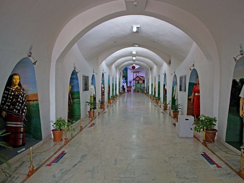
Hailed as Asia’s largest Museum of Indigenous Cultures, the Don Bosco Museum houses the beautiful culture and tradition of North East India. A seven-storeyed structure, the museum has 16 galleries that showcase artefacts, paintings and figures significant to the Northeastern culture. The museum is more of an institution with its research wing, publications, newsletters and cultural calendar. Another striking fact about the museum is that it is built in a hexagonal shape, which is why it is referred to as Shillong’s architectural pride. The museum is closed on Sundays and national holidays and other days it is open between 9 am to 5:30 pm during the summers and between 9 am to 4:30 during the winter months. Entry fees are INR 100 for Indian adults and INR 200 for adult foreigners while Indian students will need to pay INR 50 and foreign students will have to shell out INR 150.
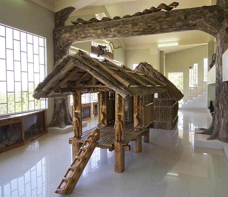
Situated in the Mawshbuit village, the Ever Living Museum is a privately owned museum depicting nature, culture, tradition, posterity and history. An ethnographic museum, it houses the objects of the hill tribe of the Garo, Khasi and Jaintia Hills and is divided into three sections. The first section houses contemporary and ancient weapons and armoury used by the Meghalayan tribesmen. The second gallery displays bamboo handicrafts items and the third gallery is a beautiful lawn of orchids, wildflowers and fruits. The museum is open from 11 am and 6 pm daily between March and September and from 11 am to 5 pm between October and February. It is closed on Good Friday, Easter and Christmas and has an entry fee of INR 50 for adults and INR 20 for children while students need to pay INR 30.
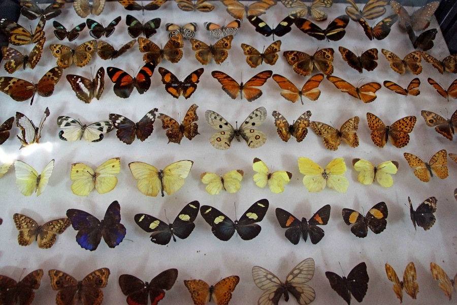
Also known as the Entomological Museum, the Butterfly Museum is a very popular tourist attraction in the city. The museum houses an extensive collection of butterflies, moths, beetles and other insects as well as also cultivates butterflies for commercial purposes. Owned and managed by Riatsamthiah Wankhar, who also organises regular programs for the conservation of moths and butterflies, the museum is a great place to visit if travelling with children. The museum is open from 10 am to 4:30 pm on Mondays to Fridays and from 10 am to 1 pm on Saturdays. It is closed on Sundays and has an entry fee of INR 5 per person.

Situated in the Upper Shillong area, the Air Force Museum is a showcase of the Indian Air Force and its defence history. The museum has aircraft models, uniforms of pilots, miniature models of missiles, rockets, machinery and technology demonstrations of the Indian Air Force Eastern Command along with pictures of the Indo-China and Indo-Pakistan wars. During the winter months, the museum is open from 9:30 am and 4:30 pm and from 9:30 am to 5:30 pm during the summer months. It is closed on Sundays and Mondays and there is a lunch break when the museum closes its shutters between 1 and 2:30 pm daily. Entrance is free.
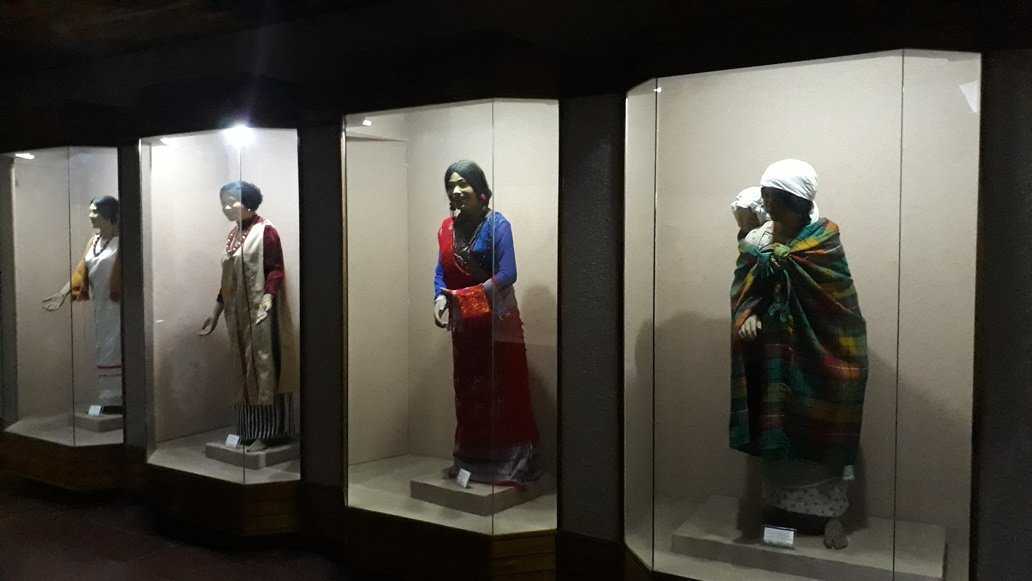
The Meghalaya State Museum exhibits a vast collection of artefacts of the tribal era and a collection of ancient scriptures. The museum is situated within the State Central Library complex and is managed by the state government. The museum is closed on Saturdays and Sundays and is open between 10 am and 4 pm on Mondays to Fridays and has no entrance fees.
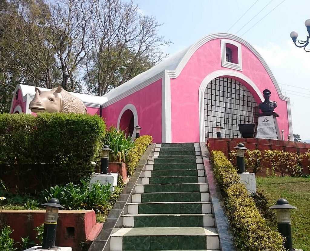
The Rhino Heritage Museum is a museum dedicated to the army and gets its name from the pink-coloured rhinoceros sculpture installed outside the premises. Among other exhibits, the highlight is the display of the weaponry of the Japanese army. Built in 1928, it is believed that the site of the museum is where the Japanese prisoners of war were imprisoned. It was later built and renovated by Lt. Gen Shokin Chauhan, the director general of the Assam Rifles. The Rhino Heritage Museum has distinctive galleries and photographs showcasing not just military paraphernalia but also depicting the local culture Closed on Thursdays, the museum is open from 9 am to 1 pm and then again between 3 and 5 pm daily.

The Capt. Williamson Sangma State Museum offers insights into the lifestyle of the local people. This museum is in the State Central Library complex where monuments to Indira Gandhi and Netaji Subhash Chandra Bose have been erected.

In the next part, we will see more of Meghalaya’s beauty.

Travel Bucket List: India – Meghalaya Part 1

With a name that means the abode of clouds, Meghalaya is a state in northeastern India that was formed by carving out two districts from the state of Assam – the United Khasi Hills and Jaintia Hills, and the Garo Hills on 21 January 1972. The state is bound to the south and west by Bangladesh and the north and east by Assam. Nicknamed the Scotland of the East by the British colonial rule, Meghalaya is the wettest region of India, with the wettest areas in the southern Khasi Hills recording an average of 12,000 mm or 470 in of rain a year. The state capital is Shillong and English is the state’s official language.

Meghalaya, alongside its neighbouring states, has been of archaeological interest. People have lived in Meghalaya since the Neolithic period and Neolithic sites discovered so far are located in the areas of high elevation in the Khasi Hills, Garo Hills and in states, where the Neolithic style of jhum or shifting cultivation is practised even today. The importance of Meghalaya is its possible role in the domestication of rice. After the Conquest of Taraf in 1304, Shah Arifin Rafiuddin, a disciple of Shah Jalal, migrated and settled in the Khasi and Jaintia Hills where he preached Islam to the local people. His khanqah or the building used for gatherings remains in Sarping/Laurergarh on the Bangladeshi border but the part containing his tomb is in Meghalaya on top of Laur Hill.

The Khasi, Garo, and Jaintia tribes had their kingdoms until they came under British administration in the 19th century. Later, the British incorporated Meghalaya into Assam in 1835. The region enjoyed a semi-independent status under a treaty relationship with the British Crown. When Bengal was partitioned on 16 October 1905 by Lord Curzon, Meghalaya became a part of the new province of Eastern Bengal and Assam. However, when the partition was reversed in 1912, Meghalaya became a part of the province of Assam. On 3 January 1921, the governor-general-in-council declared the areas now in Meghalaya, other than the Khasi states, as backward tracts.

At the time of Indian independence in 1947, present-day Meghalaya constituted two districts of Assam and enjoyed limited autonomy within the state of Assam. A movement for a separate Hill State began in 1960 and on 11 September 1968, the Indian Government announced a scheme for constituting an autonomous state within the state of Assam comprising certain areas. Accordingly, the Assam Reorganisation (Meghalaya) Act of 1969 was enacted for the formation of an autonomous state and Meghalaya was formed by carving out two districts from the state of Assam, the United Khasi Hills and Jaintia Hills, and the Garo Hills. The name Meghalaya coined by geographer S.P. Chatterjee in 1936 was proposed and accepted for the new state and the state came into being on 21 January 1972, with a Legislative Assembly of its own.[8]

Meghalaya is a mountainous state with stretches of valley and highland plateaus, and it is geologically rich. It consists mainly of Archean rock formations. These rock formations contain rich deposits of valuable minerals like coal, limestone, uranium and sillimanite. About 70% of the state is forested and is known for its biodiversity. The mountain forests are distinct from the lowland tropical forests to the north and south. These forests receive abundant rainfall and support a vast variety of floral and faunal biodiversity. A small portion of the forest area in Meghalaya is under what is known as sacred groves. These are small pockets of an ancient forest that have been preserved by the communities for hundreds of years due to religious and cultural beliefs. These sacred groves harbour many rare plant and animal species. The Nokrek Biosphere Reserve in the West Garo Hills and the Balphakram National Park in the South Garo Hills are considered to be the most biodiversity-rich sites in Meghalaya.

Meghalaya has predominantly an agrarian economy with a significant commercial forestry industry. The state is geologically rich in minerals, but it has no significant industries and is a major logistical centre for trade with Bangladesh. With the average annual rainfall as high as 12,000 mm in some areas, Meghalaya is the wettest place on Earth. The town of Sohra in Cherrapunji in the Khasi Hills south of the capital of Shillong holds the world record for most rain in a calendar month, while the village of Mawsynram, near Sohra in Cherrapunji, holds the record for the most rain in a year.

Meghalaya has one of the world’s largest surviving matrilineal cultures. Unlike many Indian states, Meghalaya has historically followed a matrilineal system where the lineage and inheritance are traced through women; the youngest daughter inherits all wealth and she also takes care of her parents. In some cases, such as when there is no daughter in the family or for other reasons, the parents may nominate another girl such as a daughter-in-law as the heir of the house and all other property they may own. Tribal people make up the majority of Meghalaya’s population. The Khasis are the largest group, followed by the Garos then the Jaintias.

Meghalaya is famous for its living root bridges, a kind of suspension bridge made over rivers using intertwined roots of Ficus elastica trees planted on opposite banks of the river or hill slopes and slowly training the aerial roots. These living bridges are made by both the Khasis and the Jaintias. Large numbers of these man-made living structures exist in the mountainous terrain along the southern border of the Shillong Plateau, though as a cultural practice they are fading, with many individual examples having disappeared recently, either falling in landslides or floods or being replaced with more standard steel bridges. Meghalaya has an estimated 500 natural limestone and sandstone caves spread over the entire state including most of the longest and deepest caves in the sub-continent.

Previously, foreign tourists required special permits to enter the areas that now constitute Meghalaya, but these restrictions were removed in 1955. Major issues in the state include illegal migrants from Bangladesh, incidences of violence, political instability and deforestation from traditional cut-and-burn shift farming practices. There are also several clashes between Khasi people and Bangladeshi Muslims in Meghalaya.

In the next part, we will explore more of the state’s capital and its largest city, Shillong.

Travel Bucket List: India – Arunachal Pradesh Part 4

Khonsa

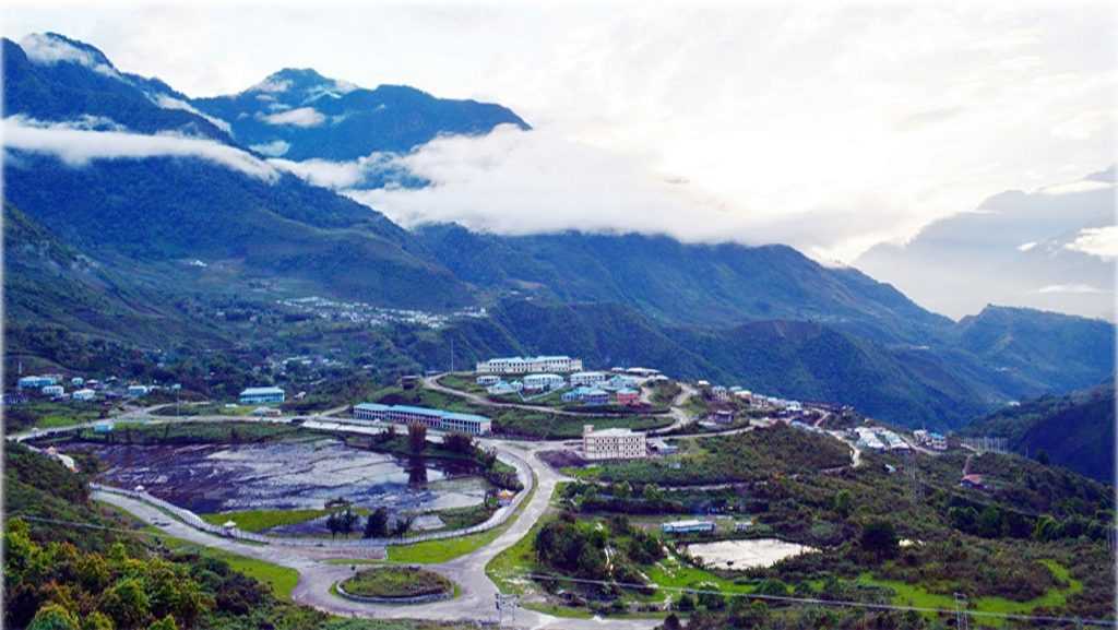
A hill station in a valley surrounded by the Himalayas, Khonsa was created during the British colonial rule. It borders Myanmar to the east and Assam in the south and is surrounded by panoramic views of thick forests fringed by hills. Located about 300 km east of Itanagar, Khonsa lies in the Tirap Valley at an average elevation of about 1,215 m above sea level with streams, deep gorges, dense forests and snow-clad hills.

The Khonsa Museum was built in 1956 and houses some amazing artefacts representing the diverse culture of the region. Other than swords and other weapons on display here, one can also find handlooms and artefacts that represent the culture of various parts of India as well as various types of cane and bamboo works. The Kheti and Lajo villages are tribal villages, home to the Nocte, a Wancho tribe that makes up the majority of Khonsa’s inhabitants. Human skulls from the times when the tribes headhunted are hung in the village dormitories to reflect their past. The Khonsa waterfall is located in a dense forest, just a few km from Khonsa and has magnificent views of the forest. The way to the waterfall is very difficult and challenging and it can be only reached with the help of a local guide.

Changlang

Due to the presence of crude oil, coal and mineral resources other than tourism and hydropower, Changlang which lies 324 km east of Itanagar has become an important town in the state. Changlang shares an international boundary with Myanmar and is best known for its bio-diversity and scenic beauty and unique culture.

Visible from the Pangsau Pass, 12 km from Nampong, the Lake of No Return has this name due to the many who perished here. The spot was used for a soft landing for fighter planes during times of war after being hit by enemies with many soldiers losing their lives in the process. Depending on the weather, Nampong has been nicknamed the Hell Pass because of the difficult terrain that worsens during the monsoon season. The Indo-Myanmar border is just 12 km from Nampong where the Lake of No Return is visible. Also known as Ledo Road, Stilwell Road is a historic road as it was connected by the Americans during World War II to connect Ledo to Changlang. The route of the entire road is quite circuitous and covers a challenging path. Popularly known as the Jairampur Cemetery, the World War II Cemetery is located some 25 km from the Indo-Myanmar Border and is where soldiers who died during World War II died. Most of the graves are those which belong to the Chinese, Indian, Kachin and British soldiers, but many graves have been destroyed by wild elephants today.

Miao

Situated 165 km east of Khonsa and about 350 km east of Itanagar, Miao is where Tibetian refugees settled down. It is also the gateway to the Namdapha National Park and an ideal spot for hiking, angling and trekking. The Patkai Bum mountain range, which is an Eastern extension of the Himalayas is what Miao is famous for and the main attractions of the town are the mini zoo and museum. There is also a Tibetan refugee settlement which sells lovely woollen carpets and the tea plantations and opium cultivation farms nearby are also popular.

Anini

A small underdeveloped remote town, Anini lies about 583 km northeast of Itanagar. The Idu Mishmi tribal people constitute a majority here. Anini’s name may have come from Inini or Innini with historical maps of Arunachal Pradesh from times before the Lower Dibang Valley district was carved out of the Dibang Valley District and before Roing was established, indicate the capital of the Dibang Valley District being Inini which have come from the Idu word Inni who is the Idu Mishmi’s supreme deity or God.

The native Idu Mishmis and other tribes were said to have migrated from ancient Tibet in the 1st century. Anini’s importance grew during World War II when supplies and troops needed to be sent to China through the Ledo Road in Assam. In 1947, Anini became a part of India, but became part of the disputed territory claimed by both India and China in 1950. Most of Anini is located on a miniature plateau between two tributaries of the Dibang river, the Dri and the Mathun rivers. The town is located on the Eurasian Plate, about 420 miles north of the junction of the Indian and the Eurasian Plates, which makes Anini earthquake-prone. The Mehao Wildlife Sanctuary nearby is a must-visit while in Anini. Anini is an important stop of the Arunachal Helicopter Service. The service connects the town to the rest of the state as well as to the Dibrugarh airport in Assam. The town is a major stop in both the Eurocopter Dauphin and the MI-172 helicopters’ schedules.

Pasighat

Situated at the eastern foothills of the Himalayas at 155 m above sea level, Pasighat is Arunachal Pradesh’s oldest town. Also known as the Gateway to Arunachal Pradesh, Pasighat is located about 265 km northeast of the capital of Itanagar, the town is also an Advance Landing Ground or ALG of the Indian Air Force.

Pasighat was founded in 1911 by the British colonial government as a gateway to the administrative convenience of the greater Abor Hills and the north area in general and settlements of Adi tribesmen still live in the villages in and around Pasighat. The town is home to the River Brahmaputra which flows down from Tibet and is a photographer’s delight.

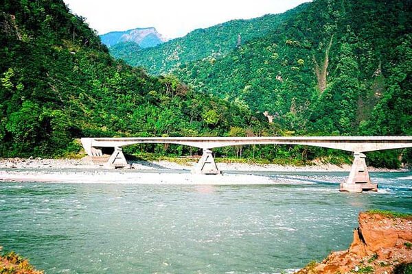
A hanging bridge on the Siang River attracts a lot of tourists around the year. Spread over an area of 190 sq km, the Daying Ering Wildlife Sanctuary is covered by alluvial grasslands which form the major area and wooded areas constitute about 15% while the remaining area or about 25% is covered with water bodies and hence attracts many migratory birds from Mongolia and Siberia. The sanctuary itself is surrounded by the Siang or the Brahmaputra River and is home to many endangered bird species.

Around 60 km from Pasighat is where the green water of River Siang meets the blue water of River Siyom and presents a marvellous sight. This is Pangin where one can find many rare plants and herbs of medicinal importance. Kekar Monying is a mountain cliff near Rottung and an important historical place. In 1911, it was here that the Adi tribesmen put up a strong fight against the British. The war was a part of a punitive expedition undertaken by the British for murdering Noel Williamson, a political officer in the previous year by Matmur Jamoh, a native of Yagrung village. Komsing, a village on the left bank of the Siang is the place of Williamson’s murder. A stone epitaph bearing the name of Noel Williamson still lies near the Siang. Komlighat used to be a river port and the ghat marks the area of the colonial town of Pasighat which has been submerged into the Siang river following a flood and the river changing its course. Today, it is a popular evening spot providing a wonderful view of the river and the hills surrounding the Pasighat plains.

The Pasighat Buddhist Temple is located opposite the airstrip and serves as the only Buddhist worship place in Pasighat. The East Siang District Museum also located nearby is the district museum. Pasighat also houses the headquarters of the Adi Baane Kebang, which acts as the de facto cultural parliament governing the cultural, linguistic and traditional aspects of the Adi people.

Aalo

Formerly known as Along, the town of Aalo lies about 365 km northeast of Itanagar and about 220 km from Likabali, at the border of Assam and Arunachal Pradesh. It is also an Advance Landing Ground or ALG of the Indian Air Force. Lying close to several tiny villages, this small town is situated at the congregation of the two rivers, the Sipu and the Yomgo. With blooming orchards of oranges and pleasant cum cool weather, Aalo is best visited in the winter season. River Rafting is a major activity in Along on the Sipu and Yomgo or Siyom Rivers which flow within Aalo. The Kamaki Hydropower Dam should also be visited to take in the gorgeous views from the dam. The Ramakrishna Mission runs a beautiful missionary school in Aalo which is exceedingly pretty and well kept. The Darka Village is a major attraction, especially during the famous Mopin Festival. The village has three rivers running through it making it beautiful.  

Daporijo

Daporijo is a small town on the way from Ziro to Aalo and lies about 270 km northeast of Itanagar and about 165 km northeast of Ziro and about 160 km southwest of Aalo. A small scenic town, Daporijo is situated 600 meters above sea level with the beautiful Subansiri River, a tributary of the Brahmaputra River, flowing through the town. The town is known for its varied ethnic cultures like the Tagin, the Galo the Hilmiri and the Mishmi who are believed to have existed since ancient times. Originally Dapo referred to the protection or a barrier against the epidemic or evil spirits while Rijo stood for the valley, so Daporijo means the valley which stops diseases or evil spirits.

The Meghna cave Temple is dedicated to Lord Lakulisha who was the 28th embodiment of Lord Shiva and the temple is especially crowded during the Maha Shivaratri festival. The temple has some Sanskrit scriptures inside and is well known for the spectacular views surrounding the cave. With beautiful green surroundings and wild animals wandering around, the Kamala Forest Reserve is a protected forest area near Daporijo and is a favourite spot for bird lovers. The Daporijo Good Shepherd Church is a beautiful catholic church under the Itanagar diocese, controlled by tribal bishops. The Subansiri River offers visitors to do rafting which should not be missed.

Anjaw

Located 450 km northeast of Itanagar, Anjaw borders China in the north. India’s easternmost district, Anjaw is also the second least populous district in the country. During the 1962 war, parts of Anjaw were briefly occupied by China and being part of a disputed border region, the area always has an Indian military presence. The Mishmi, and the Zakhring or the Meyor as they were formerly known are the main tribes here. The area is rich in wildlife with some rare mammals and birds found in the region. The small offbeat town is rich in greenery with gleaming waterfalls, beautiful river streams and pine forests.

Kibithoo is located about 100 km northeast of Anjaw about 1305 meters above sea level on the right bank of the River Lohit. Inhabited by the two main tribes of the Zedkring and the Mishmi, the town is surrounded by rivers, waterfalls, and dense forests of pine and berries and makes for a relaxing getaway. Hawai and Hayuliang are two small towns close to Anjaw. Hawai in the Mishmi language means pond and is located 1296 meters above sea level. Hayuliang means a place of my liquor in the Mishmi language and is located 750 meters above sea level and is blessed with gorgeous views of the convergence of the Dalai and the Lohit Rivers.

Walong in the Mishmi dialect means a place full of bamboo and is situated 1094 meters above sea level on the west bank of the Lohit River. Walong holds great historical importance because many Indian soldiers lost their lives here during the 1962 war. Just 20 km from the Indo-Sino border, the town has had a massive Chinese influence. The Namti Valley has a memorial built to commemorate the fallen soldiers of the 1962 war. About 7 km from Walong lies Dong on the left bank of the Lohit River and experiences the earliest sunrise in the country. Numerous pine trees surround this town which is enriched with lush greenery. Situated on the left bank of the Dalai River, 1258 meters above sea level, Chaglogam is a great place for different adventure sports like trekking, angling, rafting and mountain climbing.

Tezu

Arunachal Pradesh’s fifth-largest town and one of its most developed, Tezu lies about 346 km northeast of Itanagar. The recently constructed airport at Tezu will be the first civilian airport in the state. Tezu also has a sizeable population of Tibetan community of about 1500 mostly residing in a settlement known as locally as Lama Camp which is located in Tindolong about 6 km from Tezu. Tezu’s beauty is in full bloom during the festival of Makar Sankranti in January as there is a grand celebration organised by the Mishmi tribe called the Tamladu Festival. People also take a dip in the holy water of the Parshuram Kund in the belief that all their sins get washed away. According to legend, when Parshuram was ordered by his father to kill his mother he threw the axe with a great fury that lead to the formation of this pond and the crack in the earth eventually became the source of the Lohit River

And so we come to the end of a very intriguing and special state, one that I am hopeful I can make a trip to visit and experience.

Travel Bucket List: India – Arunachal Pradesh Part 3

Ziro

Home of the Apa tribe and famous for its pine hills and rice fields, Ziro which lies 109 km north of Itanagar at an elevation of 1688 metres is a quaint old town and a peaceful paradise. The climate in Ziro is mild throughout the year, making it a year-round holiday destination. Ziro is included in the tentative List of UNESCO’s World Heritage Sites for the Apatani cultural landscape.

The Apatani cultural landscape comprises 32 sq km cultivable areas out of a 1058 sq km plateau. The Apatani tribe, which has inhabited this region for centuries, is known for practising ecologically sustainable existential sustenance. The Apatanis have a few unique special characteristic features which differ from other tribes in Arunachal Pradesh and the rest of India. A few of these special characteristic features include practising permanent wet paddy cultivation whereas other tribes practice shifting cultivations called Jhom cultivation and cultivating permanent wetland cultivations whereas other tribes practice dry land cultivations by clearing the forests by burning the jungles. Apatanis once practised the art of facial tattoos.

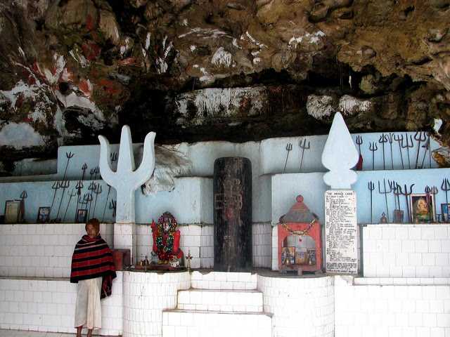
The Meghna Cave Temple is dedicated to Lord Shiva and is located close to Ziro. The 10-minute climb up the stairs is completely worth it when one reaches the 5000-year old temple 3000 feet above sea level. The temple boasts magnificent carvings and architecture and has amazing views of the area. The self-manifested Shiva Linga at Ziro with a Sfatic as garland and is 25 feet in length and 22 feet in width. This shiva linga is said to be the world’s largest which was recently discovered.  Kile Pakho is a viewpoint with unique views on both sides with the Ziro plateau on one side and the snow-laden Himalayan peaks on the other. Ziro’s famous attraction is the trek to the top of the Dolo Mando to view Hapoli town and old Ziro. The hillock is situated on the western side of Ziro on Daporijo Road. Located 3 km from Ziro are pine groves known as Midey which make for an excellent picnic spot and also provide excellent trekking trails.

The 337 sq km Talley Valley Wildlife Sanctuary is home to a wide and exotic variety of flora and fauna. The endangered clouded leopards are also found here and the sanctuary has a spectrum of flora as well which includes silver fir trees, ferns, orchids, bamboo and rhododendron. Established in 1995, it ranges in elevation from 1,200 to 3,000 m and harbours subtropical and temperate broadleaved and conifer forests and have about 16 endangered plants that have survived in this area.

Yinkiong

Located about 250 km north of Itanagar, Yingkiong lies just 1 km east of the River Siang. In 1911, following the Anglo–Abor wars, the British gained administrative control of the Upper Siang region. Yingkiong is characterised by its hilly terrains and river valleys and lies about 200 m above sea level. The town gets its name from the River Siang that flows beside and is known for its diverse and colourful ethnic tribes. This region has been inhabited mainly by four tribes, the Adi, the Khamba, the Mishmis and the Memba. The area is also known for its spectacular panorama with dense forests and birds with vibrant feathers.

The Dr Daying Ering Memorial Wildlife Sanctuary is spread across 190 sq km with more than 75% of the sanctuary covered by grassland and surrounded by the Siang river. It is also a bird watcher’s paradise with many endangered species found here. This sanctuary also spreads to Assam where it is known as the Khobo Ehapori.

The Mouling National Park is named after a mountain peak Mouling where Mouling is an Adi word which means red poison or red blood, which is believed to be red latex from a tree species found locally. It was the second national park to be created in the state, after Namdapha National Park in 1972. The Mouling National Park and the Dibang Wildlife Sanctuary are located fully or partly within Dihang-Dibang Biosphere Reserve. Spread across 483 sq km it has the Siang river flowing on the west and the Siring, Subong, Semong and Krobong rivers on the eastern ends. The national park is very isolated and communication is very weak and barely any transportation means. The national park covers an area of about 483 sq km forming the western part of the Dihang-Dibang Biosphere Reserve. Approach to the park is not possible via roads, due to the remoteness of the area and communication facilities in the area are poor. The area around Mouling National park is one of great bio-diversity, with a juxtaposition of different biotopes, and is often called the state’s cradle of biodiversity. With elevations ranging from 400 m to over 3000 m in the park, it forms a transition zone between tropical forests at lower altitudes to the more temperate forests at altitudes above 2800 m. The overall inaccessibility due to poor or no roads and stories associated with the forest itself has kept the core area of the national park relatively untouched by human activities.

Mechuka

The town of Mechukha or Menchukha is a town located about 6,000 ft above sea level in the Mechukha Valley of the Yargep Chu or Siyom River. In the Memba dialect, Men means medicine, Chu means a waterbody and Kha means snow and the town’s name means the land blessed with medicinal snow-fed water. Before the 1950s, the Mechuka valley was known as Pachakshiri. The Line of Actual Control or the McMahon Line between India and Tibet border is 29 km north of Menchuka. The valley is home to the people of the Memba, Adi and Tagin tribes.

The 400-year-old Samten Yongcha monastery of the Mahayana Buddhist sect is a contemporary of the much-revered Tawang Monastery. Numerous ancient statues can also be found here. A new giant flying squirrel was discovered here which was named Mechuka’s giant flying squirrel Petaurista mechukaensis. The IUCN Red List has classified it as a Data Deficient species.

The Namdapha National Park is a 1,985 sq km protected biodiversity hotspot in the Eastern Himalayas with more than 1,000 floral and about 1,400 faunal species. The national park harbours the northernmost lowland evergreen rainforests in the world at 27°N latitude and extensive dipterocarp forests, comprising the northwestern parts of the Mizoram-Manipur-Kachin rain forests ecoregion. The fourth-largest national park in India, Namdapha was originally declared a Wildlife Sanctuary in 1972, then a National Park in 1983 and became a Tiger Reserve under the Project Tiger scheme in the same year. Its name is a combination of two Singpho words where nam means water and dapha means origin and the name means the river that originates from the Dapha Bum glaciers.

Located near the international border with Myanmar, the park is located between the Dapha bum range of the Mishmi Hills and the Patkai range with a wide elevation range between 200 and 4,571 m and is crossed from east to west by the Noa Dihing River that originates at the Chaukan Pass, located on the Indo-Myanmar border. The Namdapha flying squirrel was first collected in the park and described. It is endemic to the park and critically endangered. The best time to visit the park is during the winter season because the humid subtropical climate keeps the winters mild. There is also a museum called the Miao Museum where visitors can get to see genuine animal specimens from the forest and also gain insights into the life of the villagers.

Roing

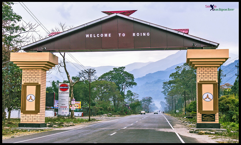
The last major township in India’s northeast, at the foothill of the Mishmi Hills, Roing lies about 350 km east of Itanagar. A natural haven with snow-peaked mountains, deep gorges, turbulent rivers cascading down the hills, numerous waterfalls, placid lakes and archaeological sites Roing is an ideal tourist destination. Located in the Lower Dibang Valley, it is home to the Adi-Padam and Idu-Mishmi tribes. The Reh festival of the Idu Mishmi is celebrated in February while the Solung festival of the Adi is celebrated in September.

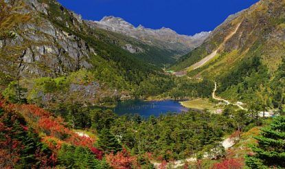
The enormous Mehao Lake is located within the Mehao Wildlife Sanctuary and about 14 km from Roing at a height of almost 3000 m and covers an area of nearly 4 sq km. The lake attracts a lot of seasonal birds and provides an ideal trekking experience and is a photographer’s delight. Because the lake is low in nutrients, there are no fish in the crystal clear lake. Trekking the small pathway leading to the lake through the virgin forest is a wonderful experience. Salley Lake is also a part of the Mehao Wildlife Sanctuary and a popular scenic spot. There are many varieties of fish in the lake which lies about 3.8 km from Roing. Itapakhur and Padum Pukhri are is a historical brick built ponds, located in Ithili village, are two famous ponds where lotuses bloom in October and November. The Kampona Pond is believed to have been the abode of the Naga King and the pond’s name translates to good looking or beautiful in the Adi dialect. Famous for fishing and angling, the Iphi Pani Ghat has amazing views of the Dibang river and valley.

Located on the banks of the Deopani River, the Nehru Van Udyan houses an exciting cactus house, an orchid area and a beautiful garden. A guest house located close to the garden is an excellent place to view the Deopani River. The park has a well-maintained garden and a few hundred meters from here is the confluence of rivers Eje and Eme.

Also called the Chimiri Fort, Rukmini Nati is located in the heart of the Chimiri Village, some 10 km from Roing and is believed to be built in the 14th century. Built with burnt bricks in the 12th century, the Bhashmaknagar Fort is an important and oldest archaeological site in the state. Various artefacts like potteries, terracotta figurines, terracotta plaques and decorative tiles that were found during its excavation process reflect upon the forward state of civilization at that time. It is believed that Rukmini, the consort of Lord Krishna is from this region, but there is no evidence to support that. The ruins of the fort which are about 30 km southeast of Roing remain and are an ideal trekking route and birdwatchers’ paradise. The remains are generally ascribed to the rule of the Chutias, a Bodo-Kachari or Tibeto-Burmese ethnic group that ruled over the region of Sadiya from the 11th to the 16th centuries. The fort, with its fortifications and buildings, is built of fired bricks. The Mipi Pene Centre was established in the year 2017 to preserve and promote the Igu system of the Idu Mishmi tribe. Mipi Pene refers to the Igu or the shaman and the centre was inaugurated in 2018.

Hunli is a small quaint town about 2 hours from Roing on way to Anini. Hunli is famous for trekking and the Temple cave at Kupunli.

Located about 56 km from Roing, the Mayodia Pass lies at an elevation of 2,655 m above sea level. Mayodia is a combination of two Idu-Mishmi words: Mayu which is the name of the mountain and Dia meaning the peak of the mountain, which makes the pass the peak of the Mayu Mountain. It is a popular local tourist attraction due to the snowfall it receives during winters.

Known as the real ocean of green paradise on Earth, the Mehao Wildlife Sanctuary is a virgin forest left largely untouched and unexplored with a large number of animals, plants, birds, fish, butterflies and reptile species. The Mishmi Hills are a birdwatcher and wildlife enthusiasts delight. The region boasts of so many rare species found only in this region in the entire Indian sub-continent. The medicinal plant Coptis Teeta or the Mishmi Teeta, an endemic species and the Taxus baccata are available here. The area is also rich in orchid varieties.

The Dihang-Dibang or Dehang-Debang is a biosphere reserve constituted in 1998. One of the eight wildlife sanctuaries in Arunachal Pradesh, the Mouling National Park and the Dibang Wildlife Sanctuary are located fully or partly within this biosphere reserve which spreads over three districts: Dibang Valley, Upper Siang, and West Siang and covers the high mountains of the Eastern Himalayas and the Mishmi Hills. This Biosphere Reserve has natural vegetation stretching in an unbroken sequence from the tropics to the mountain tundra. The reserve is rich in wildlife with rare mammals such as the Mishmi takin, the red goral, at least two sub species of the musk deer, the rare Sclater’s monal and Blyth’s tragopan, amongst others.

Tirap

Located in the southeastern part of the state about 336 km east of Itanagar, Tirap shares a state border with Assam and an international border with Myanmar. The town with its gushing rivulets, green and vibrant orchards and fresh air heals the mind and soothes the soul. The name Tirap is derived from the River Tirap which originates from a high peak in the Laju Circle and flows from the southeast to the northeast before joining the Buri-Dihing river near Ledo in Assam.

Since ancient times, Tirap has been inhabited by indigenous tribes. Japanese troops invaded and controlled the area for a brief period in 1945, until the collapse of the Japanese Empire. Recently, Tirap has been a major target for the NSCN, a Naga rebel group that aims the creation of Greater Nagaland, using military force.

Travel Bucket List: India – Arunachal Pradesh Part 2

Bomdila

270 km west of Itanagar, Bomdila is a lesser-known destination set in the eastern Himalayas with beautiful views amidst nature. It is also well known for its apple orchards and many Buddhist monasteries. Bomdila was ruled by tribal rulers until the arrival of the British who made it part of Arunachal Pradesh in 1873. The Bomdila Monastery also known as Gontse Gaden Rabgyel Lling monastery and the Eaglenest Wildlife Sanctuaries are the major attractions. Tourism is on the rise here and Bomdila has become a halt station for tourists travelling to Tawang. The Bomdila pass offers views of Kangto and Gorichen Peaks, the highest in the state.

Also known as Gentse Gaden Rabgyel Lling monastery, the Bombdila monastery was built in 1965 by the twelfth incarnation of the TsonaGontse Rinpoche. And was rebuilt by the thirteenth reincarnation, TsonaGontseRinponche who renovated the monastery by building a larger prayer hall. Inside the Gompa, there’s a huge prayer, which is used by the lamas for praying; the temple of Buddha, and a tiny quarter of monks. Apart from its religious significance, the monastery is also known for its natural beauty with stunning vistas that are fabulous and breathtaking. The Upper Gompa is located atop a steep hill. There is a monk school, a prayer hall as well as a temple dedicated to Lord Buddha on the premises. The Lower Gompa is located at the end of Bazaar Street and the main attraction is the marvellous Tibetan architecture and massive prayer hall inside. There is also a craft centre located opposite it which should be visited. R.R Hill is the highest point of Bomdila and from this height, visitors can see the roads leading to the Bhutan border as well as the one up Tawang.

The Eagle’s Nest Wildlife Sanctuary lies between the Sessa Orchid Sanctuary and the Pakhui Tiger Reserve. It’s a great place for bird watching with over 450 species spotted here. The sanctuary conjoins the Sessa Orchid Sanctuary to the northeast and the Pakhui Tiger Reserve across the Kameng river to the east. Altitude ranges here are extreme, from 500 m to 3,250 m and are part of the Kameng Elephant Reserve. The sanctuary derives its name from the Red Eagle Division of the Indian army which was posted in the area in the 1950s. Eaglenest is bounded to the north by the Eaglenest Ridge and the reserved forests of the Bugun community and adjoins the Tawang district to the north. There are no distinct geographical features delineating its western boundary along the Bhutan border and the southern boundary. Eaglenest has an unpaved road running from its base to Eaglenest pass at 2,800 m allowing good access to the entire altitudinal range, making it accessible to the military, scientists and ecotourists.

Eaglenest Wildlife Sanctuary is well known as a major birding area and is home to at least 454 species of birds. The sanctuary has the distinction of having three tragopan species, perhaps unique in India and is where the Bugun liocichla was first discovered in 1995 and again observed and described in 2006. The sanctuary is also home to a wide variety of herpetofauna including at least 34 species of amphibians, 24 species of snakes and 7 species of lizards as well as at least 165 species of butterflies. This area is extremely important for the continued well-being of the Asian elephant. Elephants regularly move up from the Assam plains to the Eaglenest ridge at 3250 m in summer, perhaps the highest altitude that elephants reach in India.

Tawang

The town of Tawang or Dawang is located about 450 km northwest of Itanagar at an elevation of approximately 3,048 m to the north of the Tawang Chu river valley, roughly 16 km south of the Line of Actual Control with China. In 1989, the present-day Tawang district to the north of the Sela Pass was split off as a separate district. Tawang is inhabited by the Monpa people.

Historically, Tawang was under the control of Tibet. During the 1914 Simla Conference, Tibet and British India signed an agreement delineating their common boundary in the Assam Himalaya region, which came to be known as the McMahon Line. By this agreement, Tibet relinquished several hundred square miles of its territory, including Tawang, to the British. This agreement was not recognised by China and records show that the Tibetans regarded the border agreed upon in 1914 as being conditional upon China accepting the Simla Convention. Since the British were unable to get China’s acceptance, the Tibetans regarded the MacMahon line as invalid. The British did not implement the McMahon Line for over two decades, during which Tawang continued to be administered by Tibet. In November 1935, the British government demanded that Tibet implement the border agreement which was met with resistance from the Tibetan government implying that China’s acceptance of the Simla Convention was a prerequisite to all such concerns. Tibet refused to surrender Tawang, partly because of the importance attached to the Tawang Monastery. In 1938 the British tried to assert sovereignty over Tawang by sending a small military column which was met with strong resistance from the Tibetan government and a serious protest was lodged against the British Indian government.

After the Sino-Japanese war in 1941, the Assam government tightened its hold on the area of the Nort-East Frontier Agency, NEFA which later became Arunachal Pradesh. In 1944 administrative control was extended over the area of the Tawang tract lying South of the Sela Pass Though the Tibetan tax-collectors packing and protests were brushed aside, no steps were taken to evict Tibet from the area north of the pass which contained Tawang town. This situation continued after India’s independence but underwent a decisive change in 1950 when Tibet lost its autonomy and was incorporated into the newly established People’s Republic of China. In February 1951, India sent an official with a small escort and several hundred porters to Tawang and took control of the remainder of the Tawang tract from the Tibetans, removing the Tibetan administration. During the Sino-Indian war of 1962, Tawang fell briefly under Chinese control, but China voluntarily withdrew its troops at the end of the war and Tawang returned to Indian administration. But China has not relinquished its claims on most of Arunachal Pradesh including Tawang.

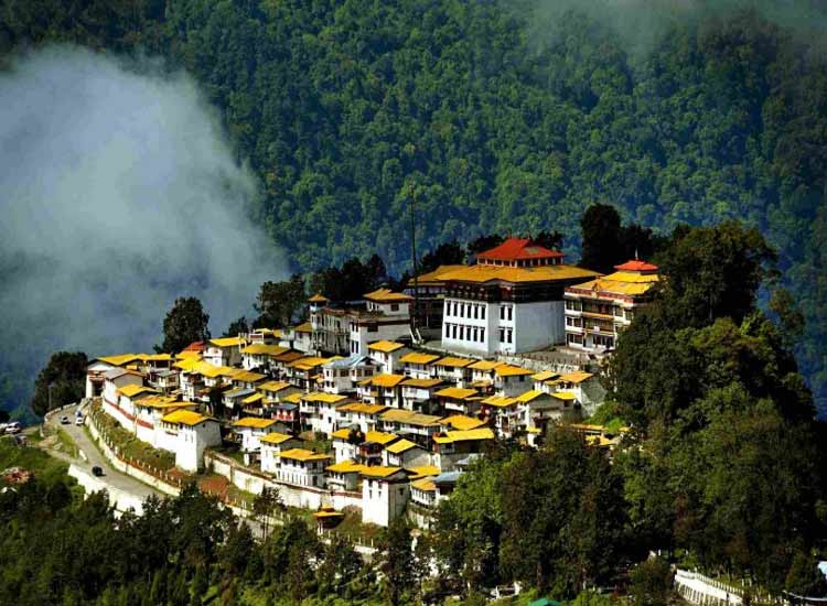
The Tawang Monastery was founded by the Merak Lama Lodre Gyatso in 1681 following the wishes of the 5th Dalai Lama, Ngawang Lobsang Gyatso. To fix the perimeter of the Dzong, the Dalai Lama had also given a ball of yarn, the length of which was to form the limit of the monastery. Perched at the height of 3,000 metres above sea level, the monastery belongs to the Gelugpa sect and is the largest Buddhist monastery in India and the biggest Buddhist monastery in the world outside of Lhasa, Tibet. It is a major holy site for Tibetan Buddhists as it was the birthplace of the sixth Dalai Lama, Tsangyang Gyatso. The monastery is believed to be 400 years old and has control over 17 gompas in the region.

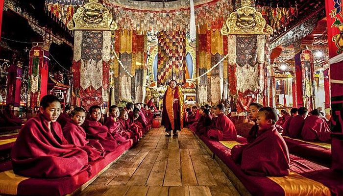
Offering breathtaking views of the Tawang-Chu Valley, the monastery is built as a large three-storeyed mansion enclosed by a 925 feet long compound wall and is home to over 300 monks. The most prominent attraction in the monastery is the massive statue of Lord Buddha which is 8 m in height. The main temple, Dukhang, boasts magnificent interiors with beautiful artwork while the inner walls contain sketches and paintings of Bodhisattvas. The library is stocked with valuable old scriptures like Kangyur and Tengyur and all primary structures are built in the traditional style of Buddhist architecture. The Tawang Manuscript Conservation Centre was established in the monastery in August 2006, which has curated 200 manuscripts, and 31 manuscripts have been treated for preservation.

The full name of the monastery is Tawang Galdan Namgye Lhatse where Ta means horse and wang means chosen, which together form the word Tawang, meaning the location selected by a horse. Gadan means paradise, Namgyal means a complete victory and Lhatse means divine. Thus, the full meaning of the Tawang Galdan Namgye Lhatse is the site chosen by the horse is the divine paradise of complete victory.

There are three legends which speak of the establishment of the monastery. In the first legend, it is said that the location of the present Monastery was selected by a horse which belonged to Merag Lama Lodre Gyatso who was on a mission assigned by the 5th Dalai Lama to establish a monastery. After an intense search, when he failed to locate a suitable place, he retired to a cave to offer prayers seeking divine intervention to choose the site. When he came out of the cave, he found his horse missing. He then went in search of the horse and finally found it grazing at the top of a mountain called Tana Mandekhang, which in the past was the palace of King Kala Wangpo. He took this as a divine and auspicious guidance and decided to establish the monastery at that location. Seeking the help of the local people, Mera Lama established the monastery at that location in the latter part of 1681. The second legend of the derivation of the name Tawang is linked to Terton Pemalingpa, the diviner of treasures. Here, he is stated to have given initiations of Tamdin and Kagyad, which resulted in the name Tawang where Ta is an abbreviated form for Tamdin and Wang means initiation. According to the third legend, a white horse of the Prince of Lhasa had wandered into Monpa region. People, who went in search of the horse, found the horse grazing at the present location of the monastery. The people of the area then worshipped the horse and the location where it was found and venerated it every year. Eventually, to honour the sacred site, the Tawang Monastery was built at the site. There is one more legend narrated about the Goddess painted on a thangka in the monastery which is that of Palden Lhamo. This female deity is compared to the Hindu Goddess Kali. Like Goddess Kali, Palden Lhamo’s thangka is drawn in black colour, with flaming eyes, dressed in a skirt made of tiger skin, and a garland of skulls around her neck. A moon disc adorns her hair, similar to the one seen on Shiva. She is also associated with Goddess Saraswati and Ma Tara. Legend also states that in the past she had lived in Sri Lanka as the consort of a demon king who practised human sacrifice. As she was not supportive of this practice she fled from the kingdom. As she was running away, the king shot her with an arrow, which struck the backside of the mule that she was riding. When she drew out the arrow, it left a gaping hole in the mule’s back, and through this gap, Palden Lhamo could watch the teachings of Lord Buddha.

At the entrance to the monastery, there is a colourful gate structure, known as the Kakaling, built in the shape of a hut-like structure, with the roof featuring mandalas. A distinctive mural is of Ningmecahn, the protector deity of the Bon religion, who is considered the guardian deity of the Tawang region. A notable feature on the wall of the front porch on the ground floor is a footprint on a stone slab said to have belonged to a resident, a water carrier, known as Chitenpa who served in the monastery for a long time and on one day announced that he had completed his service to the monastery and then stamped his left foot on the stone slab which created a dented formation of his step. This step is venerated as a miracle.

Torgya, also known as Tawang-Torgya, is an annual festival held in the monastery whose objective is to seek protection from evil spirits and pray for the prosperity and happiness of the people in the coming year. The famous dance, Losjer Chungiye is performed by the monks at the festival. The monastery is open daily between 7 am and 7 pm.

Arunachal Pradesh’s lifeline, Sela Pass connects Tawang to the rest of the country. Not just important geographically, Sela Pass is breathtakingly beautiful always covered in snow providing gorgeous views of the eastern Himalayan range. The rocky pass is also home to one of the state’s most beautiful lakes, the Sela Lake. One needs an inner line permit to visit Sela Pass. Located at an altitude of 4170 m, Sela Pass and Sela Lake lie on on your way to Tawang which is about 80 km from the pass. Also known as Se La where La means a pass, the pass is usually covered in snow and supports scarce amounts of vegetation. Sela Lake, near the summit of the pass, is one of approximately 101 lakes in the area that are sacred in Tibetan Buddhism. Sela Lake is a large lake located on the north side of the pass at an elevation of 4,160 m and often freezes during winter and is drained in the Nuranang River, a tributary of the Tawang River. Limited vegetation grows around the lake which is used as a grazing site for yaks during the summer. Construction of the Sela Tunnel which is underway will bring Tawang on the railway map through the Bhalukpong–Tawang railway line.

According to legend, a sepoy of the Indian Army named Jaswant Singh Rawat fought alone against the Chinese soldiers near the pass during the 1962 Sino-Indian War. A tribal woman named Sela who had brought food and water to him is said to have killed herself upon seeing the dead body of Jaswant Singh Rawat. Singh was posthumously awarded the Maha Vir Chakra for his courage and devotion to duty. Even though the pass is open throughout the year, the best months to visit are October, November, March, April and May as there are fewer chances of the route being snowed in.
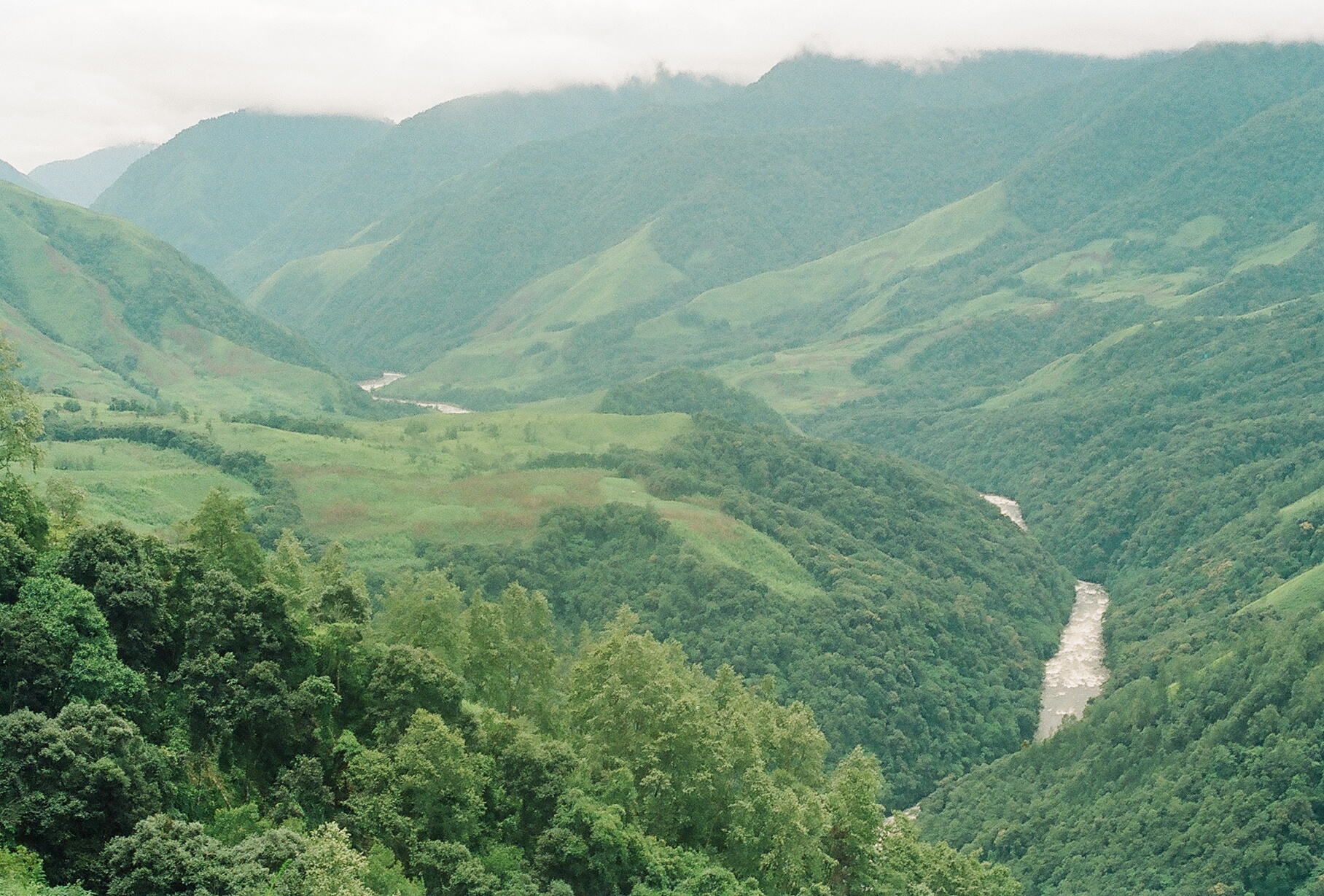
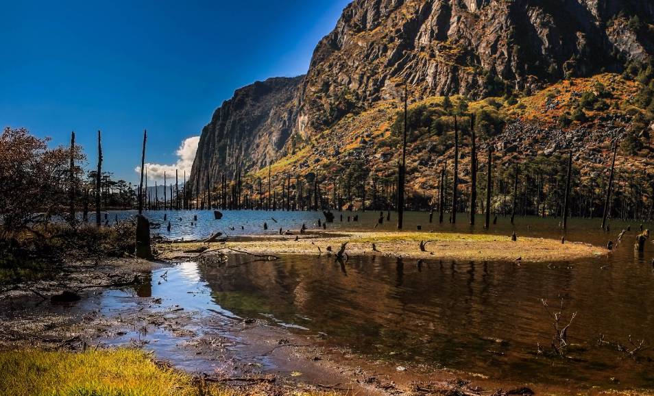
One of India’s remotest lakes, Madhuri Lake or Sangetsar Lake is a gorgeous lake against the Himalayas. The lake was made popular due to its appearance in a Bollywood movie and is known after its lead actress Madhuri Dixit who danced on its shores. The lake was previously known as Shonga-tser Lake and is located on the way from Tawang to Bum La Pass at an altitude of 12,000 ft above sea level just 30 km northeast of Tawang. The lake was created by falling rocks, boulders and trees in an earthquake and is tucked between huge mountains with many upright tree trunks standing in its belly as if guarding the lake and is special to Buddhists of India and Tibet who come here every year to pray. The best months to visit the lake are during October, November, March, April and May as the cold at this time subsides a little to allow normal tourist activities. Visits by civilians are only possible with permission from the Indian Army. The track is very treacherous, only SUVs advisable, and that too only on clear days with no snowfall or rainfall. Located almost 25 km from Tawang, the immensely picturesque P.T. Tso Lake is a perfect picnic spot, depending on the weather.

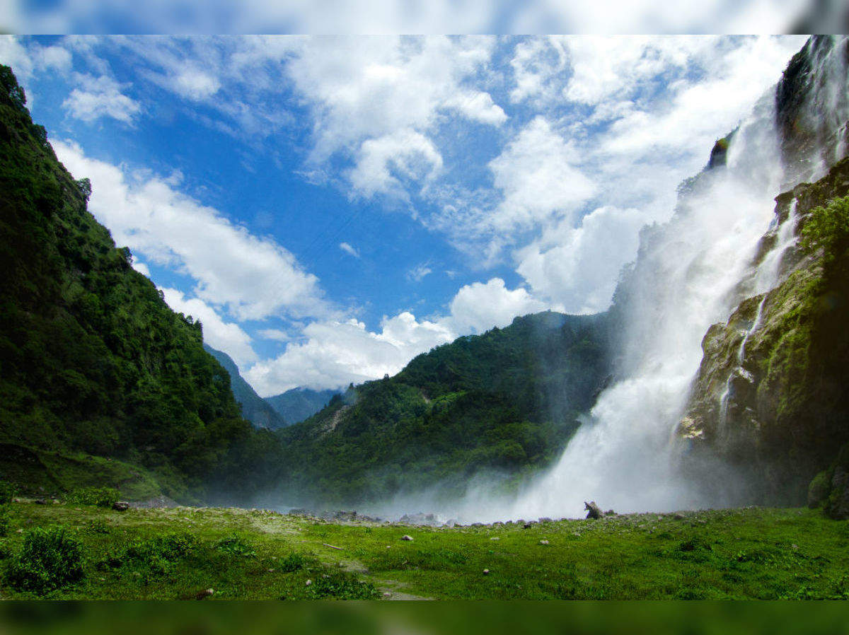
Largely known, the Nuranang Falls lie deep in the forest of Tawang and is one of the most spectacular waterfalls in the country. A beautiful white sheet of water that descends from the height of about 100 meters, it is a part of the Nuranang River which originates at the Sela Pass and just after the falls, merges with the Tawang River. Popularly known as the BTK waterfall, the Bap Ten Kang has crystal clear waters inside a lush green forest. The scenery around the falls is dotted by high hills all around, covered in thick greenery and mist hanging about. At the falls, one can visit the Hydel plant.

Gorichen Peak is Arunachal Pradesh highest peak and is located between Tawang and West Kameng at an altitude of 22,500 f above sea level, roughly about 164 km from Tawang. The peak is locally known as Sa-Nga Phu, which means the Kingdom of the Deity and is considered to be one of the sacred peaks protecting the people from the evils according to the local Monpa tribe.

The Tawang War Memorial is a 40 feet colourful structure dedicated to the martyrs of the Sino-India War of 1962 overlooking the scenic Tawang-Chu valley.