Faridabad
Haryana’s most populous city, Faridabad is a part of the Delhi NCR region, located about 41 km south of the capital and is one of the capital’s major satellite cities. The river Yamuna forms the eastern boundary with Uttar Pradesh and the city is one of India’s fastest-growing cities. Faridabad is the state’s major industrial hub with 50% of income tax collected in Haryana from Faridabad and Gurgaon. The city is famous for henna production from the agricultural sector, while tractors, motorcycles, switch gears, refrigerators, shoes, tyres and garments constitute its primary industrial products.
The city was founded in 1607 by Sheikh Farīd, treasurer to the Mughal emperor Jahangir, to protect the Grand Trunk Road between Delhi and Agra, and lies in the cultural region of Braj. A project for Pakistani refugee resettlement and light industrial development was initiated in the city in 1950. After India’s independence, Faridabad was initially a part of the Gurgaon district and later made an independent district. Close to Faridabad lies Tilpat, then known as Tilprastha, one of the five villages demanded by Pandavas to avert a disastrous war in the epic, the Mahabharata.

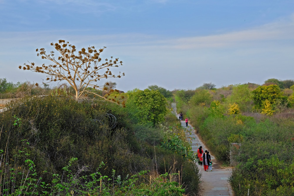
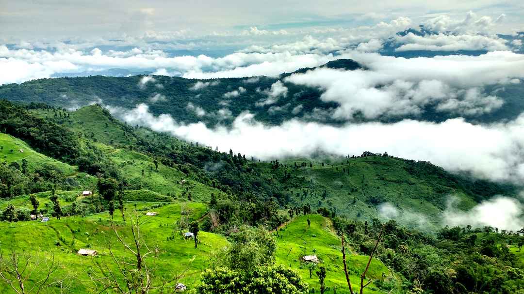
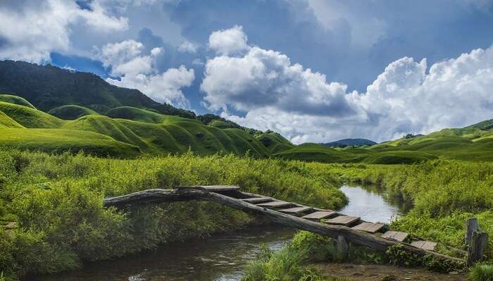
A lake fringed by the Aravalli hills, Badkhal Lake was a man-made embankment which has now dried up. Located in Badkhal village, the lake complex, spread over 40 acres, was constructed in 1969 and revived in 2015. CITM Lake is a beautiful water body formed by rainwater collected in the stone mines and a local favourite picnic spot. The tranquil location, the scenic natural landscape surrounding the body and the sparkling blue waters of the lake are a treat to nature lovers and photographers. Swimming is not advisable as the lake runs deep and has rugged stone underwater topography. Dhauj Lake is a naturally formed water body situated amidst the scenic Aravalli Hills and is famous for being one of the best sites for adventure sports in the region.

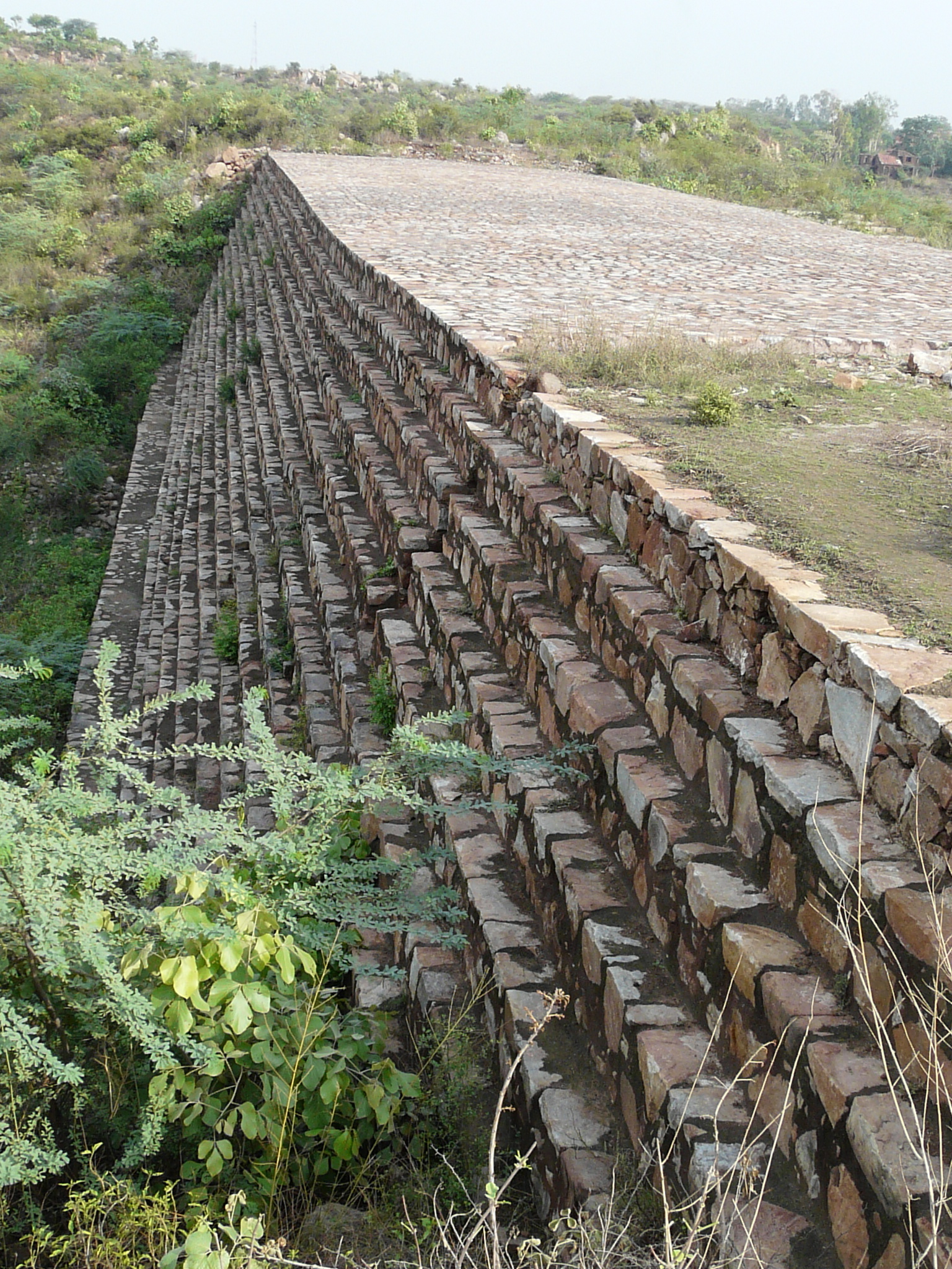
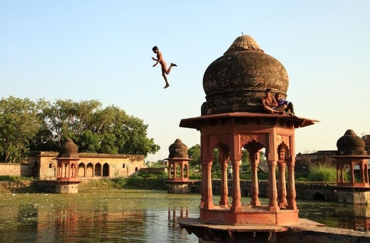
Surajkund is a 10th-century water reservoir believed to have been built by the Tomar King Surajpal. It is well known for its annual fair, the Surajkund International Crafts Mela which attracts millions of visitors, both domestically and internationally. The lake is surrounded by rock-cut steps and the embankment is constructed in a semi-circular fashion and doubles up as a picnic spot. The pond is surrounded by the ruins of an ancient sun temple, coupled with a beautiful garden and pool called the Siddha Kund. Historians also claim that King Surajpal, son of Anang Pal I, built the lake in 686 A.D. for his daughter, and it is probably after his name that the lake is called so. Another theory about the name of the reservoir is that the kund or lake is named after the Sun Temple that existed on the eastern side of the lake. During the rule of Feroz Shah Tughlaq, who belonged to the Tughlaq Dynasty, the reservoir was renovated, and the steps and terraces were rebuilt with stones in lime mortar. A cave-like structure was also built on the western side of the reservoir, close to the Sun Temple. Rainfall was captured here to create a repository, which was a hunting forest resort in the past, and now proves to be a great spectacle. Even though the reservoir dries up in the scorching summer heat before the onset of the monsoon rains, it gets filled up during monsoons and abounds in dancing peacocks.
The Anagpur Dam is located close to Anagpur village, also called Arangpur, about 2 km from Surajkund. This unique hydraulic engineering structure was built during the reign of King Anangpal of the Tomar dynasty in the 8th century. It is approachable by road from Delhi by the Delhi – Mathura road. The ruins of the fortifications found in Anangpur village establish by an inference that it was built by Anangpal as part of the Lal Kot that was developed as the first city of Delhi in the 8th century.
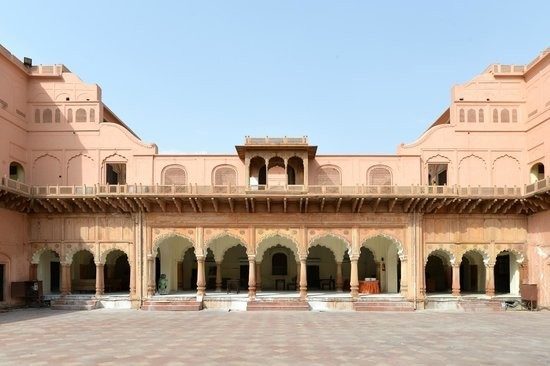
Also known as the Ballabgarh Fort, the Raja Nahar Singh Fort is located on the main road as one enters the main market of Ballabgarh. It was built by Raja Nahar Singh’s ancestor Raja Rao Balram who ascended the throne in 1739 and died in the war of Independence of 1857. The palace is known to have been constructed in parts until 1850 and today has been renovated into a beautiful palace having air-conditioned rooms, restaurants, bars and lounges, courtyards and gardens. The famous Kartik Cultural Fest here as well as weddings, musical nights and exhibitions are organised here regularly.
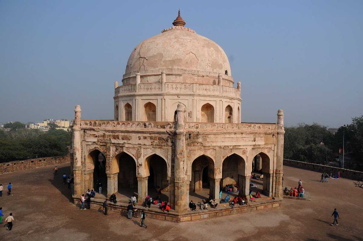
It is believed that Faridabad is named after Baba Farid, a popular Sufi saint and his tomb is a popular pilgrimage attraction with pilgrims coming from different regions here.
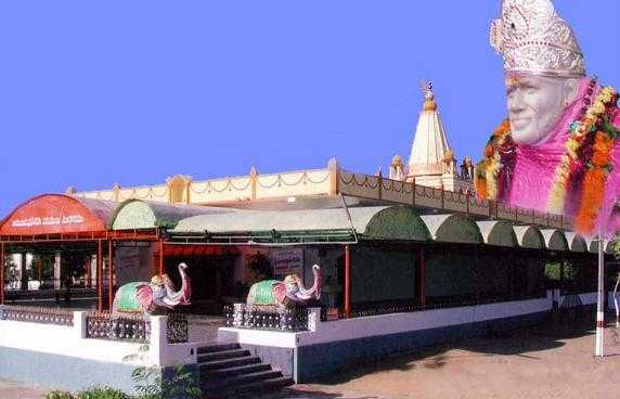
The Sri Shirdi Sai Baba Temple is dedicated to the saint, Sai baba and is spread over 3 acres of land. There is also a deity of Lord Sai Ram which is 5 feet tall made of pure white marble. The temple also houses the idols of Dwaraka Mayee and Dhuni

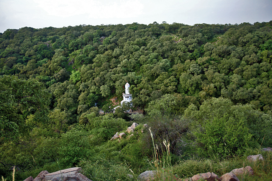
Also known as the Maharishi Parashar Tapo Bhumi, the Parson Temple is an ancient shrine dedicated to Maharishi Parashar. It is situated in the beautiful Aravalli Hills and is believed to be the location where the Maharishi performed penance and meditated. Located away from the bustling city, the temple has a tranquil vibe to help calm troubled souls.
Nuh
Located 40 km south of Gurgaon, Nuh lies on the National Highway 248 or NH 48. According to the epic, Mahabharata, the area was gifted by the eldest Pandava King Yudhishthira to their teacher Dronacharya and passed from the hands of the Maurya empire to invaders such as Parthian and Kushan, and later Yaudheya, after they expelled the Kushanas from the area between the Yamuna and Satluj. In 1156, it was conquered by King Visaladeva Chauhan of the Chauhan Dynasty and after the defeat of Prithviraj Chauhan in 1192, the area came under Qutb al-Din Aibak of the Delhi Sultanate who defeated and killed Prithviraj’s son Hemraj, who had invaded Mewat from Alwar. At the time of the invasion of Timur in 1398, Bahadur Nahar, formerly known as Sonpar Pal, was the prominent king of the area, who constructed the Kotla Bahadur Nahar fort near Kotla lake at the Kotla village of Nuh. Sonpar Pal converted to Islam in 1355 and was given a new name of Raja Nahar Khan by Sultan Firuz Shah Tughlaq and became the founder of the Khanzada Rajputs. After the fall of Tughlaq dynasty in 1398, Nahar Khan reconciled with Timur and in 1420, during the era of Nahar Khan’s grandson, Khanzada Feroz Khan, Mewat was attacked by Sultan Khizr Khan of Delhi Sayyid dynasty. In 1425, the great-grandsons of Bahadur Nahar, revolted against Dehli Sultanate but were defeated by Sultan Mubarak Shah
The Mughal emperor Aurangzeb tried to crush the revolting Khanzada chief and after the death of Aurangzeb, Bahadurgarh and Farrukhnagar in the north were under the Baloch Nawab. During the Maratha Empire, the area was conquered by French generals in the late 18th century and Nuh remained under the Bharatpur Jat Kings and their vassal relatives, one of whom was Nahar Singh. The town assumed importance at the time of Bahadur Singh of Ghasera because of the salt trade manufactured in neighbouring villages. To the west of the town is a masonry tank of red sandstone featuring a chhatri adorned with floral designs. The tomb of Sheikh Musa combines Muslim and Rajput forms of architecture and is about 2.5 km from the town. In 2018, five monuments were noted as state-protected monuments, including the Ghasera fort, the Chuhi Mal Ka Taalab, the Old Tehsil building in Nuh, the Kotla mosque, and a group of monuments at Meoli.
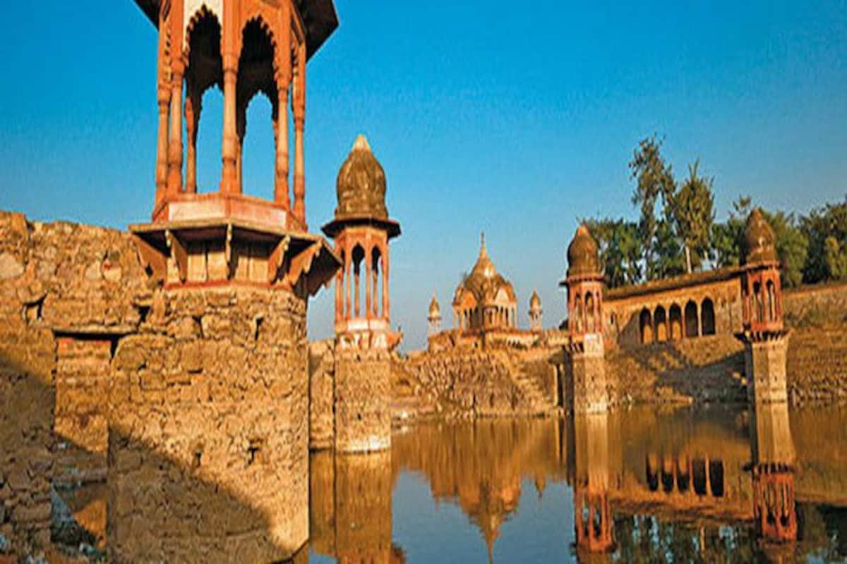
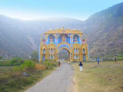
The ruined Ghasera Fort, a state-protected monument, lies at Ghasera village 14 km from Nuh city on the Nun-Sohna road. The Nalhar Pandava Reservoir and the Nalhshwar Mahadev Temple or the Nalhar Shiv temple are located 2 km from Nuh city within the U-shaped Nalhar valley surrounded by several picturesque peaks near Nalhar village in the foothills of Nalhar hills of the Aravalli range. It can be reached through a large ceremonial Hindu religious gate a short distance from the temple. There is also a natural reservoir at the base of a Kadamb tree higher up in the Nalhar hill, which can be reached by climbing 250 paved and iron stairsteps behind the Nalhar Shiva Temple. According to the popular oral tradition, the Pandavas stayed here, prayed to Lord Shiva and drank water from this reservoir during a visit in their 14 years long exile. The Nalhar hill also has amazing views. The temple was restored by Swami Gyan Giri and installed a natural lingam here which has the images of Aum, Shiva, Ganesha, Ganges, Janau and Naga.

The Kotla Fort and Tomb of Raja Nahar Khan in the Kotla Mosque is 6.5 km from Nuh city in the Kotla village. The square-shaped Kotla mosque, which dates to 1392-1400 rests on a plinth, with grey quartzite tomb and red carved sandstone jalis and has inscriptions on the ruined gateway. The tomb was notified as a state-protected monument in 2018.
The Nuh System of Lakes is a collection of several lakes lying in each other’s vicinity, and includes the permanent swamp of Khalilpur lake which gets flooded during rains and lies north-west of Nuh around the Khalilpur and Indari villages, the Chandaini lake which lies 10 km west of Khalilpur village, the Sangil-Ujina lake which is not a clearly defined basin of the lake as it carried only the overflow water in the rainy season from Khalilpur lake and other lakes, and the Kotla Dahar lake at the foothills of Aravalli Range which is the largest lake which is 5 km broad and 4 km long and lies across Nuh and Ferozpur Jhirka. With floral carvings and chattris or cenotaphs in redstone, the ancient tank of Chui Mai in Nallad is a natural reservoir and a sight to behold.
A fine blend of Muslim and Rajput style of architecture, Sheikh Musa is famous for its shaking minarets of the Tomb of Sheikh Musa. This man-made marvel is also known for its brilliant engineering techniques such as – if a person shakes one pyramid, the other person can feel the vibrations in the next one.Despite its ruined conditions due to lack of maintenance, these pyramids attract many visitors.
Close to Sheikh Musa is the Temple of Hathor which is believed to be of the Third dynasty of Tuthmosis of Egypt. Several Greek and demotic papyri were found by archaeologists in the temple complex.
Murthal
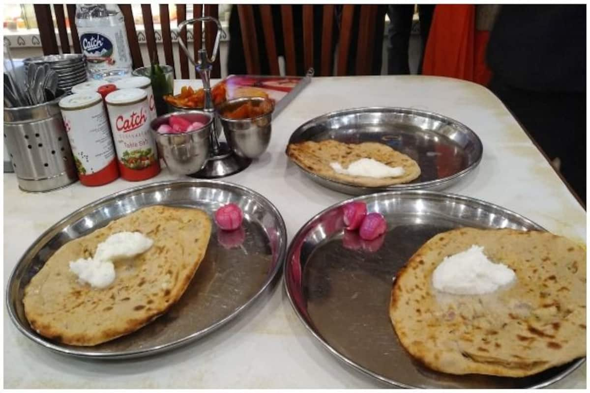
Murthal is located about 45 km from the national capital New Delhi, and 202 km southwest of Chandigarh, the state capital and is most well known for its parathas or Indian flatbreads. Situated on National Highway 1 connecting Delhi to Amritsar, Murthal is a large village that started life as a pit stop for truck drivers. Soon, its dhabas, or roadside restaurants gained popularity. Murthal has more than 50 dhabas and restaurants each famous for their special types of Parathas. Usually a year-round getaway, Murthal is most often visited during the evenings during summers. In the winter months, people visit early in the morning for parathas and tea.

Rohtak
Rohtak lies 70 km northwest of New Delhi and 250 km south of the state capital of Chandigarh on NH 9 and forms a part of the National Capital Region (NCR). Rohtak is the sixth most populous city in Haryana as per the 2011 census.
Clay mounds of coins discovered at Khokhrakot have thrown light on the process of casting coins in ancient India. The coin moulds of the later Yaudheyas of the 3rd or 4th century have been discovered in large numbers here, along with several clay seals of the same and subsequent dates. A Gupta terracotta plaque and head of later date have also been discovered. The town continued to flourish till the 10th century, as coins of King Samanta Deva of the Hindu Shahi dynasty of Kabul have been found here.

A centuries-old fort in present-day Qilla Mohallah was built by the Sheikhs of Yemen under Qazi Sultan Muhammad Surkh Zulqarni during the Ghauri Dynasty kings. The fort of Rohtak was besieged by Syed Khizer Khan in 1410 which could only succeed after a long seizure lasting six months. There have been many rumours regarding the name of the city and its origins with evidence suggesting that the old town is as old as the Indus Valley Civilization.

Asthal Bohar is a well-known Math located 7 kms from Rohtak in the eastern outskirt of the city and serves as a shelter to the followers of Guru Gorakh Nath, a fervent devotee of Lord Shiva and home to ancient discoveries, books and relics. The Durga Bhawan Mandir is a major religious shrine in Rohtak. The temple is grandly decorated during Navratri with lights and lamps. Gurudwara Bangla Sahib is dedicated to the Sikh Guru Teg Bahadur, the ninth Sikh Guru. The Gurudwara comes alive during Guru Teg Bahadur’s birth anniversary. The All Saints Church was constructed by the British in 1867. There are some tombstones, with dated inscriptions in the graveyard near the mini secretariat building of Rohtak. Previously it was said to be surrounded by a garden, but today only has a narrow strip of land. There are 180-year-old historic tombstones, here which is today in a deserted condition with a thick thorny vegetation growth covering the tombstones.

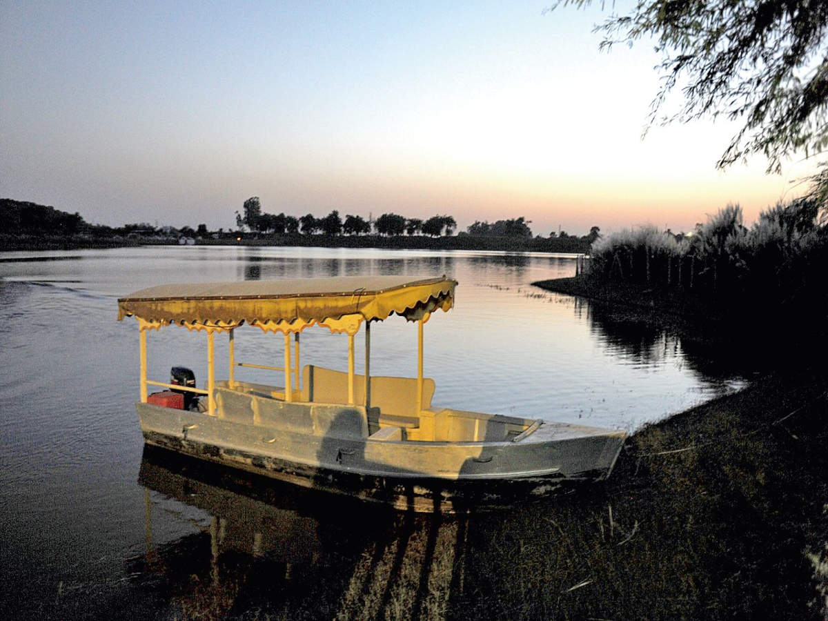
Rohtak has some of the most beautiful lakes like the Bhindawas Lake and the Tilyar Lake. Bhindawas lake is a man-made lake that has transformed itself into a bird sanctuary and is a favourite bird watching venue. Tilyar Lake is spread over 20 acres surrounded by water shrubs and forest. The lake attracts a vast array of birds along which attracts visitors. The Tilyar Lake complex houses a zoo in its vast compound which also includes a restaurant, mini train, a park for kids and retail shops. Visitors enjoy boating, angling and Kayaking while the zoo is the favourite part of the complex for children. The angling permit in the lake costs INR 200, and one can fish between 7 am and 6 pm during the summer months and between 8 am and 5 pm during the winter months. The entry fee to the zoo is INR 10 for adults and INR 5 for children and is open between 7 am and 6 pm during summer and between 8 am and 5 pm during winters.The Khaparwas Bird Sanctuary lies about 49 km south of Rohtak and about 60 km west of Gurgaon. The reserve covers 0.8 sq km and is an important part of the ecological corridor along the route of the Sahibi River which traverses from the Aravalli hills in Rajasthan to the Yamuna. It was declared a wildlife sanctuary on 30 January 1987. The Bhindawas Wildlife Sanctuary lies about 1.5 km from this sanctuary.

Meham
Also spelt as Maham, Meham, is a small town about 33 km west of Rohtak well known for its archaeological sites and is one of the few sites that have preserved the existence of the Indus Valley Civilization which are in the form of large dunes about five km away on the city’s western fringe. In ancient times, the area’s name was Mahahattam and had about two big ponds and a dozen smaller ones that were were created by the Indus Valley Civilisation to trap runoff rainwater, which could last for a full year until the next rainfall replenished the supply. Archaeological excavations in the region have yielded well-documented finds, which have shed light on the pre-Harappan settlements, particularly at Madina and Farmana Khas. Maham suffered a setback during the invasion of the Ghaznavids under the command of Sultan Mahmud and later when his son Mas’ud I sacked the town. A few centuries later, during the reign of the Turkic Muslim ruler Firuz Shah Tughlaq, the town was resettled, and agricultural operations resumed.

During the Mughal rule, a garrison commander was posted at Maham who built a small fort known as Maham Fort which is now in complete ruins except for its ramparts. Colloquially known as Choro ki Baoli or the thieves’ stepwell and Jyani Chor ki Surang or Jayani the thief’s tunnel, Shahjahan ki Baoli was in 1559 by the Mughal courtier Saidu Kalal during the reign of Shah Jahan. It is an old baoli or stepwell made of lakhori bricks with 101 steps. Several rooms in the subterranean pavilion flank both sides of the well’s steps. Today, it lies in partial ruins and faces neglect. The structure itself contains three separate chambers to hold increasing amounts of water. As rainwater was collected, one level at a time would be filled.
Two mosques, the Jama Masjid and the Pirzada Masjid were built during the Mughal rule and are currently in ruins. Parts of them have been demolished by the villagers and used for the making, drying and storing of hand-made dried cow dung cakes or as fuel for cooking. The tombs of Shah Muhammad Ramzan Mahami and Shah Ghulam Hussain Mahami lie partially ruined today though the latter, that of a Muslim saint has been partially restored by locals and religious structures erected near it.

There is also a temple named Sheetalpuri Mandir, which is about 500 years old, in the centre of Maham. In Bharan, a village near Maham, an annual religious festival celebrating Goga Navmi is held in the Goga Ji temple with wrestling tournaments organised nearby. Five km from Maham, a large village named Behlba contains an old temple named Baba Khali Nath Temple.