Travel Bucket List: India – Utarakhand Part 3

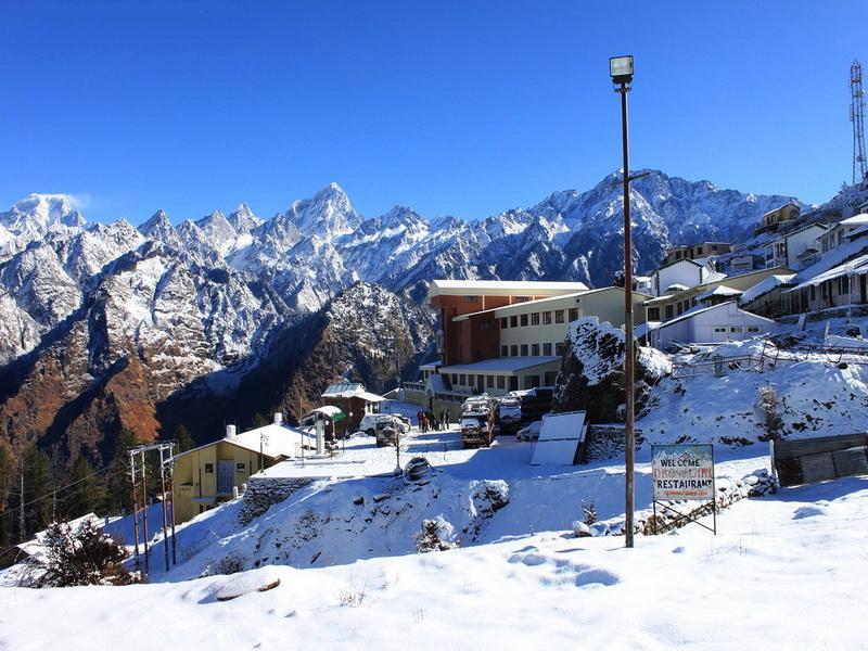
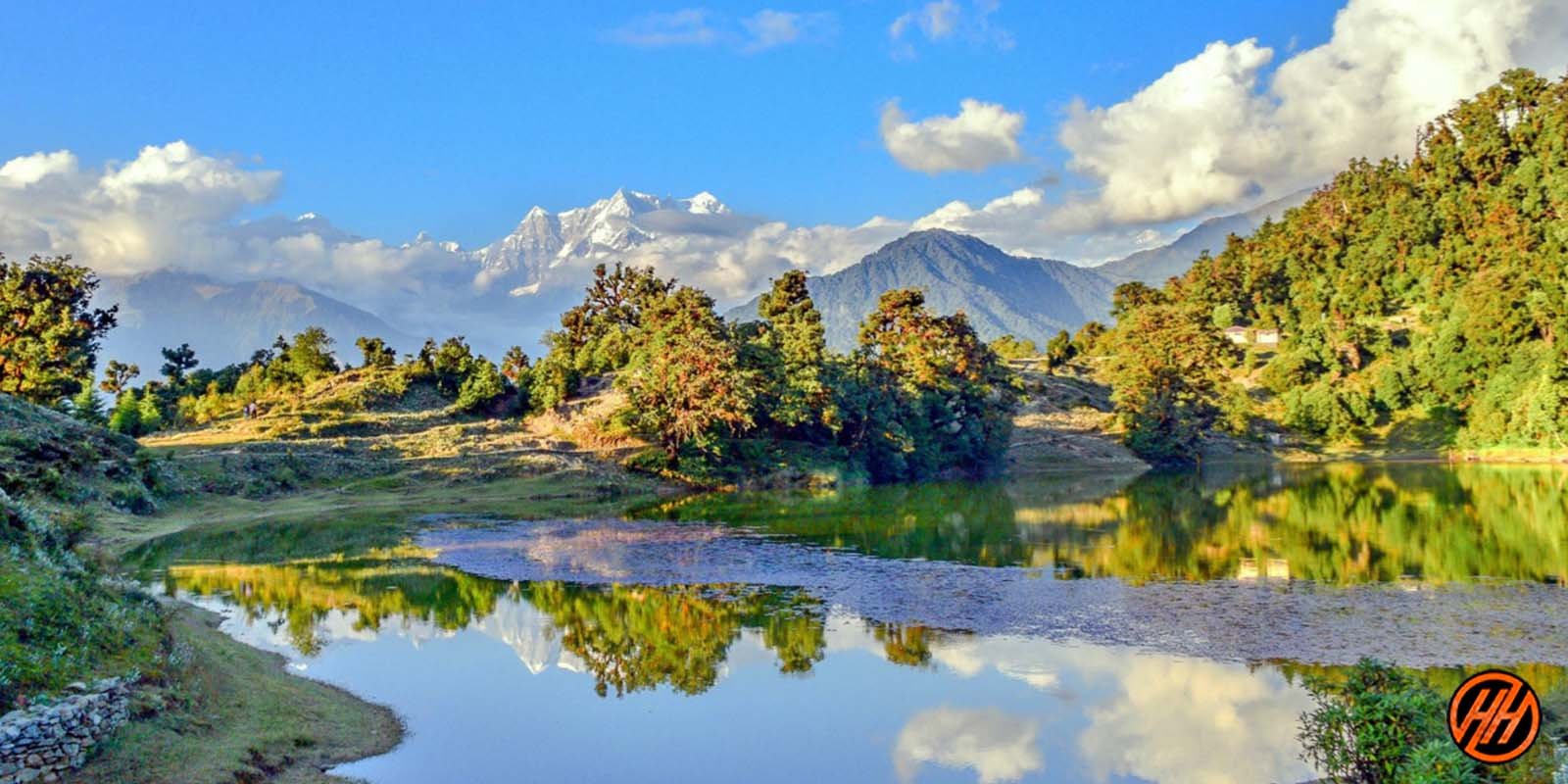
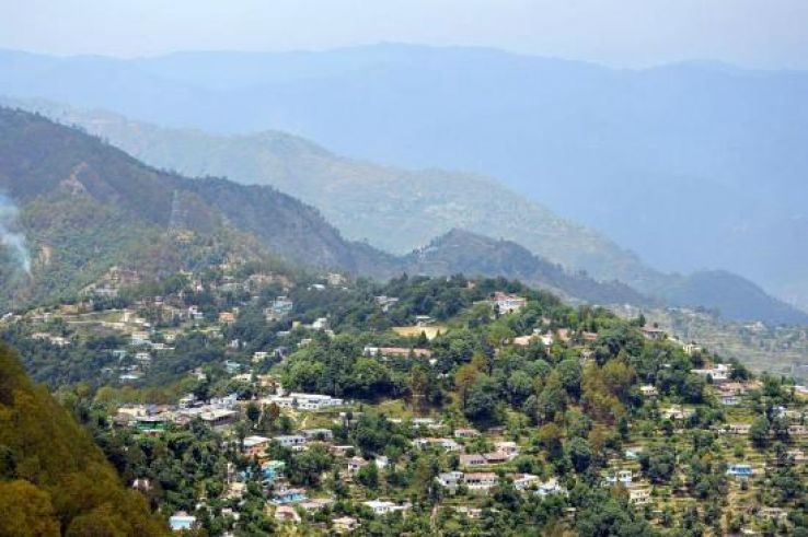
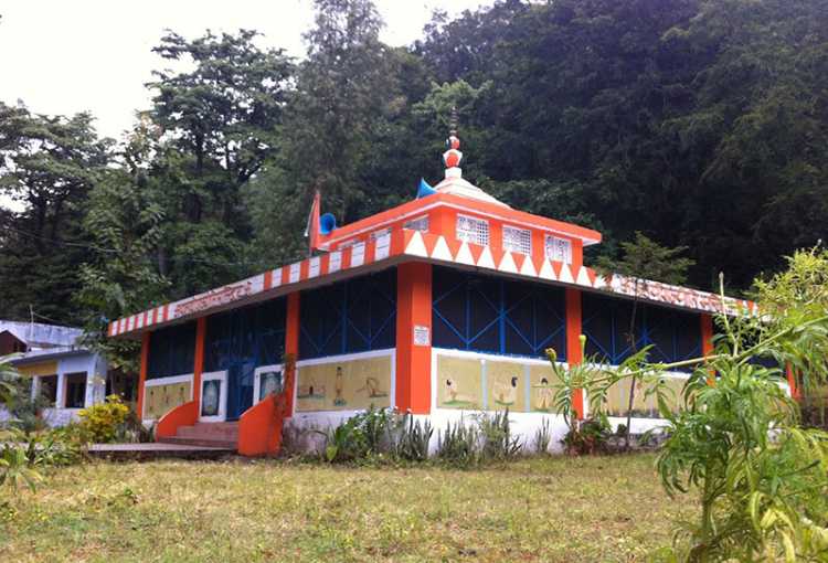
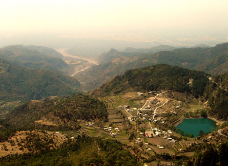
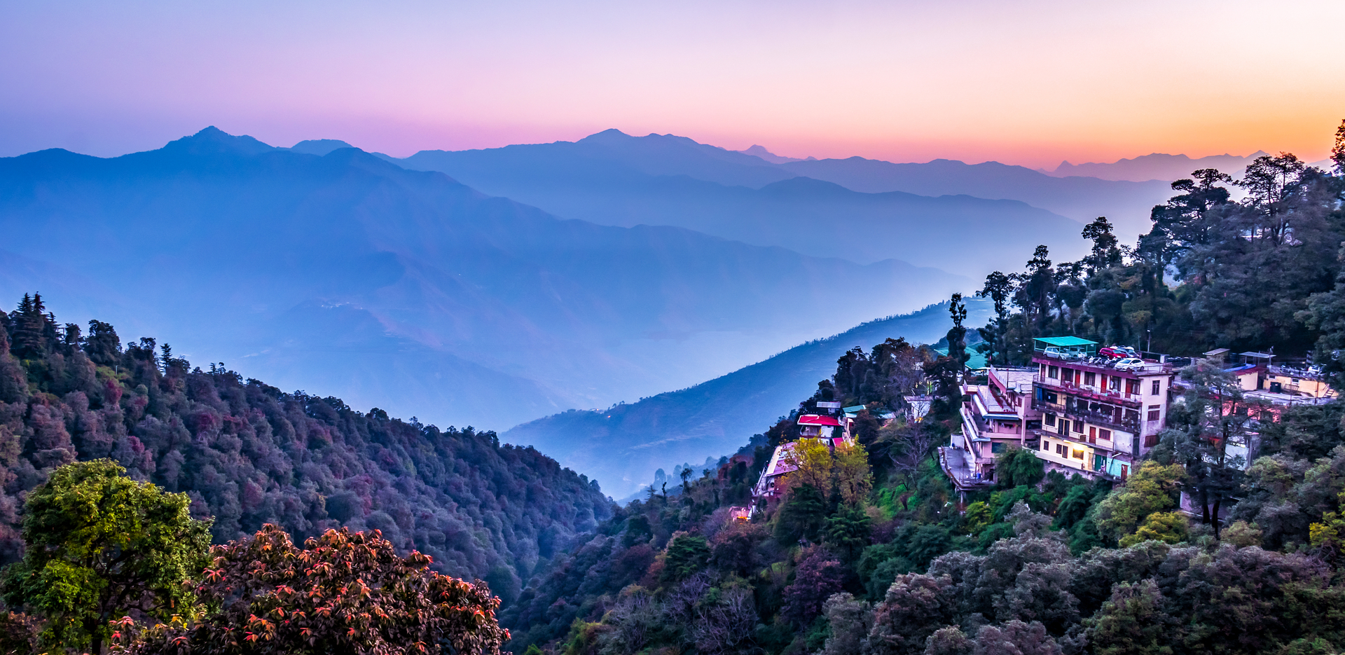
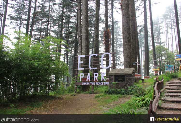
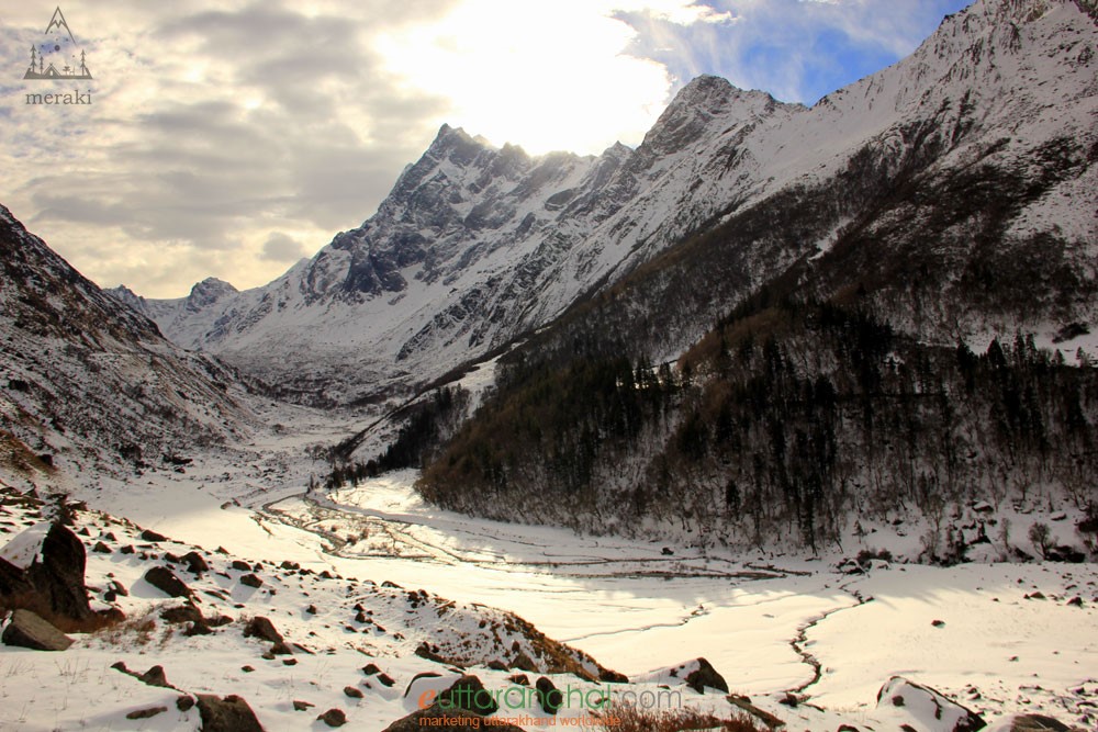
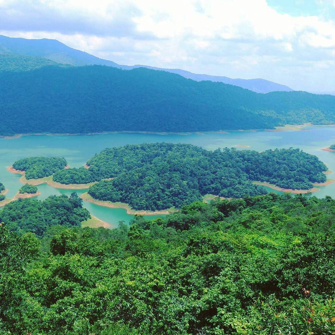
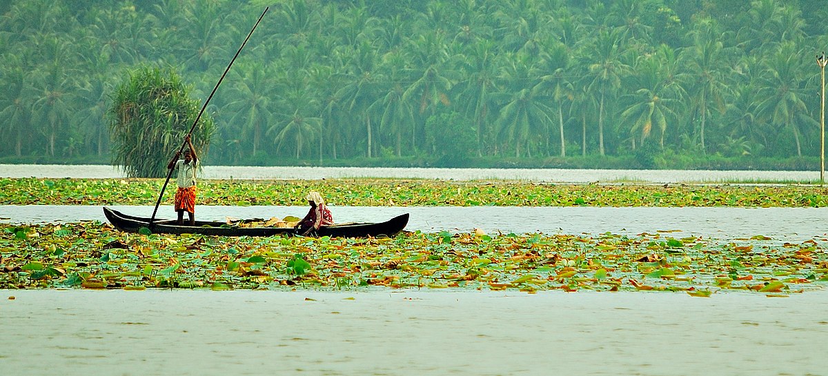
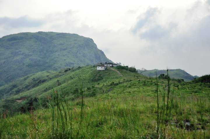
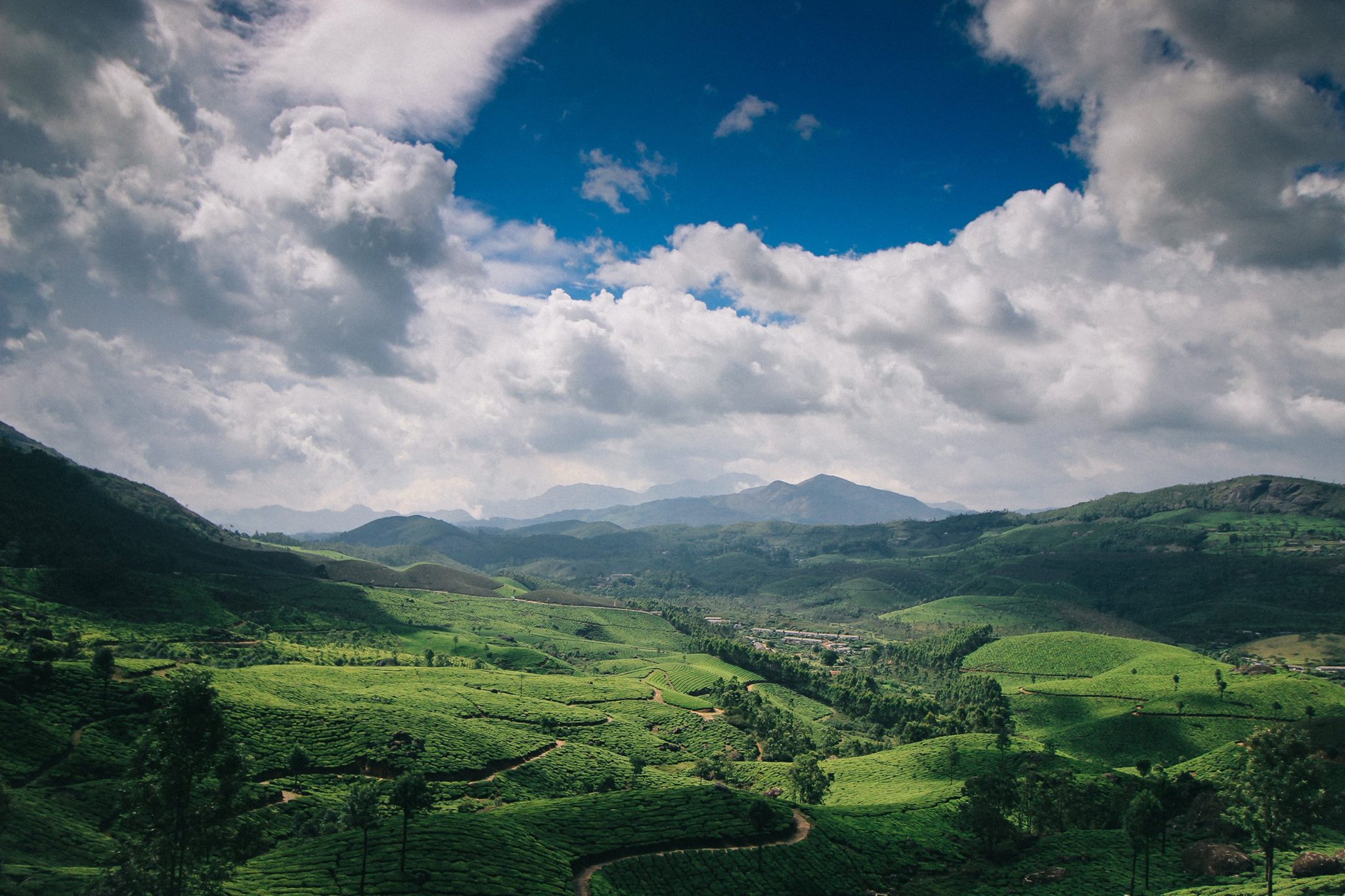
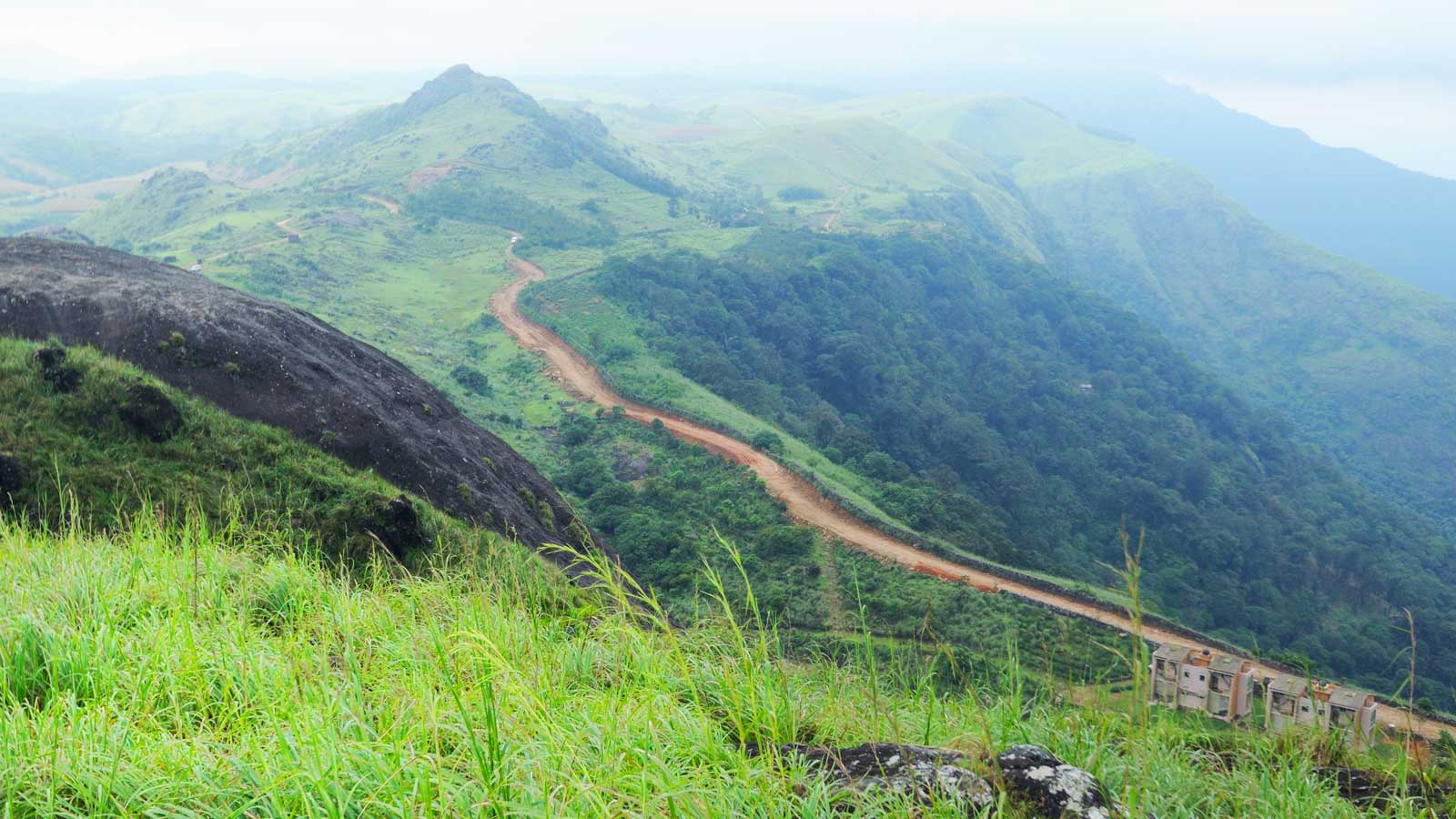
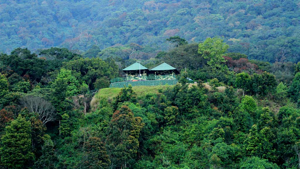
Also known as Auli Bugyal which in the local language of Garhwali mean meadow, Auli is located at an elevation of 2,800 metres and is home to mountain ranges of Nanda Devi, Mana Parvat and Kamat Kamet. Many religious destinations are also scattered around Auli. It is believed that Shankracharya had blessed Auli with his visit. Between June to October, the valley has one of highest number of flower species found anywhere in the world, with 520 species of high altitude plants, 498 of which are flowering plants with significant populations of endangered species. Dotted with apple orchards, old oaks and pine trees there is no dearth of natural beauty in Auli. Apart from skiing visitors can also go for numerous treks in the hills of Garhwal Himalayas and enjoy the spellbinding views of the snow-draped mountains. Auli is a popular hill resort in the Himalayan range which dates back to the 8th century. The three Himalayan mountain peaks of western Kumaun as a whole form the Trishul peak.

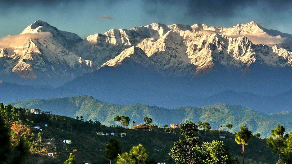
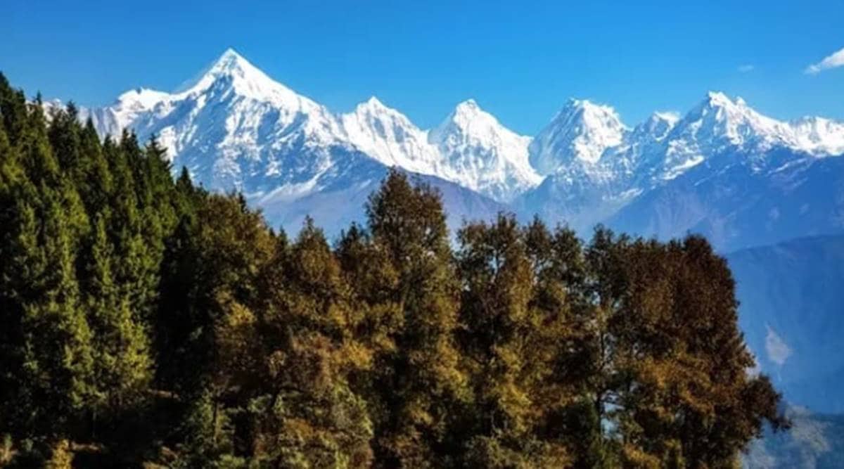
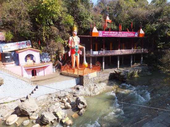
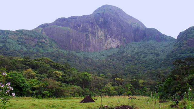
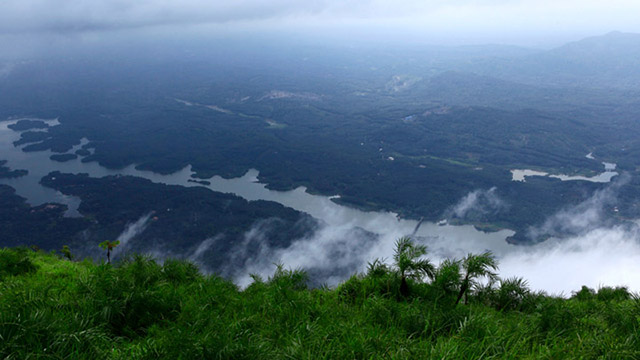
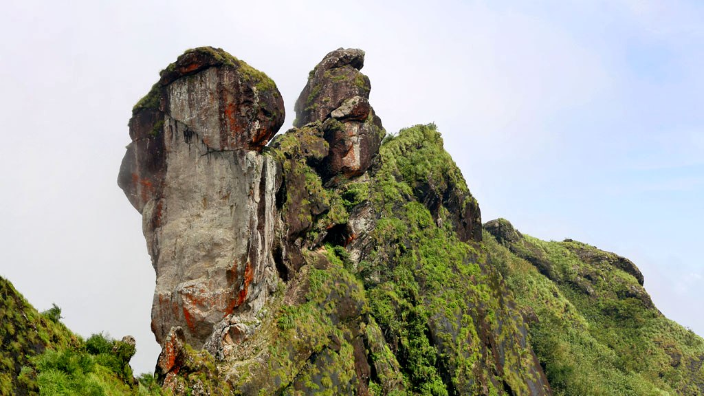
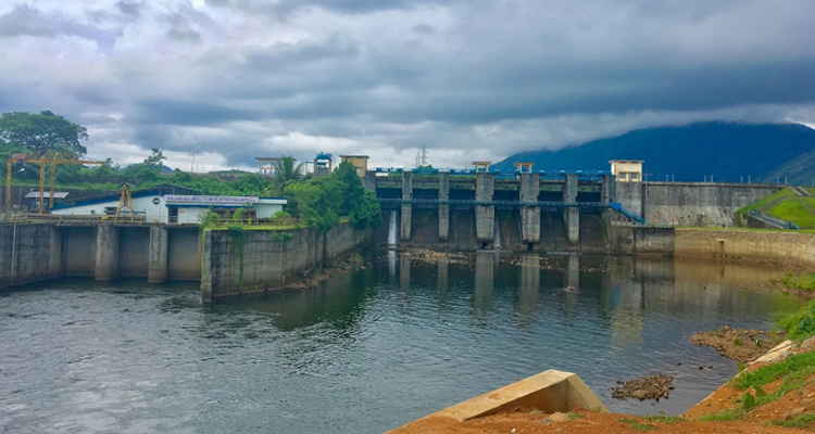
Trishul Peaks Group: At a height of 7120 m, the Trishul group forms the southwest corner of the ring of peaks that enclose the Nanda Devi Sanctuary. The three peaks that form Trishul Peak resemble the shape of a trident or Trishula, as known in Hindi and Sanskrit and the trishul is known to be the weapon of Lord Shiva. In 1907, the main peak – Trisul I – became the first peak over 7,000 m to have ever been climbed by someone. The peak can be best viewed from Kausani or during the Roopkund Trek. During the spring months of March and April the weather becomes very cold due to heavy snowfall in the valley and monsoons remain very cold too, while the temperatures fall further occasionally. In the months of September, October and November, the climate is pleasant and skies are clear. The first snow occurs generally in November/December. Panoramic views in Auli can be astonishing as it is surrounded by very high peaks including the Nanda Devi at 7817 m. The Hanuman Temple here is supposed to be the place where Lord Hanuman took some rest when he had come to the Himalayas to procure the herb Sanjivani to rescue Laxman, the younger brother of Rama during the battle in Lanka. Visitors can also enjoy a cable car here which can give them a beautiful view of the surroundings. There is an artificial lake as well in Auli which is the world’s highest man-made lake.

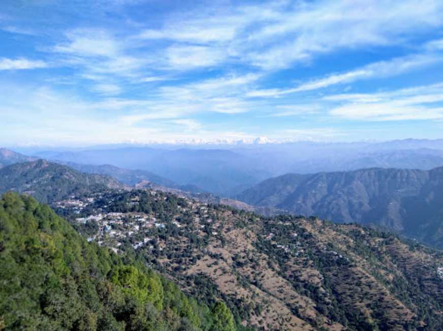
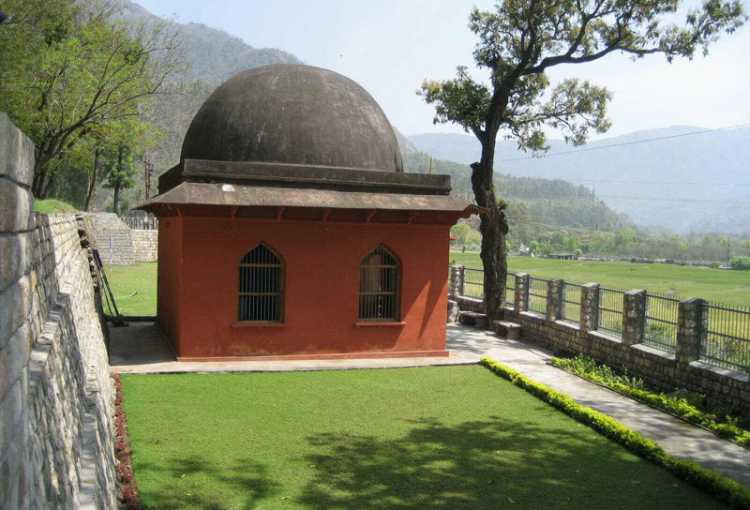
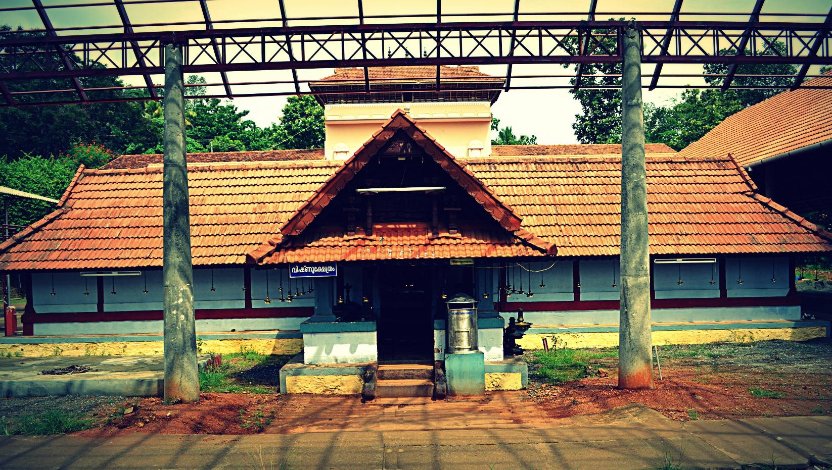
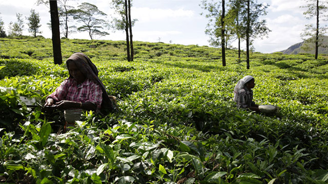
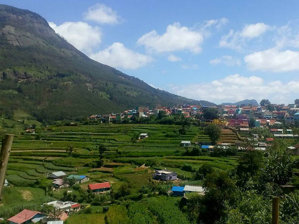
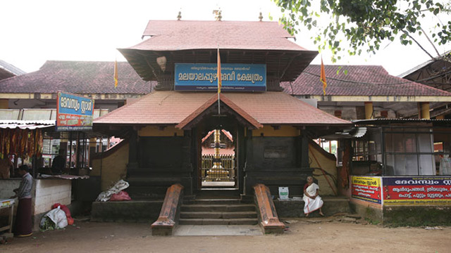
Joshimath: Also known as Jyotimath, Joshimath is a hill town perched at the height of 6150 feet in the Chamoli district of the Gharwal region. It serves as an important religious centre for Hindu pilgrims and lies in the proximity to one of the four maths founded by Adi Shankaracharya in the 8th century. According to Adi Shankara, Joshimath is in charge of the Atharvaveda, or ‘the procedures of everyday life’.It is believed that Adi Shankara himself placed the deity of Lord Narasimha in the famous Narasimha temple here.The temple is also one of the 108 Divya Desams in the country, which are Vishnu temples worshipped by the Alvar clan of Tamil poets. Overlooking the confluence of rivers Alaknanda and Dhauliganga at Vishnu Prayag, Joshimath is also the winter home of Lord Badri as the idol is shifted from Badrinath to Joshimath during the winter months. Because Joshimath is nestled amid the lap of the snow-capped Himalayas, it is also known as the gateway to trekking with many treks, including the Valley of Flowers trek located is closeby. Perched at an elevation of 3,056 m, Gurso Bugyal is a picturesque wide meadow known for its lush green pasture land and filled with giant coniferous and oak trees. This heavenly place provides a terrific view of all the nearby and significant mountain ranges namely Nanda Devi, Dron and Trishul. During spring, the white sheets of snow melt away making space for herbs and shrubs to grow. The land turns into a natural garden with infinite varieties of plants, trees and flowers. To witness the view in the most magical way, take the trail from Auli and enjoy the picturesque views of mountain ranges as you proceed towards the lush green land of Gurso Bugyal. A 3 km trek from Auli will lead you to this scenic, location. You can also trek towards Chattarkund, a small patch of land with an ethereal water body, known to have sweet water which is just one km away.

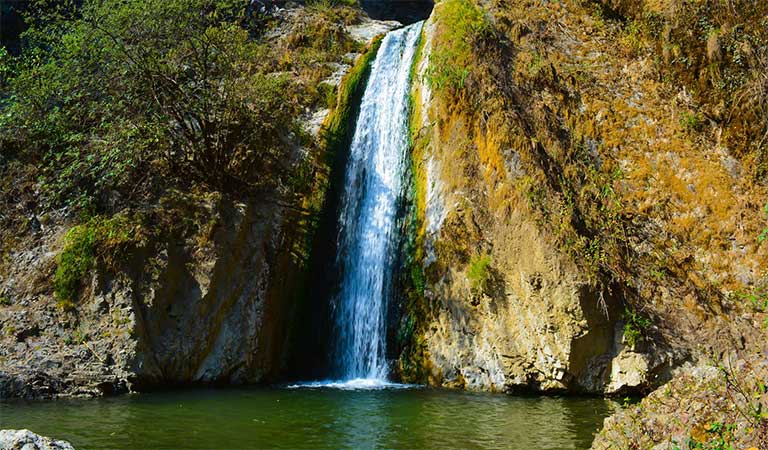
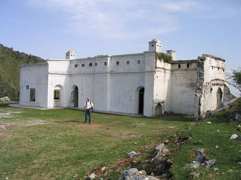
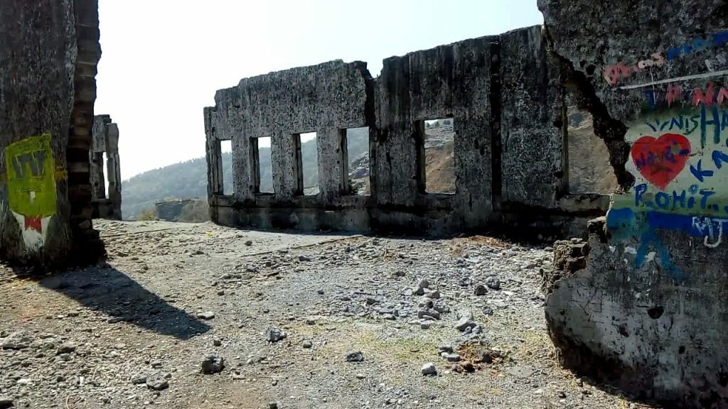
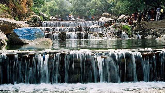
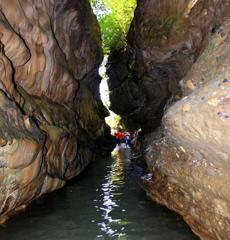
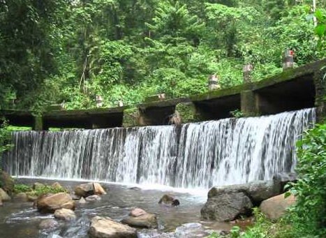
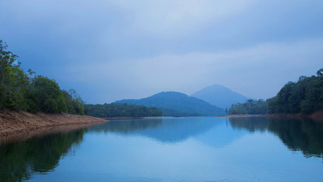
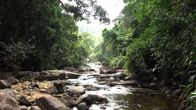
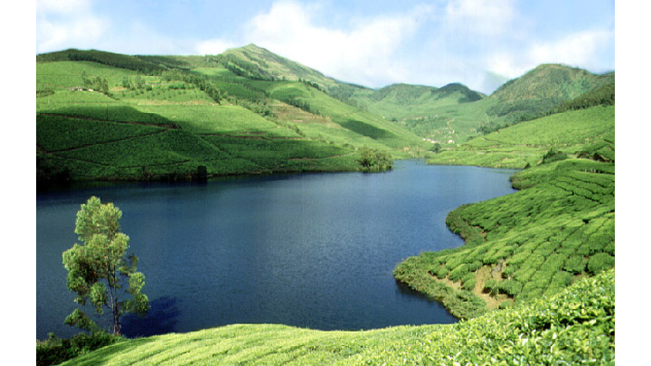
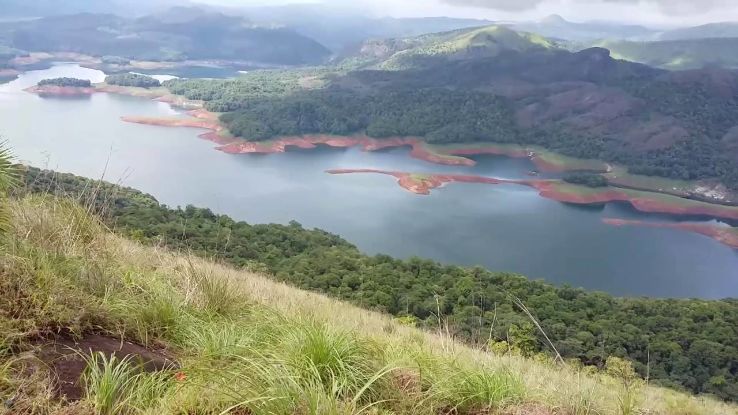
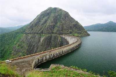
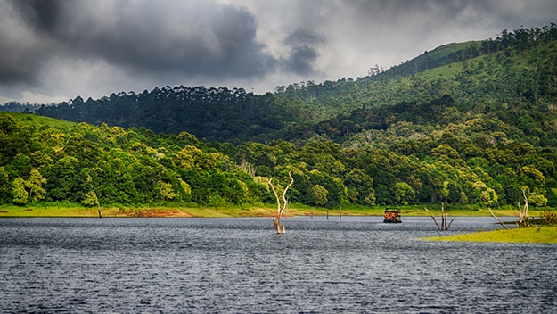
Chenab Lake: An artificial lake that serves as a reservoir for Auli, the Chenab Lake is a small crystalline lake that is still less explored and in its purest state. The trek to the lake is for those who truly want to have a crude and authentic trekking experience – through rocky passes hurdled with twigs and plants. Guarded by the Garhwal Himalayan range, the Chenab Lake still has crystal clear water that acts like a prism to the mountains. As the area around the lake remains untouched, you will not find nicely built roads to trek. No motorbikes and vehicles can be ridden on this track, which remains snow logged during the winters and becomes impossible to trek, so it is recommended to explore this place from May to October.

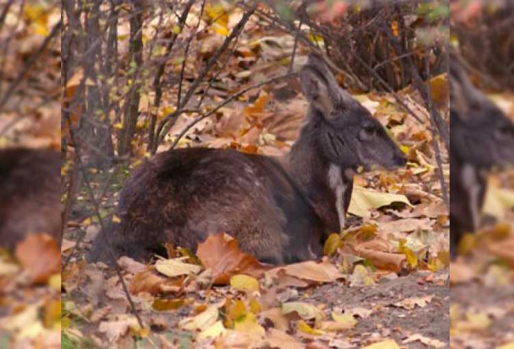
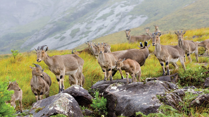
Skiing in Auli: Offering beautiful views of peaks such as Mount Nanda Devi Kamet, Mana Parwat, Dunagiri, Beethartoli, Nilkanth, Hathi Parbat, Ghori Parbat and Nar Parbat, skiing in Auli is an experience like no other. The snow-covered Auli with evergreen conifers and the oak forest an altitude of 2000 – 3000 m is an ideal place for skiing in India. While skiing in the Gorson Reserve forest which is part of the Nanda Devi National Park is inhabited by some of the widely rare Himalayan wildlife like snow leopards, musk deer, wild boars, wild cats, wild rabbits, jackals, foxes, hyenas and bears. Most skiing packages in Auli include the accommodation as well. The average cost of skiing in Auli ranges between Rs. 20,000 – Rs. 50,000 depending on the length of stay. The best time to ski is between November to February as there is enough snowfall then.

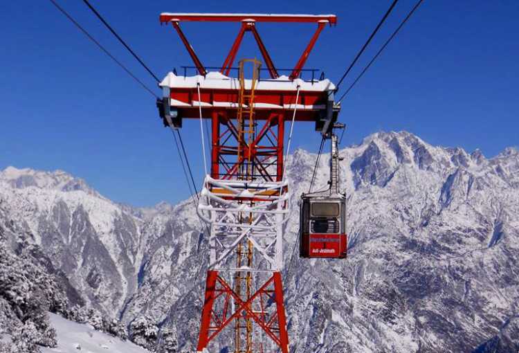
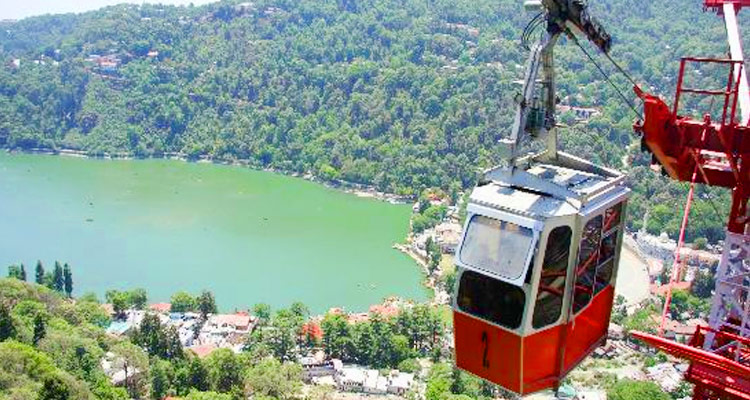
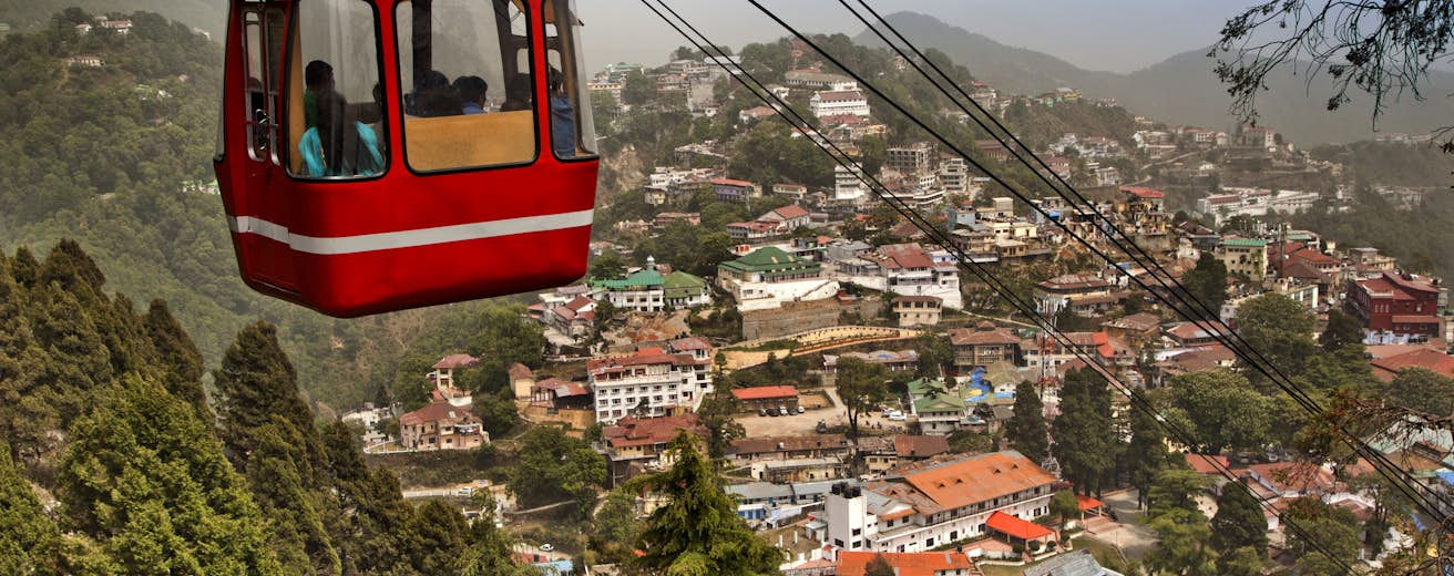
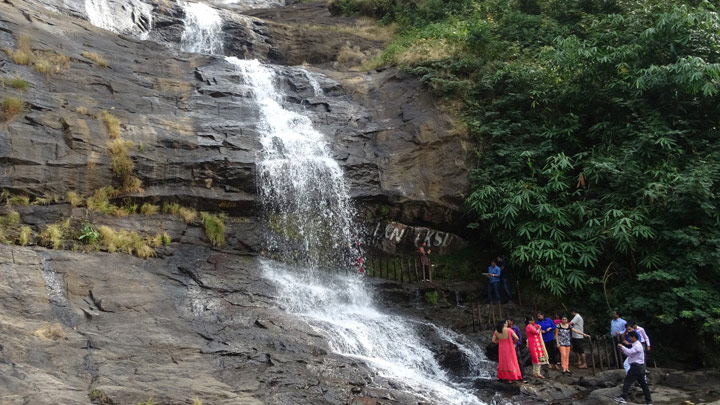
Auli Cable Car Ride: One of the major attractions in Auli is to enjoy a cable car ride. Locally known as a Gondola, the cable car ride in Auli is the second highest and the longest cable car ride in Asia after Gulmarg. Covering a total distance of 4 km, the journey starts at Joshimath and ends at Auli, and takes a total time of around 24 min. Perched at a staggering height of 3010 m above sea level, the entire trip is a visual delight. Visitors can enjoy the majestic Himalayan peaks above them with lush green valleys below. The ropeway works with two cable cars through 10 towers and can accommodate upto 25 passengers. Although, the passengers have to keep standing as there are no seats. In case vistors are lucky and are travelling at the right time, they can also witness a skiing competition going on below. The ropeway station is situated 1 km from Panchvati Inn in Joshimath and can be reached either by car or on foot.

Moving on, we travel about 150 km southwest from Auli Bugyal to the town of Chopta.

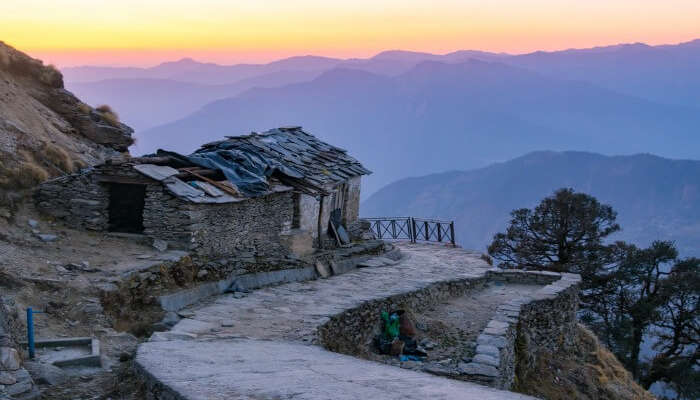
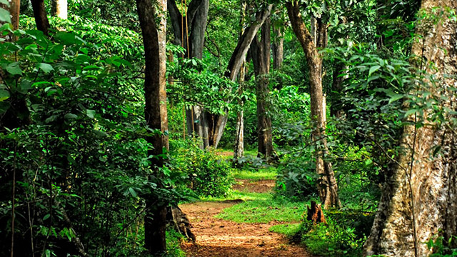
Chopta is a small region of meadows and evergreen forest area which is a part of the Kedarnath Wildlife Sanctuary and a base for trekking to Tungnath, the third temple of the Panch Kedar, which lies 3.5 km away and Chandrashila which rises to 4,000 m and is located 1.5 km from Tungnath. An unspoiled natural destination, Chopta offers views of the imposing Himalayan range including Trishul, Nanda Devi and Chaukhamba and is located at an elevation of 2,680 m. The village of Chopta is surrounded by forests of pine, deodar and rhododendron and is rich in flora and fauna include rare species of birds and musk deer. The place is popularly known as a Mini Switzerland with the best time to visit from April to November. Chopta is also a popular destination during the winter months due to the snowfall that the area experiences. The Tungnath temple and Chandrashila are covered with snow from December to March. Camping in the open grassy meadows of Chopta that slopes on softly, among alpine, pine, deodar and rhododendron trees is soul-fulfilling.

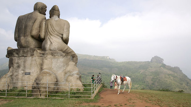
Tungnath Temple: Situated amongst the wondrous mountains of Tungnath in the Rudraprayag, the Tungnath temple is the highest Shiva temple in the world nestled at an altitude of 3680 meters. It is one of the Panch Kedars and is believed to be almost 1000 years old. The foundation of this temple was laid down by the Pandava prince Arjuna, the third brother and was built in the North Indian style of architecture with dozen shrines of other gods surrounding the temple. There are numerous tales associated with the place including the one where Lord Ram carried out meditation to get himself released from the curse of Brahmahatya or the killing of a Brahmin for killing Ravana. The distinguishing feature of this exquisite temple is its location amidst the beautiful mountain ranges. It is a fantastic place to visit especially for adventure lovers because of the trek they need to do to reach the temple. According to legend, it is believed that after the Kurukshetra war when the Pandava brothers defeated and killed the Kauravas, sage Vyas advised the Pandavas their act of killing off their own kins could be pardoned only by Lord Shiva. So they went in search of him who was already convinced of the guilt of the Pandavas and in order to avoid them, took the form of a bull and went into hiding. The Pandavas chased him to an underground safe haven at Guptakashi, where he was hiding. When Lord Shiva went back to his natural form, his remains of the bull-styled body is said to have rematerialized at five different locations. These five locations came to be known as the Panch Kedar and the Pandavas built temples of Lord Shiva at each of these locations as a sign of seeking his pardon and blessings. The opulent temple is made up of stones adorned with decorations which are painted on the outside depicting tall towers. There is a wooden stage present on top of the highest dome which also has sixteen openings. The roof of the temple is composed of stone slabs and at the entrance lays a stone image of Nandi facing towards the idol of Lord Shiva. There is an image of Lord Ganesha on the right side of the temple entrance. Inside the main chamber lies the Ashtadhatu which is composed of eight metals, idols of saint Vyas and Kala Bhairav and the followers of Lord Shiva. There are images of the Pandavas and four other Kedar shrines present inside the premises as well. At the end of the trek path of Tungnath, the entrance of the temple is marked with the presence of the name ‘Tungnath’ painted atop an arch which has recently been constructed. The Panch Kedar Yatra which involves trekking through all the five temples including Kedarnath, Tungnath, Rudranath, Madhyamaheshwar, and Kalpeshwar is considered to be very auspicious. The trek is undertaken to visit all the five shrines which are situated in Kedar valley and complete the circuit. Kedarnath is situated at the head of the Mandakini River, Madhyamaheswar is situated at the base of the Chaukhamba Peak at the height of 3500 m, Tungnath is situated in Garhwal at an altitude of 3810 m, and 500 m above the Tungnath Temple lays the Chandrashila peak. The Tungnath Temple opens when the Char Dhams of Uttrakhand is opened during April or May every year during Vaisakh Panchmi on the date that is decided by the Badro Kedar Temple Committee on Baisakhi. The temple is closed during the winter season after Diwali, and the image of the deity is moved to Mukunath which lies 19 km away from Tungnath by the temple priests during this time. During the months when the temple is not closed, it is open from 6 am to 7 pm.

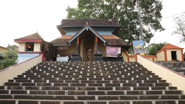
Ukhimath: Also known as winter Kedarnath, Ukhimath is famous for the temple of Lord Shiva which houses the Lord during the winter months when Kedarnath is shut down. Ukhimath is also a very beautiful hill station and is located at an altitude of 1300 meters in the lower hills. Home to Lord Kedarnath and Lord Madhyamaheswar in the winters when Kedarnath becomes inaccessible due to heavy snowfall, Ukhimath is a deeply religious town with spirituality and devotion oozing through its lanes. Ukhimath also provides some great panoramic views of the Himalayan peaks which are covered in snow. It is a place fit for some time in solidarity and amidst a spirituality of significant religious centre. The town has a beautiful summer weather with comfortable temperatures and cool breeze while the winters are quiet cold yet very beautiful. Omkareshwar Peeth, a temple dedicated to Lord Kedarnath is a must, while in the town.

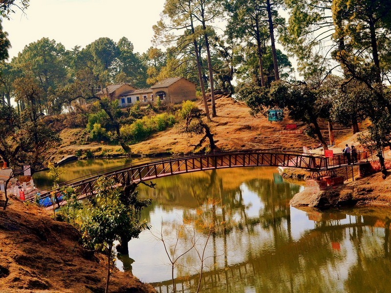
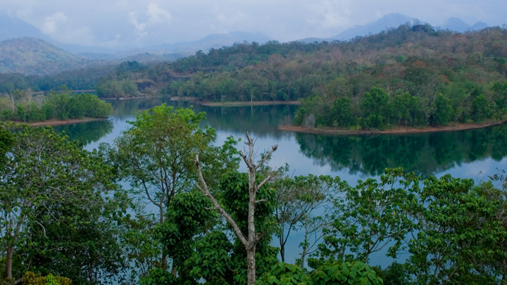
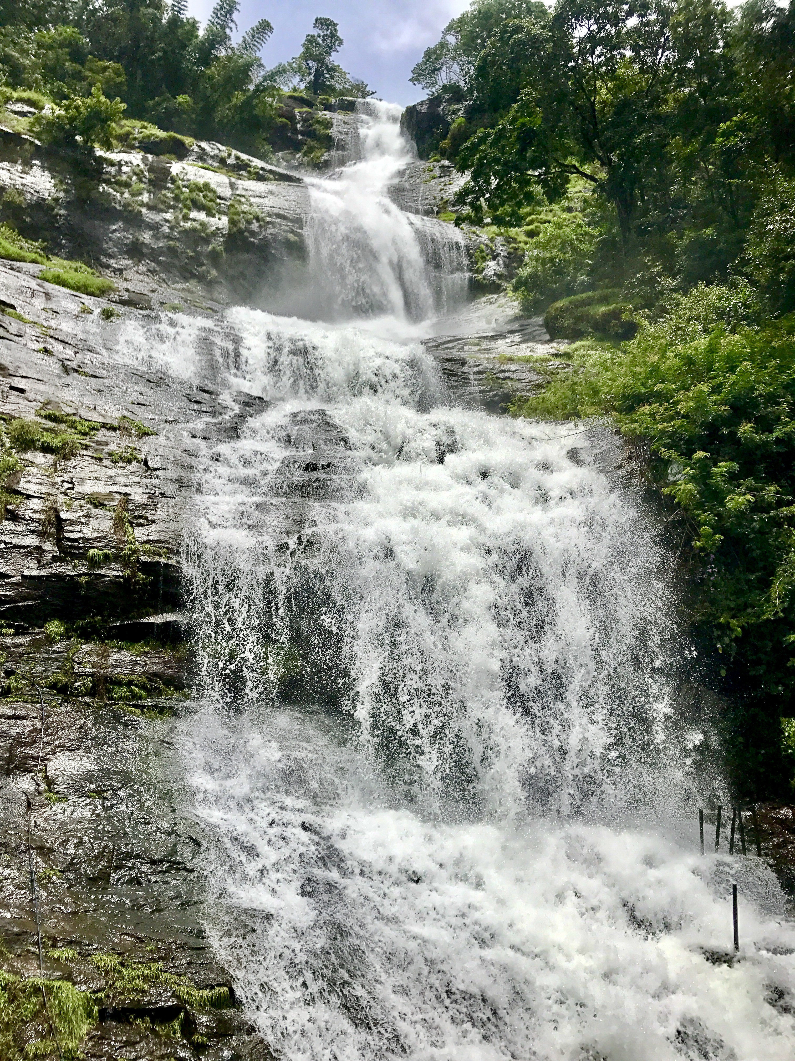
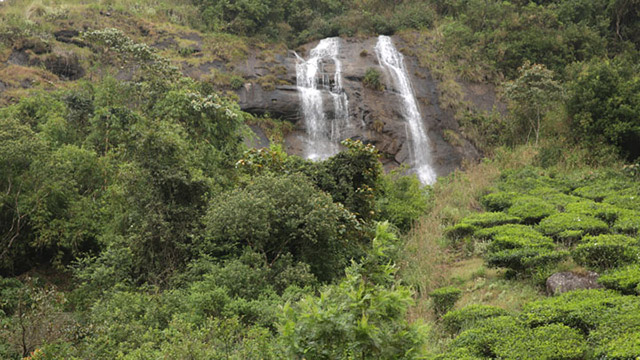
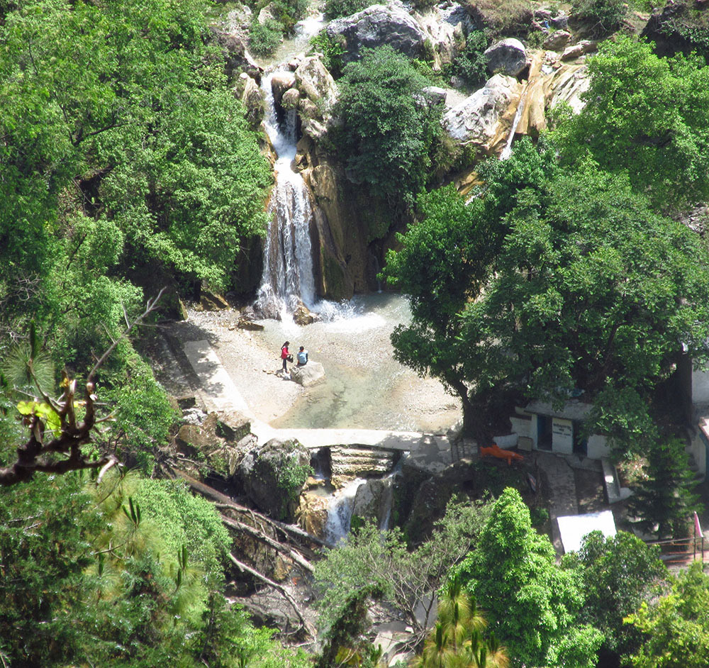
Deori Tal: Located on the Ukhimath-Gopeshwar road, the Deoria Tal is reached by a 2 km trek through the Sari Village. The lake is surrounded by pines in multitude and clearly mirrors these pines and the Chaukhamba peaks once still. The lake itself is one of the chief attractions of Chopta, with tons of visitors thronging it during peak season.

Kanchula Korak Musk Deer Sanctuary: Housing the famous musk deer, the Kanchula Korak Deer Musk Sanctuary has an abundance of lush green vegetation, a lot of varieties of which are claimed by locals to have not even been scientifically classified yet. Sprawled over an area of 5 sq. km, visitors can spend a larger part of their day here, lazing around with a pair of binoculars to explore the place.

Tungnath and Chandrashila Trek: Tungnath, a quaint village, is known as the starting point of the popular Chopta Chadrashila Trek. At a height of 2680 m, this village is surrounded by evergreen forests of pine, deodar and rhododendron. This is one of the easier treks in the Himalayan region and hence, recommended for first timers. The trek covers a large region, starting from Haridwar and ending at Chandrashila. The trek initiates from the holy city of Haridwar towards Devarivatal Lake; which is located at an altitude of 2440 m. Here, you get a picturesque view of the Chaukhamba ranges. As one goes further, one comes across Chopta, with a height of 3000m. Next comes Tungnath, at an elevation of 3680 m. And finally, one arrives at the beautiful Chadrashila Top at 4130 m. The Tungnath temple and Chandrashila peak award you with a 360 degree, mesmerising view of the valleys below. The peaks of Panchchuli, Nanda Devi, Nilkanth and Kedarnath are all covered during the trek. The trek which takes around three days has entry fees at certain checkpoints, permits for the trek and obligatory forest camping charges in the region as per the length of the stay.

Moving further south, out next destination is the hill station of Lansdowne.

Lansdowne, is a cantonment town in the Pauri Garhwal district on the Kotdwar – Pauri road at a height of 1,780 m. A quaint little hill town, Lansdowne is laden with oak and pine forest and dotted with buildings of the colonial era and is a haven for bird watchers, casual hikers and weekend visitors. The town was discovered by British and got its name from the then Viceroy of India, Lord Lansdowne. The guesthouses here are fading reminders of the colonial period, and they offer a stunning view of the mountains from their balconies. Originally known as Kaludanda after Kalu or black and Danda or hills in the Garhwali language, Lansdowne was developed by the British to cater to the recruits training centre of the Garhwal Rifles. Today, the Garhwal Rifles has its command office here. The Annual Sharadotsava or the festival of autumn is also celebrated here during autumn. The old cemetery in Kitchner Lines is one of the more mysterious places and some even call it one of the most haunted places in Lansdowne.

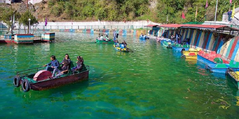
Bhulla Lake: A local favourite and a popular attraction, the Bhulla Lake is a well maintained serene lake made and maintained by Indian Army known for its tranquil atmosphere with ample boating facilities. There is an amusement park is located nearby which is quite popular among kids.

Tip N Top: Also commonly known as Tiffin Top, Tip N Top is a small hilltop viewpoint that is located at 1700 metres above the sea level about 1.5 km from the city centre and provides visitors with magnificent, breathtaking views not only of the city but also of the nearby forested areas and the Garhwal Hills with the majestic Himalayan range in the background. To get to Tip N Top, visitors would have to pass through dense forests and terrains that terminate at high altitudes to reach the final destination. The place is located close to other famous tourist attractions such as St. Mary’s Church and Mata Santoshi Devi Temple which are also very popular, and can be visited in combination with Tip N Top. The viewpoint is open from sunrise to sunset and has no entry fees.

Snow Viewpoint and Hawaghar: Beautiful vantage points reached by a short trek, the views from Snow Viewpoint and Hawaghar are totally worth the effort and energy expended. The snow capped mighty peaks, verdant green forests and a bird’s eye view of the valley below is sure to mesmerise visitors and is worth the trip there.

Bhim Pakora: Reached after a 2 km trek downhill through a rough path, Bhim Pakora is quite surprising as there are two big stones one above the other in perfect balance and while the stone can be moved with a finger it never falls down.

Jungle Safari: If you would like to explore the wilderness of Lansdowne, there are many tour operators who organise jungle safaris into the heart of the forests where visitors can catch a glimpse of Himalayan wild animals in their natural habitat.

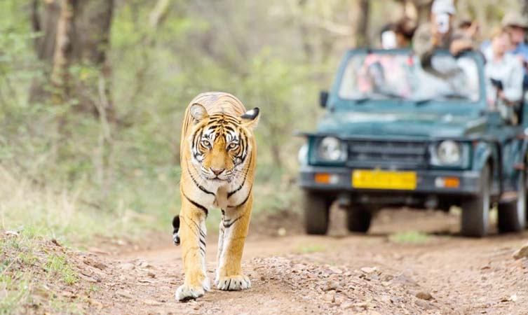
Kalagarh Tiger Reserve: A wildlife sanctuary about 13 km from Lansdowne,the Kalagarh Tiger Reserve is rich in flora and fauna. Sprawling over 300 sq km, the reserve actually forms the northern end of Jim Corbett Park. Apart from the regular spotting of tigers, barking deer, hog deer, goral, sambhar, porcupines and other varied exotic animals can be spotted here.

Tarkeshwar Mahadev Temple: Located atop a hill at 2092 meters about 39 km from Lansdowne , the Tarkeshwar Mahadev Temple is believed to be an ancient holy site or SiddhaPitas dedicated to Lord Shiva. The temple has a special Shivalinga and a Kund or a small pond known as Gauri Kund where devotees bathe before entering the temple. There are two other famous temples, Durga Devi Temple and Jwalpa Devi Temple, which are on the Pauri-Kotdwar road and are 24 km and 47 km away respectively. The Durga Devi Temple is one of the oldest Siddha Pithas in India. The Mahashivarathri festival at the Tarkeshwar Mahadev temple draws a huge crowd from across the country.

Kanvashram: A gateway to Puri, Kanvashram is an ashram located on the banks of Malini river surrounded by thick forests and hillocks. It is believed that Shakuntala, the step daughter of Sage Kanvan and the wife of King Dushyanta and who was deserted by him gave birth to her son Bharata in this Ashram. India got its name ‘Bharat’ in Sanskrit after Bharata became king following the death of his father. The Ashram also provides accommodation facilities to visitors keen on living on the premises.

Darwan Singh Regimental Museum: Established in 1923 and named after the Victoria Cross holder Darwan Singh Negi, the Darwan Singh Regimental Museum is a historical defense museum located near the parade ground in Lansdowne. This beautifully decorated two storey building is all about the origin and achievements of the Garhwal Rifles who participated in the two world wars among countless other battles throughout its more than 100 years of history. Many artifacts, including photographs, arms used by regimental commanders, captured weapons, campaign history and other information are displayed in this museum. There are many items, such as medals won by erstwhile Garhwal Rifle soldiers, that have been put on display, including the Victoria Cross awarded to Darwan Singh Negi and Gabar Singh Negi.

Our next destination is the popular hill station of Nainital.

Source

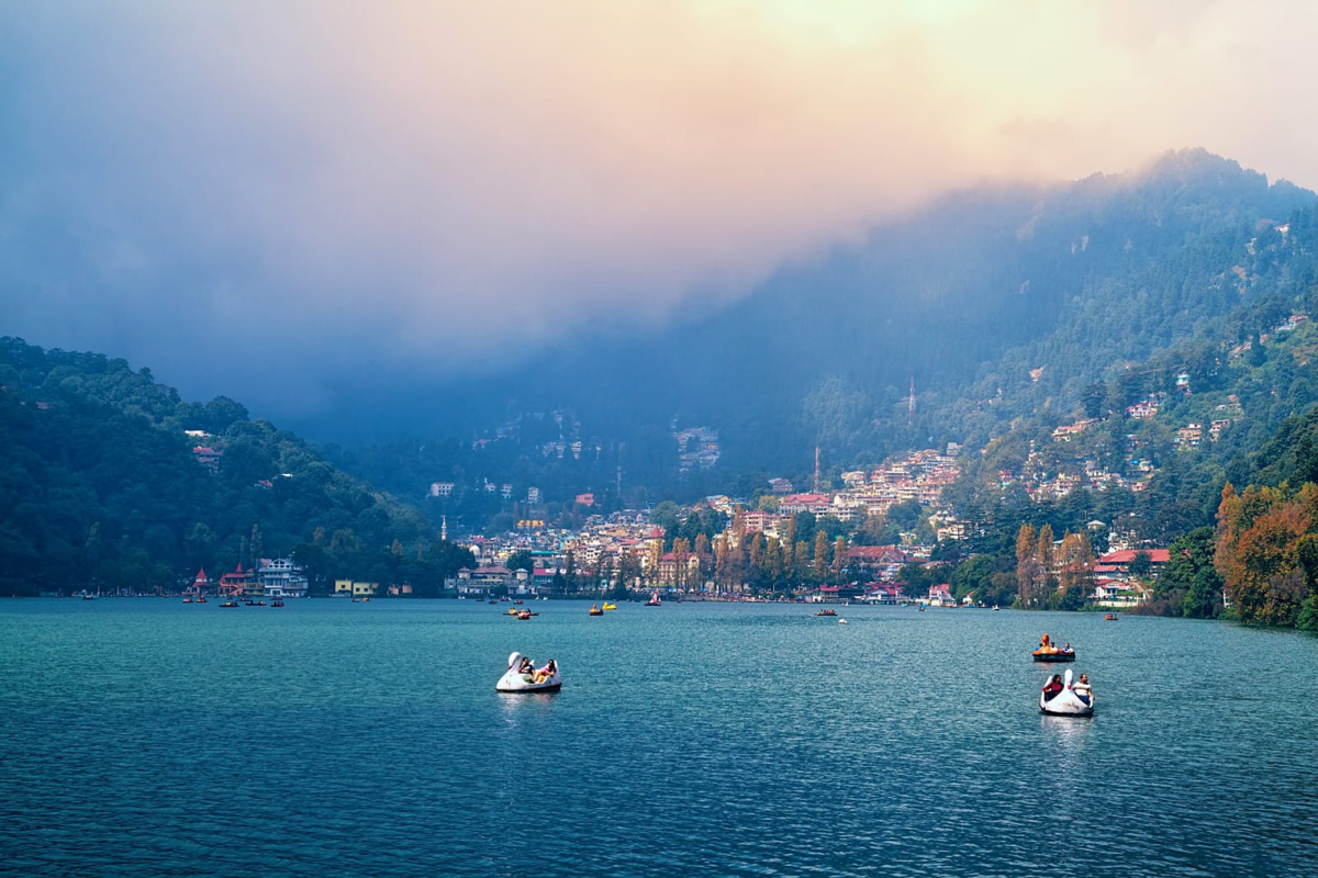
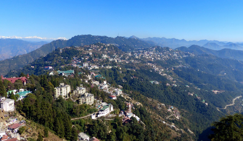
A very popular hill station, Nainital is the judicial capital of the state and also houses the Governor of Uttarakhand, who resides in the Raj Bhavan in Nainital. Located in the Kumaon foothills of the outer Himalayas, Nainital is situated at an altitude of 1,938 metres with the city set in a valley containing an eye-shaped lake, approximately two miles in circumference, and surrounded by mountains, of which the highest are Naina Peak at 2,615 m on the north, Deopatha at 2,438 m on the west, and Ayarpatha at 2,278 m to the south. Founded by the British due to its resemblance to the Cumbrian Lake District, Nainital brims with elegant colonial structures that amplify the beauty of this place. It experiences a pleasant climate throughout the year, making Nainital a tourist getaway. The Naini Lake, along with the other lakes in the area, has earned this town the title of City of Lakes.

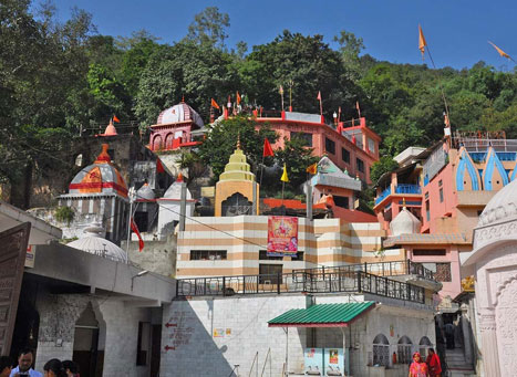
Nainital Lake: Situated in the centre of Nainital, Naini Lake which is short for Nainital Lake is a beautiful natural fresh body lake. The lake is in crescent or kidney shape and is one of the most famous lakes of the Kumaon region. Bounded by Naini Peak on North West, Tiffin Point on the South West and snow-capped peaks on the north, the Nainital Lake offers a breathtaking view, especially during early morning and sunset. The lake itself can be divided into two distinct sections, the northern part called Mallital and southern region called Tallital. Coniferous trees that cover the hillside add charm to the raw beauty of the place with the Naina Devi Temple on the shores of the lake.

Legend says that once upon a time, a very powerful king named Daksha ruled in the country. He had a beautiful daughter named Sati, and when she came of age, King Daksh began looking for a suitable groom for her. As luck would have it, Sati got attracted to Lord Shiva whom King Daksh despised thoroughly. Despite wanting otherwise, Sati and Shiva got married and started living together. This was not acceptable to King Daksh, and he decided to organize a ‘yajna’ or fire sacrifice ritual where Shiva and Sati were not invited. However, Sati decided to attend her father’s prayer service in spite of not being invited to the same. Upon reaching the venue, she and her husband were thoroughly disrespected by Daksh and unable to tolerate the humiliation, Sati jumped into the ritualistic fire. Upon learning of Sati’s death, Shiva was livid and he started performing the Tandava or the celestial dance of destruction and according to legend, it is said that Lord Shiva performed his tandava at Naini Lake as well. This gave way to apocalyptic destruction on the Earth, and the Gods feared that the world was nearing its end. When repeated pleas to Shiva by the other Gods went in vain, Lord Vishnu used his Sudarshan Chakra upon Sati’s dead body which cut it into 52 different parts. Each of the remains fell on a different portion of the country and a temple emerged there. The Naini Devi Temple was the site where Sati’s ‘nayan’ or eyes had fallen. Hindu scriptures such as the Skanda Purana mention a lake called the Tririshi Sarovar, which is believed to be the Nainital Lake. This name was derived from the names of three great sages who used to meditate here, namely Atri, Pulastya and Pulaha. A hole was dug by the three of them which soon got filled with water and came to be known as the Naini Lake or Tririshi Sarovar. According to the historical records, in 1839, a European businessman P. Barron while on a hunting expedition, accidentally found the Naini Lake and was captivated by its beauty. He then decided to build a European colony on the shores of the lake as a summer retreat for Englishmen.

A trip to the Naini Lake is perhaps incomplete without boating on the lake. Boating is available from 6 am to 6 pm when the lake is open from March to June and if you are inclined to a brightly painted gondola-like boat, it will cost you INR 210 per hour while a boat ride through the Nainital Boat Club will set you back by INR 350 per hour and a pedal boat will cost INR 150 per hour.

Peora: Best described as a hidden gem, Peora iis nestled between the Kumaon Hills and is situated at an elevation of 6000 feet. Serene and tranquil with natural beauty and untouched by industrialisation, Peora is a perfect place to enjoy some peaceful moments away from the stressful city life. There are a number of British era bungalows that give the village a rustic vibe with the snow-capped mountains, juicy fruit-laden trees, green meadows and a variety of fauna. The lush green trees are home to a myriad variety of birds and so bird watching becomes an essential activity in Peora and treks and strolls are elevated here. Since Peora is replete with trees that bear juicy fruits, you can carry a basket and collect fruits such as apples, pears, peaches, plums and many more.

Sariya Tal: Located near Kaladhungi, Sariyatal, is an artificial lake constructed as a tourist spot. The tiny lake has numerous activities like paddle boating and water sports. It is also popular for the Himalayan botanical garden which is a research centre other than being a herbarium and a butterfly park. Hiding a steep waterfall at the corner, Sariyatal is an ideal spot for solitude seekers, nature lovers and photographers. Open from 10 am to 5 pm, the entrance fee is INR 20 per person.

Eco Cave Gardens: Famous for its interconnected rocky caves, hanging gardens and the musical fountain, the Eco Gardens are a set of six small caves in the shape of various animals. Located in the Mallital area of Nainital, visitors need to crawl their way in. In the evenings, there is a musical fountain with various audio video effects. Set up to give tourists a glimpse of the natural habitat of the Himalayan Wildlife by constructing different caves for different animals, similar to their natural home, the Eco Cave Garden is lit with petroleum lamps with the most popular caves being the Tiger Cave, Panther Cave, Apes Cave, Bat Cave and Flying Fox Cave. Please note that if you are elderly, have toddlers or have any other conditions which may be aggravated by visiting the Eco Cave Garden, please stay away. The gardens are open from 10 am to 4:30 pm and adults need to pay INR 20 and children need to pay INR 10 as entrance fee. You also need to pay INR 25 as camera fees.

Pangot: Located just 15 kilometres away from Nainital, Pangot is a small and picturesque hamlet at a height of 6,300 feet and is well known for its rich and exotic bird life. Pangot also becomes a hub for photography enthusiasts when hundreds of different species of birds flock here during the harsh winters in the upper Himalayas and settle down here temporarily. The entire drive that reaches up to this marvellous area passes through the forested areas of Chenna Peak Range via Snow View Point and Kilbury, both of which are famous and excellent habitats for birding. A myriad of bird species can be seen along the way to Pangot. Some of these include Rufous-bellied Woodpecker, Spotted & Slaty-backed Forktail, Himalayan Griffon and Khalij pheasant. Spotting mammals like Yellow-throated Himalayan Marten, Sambhar, Himalayan Goral, Leopard Cat, Serow, Wild Boar, Red Fox etc. is also not uncommon. The famous Corbett National Park is situated just 80 kilometres from Pangot. Thick oak, pine and Rhododendron can be found dominating the vegetation of Pangot and nearby areas. The streams that pass by further enhance the aesthetic appeal of this breathtakingly fantastic sight. Undoubtedly, Pangot is the apt place for a small vacation with your partner, or the entire family, wherein you can simply lay back and relax. Other than bird watching visitors can indulge in camping, trekking and sightseeing.

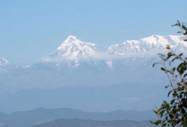
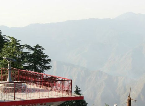
Snow View Point: Standing at a dizzying altitude of 2270 meters above sea level, Snow View Point offers a panoramic view of the mighty Himalayas draped in a blanket of snow. One can see a picturesque view of all three important peaks, namely Nanda Devi, Trishul and Nanda Kot peaks together from this point. A huge pair of binoculars has been installed here that allows visitors to take a closer look at the Himalayan range and its peaks. Looking closer, one can find a small temple housing the images of Ram, Sita, Laxman, Hanuman with Durga and Shiva. An aerial cable car connects visitors to Snow View Point directly from the Mall Road of Mallital and offers a spectacular view of the beautiful town. The view point is open from 10:30 am to 5 pm on all days except Saturdays when it is closed.

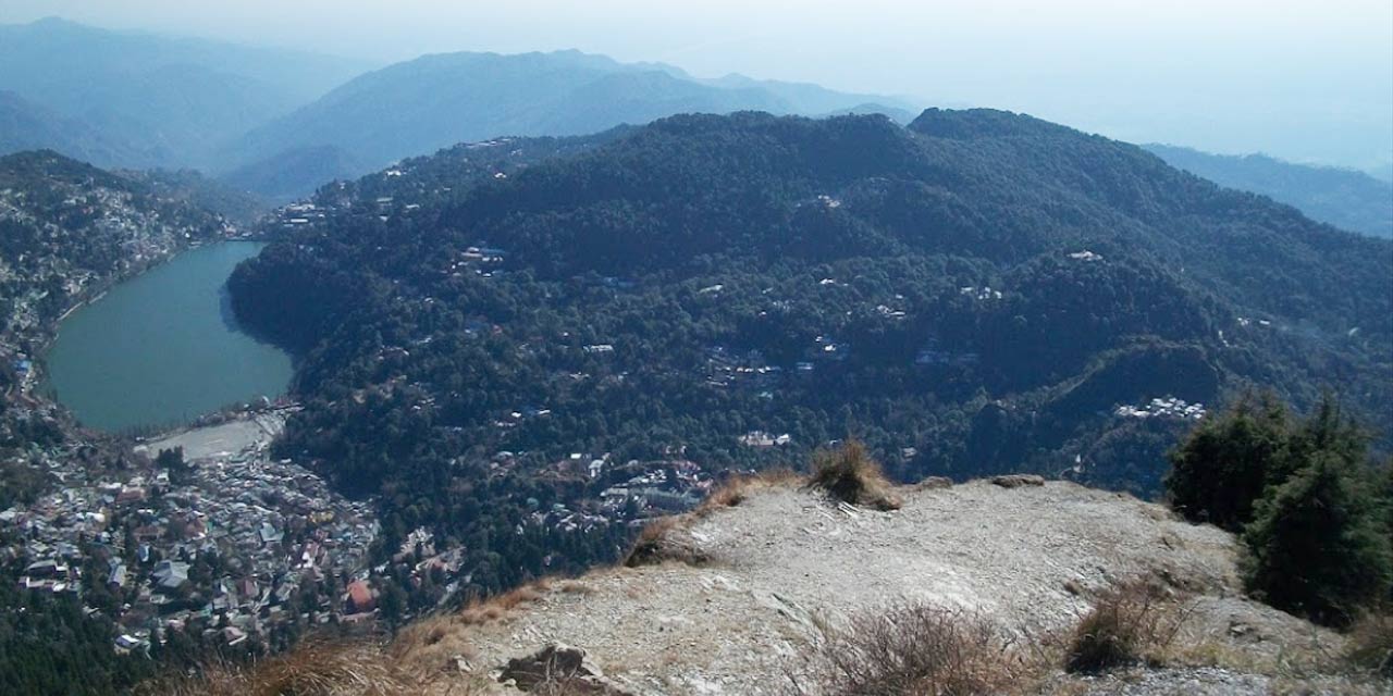
Naina Peak: The highest peak of Nainital at a height of 2615 metres, Naina Peak remains covered with snow throughout the year along with a blanket of trees over it. Due to the high altitude and scenic trails, the peak is very popular among hikers and trekkers. Also known as China Peak, it is renowned among tourists and locals for its romantic sunrise and sunset. Apart from trekking, people also reach the summit of the mountain with the help of a pony-ride. About 3 kilometres from the base of the peak is Tanke Band, which is the nearest taxi stand. One can indulge in a photography session of nature and snowclad mountain views during the day and the immensely beautiful cityline of Nainital at night. A trip to Nainital is incomplete without undertaking the 6 kilometres trek to the summit of Naina Peak from Mallital. The trek is an easy to moderate one passing through trees of deodar and cypress, pine forests and rhododendrons. At the beginning of the trek, one goes across the forest covered with blooming rhododendron trees and as the trek advances, one can see oak trees dark and laden with mosses, towering the sky. The trail upwards is steep and it can take an hour to reach the peak. There is a lodge where one can have tea and chat with the forest rangers and hear from them the stories of leopard sightings. It is best to watch the sunset and return downwards before it gets dark to avoid any mishaps. The trek downwards takes about half the amount of time one takes to reach upwards. From the summit, one can look at the elevated view of the tranquil kidney-shaped Naini Lake, the Nanda Devi peak and the mountains of Tibetan border.

Lands End: Set across the Khurpa Tal and the vast stretches of plains, Land’s End is literally the spot where the land ends and all you can see is steep cliffs surrounded by snow-dusted mountains. 4 km off the main town, Land’s End is frequented by adventure enthusiasts who trek to the scenic spot and relish the breathtaking view of mango-shaped Khurpataal Lake. The less-adventurous can take a pony, horse or taxi from the city. Do keep in mind that the view from Lands End depends on weather conditions.

Nainital Ropeway: The most popular attraction in Nainital, the Nainital Ropeway or Cable Car Ride is touted as one of the fastest ropeways in the country. The aerial ropeway connects Mallital to the Snow viewpoint, from the base to a height of 2270 metres. The aerial trip hovering over the Naini lake and the valley offer panoramic views of the breathtaking landscape. The stunning Nainital ropeway covers half a mile distance in about 3 minutes with 2 trolleys accommodating around 11 people in total at a time. The ropeway is open from 10 am to 4 pm and the entry fee for adults is INR 150 while children between the ages of 3 to 12 need to pay INR 100.

Khurpa Taal: At a distance of 12 kms from Nainital, Khurpa Taal is a pristine lake situated at an elevation of 5,500 feet. Laced with tall trees, the lake is considered ideal for fishing owing to its crystal clear waters and abundance of freshwater fish. Unexplored by tourists, the lake is a secret haven replete with bounteous nature and idyllic locales. Located on the Bajpur Road – Kaladgungi Road, Khurpa Taal is a great photography spot, especially during sunrise as the lake glistens like a diamond when the rays of the sun fall on it.

Astronomical Observatory: Perched on top of the Manora Peak in Beluwakhan, the Astronomical Observatory or Aryabhatta Research Institute of Observational Science or ARIES helps visitors see the stars, celestial bodies, the moon and other heavenly bodies with the help of high powered, imported telescopes. Visitors will need to make a prior appointment before visiting the place. Housing one of the most advanced telescopes in India, the Astronomical Observatory is an autonomous institute open of the public during working days and in the afternoons. For night viewing, three fours days are fixed during the full moon period, the permission for which has to be obtained. The observatory is open from 7 to 9 pm and there is no entry fee.

Source

Gurney House: The former abode of British hunter, conservationist, naturalist and author Jim Corbett is called Gurney House. A charming colonial cottage, located near Nainital Lake, the house has a tiny museum with the achievements and life story of Jim Corbett. A quaint little nursery is also housed in the premises with a variety of shrubberies and plants. The Gurney House was sold to Mr Sharda Prasad Varma in 194 by Jim Corbett’s sister. It is currently owned by Mr Varma’s grandaughter Nilanjana Dalmia. Even though the Gurney House is a private residence, tourists are welcome to visit by prior permission. The lovely owners also give a complimentary house tour to Corbett lovers. If visiting the house, it is open from 8 am to 5 pm, strictly by appointment.

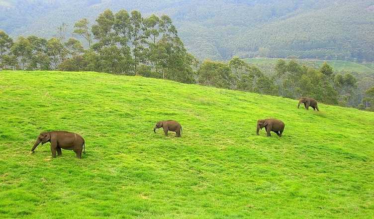
Sitabani and Sitabani Wildlife Reserve: Covered with a huge number of sal and oak trees, Sitabani is situated at the foothills of the Himalayan range and is a place of great historical significance housing splendid temples. The main attraction of this place is the myriad flora and fauna which makes the place a perfect weekend getaway to unwind. Don’t forget to visit the Sitabani temple dedicated to Goddess Sita which is where she gave birth to her twin sons, Luv and Kush. Near the Sitabani temple is the Valmiki Temple believed to be the place where the earth absorbed Goddess Sita. The temples are usually open from 6 to 8 am and then again from 1 to 3 pm daily. The Sitabani Wildlife Reserve is abundant in flora and fauna and is spread prolifically. The place is surrounded by lush green trees with the melodious chirpings of many colourful birds echoing through the forest. Animals that can be spotted lazing around in the reserve include elephants, jackals, sambhars, spotted deer, nilgai and wild boars. The various birds inhabiting the reserve are the emerald dove, white bush chant, red wattle lapwing and kingfisher. There is also a a safari ride to explore the wildlife sanctuary to the fullest and witness the beauty of as many birds and animals as possible. There is no entry fee to the reserve and it is open all days between 7 am to 6 pm.

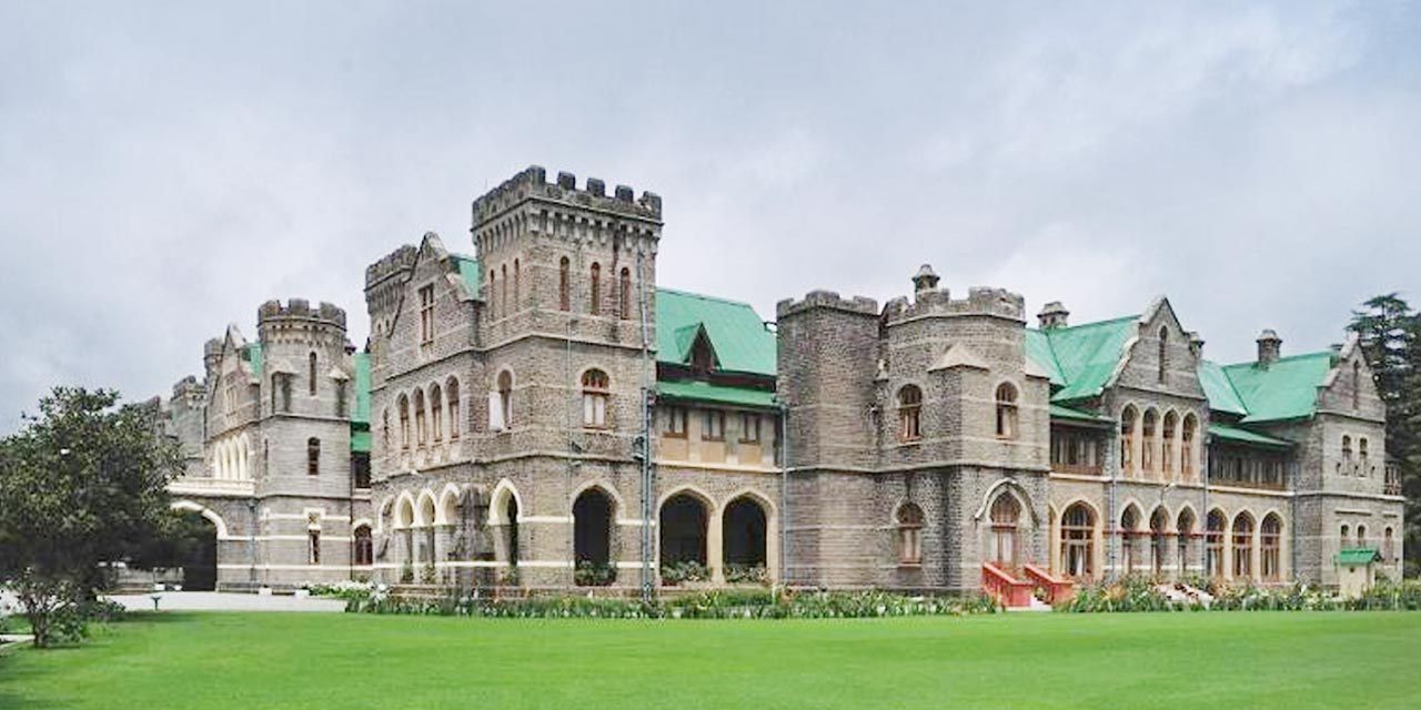
Raj Bhawan: The Governor’s House is a Victorian Gothic edifice resembling closely the Castle of Scotland and consists of two stories of buildings with 113 rooms, a garden, a swimming pool and a golf course. The second Raj Bhawan in Uttarakhand, it was built in 1899 by F.W. Steven as the summer residence of the Governor of North East Province. The Governor’s House now serves as the residence of the Governor of Uttarakhand. A guided tour is available to explore the Raj Bhawan, however, all rooms are not accessible to the public since the Governor still resides here. The Raj Bhawan is open from 8 am to 5 pm during the months of March, April, September and October and from 9 am to 4 pm during November and December. It is closed on Sundays and public holidays. Entrace fee is INR 50 per person and access to the golf course will set you back by INR 450 per person.

Our next destination is Sattal which lies just 23 km east of Nainital.

Travel Bucket List: India – Utarakhand Part 2

Located in the foothills of the Garhwal Himalayan range and popularly known as the Queen of the Hills, Mussoorie is a hill station and with the adjoining town of Landour, which includes a military cantonment, as well as Barlowganj and Jharipani are all considered part of greater Mussoorie. The town sits at an average altitude of 2,005 meters and has the Himalayan snow ranges to its north and the the Doon valley and the Shiwalik ranges to its south.

The name Mussoorie is often attributed to a derivation of mansur, a shrub which is indigenous to the area and the town is often referred to as Mansuri by locals. In 1803 the Gorkhas under Umer Singh Thapa conquered the Garhwal and the Dehra, during which time Mussoorie was established. On 1 November 1814, a war broke out between the Gorkhas and the British and Dehradun and Mussoorie were evacuated by the Gorkhas by the year 1815 and were annexed to the district of Saharanpur by 1819.

Mussoorie as a resort was established in 1825 by Captain Young, a British military officer. With Mr Shore, the resident Superintendent of Revenues at Dehradun, he explored the present site and jointly constructed a shooting lodge and also raised the first Gurkha Regiment and planted the first potatoes in the valley. Though there are no memorials to commemorate Young in Mussoorie, there is a Young Road in Dehradun. In 1832, Mussoorie was the intended terminus of the Great Trigonometric Survey of India that began at the southern tip of the country. Although unsuccessful, the Surveyor General of India at the time, George Everest, wanted the new office of the Survey of India to be based in Mussoorie; however, a compromise location was Dehradun, where it remains. The same year the first beer brewery at Mussoorie was established by Sir Henry Bohle as The Old Brewery and the brewery opened and closed twice before it was re-established by Sir John Mackinnon as Mackinnon & Co. in 1850. By 1901 Mussoorie’s population had grown, rising in the summer. Accessibility became easier in 1900 with the railway coming to Dehradun, thus shortening the road trip from Saharanpur. The Nehru family, were frequent visitors to Mussoorie in the 1920s, 1930s and 1940s, and stayed at the Savoy Hotel. On 20 April 1959 during the 1959 Tibetan Rebellion the 14th Dalai Lama took up residence at Mussoorie, until April 1960 when he relocated to Dharamsala in Himachal Pradesh, where the Central Tibetan Administration is today headquartered. The first Tibetan school was established in Mussoorie in 1960 and today about 5000 Tibetans live there, mainly in Happy Valley.

Camel’s Back Road: Incorporating a nature walk, Camel’s Back Road is a road, which takes its name from a rocky outcrop in the shape of a camel’s hump overlooking the Doon Valley and contains hotels, motels, and a cemetery with the oldest Christian church in the Himalayas, St Mary’s, above the Mall Road. This road offers stunning views of the Himalayas and is a popular place for viewing the sunrise and the sunset. Taking a long walk along this road or coming here for an early morning jog is the best way to explore what this beautiful road has to offer. You can also see a 180-year-old British cemetery, the first of its kind in Mussoorie, en route the Camel’s Back Road.

Gun Hill: The second highest point in Mussoorie, Gun Hill is at an altitude of 2,024 m and is accessed by cable car from the Mall road. At Gun Hill is a cannon previously used to sound midday. Said to be an extinct volcano, the view from Gun Hill is a panoramic view of the snow-clad Himalayan ranges right beside the widespread Doon Valley and a full view of Mussoorie. During the British colonial period freedom fighters brought a canon to the top of the hill and fired at the British. After this, the hill which is now part of Woodlawn Cemetery, started to be known as Gun Hill. The road that leads to the hill, previously known as Kingsbridge Road, is now called Gun Hill Road. Another story associated with Gun Hill says that the British brought up a large canon on the hill in 1857 during the Sepoy Mutiny, and the canon was shot every day at noon to set the time. Even though the gun was removed in the 70s, the name stuck. Gun Hill’s highlight of Gun Hill is the ropeway which provides a scenic view of the Himalayan ranges. The ropeway cable car round trip costs INR 75 per head and undoubtedly offers a picturesque view during the climb of the distant hills and green landscapes. The ropeway is open from 10 am to 6 pm daily and during the peak period months of May to July and October, it is open from 8 am to 10 pm and during the months of August, September and from late November to April, it is open from 10 am to 7 pm.

Kempty Falls: Located on the way between Dehradun-Mussoorie roads, in the Ram Gaon area of Tehri Garhwal, Kempty Falls is accessed by track from Kempty Fall Road. Surrounded by high mountain cliffs, Kempty Falls is nestled at an altitude of around 4500 ft above the sea level. The pond formed at the bottom of the falls makes an excellent spot for swimming and bathing. The name of Kempty Falls is taken from the terms camp and tea implying the elaborate tea parties that were once organized here in evenings eventually leading to a localized name Kempty. It was developed as a picnic destination by John Mekinan owing to its captivating surroundings and scenic beauty. Offering a stunning view of water stream cascading down from a great height, it divides into two main falls. The perennial Kempty waterfall is crowded almost throughout the year. One of the best ways to explore the terrain of Kempty Falls is by the means of its ropeway. Precarious and thrilling at the same time, the ropeway takes you over lush green mountains and even overlooks waterbodies and has a cost of INR 80 per person. You can also enjoy boating in the nearby man-made pond and climb from the first main Kempty Falls to the second. The first waterfall is located 5-10 minutes walk from the main road. The second falls has to be reached by walking further inside. The falls are open from 8 am to 5 pm and does not have any entry fees.

Lake Mist: About 5 km before the Kempty Falls is Lake Mist, through which flows the Kempty river with its numerous small waterfalls. The pristine Lake Mist is one of the most beautiful places in Mussoorie with its emerald waters that are covered by green forest terrains from the sides. The lake is not as crowded as Kempty Falls, so it becomes easier to enjoy it. The lake is open from 8 amto 6:30 pm.

Bhatta Falls: Located in the village of Bhatta, the Bhatta Falls in Mussoorie is a popular tourist attraction. Reaching the exact spot of the waterfall requires a little hike of 500 metres. This natural waterfall cascades down from an altitude it 30 feet into a circular pool where people enjoy swimming and bathing. There is a children’s park there as well with slopes and swings provided for them to play. The place has some small eateries as well. The falls are open from 8 am to 5 pm

Jharipani Fall: Located 6 km downhill of Mussoorie in the Jharipani village, the Jharipani Falls is a small waterfall which gushes with water just after the monsoons and remains like a thin strip of flowing water during other time of the year. The highlight of Jharipani Falls is the 1.5 km trek to reach the base. On clear days, there is a mesmerising view of the nearby peaks and the amazing valley, especially when the sky is painted a rosy red during the sunset.

Mossy Fall: Cosily tucked amidst the tantalizing mountains and the exuberant woods, Mossy Fall is surrounded by a dense forest and is accessed via Barlowganj or Balahisar. The falls are a well-kept secret of Mussoorie and are named after the moss-laden rocks surrounding the gushing waterfalls. Literally veiled from view, with a cleft in the hillside, the charming Mossy Waterfalls can be reached with a little bushwhack following slightly rough terrain. The highlight is a Shivalinga hidden near the fall, which is drenched by the continously flowing water, creating a surreal site. The scenic Lake Mossy is a hotspot for trekkers as the trail offers moderate to difficult hikes for the tourists to choose from. In addition to that, it is the go-to place for the photography enthusiasts owing to its rich scenery and minimal human interactions. The falls are open from sunrise to sunset.

Happy Valley: Lying on the western side of Library Point and famous for some magnificent Tibetan monasteries, Happy Valley is more popularly known as Mini Tibet and is one of the most detailed and largest rendition of a typical Tibetan society and home to around 5000 Tibetan refugees. The valley boasts of gorgeous views in the 360 – degree panorama. The story goes that back in 1959, the 14th Dalai Lama escaped from his home in Lhasa, Tibet and was given refuge in Mussoorie by the then Prime Minister of India, Pandit Jawaharlal Nehru. The Dalai Lama stayed in the valley for about a year before he moved to Dharamshala. During this period, a Tibetan school and a beautiful Buddhist temple was established and the valley started flourishing with the Tibetan culture and eventually came to be known as the Happy Valley, owing to its vibrancy, zeal and exuberance. When the Dalai Lama moved to Dharamshala, a large part of the population stayed back and made this valley their permanent home. The Tibetan culture continued to thrive with more temples and monasteries built and in no time the valley came to give the look and feel of a Mini Tibet as it is colloquially called. The Dalai Lama was honoured with the Nobel Peace Prize for which he delivered his acceptance speech on December 10t 1989 and since then the entire valley gets together every year to celebrate the event. Its recommended that visitors time their visit at this time to be a part of the celebrations. The places in the valley are open from 10 am to 6 pm.

Nag Devta Temple: The ancient Nag Devta Temple on Cart Mackenzie road is dedicated to Snake God Lord Shiva, about 6 km from Mussoorie on the road to Dehradun. There is vehicular access to the temple, which provides a view of Mussoorie and the Doon Valley.

Jwalaji Temple on Benog Hill: At an altitude of 2,240 m the Jwalaji Temple is 9 km west from Mussoorie, and cannot be accessed by vehicle although a motor road goes most of the way from Mussoorie. To get to the temple one has to trek for about 2 kilometers uphill to reach the temple. The path starts from Cloud’s End and passes through thick vegetation of line and deodar trees. The trek offers some panoramic views of the Shivalik ranges, Doon Valley as well as Yamuna River. Atop Benog Hill, it contains an idol of the Goddess Durga and has a view of the valley of the Aglar River. Also known as the Jwala Devi Temple, it is believed that anyone who visits this temple is resurrected from the sufferings of life and is bestowed with sacredness. Apart from pilgrims, nature lovers also visit the place to admire the thick green forest around the temple as well as the Yamuna River and Shivalik range. The temple is open from 5 to 12 noon and then again between 4 to 8 pm.

Mussoorie Christ Church: Situated on little hill-lock slightly above the Kasmanda Palace, the Mussoorie Christ Church boasts of being the very first Catholic church in all of the Himalayan region. Built in 1836, the exquisite church is an exemplary example of Gothic architecture which evolved from Romanesque architecture. The prominent style being followed, the church exhibits the pointed arches, ribbed vaults and flying buttresses ideal to the gothic style. Furnished with gorgeous pre-Raphaelite glass windows, this fetching piece of art was a gift to India from the British. The tinted glass window panes tell the tale of life events of Jesus Christ. The high altar is adorned with caricatures about the life and times of Christ from his birth to his sufferings and certification with beautifully done interior walls and a striking century-old William Hill organ. The courtyard of the church still holds the deodar tree planted by the Princess of Wales in 1906 and offers enticing views of the Doon valley on the side. The church is open from 7 am to 6:30 pm, Mondays to Saturdays and from 8 am to 6:30 pm on Sundays.

Tibetan Buddhist Temple: Nestled amidst the hustle bustle of Happy Valley is the Shedup Choepelling Temple. The huge idol of Buddha on top of the temple gives a unique charm to the tiny Buddhist temple. Located on the highest cliff of the valley, the Shedup Choepelling Temple is adorned with murals, prayer wheels and meditation chambers. Situated in between the snow-capped mountains, the temple is colloquially known as Tibetan Buddhist Temple and the first Tibetan shrine to be built in India and consecrated by the Dalai Lama. Besides the numerous idols and statues of Lord Buddha, seated in the main hall of the temple are two huge life-like idols of Buddha and the Dalai Lama, as a mark of respect to both. The vibrantly painted walls, tiny clay lamps and prayer flags add to the appeal of the place. The temple also has a rich collection of books on Buddhism and Tibetan literature and offers lovely mesmerising views of the valley, blooming flowers and snow-clad mountains. The temple is open from 7 am to 5 pm.

Cloud’s End: Surrounded by a thich deodar forest, Cloud End is a bungalow, built-in 1838 by a British major and was one of the first four buildings in Mussoorie which has been converted to a hotel today. The Cloud’s End viewpoint marks the geographical end of Mussoorie and is surrounded by thick oak and deodar forests. It tracks 2 km up to the Benog Wildlife Sanctuary offering a lovely walking track, taking in the soothing mountain air and a breathtaking view of the Aglar River Valley. Another major attraction at Cloud’s End is a heritage building set up by a Britisher in 1838, which is one of the oldest buildings in Mussoorie. Retaining the original architecture and other relics, it has now been converted into a heritage hotel, the Clouds End Forest Resort. Tourists spend some tranquil time during their stay, along with partaking in activities like hiking, hill climbing and nature walks arranged by the hotel on request. People often club the visit to Cloud’s End with the famous attractions nearby, the Jwala Devi Temple and Benong Wildlife Sanctuary.

Lal Tibba: Also called Depot Hill because of its former use as a military depot, Lal Tibba, also is the highest point in Mussoorie, with views over the town and its surroundings. A Japanese telescope, with breathtaking views of Himalayan ranges including Badrinath, Kedarnath, Banderpunch, was installed at Lal Tibba in 1967. A popular viewpoint, Lal Tibba is approximately 6 kilometres from Mussoorie and rises to a height of 2,275 meters and is a popular sunrise and sunset point. The Lal Tibba region has long been occupied, serving as a summer getaway during the British-Raj and a recovering station for the military, hence gaining popularity as a cantonment cum hill station. It is now occupied by the Indian Military Services. The main thing at Lal Tibba would be the undisturbed sight of the Himalayan ranges and a snowy white line of ranges can be easily viewed from near Char Dukan, a famous sightseeing café in Landour. There are few spectacular hikes you can undertake in the region, some of which include Pepperpot Mountain and Deo Tibba, a short hike from Tehri road. Lal Tibba is open from sunrise to sunset, so between 6 am to 6 pm and has an entry fee of INR 50 per person.

Van Chetna Kendra: A 339 hectare sanctuary, about 11 km from Mussoori, the Van Chetna Kendra was established in 1993. It is significant for the extinct bird species Mountain Quail or Pahari Bater, which was last spotted here in 1876.

Benog Wildlife Sanctuary: The sanctuary, about 6.3 km from Mussoori and open to the public, provides a woodland habitat for indigenous birds, and animals. A part of the Rajaji National Park, the Benog Wildlife Sanctuary is famous for its almost-extinct mountain quails, deer, leopards and red-billed blue magpie. The wildlife sanctuary is well known to house rare species of birds and offers an excellent trail of pine-clad slopes surrounded by Himalayan peaks for a refreshing walk. It is an ideal site for bird watching and capturing gorgeous views of the surrounding Chaukhamba and Bandarpunch Peaks. Apart from housing the fir and pine trees, the Benog Wildlife Sanctuary also hides some medicinal plants. Also known as Vinog Mountain Quail Sanctuary, it is spread across 339 hectares. The abundant wildlife paired with stunning views of the enveloping scenic vistas makes Benog Wildlife Sanctuary a must visit, especially for the nature lovers and adventure enthusiasts. Open all days of the week, the sanctuary is open from 7 am to 5 pm.

Jabarkhet Wildlife Reserve: The first privately owned and operated wildlife sanctuary in Uttarakhand, the Jabarkhet Nature Reserve is located on the Mussoorie- Dhanaulti road, around 15 kms from the heart of the city and spread over 100 acres of land. At an elevation of approximately 2000 metres above the sea level, Jabarkhet Nature Reserve is set around different altitudinal zones with an extensive variety of rare plants, insects, reptiles, animals, trees, birds and mammals. The wildlife reserve is a hidden gem and an ideal getaway in the bliss of nature. The park houses eight well-demarcated trails for a walk amidst stunning natural serenity. Guided tours are available for birdwatching and wildlife spotting. If you are seeking yet more adventure, you are free to venture off on your own with the help of tour maps which are colour coded and super easy to follow. Open from sunrise to sunset, a non-guided walk costs INR 350 while a guided walk which includes a guide, binoculars, umbrellas and leech socks costs INR 500. The reserve also organises special walks every month, with expert historians, naturalists and photographers. If you are interested, get in touch with them to get on their mailing list. Charges for this vary from INR 600 to INR 1000 depending on the duration of the walk, guide and area covered. They can also organise customised walks for you depending on the difficulty level of treks and the like. The charges for this vary between INR 1200 for day hikes to INR 3000 for overnight hikes. It is recommended to book your hikes well in advance, online or in person.

Mussoorie Lake: Located at a distance of 6 kms on the Mussoorie – Dehradun highway, the Mussoorie Lake is an artificial lake developed and maintained by the City Board and the Mussoorie Dehradun Development Authority. Surrounded by a mesmerising natural charm and some surreal views of the charming Doon Valley, this lake offers a rejuvenating retreat in nature’s lap. It’s a newly developed picnic spot originating from a natural waterfall and other than the umpteen outdoor activities available at the site, paddle boating is the most popular one. For a nominal fee, you can paddle your way across the lake to enjoy scenic views of the valley and a serene boating experience. The lake is open from 8 am to 7 pm and there is an entry fee of INR 15 per person.

Sir George Everest’s House: At Park Estate are the remains of the building and laboratory of Sir George Everest, the Surveyor-General of India from 1830 to 1843. It is after George Everest that the world’s highest peak Mt. Everest is named. A scenic walk from Library Bazar and 6 km from Gandhi Chowk, the place provides a view of Doon Valley on one side and a panoramic view of the Aglar River valley and the peaks of the Himalayan ranges on the other. Built in 1832, the house is also popularly known as Park House. Sir George Everest owned this house spent 11 years living here and using it as his observatory and laboratory. Although, very derelict and in a precarious state, the house still holds its walls and has a roof; and is likely to be converted into a museum soon. The interiors have been stripped of any belongings but the doors, fireplace and windows still remain in place. The walls have been covered in graffiti though it is whitewashed often. Today the house now comes under the jurisdiction of the Tourism Department. It is open from 10 am to 6 pm and there is no entrance fee to visit.

Company Garden: Located arund 3 km from Maill Road, the Company Garden is a popular tourist attraction nestled amidst the high Himalayas. Also known as Municipal Garden, it is maintained by the Garden Welfare Association of Mussoorie and was laid down by Dr H. Fackner in the early years of this millennium. The main attraction of the Company Garden is its vast variety of flora. The lush green carpeted lawn of the Company Gardens is covered with more than 800 types of flowering plants, and during the late spring till the end of monsoon, most of these flowers are in bloom – making the place look like the heaven’s garden. The lawn with a fountain in the middle offers a perfect place to have a little picnic with your friends and families. The heart of the garden is the gigantic China tree which offers a lovely shade during the days the sun shines real bright. The flower shrubs also work as brilliant background for photographs. There is a greenhouse nursery from where you can purchase smaller versions of the flowers you saw out in the garden in little tubs and pots to bring home. There is also an amusement park inside the Company Garden to keep tiny tots busy with safe and exciting rides. There is a man-made lake inside with an artificial waterfall where one can do paddle boating. It costs INR 75 per person for 15 minutes of boating. There is also a shop where you can get yourself photographed by a professional photographer in authentic and traditional Himachali dress. The telescopic view of the surrounding Himalayan mountains, which are otherwise far away and hidden in grey mist, costs INR 10 only. The garden is open between 9 am to 8 pm and has an entry fee of INR 18 per person.

Mussoorie Heritage Centre: Located at a distance of 3 kms from the main market, the Mussoorie Heritage Centre is a social enterprise showcasing the rich culture and heritage of the Mussoorie. Established in November 2013, the Mussoorie Heritage Centre basically displays the archives of the historical heritage of Mussoorie back from 1814 when the National Survey compiled the first map of the region; to 1959, when the 14th Dalai Lama took refuge here in Mussoorie. Started by the father-daughter duo of Vinod Kumar and Surbhi Agarwal, the heritage centre has the objective to preserve and showcase the rich cultural heritage of the town and its adjoining areas. In addition to the numerous exhibits, paintings, artefacts and historic evidence records, the Heritage Centre conducts regular research programmes, curated walks, city tours; to give an elaborate perception on what actual Mussoorie was before commercialisation took over. The Centre has two kinds of exhibitions – Exhibition 1 is the permanent display and representation of ancient pictures, factual paintings, murals and antiques, which define the look and feel of the cultural centre. With a general idea of the evolution of Mussoorie from 1814 to 1949, this exhibition targets to reinstitute the legacy of the hill town. Exhibition 2 is an annual affair with varying topics of interest every year, which runs for a year at a stretch. The topics covered include early modes of transport in the hilly terrain, commercialisation and growth of the tourism industry etc. The centre is open from 10 am to 6 pm daily and has no entry fee.

Soham Heritage Centre: Located on the Chamunda Peeth Temple Road, the Soham Heritage Centre is a private enterprise preserving the rich Himalayan heritage by showcasing the cultural diversity of the Himalayas through paintings, murals, scrap art, frescoes and artefacts. An admirable initiative by Mr Sameer Shukla and his wife Dr Kavita Shukla, the art centre is an effort to display the diversity of the Himalayas through varied art forms. Established in January 2014, the Soham Heritage & Art Centre is the result of around 18 years of tireless planning, inspiration, dedication and collecting of data. Through diverse art forms, paintings, sketches, the Soham Heritage centre aims to educate and inspire the localites and the tourist about the bounteous heritage. Mostly visited by media and architecture students, the centre also conducts occasional workshops and heritage walks to promote the same idea. The centre also has a tiny souvenir corner to help you pick quality antique products including jewellery, musical instruments, utensils, agricultural equipment among other things. The heritage centre is open from 10 am to 5 pm with an hour long lunch break from 2 to 3 pm. It is open on all days except Wednesdays and has an entry fee of INR 100 per person above 5 years of age.

Mall Road: With its architectural evidence of its colonial past, Mall Road contains shops, cafes, video game establishments, skating rinks, a nearby Tibetan market place, and a Methodist church. Located in the heart of Mussoorie, the Mall is a colonial relic with benches and lampposts and visitors can often find the author Ruskin Bond browsing the Cambridge Bookstore. Do try out a photograph in local traditional attire here. Mall Road is open daily between 9 am to 9 pm.

Library Bazaar: Snuggled amidst the eventful Mall Road of Mussoorie is the vibrant Library Bazaar, bustling with energy and vivacity and a stroll in the bazaar can take you back to the vintage times. Arranged along a small circular path, the market oozes with gusto and radiates a colonial feel. The tiny shops dotting the arena perfectly fit into the settlement and present a compressed pretty picture of the entire place. Other than finger-licking street food, local trinkets, handcrafted jewellery, you can find every bric-o-brac at the Library Bazaar. Dribbling with every possible gewgaw knick-knack, this market introduces you to the desi side of Mussoorie. The Library Bazaar gets its name from the 19th-century Victorian style library that was built in the vicinity. Another feature of the popular market is the Band Stand, where you can go to enjoy some good old colonial music. The market also houses a large statue of Mahatma Gandhi in one corner, hence it’s also popularly called as Gandhi Chawk. A haven for compulsive shoppers, the Library Bazaar has something for everyone. The bazaar is open from 10 am to 8 pm daily.

Lambi Dehar Mines: A couple of kilometres from Mussoorie, the Lambi Dehar Mines is an infamous yet popular tourist attraction. Also known as the Mine of Death, it is locally believed that the mines are haunted by a witch. The area in and around the mine is enveloped in lush greenery and surreal landscape but with an eerie and spooky silence. The mine was functional till the early 1990s, after which it was shut down due to the death of around 50000 people working here. While experts say that the death was caused due to inappropriate mining practices causing lung disorders and the eventual death of the people, locals believe that the accident was caused by some spirit who haunts the place still. There have also been reportings of sinister behaviour, blood curdling wails, strange accidents and paranormal activity near the mines, by locals. There have been several road accidents near the spot and a helicopter crash, which perpetuated the belief of witches and hauntings.

Moving on, our next destination is Dhanaulti, a town which is about 60 km east of Mussoori.

Located at a distance of 62 km from Mussoorie, this little town is an offbeat destination located at a height of about 2200 meters above sea level. A hill station from where the Doon Valley and snow-covered Garhwal Himalayas can be viewed, the town does not have much human presence. A popular attraction built in the 16th century, the Deogarh Fort has many beautiful palaces and has several murals. The place also has a number of Jain temples in and around the area. Another attraction, the Tehri Dam boasts of ultra scenic views of the hills in the backdrop and clear waters in the front. People usually come here to enjoy a day out or a picnic amidst beautiful setting. Originally known as Panchayatan temple, the Dashavatar Temple is located 10 kms away from Dhaulti in Deogarh. The temple dates back to the Gupta Empire and is enshrined by Lord Vishnu. Besides a wonderful architecture, the walls of the temple have beautifully carved panels. The walls also have inscriptions of the Vaishnava mythology. At a distance of about 8 km from Dhanaulti on the road towards Chamba, and a 2 km trek from the village of Kaddu Khal is the Surkanda Temple. While the climb is tough, it’s worth the view and serenity. This temple is based on the popular mythology of Sati jumping in to the sacrificial fire to go against her father Daksha’s act of not inviting Lord Shiva to a ceremony, this temple is one of the most popular Shaktipeeths in India. A Shaktipeeth, going by the literal translation, is a holy site with the female goddess residing for her followers. The temple is famous for its Ganga Dussehra fair in autumn and is part of the Devi Darshan triangle, which offers trekking opportunities around Dhanaulti which include Surkanda Devi, Chandrabadni and Kunjapuri.

Spread over an area of 13 hectares and covered in deodar and oak trees, the Eco Park at Dhanaulti is a very popular attraction. It was developed by the DFO and the citizens of Dhanaulti to create employment opportunities for the poor as a measure to reduce poverty, the Eco Park is located at the height of 7800 m and enjoys a pleasant weather throughout the year. The park is very well-maintained and is an amazing place for the kids to hang out with a separate playground for them. A tradition known as memory sapling plantation is followed in the park as a part of which one can plant a sapling in memory of their loved ones. The Eco Park is divided into two forests namely Amber and Dhara which are situated at a distance of 200m from each other. One gets a superb view of the Himalayas from this point with the best time to visit the park during sunrise and sunset. The best time to pay a visit to the park is between September and June. The temperature here remains pleasant throughout the year, but monsoons and winters should be avoided. Summers are a perfect time to unwind with the maximum temperature being 31 degrees celcius. The park is open from 9 am to 5 pm and entry fee is INR 15 for an adult and INR 10 for a child. Pretty much every adventure activity you can think of including sky walking, sky bridge, valley crossing, zip swinging, zip lining, trekking, rock climbing, rappelling, paragliding, cave exploration and so much more is available at the Dhanaulti Adventure Park. Located amidst towering hill, snow capped mountains and a magnificent view, it has a perfect mix of leisure and adventure. Another adventure camp, approximately 14 km away from the main market, the Thangdhar Camp is situated at a height of about 8300 feet and surrounded by pine and deodar trees. The camp organises activities like rock climbing, snow camping, trekking or mountain biking as well as sightseeing tours to the nearby Jain temples, which are the structural marvels of a bygone era, intricately carved with the Jain deities. The temples are located in the Kanali Fort, overlooking the Betwa river, and make up for a well deserved break in the journey. The Burma Bridge is a popular camp spot for a perfect campfire experience and the glaciers of Bandarpoonch and Gangotri can be seen far away.

After Dhanaulti, we travel about 325 km east to the town of Auli.

Travel Bucket List: India – Utarakhand Part 1

Formerly known as Uttaranchal, Uttarakhand is often referred to as the Devabhumi or the land of the Gods due to numerous Hindu temples and pilgrimage centres found throughout the state. was formed on the 9th November 2000 as the 27th State of India, when it was carved out of northern Uttar Pradesh, Uttarakhand is located at the foothills of the Himalayan mountain ranges and is known for the natural environment of the Himalayas, the Bhabar and the Terai regions. The state borders the Tibet Autonomous Region of China to the north; the Sudurpashchim Pradesh of Nepal to the east; the Indian states of Uttar Pradesh to the south and Himachal Pradesh to the west and north-west. The winter capital of Uttarakhand is Dehradun, the largest city of the state while Gairsain, a town in the Chamoli district is the summer capital.

Uttarakhand is rich in natural resources especially water and forests with many glaciers, rivers, dense forests and snow-clad mountain peaks. The Char-dhams, the four most sacred and revered Hindu temples of Badrinath, Kedarnath, Gangotri and Yamunotri are nestled in the mighty mountains. The state capital of Dheradun lies in the Dun Valley, on the watershed of the Ganga and Yamuna rivers. The state is blessed with a rare bio-diversity, and has 175 rare species of aromatic & medicinal plants found in the state. The state is unique in that it has almost all major climatic zones and is rich in mineral deposits.

Uttarakhand’s name is derived from the Sanskrit words Uttara meaning north, and khaṇḍa meaning land, altogether simply meaning ‘Northern Land’. The name finds mention in early Hindu scriptures as the combined region of Kedarkhand in present day Garhwal and Manaskhand in present day Kumaon. Uttarakhand was also the ancient Puranic term for the central stretch of the Indian Himalayas. However, the region was given the name Uttaranchal by the union government and Uttarakhand state government when they started a new round of state reorganisation in 1998. Chosen for its allegedly less separatist connotations, the name change generated enormous controversy among many activists for a separate state who saw it as a political act. The name Uttarakhand remained popular in the region, even while Uttaranchal was promulgated through official usage. In August 2006, after assenting to demands, the state name was formally changed to Uttarakhand.

Archaeological evidence supports the existence of humans in the region since prehistoric times. The region formed a part of the Uttarakuru Kingdom during the Vedic age of ancient India. Among the first major dynasties of Kumaon were the Kunindas in the 2nd century BCE who practised an early form of Shaivism. Ashokan edicts at Kalsi show the early presence of Buddhism in this region. During the medieval period, the region was consolidated under the Katyuri rulers of Kumaon also known as the Kurmanchal Kingdom. After the fall of the Katyuris, the region was divided into the Kumaon Kingdom and the Garhwal Kingdom. In 1816, most of modern Uttarakhand was ceded to the British as part of the Treaty of Sugauli. Although the erstwhile hill kingdoms of Garhwal and Kumaon were traditional rivals, the proximity of different neighbouring ethnic groups and the inseparable and complementary nature of their geography, economy, culture, language, and traditions created strong bonds between the two regions, which further strengthened during the Uttarakhand movement for statehood in the 1990s.

Ancient rock paintings, rock shelters, paleolithic stone tools which are hundreds of thousands of years old, and megaliths provide evidence that the mountains of the region have been inhabited since prehistoric times. There are also archaeological remains that show the existence of early Vedic practices from around 1,500 BCE in the area. The Pauravas, Khasas, Kiratas, Nandas, Mauryas, Kushanas, Kunindas, Guptas, Karkotas, Palas, Gurjara-Pratiharas, Katyuris, Raikas, Chands, Parmars or Panwars, Mallas, Shahs and the British have ruled Uttarakhand in turns. It is believed that the sage Vyasa scripted the Hindu epic Mahabharata in the state.

Among the first major dynasties of Garhwal and Kumaon were the Kunindas in the 2nd century BCE who practised an early form of Shaivism and traded salt with Western Tibet. It is evident from the Ashokan edict at Kalsi in Western Garhwal that Buddhism made inroads in this region. Shamanic Hindu practices deviating from Hindu orthodoxy also persisted here. However, Garhwal and Kumaon were restored to nominal Vedic Hindu rule due to the travels of Shankaracharya and the arrival of migrants from the plains. Between the 4th and 14th centuries, the Katyuri dynasty dominated lands of varying extent from the Katyur valley in modern-day Baijnath in Kumaon. The historically significant temples at Jageshwar are believed to have been built by the Katyuris and later remodelled by the Chands. Other peoples of the Tibeto-Burman group known as Kirata are thought to have settled in the northern highlands as well as in pockets throughout the region, and are believed to be ancestors of the modern day Bhotiya, Raji, Jad, and Banrawat people.

By the medieval period, the region was consolidated under the Garhwal Kingdom in the west and the Kumaon Kingdom in the east. During this period, learning and new forms of painting like the Pahari school of art was developed. Modern-day Garhwal was likewise unified under the rule of Parmars who, along with many Brahmins and Rajputs, also arrived from the plains. In 1791, the expanding Gorkha Empire of Nepal overran Almora, the seat of the Kumaon Kingdom, who annexed it to the Kingdom of Nepal and in 1803, the Garhwal Kingdom also fell to the Gurkhas. After the Anglo-Nepalese War, this region was ceded to the British as part of the Treaty of Sugauli and the erstwhile Kumaon Kingdom along with the eastern region of Garhwal Kingdom was merged with the Ceded and Conquered Provinces. In 1816, the Garhwal Kingdom was re-established from a smaller region in Tehri as a princely state.

After India’s independence, the Garhwal Kingdom was merged into the state of Uttar Pradesh, where Uttarakhand composed the Garhwal and Kumaon Divisions. Until 1998, Uttarakhand was the name most commonly used to refer to the region, as various political groups, began agitating for separate statehood and on 9 November 2000, Uttarakhand became the 27th state of the Republic of India.

86% of Uttarakhand is mountainous and 65% is covered by forest. Most of the northern part of the state is covered by high Himalayan peaks and glaciers. Two of the most important rivers in Hinduism originate in the glaciers of Uttarakhand, the Ganges at Gangotri and the Yamuna at Yamunotri and are fed by myriad lakes, glacial melts and streams. These two along with Badrinath and Kedarnath form the Chota Char Dham, a holy pilgrimage for the Hindus.

The state hosts the Bengal tiger in Jim Corbett National Park, the oldest national park of the Indian subcontinent. The Nanda Devi and Valley of Flowers National Parks, a UNESCO World Heritage Site located in the upper expanses of Bhyundar Ganga near Joshimath in Gharwal region, is known for the variety and rarity of its flowers and plants. The Himalayan ecosystem provides habitat for many animals, including bharal, snow leopards, leopards and tigers, plants, and rare herbs.

As I usually do, let’s start with the state capital of Dehradun.

Dehradun is the winter capital and the most populous city of Uttarakhand. Part of the Garhwal region, Dehradun is located in the Doon Valley on the foothills of the Himalayas nestled between the river Ganges on the east and the river Yamuna on the west. The city is noted for its picturesque landscape and slightly milder climate and provides a gateway to the surrounding region such as Mussoorie and Dhanaulti as well as summer and winter trekking destinations like Dodital and Dayara Bugyal for camping and grandeur Himalayan panoromic views. The Hindu holy cities of Haridwar and Rishikesh along with the Himalayan pilgrimage circuit of the Char Dham which include Yamunotri, Gangotri, Kedarnath and Badrinath.

During the days of British Raj, the official name of the town was Dehra. Dehradun is made up of two words Dehra and Dun. Dehra is derived from the word dera, meaning camp, and Dun or Doon in Garhwali language refers to a valley that lies between the middle Himalayas and the Shivaliks. The town was established when Baba Ram Rai, the son of the seventh Sikh Guru, Guru Har Rai settled his Dera or camp in the area in 1675 whichh is when the modern city of Dehradun started to develop. In the Skanda Purana, Dun is mentioned as a part of the region called Kedarkhand, the abode of Shiva. According to Hindu mythology, in ancient India during the Mahabharata era, Dronacharya the great teacher of Kauravas and Pandavas, lived here hence the city is also known as Dronanagari or thecity of Drona.

It is believed that after the battle between Ravana and Lord Rama, Lord Rama and his brother Lakshmana visited this site. Ancient temples and idols have been found in the areas surrounding Dehradun which have been linked to the Ramayana and Mahabharata and these relics and ruins are believed to be around 2000 years old. Rishikesh is mentioned when Lord Vishnu answered the prayers of the saints, slaughtered the demons and handed the land to the saints. In the seventh century, this area was known as Sudhanagara and was described by the Chinese traveller Huen Tsang and later came to be known as Kalsi.

Dehradun was invaded by Mahmud of Ghazni during his campaigns into India followed by Timur in 1368, Rohilla chief Najib ad-Dawlah in 1757 and Ghulam Qadir in 1785. In 1806, the Nepalese King Prithvi Narayan Shah united many of the Indian territories that now fell under places such as Almora, Pathankot, Kumaon, Garhwal, Sirmur, Shimla, Kangra and Dehradun. On the western front Garhwal and parts of Himachal Pradesh up to Punjab and on the eastern front the state of Sikkim up to Darjeeling became parts of Nepal for a brief period until the British East India Company went on the war from 1814 to 1816. The war ended with the signing of the Treaty of Sugowli where almost a third was ceded to British East India company. The British got Dehradun in 1816 and colonised Landour and Mussoorie in 1827–1828. Post-independence Dehradun and other parts of Garhwal and Kumaon were merged with United Provinces which was later renamed the state of Uttar Pradesh. In 2000, the state of Uttarakhand was created from the northwestern districts of Uttar Pradesh under the Uttar Pradesh Reorganisation Act 2000 and Dehradun was made its interim capital.

Sahastradhara: Literally meaning a thousand-fold spring, Sahastradhara is a popular attraction, famous for its medicinal & therapeutic value as its water contains sulphur. Sahastradhara is located about 14 km from the city, near Robber’s Cave. Also known as Sulphur Springs, this waterfall cascades through limestone stalactites from a height og around 9 meters, making the water rich in sulphur. A dip in the Sulphur-rich water here feels cold and refreshing but is believed to have remarkable medicinal advantages. The temperature of the water here is a little lower than its surroundings and its picturesque beauty attracts a lot of travellers. One can even enjoy a stunning view of the mountains on a fun ropeway ride. The falls are open from 8 am to 7 pm daily.

Robber’s Cave: Locally known as Gucchu Pani, Robber’s Cave is a river cave formed in the Himalayas, about 8 kilometres from Dehradun. This river cave is believed to be an abode of Lord Shiva and is very close to Sahasradhara and is speciality is that river water flows out from the middle of the cave. The cave is a narrow gorge formed between a conglomerate limestone formation. It creates a feeling similar to being in a scene from a mystery movie, surrounded by dark limestone as streams gush in, echoing inside the cave. With cold water underground springs, the cave cools down during the scorching-hot summer-afternoon and is a perfect picnic spot amidst the natural beauty of Uttarakhand. It is said that the cave got its name from the British after they found out that robbers kept stolen items in the cave. While the cave has elegant natural interiors, the most exquisite feature of Robber’s Cave is its 10 m high waterfall. The water in the cave appears and then, all of a sudden, vanishes underground. The water appears again on the surface a few yards away. You may also visit the Tibetan Buddhist Temple, the Takpeshwar Temple, the Ramakrishna Ashram Temple and the Dehradun Zoo; each being 2 to 4 kilometres away from Robber’s Cave.

Maldevta: located in Shripur, Maldevta offers one of the vistas of nature’s perfection, with the great Himalayas in the backdrop, the pristine Song rRiver gurgling through thick shrubberies and little birds hopping and chirping about the area. Visitors are many during the summer months, as people often come to take a chilling and refreshing dip in the river. You can indulge in a little adventure and trek through the thick wilderness and stroll around and observe birds on the go. A temple sits, most solemnly on the lap of nature, adding to the beauty. Maldevta is also famous among campers, but as the place is thickly populated with flora and fauna, campers are advised to come in groups, as wild animals tend to come out of their hideout after sunset. Maldevta is open from 10 am to 6 pm and the best time to visit is during summer, between April to July, though it is open all year round.

Lacchiwalla: Located in the forest area of Rajaji, Lacchiwalla is famous for its greenery, picturesque cottages and hotels. The brook serves as a natural water park where people can get engaged in all sorts of water activities such as swimming, boating, etc. However, one must remember to carry one’s swimming equipment as the authorities do not provide anything as such. The place is especially popular among families to hang out on weekends. It also has a garden with several monkeys menacingly hanging around and about the trees. It is open from 8 am to 5 pm in the summer and from 9 am to 5 pm in winter. Entrance fees are INR 20 for adults and INR 10 for children below the age of 12 while parking fees are INR 50 for four wheel vehicles.

Har Ki Dun: Nestled away from the hustle bustle of the city, Har Ki Dun, also known as the Valley of Gods is a beautiful cradle shaped valley with untouched panoramic beauty. Perched at an elevation of 3,566 mts above the sea level, this place is one of the remotest areas of Uttarakhand offering a plethora of trekking excursions. Here, you will find yourself surrounded by thick Pine forests and scintillating mountain peaks. This beautiful trail will take you to some of the most unexplored areas of the Garhwal Himalayan region where the simplicity and rustic lifestyle of the residents of hills is still untouched by the time. The beautifully carved houses along the way add to the charm of this trek. Visit this splendid place if peaceful nature and adventure is what you are looking for. The best time to visit is between March and June and then again between September and November. The trek will take approximately eight days.

Bali Pass: One of the least explored treks in the Indian Himalayan region that connects the Har Ki Dun Valley with Yamunotri, the Bali Pass Trek is a beautiful journey that one should try at least once in a lifetime. Bali Pass, which is set at an elevation of about 4,800 meters and located in the heights of Garhwal Himalayan region, is an exhilarating getaway where from you can capture the majestic trio of Kalanag at 6,387 meters, Bander Poonch 6,316 meters and Swargarohini group of peaks at a maximum elevation of 6,252 meters. The trail crosses the Govind National Park, which houses several colourful orchards and species of animals and birds, pens and clicks the trekker’s diary and lenses with enrapturing moments. The trail is best explored between May and June and between September and October and takes about ten days to cover. The entry fees for the trek is between INR 9,000 and INR 13,000.

Kalsi: A small village near Dehradun, Kalsi is known as the gateway to the Jaunsar-Bawar tribal region and is located between Dehradun and Chakrata hill station along the banks of the river Yamuna and is the confluence of the rivers, Yamuna and Tons. Inhabited by the people from the Khils, Bhutis and Mundar communities, Kalsi is surrounded by lush green oak and sal trees and a vast green valley, offering visitors an enchanting view of the Garhwal Himalayan ranges. Summertime is arguably the best period to visit Kalsi as the weather is much nicer and suitable for the outdoor activities with the morning hours being the best time for walking the trails. On the other hand, the periods of October to November and February to March is usually when you will see the migratory birds gather at Asan Barrage, sothere never really is a bad time to visit Kalsi. Where there, make sure, you visit the Ashokan Rock Edict which is a pear-shaped quartz rock onto which the fourteenth edict of King Ashoka is inscribed. The Pali language and the Brahmi script used in these edicts reflect upon the humane nature of Ashoka as a king and his concern for the welfare of his subjects. The names of five great Greek kings can be found engraved on the edict which conclusively dates it back to 253 BC. Dakpathar is an ideal picnic spot with many recreational water sports and activities including boating, canoeing, sailing, river rafting, water skiing, and even hovercrafts. Chakrata Hills is a hill station about 43 kms from Kalsi and offers visitors views of the towering Chakrata hills and ravishing waterfalls and also trek along the Chakrata Pass which winds along some of the waterfalls, including the very famous and beautiful Tiger Pass. If you are looking to soak in a bit of history along with the scenery, then the Timli Pass is worth visiting. This place is regarded to be historically significant as it is believed to have bore witness to the battle between the British army led by Major General Ochterlony and the Gorkhas.

Asan Barrage: Known for the many endangered migratory birds that flock here at various times of the year during their migrations, the Asan Barrage is a bird watcher’s paradise with its artificial lake attracting thousands of birds of varied species. Also known as the Dhaulipur Lake, the Assan Barrage was formed due to the confluence of two great rivers, the Assan and Yamuna rivers. Many exotic birds such as the red-crested pochards, coots, cormorants, wagtails, greater spotted eagles, osprey, marsh harriers, etc, can be seen in all their glory. A majority of bird species which migrate over the Himalayas during the winter season, stop over here on their journey towards the south of India. The lake and barrage is open during the daytime and has no entry fee.

Malsi Deer Park: Located at the base of the Shivalik range in Dehradun, the Malsi Deer Park, also known as the Malsi Zoo, is a zoological garden and heaven for nature lovers, with the beauty of the place highlighted by rich flora and fauna. It is a small zoological park with a picturesque location and vibrant wildlife, making it an amazing place for photographers. Though the park is mainly famous for deer, visitors can also spot peacock, nilgais, rabbits, and tigers to name a few. Apart from the nilgais, the park is home to Himalayan antelopes and the park is a part of the Malsi Forest Reserve. The park is closed on Mondays and on other days, it is open from 10 am to 5 pm and has an entry fee of INR 10 per person.

Tapovan Temple: Situated on the banks of the river Ganga, the Tapovan temple is a holy place which is located 5 km from Dehradun. All sorts of holy Hindu rituals are performed at the ashram which also conducts yoga courses for those interested. Surrounded by greenery a visit to this temple is known for releasing the tension and providing a sense of satisfaction as well as peace of mind. Tapovan as a place holds a lot of spiritual importance because according to Hindu mythology, Guru Dronacharya who was the teacher of the Kauravas and Pandavas in Mahabharat underwent his forfeit here. The word Tapovan has been derived from two words, Tapasya which means rigour and van which means forest. The temple and ashram are open from 6 am to 8 pm daily.

Tapkeshwar Temple: Also known as the Tapkeshwar Mahadev Temple, the Tapkeshwar Temple is located 6.5 kms from Dehradun’s city centre. A humble cave shrine dedicated to Lord Shiva, this temple is situated along the banks of a river which imparts it a unique sanctity. This cave was once the abode of the famous guru Dronacharya and hence is also known as Drona cave. A Shiva Linga is enshrined in the main complex which is believed to grant the wishes of all those who seek the Lord’s blessings. Water trickles from the ceiling continuously on the Shivalinga, making it an interesting spectacle to watch. Cool sulphur water springs here are available for pilgrims to take a bath in before they enter the main temple. The Tapkeshwar Temple, while simple and charming in its appearance, is a popular destination and is also thronged by young travellers as a picnic spot. To reach the temple, one has to take a short trek through the forest. The best time to visit the temple is during Shivratri, during which a large-scaled festival is organised to mark the occasion. Elaborate prayer services are held and pilgrims offer Lord Shiva’s favourite eatables to him on the day. A widespread legend says that Ashwathama, the son of Dhronacharya, was born inside the cave. However, his mother did not have enough milk to be able to feed her newborn. Ashwathama was wise beyond his years, and he prayed to Lord Shiva to grant him some milk to satiate his hunger. Being the generous God he is, Lord Shiva granted the wish of the newborn for milk to suffice his hunger. Since then, a Shiva Linga has been established there which is said to grant the wishes of all those who visit this temple seeking the Lord’s blessings. The Tapkeshwar Temple is a gentle amalgam of manmade and natural design. It is situated between two gentle hills, while the main sanctum is contained within the bounds of a naturally occurring cave. The architecture itself pertains to typical Hindu style. The temple is open daily from 6 am to 7 pm.

Ram Rai Gurudwara: Established by Ram Rai, the eldest son of the seventh Guru of the Sikhs, Sri Har Rai ji in 17th century, the Ram Rai Gurudwara in Dehradun is one of the oldest gurudwaras and a popular pilgrimage centre for adherants of the Sikh faith. There is an annual fair is held every year on the 5th day after Holi, the festival of colors.

Mindrolling Monastery: Also known as the Buddha Temple Complex, the Mindrolling Monastery was established in Clement Town, Dehradun by Khochhen Rinpoche in 1965. Situated in the middle of the serene foothills of the Himalayas, the Mindrolling Monastery is one of the largest Buddhist centres in India which attracts thousands of visitors. Being an architectural masterpiece with several sections, the monastery is a visual wonder. The monastery exudes beauty owing to its gardens, university complex and the tallest Stupa in Asia. While surrounded by greenery, it also has numerous shrine rooms, Tibetan art forms, and murals. What catches the attention of every tourist is the presence of the tall statue of Lord Buddha. One of the six major monasteries of the Tibetan Nyingma School, this monastery was first established in 1676. The Ngagyur Nyingma College is also present within the premises offering advanced Buddhist studies to monks. The monastery has wall paintings inside which showcase the life of Lord Buddha and has been built in the Japanese style of architecture with the Stupa, also known as the Great Stupa, inaugurated in 2002 as one of its major attractions. It has a height of 220 feet and a width of 100 square feet, making it the largest stupa in Asia. The monastery has five floors with statues of Lord Buddha and Guru Padmasambhava. There are ornate gold colour wall paintings present on the first three floors and an open platform offering a huge 360-degree view of the Dehradun Valley on the fourth floor. Visitors are allowed to go on the upper floor on Sundays only. Another distinguishing factor of the monastery is the 130 feet tall statue of Lord Buddha inside. The Mindrolling Monastery was constructed by Rigzin Tendak Lingpa in 1676. In 1965, it was re-established by Khochhen Rinpoche with the help of fellow monks. The Buddha Temple Complex was built with the aim to protect the religious and cultural understanding of the Nyigma school of Buddhism, being one of the four schools of Tibetan Buddhism. The other schools are known as Sakya, Kagyu, and Gelak. Around 50 artists were involved in the design and construction of the monastery which took almost three years to complete. The monastery is open from 8 am to 12 noon and again between 2 to 7 pm during the summer months and from 9 am to 12 noon and again between 1:30 to 6 pm during the winter months.

Clock Tower: Also known as the Ghanta Ghar, the Clock Tower is a very famous tourist attraction. Construction for the tower began in 1948 and completed in 1953 and inaugurated by Lal Bahadur Shastri. The clock does not work at present, but it is said that years ago when it was built, it was said a person on the other end of the city could hear the clock when it rang. The clock tower is situated on the Rajpur Road and is surrounded by numerous business centers. The tower has a gold plate on top of it which has all the names of the freedom fighters who fought for the independence of the country. Originally, the tower was named Balbir tower and was built to mark India’s independence. Sarojini Naidu, the then Governor of Uttar Pradesh, laid the base of the monument in 1948. It is 85m tall and has an exclusive architecture with six faces.

Moving on, let’s travel about 35 km north to the hill station of Mussoorie.

Travel Bucket List: India – Kerala Part 6

Known by its former colonial name of Quilon and Desinganadu in ancient times, Kollam is an old seaport and city on the Laccadive Sea coast on the banks of the Ashtamudi Lake. Kollam has a strong commercial reputation since the days of the Phoenicians and Romans.Fed by the Chinese trade, it was mentioned by Ibn Battuta in the 14th century as one of the five Indian ports he had seen during the course of his twenty-four-year travels. Desinganadu’s kings exchanged embassies with Chinese rulers while there was a flourishing Chinese settlement at Kollam. Kollam is also home to one of the seven churches that were established by St Thomas. The Kollam Port was founded by Mar Sabor at Tangasseri in 825 as an alternative to reopening the inland seaport of Kore-ke-ni Kollam near Backare or Thevalakara, which was also known as Nelcynda and Tyndis to the Romans and Greeks and as Thondi to the Tamils. Today, Kollam is known for cashew processing and coir manufacturing.

Source

Thevalli Palace: A place of great historical importance, the Thevally Palace is situated on the banks of the Ashtamude Lake. Once serving as the home of the Maharaja of Travancore, it was constructed under the rule of Gauri Parvathi Bai between 1800 and 1819. The striking feature about the palace is that it presents an intriguing fusion of Dutch, English and Portuguese style of architecture.

Thangassery: A place of high historical significance, Thangassery is located just 5 km from the main town of Kollam. The area houses several old churches said to have been established in the 18th century. Another important feature of the town is 144 ft high lighthouse built in 1902.

Amritapuri: The Ashram of Amritapuri has been constructed at the same place where Sri Mata Amritanandamayi Devi was born. People from all over the world, flock in to seek the blessings of Amma. Looking at Amritapuri, one can relive the ancient saying of Vasudhaiva Kutumbakam which translates to the entire world is one family. It is a collection of people from different cultures, speaking different languages and following different religions. Diverse people from different environments live together under a single roof in search of a meaningful life. Amritapuri Ashram is a small village remotely located on a small island which is surrounded by the backwaters and the Arabian Sea.

Karunagappally: The town of Karunagapally is located 23 km away from Kollam and comprises of resorts and beautiful beaches. The beauty of the place is such that it is also known as God’s own country. The main attraction for tourists flocking to the town is due to the boat facility offered at Alumkadavu. The scenic beauty of the place combined with its peaceful ambience is what makes it worth escaping to from the screeching noise and the hustle bustle of the city. The best places to visit here include Azheekal Beach, the Oachira Temple, Alumkadavu and Sasthamkotta Lake, the only freshwater lake in Kerala.

Kulathupuzha: A small village located in Kollam, Kulathupuzha is located on the Kollam-Shenkottai highway and is barely 59 kilometres away from Kollam and 64 kilometres away from Thiruvananthapuram. The village river, River Kulathupuzha, is home to numerous species of fishes and the region is as rich and dense forests and rubber plantation. The Myristica Swamps and the forest region form the Kulathupuzha Reserve Forest and the Kulathupuzha Wildlife Sanctuary. One of the oldest tea estates also is located in the village. Tourists not only get a glimpse into the lifestyle of the villagers but also experience it as they explore the village. Kulathupuzha is renowned for its ancient Sastha Temple dedicated to Bala Sastha who is considered an avatar of Lord Hariharaputra and is situated on the banks of River Kulathupuzha. The most important event in Kulathupuzha is the annual festival of Vishnu Mahotsavam which is celebrated during the months of April and May. Devotees on their way to Sabarimala often halt here and offer their prayers to Bala Sastha.

Oachira Temple: Quite a sought after pilgrim center in kollam, Oachira lies on the Kollam-Alappuzha Road. Locals of the area worship Lord Parabrahman who’s neither the idol or the temple is present at the site. The temple is dedicated to ParaBrahma, who is better known as Shiva or Ohmkaram, which is the Universal Consciousness. This means that the temple has no fixed or prescribed mode of worship and that consciousness is given the highest value here. The temple thus propagates the message of universal brotherhood and spirituality.The fact that the temple has no specific structural layout again adds on to this ideology that it upholds. Spread over thirty-six acres of land, the majestic temple witnesses a massive footfall of tourists and pilgrims daily, who belong to all sects and religions; and visit to seek blessings from the almighty irrespective of their faith. The annual festival of Ochira Kali that takes place at the temple every year in the month of June also draws enormous crowds, and visitors especially love to witness the mock fights that take place here in the waterlogged paddy fields.

Source

Kottukkal Cave Temple: Also known as Kaltrikkovil in the Malayalam language, the Kottukkal Cave Temple is a beautiful and serene rock-cut shrine that is located in the Kotthukkal Village near Anchal. The temple is an excellent example of rock cut architecture that prevailed between the 6th and 8th centuries CE, and is looked at with awe by architecture students as well as pious devotees alike. As per local legends, the big rock that makes up a significant part of the temple was brought to its present area by the incarnations of Lord Shiva, which also included Nandi. The present structure of the rock-cut temple comprises of two caves in all, both of which face the east direction. An idol of the presiding deity Lord Ganpati is present between the two caves. In addition to this, the more massive cave has Nandi in it, while the smaller one has an idol of Lord Hanuman. A Shivalinga is also present inside the temple. This combination of Shivalinga, Nandi and Hanuman is indeed unique and is found nowhere in India other than in Kollam. The temple is a breathtaking structure and is located amidst a paddy field. When viewed from a distance, it appears to be a sleeping elephant; and this adds to the beauty of the cave temple. Scholars and historians believe that the Kottukkal Cave Temple dates back to the Pallava period of the 8th century BC. Others scholars, however, believe that the cave dates back to some time between the 6th and 8th centuries A.D. The third school of thought assigns the date to 7th century AD in remembrance of Nedila Paranthaka Nedumchadayan, who ruled Chadayamangalam between 6th and 7th century AD. The Travancore Devaswom Board administers the cave and is responsible for conducting daily pooja services in the temple. It was in 1966 that the state government of Kerala pronounced the Kottukal cave to be recognised as a protected monument.

Kottarakkara Sree Mahaganapathi Kshethram: A famous pilgrim centre the Kottarakkara Sree Mahaganapathy Kshethram lies 25 kilometres away from Kollam. Considered to be one of the most important Maha Ganapathi Temple in all of Kerala, the temple is believed to be centuries old. Even though the main deity at the temple is Lord Shiva, Lord Ganesha is given utmost importance here. Other deities worshipped at the temple are Goddess Parvati, Lord Ganesha, Lord Murugan, Nagaraja and Lord Ayyappan. The legend of the Kottarakkara Sree Mahaganapathy Kshethram is associated with Perumthachan, who was a master carpenter who skillfully trained his son in carpentry and architecture. When the son bypassed the father’s skills and began to become famous far and wide, Perumthachan began to suffer from professional jealousy. If rumours are true, he dropped his chisel on his own son and faked it as an accident. Following these sad turn of events, Perumthachan started wandering and reached Kottarakkara, where he saw the Padinjattinkara temple that was under renovation. He also saw a jack tree root inside the Sarppakkavu, and he sculpted a beautiful idol of Lord Ganpati from the root. He asked the chief priest for his permission to install the lovely icon there, but he was denied since the temple already had one idol in it. Perumthachan then obtained permission from the main priest of the Manikandeswaram Kottarakkara Ganapathy Temple, and he installed the idol there. The melsanthi or the head priest was preparing nivedyam, that is offerings for the Lord, during this time. Perumthachan was curious and inquired about what the nivedyam for Lord Ganpati would be. When the head priest suggested unniyappam, Perumthachan readily agreed and instantly offered half a dozen unniyappams in a plantain leaf before the deity. Perumthachan then predicted that even though the presiding deity at the temple is Lord Shiva, his son Ganpati would gain more devotion and faith at the temple. This prophecy holds true to this date. There is yet another tale attached to the temple of Kottarakkara Sree Mahaganapathy Kshethram which talks about the marriage of Kottarakkara Thampuran’s daughter. The father of the to-be-bride requested Zamorin of Kozhikode to send a dance troupe from Malabar to perform at his daughter’s wedding. Zamorin, however, sarcastically refused to send the troupe, stating that the people of South Kerala are incapable of appreciating a fine art like Krishnanattam. Kottarakkara Thampuran thus felt insulted and prayed to Lord Ganapati at Kizhakkekara to help him find a way out. Sri Mahaganapathy then appeared in the dream of Thampuran. He gave him the unique idea of creating an altogether different art form. Thampuran then wrote the Ramanattam, designed the costumes, and in record time performed the Arangetram during the marriage of his daughter.

Rameshwara Temple: An ancient temple believed to be established in the Pandian style of architecture, the Rameshwara Temple in Kollam features inscriptions that date back to 12th to 16th century. Fascinating sculpture of a monster named Vyala can also be seen in the temple.

Infant Jesus Cathedral: A magnificent church located in Thangaserri, the Infant Jesus Cathedral is a historic Roman Catholic Church which was formerly known as the Bom Jesu Church and was established by the Portuguese in the year 1614. Built in the dedication of Saint Francis Xavier, the church witnesses a large footfall on all days of the week. The beautiful church with its marvellous architecture and spellbinding interiors is indeed a sight to behold on Sundays, that is the day of the mass when not only the Roman Catholics but people from all sects and religions come to seek the blessings of Jesus Christ.

Kumbhavurutty Waterfalls: Known for its clear blue waters that cascade from majestic heights, the Kumbhavurutty Waterfall is a popular tourist attraction that is located near the Aryankavu Panchayath and is part of the Achankovil River. The Kumbhavurutty Waterfalls boasts of being on the top of the list of the most beautiful waterfalls in Kerala, with its splendid views and colourful hues of the water fallings from a height of twenty-five metres.

Source

Ashtamudi Lake: The second largest lake in Kerala, Ashtamudi Lake runs over a length of 16 kilometres and covers almost 30% of the town of Kollam. Its name, Ashtamudi has been derived from two words ‘Ashta’ meaning eight and ‘Mudi’ meaning branch, thereby stating the fact that lake has eight branches. All the eight branches converge into a single channel that meets with the Arabian Sea. The lake is fed by the major river, Kallada. Coconut trees and palms surround the entire vicinity of the lake adding to its beauty. The lake is laid with Chinese fishing nets to give it a different look. The banks of the lake are laden with greenery and bushes, which makes it a beautiful sight for sore eyes. It is the perfect spot to escape the city with your family and friends. The backwaters of the lake can be visited by anyone, all you need to do is hire a boat. Motorboats that range from 2 seaters to 14 seaters are available depending on the person’s requirement. The eight different branches of Ashtamudi each have different names. They are Thevally Lake, Kandachira Lake, Kureepuzha Lake, Thekkumbagham Lake, Kallada Lake, Perumon Lake, Kumbalathu Lake and Kanjirottu Lake. The huge size of the lake and its geographical structure has led to the formation of many tiny islands. There are three major recognised islands – Munroe Island, Chavara Island, Thekkumbhagom Island. Munroe is a cluster of eight small islands. They are mainly filled with rich, tropical trees and bushes. They haven’t been habituated due to how small they are. Houseboats circle around them during their voyage though. Chavara is an industrial island which has a few factories located on it due to the rich minerals found here. Thekkumbhagom is a rural island with a very rustic feel. It has a historic importance as the epic Malayalam poetry, Ramachandrvilasam was composed here. You can visit this village and experience the village life of fishermen and coconut farmers. A 1000 year old temple and 200 year old church are located on this island. They truly bring out the yester year feeling in anyone who visits them.

Munroe Island: Also known as Mundrothuruthu, Munroe Island is a picturesque and magnificent inland island that is located at the confluence of the Kallada River and the Ashtamudi Lake. Named in honour of its resident, Colonel John Munro who belonged to the former princely state of Travancore and during his stay here integrated several backwater regions by digging canals, the island is renowned for its splendid beauty and scenic views and adds to the sheer beauty and charm of the already intriguing God’s own country. This hidden treasure comprises of 8 islands in total, all of which are separated by small water channels and lakes. One can experience a country craft cruise through the Munroe Island, which provides the visitor with the golden opportunity to view and enjoy the typical backwater island villages, full of colourful flowers and other plants. The cruise operates twice a day at 9 am and 2 pm and the price of the ticket is INR 500 per person.

Sasthamcotla Lake: Sasthamcotla Lake is the largest freshwater lake in Kerala and said to have derived its name from an ancient Sastha Temple located near the lake. The lake is the biggest source of drinking water for the residents of kollam town. Located19 kms from kollam town, this lake houses a large population of larva cavborus which is responsible of consuming bacteria from the lake water and makes its healthy for drinking.

Achankovil River: The confluence of the Rishimala, Pasukidamettu and Ramakkalteri Rivers on the peninsula of the country gives rise to the breathtaking Achankovil River. The river originates from the hills of Achankovil in the Pathanamthitta, from where it flows through Mavelikkara, Thiruvalla and Karthikapally Taluk into the left of river Pamba, which lies near the Vembanattu Lake. Also known as Achankovilaaru, the river is about 128 kilometres long and is brimming with flora and fauna on its either bank. The word Achan Kovil means the shrine of Achan, or in other words, the shrine of the Supreme Deity. One can thus find numerous ancient temples and religious places of great importance along the river route, such as Pandalam, which is considered to be the native place of Lord Ayyappa. Edappon, a spot famous for its flora and fauna, also lies on the banks of the river, and this haven is also a must visit place.

Kollam Beach: Voted as the first Beach Wedding Destination in Kerala, the Kollam Beach requires no introduction. This scenic and breathtaking natural wonder is also known as the Mahatma Gandhi Beach and boasts of pristine blue waters that seem to unite with the bright sky at an infinite distance, while tourists marvel at the sheer magnificence of the majestic scene. Kollam Beach is brimming with a large number of local and international tourists all year round who can be seen enjoying the numerous activities that the beach offers, while also appreciating the enchanting panoramic views of the Arabian Sea. Kollam Beach also houses the Mahatma Gandhi Park, which was inaugurated in 1961, and has been a significant tourist attraction ever since. The area was formerly a port city and was also the harbour for Chinese ships and trade, and the traces of Chinese commerce can still be seen here. The beautiful beach is till date famous for its Chinese fishing nets, Chinese water pots and sampan like boats. The exotic views, lush greenery, calm backwaters and myriad of activities offered here make the place one of the most popular tourist attractions in all of Kerala. It appeals to people of all age groups, from children to adults and the elderly, who never seem to get enough of the beach in just one visit.

Thangassery Lighthouse: Also known as the Tangasseri Light House, the Thangassery Lighthouse boasts of being the second tallest on the entire coast of Kerala and is thus even one of the most visited lighthouses in the state. Located at Tangasseri, it is one of the two lighthouses in the Kollam Metropolitan Area and is presently under the surveillance of the Chennai Directorate General of Lighthouses and Lightships. The majestic tower is clearly visible and distinct, with its painted red and white oblique bands, and looks pretty indeed in all its glory and majesty. The tower has a total height of 41 metres, or 135 feet, and has been operational since the year 1902. Closed on Mondays, the lighthouse is open from 10 am to 1 pm and then again from 2 to 6 pm on other days. Entrance fees is INR 10 for adults and INR 3 for children.

Rosemala: Nestled amidst the pretty pristine woods of Shenduruney forests, Rosemala is a well kept secret. Located in Aryanvaku, the valley appears the unfurling petals of a rose, hence the name. The highlight of the place is that it can only be reached by a 10 km long trek through the jungle. On the way, there are beautiful views of the green hills in the backdrop and several tinkering streams crisscrossing the forest path. Alternatively, you can also take a jeep or an SUV if you don’t want to venture out on foot. A little further on the path, there is the famous Rosemala watchtower. From the tower is visible the mighty Thenmala Dam in all its entirety and glory. Boasting of panoramic vistas of the gorgeous surroundings, the major attractions of the place are the beautiful woods, a watch tower and the lake. The tourists are welcomed to watch sweeping views of the surroundings and of the lake from the watchtower and also of the mighty Thenmala Dam. The beautiful valley abounds in the bounty of nature and is a mesmerizing place to visit.

Punalur: Lying along the border of Tamil Nadu and Kerala, Punalur, Punalur derives its name from two words one Tamil and one Malayalam. Tamil word ‘punal’ means water and Malayalam word ‘ooru’ means place together making Punalur the place of water. Indeed Kallada flows right through the heart of the city with the famous suspension bridge hanging over it, stretching for 400 metres across its width. Panalur is known as Pepper Village of Kerala and is also houses a major Paper Mill established in 1850’s. Panalur has lovely woods of pineapples, coconut and palm trees, cinnamons and other spices and has exciting adventure sports and exotic jungle experiences in the Thenmala Ecotourism Park. Panalur It was the heart of the riots against Diwan back in the days and also the centre of the Keralite industrial revolution that took strength from the establishment of the Punalur paper mills. Historical importance apart, this town is also a proper tourist attraction mainly for the British era bridge and the picturesque beauty all around.

Pathanapuram: Known for its rubber and spice plantations, Pathanapuram is a beautiful town settled between the Western Ghats in the Eastern part of Kollam. Spread over an area of 248.32 square km, it is an important centre for trade. The residents of Pathanapuram indulge themselves in daily activities such as maintaining dairies, poultry, farming, rearing of goats, making bricks, weaving bamboos, etc. to earn their primary income. Since the town comprises of cultivations of spice and rubber, it attracts a huge number of foreign as well as local tourists who trade in this area of business. People also visit the place during the months of February and March to experience the Chandanakuddam festival which is held at the mosque every year for the devotees.

Shenduruny Wildlife Sanctuary: Located in the Western Ghats, the Shenduruny Wildlife Sanctuary is a protected area that serves as the natural habitat for a myriad of plants, birds and animals, and provides them with a safe reclusive spot, far away from the dust and dirt of city life. The sanctuary was established on 25 August in 1984 and is presently under the control of the Agasthyamalai Biosphere Reserve. This majestic site is like a treasure trove for all nature lovers, photographers, archaeologists and biologists since the place is home to endless flowering plants, birds and trees. Spread over an area of 172 square kilometres, the sanctuary also boasts of being home to an artificial lake that is around 18 square kilometres in size and is surrounded by the reservoir of the Thenmala Dam. According to archaeological studies that were recently conducted, the wildlife sanctuary has been home to some of the oldest and earliest river valley civilisations of the country, some of which were even older than the Indus Valley civilisation. These findings have now also added an archaeological aspect to the site, and the popularity of the sanctuary has now doubled. Interestingly, the first eco-tourism project in India, known as the Thenmala Eco-tourism Project, was also formulated in and around the Shenduruney Wildlife Sanctuary. Since animals are set free in the sanctuary and are allowed to live in their natural habitat, special care needs to be taken by the authorities to ensure that poaching and other illegal activities do not take place at the site. Thus, tourists are allowed to enter this restricted area only after they produce a permit, which they can obtain after getting proper verification done and following all the stated guidelines. Note that all visitors need to carry a valid ID proof along with the permit; else they will be denied entry into the sanctuary.

We finally reach the southernmost district in Kerala which is also the state capital of Thiruvanthapuram.

Commonly known by its former name of Trivandram, Thiruvananthapuram is the capital of the state and its most populous city.  Located on the west coast of India near the extreme south of the mainland, Thiruvananthapuram is a major information technology hub in Kerala Referred to by Mahatma Gandhi as the Evergreen city of India, the city is characterised by its undulating terrain of low coastal hills.  The present regions that constitute Thiruvananthapuram were ruled by the Ays until their fall in the 10th century. The city was then taken over by the Chera dynasty and in the 12th century, by the Kingdom of Venad. In the 17th century, king Marthanda Varma expanded the territory and founded the princely state of Travancore and made Thiruvananthapuram its capital. Following India’s independence in 1947, Thiruvananthapuram became the capital of Travancore-Cochin state and remained so till the new Indian state of Kerala was formed in 1956. The city takes its name from the Malayalam word thiru-anantha-puram, meaning The City of Lord Ananta, referring to the deity of the Sri Padmanabhaswamy Temple located in the city. Thiruvananthapuram is also known in the literature, and popular reference as Ananthapuri derived from the Sanskrit word Syanandurapuram, meaning The City of Bliss in Carnatic kirtanas composed by Swathi Thirunal, the erstwhile Maharaja of Travancore. The city was officially referred to as Trivandrum, the anglicised name until 1991, when the government decided to reinstate the city’s original name. Thiruvananthapuram is a notable academic and research hub and being India’s largest city in the deep south, it is strategically prominent. Thiruvananthapuram is a major tourist centre, known for the Padmanabhaswamy Temple, the beaches of Kovalam and Varkala, the backwaters of Poovar and Anchuthengu and its Western Ghats tracts of Ponmudi and the Agastyamala.

Padmanabhaswamy Temple: One of the 108 Divya Desams, the Sree Padmanabhaswamy Temple is embellished in gold-plated covering and the temple is opened only to Hindus. Dedicated to Lord Padmanabha, one of the avatars of Lord Vishnu, the Padmanabhaswamy Temple is one of the principal centres of Vaishnava worship in the dharma of Vaishnavism. Built as a replica of the Adikesavaperumal Temple in Thiruvattar, the Padmanabhaswamy temple is well-preserved from antiquity. Although the origin of this temple still remains a mystery, devotees believe it to have existed since the first day of the Kali Yuga, which was 5000 years ago. The Padmanabhaswamy temple also has a mention in the Bhagwad Gita where the scripture state that Balarama, the older brother of Lord Krishna frequented the temple, bathed in the Padmatheertham and also made several offerings the deity here. The architecture of the temple can be described to be a fusion of the Kerala style and the Dravidian Templestyle which can be found in many nearby temples. One main characteristic of this type of architectural design are high walls. The temple also houses a sanctum sanctorum or the garbagriha on a stone slab. The main deity of the temple is an 18-feet-long idol. The entire construction has been carried out with precision in stone and bronze with beautiful murals and paintings adorning its walls. A broad corridor extends from the eastern side and is said to have 365 and one-quarter of granite stone pillars spectacularly carved with ornate designs. Another attraction is the Navagraha Mandapa, which is a ceiling displaying the nine planets.

In the temple, Sri Padmanabha reclines majestically on the serpent Anantha, which has five hoods facing inwards forming an umbrella over the deity’s head, signifying contemplation.  This is known as the Ananatha-Sayanam posture, the posture of eternal sleep, Yogi-Nindra, on the serpent. The idol rests its right hand over a Shiva Lingam while surrounded by the great goddesses Sridevi, the Goddess of Prosperity and Bhudevi, the Goddess of Earth. Lord Brahma emerges on a lotus from the idol’s naval.

The story behind the Padmanabhaswamy Temple begins with the sage, Divakar Muni who was a staunch believer in Lord Vishnu and also deeply meditated in his name. One day the Muni noticed a child and felt paternal love towards it, he never wished to let the child out of his sight, and thus pleaded the kid to never leave him. The child agreed, but on one condition, that he must always be treated with love and respect. In failing to do so, the child said that he would disappear and never return. The eager sage agreed and took care of the child and fondly tolerated the child’s tantrums and mischief. Once when Divakar Muni was meditating, the child began mishandling the salagram, an instrument used by the Muni to worship Lord Vishnu. Enraged by this incident, the sage shouted at the kid, upon which the latter began the run from Divakar Muni. However, before leaving the child told the sage, “If you wish to see me again, you will find me again in Ananthankaadu”, which is a present temple situated behind the present Padmanabhaswamy temple in Trivandrum. This episode made the Muni realise that the child was an extraordinary being, and thus set on a mission to find the kid again. He gave up food, rest and sleep and continued along the route the child had taken. He spotted the child at a distance disappearing into a tree. When he neared, this tree fell and took the form of Shree Maha Vishnu in a divine avatar which was about 8 miles long. Terrified by this sudden manifestation, Divakar Muni requested Lord Vishnu to retract to his original self so that the former could worship him. Vishnu agreed and condensed three times the length of the Sanyasi’s Yoga Dand. The sage immediately offered the Lord a raw mango in a coconut shell, which is a continued daily tradition in the temple even now. Lord Vishnu instructed that any devotion in the form of prayers or worship to him must be performed by Tulu Brahmins, which happens to be the reason why more than half the priests at the temple are from the Tulu region.

In 2011, the Supreme Court of India sent a seven-member team in the presence of the Head Trustee of the Travancore Trust of Sri Anantha Padmanabha Swamy to open the six vaults that were locked inside the temple. When these chambers were opened, everyone was awestruck. The chambers contained sacks of diamonds, piles of priceless gems, hundreds of gold statues, numerous gold idols, heaps of gold utensils, thousands of gold coins from different nations and pricey ancient weaponry. The priceless items found weighed over 1 ton of pure gold and diamonds and were worth more than 1000 billion dollars. Many gold statues that were found were over 9 feet in height and studded with precious gems. Colossal solitaire diamonds lay in the vault and were bigger than a human thumb. Gold and diamond necklaces were about 18 feet long, and heaps of solid gold coconut shells were discovered that weighed more than 66 pounds. The temple vaults are labelled for documentation purposes. There are A, B, C, D, E and F vaults, all of which except Vault B are opened at least 8 times annually. Famous historians, priests and archaeologists believe that the mysterious contents of this vault are extremely sacred and it may be risky to unveil. The chamber is believed to have been sealed by the Siddha Purushas or the Ever-Ready Male Devotees of the 16th century using the Naga Bandham or the Snake Guard. The door of Vault B which is guarded by snakes can be opened only through a knowledgable sage who knows well about the Naga Bandham. The Muni would have to chant the Garuda Mantram or the Eagle Chant to open the door, which would only easily open then. Any attempt to open the door using machinery or technology is believed to own the potential to wreck the whole country.

For visitors wanting to pray in the temple, there are strict clothing restrictions. Trousers, half pants, bermudas, denim are not allowed for any gender. Women should wear sarees or salwar kameez and men should be dressed wear traditional mundus or dhotis. The temple’s morning darshan timings are from 03:15 to 04:15 am which is the Nirmalya Darshanam and then from 06:30 to 7 am and 8:30 to 09:15 am. The temple open again in the evening from 5 to 6:15 pm and again from 6:45 to 7:20 pm. You can get a special darshan for INR 150 and if you want prasad or offerings with the special darshan, it will cost you INR 180.

Karikkakom Chamundi Devi Temple: A 600 year old temple, the Karikkakom Sree Chamundi Devi Temple is set in dense green environs with the tall lush palms enveloping it from all sides. The peculiarity of this temple is that it worships all the three forms of Goddess Chamundi: Maha Chamundi, Rakhta Chamundi and Bala Chamundi. During ancient times, kings chose this temple as the place for bringing justice and punishing wrong doers. The accused were brought to stand in front of Rakhta Chamundidevi’s sanctum, put 21 coins in the nada and asked to say the truth. It was believed that the goddess would treat those who were honest and punish those who lied, and hence, nobody would dare to lie. During the Pongala festival, millions of women gather at the temple for this seven-day celebration at the end of which the enormous idol of the goddess is carried around the temple in a beautiful golden chariot. The special diet during this seven-day festival is a unique blend of rice, ghee, coconut and jaggery made in small earthen pots and is a real treat for the taste buds. The opulent Chamundi Devi Temple is colossal and houses the sanctums of many goddesses. The highlight and the principal deity is a gorgeous Panchahola idol of Goddess Karikkakom who is a reincarnation of Goddess Chamundi. Since Chamundi Devi herself is the ferocious form of Goddess Kali, you will also find Goddess Kali’s idol here. To the right of the main shrine is the Rakhta Chamundi shrine where justice was imparted in the olden days. Here, the deity is worshipped as a wall painting and not an idol. Rakhta Chamundi is the fierce and aggressive form of Goddess Chamundi and legend says that if offerings and prayers are made to this goddess, she will grant your most ardent wish, bless you with prosperity and even cure the most chronic diseases. There is also a shrine of Bala Chamundi, which is the childhood form of the goddess. It is said that couples who have been unable to conceive a child pray to the goddess and present offerings like toys and cradles, the goddess will bless them with a child. People seek the blessings of the goddess to cure stubborn illnesses in children too. To the north of the temple, not too far away, is a small and cosy house called the Guru Mandiram. This house assumes great importance because it is believed to be the ancestral home of the Yogiswaran or sage who first brought the devi to the temple. Other deities worshipped at the temple are Sastha, Ganapati, Yakshiyamma, Bhuvaneshvari, Ayiravalli and Yogeshwara. The temple is open daily from 5 to 11:30 am and again from 5 to 8 pm.

Attukal Temple: A temple which has a mention in the Guinness World Book record when over 37 lakh women offered pongala at this temple at once, making it the destination of the largest gathering of women for a religious activity, the Attukal Bhagavathy Temple popularly known as the Sabarimala for women, this temple draws a massive throng of women each year during the famous Attukal Pongala festival. Rich in cultural heritage and adorned by Tamil architecture, this temple whose principal deity is Goddess Bhagavaty is said to bless her devotees with progeny, heath, wealth and in all, a bountiful life. The temple’s Attukal Pongala Festival is a huge hit in the south, and its celebration is eagerly awaited by the locals. The story behind the history of this temple is quite an interesting one and revolves around an ardent devotee of the Goddess Bhagavathy named Kannagi. Once, Kannagi was on her way to Kodungallur and Attukal fell in her route. When she reached Attukal, she found the Killi river blocking her way. As Kannagi was trying to figure out how to cross the river, she found an old man performing religious rituals at the banks of the river. This man was none other than the head of the Mulluveetil family, an influential family of the city. Kannagi knew that he could help her and so, she transformed into a little girl and asked the old man to help her cross the river. The Karanavar or the head of the family was taken aback by the charisma, charm and glow of the little girl. He at once knew that this was no ordinary child. He willingly took the girl to the other side and requested her to grace his humble abode. The entire family started preparing to give Kannagi a grand welcome. However, the little girl disappeared before they could receive her and left everyone disappointed and perplexed. That night, Kannagi arrived in the Karanavar’s dream and asked him to build her an abode in the close by grove, or as they called it, Kavu. She informed him that when he visits that location, he will find three gold lines in the spot she wants her abode built in; and to the Karanavar’s surprise, he found the gold lines exactly where she had pointed! The Karanavar did not waste any time in starting this holy project and within no time, had erected what is now the Attukal Bhagavathy Temple. The temple can be visited from 4:30 am to 12:30 pm and again from 6:45 to 8:30 pm.

Aazhimala Siva Temple: Named because it rests right on the golden shore of the Arabian sea on a slightly elevated platform, the Aazhimala Siva Temple in Kazhivoor which translates to Aazhi meaning sea and Mala means hill is devoted to Lord Shiva. The annual festival of the temple is held between January and February where thousands of devotees come together to offer the Naranga Vilakku which is essentially an oil lamp that is lit on a lemon. Since the Aazhimala Siva Temple is located on an elevated pitch, the temple provides a panoramic and simply astounding view of the mesmerizingly rhythmic waves of the Arabian Sea and the endless golden shore of the remarkable Aazhimala Beach. The Aazhimala Beach has beautifully adorned the background of this temple with its seamless turquoise waters and its glistening golden shore. Since the temple rests right on the shore of the marvellous Aazhimala Beach, one should take the time to go around the coastline and explore the beach, especially during sunrise and sunset. The view of the giant ball of fire slowly sinking into the horizon and making the entire skyline blush in the shades of deep magenta is one that you do not want to miss. The temple is open from 5 to 9 am and again from 5 to 8 pm daily.

Pazhavangadi Ganapathy Temple: A popular temple constructed in a blend of Dravidian and South Indian architecture, the Pazhavangadi Ganapathy Temple is said to fulfil the deepest wishes and fix the stubbornest problems of devotees who visit him. The temple is famous for two reasons: its exceptional jet-black colour, a rare colour for temples in India, and its unique Ganesh idol. The position of the idol that sits in this temple is different from most others. Here, Lord Ganesh relaxes languorously with only his right knee folded under him as against his typically seen standing position or his seated position with crossed legs. The most common vazhipadu or offering made to Lord Ganesh here is an open husked coconut which is cracked right at the temple. Breaking open this coconut symbolises overcoming any hurdles or obstacles that lie in the way of the fulfilment of one’s innermost desires. There are two idols of Lord Ganesh inside the shrine, one made of pure granite and the other made entirely of gold. Even though Lord Ganesh is the principal deity of this temple, there are stupefying idols of Lord Vishnu, Lord Ayyappa, Goddess Durga, Nagaraja and the Brahmarakshaks. The idol of Lord Vishnu is a unique one where Lord Vishnu majestically reclines on the serpent Anantha which is made out of a blend of Kudusarkara, herbs and Salagramam and is decorated with gold jewels and other expensive stones. Another popular ritual at the temple is that once in every 6 years, a 56-day long Murajapam is performed to please the great Lord Ganesh. The festival is carried out by many priests who gather at a yagna and perform Vedic chants through days and nights. It is concluded by lighting over one lakh lamps which float through the night sky like countless twinkling stars- truly a magnificent sight to watch. The history of the erection of this temple dates back to the time when the Travancore Kingdom army as at war on the Padmanabhapuram front. The regiment was on guard at the fort but was continually harassed by a Yaskhi, a relentless demon. Every soldier was petrified of encountering this demon. One of these soldiers was an ardent devotee of Lord Ganesh and believed that the lord is always with him. When he was stationed at the fort, he was fearless because he knew that Lord Ganesh would protect him. When he went to the nearby river for his bath, he was surprised to stumble upon the idol of Lord Ganesh. The soldier considered this to be a good sign and decided to keep the idol with him at all times. The entire Travancore army was left undisturbed and unaffected by the Yakshi forever. Acknowledging the limitless power of this idol, a temple was constructed where the soldier had found the idol. However, when the headquarters of the Travancore Kingdom was moved to Trivandrum in 1795, they decided to move this holy idol with them. The present temple was erected in 1860 by the then reigning king Maharaja Ayilyam Thirunal, and unlike other temples, the Pazhavangadi Ganapathy Temple was maintained and looked after by the army. Morning darshan can be had from 4:30 to 10:45 am and evening darshan from 5 to 8:30 pm.

CSI Christ Church: A beautiful gothic church in Palayam, the CSI Church is enveloped in the canopy of lush, dense trees, it is the oldest church in the city and was consecrated in early 1859. This church was built by the early Christian settlers of Munnar and has a 1000-year-old cemetery in its premises. The main architectural style of the church is essentially ancient Gothic. The entire structure is made of beautiful and authentic rough-hewn granite with natural non plastered walls and is adorned with traditional memorial brass plaques. The highlight of the architecture are the artistic and extremely alluring glass windows that depict the biblical characters and saints. The most popular stained window is called the Good Shepherd. The windows on the walls have been cleverly designed to depict the twelve disciples in the Bible and their respective symbols. Many inscriptions and carvings are drawn out to convey and commemorate the life of Lord Jesus. The antique furnishings of this church are truly breathtaking. Some of these include the Pulpit, the Altar, the Lectern, the brass altar railings, and an immaculately carved teakwood screen.

Kuthiramalika Palace: Built in the 1840s by Maharaja Swathi Thirunal, the Kuthira Malika Palace which literally translates to Mansion of Horses, and it has been named so because of the 122 horses that adorn the many pillars that support the southern roof of this majestic structure. The main idea behind building this palace was to preserve and promote the many traditional art forms of India, mainly the south. One of the most attractive characteristics of the architecture at the palace is that it is embellished by the traits of traditional Kerala-style design, typical to the Travancore era. You are welcomed into the palace by the 122 wooden horses that are carved into the brackets of the palace’s grand pillars, sloping roofs, pillared passages, outlined courtyards and overhanging eaves- all distinctive characteristics of ancient Kerala-style architecture. Made of teakwood, rosewood, marble and granite and is said to have been built by a whopping 5000 Vishwabrahmins in 4 years, a noteworthy aspect of the architecture of the houses 16 main rooms, and no two rooms are alike. In all, the Kuthira Malika Palace houses 60 rooms of which only 20 are open to visitors. The floor is constructed, believe it or not, by egg-whites, charcoal and limestone. This keeps it smooth and cool even in the hottest temperatures. A part of the Kuthira Malika Palace has been converted into a museum where people can find exquisite ancient antiquities of the Travancore Dynasty. The museum houses artifacts like the ethnic jewelry that was once worn by the queens, wooden paintings and carvings, armory and idols made of the purest metal. The exhibits on display include 14 life-size Kathakali figurines, tall and elegant Belgian and Italian mirrors, glamorous and humungous crystal chandeliers, paintings, a giant harpoon specially brought in from Belgium, numerous armaments, antique musical instruments, impeccably designed traditional furniture, and marvellous Greek statues. Two of the royal thrones of the Travancore kings is also on display here. One of these thrones has been built completely from ivory- 24 elephant tusks to be precise. The other one is made of Bohemian crystals and is decorated with the Travancore emblem, conch on the head. Don’t forget to see the famous illusion portrait of Sree Chithira Thirunal Balarama Varma painted by Svetoslav Roerich. The peculiarity of this portrait is that no matter what angle you look at the painting from, you will always find the eyes and the feet following you. However, the most interesting attraction here is the Musical Tree. This tree produces 8 different sounds when tapped in different locations. The annual music festival, the Swathi Sangeethotsavam is conducted right in palace premises when thousands of people throng here to watch performances of leading classical musicians. Closed on Mondays, the palace is open from 8:30 am to 1 pm and then again from 3 to 5:30 pm on other days. Entrance fees are INR 10 and INR 3 for Indian adults and children and INR 20 for foreigners. Photography fees are INR 15.

Observatory: Situated on a hill at an elevation of about 60 metres above sea level and the highest point in the city, this astronomical observatory offers exquisite views of the surroundings and the city as a whole. It was built in 1837 and is part of the Department of Physics, University of Kerala today. It is fast developing as one of India’s most important astronomical centres with modern facilities like an 11-inch telescope, CCD camera, sun workstations, image processing facility and partnership with national programmes. The observatory was a brainchild of Sri Swathi Tirunal, the Maharaja of Travancore who was an ardent follower of astronomy. He took a particular interest in equipping it with the best instruments available in Europe at that time. Along with astronomical equipment, meteorological observations were also paid attention. The instruments initially procured for the Observatory include a transit telescope with five feet focal length and four inches aperture, a transit clock, an altitude and azimuth instrument having 18 and 15-inch circles and powerful telescopes. Today, computational facilities, a library and audio-video facilities are available for students of the University. Sky-watching programs for students, teachers and the general public are organised in the evenings. The observatory is open from 9 am to 5 pm and is closed on Sundays and national holidays. Entrance fees are INR 10  for adults and INR 5 for children.

Napier Museum: Renowned for its fine collection of sculptures, paintings and musical instruments, the Napier Museum is located in the heart of the city and is also an architectural marvel established around 150 years ago. In the best possible words, the Napier Museum is a delight for adults and children alike. The museum houses one of the oldest zoological gardens in India in its premises. The museum itself, based on the Indo-Saracenic styles of architecture is one of the most visited art and natural history museums in India. With works of famous artists, such as Raja Ravi Varma, and the celebrated Russian theosophist, Nicholas Roerich, and specimens of Tanjore and Mughal art forms, history was never more fun for those willing to delve into it.

Sri Chitra Art Gallery: A perfect place for art lovers, the Sri Chitra Art Gallery houses some of the famous work of Raja Ravi Verma. His western form and style of paintings depicting Indian lives are an attraction here. Other art objects belonging to the Mughals, Rajputs and Tanjore art schools can also be seen.

Priyadarshini Planetarium: Regarded as one of the best planetariums in the whole of South India, the Priyadarshini Planetarium is India’s first titled domed planetarium. The auditorium is equipped with an advanced GM-11 starfield projector that can simulate the star-studded sky from any location on the entire planet, of any given time and on any day 12500 years in the past or 12500 years into the future. The planetarium runs shows in two languages, English and Malayalam. The Malayalam shows run at 10:30 am, 3 and 5 pm. The only English show of the day runs at 12 noon daily. There is also a designated sky observatory open to visitors on Thursdays and Fridays from 6:30 to 8 pm. The other main attractions are the many 3D and 6D shows, the thrillarium, the children’s park, laser shows played every evening and the very famous musical fountain. Children between the ages of 3 and 10 pay INR 40 per person while adults who are older than 11 pay INR 75 per person. For a student or children’s group, the discounted ticket rate is INR 30 per person. For the Night Sky Observatory, you pay INR 20 per adult and INR 15 per child and for other 3D and 6D shows, the ticket rates are INR 25 per adult and INR 15 per child. If you want to catch the laser show at 7 pm or witness the beauty of the musical fountain, you have pay a nominal rate of INR 30 per adult and INR 20 per child.

Vellayani Lake: Also known as Vellayani Kayal, Vellayani Lake is the largest freshwater lake in Kerala, situated in the Trivandrum city. The water from the lake is mostly used for irrigation and drinking purposes and for harvesting lotus flowers.

Agasthyakoodam: Also known as Agastya Mala Peak, Agastyakoodam is the second highest peak in Kerala with a height of 1868 metres. Located within the premises of Neyyar Wildlife Sanctuary, Agastyakoodam is part of the Agasthyamala Biosphere Reserve and boasts of surreal natural beauty. Nestled in Sahyadris of Western Ghats, the slopes of the peak are carpeted in purple hues of orchids. Home to diverse species of fauna and rare species of medicinal herbs, the region is a hotspot for avifauna and exotic birds. The spot is considered a haven for birdwatchers. Besides, since it is a protected zone, you can spot nature at its best, without any commercial interference. The colossal peak is also a major Hindu pilgrimage spot for the devotees of the Hindu sage Agastya, on whose name the peak has been named. There is also a statue of him at the top where the Hindus can offer puja and prayers.

Neyyar Dam & Wildlife Sanctuary: Famous for its Lion and Deer Safari, the Neyyar Wildlife Sanctuary is a treat for nature enthusiasts. The park houses a crocodile farm and elephant rehabilitation centre. Ask for a guided tour of the sanctuary which is quite informative.

Peppara Wildlife Sanctuary: Open all year round, the Peppara Wildlife Sanctuary is located along the catchment area of the Peppara Dam on the Karamana River. The sanctuary rich in flora and fauna offers a natural habitat to around 43 species of mammals, 233 species of birds, 46 species of reptiles, 13 species of amphibians and 27 species of fishes. The commonly found animals here are tiger, leopard, sloth bear, elephant, deer, Bonnet Macaque, Nilgiri Langur, Lilgiri Tahr, etc.

Varkala: A coastal town in the southern part of Kerala known for the unique 15m high Northern Cliff adjacent to the Arabian Sea, Varkala is popular for its hippie culture, shacks on the cliff serving great seafood and playing global music and the samadhi of Kerala’s saint Sree Narayana Guru. Varkala is also known for Jardana Swami Temple, also known as Dakshin Kashi. Varkala was once known as Udaya Marthandapuram, after the 16th century Travancore king Udaya Marthanda Varma, who contributed immensely to the development of this little coastal town. Sometimes referred to as the Southern Varanasi, Varkala has some fascinating legends associated with its historical origins. According to the popular myth, King Pandyan built the famous 2000-year-old Janardhan Swami temple here as a redemption for his sins, as instructed by Lord Brahma. Another story tells the tale of a group of pilgrims who sought Lord Narada’s help in atoning their sins. The Lord flung his loincloth or valkalam, which landed on the seaside, thus giving the town its name. The pilgrims had to offer prayers here, giving rise to the tradition of Papanasam or redemption of sins by dipping in the holy waters of the sea. Varkala has some of the best pristine beaches, hills, lakes, forts, lighthouses, natural fisheries and springs, all of which make this town a little paradise.

Source

Kallar: A scenic location of small, gorgeous and less polluted hamlets situated on the way from Ponmudi hill station to Thiruvananthapuram, Kallar provides a perfect weekend getaway in the lap of nature. The term Kallar has been derived from the two words, kallu which means stone and aru meaning river, thus getting its name from river Kallar flowing nearby, known for beautiful round boulders and pebbles, flowing primarily in the upper reaches of its course. It lies on the bank of Vamanapuram River, which is a tributary of Neyyar River.

Source

Poovar: A small rustic town situated 27 kms from Thiruvananthapuram with unspoilt, unexplored golden sand beaches and beautiful backwaters, Poovar is known as a fishing village. The tranquil Poovar island lies between the Arabian Sea and the Neyyar River. Hiring a boat, especially during the sunset that will take you through the mangrove forest of backwaters is a must-do activity. The boat ride costs around INR 3000- INR 4000. The town has some of the beautiful resorts and hotels that are known for the hospitality they offer. Poovar beach is secluded and is only accessible by a boat. Swimming is allowed here throughout the year except for the monsoon months. There is an interesting story about how Poovar got its name. When Marthanda Varma Maharaja was declared as the successor of the King, Ettuveetil Pillamar, the other two sons with the help of Madampis tried to seize power. Therefore, the Maharaja had to run away and he ended up in Poovar. Moosa Marikar, a prosperous and noble businessman, provided him with a safe place. He also helped the Maharaja to regain his lost kingdom. During his stay at Poovar, Marthanda Varma was fascinated by the beautiful red flowers, from the Kovala trees which flanked the banks of the Neyyar River. The flowers floating in the river seemed like a red carpet. It is believed that the Maharaja described the river as ‘Poo-aar’ meaning ‘a stream of flowers’ and this was how Poovar got its name.

This ends this mini series on Kerala. God’s own Country has some incredible places to offer visitors and I am really looking forward to exploring this state once things get better and we can start travelling again. Hope you enjoyed reading it as much as I enjoy researching and writing about it.

Travel Bucket List: India – Kerala Part 5

The name Kottayam is a combination of the words kotta and akam in Malayalam, which together mean the interior of a fort. The current Kottayam district was previously part of the state of Travancore. Kottayam has been involved in a number of political movements, including the Malayali Memorial movement whose goal was more representation for Travancoreans in the civil service. The Vaikom Satyagraha, a protest against caste discrimination, took place here and the district also participated in the protests for responsible government in Travancore, which ended with the overthrow of Sir C. P. Ramaswami Iyer, the Diwan of Travancore.  With a network of rivers, backwaters, ancient religious places, and hill stations, Kottayam is a local, domestic and international tourist destination.

Subrahmanya Temple: An ancient temple considered to be created by Chithira Thirunal Balarama Varma of Travancore Kingdom, the Subrahmanyaa Temple is located in Perunna Village about 21 km from Kottayam. The temple is installed with the idols of Devasenapthi, an incarnation of Lord Murugan apart from the idols of Lord Krishna, Lord Maha Ganapathi and Lord Ayyappa. The temple is usually flocked with devotees in the month of Dhanu which is mid October.

Saraswathy temple: A temple dedicated to the Goddess of learning and art i.e. Goddess Saraswathy, this temple is located Panachikad Village. The temple houses various paintings and sculptures that depict the Indian mythology. The temple is popularly referred to as Mookambika Temple and an annual ceremony of Vidhyarambham which is a Hindu tradition, which introduces young children into the world of knowledge, letters, and the process of learning. This ceremony can be performed for a child between the age of 2-5years. This ritual is usually conducted on the last day of Navratri, which is known as Vijayadashami.

Ettumanoor Mahadeva Temple: Located at a distance of about 10 kms from Kottayam in Kumarakom, the Ettumanoor Mahadeva Temple is a holy place for Hindus. Considered to be the oldest temple in Kerala, the temple is believed to have been a common site of worship by the Pandavas and Sage Vyasa in the ancient days. Dedicated to Lord Shiva, the shrine is popular for its spectacular murals, beautiful frescos and excellent wood carvings made in the 16th century, which are borrowed from the classic epics of Ramayana, Mahabharata and Puranas. The age-old lamp at the entrance of the temple is fed with oil by devotees every day; it was believed to have been lighted 450 years ago and has been burning ever since. Renovated in 1542 AD, the shrine is popular for its magnificent gopuram, the monumental gatehouse tower, roofs covered in copper plates, a golden flagstaff and outstanding wall paintings. The temple premises consist of a sanctum sanctorum, the chief idol of Lord Shiva, and smaller shrines dedicated to Lord Ganapathi and Lord Shasta. One of the wealthiest Devaswoms in Kerala, this temple is thronged by tourists and pilgrims all through the year. However, it literally comes to life during the grand festival of Arattu celebrated in the month of February – March. The temple is open from 4 am to 12:30 pm and again from 5 to 8 pm.

Chottanikkara Temple: Located around 50 kms from the town of Kottayam near Ernakulam, Chottanikkara is a very revered temple in Kerala. Popular for its spectacular architecture, the shrine stands out to be the ultimate testimonial for the primordial vishwakarma sthapathis or wooden sculptures in carving out this temple. Sree Mahamaya Bhagawati or the Aadiparashakthi, believed to be the supreme mother Goddess in Hindu religion, also known as the Goddess of Power presides the temple. Popularly known as Chottanikkara Devi, the Goddess is worshipped in three forms at three different times of the day. In the morning, she is worshipped as Maha Saraswati, decked in white; in the afternoon, she is worshipped as Maha Lakshmi, clad in crimson; and in the evening, she is worshipped as Sree Durga, draped in blue. Besides the Chottanikkara Devi, Lord Shiva, Ganesha and Lord Dharmasastha or Ayyappa are also worshipped at the temple. The shrine is a popular pilgrimage spot of the Hindus and is highly revered by the devotees. It is believed that Chottanikkara Devi possesses supernatural powers and can cure any disease; for this reason, a lot of patients suffering from mental illnesses visit the holy temple. Guruthi Pooja is an important ritual performed at the temple every evening to invoke Goddess Mahakali. The pooja is done at the Keezhkkaavu temple within the complex itself. The Keezhkkaavu Devi is believed to be a fiercer form of Mother Kali; she was born out of the third eye of Lord Shiva to kill the demon king Daruka. The temple follows are strict dress code. Both men and women are expected to dress modestly preferably in traditional Indian clothes. Men are made to take off their upper garments including their shirts and vests. Women should ideally be wearing traditional sarees or salwar suits. In any case, their shoulders, arms and legs should be covered. The temple is open from 4 am to 9 pm daily.

Kumaranalloor Bhagavathy Temple: Located at a distance of 4 kms from Kottayam in Kumaranalloor, the Kumaranalloor Devi Temple enshrines Bhagwathi- the mother Goddess. Considered as one of the most important Hindu temples among 108 Durgalayas or Devi temples spread across Kerala, the shrine is said to be 2400 years old as per historical, mythical and scientific sources. Sprawling over a vast area of 15000 square metres, the temple has a notable architectural pattern with a unique structure of nalambalam and sreekovil which is the sanctum sanctorum, both of which are rarely found in generic temple architecture. Believed to be an equivalent of the Madurai Meenakshi Temple by devotees, the Kumaranalloor Devi Temple was supposedly constructed by Lord Purshuram. The Goddess Kathyayani presides the temple complex and is worshipped in five different forms including Saraswati, Lakshmi, Parvathi, Durga and Vana Durga. The temple is believed to be an ancient cultural centre, and is one of the 32 gramams made by Lord Parshuram. Originally, the shrine was called ‘Thingalkkadu’ which was later changed to ‘Indu Kananam’ . In some prehistoric books, the temple is called Mahishari kovil and some inscriptions trace the history of the temple to an 11th century AD Shiva temple. Much later, it was converted to a Durga Temple. The temple is open daily from 4 am to 12 noon and again from 5 to 8 pm.

Thirunakkara Mahadev Temple: A popular Hindu shrine and great example of the Kerala style of architecture, the Thirunakkara Mahadev Temple is dedicated to Lord Shiva. The temple was established in 16th century by the king of Thekkumkur. The place is also adorned with several beautiful murals showcasing the Hindu themes. The festival of Aaraattu celebrated for 10 days witness several cultural performances of various art forms like Kathakali, Velakali and Mayilattom performed by professionals. The festival attracts devotees and tourists in large number to the temple.

Subramania Swami Temple: A beautiful temple depicting the Kerala style of architecture, the Subramania Swami Temple is located in a village called Kidangoor. Dedicated to Lord Subramaya Swami, the temple is mainly known for its annual festival that is held during the months of February and March for 10 days. During the festival one can see the performance of Chakiarkoothu by professional dancers and it attracts devotees from all over the state.

Thazhathangady Juma Masjid: Also popularly known as Taj Juma Masjid, the Thazhathangady Juma Masjid is a beautiful structure situated on the banks of River Meenachil. The shrine is said to have been established by the members of Jama-Athe 1959 and was completed in year 1964. The mosque building is famous for its charming wood carvings and structure. Once it served as a home to Muslims who came from different parts of Kerala, the residents followed Hanafi tradition back in 1947 under the leadership of Kottayam Sethu Masjid.

Tomb Of Saint Alphonsa: Located at a distance of 5 kms east of Pala in Bharananganam, the St. Mary’s Church holds the mortal remains of St. Alphonsa who lived between 1910 and 1946. Born as Anna Muttathupadathu, St. Alphonsa was an Indian religious sister and educator. She was the first Indian woman to be canonised as a Saint by the Catholic Church and also the first canonised saint in Syro-Malabar Catholic Church, an Eastern Catholic Church in India. Her death anniversary falls on 28th of July which is a highly revered day when the church is thronged by devotees in huge numbers to visit to pay homage to the saint and to seek her blessings. The museum adjacent to the chapel holds her belongings including  her books, cot, umbrella among other belongings. A copy of her sermon is also available which reads, “Alphonsa is among the few great souls who lived in India; who have achieved greatness in God’s sight”. Next to it is her room where she spent several years of her life. Across the chapel is the two storeyed building which was originally the Papal podium, which is now surrounded by a stadium and well-maintained terraced garden. The complex also houses a souvenir shop which sells books, rosaries and pictures to take home. The tomb is open from 6:30 am to 11 am, Mondays to Fridays and from 8:15 am to 3 pm, Saturdays and Sundays.

Poonjar Palace: A huge majestic palace bound by massive walls is the Poonjar Palace located in Meenachil. The palace is adorned with a fascinating collection of various type of furniture and antiques which includes grand chandeliers, jewelry boxes, statues, grain measurer, weapons and palm leaf engravings. Visitors also see a beautiful sculpture of Nataraja, a palanquin and a thoni for Ayurvedic massages crafted out of a single piece of wood.

Discs & Machines – Sunny’s Gramophone Museum: Located at an hour’s drive from Kottayam, Sunny’s Gramophone Museum also known as Discs & Machines, is a unique private venture which is one of its kind in the country. The two floored depository is a storehouse of over one hundred thousand rare records and about 260 gramophones, phonographs and record players. Established as a result of passion of Mr. Sunny Mathew, a retired officer of the Kerala Forest Department, the museum is a treasure trove of vintage cars, vinyl records, gramophones, valve radios, tape recorders, olden day telephones, sewing machines etc. of the bygone era. The building was constructed with the objective to preserve the rich antique objects and make them available for the future generations to see and study from. The museum houses rare gramophone records from the period as old as 1900s and 1940s; the earliest in his collection dates to 1897. Most of the instruments still function perfectly and Mr. Sunny personally takes care of them all. On request, he even plays them for you and can even give you a brief context of the instrument. The verve, enthusiasm and knowledge of the gentleman is beyond par. Besides exploring the artistic and heritage excellence of this place, it is also an ideal spot to research and learn about 20th century music. The museum is open only on Sundays from 2 to 7 pm and has no entry fee.

Marmala Waterfalls: Located at a distance of few kms from Erattupetta in Kottayam inside a private rubber estate, the Marmala Waterfalls are popularly known as the enchantress of the jungle. Plummeting from a height of 200 feet, the unblemished clear waters create an aura of mist around them. The tantalising waterfalls splash into a 12 feet pond and run down to join the river Teekoy. Replete with timber trees on the green-carpeted mountains, the clear cascading waters offer a sight like no other. Slightly veiled amidst thick bushes and blue hills, the location can only be reached by a short trek on the hillside. Blessed with a rich biodiversity, an emerald forest cover and an all around utopian environment, the waterfalls is the perfect place to get away from the din and chaos of the city and spend some moments of solitude to reinvigorate and rejuvenate. Besides, the mesmerising natural environment provides plenteous opportunities for photography enthusiasts to capture those picture perfect moments in their cameras and their lives forever. The waterfalls also offer trekking opportunities. However, the rough terrain is very difficult to trek; the road is slippery and full of rocky obstacles and it is advisable that only experienced trekkers take up the challenge. The best time to visit Marmala Falls is during early monsoon when the place comes alive.

Thangal Hill: Popular for its cascading waterfalls, blue mountains, meandering rivers, clear waters and misty environment, Vagamon is a quaint little hilltown bordering the districts of Kottayam and Idukki. Three mighty hills known as Thangal, Murugan and Kurisumala form the essence of the town. Colloquially known as Thangal Para, the Thangal Hills are an important pilgrimage spot for Muslims, located barely 5 kms from Vagamon. The whopping boulder at the top of the hill houses the mausoleum of Sheikh Fariduddin and is visited by thousands of Muslim pilgrims annually during the festival of Urs. Just below the rock boulder at the bottom of the hill, is a mosque used by the devotees and the locals to offer their prayers. Surrounded by emerald green meadows and verdant tea- plantations, the hilltop also provides some awe-striking panoramic vistas of the valley below lined with trees of pepper, vanilla, rubber and coffee. Thangal Para makes for an ideal weekend getaway for couples and families alike, hushed in the serenity and quietude of nature’s bliss. Besides, the summit is also popular amidst the mountaineers, trekkers and adventure seekers as the hill provides some wonderful trekking opportunities both for the beginners and experts. The crevices and crannies in the terrain enable both novices and pros to try out their luck here. Legend goes to say that about 800 years ago, Husrat Sheikh Fariduddin Baba- a sufi saint visited this place along with his 40 followers. After reaching the hill, he decided to stay here and preach to the locals. His teachings became widely popular and he stayed on till he took his last breath at the same place. He was buried at the hilltop and a mausoleum was constructed in his memory by his followers. The stone boulder is supposedly the place where he used to grind his paan or betel leaves.

Elaveezha Poonchira: Located at a distance of 15 kms from Thodupuzha and 60 kms from Kottayam, Elaveezha Poonchira is a small quaint hill station. Perched at a height of 3200 feet above the sea level, it can be reached by a jeep ride through the unpaved rocky mountainous terrain. Literally translating to a flowery lake where no leaves fall, the place has acres of barren land without any plantation or trees with a perennial lake, Poonchira. The area receives heavy rainfall, and the entire valley turns into a river during monsoons. A well kept secret of Kerala, Elaveezha Poonchira is replete with rocky cliffs, contours and crevices and hence, lures a lot of trekkers, mountaineers and adventure enthusiasts to the spot to try their hand at trekking. You can either embark on the tried and tested terrains or pave new trails for yourself. The mountain peak also offers an enthralling view of the Malankara Dam in addition to providing several captivating vistas of the surrounding paradise. Besides, it has traces of burial chambers, tribal settlements and several caves including Nilavara, Pandavan Guha etc., which are a personal favourite among the tourists. It is believed that the place was a temporary abode for the Pandavas for a short while. One day, while they were living here, their wife Draupadi went to take a bath in the pond. Some devas saw her and were enamoured by her beauty. To prevent any kind of misdeed from happening, Lord Indra built hills in the form of screen to block the view. The pond thus became a dam surrounded by hills. Since the hills were tree- less, there were never any astray leaves; hence the place came to be known as Elaveezha Poonchira. Any time of the year is a good time to visit Elaveezha Poonchira except monsoons. Rainy Season can prove very fatal as the entire valley gets immersed in water. The roads also turn slippery and any journey should be avoided.

Kottathavalam: A fascinating cave carved out of rock surface is Kottathavalam lying on the top of a Murugan Hills at Kurisumala. The cave is considered to be the resting place for the Madura Royal family. The cave is adorned with various sculptures of Gods and Goddesses along with the sculptures of weapons used in the ancient times giving us a glance into the amazing past.

Illikkal Kallu: Located at a height of 6000 ft above the sea level in the Western Ghats of Kottayam,  Illikkal Kallu is a major tourist attraction. Situated in Moonnilavu Village, the nearest city is Teekoy. A prominent and unique feature of this peak is that half the boulder of the majestic rock has fallen apart with the remaining half standing sturdy. Surrounded by colossal green hills, the offbeat destination boasts of immaculate environs, enchanting panoramic vistas and an all around utopian atmosphere. In addition to the surreal natural beauty, the sublime view of the Arabian Sea in the near horizon as a thin blue stroke, is a sight beyond description. One of the highest peaks in the vicinity, Illikkal Kallu comprises of three different hills- each rising to at least 4000 ft above the sea level. Boasting of mystical surroundings, hills imbued with a green blanket and an overall idyllic setting, the destination is blessed with bounteous natural bliss and is still unexploited and untapped by tourism. The first one shaped like a mushroom is called Kuda Kallu which means umbrella shaped rock. Neela Koduveli, the blue flower grows here. The herb is known to have medicinal properties and is one of the most sought after plants in the world. The locals believe that the plant has supernatural powers which can increase wealth and ensure a better harvest in addition to curing any disease on the face of the earth. The second boulder has a small hunch on the side and is called Koonu Kallu which translates to hunchback rock. Across this rock is the notorious yet exciting Narakapalam, commonly known as the Bridge to Hell. This half foot wide bridge connects the first boulder to the second. Walking this narrow bridge is extremely thrilling. Besides the fear of height and danger, the bridge offers a mesmerising scenery of the surrounding haven, verdant green valleys and the merging of the skyline in the mountains below. Above all, the sunset view as seen from the peak is absolutely riveting; the moon rises adjacently as the orange sun goes down. Also, the winding roads leading to the majestic boulders can give an adrenaline rush to all the adventure junkies. Avoid the monsoons when visiting here as it can get extremely slippery and dangerous due to the possibility of landslides and landslips.

Vaikom: The oldest city in Kottayam, Vaikom lies very close to Kumarakom. The Vaikom Temple lies at the heart of the town and becomes very prominent during its Vaikom Ashtami celebrations during the month of November. This temple was constructed in the year 1594. It is also enclosed by a courtyard which is spread across 8 acres of land. The history of Vaikom can be traced back to the time when there existed a kingdom known as Venmalanadu of which Vaikom is a part. Later, Venmalanadu was broken down into Vadakkumkoor and Thekkumkoor. Vaikom became a part of the dynasty of Vadakkumkoor. In 1742, Vaikom became a part of the Travancore after the Maharaja of Travancore took over Vadakkumkoor and merged it into his kingdom. However, Vaikom became famous due to the Satyagraha which was held in there during the Indian Independence Movement.

Source

Nattakom and Panachikad: Located south of Kottayam, Nattakom and Panachikad are two villages flanked by dense evergreen forests and several beautiful streams. The villages serves as a wholesome package for vacations offering its visitors an experience of famous Kerala’s Ayurvedic massages and recreational activities including fishing and swimming. One can also witness some of the exotic varieties of rare migratory birds in the area between November and February.

Source

Kumarakom Bird Sanctuary: Also popularly known as the Vembanad Bird Sanctuary, the Kumarakom Bird Sanctuary is a breathtaking and beautiful bird sanctuary that is located at Kumarakom about 15 km west of the town of Kottayam. Situated on the banks of the Vembanad Lake in the Kerala Backwaters, this bird sanctuary is a favourite destination for many native as well as migratory birds, which makes the place a delight for bird watchers and nature lovers. The sanctuary is spread over an area of over 14 acres on the southern bank of the Kavanar River and is managed by Kerala Tourism Development Corporation. The sanctuary initially developed in a rubber plantation and was known as the Baker’s Estate. While neighbouring areas such as Poothanpandi Kayal and Pathirmanal are also excellent locations for spotting some rare and exquisite birds, this sanctuary is home to local birds like owls, cuckoos, waterfowls and herons; as well as migratory birds like the Siberian Crane. Other birds are also spotted here during their respective migratory seasons, some of which come from the Himalayas, while others flock from Siberia. The walk through the Vembanad Bird Sanctuary, jumping over the puddles and walking through the muddy paths is a unique experience in itself. The sanctuary is open daily from 6 am to 6 pm and for entry fees, Indians pay INR 50 while foreigners pay INR 100. There is also a parking fee of INR 25 per vehicle.

Now let’s explore what Idukki has to offer.

Created by the spiltting of Kottayam district in 1972, Idukki lies amid the Western Ghats of Kerala. Though it is regarded as the second-largest district in the region, it has the lowest population density and the urban population is higher than the rural. Idukki is rich in forests and also known as the Spice Garden of Kerala. The name is derived from the Tamil and Malayalam word idukku meaning narrow gorge. This district has several protected areas including Periyar Tiger Reserve in the south, Kurinjimala Sanctuary to the east, Chinnar Wildlife Sanctuary to the northeast, Eravikulam National Park and Anamudi Shola National Park to the north and Pampadum Shola National Park to the south. These protected areas are well known for several threatened and endemic species including tiger, Nilgiri tahr, grizzled giant squirrel, Nilgiri wood-pigeon, elephant, gaur, sambar deer, purple frog and neelakurinji.

Kulamavu Dam:Situated in Kulamavu, the Kulamavu Dam is a gravity dam. The dam part of three dams dedicated to the Idukki Hydro Electric Power Plant that also encloses a manmade lake, this is a good place for some short sightseeing. Besides, Kulamavu dam is also part of the state’s largest river, Periyar’s power ventures. However, photography is not allowed here. There are occasional boating facilities at the lake here. Quite close to the dam are a few eating options.

Source

Idukki Arch Dam: An engineering marvel, the Idukki Arch Dam is located is an arch dam with a double curvature and is built on River Periyar. The dam is constructed in a gorge between two hills, Kuravathi and Kuravan. It is at the height of about 550 feet and is a breathtaking sight in the otherwise rugged terrain along which has been built. Because of this height, it is one of the highest arch dams in Asia. Because of its massive size, the dam can be seen from quite some distance and the sight of the structure in between the granite hills is breathtaking. The surrounding is lush green, and the reservoir serves as a quick getaway for locals. As part of promoting hydel tourism, boating in the reservoir is open for tourists. The dam is open from 9 am to 5 pm and has an entry fee of INR 25. You can hire a boat for INR 125.

Malankara Dam: A gravity dam built across the Thodupuzha River, the Malankara dam supports the irrigation of the region and has been constructed to use the tailwater coming from the Moolamattom powerhouse. Situated near Thodupuzha-Moolamattom Road, the reservoir and dam is a very famous tourist spot. The dam remains open to the tourists throughout the year and is a perfect place for fishing and boating. There is a park covering 15-acre land situated near the reservoir which is under construction. There is an artificial lake that has been created by the Malankara Dam across the waters from the tail-gate of the Moolamattom Power House. Since the dam remains unexplored by many, it has managed to retain its natural beauty. The dam is open from 8 am to 6 pm and does have any entry fee.

Cheruthoni Dam: The Cheruthoni Dam is 138 m tall and is the largest concrete gravity dam close to the Idukki Arch Dam. Constructed across the Periyar River, this third highest dam in the country was built in 1976 as a part of the Idukki Hydroelectric project along with two other dams namely Kulamavu and Idukki. The dam is looked after by the Kerala State Electricity Board and also rents out boats to engage in the two-hour cruise between Kulamavu and Idukki. On the way, visitors are spellbound by the beauty that this place offers and the enchanting views of the sunrise and sunset that one gets to experience from here. From the great height at which the Cheruthoni Dam is situated, one can view certain parts of the Kochi city on a clear day. However, one can reach the dam only by walking or via a jeep.

Source

Mattupetti Dam: A strong gravity dam, the Mattupetty Dam was constructed for power generation and water conservation. Located in the Munar hills near the Anamudi peak, the dam is situated 1700 meters high. The green valleys and pleasant ambience surrounding make up for a captivating site. The reflection of the tea gardens into the water is the most beautiful part of the dam. Speed boating too is organized here by the Tourism Promotion Council of the district of Idukki. Other water sports organized include motor boats, paddle boats, and rowboats. Open from 9:30 am to 5:30 pm, the dam has an entry fee of INR 10 per person. If you want to ride a speed boat, the cost is INR 500 for upto 5 people for 15 minutes and INR 300 for upto 5 people for a normal boat for 15 minutes.

Cheeyappara Waterfalls: Located on the Kochi-Madurai Highway or National Highway 49, the Cheeyarappa Falls is an on-the-way tourist attraction. It falls between Munnar and Kochi. One of the largest waterfalls in the state the falls cascade through seven tiers of stones, these falls are a force of nature that you can not only see and experience but dip your toes into and enjoy. The surroundings of the waterfall complement its opulent natural splendour. Evergreen forests stretch out for as much as two acres around the falls, making it an active adventure and trekking spot. Several species of exotic plants and animals can be found in the neighbouring area, enclosed in the casket of a dense forest. At the height of 1000 feet above sea level, the Cheyyappara Falls are a part of a chain of waterfalls that descend from the Deriyar River that originates in the Western Ghats. It forms the base camp for several treks or walking trails that start off in this area. The cascade has an inherent natural magnificence unlike other waterfalls in the state, which is why it is now being classified as an eco-tourism destination. On the opposite side, a valley stretches out into a vast expanse, swallowing the fast-flowing water into its body. Occasionally, this view gets covered up by hanging clouds, so it all depends on your luck.

Power House Falls: Said to be originating from Devikulam which also known as the Lake of Goddess, the PowerHouse Falls is situated about 35 kms from Munnar. The waterfalls fall from a height of 2000 m above the sea level and the area around the waterfall is enclosed by tea estates and thick vegetation.

Anchuruli Waterfalls: Situated amongst the gushing locations in Western Ghats and providing an enchanting view of the semi-evergreen forests grasslands, the Anchuruli Waterfalls which is also spelt as Anjuruli is a location definitely worth visiting. The water that comes from Erattayar River is used for the Idukki hydro-electric project. A tunnel which is 2 km long passes through Erattayar and Anchuruli carrying water to the lake. Though the tunnel is dangerous, it is a fun place to take a stroll especially for all the adventure lovers. The name ‘Anchuruli’ means five vessels and has been derived from the five small hills that can be seen in water once the water level is low and these hills appear like five vessels that are inverted. With an amazing view of nature, this destination is truly a place for everyone to unwind away from the hustle-bustle of daily life. An extension of the Idukki Dam, here the chirping sounds of the birds and that of streams and waterfalls provide a very comforting atmosphere to the place.

Valara Waterfalls: Situated between Adimali and Neriamangalam, the Valara Waterfalls is one of the most enchanting spots in this region. Valara, which comprises a chain of waterfalls surrounded by lush green forests, is home to a variety of animals and birds is situated 42 km away from Munnar. The flawless look, fabulous views and the gushing waterfall makes it a place definitely worth visiting.

Hill View Park: Located just about a km from Idukki city centre, the Hill View Park is approximately 350 feet from the Idukki dam. As the name suggests, Hill View Park is one such places in Idukki that offers spectacular views of the Cheruthoni and Idukki Dams. This park is a great place to spot diverse wildlife in its belt natural habitat. Hill View Park also has a couple of recent adventure additions including ziplining. A sloping path up to Hill View Park opens visitors to a serene green atmosphere with a few eating options and toilet facilities as well. There is also a children’s play area with slides and swings within this park. One of the top buys here is the famous spiced chocolate. Hill View Park is a great photo op for the Idukki dam, as it is not allowed to click pictures at the dam.

Ayyapancoil Hanging Bridge: A bridge that is one of a kind and attracts numerous tourists on a daily basis, the Ayyapancoil Hanging Bridge is one of the longest hanging bridges in Kerala. An engineering wonder which also happens to be the least explored place, the area that surrounds the bridge is not visited by a lot of tourists thereby making it retain its natural beauty to date. The reservoir along with the Periyar River adds natural beauty to the bridge with the scenic mountains, dense coconut trees and the freshness of the river water flowing. The views that you get from the bridge are going to leave you enthralled. Also, the surrounding reservoir and mountains make up for a spectacular view. So, next time whenever you feel like unwinding away from the screeching noise of the city, you definitely know where to head!

Pothamedu View Point: Situated about 5 km off Munnar, the Pothamedu View Point is adorned with stretching hills and lush green mountains. One can witness the spectacular wide views of tea, coffee and cardamom plantations of the area. It is an ideal place to witness beautiful sunrises and sunsets. The Idukki Arch Dam which is about 60 kms away is visible from this viewpoint on a clear day,

Kalvari Mount: Located on the Kattapana – Idukki Road, Kalvari Mount is a popular hillock and a popular Christian pilgrimage site situated 5 km on the outskirts of the city of Idukki. Also known as Kalyanathandu, the vantage point is perched at a height of 20 m and boasts of scenic sunrise and sunset views to die for. Besides, you will be enthralled by the stunning panoramic vistas of the gorgeous valley below and also of the Idukki Dam. If you get lucky, you might also be able to spot herds of elephants bathing in the lakes below. The highlight of the mountain are its grand celebrations of Good Friday and Lent. In the month of April, the Christian devotees and pilgrims carry out and elaborate procession atop the mountain to commemorate the crucifixion of Jesus Christ. The hillock however, has a very steep slope and is mostly scaled by professional trekkers. As the road is rugged and the rocks are mostly slippery, it is advised to climb to the top only on foot. But if you are a professional driver and you have an SUV, you can choose to drive up. There is enough space to park your vehicles on top. In addition to this, Kalvari Mount is also a popular picnic spot. You can also choose to extend your stay and enjoy surreal views of the adjacent dense green forest and sweeping views of the valley. There are two cottages at the foothills of the mountain that are managed by the forest department, where you can stay for the night.

Chathurangapara Viewpoint: Located on the border of Tamil Nadu and Kerala, Chathurangapara is a hilltop viewpoint. This viewpoint is a nature lover’s paradise. Surrounded by windmills, Chathurangapara provides a panorama of the entire Idukki hill station. While the viewpoint is open 24hrs of the day, it is best to visit either around sunrise or sunset, when the sky and mountains merge with one another. Because of high-speed winds and the many, many windmills around Chathurangapara, it is advisable to be very careful when visiting this viewpoint. It can get very windy very fast, and one must stay within safe distances from the edge of the cliff. The Viewpoint is about 18 kilometers from the main Idukki city, and one cana vail bikes or cabs to reach this viewpoint.

Munnar: Munnar is a popular hill-station of Kerala perched at an altitude of 1600 metres in the Western Ghats. Famous for its tea estates, various shades of green, blankets of mist and craggy peaks, Munnar is aptly known as the Kashmir of South India. Situated on the banks of three rivers – Madupetti, Nallathanni and Periavaru, Munnar is also blessed with natural view-points apart from the tea-plantations. Munnar is divided into Old Munnar, where the tourist information office is, and Munnar, where the bus station and most guest houses are located. The Eravikulam National Park, Salim Ali Bird Sanctuary and tea plantations are its major attractions. In Munnar, brace yourself up for one of the most romantic places in India, for the delightful weather, the endless lush green fields of tea-gardens and the hilly terrains of Western Ghats. Over the past few years, Munnar has become one of the most sought- after honeymoon destination.

Suryanelli: A resort town in Chinnakanal village, Suryanelli located at a distance of around 50 km from Munnar and is famous for its tea and cardamom plantations and stunning vistas of mountains, waterfalls and sunrise. The forest here is home to many endangered animals, including the Nilgiri Marten, a native here. Suryanelli in Tamil roughly translates to no sunlight which is very apt, since the place, sitting at the height of 1,412 m from sea level, is densely covered by forest. The town, though is lesser-known and shadowed by the fame of much more popular Munnar. The village receives very high rainfall every year, in the months of June-September. There are many near-by places that one can visit while staying here.

Kuttikanam: A hill station lying within the territory of Peermade, Kuttikkanam is located 3500 feet above sea level and is famous for the tea and coffee plantations that grow in the area on a full scale. The green hills, the number of animals that can be spotted alongside the various species of fauna and the pleasant climate add to the positives of it

Vattavada: Situated in the Western Ghats, the rolling topography of the hills and valleys of Vattavada are only about 45km away from Munnar. Experiencing a pleasant climate in the region around and in Vattavada varies in height from 4760 ft to 8842 ft above sea level. All these factors, coupled together, give Vattavada the perfect required conditions for the growth of various vegetables and fruits. With a wide variety of crops grown here, Vattavada is a unique tourist destination surrounded in lavish greenery and nature. Interestingly, the village of Vattavada also has a Tamil connection. The residents of this village are mainly from Tamil Nadu who fled into the area after the invasion by Tipu Sultan around two hundred years ago. Their cultural nuances are still felt in their dialect and practice of caste system which varies slightly from those of the Kerala plains.

Kanthalloor: A beautiful village, Kanthalloor is situated at a distance of 330 km from the state’s capital, Trivandrum. The town is peacefully nestled amidst the Western Ghats and is widely known for its picturesque landscapes and pleasant, salubrious climate. Kanthalloor is often called Kerala’s Kashmir and the Land of Fruits. Its proximity to Munnar has helped put this village on the tourism map. The town is famous for growing a wide variety of crops, seasonal fruits and vegetables that are not produced anywhere else in Kerala. Kanthalloor is surrounded by the evergreen Anaimudi Sholai National Park, which was formerly known as Mannavan Chola. The scenic farm fields and the deep, echoing valleys add to Kanthalloor’s photogenic environment. It is truly a must-visit destination for nature lovers who wish to lose themselves in the serenity and have a relaxing time.

Parunthumpara: Located at an altitude of 1200 m, Parunthumpara is a quiet scenic landscape that has been attracting visitors recently. Parunthu which in Malayalam means an eagle and para meaning a rock, in essence, describes the natural terrain of Parunthumpara. The small village of Parunthumpara is hence famous for its rock that resembles an eagle. The sprawling meadows and stunning natural beauty are ideal for a trek or picnic. On the other hand, Paranthumpara is easily accessible, en route and nearby to Kerala’s other tourist attractions. Kerala tourism is planning to showcase Parunthumpara as an essential stopover for tourists travelling between Kumarakom and Thekkady.

Vagamon: Known as the Scotland of Asia and located near the Kottayam-Idukki border, Wagamon, popularly known as Vagamon, is a quiet offbeat hill station in Kerala. With a pleasant climate throughout the year, this breathtaking tourist spot has meandering rivulets and lush green hills surrounding it. The tea garden, pine forests, waterfalls, mesmerising meadows are all that makes Vagamon the perfect getaway. Vagamon is gradually gaining attention for being one of India’s topmost adventure tourism spot, with activities such as trekking, rock climbing and paragliding being offered to tourists. Cycling through the mountains is another interesting activity that visitors can participate in to get a better feel of the place. The Kerala Tourism Department and the Adventure Sports and Sustainable Tourism Academy (AASTA) celebrates an International Paragliding festival in Vagamon each year, which is very popular with both the tourists as well as the locals.

Source

Ramakkalmedu: A tiny hamlet close to the Kerala-Tamil Nadu border, Ramakkalmedu is located 40kms away from Thekkady. From here, one can get beautiful views of the sunrise in the eastern hills and the sunset on the eastern mountains. The thick evergreen forest surrounding the mountains which are situated adjacent to the site and serving as a natural habitat for a variety of birds and animals provide a beautiful view worth looking at. Its name can be broken down into three words namely Ram, Kal, and Medu referring to Lord Rama, rock, and land.  According to legend, this place was visited by Lord Rama while he was searching for his wife Sita who was kidnapped by Ravana, the king of Lanka. While his search was going on, he stepped on the tallest rock while looking for Sita which was named as Ramakkal and later came to be known as Ramakkalmedu. Since Ramakkalmedu hill station is situated at an elevation of 3560 feet from sea level, the area is famous for carrying out adventure activities including hiking, paragliding, trekking, and camping. Situated atop one of the Ramakkalmedu hills, the statue of Kuruvan & Kuruthi was built by C.B. Jinan of Balaramapuram. This exquisite beauty is visited by hundreds of tourists on a daily basis. One can also view a part of the Tamil Nadu state from this hill. Kuruvan and Kurathi were the two historical characters belonging to the local community whose names have been given to these huge rocks between which the Idukki Dam was constructed. It is also said that the famous place where the Idukki Dam is built was found out by Kuruvan and Kuruthi. According to the rules, no tourist is allowed to climb on the top of the statue. There is a mandapam built behind the statue by the authority which serves a rest house for the visitors. One can reach here by foot or vehicle with parking facility available.

Panchalimedu: One of the most exquisite hill stations in Idukki, Panchalimedu provides an unearthly atmosphere with its speciality being the cold climate and refreshing breeze. The place is surrounded by a captivating set of hills which refreshes the mind and body of its visitors. If legends are to be believed, then the Pandavas came here and stayed at this place during the period of their exile which is how the place got its name. One of the caves here also bears the footprints of Bhima and a small pond known as Panjali Kulam situated here is the place where the wife of the Pandavas i.e. Panchali used to take bath. On the western side, the cliff points towards Mundakkayam and Kanjirapally. It is also said that even the sea can be viewed from here on a day when the sky is clear. Panchalimedu is situated at a distance of 7 km from Murinjapuzha on the Kottam-Kumily route at an elevation of 2500 feet above sea level. A number of Ayyappa devotees camp here on Makar Sankranti to be a part of the pious Makaravilakku that appears in the Ponnambalamedu near the Sabarimala temple. One is likely to discover a lot of new things and places at this hill station and witness the surreal beauty of nature.

Anakkara: A small village in Idukki, Anakarra is just about 50 sq. km in area. Situated approximately 18 km from Idduki wildlife sanctuary on the Kumily-Munnar state highway, this place is famous for its spice plantations and picturesque waterfalls. It also offers trekking opportunities and paragliding options depending on weather for adventure enthusiasts. Aruvikuzhi Falls, also known as Chellarcovil falls is a very famous spot which also houses an Ayurvedic destination resorts apart from spice plantations. Ottakathalemedu is another nearby place which offers a panoramic view of Anakkara and surrounding area and a beautiful sunset view. Home Stays are an important accommodation option in this area.

Meesapulimala: The second highest peak in Southern India, Meesapulimala stands elevated at an altitude of 2641 meters or 8660 feet above sea level. The densely covered terrain has eight peaks that together resemble a moustache and is, therefore, called Meesapulimala. Also, considered as a hotspot of diversity, Meesapulimala has been recognised as a UNESCO world heritage site.

Eravikulam National Park: Located a 45 minute drive away from Munnar, the Eravikulam National Park houses a rich and diverse variety of flora and fauna and is a UNESCO world heritage site. Also known as Rajamalai Wildlife Sanctuary, this place was managed as a game reserve by the Kanan Devan Hills Produce Company before 1971. The control was taken over by the Karnataka Government in 1971, and it was declared a national park in 1978. Elephant, Nilgiri langur, Nilgiri marten, Atlas moth (largest in the world), lion-tailed macaque, small-clawed otter and a rare tiger or leopard are some of the main animal species that can be spotted here. The Eravikulam National park is famous for housing the endangered mountain goat of South India, the Nilgiri Tahr. It stands out for the ravishing beauty of its rolling grasslands and sholas, spread over 97 sq km in the Kannan Devan hills. Anamudi, which is the highest peak south of Himalayas at a height of 2695m, stands majestically in the central area of the national park. The slopes of the hills are home to many kinds of rare plants and trees some of which are epiphytic orchids and beautiful wild balsams. The important fauna here is the Nilgiri Tahr, Nilgiri Langur, leopard, tiger, Indian bison, etc. The next bloom of Neelakurinji Flowers that bloom ever 12 years will be in 2018. The park is open from 7:30 am to 4:30 and is closed during February and March. Entry fees for Indians is INR 90 for an adults and INR 65 for children and foreigners will need to pay INR 360. There is a reservation fee of INR 50 and the reservation counter at the Munnar information centre is open from 9 am to 3 pm daily.

Anamudi Peak: Often called the pride of Kerala, Anamudi or Anai Mudi Peak in Munnar stands at a magnificent height of 2695 metres above sea level. Literally meaning Elephants Forehead, the peak is well known to be the home for the largest surviving population of Asian elephants in India. The peak itself is within the boundaries of the Eravikulam National Park, offering plenty of opportunities to explore to flora and fauna of the surroundings. A famous trekking destination in Munnar, the Anamudi peak is considered to be the tallest peak outside of the Himalayas and in the Western Ghats of the South as well as the greatest topographic isolation in India. It is also famous for the Neela Kurinji flower which is known to blossom only once every 12 years. The Anamudi Peak remains closed to visitors from February to March. The peak is open from 8 am to 4:30 pm.

Pampadum Shola National Park: The smallest national park of the state with an area of 11.75 sq km, the Pampadum Shola National Park is managed and maintained by Kerala Department of Forests and Wildlife. Pampadum Shola is a Malayalam word which translates to ‘a forest where snakes dance’. Here, ‘pamp’ translates to a snake, ‘aattam’ refers to the dance performed by the snakes and ‘shola’ or ‘cholai’ translates to a forest. Owing to the spectacular biodiversity of flora and fauna, this park, along with the Westerns Ghats, and few other parks are being observed by UNESCO World Heritage Committee to consider them as a World Heritage Site nominee. Cloudy weather prevails throughout the year in the park, perfect for trekking and picnics. The park has an undulating terrain with varied hill heights. The altitudes range between 1500 meters to 2500 meters, and a continuous patch of forest prevails from 1500 meters, up to 2000 meters. The area above that is mostly covered with grasslands.

Mathikettan Shola National Park: Located in between the as Eravikulam and Pampadam Shola National Parks, the Mathikettan Shola National Park was established initially to encourage cardamom plantation, it was declared as a national park in 2003 to protect the environment, and it’s ecology, flora and wildlife. It now stands as a conservatory for wildlife and flora alike. The name of the park, Mathikettan, is derived from Tamil directly translating to mind confuser and is credited to the belief that one may lose their way once they enter the forest. The vast forest plays a vital role in the environment serving as a biodiversity hot spot. The tall forests transform into a natural sanctuary where it also is an excellent spot for bird-watching. Tourists may even spot animals such as elephants, tigers, panthers, rat snakes, flying squirrel, giant grizzled squirrel, king cobra, crocodiles, Nilgiri tahr, spotted deer among others.

Source

Anamudi Shola National Park: Located along the western ghats the Anamudi Shola National Park is a remarkable national reserve spread over 7.5 km square. You can plan a trek in the establishment to check out various attractions within the park. Thoovanam waterfall, Chinnar River and the adjacent waterfall, and Pambar river to name a few. The park has been nominated for the status of World Heritage Site under UNESCO’s World Heritage Programme. In 2003 it was declared as a National Park as a part of the Annamalai sub-cluster. It is being managed by Munnar Wildlife Division and Kerala Wildlife and Forest department since then. The west coast tropical evergreen is the dominant flora that covers the major forest area. As you go to the higher altitude areas, you will find more of the southern hilltop tropical vegetation. In addition to the unique biodiversity and climate of the park, it also has one of the largest shola forest ecosystems in India. The park also houses over 60 species of trees, 38 species of climbers and 175 species of herbs and shrubs. You can easily spot leopards, civet cats, wolves, Indian Bison, wild boars, elephants, tigers, Panther, sloth bear, flying squirrels, jungle cat, wild dogs, and more. It’s not only about animals. In addition to that, you can also enjoy a wide range of rare birds (more than 76), over 200 species of moths, 100 species of butterflies, and even reptiles. The park is open from 7:30 am to 4 pm and Indians pay INR 90, children between the ages of 5 and 12 pay INR 65 and foreigners, both adults and children pay INR 360 as entrance fees.

Periyar National Park: One of the most bio-diverse regions in the world and the best-protected reserve area in India, the The Periyar National Park in Thekkady is famous for its gorgeousness, greenery and stillness. The park is the dwelling place of abundant significant species, including the royal tigers and majestic elephants apart from other reptiles, fishes and birds. The Periyar National Park is spread over 257 square miles and the rivers Pamba and Periyar flow through it. The attractions at the national park are perfect places for enjoying boating at the magnificent lake, trekking through the dense forests, or simply sitting back to spot an animal or two. The Periyar National Park is home to many threatened and endangered species like elephants and tigers. One can easily spot white tigers, Indian elephants, wild pigs, flying squirrels, fruit bats, sloth bears and jungle cats here. More than 266 species of birds, including migratory ones, also live here. Top birds to spot here are Malabar grey hornbill, white-bellied blue flycatcher, Sunbird, great hornbill, black-necked stork and Nilgiri wood pigeon. 45 species of reptiles, including lizards, snakes and turtles; 40 species of fishes and more than 160 butterfly species are found here. The floral beauty of the place is equally enchanting. Top flora of this park comprises of teak, mangoes, rosewood, tamarind, bamboos, sacred fig, sandalwood, jacarandas, Indian conifer and others. Plants of medicinal importance and coffee, cardamom and tea plantations can also be found here. The best way to see the sights and spot the wildlife at the park is to take a safari. You can choose between elephant safari or a jeep safari or opt for a boat cruise at the lake. Not available during the monsoon season, the boat safari cruise timings are 7:25 am, 9:15 am, 11:15 am, 1:30 pm and 4 pm with each cruise lasting about 30 minutes. The Jeep safaris are ideal for individuals or small groups. Photographers especially prefer this option to click the ferocious and majestic animals in all their beauty and grandeur. The full day safari starts in the early morning hours, while the last trip starts by three in the evening. The timings for the night safari are from 11 pm to 3 am. The park is open from 6 am to 7 pm with the night safari starting after 8 pm. Entrance fees for an Indian is INR 45 for an adult and INR 15 for a child while for foreigners it is INR 500 for an adult and INR 180 for a child. Boating fee is INR 255 per person while binocular fees are INR 50 with a security deposit of INR 100.

As we get closer to the southern part of the state, our next halt is Pathanamthitta.

A fast growing town and known as the Pilgrim Capital of Kerala due to its proximity to the holy pilgrim centre of Sabrimala. More than half district is covered with forests and agriculture is the main economy here. The regions that form the town were formerly under the rule of Pandalam, which had connections with the Pandya kingdom. It is believed that Hindu God Lord Ayyappa was the King of this region.When Pandalam was added to the princely state of Travancore in 1820, the region came under Travancore administration. Modern day Pathanamthitta district, was formed with on 1 November 1982. Situated near the Western Ghats and bordered by the hills, Pathanamthitta is a treat to eyes with its vast unending stretches of forests, rivers and rural landscapes. Blessed by nature, the district is famous for its scenic beauty, fairs and festivals. Land of Lord Ayyappa is the tag-line of Pathanamthitta tourism and it attracts a large number of tourists and pilgrims every year. The region is parted into a fascinating topography of highlands, midlands and lowlands crafted by three rivers coursing in the town. The town of Pathanamthitta is also marked by a culture unique to this place as well as an art of metal mirrors i.e. Aranmula Kannadi, handcrafted with intricacy and poise. The town also practices the art of ‘vaasthu vidya’ in its purest form at a heritage village of Vassthu Vidya Gurukulam.

Source

Sabarimala: More than 30 million pilgrims visit the temple in Sabarimala annually, making it the largest in India and second largest in the world, after the Hajj Pilgrimage of Mecca, Saudi Arabia. Located inside the Periyar Tiger Reserve, in the Pathanamthitta district, Sabarimala is a temple town on the bank of the River Pampa. Named after the mythological character, Sabarimala is home to the famous Ayyapa temple. The temple is also known as Dharma Sashta and is believed to be the son of Shiva and Mohini, the feminine incarnation of Lord Vishnu. People believe that Vishnu’s incarnate, Parasurama, placed the Ayyappa Idol at the top of the mountain. One can see that the traditions of Sabarimala are a blend of Shaivism, Shaktism, Vaishnavism and other Sramana traditions. The temple is situated amidst eighteen hills and dense forest surrounding the temple, which is known as Poongavanam. People trek up the mountains from Plapalli, proceeding to Aangaamuzhi, and then to Muzhiyaar and finally to Sabarigiri road. The temple is open on the first five days of each Malayalam month with it being most crowded during Mandalapooja, Makaravilakku or Makar Sankranti.

The Ayyappa Temple is one of the very few Hindu temples in India that are open to all faiths and emphasizes on secularism and communal harmony. All men are seen equal before the Lord, irrespective of their caste, creed or race and hence all people visiting the temple refer to each other as Ayyappa Swami. The temple is considered to be laid out according to the Lord’s wishes and hence one can see that Goddess Malikappurathamma is placed left to the main sanctum sanctoram and the Lord’s aides, Vavar and Kadutha stand at the foot of the 18 Holy steps or the Pathinettu Thrippadi that leads to the main sanctum. The temple was rebuilt after a massive fire in 1950 and stands on a plateau surrounded by mountains and valleys below. The sanctum sanctorum has a copper-plated roof with golden finials, two mandapams, the Kodimaram or the flagstaff and the Belikalpura which houses the altar. The Ayyappa idol which was initially carved out of stone is presently made out of Panchaloha, an amalgamation of five metals and stands one and a half feet tall. The Sabarimala pilgrimage is undertaken by thousands of ardent devotees every year. A strict-41 day fast is observed before the pilgrimage, which is believed to cleanse the mind, body and soul. The devotees follow a Lacto-vegetarian diet and practice celibacy and teetotalism. They also do not cut their hair or nails during this period, allowing them to grow. Their attire is composed of simple black or saffron garments, and they wear a special mala or chain made of Rudraksha beads. The devotees are expected to lead an altruistic lifestyle by helping others and doing service in the name of their Lord Ayyappan. After the fast period, the devotees follow the difficult path through Erumely to reach the Pamba river, or else they arrive by vehicles. They then begin their long climb from the Neeli Mala to Sabari Mala, the abode of Lord Ayyappan.

Source

Women between the ages of 10 to 50, during their menstrual cycles were not allowed on Sabarimala until the Indian Supreme Court overturned the restriction on 28th September 2018. While the entry of women into the Sabarimala Temple is still a burning issue, there are legends that tell us why women have been barred from the temple for ages. The first legend says that Lord Ayyappa was born out of the union of Lord Shiva and Mohini, the feminine incarnation of Lord Vishnu. It is said that Lord Vishnu took this feminine form to mainly destroy a demon, Bhashmasura, who had acquired the elixir from the gods during the churning of the ocean. When Lord Ayyappa was a minor, a lady-demon started creating havoc in the south and could only be defeated by the son of Lord Shiva and Mohini. After Lord Ayyappa defeated her, she turned into a beautiful woman and revealed that she was cursed to live the life of a demon. She proposed to Lord Ayyappa who, without any second thoughts, refused. But as she persisted, he promised that he would marry her the day kanniswamis or new devotees stopped visiting him at Sabarimala. The woman agreed to wait for him at the neighbouring temple and is worshipped today by many as Malikapurathamma. In her honour, it is said that Lord Ayyappa does not receive any menstruating women. Women, too, do not prefer visiting the temple as that would mean insulting Malikapurathamma’s love and sacrifice. Another legend treats Lord Ayyappa as a historical figure who was born in the royal family of Panthalam. He grew up to be one of the most loved and respected princes in the kingdom who cared for his people. One day, an Arab commander by name Babar or Vavar attacked the kingdom but was defeated by Ayyappa and since then, became his devout follower. Today, Vavr lives in the spirit in a shrine in Erumeli at a small distance from Sabarimala. As the presiding deity of the Sabarimala Temple, Ayyappa vowed to answer each devotee’s prayers who walks up to his shrine and hence shunned all worldly desires, including contact with women.

Kaviyoor Rock Temple: The cave temple left in the state, the Kaviyoor Rock Temple glorifies the culture of the area more that its spiritual aspect. This ancient cave temple established in Tamil Pallava style is devoted to Lord Hanuman, the Monkey God. Thus, one can witness the large number of monkey in an around the temple who are feasted on regular basis.

Kaviyoor Mahadeva Temple: An ancient temple located on a small hilltop at Kaviyoor, the Kaviyoor Mahadeva Temple is dedicated to Lord Shiva and Goddess Parvati and is one of the most popular and significant Shiva Temple in Kerala. Built in a unique style of architecture, the temple is also popularly known as Thrikkaviyoor Mahadeva Temple. Kerala is a state of strict rituals and traditions that also form a very significant part of all temples including this ancient temple. A non-Hindu can’t enter the temple other than the outer walls. A strict dress code is to be followed and photography is absolutely prohibited. An annual festival is organised during December and January and the festival of Hanuman Jayanti is celebrated here with great fervor. The temple is also referred to as the Hanuman temple. Other major temples located in the vicinity of the temple are Bhagavathy Temple, Sabarimala Sri Dharmasastha Temple, Kadamanitta Devi Temple, Valiyakoikal Temple, Aranmula Parthasarathy Temple and Sree Vallabha Temple.

Malayalapuzha Devi Temple: An epitome of art and architectural marvel of ancient times, this temple is considered to be one of the largest Devi temples. It is dedicated to Goddess Durga and it is a common belief that whoever worships here with a true heart is granted their wishes and is aided in realising their dreams.

Sree Vallabha Temple: An important spiritual site for Vaishnavites, the Sree Vallabha Temple is one of the hundred and eight Vaishnava temples in India. The temple is mainly renowned for its big Vedic school where students are taught and trained in Hindu Tantric practices and Vedas. One of the most striking feature of the temple is the daily performance of Kathakali in the temple in evening.

Thriveni Sangamam: Situated on the way to Sabarimala, the Thriveni Sanganam as the name suggests is the point where the Holy Pamba River meets with the Manimala River in its north and with the Achankovil River in the south. Devotees stop here to take a dip in the holy water to wash away their sins. The Pamba River, also known as the Dakshina Ganga or the Ganges of South India, is the third longest river in the southern part of the country which begins flowing from the Western Ghats. Devotees believe that it was near this holy river that King Rajasekara gained a vision of Lord Ayappa. Considered as pure as the Ganges, the water of the Pamba River can purify the evil and lift the curse which is why it is deemed to be lucky for all the pilgrims to take a dip in the river before and after trekking the Sabarimala. The perfect time to visit Thriveni Sangamam is between September and February when the temperature is extremely pleasant and worth exploring. The summers are hot and humid whereas the monsoon experiences heavy rainfalls thereby not allowing you to step outside. Thus, you should avoid visiting during the monsoon and summers.

Manjinikkara Church: Another significant Syrian Christian’s pilgrim center, the Manjinikkara Church is located in Manjanikkara on the top of a hill about 6 km from Pathanamthitta. This church was created by Mor Yullus Elias Qoro and is known for its remarkable altar with figures of Saint and Jesus. However, the salient feature of this church is ascribed as the presence of the holy tomb of Patriarch Mar Ignatius Elias III placed near the altar. It is said that the saint arrived at this place in 1931 and stayed here till his death in 1932. A festival in the honour of the saint is organized every year and is known as feast of the saint or Orma Perunnal. Paliakara Church is also located in the vicinity.

Paliakara Church: An ancient structure that holds a reflection of the rich cultural past of Kerala, the Paliakara Church is located in Trivuvalla and is one of the important religious centers for Syrian Christians with its roots going back to 54 AD to the arrival of St. Thomas. Known for its incredible architecture, the outer wall of the building is adorned with the carved latticework and engravings of various saints. The church’s other major attraction are the ancient paintings on the eastern wall made with the help of natural vegetable dyes. They depict the main events of the life of Jesus Christ. One can also see the painting of patron saint of the church St. George as well as a painting showcasing the twelve apostles of Christ. The most fascinating thing about this structure is that one can witness an amazing blend of Hindu elements in many aspects of church. Tiny sculptures of elephants and tigers can be seen on wooden beams supporting the roof. A feast is organized for 10 days from mid-April to mid-May every year. The church is opened from 8 am to 8 pm every day and for everyone.

Perunthenaruvi Waterfall: A natural waterfall with captivating surroundings is situated on the banks of the River Pamba, the Perunthenaruvi Waterfall is 60 to 100 ft deep which pours down on a rocky bed. The place is a favourite picnic spot among locals as well as tourists.

Gavi: One of the most beautiful places in India, Gavi is a small village tucked between tea estates and wide and dense forests. A unique project in itself, the place is a model of eco-tourism site and is situated some 14 km away from the Periyar Tiger Reserve. This ambitious eco-tourism project of the Kerala Forest Development Corporation, has caught the eye of the world for its excellent model and use of local people for conservation & tourism. A place which is full of breathtaking sceneries, wildlife, amazing people, and great activities is the epitome of everything that tourism in Kerala represents. The eco-tourist lodge at the village is located conveniently in front of a magnificent lake providing great views of a lake and the adjoining forest. One can enjoy trekking, camping, canoeing and other activities or just sit back near the lake and be blown away by the beauty of the place. The best time to visit the village is from October till February as the weather is pleasant with temperatures in day time hovering around 28 degrees and 20 degrees during night time.

Our next destination moving further south is Kollam