Travel Bucket List: India – Madhya Pradesh Part 1

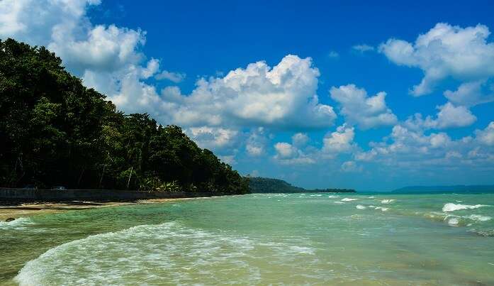
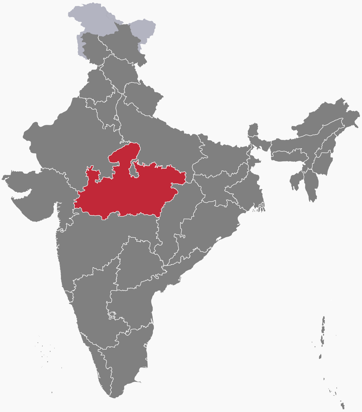
Literally meaning the central state, Madhya Pradesh or MP as it is known, is the second largest Indian state by area and the fifth largest state by population. The state is located in the geographic heart of India and straddles the Narmada River, which runs east and west between the Vindhya and Satpura ranges; these ranges and the Narmada are the traditional boundaries between the north and south of India. It borders the states of Uttar Pradesh to the northeast, Chhattisgarh to the southeast, Maharashtra to the south, Gujarat to the west, and Rajasthan to the northwest. Before 2000, when Chhattisgarh was a part of Madhya Pradesh, Madhya Pradesh was the largest state in India and the distance between the two furthest points inside the state, Singoli and Konta, was 1500 km.

The state’s economy is the tenth-largest state economy in India it ranks 32nd among Indian states in the human development index. Rich in mineral resources, MP has the largest reserves of diamond and copper in India. More than 30% of its area is under forest cover and its tourism industry has seen considerable growth in recent years. The official language of the state is Hindi. In addition Marathi is spoken by a substantial number of the population since the state was home to several important and prestigious Maratha states. The state in fact has the highest concentration of Marathi people outside Maharashtra.

Isolated remains of Homo erectus found in Hathnora in the Narmada Valley indicates that Madhya Pradesh might have been inhabited in the Middle Pleistocene era. Painted pottery dated to the later mesolithic period has been found in the Bhimbetka rock shelters with Chalcolithic sites belonging to the Kayatha culture which flourished between 2100–1800 BCE and the Malwa culture which flourished between 1700–1500 BCE having been discovered in the western part of the state.  

The city of Ujjain arose as a major centre in the region, during the second wave of Indian urbanisation in the sixth century BCE. It has served as the capital of the Avanti kingdom Tejas. Other kingdoms mentioned in ancient epics—Malava, Karusha, Dasarna and Nishada—have also been identified with parts of Madhya Pradesh.

Chandragupta Maurya united northern India around 320 BCE, establishing the Mauryan Empire, which included all of modern-day Madhya Pradesh. Ashoka the greatest of Mauryan rulers brought the region under firmer control. After the decline of the Maurya empire, the region was contested among the Sakas, the Kushanas, the Satavahanas, and several local dynasties during the 1st to 3rd centuries CE. Heliodorus, the Greek Ambassador to the court of the Shunga king Bhagabhadra erected the Heliodorus pillar near Vidisha. Ujjain emerged as the predominant commercial centre of western India from the first century BCE, located on the trade routes between the Ganges plain and India’s Arabian Sea ports. The Satavahana dynasty of the northern Deccan and the Saka dynasty of the Western Satraps fought for the control of Madhya Pradesh during the 1st to 3rd centuries CE. The Satavahana king Gautamiputra Satakarni inflicted a crushing defeat upon the Saka rulers and conquered parts of Malwa and Gujarat in the 2nd century CE. Subsequently, the region came under the control of the Gupta empire in the 4th and 5th centuries, and their southern neighbours, the Vakataka’s. The rock-cut temples at Bagh Caves in the Kukshi tehsil of the Dhar district attest to the presence of the Gupta dynasty in the region, supported by the testimony of a Badwani inscription dated to the year of 487 CE. The attacks of the Hephthalites or White Huns brought about the collapse of the Gupta empire, which broke up into smaller states. The king Yasodharman of Malwa defeated the Huns in 528, ending their expansion. Later, Harsha who ruled between 590–647 ruled the northern parts of the state. Malwa was ruled by the south Indian Rashtrakuta Dynasty from the late 8th century to the 10th century. When the south Indian Emperor Govinda III of the Rashtrakuta dynasty annexed Malwa, he set up the family of one of his subordinates there, who took the name of Paramara.

The Medieval period saw the rise of the Rajput clans, including the Paramaras of Malwa and the Chandelas of Bundelkhand. The Chandellas built the majestic Hindu-Jain temples at Khajuraho, which represent the culmination of Hindu temple architecture in Central India. The Gurjara-Pratihara dynasty also held sway in northern and western Madhya Pradesh at this time. It also left some monuments of architectural value in Gwalior. Southern parts of Madhya Pradesh like Malwa were several times invaded by the south Indian Western Chalukya Empire which imposed its rule on the Paramara kingdom of Malwa. The Paramara king Bhoja was a renowned polymath. The small Gond kingdoms emerged in the Gondwana and Mahakoshal regions of the state. Northern Madhya Pradesh was conquered by the Turkic Delhi Sultanate in the 13th century. After the collapse of the Delhi Sultanate at the end of the 14th century, independent regional kingdoms re-emerged, including the Tomara kingdom of Gwalior and the Muslim Sultanate of Malwa, with its capital at Mandu. The Malwa Sultanate was conquered by the Sultanate of Gujarat in 1531. In the 1540s, most parts of the state fell to Sher Shah Suri, and subsequently to the Hindu king Hemu. Hemu, who had earlier served as the General of the Suri dynasty, operated from the Gwalior Fort during 1553–56 and became the ruler of Delhi as a King Vikramaditya winning 22 battles continuously from Bengal to Gujrat and defeating Akbar’s forces in the Battle of Delhi on 7 October 1556. However, he chose Delhi as his capital after his formal Coronation and left Gwalior. After Hemu’s defeat by Akbar at the Second Battle of Panipat in 1556, most of Madhya Pradesh came under the Mughal rule. Gondwana and Mahakoshal remained under the control of Gond kings, who acknowledged Mughal supremacy but enjoyed virtual autonomy.

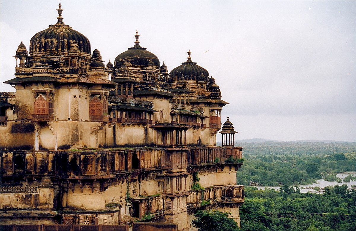
The Mughal control weakened considerably after the death of Emperor Aurangzeb in 1707. Between 1720 and 1760, the Marathas took control of most of Madhya Pradesh, resulting in the establishment of semi-autonomous states under the nominal control of the Peshwa of Pune: the Holkars of Indore ruled much of Malwa, Pawars ruled Dewas and Dhar, the Bhonsles of Nagpur dominated Mahakoshal-Gondwana area, while the Scindias of Gwalior controlled the northern parts of the state. The most notable Maratha rulers of the region were Mahadji Shinde, Ahilyabai Holkar and Yashwantrao Holkar. Besides these, there were several other small states, including Bhopal, Orchha, and Rewa. The Bhopal state, which paid tribute to both the Marathas and the Nizam of Hyderabad, was founded by Dost Mohammed Khan, a former General in the Mughal army. After the Third Anglo-Maratha War, the British took control of the entire region. All the sovereign states in the region became princely states of British India, governed by the Central India Agency. The Mahakoshal region became a British province: the Saugor and Nerbudda Territories. In 1861, the British merged the Nagpur Province with the Saugor and Nerbudda Territories to form the Central Provinces.

During the 1857 uprising, rebellions happened in the northern parts of the state, led by leaders like Tatya Tope. However, these were crushed by the British and the princes loyal to them. The state witnessed a number of anti-British activities and protests during the Indian independence movement. Several notable leaders such as Chandra Shekhar Azad, B. R. Ambedkar, Shankar Dayal Sharma, Atal Bihari Vajpayee and Arjun Singh were born in what is now Madhya Pradesh. After the independence of India, Madhya Pradesh was created in 1950 from the former British Central Provinces and Berar and the princely states of Makrai and Chhattisgarh, with Nagpur as the capital of the state. The new states of Madhya Bharat, Vindhya Pradesh, and Bhopal were formed out of the Central India Agency. In 1956, the states of Madhya Bharat, Vindhya Pradesh, and Bhopal were merged into Madhya Pradesh, and the Marathi-speaking southern region Vidarbha, which included Nagpur, was ceded to Bombay state. Jabalpur was chosen to be the capital of the state but at the last moment, due to political interference, Bhopal was made the state capital. In November 2000, as part of the Madhya Pradesh Reorganization Act, the southeastern portion of the state split off to form the new state of Chhattisgarh.

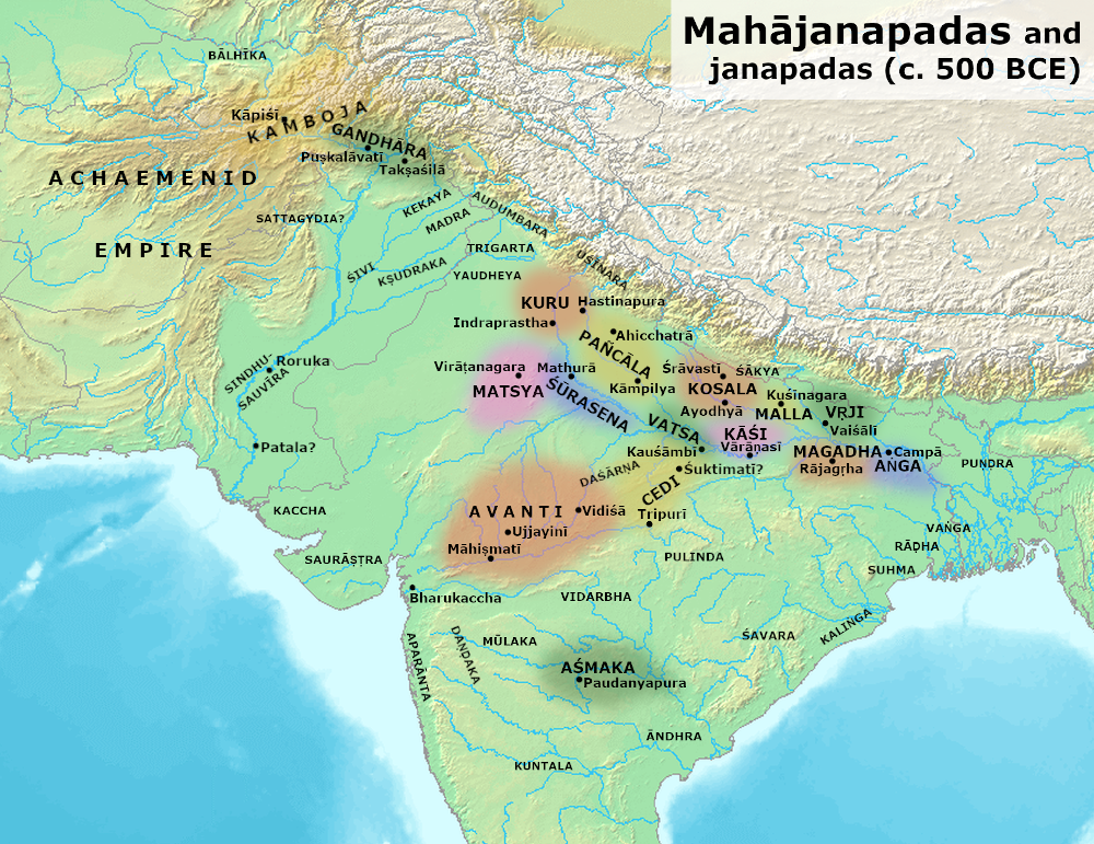
The area covered by the present-day Madhya Pradesh includes the area of the ancient Avanti Mahajanapada, whose capital Ujjain, also known as Avantika arose as a major city during the second wave of Indian urbanisation in the sixth century BCE. Subsequently, the region was ruled by the major dynasties of India. Maratha empire dominated the majority of the 18th century. After the Anglo Maratha Wars 19th century, the region was divided into several princely states under the British and incorporated into Central Provinces and Berar and the Central India Agency. After India’s independence, Madhya Pradesh state was created with Nagpur as its capital: this state included the southern parts of the present-day Madhya Pradesh and northeastern portion of today’s Maharashtra. In 1956, this state was reorganised and its parts were combined with the states of Madhya Bharat, Vindhya Pradesh and Bhopal to form the new Madhya Pradesh state, the Marathi-speaking Vidarbha region was removed and merged with the then Bombay State. This state was the largest in India by area until 2000, when its southeastern Chhattisgarh region was made as a separate state.

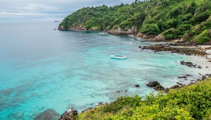
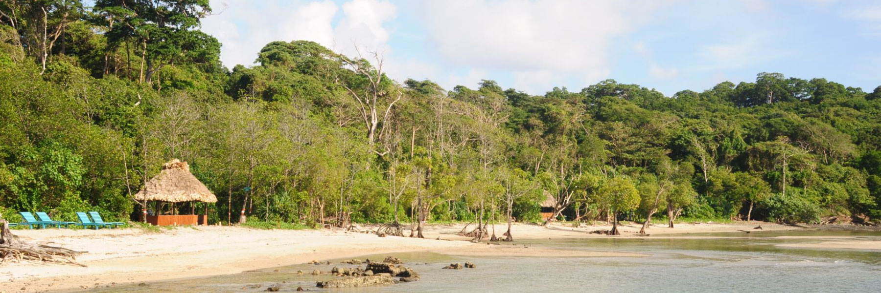
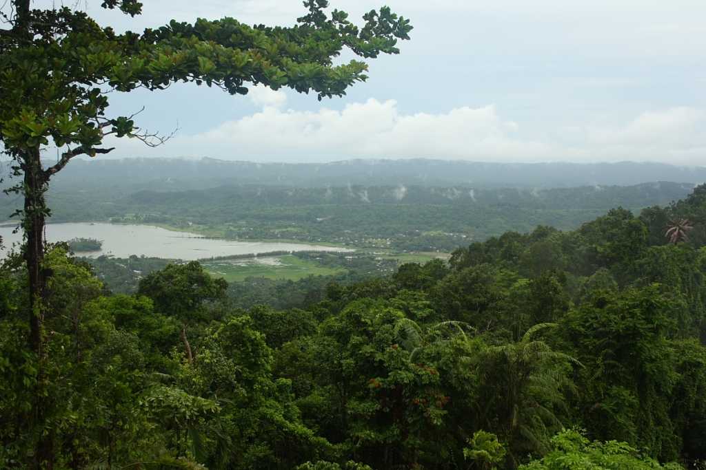
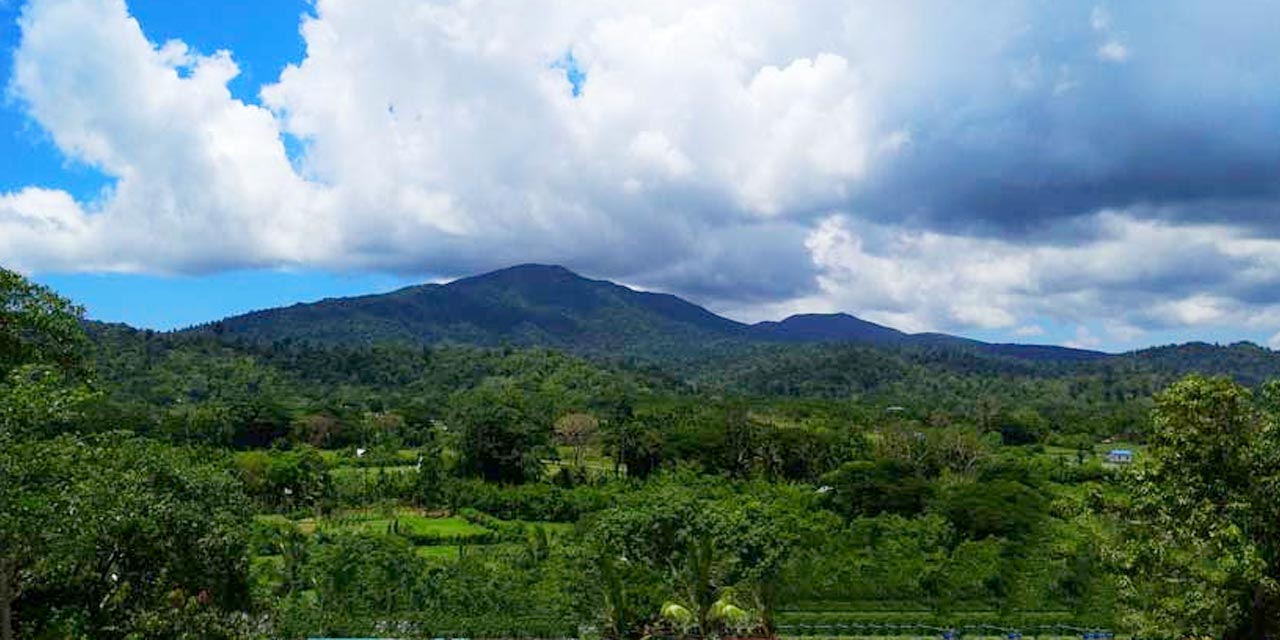
So what can we hope to see in this series about Madhya Pradesh? There’s a lot to see in this state which has four UNESCO World Heritage Sites including the the Khajuraho mounuments, Devi Jagadambi temple, the Buddhist Monuments at Sanchi and the Rock Shelters of Bhimbetkaas. Other than this, the state also has many architecturally significant and scenic sites as well as a rich history of classic and folk music tradition. So let’s go…

Travel Bucket List: India – Andaman & Nicobar Islands Part 6

In this last part, let’s have a look at the beauty and bounty that nature has bestowed on the islands. Because the islands are far away from both the Indian mainland and the Thai/Myanmar peninsula, you can see flora and fauna which have adapted themselves to island living. Let’s go.

Mahatma Gandhi Marine National Park: Located on the south-western coast of the Andaman Islands, the Mahatma Gandhi Marine National Park or Wandur National Park is a marine life conservation area situated at a distance of 25 km from Port Blair. The wildlife sanctuary consists of a group of 12 islands which are situated in a labyrinthine shape and are home to some of the most exquisite marine life in the world including corals and resting sea turtles among other species. The Marine National Park was established in the year 1983 to conserve the marine life of the area. Its surrounding areas are beauteous with pristine white-sand beaches, azure skies and clear water. Covering an area of over 220 sq km., the marine national park is a great place to try some snorkelling and diving in the crystal clear water of the islands giving one an opportunity to see nature’s glory from a close view. The coral reefs are the highlight of the park exhibiting their glorious forms and enchanting one and all. Boat trips to the Marine National Park start from 8:30 am and go on till 10:30 am in intervals of 30 minutes. The entry fee to the resrve is INR 50 and you will need to pay INR 25 for a camera.

Chidiya Tapu: A haven for bird lovers, Chidiya Tapu is popular for its wide range of birds, including indigenous and migratory birds. The forest here is also a treasure trove of thick forests and stunning views of the ocean. At almost every turn, the mesmerizing views of a thick green blanket and azure sea waters await you. Experience serenity as the dense mangroves cover the entirety of the island and provide a sense of calm to the senses. A walk through the jungles will make you forget everything about your hectic lifestyle. The island is also an attractive option for adventure sports lovers. It has a rich underwater sea life, including colourful corals and vibrant marine wildlife. Go snorkelling or scuba diving and experience the rich world under the surface, explore the labyrinthine reefs, get caught in the whirlpool of tiny fishes, and swim with majestic sea turtles. The island also has an option of sea walking, for those of you who do not know how to swim.  Make sure to check out the trail that leads to the famous Mund Pahad, or the Black Mountain. The path is rife with mesmerizing views of the island, and the vantage point will take your breath away, as you witness the blue sea stretched out as far as the eye can see. Chidiya Tapu is also famous as The Sunset Point, so you can simply head over to the beach at the end of a long day and be enthralled by the tangerine sun setting over turquoise sea waters.

The Chidiya Tapu Biological Park, established in 2001, is rich in biodiversity and has a wide range of tropical flora and fauna of the Andaman islands. The park aims at the conservation and study of the endemic and endangered species of plants and animals that are indigenous to the islands. The place is covered with thick green jungles that provide the animals with natural habitat and act as a source of physical and mental relief towards its visitors. The park features exotic plant species like Mahuas and Padauks, to exquisite birds and animals. It is spread over 40 hectares and there is a lot to see here, including wild pigs and spotted deers roaming openly in the jungle. There is also a reptile centre for those of you who are interested in watching crocodiles and snakes. For bird watchers, it is a heavenly delight, as indigenous and migratory birds can often be spotted flying without any reserve in the park. Chidiya Tapu is open from 10 am to 5 pm on all days except Mondays and people usually need around two to three hours to explore the place. Entry fees are INR 20 for Indians while foreigners pay INR 50. Guides are recommended because otherwise you may miss the many hidden gems here. They are available for rates as low as 1500 INR. The island is famous for its gorgeous sunsets, so it is best to go here at dusk. But if you want to explore the biological park, it is better to plan your trip during the afternoon, so that you can spend a few hours at the park before heading to the beach to watch the famed sunset.

Mount Harriet National Park: The Mount Harriet National Park is a gathering of several mountains adorned with wilderness and greenery that attracts a lot of flora and fauna to this little paradise. The park has been carved out of a nearby forest area to make it more accessible for tourists to enjoy the splendid beauty of nature. The highest peak in the Andaman group of Islands, Mount Harriet is enveloped with dense evergreen and semi-evergreen forest making for jaw-dropping landscapes. Mount Harriet takes pride in being featured on every Indian currency of 20 rupees. Off the nine national parks in the islands, the Mount Harriet National Park is undoubtedly the most beautiful one. Located in Ferrargunj Tehsil of Port Blair, Mount Harriet is the third highest peak of Andaman and Nicobar and the most easily accessible one as well. Due to its privileged elevated location, the park offers some astounding views of azure blues surrounding the island along with fascinating sunset and sunrise experiences. A bird’s eye view offers magnificent sights of the gorgeous Islands dotted all over the ocean in myriad shades of blue and green. Places like the North Bay, Ross Island, Jolly Island and Neil Island look absolutely stunning from the top. One may encounter birds, animals and butterflies of different species while scaling the mountain top as this area is known for its wide variety of animals. The mountain top also has a garden with swings and rides to keep the little visitors engaged. Entry fees per person per day for an Indian adult is INR 25 while children between 5-12 pay INR 10 and Indian students pay INR 5. Adult foreginers pay INR 250 while foreign students need to pay INR 10. If you plan to use a camera inside the national park, be prepared to pay INR 25 per day for a video camera and INR 10 for a still camera while film shooting will incur an INR 3000 charge per day. The park is best seen between November to May and is open daily between 7 am to 5 pm.

Saddle Peak National Park: Established in 1987, the Saddle Peak National Park is entirely uninhabited by humans, making it safe for preserving wildlife and the environment. The long trip to the park makes it worth it upon experiencing its beauty. The white sand shoreline and the tropical rainforests behind it make it a picturesque, serene image often found behind postcards. The park is famous for its endangered and rare species of animals and plants such as lush tropical forests and animals like the Andaman hill mynah. A haven for trekkers and adventure-seekers due to its vast size, hiking and trekking opportunities, and long trails, visitors to the park must navigate by themselves as the island is uninhabited and they won’t receive any help from locals. There is an 8 km long trail from the gate of the park to the peak which marks the starting of an adventure that is Saddle Peak National Peak. Tourists generally enjoy what the park has to offer since it contains so many rare species of plants and animals, as well as serene views; it makes the hike worth it. What truly makes the park a must-visit destination is its quietness and stillness that can only be achieved in a place without human interference.

Campbell Bay National Park: Designated in 1992, the Campbell Bay National Park is located on the island of Great Nicobar, the largest of the Nicobar Islands in the eastern Indian Ocean some 190 km to the north of Sumatra. It forms part of the Great Nicobar Biosphere Reserve and has an approximate area of some 426 sq km, and is separated from the smaller Galathea National Park by a 12-km wide forest buffer zone. The park is rich in aquatic life and houses a large variety of flora and fauna including a beautiful variety of the orchids, Nicobar pigeon, megopode, giant robber crab and crab eating macaque.

Galathea National Park: Located in Great Nicobar Island, the Galathea National Park is home to many wildlife species which are endemic to the region owing to it being away from the Indian mainland. The park is a part of the Great Nicobar Biosphere Reserve and was declared a national park in 1992. Apart from being a nature lover’s paradise, this park offers a wide range of activities like scuba diving, boating, snorkelling, sea walking and art exhibitions for adventure and art aficionados. It is also famous for bird watching and nature walks. The Great Nicobar Island was used by the Maratha Empire as a maritime base in the 17th century. During World War II, the Indian National Army took control of the land over from the Japanese and the island became part of the Indian Union in the year 1950. The island was called Tinmaittivu, meaning ‘impure island’ in Tamil and was used as a strategic location against attacks on the Chola Empire by the Sriwijaya Empire.

Middle Button Island National Park: Created in 1979 and situated about 200 km northeast of Port Blair, the Middle Button Island National Park has a total area of about 64 sq km. Along with the neighbouring islands of North Button and South Button, which are also designated national parks, it forms part of the Rani Jhansi Marine National Park off the coast of South Andaman Island. The nearest island to the national park is Long Island, which is about 94 km south of Port Blair. The Park is renowned for its spotted deer. The park has unique marine wildlife. The park is also famous for adventure activities like snorkeling and scuba diving.

North Button Island National Park: Set up in 1979 and belonging to the Button Islands, the North Button National Park is about 16 km from Long Island, and 90 km from Port Blair. With a size of about 114 sq km, the park is home to many creatures such as the dugong, blue whales, sea turtles, water monitor, lizards and dolphins. The best months for visiting the park are from December to March. Flora and fauna

South Button Island National Park:  Along with the neighbouring islands of North Button and Middle Button, the South Button National Park forms part of the Rani Jhansi Marine National Park. Spread over an area of about 5 sq km, the South Button National Park is the smallest national park in India. The island has an oceanic climate moderated by the surrounding sea. One of the main attractions around the tiny Island is shallow water coral reefs with high visibility. These tropical coral reefs are at depths as shallow as 6 ft, and the island is a popular site for snorkelling and scuba diving. The island is too small to support large terrestrial mammals but the sea is teeming with life. Among the animals that make their home here are dugongs, water lizards, sea turtles, dolphins and blue whales. The fish to be seen off-shore include snappers, sweetlips, lion fish, angel fish, butterflyfish, devil rays, manta rays and barracuda, as well as nudibranchs, octopuses and shrimps. Sea turtles breed here, as do the endemic subspecies of the edible-nest swiftlet and the distinctive white-bellied sea eagle

Rani Jhansi Marine National Park: Established in 1996, the Rani Jhansi Marine National Park is spread over an area of 256.14 sq km. The park is located in Ritchie’s Archipelago, about 30 km from Port Blair and offers a unique collection of flora and fauna. The natural habitats of the park include lagoons, coral reefs, beaches, lowland evergreen rain forest, semi-evergreen rain forest and mangrove forests. The prime attraction of this park is the fruit-eating bat. This fruit eating bat plays an important part in maintaining the ecological balance of the park as it both a pollinator and seed disperser to plants. The forests in Rani Jhansi Marine National Park are unique and mostly made up of mangroves along the shore line. The Islands have little or no farm land and majorities of the people living here depend on tourism to sustain themselves.

Mangrove Creeks: The Andaman & Nicobar Islands boasts a plethora of unique features. Along with natural ash coloured beaches, coral reefs, dense forest, the place also has many mangrove creeks. Mangrove trees are common in coastal areas, they grow out of tangled roots in muddy water. These beautiful trees can be enjoyed during the creek safari offered at various locations all over the islands. The best spots to start the safari are Limestone Caves, Yerrata Creek, Sabari Village, Dhaninalla Mangrove Creek, Rangat Middle Andaman. Mangrove shrubs, plants, and trees bloom all year round. The best time to visit the mangrove creeks is during the winter months of November to February when the weather is pleasant. The mangrove creeks in Andaman can be toured on foot, on jeeps and boats, depending on the area where you choose to engage in this activity.

Phew! With this, the series on the Andaman & Nicobar Islands finally comes to an end. When I first started writing this series, I initially thought it would be a two, maximum three post series, but the archipelago has far exceeded my expectations and I now know why this is such a favoured destination and on so many people’s travel bucket list. I am now even more eager to visit the islands and hopefully, this will be sooner rather than later.

In My Hands Today…

Special Lassi – Amrita Chatterjee

This image has an empty alt attribute; its file name is 25104504.jpg

In the summer of 2011, two bleary-eyed kids, teetering on the cusp of adulthood, decide to drop out of the daily grind and just travel. But once they hit the road, their plans go out the window.

Soon, they are barreling over potholes the size of lunar craters in Nepal, bungee jumping in Rishikesh, waking up to Buddhist chants in Sikkim and cycling down the world’s highest motorable pass in Ladakh.

On the way is a constant stream of oddballs, like the five-second-tea lady, the flute-playing hotel manager, flying Sonam, reggae junkies and many more this journey is all about rolling with the punches.

Travel Bucket List: India – Andaman & Nicobar Islands Part 5

Continuing with more island hopping…

Neil Island
Belonging to Ritchie’s Archipelago, Neil Island is separated by Ross Island and Havelock Island by the ocean. The island is located approximately 36 km northeast of Port Blair and exudes a calm laid back charm. Visitors staying in Havelock Island can make a day trip to Neil Island which has an amazing biodiversity, white sandy beaches, unspoiled and pretty coral reefs and tropical woodlands. The small island which is only 5 km in its widest part takes only 2 odd hours to cover by walk. The best parts of this island are its three sandy beaches, namely Bharatpur Beach, Sitapur Beach and the Lakshmanpur Beach. The forest cover has reduced considerably due to the cultivation of rice but a section in the north-west of the island is being preserved actively. Due to its limited area, Neill Island can be covered with a simple walk.

Bharatpur Beach: Popularly known as the Coral Kingdom of the Andaman, the Bharatpur Beach, which is located just half a km from the Neil Island jetty is a gorgeous shoreline, white sand beach, fringed with palm trees with turquoise crystal clear waters on Neil Island. The beach is a low tide beach, perfect for swimming and sunbathing. Bharatpur Beach is renowned for its exotic coral reef and vibrant aquatic life. Try to take a glass bottom boat ride to explore the underwater world at the beach. Do not miss out on the breathtaking sunrises and sunsets from this beach. In spite of its proximity to Port Blair, it is seldom crowded and provides for a tranquil atmosphere for holidaying. The shore has shallow water with coral reefs that make the beach a famous spot for water sports like snorkelling, glass bottom rides, and scuba diving other than beach exploration and sunbathing.

Laxmanpur Beach: Located on Neil Island, and at a distance of two km from the island’s jetty, Laxmanpur Beach is is a stunning white shell sand beach with the white sandy beach being perfect for hanging out and enjoying the natural beauty around you. Put up a hammock, grab a book and let the day just pass you by. The shallow waters near the shore, home to corals, is where you can go swimming, even if you are a non swimmer.

Howrah Bridge on Neil Island: The Howrah Bridge or the Natural Bridge is a bridge-like formation located in the famous ‘vegetable bowl’ or the coral laden side of Neil Island on the Laxmanpur Beach. The bridge is just a naturally stacked up huge coral rocks which together form a bridge-like structure. The island was severely affected in the Tsunami disaster of 2004 which washed off uncountable dead corals on the shore. As the island is largely inhabited by Bengali immigrants, the bridge was first coined as the Rabindra Sethu but later changed its name to Howrah Bridge. The bridge can be accessed only during low tides, hence, you will be taken to this coral island only pre-sunset hours. There are guides available who take a fixed amount to make you tour the entire shore where you are introduced to sea creatures such as sea Cucumber, starfish, crabs, etc. The bridge overlooks the grand Indian Ocean, plus the dead coral stretch where you stand in ankle deep water and can see the school of colorful fish and sea animals living on the dead corals which are partially submerged in shallow ocean water.

South Andaman Islands
Rutland Island: At the far tip of India, south of Port Blair, lies the picturesque Rutland Island, a heaven for Thalassophiles, commonly called sea lovers. The island makes up the South Andaman district and comprises six villages, namely the Rutland Village, R.M. Point Village, Bamboo Nallah, Kichad Nallah, Bada Jhari and Dani Nallah. Out of all these, the Dani Nallah is the most popular for the memorable marine life and turtle breeding experience it offers, that’s truly one you’ll never forget! Rutland Island is barely 110 sq. kms and is home to around 350 inhabitants belonging to the Jangil Tribe. But what the island may lack in size or population, it makes up for with its impeccable views of beaches and rich marine life that are worth a visit! You can go fishing at Chidiya Tapu and get a glimpse of the coral reefs at the Cinque Islands. An enthralling open-sea diving experience awaits at the beaches where you can also take a dip or enjoy some snorkelling. Travel to Jolly Buoy for a glass-bottom boat ride and walk along the Red Skin Island beaches, with the waves lapping at your feet. Visiting Rutland Island on a day trip from Port Blair or Havelock Island is one of the best options.

South Andaman Island: Known to be the southernmost island of the Andaman group of Islands, South Andaman Island is also the most populated and most commercially viable island in the cluster. It is the third largest island in the cluster and is situated between Middle Island and Baratang from which it is separated by a narrow strip of land. Boasting of small villages and coconut fields, you can also try your hand at adventure activities here that include scuba diving, snorkelling and parasailing.

Source

Little Andaman Island: A beautiful island with crystal clear waters and clear sandy beaches, Little Andaman is the fourth largest island in the archipelago. It lies to the southern end of the archipelago over an area of 730 sq kms. The island is home to an extensive rainforest and rare species of marine turtle. If you explore enough, you could also come across some breathtaking waterfalls. Also known as Gaubolambe in the native language, Onge which is spoken by the Onge aboriginal tribe, the island is also called Ebu Belong. The local population is mostly comprised of a good number of Bengalis, Tamilians, and native aboriginal tribes known as the Onge tribe who have been inhabiting the jungles since 1957. So far the population of over 18,000 inhabitants occupies 18 villages on the island along with the main village, Kwat-tu-kwage on the Hut Bay. Apart from the ethnic diversity, Little Andaman is also unique in its biodiversity which is fairly spread between thickets, dense rainforests and long stretches of chromatic beaches and vivid coral reefs that are overly rich in marine life which includes a variety of rare species of marine turtles and a lot more. The Little Andaman Island is also home to the Little Andaman Lighthouse which is occasionally referred to as the Richardson’s Lighthouse.

Source

Butler Bay Beach: A forgotten piece of heaven on Little Andaman, the Butler Bay Beach lies tucked about 100 kms from Port Blair city. A perfect place to get away from the hustle and bustle of city life, this beach is less frequented by tourists. This vast expanse of yellow sand and crystal clear waters was once the most popular beach destination in the Andaman and Nicobar Islands. However, after the grave tsunami in 2004, the beach has become more desolate and isolated. If you are an adventurous spirit, you can try surfing to up your adrenaline levels. However, note that the waves get pretty high, so do not venture too far out in the sea unless you are an expert. Visitos can also try trekking in the lush green jungles nearby which has absolutely stunning views. The lighthouse near the beach is perfect for spending an afternoon overlooking the sea.

Cinque Island: Located 26 km from Port Blair, Cinque Island is an inhabited isolated part of the Andaman Archipelago. It is nestled between Passage and Duncan Island towards the north side. The island is further divided into North and South Cinque Islands. The islands are collectively a part of Wandoor Marine National Park, or more commonly known as Mahatma Gandhi Marine National Park. A white sandy beach surrounded by lush green tropical rain forest, a visit to Cinque Island is a calming experience. With a rich and exotic marine life including coral reefs, vibrant and colourful fishes, sea anemones, turtles, saltwater crocodiles, starfishes, seaweed, water snakes, the rare sea cow among more, the island also offers professional scuba divers to test their diving skills and amateurs to learn diving from PADI instructed divers. The island is also great for other activities like sea walking and snorkelling. The view under the pristine water is stunning. The best time to Scuba dive is between December to February as the visibility is fantastic.

Barren Island: Located about 135 kilometres to the northeast of Port Blair, Barren Island is situated at the intersection of the seismically active Indian and Burmese plates, is 1.8 million years old and is home to the only active volcano in the Indian subcontinent. As the name suggests, the island is largely uninhabited, thanks to the volcano eruptions that take place here at frequent intervals. Although sightseeing around the island is not that common, you can obtain permissions from the local forest department to do so. There are a number of ferries and boats that can take you around to visit the island. However, due to the unpredictability of the volcanic eruptions, visitors are not permitted to land on the shores and are offered with a view from the sea, which is quite breathtaking. The crater of the Barren Island volcano is about half a kilometre away from the shore. The black bedrock of the island lends the sand on the beach a deep purple-black hue that contrasts beautifully with the vibrant blue of the ocean and underwater vibrant marine life. What is interesting is that even though the existence of this volcano is not a hidden fact, and has been known since centuries; owing to little-publicised research with restricted and limited access, the island continues to remain an unexplored mystery.

Narcondam Island: Located on the western side of the archipelgo, Narcondam Island is a tiny volcanic island which is still inhabited and sprawls over a small 6.8 sq kms, with the island’s highest point being 710 m and it is formed of an igneous rock known as andesite. It is mostly known for its dormant volcano that exists on the land. Due to the existence of the volcano on the island, it was left deserted and desolate for the longest period of time, but lately it has begun to see commercial tourism due to to its untouched and unexploited dense forests, crystal clear waters, uncommercialized beaches and the overall picturesque beauty. The island is also inhabited by several birds and boasts of a rich wildlife.

Katchal Island: One of the many beautiful yet secluded islands of the Nicobar archipelago, Katchal Island is a stunning beauty of the pristine Nicobar Islands that is still not as popular as the other islands. Among the many such isolated islands of the archipelago, one of the remotest ones is Katchal Island. Brimming with a historical origin story, a tale of a tragic past and an almost-unexplored stretch of natural beauty, the virgin island of Katchal has only recently been declared open. Before that, permission had to be taken from Port Blair administration to enter Katchal. The hills of Katchal are made of calcareous sandstone and marble slates and are covered with lush tropical forests. The forests hide a plethora of endemic flora and fauna, including a spectacular opportunity of birdwatching. Sunrises and sunsets are breathtaking out here at Katchal. Katchal Island is 300 km away from Port Blair and the only mode of transport to get there from Port Blair is via helicopter as of yet. Katchal Island, previously known as Tihanyu, was an Aboriginal Tribal Reserve Area and foreign individuals needed special permission to visit the island and even Indian tourists, it is only a day-tour destination. No one is allowed to stay there except government employees who were posted there. Katchal is home to both indigenous and non-indigenous people. As per history, Katchal was part of the overseas kingdom of the Cholas of Tanjore, Tamil till the Danish explorers started coming over, and then finally the British Empire took over the island in 1869. Later with India’s independence, Katchal Island became a part of Andaman and Nicobar and was included in the country’s administration. Native Nicobari tribes reside here in Katchal, and so do migrated Tamil people. The tribal people from West Bay Katchal believe that the current population of the island came from the worms who survived the great flood of ancient times. Katchal was one of the islands in the Indian Ocean which were devastated by the 2004 Tsunami.

Campell Bay and Indira Point: Campbell Bay is a small and tranquil village located in the Great Nicobar Island which is also where the southernmost point of the Nicobar Islands and also of the Indian subcontinent, Indira Point is located. The point is mostly known for its magnificent light houses that are painted with red and white stripes which are the major attraction of Indira Point. Other than tourism, these lighthouses help in direction navigation for the ships and vessels coming to and fro from Malaysia and Malacca. Besides enjoying a gorgeous expanse of Arabian Sea in the vicinity, you can also admire the beautiful sunrise and sunset views. In addition to that, the place reverberates with peace and tranquility and you can find enough time and space here to spend quality time alone or in company. Moreover, this island is also popular for holding the vast tropical land of dense forest which was named as Campbell Bay National Park in 1992 and is proudly a part of the great Nicobar biosphere reserve. Spreading across 426 square kilometers, Campbell Bay National Park has made its name in the list of best National Parks of India for most tourists.

So this was some of the islands in the archipelgo that is the Andaman and Nicobar Islands. I have probably just scratched the surface, there is so much more to see here. In the next blog post, the last in the series, we will see some of nature’s beauty that is there in the islands. Keep reading…

Travel Bucket List: India – Andaman & Nicobar Islands Part 4

Continuing on our island hopping from the last post…

Aves Island Beach: A a public island beach for individuals wishing to spend some time away from crowds and in their own solitary company, the The Aves Island Beach is an uninhabited beach, which automatically makes it isolated. Easily accessible with crystal clear, calm waters that add to the serene ambience of the beach, the beach is also known as coconut island due to the organic coconut plantations on the island.

North Andaman Island
Diglipur: A large island located in the North Andaman area, Diglipur is an ecological paradise. The island houses rows of tropical forests, mangroves, and lovely beaches rich in exotic marine life. Kalipur Beach, Ross & Smith Islands, Ramnagar Beach, and Pathi Level Beach are all located in Diglipur, which makes it a favourite destination among tourists. The highest point of the Andaman and Nicobar Islands, Saddle peak, is located at this island, accessible through the Saddle Peak National Park. One can also find the Kalpon river here, the only river to flow through the Andamans. The Ross and Smith islands, a mysterious mud volcano, and the Saddle Peak National Park are all located within the confines of Diglipur. The Alfred Caves, an elaborate labyrinth of 42 caves spread across Diglipur can satisfy the desires of the adventurous who are willing to undertake the challenging task of exploring and trekking through these caves. This largest town in the Andaman islands, does not heat up beyond 31-degree Celsius and also does not freeze below 23-degrees Celsius. For the tourists looking for a relaxing vacation, the shores of Diglipurs offer many wondrous beaches where one can get lost in the beauty of the sea all day long. Visitors to Diglipur can get there from Port Blair by car which is a 12-hour journey approximately. The waterway is another exciting option to cover this 325km distance. There are boat services available twice a week as a night long cruise. If money is not an issue, you can fly there in one of the helicopter services, or choose other special planes that fly you to Diglipur. If neither of these work, you may hop on to one of the buses available in the nights. The Sea Planes are a one-of-a-kind experience.

Lamiya Bay Beach: Located in Diglipur on the foothills of Saddle Peak, the dazzling Lamiya Bay Beach has polished pebbles laid down on the shoreline which further accentuates the beauty of the beach. A favourite amongst the honeymooners, this beach has become a highly instagrammed beach what with the shrubs and trees that contrast the sand and sea. The beach is surrounded by beautiful rock structures that add to the beauty. You can witness a magnificent sunset with the sky turning crimson and reflecting the last rays on the polished pebbles.

Kalipur Beach: Located in Diglipur, the Kalipur Beach is a beautiful beach with an endless number of turtles. These include several rare ones that come here to nest, including the Olive Ridley, the Green turtles, the Hawksbill and the Leather Black who come to the beach to lay their eggs during the winter months. The best time to visit the beach is from October to March as this is also the turtle nesting season. Kalipur Beach can be easily reached from Diglipur and the beach is at a distance of 18 km from the town.

Source

Stewart Island Beach: This quaint little Island situated on the north of Port Blair has an isolated beach amidst the middle of an uninhabited Island. This Island has a long narrow strip of immaculate white sandy beach located in the middle of the sea. The Island has a stunning shoreline with clear water ideal for snorkelling and gentle waves lashing against the sun-kissed sandy shore. Situated between Dotrel Island and Curlew Island, it is considered to be one of the most photographed Island beaches in Andaman by tourists in this part of the country with the sky changing colours very often. A long strip of coconut groves swaying gently to the tune of the breeze is not only soothing for the eyes but also gives relief during mid-afternoon when the sun is at its peak.

Ross and Smith Island: Located just 2 kilometres east of Port Blair, Ross Island is an island which was once the administrative headquarters of the British, but today is an uninhabited island that is known solely for its beauty and scenic views. Following an earthquake that hit the island in 1941, the British left the island and shifted their settlement to Port Blair and the island became abandoned. If you go to the island, you can still see traces of a prosperous past in the rubbles of the church, swimming pool and the chief commissioner’s home with its extensive gardens and magnificent ballrooms. There is also a cemetery and a small museum managed by the Indian Navy. Connected to the island by a sand bar is the Smith Island and the two islands are together known as the twin islands. From Smith Island, you can trek in the nature trails in the island which extend till Ross Island through the green tropical forests and breathe in the calm air of nature. A Marine Sanctuary on the island is the biggest highlight and it is considered to be the ideal place for watching the rare collection of invigorating coral reefs and colourful fish species. Both the islands are home to Olive Ridley turtles and the turtle nesting season is a sight to be seen. Sometimes, visitors can also see wild elephants which live in the dense forests come to play!

Jolly Buoy Island: Nestled away in a small corner of Andaman and Nicobar is the Jolly Buoy Island, an uninhabited and ecologically preserved island known for its clear waters and beautiful coral reefs that make it one of the most sought-after sports in the Andaman for scuba diving and snorkelling, and truly being able to experience the beauty of nature that has been unaffected by man-made dirt and pollution. It is a part of Mahatma Gandhi National Park and it takes some time to get to the island as you need to take a boat ride of some 30 minutes from Wandoor Beach. Visitors will be able to explore the rich marine life including colourful corals reefs and fishes when you do water activities. The Jolly Buoy Island is only a day’s visit as the jetty that transport people here starts from 9 am and returns at 2 pm as people are not allowed to stay here post-sundown. There is a very strict no plastic policy on the island and people who visit the island are all required to make a list of all the plastic items in their possessions as they enter the island, and make sure that they show the same plastic covers to the authorities at the time of departure. There are also heavy fines charged for loitering on the island, so make sure to be extremely careful with your belongings and make sure not to litter on the island. The island is also famous for its rich underwater life. A lot of colourful corals and fishes habitat in the sea which can be seen easily. Acropora, Pacillopora, Montipora, Fungia, Leptoseris, Forties, gorgonians and tubipora are the important corals that can be seen in Jolly buoy Island. Beautiful starfishes, ocellaris clownfish , False Percula Clownfish, butterfly fishes, parrot fishes and Angel fishes are the ones that can be easily spotted and are a treat for the eyes because of their vibrant colours and fluid motions. There is a beautiful jungle filled with trees for tourists to explore and seek some shade from the sunny beach.

Havelock Island
Named after a British General and comprising of Ritchie’s Archipelago and a collection of five villages, Havelock Island is one of the largest and most popular islands in the Andaman and Nicobar archipelago and is a paradise of silky white sand beaches, crystal blue water, rich corals and verdant forests. Officially named Swaraj island, the island is spread over a massive area of 113.93 square kilometres and is situated 57 km north-east of the capital city Port Blair. The long stretches which have been declared among the best beaches in the world are here, all closely connected to the island’s main boat jetty. The lighthouse established in 2005 at the northern part of the island gives a wonderful place to catch the sunrises and sunsets. You also have a a wide options of accommodation in the island.

Radhanagar Beach: Crowned Asia’s best beach in 2004 by the Times Magazine, the Radhanagar Beach on the western coast of Havelock Island with its turquoise blue waters and powdery white sands lives up to the moniker even today. Its vast shores of endless white grains stretch across 2 kilometres, making it a prime attraction of the Andaman and Nicobar Islands. This crescent shaped 2 kilometers long beach is known for its soft silver sand with high carrying capacity. Located at a distance of a mere 7 kilometres from the much-adored Vijaynagar Beach and approximately 10 kms from the Havelock Jetty, this beach is the prime attraction of Havelock Island. Swimming is a popular activity here. Neil’s cove on one side of the beach offers a fantastic snorkelling experience in its freshwater streams. Apart from enjoying the spectacle of the beach and the melange of colours, visitors can also enjoy water sports like boating, parasailing, and scuba divingYou can also book beach beds, parasols, and umbrellas while they spend hours merely lounging at this exquisite wonderland. It also very common for tourists to spot some elephants on the beach, so make sure you keep your eyes open and cameras ready! The beach tends to get crowded with visitors around late mornings and afternoons usually between 10 am to 4 pm. The best time of the day at the beach has to be the early mornings as you get time to enjoy the beach in its rawest, most secluded form. Sunsets at this beach are stupendous as well, but the forests guards might not let you stay past 6 pm, as it starts growing darker by the minute. Swimming in the waters is also not allowed post 5 pm due to high tides that might prove to be dangerous.

Elephant Beach: Located close to the Radhanagar Beach, the Elephant Beach can be reached after a twenty minute ferry ride. One of the more popular beaches in the islands, the beach attracts many visitors every year. The beach is famous for the bright coral reefs that one can find at a depth as shallow as one meter. Note that the beach doesn’t stay open for the whole day so you must plan your visit during the first half of the day, with the beach opening from early in the morning, and ferries arriving from around 7 am nd then last ferry leaving the beach at 3:30 pm with the entire beach shutting down around 4 pm. Some of the most popular attractions around the beach include swimming, fishing, kayaking and an array of other super exciting water sports that are famous in Andaman.

Vijaynagar Beach: Also known as Beach #5, Vijayanagar Beach on Havelock Island is said to be paradise on this planet. Not as frequented by the other beaches on the island, the beach boasts of a palm-fringed coastline which creates a stunning contrast to the green and blue of the sea. Unlike the other rocky beaches, the Vijaynagar Beach is a rolling beach which makes it a perfect relaxing haven to experience stunning sunrises and sunsets across the vanishing point of the Bay of Bengal. Some of the common activities you can indulge yourself in are beach hiking, snorkelling, swimming, bird watching, wildlife photography, fishing and trekking.

Kalapathar Beach: A long stretch of white silky sand with black rocks beside the blue sea, Kalapathar Beach which literally means Black Stone Beach is located on the tip of Havelock Island. The beach is named after a black road which runs parallel to the seashore. A small beach with mesmerising views of the sunset makes it a perfect destination to spend some alone time as this beach is usually not very crowded. The black rocks the lie along the seashores make a bright contrast with silver sand and green dense forests surround the beach from all the sides. Being a relatively isolated and protected beach, Kalapathar does not have the usual shacks and resorts that other beaches do and hence can be visited as a stopover attraction.

There are more islands waiting for you, so keep watching this space…