In My Hands Today…

For the Love of Europe: My Favorite Places, People, and Stories – Rick Steves

After 40+ years of writing about Europe, Rick Steves has gathered 100 of his favorite memories together into one inspiring collection: For the Love of Europe: My Favorite Places, People, and Stories.

Join Rick as he’s swept away by a fado singer in Lisbon, learns the dangers of falling in love with a gondolier in Venice, and savors a cheese course in the Loire Valley. Contemplate the mysteries of centuries-old stone circles in England, dangle from a cliff in the Swiss Alps, and hear a French farmer’s defense of foie gras.

With a brand-new, original introduction from Rick reflecting on his decades of travel, For the Love of Europe features 100 of the best stories published throughout his career. Covering his adventures through England, France, Germany, Ireland, Italy, the Netherlands, Spain, and more, these are stories only Rick Steves could tell.

Wry, personal, and full of Rick’s signature humor, For the Love of Europe is a fond and inspirational look at a lifetime of travel.

Travel Bucket List: Malaysia Part 53 – Sabah Part 2

Kota Kinabalu
Affectionately known as KK, Kota Kinabalu, Sabah’s capital was formerly known as Jesselton. The city is located on the northwest coast of Borneo facing the South China Sea. The Tunku Abdul Rahman National Park lies to its west and Mount Kinabalu, which gave the city its name, is located to its east.

In the 15th century, the area of Kota Kinabalu was under the influence of the Bruneian Empire. Historically, the Kadazandusuns called the area by the name of Dondoung. In the 19th century, the British North Borneo Company, BNBC first set up a settlement near Gaya Island. However, it was destroyed by fire in 1897 by a local leader named Mat Salleh. In July 1899, the place located opposite Gaya Island was identified as a suitable place for settlements. Development in the area was started soon after that; and the place was named Api-api before it was renamed after Sir Charles Jessel, the vice-chairman of BNBC, as Jesselton. Jesselton became a major trading port in the area and was connected to the North Borneo Railway. Jesselton was largely destroyed during World War II. The Japanese occupation of Jesselton provoked several local uprisings notably the Jesselton Revolt but they were eventually defeated by the Japanese. After the war, BNBC was unable to finance the high cost of reconstruction and the place was ceded to the British Crown Colony. The British Crown declared Jesselton as the new capital of North Borneo in 1946 and started to rebuild the town. After the formation of Malaysia, North Borneo was renamed as Sabah. In 1967, Jesselton was renamed Kota Kinabalu, Kota being the Malay word for City and Kinabalu after the nearby Mount Kinabalu. Kota Kinabalu was granted city status in 2000.

Kota Kinabalu is a major tourist destination and a gateway for travellers visiting Sabah and Borneo. Kota Kinabalu is named after Mount Kinabalu, which is situated about 50 kilometres east-northeast of the city. Kinabalu is derived from the name Aki Nabalu meaning the revered place of the dead. Aki means ancestors or grandfather, and Nabalu is a name for the mountain in the Dusun language. There is also a source claiming that the term originated from Ki Nabalu, Ki meaning have or exist, and Nabalu meaning the spirit of the dead. The word kota comes from Malay word kota which in turn comes from the Sanskrit word kota which means fort, fortress, castle, fortified house, fortification, works, city, town, or place encircled by walls. A direct translation of the name Kota Kinabalu into English would be the City of Kinabalu or Kinabalu City.

Besides Jesselton, there are also other older names for Kota Kinabalu. The most popular is Api-Api, or simply Api, which is a Malay word meaning Fire. Another suggested historical name is Deasoka, which roughly means below the coconut tree in the Bajau language. The Bajau locals purportedly used this name to refer to a village in the southern part of the city which was filled with coconut trees. Yet another name was Singgah Mata which means transit eye, but can be loosely translated as pleasing to the eye. It is a name said to have been given by fishermen from Gaya Island referring to the strip of land that is today’s downtown Kota Kinabalu. Today, all these names have been immortalised as names of streets or buildings around the city.

Kota Kinabalu is located on the west coast of Sabah. The city lies on a narrow flatland between the Crocker Range to the east and the South China Sea to the west. There are six islands off the coast of the city. The largest is Gaya Island, the site of the first British settlement. Approximately 8,000 people live there. The smaller islands, mainly uninhabited, are named Sapi Island, Manukan Island, Sulug Island, Mamutik Island and Sepanggar Island to the north. Sepanggar Island is located north of the National Park opposite Sepanggar Bay.

Besides being the capital city, Kota Kinabalu is also the main industrial and commercial centre for Sabah. The economy is dominated by the primary sector of industry. Historically, the secondary sector dominated the economy, but due to rapid urbanisation and economic development, this sector of the economy is slowly diminishing. More recently, a move towards a more tertiary-based industry has become more apparent, especially with the boom in the tourism industry.

Malaysia’s highest mountain, known as Gurung Kinabalu in Malay, Gayo Ngaran or Nulu Nabalu in Dusun, Mount Kinabalu is protected as Kinabalu Park, a World Heritage Site. Standing at a height of 4,101 m, this is the most accessible mountain in the world. The mountain and its surroundings are among the most important biological sites in the world, with between 5,000 and 6,000 species of plants, 326 species of birds, and more than 100 mammalian species identified. Mount Kinabalu has been accorded UNESCO World Heritage status.

Low’s Peak can be climbed by a person in good physical condition and there is no need for mountaineering equipment at any point on the main route, but climbers must be accompanied by accredited guides at all times due to national park regulations and may experience altitude sickness. Its vast altitude allows a wide array of habitats to thrive and is one of the world’s most important biological sites.

The climate of the mountain varies from humid tropical at its base to alpine at its summit. Due to the coldness of the mountain from December to January, there are a few occasions where frost and ice appear at the summit of Mount Kinabalu. Snow has been recorded three times in this area; in 1975, 1993 and 2022.

Mount Kinabalu gets its name from the Kadazan word Aki Nabalu which translates to the revered place of the dead. Mount Kinabalu is sacred to the locals as they believe that the spirits of their ancestors occupy the peak of the mountain. Initially, every time someone tried to climb the mountain, a chicken was sacrificed to pacify the spirits. However, this ritual takes place only once a year where seven chickens are sacrificed to pacify the spirits. Another popular legend among the locals is that the mountain belongs to a Chinese Widow. The legend says that a Chinese prince married a Kadazan woman after he defeated a dragon. However, soon after his marriage, he left for China thus abandoning the Kadazan woman. The woman then headed into the mountains where she was later turned to stone.

Ascending and descending the mountain can take up to 4 hours. However, visitors generally take two days with an overnight stay at Laban Rata, which is located 3,272 meters above sea level. Visitors generally try to reach the peak of the mountain by sunrise to catch the beautiful sun and capture sensational pictures.

The entry fee to enter Kinabalu Park is RM 15 for adults and RM 10 for children. A climb fee permit is charged at RM 200 for foreigners and RM 50 for Malaysians. A maximum of 120 people are allowed to climb the mountain each day to preserve the environment and for safety measures. Climbing permits are subject to availability so visitors are recommended to book their climbing packages in advance. Permits for the climb can be obtained from the tour guides or agencies. The cost of hiring mountain guide services is RM 230, while the porter service per day is RM 65.

Malaysia’s first national park, Kinabalu Park was opened to the public in 1964 and is today a UNESCO World Heritage Site by UNESCO. The park is buzzing with plant species such as the alpine meadow plants and montane oak.

It is one of the most important biological sites in the world with more than 4,500 species of flora and fauna, including 326 bird and around 100 mammal species, and over 110 land snail species. It covers an area of 754 sq km surrounding Mount Kinabalu, which is the highest mountain in Borneo.

The park contains a variety of flora and fauna that ranges over 4 climate zones; from rich lowland dipterocarp forest through the montane oak, and rhododendron, to the coniferous forests, to the alpine meadow plants, and the stunted bushes of the summit zone. The mountain is also known for its many carnivorous plants and orchid species, most notably Nepenthes rajah. It is also home to a multitude of endemic animal species, including the Kinabalu giant red leech and Kinabalu giant earthworm. The park also plays host to a variety of birds, insects, mammals, amphibians, and reptiles.

Mount Kinabalu is one of the youngest non-volcanic mountains in the world. It was formed within the last 10 to 35 million years. The mountain still grows at a rate of 5 millimetres a year. Kinabalu Park has eight nature trails for visitors who want to explore nature without trekking the mountain. There are several other attractions in the park such as the Orchid Conservation Center and the Butterfly Farm which will be an educative experience. One should not miss the waterfalls in the park, Kipungit Waterfall and Langanan Waterfall. The latter stands at 120m high and is a sight to behold.

April is the most preferred month for climbing the mountain as the weather is stable and is more suited for climbing. Visitors are advised to avoid climbing the mountain during November and December, as these months witness heavy rainfall which can make climbing difficult and dangerous.

Standing at 800 m above sea level, Kokal Hill is popular for its mesmerising city view, cool and fresh air, chilly temperatures and relaxing atmosphere. To get to the panoramic view, one needs to hike to the top which has resorts, cafes, homestays and a perfect location for landscape photography. Kokol Hill experiences a cool and pleasant climate mostly and is very crowded on clear days. It is best to visit around 6 am and in the evenings to experience the beautiful sunrise and sunset respectively.

The oldest standing structure in Kota Kinabalu, the Atkinson Clock Tower was originally known as the Atkinson Memorial Clock Tower and sits in solitary on the bluff along Signal Hill Road. The clock tower was built in memory of Francis George Atkinson, Jesselton’s first district officer who died of Malaria or Borneo Fever. His mother Mrs Mary Edith Atkinson presented a two-faced clock to Jesselton town as a tribute to the memory of her son and it was decided later that a clock tower would be built in his honour. The clock tower was originally built using Mirabau wood. Measuring 50 feet high, the clock tower stood from its lookout point on the hill facing towards the township of Jesselton. A weather vane with initials of the wind direction added a few more inches to the height of this elegant monument. Ships calling port at the wharf used the Atkinson Clock Tower as their navigation landmark, as it could be seen from the sea. The clock tower was illuminated at night and was used as a shipping landmark right up to the 1950s.  

Over the years, the clock tower underwent many transformations. Subsequent repairs and renovations have altered its appearance. Japanese machine-gun fire during World War 2 damaged the dial and cog of the clock tower’s mechanisms. The clock tower was extensively renovated and altered for Jesselton’s Diamond Jubilee celebrations in 1959. In 1961, the Atkinson Clock Tower’s clock face was altered yet again. The dials of the clock were changed and the face was replaced with translucent Perspex, with black figures on a white background for internal lighting. But the building itself has remained intact in its exact location for more than a century. The clock tower is protected with its site gazetted in 1983.

A cluster of traditional homes, the Mari Mari Cultural Village is popular for its tours and traditional art and craft displays. Murut, Dusun, Bajau and more are the communities scattered around Jin Kiansom, in Kota Kinabalu. One can witness tattoo-making, blow-pipe making and other indigenous crafts that these tribes engage in, as well as sample their cuisine and learn about their lifestyles and beliefs. While here, make sure to visit the Kiansom Waterfall which is close to the village.

The tour of the Mari Mari Cultural Village takes one through the vast area inhabited by the members of 5 different tribal communities. One can witness the various traditional activities and habits followed by each of these distinct tribes and their daily routines and rituals. Some of the fun activities included in the Mari Mari Tour include rice wine tasting, a unique method of cutting trees and blowpipe dart shooting which was once used as a means of defensive weapon but has now been turned into a harmless entertaining game. One can also volunteer for their special folk music and tribal ethnic dances like the Magunatip bamboo dance performed by the Murut tribes.

The Murut Tribe is one of the oldest tribal communities residing in the Mari Mari Village. They used to have quite a dominant grasp over the other tribes residing in and around the area due to their headhunting practices. They were also well-known for their fatal weapons like poisoned blowpipes, swords and ribbed spears coated with venom. One of their ancient traditions involved strategically placing the skeleton heads of those sacrificial humans to display their might to the neighbouring tribes and preventing any attempts of attacks or threats to the members of their tribe. However, after British colonisation, their population started decreasing rapidly and they became more domesticated leading them to turn into one of the friendlier tribes of the current times.

The Lundayeh Tribe, also called the Lun Bawang tribe, are a hard-working community of fishermen, livestock farmers, hunters and fishermen. They were infamous for their hardcore burak or rice wine drinking habits. In the early 20th century, there was a major smallpox epidemic which wiped out most of the Lundayeh tribe members. This was mainly due to their low immunity caused due to excessive drinking which made them more vulnerable to any kind of outbreaks. Today, the Lundayeh are considered almost extinct.

The Bajau tribal community has two subdivisions – about half of them residing in Kota Belud and the other half in Sempora. The Bajau tribes of Kota Belud are popularly known as the Cowboys of the East due to their skilled horse breeding and horse riding abilities. The Bajau Laut tribes of Semporna are fondly known as Sea Cusps due to their proficient sailing skills.

The Kadazan tribe is truly the people of the land. They cherish their produce and celebrate Kaamatan annually which they consider to be one of the most auspicious harvest festivals to honour and thank the agricultural deities. Most of the Kadazans are Christians, mainly Roman Catholics and a minority community of Protestants and Islamic followers.

The Rungus tribe was earlier considered to be a sub-community of the bigger Kadazan ethnic group until recently when they were declared to be a separate, independent tribal community that happened to be heavily influenced by Malaysian society. The entire community is quite heavily dependent upon rice harvest and processing making it their main source of income.

The cultural village is open from 10 am to 6 pm daily. Entry fees are RM 180 for adults RM 160 for children between the ages of 5 and 11.

The Japanese thermal pools at the Poring Hot Springs are part of the Kinabalu National Park and are a perfect way to relax after an exhaustive trek on Mount Kinabalu. The natural hot springs and the baths contain sulphur which is known for its skin-curative and restorative properties. The complex also has an enchanting forest filled with life, where a lucky few might even get to see some rare flora or fauna like the Rafflesia flower which only blooms rarely. Poring Hot Springs makes for a great trip for anyone looking for some adventure and the chance to attune to oneself.

The Poring Canopy Walk offers a chance to have a thrilling bird’s eye view of the entire spring complex from a height of 30 metres. It consists of a series of walkways suspended from trees in a circular shape. Visitors can opt to undertake an unguided trek through the forest complex to the Kipungit and Langanan waterfalls. The park complex also houses a beautiful butterfly park, located en route to the canopy walk. Another attraction for lovers of flora and fauna is the orchid garden within the park, home to a wide variety of orchids and also certain kinds of animals. The forest also has activities like bird watching that are highly enjoyable. The spring is open daily from 8 am to 6 pm.

The Kota Kinabalu City Mosque is the largest and second main mosque in Kota Kinabalu. Surrounded by a man-made lagoon, it is popularly known as the Floating Mosque because it appears to be floating on the water. The mosque is believed to be an epitome of Islamic architecture having been built in the lines of the Mosque Of Nabawi Al-Munawwara. It consists of a huge prayer hall along with three distinct madrasahs or Islamic schools with the capacity of accommodating up to 12,000 people at a time. Visitors are permitted to enter the mosque and look through it, however, they must register themselves with the Kota Kinabalu City Mosque Tourism Management first.

The dome of the mosque is striking and resplendent in gold and blue colours with the structure resembling Al Masjid an Nabawi, the second holiest mosque in the world. It is surrounded by an artificial lagoon that gave it the name of the floating mosque. Apart from 3 madrasahs and a prayer hall, a palliative care clinic as well as a fish farm. The mosque also introduced paddle boat rides for visitors in 2008. The mosque is open from 8 am to 12 noon and then again between 2 to 3:30 pm and 4 to 5:30 pm. It is closed on Fridays, but open all other days. Entry is free for Malaysians, but foreigners need to pay RM 5.

The Puh Toh Tze Temple is one of the most popular Buddhist temples in the country. The temple is adorned with traditional carvings and sculptures of the local deities. Built in the late 21st century, the temple was constructed to pay respect to and worship the Chinese goddess Kwan Yin, the Goddess of Mercy and Compassion, who is considered to be one of the most influential goddesses in the kingdom of Chinese deities. The architecture of this temple has gained its inspiration from the traditional Chinese designs and patterns making it one of the most popular tourist attractions at Kota Kinabalu. There are several intricate features in the temple. A massive stone staircase pavilion is flanked by statues of 10 deities on either side. However, the statue of Kwan Yin which greets visitors right as they cross the main entrance captivates their attention and dominates over the rest of the statues. Inside the temple is a huge Chinese laughing Buddha statue with miniature followers clinging onto him giving the statue a humorous touch. The walkway of Puh Toh Tze Temple houses the giant bell which is believed to have brought about good fortune to anyone who rings it.

In My Hands Today…

The Gran Tour: Travels with my Elders – Ben Aitken

When Ben Aitken- a millennial Bill Bryson- learnt that his gran had enjoyed a four-night holiday including four three-course dinners, four cooked breakfasts, four games of bingo, a pair of excursions, sixteen pints of lager and luxury return coach travel, all for a hundred pounds, he thought, that’s the life, and signed himself up.

Six times over. Good value aside, what Ben was really after was the company of his elders – those with more chapters under their belt, with the wisdom granted by experience, the candour gifted by time, and the hard-earned ability to live each day like it’s nearly their last.

A series of coach holidays ensued – from Scarborough to St Ives, Killarney to Lake Como – during which Ben attempts to shake off his thirty-something blues by getting old as soon as possible.

Travel Bucket List: Malaysia Part 52 – Sabah Part 1

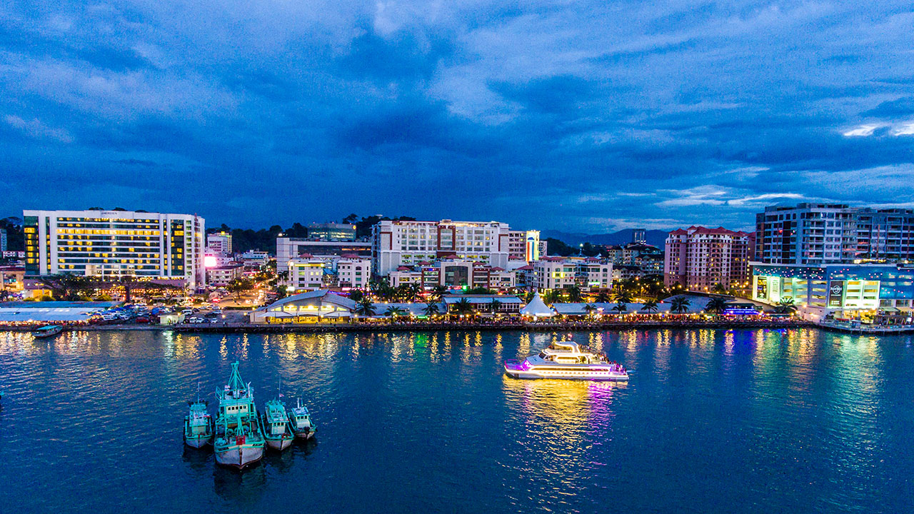
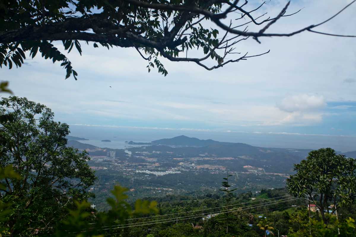
Located in the northernmost part of Borneo, Sabah has land borders with Sarawak to the southwest and Indonesia’s North Kalimantan province to the south. The Federal Territory of Labuan is an island just off Sabah’s west coast. Sabah shares maritime borders with Vietnam to the west and the Philippines to the north and east. Kota Kinabalu is the state capital, the economic centre of the state, and the seat of the Sabah State government. Other major towns in Sabah include Sandakan and Tawau. Sabah has an equatorial climate with tropical rainforests, abundant with animal and plant species. The state has long mountain ranges on the west side, which form part of Crocker Range National Park. The Kinabatangan River, the second longest river in Malaysia, runs through Sabah. The highest point of Sabah, Mount Kinabalu, is also the highest point in Malaysia.

The origin of the name Sabah is uncertain, and many theories have arisen. One theory is that during the time it was part of the Bruneian Sultanate, it was referred to as Saba because of the presence of a variety of banana called pisang saba, also known as pisang menurun, which is grown widely on the coast of the region and popular in Brunei. The Bajau community referred to it as pisang jaba. While the name Saba also refers to a variety of bananas in both Tagalog and Visayan languages, the word in Visayan has the meaning noisy, which in turn is derived from Sanskrit Sabhā, meaning a congregation, or crowd and related to a noisy mob. Due to the local dialect, the word Saba has been pronounced as Sabah by the local community. While Brunei was a vassal state of Majapahit, the Old Javanese eulogy of Nagarakretagama described the area in what is now Sabah as Seludang.

Although the Chinese have been associated with the island since the days of the Han dynasty, they did not have any specific names for the area. Instead, during the Song dynasty, they referred to the whole island as Po Ni, also pronounced Bo N), which is the same name they used to refer to the Sultanate of Brunei at the time. Due to the location of Sabah near Brunei, it has been suggested that Sabah was a Brunei Malay word meaning upstream or in a northerly direction. Another theory suggests that it came from the Malay word sabak, which means a place where palm sugar is extracted. Sabah is also an Arabic word, which means morning.

The presence of multiple theories makes it difficult to pinpoint the true origin of the name. It is nicknamed the Land Below the Wind or Negeri Di Bawah Bayu, as the state lies below the typhoon belt of East Asia and has never been battered by any typhoons, except for several tropical storms.

The earliest known human settlement in the region existed 20,000–30,000 years ago, as evidenced by stone tools and food remains found by excavations along the Darvel Bay area at Madai-Baturong caves near the Tingkayu River. In 2003, archaeologists discovered the Mansuli valley in the Lahad Datu District, which dates back the history of Sabah to 235,000 years. During the 7th century, a settled community known as Vijayapura, a tributary to the Srivijaya empire, was thought to have existed in northwest Borneo. The earliest independent kingdom in Borneo, supposed to have existed in the 9th century, was Po Ni, as recorded in the Chinese geographical treatise Taiping Huanyu Ji. It was believed that Po Ni existed at the mouth of the Brunei River and was the predecessor to the Bruneian Empire.

In the 14th century, Brunei and Sulu were part of the Majapahit Empire but in 1369, Sulu and the other Philippine kingdoms successfully rebelled and Sulu even attacked Brunei, which was still a Majapahit tributary. The Sulus specifically invaded Northeast Borneo at Sabah. The Sulus were repelled but Brunei became weakened. In 1370, Brunei transferred its allegiance to the Ming dynasty of China. The Maharaja Karna of Borneo then paid a visit to Nanjing with his family until his death. He was succeeded by his son, Hsia-wang, who agreed to send tribute to China once every three years. After that, Chinese junks came to northern Borneo with cargoes of spices, bird nests, shark fins, camphor, rattan and pearls. More Chinese traders eventually settled in Kinabatangan, as stated in both Brunei and Sulu records. A younger sister of Ong Sum Ping or Huang Senping, the governor of the Chinese settlement, then married Sultan Ahmad of Brunei. Perhaps due to this relationship, a burial place with 2,000 wooden coffins, some estimated to be 1,000 years old, was discovered in the Agop Batu Tulug Caves and around the Kinabatangan Valley area. It is believed that this type of funeral culture was brought by traders from Mainland China and Indochina to northern Borneo as similar wooden coffins were also discovered in these countries.

During the reign of the fifth sultan of Bolkiah between 1485 and 1524, the Sultanate’s thalassocracy extended over northern Borneo and the Sulu Archipelago, as far as Kota Seludong, present-day Manila, with its influence extending as far as Banjarmasin, taking advantage of maritime trade after the fall of Malacca to the Portuguese. Many Brunei Malays migrated to Sabah during this period, beginning after the Brunei conquest of the territory in the 15th century. But plagued by internal strife, civil war, piracy and the arrival of Western powers, the Bruneian Empire began to shrink. The first Europeans to visit Brunei were the Portuguese, who described the capital of Brunei at the time as surrounded by a stone wall. The Spanish followed, arriving soon after Ferdinand Magellan’s death in 1521, when the remaining members of his expedition sailed to the islands of Balambangan and Banggi in the northern tip of Borneo. Later, in the Castilian War of 1578, the Spanish, who had sailed from New Spain, which was centred in Mexico and had taken Manila from Brunei, unsuccessfully declared war on Brunei by briefly occupying the capital before abandoning it. The Sulu region gained its independence in 1578, forming its sultanate, known as the Sultanate of Sulu.

When the civil war broke out in Brunei between Sultans Abdul Hakkul Mubin and Muhyiddin, the Sulu Sultan asserted their claim to Brunei’s territories in northern Borneo. The Sulus claimed that Sultan Muhyiddin had promised to cede the northern and eastern portions of Borneo to them in compensation for their help in settling the civil war. The territory seems never to have been ceded formally, but the Sulus continued to claim the territory, with Brunei weakened and unable to resist. After the war with the Spanish, the area in northern Borneo began to fall under the influence of the Sulu Sultanate. The seafaring Bajau-Suluk and Illanun people then arrived from the Sulu Archipelago and started settling on the coasts of north and eastern Borneo, fleeing from the oppression of Spanish colonialism. While the thalassocratic Brunei and Sulu sultanates controlled the western and eastern coasts of Sabah, respectively, the interior region remained largely independent from either kingdom. The Sultanate of Bulungan’s influence was limited to the Tawau area, which came under the influence of the Sulu Sultanate before gaining its own rule after the 1878 treaty between the British and Spanish governments.

In 1761, Alexander Dalrymple, an officer of the British East India Company, agreed with the Sultan of Sulu to allow him to set up a trading post for the first time in northern Borneo, although this was to prove a failure. Following the British occupation of Manila in 1763, the British freed Sultan Alimuddin from Spanish colonisers and allowed him to return to his throne; this was welcomed by the Sulu people and by 1765, Dalrymple managed to obtain the island, having concluded a Treaty of Alliance and Commerce with the Sultan of Sulu by a willing Sultan Alimuddin as a sign of gratitude for the British aid. A small British factory was then established in 1773 on Balambangan Island, a tiny island situated off the north coast of Borneo. The British saw the island as a suitable location to control the trade route in the East, capable of diverting trade from the Spanish port of Manila and the Dutch port of Batavia, especially with its strategic location between the South China Sea and Sulu Sea. The British abandoned the island two years later when the Sulu pirates began attacking. This forced the British to seek refuge in Brunei in 1774 and to temporarily abandon their attempts to find alternative sites for the factory. Although an attempt was made in 1803 to turn Balambangan into a military station, the British did not re-establish any further trading posts in the region until Stamford Raffles founded Singapore in 1819.

In 1846, the island of Labuan on the west coast of Sabah was ceded to Britain by the Sultan of Brunei through the Treaty of Labuan, and in 1848 it became a British Crown Colony. Seeing the presence of the British in Labuan, the American consul in Brunei, Claude Lee Moses, obtained a ten-year lease in 1865 for a piece of land in northern Borneo. Moses then passed the land to the American Trading Company of Borneo, which chose Kimanis, which they renamed Ellena, and started to build a base there. Requests for financial backing from the US government proved futile and the settlement was later abandoned.

Japanese forces landed in Labuan on January 3, 1942 and later invaded the rest of northern Borneo. From 1942 to 1945, Japanese forces occupied North Borneo, along with most of the rest of the island, as part of the Empire of Japan. The occupation drove many people from coastal towns to the interior, fleeing the Japanese and seeking food. As part of the Borneo Campaign to retake the territory, Allied forces bombed most of the major towns under Japanese control, including Sandakan, which was razed to the ground. The Japanese ran a brutal prisoner-of-war camp known as Sandakan Camp for those siding with the British. The majority of the POWs were British and Australian soldiers captured after the fall of Malaya and Singapore. The prisoners suffered notoriously inhuman conditions, and amidst continuous Allied bombardments, the Japanese forced them to march into Ranau, which is about 260 kilometres away, in an event known as the Sandakan Death March. In March 1945, Australian forces launched Operation Agas to gather intelligence in the region and launch guerrilla warfare against the Japanese. The war ended on September 10, 1945, after the Australian Imperial Forces or AIF succeeded in the battle of North Borneo.

After the Japanese surrender, North Borneo was administered by the British Military Administration and, on July 15, 1946, became a British Crown Colony. The Crown Colony of Labuan was integrated into this new colony. Due to massive destruction in the town of Sandakan since the war, Jesselton was chosen to replace the capital and the Crown continued to rule North Borneo until 1963. Upon Philippine independence in 1946, seven of the British-controlled Turtle Islands, including Cagayan de Tawi-Tawi and Mangsee Islands off the north coast of Borneo, were ceded to the Philippines as part of negotiations between the American and British colonial governments. On August 31, 1963, North Borneo attained self-government. After discussion culminating in the Malaysia Agreement and 20-point agreement, on September 16, 1963, North Borneo as Sabah was united with Malaya, Sarawak and Singapore, to form the independent Malaysia.

From before the formation of Malaysia until 1966, Indonesia adopted a hostile policy towards the British-backed Malaya, leading after the union to the Indonesia-Malaysia confrontation. This undeclared war stemmed from what Indonesian President Sukarno perceived as an expansion of British influence in the region and his intention to wrest control over the whole of Borneo under the Greater Indonesia concept. Meanwhile, the Philippines, beginning with President Diosdado Macapagal on Ju, June 1962, claimed Sabah from cession by heirs of the Sultanate of Sulu. Macapagal, who considered Sabah to be the property of the Sultanate of Sulu, saw the attempt to integrate Sabah, Sarawak and Brunei into the Federation of Malaysia as trying to impose the authority of Malaya on these states.

Sabah held its first state election in 1967. In the same year, the state capital of Jesselton was renamed Kota Kinabalu. On June 14, 1976, the state government of Sabah signed an agreement with Petronas, granting it the right to extract and earn revenue from petroleum found in the territorial waters of Sabah in exchange for 5% in annual revenue as royalties based on the 1974 Petroleum Development Act. The state government of Sabah ceded Labuan to the Malaysian federal government, and Labuan became a federal territory on April 16, 1984. In 2000, the state capital, Kota Kinabalu, was granted city status, making it the 6th city in Malaysia and the first city in the state.

In February 2013, Sabah’s Lahad Datu District was penetrated by followers of Jamalul Kiram III, the self-proclaimed Sultan of the Sulu Sultanate. In response, Malaysian military forces were deployed to the region, following which an Eastern Sabah Security Command was established. Sabah has seen several territorial disputes with Malaysia’s neighbours, Indonesia and the Philippines. In 2002, both Malaysia and Indonesia submitted to arbitration by the ICJ on a territorial dispute over the Ligitan and Sipadan islands, which was later won by Malaysia. There are also several other disputes yet to be settled with Indonesia over the overlapping claims on the Ambalat continental shelf in the Celebes Sea and the land border dispute between Sabah and North Kalimantan. Malaysia’s claim over a portion of the Spratly Islands is also based on sharing a continental shelf with Sabah. The Philippines has a territorial claim over much of the eastern part of Sabah. It claims that the territory is connected with the Sultanate of Sulu and was only leased to the North Borneo Chartered Company in 1878, with the Sultanate’s sovereignty never being relinquished. Malaysia, however, considers this dispute a non-issue, as it interprets the 1878 agreement as that of cession and deems that the residents of Sabah exercised their right to self-determination when they joined to form the Malaysian federation in 1963. Before the 2013 incident, Malaysia continued to dutifully pay an annual cession payment amounting to roughly $1,000 to the indirect heirs of the Sultan, honouring an 1878 agreement, where North Borneo, today’s Sabah, was conceded by the late Sultan of Sulu to a British company. However, the Malaysian government halted payments after this tragedy. As a result, the self-proclaimed Sulu heirs pursued this case for legal arbitration vis-à-vis the original commercial deal. Since then, Sulu claimants have been accused of forum shopping. In 2017, the heirs showed their intention to start arbitration in Spain and asked for $32.2 billion in compensation. In 2019, Malaysia responded for the first time. The attorney general at the time offered to start making yearly payments again and to pay RM 48,000 or about USD 10,400 for past dues and interest, but only if the heirs gave up their claim. The heirs did not accept this offer and the case, led by Spanish arbiter Gonzalo Stampa, continued without Malaysia being involved. In February 2022, Gonzalo Stampa awarded US$14.9 billion to the Sultan of Sulu’s heirs, who have since sought to enforce the award against Malaysian state-owned assets around the world. It is noteworthy that on 27 June 2023, the Hague Court of Appeal dismissed the Sulus’ bid and ruled in favour of the Malaysian government, which hailed the decision as a landmark victory.

The Philippine claim can be based on three historical events: the Brunei Civil War from 1660 until 1673, the treaty between the Dutch East Indies and the Bulungan Sultanate in 1850 and the treaty between Sultan Jamal ul-Azam and Overbeck in 1878. Further attempts by several Filipino politicians to destabilise Sabah proved to be futile and led to the Jabidah massacre in Corregidor Island, Philippines. This led the Malaysian government to support the insurgency in the southern Philippines. Although the Philippine claim to Sabah has not been actively pursued for some years, some Filipino politicians have promised to bring it up again, while the Malaysian government has asked the Philippines not to threaten ties over such an issue.

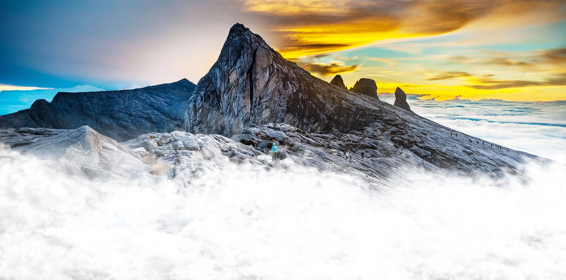
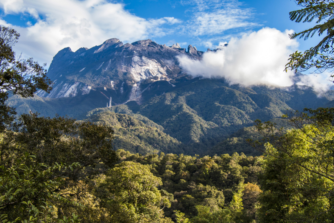
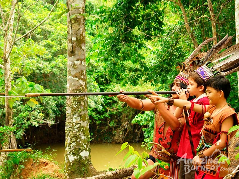
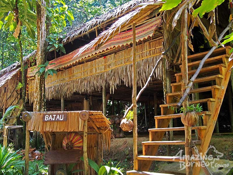
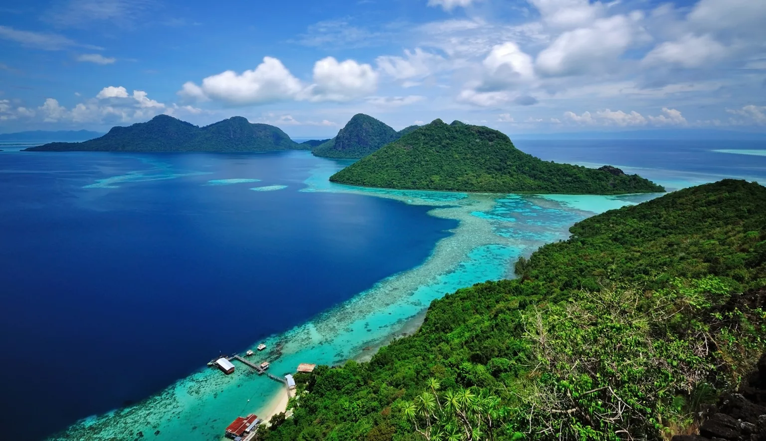
Sabah exhibits notable diversity in ethnicity, culture and language. It is known for its traditional musical instrument, the sompoton. Sabah has abundant natural resources, and its economy is strongly export-oriented. Its primary exports include oil, gas, timber and palm oil. The other major industries are agriculture and ecotourism. Sabah is located south of the typhoon belt, making it insusceptible to the devastating effects of the typhoons that frequently batter the neighbouring Philippines. The state is surrounded by the South China Sea in the west, the Sulu Sea in the northeast and the Celebes Sea in the southeast. Sabah’s 1,743 km of coastline faces erosion and because it is surrounded by three seas, it has extensive marine resources. The state coastline is covered with mangrove and nipah forests. Both coastal areas on the west coast and east coast are entirely dominated by sand beaches, while in sheltered areas the sand is mixed with mud. The western part of Sabah is generally mountainous, containing three of the highest peaks. The main mountain range is the Crocker Range, with several mountains of varying heights. Adjacent to the Crocker Range is the Trus Madi Range, with Mount Trus Madi, at a height of 2,642 m. The highest peak is Mount Kinabalu, at a height of 4,095 m. The central and eastern portions of Sabah are generally lower mountain ranges and plains with occasional hills. On the east coast is the Kinabatangan River, which is the second-longest river in Malaysia after the Rajang River in Sarawak, with a length of 560 km. Sabah experiences two monsoon seasons, the northeast and southwest. It also receives two inter-monsoon seasons, from April to May and September to October. As Sabah lies within the Sunda Plate with compression from the Australian and Philippine Plates, it is prone to earthquakes.

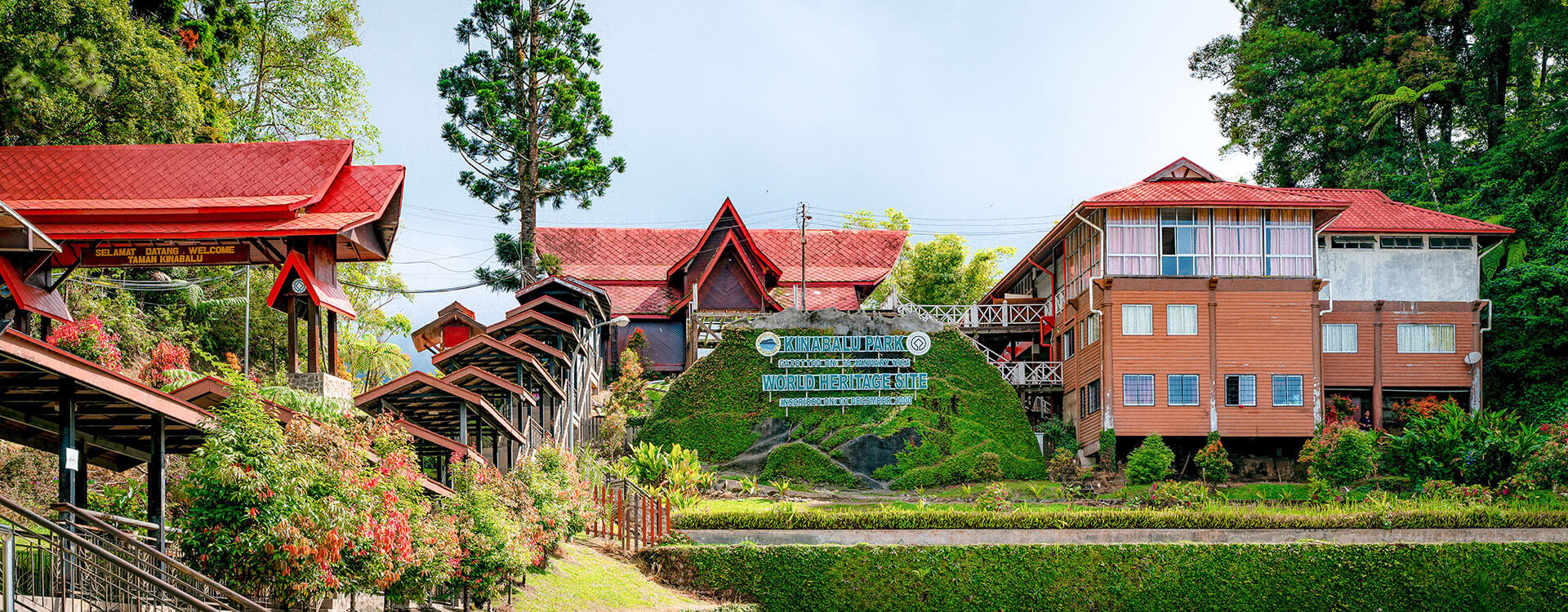
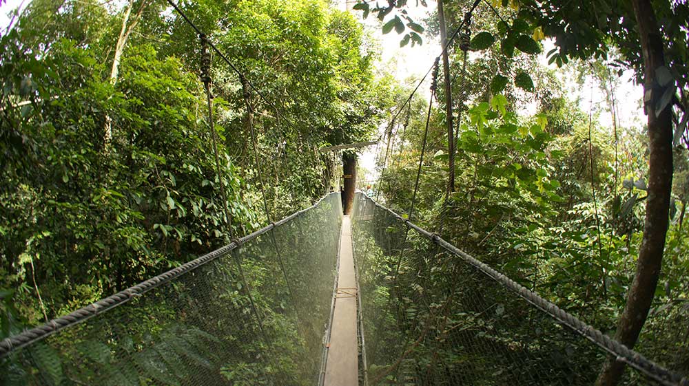
The kingfisher is the state bird of Sabah and is featured in one of its coats of arms. The Semporna Peninsula on the north-eastern coast of Sabah is identified as a hotspot of high marine biodiversity importance in the Coral Triangle. The jungles of Sabah host a diverse array of plant and animal species. Most of Sabah’s biodiversity is located in the forest reserve areas, which form half of its total landmass. Its forest reserves are part of the 20 million hectares of equatorial rainforests demarcated under the Heart of Borneo initiative. Kinabalu National Park was inscribed as a World Heritage Site by UNESCO in 2000 for its richness in plant diversity combined with its unique geological, topographical, and climatic conditions. The park hosts more than 4,500 species of flora and fauna, including 326 birds and around 100 mammal species, along with over 110 land snail species.

Since the post-World War II timber boom, driven by the need for raw materials from industrial countries, Sabah forests have been gradually eroded by uncontrolled timber exploitation and the conversion of Sabah forest lands into palm oil plantations. Since 1970, the forestry sector has contributed to over 50% of the state revenue, of which a study conducted in 1997 revealed the state had almost depleted all of its virgin forests outside the conservation areas.

In My Hands Today…

A Travel Guide to the Middle Ages: The World Through Medieval Eyes – Anthony Bale

A captivating journey of the expansive world of medieval travel, from London to Constantinople to the court of China and beyond. Europeans of the Middle Ages were the first to use travel guides to orient their wanderings, as they moved through a world punctuated with miraculous wonders and beguiling encounters.

In this vivid and alluring history, medievalist Anthony Bale invites readers on an odyssey across the medieval world, recounting the advice that circulated among those venturing to the road for pilgrimage, trade, diplomacy, and war. Journeying alongside scholars, spies, and saints, from Western Europe to the Far East, the Antipodes and the ends of the earth, Bale provides indispensable information on the exchange rate between Bohemian ducats and Venetian groats, medieval cures for seasickness, and how to avoid extortionist tour guides and singing sirens.

He takes us from the streets of Rome, more ruin than tourist spot, and tours of the Khan’s court in Beijing to Mamluk-controlled Jerusalem, where we ride asses across the holy terrain, and bustling bazaars of Tabriz. We also learn of rumored fantastical places, like ones where lambs grow on trees and giant canes grow fruit made of gems. And we are offered a glimpse of what non-European travelers thought of the West on their own travels.

Using previously untranslated contemporaneous documents from a colorful range of travelers, and from as far and wide as Turkey, Iceland, North Africa, and Russia, A Travel Guide to the Middle Ages is a witty and unforgettable exploration of how Europeans understood―and often misunderstood―the larger world. 20 illustrations; 6 maps