Empress: The Astonishing Reign of Nur Jahan – Ruby Lal
Four centuries ago, a Muslim woman ruled an empire.
When it came to hunting, she was a master shot. As a dress designer, few could compare. An ingenious architect, she innovated the use of marble in her parents’ mausoleum on the banks of the Yamuna River that inspired her stepson’s Taj Mahal. And she was both celebrated and reviled for her political acumen and diplomatic skill, which rivaled those of her female counterparts in Europe and beyond.
In 1611, thirty-four-year-old Nur Jahan, daughter of a Persian noble and widow of a subversive official, became the twentieth and most cherished wife of the Emperor Jahangir. While other wives were secluded behind walls, Nur ruled the vast Mughal Empire alongside her husband, and governed in his stead as his health failed and his attentions wandered from matters of state. An astute politician and devoted partner, Nur led troops into battle to free Jahangir when he was imprisoned by one of his own officers. She signed and issued imperial orders, and coins of the realm bore her name.
Acclaimed historian Ruby Lal uncovers the rich life and world of Nur Jahan, rescuing this dazzling figure from patriarchal and Orientalist clichés of romance and intrigue, and giving new insight into the lives of women and girls in the Mughal Empire, even where scholars claim there are no sources. Nur’s confident assertion of authority and talent is revelatory. In Empress, she finally receives her due in a deeply researched and evocative biography that awakens us to a fascinating history.
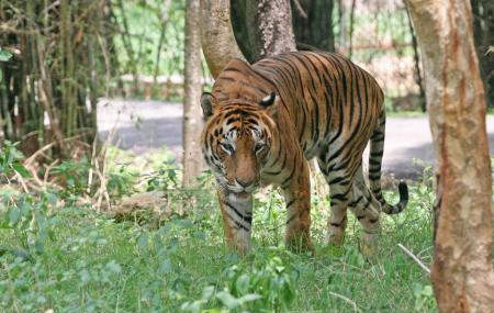
Dampa Tiger Reserve Located amidst deep and dense forests, the Dampa Tiger Reserve is located about 120 km southwest of Aizwal and is rich with a variety of flora and fauna. The wildlife sanctuary covers a sprawling area of over 500 sq km in the Lushai Hills at an altitude of between 800 to 1,100 m on the western side of Mizoram and touches the international boundaries with Bangladesh. It was declared a tiger reserve in 1994 and is part of Project Tiger. The name Dampa means lonely men and refers to a local narrative about a village, where a lot of the women died.
The protected area was initially established as a wildlife sanctuary in 1985 with an area of about 680 sq km, which was reduced to about 340 sq km. In 1994, it received the status of a Tiger Reserve with an area of 500 sq km and thus became part of Project Tiger. The jurisdiction of the reserve is under two ranges, namely the Teirei Range and the Phuldungsei Range. The hills around the wildlife sanctuary are known to be the bio-geographic highway that connects India to certain regions of Mayanmar and China.
The tropical forests of the Dampa Tiger Reserve are home to diverse flora and fauna consisting of forests interpolated with steep precipitous hills, deep valleys, jungle streams, ripping rivulets, and natural salt licks. The reserve is not easily accessible unlike other parks where one can ride on a four-wheeler but one has to walk through the forest if one wishes to sight animals.
Dampa is home to the sloth bear, the serow, the hoolock gibbon, the slow loris, the endangered Phayre’s leaf monkey, the India leopard and the clouded leopard to name a few. The Bengal tiger was said to be extinct here until very recently when in May 2021 a camera trap finally captured a definite picture of a Bengal tiger. The last such recording was seven years ago, and before that, tiger scat was the only proof of their existence.
The Blue Pitta which belongs to the Pittidae family and is one of the 30 species on Earth is one of the main attractions here. Studies suggest that only 6 out of these 30 species of Pitta are found in India. There are about 54 species of birds that reside in the protected area out of which only 25 species have been identified by biologists researching the fauna of the reserve. Out of these 25, two species are in the nearly threatened category, and one is on the verge of extinction.
Dampa wildlife sanctuary is famous for its Jungle Safari. A part of the Safari includes taking detours in the deep, dense forests of the reserve. During the safari, one can spot leopards and tigers. A large variety of deer and bears are a common sight around the national park. Apart from this, Dampa also houses an exquisite variety of birds. One can book safari tours in advance and also opt to stay at one of the guesthouses available nearby at Dampa Hills.
Dampa Tiger Reserveis the largest wildlife sanctuary in Mizoram, was notified in 1985 and declared a tiger reserve in 1994. It is situated in the western part of Mizoram state, on the international border with Bangladesh about 127 km from Aizawl. It covers an area of approximately 550 sq km. The tropical Forests of Dampa are home to rich flora and fauna. It consists of forest interpolated with steep precipitous hills, deep valleys, jungle streams, ripping rivulets, natural salts licks, with an altitudinal zone of 200 m to 800 m. Dampa Tiger Reserve is a part of Project Tiger funded by the Government of India
Lunglei Situated in the south-central part of Mizoram, which means the bridge of rock got its name from a bridge-like rock found in the riverine area around Nghasih – a small tributary of the River Tlawng, the longest river in Mizoram. It is the largest town after the capital, Aizawl, and is located about 165 km south of Aizawl.
Lunglei was the capital of the South Lushai Hill Districts for 10 years from 1888, as was Aizawl for the North Hill Districts. The two were united in 1898. Until India’s partition, Lunglei had direct access to Chittagong, a big city in what is today Bangladesh which made Lunglei the commercial and educational centre. The first Jeepable road to Lunglei was made only in the 1950s.
Lunglei is famous for its scenic beauty and natural setting and is an ideal offbeat destination for those who love natural beauty and adventure activities bundled into one. Trekking, bird watching and camping are among the popular activities opted for by tourists visiting Lunglei. Lunglei is a biodiverse region, home to the Thorangtlang Wildlife Sanctuary and the Saza Wildlife Sanctuary. While the Saza Wildlife Sanctuary is famous for hosting migratory and endemic bird species, the Thorangtlang Wildlife Sanctuary is home to several animal species such as leopards, tigers, porcupines and leaf monkeys among others. Visiting the Lunglei Rock Bridge at the Nghasih stream is another popular activity while here.
On a rocky portion on the southern edge of Tawikhawthlir hill near Mualcheng village, about 65 km south of Lunglei, there are three figurines of persons in meditational poses which the local people call Lung Milem or the Stone Figures. It is not known who created them and it remains a mystery to date as no other relics of Buddhism are found elsewhere in the state.
Ui Lung is a monolith famous for its remarkably intricate carvings. It was erected in the whereabouts of 1800 by a certain Chinzah chieftain and his citizens in an expression of their longing for their fellow clansmen who perished in a severe famine. Their former village called Dawn is now in the Myanmar Republic. The stone features intricate carvings of animal heads, gongs, and human figures with spears and other weapons. It is a landmark in the historical wealth of the state. One may also visit Chhura leh Naa Vawk, a monolith with carvings portraying Mizo historical stories close to Ui Lung.
The District Museum at Lunglei is well-known as a storehouse of the ethnic culture and traditions of the state. There are exhibits of armour, jewellery, utensils, paintings, and other native art.
Lying about 84 km northeast of Lunglei, Khawnglung is a mountain situated near Pangzawl and a village of the same name used to be located on the ridge and was the scene of one of the bloodiest massacres during the days of internecine feuds between the Sailo chiefs in the middle of the nineteenth century. Intertwined with this event is the tragic love story of Chalkunga and Thanghniangi, a beautiful maiden who happened to be one of the many female captives taken by the raiders. Chalkunga later rescued her in a daring lone foray, only to lose her on the way home in the flooding Tiau river which swept her away from his grasp while they were attempting to cross it. With sheer cliffs on all sides, the mountain has always been a natural shelter for man and animals for ages. Declared a wildlife sanctuary in 2000, Khawnglung covers an area of 35 sq km and is rich in flora and fauna, particularly primates and birds. It however requires trekking for about 10 km to reach the sanctuary. The best time to visit is between October and March.
Champhai A bustling commercial town at the Indo – Myanmar border, Champhai is a beautiful place and a storehouse of ancient relics, monuments, legends and folklore. Located about 186 km east of Aizwal, Champhai is also considered the fast-emerging fruit bowl of Mizoram. Well-tended vineyards, passion fruit and the recently introduced kiwi fruit plantations in the surrounding hill slopes provide a kaleidoscope of colours. Champhai is believed to be the entry point and the settlement of the first Mizo migrants to India. At the base of the town, towards the Myanmar border is the Champhai Valley. Surrounded by undulating hills, is a wide expanse of rice fields, popularly known as the rice bowl of Mizoram. Because of Champhai’s strategically important location, it is the main business corridor for India and Myanmar in the area.
Champhai was the headquarters of Lalbura Sailo, the son of Vanhnuailiana, a Mizo Chief against whom the British Expedition of 1871–72 was directed. It was accorded the status of a fort during British colonial rule. The Champhai Valley was once a lake and was gradually silted to obliterate the lake. The soil of the plain was still uncultivated during the Lushai Expedition of 1872. Irrigated rice cultivation started in Champhai in 1898 encouraged by the British colonial authorities to supply rice to their soldiers and labourers.
Champhai has several tourist attractions mostly including natural settings, including Kungawrhi Puk, a cave, the river Tiau Lui and the Rih Dil lake. Adventure enthusiasts can indulge in some trekking at the Thasiama Seno Neihna which is about 83 km south of Champhai.
Hla Kungpui Mual is a monument to commemorate Mizo poets, writers, and composers. It was set up in 1986 at the southern edge of the Khawbung Village in the Champhai district. Here, the monuments of Mizo laureate poets and writers are erected at intervals of 10 years. There is a Mizo Poets Square Archive and Library within the compound where the belongings of the poets are preserved. Currently, a total of 36 monuments call the Poet’s Square home.
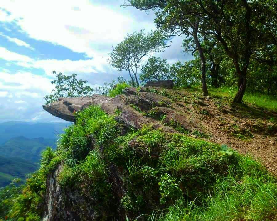
Once upon a time, on the legendary Lianchhiari Lunglen Tlang cliff, the love-smitten Lianchhiari used to look out for her lover, Chawngfiang, who had migrated to a distant village. With its idyllic view, this perilously protruding cliff has it has found a natural home in a plethora of romantic lore. It lies South of Champhai on the way to Khawbung.
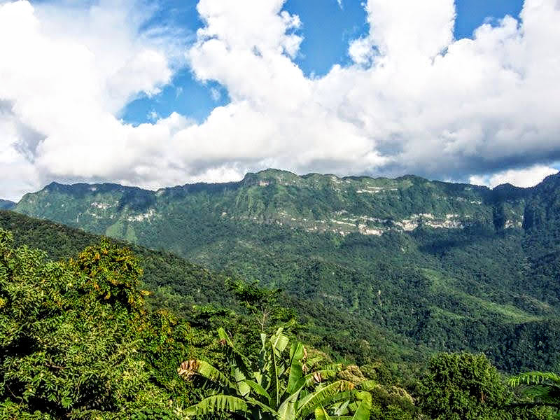
Located to the northeast of Champhai, Mt. Lengteng and its surroundings have been declared a wildlife sanctuary. The second-highest mountain in the region is filled with broad leaf and tropical evergreen forests, and sheer rocky cliffs. It is home to the endangered state bird, Vavu or Mrs Hume’s Pheasant and hornbills and endangered mammals like the slow loris, the leopard, the leopard cat, the serow, the goral and the Asiatic black bear. The sanctuary boasts orchids of various hues and beautiful flowering trees like rhododendrons and cherries. The Lengteng Wildlife Sanctuary is very close to the Murlen National Park which is spread over an area of 100 sq km with sub-tropical evergreen forests.
The Rih Lake is the largest in Mizoram and is often contested to be situated in Myanmar. It is a beautiful heart-shaped lake, believed to be the passage of souls to their eternal abode and is 14 miles from Champhai in Mizoram and 63 miles from Falam, Myanmar. Because it lies in a sensitive area, it cannot be visited without prior permission from the Deputy Commissioner’s Office.
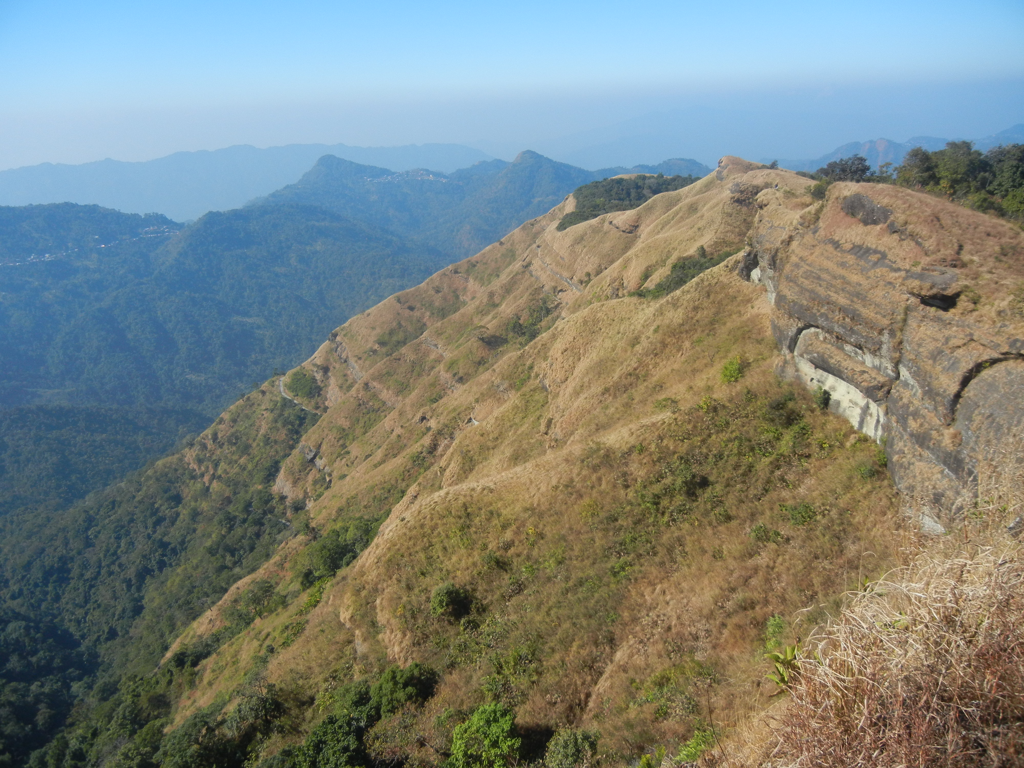
Reiek A mountain and tourist spot, Reiek is located about 29 km southwest of Aizawl at an elevation of 1,465 m. Overlooking Aizawl and offering a view of the surrounding valleys and hills, on a clear day, the plains of Bangladesh can be seen from the top of the hill. Reiek Hill is surrounded by thick lush green temperate trees and bushes. The best time to visit Reiek is in April. Apart from sightseeing, the hill is also a haven for birdwatchers. While climbing up the hill one will come across nests and chirping of the native birds including the Peregrine Falcon which is known to make nests at the rocky edges.
Reik also has a Heritage Village which is a typical Mizo village consisting of the distinctive traditional huts of the different Mizo sub-tribes, a Mizo chieftain’s house, a bachelor’s dormitory and of widows has been created and maintained by the Tourism Department. There is also a cafeteria and a resort providing decent food and accommodation.
Reiek is also the venue for the annual Anthurium festival which takes place each year in September. The Anthurium Festival is a festival promoting the Anthurium grown in Mizoram and the rich Mizo customs and traditions at Reiek Tlang. The festival is organised by the Tourism and the Horticulture Department and has the dual purpose of promoting the cultivation and marketing of the enthralling flower and attracting more tourists to the state and showcasing the rich and rhythmic cultural dances and games of Mizoram as well as fashion shows which are also a regular feature of the festival.
Hmuifang One of Mizoram’s beautiful destinations, Hmuifang or Hmuifang Tlang is a hill station with a lot to offer. Located 50 km from Aizawl at an elevation of 1619 m, Hmuifang is a hill town at the heart of the state and is known for its adventure and wildlife-related activities. A land of virginal green forests and slopes, Hmuifang is also famous for the Thalfavang Kut, a festival that gives one a peek into the Mizo culture by showcasing various dances such as the Cheraw, the Sawlakai, the Siktuithiang lam and the Chheihlam
The Hmuifang Tourist Resort built on the former land of the erstwhile Mizo chief is located at the scenic peak of the mountain and is maintained by the State Government. The resort has comfortable accommodations offering 6 double rooms and a cafeteria. The patches of grasslands on the peak are also ideal for picnics and outdoor camping. The resort is also the venue of the annual Anthurium Festival and Thalfavang Kut. From here, one can visit the Mizo villages situated on the hillsides, namely Hmuifang village, Sumsuih village, Lamchhip village and Chamring village, to see typical Mizo rural life. The mountain also has beautiful cliffs and offers great views of the surrounding hills with the forests abounding with varieties of flora including rare orchids and wildlife, especially avifauna.
Winters are the best time to visit Hmuifang because of the misty hills and the chilly air but it can be visited any time of the year with temperate temperatures.
Kolasib A quaint town away from the commercialised cities, Kolasib is one of the newer districts in Mizoram and lies in the northern part about 78 km north of Aizwal. In the absence of any written or any other form of authentic records, as is the case of many places in Mizoram, nothing is authentically known about the ancient or medieval ages of the history of the place. Written or authentic records were kept only after the state came under the occupation of British colonial rule in the 2nd half of the nineteenth century. It is said that a chief named Kawla was ruling the village now known as Kolasib and so the village was referred to as the Kawla Chief Village which then became Kolasib during British rule and the name stuck.
Kolasib which is part of the Aizwal Mountainous Region of the Eastern Hill Zones has an average literacy rate of 93.50%, higher than the national average of 74.04%. November to March is the best time to visit Kolasib and the climate is quite temperate and not extreme.
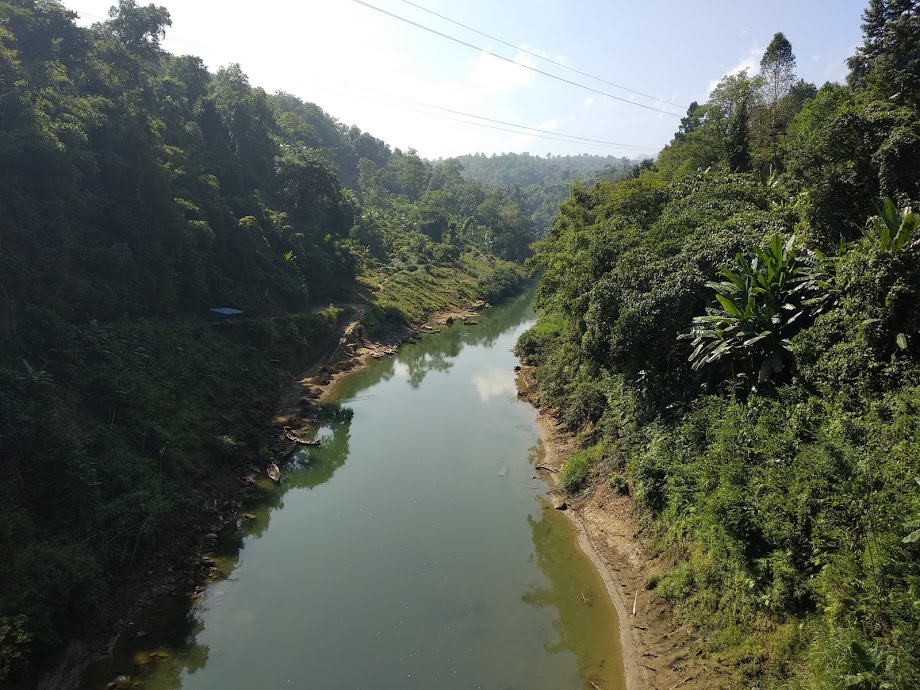
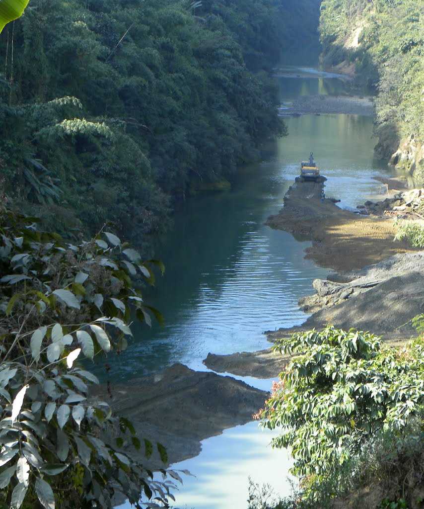
The River Tlawng is Kolasib’s best attraction with its beautiful river banks and adjoining forests serving as a countryside getaway. Close to Tamdil Lake, the river is considered to be Mizoram’s longest river and is spread across 185 km and is also known as Katakha or Dhaleswari in the local dialect. There is leisure boating available which can be done by requesting locals who would be willing to ferry around tourists.
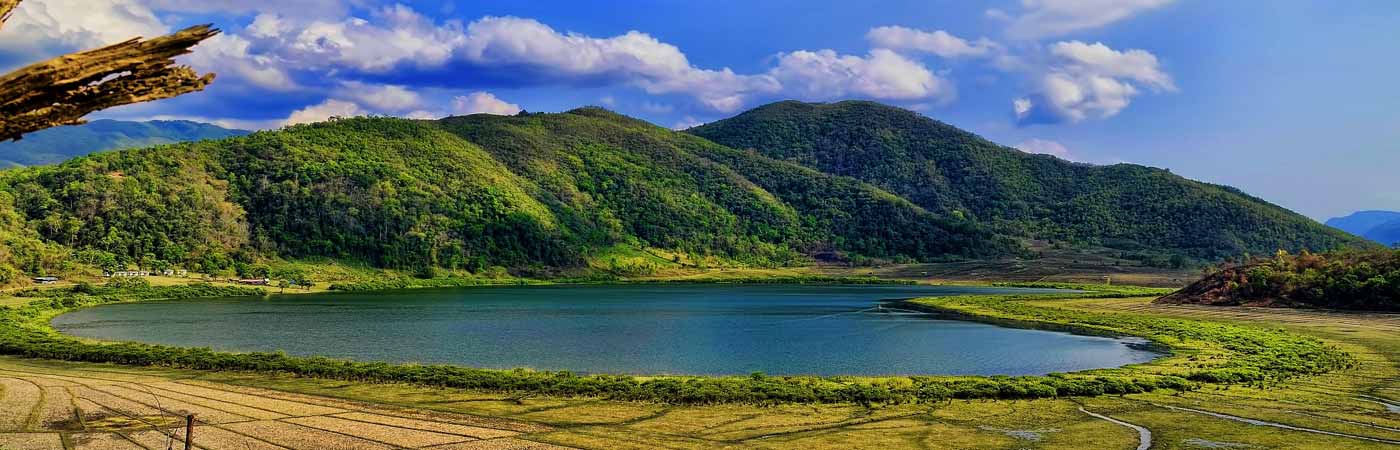
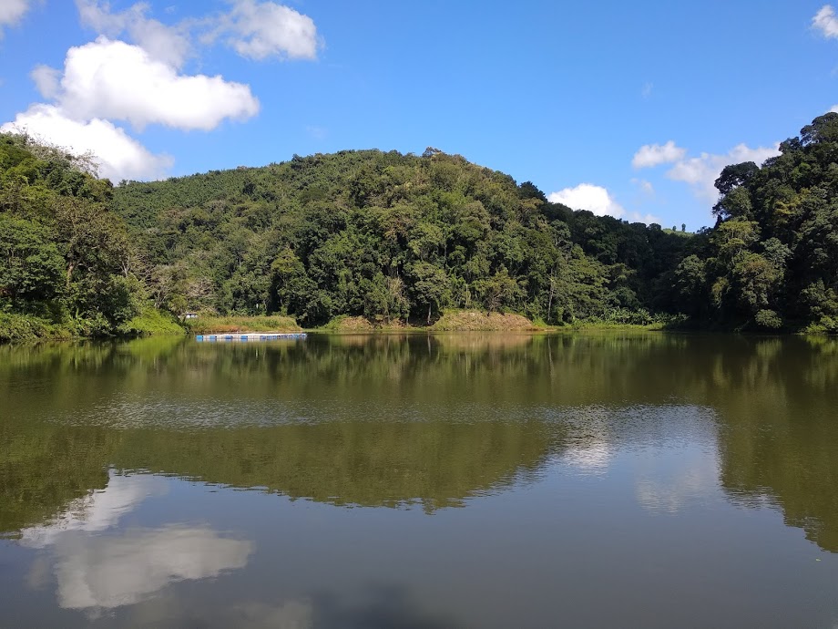
Tamdil or Tam Lake The largest lake in the state of Mizoram, Tamdil or Tam Lake is a man-made lake developed as an important pisciculture centre and a holiday resort by the state government. The name Tamdil which translates to Lake of Mustard is located about 6 km from Saitual village and 87 km east of Aizwal and is a local favourite. The lake is tucked between evergreen thick forests and are home to wide species of trees, plants and animals as well as has a magnificent landscape, clear, blue waters and a serene environment. A new species of frog called Leptolalax tamdil was described from this lake in 2010.
The origin and etymology of Ṭam Dil are shrouded in myth. Folklore has it that a married couple had a jhum plot in this small valley surrounded by small steep hills. The man, unfortunately, died leaving the wife to care for the crops alone. In the middle of the field was a robust mustard plant, conspicuously bigger than any other plant. One night the widow has a visitation by her husband, who informed her to take special care of the giant mustard plant as it was a harbinger of immense blessing. She did as she was told, and the plant thrived very well and grew bigger and bigger. After some time, the widow remarried but her new husband did not like her to keep anything that would remind her of her former husband and so he pulled the plant up by its roots and threw it away. Out of the hole left in the ground, water flowed out immediately and filled the valley to become a large and beautiful lake. Hence the name of Ṭam Dil, for the Lake of the Mustard.
The place is a local favourite for relaxation and allows one to be away from the crowd, in the lap of nature. One can also boat in the lake, walk around its shores or just spread a carpet, lie down and read a book.
Mamit Emerging from the regrouping of villages, Mamit lies about 88 km northwest of Aizwal at an average elevation of 718 m. The Mamit District was etched out from the erstwhile Aizawl District in 1998. The dominant tribe within the district is Mizo followed by Chakma and Reang. Mamit is famous for the production of oranges and is known as the Orange Garden of Mizoram. The fourth largest district in Mizoram, Mamit is known for its exquisite scenic locales. The Dampa Tiger Reserve is a popular tourist attraction as is the longest cave network of Mizoram in Pukzing.
Saitlaw is a small town situated around 11 km away to the west of Mamit, in the northeastern part of the state and is surrounded by the Rengdil village to the west and the Bualpui village to the north. West Phaileng is a village situated a few km away from Mamit at an altitude of around 1,290 feet above sea level. The Dampa Sanctuary is in very close proximity to this town which is flanked by dense forest and teak plantations. Kanghmun is a village in the southeastern part of Mamit district at a height of 2,841 feet above sea level. It is known for its cultural values and traditions of the Mamit district. Home to the biggest cave in the state, the 25 m wide Pukzing Cave is in the village of Pukzing at a distance of 12 km north of one of the most famous villages in Mamit, Phuldungsei. Lungkulh is famous for its artificial lake that boasts activities like fishing and boating. It is a brick structure that resembles a mound or a knoll and makes for a beautiful picturesque location.
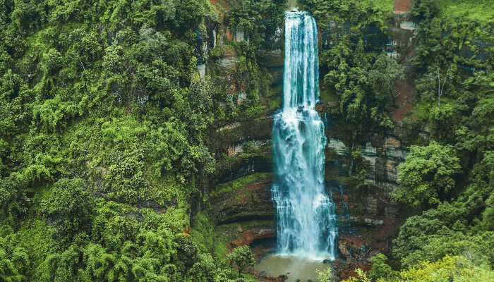
Vantawng Falls The highest waterfall in the state and the 13th highest in the country, Vantawng Waterfalls is one of the most mesmerizing waterfalls in Northeast India. One of Mizoram’s best attractions, Vantawng Falls is located about 100 km south of Aizwal and about 39 km north of Serchhip. Tucked between the verdant valleys with thick greenery around, the fall seems like a river of white milk from a distance.
Vantawng Khawhthla or Vantawng Falls is the highest and most spectacular of the waterfalls and cascades in the fast-flowing Vanva River near Thenzawl and is named after Vantawnga, who was said to be an excellent swimmer. So good a swimmer was Vantawnga that he could hover in the cascading water like a fish, but unfortunately, during one of such performances, a drifting log fell from above and killed him. The height of the fall is recorded as 324 feet and it is difficult to get close to it because of the sheer forested hillsides surrounding it, hence a viewing tower has been constructed. September to January are the best months to visit the Vantawng Falls because the weather is cold and the falls are visible flowing at their full might through the verdant Mizo Hills. The winters are cold in the Mizo mountains, so protection is required.
Serchhip Headquarters of the Serchhip district and about 107 km south of Aizwal, Serchhip lies in the central part of Mizoram. The district has the highest literacy in India. The origin of Serchhip’s name comes from the citrus trees found on top of the first hill of the then-Serchhip village. The word meaning of Ser-chhip is ‘citrus-on-top’. In addition to the former Serchhip village, the Town Area now included New Serchhip and Chhiahtlang villages.
Serchhip is at an average elevation of 888 m and lies between the two very important rivers of Mat and Tuikum. River Tuikum is a public drinking water for Serchhip and River Mat is an irrigation water for Zawlpui, the rice bowl of Serchhip.
The first settlement within the Serchhip area can be traced back to Lallula, a Mizo chief, who set up a settlement at Kawlri. Lallula massacred Thlânrâwn Pawi at Zopui. After this incident, afraid of revenge from Thlânrâwn, he fled towards Artahkawn to Lunglei Zobawk. And from there, he migrated towards the north and reached Serchhip Kawlri. The second settlement at Serchhip was founded by Bengkhuaia, son of Lalpuithanga, Chief of Bâwngchâwm, a great Mizo chief. From Kawlri he made a raid on Assam valley in 1871 and captured Mary Winchester, the daughter of James Winchester, which led to the First Lushai Expedition in 1872.
The district consists of many towns and villages lying around Serchhip. Thenzawl is the second biggest town after Serchhip and is one of the few flat areas with a beautiful grassy landscape. Close to Thenzawl is the spectacular Vantawng Falls.
Zoluti Hriatrengna Lung or Memory Stone is dedicated to Mary Winchester who was known as Zoluti by the Mizo people. The spot where Zoluti was handed back to British officials on 21 January 1872 is Aw-A Mual at Kawlri Tlang near Serchhip Kawnpui. Here, there is a stone erected on 5 January 1994 in memory of Zoluti, daughter of Dr Winchester, a manager in one of the Assam Tea Gardens.
Chhingpuii Thlan which means the Tomb of the Unmarried Woman is a stone erected in memory of Chhingpuii about 4 km north of Chhingchhip. This stone is named after a beautiful woman Chhingpuii who married Kaptuanga but was kidnapped and killed during the second civil war. It is after this that Kaptuanga was devastated and committed suicide.
Paragliding has become popular in Serchhip and can be practised at Chuanhnuai which lies between Serchhip and Keitum Village. It has now become so popular that a Paragliding Festival was organised attracting paragliders from other states as well. This is the only paragliding location available in Mizoram. Paragliders take off from Chuanhnuai and land in a very beautiful valley called Zawlpui leilet.
When I wrote my series on Indian fabrics and sarees, I was unaware of World Saree Day. And once I knew this day existed, I had to write about it. Celebrated today, 21 December, the day was started to encourage women to wear the saree, a timeless garment which, to me, defines a woman from India and the Indian subcontinent.
The origin of the drape or a garment similar to the sari can be traced back to the Indus Valley Civilisation, which flourished in north-western India between 2800 and 1800 BC. The garment developed from the common word sattika, which signifies a woman’s dress and appears in early Jain and Buddhist writings. Sattika was a three-piece outfit that included the Antriya or the bottom garment, the Uttariya or a covering worn over the shoulders or the head and the Stanapatta, a pectoral band. This ensemble may be dated back to the 6th century BC in Sanskrit and Buddhist Pali literature. Poshak, the Hindi word for costume, referred to the three-piece ensemble. The Antriya resembled the dhoti or the fishtail style of tying a sari. It further evolved into the Bhairnivasani skirt, which went on to be known as the ghagra or lehenga. The Uttariya evolved into the dupatta and the Stanapatta evolved into the choli.
Cotton was first cultivated in the subcontinent around the 5th century BC and this was followed by the incorporation of hues and dyes like indigo, lac, red madder and turmeric to create a drape which was used by women to cover their modesty. As the years went by, the elite started wearing sarees with expensive stones and gold thread which could showcase their wealth. But the saree stood strong as the garment of the Indian woman and each region and state had its regional variants, both in terms of fabrics and saree styles.
Industrialisation brought with it synthetic fabrics and dyes and with this came new dyeing and printing techniques which meant the consumers had access to a wide variety of sarees. The development of textiles in India reflected in saree designs and sarees soon started including figures, motifs, and flowers.
An extremely versatile garment, the saree can be draped in more than 80 recorded ways with the most common style or drape being the one where the saree is wrapped around the waist, with the loose end of the drape to be worn over the shoulder, baring the midriff. It is widely believed that it was the Nobel laureate Rabindranath Tagore’s brother Satyendranath Tagore’s wife Jnanadanandini Devi, who popularised the new form of wearing sarees which we see today.
Today when urbanisation and westernisation have taken over Indian fashion, a day dedicated to the attire which is synonymous with the Indian woman is essential. The saree is a reflection of the subcontinent’s rich cultural history and traditions and should not be allowed to wither away.
Known as the Songbird of India and one of India’s easternmost states, Mizoram is the southernmost of the seven sister states, sharing borders with the Indian states of Tripura, Manipur and Assam and also international borders with Bangladesh and Myanmar.
The name of the state is derived from Mizo, the self-described name of the native inhabitants, and Ram, which in the Mizo language means land. Thus Mizoram means the land of the Mizos. A landlocked state, Mizoram is India’s fifth smallest state with the Tropic of Cancer running through the state nearly to its middle.
Like several other northeastern states of India, Mizoram was previously part of Assam until 1972, when it was carved out as a Union Territory. In 1986 the Indian Parliament adopted the 53rd amendment of the Indian Constitution, which allowed for the creation of the State of Mizoram on 20 February 1987, as India’s 23rd state. Mizoram is the 2nd least populous state in the country and covers an area of approximately 21,087 sq km, of which approximately 91% is forested.
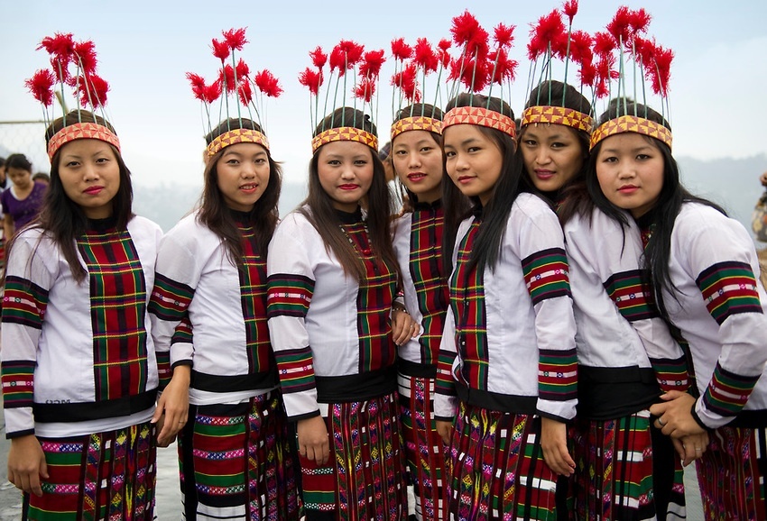
About 95% of Mizoram’s population descends from a diverse tribal origin. Mizos first began to settle in the area in the 16th century, coming in waves of immigration from Southeast Asia. This immigration lasted through the 18th century. Mizoram has the highest concentration of tribal people in India and the people of Mizoram are protected under the Indian constitution as a Scheduled Tribe. Mizoram is one of three states in India with a Christian majority with about 87% of the population following Christianity with people belonging to various denominations, mostly Presbyterians in the north and Baptists in the south. Mizoram is a highly literate agrarian economy with about 20% of the state’s population living below the poverty line.
Because of the sensitive nature of the state, so close to international borders, Indians need an Inner Line Permit or ILP to enter the state which cost INR 170 for a 15-day permit. The process to get an extension is slightly difficult. One can also get ILP documentation done at the Lengpui Airport in Aizwal.
Mizoram is derived from two Mizo words, Mizo and Ram where Mizo refers to native inhabitants and Ram means land. There is a dispute on the term zo. According to one view, zo means a highland or hill and Mizoram means the land of the Mizo people. There is also a view that says zo may also mean a cold region and therefore, Mizo may also signify people of the cold region. As with other tribes of northeastern India, the origin of the Mizos is shrouded in mystery. The people living in the Mizo Hills were generally referred to as the Cucis or Kukis by their neighbouring ethnic groups which was also a term adopted by the British. The majority of the tribes classified as Mizo today most likely migrated to their present territories from the neighbouring countries in several waves, starting around 1500. Before the British colonial rule, the various Mizo clans lived in autonomous villages with the tribal chiefs enjoying an eminent position in the gerontocratic Mizo society. The chiefs were the absolute rulers of their respective clans’ territories, although they remained under the nominal political jurisdictions of the Rajas of Manipur, Tripura and Burma.
The Mizo Hills formally became part of British India in 1895, and practices such as head-hunting were banned in Mizoram as well as neighbouring regions. The northern and southern Mizo Hills became the Lushai Hills, with Aizawl as their headquarters by declaring the whole area as an excluded area till Indian independence. After Christian missionaries arrived, the majority of the population became Christians in the first half of the 20th century.
Post-Indian independence, the number of tribal chiefs had increased to over 200 with the educated elites campaigning against the tribal chiefdoms under the banner of the Mizo Union. As a result, the hereditary rights of the 259 chiefs were abolished under the Assam-Lushai District Act, 1954. Village courts were re-implemented in the Mizo region along with other parts of Assam.
A period of protests and armed insurgency followed in the 1960s, which resulted in the Mizo National Front or MNF seeking independence from India which failed to garner public support or participation. In an attempt to counter these insurgency threats, the Indian government bombed state areas affected by insurgency, which is the only known bombing of India on its soil on 5 March 1966. In 1971, the government agreed to convert the Mizo Hills into a Union Territory, which became Mizoram in 1972. Following the Mizoram Peace Accord of 1986 between the Government and the MNF, Mizoram became a full-fledged state of India in 1987.
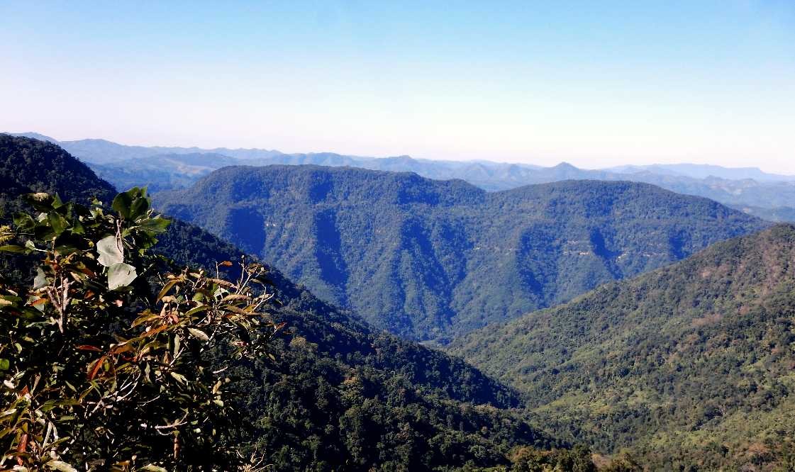
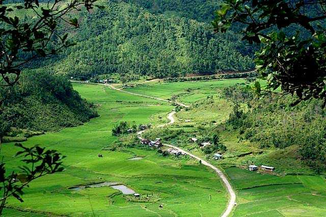
Geographically, Mizoram is a land of rolling hills, valleys, rivers and lakes. As many as 21 major hill ranges or peaks of different heights run through the length and breadth of the state, with plains scattered here and there. Phawngpui Tlang also known as the Blue Mountain, situated in the southeastern part of the state, is the highest peak in Mizoram at 2,210 m or 7,250 ft. About 76% of the state is covered by forests, 8% is fallow land, 3% is barren and considered uncultivable area, while cultivable and sown area constitutes the rest. Slash-and-burn or jhum cultivation, though discouraged, remains in practice in Mizoram and affects its topography. According to the Ministry of Environment, Forest and Climate Change, as of 2021, Mizoram has the highest forest cover as a percentage of its geographical area of any Indian state, at 84.53% forest.
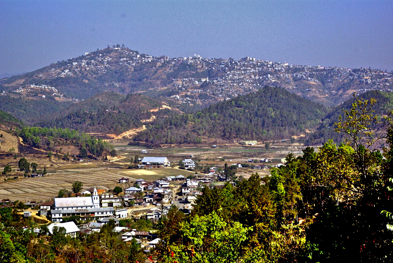
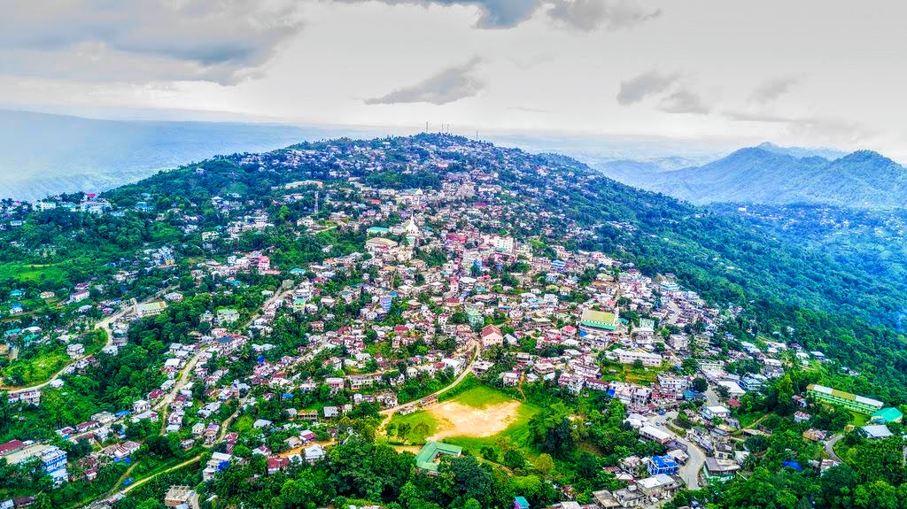
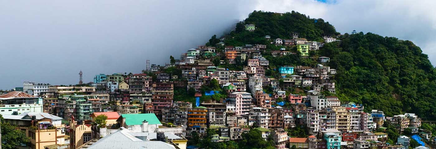
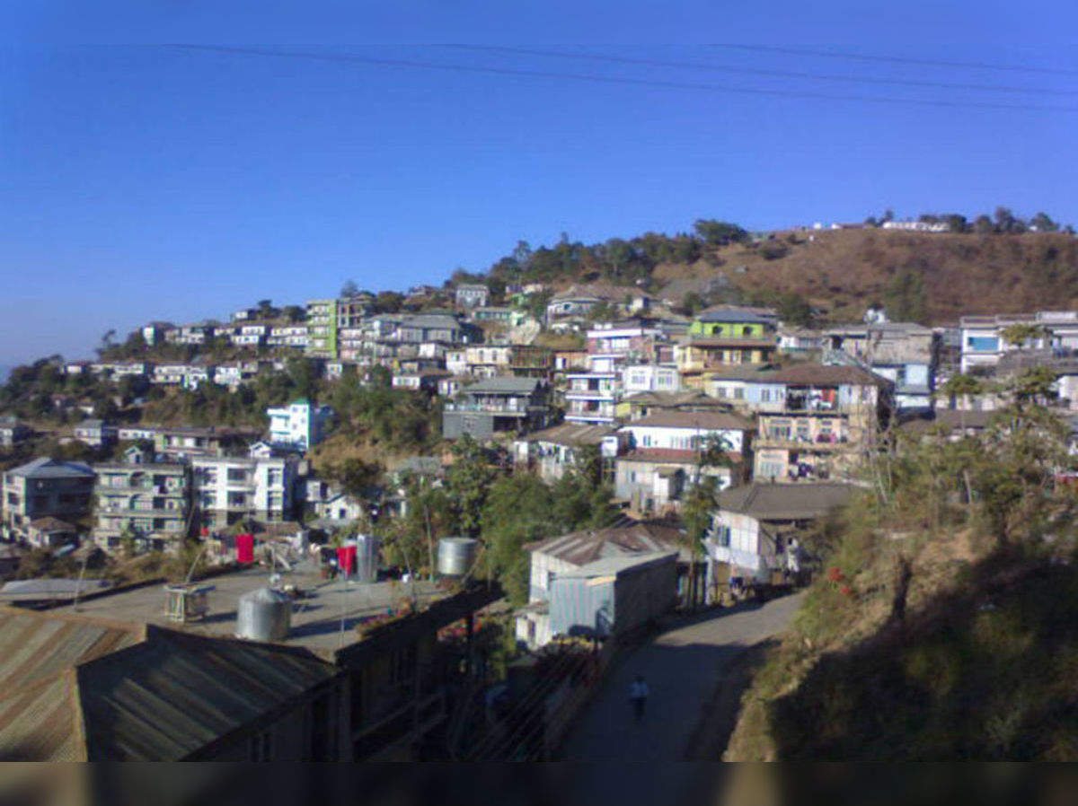
Aizwal Mizoram’s capital, Aizawl was officially established on 25 February 1890 and is the largest city in the state as well as the centre of administration, the state assembly house and the civil secretariat. Located north of the Tropic of Cancer in the northern part of Mizoram, Aizwal is situated on a ridge 1,132 m above sea level, with the Tlawng river valley to its west and the Tuirial river valley to its east.
In 1871–72, the disorderly conduct of Khalkom, a Mizo chief, compelled the British to establish an outpost that later became Aizawl village about 14 km from Sairang from where one could travel by flat-bottomed boat. In 1892-95 Aizawl became accessible from Silchar by a fair-weather road. The Indian Air Force carried out air strikes on the town during the March 1966 Mizo National Front uprising, following which the MNF withdrew to Lunglei. Until 1966, Aizawl was a large village but the regrouping of Mizo villages after the uprising made it become a larger town and then a city. Aizawl has become the centre of the Mizoram road network connecting the north and south, east and west of the state. More than 25% of the state’s population resides in Aizawl.
Primarily dominated by the Mizo Tribe, Aizawl and its surrounding areas are lush with rolling hills and abundant greenery. An Inner Line Pass or ILP is required for entry into Mizoram which is available in Guwahati, Silchar, Shillong, New Delhi, and Kolkata.
The Durtlang Hills is located in the northern part of Aizawl and is a popular attraction with viewpoints offering panoramic views of the capital city. One can drive to the destination and once there engage in a bit of light hiking and trekking. The best time to visit the Durtlang Hills would be in the morning when the sun is not as harsh as it would be during the afternoon.
Located in Kidron Valley, the Solomon Temple is a grand church constructed by the religious group Kohhran Thianghlim, as The Holy Church. The church was founded in 1984 and is one of the largest in the state. The Temple is a square site measuring 180 ft on each side with the interior measuring 120 ft. A verandah 30 ft wide is attached to the exterior of the main hall on all four sides and is called the porch of Solomon’s Temple. The main building has twelve main doors and above the porch are four pillars, each carrying seven stars of David, meant to represent the seven churches of the Book of Revelation. On each of the pillars is a picture of the Cross of Jesus Christ and the emblem of the Holy Church is embedded. Atop the porch is an idol of two Angels blowing trumpets which face the top of the pillar and flank the northern side of the pillar, which is now used as the main entrance. The temple has four towers, one on each corner with each tower topped with a crown, representing the Crown of Salvation, the Crown of Righteousness, the Crown of Life and the Crown of the Overcomer. Two intersecting horizontal ridges cross in the middle of the pitched roof such that when viewed from the air they form a cross, representing the new covenant. There is a park with the complex as well as a restaurant, an educational institute and a social service centre. The Salvation Army Temple has wonderful bell chimes and these can be heard throughout the city on quiet mornings.
A popular picnic spot, the Berawtlang Tourist Complex is located around 7 km from Aizwal and hosts multiple ceremonial functions and houses cottages as well as restaurants. Fairs are frequently conducted here, with various cultural activities, serving as a recreational centre. This place is
Located right in the centre of the city, the Mizoram State Museum displays the rich heritage of Mizoram. Along with the numerous archaeological artefacts, photographs and natural history specimens, an entire gallery here is dedicated to the Mizo tribes. An ethnographic museum with multipurpose collections on display, the museum has five galleries, namely the Textile Gallery, Ethnology, History, Anthropology, Natural History, and an Archaeology Terrace occupying four floors. The museum was established in April 1977 by the Tribal Research Institute under the Education Department. In 1989, it came under the Art and Culture department. The museum was earlier housed in a rented building but on 14 July 1990, it was moved to a new building.
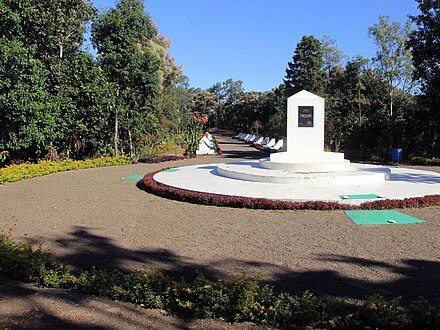
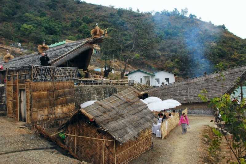
Falkawn Village Located just 18 km south of Aizwal, Falkawn Village is a model village depicting the lifestyle of the Mizo people and is frequented by tourists. A unique cultural extravaganza for first-time visitors to Mizoram. Falkawn village depicts the livelihood and culture of the Mizo people, who form the biggest tribe in the state. The Art & Culture Department of the state government has set up a Cultural Centre or Zokhua at Falkawn in 1992 which is a mini live museum where the Zawlbuk or the dormitory, the Lal In or the Chief’s House, the Pum or the Blacksmith and other typical Mizo houses are erected. There are freedom fighter memorial stones and a Taitesena commemoration stone. Entry fees are INR 20 for adults and INR 10 for children.


