Kokrajhar
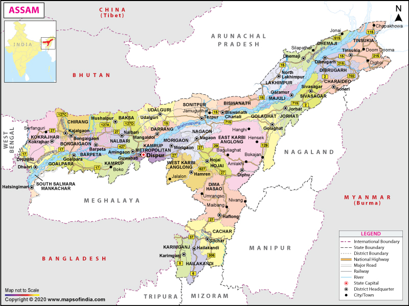
About 226 km west of Guwahati is the town of Kokrajhar, our next destination. Located on the north bank of the Brahmaputra, with the Gourang river flowing through it, the district shares a border with the Kingdom of Bhutan. Abode of the elusive Golden Langurs, the Chakrashila Wildlife Park is located here. The area is rich in natural beauty and sits at the foot of the lower Himalayas and the region is dotted with lush green forests. Kokrajhar is also the headquarters of the Bodoland Autonomous Council. Although the residents mainly speak Bodo now, early settlers were the Mon-Khmer speakers who were later pushed over by the Tibeto-Burman speakers that migrated from Tibet and China. The settlement of the Bodo people started with the earliest ruler of Assam, Kalika Purana, who belonged to the Bodo tribe. According to experts, the last rulers of the Naraka dynasty that ruled Assam fought for the Kauravas in the Mahabharat and were slain by mighty Krishna himself.

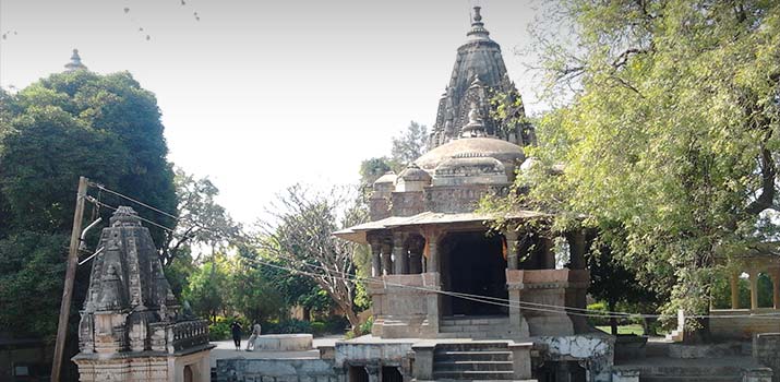
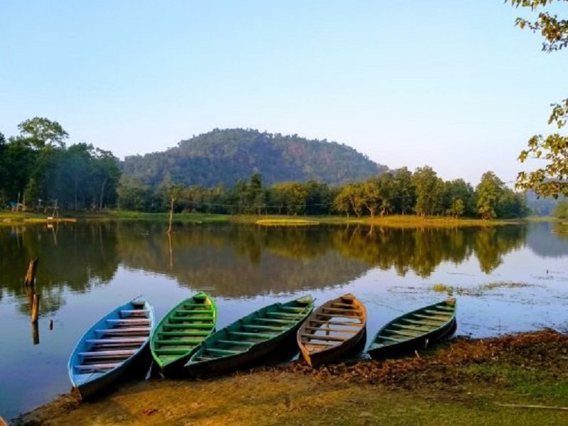
The three major tourist attractions here are the Chakrashila Wildlife Sanctuary, the Hanuman Temple and the Kali Temple. The Chakrashila Wildlife Sanctuary covers about 46 sq km and is popular for its exotic Golden Langur, making it the second protected habitat of the Golden Langur in India. Home to leopards, leopard cats, rhesus macaques, porcupines, Asiatic jackals; the sanctuary is also the abode of 250 endangered bird species including the night heron, the open billed stork, the lesser whistling teal and the hornbill. The sanctuary also has 23 different species of amphibians, over 40 species of butterflies and 60 types of insects. The lakes of Dheer and Deeplai which lie adjacent to each other adds to the beauty of the sanctuary. The sanctuary has provisions for trekking. Open all year, it is better to avoid the sanctuary in the monsoon season because the region is prone to heavy rainfall. The ancient Hanuman Temple is very popular while the Brahma Mandir which is dedicated to Lord Brahma said to be the creator of the universe is open daily between 5 am to 8 pm. The Daimalu Park and the Thandwai Brahma Memorial Park are ideal for relaxing while the Mahamaya Dham of Parbatjhora is a site of religious importance visited by devotees. The marvellous architecture of Mahamaya Snanghat Mandir is sui-generis. The lofty Maa Kali statue of Pachis Haat Kali Mandir catches the attention of the passers-by.

Bongaigaon
Our next destination is Bongaigaon which lies about 43 km east of Kokrajhar and 184 km west of Guwahati. The industrial and commercial hub of West Assam, Bongaigaon was the last capital of the Kamatapur Kingdom and home to many historical monuments of Assamese culture.

The Bagheswari Temple is one of the oldest temples in Assam and is dedicated to Goddess Parvati. It is among the oldest of the 52 Shakti Peethas or shrines devoted to Shaktism and the temple is so named due to the nearby Bagheswari Hill where tigers or bagh would be found in large numbers. Devotees flock to the temple in large numbers during the festival of Durga Pujo, specifically at the time of Durga Mahaashtami when buffalos are sacrificed. Legend has it that when Goddess Parvati was scattered across the earth by Lord Vishnu, a part of her Trishul or trident was found where the shrine within the temple lies, constructed by King Abhayapuri. The Lalmati – Duramari Ganesh Temple lies on Khagrapar Hill and is an ancient temple with stone carvings in the temple suggesting that the temple could belong to a period between the 8th and 10th centuries. Believed to be destroyed by an earthquake, the temple exists in a ruined state today. The Rock Cut Caves are evidence of the far-reaching rock-cut architectural movement during the Salasthamba period. These five caves at Jogighopa, at the bank of the Brahmaputra river, are some of the best-known examples of rock-cut structures in the state and are now preserved by the Archaeological Survey of India. The Bagheswari Hill is the highest point in Bongaigaon which houses a shrine dedicated to Lord Shiva. This hill overlooks the Bagheswari Temple, lending its name to it. From the top of the hill, one can enjoy panoramic views of the city.

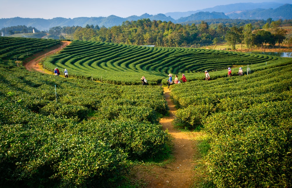
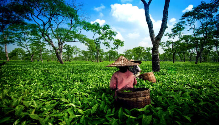
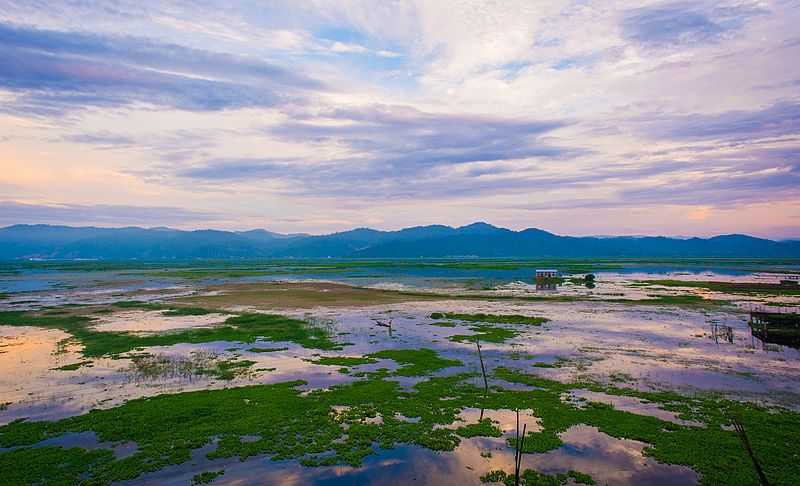
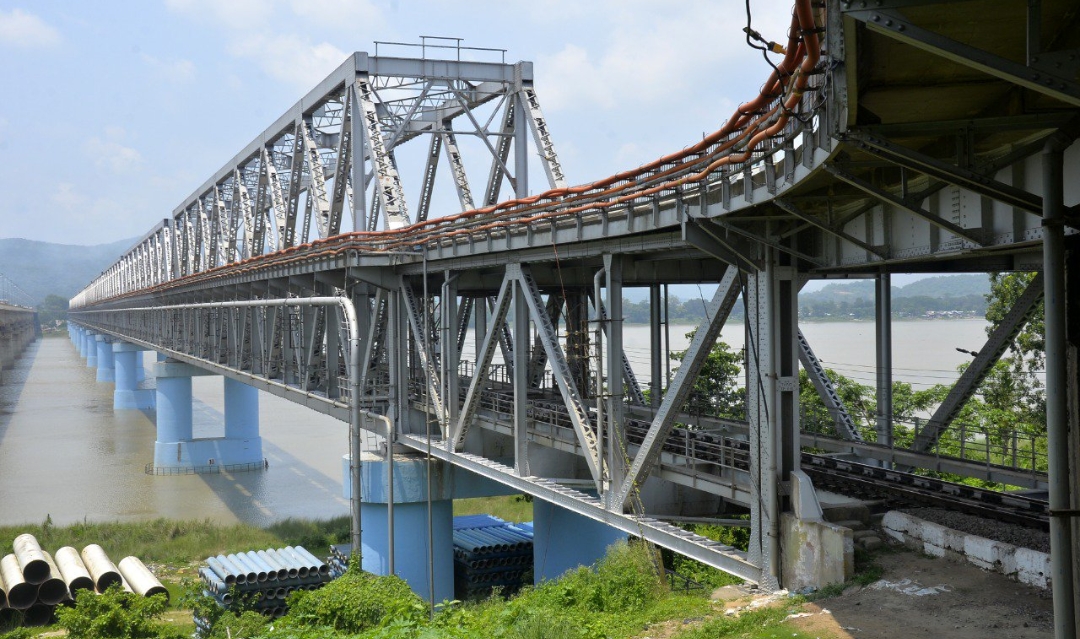
Known locally as Tamranga Bil or Tamranga Beel, the Tamranga Lake is one-half of the largest freshwater lakes in Assam. Located at around a half-hour drive from Bongaigaon, the lake is flanked by hills on one side and paddy fields and rubber plantations on the other and serves as a great picnic sport during the winter season. Tourists or non-locals who visit can pay local fishermen or boatmen a small fee to enjoy a leisurely boat ride on the lake. The Birjhora Tea Estate is one of the biggest tea gardens and is beautiful because of how it slopes towards Birjhora Hill. Situated on the banks of River Brahmaputra, Jogighopa and Pancharatna are two famous historic sites with Pancharatna lying on the southern side while Jogighopa lies on the northern side of the banks of the river. Both places have several cubicles cut down from rocks. These small rooms are considered to belonging to the medieval period and used by monks to meditate. There are various ancient temples and monuments made of huge rocks. The Narnarayan Setu is a double-deck bridge with a railway track on the lower deck and a road on the upper deck that connects Jogighopa with Pancharatna.

The Koya-Kujia Bill is an ecological park, famous as a picnic spot. A project undertaken by the Assam Tourism Development Corporation, Koya-Kujia Bill aims to keep safe the number of birds that fly here every winter and to keep intact its natural vegetation. It is a natural water body that is surrounded by well-manicured gardens laden with the rich vegetation of different species of plants, shrubs, and herbs. The park also has recreational activities including swings and slides and boating in the waters of the Koya Kujia Lake. Each year, numerous birds arrive at the park in January and December. Located in the small town of Abhayapuri, about 22 km south of Bongaigaon, one will need to hire a private vehicle to reach the park. The Kachugaon Game Reserve, located in Kachugaon is a protected area under the Assam Forest Department which has many rare and endangered species such as the gaur, the golden langur, the spotted deer and the elephant.
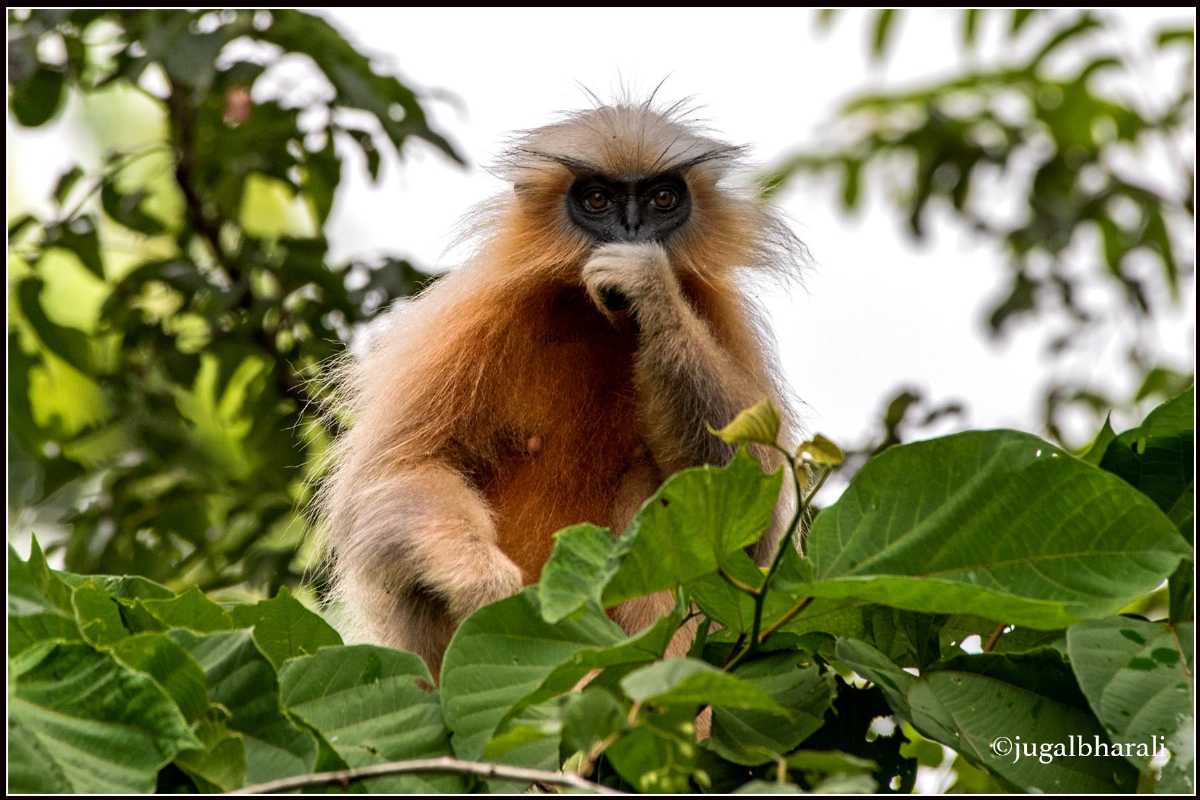
Located on the banks of the river Aie, about 15 km from Bongaigaon, the Kakaijana Wildlife Sanctuary or the Kakoijana Reserved Forest’s famous inhabitants are the golden langurs which are native to western Assam and along the Indo-Bhutan border region. Golden langurs are listed in the category of rare species in the Red Data Book of the International Union for Conservation of Nature. Set in an area of 17.24 sq km, the sanctuary was initially, a reserved forest, it later got promoted to the status of a sanctuary. Apart from the golden langur, several species like stork, python, leopard, hornbill, porcupine and much more are found here.
This sanctuary houses various species of animals like hornbill, leopard, python, stork, golden langur, monitor lizards and pangolin. In addition to these, jungle fowl, barking deer, porcupine, mongoose and binturong can also be spotted at this sanctuary. Apart from the animals, tourists can also find various kinds of bird species like red vented bulbul, pied harrier, jungle leubbler and many others. Kalikapat, a spring on the hill, which flows from the dense forests and reaches paddy fields is yet another leading attraction.

Goalpura
Located about 57 km south of Bongaigaon and roughly 150 km east of Guwahati, on the south bank of the Brahmaputra, Goalpura was a princely state ruled by the Koch kings and came under British colonial rule in 1765. In 1826 the British accessed Assam and Goalpara was annexed to the North-East Frontier in 1874. The name Goalpara is said to have originally derived from Gwaltippika meaning Guwali Village or the village of the milkmen. Goalpara is known for its rich wildlife and dense forests. It is home to numerous rare and endemic plant and animal species. But lately, due to tremendous tourism pressure and human traffic, there has been a considerable loss of biodiversity and disbalance in the ecosystem. The forests were originally covered with Sal or Shorea Robusta trees, however, there has been a large-scale decline in the vegetation due to exploitation and encroachment. The rapid depletion of the forest cover has not only brought about environmental changes but has also led to the extinction of various floral and faunal species.

Surya Pahar is a relatively unknown site 12 km southeast of Goalpara with high archaeological value. Translating to the Hill of the Sun, Surya Pahar’s name implies that the site was associated with the cult of sun worship. The archaeological findings discovered from the area are kept in the local museum. Dotted with shivlingas, Suraya Pahar holds the unique distinction of being marked and holding major significance in the history of 3 major religions which is proven by the presence of an amalgam of Hinduism, Buddhism and Jainism relics, archaeological and religious articles. It is believed that the great sage Vyasa laid the foundations for Surya Prahar modelling it on Kashi with 99,999 Shiv Lingams dotted across the mountain face and it was a thriving civilization and a major trading city long ago with maritime trade routes through the mighty Brahmaputra. Being an amalgamation of Hinduism, Buddhism, and Jainism, it enjoyed great status. Some historians even believe that Sri Suraya Pahar was the ancient seat of the Pragjyotish Kingdom and not Guwahati. Many Hindu rock carvings have been discovered in this place along with some rock-cut antiques, 25 stupas and the deities belonging to Hinduism, Buddhism, and Jainism. These are kept at a museum in Surya Prahar. Jainism which didn’t have a strong foothold anywhere in the Northeast except for its presence in Suraya Pahar, hence, is of great significance. 25 stupas in the eastern periphery are proof of the presence of Buddhism.

Around 15 km from Goalpara lies Tukeswari. According to legends, a portion of Goddess Sati fell at this site and the Tukeswari temple which is located atop the Tukeswari Hill also has a temple dedicated to Lord Shiva. An ancient shrine, the Nandeswar Devalaya stands atop the Nandeswar hill alongside the river Dudhnoi. Dedicated to Lord Shiva, the temple comes to life during the festivals of Shivratri, Dol Jatra and Durga Pooja. One of the 51 Shakti Sthals, the Sri Joybhum Kamakhya Temple is a major temple nestled on the banks of River Brahmaputra, about 50 km from Goalpara. There is also a temple of Lord Shiva built near the Joybhum Kamakhya Temple and thousands of devotees come to the temple during the celebration of the annual festival in October. A hub of Vaishnavite culture and religion, the Shyamrai Satra was established in Goalpara with the ashes of Sri Manta Sankardeva preserved by the Satra authority and which is displayed during the celebration of Sankar Jayanti which takes place in April/May. An important religious site on the banks of Brahmaputra, Buraburi Than showcases secularism with people from different religions taking part in the various religious functions. At Dadan Hills, there is a temple dedicated to Lord Shiva which was built by Dadan, a general of King Bana of Sonitpur. One of the many legends that surround this temple suggest that a wild elephant was killed by the general at the foothill of the hill, who can be seen in the form of a stone sculpture on the banks of the river Dariduri.
Barpeta
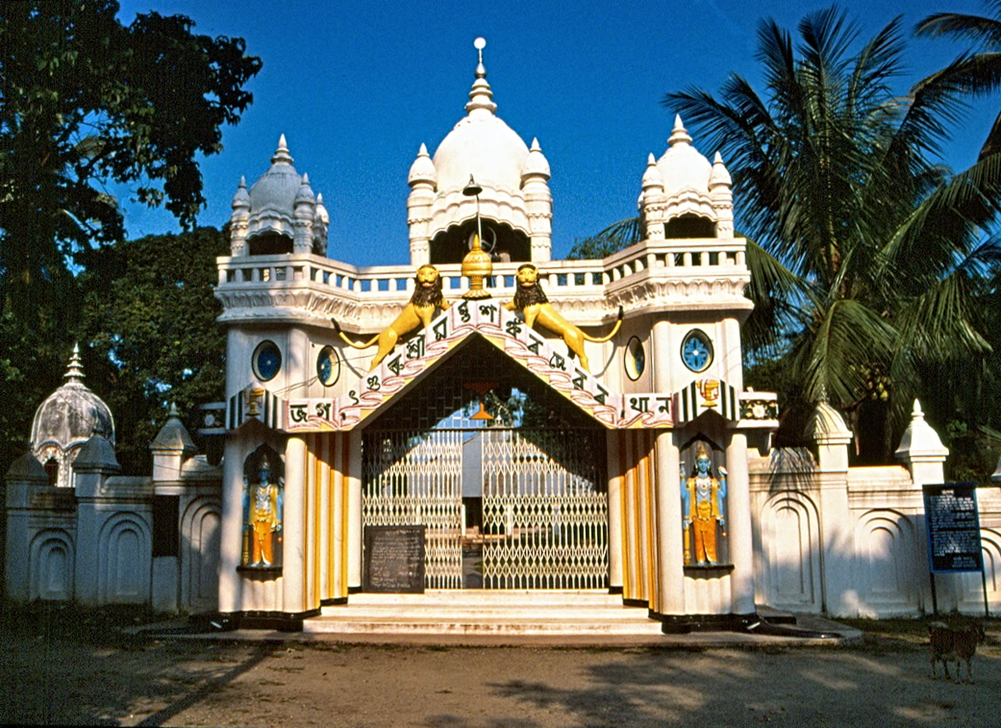
70 km northeast of Goalpura and 95 km northwest of Guwahati lies the town of Barpeta, the next town we will be exploring. Known as the Land of Satras, the town is referred to in the local language as Satra Nagari or the town of temples due to it being home to many Vaishnavite Satras. The name Barpeta is derived from Bar meaning big and Peta meaning pond. Hence, the name Barpeta translates to a land of big ponds. Barpeta was earlier known as Tatikuchi, where Tati stands for weaver and Kuchi means a cluster of villages in the native Barpetia dialect, the land of weavers. In ancient times, it was a central part of erstwhile ancient Kamrup, included in Kamapitha of Kamarupa Pithas, the ancient divisions of the old Kamrup region. Before urbanisation, the town had many ponds. Barpeta is also the gateway to the rich natural reserve of Manas National Park.

One of the most popular Satras in Assam, the Barpeta Satra was originally known as Barpeta Than. It was established by Sri Madhabdeva around 500 years back around 1583. Sri Mathura Das Burha Ata, a disciple of Sri Madhabdeva, became the first Satria of the Barpeta Satra and today, the Barpeta Satra functions as a Kirtanghar and stands as an important site for Vaishnavite devotees An important festival celebrated here is Holi, where devotees flock from across the state to observe Doul Mahotsav. The Sundariya Satra was constructed by Shri Madhavdeva after he left the Ganakkuchi Satra. Apart from serving as an abode to Shri Madhavdeva, the premises of the shrine played a vital role in spreading Vaishnavism and reformation. The Dargah of Syed Shahnur Dewan is located at Bhella, nearly 8 km away from Barpeta. An important shrine for those following the Islamic faith, it is said that during the medieval period, Syed Shahnur Dewan, a disciple of the Muslim Sufi saint Ajan Fakir, arrived here to spread the religion of Islam and Sufi philosophies. The Beki river which originates in Bhutan is one of the right bank tributaries of the river Brahmaputra and a significant portion of this river flows through Assam. A great view over the river can be had from the bridge along NH-31 which runs across the river.

Nalbari
Located at the base of the eastern Himalayas, about 52 km east of Barpeta and 72 km north of Guwahati, Nalbari’s history dates back many centuries. The Suvarnakundya village close to Nalbari produced the finest silk of Kautilya’s time. The area also produced a special perfume with the Chandan and Aguru products highly sought and exported far and wide, including north India. Western Assam was known as Kamarupa from the ancient to the pre-modern period and existed in harmony with the Davaka region of central Assam. Kamarupa was divided into Kamarupa Pithas or geographical divisions and the Nalbari district was carved out in 1985. Bhutan shares an international border with the district with the Bramhaputra river lies to the south. The word Nalbari is derived from Nal and Bari with Nal a variety of reed while Bari is enclosed ground with plantation.

Hari Mandir, located in the heart of the town is a major attraction. Established in 1965, the temple is built on the land donated by Rambahadur Pratap Narayan Choudhury and witnesses a huge crowd of pilgrims during a celebration of the festival of Raas Mahotsav. The festival is held annually during November and goes up to 15 days drawing pilgrims from all over the country.
_1606824991.jpg)
The annual Raas Music Festival is a significant cultural and spiritual festival is celebrated at the end of the year, generally in November and go on for 11 days in the premises of the Hari Mandir. Raas essentially translates to dancing in delight and is often associated with Lord Krishna. The festival transforms the town of Nalbari into a festive extravaganza attracting thousands of visitors every year. The festival was first believed to have been celebrated in 1933 in the Nalbari Purana Natkhola, but the venue was later shifted to the present Hari Mandir to accommodate the growing number of visitors. The main puja mandap or hall at Hari Mandir has a beautiful idol of Radha-Krishna where the main Raas pooja takes place. In addition, there are several other temporary stalls with idols depicting a varied range of events, from events in the life of Lord Krishna to mechanised versions of current events.
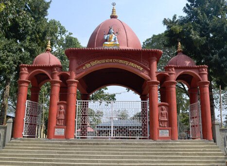
The Billeshwar Temple is an ancient temple over 500 years old with an interesting past. Located at Belsor village near Nalbari, the temple is dedicated to Lord Krishna, although it is believed that a Shiva Linga was found on the same spot. As per the legend, once a cow owned by the priest refused to be milked. The following day, the priest found out that the cow gave her milk to a bush of Virina. When the case came to the notice of the king, he dug up the place and found a Shiva Linga. The Birreswar was soon established which later came to be known as the Billeswar Temple and today is known as the Belsor Temple. An ancient temple dedicated to Goddess Parvati, the Shripur Dewalay Mandir is said to have been created by an Ahom king, Sib Singha. As per the legend, the part of the body of Goddess Parvati or Sati fell here. Every year, the festivals of Durga Puja and Kali Puja are celebrated here. Located in Daulashal, the Daulashal Temple is dedicated to Lord Krishna and his brother Lord Balram. Once known as Daulakhal owing to the presence of a great temple or doul and a canal or khal, today it is a centre of religious significance. According to legend, the Jaypal Than Temple was revealed to the Ahom king Sib Singh by a cow named Kapali. Today, only some parts of the temple are visible, the larger part being buried underground due to an earthquake. The Basudeb Devalay was built between 1718 and 1744 under the rule of Ahom King Sib Singha. As per legend, once the fishing net of some fisherman fishing in the pond got stuck for seven days. On the seventh day, a local had dreamed of Lord Basudeb wishing to be relieved from the fishing net. When the news of the dream reached King Sib Singha, he immediately tried to remove the two stones on the spot. However, when he failed, the king decided to build a temple there. The Bagheshwari Dewbahar Guri Dewalay is an ancient temple situated near Nalbari and was patronised by Kamleswar Singha, the Ahom king. Thetha Gohain was established by the end of the 19th century on a piece of land donated by Janmi Majumdar, who lived in Kamarkuchi. Also known as Sangdo Palgi Gumba, the Buddhist Temple is located in Bangnabari village, about 30 km from Nalbari and was built 60 years ago by Nepalese immigrants and is one of the biggest Gumbas in the district.
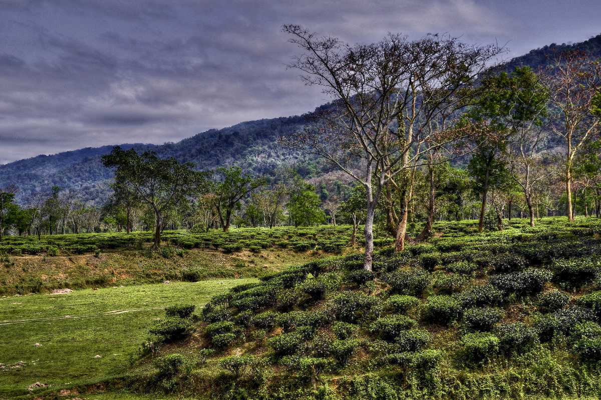
Built by King Fenugwa in the 14th century, the Fenguwa Fort is massive at 3.2 km in length and was built to safeguard the kingdom. Located about 7 km south of Nalbari, the Ganga Pukhari is a pond that was created by a Brahmin named Gangadhar and is renowned for a fair that is organised annually on the occasion of Ashok Ashtami. Another lake, Mahmara Pukhari was dug up under the rule of the Ahom kings and it is believed that a buffalo was sacrificed during the excavation to get rid of water scarcity. The Angradhowa Pukhari was constructed by King Fenguwa and according to legend, was used to wash the queen’s jewellery with charcoal and thus got its name. Sonkuhira is a local favourite picnic spot and is home to many migratory birds and thus serves as a paradise for bird watchers.
Hajo
25 km south of Nalbari and about 24 km northwest of Guwahati lies Hajo, a multi-faith pilgrimage centre. Hajo is an ancient pilgrimage centre for Hinduism, Buddhism, and Islam and lies on the northern bank of the Brahmaputra River. The area is dotted with several ancient temples and other sacred artefacts. The word Hajo is derived from the Boro word Hajw which means Hill.

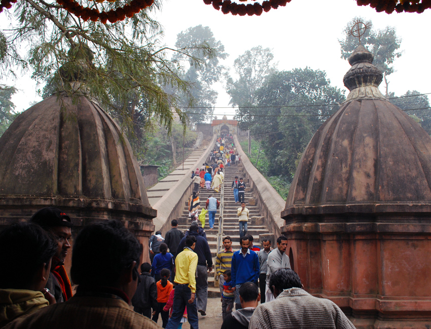
The Hayagriva Madhava Temple has an idol of Lord Vishnu that is similar to the idol of Lord Jagannath in Puri. It is also believed that Lord Buddha is to have attained Nirvana here and hence is visited by Buddhists, Bhutiyas and Hindus. Visitors will have to climb a fleet of stairs to reach the temple and the festival of Holi in March is celebrated with grandeur. The Kedareswar Temple, located atop Madanachala Hill is a temple dedicated to Lord Shiva and is regarded as one of the oldest temples in the Indian subcontinent. This temple enshrines a huge Shivalinga, made of stone, which is popularly known as the Svayambhu Linga. It is also referred to as the Ardhanariswara form of Lord Shiva and the Shivalinga is always covered by a huge metal bowl. The Kamesware Temple is an ancient temple, built in the 18th century by the Ahom king Pramatta Singha. Much later, it was turned into a temple dedicated to Lord Shiva with the shiv linga here resembling that in Kedarnath. One of the popular temples, the Deva Bhavana was, according to a legend, the meeting point of deities. The Hajo Powa Mecca is located near the Madhava temple and was constructed by Mir Lutufullah-i-Shiraji in 1657, during the rule of the Mughal Emperor Shahjahan. The word Powa means ¼ and, Powa Mecca figuratively refers to having a quarter of the sanctity of Mecca. It is also believed that the foundation of the mosque was laid with the soil that was brought from Mecca. The tomb of Pir Giasuddin Auliya, a pioneer of Islam is located here.

Sualkuchi
Sualkuchi is a small sleepy village about 11 km south of Hajo and just on the other bank of the Brahmaputra and across the river from Guwahati is best known for its skill and craftsmanship for producing one of the best kinds of silk in the state. It has a large number of cottage industries engaged in handloom and is the textile centre of Assam. Muga silk and Pat silk along with Eri silk and Endi cloth from this region is famous for their quality. Mekhela chadors and Gamosas made from these indigenous materials are in demand throughout Assam as well as other parts of India. Also rich in flora and fauna, Sualkuchi is an ecologically diverse area inhabiting not only the local exotic animals and birds but also varied species of migratory birds. The Hatisatra Monastry is not only beautiful but one of the biggest monasteries dedicated to Lord Krishna. Established by Kanu Bura Thakur, a saint from Nalanga, the monastery attracts pilgrims in large numbers. The Sidheswar Devalaya is one of the major temples dedicated to Lord Shiva and was renovated by the Ahom King Shiba Singha. Situated in the southwest part of the town, on the Sidheswari Hill, long queues can be seen in this ancient temple, especially during the month of Bhole Bom. The Ganesh Bigrah Temple is an ancient temple believed to be established in the 11th century by King Ratnapal. Situated near Ghatia Hills, this temple houses a very majestic stone sculptured idol of Lord Ganesha along with the stone idol of Har-Gouri and a Shivalinga. One can also witness a copper idol of Lord Krishna of a height of about 10 inches.