The Long Partition and the Making of Modern South Asia: Refugees, Boundaries, Histories – Vazira Fazila-Yacoobali Zamindar
Nation-states often shape the boundaries of historical enquiry, and thus silence the very histories that have sutured nations to territorial states. “India” and “Pakistan” were drawn onto maps in the midst of Partition’s genocidal violence and one of the largest displacements of people in the twentieth century. Yet this historical specificity of decolonization on the very making of a nationalized cartography of modern South Asia has largely gone unexamined.
In this remarkable study based on more than two years of ethnographic and archival research, Vazira Fazila-Yacoobali Zamindar argues that the combined interventions of the two postcolonial states were enormously important in shaping these massive displacements. She examines the long, contentious, and ambivalent process of drawing political boundaries and making distinct nation-states in the midst of this historic chaos.
Zamindar crosses political and conceptual boundaries to bring together oral histories with north Indian Muslim families divided between the two cities of Delhi and Karachi with extensive archival research in previously unexamined Urdu newspapers and government records of India and Pakistan. She juxtaposes the experiences of ordinary people against the bureaucratic interventions of both postcolonial states to manage and control refugees and administer refugee property. As a result, she reveals the surprising history of the making of the western Indo-Pak border, one of the most highly surveillanced in the world, which came to be instituted in response to this refugee crisis, in order to construct national difference where it was the most blurred.
In particular, Zamindar examines the “Muslim question” at the heart of Partition. From the margins and silences of national histories, she draws out the resistance, bewilderment, and marginalization of north Indian Muslims as they came to be pushed out and divided by both emergent nation-states. It is here that Zamindar asks us to stretch our understanding of “Partition violence” to include this long, and in some sense ongoing, bureaucratic violence of postcolonial nationhood, and to place Partition at the heart of a twentieth century of border-making and nation-state formation.
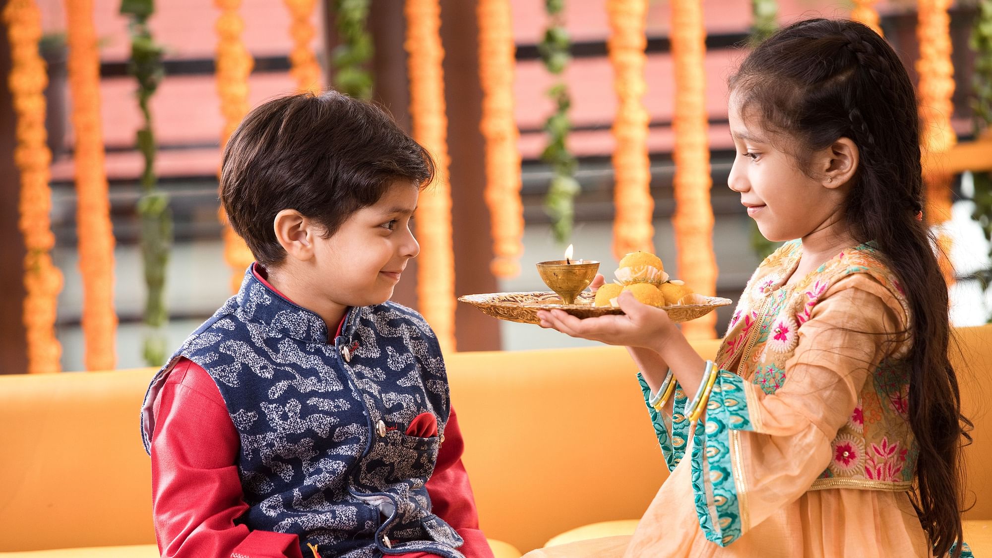
About 10 days back, on the second day after the festival of lights, Diwali, is the festival of which strengthens the bonds between a brother and sister. Also known as Bhratri Dwitiya, Bhaubeej, Bhai Tika and Bhai Phonta, Bhai Dhooj strengthens the bond of affection between brothers and sisters. There are two Bhai Dooj in Hindu calendar. The first one falls on the Dwitiya Tithi of Chaitra month and is not as popular as the second one which falls two days after Diwali or the second lunar day of Shukla Paksha or the bright fortnight in the calendar month of Kartika. The celebrations are similar to the festival of Raksha Bandhan and on this day, sisters give gifts to their brothers. In the southern part of the country, the day is celebrated as Yama Dwitiya.
The festival is known by different names in different communities. In North India, it is known as Bhai Dooj and is observed during the Diwali festivities, on the second day after Diwali. In Nepal it is known as Bhai Tika, where it is the most important festival after Dashain or Vijaya Dashmi or Dussehra. Observed on the fifth day of the Tihar festival, it is widely celebrated by the Khas people. In West Bengal, Assam, Tripura, Bangladesh, it is known as Bhai Phonta and it takes place every year on the second day after Kali Puja. In western Odisha, it is called Bhai Jiuntia while the Marathi, Gujarati and Konkani-speaking communities in the states of Maharashtra, Goa, Gujarat and Karnataka call it Bhau Beej, Bhav Bij or Bhai Beej. Other names for the festival include Bhatru Dviteeya, Bhatri Ditya or Bhaghini Hastha Bhojanamu in Andhra Pradesh and Telangana.
Another name for the day is Yamadwitheya or Yamadvitiya, after a legendary meeting between Yama the God of Death and his sister Yamuna, the river on the Dwitheya or the second day after new moon. According to a legend, Yamraj’s sister Yamuna tried to get her brother to visit her on many occasions but Yamraj was unable to do so for a long time. When he finally met her, he was greeted with a grand ceremony, offered sweets and had the ceremonial tika placed on his forehead. Being immensely pleased with the love and respect he was showered with, Yamraj gave Yamuna a boon and she in turn asked him to dedicate a day on which he would visit her house each year. Hence, the ritual of siblings visiting each other on this day began to honour the kinship between them.According to another legend, after slaying the evil demon Narakasura, Lord Krishna visited his sister Subhadra who gave him a warm welcome with sweets and flowers. She also affectionately applied tilaka on Krishna’s forehead and some believe this to be the origin of the festival.
Celebrated like the festival of Raksha Bandhan, but without the tyong of the rakhi on the brother’s wrists, on this day, sisters invite their brothers for a sumptuous meal often including their favourite dishes and sweets. The ceremony signifies the duty of a brother to protect his sister, as well as a sister’s blessings for her brother. Sisters then perform an arti for their brother and apply a red tika on the brother’s forehead. This signifies the sister’s prayers for the long and happy life of her brother and treat them with gifts. In return, elder brothers bless their sisters and treat them with gifts or cash. In Haryana and Maharashtra, women who do not have a brother worship the moon instead and apply henna or mehendi on girls as a tradition. For sisters whose brothers live far away and can’t meet her, send her prayers for the long and happy life of her brother through the Moon God and performs aarti or prayer to the moon. This is the reason why children affectionately call the moon Chandamama where Chanda means the moon and mama means a mother’s brother. In West Bengal, Bhai Phonta is marked with many rituals along with a grand feast arranged for the brothers though it is necessary that, both the brother and sister are more than 5 years of age.
In Nepal, Bhaitika or Bhaitihar is known as the tihar or festival of brothers. On this day, sisters pray to the God of death, Lord Yamra for the long life and prosperity of their brothers. The ritual involves sisters marking the forehead of their brothers with a seven coloured long tika with the rest of the rituals is similar to that performed by Hindus elsewhere.
To all sisters and brothers, hope you had a fabulous festive period!
With seven National Parks, Assam now has the third most National Parks in India, after the 12 in Madhya Pradesh and nine in the Andaman and Nicobar Islands and so this part will focus on the National Parks in Assam. We will start from the west and make our way eastwards.
Raimona National Park Located in the Saralpara Forest Division of Kojrajhar, the Raimona National Park is one of Assam’s newest national parks which was declared a national park on 5 June 2021 on the occasion of World Environment Day. The park is part of a contiguous forest patch with an area of 422 sq km covering the northern part of the notified Ripu Reserve Forest, which in turn forms the westernmost buffer to the Manas Tiger Reserve in the southern foothills of Eastern Himalaya Biodiversity Hotspot. The Sankosh River forms a boundary on the west along the boundary with West Bengal, Bhutan lies to the north and the Saralbhanga River lies to the east. Historically the area was a part of the migratory route of the faunal species from Himalayan Mountain, Indo-Malayan and Indo-Chinese realms towards the west and Peninsular Indian realm species to the east. It shares contiguous forest patches of Phibsoo Wildlife Sanctuary and Jigme Singye Wangchuck National Park in Bhutan, creating a transboundary conservation landscape of more than 2,400 sq km.
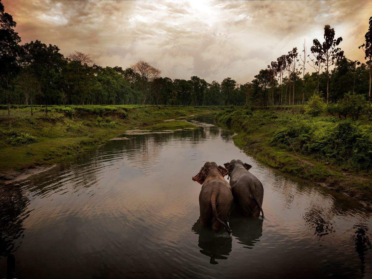
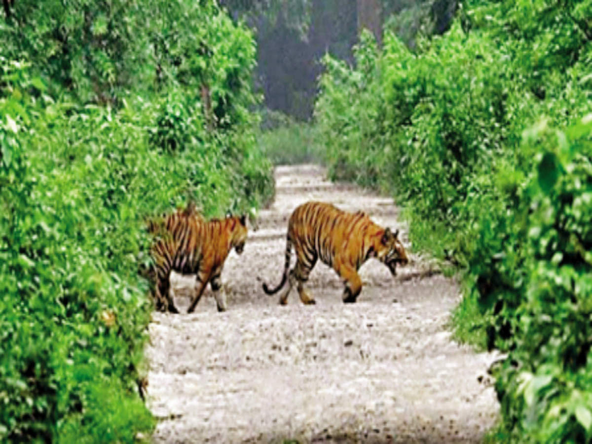
The Raimona National Park is famous for the Golden Langur, an endemic species which has been named the mascot of the Bodoland region. It also has the Asian elephant, the Royal Bengal Tiger, the Clouded Leopard, the Indian Gaur, the Wild Water Buffalo, the Spotted Deer, the Hornbill and more than 150 species of butterflies, 170 species of birds and 380 varieties of plants and orchids.
Manas National Park The Manas National Park is many things – a UNESCO Natural World Heritage site, a Project Tiger Reserve, an Elephant Reserve and a Biosphere Reserve. The only tiger reserve in Assam, the national park is famous for the rare golden langur and the red panda and is known as one of the best-kept national parks in India.
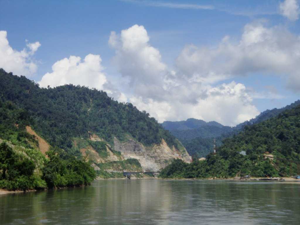
Located in the Himalayan foothills, it is contiguous with the Royal Manas National Park in Bhutan and is known for its rare and endangered endemic wildlife such as the Assam roofed turtle, hispid hare, golden langur and pygmy hog and is famous for its population of the wild water buffalo. The name of the park comes from the Manas River, a major tributary of the Brahmaputra River, which passes through the heart of the national park. Five other smaller rivers also flow through the national park which lies on a wide, low-lying alluvial terrace spreading out below the foothills of the outer Himalaya. The Manas river also serves as an international border dividing India and Bhutan.
On an area of 360 sq km, the Manas National Park was declared a wildlife sanctuary on 1 October 1928 and the Manas Bio Reserve was created in 1973. Before the declaration of the sanctuary, it was a reserved forest called Manas R.F. and North Kamrup R.F used by the Cooch Behar royal family and the Raja of Gauripur as a hunting reserve. It was declared a World Heritage Site in 1985 after being increased to 391 sq km in 1951 and 1955 and the Kahitama, the Kokilabari and the Panbari Reserved Forests were added in 1990 to form the Manas National Park which was then declared a World Heritage Site in 1992 and increased to 950 sq km in 2008. On 21 June 2011, it was removed from the List of World Heritage Sites in Danger and was commended for its efforts in preservation. There is only one forest village, Pagrang, in the core of the national park with 56 other villages surrounding the park and many more fringe villages are directly or indirectly dependent on the park.
The park is divided into three ranges. The western range is based at Panbari, the central range at Bansbari and the eastern range at Bhuiyapara. The ranges are not well connected, while two major rivers need to be forded in going from the centre to the Panbari, there is a rough trail, the Daimari road connecting the centre to the eastern range. Most visitors come to Bansbari and then spend some time inside the forest at Mathanguri on the Manas river at the Bhutan border.
Manas is recognised not only for its rich biodiversity but also for its spectacular scenery and natural landscape which includes a range of forested hills, alluvial grasslands and tropical evergreen forests. It’s home to India’s second-largest tiger population and also famous for its population of wild water buffalo. Manas harbours the maximum number of endangered species from India as listed in the IUCN Red Book.
The park is divided into two biomes, the first one is the Grassland Biome that has animals like the Pygmy Hog, the Indian Rhinoceros, the Bengal Florican, and the Wild Asian Buffalo. The second biome is the Forest Biome that has animals like the Slow Loris, the Capped Langur, the Sambar, the Great Hornbill, the Malayan Giant Squirrel and many others. The park boasts 55 species of mammals, 380 species of birds, 3 species of amphibians and 50 species of reptiles. One can easily spot rhinos and tigers while sitting on an elephant which can be arranged by forest officials from Mathanguri during which one can see tea pickers during the tea season. The best time to see these activities is from October till the first week of December and again from mid-March onwards.
The summer palace of the King of Bhutan lies beyond the bend of the Manas River and lies on the Bhutan side of the Manas National Park. One needs to hire a boat to cross over to the Bhutan side after taking prior permission and stroll about a km to get to the summer palace, which is guarded by a solitary watchman.
The Bodo tribe, indigenous to Assam have set up their Eco-tourism Society in the National Park where they perform their traditional dances and music and visitors can get to see local handlooms and textile woven by the women. Some villagers also take the visitors out on foot safaris and can even offer one a night stay in the forest.
A boat ride in an eight-person boat will cost INR 8000 and a safari will set Indians back by INR 120 per person and INR 750 per person for foreigners. Still camera charges for Indians and foreigners are INR 50 while for a video camera, Indians need to pay INR 100 while foreigners pay INR 500. A typical day for a visitor in the sanctuary will start early around 5 am with a 1-2 hour elephant ride, after which one can stroll on the river banks. After a hearty breakfast, a visit to the Manas Maozigendri Ecotourism Society is a must where one can have a traditional Bodo style lunch and enjoy their music and dance. After lunch, it’s time for river rafting which will take 2-3 hours and one can end the day by taking in the jungle safari to enjoy bird watching and catch wild animals in their homes.
Orang National Park Located on the northern bank of the Brahmaputra River in the Darrang and Sonitpur districts, the Orang National Park covers an area of 79.28 sq km. It was established as a sanctuary in 1985 and declared a national park in 1999. With rich flora and fauna, including the great Indian rhinoceros, the pygmy hog, the Asian elephant, the wild water buffalo and the Bengal tiger, it is the only stronghold of the rhinoceros on the north bank of the Brahmaputra river. The park has a chequered history of habitation. Up to 1900, it was inhabited by local tribes who abandoned the area because of an epidemic disease. In 1919 the British declared it the Orang Game Reserve and was established as a wildlife sanctuary in 1985 and declared as National Park in 1999.
During the monsoon season, the park becomes a veritable flood plain with the many streams overlapping each other and these flood plains constitute twelve wetlands in the park, apart from the 26 man-made water bodies. The park is thus formed of alluvial flood plains of the many rivers and is an integral part of the Indo-Burma biodiversity hotspot. The park has been categorized into the Eastern Himalayan Moist Deciduous Forest in an area of 15.85 sq km, the Eastern Seasonal Swamp Forest with an area of 3.28 sq km, the Eastern Wet Alluvial Grassland with an area of 8.33 sq km, the Savannah Grassland on an area of 18.17 sq km, the Degraded Grassland in 10.36 sq km, the Water Body of 6.13 sq km, the Moist Sandy area with an area of 2.66 sq km and the Dry Sandy area with an area of 4.02 sq km. It is bounded on its south and east by islands and spill channels of the river, but the flat alluvial land is seen distinctly as two terraces; the lower terrace is of recent origin on the bank of the Brahmaputra river and the other is the upper terrace to the north, separated by a high bank running through the park. The whole park is encircled by inhabited villages thus subjecting it to biotic pressure with fox holes built by the villagers on its west.
The park will pleasantly surprise visitors with its rich variety of animals, birds and fishes and a similar abundance of flora. The park is known for its rhinoceros conservation and has The Great Indian Rhinoceros and the Bengal Tiger. Apart from rhinos, one will find here the Great Indian Rhinoceros, porcupines, Bengal tigers, civets, water buffaloes, leopards and many more. A huge number and types of fish are also present here. Along with this one can spot several birds in the park such as kingfishers, fishing eagles, woodpeckers, mallards, white pelicans and so on. A safari into the park will let one experience the refreshing beauty of the surroundings and vegetation as well as the enjoyment of watching such a variety of wildlife. The park is also an important breeding ground for various fishes. The best time to visit the Orang National Park is between November to April as winters are cool and pleasant. Visitors, however, need permission from authorities in advance to visit the park.
Kaziranga National Park Hosting two-thirds of the world’s great one-horned rhinoceroses, the Kaziranga National Park is a UNESCO World Heritage Site. It is also home to the highest density of tigers among protected areas in the world and was declared a Tiger Reserve in 2006. The park is also home to large breeding populations of elephants, wild water buffalo, and swamp deer and is recognised as an Important Bird Area by BirdLife International for the conservation of avifaunal species. Located on the edge of the Eastern Himalaya biodiversity hotspot, the park combines high species diversity and visibility. The national park is a vast expanse of tall elephant grass, marshland, and dense tropical moist broadleaf forests, crisscrossed by four major rivers, including the Brahmaputra, and includes numerous small bodies of water. The park celebrated its centennial in 2005 after its establishment in 1905 as a reserve forest.
The history of Kaziranga as a protected area can be traced back to 1904, when Mary Curzon, the wife of the Viceroy of India, Lord Curzon of Kedleston, visited the area. After failing to see a single rhinoceros, for which the area was renowned, she persuaded her husband to take urgent measures to protect the dwindling species which he did by initiating planning for their protection and on 1 June 1905, the Kaziranga Proposed Reserve Forest was created with an area of 232 sq km. Over the next three years, the Park area was extended by 152 sq km, to the banks of the Brahmaputra River and in 1908, was designated a Reserve Forest. In 1916, it was redesignated the Kaziranga Game Sanctuary and remained so till 1938, when hunting was prohibited and visitors were permitted to enter the park. It was renamed the Kaziranga Wildlife Sanctuary in 1950 to rid it of its hunting connotations.
In 1954, the Assam (Rhinoceros) Bill, which imposed heavy penalties for rhinoceros poaching was passed and in 1968, the Assam National Park Act of 1968 was passed which declared Kaziranga a designated national park and the 430 sq km park was given official status by the central government on 11 February 1974. In 1985, Kaziranga was declared a UNESCO World Heritage Site for its unique natural environment.
Kaziranga has been the target of several natural and man-made calamities in recent decades including floods caused by the overflow of the river Brahmaputra, leading to significant losses of animal life and encroachment by people along the periphery has also led to a diminished forest cover and a loss of habitat.
Although the origin of the name Kaziranga is not certain, there are many possible explanations derived from local legends and records. According to one legend, a girl named Rawnga, from a nearby village, and a youth named Kazi, from Karbi Anglong, fell in love. This match was not acceptable to their families, and the couple disappeared into the forest, never to be seen again, and the forest was named after them. According to another legend, Srimanta Sankardeva, the sixteenth-century Vaisnava saint-scholar, once blessed a childless couple, Kazi and Rangai, and asked them to dig a big pond in the region so that their name would live on. Kaziranga also could mean the Land of Red Goats or Deer, as the word Kazi in the Karbi language means goat, and Rangai means red. Some historians believe, however, that the name Kaziranga was derived from the Karbi word Kajir-a-rong, which means the village of Kajir. Among the Karbis, Kajir is a common name for a girl child, and it was believed that a woman named Kajir once ruled over the area. Fragments of monoliths associated with Karbi rule are found scattered in the area that seems to bear testimony to this assertion.
The park is approximately 40 km in length from east to west, and 13 km in breadth from north to south and covers an area of 378 sq km, with approximately 51.14 sq km lost to erosion in recent years. The park area is circumscribed by the Brahmaputra River, which forms the northern and eastern boundaries, and the Mora Diphlu, which forms the southern boundary. Other notable rivers within the park are the Diphlu and Mora Dhansiri. Kaziranga has flat expanses of fertile, alluvial soil, formed by erosion and silt deposition by the Brahmaputra and the landscape consists of exposed sandbars, riverine flood-formed lakes known as beels, which make up 5% of the surface area, and elevated regions known as, chapories, which provide retreats and shelter for animals during floods. It is one of the largest tracts of protected land in the sub-Himalayan belt, and due to the presence of highly diverse and visible species, has been described as a biodiversity hotspot.
In the park, safaris can be undertaken both during the day and night during the open tourist season. Elephant rides are also very popular among visitors and hiking is prohibited. Kaziranga has a total of 35 mammalian species, out of which 15 are threatened. The big-five of Kaziranga is the collective name given to the group of the one-horned rhino, the wild water buffalo, the swamp deer, the Asian elephant and the royal Bengal tiger. The rivers within Kaziranga are also home to the endangered Ganges Dolphin. The national park is divided into 4 zones: Kaziranga Range, Western Range, Eastern Range and Burapahar Range. One safari of one zone is allowed at a time. While the Western zone is considered good for elephant watching, safaris and rhino sightseeing, the Eastern zone is better for watching water birds.
The Kaziranga National Park is between 1st November and 30th April each year, but the best time to visit is after the second week of January as the grass levels would have reduced and there would be clear visibility. The entry to the part is INR 100 per person for Indians and INR 650 for foreigners while the cost of an elephant ride is INR 750 per person for Indians and INR 1250 per person for foreigners and the booking times for the elephant safari is between 5:30 to 7:30 am and then again between 3 – 4 pm. To go on a jeep safari, everyone will need to pay INR 300 as toll charges per trip per vehicle and the jeep safari booking is open between 7 to 10 am and then from 1:30 pm till the sunsets.
Nameri National Park Located on the foothills of the eastern Himalayas about 35 km from Tezpur, the Nameri National Park is about 9 km from Chariduar, the nearest village and shares its northern boundary with the Pakhui Wildlife Sanctuary in Arunachal Pradesh and together they constitute an area of over 1,000 km of which Nameri has a total area of 200 km. The park was declared as Tiger Reserve around 1999 – 2000 and is the second Tiger reserve in Assam after the Manas Tiger Reserve. Nameri National Park has two core areas: the Nameri National Park and the Sonai – Rupai Wildlife, a satellite core of the Tiger Reserve. The river Jia – Bhoroli is the lifeline of Nameri, which flows along the southern boundary of the park from the northwest to the southeast. In the east, the river Bor – Dikorai, a tributary of the river Jia – Bhoroli, flows along the southern boundary from the northeast to the southwest.
The park boasts of a dense elephant population and other animals that the park includes tigers, sambars, leopards, Bengal foxes, mouse deer and jungle cats. Some rare Himalayan plant varieties are also found seen. The park is popularly referred to as The Last House of White Winged Wood Duck and one can swim, river raft and sunbathe here. The park is open between 10 am and 5 pm daily and has an entry fee of INR 50 for Indians and INR 250 for foreigners.
Dibru Saikhowa National Park Boasting a rich collection of flora and fauna, many of them endangered, the Dibru Saikhowa National Park is one of the few remaining protected sites in the Endemic Bird Area of the Assam Plains. The national park is a river island national park and one of the 19 biodiversity hotspots in the world located about 12 km north of Tinsukia. Of the seven parts of the park, one is a wetland and the rest are mainly covered with grasslands and dense forest. An identified Important Bird Area (IBA), it is most famous for the rare white-winged wood ducks as well as feral horses. In 1997, Dibru Saikhowa National Park became the ninth biosphere reserve out of the total 18 identified to date in India. Earlier known as Dibru Reserve Forest and Saikhowa Reserve Forest, this protected area was notified as a wildlife sanctuary in 1986, and a national park in 1999.
Comprising tropical moist deciduous forests, tropical semi-green forests, Salix swamp forests, moist evergreen forests, grasslands and canebrakes, the region originally comprised a tropical rainforest but after the disastrous earthquake of 1950, it underwent major geomorphological changes and the rainforest eventually gave way to deciduous forests. The park is bounded by the Brahmaputra river, Lohit river and Arunachal Hills in the north and Dibru river, Debang river, Dibru and Patkai hills in the south, making for beautiful, verdant surroundings. The climate is tropical monsoon, with a hot, humid and wet summer and cold and dry winters.
The Dibru Saikhowa National Park has no roads inside and so there are no jungle safaris or elephant rides available and visitors can only explore the park by trekking, though there is a boat service which is available which can take one to various spots. Guijan Ghat and Saikhowa Ghat or Dhola Entry Point are the national park’s entry points with the former about 10 km and the latter about 50 km from Tinsukia. Although accessible round the year, the best time to visit this park is during the late winter as during the monsoon, the park may sometimes close due to heavy rain, without any prior notice. Entry to the park is not permitted before sunrise and after sunset and night halts and picnics are not allowed inside the park.
Kekjori Trees are known for their vast branches with a single tree covering a vast area with branches spreading low and wide. A visit to look at these trees requires a 15-minute boat ride to an island in the middle of the Brahmaputra and a half-hour walk. Churkey Sapori or the river island in the north of the Saikhowa part of the park is famous for spotting the bright coloured wild horses known as Feral Horses which are free-ranging, untamed horses descended from domestic horses that escaped from army camps during World War II and are not truly wild horses. Although not a scheduled wildlife species, the feral horses of Dibru-Saikhowa have considerable curiosity value. The Maguri Matapung Beel is a lake within the park and a haven for birds and is classified as an Important Bird Area or IBA and is host to 374 different species of birds. The boat safari on this lake is an amazing opportunity for bird watchers to spot migratory birds and rare birds of various descents and if lucky, one can even spot the endangered River Dolphin.
Entry fees for Indians are INR 100, while foreigners pay INR 500. The park is open between sunrise and sunset and if interested in photography, Indians need to pay INR 50 while foreigners pay INR 500 and for videography, Indians pay INR 500 and foreigners INR 1,000.
Dihing Patkai National Park Assam’s newest national park, and covering an area of 234 sq km in a rainforest, the Dehing Patkai National Park was declared a wildlife sanctuary on 13 June 2004 and was upgraded to a national park on 13 December 2020 and officially notified as one on 9 June 2021. It is located in the Dehing Patkai landscape which is a dipterocarp-dominated lowland rainforest with the rainforest stretching for more than 575 sq km in the districts of Dibrugarh, Tinsukia and Charaideo with the forest further spreading over in the Tirap and Changlang districts of Arunachal Pradesh. It encompasses the erstwhile Dehing Patkai Wildlife Sanctuary, the Jeypore Reserve Forest and the western block of the Upper Dihing Reserve Forest. Dehing Patkai forms the largest stretch of lowland rainforests in India and the wildlife sanctuary was declared as the Dehing-Patkai Elephant Reserve under Project Elephant. It is the last remaining stretch of the Assam Valley tropical wet evergreen forest.
Being a completely virgin rainforest, the Dihing Patkai National Park is very rich in biodiversity and an ideal habitat for non-human primates. Today, 47 mammal species, 47 reptile species and 310 butterfly species have been recorded in the park. There are more than a dozen different ethnic groups living in the area including the Tai Phake, the Khamyang, the Khampti, the Singpho, the Nocte, the Chutia, the Ahom, the Kaibarta, the Moran, the Motok, the Burmese and Nepali people, many of whom were brought by the British to work in the tea plantations
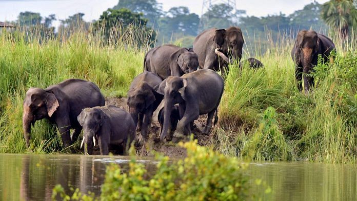
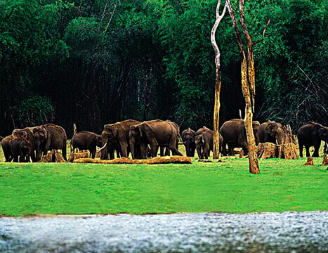
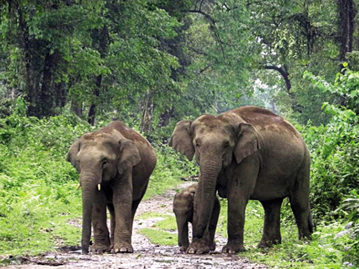
The sanctuary’s most ubiquitous inhabitant is the Asian elephant. The mega-herbivore can be seen in herds as well as alone, and is considered a sight to behold, but also one to be wary of, especially for travellers on foot. The national park is also famous for birds and is a biodiversity hotspot with over 350 species of avifauna providing a unique habitat for many globally threatened species including the extremely rare white-winged wood duck and many migratory birds.
The landscape of Dihing Patkai is dominated by towering Hollong and the Mekai trees, with other species such as beautiful Nahar or Messua ferrea, which puts out red, yellow, and silver leaves in spring. Cutting through the forest is the Burhi Dihing river, which creates several sand islands that are popular with migratory roosting birds. The park has two main access points, Soraipung, a small village where the range officer and the interpretation centre is located and the Jeypore gate which is a short distance from Jeypore town. The closest town is Digboi, which is 10 km away.
The best time to visit Dehing Patkai Wildlife Sanctuary is during the winter and spring months. Between November and the end of February, there is no rain and waterlogging and one can see many migratory birds around with birds and small mammals at their peak from about 7 am till around 10-10:30 am and then again from the afternoon until sunset. Between March and April, there is rainfall, which brings new growth and the breeding season. This is also a good time to hear and spot the Blue-eared barbet, the drongo cuckoo, the common hawk, the Hodgson’s hawk, and the highly sought-after violet and emerald cuckoos.
Unlike conventional national parks, Dehing Patkai Sanctuary does not have safari vehicles and canter buses. The Park can be explored by vehicle, both private or hired, by boat, or on foot. Taxis charge between INR 1,200 to INR 1,500 per day, depending on the vehicle.
With this, we come to the end of this visit around the northeastern state of Assam. A region I have been wanting to visit for decades and hope to visit soon. In the next part, we will explore a new state in India.
Sadiya A former capital of the Chutia Kingdom, Sadiya lies in the foothills of the Himalayas, not too far from the state’s border with Arunachal Pradesh. After the downfall of the Chutia Kingdom, it became the seat of the Sadiya-Khowa-Gohain of the Ahom kingdom and extensive remains of buildings and fortifications built during the rule of the Chutias near Sadiya still point to the importance of the region in the past. It was the centre of development of the eastern form of Prakrit during both the Chutia and Ahom periods, which later gave rise to the modern form of Assamese. Sadiya, which lies 67 km north of Digboi and 552 km northeast of Guwahati, stands on a grassy plain, almost surrounded by forested Himalayan mountains, on the right bank of Lohit River which is locally, but erroneously, considered the main stream of the Brahmaputra river. The town is famous for a flower named Satphul, which means a blessing or a desert flower, similar to jasmine. The word Sadiya is derived from the Deori language and it stands for the land of the rising sun where Sa or Xa means Sun, Di stands for water and Ya means land.
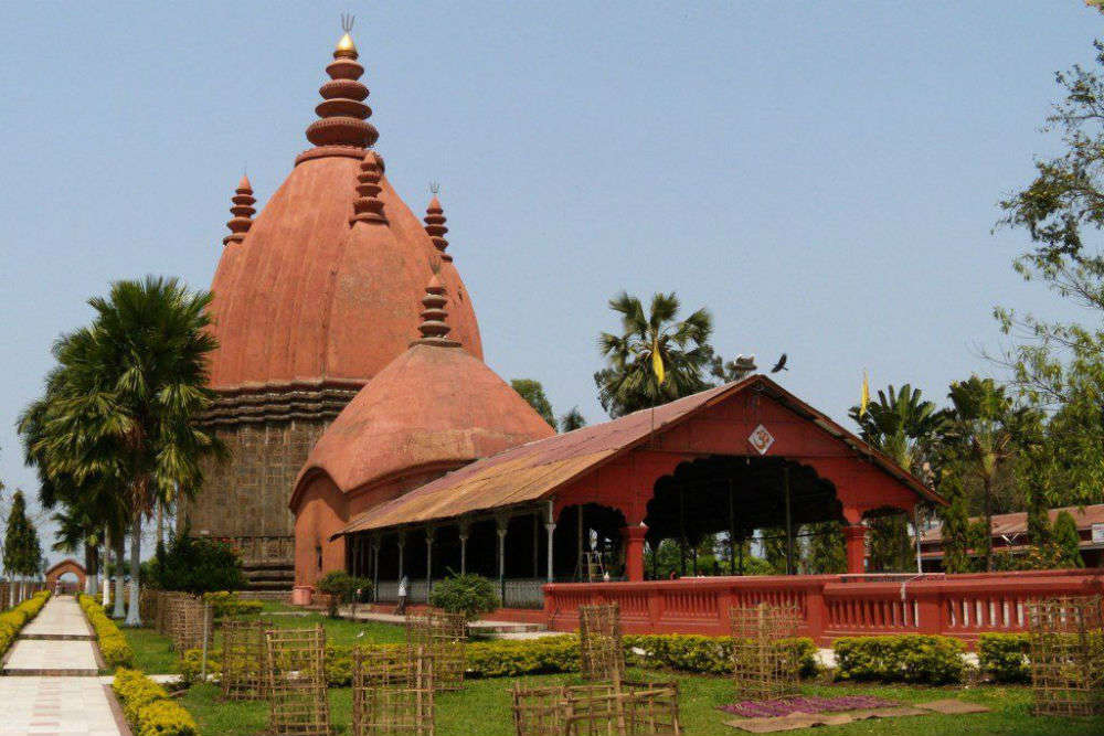
The Tameshwari Temple is what Sadiya is mainly famous for. A Shakti temple that can be accessed by taking ferry rides from the Dhola Ghat, it is also an important archaeologists site. The roof of the temple is made entirely of copper or tam in Assamese, hence the temple’s name. The most notable among the temples built by Chutia kings, the temple was dedicated to Kechaikhati, a primordial female tribal deity of the Chutiyas later Sankritised as Tamreswari. As per the Kalika Purana, the main temple was an octagonal structure surrounded by eight dwarapals or guards in eight directions. When the Britishers visited the temple complex, the main temples has disappeared and only a small square structure remained. The wall and doors of the temple were well designed and there were two giant elephant sculptures with silver tusks at the main door of the complex. The walls were made without any mortar and instead used iron dowels and brackets. The temple was surrounded by brick walls and on the western wall, there was a place for human sacrifice. Although the temple is now completely submerged under marshy lands due to silt deposition, in 1959 it showed that the main statues of the temple were built of sandstone and granite. The roof of the temple was originally sheeted with copper but in 1848, the copper roof was already removed. In the floods of 1959, due to the deposit of silt in the banks of the Paya river, the structure was completely submerged in the waters.
There are many other Shaivik temples where Deori tribes used to worship in ancient times. The two major ones are the Burha-Burhi Thaan and the Boiragi Thaan. Also built by the Chutia kings, Bura-Buri Than was dedicated to the primordial parents Gira-Girasi or Bura Buri, which were later Sanskritised as Shiva and Sakti. Although the structure has fallen due to natural calamities, the base remains intact upon which a new temple has been built. The foundation is an octagonal shaped base made of stone with each edge spanning 3.4 m in length. The temple was built using granite stone and fixed using iron dowels and brackets similar to the ones used in the Malini Than and the Tamreswari temples and was surrounded by a wall built using bricks.
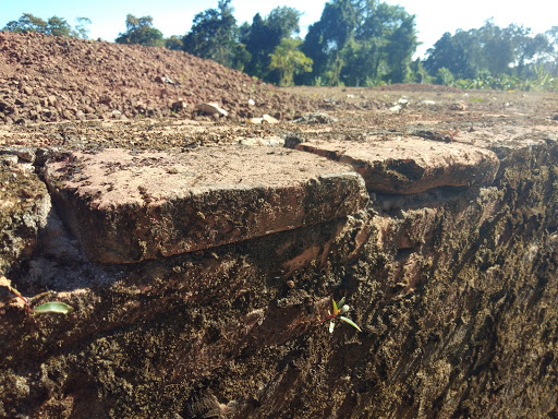
The Bhismaknagar fort, further east of Sadiya, is tentatively dated to the 8th century. Based on the inscription , it is assumed to be the capital of Chutiya king Laksminarayaṇa of the early 15th century. The fort located in Roing is an important monument built by Chutia kings with the walls of the fort spread over 10 sq km. The name was probably derived from Bhismaka, the Hindu monument constructed for the royal lineage of the Chutias during the Neo-Vaishnava movement in the 16th and 17th centuries. A brick with the name Lakshminarayan indicates that the fort was repaired during the 15th century. The Bhismaknagar central complex extended over an area of 1860 sq m and has three halls, six ingresses and two extension rooms as well as a two-meter high stone wall inside the complex with a medieval architecture. While quarrying in the fort, enormous pieces of work of art like potteries, terracotta figurines, terracotta plaques and decorative tiles were recovered. Fabricated from the burnt bricks gave this fort an impressive and remarkable top view.
In the hills north of Roing lie scattered some old brick structures, mainly between the Chidu and Chimri villages situated at an altitude of about 305 m. The local people, the Idus called these structures Rukmini Nati where nati is the Idu word for bricks. Excavations of the two mounds at Chimri, unearthed two rooms, built on a slope, at a distance of 14 m from each other. The contents dug out from inside the walls of the rooms were of river-borne materials, which suggests that they were destroyed by floods. There is evidence of the extension to this area being of the same culture as that of Bhismaknagar. Another archaeological site called Duku Limbo lies on the left bank of the Dibang at the foot of Elopa hill with brickbats found at this site suggest that the Brismaknagar culture had extended to this point.
Tezu Fort is an old mud fort in the Tindolong area, 6 km from Tezu, which was explored in 1972. The area of the fort, enclosed by earthen ramparts is square with the rampart 8 ft high, and equally broad at the top with sloping sides. On both the inner and outer sides of the rampart run two ditches about 6 m wide. There is a prominent mound, circular and about 3 m in height, almost at the centre of the enclosure which appears to be a cavalier for lookout purposes. The complex seems to represent a defensive mud-fort or redoubt of a modest dimension suitable for a small band of soldiers to maintain vigilance against the enemies from their hide-outs inside the jungle especially in guerilla warfare, the normal practice in the region. The fort has been assigned roughly to a period about the 14th to 15th centuries.
Haflong Our next destination Haflong is Assam’s only hills station which lies 577 km south of Sadiya and about 280 km southeast of Guwahati. Haflong is a Dimasa word that means an anthill. Haflong produces fruits like pineapples and oranges and like other hill stations in India, Haflong’s architecture reflects its British colonial past.
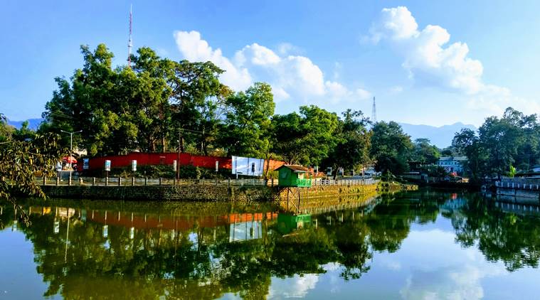
Haflong Lake is one of the largest natural water bodies in Assam and is situated in the heart of the town and is also Haflong’s most popular tourist spot with the lake providing majestic views of the Himalayas and offers opportunities to engage in boating. Another major attraction is Haflong Hill which is popular for trekking and hiking. The scenic view of the adjacent mountains and the lush forests makes it worth visiting. The Chavang Kut, a harvest festival is celebrated in Haflong every day in November. Situated 47 km from Haflong, Maibong is located on the bank of the Mahur River and was the ancient capital of the Dimasa Kachari Kingdom which existed from the 16th to the 18th centuries. Maibong still contains the ruins of the once flourishing capital of the kingdom and visitors will find the remains of a stone house and a temple of the Kachari kings. The monolithic Ramchandi temple of the Kachari kings, built in the 12th century is also famous.
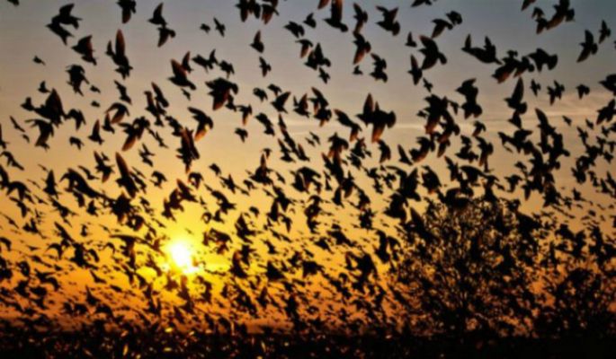
Jatinga Jatinga located about 5 km south of Haflong and 328 km southeast of Guwahati is a village on a ridge, inhabited by about 2,500 Khasi-Pnar people and a few Assamese. It is famous for the phenomenon of bird suicides. At the end of the monsoon months, between August to November, especially on moonless and foggy nights between 6 and 9:30 pm, birds that are not disturbed by the locals but out of the dark northern skies will start to descend as they are attracted to lights. These dazed birds are captured using bamboo poles by the locals. The local tribals first took this natural phenomenon to be spirits flying from the sky to terrorise them with the phenomenon not confined to a single species, with the tiger bittern, black bittern, little egret, pond heron, Indian pitta, and kingfishers all being affected, as well as hill partridge, green pigeons, emerald doves, necklaced laughing thrushes and black drongos with the birds mostly juvenile. Experts believe the cause likely to be disorientation at high altitudes and high-speed winds due to the widespread fog at the time. The birds, mostly juveniles and local migrants, are disturbed by high-velocity winds at their roost and when the disturbed birds fly towards lights as refuge they are hit with bamboo poles and killed or injured. The killings, as well as the number of birds arriving at the village, has been declining gradually since the last few years with much of this due to the loss of habitat caused by development and environmental degradation.
Diphu The headquarter of Karbi Anglong district Diphu lies 150 km north of Jatinga and about 250 km east of Guwahati. Known as a mini hill station, it is a popular weekend getaway. The word Diphu comes from the Dimasa language, which means white water where Di means water and Phu means white. Historically, it is said that the stream in Diphu carries large amounts of sediment during the rainy season, giving it a whitish colour, hence its name. Diphu is home to many indigenous communities of Assam including the Karbis, the Dimasa Kacharis, the Boro Kacharis, the Garo Kacharis, the Rengmas and the Tiwa Kacharis.
The Arboretum Cum Craft Centre is located around 8 km from central Diphu and is a planned complex consisting of a park, a garden and a craft and exhibition centre. The garden is well maintained throughout the year and has a variety of annual and seasonal flowers on display throughout the year. There is also a small park area for children to play in. The Arboretum Cum Craft Centre also houses an open-air stage where events can take place as well as an indoor hall where smaller events or exhibitions can be organised. The traditional exhibit store is from where one can buy clothes and souvenirs from the region. The centre is open daily between 6 am and 7 pm.
5 km from Diphu town towards the Marat Longri Sanctuary, the Botanical Garden is a well-maintained garden with flowers, trees and plants native to the district and Assam grown including many medicinal herbs and plants. There is a semi-natural water body also part of the complex which is suitable for boating. The park also has replicas of traditional Karbi homes on display and there is a cafeteria inside which caters for food and refreshments. The park is open daily between 9 am and 5 pm and has an entry fee of INR 10 per person.
Located at a distance of around 4 km from Diphu, Singhason is the highest peak in the district and an excellent spot for hiking and trekking. From the top, beautiful panoramic views of the surrounding Brahmaputra valley and the distant white peaks of the Himalayas can be seen with sunrises and sunsets, highly recommended when the weather is suitable.
The Marat Longri Wildlife Sanctuary, located around 10 km from Diphu, is a protected reserve that is a part of the greater Dhansiri-Lunging Elephant Reserve. Spread over an area of approximately 451 sq km, this reserve was declared a wildlife sanctuary in 2003. Although it is relatively underdeveloped, it is home to many important faunas of the region, including the Royal Bengal Tiger, the Asiatic Elephant, the Himalayan Black Bear and the Hoolock Gibbon. The best time to visit the sanctuary is between November and March which is the winter months with cool temperatures and minimal humidity.
Established in 1886, the District Museum houses many regional archaeological artefacts with the collection including those of handicrafts, hunting and house tools, ornaments, textiles, and traditional instruments that reflect the culture and lifestyle of the various indigenous communities of the region. A brilliant image of Lord Narasimha is also on permanent display within the museum.
Karimganj Located close to India’s border with Bangladesh, Karimganj lies about 330 km south of Mayong and Guwahati. It makes up the Barak Valley alongside Hailakandi and Cachar and was previously part of the Sylhet district which is in Bangladesh today before India’s partition of India. During the partition, a plebiscite was held to decide whether the Sylhet region covering the entire Sylhet, Moulovi Bazaar, Karimganj would remain in India or join the newly formed Pakistan. A delegation led by Abdul Matlib Mazumdar went to the Radcliffe Commission to plead their case to let the greater Sylhet region remain with India, but due to the demands of the Muslim League, a plebiscite was held where the Sylhet region, including Karimganj, voted to go with Pakistan, winning by a very small margin. Sylhet was made part of East Pakistan with Karimganj being divided and handed over to India with the reason being to let India have proper connectivity with Tripura. The Kushiyara River was made the river border between India & East Pakistan, now Bangladesh. Parts of Karimganj including Beani-Bazar, Barlekha, Shahpur and Zakiganj fell under East Pakistan and Karimganj was given to India. KArimganj has two major rivers Kushiara and Longai with a long rumbling canal called Noti Khal connecting the two rivers.
The Chhatachura Range that flanks the town arises from the southeast side of the district with its highest peak at 2087 ft above sea level and a middle part known as Saraspur at 1000 ft high. The lowest section of the hill is called Badarpur and is 500 ft above sea level. Separating the valleys of Longai and Chargola, the Duhalia Range is the 3rd range passing through Karimganj. Popularly referred to as the Pratapgarh Range, its highest hill is 1500 ft above sea level. The Adamail Range forms a border with Bangladesh and is also referred to as the Patharia Range. The range is spread over a length of 45 km, with its highest peak elevated at about 800 ft above sea level. The River Kushiara separated by the River Barak flows from Karimganj to Bangladesh and serves as an international border separating Assam and Bangladesh.
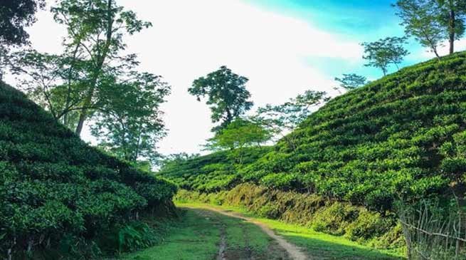
Hailakandi Located about 51 km southeast of Karimganj and about 312 km south of Guwahati, Hailakandi in the heart of the Barak Valley makes up the Valley alongside Cachar and Karimganj. The town is the administrative headquarters of the district and has several legends attached to it. More than 50% of the district is a reserve forest with two reserve forests, the Inner Line Reserve Forest and the Katakhal Reserve Forest. Blessed with a thick cover of lush green forest, sprawling tea gardens, lovely fruit orchards and a gurgling river, Hailakandi has many hidden treasures waiting to be explored. Situated at Badarpur Ghat, the Siddyashar Bari Sibmandir is a popular temple dedicated to Siddyashar Bari. Offering a splendid view of the River Barak, the Pach Pirr Mukam is a famous spot in the town with the huge cropland near the place adding charm and beauty to it.
Silchar Just 35 km north of Hailakandi and 303 km south of Guwahati lies the town of Silchar in the southernmost part of Assam. The headquarters of the Cachar district, Silchar was founded by Captain Thomas Fisher in 1832 when he shifted the headquarters of Cachar to Janiganj in Silchar and earned the moniker Island of Peace from Indira Gandhi, the then Prime Minister of India. The city is located in an alluvial flat plain with swamps, streams, and isolated small hills, locally known as tilla marking its landscape. Apart from Barak river, the other major river is Ghagra river. Silchar is in Zone V on the Seismic Zonation Map and has witnessed major earthquakes. Silchar is the site of the world’s first polo club and the first competitive polo match. In 1985, an Air India flight from Kolkata to Silchar became the world’s first all-women crew flight. The name Silchar comes from the two Bengali words shil mean rock and char meaning shore or island. It is theorised that locals started calling the area Shiler Chor meaning the rocky shore, which got shortened to Silchar, which was in turn adopted and popularised by the British.
Cachar was ruled by the Tippera dynasty in the 13th century and eventually moved eastwards to present-day Tripura and by the 16th century, Cachar was a part of the Tripura Kingdom. While the hill areas of the Kachari kingdom i.e. Dima Hasao, had a Dimasa stronghold, the plain areas i.e. present-day Cachar had Bengalis constituting the majority. Eventually, the formal conversion of the Dimasa kings into Hinduism was carried out under Bengali Brahmins when Raja Krishna Chandra and Raja Govinda Chandra performed the Hiranyagarbha ceremony in 1790. The Kings in turn were great patrons of Bengali literature and Bengali was the court language of the Kachari kings. After taking over parts of the Brahmaputra Valley and Manipur by 1823, the Burmese made forays into Cachar as well which prompted the British occupation of Cachar as essential towards guarding the nearby British held district of Sylhet against the Burmese. Captain Thomas Fisher, an army officer took charge of Cachar in 1830 with the headquarters in Cherrapunji and in 1833 Silchar was made the headquarters. In 1942, the Japanese forces dropped a bomb on the Derby Tea Estate 20 km from the town. In the 1850s, the British observed exiled Manipuri princes in Silchar play Sagol Kangjei, the predecessor to modern polo which was already popular in nearby Manipur. In 1859, the world’s first polo club in Silchar, called the Silchar Kangjei Club was established which was later renamed to Silchar Polo Club and survives today as the Cachar Club. The first competitive modern form of polo was played in Silchar as well though no polo is played anymore.
Khaspur is located 20 km from Silchar and has the ruins of a great Dimasa kingdom. The main attractions here are the Lion Gate, the Sun Gate and the old kings’ temple. The original palace is in a state of non-existence, but its subsidiaries, the main entrance gate, the Suryadwar, the Debalaya are still intact with the entrances made of an elephant pattern. The Bhubeneshwar temple or the Bhubanhill Temple is one of the most celebrated temples of Lord Shiva in south Assam and is located about 50 km from Silchar and on the top of the Bhuvan hill. During the festival of Shivaratri, thousands of Shivayats march towards the hilltop to worship Lord Shiva. This temple by its geographical location attracts a lot of hikers as there are no motor roads to reach the hilltop, one has to hike at least 17 km from the plains to the temple. About 22 km from Silchar on the way to the Kumbhirgram airport the Vishnu temple at Salganga is another tourist attraction. One of the most revered temples in south Assam, the Kachakanti Kali Temple dates back to the 19th century. It was built in 1806 by the then Kachari King and was later renovated in 1978. The temple is dedicated to the Mother Goddess Kachakanti, who is said to be an amalgamation of two powerful Hindu deities, Goddess Durga and Goddess Kali and it is said that even until 1818, even human sacrifices were offered to the Goddesses here. The Badarpur Fort is located on the bank of the Barak River, about 16 km from Badarpur Railway station and is an important feature of the Barak Valley. The Maniharan Tunnel is only a few km from Silchar and according to Hindus, was constructed during the days of Lord Krishna and was once used by him. Many small temples are devoted to Garuha, Lord Lakshmana, Lord Rama and Lord Hanuman. One of Silchar’s beautiful lakes, Dolu Lake is a photographer’s delight where one can spend some time contemplating life and its mysteries. The Gandhibag Park is located on the banks of a lake in the heart of the town and is named after Mahatma Gandhi. The park includes the Shahid Minar, the memorial for 11 martyrs who died on 19th May 1962 while fighting for the protection of their Bengali language against the Government of Assam.
Sivasagar 57 km east of Jorhat and 362 km east of Guwahati, Sivasagar which translates to the ocean of Shiva and is well known for its Ahom palaces and monuments and today is an important centre for tea and oil. Formerly known as Rangpur, Sivasagar was the capital of the Ahom Kingdom who ruled Assam for six centuries from 1699 to 1788 until their kingdom fell to the Burmese in 1819 and the ruling class was all but wiped out. The province was conquered by the British in 1825 and completely annexed in 1826. It was said that the original name of Sivasagar was Kalansupar after the name of Kalansu Gohain who resided in a village that originally existed where the Sivasagar tank is currently located.
The Joysagar Tank and Temples are located in nearby Rangpur. Completed in a record 45 days in 1697, these massive structures along with the tanks and temples span an area of nearly 320 acres. There are also temples on the banks of the water body named Jeydol, the Shiv Temple, the Devi Ghar and the Nati Gosain temple. The famous Shiva temple known as Shivadol is located on the shores of the Sibsagar Lake and was constructed in 1734. Dedicated to Lord Shiva, Shivadol was built by Bar Raja Ambika, the Queen of the Ahom King Swargadeo Siba Singha. It is the tallest Shiva temple in India with a height of about 32 m and a base perimeter of 59 m.
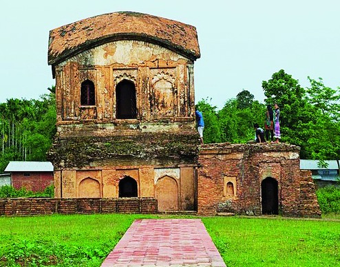
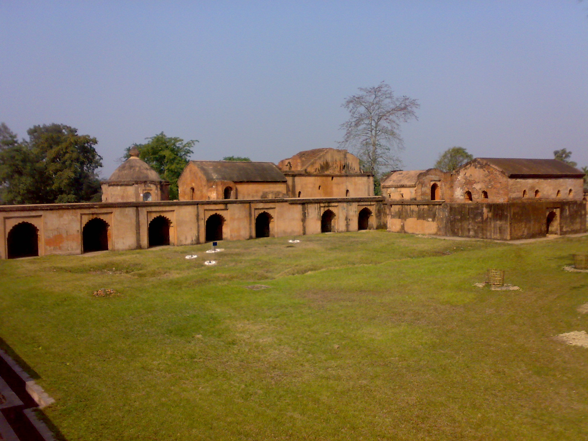
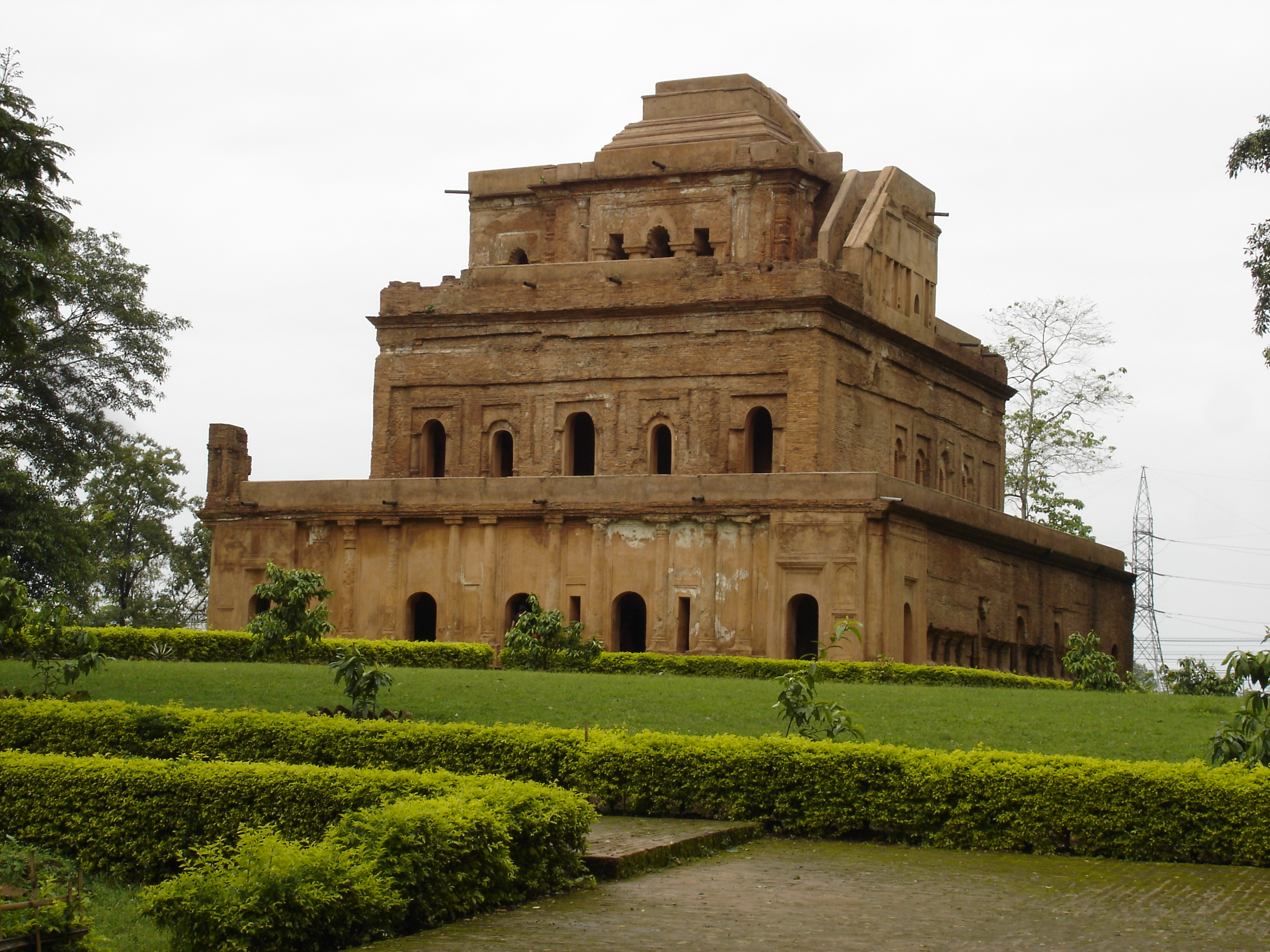
The Talatal Ghar or the Rangpur Palace is impressive in Tai Ahom architecture and is also the largest of all Ahom monuments in the world. Boasting of a typical Mughal architecture style, the upper ground floor of the Talatal Ghar is popularly known as Kareng Ghar and was used as a palace by Assamese royalty. Raja Swargdeo Rudra Singha, the successor of Raja Swargadeo Rajeswar Singha, added the top floors during his regime making the palace a spectacular seven-story palace. The palace has been built with organic materials, out of bricks and a mixture of rice powder and duck eggs. What is truly notable is that this structure has been standing tall and strong for centuries. The palace was originally built as an army base by Swargadeo Rajeswar Singha between 1751 and 1769 and has two tunnels and three underground floors built to facilitate emergency evacuation for the King and his army. After Swargadeo Rudra Singha’s demise, the fort underwent major changes with three ground storeys added making the Talatal Ghar a seven-storey palace. Of the seven levels, four levels lay above the ground and three levels lie below. Visitors are only allowed to visit the upper three levels while the underground floors are closed.
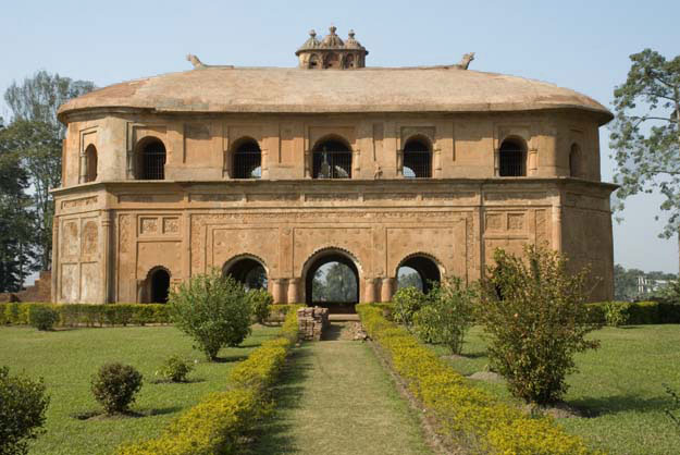
Often referred to as the Colosseum of the East, Rang Ghar is one of the oldest surviving amphitheatres in Asia and is located near Rangpur Palace. The name translates to House of Entertainment and dates back to 1746 when the Ahoms used to rule. The two-storied building was originally built by Ahom ruler Swargadeo Pramatta Singha to be used by Ahom kings and nobles for witnessing sports held at the adjoining Rupahi Pathar. It served as a royal sports pavilion, particularly during the Rangauli Bihu festival. However, today, the condition of this monument is quite fragile with frequent earthquakes and seismic surveys causing at least 35 noticeable cracks on the walls. At a height of 10 meters, Rang Ghar is a brilliant specimen of the Ahom style of architecture, made exclusively of baked red bricks. The base of the structure is composed of a series of entrances, and its roof is shaped like an Ahom long royal boat with sculpted stone crocodiles found adorning the top of the ceiling and the exterior has an eclectic melange of exquisitely carved floral and geometrical patterns. Rang Ghar is open between 9 am and 5 pm and has an entry fee of INR 5.
The royal seat of the Ahoms, the Gargaon Palace or Kereng Ghar has located 13km from Sivasagar and consists of seven floors, three of which are underground. There are also many exciting underground passages with many of them closed to the public due to safety reasons.
Located 28 km from Sivasagar, Charaideo was the capital of the Ahom dynasty and was built by Sukhapa, the founder of the Ahom dynasty. The main attraction of Charaideo is its burial vaults or maidans of the king and members of the Ahom dynasty, which are however in ruins today. The Ahom Museum, on the banks of Sibsagar Lake, displays artefacts such as royal armoury, clothes and manuscripts which belonged to the rulers of the Ahom dynasty.
Gaurisagar Tank, an artificial reservoir near Sivasagar, is spread over 150 acres with temples scattered all around it dedicated to Lord Shiva, Lord Vishnu and Goddess Durga. The landmark of the town, the Sibsagar Lake is also an artificial lake built by Queen Ambika, wife of King Shiva Singha, in 1734. The pretty lake is surrounded by parks, gardens, museums, masjid, Buddhist monastery, church and temples.
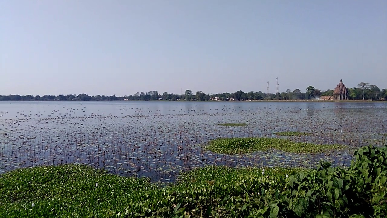
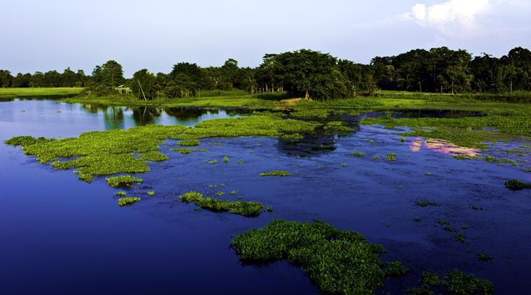
Majuli A lush green, pristine, environment-friendly and pollution-free freshwater island on the Brahmaputra, Majuli is located about 20 km from Jorhat and about 347 km from Guwahati. With a total area of 1250 sq km, Majuli is the world’s largest river island and in 2016 it became the first island to be made a district in India. The island is formed by the Brahmaputra River in the south and the Kherkutia Xuti, an anabranch of the Brahmaputra, joined by the Subansiri River in the north and is accessible by ferries from Jorhat. Majuli was formed due to course changes by the Brahmaputra and its tributaries, mainly the Lohit and is the home of Assamese neo-Vaishnavite culture and is mostly inhabited by tribals. Majuli was a long, narrow piece of land called Majoli or the land in the middle of two parallel rivers that had the Brahmaputra flowing in the north and the Burhidihing flowing in the south until they met at Lakhu. It was once known as Ratnapur and was the capital of the powerful Chutia kingdom. Frequent earthquakes between 1661 and 1696 set the stage for a catastrophic flood in 1750 that continued for 15 days, as a result of which, part of the Brahmaputra discharged southward into what was the Burhidihing’s lower channel and Majuli island was formed. The Burhidihing’s point of confluence moved 190 km east and the southern channel which was the Burhidihing became the Burhi Xuti. The northern channel, which was previously the Brahmaputra, became the Luit Xuti. In due course, the flow in the Luit Xuti decreased, and it came to be known as the Kerkota Xuti; and the Burhi Xuti expanded via erosion to become the main Brahmaputra River. Majuli has been the cultural capital of Assamese civilisation since the 16th century with Sankardeva, a pioneer of the medieval-age neo-Vaishnavite movement, preaching a monotheist form of Hinduism called Vaishnavism and who established monasteries and hermitages known as satra on the islet after which the island soon became the leading centre of Vaishnavism. After the arrival of the British, Majuli was under the rule of the British until India gained independence in 1947. The locals speak mainly the Assamese and Mising languages with a few also speaking the Deori language.
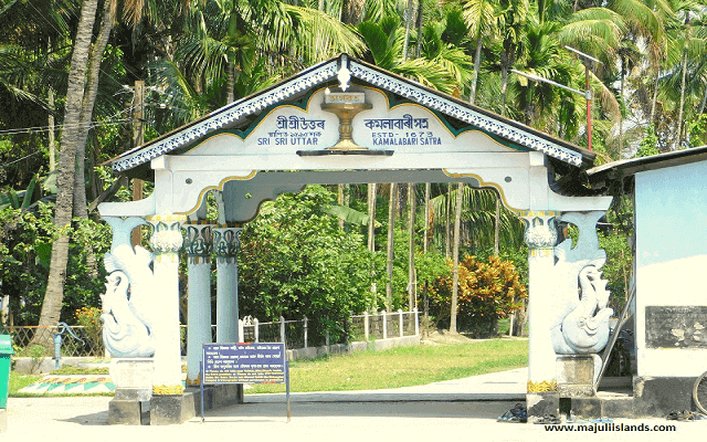
The Kamalabari Satra is very famous which houses significant articles related to art, culture, literature and classical studies. The North Satra, another portion of the Kamalabari Satra participates in several cultural events of satra art across the country. The Dakhinpat Satra was the chief satra patronized by the Ahom rulers with the Rasotsava festival of Assam celebrated with great enthusiasm and passion and the highlight of the festival, the performance of Rasleela on a full moon night. The Auniati Satra is famous for its Apsara and Paalnaam dance forms and was founded by Niranjan Pathakdeva and features a wide collection of traditional Assamese utensils, jewellery and handicrafts as well as old utensils, jewellery and handicrafts. An important attraction in Majuli, Gamur is among the many holy seats here with others including Auniati, Daksinpath and Kamlabari. This Vaishnavite spot preserves ancient artefacts and articles, the most prominent among these being Bortop.
Located on the banks of the river Brahmaputra, Tengapania is a spectacular and popular picnic spot bound by Dhakuakhana, Machkhoa and Disangmukh. Often referred to as the one-man forest, the Molai Forest is a famous forest on Majuli and is named after Jadav Payeng, a forestry worker and environmental activist. When the forest was abandoned in 1983, Jadav single-handedly put in an effort spanning over 30 years into making this a full-fledged 1360-acre forest reserve which has been widely appreciated. Molai Forest is home to the Indian tiger, Indian rhinoceros, deer, monkeys, rabbits, several apes and a variety of birds including vultures. Around 100 elephants visit this forest annually and stay for 6 months. Molai Forest is open throughout the day on all days and there is no entry fee to see this forest. However, tourists are requested to visit this forest during daylight hours to ensure their safety.
The Assam Majuli Festival is held on the bank of river Luit, with many cultural programs as well as exhibitions of Assamese products as well as a food festival showcasing Assamese and tribal dishes. The festival is usually held in November so that the weather is mild and there are no floods in the Brahmaputra.
Dhemaji 95 km north of Majuli and 459 km northeast of Guwahati lies the serene town of Dhemaji whose name is derived from the Deori word Dema-Ji which means great water indicating it to be a flood-prone region. Established by the first king of Ahom reign, Chow Chukafa, Dhemaji is located in the northeastern part of Assam and borders Arunachal Pradesh and is part of the Brahmputra plains. Considered very important from an archaeological point of view, Dhemaji is inhabited by many Assamese tribes including the Chutia, the Ahoms, the Sonowal Kacharis, the Koches, the Kalitas, the Kaibartas, the Mishings and the Deoris.
Gerukamukh, located around 45 km from Dhemaji, is a beautiful natural spot on the banks of the river Subansiri, the largest tributary of the Brahmaputra. Surrounded by rolling hills and dense evergreen forests, it is a popular picnic and angling spot during the winter months. Gerukamukh is also important due to it being the location for the under-construction Subansiri Dam, which when completed, will be the largest hydroelectric power project in India. Malinithan which is located 32 km from Dhemaji at the foot of the Siang hills close to the Assam-Arunachal Pradesh border is a site of ancient temple ruins. With many relics within the ruins, it holds great religious importance for locals. The shrine was dedicated to Goddess Malini, also known as Goddess Parvati. The ruins of the temple suggest that it was built with granite stones under Aryan influence with archaeological finds including many idols of Goddess Durga and Lord Shiva, indicating that Shakti was worshipped in this region. Local mythology mention that when Lord Krishna wanted to marry Rukmini, he abducted her before her wedding with Shishupala. On their way, they stopped at Malinithan, where they were welcomed by Lord Shiva and Goddess Parvati who presented them with garlands made of flowers plucked from her orchard, which impressed Lord Krishna so much that he gave Goddess Parvati the title of Malini or the mistress of the garden. The findings unearthed here reveal an exceptionally designed pedestal of the temple as well as statues and sculptures of various Gods and Goddesses, animals and flowers. There are also some ruins of columns and panels that probably formed the facade of the temple.
Located 25 km south-west of Dhemaji, the Maa Manipuri Than is a temple, established by the then Ahom King, Gourinath Singha in tribute to the people of Manipur or the Manipuris for their aid in controlling the Mua-Mariah renaissance during the later period of Ahom reign. The temple is frequented by a large number of devotees and pilgrims throughout the year. Ghugulani is a temple and part of the historical site of Ghuguha Dol which was constructed in the memory of Queen Ghuguhi, who was the wife of the then Ahom King, Tyao Khamti. According to legend, Bamuni Konwar, son of Tyao Khamti and his wife Ghuguhi, had taken his first breath where the temple stands.
The Bardoibum-Beelmukh Wildlife Sanctuary is located about 46 km southwest of Dhemaji and is shared between the districts of Dhemaji and Lakhimpur. Covering an area of around 11.25 sq km, this bird sanctuary was officially declared a sanctuary in 1996. It is the breeding for many bird species, most notably the Whistling Teal. The best time to visit the bird sanctuary is in the winter months when many migratory birds migrate here to escape the harsh winters of north Asia. Common bird sightings here include the fishing eagle and the adjutant stork. Among the prized bird species to be spotted here include Chestnut Bittern, Openbilled Stork, Indian Roller and Blackheaded Oriole. Aquatic flora dominates the sanctuary due to it mostly being a water body with semi-aquatic vegetation and trees found along the banks of the bil or lake.
Dibrugarh Moving on, our next destination is Dibrugarh which is located on the banks of the Brahmaputra about 70 km east of Dehamji and 442 km northeast of Guwahati. The largest city in Assam in upper Assam with sprawling tea gardens, Dibrugarh also serves as the headquarters of the Sonowal Kachari Autonomous Council, which is the governing council of the Sonowal Kachari tribe which found predominantly in the district. Dibrugarh also acts as the endpoint of the North-East Frontier Railway Zone with Dibrugarh railway station ranking as the top largest railway junction in the entire Northeast.
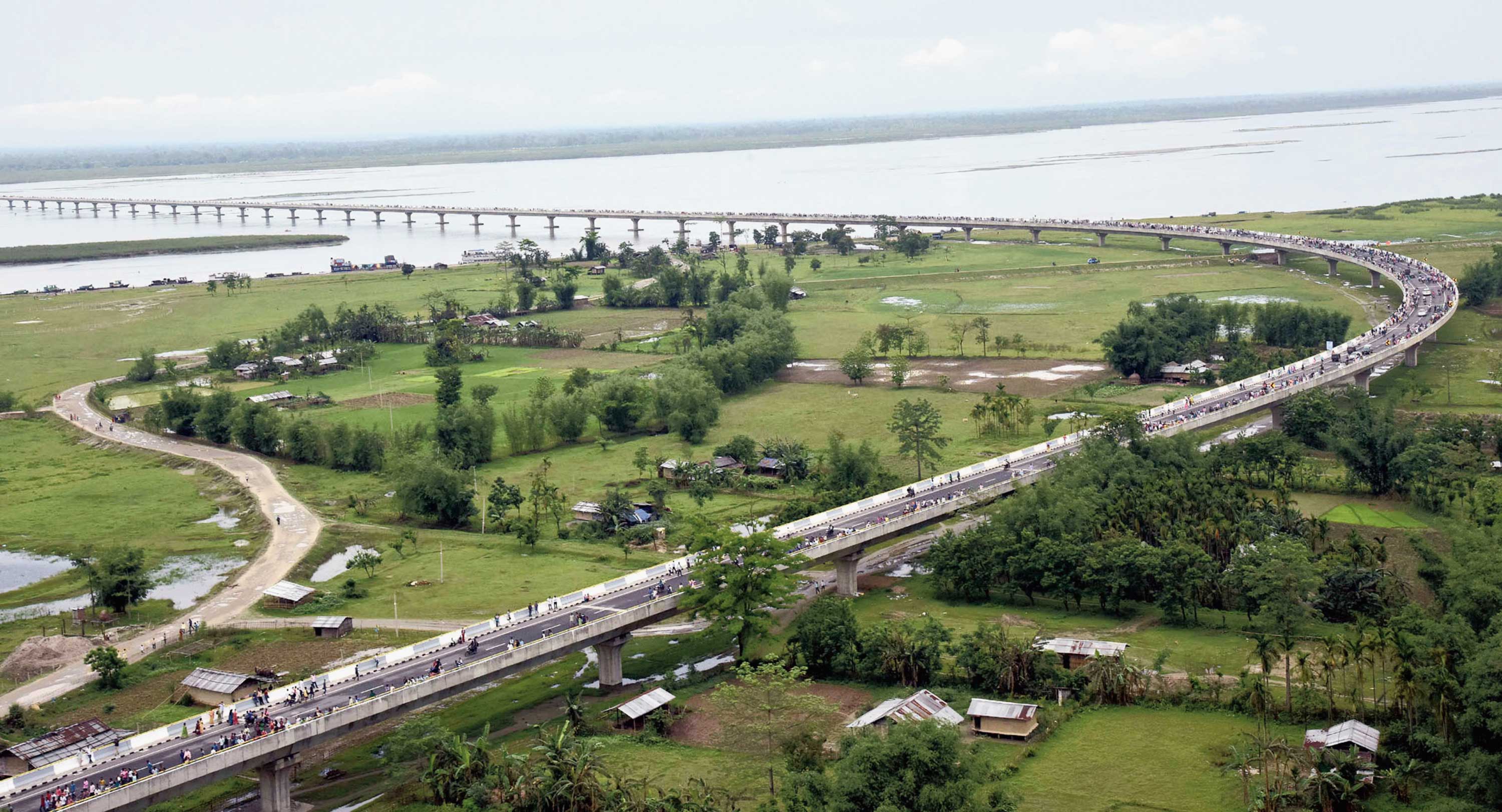
Dibrugarh derives its name from Dibarumukh, a renowned encampment of the Ahoms during the Ahom Sutiya War. Either the name Dibru evolved from the Dibaru river or from the Dimasa word Dibru which means a blister and Garh meaning a fort. Both Dibru and Dibaru are Dimasa words with the Dimasas adding the prefix Di, which means water wherever there is a small stream, a river, or a large river in a town or city. Dibrugarh was part of the Chutia kingdom until 1523 when the Ahoms annexed it due to the weak rule of the Chutia king Nitipal and was known as Ti-Phao in Ahom Buranji. Buridihing, a tributary of the Brahmaputra, divides the district from east to west and at a later stage in its course, acts as a divider between Dibrugarh and Sivasagar districts. Dibrugarh, along with Tinsukia and Sivasagar account for approximately 50% of India’s Assam tea crop, and so Dibrugarh can rightly be called the Tea City of India. Bogbeel Bridge, the longest train cum road bridge is located here.
A replica of the Lord Jagannath Temple in Puri known as Shrikshetra Dhaamhas a height of 85 feet and is expected to be a major religious centre in eastern Assam. Dinjoy Satra is located around 5 km towards the north of Chabua Township and was a Satra found by Aniruddha Dev at Bisnubalikakunshi village towards North Lakhimpur that was later shifted to Khutiaputa. In due course of time and after many disturbances, the Satra was named Dinjoy Satra when it was brought to Dinjan at Chabua and has since then been kept here and is popularly called Dinjoy Satra. The Dehing Namti Satra is located on the banks of Disang River in Sasoni Mouza and is the main branch of the Satra is located at Namti in Nazira and was found by Binandashyam Gohain who had a follower named Lachit Borphukan. The Raidongia Dol is Dibrugarh’s most famous site and is a magnificent structure at a height of about 45 feet. The tea gardens in and around Dibrugarh boasts of scintillating greenery where one can watch the tea pickers at work, and gain an insight into the tea making process. One can also taste the premium quality tea here and take back some. A maidam is an ancient burial mound of royalty and aristocracy and the Barbarua Maidam consists of two ancient graveyards, said to be devoted to high ranked officials. There are two others in the area, devoted to dead soldiers. The Bahikhowa Maidam is dedicated to Bahikhowa Dasarath Dowerah Borphukan who was the chief of army staff of the Ahoms during the rule of Rajeswar Singha and this maidam is dedicated to him but is presently in ruins. There are 3 more small maidams located very close to the Bahikhowa Maidam. The Lekai Chetia Maidam is presently known as Thaan, which is a religious institution and has a site towards its north, which is known as Lekai dedicated to Lekai Chetia, an officer of the Ahom kingdom under Swragodeo Pratapsingha. The Sarumechlow and Bormechow Maidams are two maidams which are the graveyards of the two queens of King Sukhampha Khura, of the Ahom regime, Bormechow and Sarumechlow.
The Jokai Botanical Garden cum Germplasm Centre works on developing trekking routes inside the Jokai reserve forest and the introduction of boating facilities at the Era-suti. The Jeypore Rainforest situated 60 km southeast of Dibrugarh is India’s easternmost rainforest and one of the very few wildlife reserves on earth housing seven wildcat species including the Royal Bengal Tiger, the clouded leopard, the common leopard, the golden cat and the marbled cat. The Jeypore reserve forest and Dilli reserve forest combine to be the only rain forest in the state spread across three of Upper Assam’s districts of Tinsukia, Dibrugarh and Sibsagar and comprises an area of 575 sq km. The forest is listed to be the last lowland forest under the Assam valley wet evergreen forest area in the region. The Dehing Patkai Wildlife Sanctuary is in the Dehing Patkai rainforest in an area of 111.19 sq km and is famous for the Assam Valley Tropical Wet Evergreen Forests bordering Arunachal Pradesh. The Sanctuary is a part of the Dehing-Patkai Elephant Reserve having World War II cemeteries nearby, along with the Stillwell Road and the oldest refinery of Asia in Digboi and open cast coal mining at Lido.
Tinsukia An industrial town 49 km east of Dibrugarh, 480 km northeast of Guwahati and 84 km from Assam’s border with Arunachal Pradesh, Tinsukia was the capital of the Motok kingdom founded by Swargadeo Sarbananda Singha as well as the site of Bengmara, originally known as Changmai Pathar. Swargadeo Sarbananda Singha, known as Mezara, was a member of the erstwhile Chutia royal family and rose to become an able administrator who adopted the name Sarbananda Singha after he became the ruler. Tinsukia is a popular tourist town and serves as a base for nearby towns.
Famous for its tea gardens, Doomdooma is a famous Tinsukia attraction. The plantation is also known as the Hindustan Lever’s Doomdooma Tea Gardens. The Doomdooma Reserve Forest is also close to the tea garden. Rangagora village which is about 10 km from Tinsukia and Dighaltarang, about 15 km from Tinsukia are also known for their tea plantations. The starting point of the historic Stilwell Road, Lekhapani is situated in the Patkai foothills on the Assam – Arunachal Pradesh border and the main residents of the place are the Tangsa Naga tribe. Bardubi is a scenic and mesmerising small village located 12 km from Tinsukia and is surrounded by towering snow-capped peaks. About 6 km from Margherita, Ledo is known for the Indo – Burma Highway which is about 430 km long built during World War II. The Bell Temple is located 17 km from Tinsukia is a major attraction of the town. Dedicated to Lord Shiva, it is also known as the Tilinga Temple, where Tilinga stands for a bell. There is a huge banyan tree in the complex which is tied all over with pretty bells by devotees who believe that in doing so, their wishes will be fulfilled. The biggest attraction in town, Na-Pukhuri is a group of nine lakes on the periphery of the town and a historical monument built during the period of King Sarbananda Singha. The central tank is the most popular one which covers over 10 acres and is filled with natural water. Due to its area and the method of filling, it is also called a lake and has tiled pathways and jogging tracks along with many playing equipments. This park also has a triple cascade fountain in its central area. The Bherjan-Borjan-Padumoni Wildlife Sanctuary lies just 6 km from Tinsukia and has various species of animals including the hoolock gibbon, the stump-tailed macaque, the capped langur, the common macaque and the slow loris.
Digboi Famous as the Oil City of Assam, Digboi lies 33 km east of Tinsukia and 488 km northeast of Guwahati. It houses the oldest refinery in India, a hundred-year-old oil field where crude oil was discovered here in the late 19th century. Digboi is also known for its golf courses which are left by the British. There is an interesting story about how the town got its name. It is believed that it is derived from the phrase dig-boy-dig as told by the English to the labourers digging for crude oil. Apart from the Digboi Oil Refinery, Digboi Lake is serene and has picturesque views. The Digboi Oil Centenary Museum is dedicated to the history of the Assam oil industry exhibiting some of the best original engines and pump models and has grand photo halls and facts listed on them. The museum is closed on Mondays and other days is open between 10 am and 6 pm. The Digboi Golf Club with its 18 holes was founded in 1888 and spans an area of over 6300 yards and hosts several major tournaments. The War Cemetery is also a place of interest where the most dramatic event in Digboi’s history took place during World War II when the belligerent Japanese came close to within three days marching distance of Digboi. Margherita is a centre of tea gardens, plywood factories, and coal mines, with many picnic spots dotting the sandy banks of the River Dihing. Take a day trip here and breathe in the cool, misty air fresh with the aroma of fresh tea leaves.