Travel Bucket List: India – Gujarat Part 1

Located in India’s westernmost part, bordering Pakistan, the state of Gujarat has a 1,600 km long coastline, most of which lies on the Kathiawar peninsula. The fifth largest state by area and the ninth largest state by population, Gujarat with its population in excess of 60 million is bordered by Rajasthan to the northeast, Dadra and Nagar Haveli and Daman and Diu to the south, Maharashtra to the southeast, Madhya Pradesh to the east, and the Arabian Sea and the Tharparkar, Badin and Thatta districts of Pakistani province of Sindh to the west. The capital city is Gandhinagar, while its largest city is Ahmedabad. Gujarat’s economy is one of the strongest in the country at number five and is built upon the business acumen of its people.

Historically, the north was known as Anarta, the Kathiawar peninsula, “Saurastra”, and the south as “Lata”. Gujarat was also known as Pratichya and Varuna. The Arabian Sea makes up the state’s western coast. Gujarat has the longest coastline – 24% of the Indian coastline is in this state and is dotted with 41 ports: one major, 11 intermediate and 29 minor.

The state encompasses some sites of the ancient Indus Valley Civilisation, such as Lothal, Dholavira and Gola Dhoro. Lothal is believed to be one of the world’s first seaports. Gujarat’s coastal cities, chiefly Bharuch and Khambhat, served as ports and trading centres in the Maurya and Gupta empires, and during the succession of royal Saka dynasties from the Western Satraps era. Along with Bihar and Nagaland, Gujarat is one of the three Indian states to prohibit the sale of alcohol. Gir Forest National Park in Gujarat is home of the only wild population of the Asiatic lion in the world.

The word Gujarat is derived from the Sanskrit term Gurjaradesa, meaning “The Land of the Gurjaras”, who ruled Gujarat in the 8th and 9th centuries. Parts of modern Rajasthan and Gujarat have been known as Gurjaratra or Gurjarabhumi or land of the Gurjars for centuries before the Mughal period.

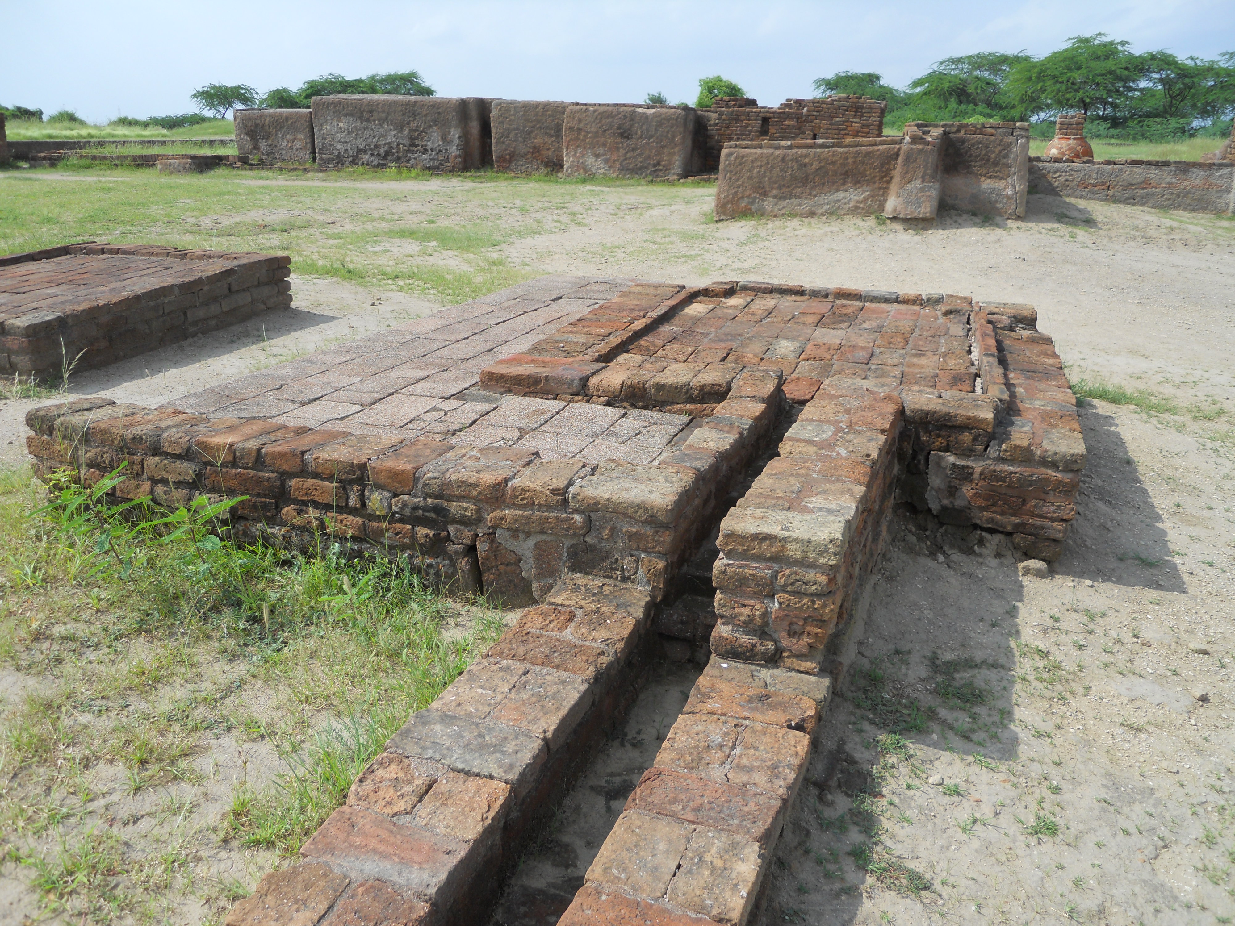
Present day Gujarat was one of the main central areas of the Indus Valley Civilisation. It contains ancient metropolitan cities from the Indus Valley such as Lothal, Dholavira, and Gola Dhoro. The ancient city of Lothal was where India’s first port was established. The ancient city of Dholavira is one of the largest and most prominent archaeological sites in India, belonging to the Indus Valley Civilisation. The most recent discovery was Gola Dhoro. Altogether, about 50 Indus Valley settlement ruins have been discovered in Gujarat.

There is clear historical evidence of trade and commerce ties between ancient Gujarat and Egypt, Bahrain and Sumer in the Persian Gulf during the time period of 1000 to 750 BC. There was a succession of Hindu and Buddhist states such as the Mauryan Dynasty, Western Satraps, Satavahana dynasty, Gupta Empire, Chalukya dynasty, Rashtrakuta Empire, Pala Empire and Gurjara-Pratihara Empire, as well as local dynasties such as the Maitrakas and then the Chaulukyas who ruled the state.

The early history of Gujarat reflects the imperial grandeur of Chandragupta Maurya who conquered a number of earlier states in what is now Gujarat. Pushyagupta, a Vaishya, was appointed the governor of Saurashtra by the Mauryan regime. He ruled Girinagar which is now modern-day Junagadh between 322 to 294 BC and built a dam on the Sudarshan lake. Emperor Ashoka, the grandson of Chandragupta Maurya, not only ordered engraving of his edicts on the rock at Junagadh but asked Governor Tusherpha to cut canals from the lake where an earlier Mauryan governor had built a dam. Between the decline of Mauryan power and Saurashtra coming under the sway of the Samprati Mauryas of Ujjain, there was an Indo-Greek defeat in Gujarat of Demetrius. In 16th century manuscripts, there is an apocryphal story of a merchant of King Gondaphares landing in Gujarat with Apostle Thomas. The incident of the cup-bearer torn apart by a lion might indicate that the port city described is in Gujarat.

For nearly 300 years from the start of the 1st century AD, Saka rulers played a prominent part in Gujarat’s history. Mahakshatrap Rudradaman I founded the Kardamaka dynasty which ruled from Anupa on the banks of the Narmada up to the Aparanta region which bordered Punjab. In Gujarat, several battles were fought between the south Indian Satavahana dynasty and the Western Satraps. The greatest and the mightiest ruler of the Satavahana Dynasty was Gautamiputra Satakarni who defeated the Western Satraps and conquered some parts of Gujarat in the 2nd century AD. The Kshatrapa dynasty was replaced by the Gupta Empire with the conquest of Gujarat by Chandragupta Vikramaditya. Vikramaditya’s successor Skandagupta left an inscription around 450 AD on a rock at Junagadh which gives details of the governor’s repairs to the embankment surrounding Sudarshan lake after it was damaged by floods. The Anarta and Saurashtra regions were both parts of the Gupta empire. Towards the middle of the 5th century, the Gupta empire went into decline. Senapati Bhatarka, the Maitraka general of the Guptas, took advantage of the situation and in 470 AD he set up what came to be known as the Maitraka state. He shifted his capital from Giringer to Valabhipur, near Bhavnagar, on Saurashtra’s east coast. The Maitrakas of Vallabhi became very powerful with their rule prevailing over large parts of Gujarat and adjoining Malwa. A university was set up by the Maitrakas, which came to be known far and wide for its scholastic pursuits and was compared with the noted Nalanda University. It was during the rule of Dhruvasena Maitrak that Chinese philosopher-traveler Xuanzang or I Tsing visited in 640 AD along the Silk Road.

Gujarat was known to the ancient Greeks and was familiar with other Western centers of civilisation through the end of the European Middle Ages. The oldest written record of Gujarat’s 2,000-year maritime history is documented in a Greek book titled The Periplus of the Erythraean Sea: Travel and Trade in the Indian Ocean by a Merchant of the First Century.

In the early 8th century, the Arabs of the Umayyad Caliphate established an empire in the name of the rising religion of Islam, which stretched from Spain in the west to Afghanistan and modern-day Pakistan in the east. Al-Junaid, the successor of Qasim, finally subdued the Hindu resistance within Sindh and established a secure base. The Arab rulers tried to expand their empire southeast, which culminated in the Caliphate campaigns in India fought in 730; they were defeated and expelled west of the Indus river, probably by a coalition of the Hindu rulers Nagabhata I of the Pratihara Dynasty, Vikramaditya II of the Chalukya dynasty and Bappa Rawal of Guhila dynasty. After this victory, the Arab invaders were driven out of Gujarat. In the late 8th century, the Kannauj Triangle period started. The three major Indian dynasties – the northwest Indian Gurjara-Pratihara Dynasty, the south Indian Rashtrakuta Dynasty and the east Indian Pala Empire – dominated India from the 8th to 10th centuries. During this period the northern part of Gujarat was ruled by the north Indian Gurjara-Pratihara dynasty and the southern part of Gujarat was ruled by the south Indian Rashtrakuta dynasty until it was captured by the south Indian ruler Tailapa II of the Western Chalukya Empire.

Zoroastrians from Greater Iran migrated to the western borders of South Asia which were then Gujarat and Sindh during the 8th or 10th century, to avoid persecution by Muslim invaders who were in the process of conquering Iran. The descendants of those Zoroastrian refugees came to be known as the Parsi community both in present day India and Pakistan.

The Chaulukya dynasty ruled Gujarat from 960 to 1243 AD and at that time, Gujarat was a major center of Indian Ocean trade, and their capital at Anhilwara (Patan) was one of the largest cities in India, with population estimated at 100,000 in the year 1000. After 1243, the Solankis lost control of Gujarat to their feudatories, of whom the Vaghela chiefs of Dholka came to dominate Gujarat. In 1292 the Vaghelas became tributaries of the Yadava dynasty of Devagiri in the Deccan. Karandev of the Vaghela dynasty was the last Hindu ruler of Gujarat. He was defeated and overthrown by the superior forces of Alauddin Khalji from Delhi in 1297. With his defeat, Gujarat became part of the Muslim empire, and the Rajput hold over Gujarat would never be restored.

An independent Muslim community continued to flourish in Gujarat for the next hundred years, championed by Arab merchants settling along the western coast belonging to the Shafi’ite madhhab. From 1297 to 1300, Alauddin Khalji, the Turko-Afghan Sultan of Delhi, destroyed the Hindu metropolis of Anhilwara and incorporated Gujarat into the Delhi Sultanate. After Timur’s sacking of Delhi at the end of the 14th century weakened the Sultanate, Gujarat’s Muslim Rajput governor Zafar Khan Muzaffar also known as Muzaffar Shah I asserted his independence, and his son, Sultan Ahmed Shah who ruled between 1411 to 1442, established Ahmedabad as the capital. Khambhat eclipsed Bharuch as Gujarat’s most important trade port.

Later, a close alliance between the Ottoman Turks and Gujarati sultans to effectively safeguard Jeddah and the Red Sea trade from Portuguese imperialism, encouraged the existence of powerful Rumi elites within the kingdom who took the post of viziers in Gujarat keen to maintain ties with the Ottoman state. The Mughal emperor Humayun, had also briefly occupied the province in 1536, but fled due to the threat Bahadur Shah, the Gujarat king, imposed. The Sultanate of Gujarat remained independent until 1572, when the Mughal emperor Akbar the Great conquered it and annexed it to the Mughal Empire. The Surat port then became the principal port of India during Mughal rule to gain widespread international repute. The city of Surat, famous for its cargo export of silk and diamonds had come on a par with contemporary Venice and Beijing which were some of the great mercantile cities of Europe and Asia, and earned the distinguished title, Bab al-Makkah or Gate of Mecca.

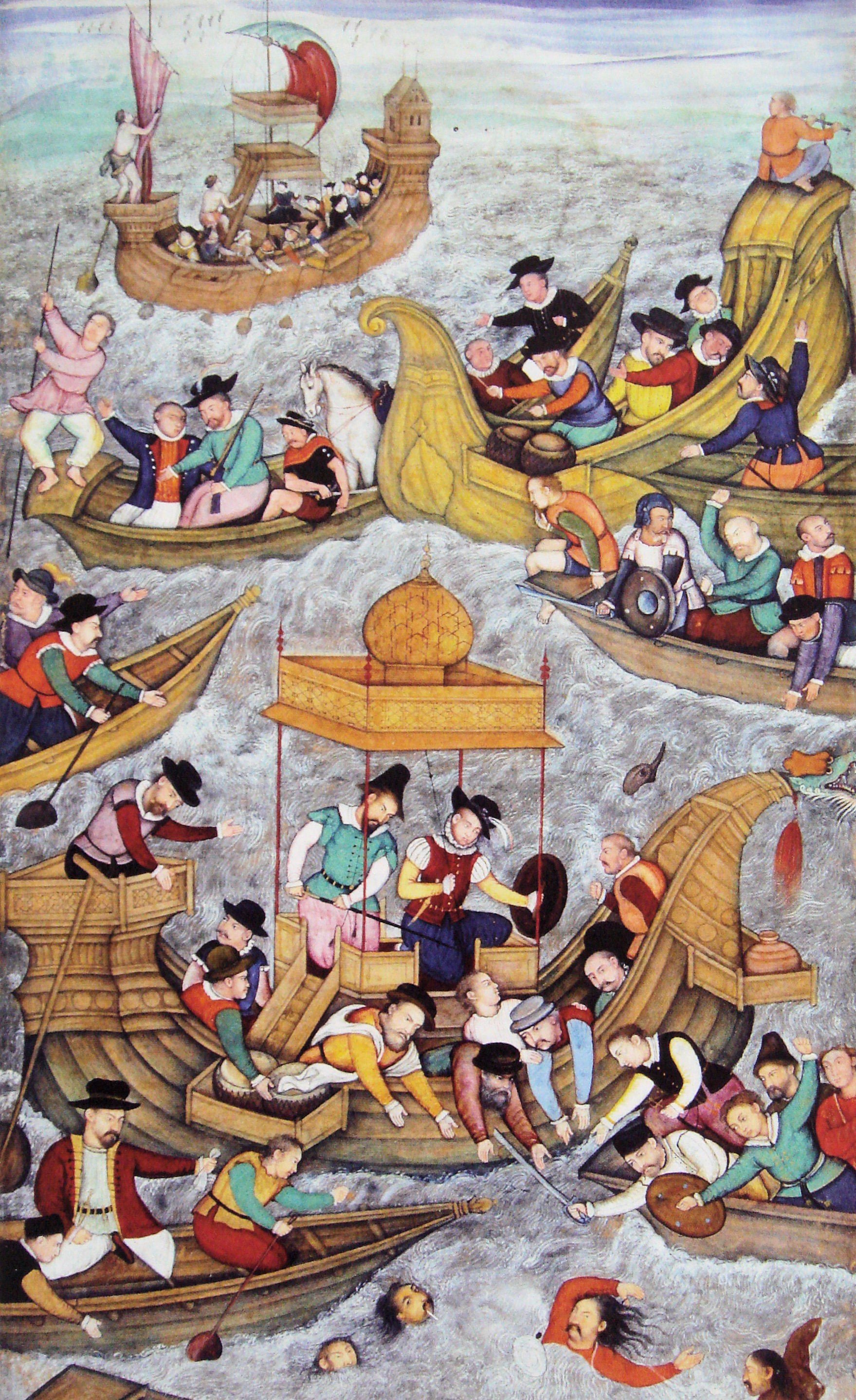
In 1497, Portuguese explorer Vasco da Gama is said to have discovered the Europe-to-India sea route which changed the course of history, thanks to Kutchi sailor Kanji Malam, who showed him the route from the East African coasts of Mozambique sailing onwards to Calicut off the Malabar coast in India. Later, the Gujarat Sultanate allied with the Ottomans and Egyptian Mamluks naval fleets led by governor-generals Malik Ayyaz and Amir Husain Al-Kurdi, vanquished the Portuguese in the 1508 Battle of Chaul resulting in the first Portuguese defeat at sea in the Indian Ocean. To 16th-century European observers, Gujarat was a fabulously wealthy country. The customs revenue of Gujarat alone in the early 1570s was nearly three times the total revenue of the whole Portuguese empire in Asia in 1586–87, when it was at its height. When the British arrived on the coast of Gujarat, houses in Surat already had windows of Venetian glass imported from Constantinople through the Ottoman empire. The conquest of the Kingdom of Gujarat marked a significant event of Akbar’s reign. Being the major trade gateway and departure harbour of pilgrim ships to Mecca, it gave the Mughal Empire free access to the Arabian sea and control over the rich commerce that passed through its ports. The territory and income of the empire were vastly increased.

For the best part of two centuries, the independent Rajput Sultanate of Gujarat was the cynosure of its neighbours on account of its wealth and prosperity, which had long made the Gujarati merchant a familiar figure in the ports of the Indian Ocean. Gujaratis, including Hindus and Muslims as well as the enterprising Parsi class of Zoroastrians, had been specialising in the organisation of overseas trade for many centuries, and had moved into various branches of commerce such as commodity trade, brokerage, money-changing, money-lending and banking. By the 17th century, Chavuse and Baghdadi Jews had assimilated into the social world of the Surat province, later on their descendants would give rise to the Sassoons of Bombay and the Ezras of Calcutta, and other influential Indian-Jewish figures who went on to play a philanthropical role in the commercial development of 19th-century British Crown Colony of Shanghai. Spearheaded by Khoja, Bohra, Bhatiya shahbandars and Moorish nakhudas who dominated sea navigation and shipping, Gujarat’s transactions with the outside world had created the legacy of an international transoceanic empire which had a vast commercial network of permanent agents stationed at all the great port cities across the Indian Ocean. These networks extended to the Philippines in the east, East Africa in the west, and via maritime and the inland caravan route to Russia in the north.

When the cracks had started to develop in the edifice of the Mughal Empire in the mid-17th century, the Marathas were consolidating their power in the west. Chatrapati Shivaji, the great Maratha ruler, attacked Surat in southern Gujarat twice first in 1664 and again in 1672. These attacks marked the entry of the Marathas into Gujarat. However, before the Maratha inroads into Gujarat, the Europeans had made their presence felt, with the Portuguese leading them, followed by the Dutch and the English. The Peshwas had established their sovereignty over parts of Gujarat and collected taxes and tributes through their representatives. Damaji Gaekwad and Kadam Bande divided the Peshwa’s territory between them, with Damaji establishing the sway of Gaekwad over Gujarat and made Baroda or present day Vadodara in southern Gujarat his capital. The ensuing internecine war among the Marathas was fully exploited by the British, who interfered in the affairs of both Gaekwads and the Peshwas. In Saurashtra, as elsewhere, the Marathas were met with resistance. The decline of the Mughal Empire helped form larger peripheral states in Saurashtra, including Junagadh, Jamnagar, Bhavnagar and a few others, which largely resisted the Maratha incursions.

In the 1600s, the Dutch, French, English and Portuguese all established bases along the western coast of the region. Portugal was the first European power to arrive in Gujarat, and after the Battle of Diu, acquired several enclaves along the Gujarati coast, including Daman and Diu as well as Dadra and Nagar Haveli. These enclaves were administered by Portuguese India under a single union territory for over 450 years, only to be later incorporated into the Republic of India on 19 December 1961 by military conquest. The British East India Company established a factory in Surat in 1614 following the commercial treaty made with Mughal Emperor Nuruddin Salim Jahangir, which formed their first base in India, but it was eclipsed by Bombay after the English received it from Portugal in 1668 as part of the marriage treaty of Charles II of England and Catherine of Braganza, daughter of King John IV of Portugal. The state was an early point of contact with the west, and the first British commercial outpost in India was in Gujarat.

Later in the 17th century, Gujarat came under control of the Hindu Maratha Empire that rose defeating the Muslim Mughals and who dominated the politics of India. Most notably, from 1705 to 1716, Senapati Khanderao Dabhade led the Maratha Empire forces in Baroda. Pilaji Gaekwad, first ruler of Gaekwad dynasty, established the control over Baroda and other parts of Gujarat. The British East India Company wrested control of much of Gujarat from the Marathas during the Second Anglo-Maratha War in 1802–1803. Many local rulers, notably the Rajput Maratha Gaekwad Maharajas of Baroda (Vadodara), made a separate peace with the British and acknowledged British sovereignty in return for retaining local self-rule. An epidemic outbreak in 1812 killed half the population of Gujarat.

Gujarat was placed under the political authority of the Bombay Presidency, with the exception of Baroda state, which had a direct relationship with the Governor-General of India. From 1818 to 1947, most of present-day Gujarat, including Kathiawar, Kutch and northern and eastern Gujarat were divided into hundreds of princely states, but several districts in central and southern Gujarat, namely Ahmedabad, Broach (Bharuch), Kaira (Kheda), Panchmahal and Surat, were governed directly by British officials.

After Indian independence and the partition of India in 1947, the new Indian government grouped the former princely states of Gujarat into three larger units; Saurashtra, which included the former princely states on the Kathiawad peninsula, Kutch, and Bombay state, which included the former British districts of Bombay Presidency together with most of Baroda state and the other former princely states of eastern Gujarat. Bombay state was enlarged to include Kutch, Saurashtra (Kathiawar) and parts of Hyderabad state and Madhya Pradesh in central India. The new state had a mostly Gujarati-speaking north and a Marathi-speaking south. Agitation by Gujarati nationalists, the Mahagujarat Movement, and Marathi nationalists, the Samyukta Maharashtra, for their own states led to the split of Bombay state on linguistic lines; on 1 May 1960, it became the new states of Gujarat and Maharashtra. In 1969 riots, at least 660 died and properties worth millions were destroyed.

The first capital of Gujarat was Ahmedabad; the capital was moved to Gandhinagar in 1970. The Nav Nirman Andolan, a socio-political movement of 1974, was a students’ and middle-class people’s movement against economic crisis and corruption in public life. This was the first and last successful agitation after the Independence of India that ousted an elected government.

The 2001 Gujarat earthquake’s epicentre was located about 9 km south-southwest of the village of Chobari in Bhachau Taluka of Kutch District. This earthquake’s magnitude of 7.7 shock killed around 20,000 people, including at least 18 in South-eastern Pakistan, injured another 167,000 and destroyed nearly 400,000 homes.

In February 2002, the Godhra train burning lead to statewide riots, resulting in the deaths of 1044 people – 790 Muslims and 254 Hindus, and hundreds missing still unaccounted for. The Akshardham Temple was attacked by two terrorists in September 2002, killing 32 people and injuring more than 80 others. National Security Guards intervened to end the siege killing both terrorists. On 26 July 2008 a series of seventeen bomb blasts rocked the city, killing and injuring several people.

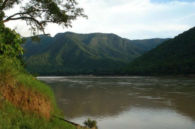
The Sabarmati River is the largest river in Gujarat followed by the Tapi, although the Narmada covers the longest distance in its passage through the state. The Sardar Sarovar Project is built on the Narmada River and it is one of only three rivers in peninsular India that run from east to west – the others being the Tapi River and the Mahi River. Gujarat has some of the major mountain ranges of India, including the Aravallis, the Sahyadris or what is commonly known as the Western Ghats, the Vindhyas and the Saputaras. Girnar is the tallest peak and Saputara is the only hill-station in the state. The Rann of Kutch is a seasonally marshy saline clay desert located in the Thar Desert biogeographic region in between the province of Sindh and the state of Gujarat situated 8 kilometres from the village of Kharaghoda in the Surendranagar District and Pakistan’s Sindh province. The name “Rann” comes from the Gujarati word rann which means “desert”.

As per the 2011 census, the state has one of the lowest sex ratios in the country. There are 918 girls for 1000 boys. Hindus makes up the biggest number of residents at about 88.5% with Muslims constituting about 10% and the others the balance 1.5% of the population. Gujarat has the third-largest population of Jains in India, following Maharashtra and Rajasthan. The state’s official language is Gujarati which is spoken natively by about 86% of the population. People from the Kutch region also speak in the Kutchi mother tongue, and to a great extent appreciate Sindhi as well. Memoni is the mother tongue of Kathiawar and Sindhi Memons, most of them who are exclusively Muslims.

The best time to visit the state is between une to March, when the weather is pleasant as compared to the summer, when heat and humidity rules the roost.

So let’s go and visit Vibrant Gujarat as the state tourism puts it. This time, instead of starting with a state’s capital city and then fanning outwards, I am going to start first with South Gujarat which is the part closest to my home state of Maharashtra and then move to Central Gujarat, North Gujarat and then loop back to Saurashtra and Kutch.

Festivals of India: Hanuman Jayanti

Celebrating the birth of India’s ancient superhero, Hanuman Jayanti is celebrated on different days in different parts of India. In most states of India, the festival is observed either in Chaitra, usually on the day of Chaitra Pournimaa or in Vaishakha, while in a few states like Kerala and Tamil Nadu, it is celebrated in the month Dhanu, also called Margazhi in Tamil. The date of Hanuman Jayanti varies from year to year and across India, various states and communities celebrate it in different times of the year. Communities in South India usually celebrate this festival during the Margazhi month of Moola Nakshathram as that month is believed to be when Hanuman was born. Telangana and Andhra Pradesh, however, celebrate Hanuman Jayanti from Chaitra Purnima to the tenth day of Krishna Paksha in the month of Vaishaka. Maharashtra places the holiday on the full moon day during the month of Chaitra.This year, the festival is celebrated today, the 8th of April, across India, Nepal, Sri Lanka and across the world where his devotees reside.

Also known as Sankatmochan, Dukhbhanjan, Maruti Nandan or Pawanputra, Lord Hanuman is an ardent devotee of Lord Sri Rama and is widely known for his unflinching devotion to Sri Rama. He is said to be able to assume any form at will, wield the mace or gada as well as many other celestial weapons, lift and move mountains, dart through the air, seize the clouds and equally rival Garuda in the swiftness of flight. Hanuman is seen as a symbol of strength and energy and also someone to turn to when a devotee is in difficulty.

Source

On Hanuman Jayati, devotees of Lord Hanuman celebrate him and seek his protection and blessings. They flock to temples to worship him and present religious offerings. In return, The devotees receive Prasad or the holy offering by the temple priests as sweets, flowers, coconuts, tilak, sacred ash and holy water. People also celebrate him on this day by reciting various devotional hyms and prayers like the Hanuman Chalisa and reading holy scriptures like the Ramayana and Mahabharata. Lord Hanuman is said to be the epitome of belief, trust and devotion. On this day, devotees pray to imbibe these qualities in their lives and lead a principled life.

Source

Lord Hanuman was born on the Anjaneri mountain. His mother Anjana was an apsara who was born on earth due to a curse. She was redeemed from this curse on giving birth to a son. The Valmiki Ramayana states that his father Kesari was the son of Brihaspati, he was the King of a place named Sumeru. Anjana performed intense prayers lasting 12 long years to Shiva to get a child. Pleased with their devotion, Shiva granted them the son they sought. Hanuman, in another interpretation, is the incarnation or reflection of Shiva himself.

Hanuman is often called the son of the deity Vayu or the Wind God; several different traditions account for the Vayu’s role in Hanuman’s birth. One story mentioned in Eknath’s Bhavartha Ramayana from the 16th century which states that when Anjana was worshiping Shiva, the King Dasharatha of Ayodhya was also performing the ritual of Putrakama yagna in order to have children. As a result, he received some sacred pudding or payasam to be shared by his three wives, leading to the births of Rama, Lakshmana, Bharata, and Shatrughna. By divine ordinance, a kite snatched a fragment of that pudding and dropped it while flying over the forest where Anjana was engaged in worship. Vayu, the Hindu deity of the wind, delivered the falling pudding to the outstretched hands of Anjana, who consumed it. Hanuman was born to her as a result. Another tradition says that Anjana and her husband Kesari prayed Shiva for a child. By Shiva’s direction, Vayu transferred his male energy to Anjana’s womb. Accordingly, Hanuman is identified as the son of the Vayu

Another story of Hanuman’s origins is derived from the Vishnu Purana and Naradeya Purana. Narada, infatuated with a princess, went to his lord Vishnu, to make him look like Vishnu, so that the princess would garland him at swayamvara or the husband-choosing ceremony. He asked for ‘Hari Mukh’ (Hari is another name of Vishnu, and mukh means face). Vishnu instead bestowed him with the face of a vanara. Unaware of this, Narada went to the princess, who burst into laughter at the sight of his ape-like face before all the king’s court. Narada, unable to bear the humiliation, cursed Vishnu, that Vishnu would one day be dependent upon a vanara. Vishnu replied that what he had done was for Narada’s own good, as he would have undermined his own powers if he were to enter matrimony. Vishnu also noted that Hari has the dual Sanskrit meaning of vanara. Upon hearing this, Narada repented for cursing Vishnu. But Vishnu told him not to repent as the curse would act as a boon, for it would lead to the birth of Hanuman, an avatar of Shiva, without whose help Rama (Vishnu’s avatar) could not kill Ravana.

Lord Hanuman is best known for his role in the epic poem and sacred text the Ramayana, which tells the story of the divine Prince Rama. Rama was sent into exile unjustly by his stepmother, Kaikeyi. While in exile, Rama’s wife, Sita, is abducted by the demon Ravana. Much of the epic poem is devoted to Rama’s determined quest to rescue Sita from Ravana. Rama successfully recovers Sita and kills Ravana with the help of the vanara or his monkey army. Rama and Sita return to the kingdom of Ayodhya and usher in a golden age of humanity. Rama, the titular character of the Ramayana, is identified as an incarnation, or avatara, of the god Vishnu.

Source

Hanuman plays a central role in the Ramayana, and his stories are nearly always tied to those of Prince Rama, also called Lord Ram. Even before Hanuman’s birth, it was predicted that he would be a devotee of Lord Ram. After he was born, Hanuman was a trouble maker who, among other feats of mischief, tried to grab the sun from the sky. In response, powerful sages cursed Hanuman and made him forget his magic powers. Hanuman became a loyal servant to Rama and a commander of Rama’s legions of monkeys. The memory of his powers was restored to Hanuman by Jambavan, the king of the bears, and as a result, Hanuman made a giant leap across the strait that lies between India and Sri Lanka, called the Palk Strait today, to steal the medicinal herbs necessary to heal the wounded in Rama’s army. When Hanuman struggled to identify the herbs, he picked up the entire mountain and brought that back to India. Before Hanuman left Sri Lanka, his tail was set on fire. Hanuman, however, used this fire to burn Sri Lanka to the ground.

Hanuman is held up as the embodiment of loyalty and devotion and these admirable traits are recognized year round at temples dedicated to Hanuman and given special attention during Hanuman Jayanti. During Hanuman Jayanti, Hindus take an early morning holy bath and either attend temples dedicated to Hanuman or perform puja at home if they have their own shrine dedicated to Hanuman. The Hanuman Chalisa is read in order to conquer evil spirits and provide mental peace to those reading and listening. People apply red powder to their foreheads in an echo of how Hanuman covered his whole body in sindoor to ensure Rama’s immortality. There is an interesting legend to why Hanuman covered his body with Sindoor. As per the legend, when Lord Hanuman found Sri Sita applying sindhūr to her forehead, He questioned her and she replied that doing so would ensure a long life for her husband, Lord Sri Rama. Lord Hanuman then proceeded to smear his entire body with sindhūr, thus ensuring Lord Sri Rama’s immortality.

Hanuman is also celebrated as a symbol of devotion, strength, magical powers and energy and also as the 11th Rudra avatara of the great god Shiva. Many devotees pray to Hanuman to be blessed with bravery, intelligence and loyalty like that which Hanuman displayed.

Hanuman is a popular god among Hindus, and his temples are often filled with monkeys who know that humans cannot harm them so long as they are on temple grounds. Hindus, however, are not the only ones who recognize Hanuman. Hanuman also appears in Buddhism, Sikhism and Jainism as well as in Indian pop culture.

Hanuman has been honored for millennia, and that fact has not changed in the modern age. Thousands still flock to his temples and wear sindoor in recognition of his devotion to Rama. Hanuman himself would likely be pleased with this. There is, after all, something perfect about the determined loyalty of Hindus to the god who was known for his faithfulness.

Here’s the divine voice of the late singer M.S. Subbalakshmi reciting the Hanuman Chalisa to end this blog post!

Travel Bucket List – India: Odisha Part 5

A state which is rich in natural resources, Odisha has some beautiful naure parks, wildlife sanctuaries and other natural beautities. This post is all about these nature’s bounties in the state.

Lake Chilika
Chilika Lake is the largest internal salt water lake in Asia, a paradise for bird watchers and nature lovers. The pear-shaped lake is dotted with a few small islands and has fisheries and salt pans around its shore. The Chilika Lake also houses the most accommodating ecosystems in the world, which means a wide assortment of flora and fauna can be spotted here.

A geological survey has confirmed that Chilka used to be a part of the Bay of Bengal during the late Pleistocene period. The place has an important role to play in the history of India. During the rule of the Kalinga dynasty, Chilka was a bustling commercial centre and a prominent harbour. Ptolemy also talks about the Chilka Lake in his text as an important port.

Spread over an area of 1100 sq km, the Chilika Lake Sanctuary is also one of the most visited sanctuaries in the state. The Chilika Lake attracts an array of birds that choose this spot as their winter stopover, and come to visit this lake from as far as Iran, Siberia and Central Asia. The graylag geese, purple moorhen, flamingo, Brahminy Kite, spot-billed pelican, bar-headed goose, open-billed stork, pintail, king fisher, Egret, Avocet, gulls, tern, herons and white-bellied sea eagles are found here in large populations. In fact, the Chilika Bird Sanctuary is home to one of the largest breeding colonies of flamingos in the world.

Some of the interesting and visited places in this area include Bird Island where ornithologists flock in large numbers to witness birds in their natural habitat and Nalabana which is a huge island in the centre of the lake that gets completely submerged during the monsoon months and a designated bird sanctuary. There is also Kalijai Island which is considered to be the abode of Goddess Kalijai. The temple located here has an interesting history to it – it is widely believed that a young girl named Kali, and her sister who later came here looking for her, were both drowned in this island and the residents vouch to have heard their cries. Upon the construction of a temple, the cries ceased, and since then, the place has had a significant religious value. The location is easily accessible via a boat from the Chilika Lake and is a must visit at the time of Makar Sankranti, when the Makar Mela takes place. Then there is Satapada Island which is surrounded by the lagoon on three sides and attracts visitors because it is home to the flagship species of the Chilika Lake, the Irrawaddy dolphins. This island is one of the only two lagoons in the world where this endangered species can now be found. You can easily reach this the island via boats arranged by the Odisha Tourism Development Corporation (OTDC). Other islands, including the Breakfast Island, Beacon Island and Honeymoon Island are also popular attractions that tourist love to visit. Please ensure that when you travel on boats in the lake, you only travel on the ones that have been provided by OTDC, since other local boats do not have life jackets.

The best time to visit the Chilika Lake is the winter months between October to March, when you can see the sheer variety of migratory birds coming there plus you had the added benefit of cooler weather and daytime temperature remains pleasant. Do avoid the monsoon season between June to September.

Tikarpada Wildlife Sanctuary
Spread across a lush 795.52 acress, the Tikarpada Wildlife Sanctuary enthrals visitors with its overwhelming beauty, lush green surrounding, the ever cherished rambling of River Mahanadi besides the very famous Satkosia gorge and the large variety of wild animals, birds and plants. The speciality of Tikarpada is its efforts towards bringing back the endangered gharials or crocodiles. The gharials that find their home here at the Gharial Sanctuary, who were reintroduced in the Mahanadi River ecosystem to increase the level of their population.

Sometimes thunderous and sometimes calm river Mahanadi renders the opportunity for fish angling, or to motor-boat or river rafting across it. You can choose to trek or camp in the sanctuary as well. This a perfect destination for the lovers of nature, wildlife and adventure.

Tikarpada has tropical climatic conditions and so the months between September to March are the best months to visit this place.

Satkosia Tiger Reserve
Satkosia spreads along the magnificent gorge over the mighty river Mahanadi in Odisha. Located around 160 km from Bhubaneswar, this sanctuary created in 1976 is home to tigers in the deciduous forests of the Eastern Ghats. The name Satkosia originates from two words; sat meaning seven and kos meaning two miles, indicating the length of the gorge as 14 miles or 22 km. The area was declared as Satkosia Tiger Reserve in 2007, comprising two adjoining wildlife sanctuaries; the Satkosia Gorge sanctuary and Baisipalli sanctuary. It is also home to elephants, birds and other animals that can be spotted in the wild. The reserve has an area of 963.87sq km with 523.61sq km as core area. The area is also a part of the Mahanadi elephant reserve. Satkosia is the meeting point of two bio-geographic regions of India; the Deccan Peninsula and the Eastern Ghats, contributing immense biodiversity.

When boating, one can spot the river-inhabitants being the Gharials or the Indian fish-eating crocodile. The Mahanadi River passes through a 14 mile long gorge, being the reason why the town was named Satkosia from Saat Kros, Kros being an old local measurement.

There are various lodging options operated by the Odisha Forest Development Corporation in Satkosia. You can also visit the neighbouring Kuanria Deer Park & Dam and the Kantilo Neelamadhav Temple.

Bhitarkanika National Park & Wildlife Sanctuary
Located at a distance of 120 km from Cuttack in Odisha, the Bhitarkanika Wildlife Sanctuary is a one of a kind sanctuary that sprawls over 650 sq. kms and boasts of rich marine vegetation, salt tolerant varieties of trees and plants, rivers and creeks. Home to some of the rarest species in the world both in terms of flora and fauna, the sanctuary is mainly known for its species of reptiles especially crocodiles, however, it also attracts a plethora of migrant species like Olive Ridley Sea Turtles, Asian Open Bill, Black Ibis, Egrets, and Darters etc. In the winter (which is the ideal migrating season for avifauna species), you can find as many as 215 species of migratory birds.

The highlight of the wildlife sanctuary is the rare white crocodile that can grow up to 23 feet. Another attraction of the region are the sprawling mangrove trees making it the second largest mangrove forest in India. There are several entrances available for the park, the most popular one of which is boating from Khola to Dangmal. This entrance allows you to walk through the dense forests and experience the rich ecosystem in all its glory. The visitors can also choose to stay at the forest guest houses if they want to spend the night maidst bounteous nature and rich wildlife.

Simlipal National Park
Reflecting the natural beauty of a bygone era, the Simlipal National Park is a beautiful and scenic place. Situated in Mayurbhanj, it once used to be a hunting ground for the rulers of the province. Simlipal is the largest wildlife sanctuary in India and is also considered as one of the principal tiger projects in India. It is part of the Mayurbhanj Elephant Reserve, which includes three protected areas — Similipal Tiger Reserve, Hadgarh Wildlife Sanctuary and Kuldiha Wildlife Sanctuary. The Simlipal National Park derives its name from the abundance of red silk cotton trees growing in the area and is the 7th largest national park in India. The area is rich with dense forests, striking meadows, startling waterfalls and beautiful rivers. It is blessed with great bio-diversity and huge varieties of fauna that make it a great place to engage in wildlife sightseeing! Simlipal Reserve is home to more than 1000 varieties of plants. It has around 96 species of orchids that are endemic to the forest. Baripada is the nearest town to Simlipal and can be considered a gateway to the same.

The park has some beautiful waterfalls like Joranda and Barehipani Falls. It is home to Bengal tiger, Asian elephant, gaur, and chausingha. Besides Simlipal provides habitat fo as well as an orchidarium. This protected area is part of the UNESCO World Network of Biosphere Reserves since 2009.

Duduma Waterfalls
The 175-metre high horsetail type, single fall cascade of Duduma waterfall tears through the rugged rocks of the Eastern Ghats and the dark green deciduous forest that is so widespread in this region. It creates an exhilarating scene amidst the rustic greenery right along the border of Andhra Pradesh and Odisha. Formed by the Machkund river, which gets its name from the pilgrimage site Matsya Kunda near Paderu in Andhra Pradesh, the fall has two sub-waterfalls, one on the Odisha side and the other on the Andhra Pradesh side. The grandeur of the falls is at its full display especially during and after the monsoon. Along with the picturesque waterfall, there is also a hydel power project plant and a customary dam to facilitate it. With prior permission from the authorities, you can pay a visit to the powerhouse and get a first-hand experience of how this alternate source of energy is created. Located around 70 km from Jeypore, Duduma attracts those who love nature and want to explore places beyond the stereotypical boundary of tourism.

Chandaka Forest
The Chandka Elephant Sanctuary is a wildlife reserve located in the south fringe of Cuttack and is nestled on Khurdha uplands of the Eastern Ghats biotic region. The Chandaka Forest is spread over 175.79 sq km of rolling table land and small sprawling hillocks in the Khurdha and Cuttack districts. It was designated as an elephant reserve in December 1982. The floral diversity is distributed in six types and the Indian elephant is the flagship fauna species. There are a number of watch towers for visitors to observe wildlife. While the Kochilaberana, Pitagadia and Charichhak watch towers are excellent for observation of birds and animals, the ones at Kumarkhunti and Ambilo have the comfort of rest houses where one can make a night halt. There are also two water reservoirs, Deras Dam and Jhumka Dam, situated within the reserve. The cottages near Deras provide a scenic view of the Chandaka reserve and a chance to see wildlife.

Kotgarh Elephant Reserve
Situated in the Baliguda subdivision of the Kandhamal district the Kotgarh Wildlife Sanctuary is classified as an Eastern Highlands moist deciduous forest. Around 52 tribal villages such as Kutia Kondh and Desia Kondh inhabit the sanctuary. Designated and proposed reserve forests include Madagoda, Haripur, Lassery, Bonduru, Supamaha, Killangi, Subarnagiri and Guma. A known tiger habitat, the forest patch is adjacent to an old elephant corridor from Boudh, Karlapat and Lakhari valley in Gajapati district’s Gandahati waterfall region. The Kotgarh sanctuary is nominated to be a part of the proposed 14 elephant corridors for safe movement of the elephants which frequently come out of their habitation in search of food and water.

Karlapat Wildlife Sanctuary
The Karlapat Wildlife Sanctuary is located in the Kalahandi district and a very popular tourist attraction Located around 12 km from Bhawanipatna, the district headquarters of the Kalahandi district, the sanctuary covers an area of 175 sq km and lies within the Eastern Highlands moist deciduous forests ecoregion. A beautiful waterfall, ‘Phurlijharan’ has been developed as a picnic spot for the local visitors and draws large number of visitors from far off places in and around Kalahandi District. The sanctuary is home to a plethora wildlife animals and birds.The sanctuary is rich in wildlife such as leopard, gaur, sambar, nilgai, barking deer, mouse deer,soft claws ottawa, a wide variety of birds and reptiles. The undulated topography of the sanctuary, with hills, valley, perennial streams and deep water pools give it an unique charm.

In My Hands Today…

Sacred Waters – Meira Chand

Orphaned as a child and widowed at thirteen, Sita has always known the shame of being born female in Indian society. Her life constrained and shaped by the men around her, she could not be more different from her daughter, Amita, a headstrong university professor determined to live life on her own terms. While trying to unravel the mysteries in her mother’s past, Amita encounters a traumatic event that leads her down the path of self-discovery.

Unfolding simultaneously, their stories are set against the dramatic sweep of India’s anti-colonial struggle in the 1940s, and move between past and present, from rural India to the chaotic Burmese battlefront where Sita experiences life as a recruit in the Indian National Army, to modern-day Singapore. Richly layered and beautifully evocative, the novel is a compelling exploration of two women’s struggle to assert themselves in male-dominated societies of both the past and the present.

Travel Bucket List – India: Odisha Part 4

After seeing the inland towns and cities of Odisha, let’s turn to it’s coastal cities. With a long coastline and the eastern boundary of the state being the Bay of Bengal, there are some stunning beaches in this state.

Source

Konark
65 kms south of Bhubaneshwar, Konark is set like a jewel against the stunning backdrop of the Bay of Bengal. One of the wonders of India, the carvings of the Konark Sun Temple, a UNESCO World Heritage Site, attract large flocks of tourists throughout the year. Along with the marvelous temples, the city has a lovely beach and an engrossing archaeological museum to explore.

Source

The Konark Sun Temple is a UNESCO World Heritage site and one of the prime tourist attractions of Odisha along with the Puri Jagannath Temple. Built in the form of a giant rath or chariot of the Sun God, it depicts the chariot being pulled by a set of seven horses, four on the left side and three on the right. It has three deities dedicated to the Sun God on three different sides of the temple which catch the direct rays of sun in the morning, afternoon and evening. There is also a dedicated archaeological museum inside the temple complex. The temple transforms into a stage during The Konark Dance Festival, which is held every year usually in February for five days and attracts a lot of foreign and Indian tourists. The Sun Temple is one of the last standing structures from before the fifteenth century in the country. The sun rays reach the Nata Mandir from the coast and reflect through the diamond at the centre of the idol. The idol is believed to float mid-air due to arrangements of the magnets at the top of the temple but they were later removed due to the disturbance caused to ships and technology. An engineering and artistic masterpiece, the Sun Temple reflects the artistic genius of architects and sculptures of an ancient time despite the fact that much of the temple in ruins today. The Sun Temple complex also houses shrines, such as the Mayadevi Temple and Vaishnava Temple, which are popular among visitors.

Situated 3 kms east of Sun Temple where the Chandrabhaga river joins the sea is the Chandrabhaga Beach, one of the most beautiful and pollution free beaches in the country. Owing to its immaculately clean shores and crystal clear waters, the beach has been awarded with the Blue Flag Certification by the Foundation of Environmental Education (FEE), a tag given to environmental friendly beaches which meet their stringent standards. Lined with tall trees and vast expanse of golden sands, the beach holds cultural and historical importance as well. Several cultural festivals and religious fairs are held here frequently which attract a lot of pilgrims and devotees to the beach. During the annual Chandrabhaga Fair, the beach takes on a very different look and comes alive with people, colours, light and activities. Go to the top of the lighthouse standing near the beach to take in the beach, sea, people and activities.

The Archaeological Museum is situated outside the Sun Temple and houses some unique artifacts which reflect the essence of Oriyan art form. The museum has 250 different kinds of antiques recovered from the Sun Temple. The museum started operating from its present location in 1968, when the fallen structures and archaeological remains of the Sun Temple were shifted to the present museum. The museum comprises of four galleries which preserve around 260 antiques that have been retrieved from the clearance work of the Sun Temple like carved stones, images of Surya Narayana and erotic sculptures. Besides these, the museum also displays images of various other monuments and archaeological sites of Odisha. The museum is open from 10 am to 5 pm everyday except Friday.

Source

Astaranga meaning “colourful sunset” is a magnificent beach located near the mouth of the Devi river at a distance of 19 km from Konark. As the name suggests this beach is famous for the picturesque views that it provides during the sunset. The sky takes on vivid hues and the blue water in juxtaposition of it makes the whole place look magical. The beach is also a famous fishing village and every morning a market is set up on the beach from where you can purchase the different varieties of fresh fish. During the winter months the beach becomes a safe haven for the Olive Ridley turtles who nest here in large numbers and can be seen crawling on the sand. The best time to visit this beach is in the winter between October and March. There is a sufi shrine located at the edge of the beach is which is dedicated to Saint Makhdum Jahanganst. Visited by people from all faiths, the umbrella and wooden shoes of the saint are kept as relics.

Chaurasi is small village situated on the right bank of river Prachi. This place is famous for its temples dedicated to Barahi, Amareshras and Laxminarayanan. Barahi, also known as Varahi, is the name of Mother Goddess whose temple was built in the first quarter of the 10th century. Goddess Barahi is depicted to have a boar face and a pot belly, holding a fish in one hand and a cup in the other. She has a third eye on her forehead and is worshipped according to the tantric rituals. The temple is lavishly decorated and has a rectangular porch at the superstructure level. Tourists flock to have a glimpse of the unique Barahi deity, who is offered fish everyday. The other two temples dedicated to Laxminarayan and Amareshwar also attract visitors.

The Kakatpur Temple is located in a small village called Kakatpur on the Puri-Astaranga road around 30 km from Konark on the banks of river Prachi. Goddess Mangala is the chief deity of the temple and this temple has a link to Puri’s famous Lord Jagannath Temple. On the occasion of the Nabakalebara or the festival of restoration of the idols, the priests from the Lord Jagannath Temple come to Goddess Mangala at the Kakatpur Temple and pray to her to help them find the sacred trees to create the new idols for Jagannath, Subhadra and Balabhadra. Jhamu Yatra is a popular festival celebrated in the Kakatpura Temple. It falls on the first Tuesday of the Hindu calendar month of Baisakh, during April 14 to May 15, every year.

Source

The Ramachandi Temple, located around 5 km from Konark is the temple of the reigning Lord of Konark, Ramachandi, on the banks of Kushabhadra river. The temple is famous as one of the Sakta Pithas of Puri. The main temple is built on a raised platform and has figures of the Sun God on three walls of the temple – the south, west and north walls. Goddess Chandi, the reining deity, remains seated on a lotus flower inside the temple. This temple is believed to be more ancient than the Sun Temple of Konark. There is a beach near the temple which is a popular picnic spot among locals, especially young couples.

A unique place near Konark, Kuruma is a small village about 8 km from the Sun Temple. This place gained fame after excavations were carried out in this small hamlet from 1971 to 1975. The findings include a high wall and antique images of Heruka or Dharma, Sun God and Buddha. This place then became popular as a Buddhist tourist spot. The excavated site was believed to be constructed in the 9th–10th centuries and is believed to have been a Buddhist monastery. The idol of Buddha discovered at this place is seated in a cross-legged position. The right hand of the idol is in Bhumisparsha mudra and it has the left hand resting on the left knee. The image is a decorated one, with a beautiful crown and a wonderfully engraved necklace.

Paradeep
Paradip or Paradeep, is located at the confluence of Bay of Bengal and Mahanadi and is one of India’s busiest ports as well as the oldest and largest in the state. In addition to the busy dockyard, the city also has some amazing beaches that offer amazing views. Boasting of golden shimmering sands, indigo blue waters, lined with huge rock boulders, laced with emerald green forests and adorned with a quaint island is actually and estuary of the river Mahanadi. The dash of rocks at the side offers an amazing marine drive and make for an ideal day-out destination. Don’t forget to try the famous Paradeep Lassi, also known as the Gaveskar Lassi made from coconut. It is available both at the beach and in the town.

A towering light house is also situated on the beach which allows tourist to come have a look from the inside. The light house is only open from 5-5:30 pm so make sure you plan your visit to the lighthouse accordingly.

The Gahirmatha Beach located close to Paradeep beach is home to a rare species of white crocodiles, and is famous for white monitor lizards, sea turtles, migratory birds as well as deer. The Bhitarkanika National Park, a forest with mangroves criss-crossed by rivers and streams, can take you a hundred years back in history when man, nature and animals lived in harmony. The the beach has lately become a hub for nesting for olive Ridley sea turtles.

Source

The Paradeep Marine Aquarium houses an astonishing collection of vibrantly colourful fish. The in-house museum boasts of 28 splendid tanks with vast varieties of fresh water and marine species of fish and other aquatic animals.

The Smruti Udyan has been dedicated to the lives of thousands of people who died during the massive cyclone of 1999 that hit Odisha. The lush green garden at the front blooms with vibrant flowers ideal to spend an evening.

The Jagannath Temple is a tribute to India’s secular make-up. A 60-feet pillar called the Aruna Stambh is constructed at the entrance of the temple and has engraved holy symbols of Hinduism, Islam, Sikhism and Christianity. The most popular festival at the Jagannath Temple is the Car Festival where non-Hindus also take part enthusiastically in drawing the chariot and in other festivities.

Located at a short distance of 12 kms from the Paradeep Beach, Nehru Bangla is just the guest house where the first Prime Minister of India Pandit Jawaharlal Nehru stayed at when he came to inaugurate the Paradeep Port. The guest house has now also been converted into a tourism spot for people who want to go have a look.

The Hanuman temple is yet another prominent attraction here. Dedicated to Lord Hanuman, the tiny mandir invites pilgrims from the all over the city to pay homage. Tuesdays are the most crowded days of the week at the temple.

Gopalpur
A small coastal town around 15 km from Berhampur and close to the border with Andhra Pradesh, Gopalpur lies towards the south of the state. Gopalpur also has an ancient, commercial port, now lying in ruins. Under the ownership of the Soraine family the village grew in wealth, from an obscure little fishing village, Gopalpur became a prominent trading port. The family built the port, the lighthouse and the Albert Hotel and established both a local fishing industry and a trade route with Burma. What was once a bustling port city before being deserted, is today, one of the best beaches in the eastern coastline of the country. It is know for being an offbeat destination and a place for relaxation. The beaches are sparkling gold which along with the azure water of the Bay of Bengal providing a perfect place to relax and immerse yourself in nature.

The Gopalpur beach is a luxurious beach and is popular for being one of the few sites in India where Olive Ridley Turtles nest. Flanked with coconut and casuarina groves, it is a perfect outing for a languorous weekend. The beach, also known as ‘Gopalpur-on-Sea’ has a calm and soothing coast. It is famous for hosting the annual Gopalpur Beach Festival and offers up the possibility of experiencing a number of aqua sports.

One of the most popular landmarks of the beach is its lighthouse which offers a marvellous 360 degree view of the entire city of Gopalpur, the azure waters of the Bay of Bengal and some parts of the Chilika Lake. One can also see the exotic red crabs casually strolling on the beach’s lonely coast! The lighthouse is a great place for photographers, both professional and amateur, to capture amazing photos of the town and beach

Aryapalli Beach is an absolutely gorgeous beach during high tide at sunset. The coastline of Aryapalli Beach falls in the rain-shadow of the region, so the beach get a fair amount of rain during the monsoon season. The beach is a quiet and charming place where visitors can relax and refresh. It is a cherished experience that one gets by visiting the place. The best time to visit the beach is between the months of October and June. Surfing, sun bathing and swimming are a few leisure activities that are popular with visitors.

Sonepur Beach is considered by most of the tourists as one of the best beaches in the entire state of Orissa. Located on the borders of Andhra Pradesh and Orissa, this beach divides the sea from the main land along with the River Bahuda. Sonepur Beach is a natural beauty untouched by human civilization. This beach is quite close to Berhampur, just at a drive of around 11 km. You can take a motor boat services to the sangam or meeting point of the river and the Bay of Bengal.

The Maa Tara Tarini Hill Shrine is considered as one of the oldest shrines of Maa Tara in the entire country. It is situated on the Kumari Hills on the banks of the River Rushikulya, just a few kilometres away from the coastal town of Gopalpur and about 13 km away from Berhampur, the nearest railway station. Thousands of devotees visit the place on a regular basis in order to get the auspicious blessings of the Mother Goddesses. There are two Goddesses in the temple, Maa Tara and Maa Tarini beautifully ordained with gold and silver ornaments. They are believed by the locals to be the manifestations of Adi Shakti. The temple is also considered as one of the ancient Shakti Peethas of India.

Chandipur
16 km from Baleswar railway station, Chandipur is famous for its disappearing sea. A quaint seaside town which offers complete serenity and tranquillity, this is the best place if you want to relax and spend some quality time either alone or with your loved ones. India’s missile testing launch pad is also located here and missiles like Agni, Prithvi, Akash and Shaurya can be seen here. You can visit this testing range by taking special visiting permission from the authorities. Chandipur is also famous for its sea food and sweets which are a huge hit with tourists. Chandipur is at its best during winters when the cool breeze by the beach hits you as you walk along the seashore.

The Chandipur Beach’s unique specialty is the ebb tides that recede around 1 to 4 km during low tides and they tend to disappear rhythmically. The beach has spectacular views of the rising and setting sun. When the water disappears, you can even take jeep ride towards the sea. The sea disappears during the day in this beach and locals call this this the “Hide and Seek Sea”. Watching the sea disappear and miraculously reappear as it plays with you is an unforgettable experience that will leave you in awe of the miracles of nature. During the time when the sea receeds, you can walk deep into the actual seabed. In fact, when you walk on the beach when it has receded, only your feet get submerged into the shallow water and get surrounded by moist sand; so if you take a picture from afar, it looks as if you are actually walking on water.

The Panchalingeshwar Shrine, lies around 36 km from Chandipur and is located amidst the dense green vegetation and rocky hills of the Nilagiri Hills. It is popular for the Shiva shrine which is located on the hill top. Five Shiv Lingas which are born naturally in the middle of two large rocks with a stream flows over these Lingas. A temple has been built by the side where priests perform rituals and worship the deity. You need to climb 263 steps to get to the temple which start at the foot of the hill.

The town of Nilagiri or Blue Mountain is located around 32 km from Chandipur and where the Panchalineshwar temple is situated on one of the hills. The name comes from the apparent blue colour of the hills. The royal palace and the Jagannath temple adjacent to it are are must-vist places in this town. You can get to see the antique gold and diamond ornaments along with the royal clothes worn by the then Kings and Queens of Nilagiri kept for display inside the palace. The spectacular Khumkut Dam, close to the town can also be checked out.

Bhitarkanika, located at a distance of 206 km from Chandipur, lies at the delta of Bhramani, Baitarani and Dhamra rivers. Embellished with exotic wildlife and lush green forest, Bhitarkanika sees tourists pretty much throughout the year. Visitors have to take permission for entry from the Forest Authority of Bhitarkanika. To reach the place, one has to take a boat ride from Khola to Dangmal which is the only means of communication. The ride is very enthralling as one can witness the second-largest mangrove ecosystem in India. Bhitarkanika has a National Park encompassed by the Wildlife sanctuary. Gahira Matha beach lies nearby which acts as a separator between the jungle and the Bay of Bengal. Rich in flora and fauna, Bhitarkanika is home to exotic and endangered wild species like white crocodiles, saltwater crocodiles, monitor lizards, pythons, king cobra, darters and many more. Birds from Central Asia and Europe migrate here creating an added advantage for tourism