Travel Bucket List: Nepal – Part 16

Jomsom
Also known as Dzongsam or the new fort, Jomsom is the centre of the Gharapjhong rural municipality in Mustang district and a former independent village development committee situated at an altitude of about 2,700 m in western Nepal. The soaring peaks of Dhaulagiri and Nilgiri form a backdrop to the town straddling the Kali Gandaki River, which flows right through the centre of Jomsom. Along the banks of the Kali Gandaki, black fossilised stones called shaligram, considered a symbol and reminder of Lord Vishnu can be found. Such stones are believed to be found only in the Kali Gandaki, and are considered holy by Hindus. The town is also the main hub for onward travel to Upper Mustang and Muktinath.

Jomsom lies to the north of Pokhara and is the main gateway to Upper Mustang. The trail passing through Jomsom follows the Kali Gandaki River which forms the deepest ravine in the world; on one side lies the Annapurna mountain range and on the other side is Dhaulagiri. The river freezes during winter and flows with rainwater and melting snow in summer and monsoon. With its diverse landscape, the area around Jomsom has the scenery of rocky cliffs and high peaks of the Himalayas without much presence of greenery, with the exception being forests of bright rhododendrons. The culture in Jomsom is a rich combination of Hinduism and Tibetan Buddhism.

The houses in Jomsom are designed to protect the inhabitants from the strong winds that blow in the valley every day from late morning onwards. These winds are caused by the differences in atmospheric pressure between the Tibetan plateau and the lower reaches of the valley. The best example of the unique architecture of this region is found in the village of Marpha which is a two-hour walk down from Jomsom, where one can find stone-flagged streets with an efficient underground drainage system and flat-roofed houses with a central courtyard, which best showcase the architecture of this area.

Not too far from Jomsom is Muktinath, the famous pilgrimage site for Buddhists and Hindus. For Hindus, Muktinath is a sacred place of salvation. They believe that bathing in the waters here guarantees salvation after death. The Hindu god, Lord Brahma, is said to have lit the eternal flames that burns at Muktinath. To Buddhists, Muktinath is where the great sage Guru Rinpoche or Padmasambhava who brought Buddhism to Tibet, came to meditate. The area around Jomsom is a perfect place to find fossilised ammonites, known locally as Shaligram, which are found all along the upper reaches of the Kali Gandaki.

Most of the route along the Jomsom trek forms part of the Annapurna circuit and Annapurna foothill treks. The usual starting point is Naya Pul on the Pokhara to Baglung road and from there, via Ghorepani and Tatopani, into the gorge of the Kali Gandaki. The deep valleys and high mountains encircling the giant Annapurna Himal embrace a wide range of peoples and terrain, from sub-tropical jungle to a high, dry landscape resembling the Tibetan Plateau.

Located 13 km from Jonsom, Dumba Lake is a small but picturesque attraction which is a short hike from Jomsom. Leopard Cave is an underground natural enclosure located at Thini. Rare snow leopard species are found here. Jomsom View Tower, from the height of 3750 m, offers beautiful panoramic views of the mountains of Mustang. The view tower is located at Thini, which is a short hike from Jomsom. Located on the Beni-Jomsom highway, about 40 km from Jomson, Rupse Falls is a major tourist attraction. The water falls from a height of 300 m and is surrounded by lush greenery and the world’s deepest gorge, the Kali Gandaki Gorge lies very close to the waterfall.

Kagbeni
A village in Upper Mustang, Kagbeni is located in the valley of the Kali Gandaki River and lies on the trail from Jomsom to the royal capital Lo Manthang, near the junction with the trail to Muktinath. Kagbeni is also regarded as one of the oldest villages in the Himalayas and lies between two sacred rivers Muktinath and Kali Gandaki. Officially Kagbeni is a settlement that bridges the gap between Lower and Upper Mustang, right at the feet of Muktinath Valley by the River Kali Gandaki. But spiritually, Kagbeni is a Tibetan village, stuck in the annals of time. In ancient times, Kagbeni was an important centre of trade for Tibetans and Indians. The famous Salt Trade Route between the two countries went through the village.

Kag Chode Thupten Samphel Ling Monastery, or the Red Monastery is the most famous landmark in the village. Built in 1429, the beauty of the monastery matches its surroundings. From outside, it looks colourful and desolate, just like the rest of Kagbeni. Inside there are sculptures of Buddha and friendly monks and a tranquil environment, where one can sit and meditate or listen to the silence. Photography is prohibited inside the monastery.

The Upper Mustang requires a special permit and USD 50 per day per person to stay and is why today many travellers prefer Kagbeni instead to get the ambience of high mountains. There are many trekking trails from Kagbeni, that lead up to the old royal capital of Lo Manthang. While trekking, one will come across Chortens and prayer wheels. Chortens are Buddhist tomb shrines, which are common in Tibetan culture and must always be crossed by the right side. The Tibetan Buddhists consider it bad luck to cross by the left. One will see numerous colourful Buddhist flags as well, planted here and there. From the summits, the entire valley can be seen, still like a painted picture on an artist’s canvas. A raw cold wind blows at this altitude at all times, and the view opens up to the vast expanses of mountain desert plains stretching into Tibet, it feels mysterious and intoxicating, but most importantly, insignificant. To stand there in front of the historical and unfathomable terrains of the Himalayas is as humbling an experience as it can be.

Mustang
Mustang which means a fertile plain was once part of the Kingdom of Lo-Manthang that joined the Federation of Nepal in 2008 after the abolition of the Shah dynasty. It straddles the Himalayas and extends northward onto the Tibetan Plateau is one of the remotest areas in Nepal and is second in terms of the sparsity of population. The elevation ranges from 1,372 to 8,167 m and includes Mount Dhaulagiri, the 7th highest mountain in the world, with several peaks above 7,000 meters.

Part of an ancient kingdom bordering the Tibetan plateau and sheltered by some of the world’s tallest peaks, Mustang still maintains Tibetan traditions because of strict regulations on the movement of tourists. Upper Mustang was a restricted area until 1992, which makes it one of the most preserved regions in the world due to its relative isolation from the outside world, with a majority of the population still speaking traditional Tibetic languages. Mustang is derived from the Tibetan word meaning the “Plain of Aspiration. It is a popular area for trekking and can be visited year-round, regardless of season. Lower Mustang is well-known for its natural scenery while Upper Mustang is famous for its trekking and hiking trails, monasteries, caves and local tribes.

The Kali Gandaki River is a highly important feature of Mustang. Its source is located near the Tibetan border coincides with the Tibetan border and the Ganges-Brahmaputra watershed divide. From there, it flows south towards the northern Indian plains through the ancient kingdom of Mustang, flowing through a sheer-sided, deep canyon immediately south of the Mustang capital of Lo Manthang, then widens as it approaches Kagbeni where high Himalayan ranges begin to close in. The river continues southward past Jomsom, Marpha, and Tukuche to the deepest part of the gorge about 7 km south of Tukuche in the area of Lete. The gorge then broadens past the border of Mustang and Myagdi. Geographically, Lower Mustang lies between the Tibetan Plateau in the North and the high Himalayan Mountains in the South. The region between the Tibetan Plateau and the Himalayan Mountains is called Trans-Himalaya. The Kali Gandaki Gorge or Andha Galchi, measured by the difference between the river height and the heights of the highest peaks on either side, is the world’s deepest canyon.

Much of the history of Mustang is about legends rather than documented facts. However, it is believed that Mustang or the Kingdom of Lo was once a part of the Ngari area of Tibet and a loose collection of feudal estates, their history is also tied to Tibetan religion and culture, geography, and politics. It was often closely linked to adjoining kingdoms of Western Tibet and, during other periods of history, politically linked to Lhasa, the capital of Central Tibet. Lo was incorporated into the Tibetan Empire by Songtsen Gampo, the most famous Tibetan king.

From the 15th century to the 17th century, Mustang had control over the trade between the Himalayas and India because of its strategic location. In 1380, Lo became an independent kingdom under Ame Pal. The last royal family traced its lineage for 25 generations, all the way back to Ame Pal who oversaw the founding and building of much of the Lo and Mustang capital of Lo Manthang, a walled city surprisingly little changed in appearance from that period. The only remnant of these kingdoms is the still-intact Kingdom of Lo, an area corresponding to the northern third of Mustang.

In 1769, the army of Prithvi Narayan Shah, the first King of the Gorkha Kingdom and the Shah dynasty, unified what was a land of many small kingdoms to forge the kingdom of Nepal. At the end of the 18th century, the kingdom was annexed by Nepal and became a dependency of the Kingdom of Nepal in 1795. During the late 1950s and 60s, Mustang became the centre for Tibetan guerrillas engaged in small operations against the Annexation of Tibet by the People’s Republic of China in 1959. Up until 2008, the Kingdom of Lo or Upper Mustang was an ethnic Tibetan kingdom and a suzerainty of the Kingdom of Nepal. Though still recognised by many Mustang residents, the monarchy ceased to exist on 7 October 2008, by order of the Government of Nepal. The last official and later unofficial king (raja or gyelpo) of Mustang was Jigme Dorje Palbar Bista who lived between 1930 and 2016. He died on 16 December 2016 after living a retired life largely in Kathmandu since 2008 when Nepal abolished its own monarchy.

One feature of Mustang is the thousands of cliff dwellings, some highly inaccessible. These Mustang Caves or Sky Caves of Nepal are a collection of some 10,000 man-made caves dug into the sides of valleys in the Mustang. Several groups of archaeologists and researchers have explored these stacked caves and found partially mummified human bodies and skeletons that are at least 2,000–3,000 years old. Explorations of these caves by conservators and archaeologists have also led to the discovery of valuable Buddhist paintings, sculptures, manuscripts and numerous artefacts belonging to the 12th to 14th centuries. The caves lie on the steep valley walls near the Kali Gandaki River in Upper Mustang.

Lo was out-of-bounds for foreigners until 1992. Although it is now open on a restricted basis to foreign travellers, tourism to the region is still strictly restricted and hard to access. The Nepalese government have introduced a surcharge for anyone trekking past Kagbeni, which marks the border of Upper Mustang. Foreign tourists are required by the Nepalese Department of Immigration to acquire special permits, pay fairly steep fees of US$50 per day per person, and be accompanied by a liaison guide to protect local traditions and the environment from outside influence.

The ancestral isolation of Mustang helped to retain its ancient culture largely unviolated, and it survives as one of the last bastions of traditional Tibetan life. In this ancient forbidden kingdom, traditions have survived longer than in Tibet proper following its annexation by China. The lower Mustang areas such as much of Baragaon, Panchgaon, and Thak Sat Sae along the Annapurna Circuit are among the most heavily trekked routes in Nepal. The scenery of the trail ranges from forests of bright rhododendron fields to rocky cliffs and deserts. The culture along the trek is a rich combination of Hindu and Tibetan Buddhism. The trail’s highest point is Muktinath at 3800 m, a popular Hindu and Buddhist pilgrimage site for centuries. The Kali Gandaki Gorge is part of the popular trekking route from Pokhara to Muktinath. The gorge is within the Annapurna Conservation Area.

The Muktinath Temple is significant to both Hindus and Buddhists. Located in the Muktinath Valley, the shrine is close to the rural Ranipauwa, which is often mistaken to be Muktinath. The temple’s name refers to Mukti, meaning nirvana, or salvation, and nath, which signifies master, or Lord. Among the Hindus, Muktinath temple is also referred to as the Mukti Kshetra, which translates to “the place where one receives moksha or liberation”. Of the one hundred and eight sacred Shri Vaishnava temples, Muktinath Temple holds the 106th rank among the Divya Desam, or ‘premium temples’. The ideal time to visit this temple is between March to June when the temperatures are relatively warm, and the overall weather condition is pretty pleasant.

One of the eight sacred shrines, Muktinath Temple, is built in the Pagoda-styled central temple which has a gold statue of Lord Vishnu. Even though the temple is small, the main deity is almost the size of an adult man. This central statue in the temple is seen as the manifestation of Padmapani, a compassionate embodiment of all the Buddhas. In front of the temple lie two ponds, named Lakshmi Kunda and Saraswati Kunda respectively. It is a common belief that bathing in these water bodies washes off all negative forces and karma. Muktinath temple is said to have risen on its own; therefore including it as one of the eight shrines which have supposedly existed by themselves.

The outer courtyard, or the Prakaram, houses one hundred and eight waterspouts shaped like the heads of bulls, through which the sacred water of the Kali Gandaki River flows. This water symbolises the Pushkarini waters that are believed to have descended from the one hundred and eight Divya Desams. Devotees bathe in these waters even during freezing temperatures, with the hope of washing away their sins and attaining salvation.

Because of the hundred and eight water springs, the temple is also known as Chumig Gyatsa which translates to Hundred Waters. The Buddhists consider it to be an essential place for the Dakinis, the goddesses who are also known as the Sky Dancers. Legend also says it is the place where Guru Padmasambhava had meditated for some time before moving on with his journey from India to Tibet.

Short Story: The Compass

The sun was setting over the small coastal town of Crescent Bay, casting a warm golden hue over the waves. Emma Carter stood in her grandfather’s study, surrounded by dusty bookshelves filled with travelogues and maps. It had been a week since her grandfather, a renowned explorer, had passed away, and she still felt the weight of his absence.

As she rummaged through his belongings, Emma’s fingers brushed against something cool and metallic. She pulled out an ornate compass, its burnt orange casing reflecting the fading light. It was unlike any compass she had seen before—intricate designs adorned its surface, and it felt strangely alive in her hand.

“Ah, you found it,” came a voice from behind her. It was her grandmother, Margaret, who entered the room with a gentle smile tinged with sadness. “Your grandfather always said that compass held more than just direction.”

“What do you mean?” Emma asked, turning the compass over in her hands. Margaret’s eyes sparkled with nostalgia. “He believed it would lead you to places you needed to be—not just physically, but emotionally as well. It was his most prized possession.”

Emma felt a surge of curiosity. “What was his last wish?” Margaret took a deep breath, her expression growing serious. “He wanted you to follow in his footsteps and explore the world. He believed there were still adventures waiting for you.”

Emma’s heart raced at the thought. She had always dreamed of becoming an explorer like her grandfather, but life had kept her tethered to Crescent Bay—school, work, and responsibilities. Now, with this compass in hand and her grandfather’s wish echoing in her mind, she felt an undeniable pull to embark on a journey.

The next morning, Emma packed a small backpack with essentials—water, snacks, a notebook to document her journey—and slipped the compass into her pocket. With one last glance at her childhood home, she set off towards the nearby cliffs that overlooked the ocean.

As she reached the edge of the cliffs, Emma took out the compass and held it before her. The needle spun wildly before settling in one direction—toward the north. She smiled at the thought of adventure awaiting her. “Alright,” she said aloud to herself, “let’s see where this leads.”

Following the compass’s direction, Emma trekked through winding paths and dense forests that bordered Crescent Bay. With each step she took into the wilderness, she felt a sense of freedom wash over her—a stark contrast to the confines of everyday life. Hours passed as she walked deeper into nature. The compass led her to a hidden waterfall cascading into a crystal-clear pool surrounded by vibrant wildflowers. Emma gasped at the beauty before her; it was as if nature had painted this scene just for her.

She sat on a rock by the water’s edge and opened her notebook to jot down her thoughts. “Day 1: Found a hidden waterfall,” she wrote. “The compass is guiding me toward something special.” As she wrote, Emma couldn’t shake off the feeling that this journey was more than just an exploration of new places—it was also about uncovering pieces of herself that had long been buried under layers of expectation and routine. The next day brought new adventures as Emma continued to follow the compass northward. Each destination revealed breathtaking landscapes—a secluded beach with golden sands, and an ancient grove filled with towering trees that whispered secrets in the wind.

One afternoon, while exploring an old fishing village along the coast, Emma stumbled upon an elderly man sitting outside a small shop filled with trinkets and souvenirs. His weathered face broke into a warm smile as he saw Emma approach. “Ah! You look like someone who enjoys adventure,” he said with a twinkle in his eye. “I do!” Emma replied enthusiastically. “I’m following my grandfather’s compass.” The man’s expression shifted to one of recognition. “Your grandfather? Thomas Carter? He was quite the explorer! I remember him well.”

Emma’s heart swelled with pride. “Yes! He passed away recently.” The man nodded solemnly. “He left behind quite a legacy. Did he ever tell you about his journey to find the Lost Isles?” Emma shook her head. “No, he didn’t mention it.” “Ah,” he said thoughtfully. “It’s said that those isles hold treasures beyond imagination—both material and spiritual.” He leaned closer and whispered conspiratorially, “Many have searched for them but few have returned unchanged.”

Intrigued by his words, Emma asked him for more details about these isles and how they related to her grandfather’s adventures. “Your grandfather believed that true treasure lies not just in gold or jewels but in understanding oneself,” he explained. “Perhaps your compass is guiding you toward those isles—not just geographically but emotionally as well.” With newfound determination igniting within her, Emma thanked the man and continued on her journey.

Days turned into weeks as Emma followed the compass further along the coast and inland through lush landscapes dotted with villages rich in culture and history. Each place she visited seemed to resonate with stories from generations past—stories that echoed themes of love, loss, resilience, and hope.

One evening while camping under starlit skies near a serene lake, Emma reflected on what she had learned so far. She realized that every destination brought new insights about herself and her family’s legacy—the sacrifices made by those who came before her and their dreams woven into hers. As she sat by the flickering campfire writing in her notebook about these revelations, she felt an overwhelming sense of connection—not only to nature but also to those who had walked this earth long before her.

“Maybe my grandfather wasn’t just an explorer,” she mused aloud to herself. “Maybe he was also searching for something deeper—a way to understand our place in this world.” But not all days were peaceful; one afternoon while hiking through dense woods toward what appeared on maps as an uncharted area near the coast—dark clouds gathered ominously overhead.

Emma quickened her pace but soon found herself caught in a torrential downpour that soaked through her clothes within minutes. Seeking shelter beneath an ancient tree with gnarled roots protruding from its base—she huddled against its trunk trying desperately to shield herself from the rain pelting down relentlessly around them! As thunder rumbled overhead sending shivers down her spine—Emma closed her eyes tightly wishing the storm would pass quickly allowing sunlight back into life once more!

Suddenly—a flash illuminated the surroundings revealing something glinting among the roots below! Curiosity piqued despite fear gripping her heart; she reached down carefully brushing away mud until uncovering a small metallic box intricately engraved resembling designs reminiscent of ancient times!

Heart racing—she pried open the lid revealing inside delicate necklace adorned with beautifully crafted emeralds glistening even amidst gloom surrounding them! “This must be part of what my grandfather sought!” Emma gasped realising the connection between the necklace discovered here today aligning perfectly alongside stories told earlier during travels! With renewed vigour despite the storm raging outside—Emma carefully secured the necklace around her neck feeling the warmth radiating from stones nestled against her skin!

Once the rain subsided allowing sunlight to break through the clouds illuminating the path ahead—she continued onward determined to uncover secrets hidden within the legacy left behind not just by ancestors but also by those who loved fiercely throughout history!

Days later, arriving at a coastal town bustling with life; locals welcomed warmly sharing tales woven together across generations connecting past present future alike reminding everyone importance of cherishing memories made along the way!

One evening while dining at a local eatery surrounded by laughter joy filling air; Emma overheard a conversation between two fishermen discussing legends tied back towards Lost Isles mentioned earlier during travels! Intrigued—she approached them asking questions prompting them to share stories passed down through families revealing deeper truths surrounding love triangles heartbreaks tragedies faced throughout centuries past…

Each tale resonated deeply within the heart inspiring hope and resilience reminding everyone present how love transcends time itself weaving threads connecting lives forevermore!

After weeks spent exploring the coastline and discovering hidden gems along the way—Emma finally arrived at a destination marked clearly upon the map indicating a location rumouredto to lead towards Lost Isles itself! Standing upon a cliff overlooking the vast expanse of ocean waves crashing against rocks below; she felt a mixture of excitement and trepidation coursing through her veins knowing that her journey was nearing its conclusion yet realising adventure never truly ends!

Taking a deep breath and gathering courage; she held tightly onto the emerald necklace feeling its energy pulsate reminding strength derived from the legacy left behind guiding every step taken thus far! With determination igniting spirit within; Emma set sail aboard the small boat navigating treacherous waters guided solely by intuition trusting compass leading true north towards destiny awaiting discovery…

After hours spent battling waves, she finally emerged victorious upon a shore of pristine white sand stretching endlessly before her. Her eyes were wide open taking everything the moment offered fully appreciating the beauty surrounding her. As sunlight bathed the landscape illuminating the vibrant colours of the flora and fauna thriving all around; Emma stepped ashore feeling a connection deepening within her heart knowing this place held significance beyond comprehension!

Exploring further inland, Emma discovered hidden caves adorned with beautifully crafted murals depicting stories told throughout history capturing the essence of love lost and found again reminding everyone of the importance of cherishing bonds formed across generations…

While exploring the cave adorned with intricately carved symbols resembling the emerald necklace discovered earlier; realisation dawned upon Emma. She understood the truth behind the legacy woven throughout lives lived long ago—the necklace wasn’t merely an artefact representing wealth but rather the embodiment of hope resilience love transcending time itself! After days spent uncovering secrets hidden within the Lost Isles; Emma returned home feeling transformed and enriched with the experiences gained along the way shaping her perspective forevermore!

Back at Crescent Bay surrounded by familiar sights and sounds, Emma’s heart was filled with warmth reminding everyone present of the importance of embracing the journey undertaken together and forging deeper connections. As the news spread throughout the community regarding the discoveries made during Emma’s travels, it inspired others to pursue dreams and to ignite passions reigniting the flames of hope within hearts longing for adventure awaiting discovery beyond horizons unseen…

Standing upon the cliff overlooking ocean waves crashing against rocks below once again; Emma held tightly onto her emerald necklace feeling energy pulsate reminding strength derived from the legacy left behind guiding every step taken thus far! With newfound purpose igniting spirit within; she vowed to continue honouring ancestors ensuring stories lived on inspiring future generations embracing journeys undertaken together forging connections deeper than ever imagined possible…

Travel Bucket List: Nepal – Part 15

Shashwat Dham
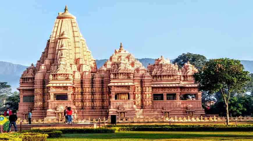
Located on the East-West Highway in Devchuli, Shashwat Dham is a Hindu religious site and tourist destination. The spiritual site consists of a temple of lord Shiva and a Vedic karmakanda gurukul spread over 12 acres.

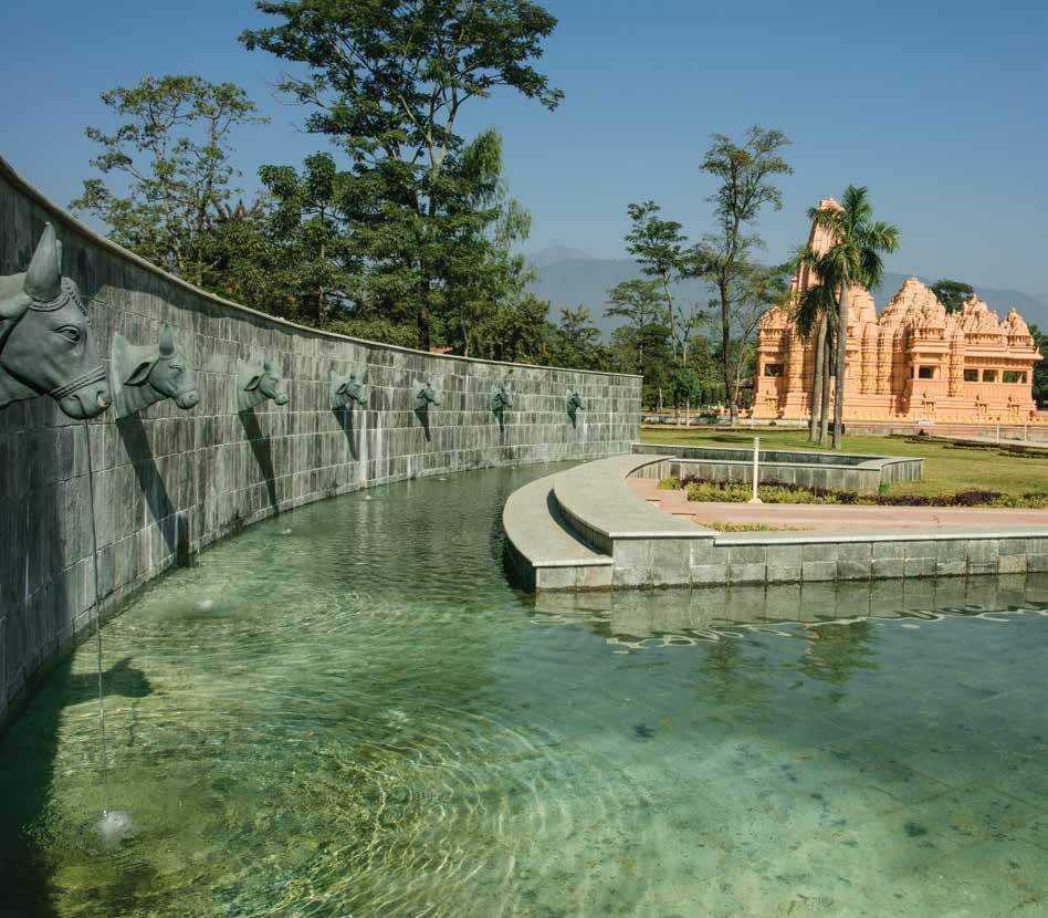
The main temple is dedicated to Lord Shiva and is known as Ekambareshwor. It is modelled in the Khajuraho style of architecture. The temple is surrounded by a pond filled with water from various holy shrines from the Indian subcontinent such as Badrinath, Kedarnath, Muktinath and Pashupatinath. The temple houses 16 deities, with the sanctum sanctorum belonging to the Shivalinga. The abode of Lord Shiva here is called Ekambareshwara, and it is surrounded by holy waters from the seven sacred rivers of Nepal – Saptagandaki.

The Manuscript Resource Centre unearths and preserves as many as possible. There are expert scholars to decode the archived manuscripts and spread the Sanatana knowledge to the masses for their understanding.

The Centre for Meditation and Yogic Sciences is a sanctuary for all seeking peace and happiness. The tranquil environment helps calm the mind and relief from the stress of the outside world, and the daily spiritual lectures, yoga sessions and satsangs help them find their true self. There is also a museum which allows visitors to learn about spiritual destinations in Nepal. One should not miss the Kamal Kund beside the Gurukul area, where there are many lotuses in bloom usually and create a lovely sight to behold. Sahastra Saligram in the north-east or Ishan Kona, as it is called in Vedic terms, is a collection of 1000 saligram stones – the most natural manifestation of Lord Krishna. The popular belief is, circumambulation of the stones energises the mind and spirit with positivity.

Shashwat Dham has a Dhunge Dhara and a water reservoir with cow-faced stone taps. The Hanuman Chhatra Temple and Dharma Kshetra, with a statue of Arjuna en route to the great war of Kurukshetra with Krishna as his charioteer in the temple complex, adds to the beauty of the place.

Gorkha
Formerly known as Prithvinarayan Municipality, Gorkha was originally named after King Prithvi Narayan Shah, who was born in Gorkha and united and founded modern Nepal. In 2009, the name was changed to Gorkha after the end of the monarchy in Nepal.

The old royal palace or Gorkha Durbar, Gorakhnath and the Kalika Temple dedicated to Goddess Kali are the main attractions of the town. The Royal Palace was destroyed in the 2015 earthquake, but the Gorakhnath shrine and Kalika temple are open with no entrance charges. The lower palace or Tallo Durbar and a modern park are other major attractions. Gorkha is also the starting point of the Manasalu Himal or Mount Manasalu and Mount Ganesh trekking route.

The Gorkha Museum’s Newari-style architecture is grander than the collection inside. The hallways inside are lined with art and craft items, some weapons and historical remnants of the Newari culture and the Shah and Malla kingdoms. It’s the corridors and galleries and hallways themselves, and the huge garden outside that steals the show.

The Manakamana Temple is one of the most sacred places and the abode of the Hindu Goddess Bhagwati, an incarnation of Goddess Parvati. This temple is much-visited because of the belief that whatever one wishes for in this shrine is granted. There is a fantastic cable car ride over the green valleys from Kurintaar to Manakamana temple.

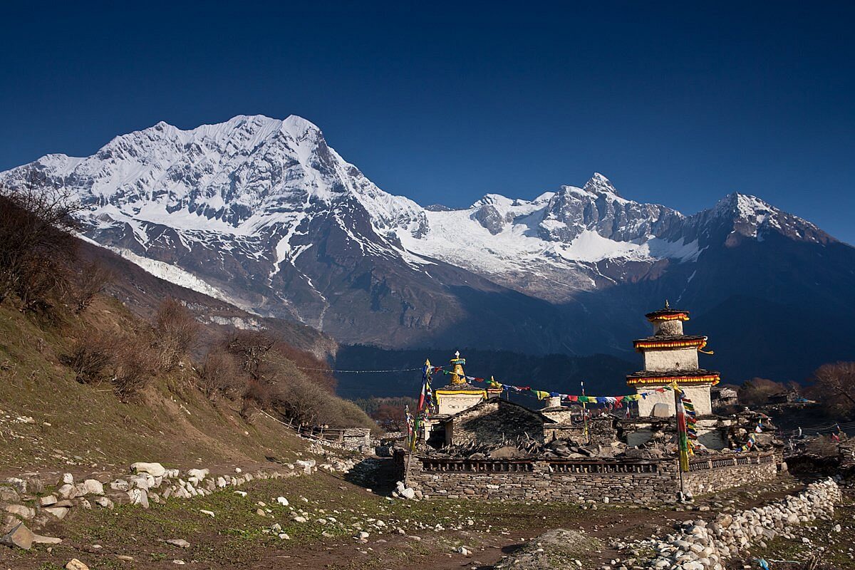
The Manaslu trekking is the most exciting thing to look forward to. Mount Manaslu lies just towards the east of the great Annapurna massif. The highest point of the trek is at Larkya La pass, from where a breathtaking view of the Manaslu can be savoured.

Gorkha has temples dedicated to Lord Shiva, Lord Vishnu, Lord Ganesh and Lord Bhimsen, the Newari god of money and commerce and is very much revered in close vicinity. The Durbar Square is the prime attraction of the Gorkha valley, being the birthplace and early home to unified Nepal’s first ruler, Prithvi Narayan Shah. The complex is a fort, a palace and a religious destination all punched into one. Perching atop high hills, Gorkha Durbar overlooks the sprawling emerald-green Trisuli Valley. If one looks down from the edge, one can see the tiniest sliver of a stream flowing through the valley. And straight ahead, one can see the entire range of Annapurna, Manaslu, Ganesh Himal and Himalchuli, standing majestically in the distance.

The Durbar area is where the Gorkha Palace stands towards the east. To reach the palace called Dhuni Pati, one has to climb 1700 steps from the bottom of the hill. It is a taxing adventure to pursue, but for those up to the challenge, it can be quite rewarding to finally finish the hike and be surprised by the spectacular panorama. This palace is where the first ruler of a unified Nepal was born and raised. From the windows of the palace, the king as a child prince used to look out at the entire valley and imagine it as his one day – or so says the lore.

There are several other attractions in Durbar Square, of which many were not harmed in the 2015 earthquake. The western gate of the durbar leads to the 17th-century Kalika Temple, a shrine devoted to the goddess of death and doom, Goddess Kali. The architecture is a mind-blowingly psychedelic one, with peacocks, serpents, demons and angels all interwoven in the wooden carvings. Near the palace is the mausoleum of Guru Goraknath, the saint who is said to have been the mentor and guide for young Prithvi Narayan Shah. Towards the northern gate is a towering statue of Lord Hanuman, coloured vividly in orange and red. From here, one can go visit a rocky platform called Chautara, with four sets of carved footprints, believed to be of Sita, Rama, Guru Goraknath and Guru Padmasambhava.

Bandipur
Known for its preserved, old time cultural atmosphereis, Bandipur is a hilltop settlement and rural municipality in the Gandaki province. Bandipur is located on an elevation of 1030 m on a mountain saddle of the Mahabharat range approximately 700 m above the Marsyangdi River Valley, 143 km to the west of Kathmandu and 80 km to the east of Pokhara. Since 1998 it is connected by an 8 km access road from Dumre, on the Prithvi Highway. The mountain saddle, just 200m long, is barely wide enough to accommodate the main street lined by 2 –3 storey buildings on either side. Behind these houses the mountainsides steeply descend and the gardens are only accessible by stairs.

Bandipur was established as a funnelling point of trade by Newar traders from Bhaktapur in the Kathmandu valley after it had been conquered in 1768 by Prithvi Narayan Shah. They took advantage of its malaria free location to develop it into an important stop along the India-Tibet trade route. With them they brought their cultural heritage and architecture which basically has remained unchanged to this day.

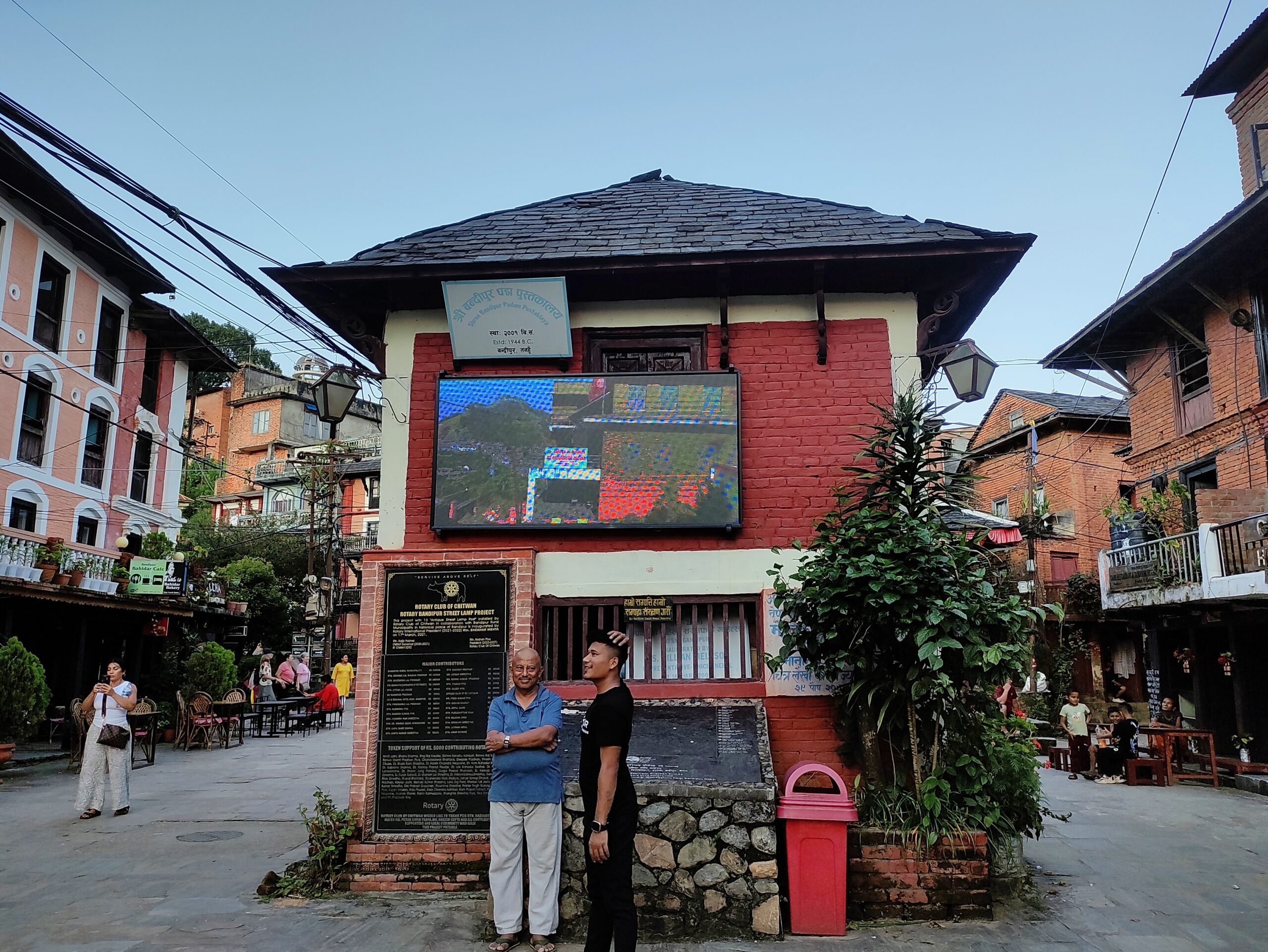
Originally a simple Magar village in the early 19th century, Bandipur developed into a prosperous trading centre and a community with town-like features: substantial buildings, with their neoclassical façades and shuttered windows and streets paved with slabs of silverish slate. Bandipur had its heyday in the Rana times between 1846 and 1951, when, as a measure of its power and prestige, it was granted special permission to have its own library which still exists.

In the 1970s, trading fell into a steep decline with the construction of the Prithvi Highway. For technical reasons it was logically built in the Marsyangdi valley, leaving Bandipur isolated up on the mountain. In addition to that, as a result of its poor accessibility, Bandipur lost importance because the district headquarters of Tanahun were moved to Damauli. The tradesmen of Bandipur were forced to move down to Dumre and many even left for the Terai; Bandipur turned into a semi-ghost town. The population declined considerably.

On two occasions Bandipur has witnessed some turmoil. The people were not easily and readily sidestepped by the construction of the road and fought for a different route in the planning process. In the 1970s, when the first demonstrations for democracy took place in Nepal, the people of Bandipur stormed the little garrison. Several people were killed and the soldiers fled. Again, when the district headquarters were to be moved, the people demonstrated and occupied the administration. The civil servants fled during the night. Even the king was flown in by helicopter to calm the situation. However, the decline of the little town could not be reversed. Some relics of its wealthy past remain. Although many houses are in bad condition, the typical Newari architecture is preserved. A distinctive aspect of Bandipur’s main street is a covered veranda extending along almost the entire length on the northern side. Most of the buildings still have little shops in them. The slate slabs in the main street have been destroyed by heavy vehicles, for which they were not made, but they can still be made out along the edges and in the smaller alleys. The library still exists and was carefully renovated in 2000. Another relic is a soccer-field-sized Tundikhel to the northeast of Bandipur and the villages importance as centre for schools for the surrounding villages.

Siddha Gufa Cave is 1.5 hours trek away from the northern end of the town through a muddy and exciting road for those who love adventure. For a shorter walk, one can take the route from Bimalnagar on the Prithvi Highway, it takes only 45 minutes. Once one reaches the entrance, a ladder-like staircase will take one down from the cave’s mouth into the enormous cavern. It is hard to imagine the interior of Siddha Gufa from outside. Stalactites and stalagmites adorn the centuries-old walls of the cave. Abstract rock formations carve climbing routes inside the cave and give it a mysterious look. With a depth of 437 metres and a height of 50 metres, it is the highest cave in Nepal.

Yet another shrine, this one is not for a deity but the sword of Mukunda Sen, the 16th-century Palpa King. Now, what is so special about a sword that it needs to be enshrined? Legend says that Lord Shiva himself gifted this sword to the King and the blade is a manifestation of Adi Shakti – the feminine power of the cosmos. Once a year during Vijaya Dashami or Dasain, as they say there, the blade of the sword gets sacrificial blood.

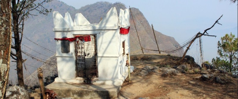
Thani Mai is a small white temple at the top of Gurungche Hill, dedicated to the mother goddess. Visit the temple to have a stunning, 360-degree vista of the entire place, with the majestic ranges of the Himalayas rising to the sky from behind all along the horizon. The climb is only 30 minutes and not that hard, and the spectacle from up above is a reward worth savouring. Sunrises and sunsets are exceptionally beautiful from here.

Bindebasini temple is an old and ornate shrine at the northeast end of Dumre bazaar, which is the main shopping lane. The walls of the temple are carved with scriptures and shlokas, giving it a mystic look all over. The shrine is dedicated to Goddess Durga. The courtyard leading up to the temple and the shrine itself will take one back to the old days.

Visiting the silkworm farm, after a 2.5 km downhill hiking from the Heritage Guest House, is a unique experience. On request and a small donation, a professional in the farm will show you the mulberry orchards that the farm owns, which are the foods for the silkworms. The worms are reared indoors from August to December and from March to May. But the process goes on all year long, and one can see it anytime from 10 am to 4 pm, Sunday to Friday.

Padma Library is not a very well-stocked one in terms of books, but it is worth a visit because of its impressive 18th-century architecture with carved windows and beams. It stands near Bindebasini Temple, so both attractions can be combined.

Tundikhel is a large, green table-top ground open for the public. Once upon a time, this man-made plateau region was used by traders to sell off some goods before making their way to Tibet or India. The ground was also used for parade purposes by the Gorkha regiment. Today, it is open to everyone. Tundikhel offers a spectacular view of the Himalayan range behind the immediate houses and buildings. Peaks like Dhaulagiri, Langtang Lirung, Manaslu and Ganesh Himal can be spotted in the distance. It is a good place to breathe in some fresh air and enjoy a beautiful sunset.

Narayangarh
An important trading post, located in the centre of Bharatpur, Narayangarh or Narayanghat is a major transportation and commercial hub located on the bank of the Narayani River. The town is famous for Taas, a spicy fried goat-meat lunch dish served with bhuja or chiura. This moderately crowded city falls under the bigger umbrella of Bharatpur City and under the administrative jurisdiction of Chitwan district in southern Nepal.

The Narayangarh-Mugling Highway, which is the main driving route via the hills up to Pokhara and the capital Kathmandu, meets the east-to-west road called Mahendra Highway. The confluence of these two main arteries is one of the busiest places in Nepal, both for local traffic as well as tourism. Any car driving from the Indian border will have to cross the Narayangarh-Bharatpur area to reach the capital is also a driving factor behind its rising popularity. Narayngarh is most popularly known as the gateway to the Chitwan National Park. Canoeing in the Rapti River and ox-cart riding are some offbeat adventures that one can indulge in here.

The Bish Hazari Taal which translates to 20,000 lakes is called so because the water bodies in this place are divided into numerous small and big ones, which make it look like there are too many. The lake is a resting ground for a variety of bird species which fly over Nepal while migrating south, and thus a must-visit for birdwatchers. Bish Hazari Taal also has a lot of crocodiles hiding in the swamps.

The confluence of Kali Gandaki and Trishuli Rivers is considered to be a holy confluence forming the River Narayani, which is an important tributary of the Ganges. A few km drive up northeast from Narayangarh will bring one to this beautiful confluence. The village that surrounds the river confluence is called Devghat and can be reached via a suspension footbridge.

A half an hour’s drive from Narayangarh will take one to Tharu village. The Tharus are one of the largest ethnic groups of Nepal and indigenous habitats of the Terai region. The Tharu Cultural Museum is the main attraction which was built to conserve the heritage of the Tharus. The museum houses multiple models, artefacts, weapons, potteries and other articles about the cultural and ethnic history of the Tharus. There are cultural shows and festivals as well occasionally, where the Tharu people perform and sell their handmade products for the visitors.

Bharatpur
Nepal’s third most populous city and located in south central Nepal, Bharatpur is also the second largest metropolitan city in the country by area. One of the fastest-growing cities in Nepal, Bharatpur lies on the eastern bank of the Narayani River and serves as a commercial centre of the Chitwan district and the central region of Nepal.

The Chitwan National Park is home to one-horned rhinos, elephants, Bengal tigers, crocodiles, deer and many other wild animals. It is the third largest tourist destination in Nepal after Kathmandu and Pokhara. The park has been listed in the UNESCO World Heritage List since 1983.

The Narayani River flows north to south in the south of Bharatpur. It is the deepest and one of the largest rivers in Nepal. The Narayani Bridge connects the Chitwan District with the Nawalpur District of Nepal. Small islands, like Nagarban in the Narayani River, are popular picnic spots. The Rapti River flows east to southwest in the south of Bharatpur and meets the northern border of the Chitwan National Park.

The Tinkhole Monastery is a local favourite and the temple’s architecture reflects the Buddhist way of life. The Ganeshthan Temple at Baseni is the most famous Hindu temple in Bharatpur. This temple is believed to be constructed by Muni Makunda Sen, King of Palpa in the 15th century, but the modern temple was constructed in 1952 in the period of King Mahendra. The Bageshwari Temple is an ancient temple believed to have been built before Muni Makunda Sen and was renovated by Yogi Narahari Nath. The Harihar Temple lies on the banks of the Narayani River. The Mahakaleshwar Shiva Mandir is the only temple dedicated to Lord Shiva around Bharatpur. Along with the building, the temple has 108 lingams, a fire pit, a statue of Lord Hanuman statues, Satsang halls and Ganesha temples. The Gauri Kund can also be seen in the temple periphery. The Kalika Temple is located in Gaindakot and was built around 1992 on the top of the hill. The Jakhadi Mai Temple is on the eastern corner of the jungle and was constructed in 1982 by the locals. The Durga Temple was built by the police force within the compound of Bharatpur’s Police Academy in 1992 while the Rameshwar Temple was built in 1994. It is the city’s busiest temple and serves people through a health post.

Located in the old headquarters of Chitwan district, the Upardanghari Fort is believed to have been built by Satrubhanjan Shah, son of the prince Bahadur Shah, to defend the newly founded kingdom in the seventeenth century. The Kasara Durbar is an old palace built by Rana Regime inside the Chitwan National Park. Now, it is being used as an office of the park and hosts a museum. The Diyalo Bangala Palace or Aptari Bharatpur was the summer palace used by the Shah dynasty. It is located on the banks of Narayani River. The small islands on Narayani River that can be reached by launches, like Nagarban, are lovely spots for a picnic.

In My Hands Today…

Bewildered – Laura Waters

What would move you to ditch your life and take off into the wild for five months? For Laura Waters, it took the implosion of a toxic relationship and a crippling bout of anxiety. Armed with maps, a compass and her life in a bag on her back, she set out to walk the untamed landscapes of the Te Araroa trail in New Zealand, 3000 kilometres of raw, wild, mountainous trail winding from the top of the North Island to the frosty tip of the South Island. But when her walking partner dropped out on the second day, she was faced with a choice: abandon the journey, or face her fears and continue on alone? She chose to walk on.

For five months, Laura battled not only treacherous terrain and elements, but also the demons of self-doubt and anxiety. As the kilometres fell behind her, nature did its work, stripping away her identity and guiding her towards a new way of being. At the end of Te Araroa, it was the hard-earned insights into the power of nature, emotional wellbeing and fulfilling relationships – with others as well as with herself – that were Laura’s greatest accomplishments. She emerged ‘rewilded’, and it transformed her life.

Travel Bucket List: Nepal – Part 14

Lumbini
The birthplace of Lord Buddha, Lumbini, aka ‘the lovely’, is a UNESCO World Heritage site as well as a Buddhist pilgrimage site. According to the sacred texts of the Buddhist Commentaries, Maya Devi gave birth to Siddhartha Gautama in Lumbini in c.624 BC, who then achieved Enlightenment, and became Shakyamuni Buddha, the founder of Buddhism. He later passed into parinirvana at the age of 80 years, in 544 BC. Lumbini is one of four most sacred pilgrimage sites pivotal in the life of the Buddha.

Lumbini has a number of old temples, including the Mayadevi Temple, and several new temples, funded by Buddhist organisations from various countries. Most of the temples have already been completed and some are still under construction. The Puskarini, or Holy Pond, is where Mayadevi, the Buddha’s mother, is believed to have taken the ritual bath prior to his birth and where the Buddha also had his first bath. At other sites near Lumbini, earlier Buddhas were born, then achieved ultimate Enlightenment and finally relinquished their earthly forms. Lumbini was made a World Heritage Site by UNESCO in 1997. The Lumbini Development Zone, designed by Japanese architect Kenzo Tange, offers a deeper dive into Buddhist heritage. Divided into eastern and western monastic zones, it houses impressive monasteries from countries like Thailand, Myanmar, China, and Japan. Beyond its spiritual and historical treasures, Lumbini is surrounded by the natural beauty of the Terai plains. The nearby Lumbini Crane Sanctuary is a haven for the endangered Sarus cranes and other wildlife, promoting conservation and offering a serene escape into nature.

In the time of the Buddha, Lumbini was situated east of Kapilavastu and south-west of Devadaha of Shakya, an oligarchic republic. According to the Buddhist tradition, it was there that the Buddha was born. The Ashoka Pillar of Lumbini, a monolithic column with an inscription in the ancient Brahmi script discovered at Rupandehi in 1896, is believed to mark the spot of Ashoka’s visit to Lumbini.

In 1896, former Commander-In-Chief of the Nepalese Army General Khadga Shamsher Jang Bahadur Rana and Alois Anton Führer discovered a great stone pillar at Rupandehi, according to historical records made by the ancient Chinese monk-pilgrim Xuanzang in the 7th century and by another ancient Chinese monk-pilgrim Faxian in the early 5th century. The Brahmi inscription on the pillar gives evidence that Ashoka, emperor of the Maurya Empire, visited the place in 3rd-century BCE and identified it as the birth-place of the Buddha.

Lumbini is 4.8 km in length and 1.6 km in width. It is bordered by a large monastic zone in which only monasteries can be built, no shops, hotels or restaurants. It is separated into an eastern and western monastic zone, the eastern having the Theravadin monasteries, the western having Mahayana and Vajrayana monasteries. There is a long water filled canal separating the western and eastern zones, with a series of brick arch bridges joining the two sides along the length. The canal is serviced by simple outboard motor boats at the north end which provides tours.

The Lumbini complex is divided into three areas: the Sacred Garden, the Monastic Zone and the Cultural Centre and New Lumbini Village. The Sacred Garden remains the epicenter of the Lumbini area and consists of the birthplace of Buddha and other monuments of archaeological and spiritual importance such as the Mayadevi Temple, the Ashoka Pillar, the Marker Stone, the Nativity Sculpture, Puskarini Sacred Pond and other structural ruins of Buddhist stupas and viharas. The Monastic Zone, spanning one square mile is divided into two zones: the East Monastic Zone which represents Theravada school of Buddhism and the West Monastic Zone which represents Mahayana and Vajrayana school of Buddhism, with their respective monasteries on the either side of a long pedestrian walkway and canal. Marking the monastic spot as a sacred pilgrimage site, many countries have established Buddhist stupas and monasteries in the monastic zone with their unique historical, cultural and spiritual designs. The Cultural Centre and New Lumbini Village comprises Lumbini Museum, Lumbini International Research Institute, World Peace Pagoda of Japan, Lumbini Crane Sanctuary and other administrative offices. New excavations in the Mayadevi temple in Lumbini in 2013 revealed a series of the most ancient Buddhist shrines in South Asia extending the history of the site to a much earlier date.

The Lumbini Monastic Site is a sacred complex dedicated to preserving the spiritual and historical significance of Lord Buddha’s birthplace. This expansive area is part of the larger Lumbini Development Zone, a UNESCO World Heritage Site. The site features an array of monasteries, meditation centres, and monuments, as well as numerous meditation centres. It is designed to accommodate pilgrims and visitors, offering them a place for meditation, study, and reflection. The site is divided into two zones: the East Monastic Zone, dedicated to Theravada Buddhism, and the West Monastic Zone, which primarily features Mahayana and Vajrayana monasteries. The Monastic Site is adjacent to the Sacred Garden, which contains the Maya Devi Temple, the Ashoka Pillar, and the sacred Bodhi tree.

The West Monastic Zone houses fourteen Mahayana Monasteries and two Vipassana meditation centres. Vajrayana includes traditions of Tantra and Mantra in Buddhism. The name is derived from a mythical weapon, Vajra, and revolves around rituals and practices using Mudras, Dharanis, Mandalas and Mantras. Vajrayana is considered one of three paths that lead to enlightenment. The Mahayana Temples are devoted to the classification & traditions of Buddhism and its philosophies. It refers to the path of the Bodhisattva where one seeks enlightenment that doesn’t just benefit them but also all the living beings. Those who have attained this stage are called Samyaksambuddha who are believed to have the ability to teach the technique and help others attain enlightenment in one lifetime.

The East Monastic Zone has monasteries where Theravada Buddhism is specifically practised and is also called the Southern Buddhism Zone. The temples in this zone function as per the principles of the senior Buddhist monks. These principles have helped maintain the true essence of Buddhism and keep it as close as possible to the genuine techniques taught by Gautama Buddha. It is one of the ways to live life in complete harmony with other living things on the planet. Up until now, they have helped devotees understand the reality behind the teachings and provided a way of attaining self-liberation by dedicating their lives to a long-term monastic way of living and genuine meditation practices.

Located 24 km from Lumbini, Tilaurakot houses remains of Kapilavstu and is considered to be where Lord Gautama Buddha spent 29 years if his life. Its unearthing is marked as a significant event that reveals the historical life of Gautama Buddha. It is set in the district of Kapilavastu which is believed to be the site of the ancient city of the Shakyas. The exposed ruins include foundations of a structure that resemble a residential complex. Studies reveal that Gautama Buddha had lived his life as a prince and received all the royal luxuries before renouncing his throne and walking out of the Eastern Gate. Tilaurakot is termed as a UNESCO tentative site and is a significant tourist attraction. It is situated on the banks of Banaganga Rice and is surrounded by trees. A small museum in the vicinity has some of the objects that were found during excavation. Tilaurakot was discovered in the 19th century when archaeologists began their search of Kapilavastu based on the information documented by two Chinese Buddhist Monks, Faxian and Xuanzang.

The Maya Devi Temple is a revered and historically significant site marking the birthplace of Siddhartha Gautama, who later became known as Buddha. Situated in the Lumbini Garden, it is a UNESCO World Heritage Site. The temple complex includes ancient ruins, stupas, and monuments dating back to the 3rd century BCE and later. Inside the temple, a marker stone is placed on the exact spot where Buddha is believed to have been born. The temple is next to the sacred pool called Pushkarini and a sacred garden. A significant bas-relief sculpture within the temple depicts Queen Maya Devi holding onto a Sal tree while giving birth to Siddhartha Gautama. This image is one of the most iconic representations of the birth of Buddha. The temple complex is surrounded by ancient stupas and pillars, including the famous Ashoka Pillar. Erected by Emperor Ashoka in 249 BC, the pillar bears inscriptions that commemorate his visit to Lumbini and the significance of the site.

The history of the temple goes back to 2013 when an international team of archaeologists found a few ruins dating back to the sixth century BC. It was the remains of an ancient tree shrine that belongs to 550 BC. The researchers found out that the site is the earliest evidence of Buddhism as well as of Gautam Buddha.

Maya Devi Temple has a number of places within its complex to explore. The famous Ashoka Pillar is located in Maya Devi Temple. The inscription says that the pillar was erected by the people who were in charge of Emperor Ashoka’s visit to the park in 249 BC. The inscription is oldest in Nepal. The sacred bathing pond is located right next to the shrine, is where Maya Devi took a bath before giving birth. The most beautiful and well-decorated sight at Maya Devi Temple is the Bodhi Tree. It is related to the ancient fig tree and is characterised by heart-shaped leaves. The heart shape refers to the time when Buddha achieved enlightenment. The Bodhi tree is kept clean and is decorated with colourful prayer flags. The temple is open daily from 6 am to 6 pm. Entry is free for Indian and Nepali citizens, SAARC passport holders pay NPR 100 while foreigners pay NPR 200.

The Japan Peace Stupa, also known as World Peace Pagoda is an early 21st century monument. Located outside the main compound, the structure is a glorious stupa with traditional pagoda style architecture. Constructed by Japanese Buddhists at a cost of US $1 million, the monument is coloured white with a golden Buddha statue. The majestic structure has a dome in the centre that can be reached by climbing one of the two flights of stairs leading to it. On the second level, there’s a corridor encircling the dome. The Symbol of Peace is open all days of the week. The pagoda is open daily between 8 am and 8 pm.

The Royal Thai Monastery in Lumbini is an imposing and stunning wat-style monastery. The gleaming building is constructed from white marble with a blue-roofed meditation centre closeby. The Dharma Swami Maharaja Buddha Vihar is a Buddhist Gompa belonging to the Sakyapa order. It was established by His Eminence Chogya Trichen Rinpoche. Every day, Tara Pooja is performed by the 600 monks residing in the monastery.

The Cambodian Monastery is an amalgamation of colourful fantasy and spiritual forces making it one of the most fascinating temples in the region. Built in a architectural design matching the famous Angkor Wat, the charming monastery is surrounded by a square railing, each having four 50m green snakes. The large compound has an outer wall covered with beautiful and intricate designs.

The Sri Lankan Monastery also known as the Sri Lanka Maha Vihara, showcases traditional Sri Lankan architectural elements. The monastery is a Theravada Buddhist establishment dedicated to Sri Lanka. It is a striking monastery nestled in the East Monastic Zone, which has a spherical raised platform with a traditional Pagoda. Underneath the Pagoda is a beautiful golden idol of Lord Buddha, seen seated in a meditating posture. This arrangement has a pathway that encircles the structure and provides an area for circumambulation. The monastery holds several critical religious events and practices, especially those followed in Sri Lanka.

The Thrangu Vajra Vidya Monastery is a monastery dedicated to Thrangu Rinpoche. He believed in the teachings of Buddha, building his principles on peace, knowledge and unity. Today, this monastery has a number of students who are aspiring monks. The monastery is open daily from 8 am to 5 pm.

A chorten created by Buddhists from Manang in Northern Nepal, the Manang Samaj Stupa is known to be one of the oldest Stupas in Nepal, dating back to the birth of Gautam Buddha in 600 BC. There is a golden Buddha Statue in the middle of this building and is surrounded by colourful murals. At present, this attraction is believed that it will go under renovation soon. The monastery is open daily from 8 am to 5 pm.

The Great Drigung Lotus Stupa is one of the most religiously important Stupas in Lumbini and was built by the German Tara Foundation. The building contains a hollow crown partly covered in glass which reveals the Buddha statue inside. The domed ceiling of the Stupa is covered with Buddhist murals. The gold, wood and carvings represent the beliefs and teachings of Buddha that spreads the message of peace and non-violence.

Dae Sung Shakya Sa, popularly known as the Korean Temple is an impressive structure built in a Korean style of architecture with colourful murals on the ceiling. It even offers community sleeping area as well as three meals a day to visitors for a few days at a minimal cost of NOR 500 per day. Meditating in the courtyard full of monks and pilgrims is a peaceful and refreshing experience. Entry fee to the monastery is NPR 400.

The Myanmar Golden Temple in Lumbini is the oldest structure of the city. Built in the Burmese style of architecture, the impressive corncob-shaped shikhara, styled after the temples of Bagan gives a regal look to the whole structure. There are three prayer halls and a Lokamani Pula Pagoda inside the building. The temples is open daily from 8 am to 12 noon and then again between 1 to 5 pm.

The Zhong Hua Chinese Buddhist Monastery, popularly known as the China Temple is an impressive structure is built in a pagoda-style of architecture and resembles the look of the famous forbidden city of China. As one enters, the perfectly manicured internal courtyard fills the heart with peace and joy. The Vietnam Phat Quoc Tu Temple has a facade flanked with artificial mountains and a grand roof.

The Supa Deurali Temple, located near Lumbini in the Arghakhanchi District is a significant Hindu shrine dedicated to the goddess Durga. It is a popular pilgrimage site, especially for those traveling to or from Lumbini. Devotees believe that worshipping at the Supa Deurali Temple brings protection, prosperity, and the fulfillment of wishes. The temple showcases traditional Nepalese architectural elements with an inner sanctum housing the idol of the Goddess Durga, where devotees offer prayers, flowers, and other offerings. The temple is built using local stone and wood, reflecting the vernacular architecture of the region. It is particularly vibrant during Hindu festivals of Dashain and Navratri. The temple is associated with numerous local legends and myths, which enhance its spiritual allure. One popular belief is that those who pray earnestly at Supa Deurali and make a vow will have their wishes fulfilled by the goddess.

Maula Kalika, a revered Hindu temple located near Gaindakot, is dedicated to the goddess Kali. Perched atop Maula Hill, the temple offers stunning panoramic views of the surrounding landscapes. While it is not in immediate proximity to Lumbini, it is accessible from the region. The journey to the temple includes ascending stone steps, which are surrounded by lush greenery. Devotees visit Maula Kalika to seek blessings, protection, and the fulfillment of their wishes. The temple holds particular importance during the festivals of Dashain and Navaratri. The temple features traditional Nepalese temple architecture with the inner sanctum housing the idol of the Goddess Kali, adorned with flowers, offerings, and traditional decorations. Symbols of the goddess’s power and presence are prominently displayed around the temple. One of the main attractions of Maula Kalika Temple is its location. From the temple, visitors can enjoy panoramic views of the Terai plains, the Trishuli River, and the distant Himalayan peaks.

Located near Butwal, Manimukunda Sen Park is a picturesque and historically significant park. Named after King Manimukunda Sen, a medieval king of the Palpa kingdom, it is easily accessible by road, making it a convenient day trip for visitors staying in Lumbini. The park is renowned for its lush greenery, well-maintained gardens, and peaceful ambiance and is a popular spot for picnics and family outings. According to local legends, the king used the area as a summer retreat. The ruins of his palace can still be seen within the park, adding a historical dimension to the natural beauty of the area. Visitors can enjoy leisurely walks along tree-lined paths, relax on well-manicured lawns, and take in the scenic views of the surrounding hills. It also features a variety of plant species, making it a haven for botany enthusiasts. The park includes a designated play area for children, equipped with swings, slides, and other playground equipment.

Lumbini Garden, the birthplace of Siddhartha Gautama or the Buddha and an important Buddhist pilgrimage site is now a sanctuary for cranes. This sanctuary is spread over the area of 6 sq km and consists of the ruins of the palace of Tilaurakot where Siddhartha Gautam spent 29 years of his life. It is one of the most unique attractions in Nepal and is definitely worth a visit. The crane sanctuary aims at protecting the endangered Sarus Cranes in and around the wetlands of this area by creating a local community for their protection and to restore their natural habitat while creating an education facility around this conversation. It is believed that Gautam Buddha fought for the preservation of this bird, around 2500 years ago, and the Lumbini Crane Sanctuary wishes to continue his noble mission.Along with the Sarus Cranes, one may get a chance to see the antelope-like blue bull. Hence, for those who are interested in Buddhism or wildlife conservation, must visit this attraction. Entry to the sanctuary is free.

Located inside the UNESCO World Heritage Site of Sacred Garden Area, the Lumbini Museum displays about 12,000 artifacts including religious manuscripts, metal sculptures, Terra cottas, coins from Maurya and Khusana dynasty and stamps from all over the world depicting Lumbini. The Lumbini International Research Institute (LIRI), located opposite the Lumbini Museum, provides research facilities for the study of Buddhism and religion in general. This museum was built in the 1970s and is now reimagined by architect Kris Yao from Taiwan and his team.